6.2Km
6.2Km
Note
 0m
0m
0m
50m
50m
50m
50m
50m
50m
0m
0m
0m
50m
50m
50m
50m
50m
50m
Quest’ascensione richiede, come minimo, due giorni. I più allenati dovranno essere in grado, il secondo giorno, di partire da 3.071 mt, arrivare in cima al Monte Bianco e scendere fino a 1.700 mt. Normalmente credo che si possa benissimo affrontare in 3 giorni, il primo di salita al rifugio, il secondo ascesa in vetta e ritorno al rifugio, il terzo di discesa in Val Veny. Se invece si ha qualche giorno in più a disposizione da spendere per la permanenza al rifugio, il soggiorno sarà assolutamente piacevole grazie allo spettacolo naturale che da lì si può godere, alla cortesia dei gestori, (cosa sempre più rara) e al poco affollamento.
Avvicinamento
Arrivati a Courmayeur si prende la strada che porta in Val Veny e la si percorre fino alla sbarra poco dopo La Visaille che impedisce l’accesso al fondovalle (1.700 mt circa).
Descrizione
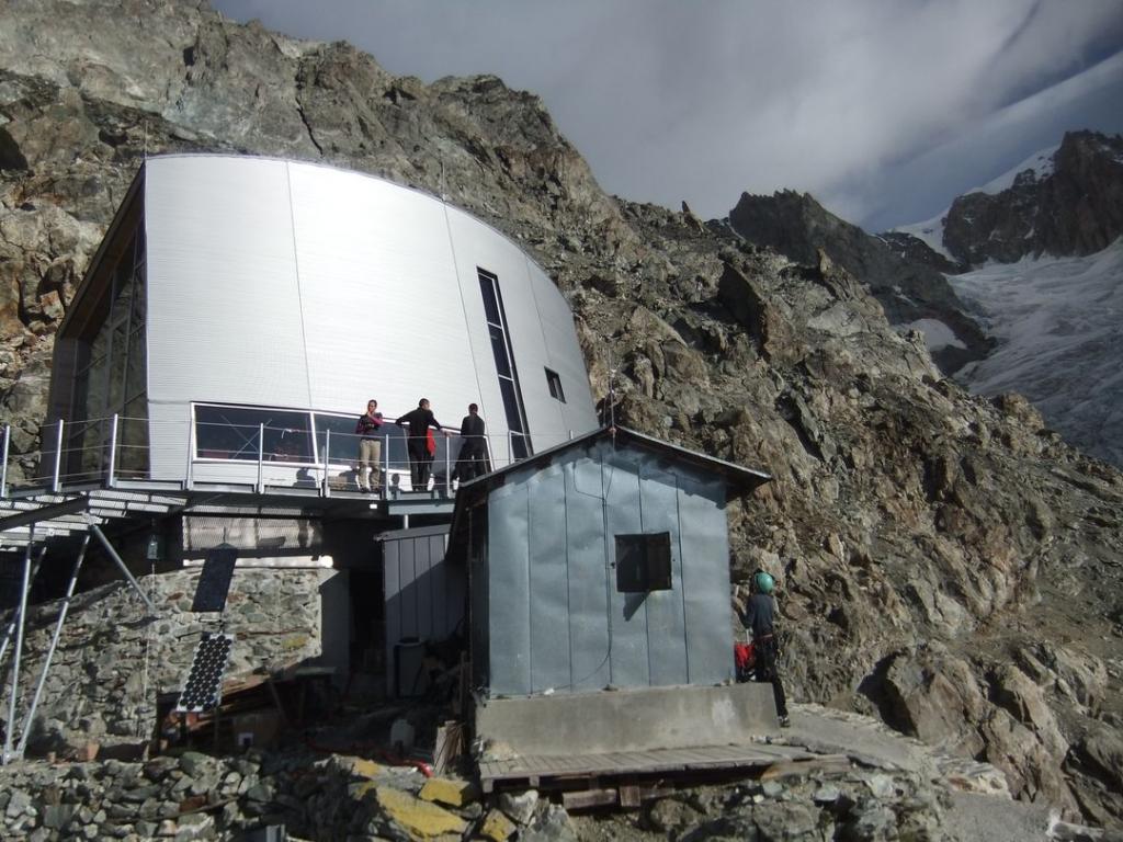
1° GIORNO (da Val Veny 1.600 mt al rif. Gonella 3.071 mt)
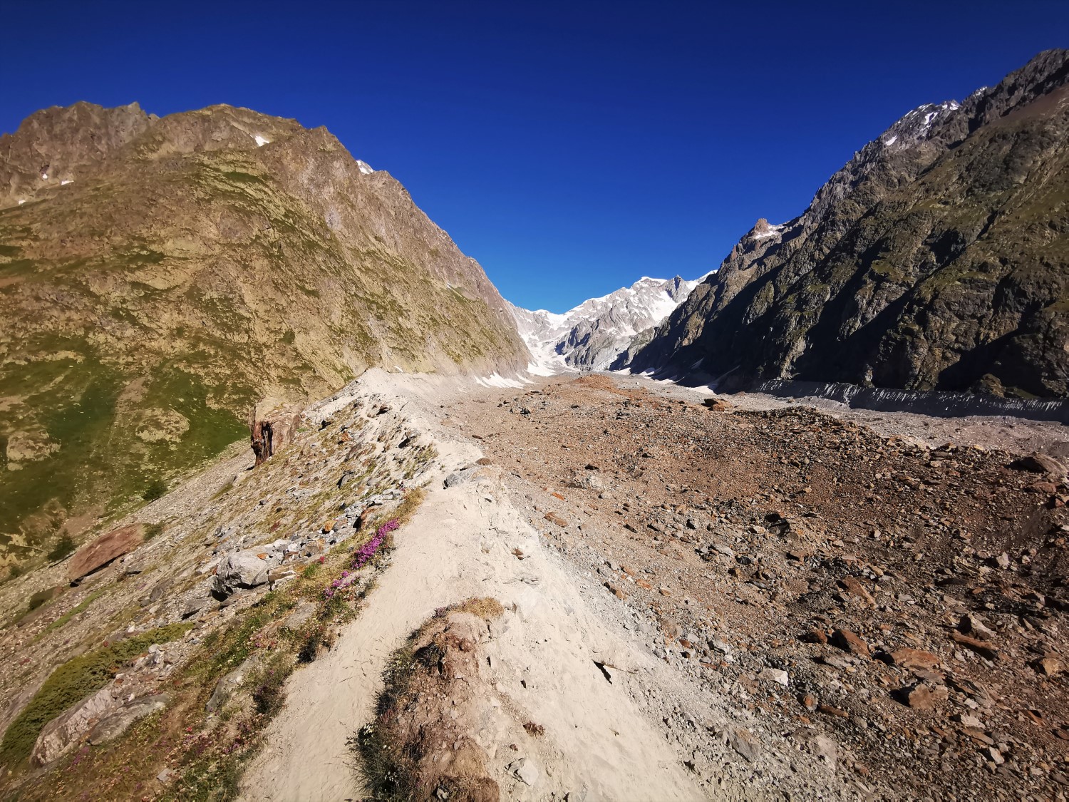
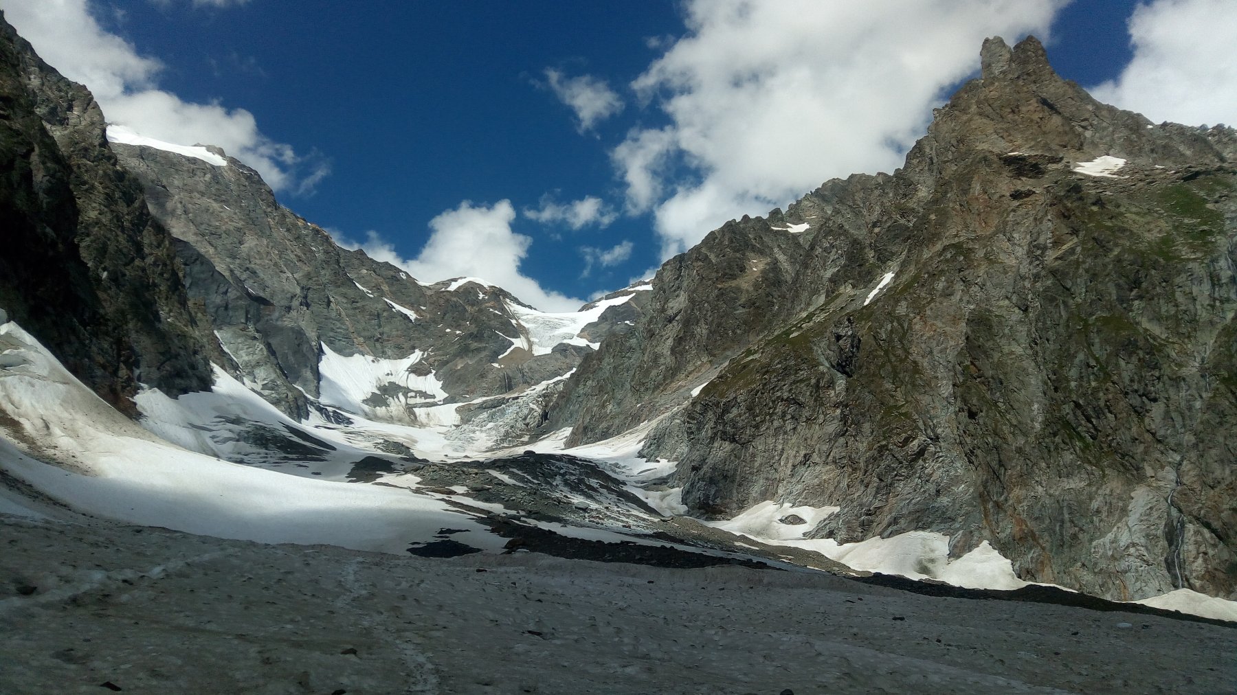
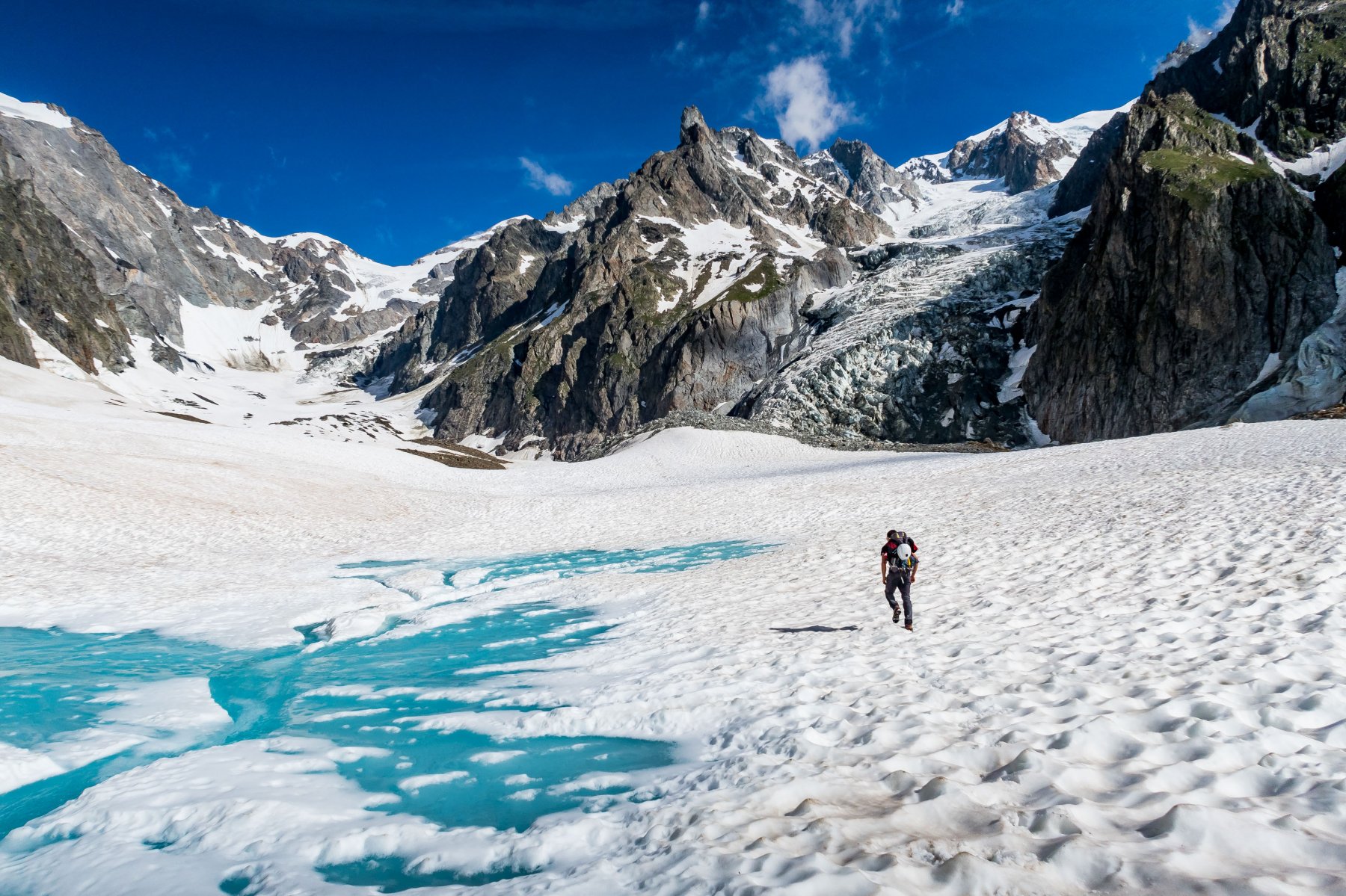
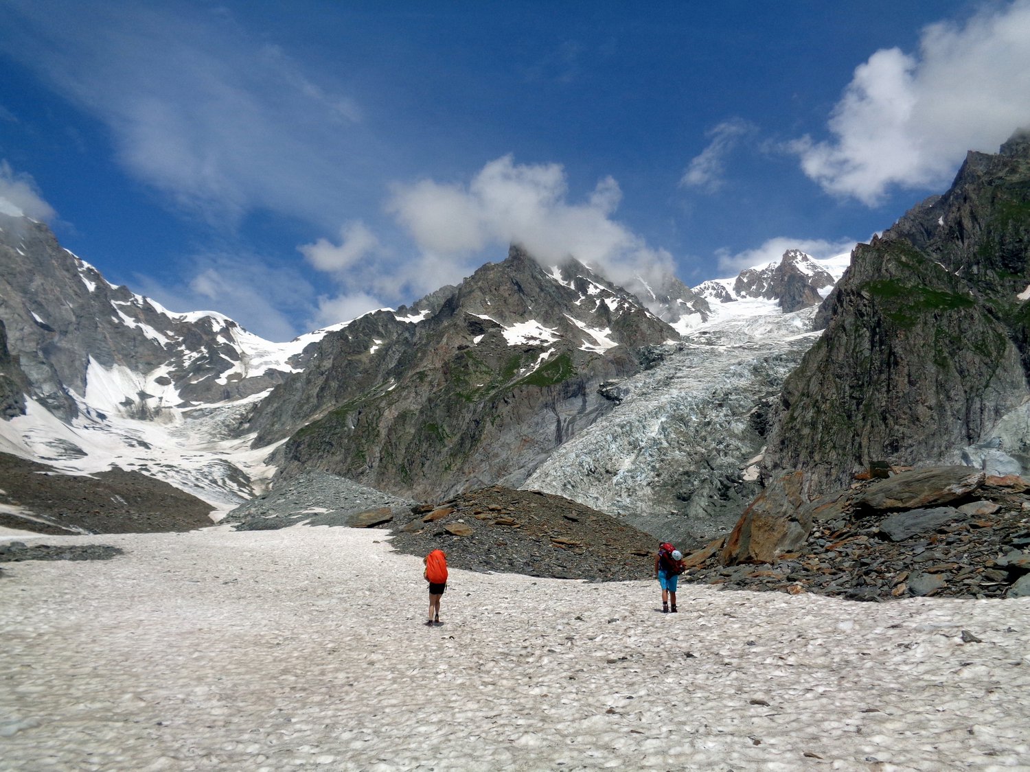
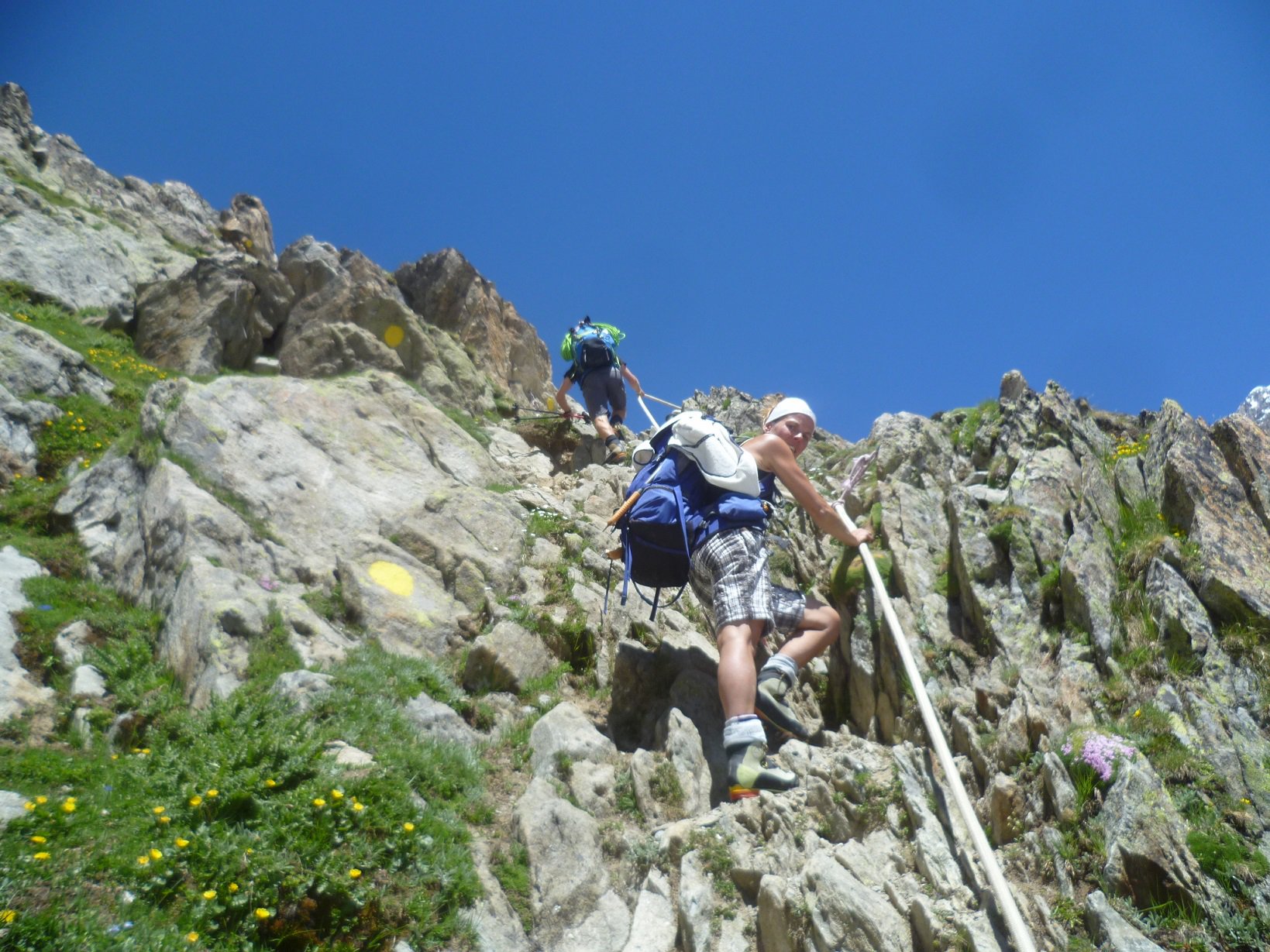
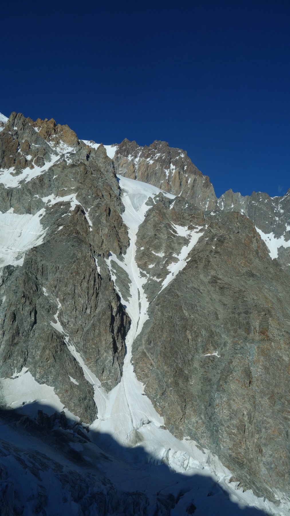
Lasciata l’auto si prosegue su strada asfaltata fino al ponte che attraversa la parte terminale del lago di Combal, da qui si prende la strada sterrata a destra, e dopo un breve tratto, dietro ad una curva, ci si trova di fronte il bar Combal (1.970 mt), prima di arrivare ad esso si intraprende a sinistra un sentiero ben segnalato e dopo pochi minuti ci si trova su una cresta che costeggia la destra orografica del ghiacciaio del Miage.
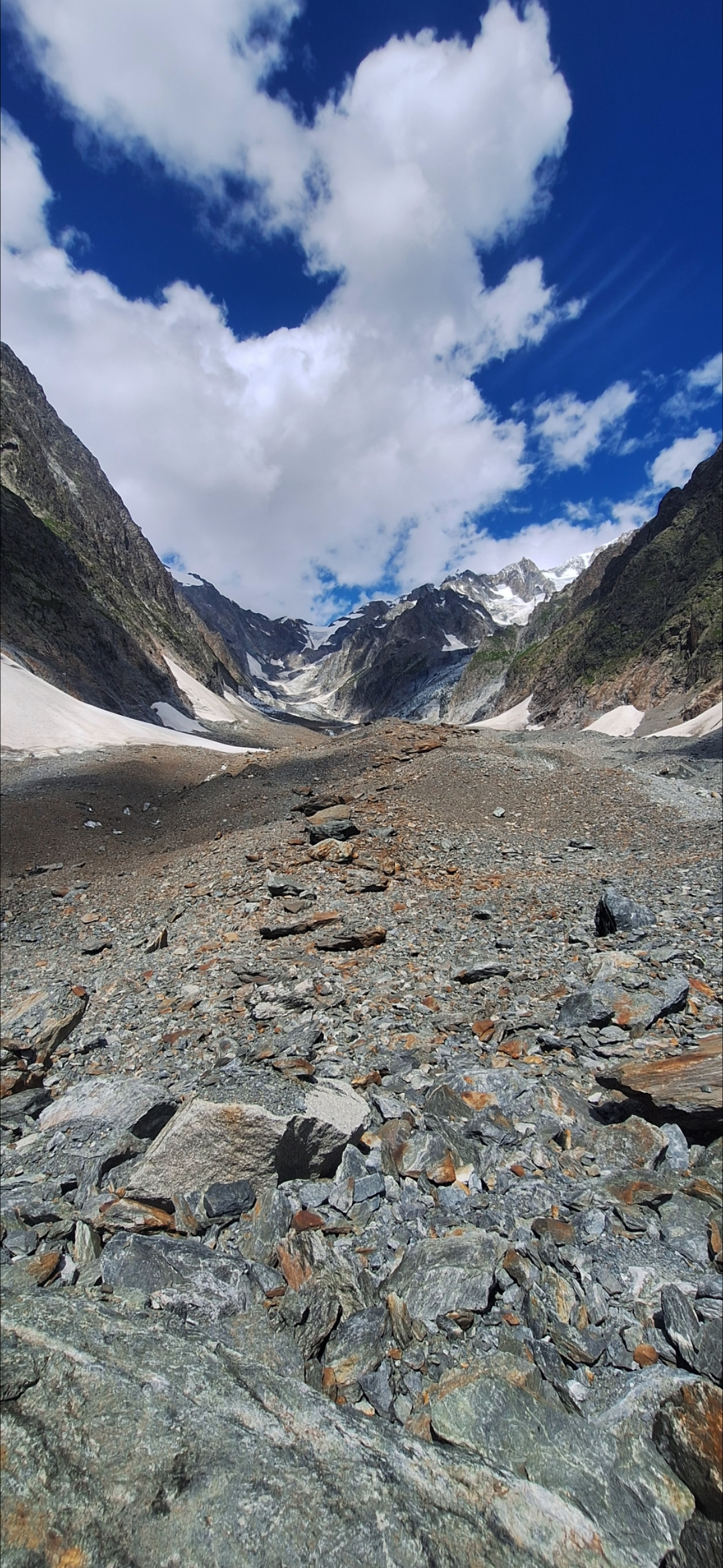
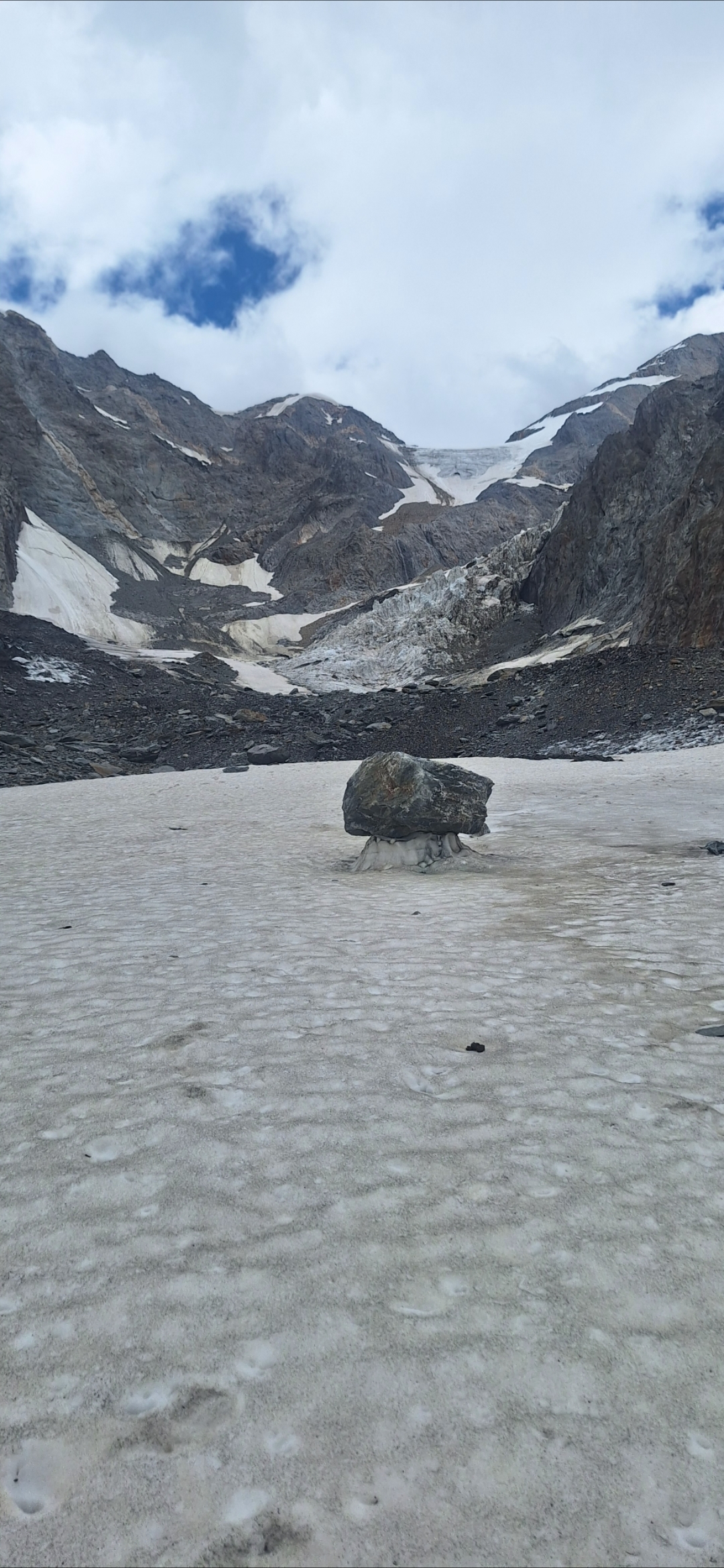
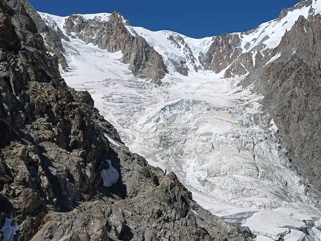
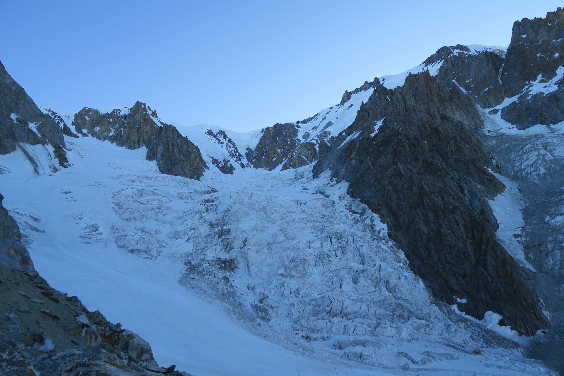
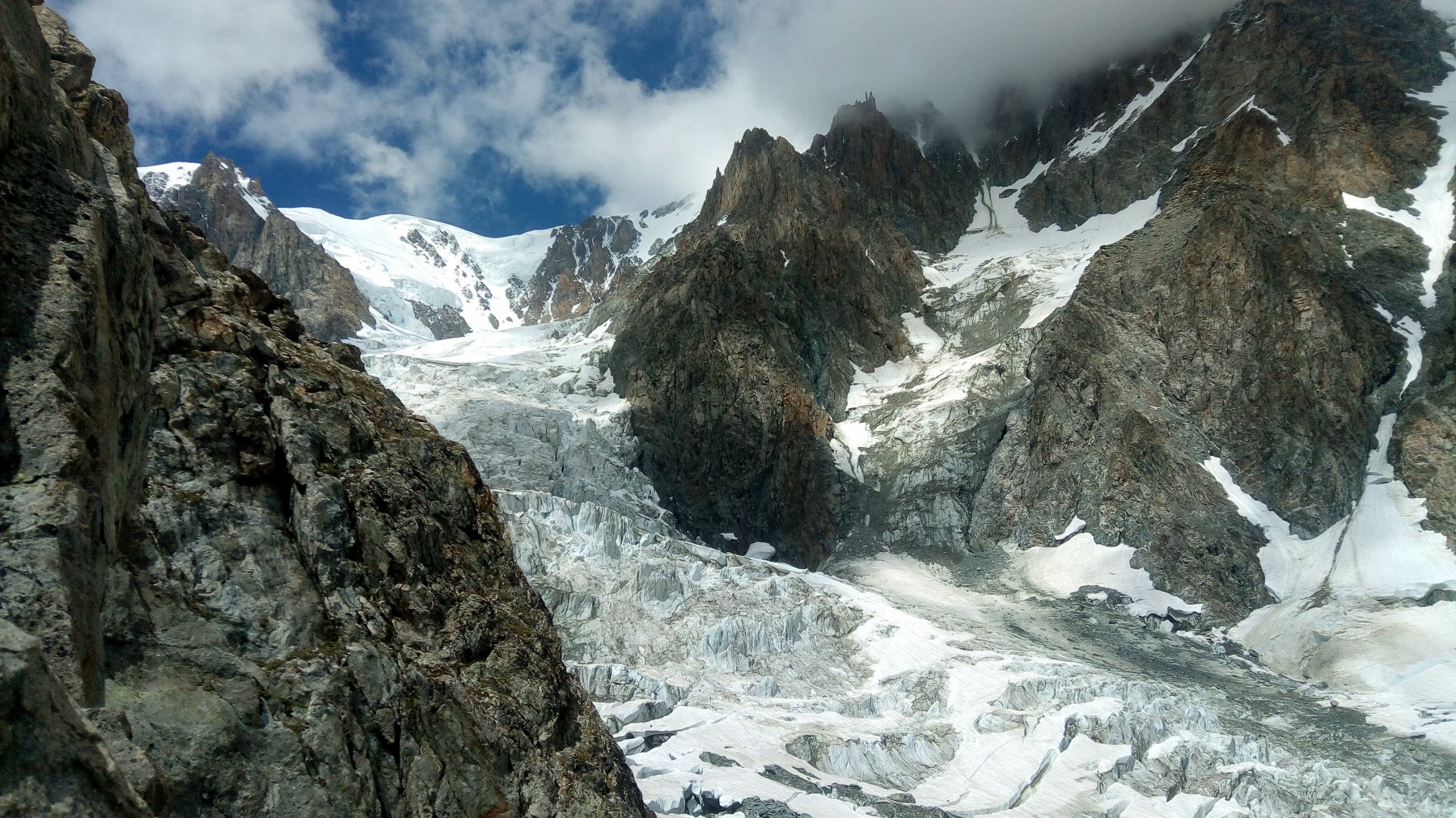
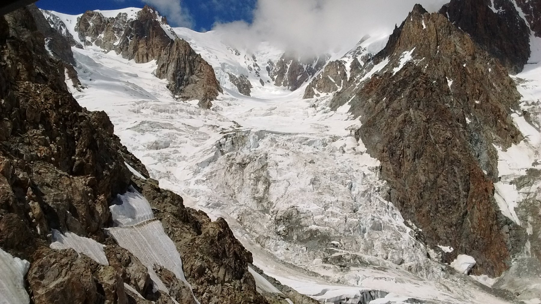
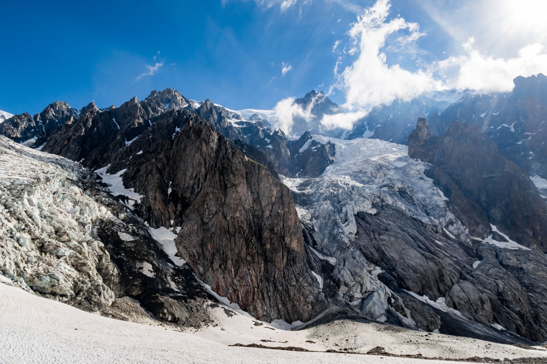
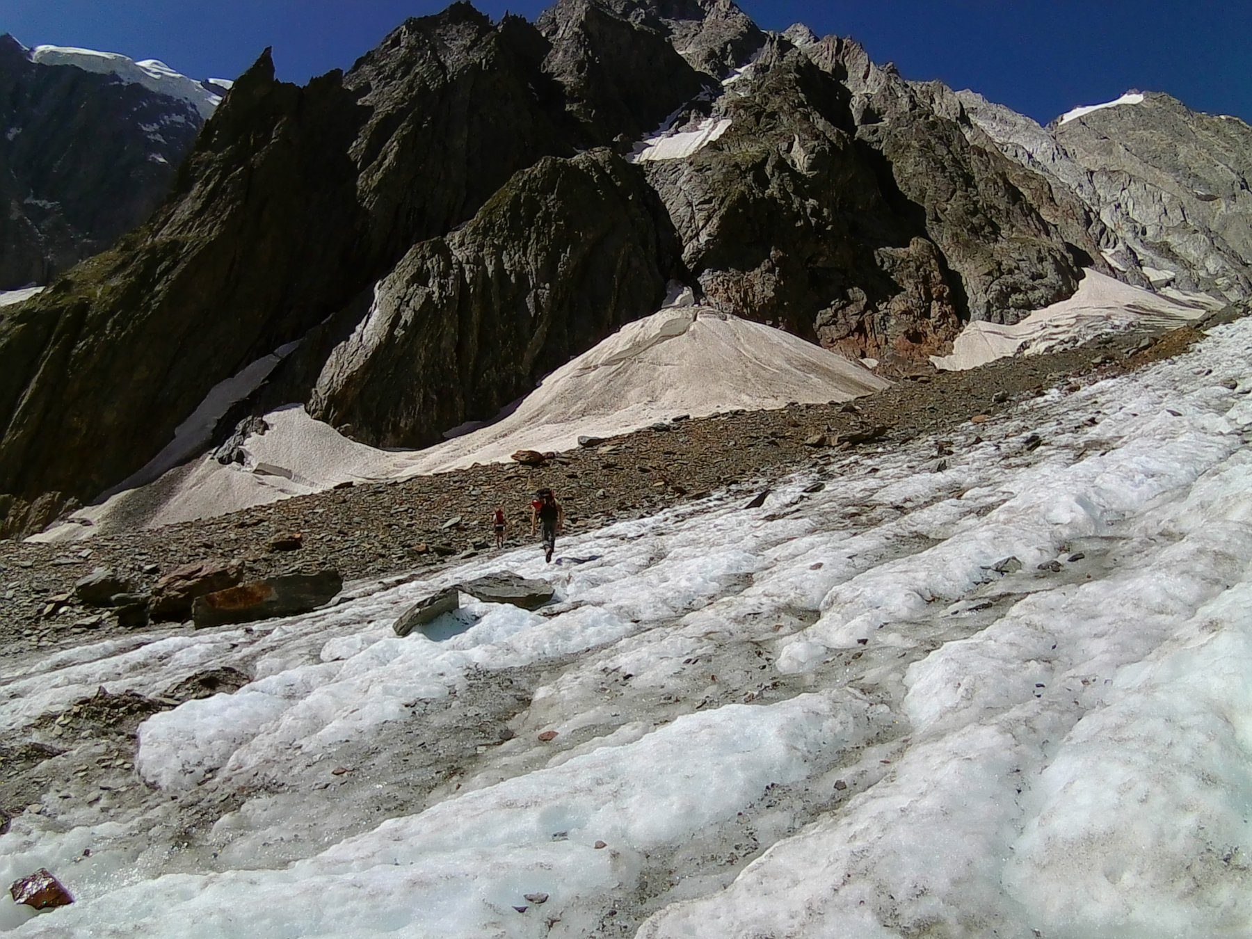
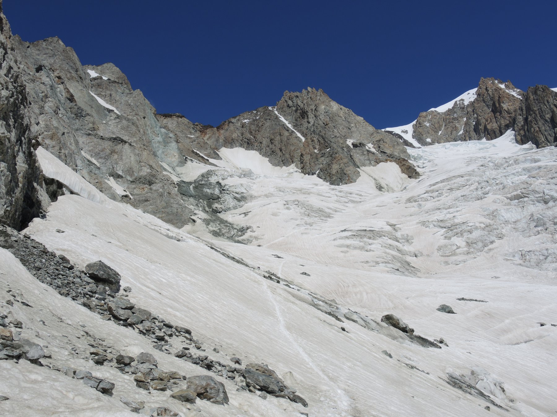
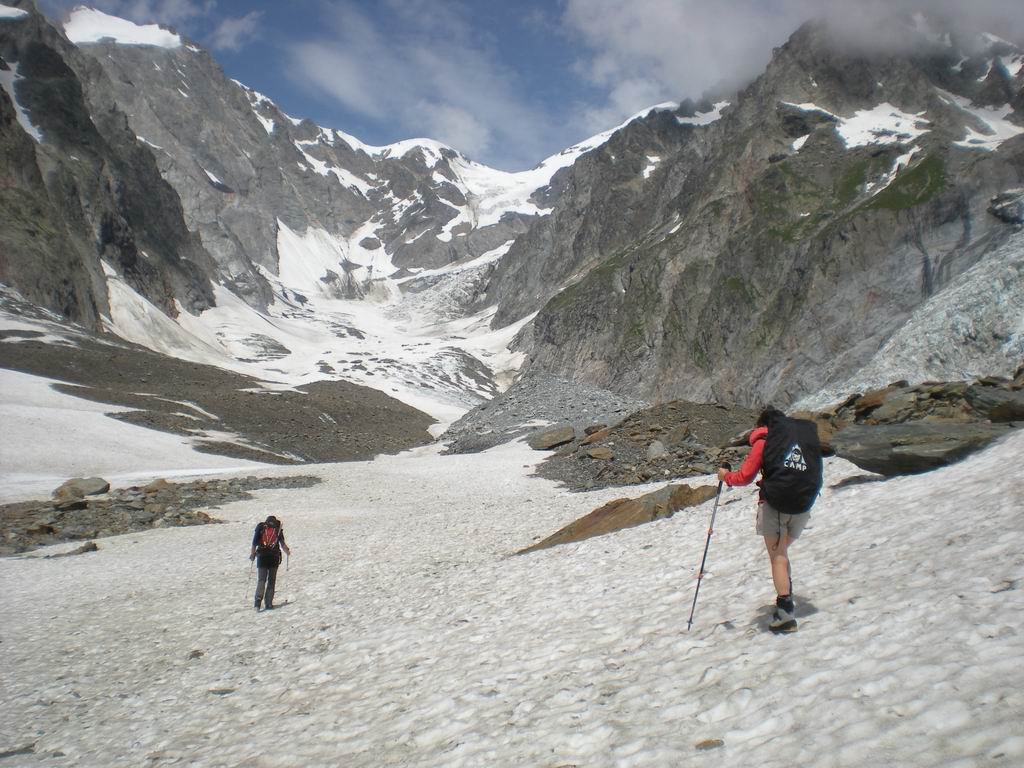
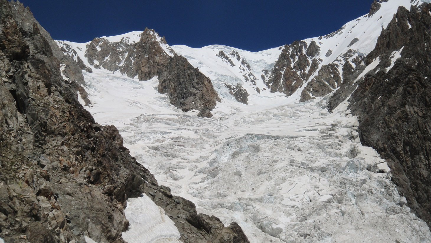
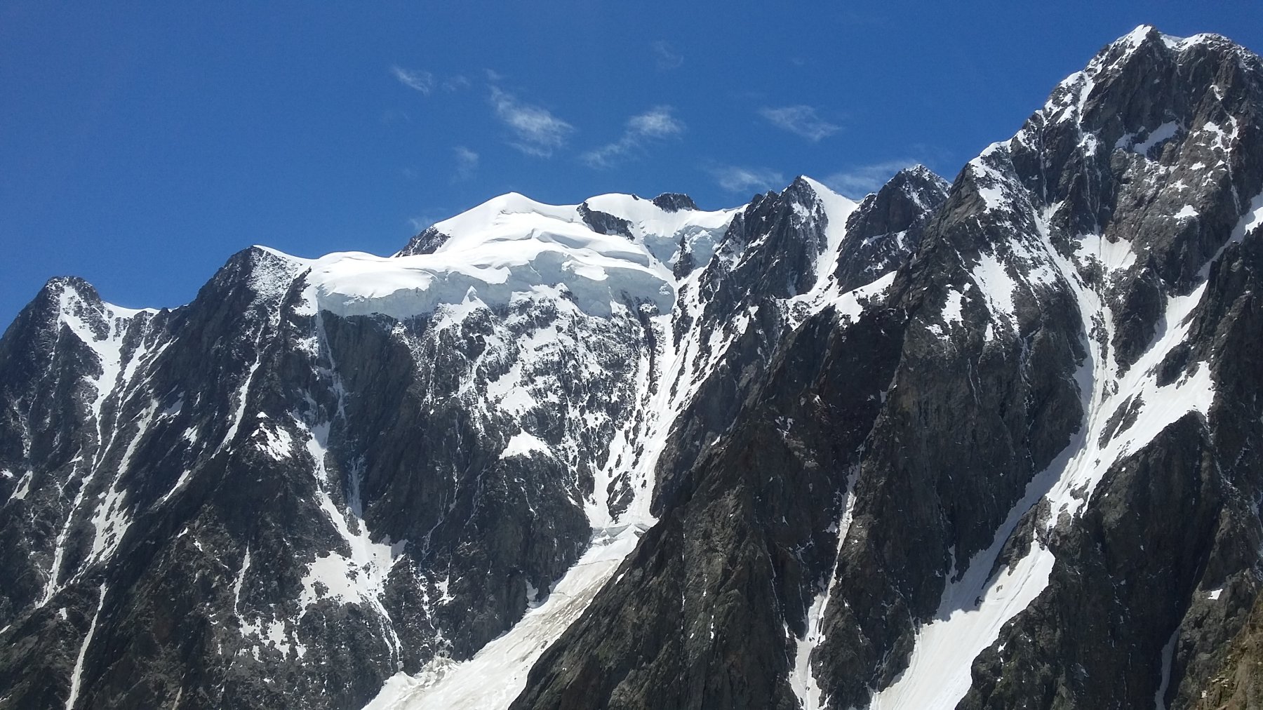
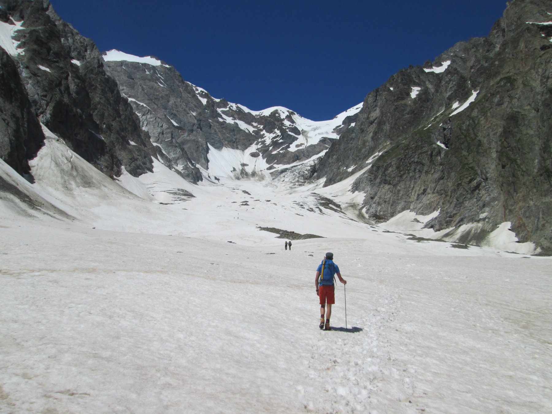
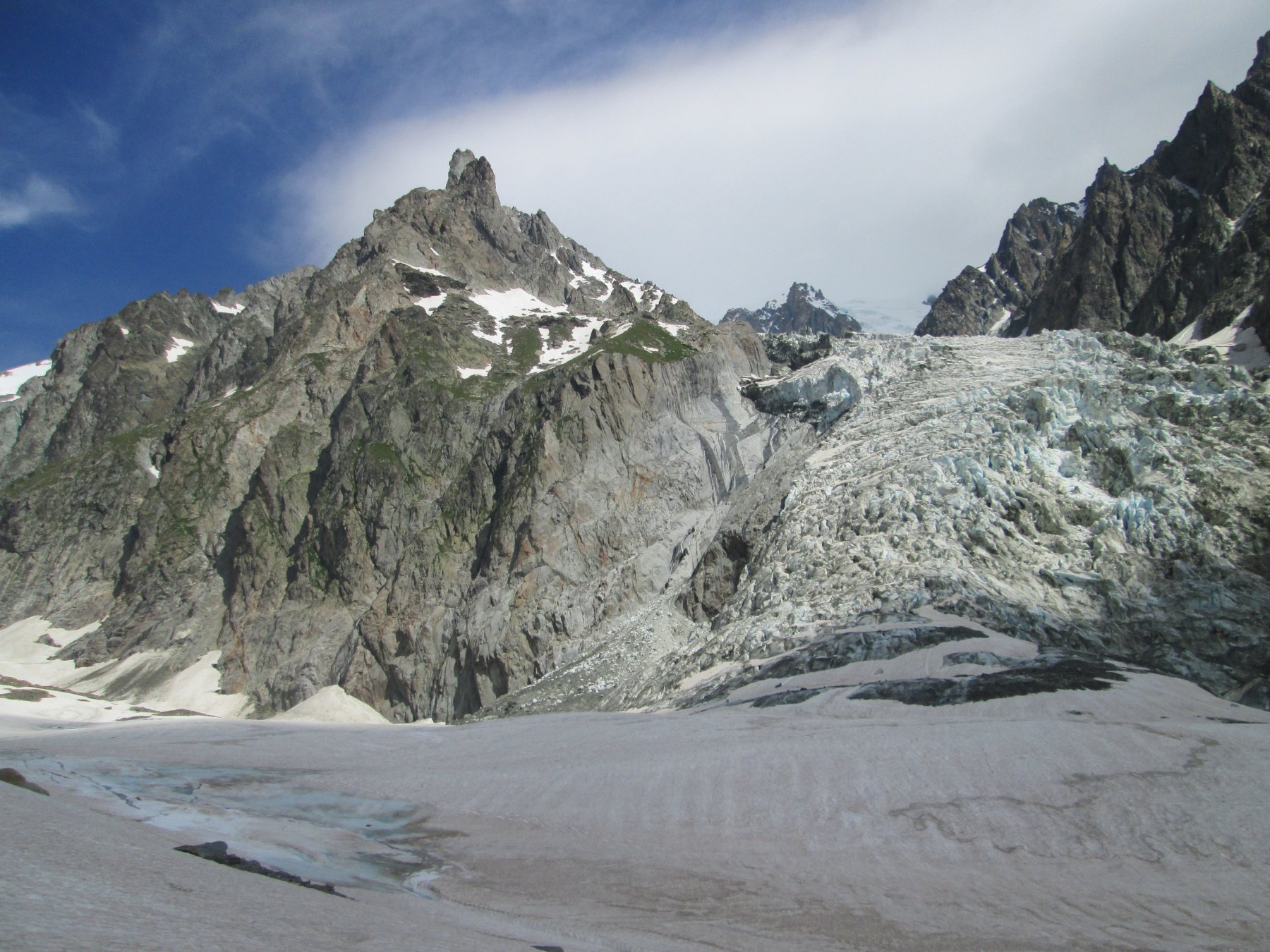
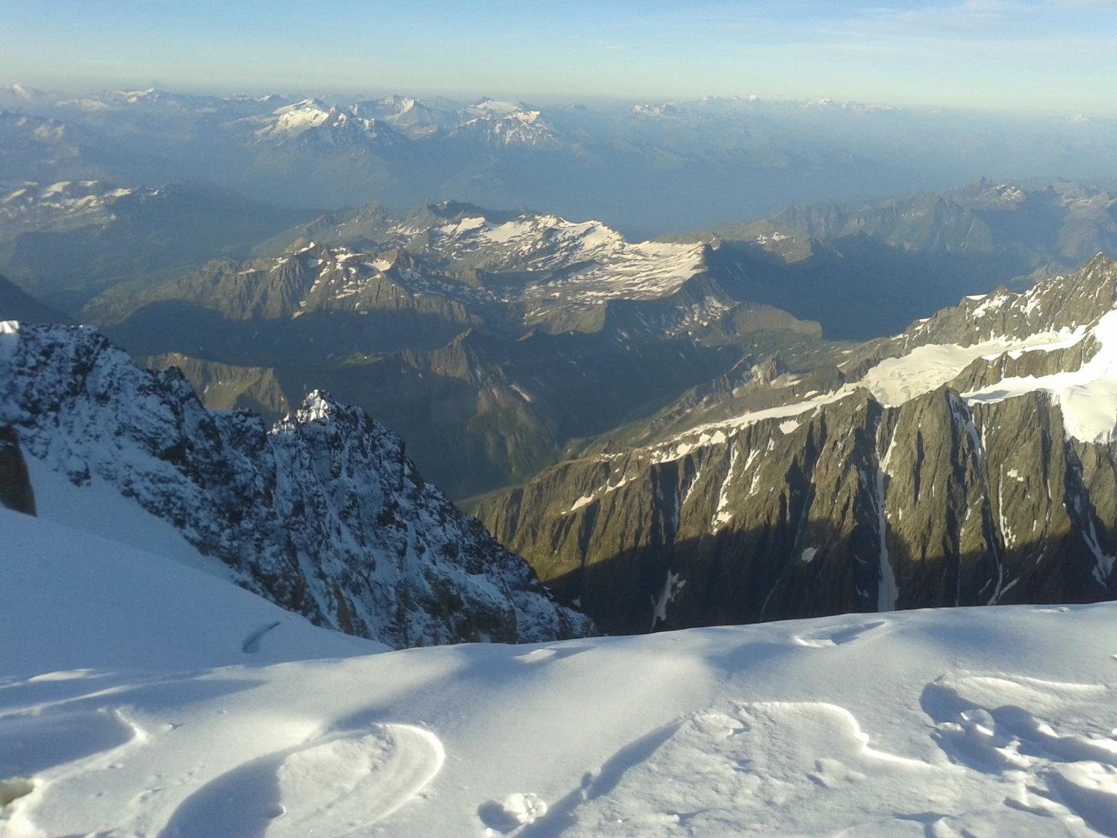
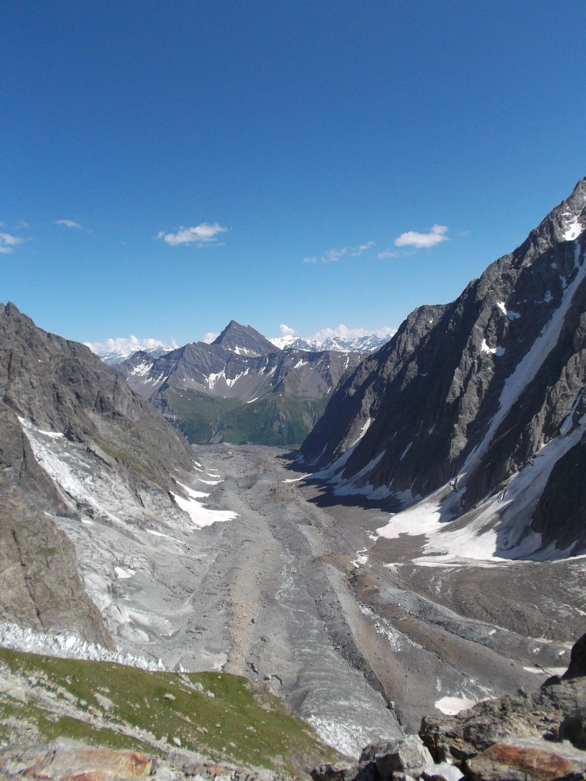
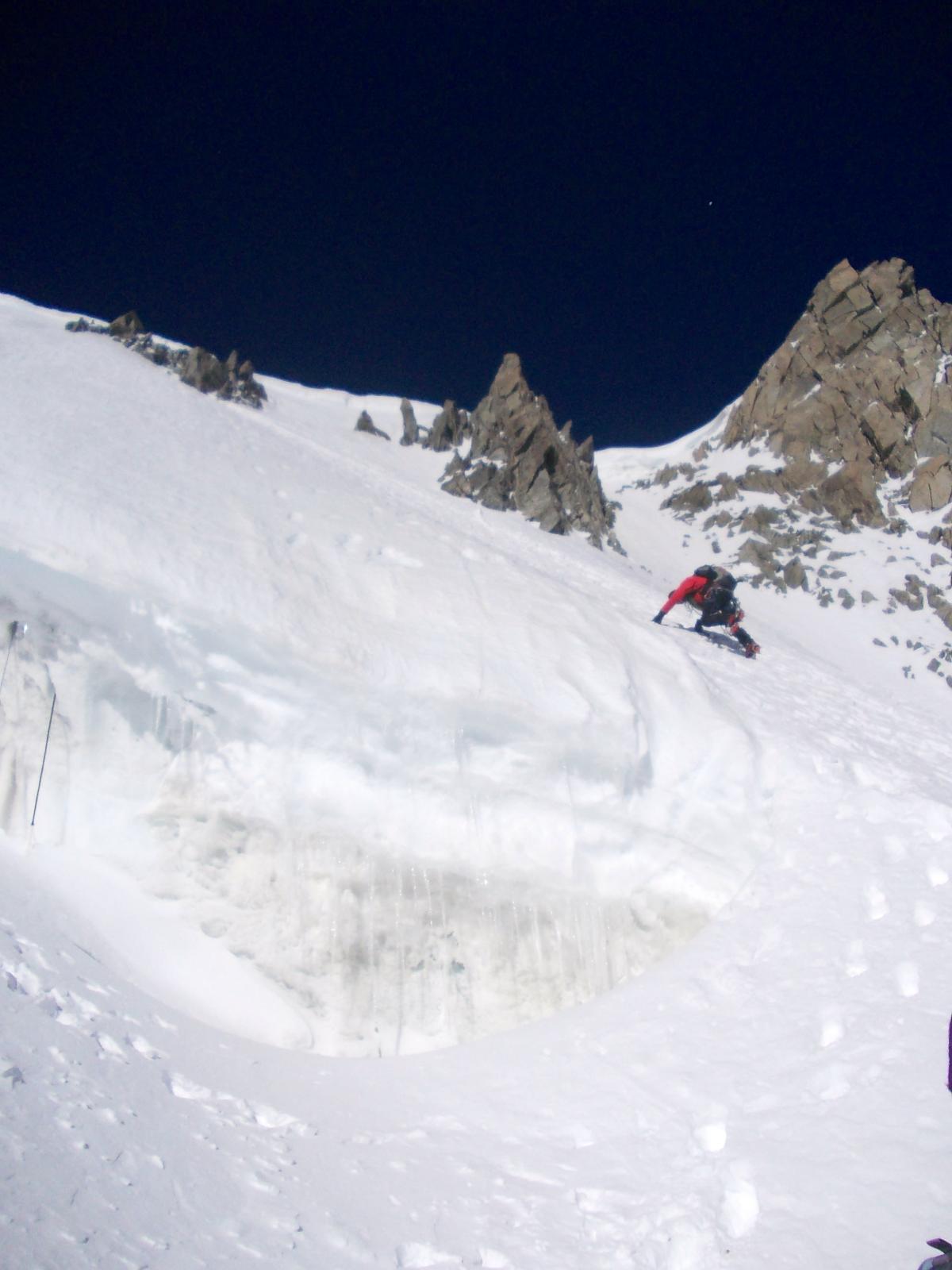
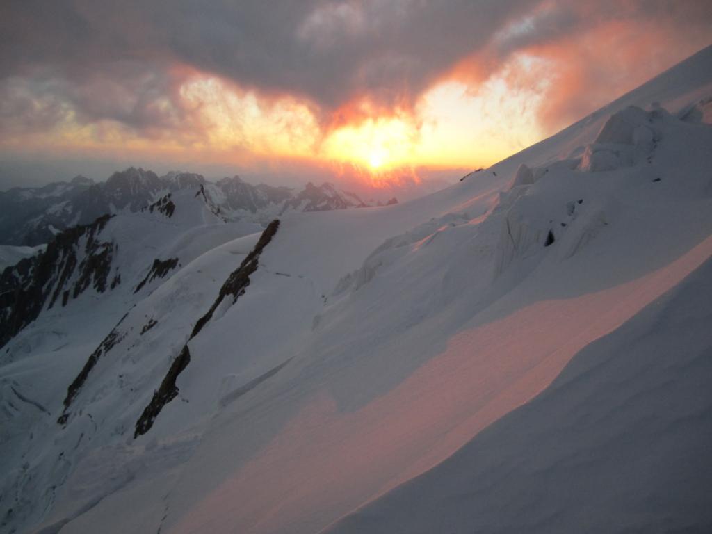
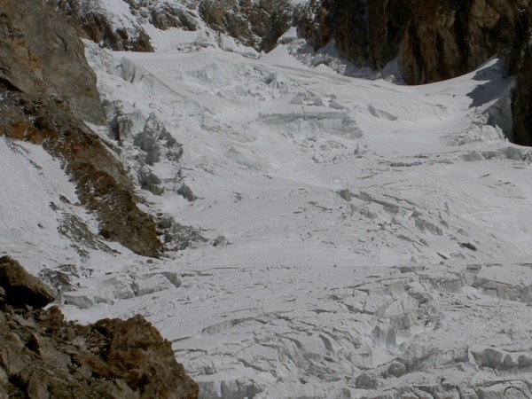
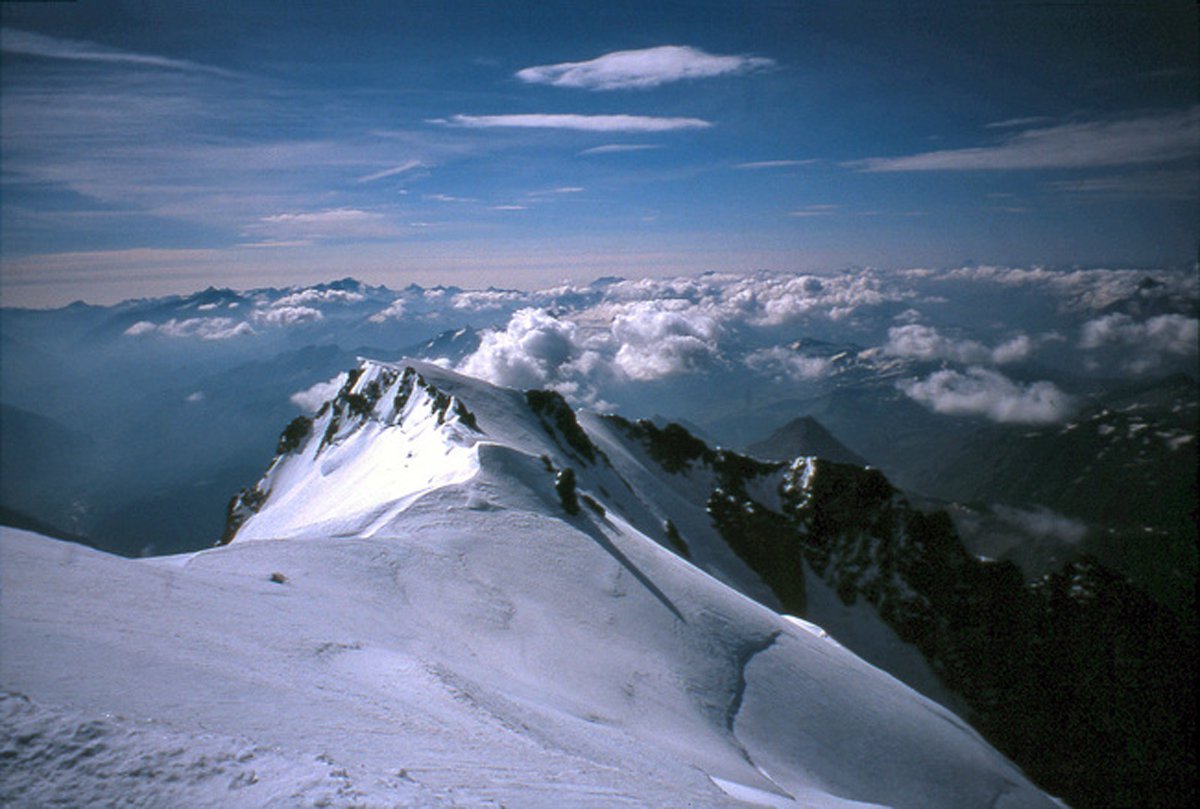
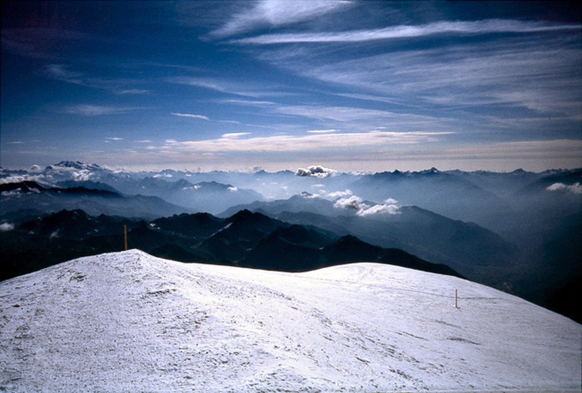
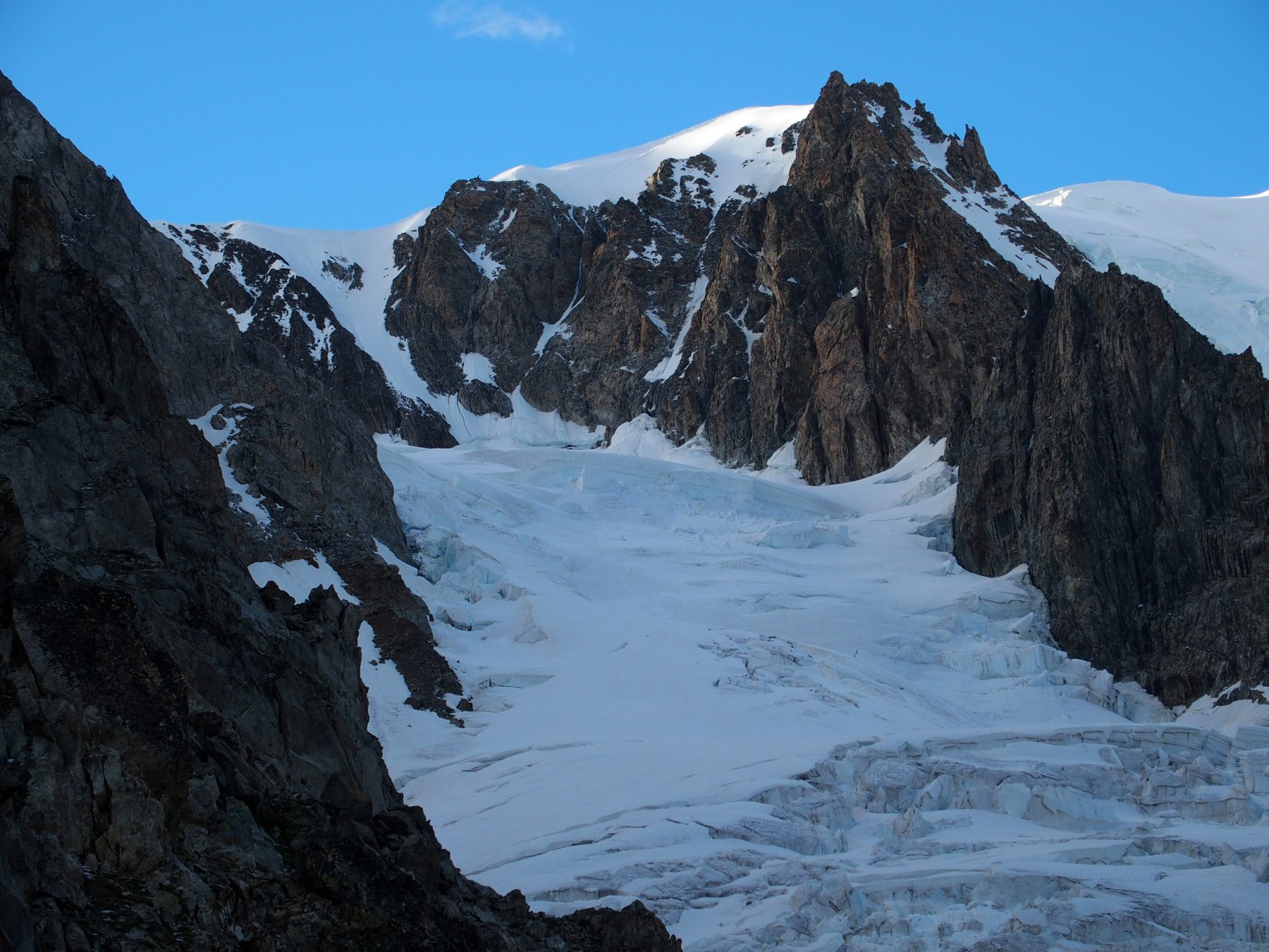
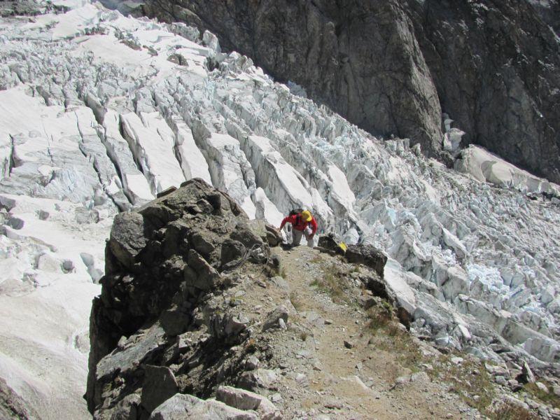
Da questo punto guardando il fondovalle si ha di fronte l’immenso ghiacciaio, l’Aiguilles de Trelatête a destra, l’Aiguilles Grises sulla sinistra, e altre guglie e vette contornate da seracchi sospesi che di tanto in tanto ravvivano l’atmosfera con fragorose scariche le quali però data la distanza dal tracciato non presentano problemi; mentre se ci si volta all’indietro si scorge il caratteristico lago del Miage il quale potrebbe rappresentare una piacevole meta velocemente raggiungibile per un’escursione più famigliare. Seguendo poi la facile cresta si arriva al suo termine e a questo punto il sentiero ci porta a scendere verso destra direttamente sul ghiacciaio del Miage coperto interamente da detriti morenici ma del tutto vivo, da qui si prosegue seguendo centralmente rispetto al ghiacciaio evidenti ometti e cerchi gialli, i quali dopo circa 5 km, su minima pendenza ci fanno arrivare al termine del tratto morenico, da qui alla nostra destra si può vedere l’imponente ghiacciaio del Dôme e la bastionata rocciosa alla sua sinistra che sorregge il rifugio; a questo punto s’inizia a calpestare il ghiacciaio vero e proprio che solitamente non necessita l’utilizzo di ramponi e picca.
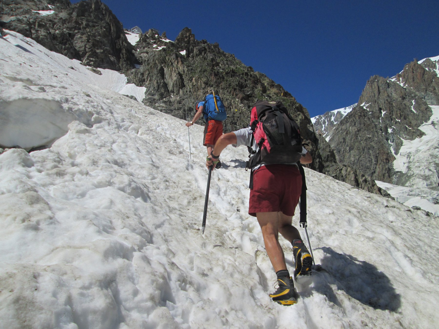
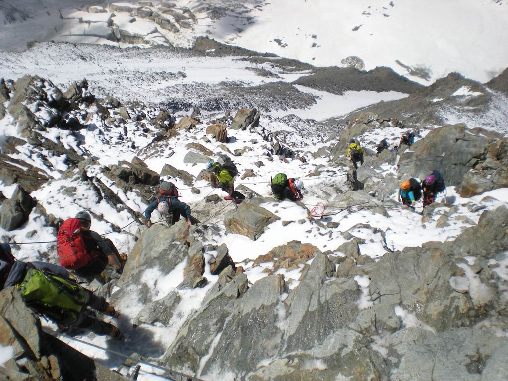
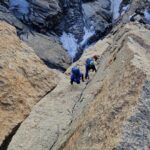
Questa parte di percorso, più intuitiva, ci fa spostare prima verso sinistra poi a destra e saltando alcuni facili crepacci si arriva a calpestare un breve nevaio che evidenzia la traccia la quale sfocia sul sentiero roccioso.
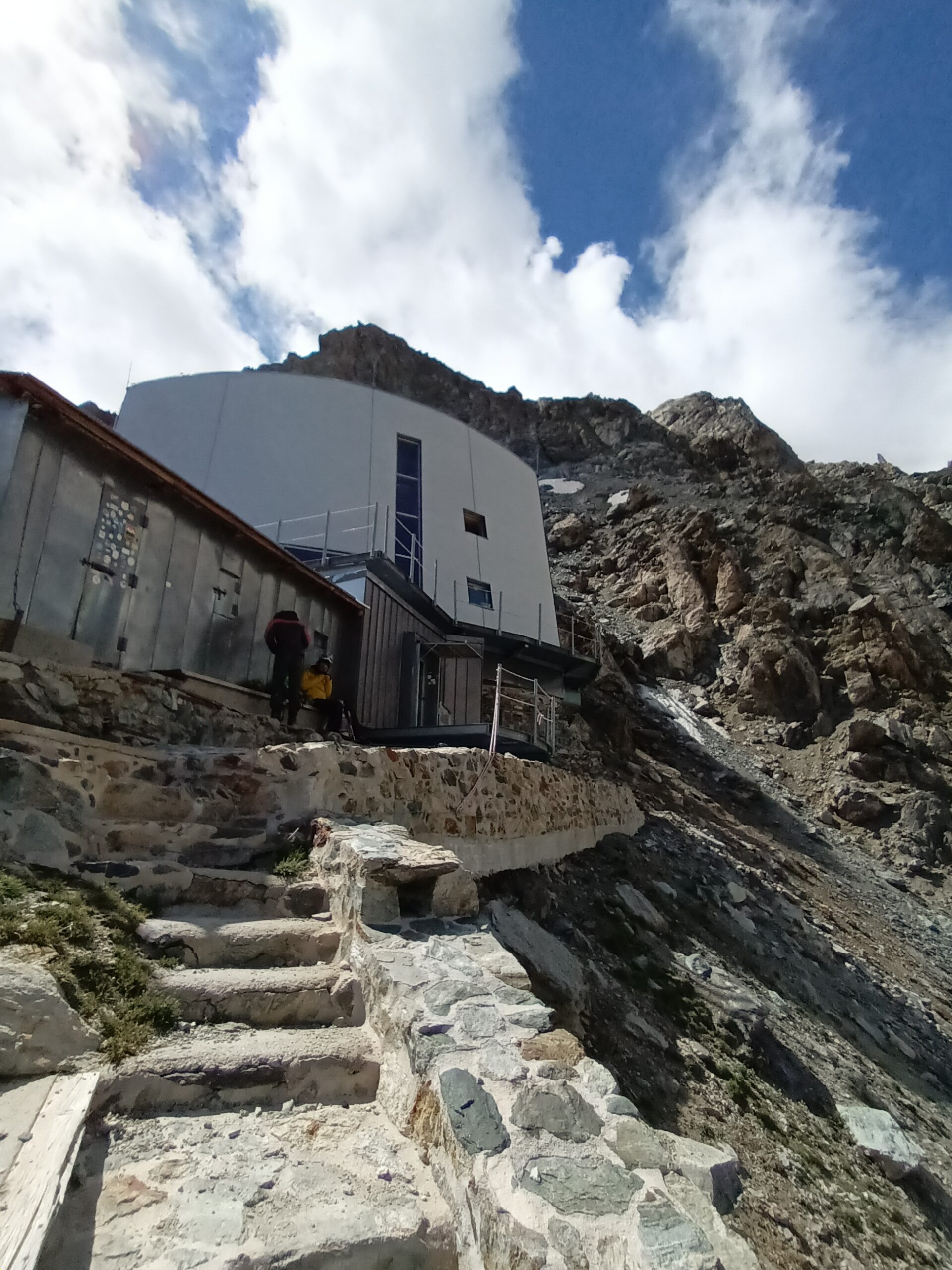
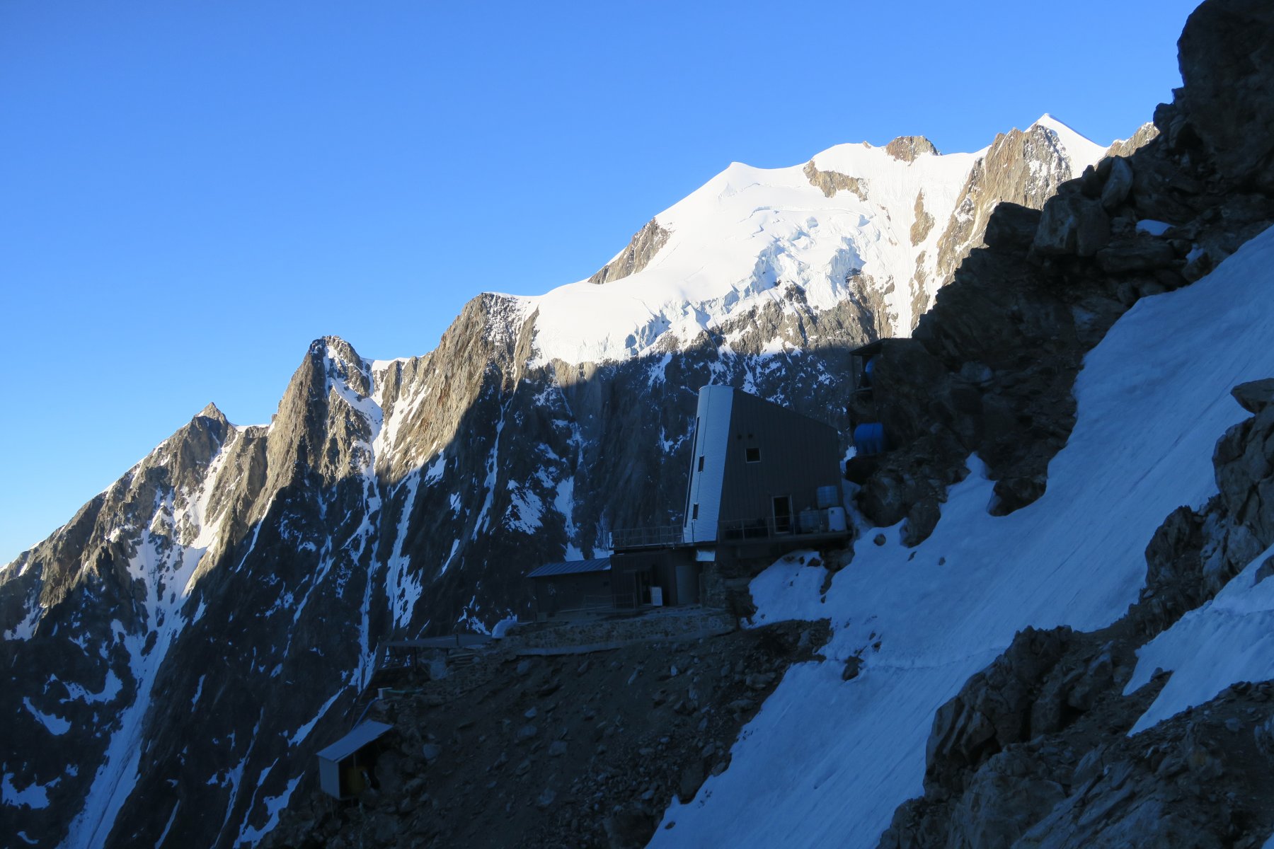
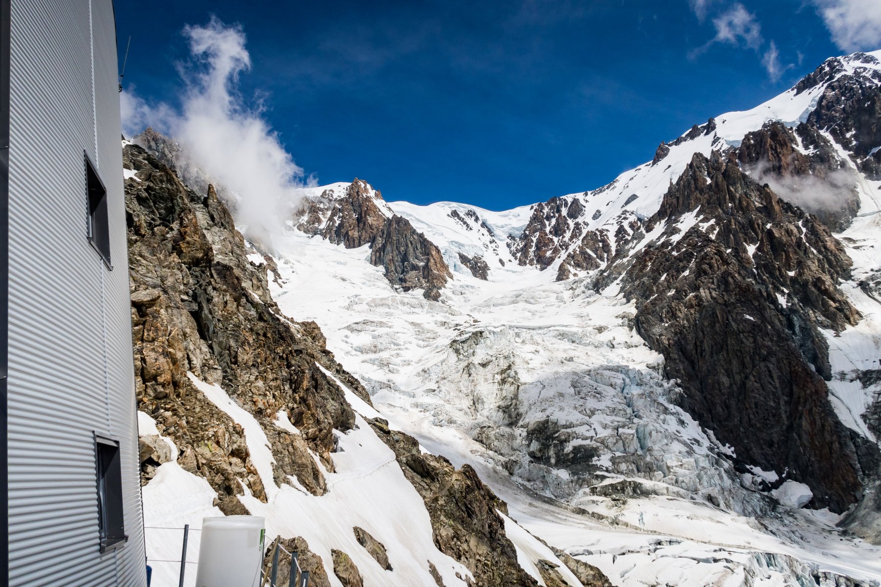
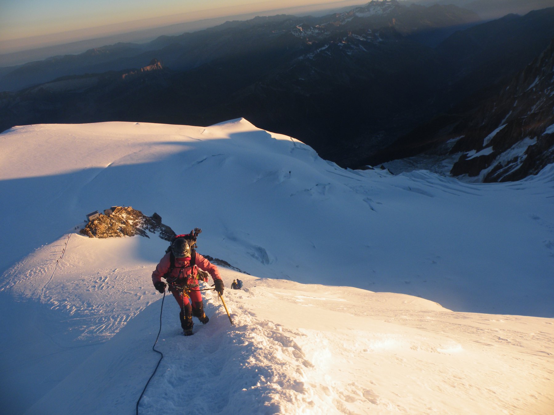
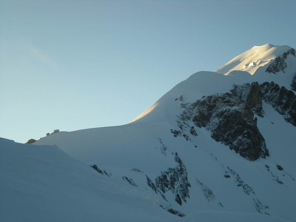
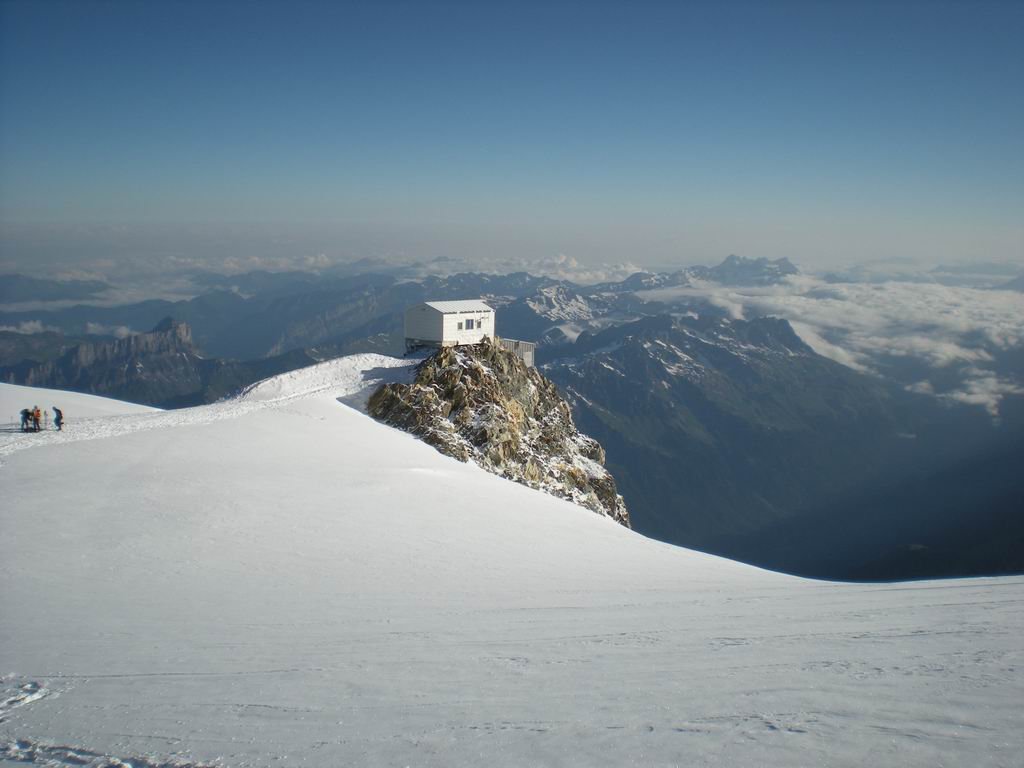
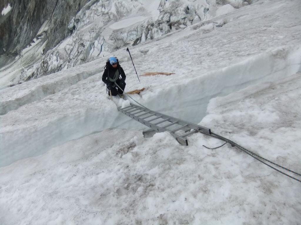
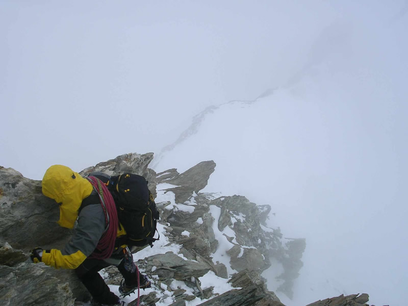
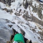
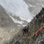
Esso si presenta ben segnalato e attrezzato in parecchi punti con catene e scalette, che agevolano il passaggio, solo per un piccolo tratto il sentiero è interrotto da un altro nevaio e poco dopo seguendo sempre la via ferrata si arriva al rifugio dopo cinque ore dalla partenza dall’auto.
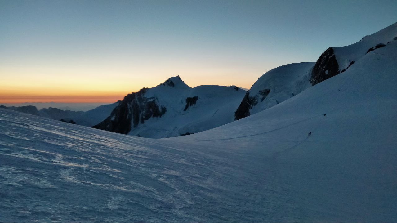
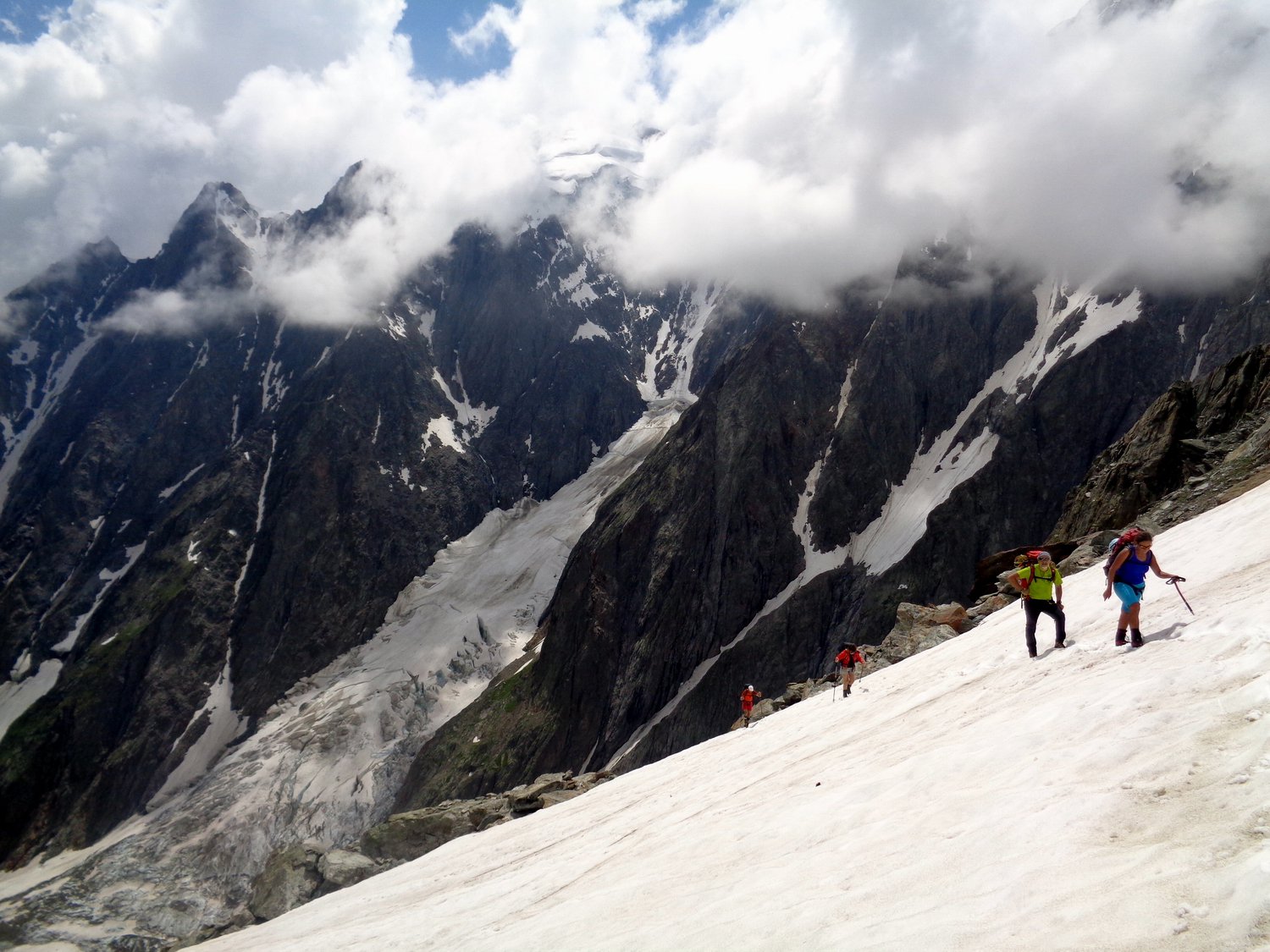
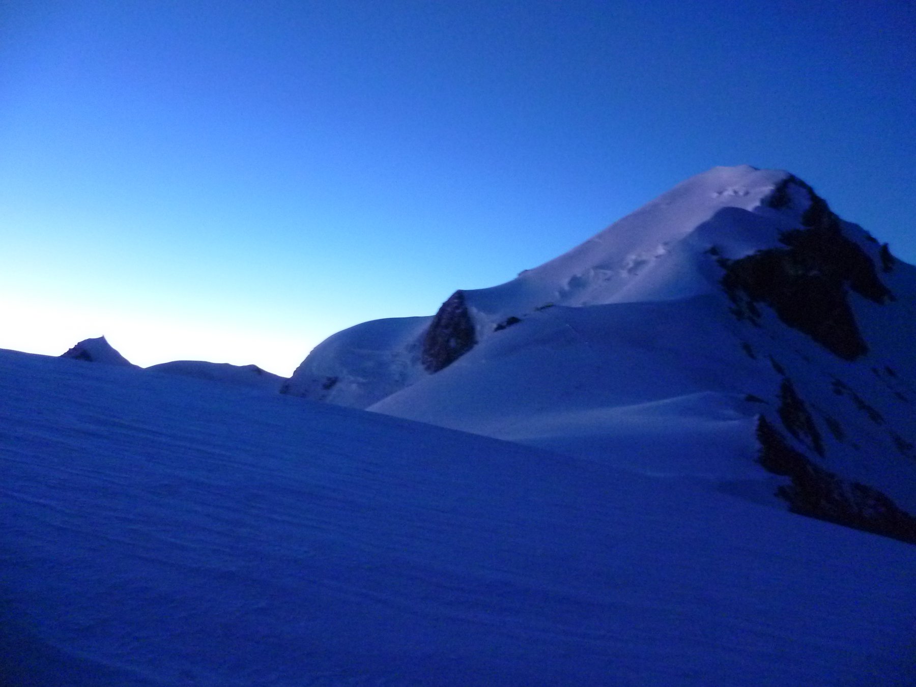
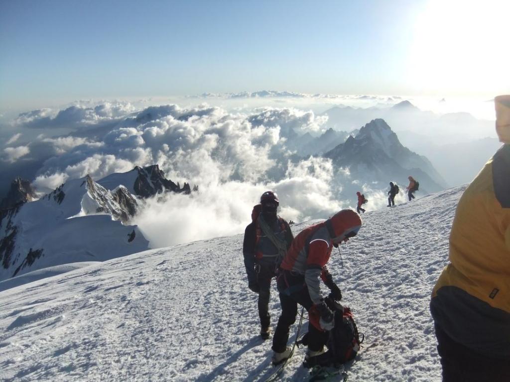
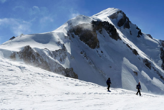
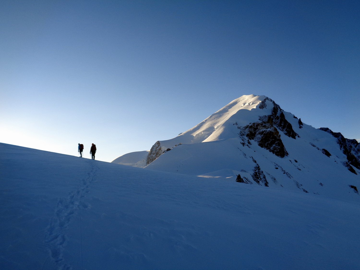
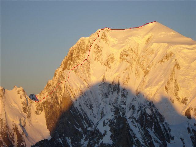
2° GIORNO ( dal rif. Gonella 3.071 mt al Monte Bianco 4.810 mt )
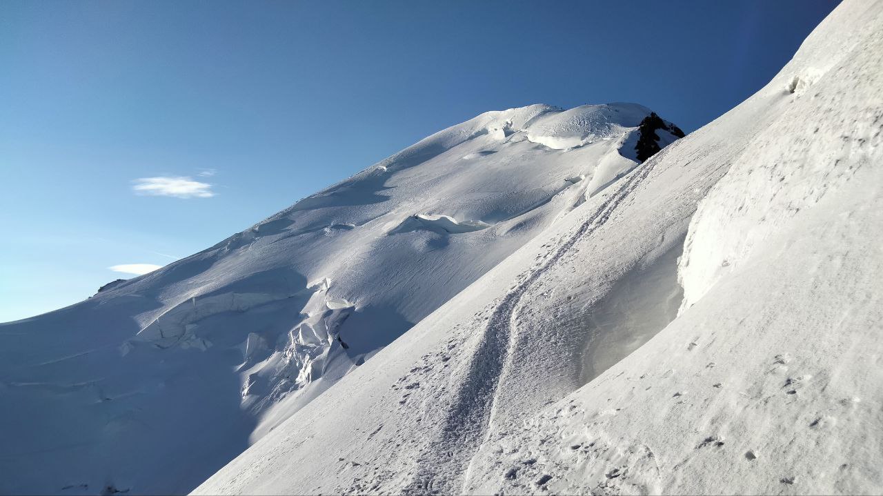
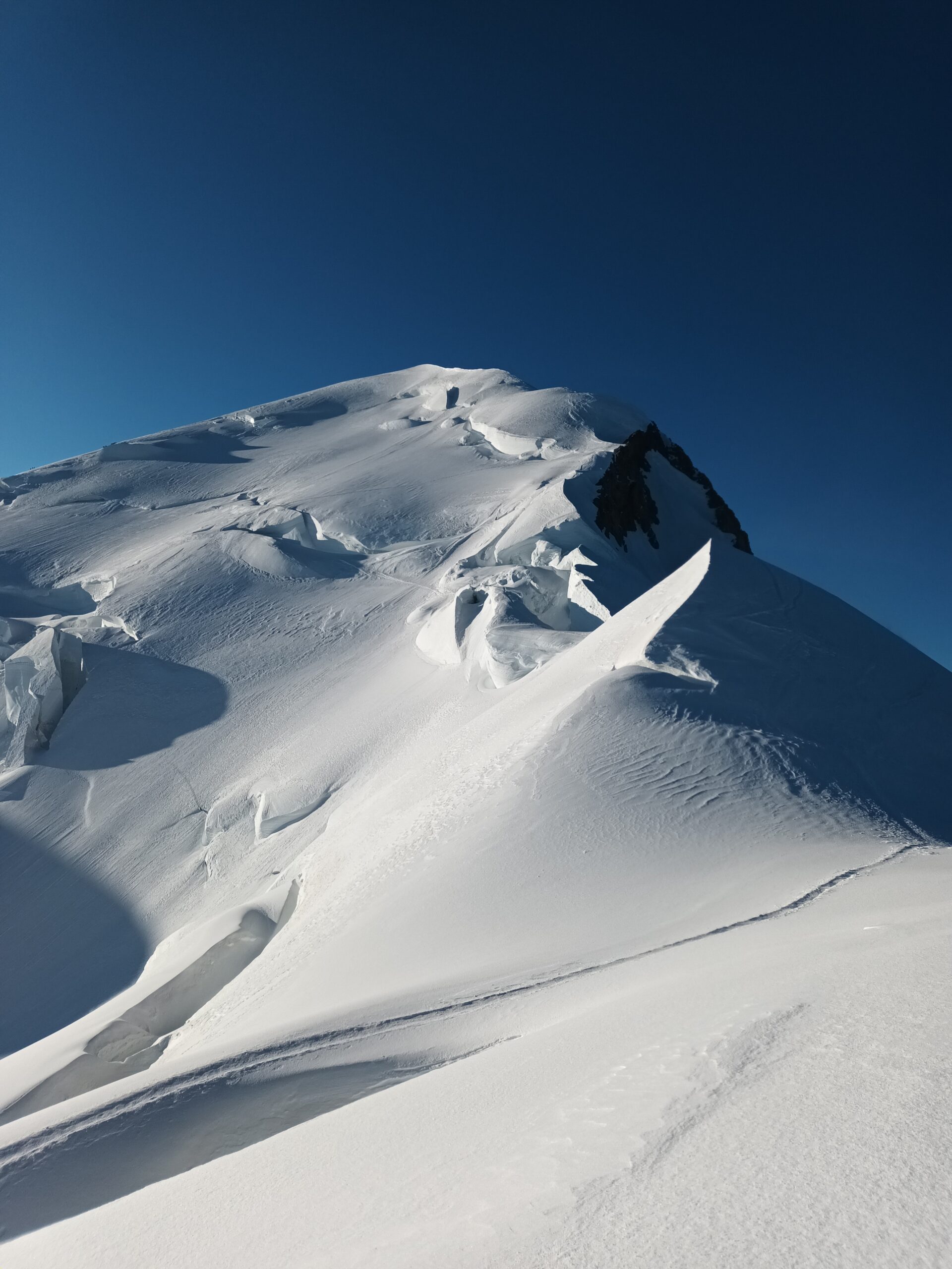
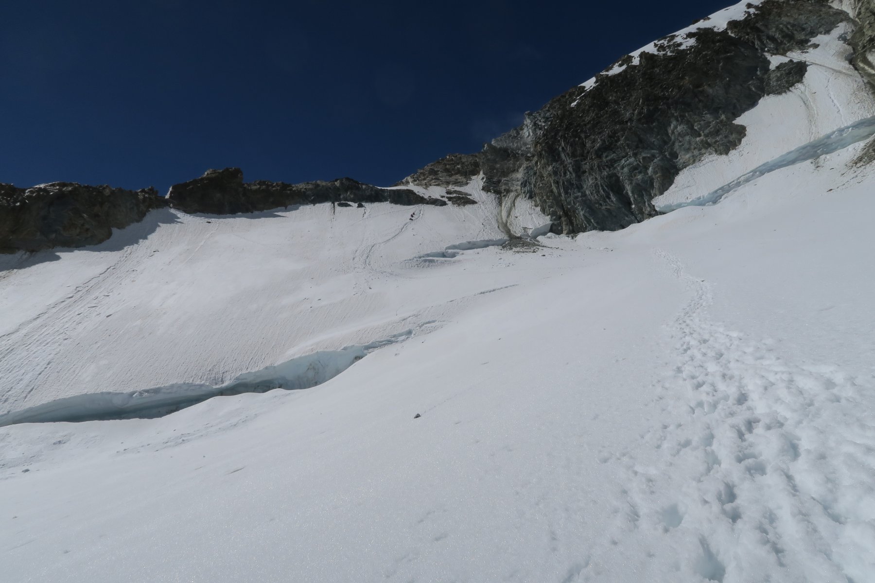
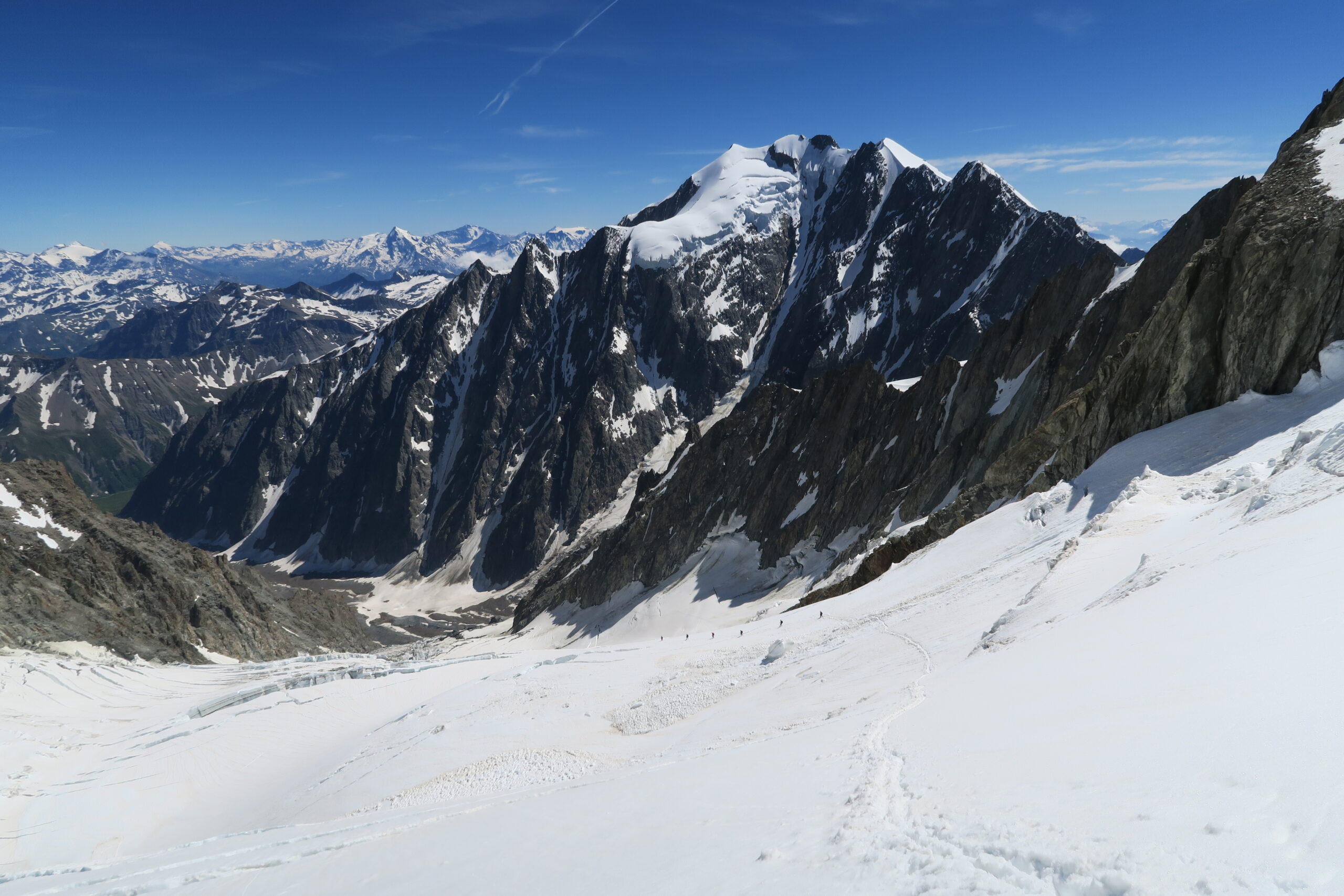
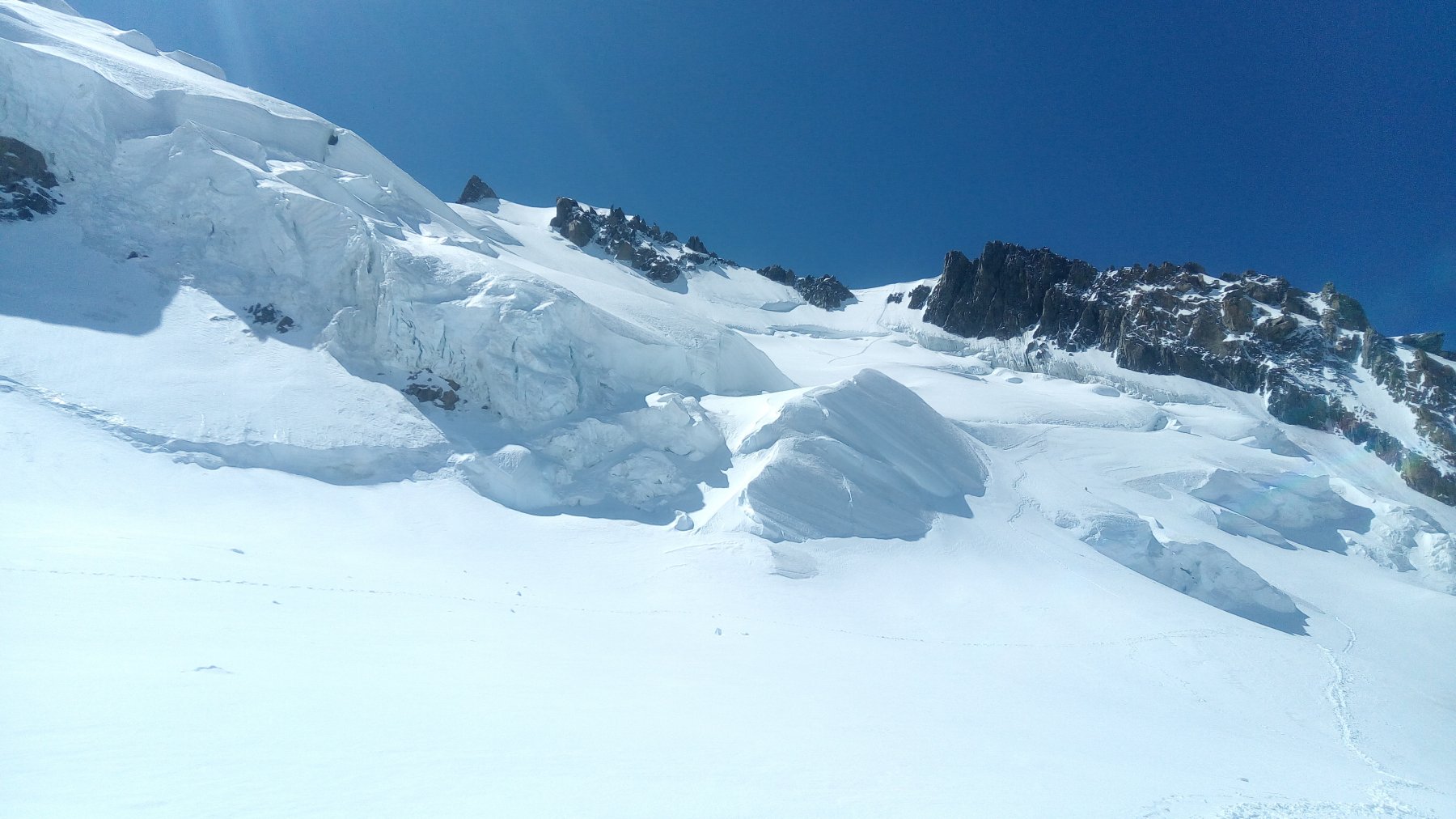
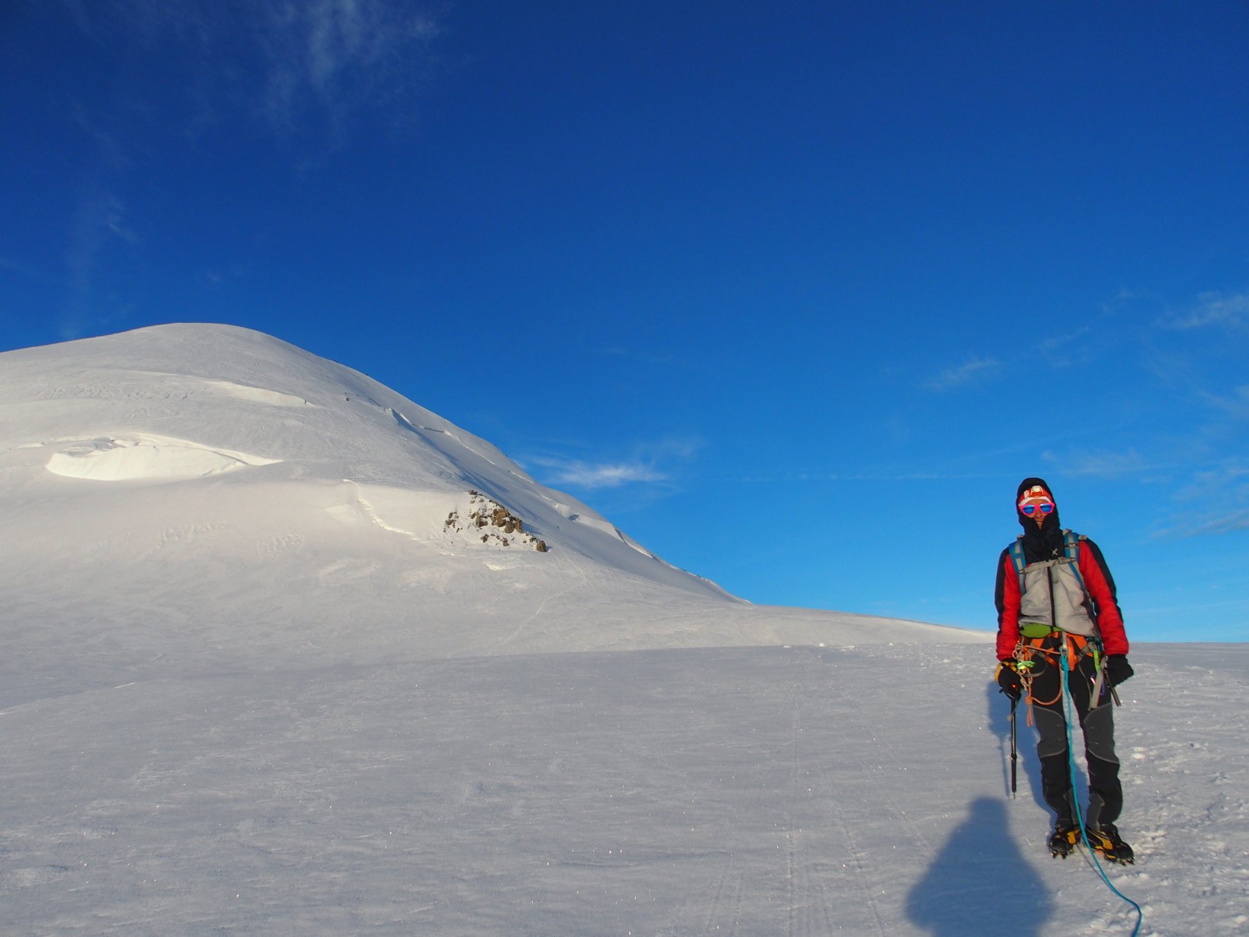
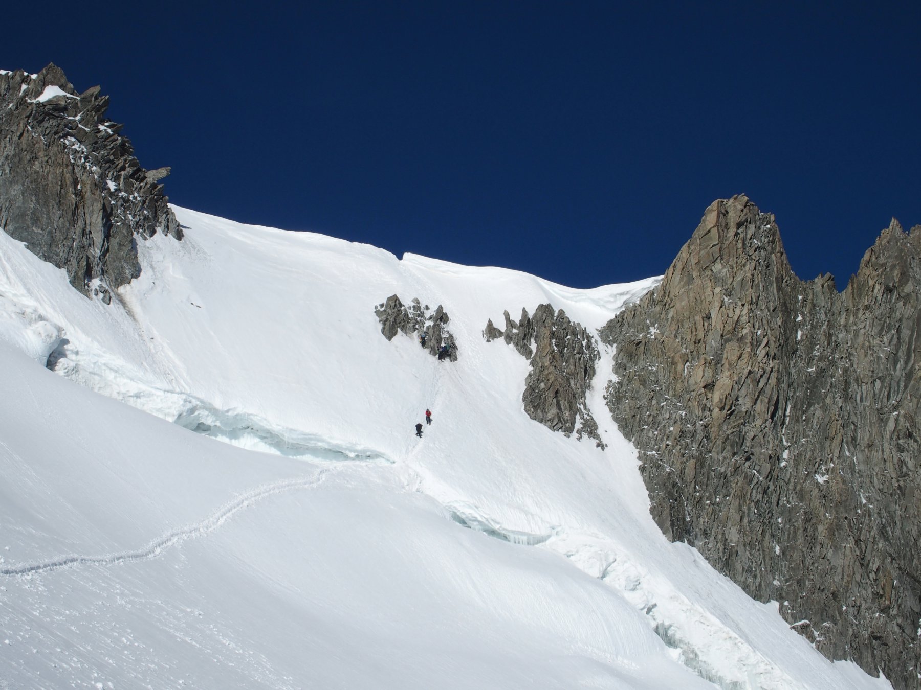
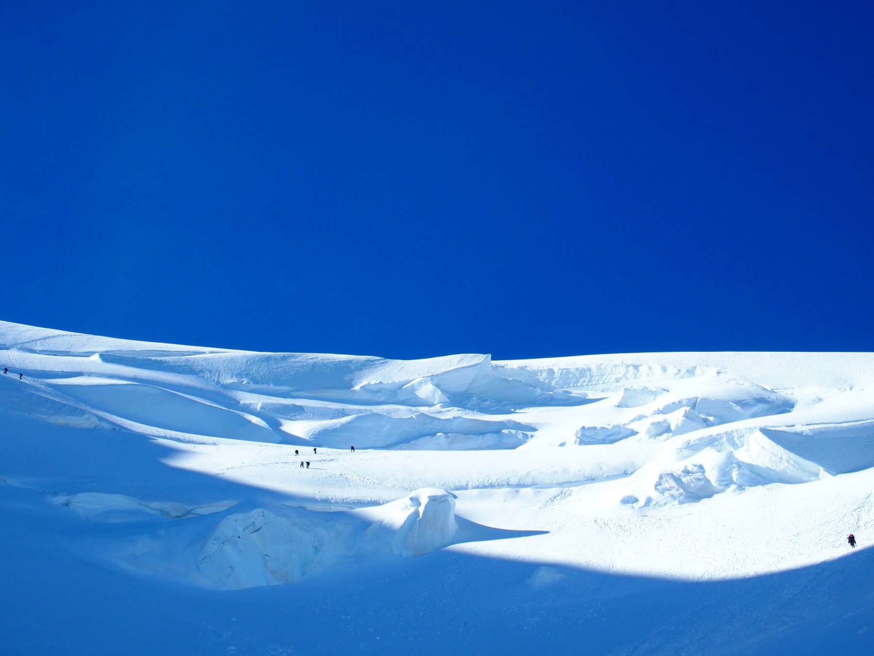
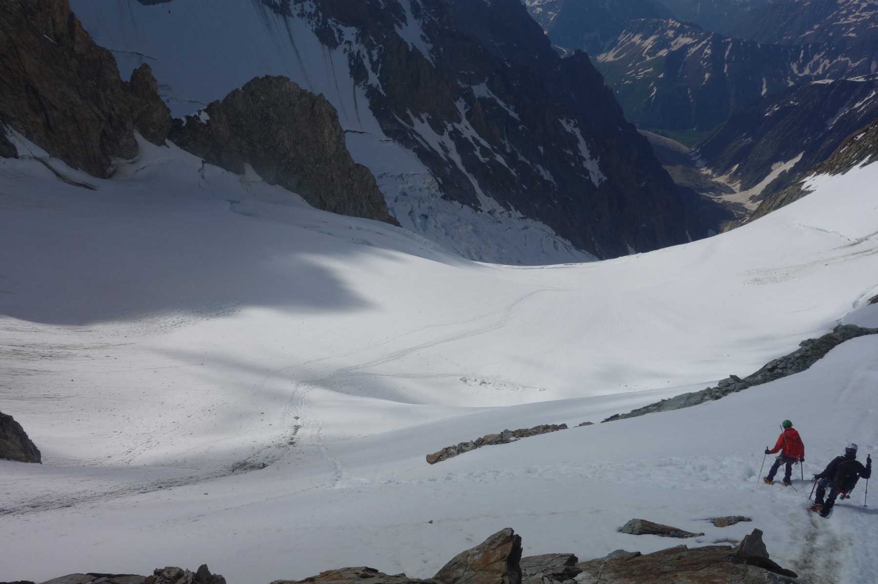
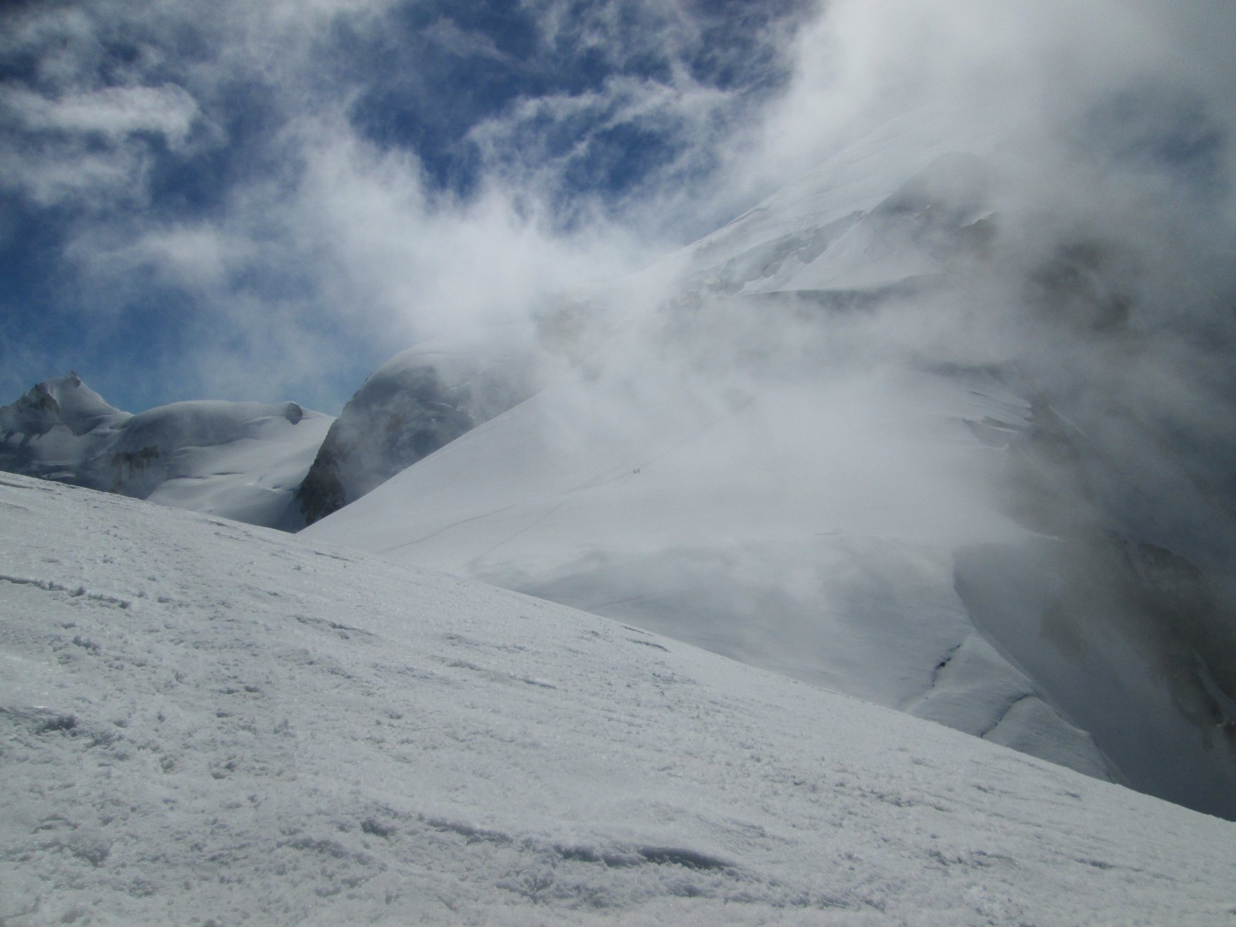
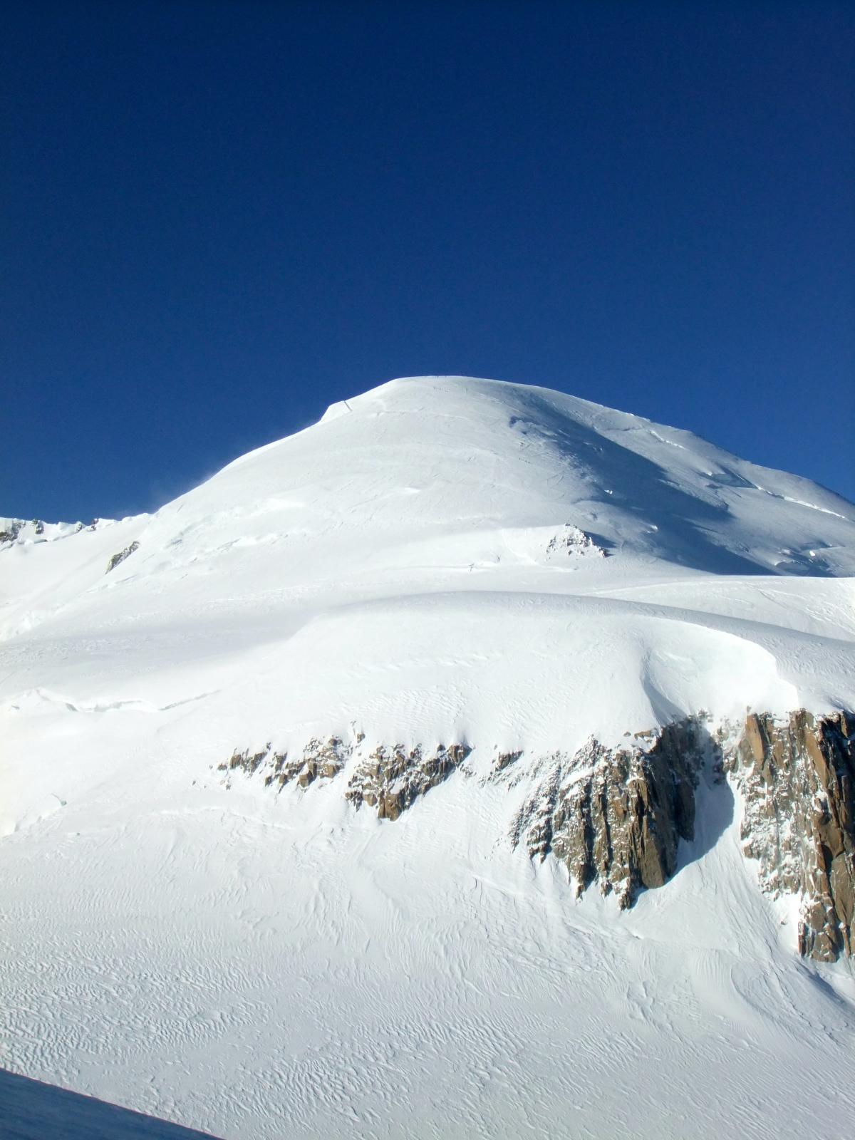
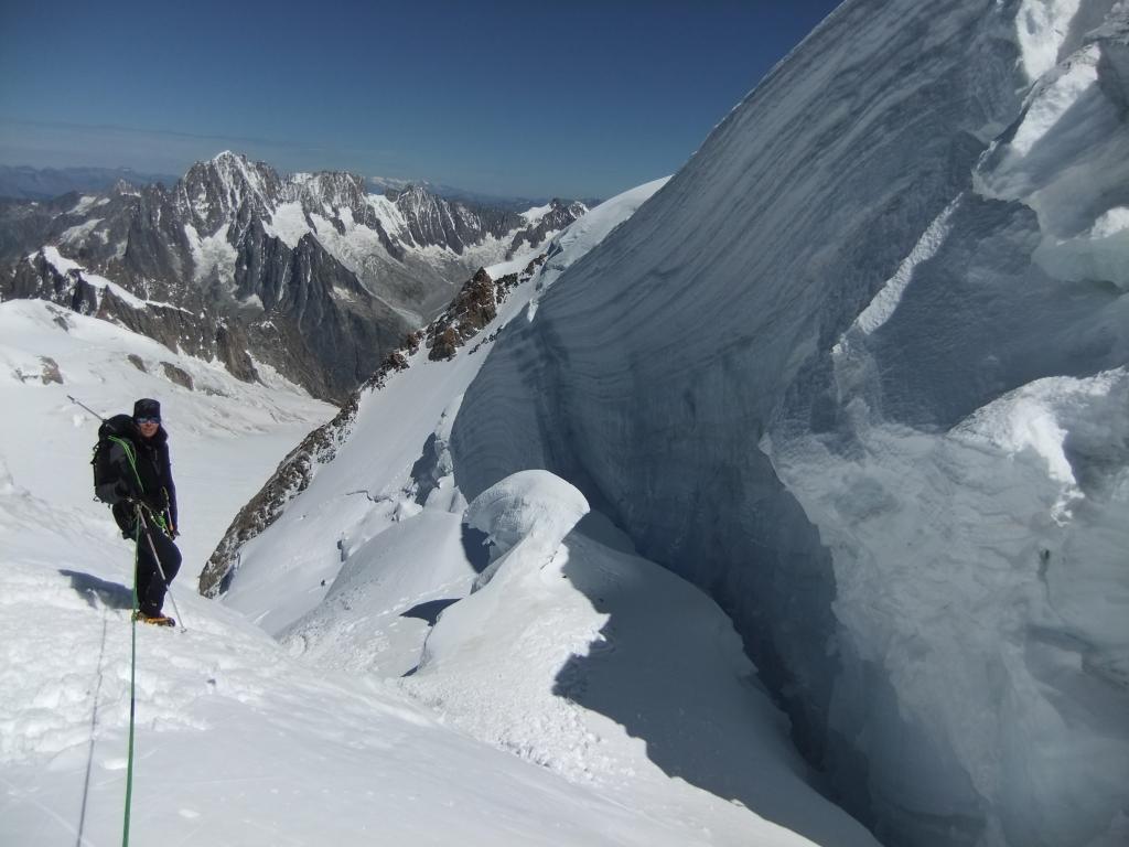
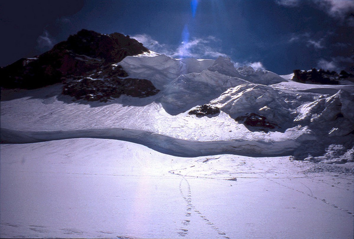
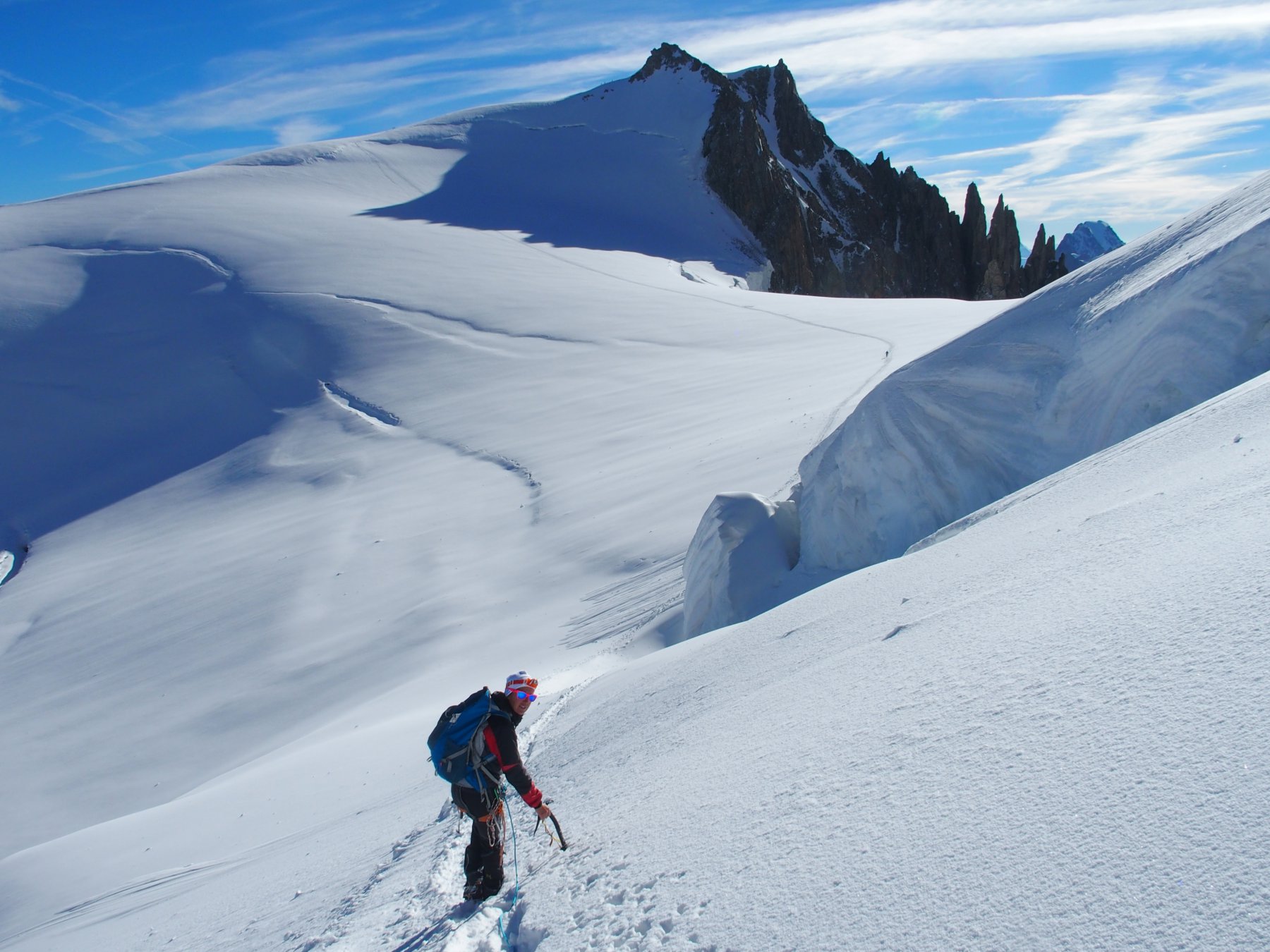
Dal rifugio si percorre un facile e breve sentiero che può essere pericoloso per scariche di pietre, poco dopo si arriva a calpestare il ghiacciaio del Dôme che di per se non dovrebbe presentare grosse difficoltà se non fosse che l’estate così calda (2003) lo ha flagellato aprendo parecchi crepacci, questo ci obbliga a seguire con molta attenzione la traccia dovendo così fare parecchi zig zag.
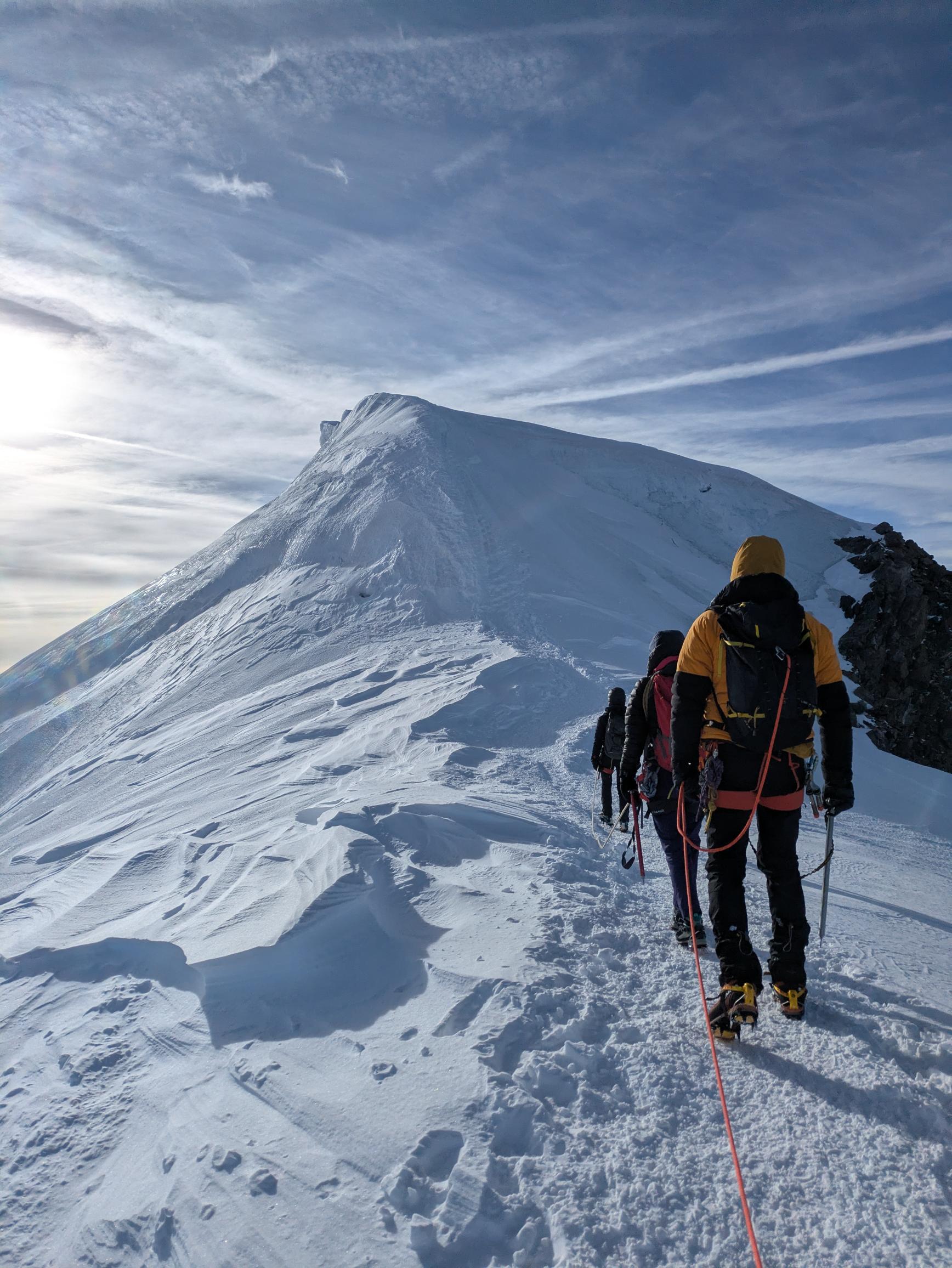
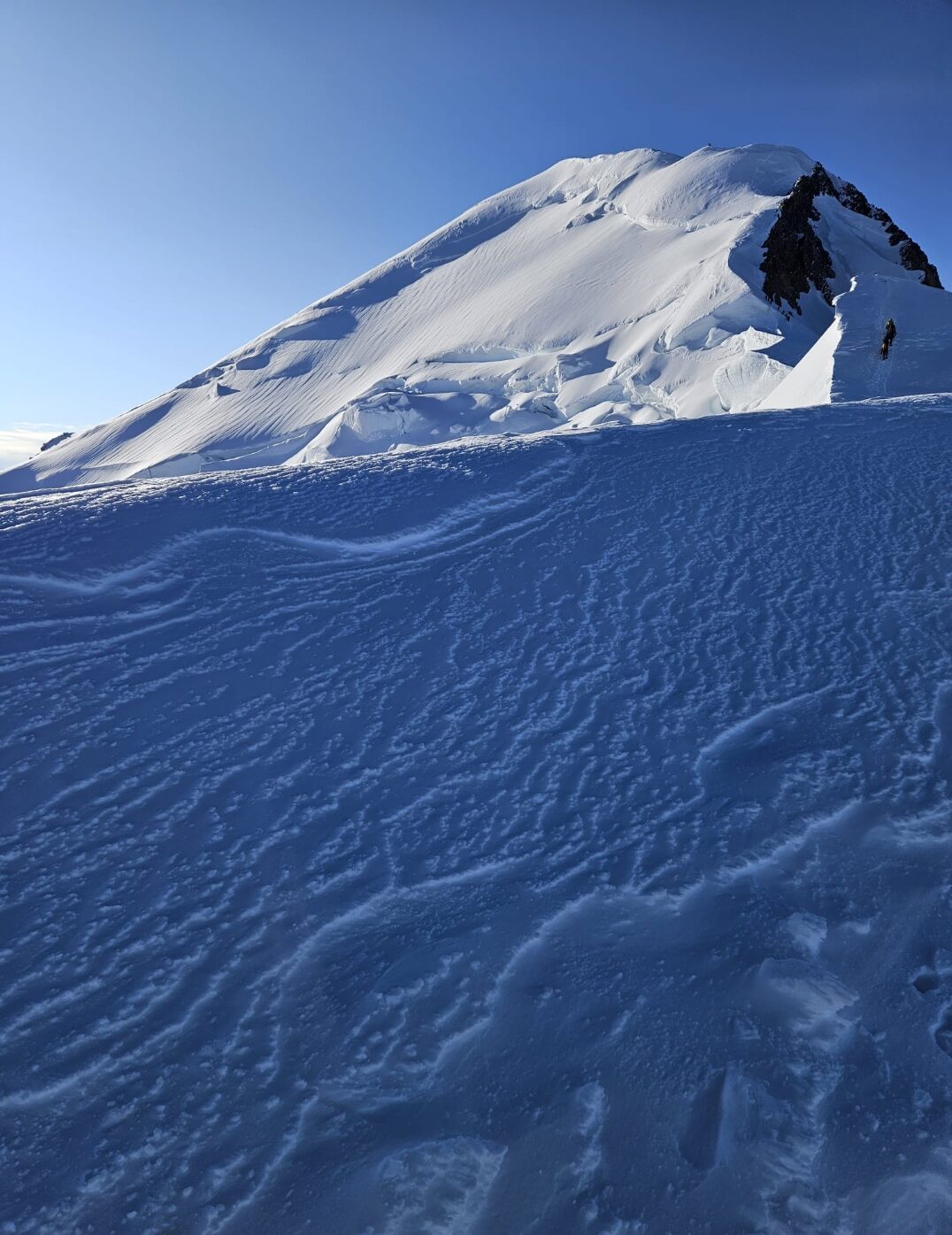
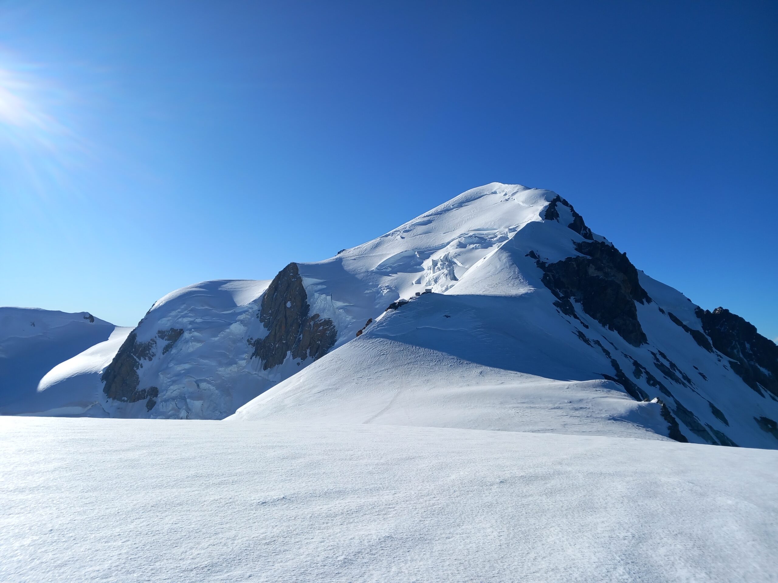
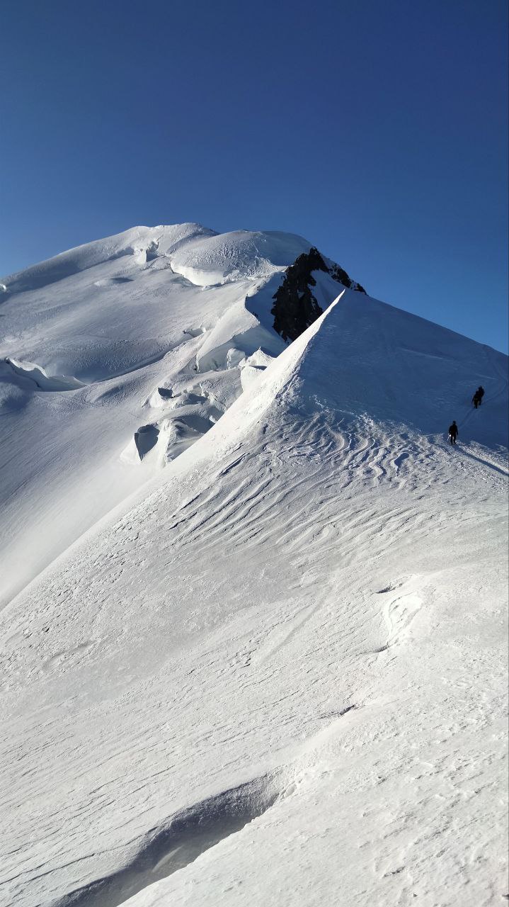
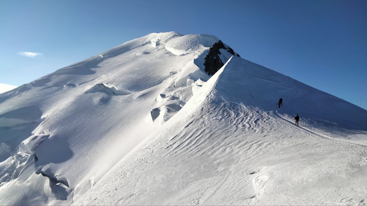
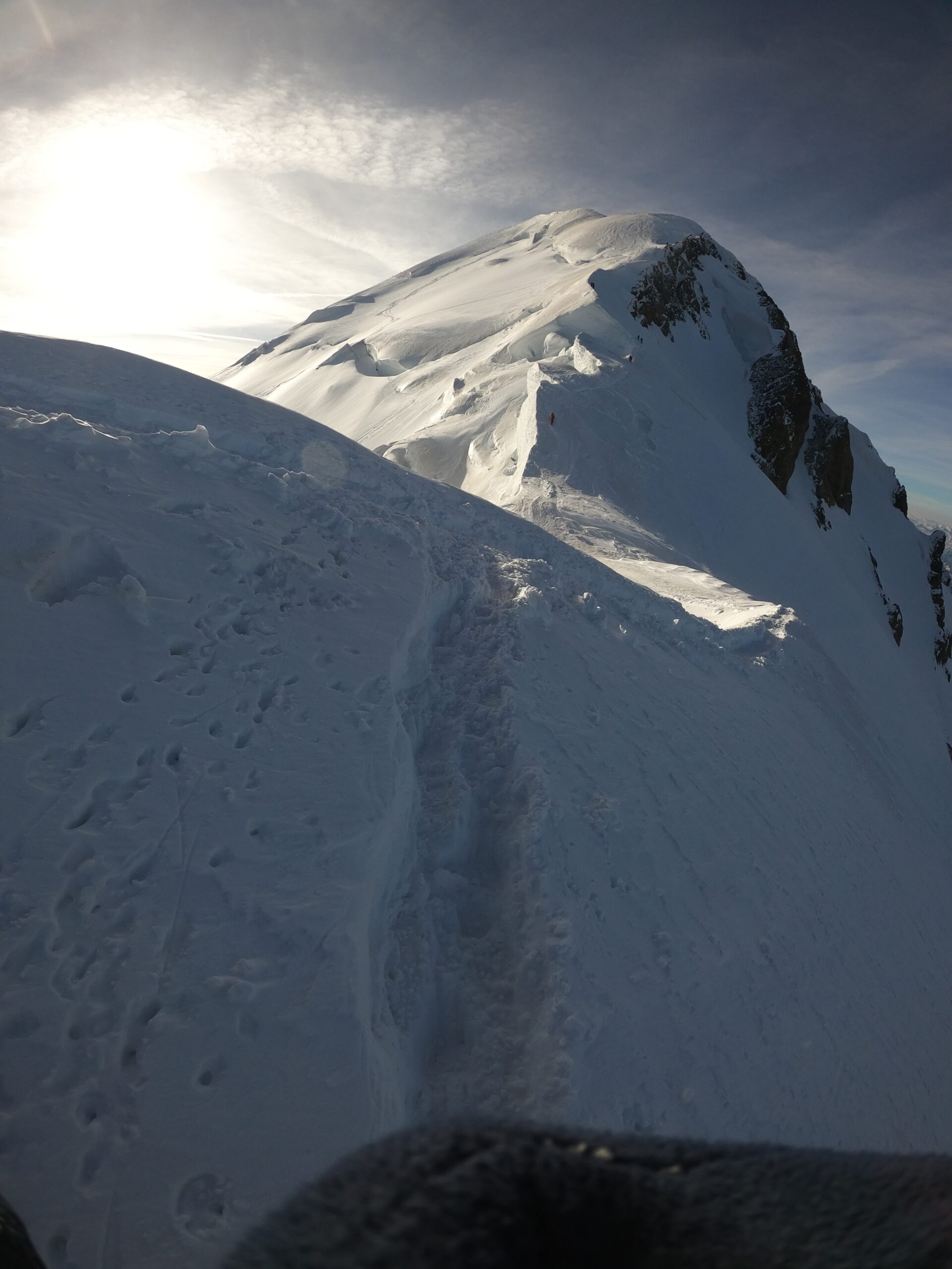
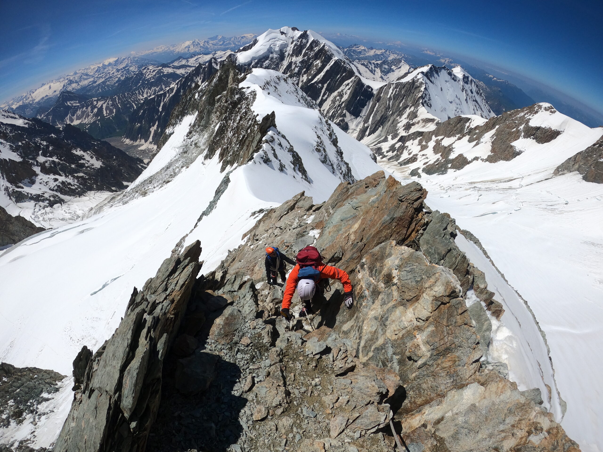
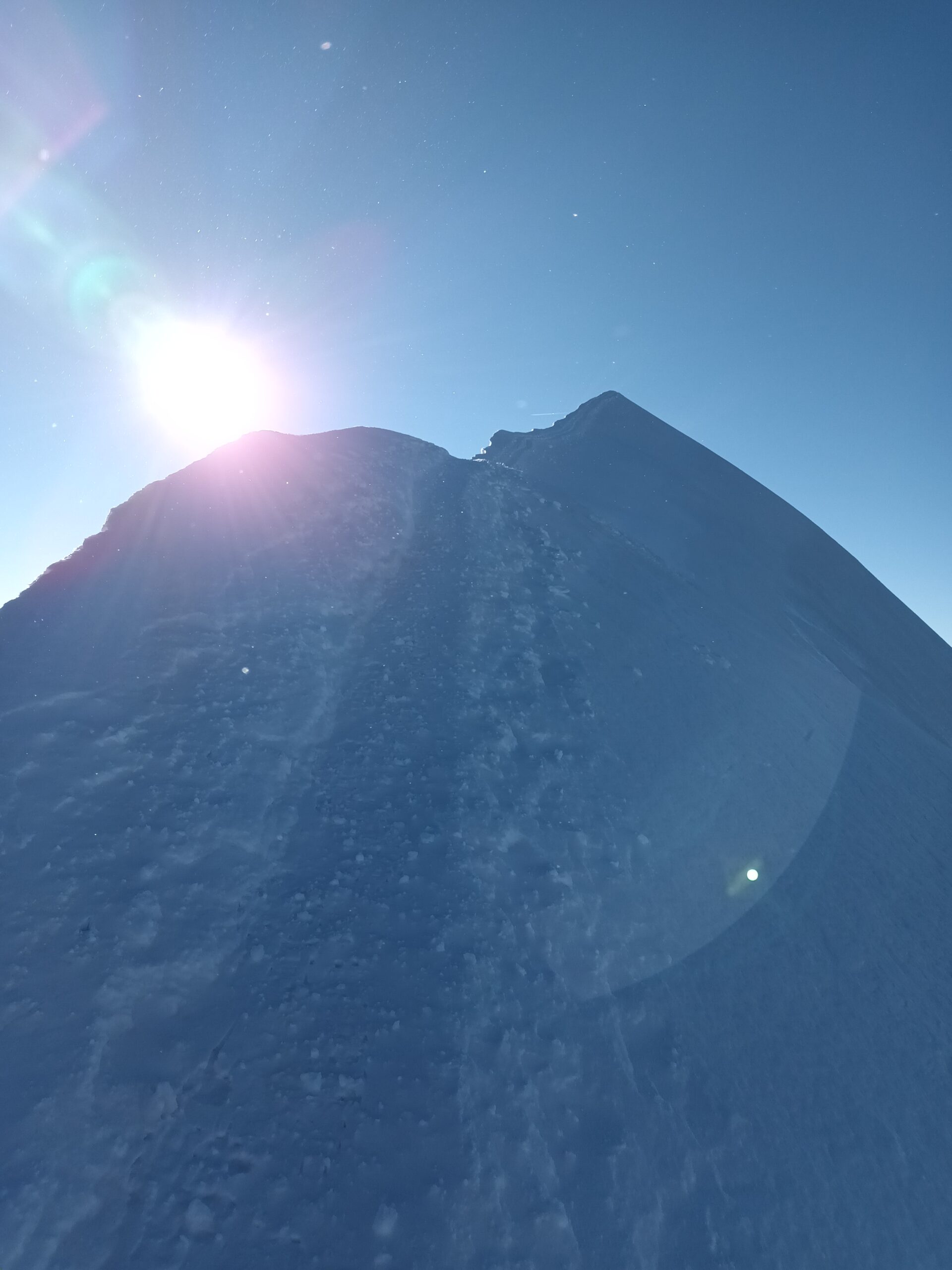
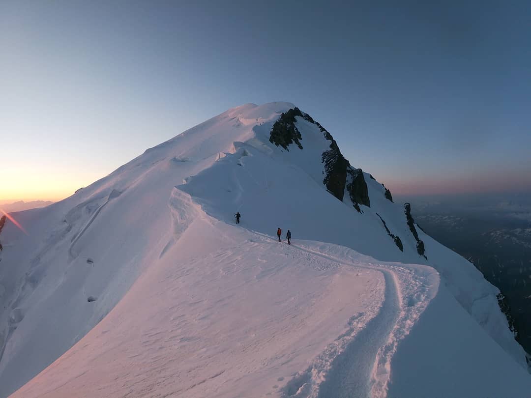
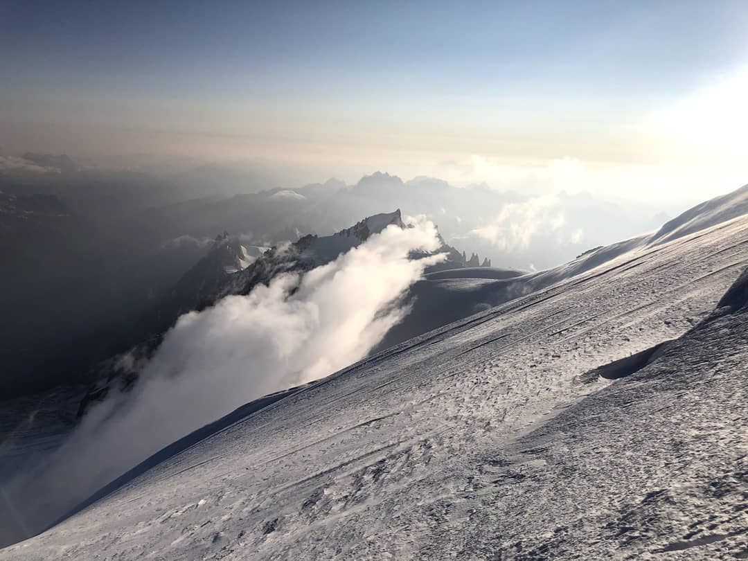
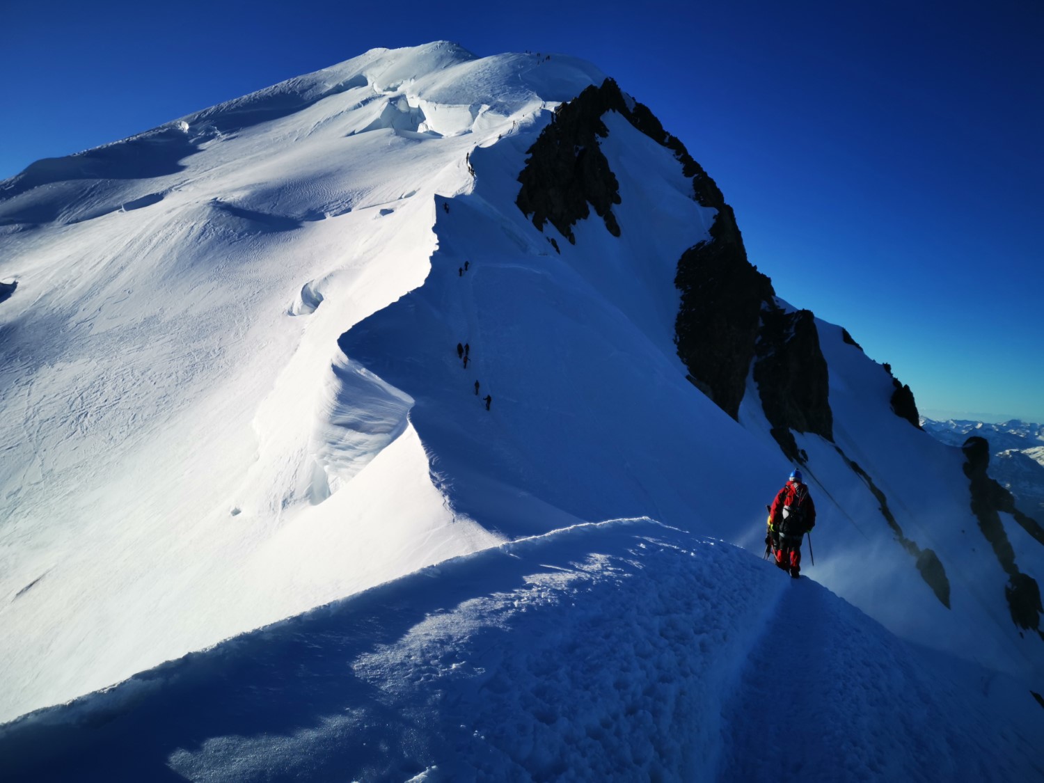
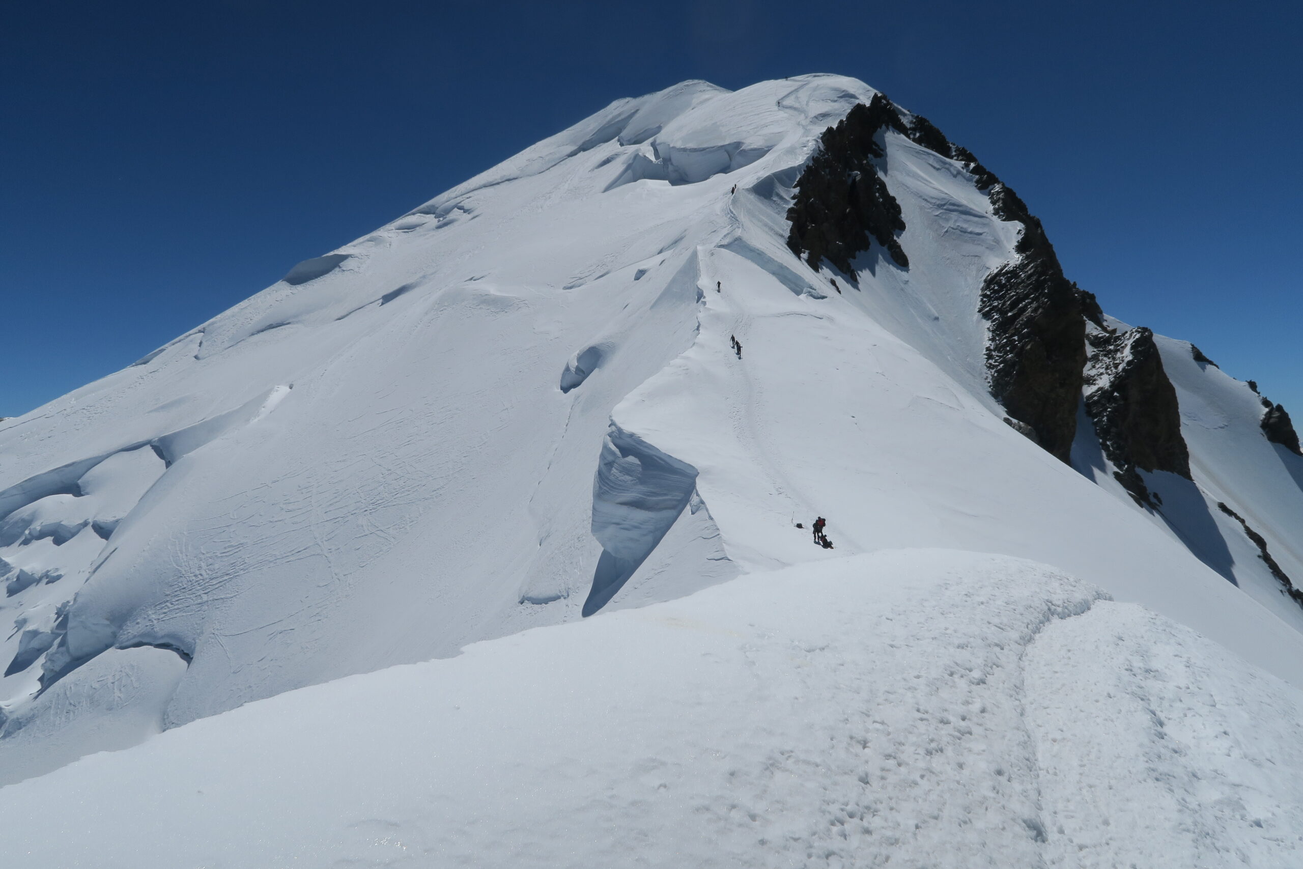
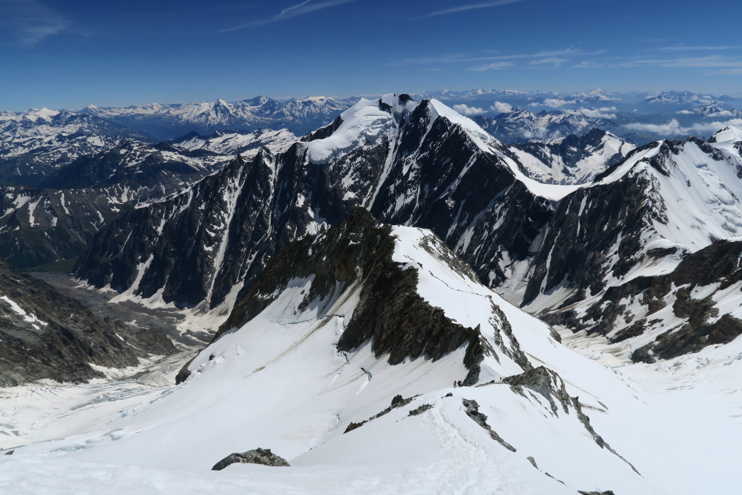
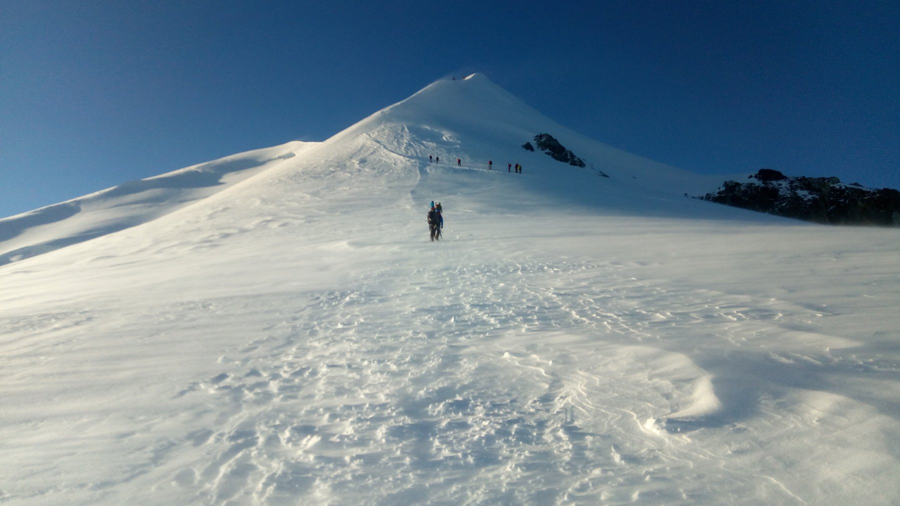
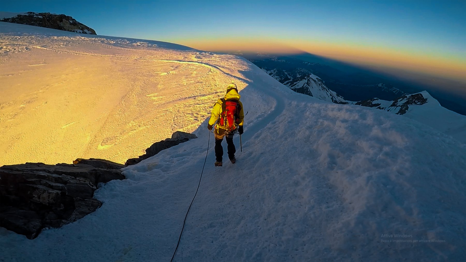
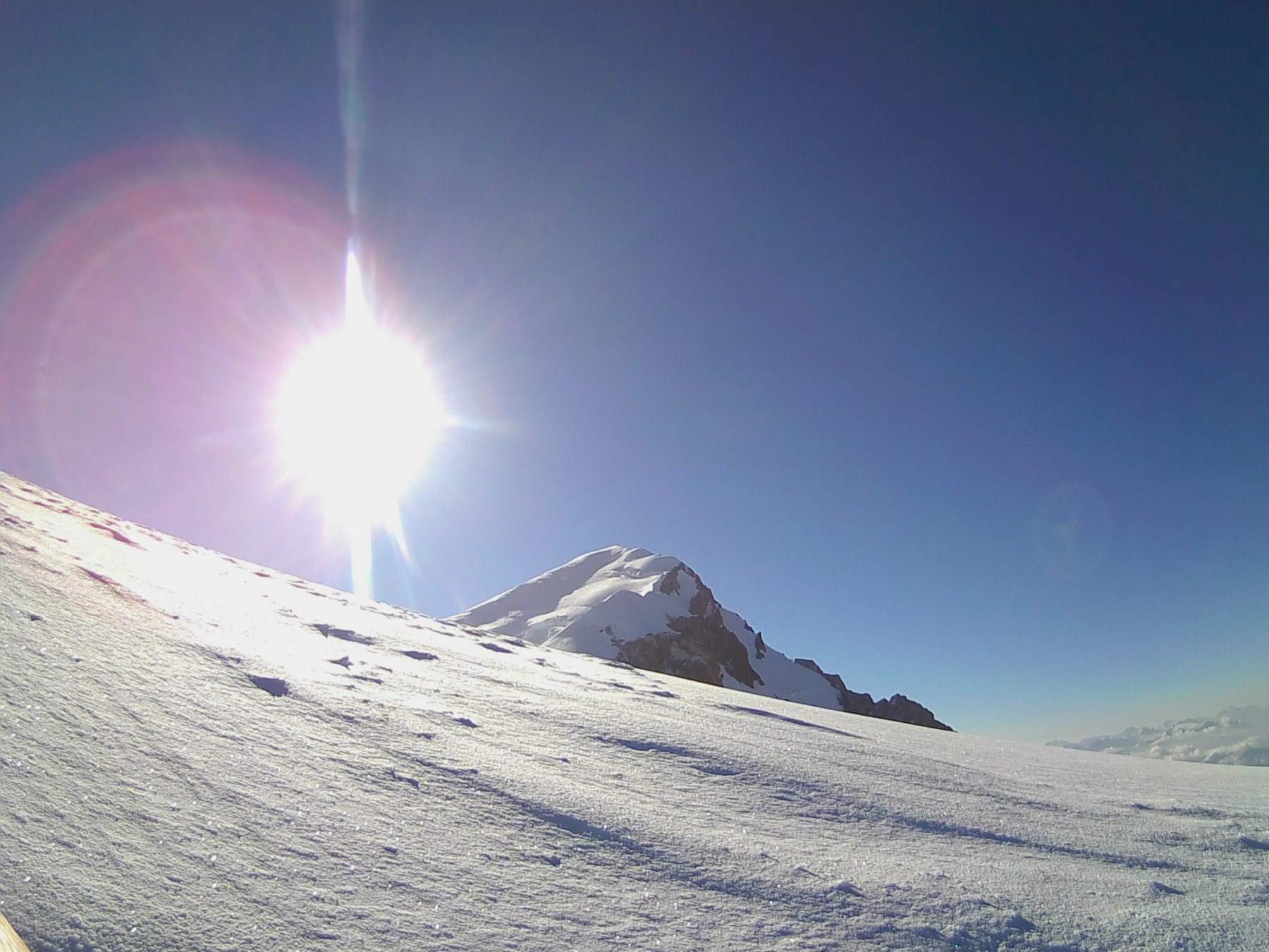
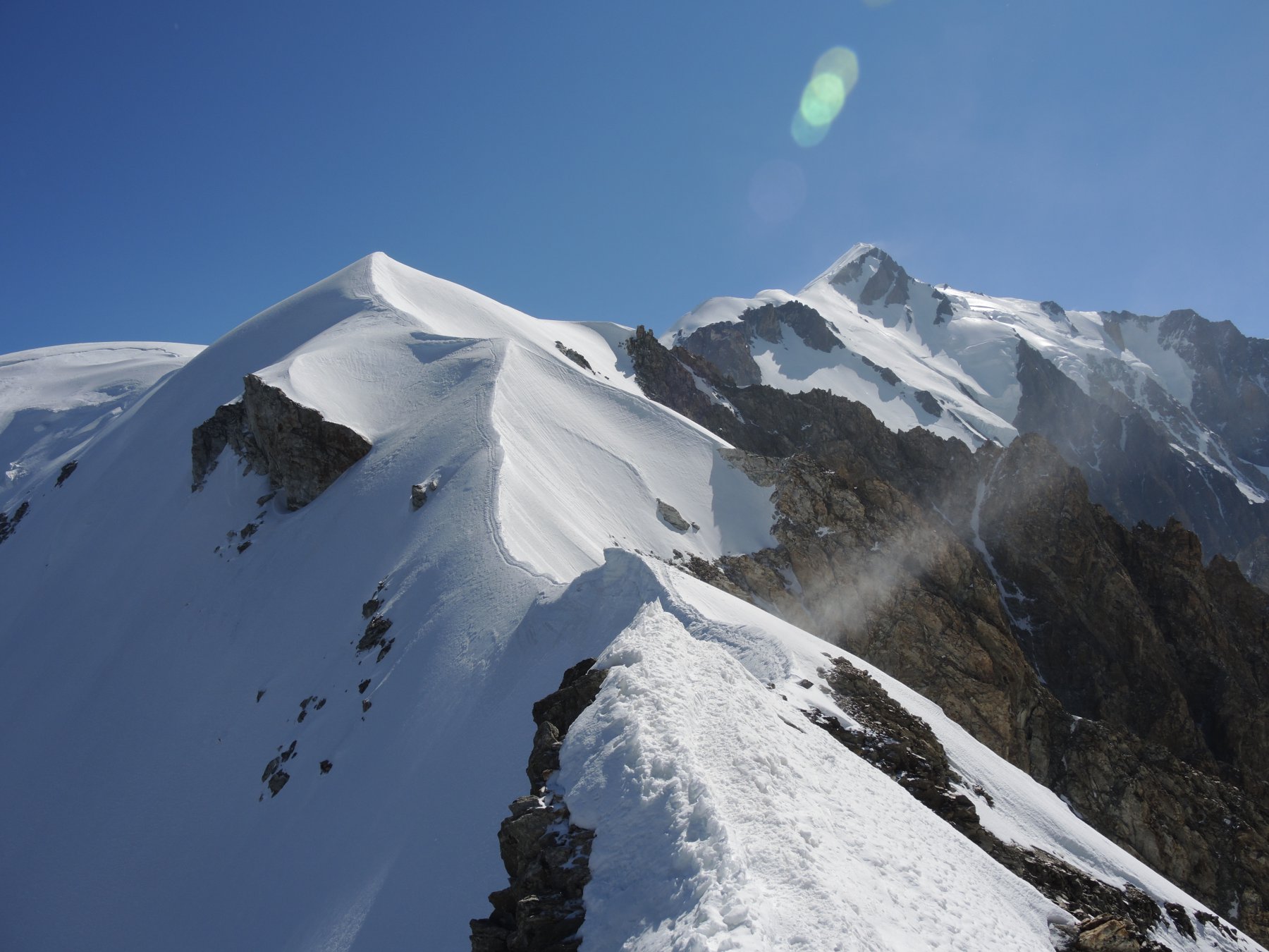
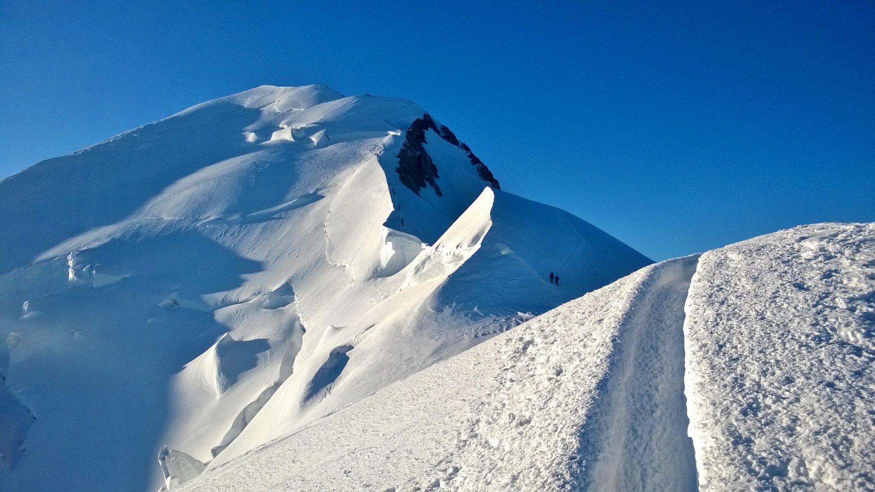
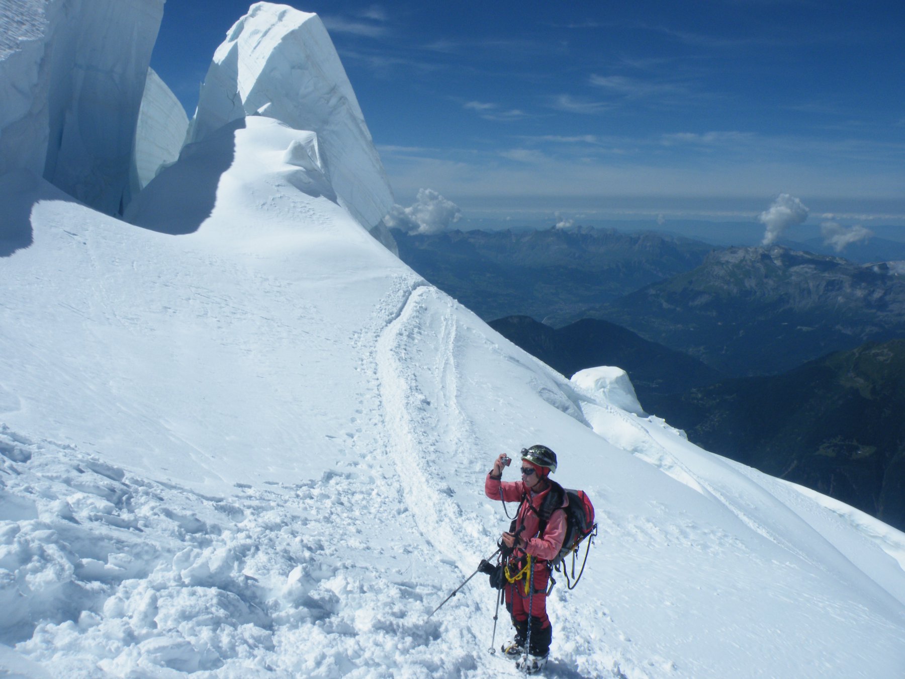
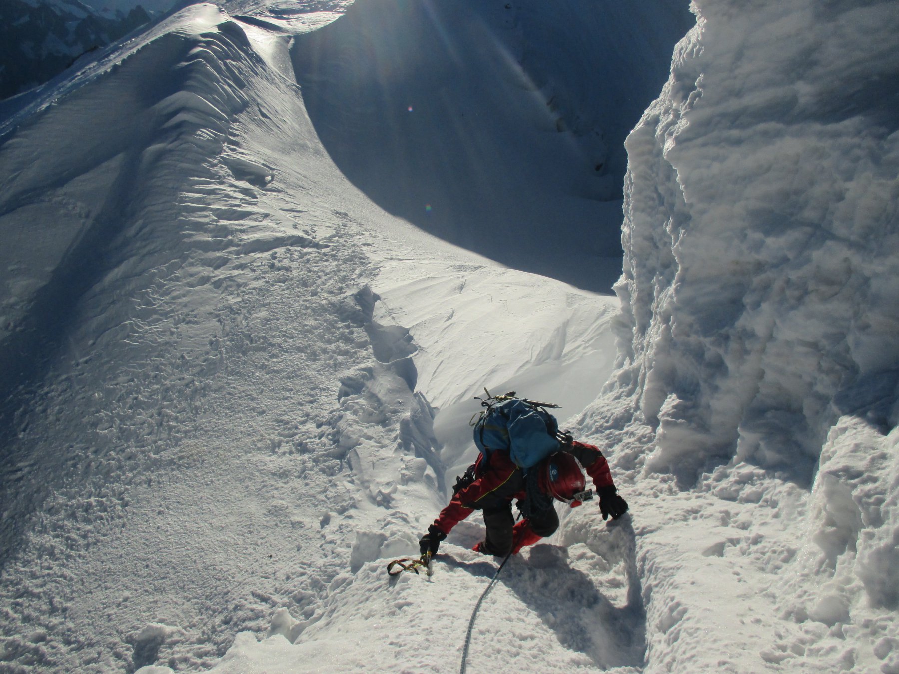
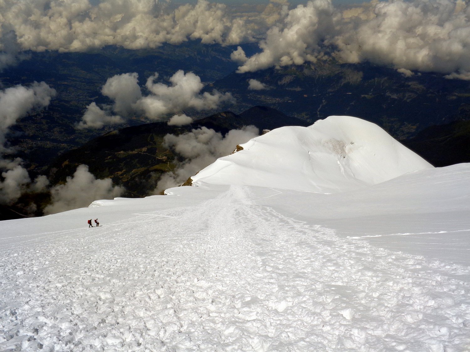
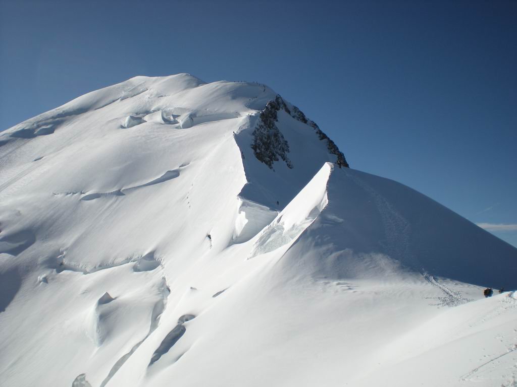
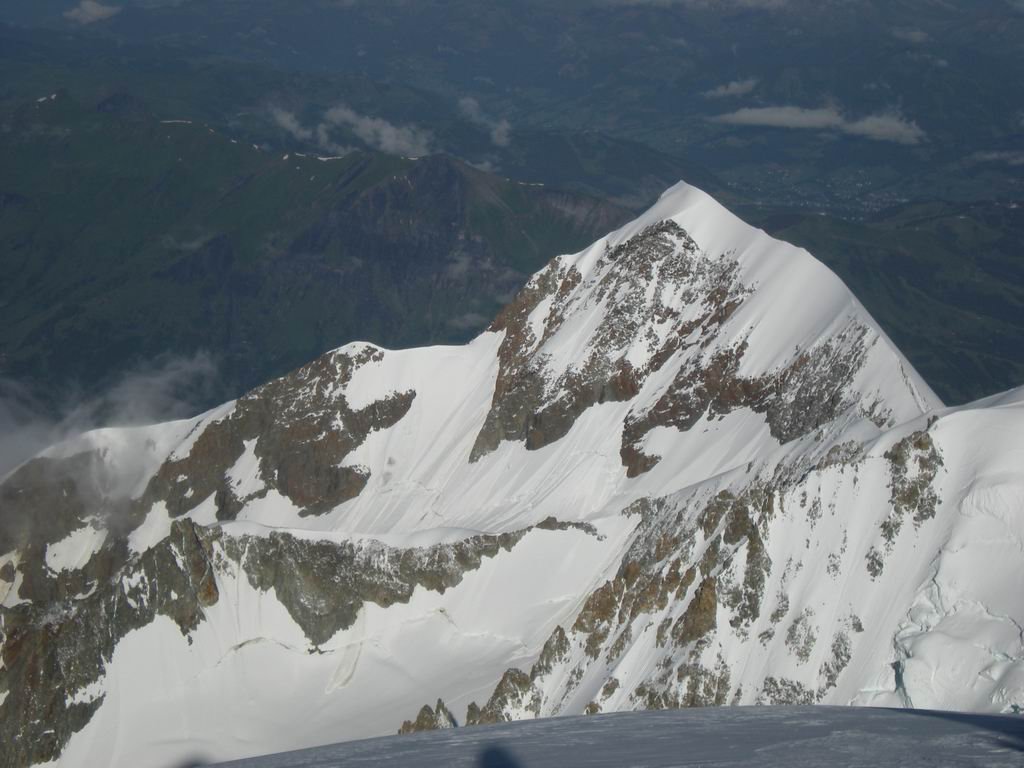
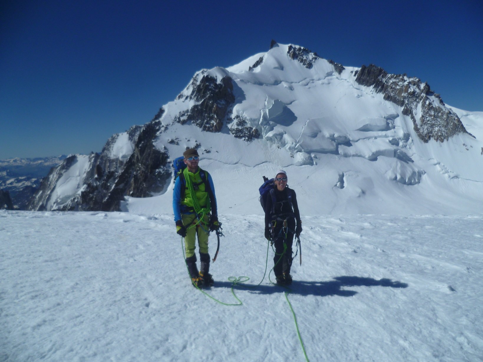
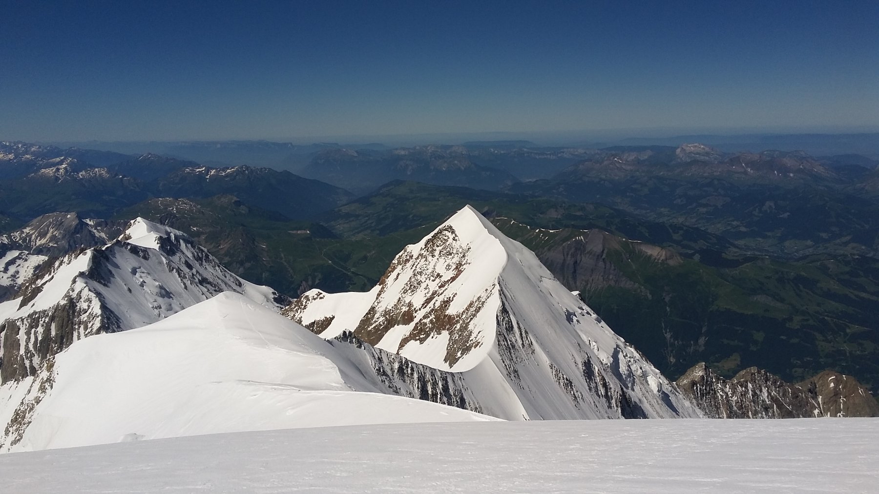
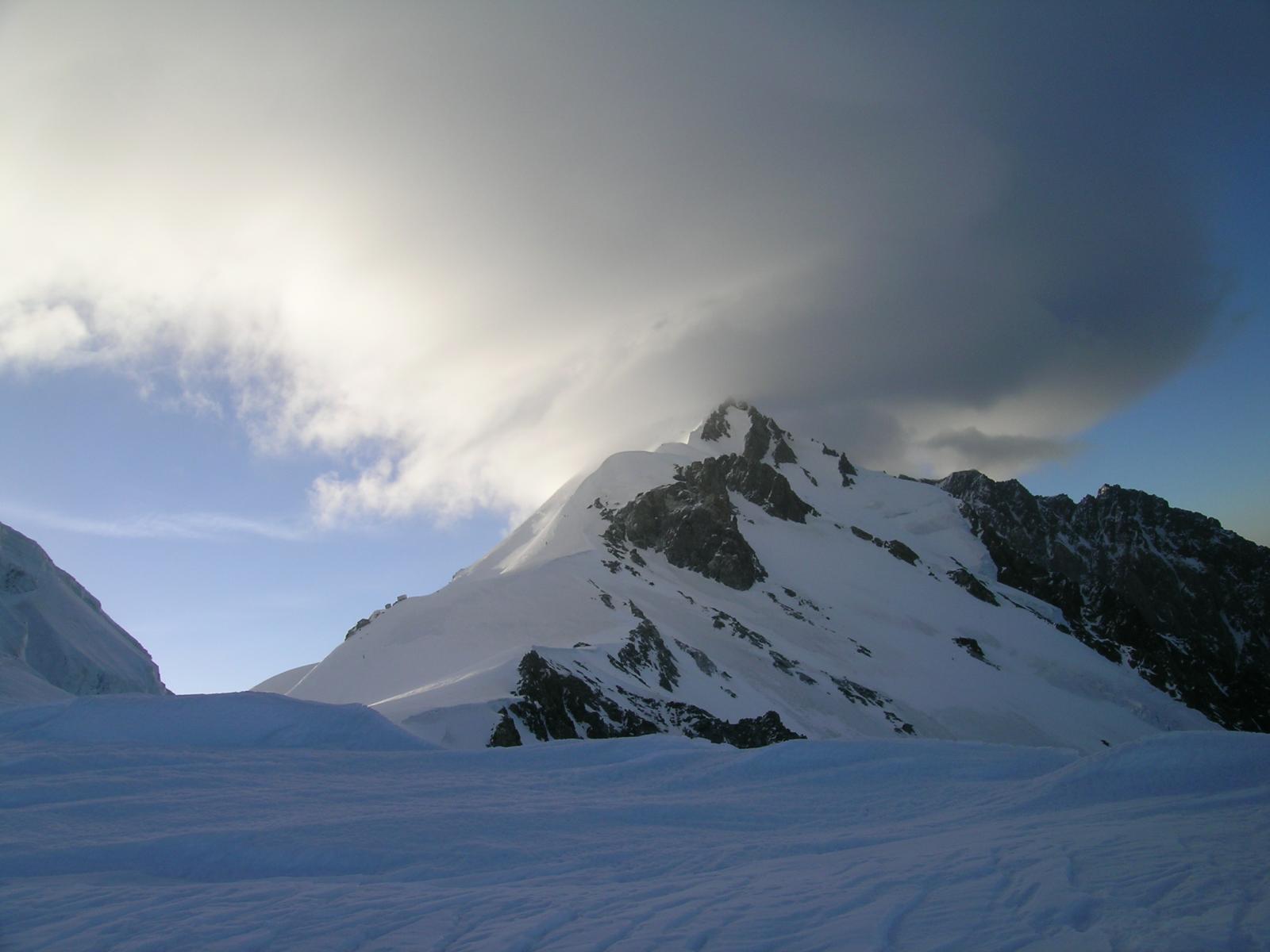
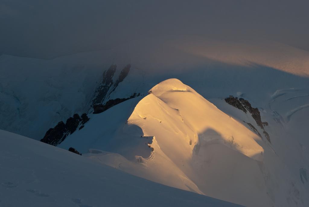
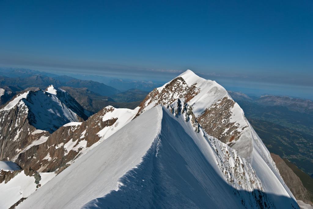
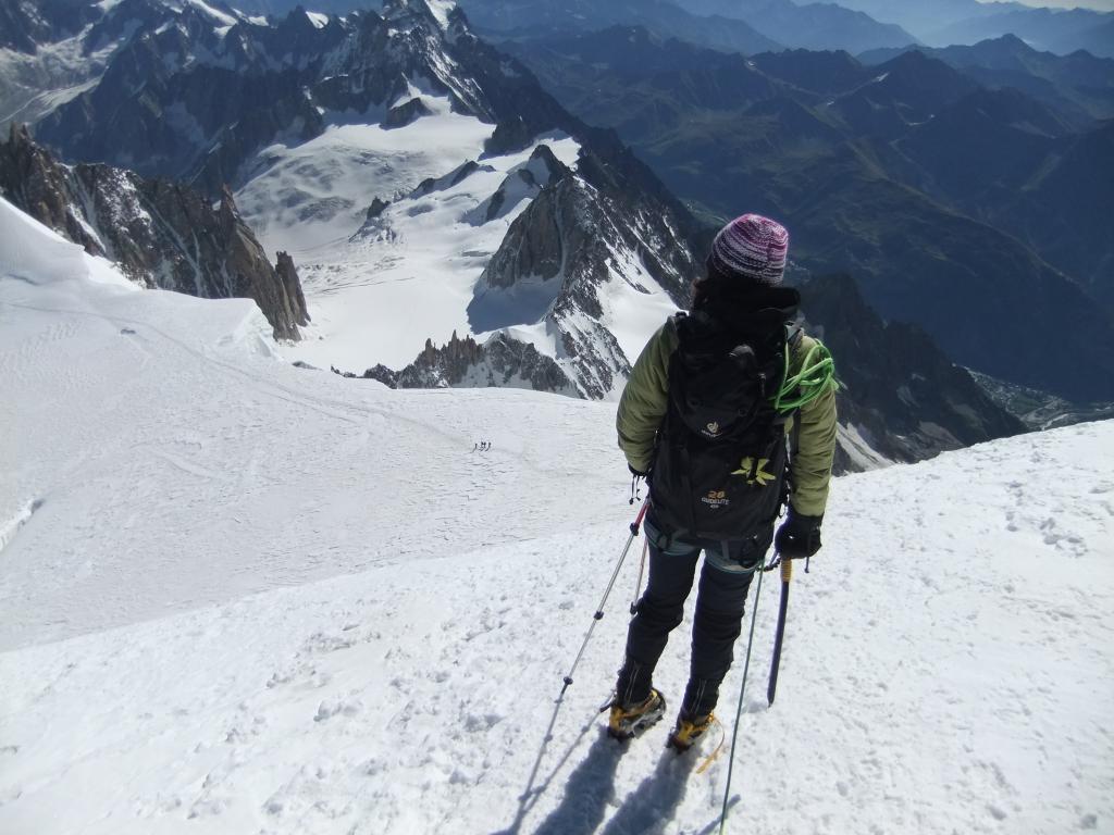
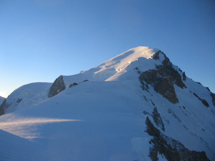
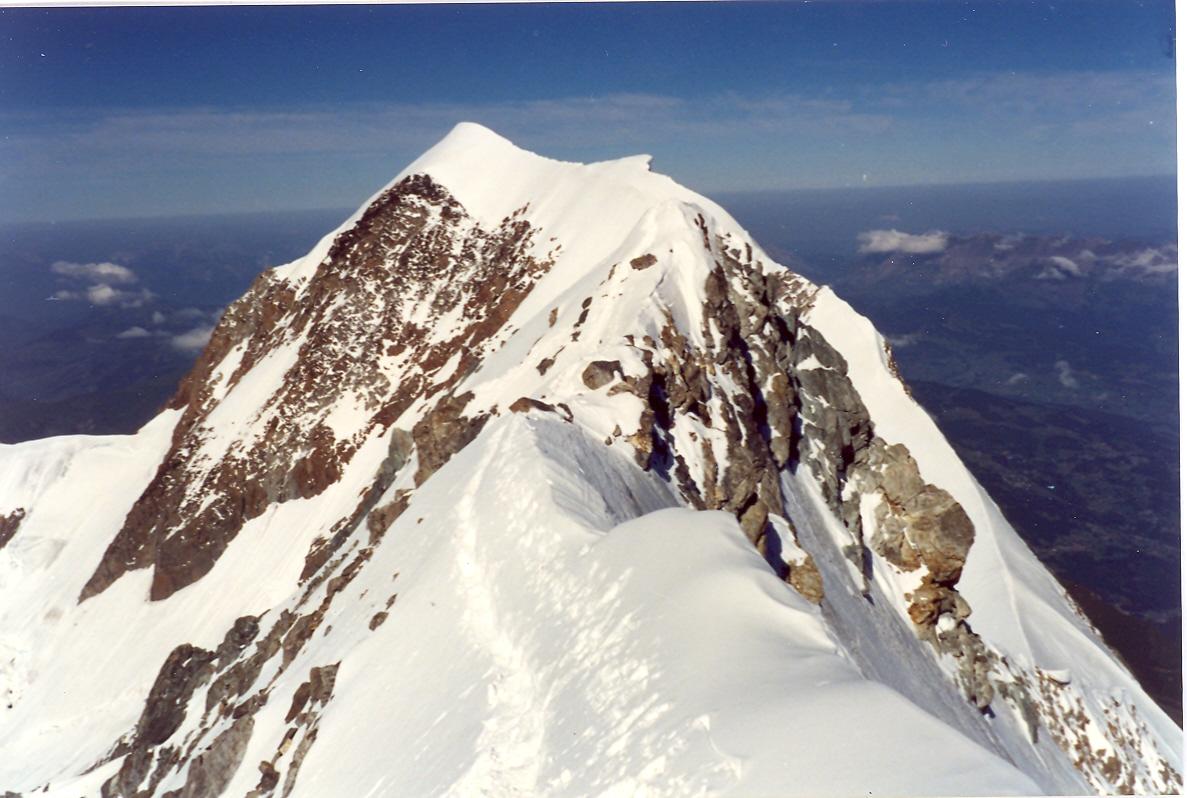
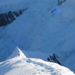
Dopo circa cinque ore ci troviamo di fronte alla parte terminale del ghiacciaio del Dôme che sempre a causa delle elevate temperature si presenta ghiacciata con una pendenza di 45° e un’estensione di 30 mt prima dell’uscita su roccia tra il col des Aiguilles Grises e il col de Bionnassay, la quale potrebbe anche essere ricoperta da neve se l’estate fosse stata meno torrida, dalla cresta procedendo verso destra si arriva in breve tempo in prossimità dell’affilata cresta di Bionassay, la quale è molto suggestiva e richiede sicurezza di piede e fiducia nei ramponi.
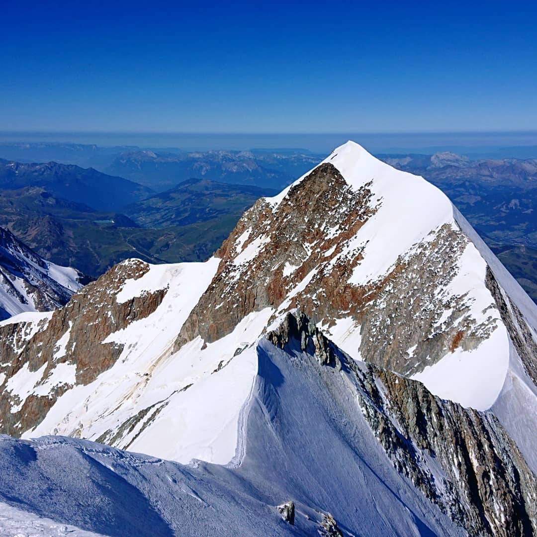
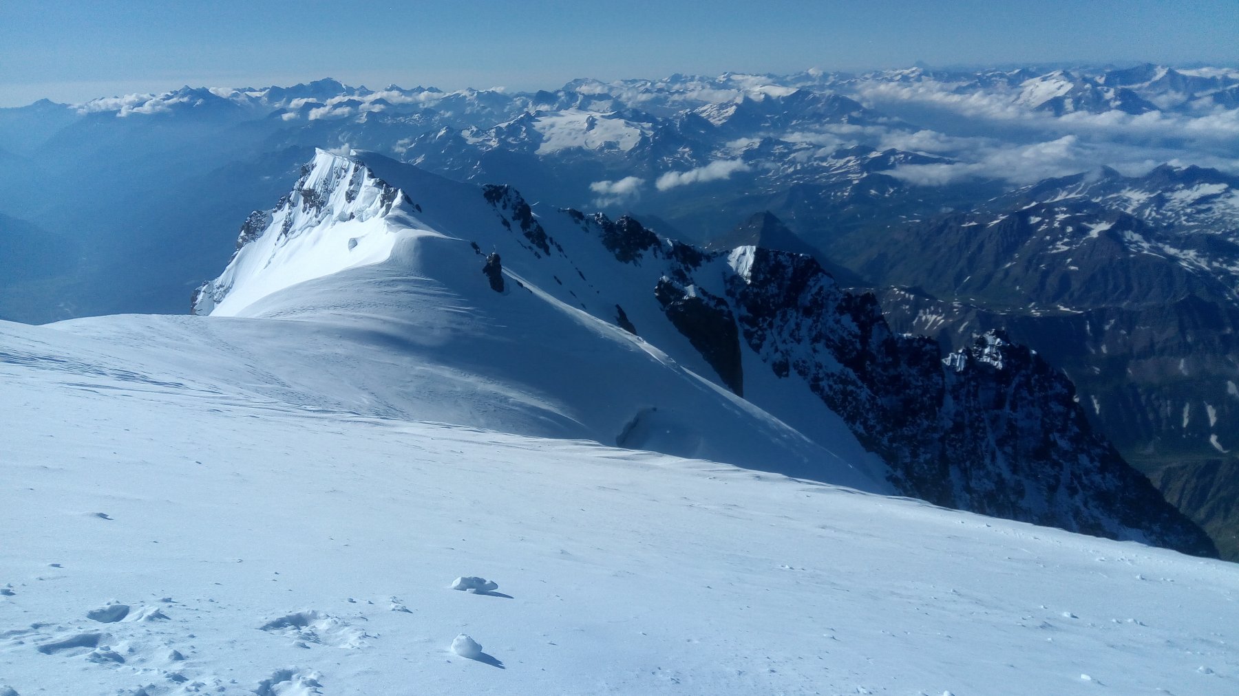
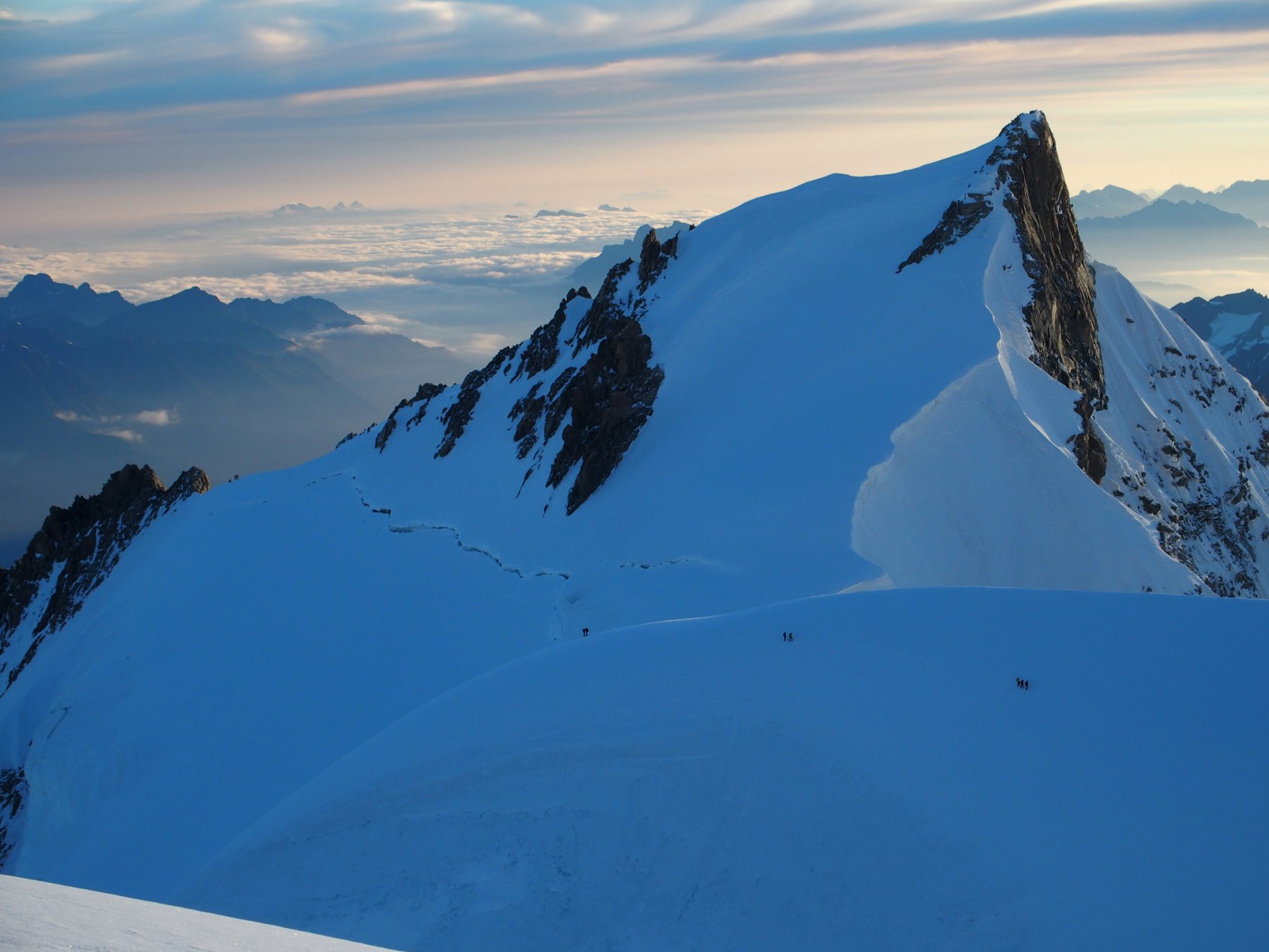
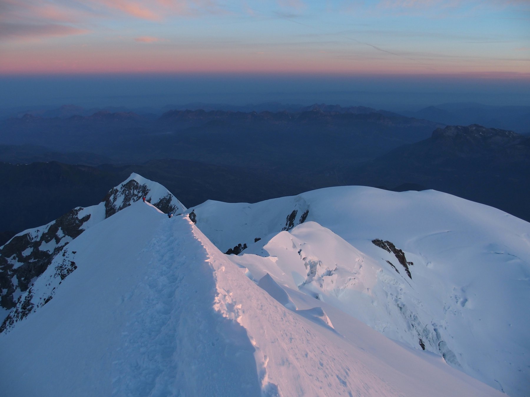
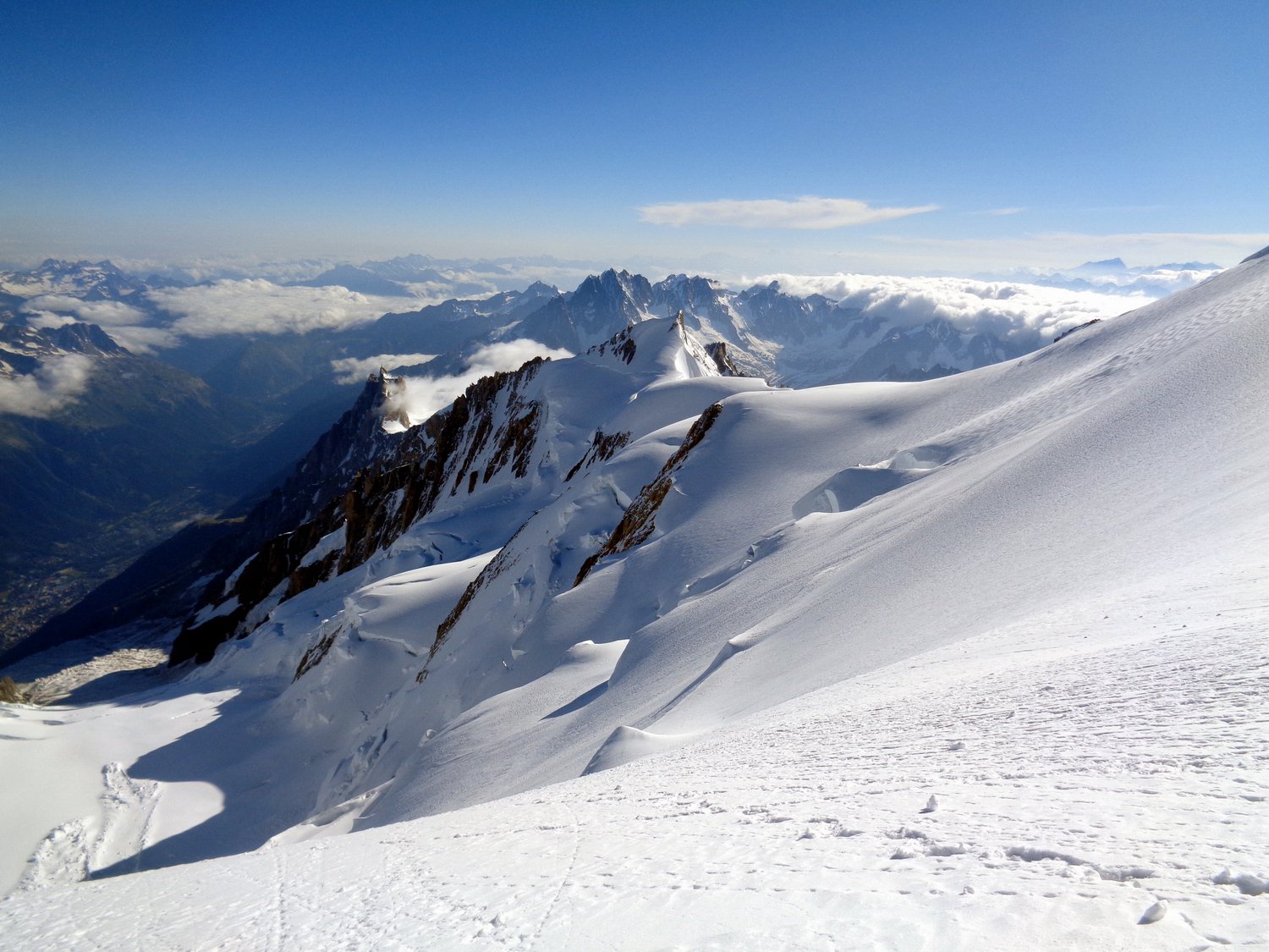
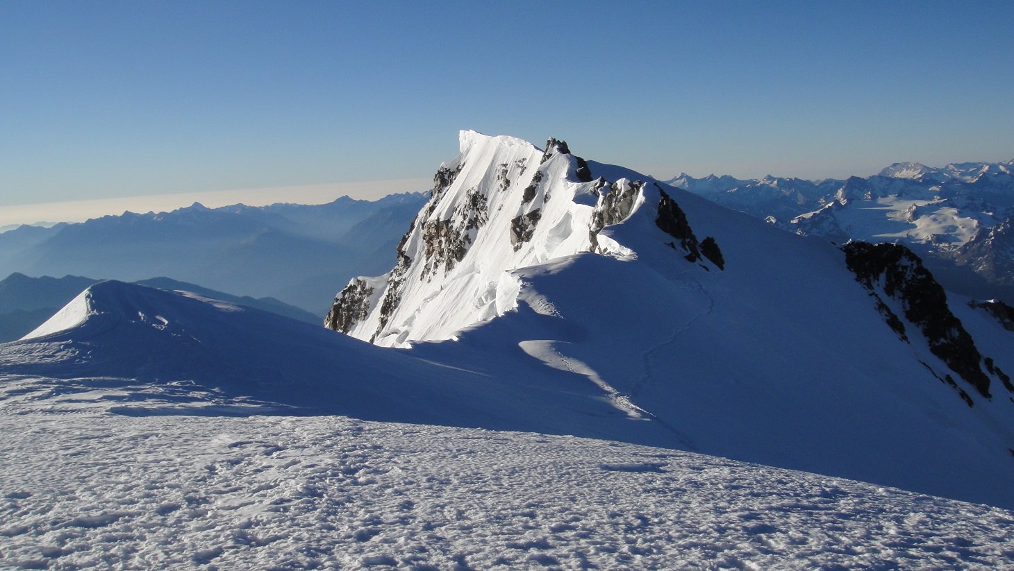
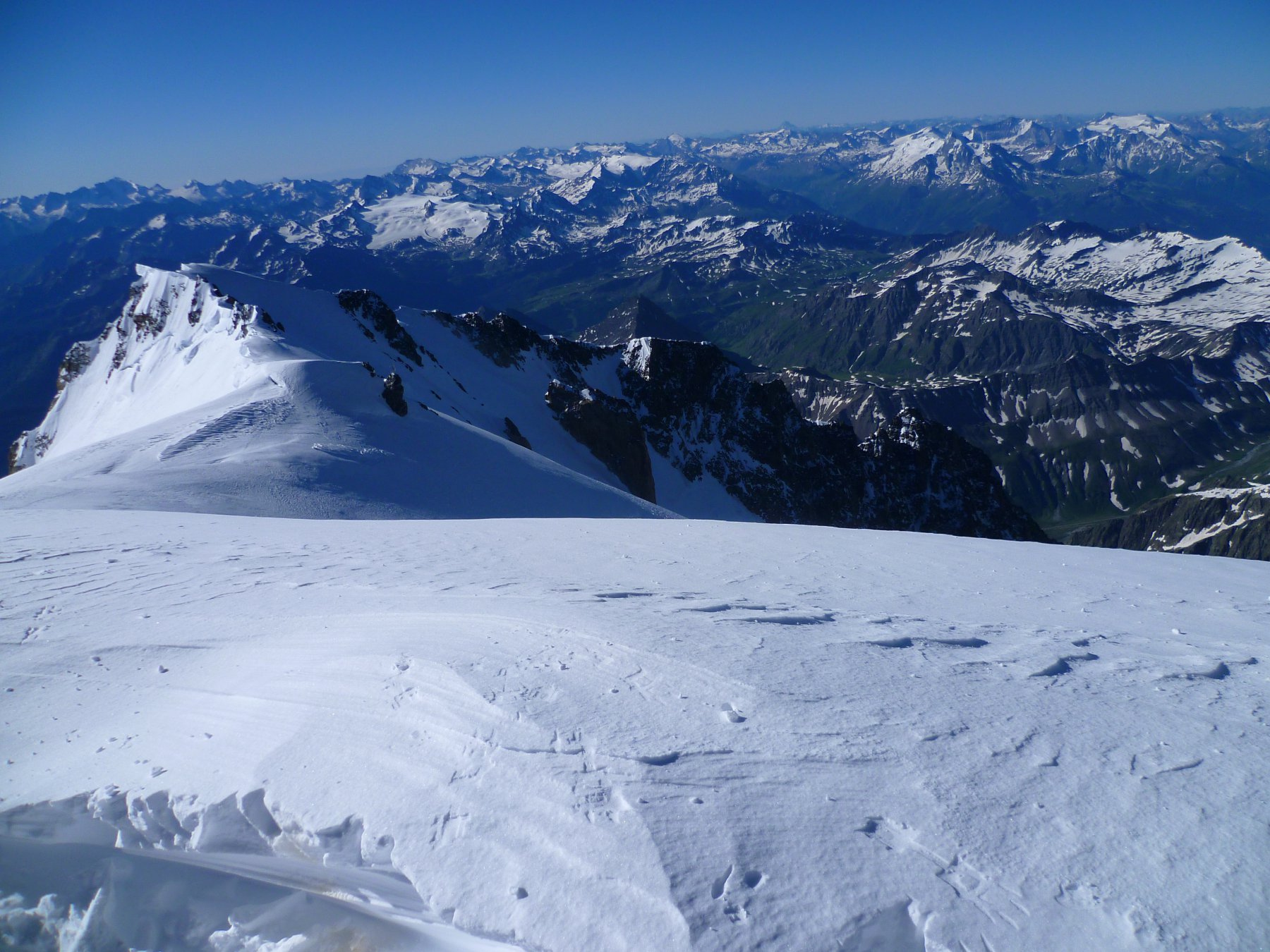
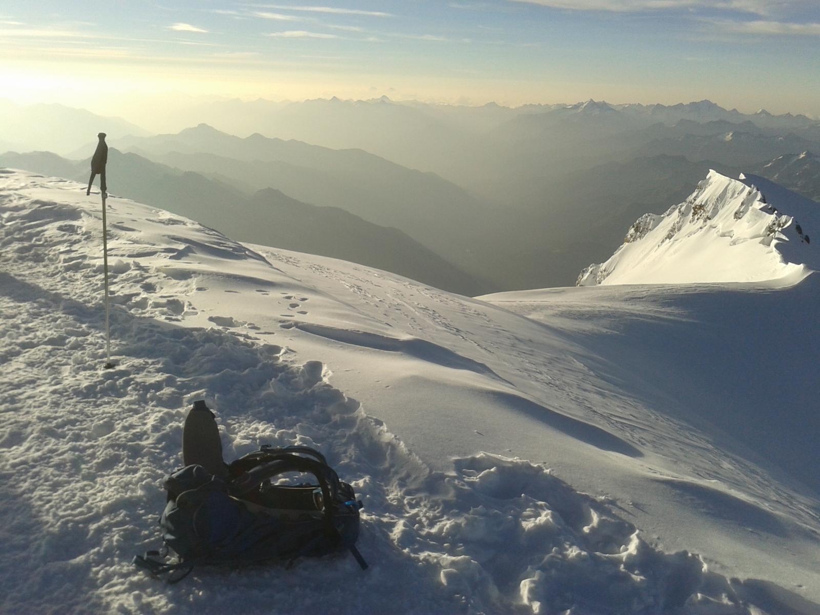
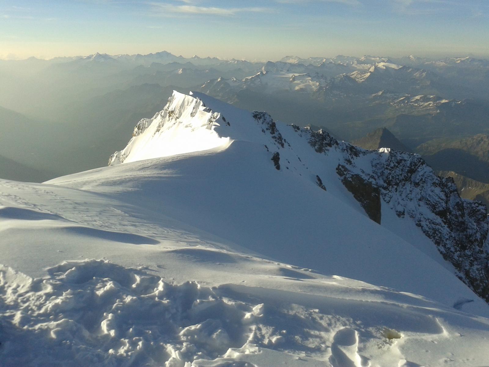
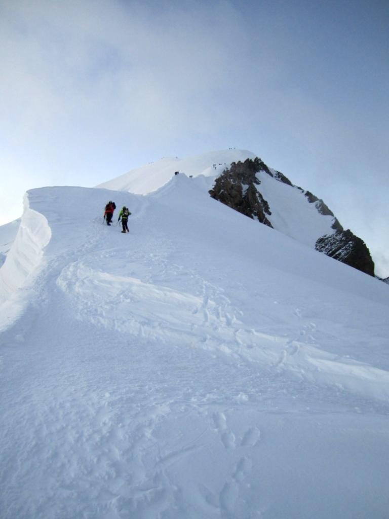
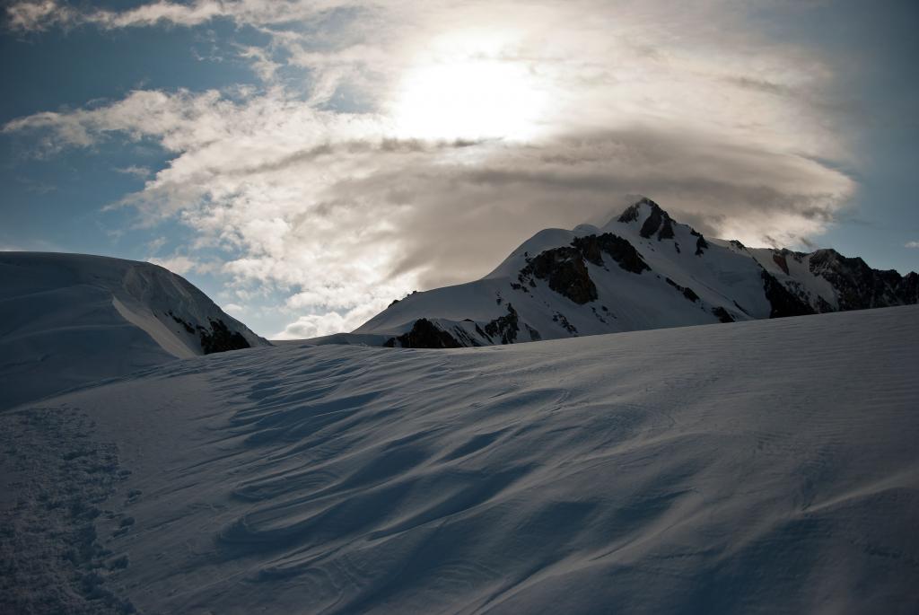
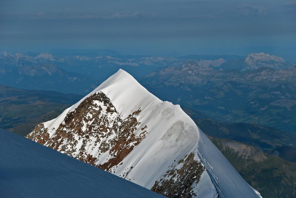
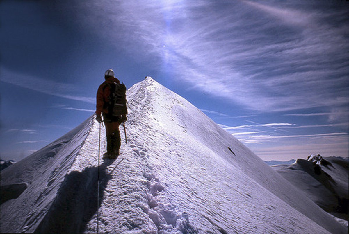
Poco dopo il percorso risulta più agevole, puntando in direzione nord est si passa nei pressi del Piton des Italiens (4.002 mt) da qui voltandosi indietro si può vedere l’ Aiguilles de Bionnassay.
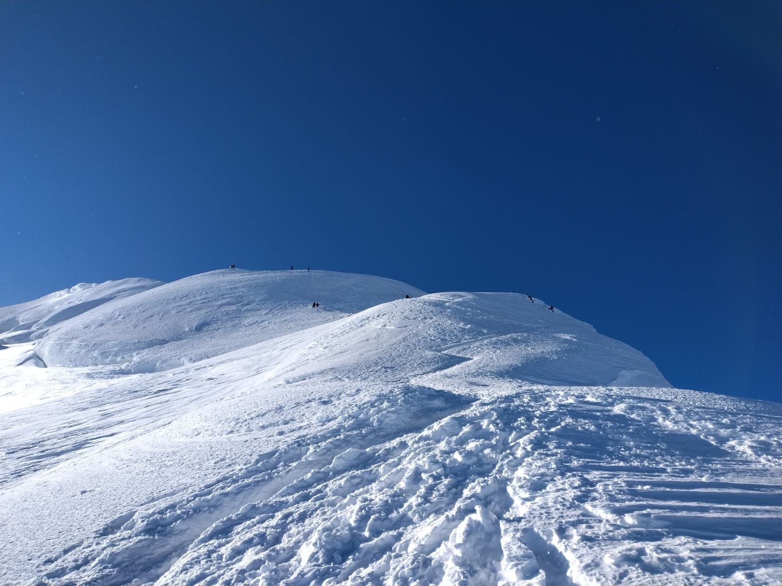
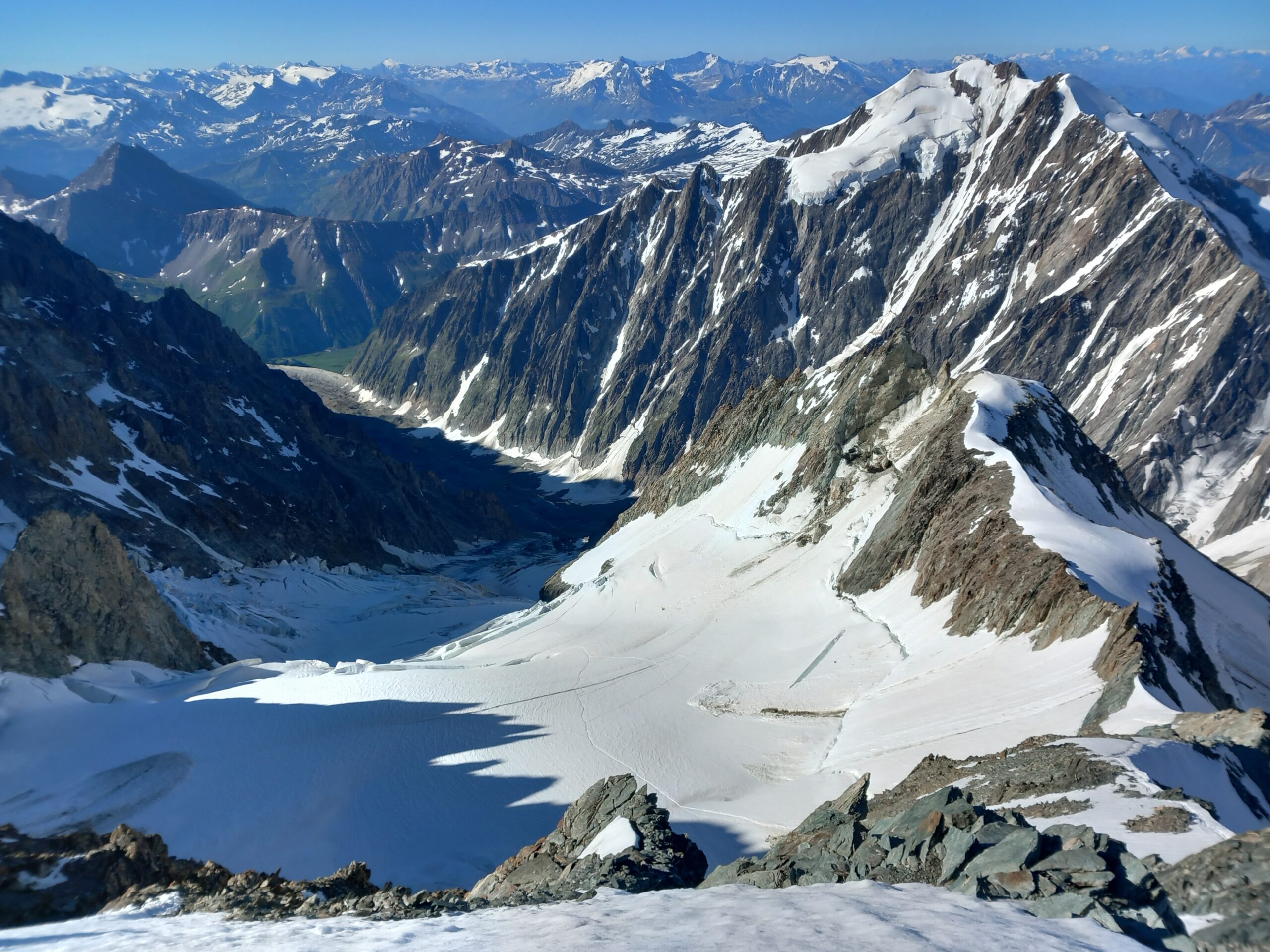
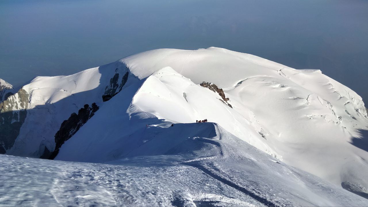
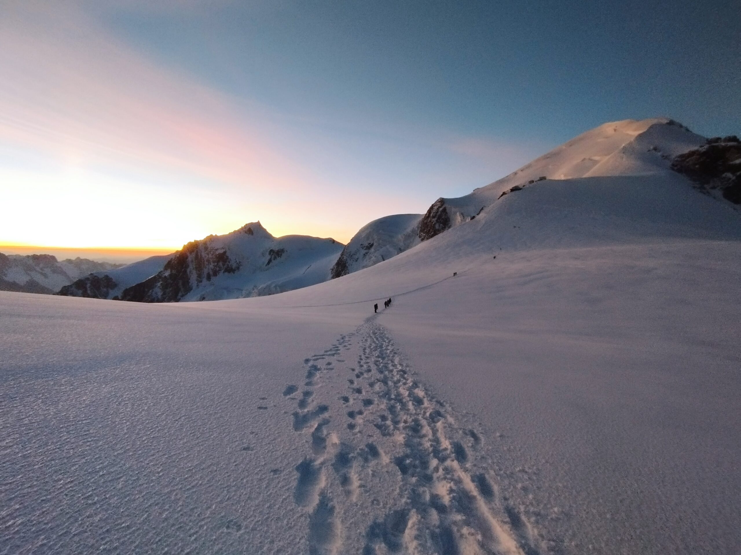
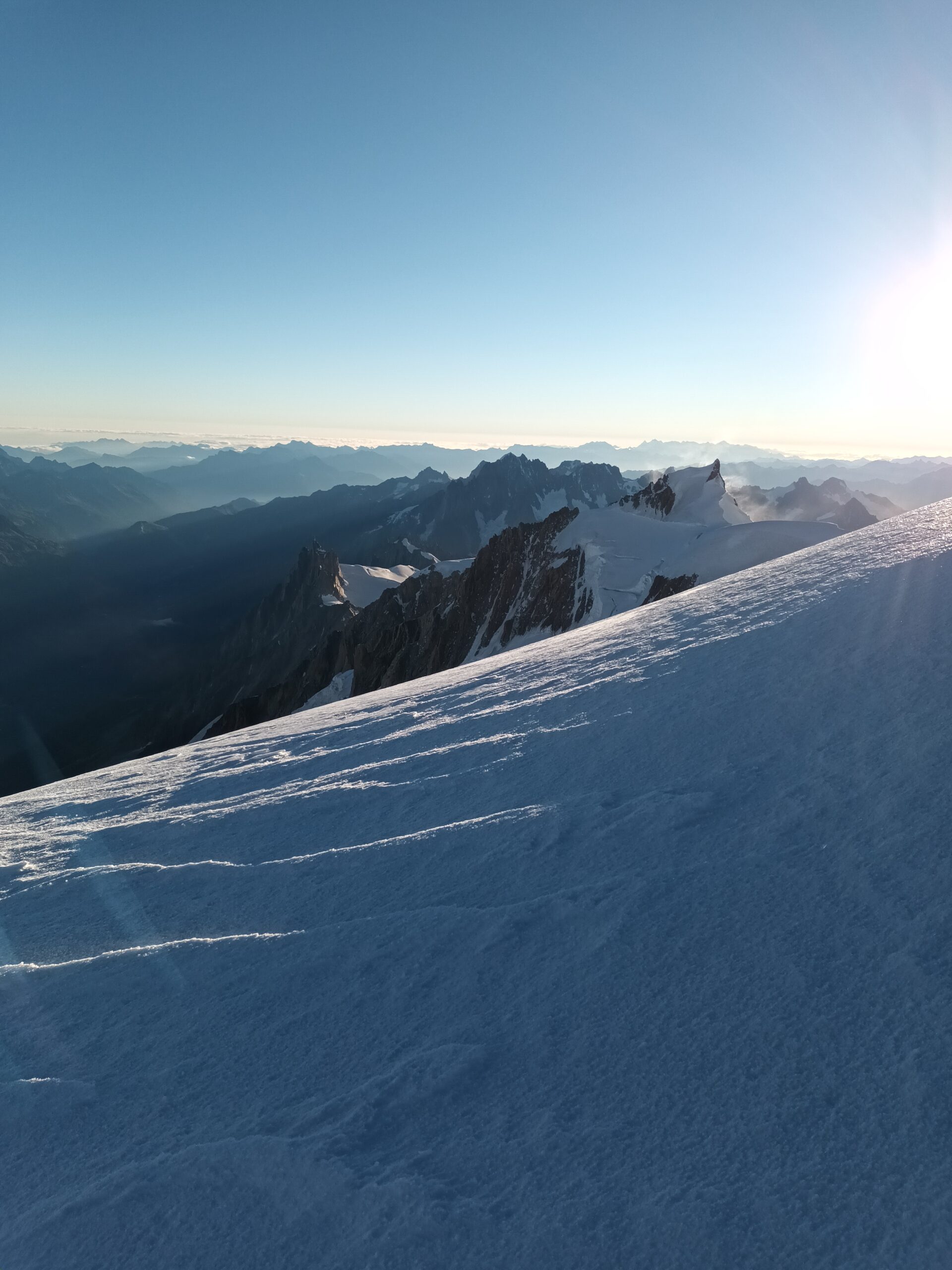
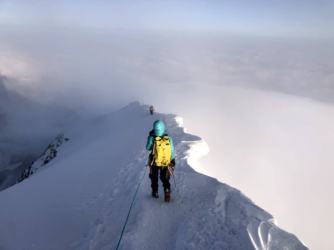
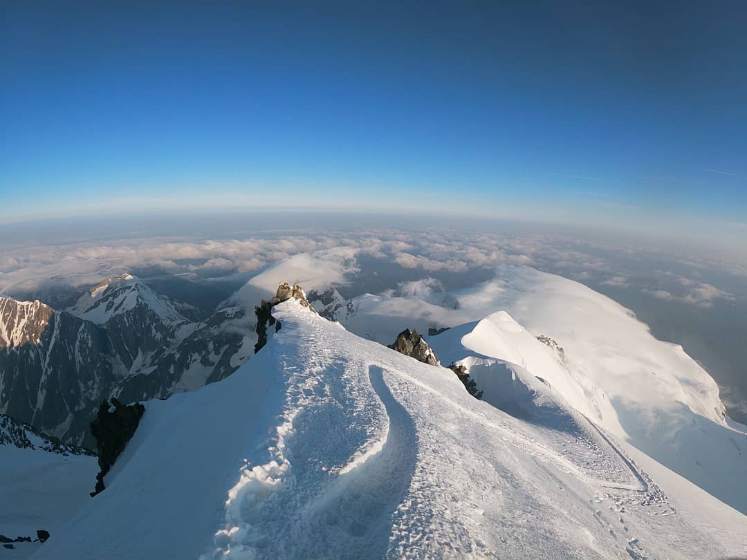
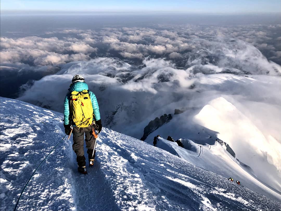
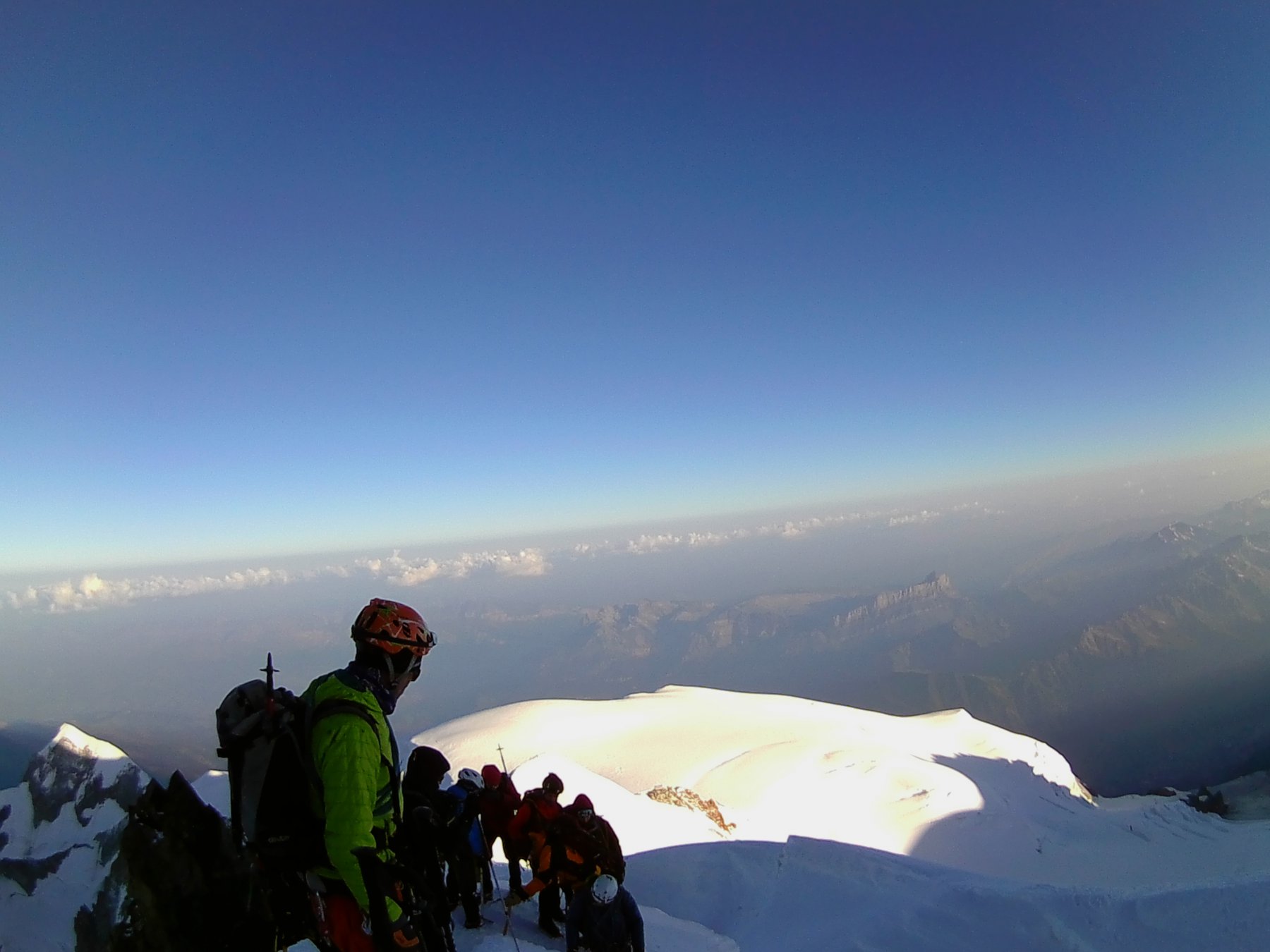
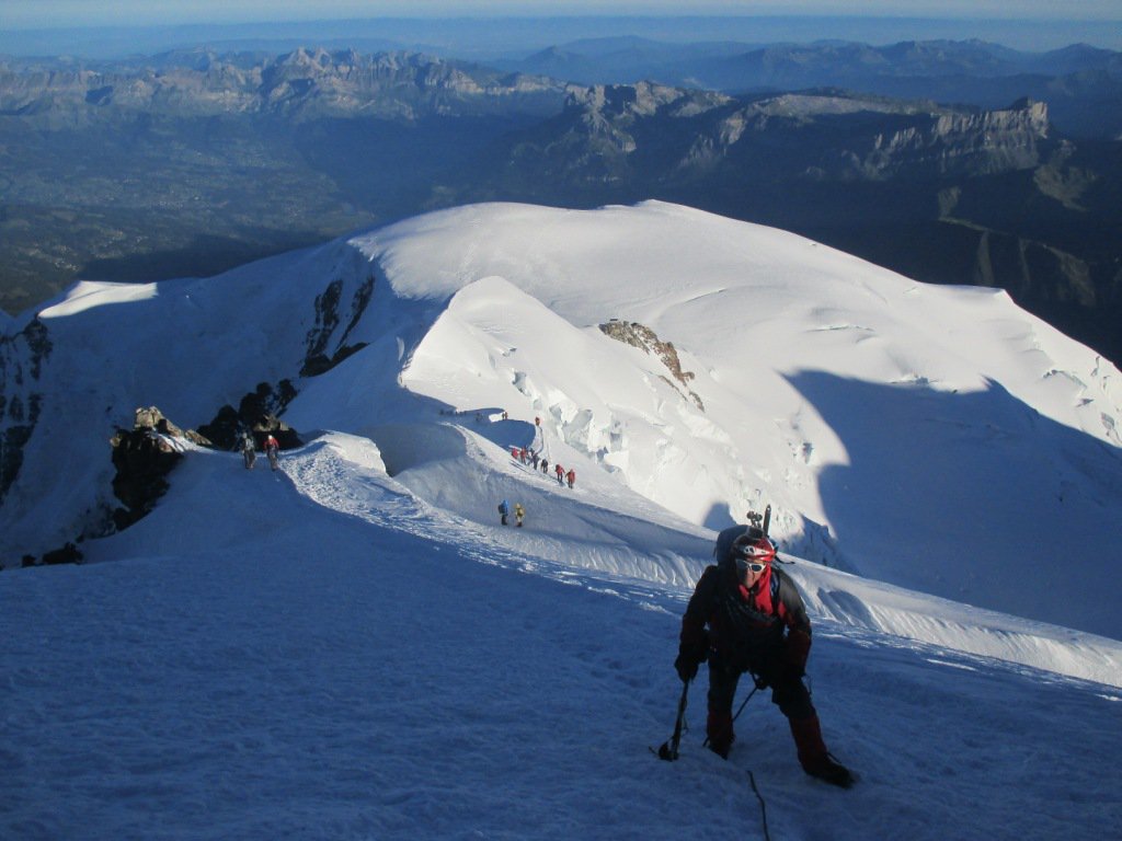
Procedendo in direzione nord est, superato il Dôme du Goûter s’incrocia la via normale francese che parte dal rifugio Gouter.
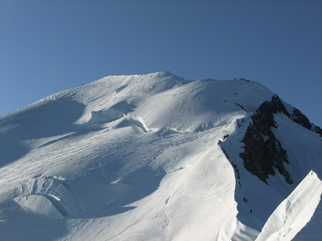
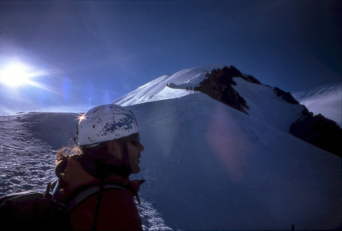
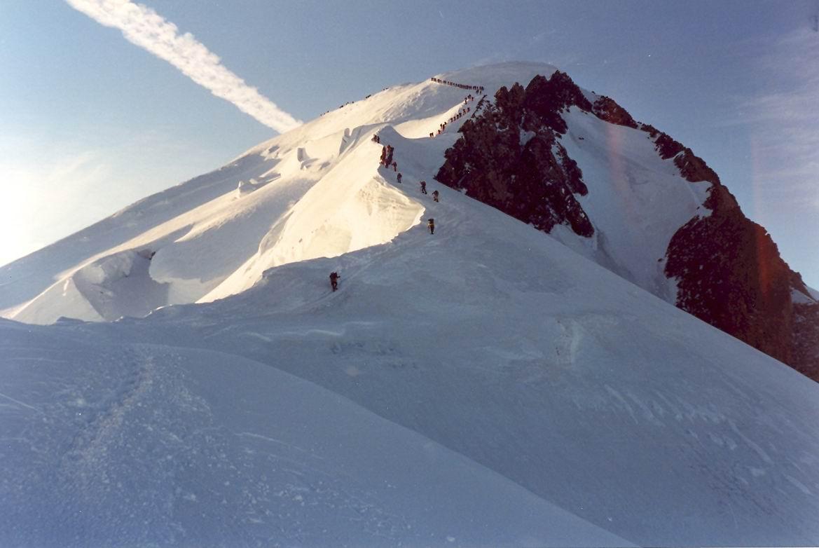
Da questa via. che è assolutamente la più frequentata, arrivano decine di alpinisti che fanno rientrare un po’ nella civiltà dopo essere stati immersi in un ambiente assolutamente selvaggio. Dall’incrocio in poi si segue la via francese che punta in direzione sud est.
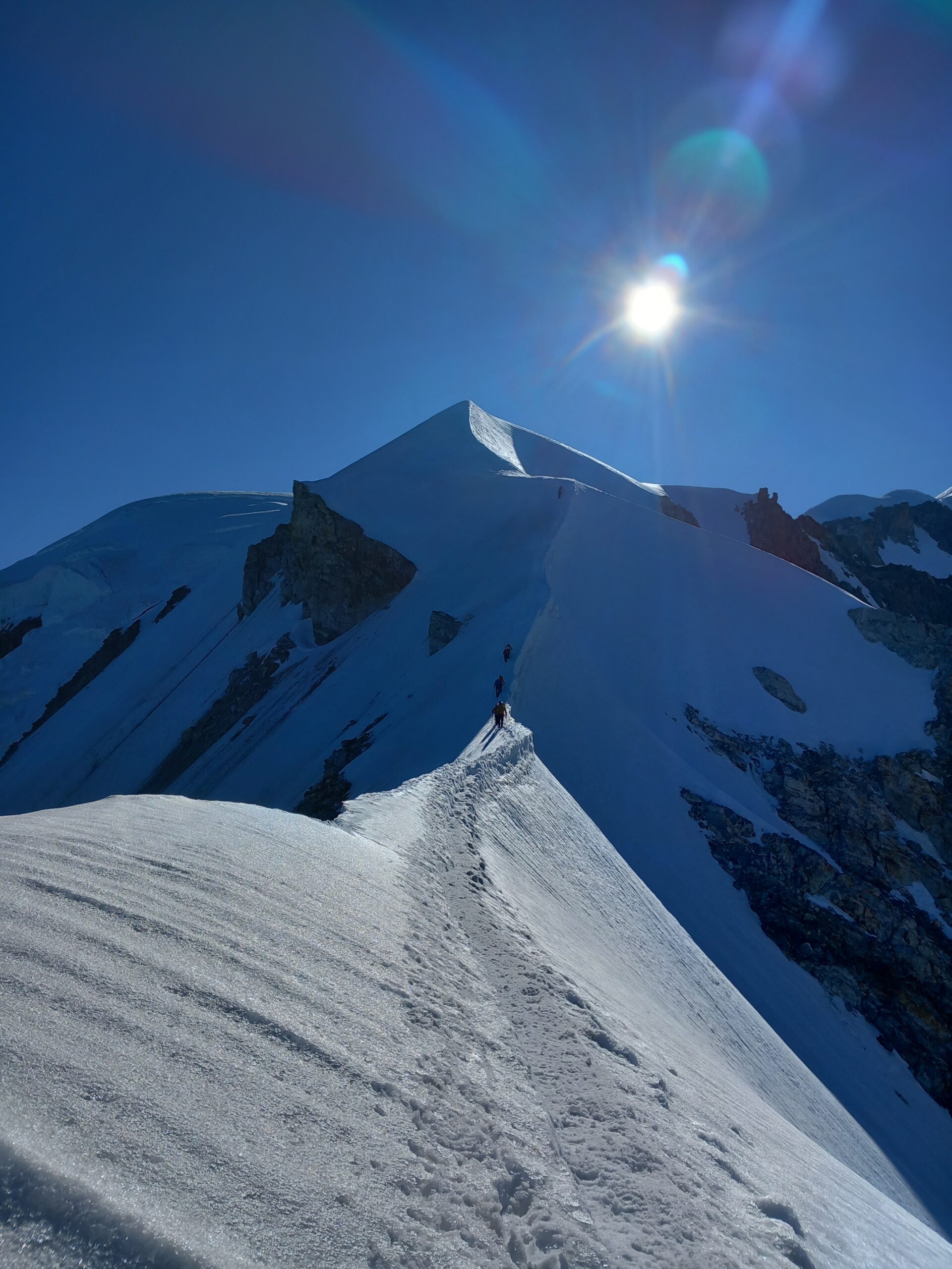
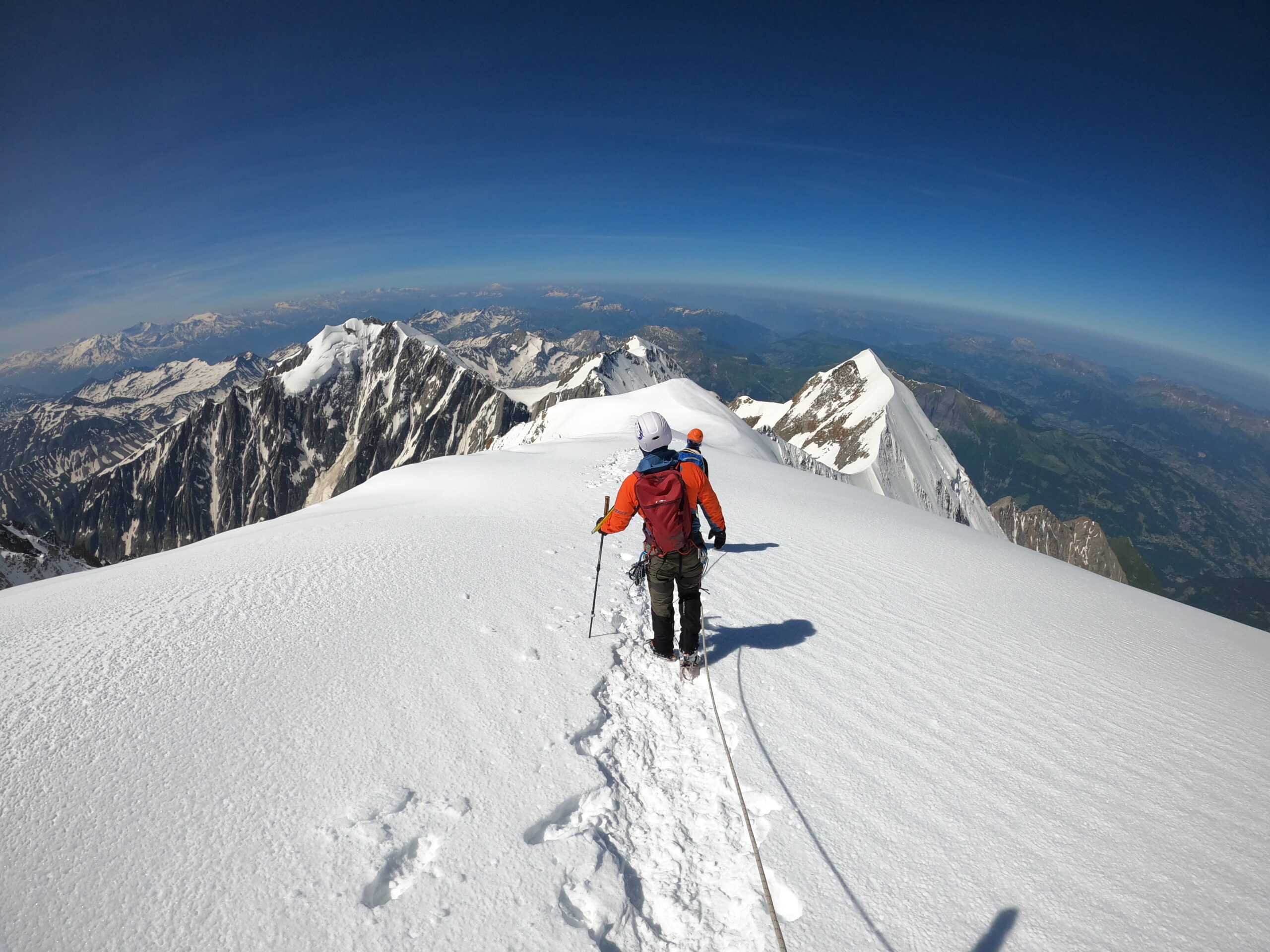
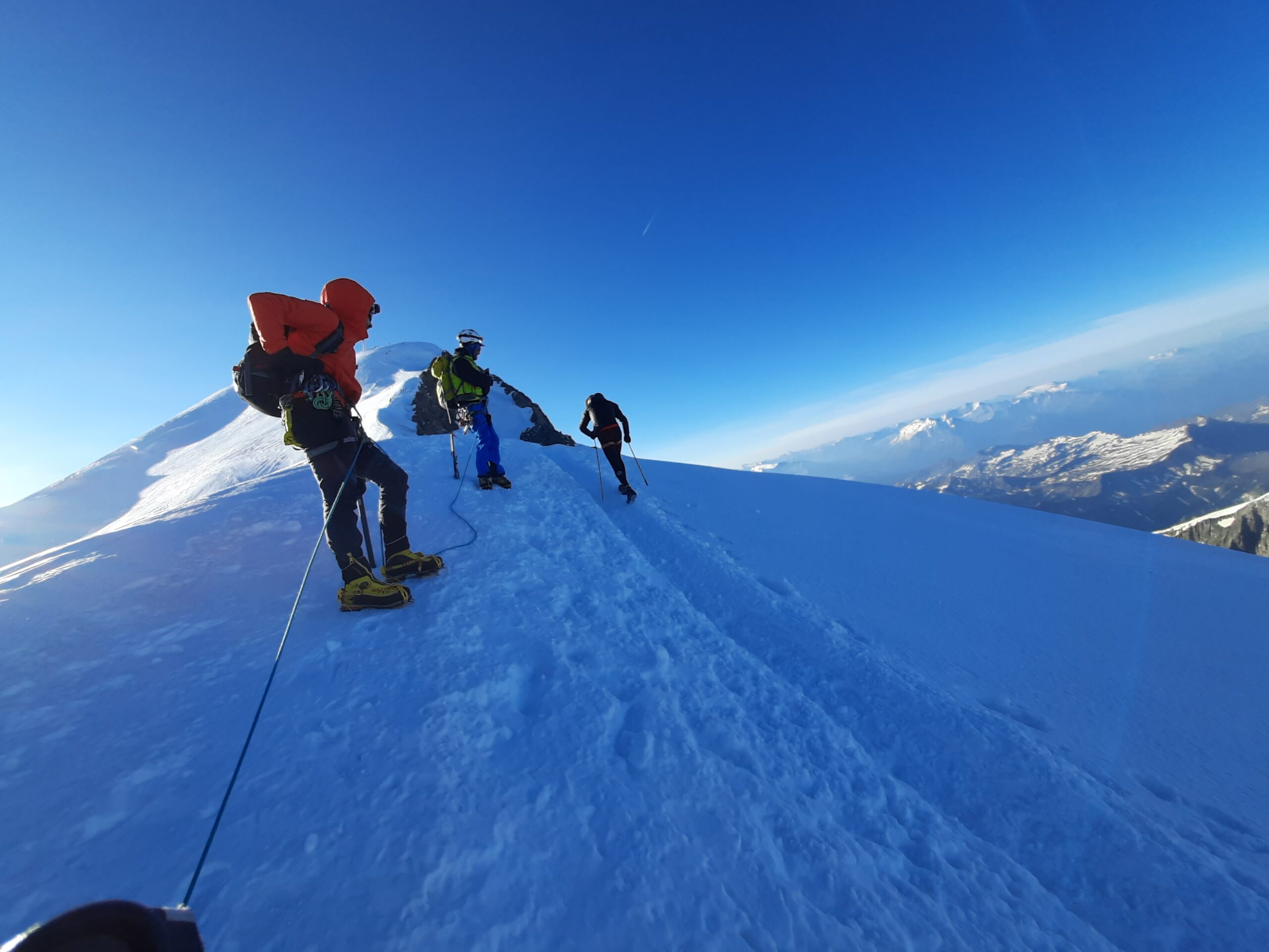
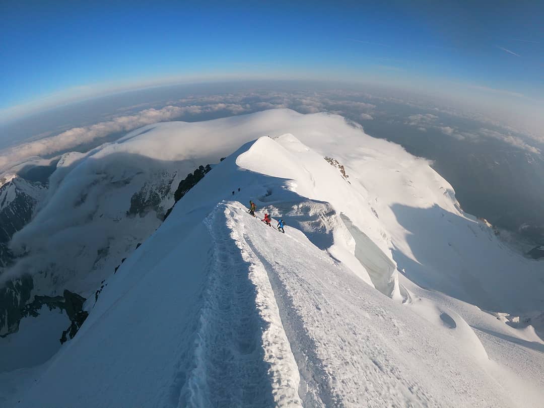
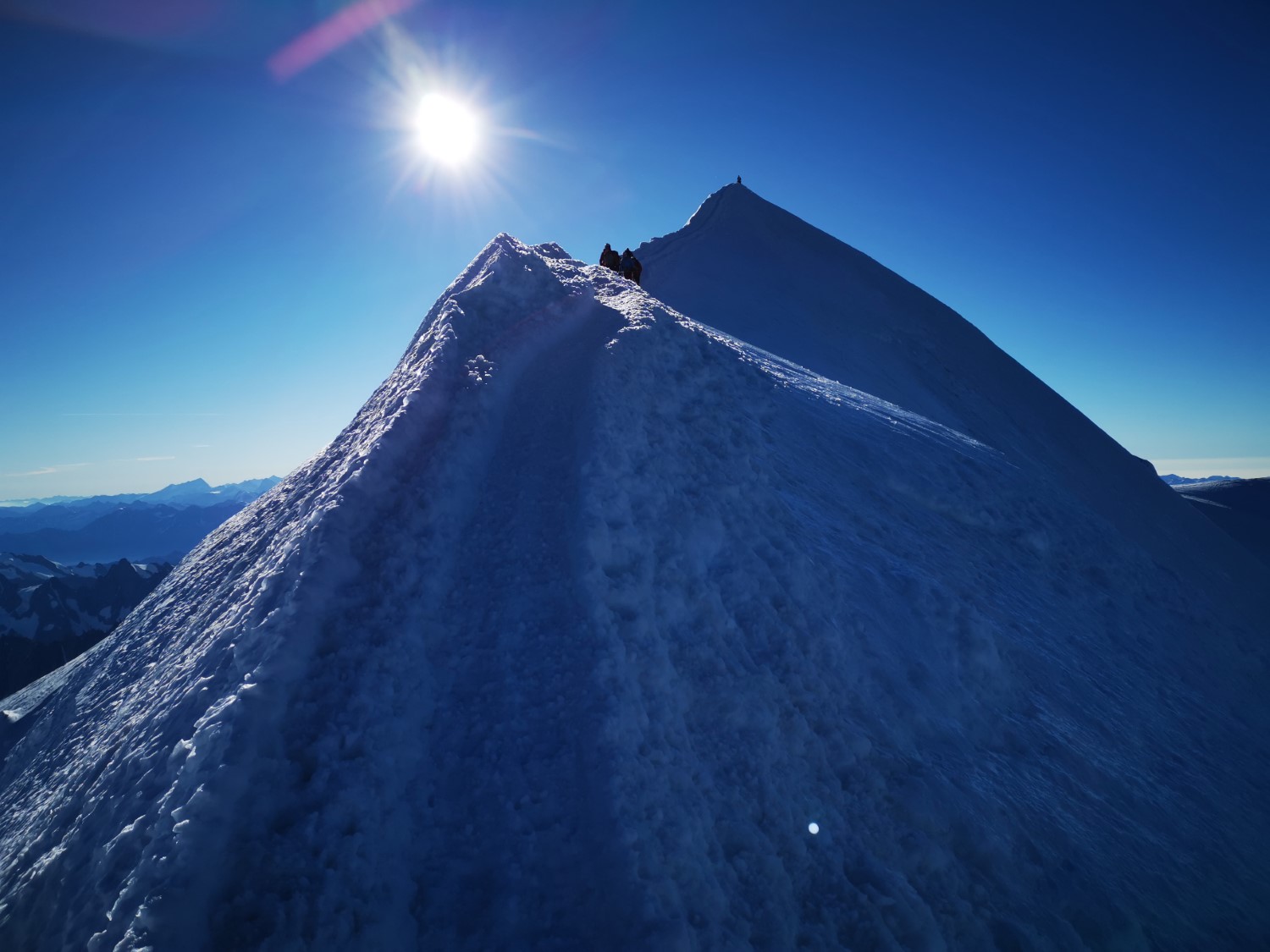
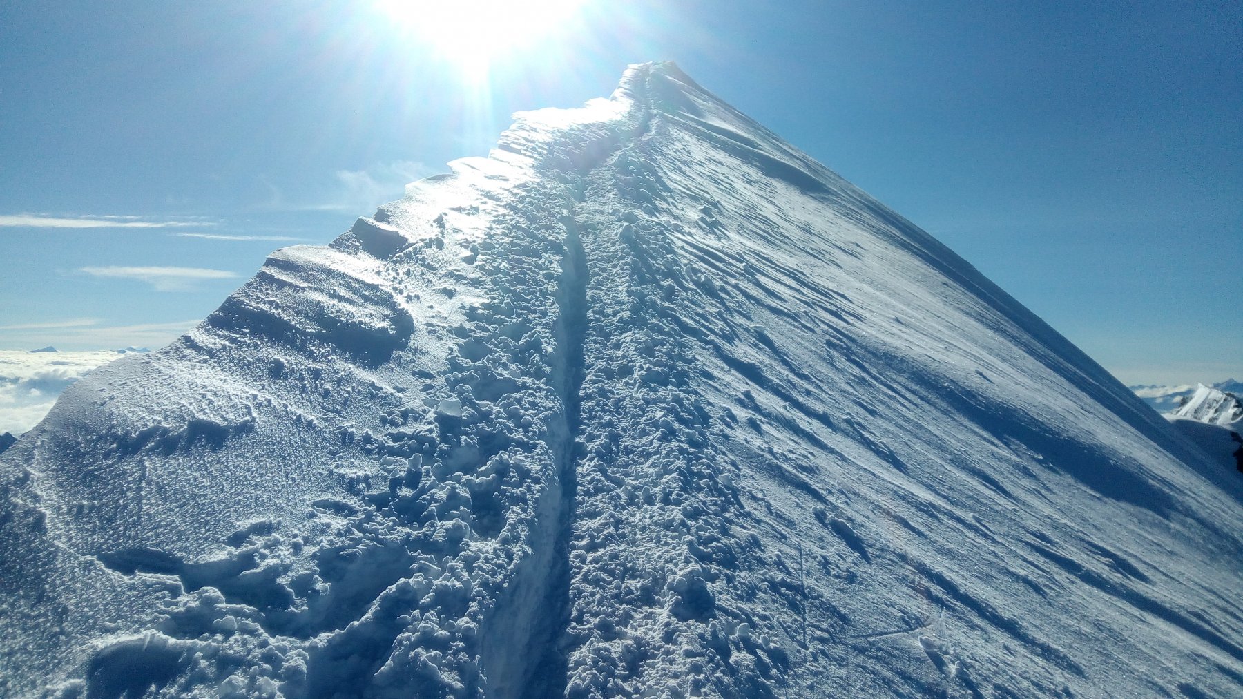
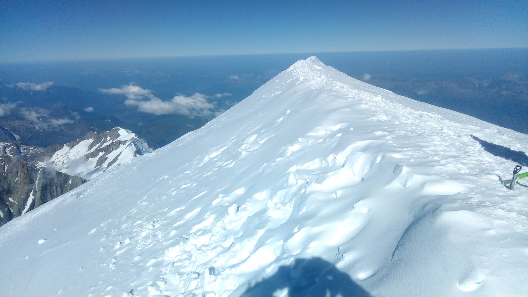
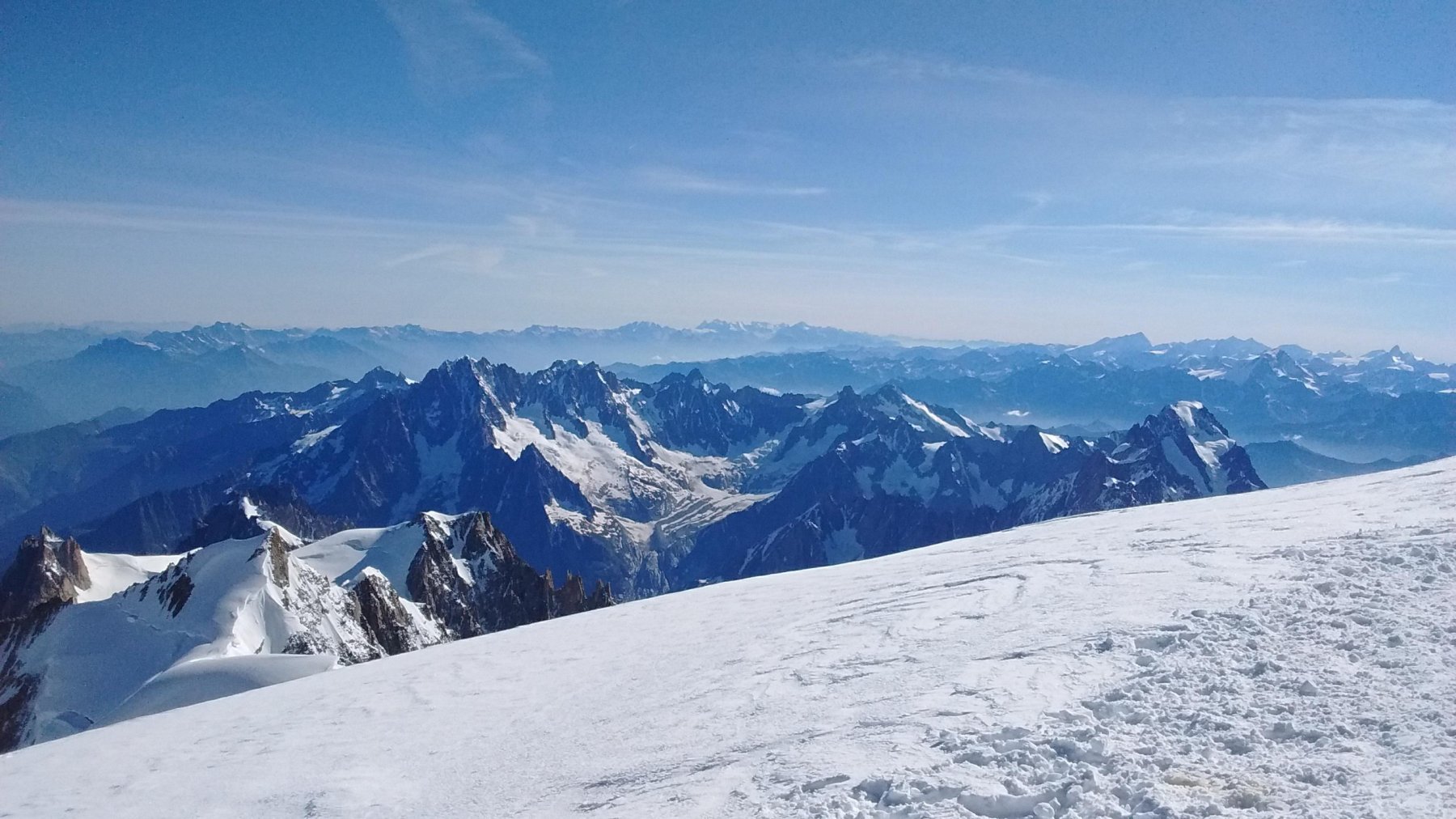
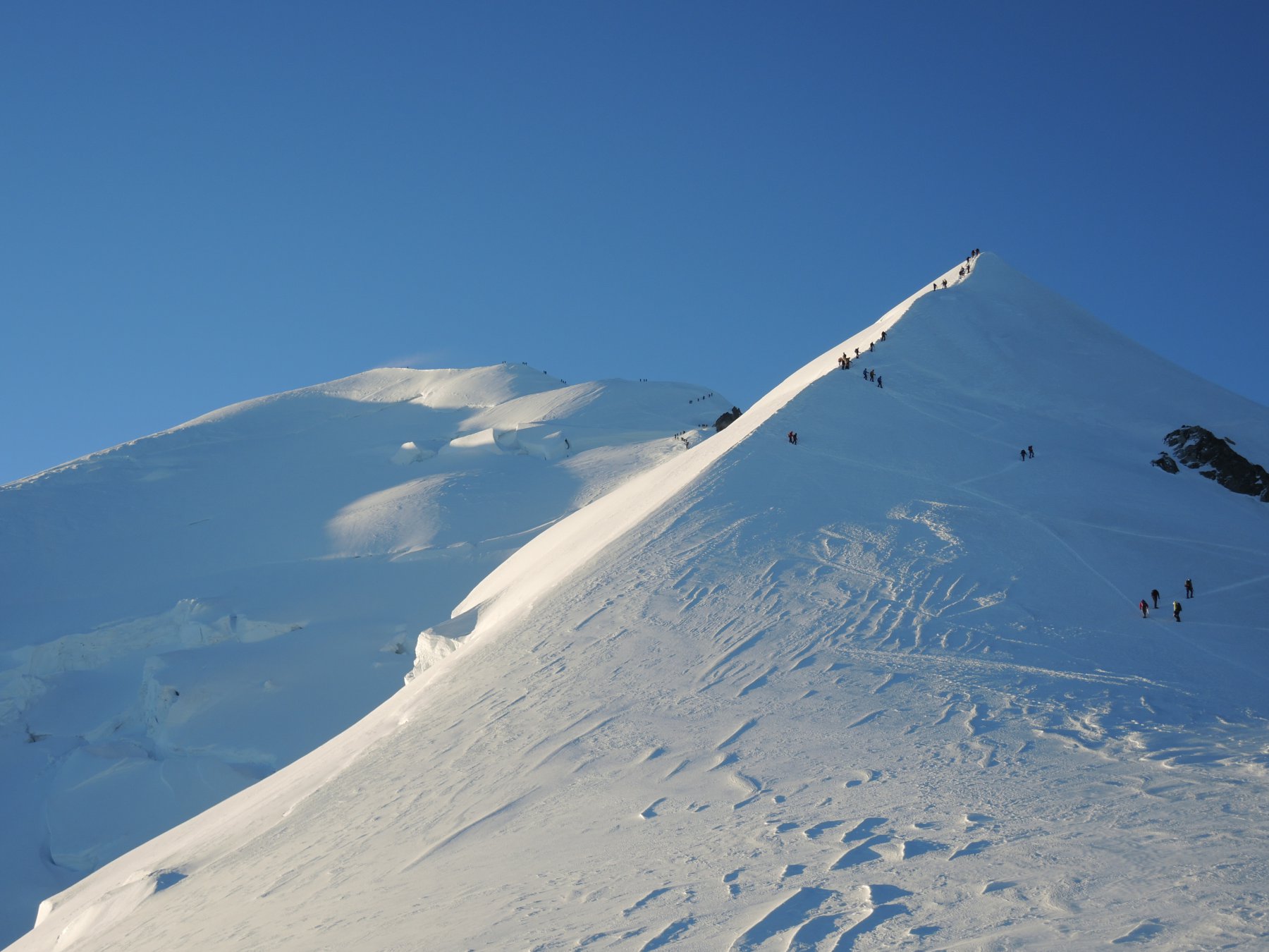
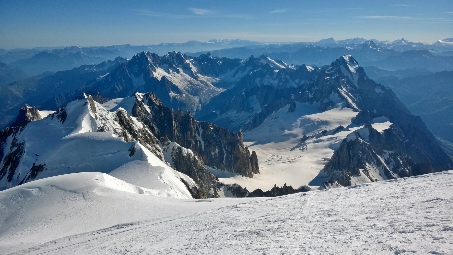
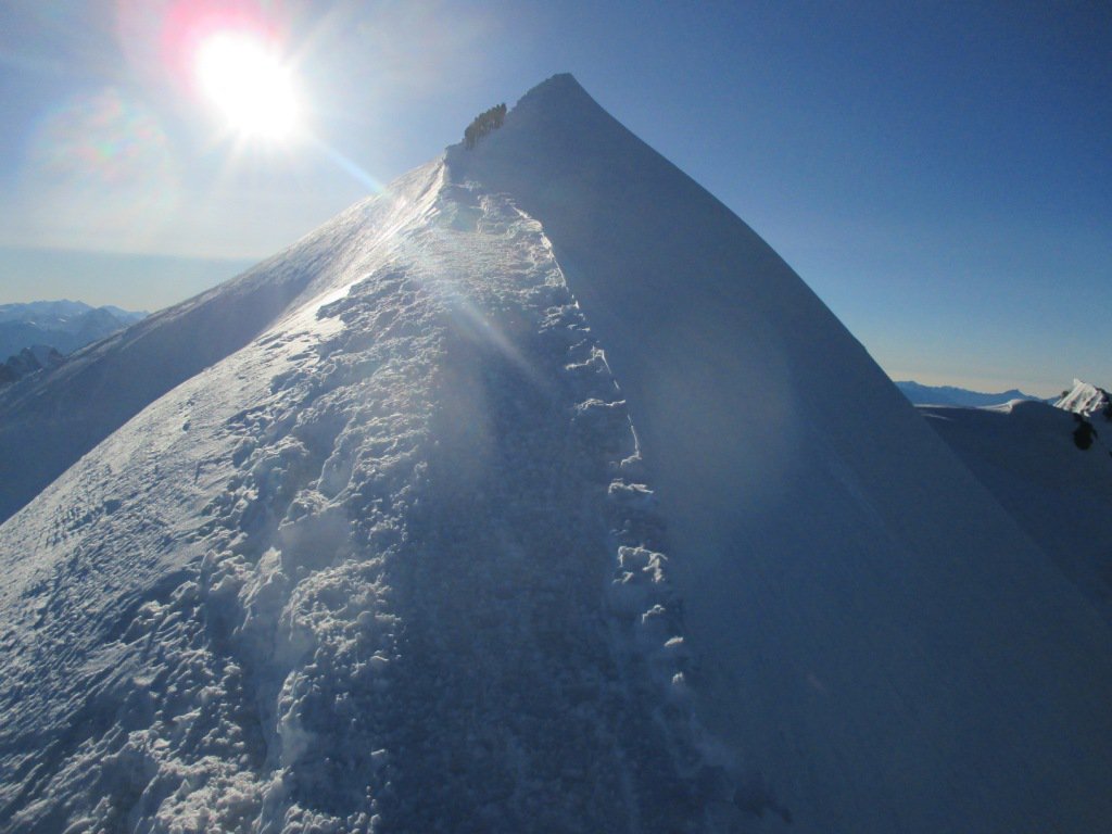
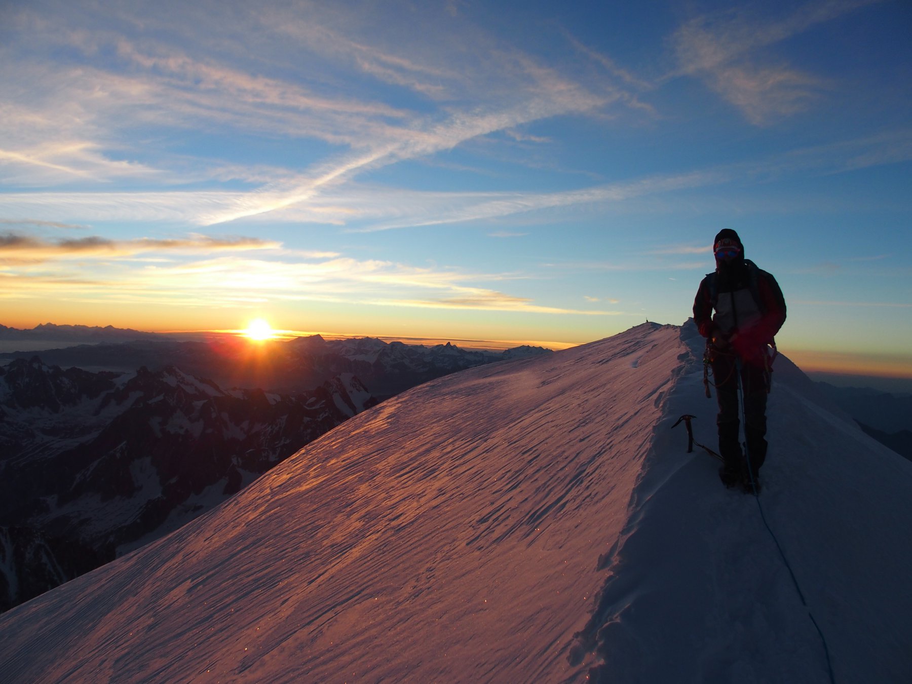
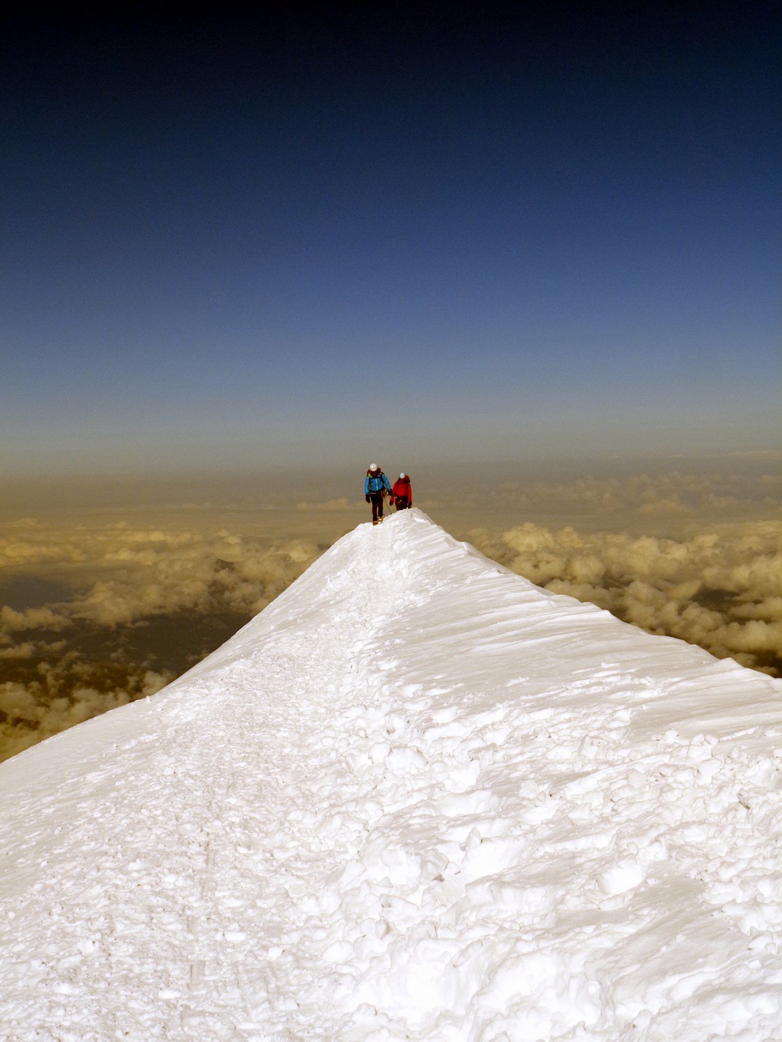
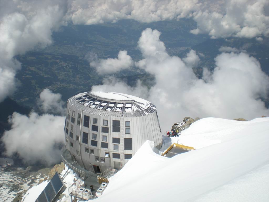
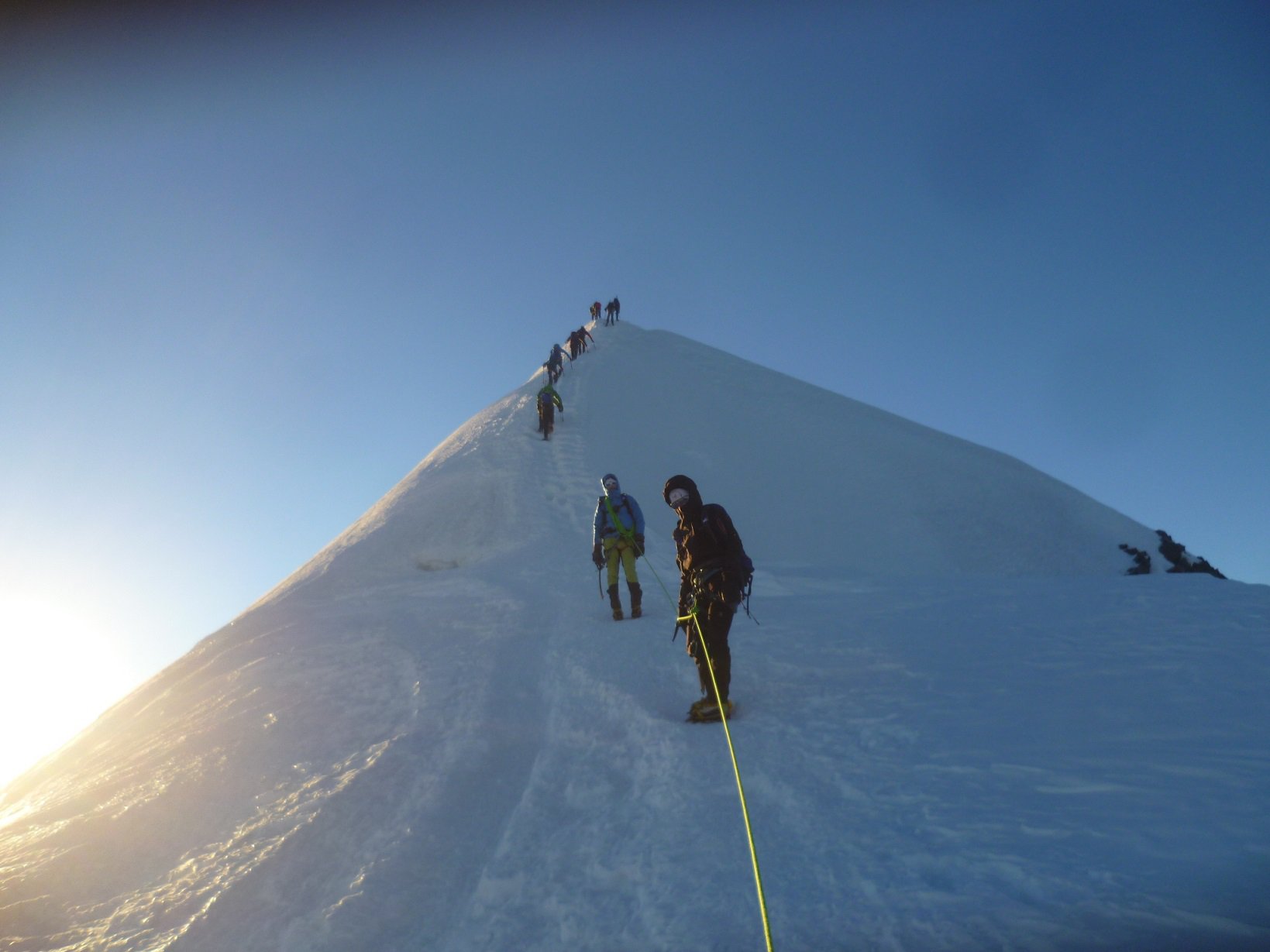
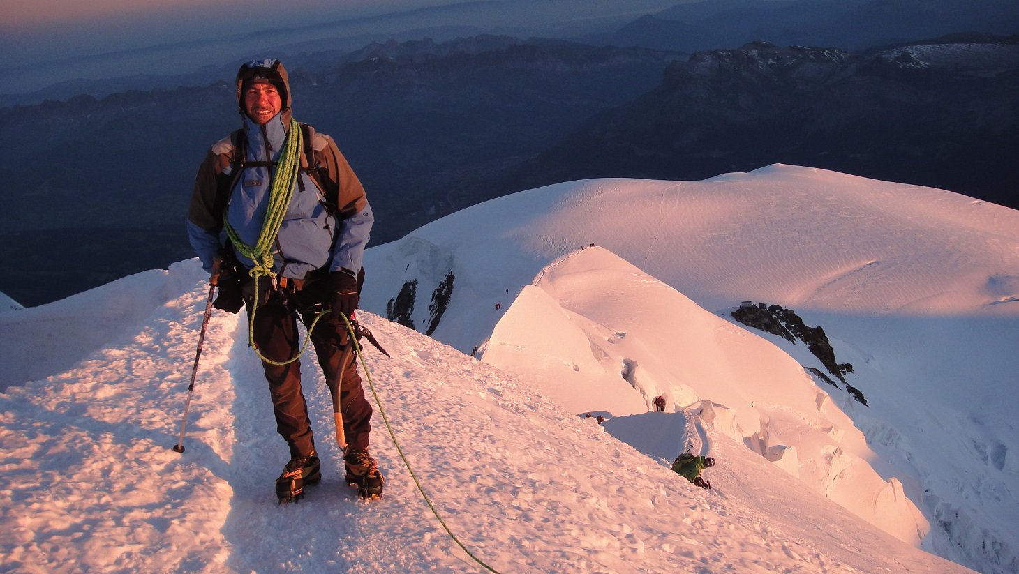
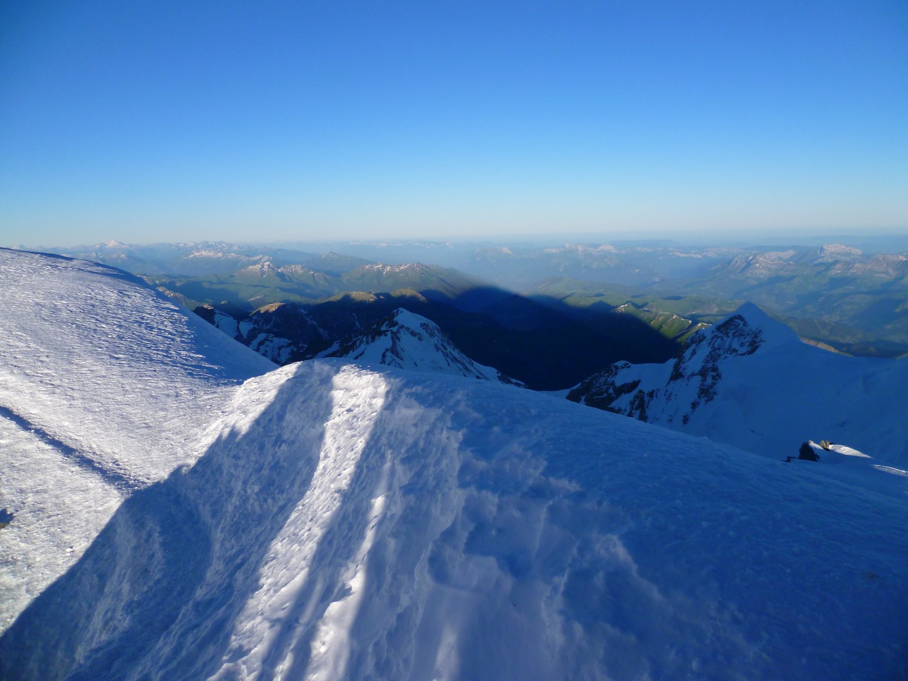
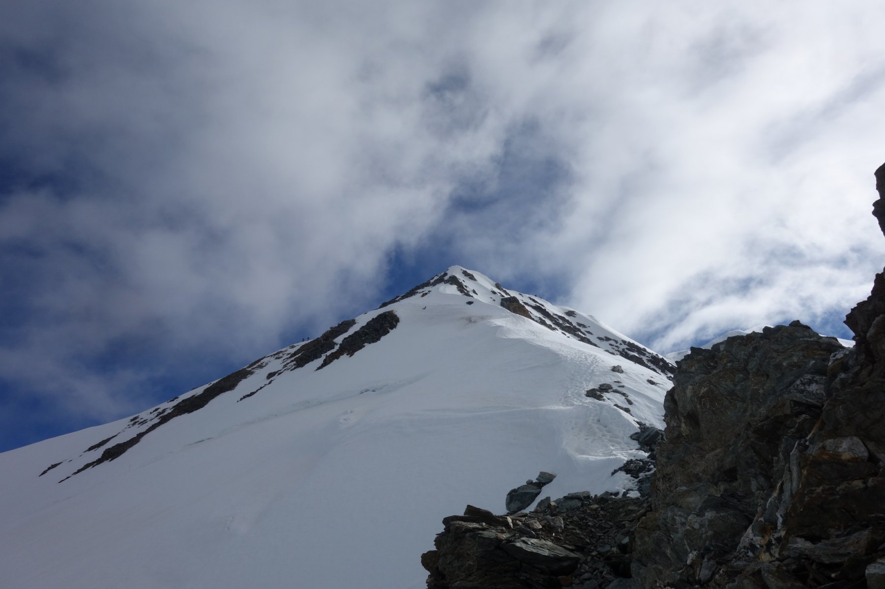
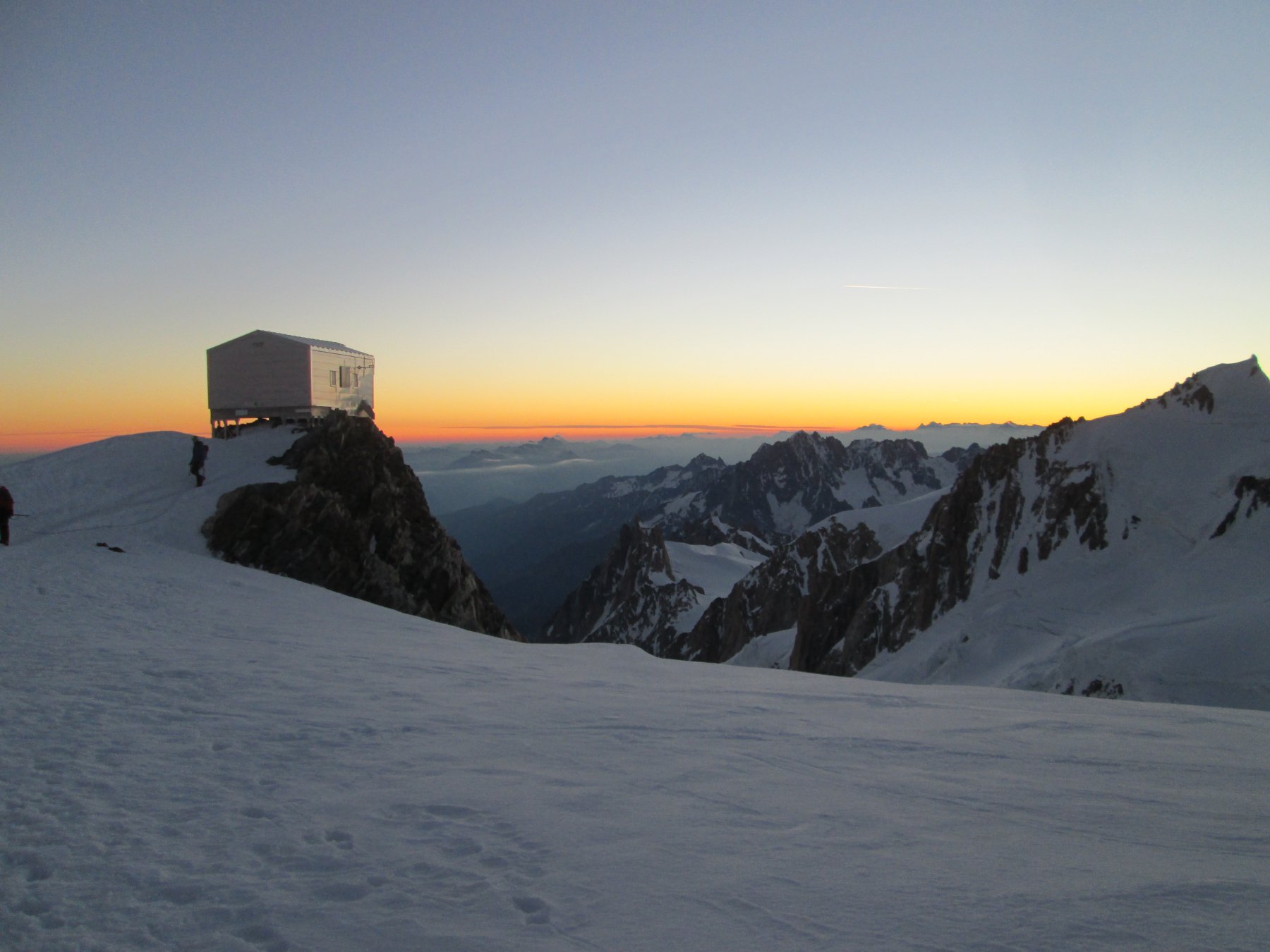
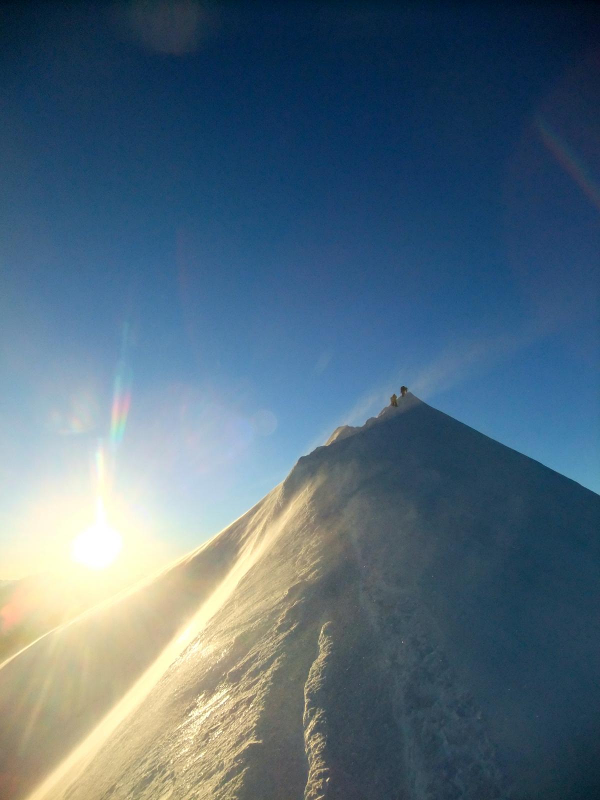
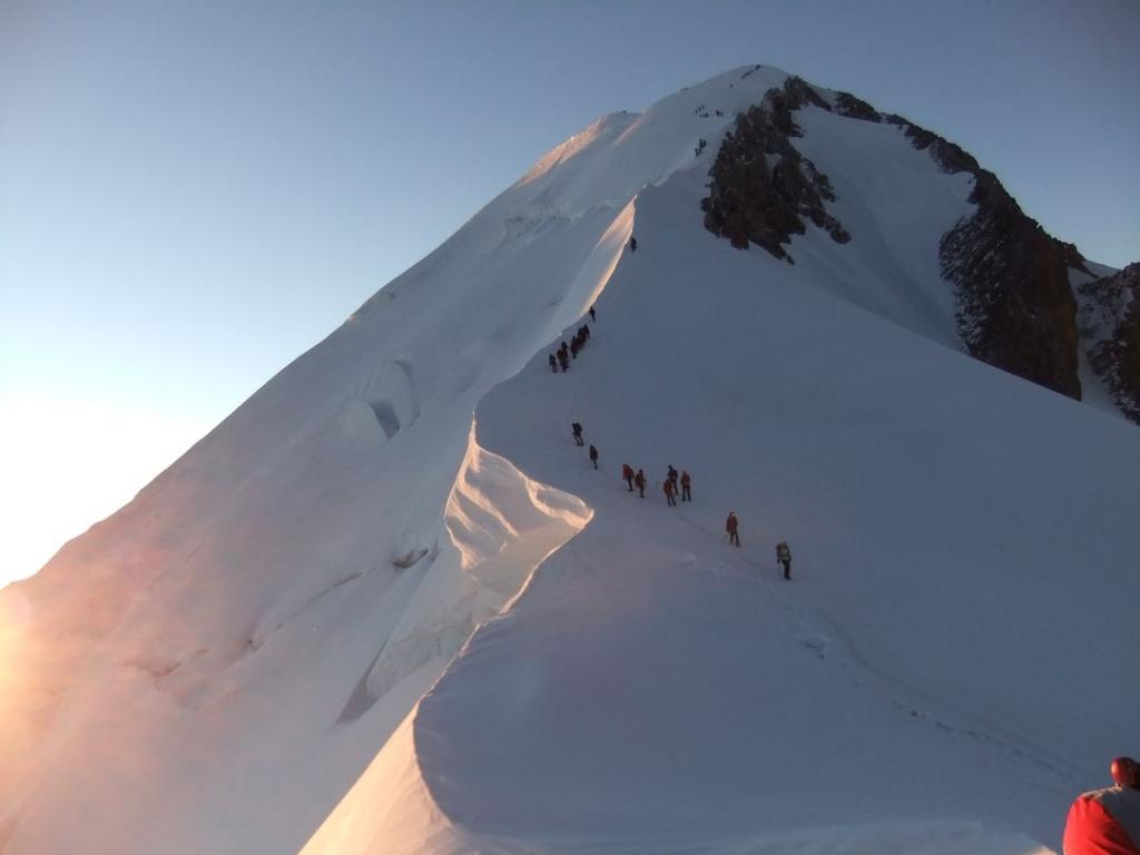
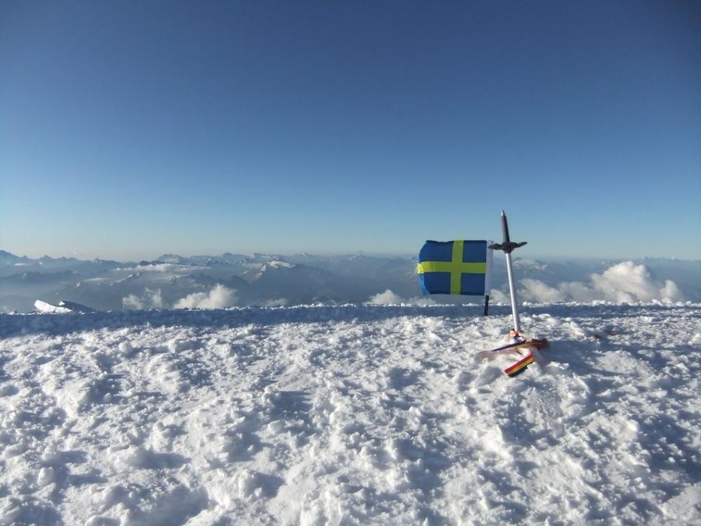
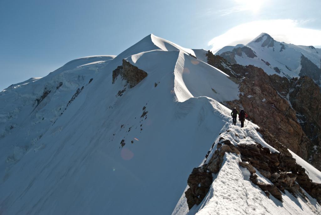
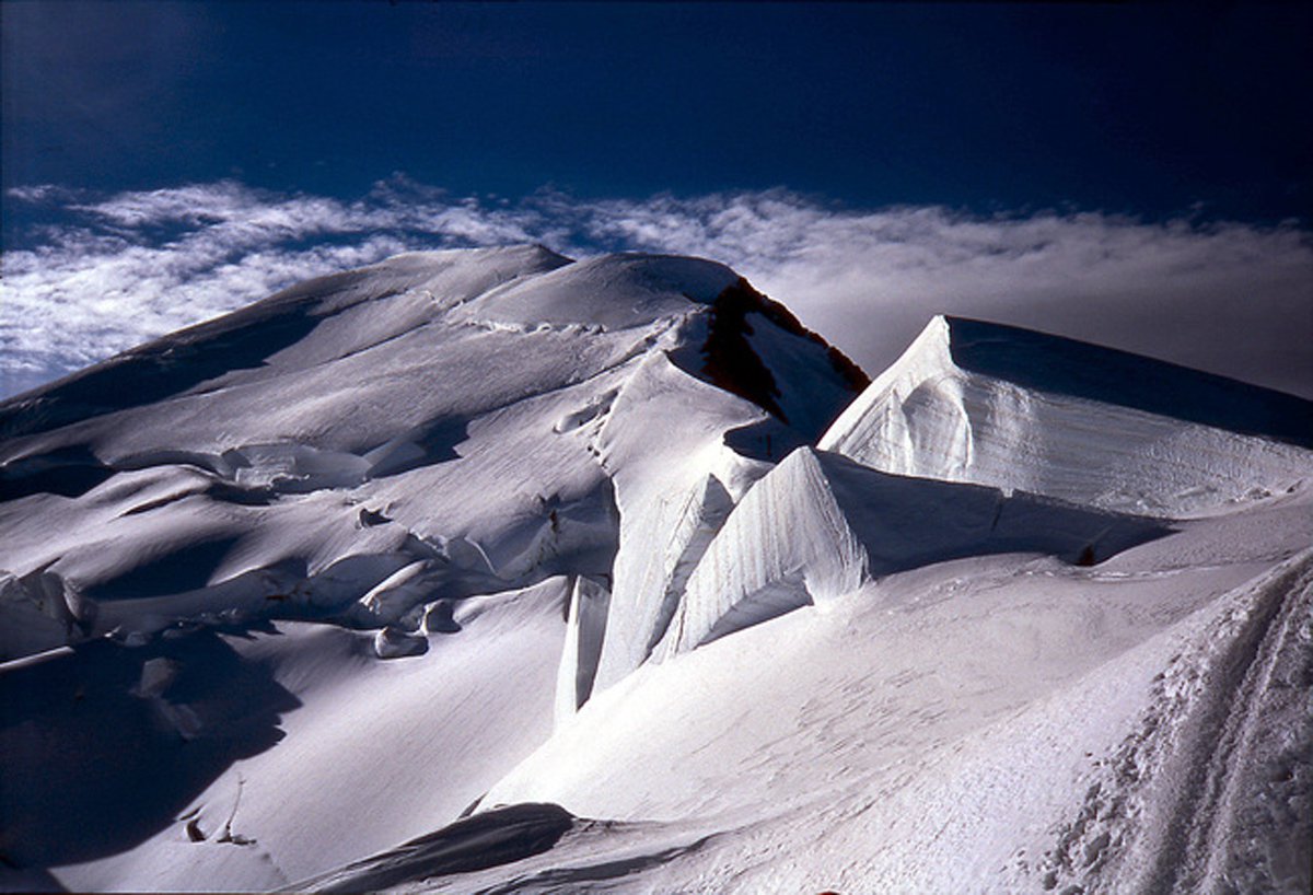
Dopo una leggera discesa si risale un tratto più ripido fino al Bivacco Vallot (4.362 mt), posto d’emergenza molto utile in caso di mal tempo. Da qui, spostandosi decisamente verso destra in direzione sud con una pendenza prossima ai 40°, si arriva in poco tempo sulla cresta de Bosses (4.500 mt circa), che seguita per tutta la sua estensione ci fa arrivare in un’ora in cima al Tetto d’Europa.
Discesa seguendo lo stesso itinerario di salita o da una delle altre ‘normali’.
Nelle vicinanze Mappa
Itinerari
29/08/2021 AO, Courmayeur D+ 3237 m D+ Sud
Bianco (Monte) Cresta dell’Innominata
 0m
0m
14/06/2026 AO, Courmayeur D+ 2200 m AD- Varie
Trelatete (Aiguille de) traversata dal Bivacco Rainetto al Rifugio Elisabetta
 0m
0m
26/07/1998 AO, Courmayeur D+ 1457 m F Varie
Lechaud (Punta) da La Visaille per il Colle di Chavannes ed il versante Est
 0m
0m
02/04/2021 AO, Cormayeur D+ 950 m ED Sud-Est
Bianco (Monte) Hypercouloir du Brouillard
50m
21/08/2013 AO, Courmayeur D+ 3200 m D+ Sud-Est
Bianco (Monte) Cresta di Peuterey dal Col Eccles
 50m
50m
24/08/2025 AO, Courmayeur D+ 1400 m PD- Sud
Estellette (Aiguille d’) da La Visaille
 50m
50m
18/08/2021 AO, Courmayeur D+ 1300 m F+ Sud
Gonella Francesco (Rifugio) al Dome da La Visaille
 50m
50m
09/08/2024 AO, Courmayeur D+ 3400 m ED- Sud-Est
Bianco (Monte) Pilone Centrale Freney – Via classica
 50m
50m
02/07/2021 AO, Courmayeur D+ 400 m TD+ Sud-Est
Brouillard (Pilastro Rosso del) – Via Bonatti-Oggioni
 50m
50m
12/08/2021 AO, Courmayeur D+ 2600 m AD Est
Bionnassay (Aiguille de) Cresta Est
 50m
50m