3.1Km
3.1Km

Note
 50m
50m
3Km
3.2Km
3.2Km
3.2Km
3.2Km
6.3Km
6.3Km
50m
50m
3Km
3.2Km
3.2Km
3.2Km
3.2Km
6.3Km
6.3Km
3.1Km
3.2Km
3.2Km
3.2Km
4.6Km
5.6Km
6Km
6.3Km
7.5Km
7.7Km
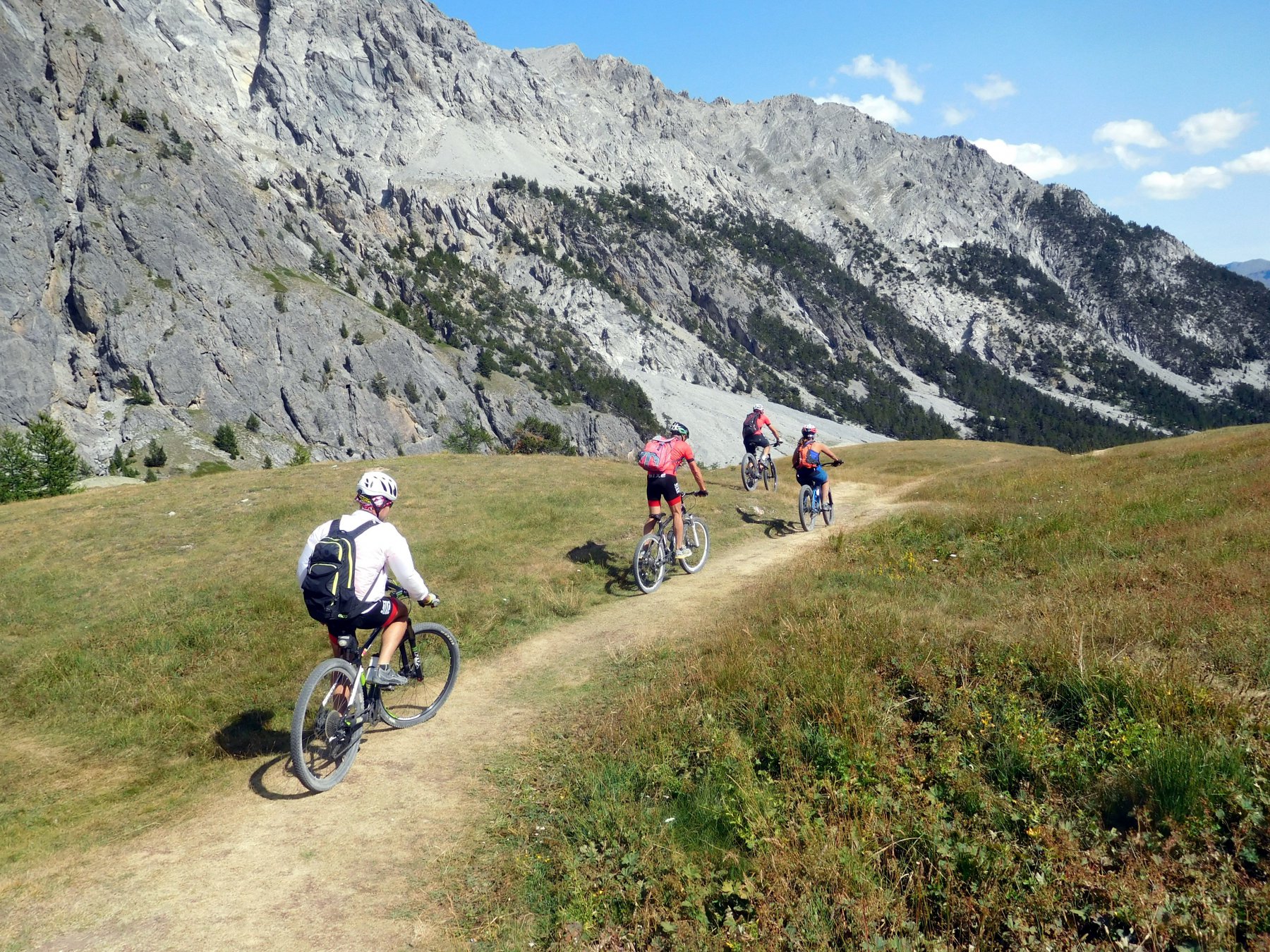
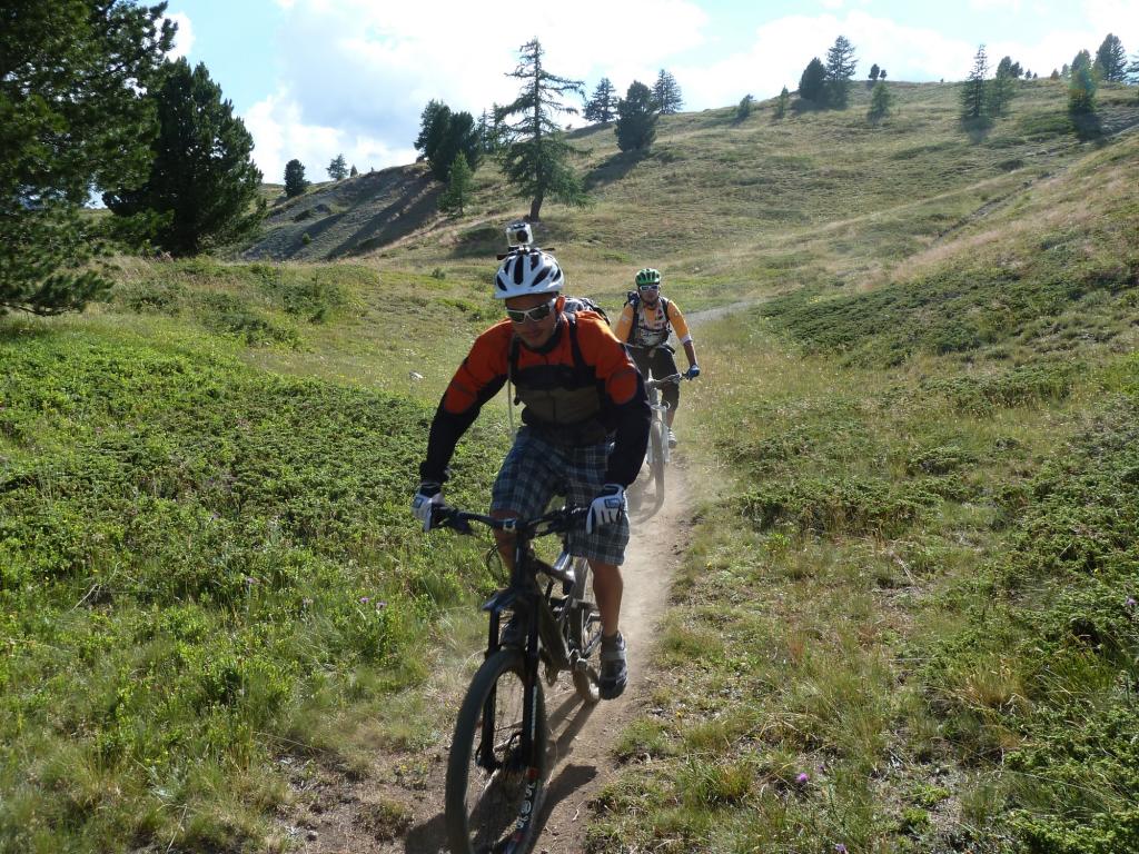
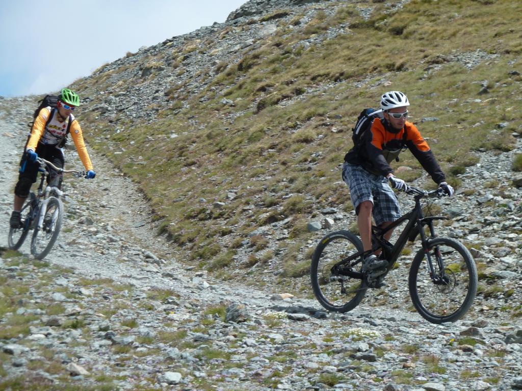
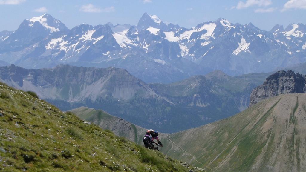
Pedalabilità in salita variabile in base alle condizioni del fondo, al mezzo, alla gamba e alle capacità. Mediamente: in salita 75%, discesa 98%.
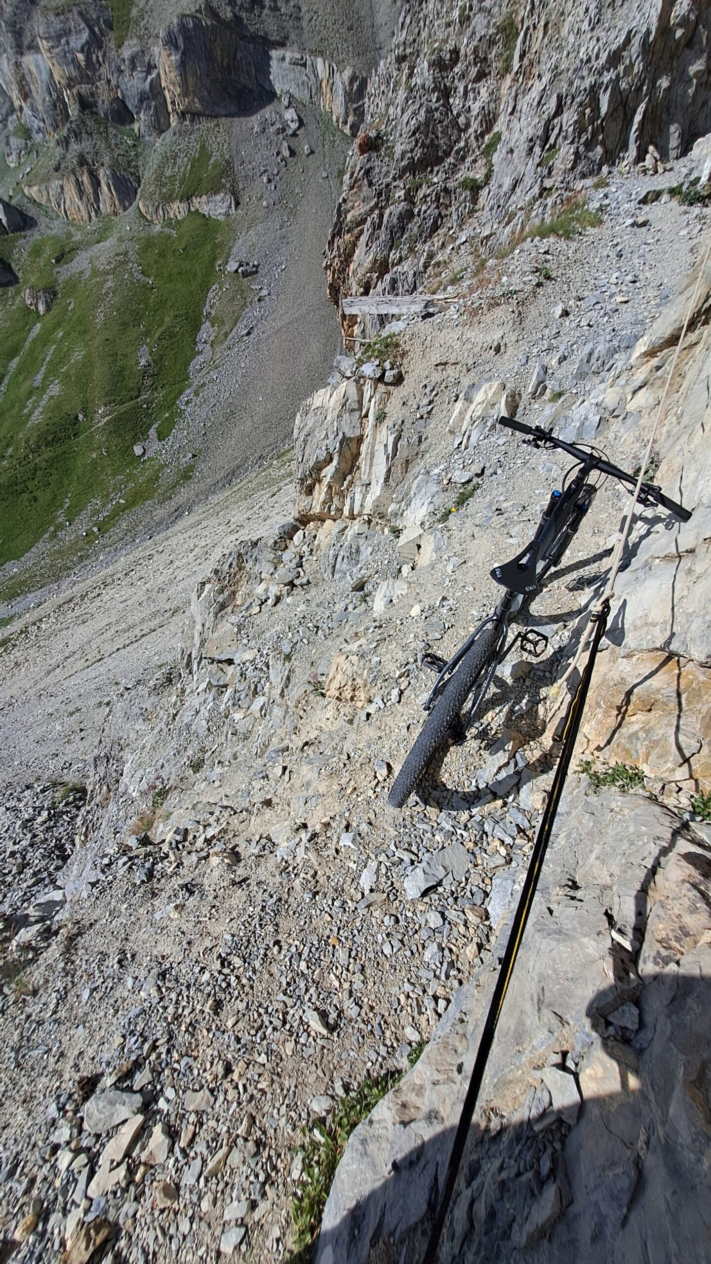
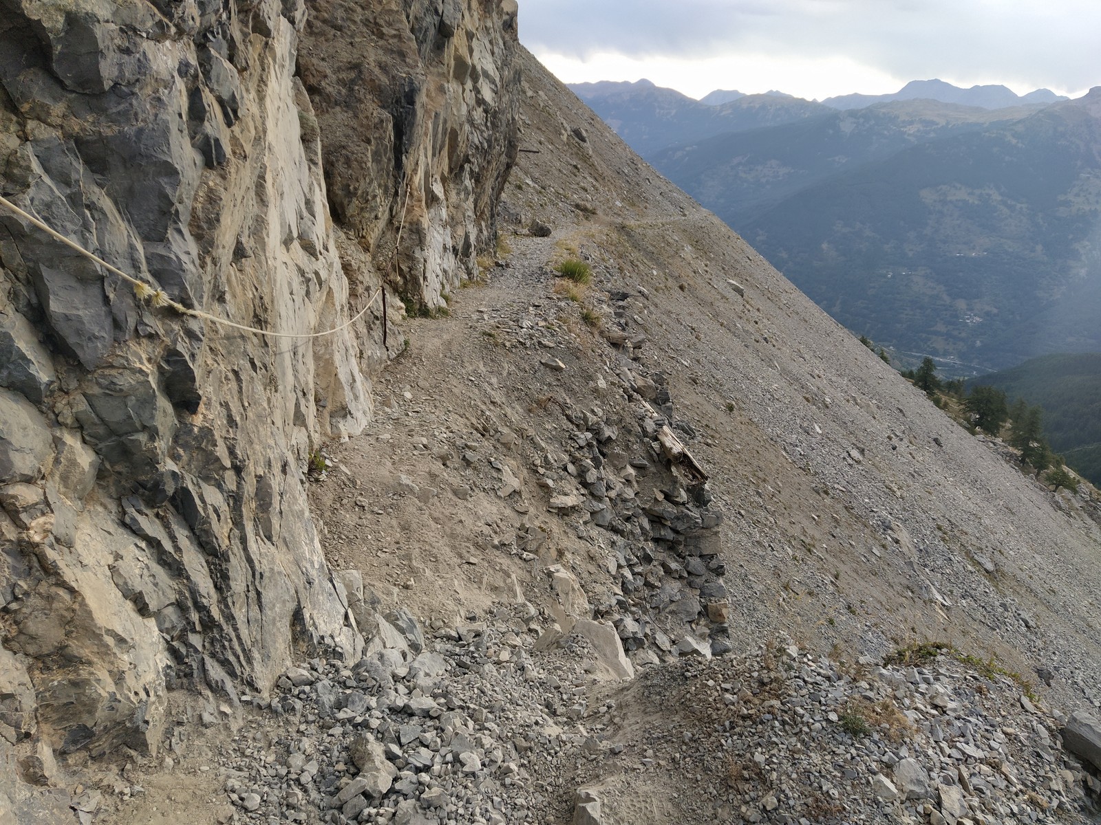
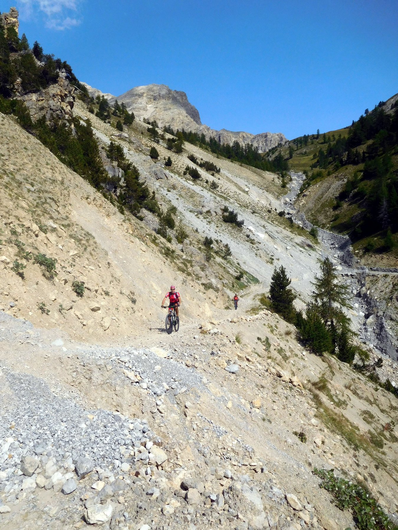
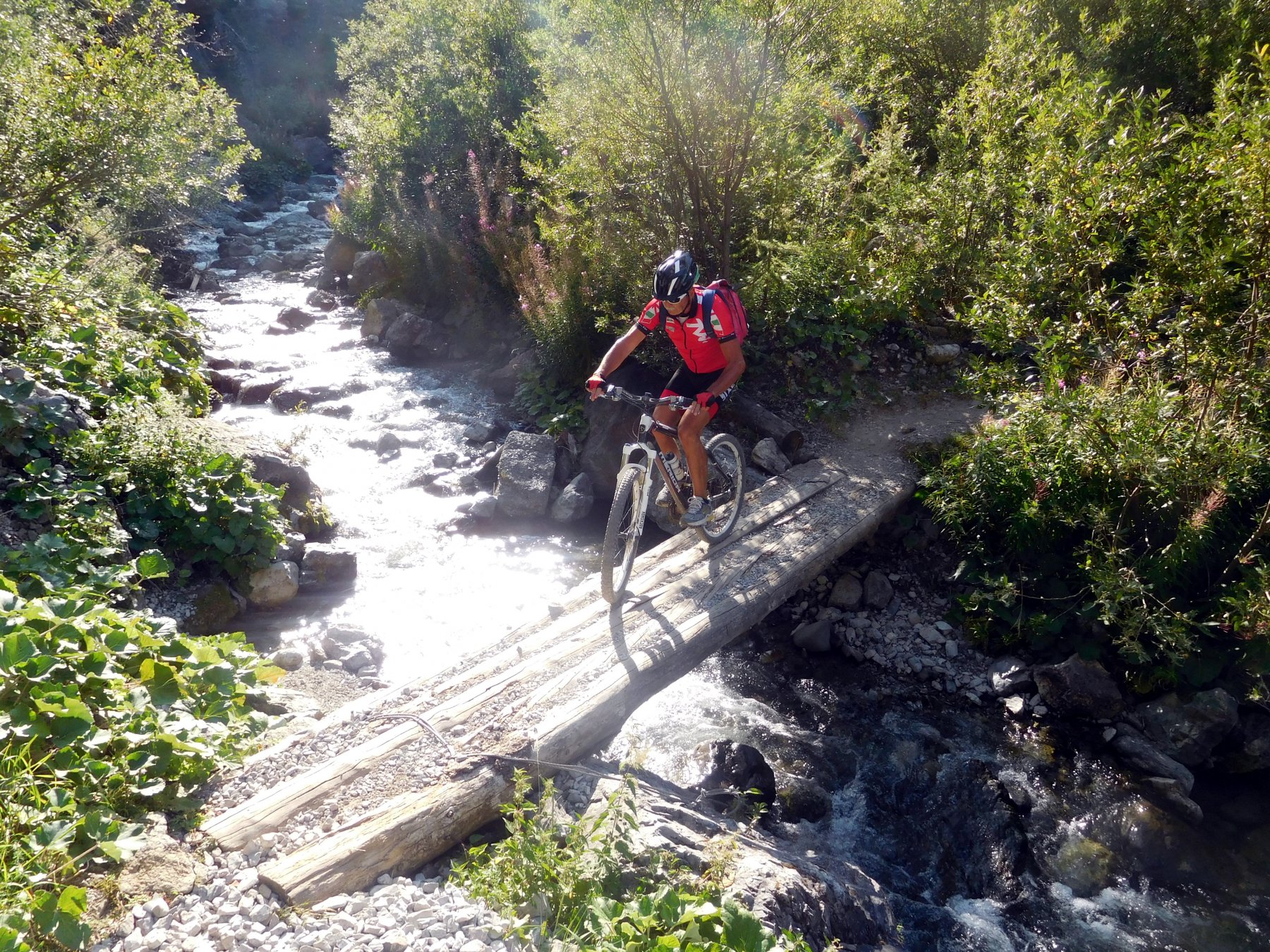
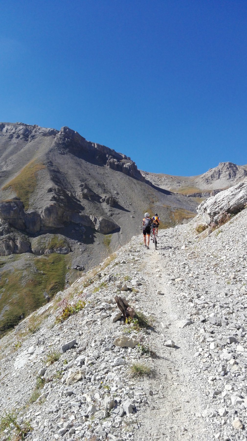
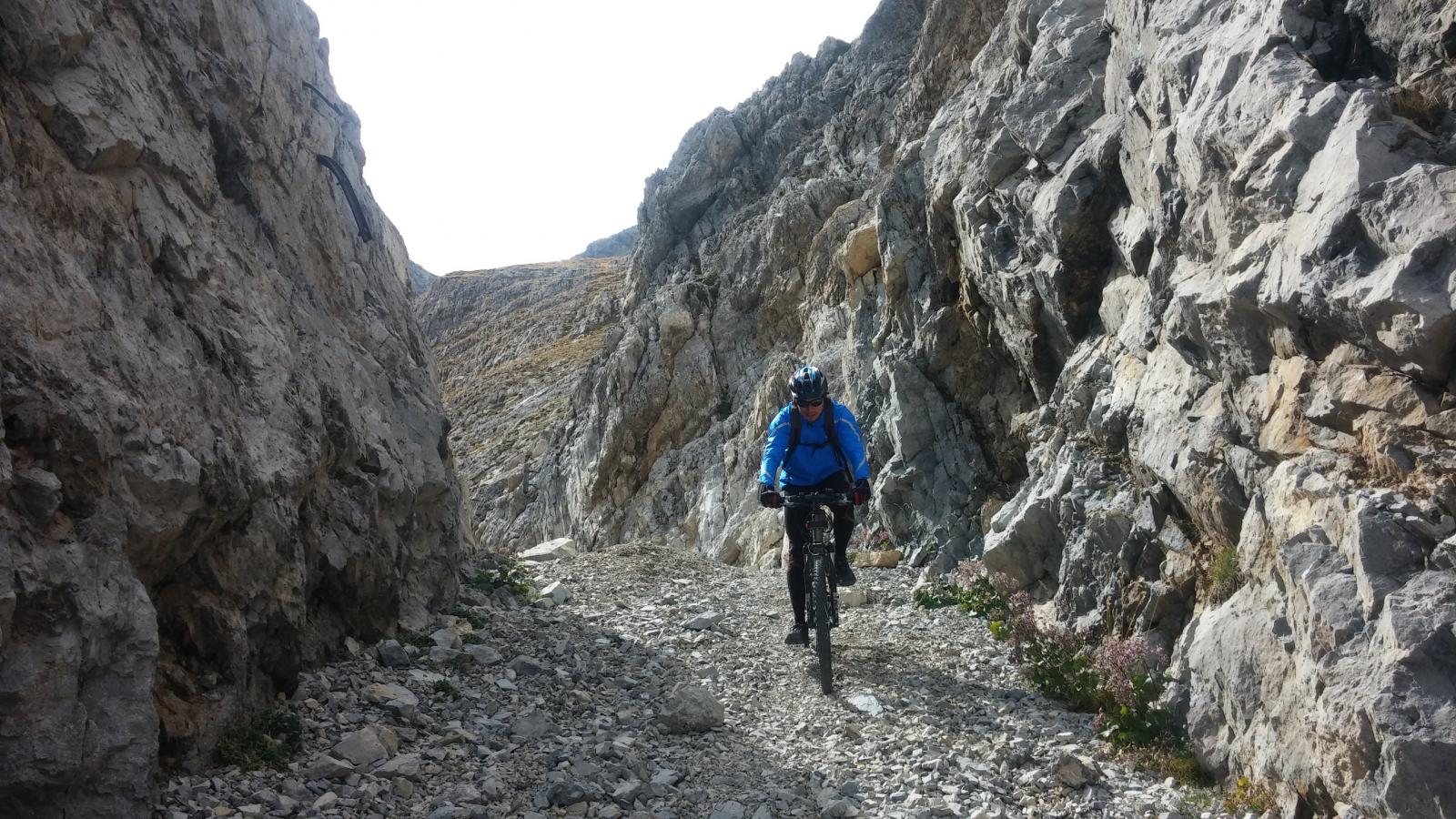
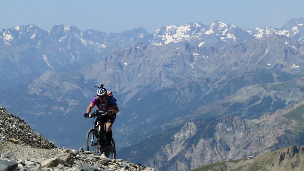
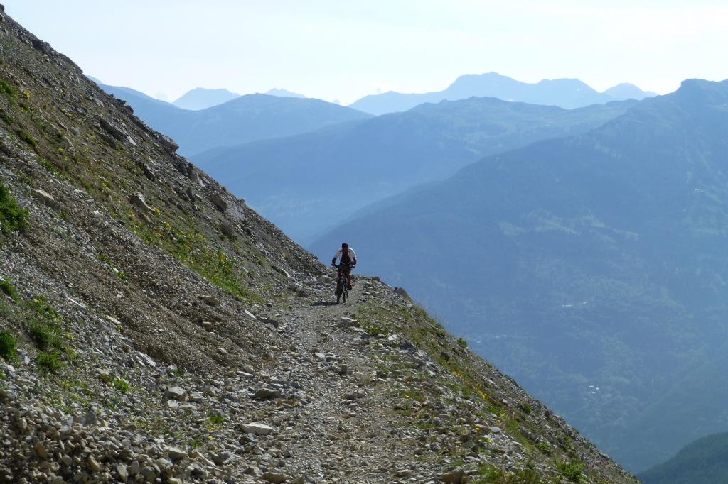
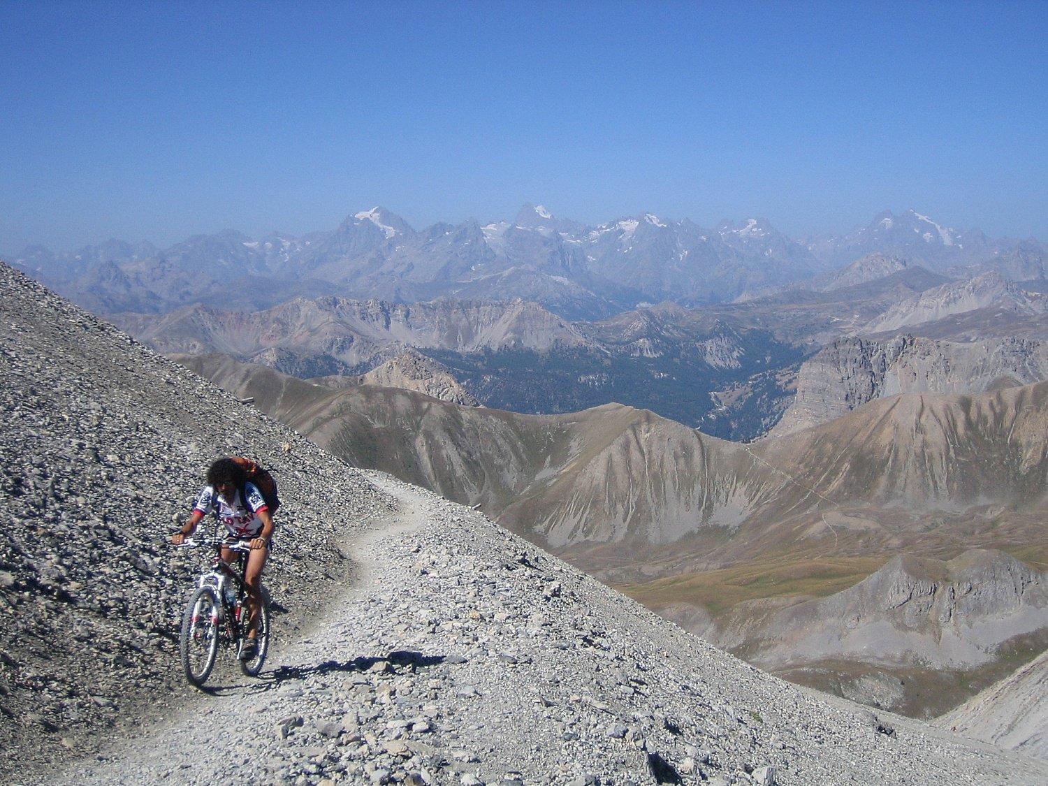
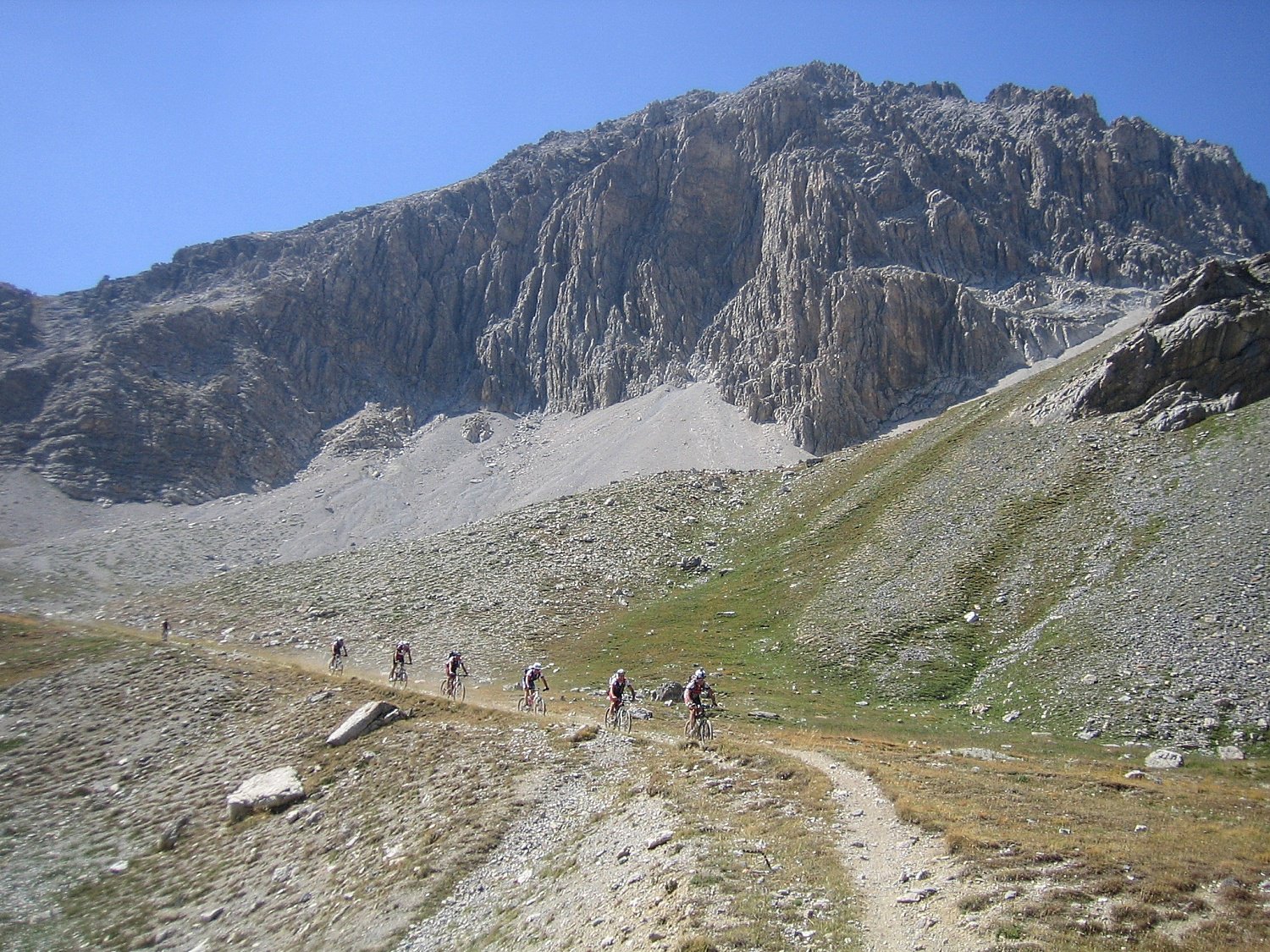
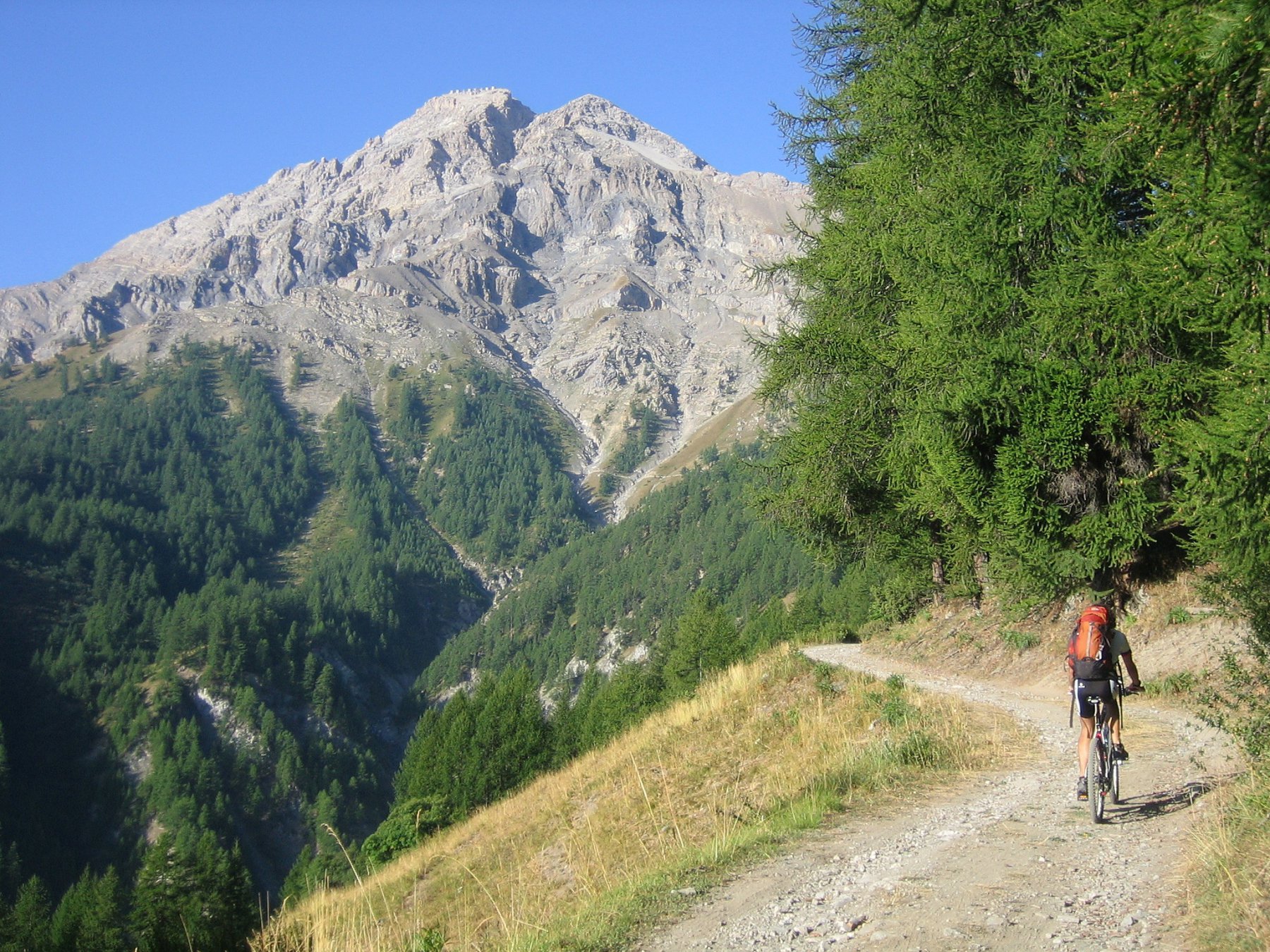
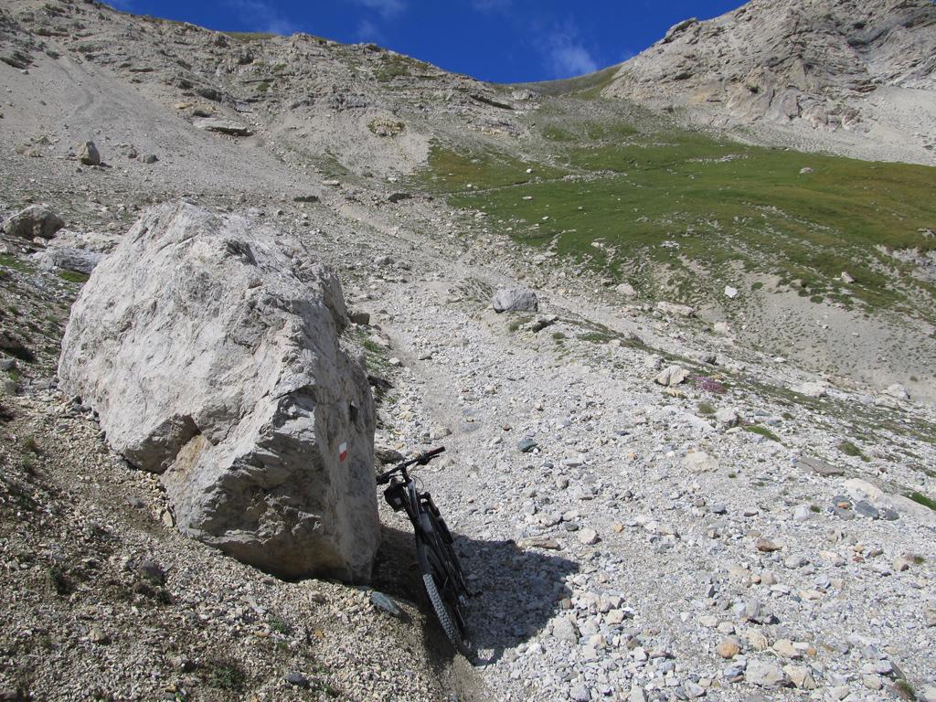
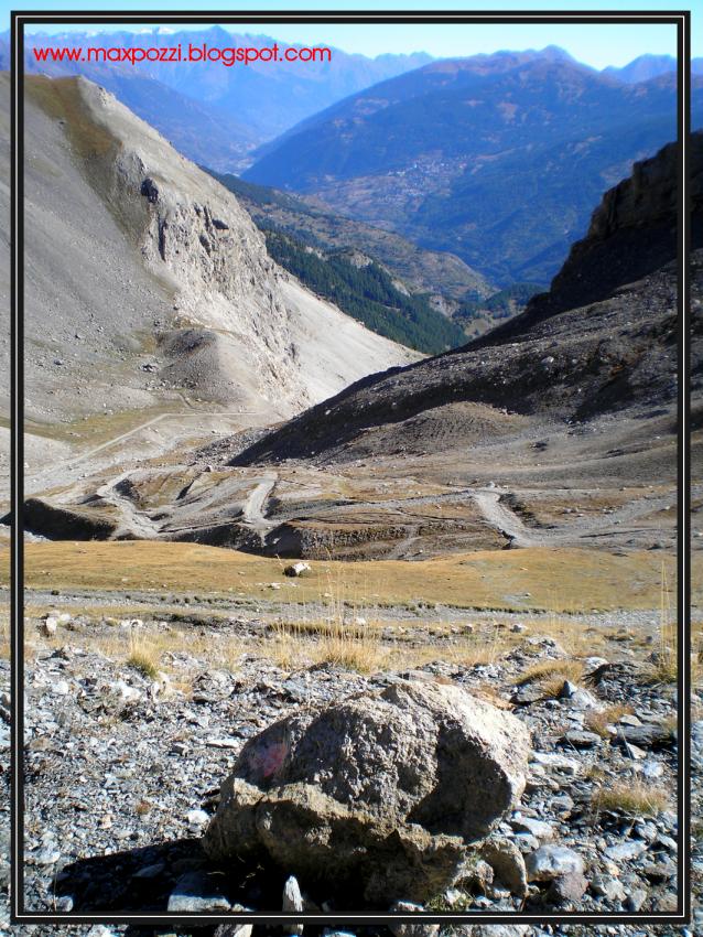
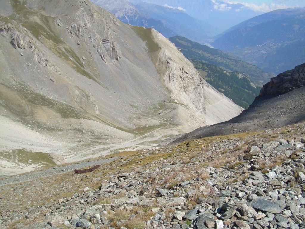
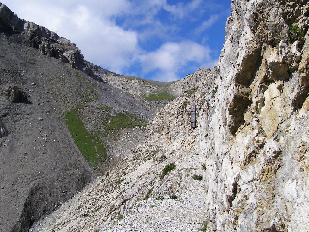
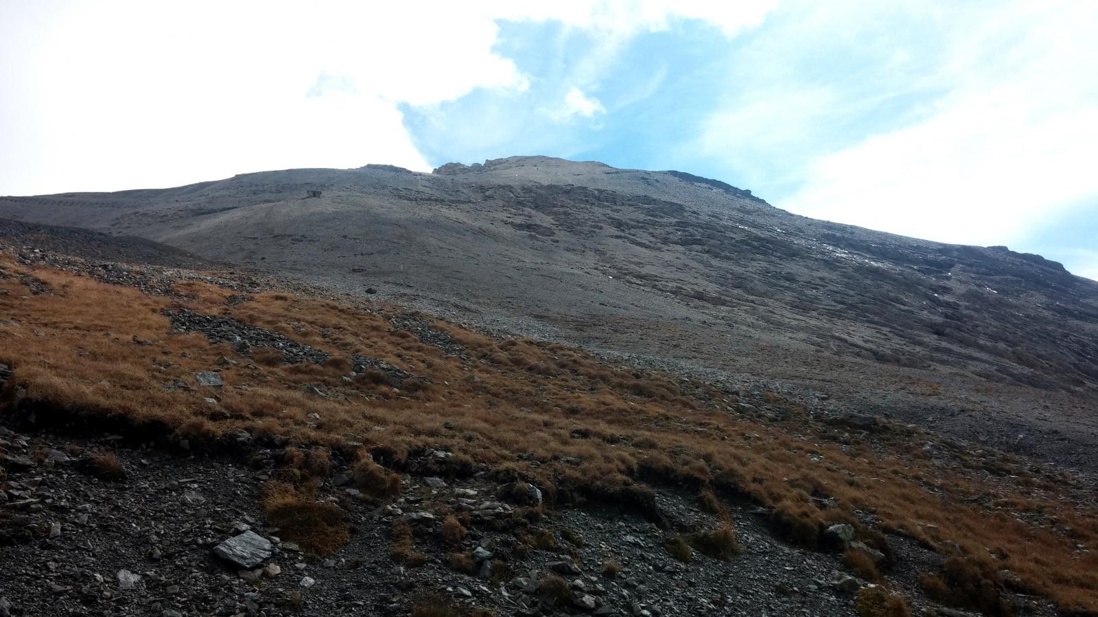
E' una salita impegnativa e anche bella pedalabile, salvo nel tratto centrale, dove la militare, franata e sassosissima, ne impedisce la pedalabilità per quasi 1 ora.
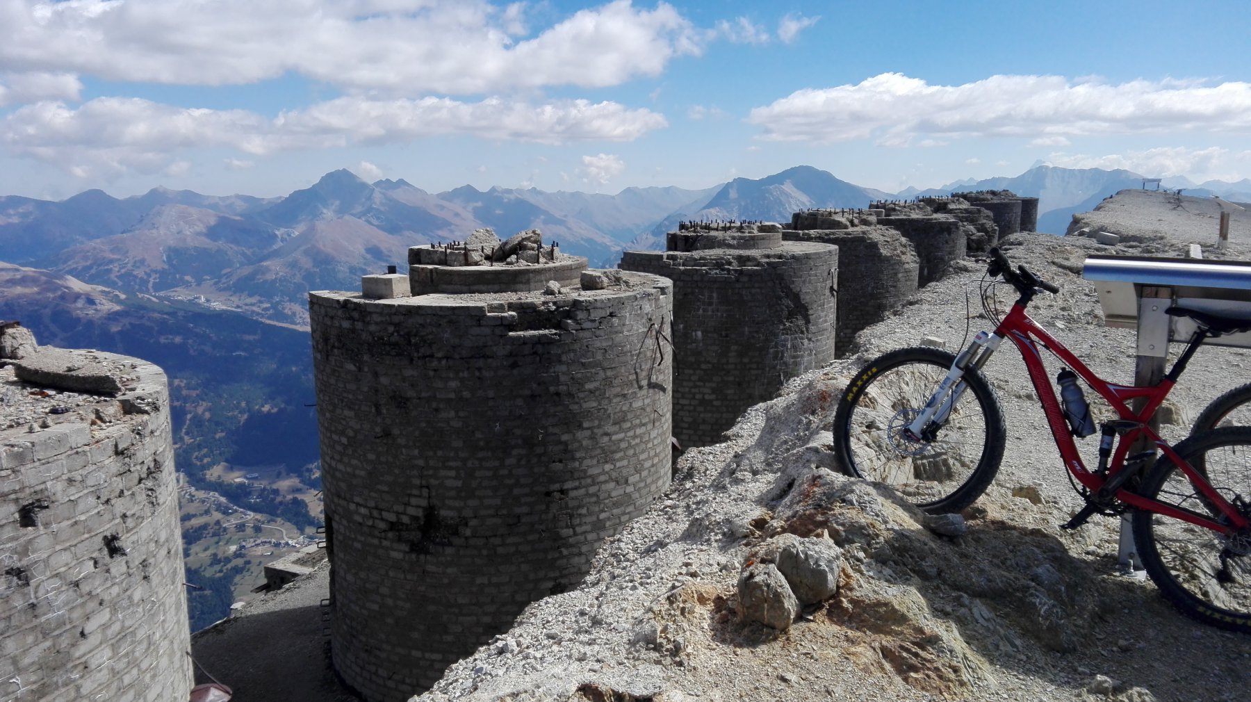
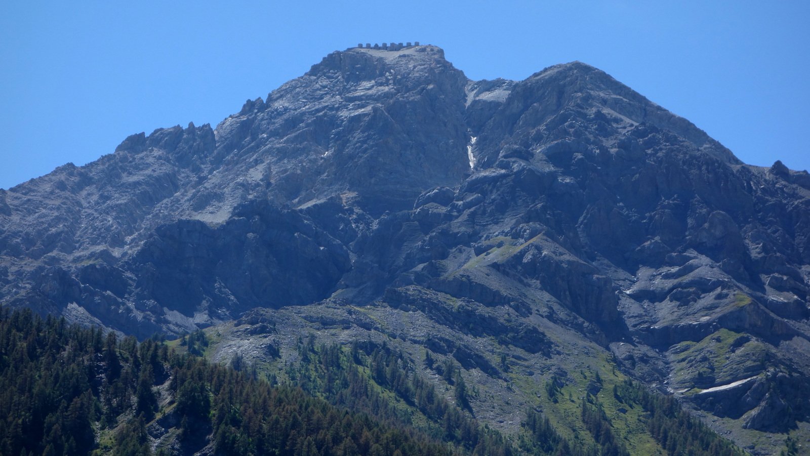
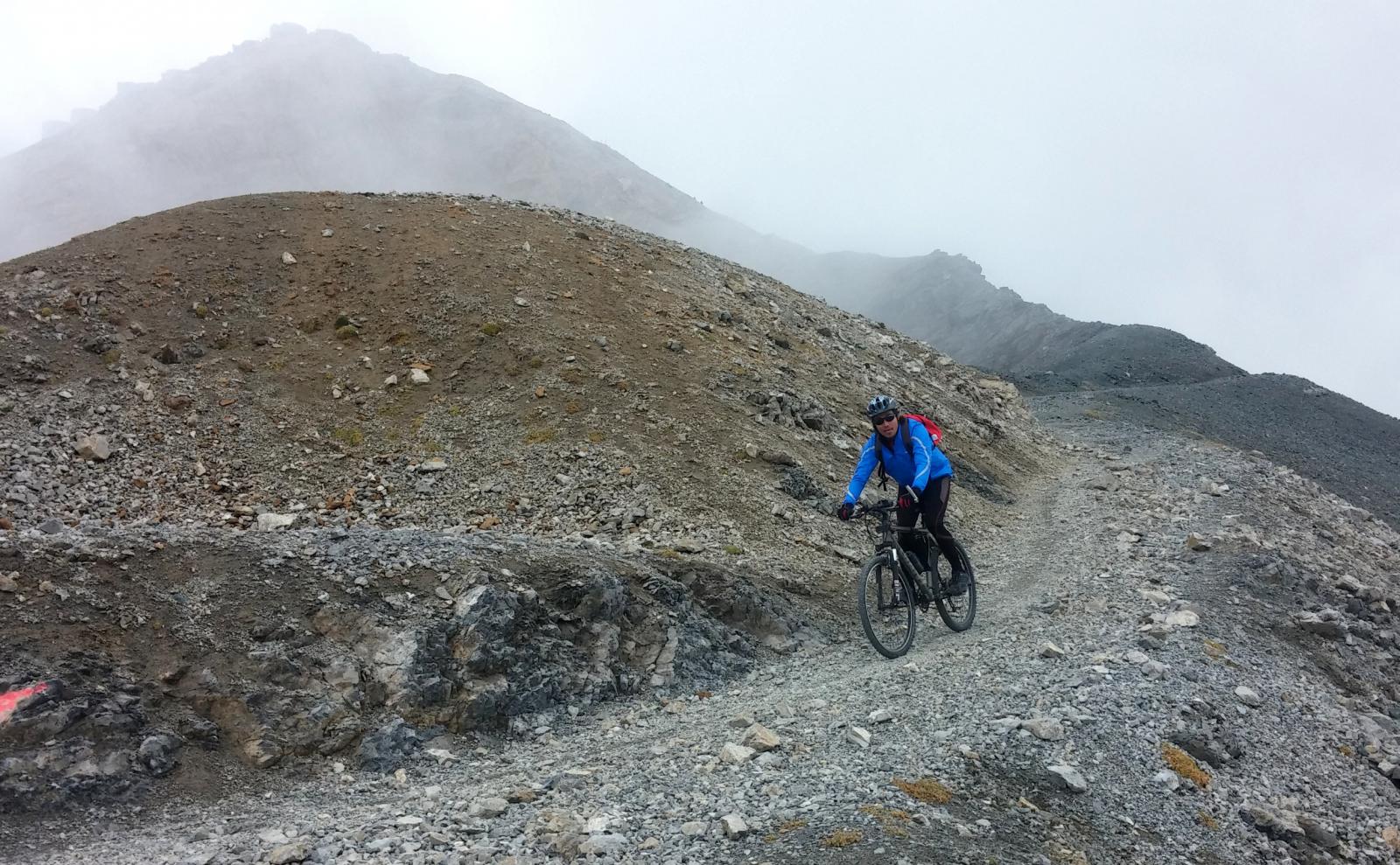
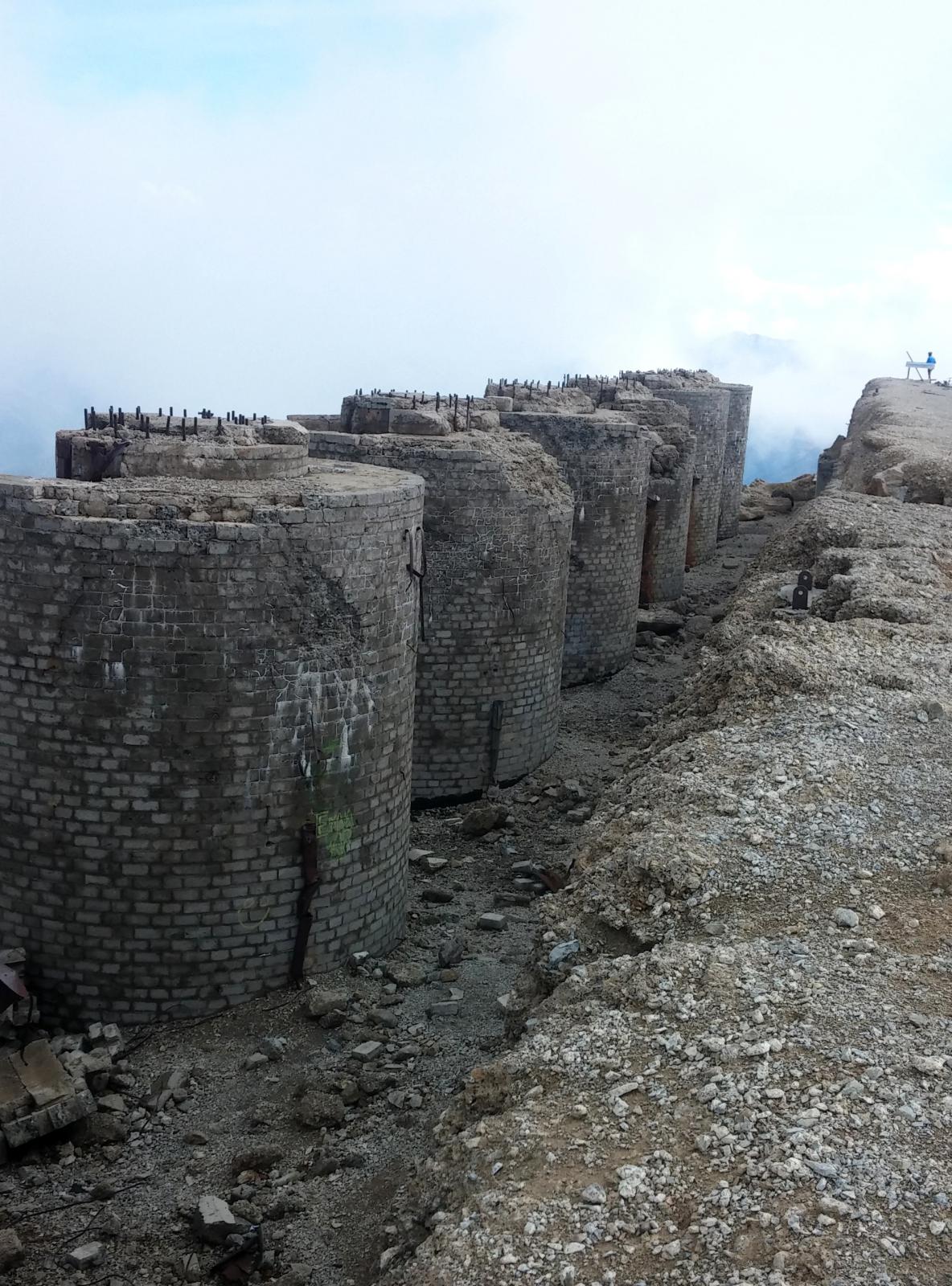
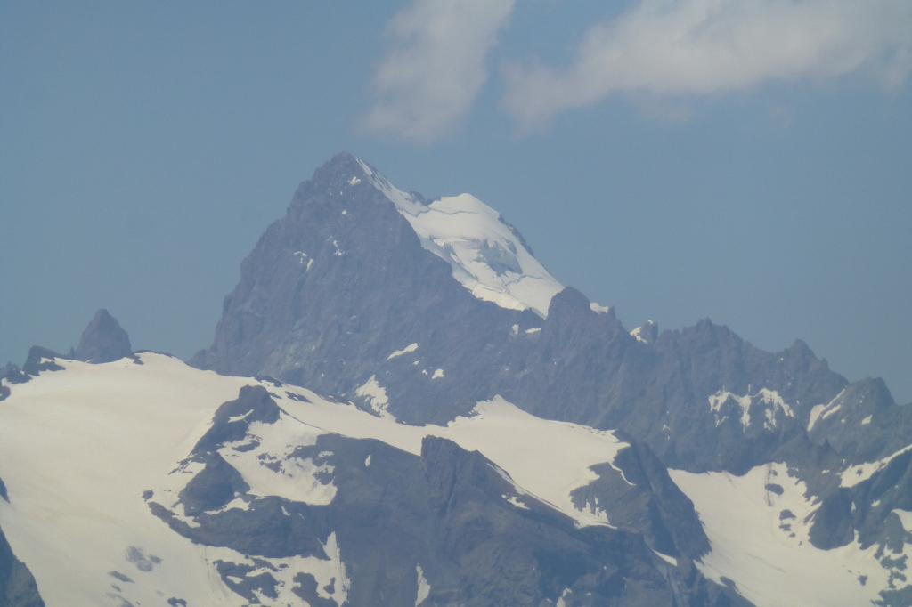
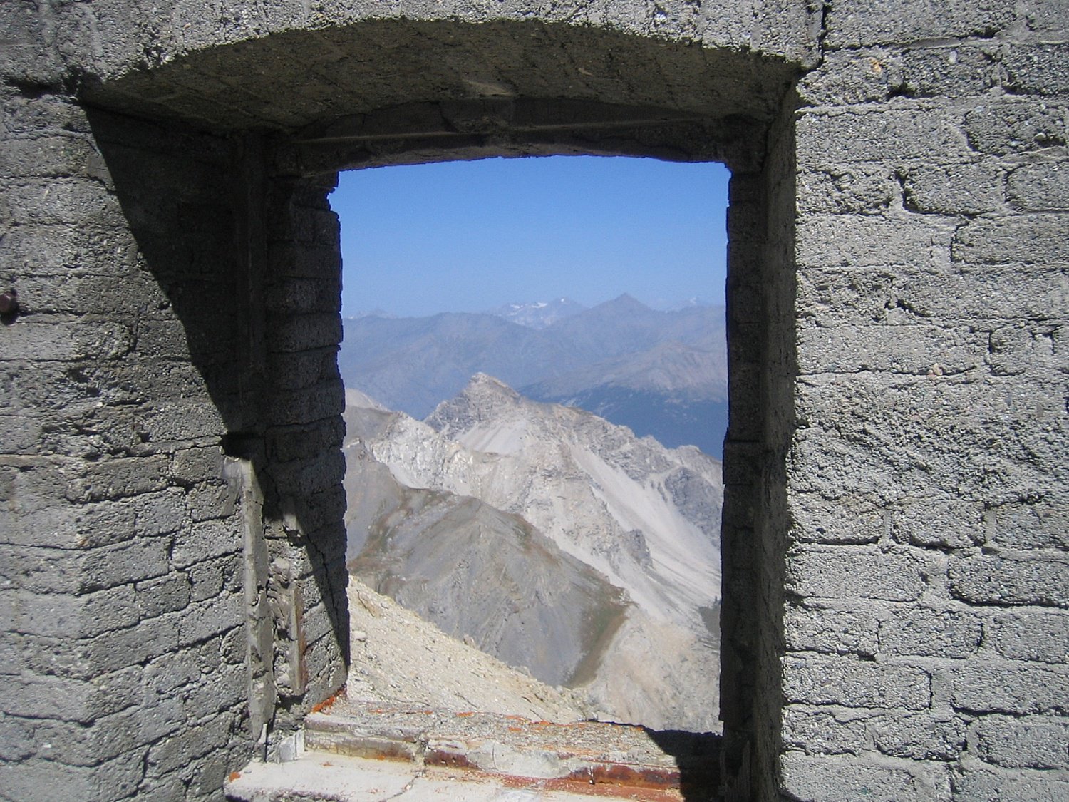
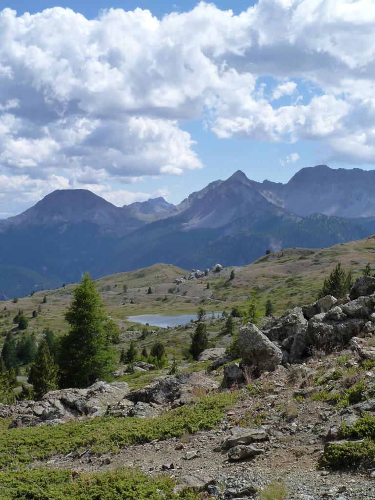
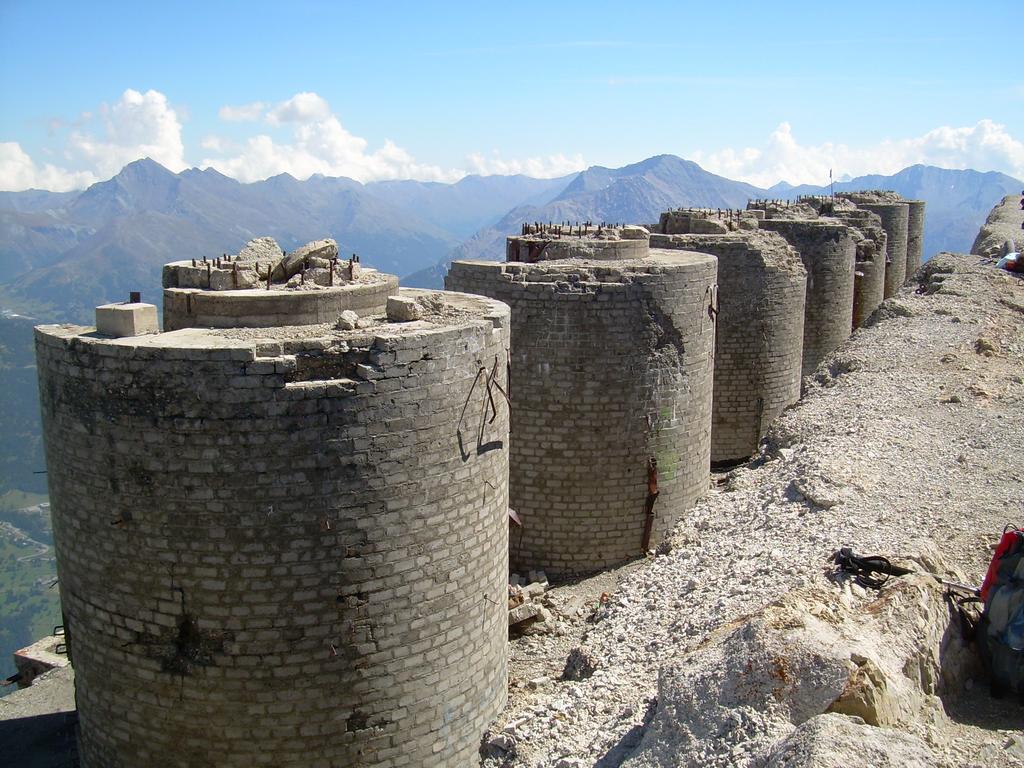
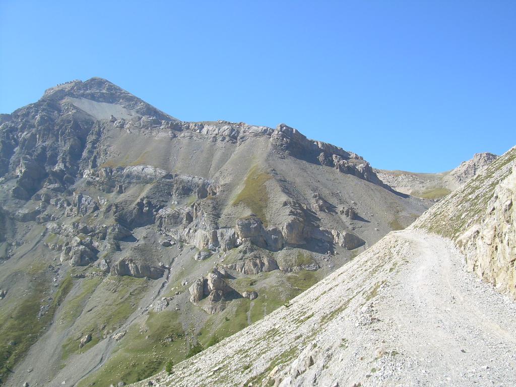
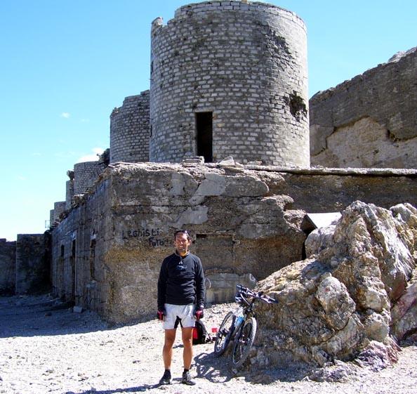
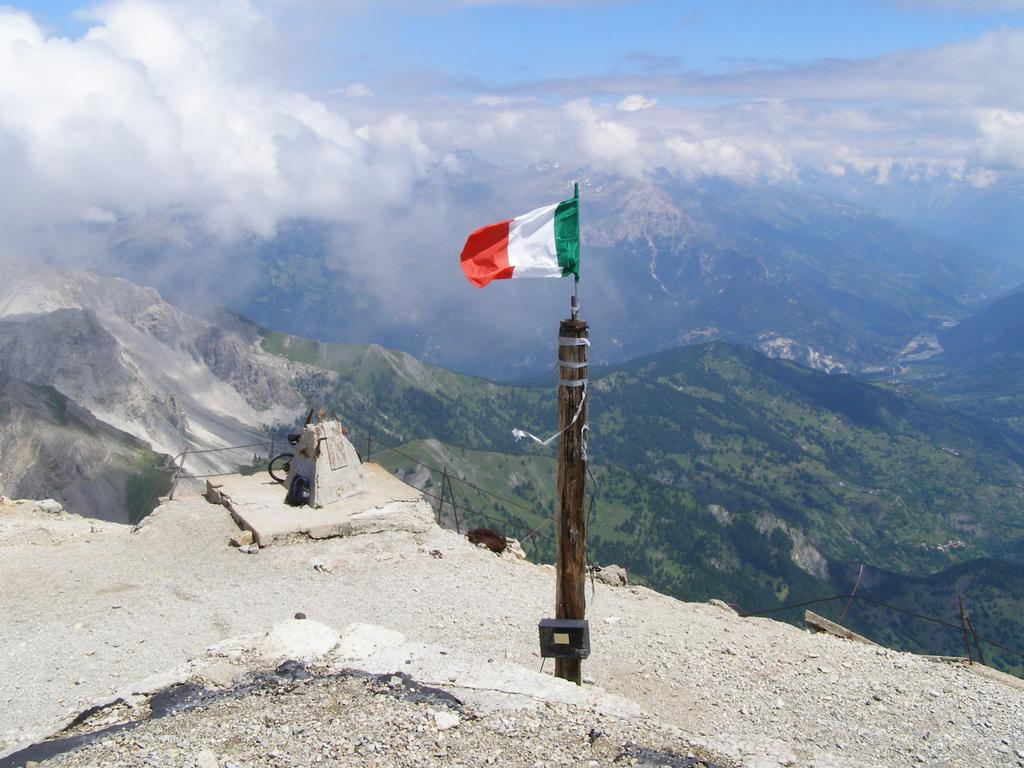
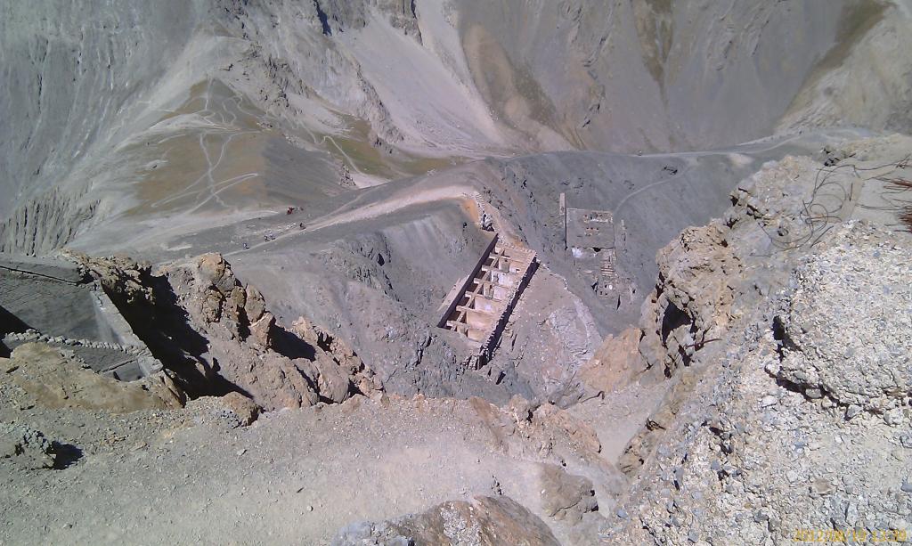
Raggiunge un monte che svetta solitario e maestoso(m.3130) tra tutti gli altri e sulla sua cima sorge lo storico e grandissimo "forte" omonimo, di cui si racconta tutto e il contrario di tutto.
Avvicinamento
E' una salita impegnativa e anche bella pedalabile, salvo nel tratto centrale, dove la militare, franata e sassosissima, ne impedisce la pedalabilità per quasi 1 ora.
Raggiunge un monte che svetta solitario e maestoso(m.3130) tra tutti gli altri e sulla sua cima sorge lo storico e grandissimo "forte" omonimo, di cui si racconta tutto e il contrario di tutto.
ATTENZIONE!!! DAL 2019 LA STRADA MILITARE FENILS-CHABERTON E' FRANATA IN MANIERA IMPORTANTE DOPO IL BIVIO CON IL SENTIERO PER IL LAGO DI DESERTES ED E' VIETATO IL TRANSITO, ANCHE A PIEDI OLTRE QUEL PUNTO FINO AL CONFINE FRANCESE.
Descrizione
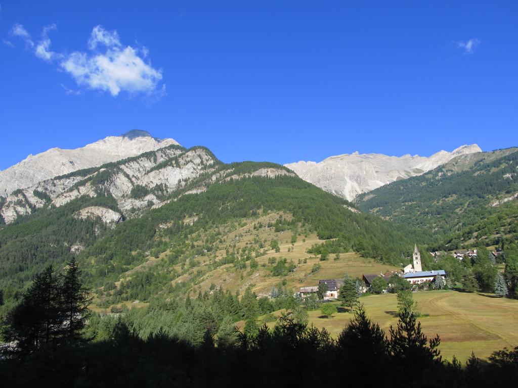
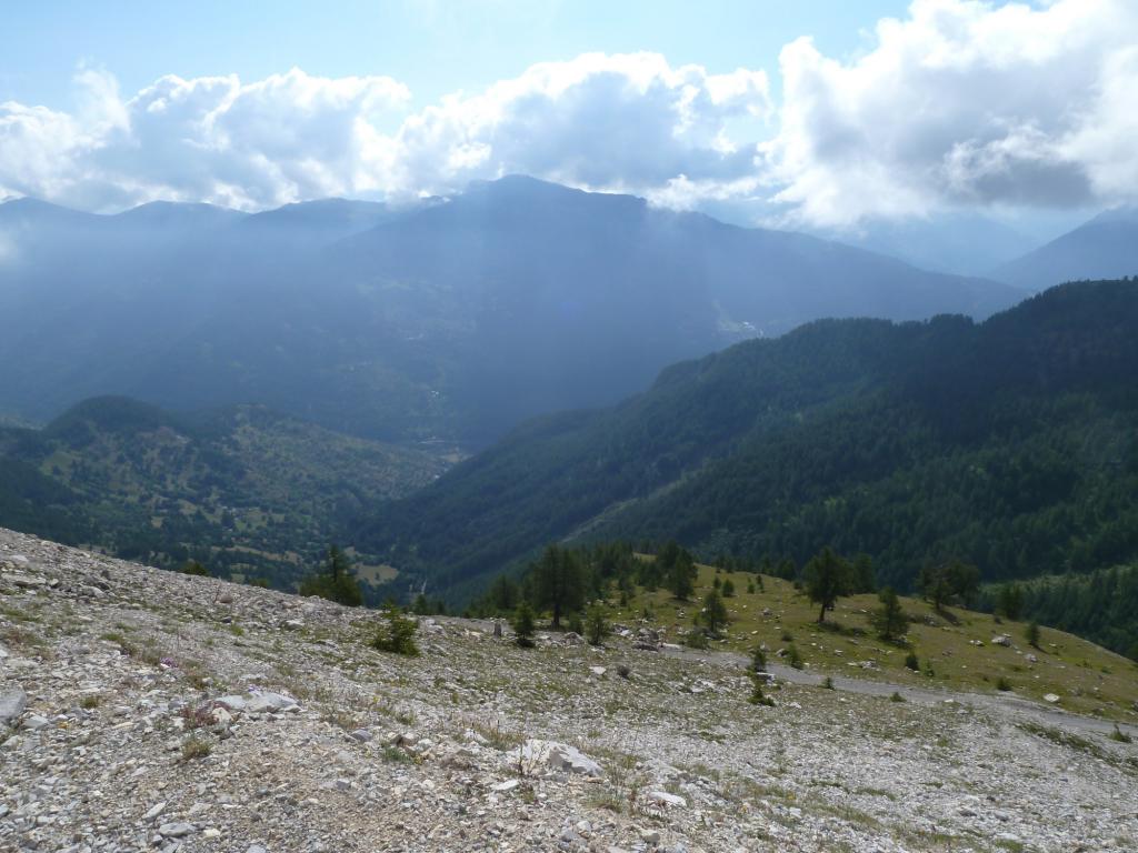
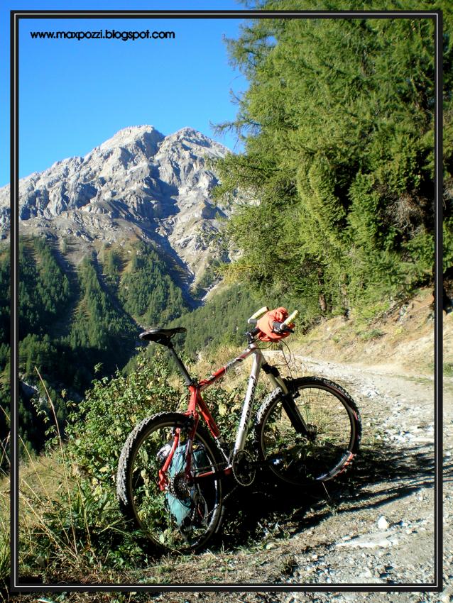
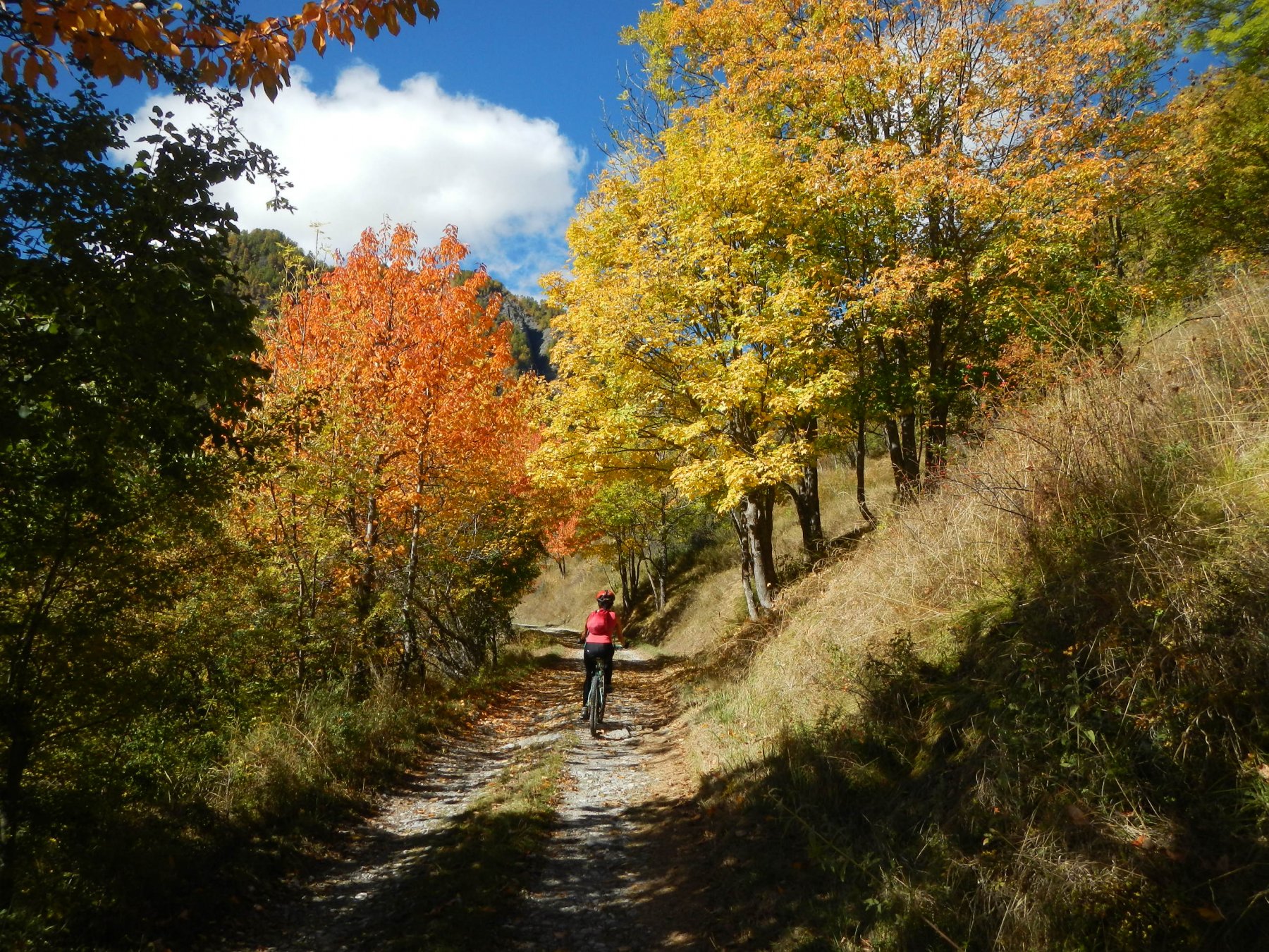
Si parte dal ponte che attraversa la grigia “dora riparia”, a valle di Fenils(1250), si sale per l’unica strada che attraversa il paese e diviene subito sterrata; dopo qualche tornante si raggiunge “Pra Claud”(1589), sbarra che impedisce l’accesso di auto e moto, rifornirsi d’acqua, perché poi d’estate é possibile che non ne troviate più.
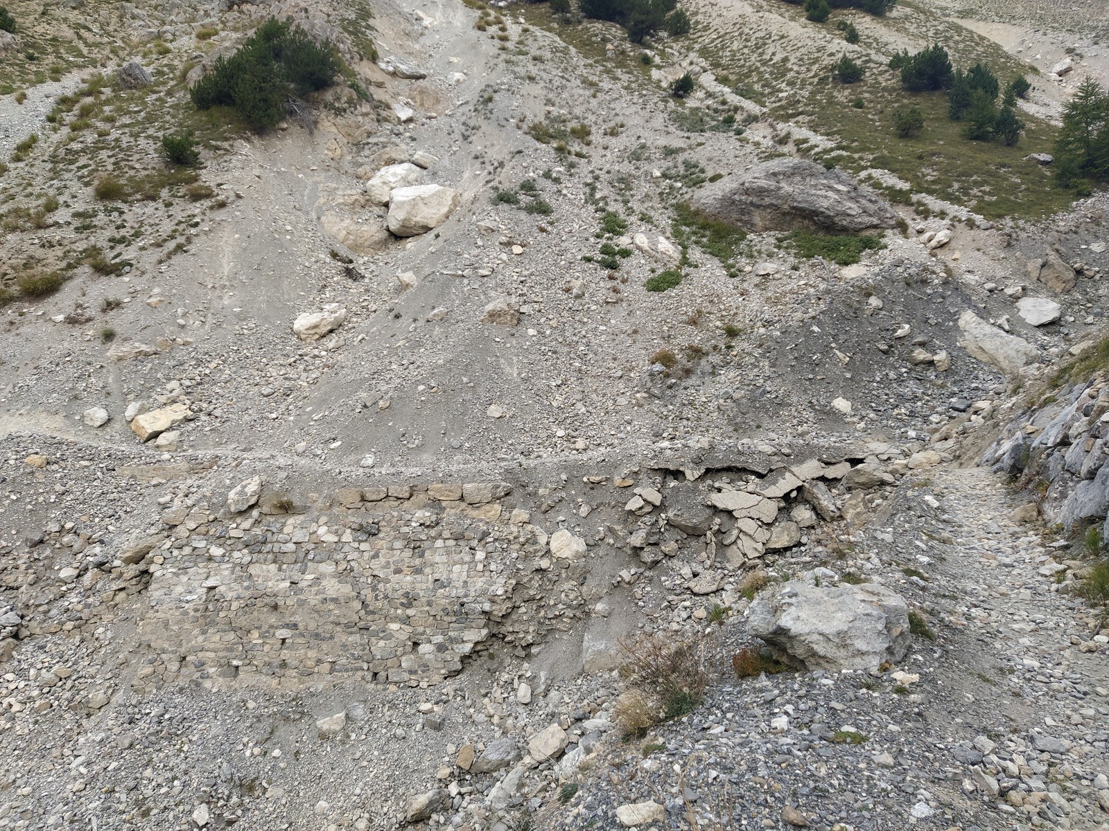
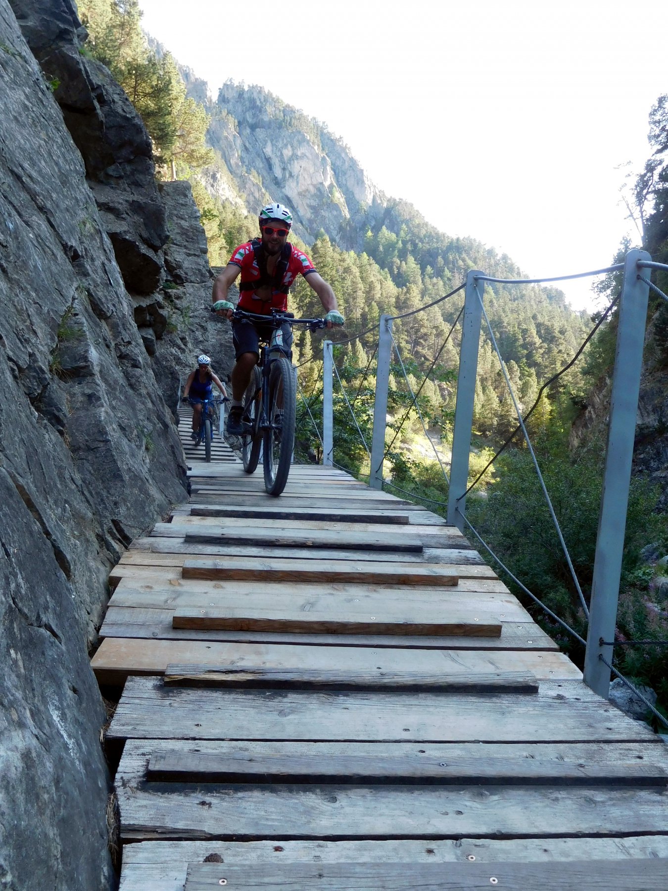
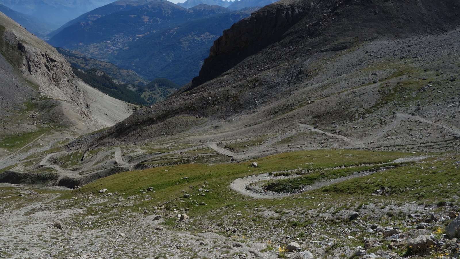
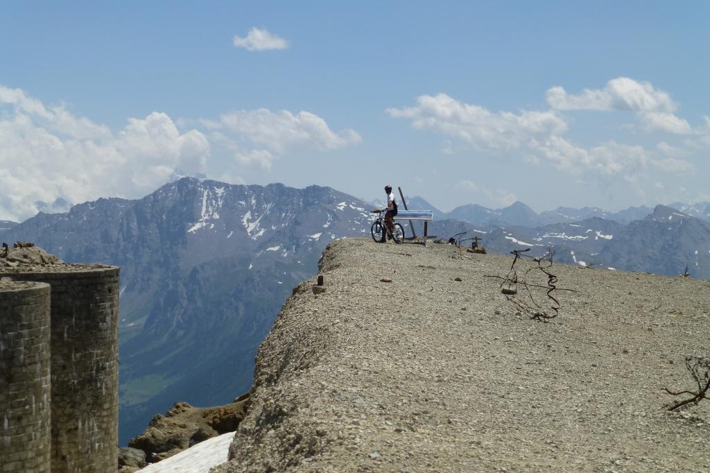
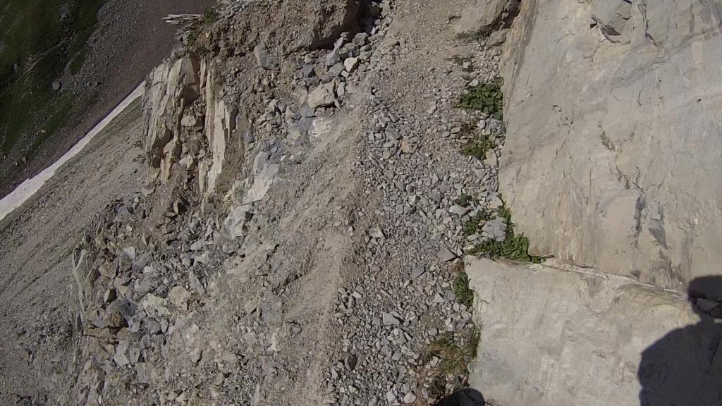
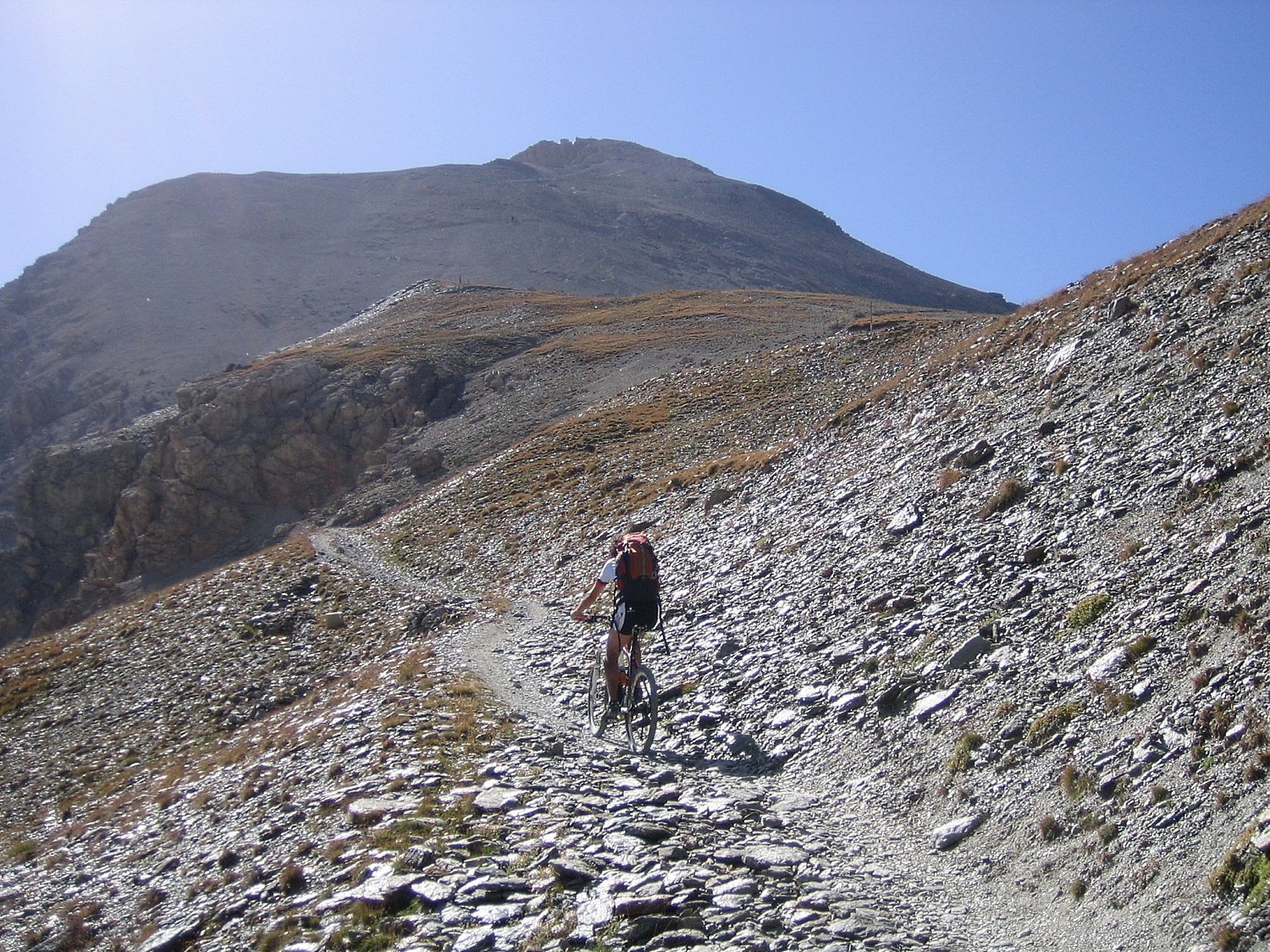
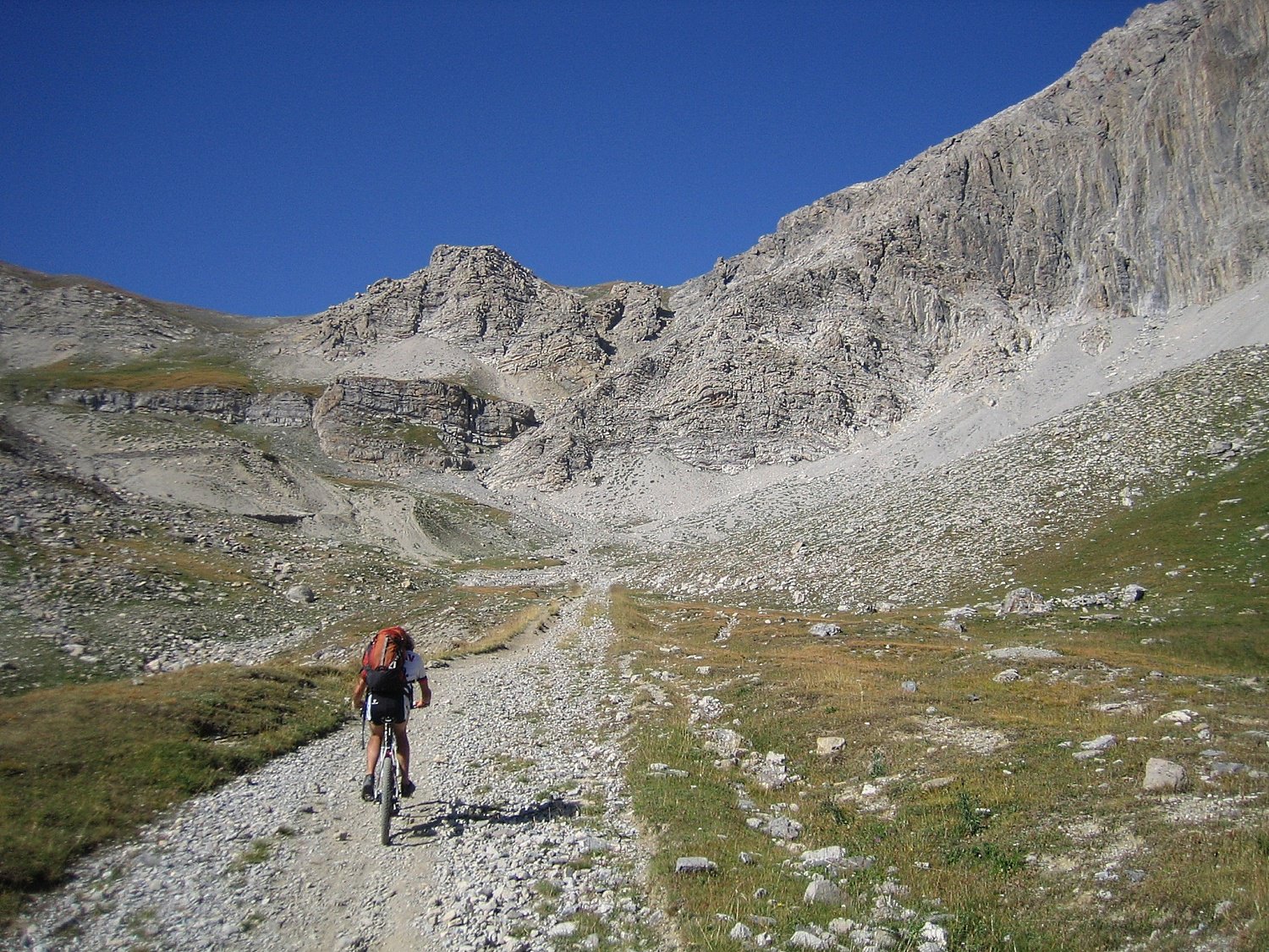
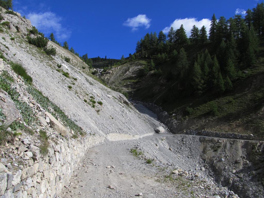
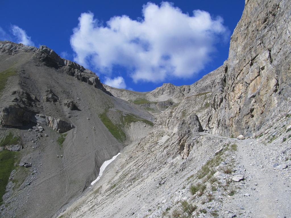
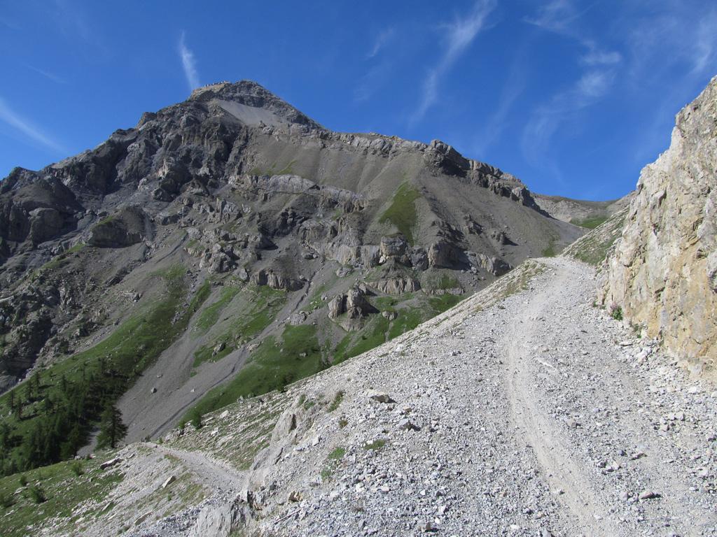
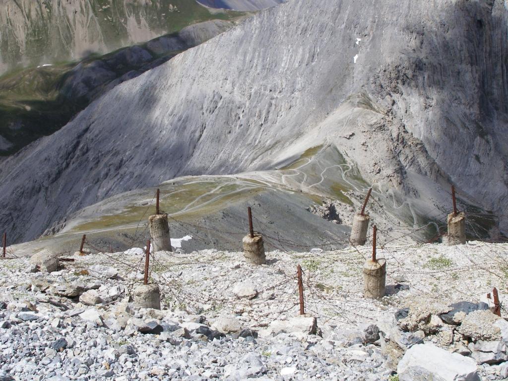
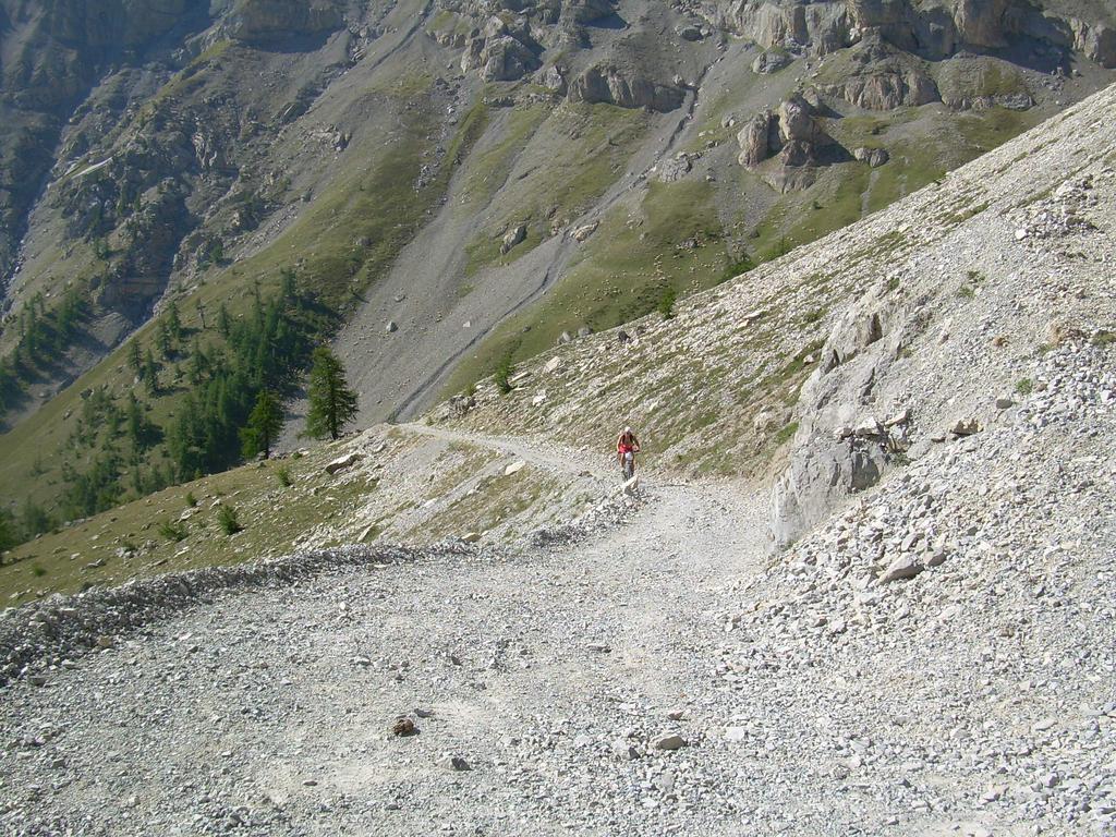
Dopo altri tornanti si attraversa un pendio detritico molto franoso, è possibile trovare questo tratto sconnesso salvo opere di sistemazione della strada. Si pedala ancora tranquillamente sino ad un bivio ,ignorate una sterrata che va a sx in traversone e salite a dx per tornanti che portano al pian dei morti. Questo tratto è ripido e un po’ ghiaioso, ma discretamente pedalabile. Dopo la Rocca Tagliata inevitabilmente si continua a piedi per 45′ raggiungendo il colle di Chaberton (2671).
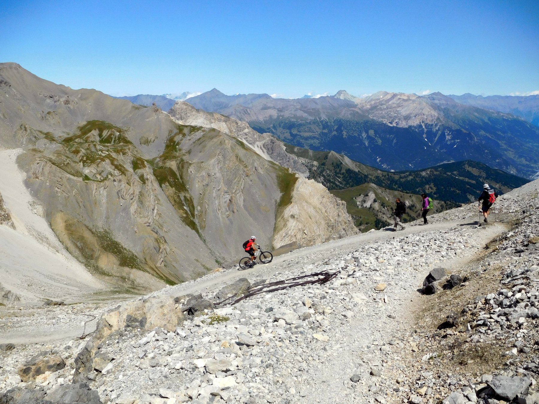
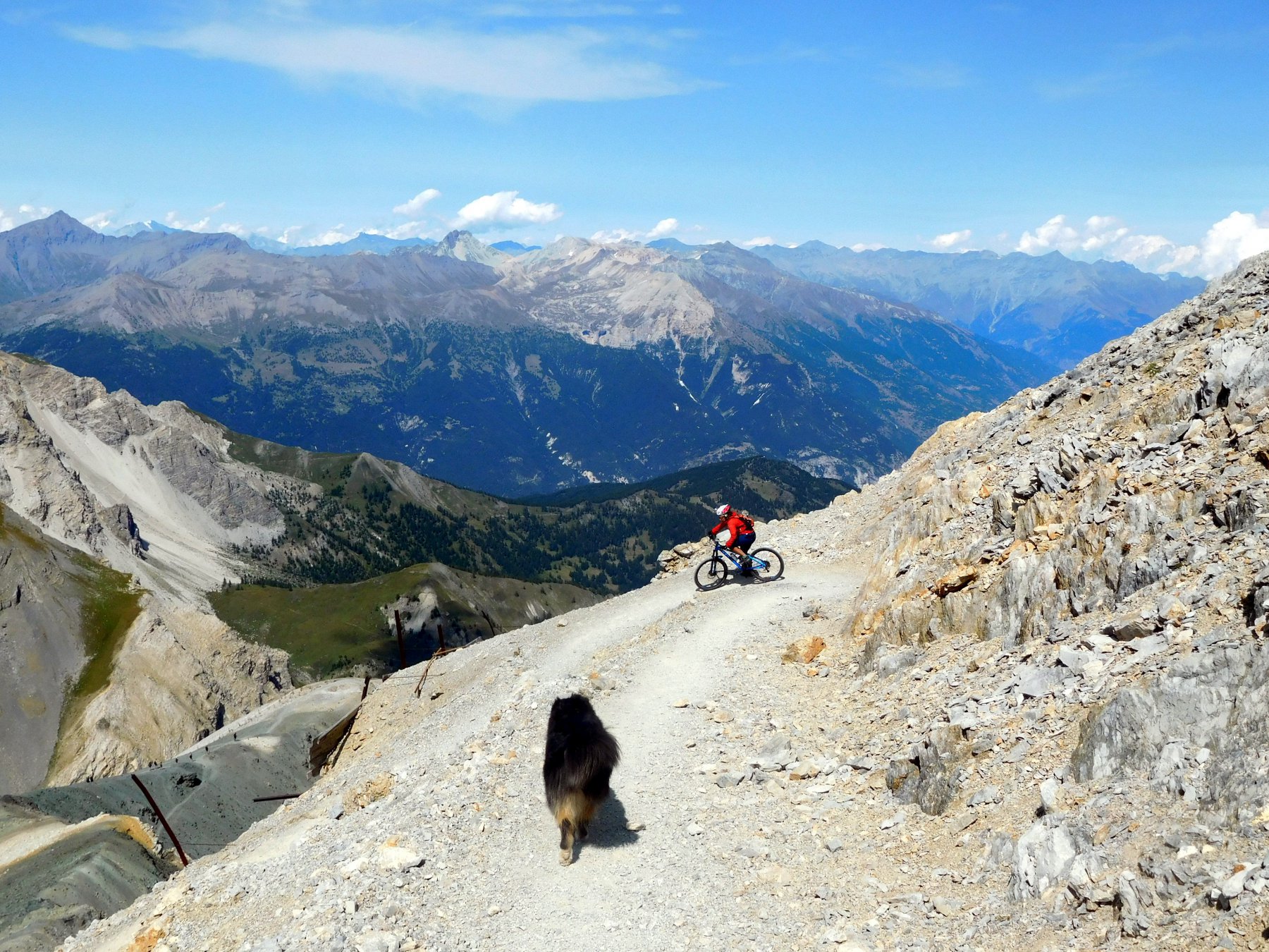
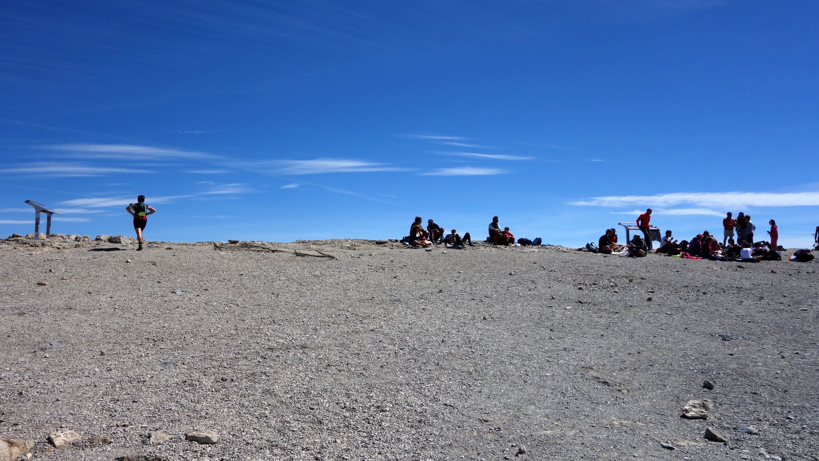
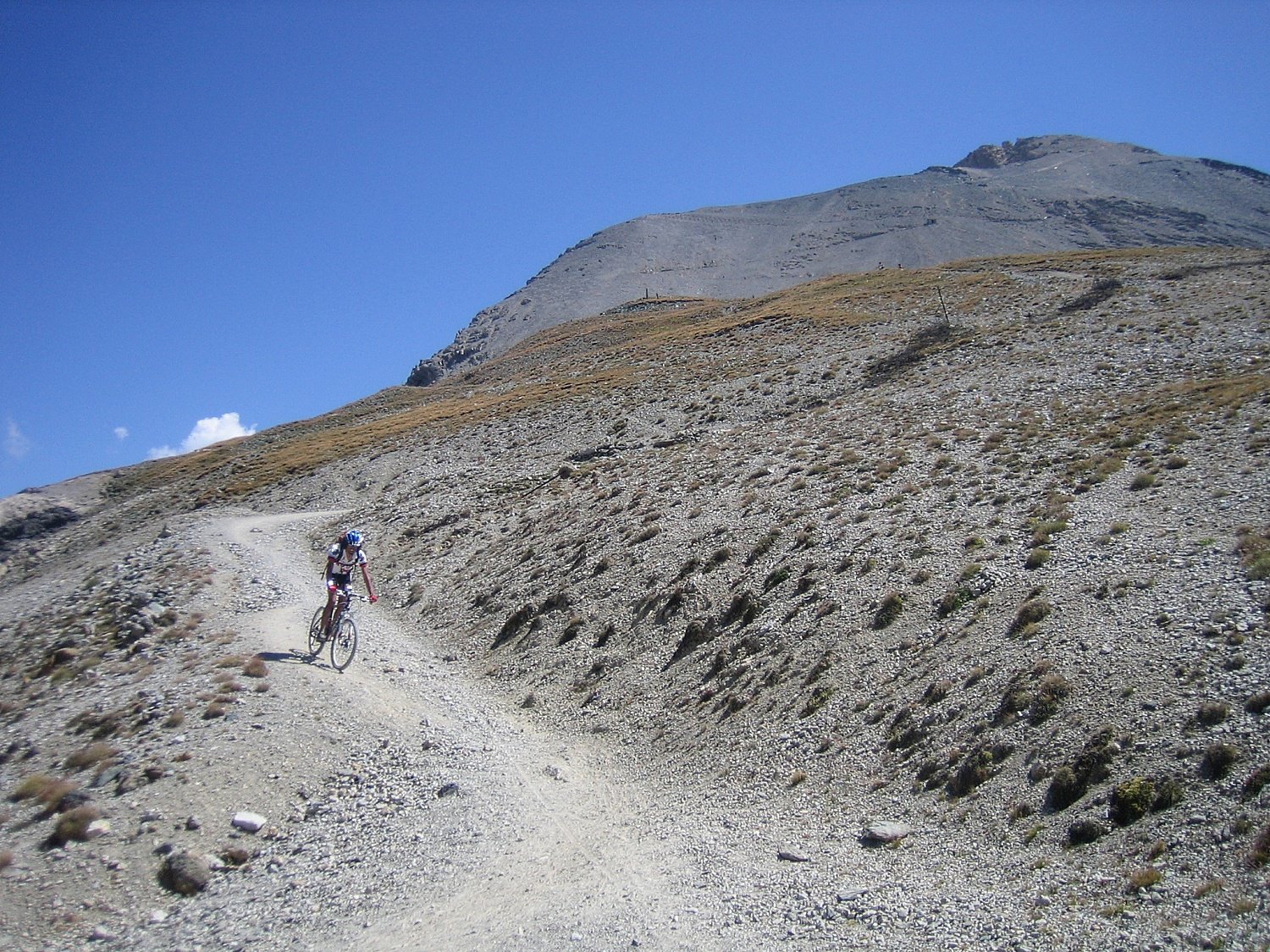
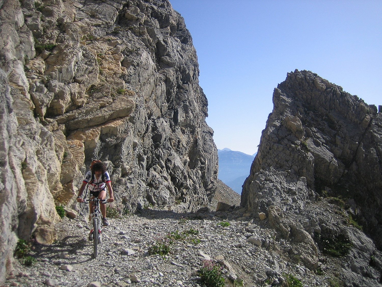
Di lì invece il sentiero che porta al Forte (3130), benché ripidino, presenta di tratti pedalabili, anche se anno dopo anno le pietre invadono sempre di più il sentiero, una volta percorso anche dai fuoristrada. Quindi in base alle proprie capacità e doti di “galleggiamento” si arriva in sella o meno alla spianata sommitale.
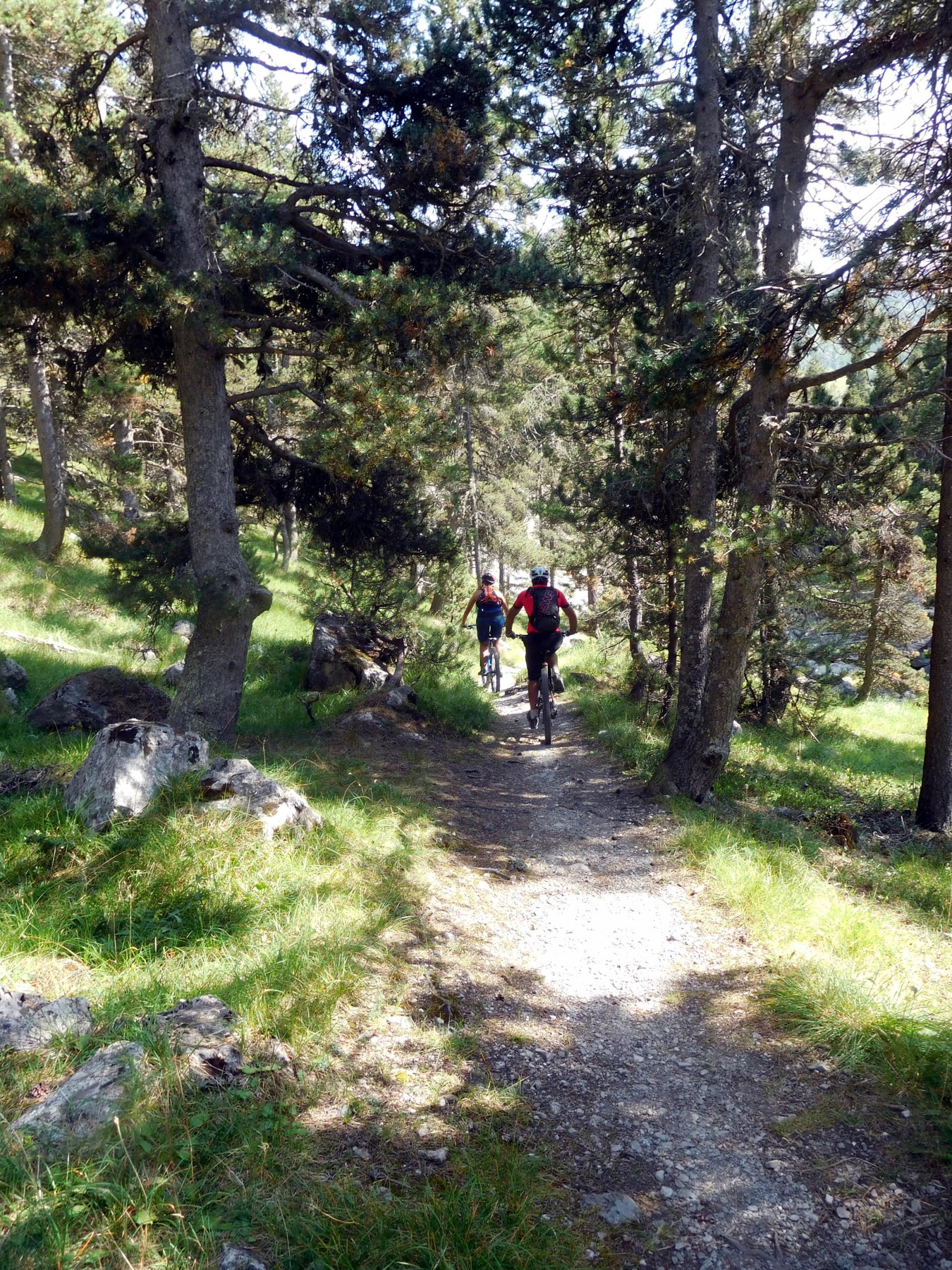
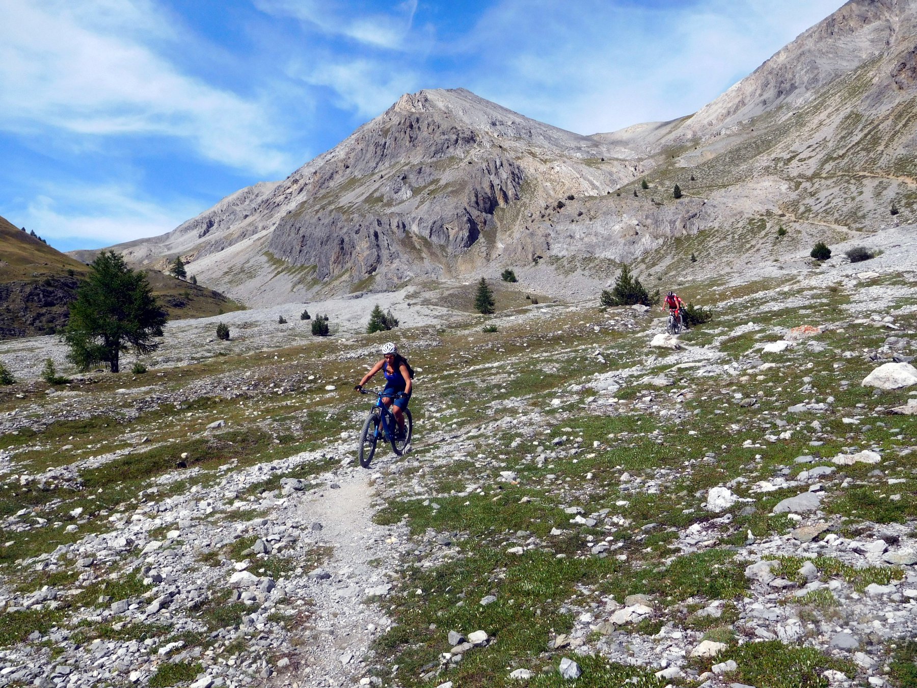
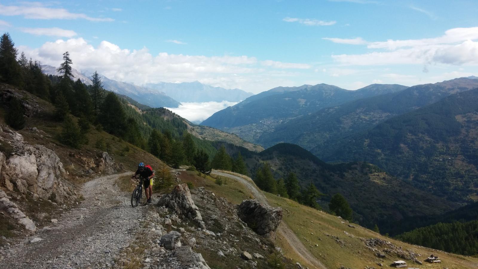
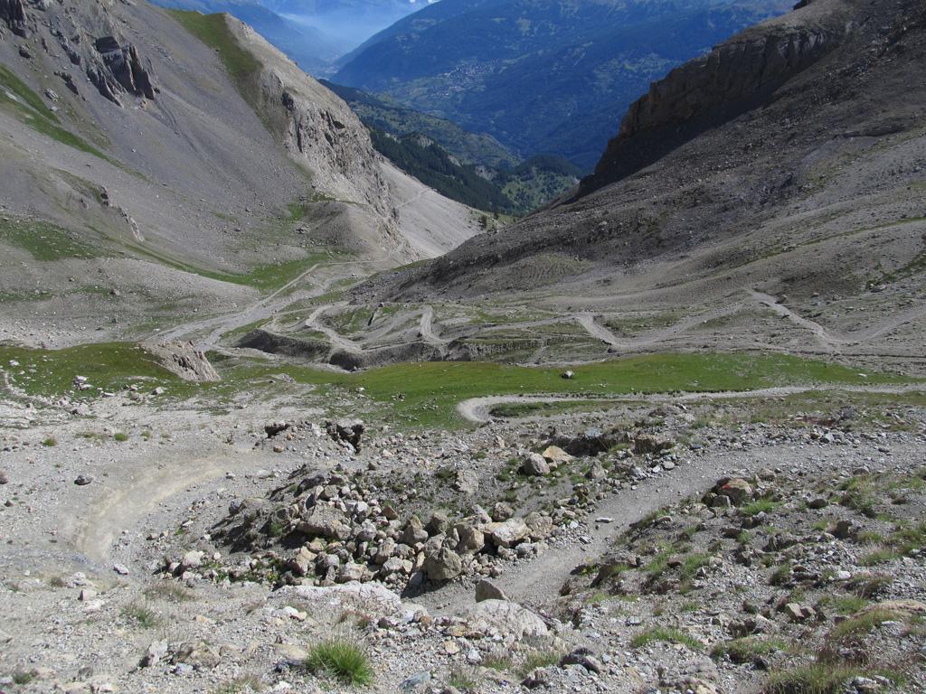
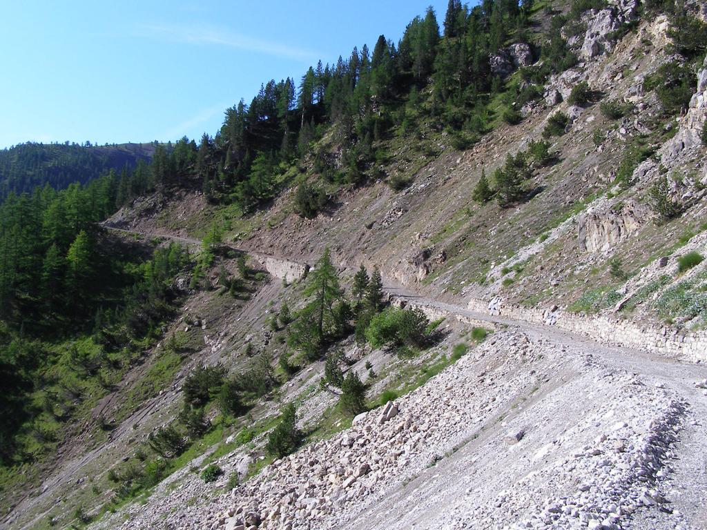
Per la discesa, una volta ritornati al Colle dello Chaberton, anzichè tornare dalla strada dell’andata, si può scendere sul sentiero inizialmente facile, poi un po’ più tecnico e gradinato che porta al Vallon des Baisses, dove si incontra una stradina che raggiunge il Village de Soleil e quindi Monginevro-Claviere. Da qui per strada a Cesana e poi a Fenils, magari percorrendo la pista forestale sul versante idrografico sinistro del torrente Ripa.
- Cartografia:
- Fraternali 1:25.000 n.1 Alta Valle di Susa
Nelle vicinanze Mappa
Itinerari
14/10/2023 TO, Cesana Torinese D+ 386 m MC, BC, S1 Sud-Est
Rosso (Colletto) e Colletto Grigio da Fenils, giro per Desertes
 50m
50m
12/11/2025 TO, Cesana Torinese D+ 751 m BC, BC+, S0 Sud
Gardiol (Punta) da Fenils
 50m
50m
19/08/2019 TO, Cesana Torinese D+ 1274 m BC, TC, S1 Sud-Ovest
Fraiteve (Monte) da Sansicario
2.8Km
20/07/2025 TO, Cesana Torinese D+ 650 m MC, MC, S0 Sud-Est
Sestriere da Sansicario per i sentieri Louis XIV e Gelindo Bordin
 3Km
3Km
06/07/2022 TO, Cesana Torinese D+ 1350 m MC+, MC, S0 Varie
Corbioun (Monte) da Cesana, giro per Thures, Capanna Mautino, Sagnalonga
 3.2Km
3.2Km
28/06/2025 TO, Cesana Torinese D+ 900 m MC, MC, S0 Sud-Est
Bercia (Colle) da Cesana, giro per Sagnalonga, Lago Nero, Bousson
 3.2Km
3.2Km
18/08/2025 TO, Cesana Torinese D+ 1200 m BC, BC, S1 Tutte
Gignoux (Lago) o dei Sette Colori da Cesana, giro per Col Chabaud, Fort Gondran, Monginevro, Sagnalonga
 3.2Km
3.2Km
06/07/2025 TO, Cesana Torinese D+ 1200 m BC, MC+, S2 Varie
Gignoux (Lago) o dei Sette Colori da Cesana, giro per Sangalonga, Col Saurel, Lago Nero, Rhuilles
 3.2Km
3.2Km
05/07/2026 TO, Cesana Torinese D+ 1000 m MC+, BC, S1 Tutte
Bosco (Cima del) da Bousson, giro per Thures
 6.3Km
6.3Km
01/07/2017 TO, Cesana Torinese D+ 600 m BC, TC, S0 Varie
Nero (Lago) da Bousson, giro per Chabaud e Rhuilles
 6.3Km
6.3Km
Servizi
3.1Km
3.2Km
L’Ibarus Rifugio
Cesana Torinese
3.2Km
Piergiorgio Frassati B&B
Cesana Torinese
3.2Km
Casa Cesana Bar
Cesana Torinese
4.6Km
La Chardouse Rifugio
Oulx
5.6Km
La Moretta Ristorante
Oulx
6Km
Centro Ristorante
Cesana Torinese
6.3Km
L’Eitabl Ristorante
Oulx
7.5Km
La Fontana del Thures Rifugio
Cesana Torinese
7.7Km