8.4Km
8.4Km
Note
 50m
50m
50m
50m
50m
50m
50m
50m
50m
50m
50m
50m
50m
50m
50m
50m
50m
50m
50m
50m
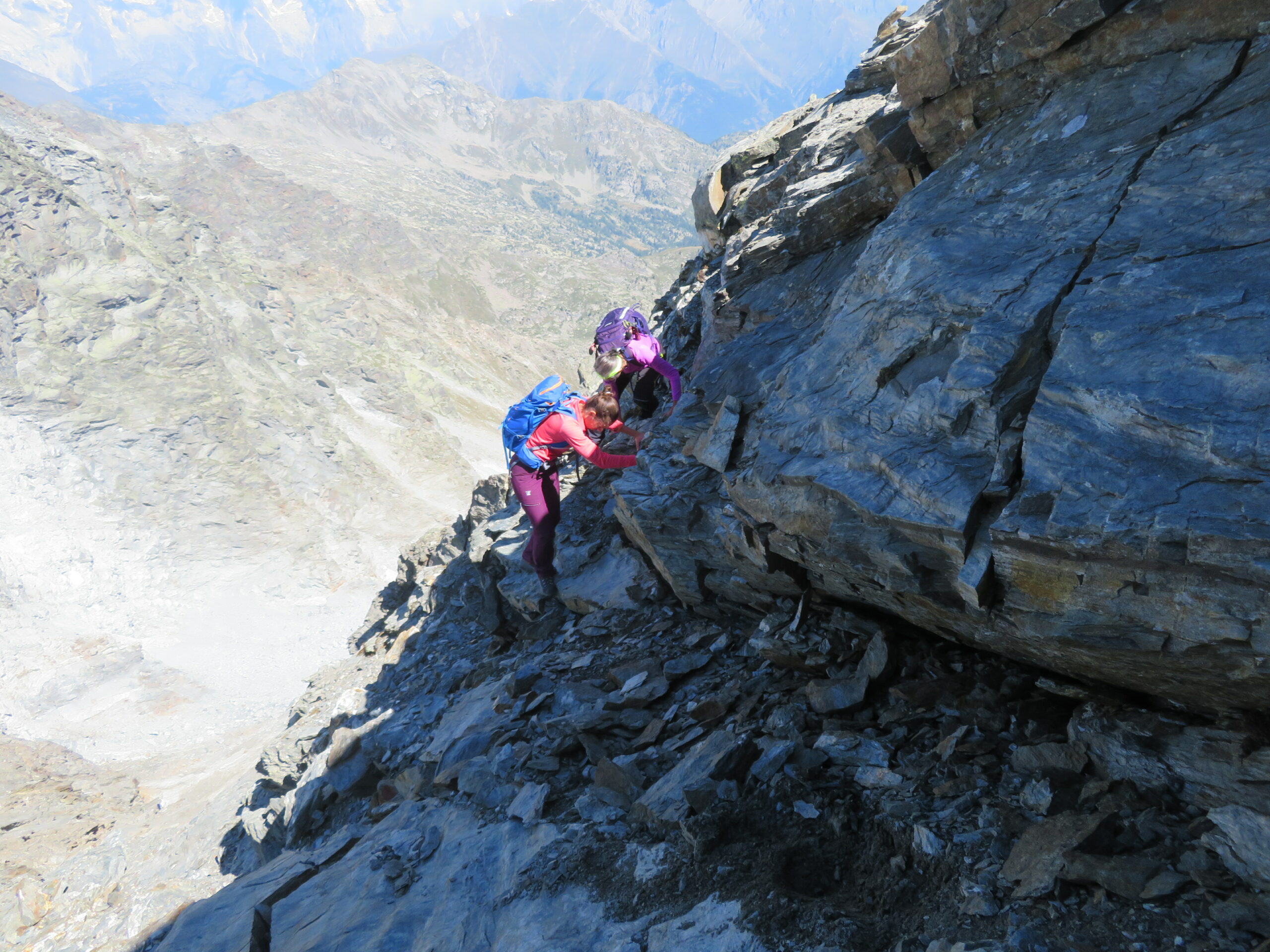
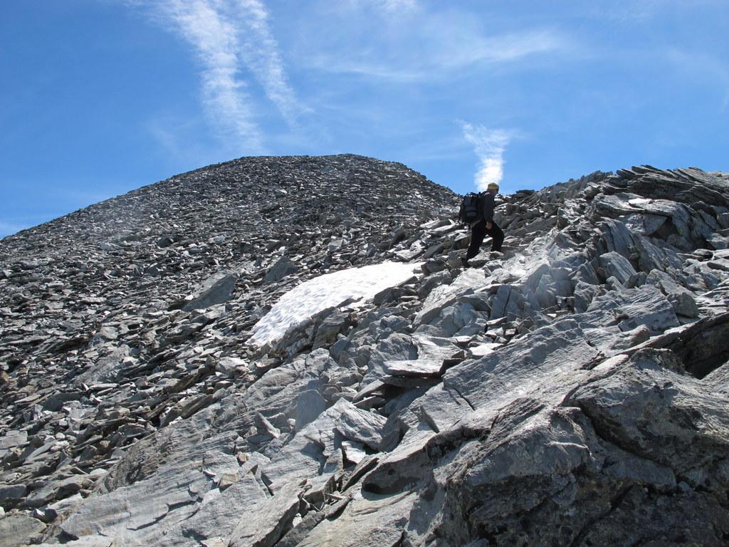
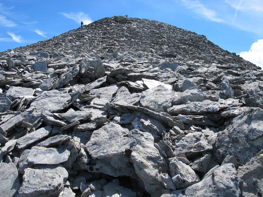
Il percorso è veramente molto lungo. Sono più di 22 km andata e ritorno. Fattibile in giornata oppure in due giorni pernottando al Rif. Deffeyes. Cresta caratterizzata da roccia scadente da percorrere con cautela. In caso di neve, ghaiccio o verglass le difficoltà aumentano e sono indispensabili piccozza e ramponi (con neve la cresta ha pendenze anche superiori ai 40°). Abbinabile con la vicina Becca Bianca.
Avvicinamento
autostrada To/Courmayeur, uscita Morgex, Pre San Didier, bivio La Thuile, La Juox. Penultimo parcheggio sulla destra a fine strada, l'ultimo è riservato ai clienti del bar cascate
Descrizione
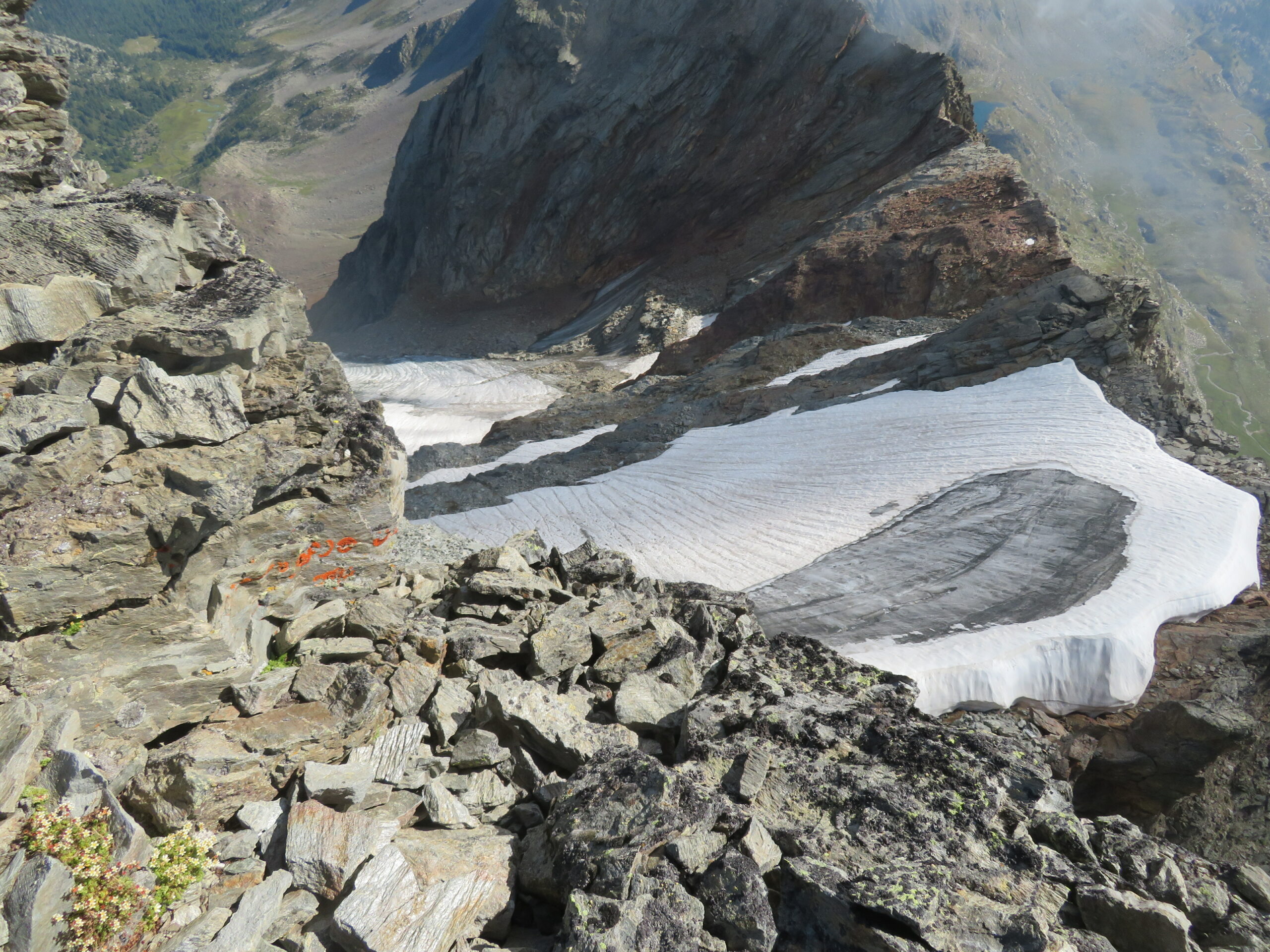
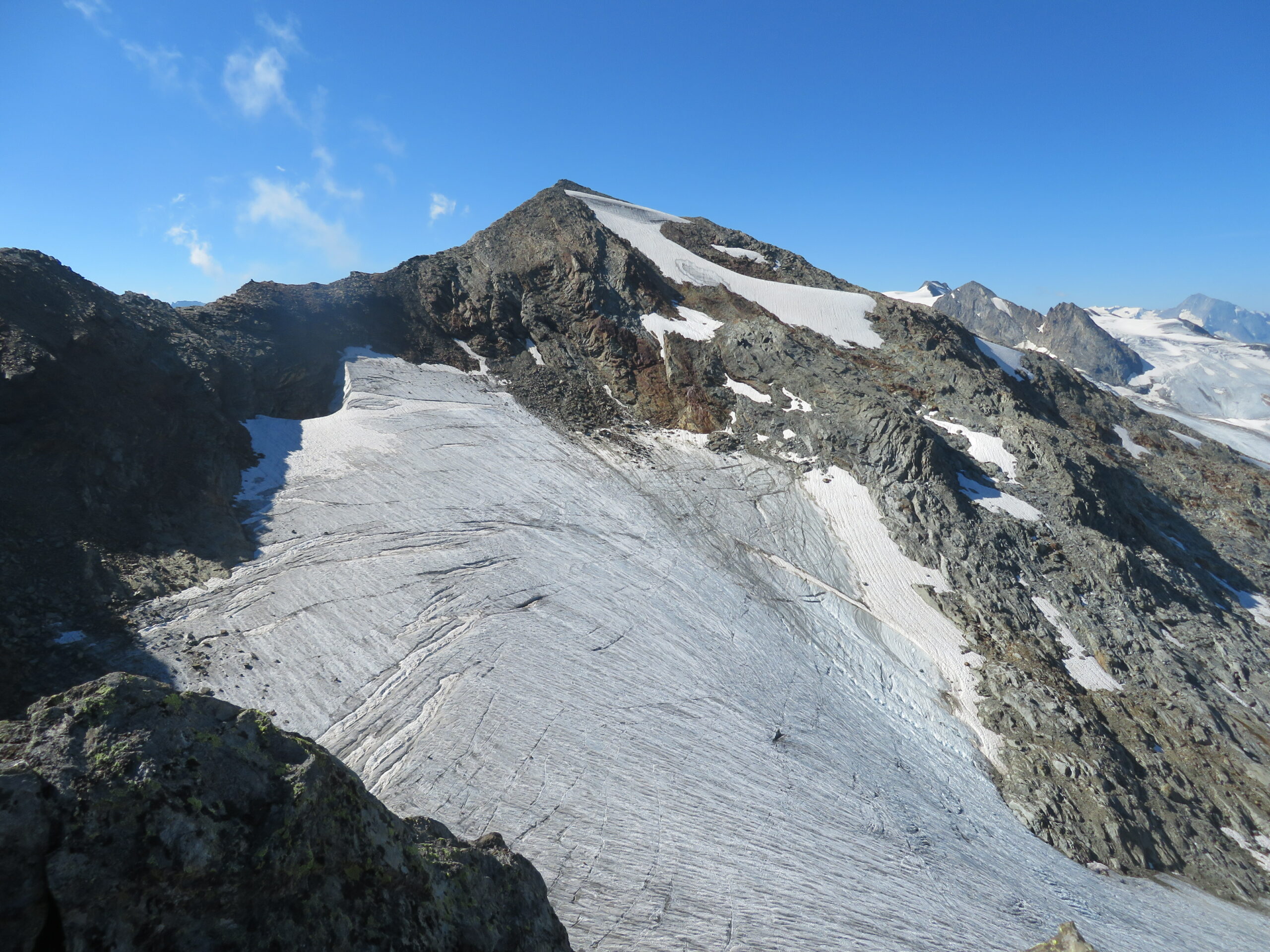
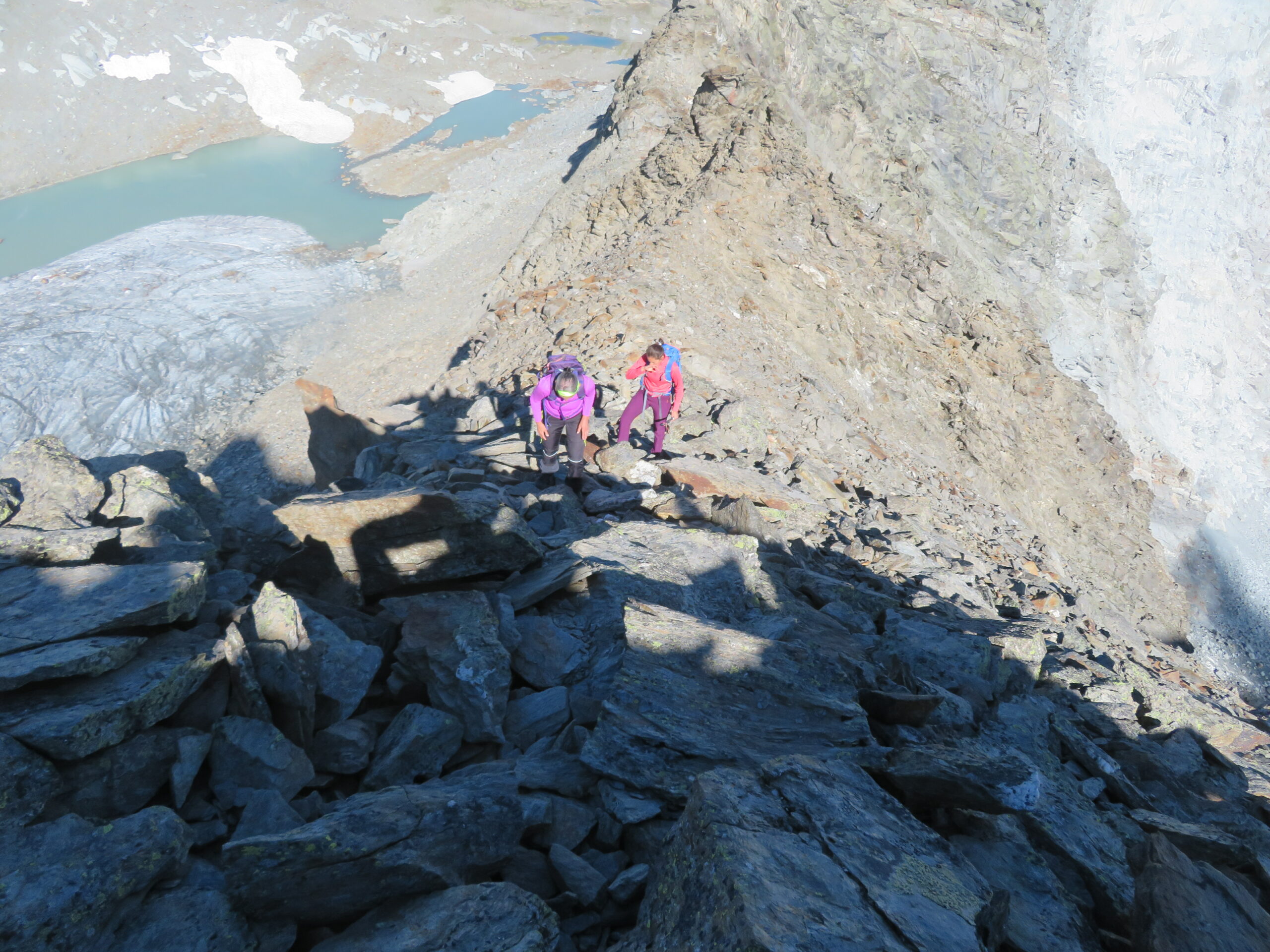
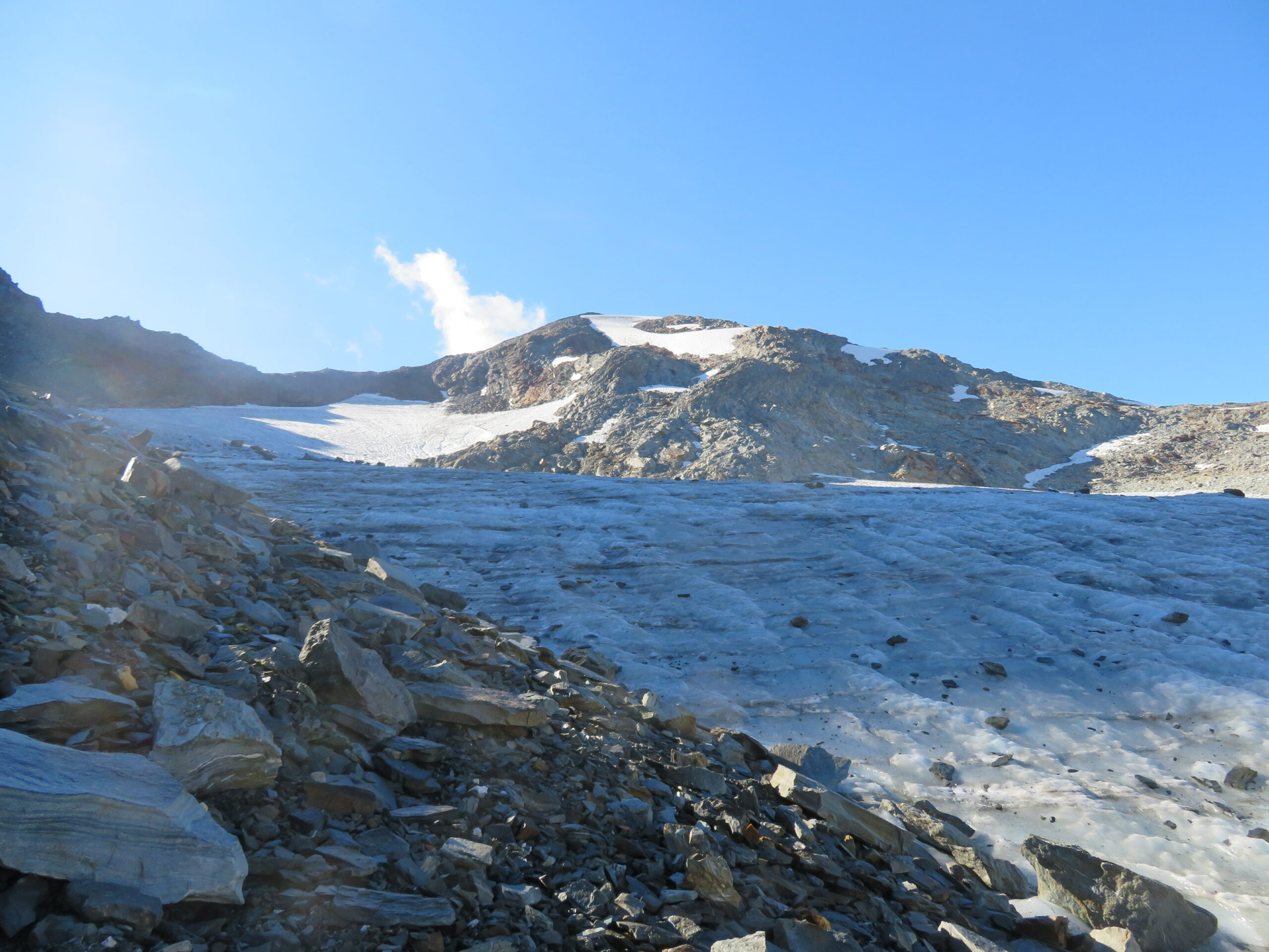
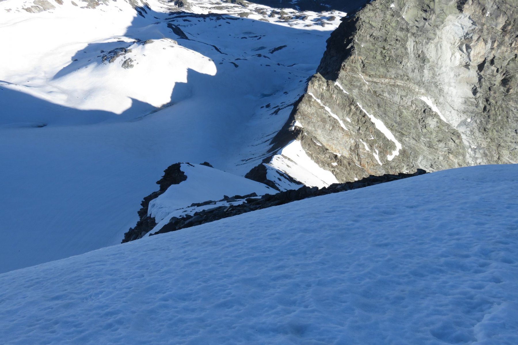
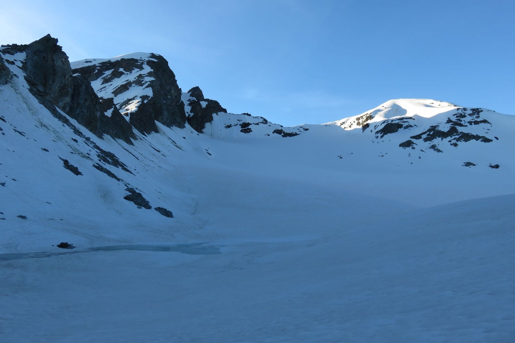
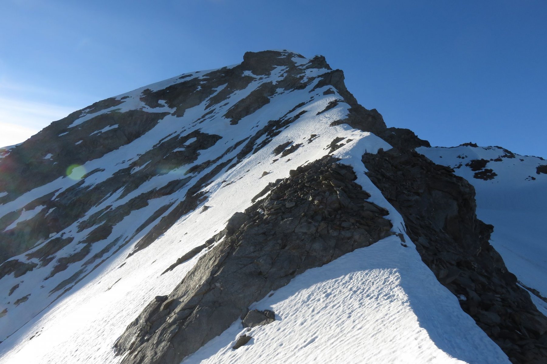
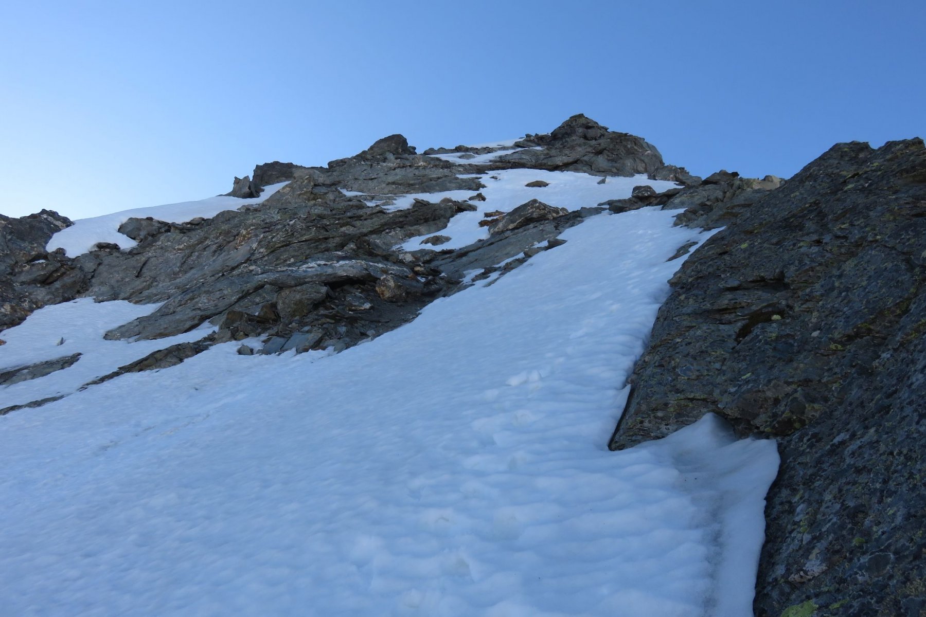
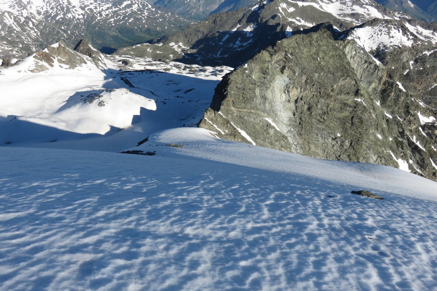
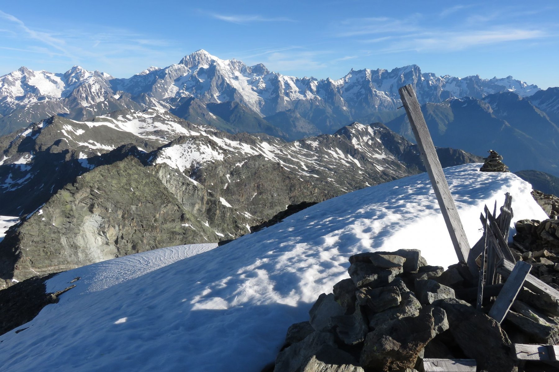
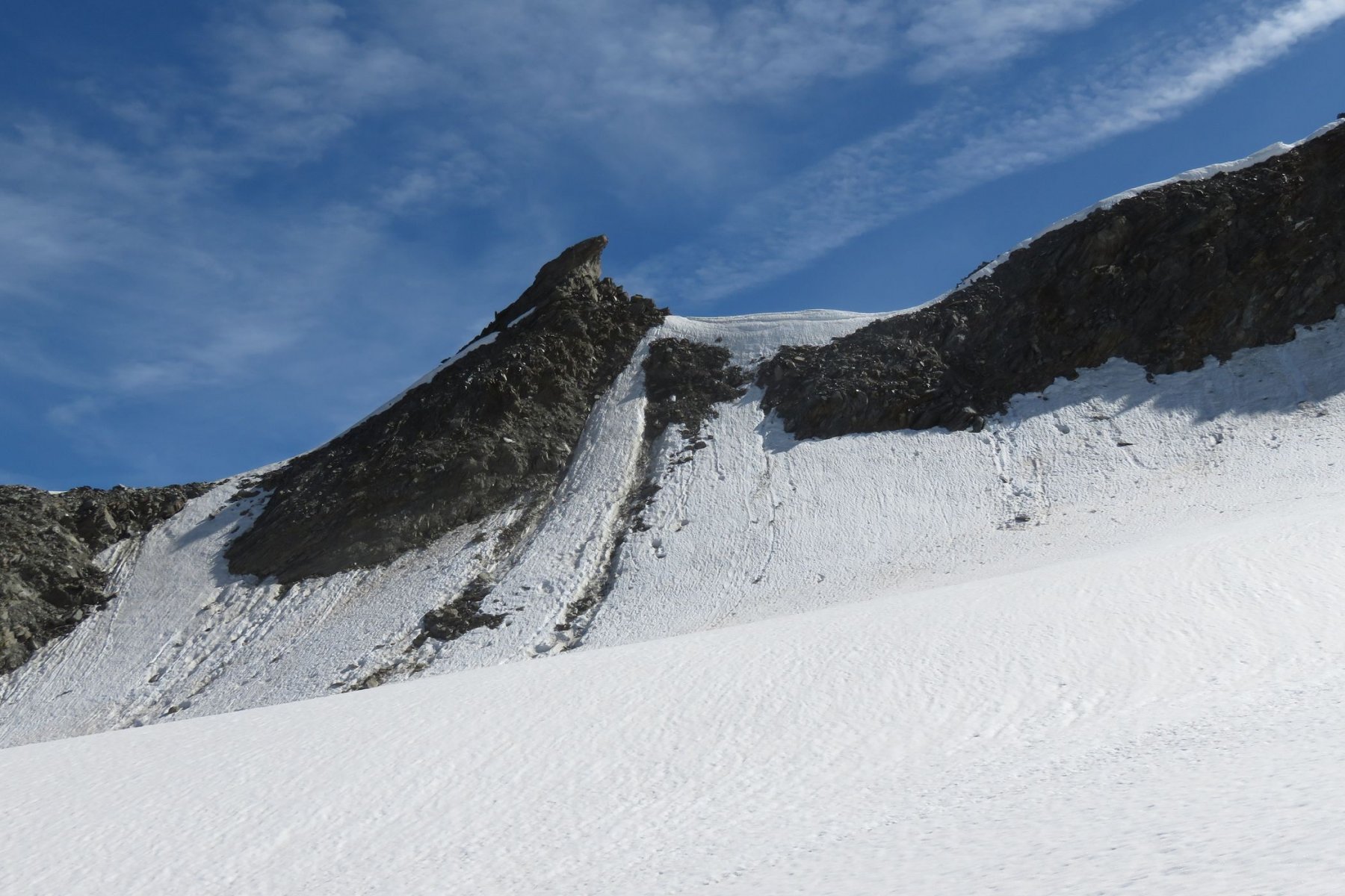
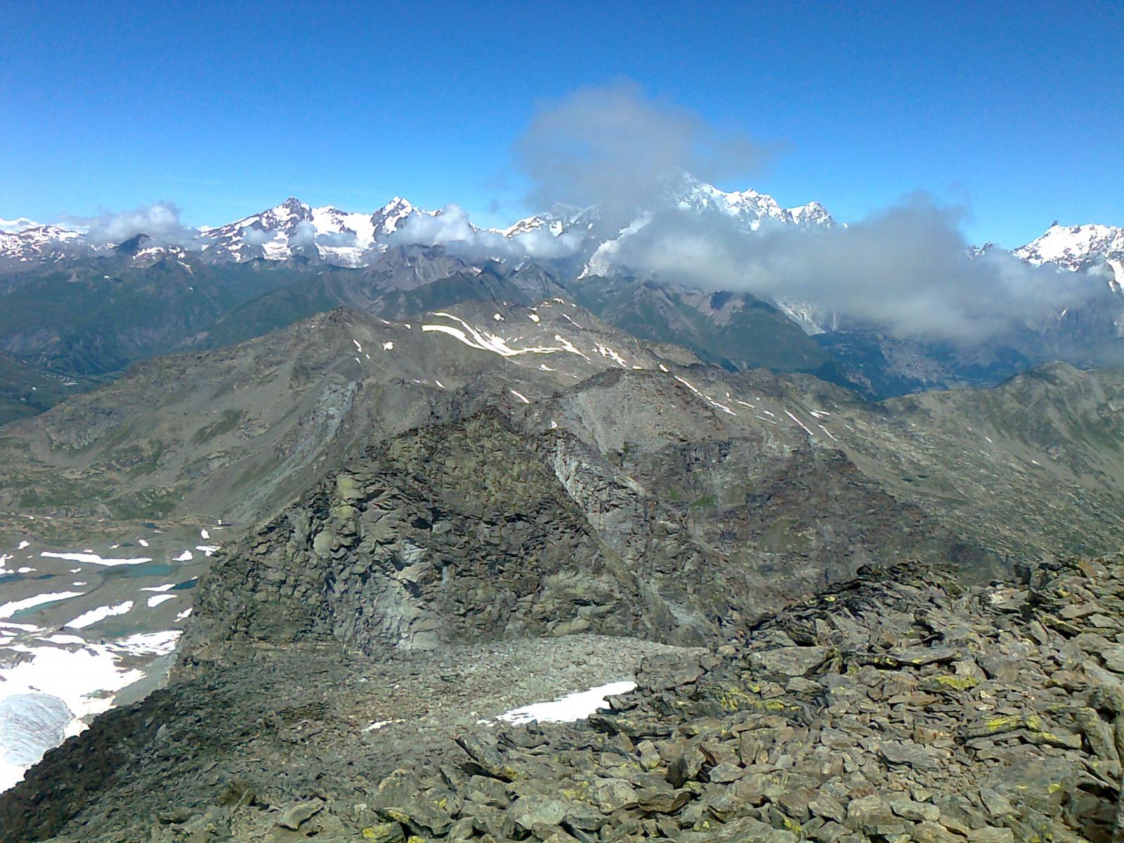
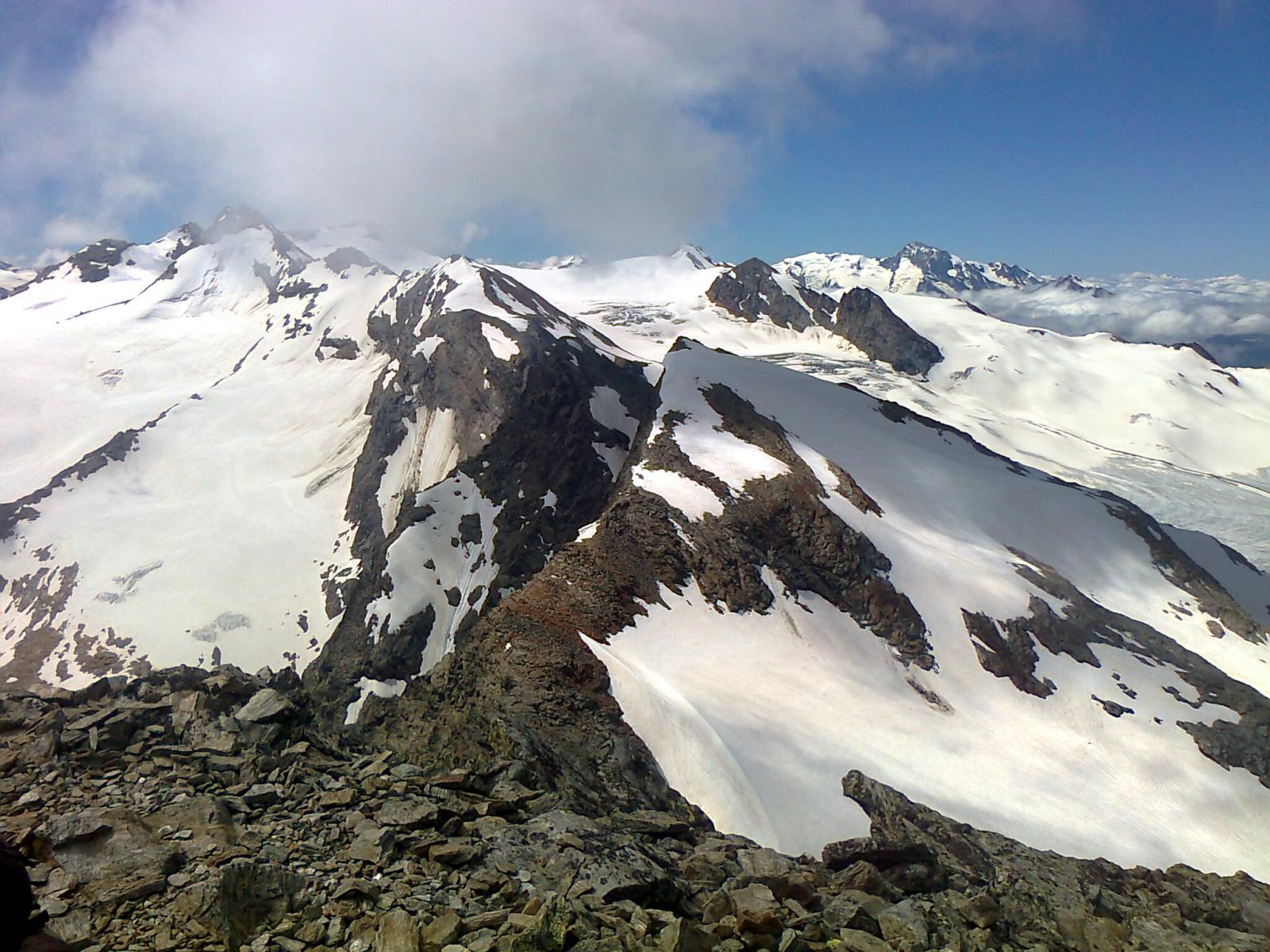
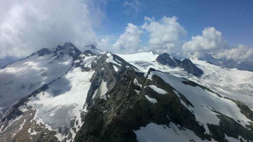
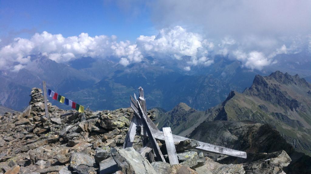
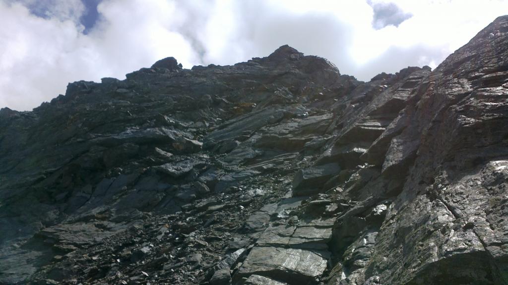
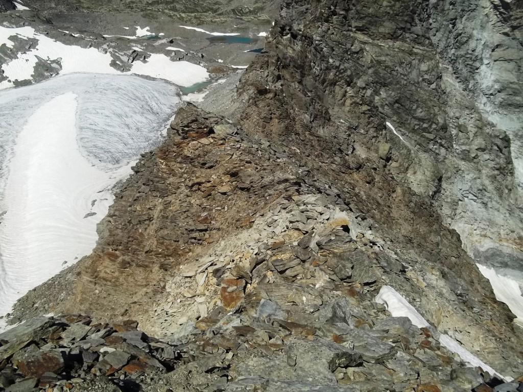
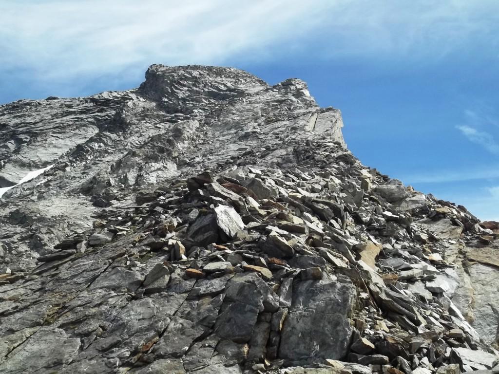
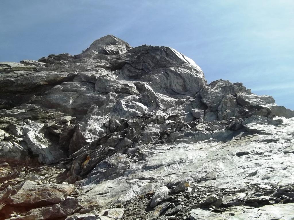
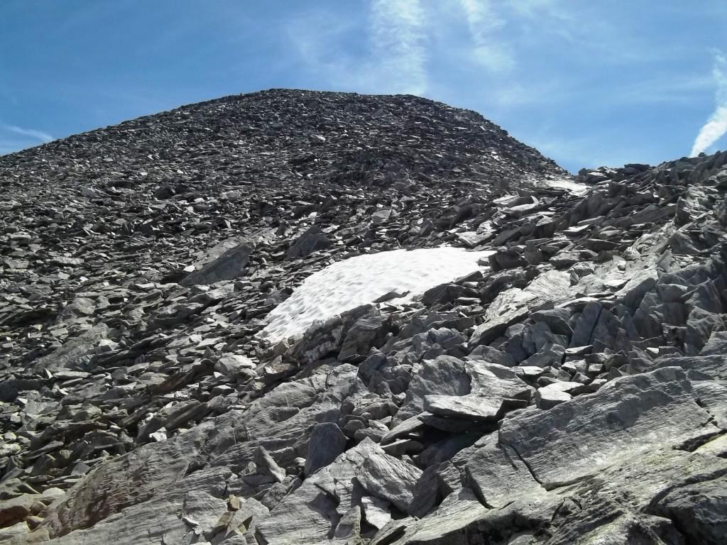
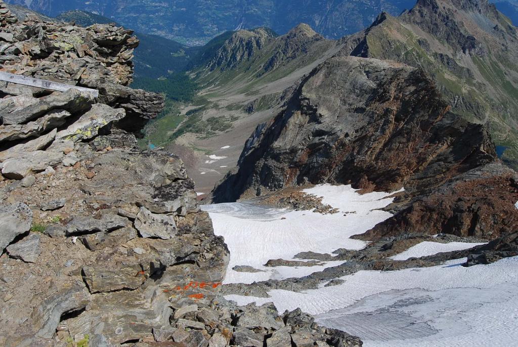
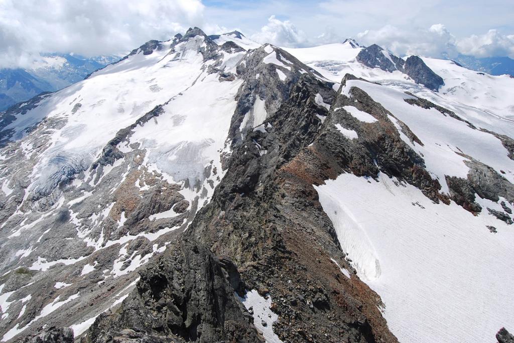
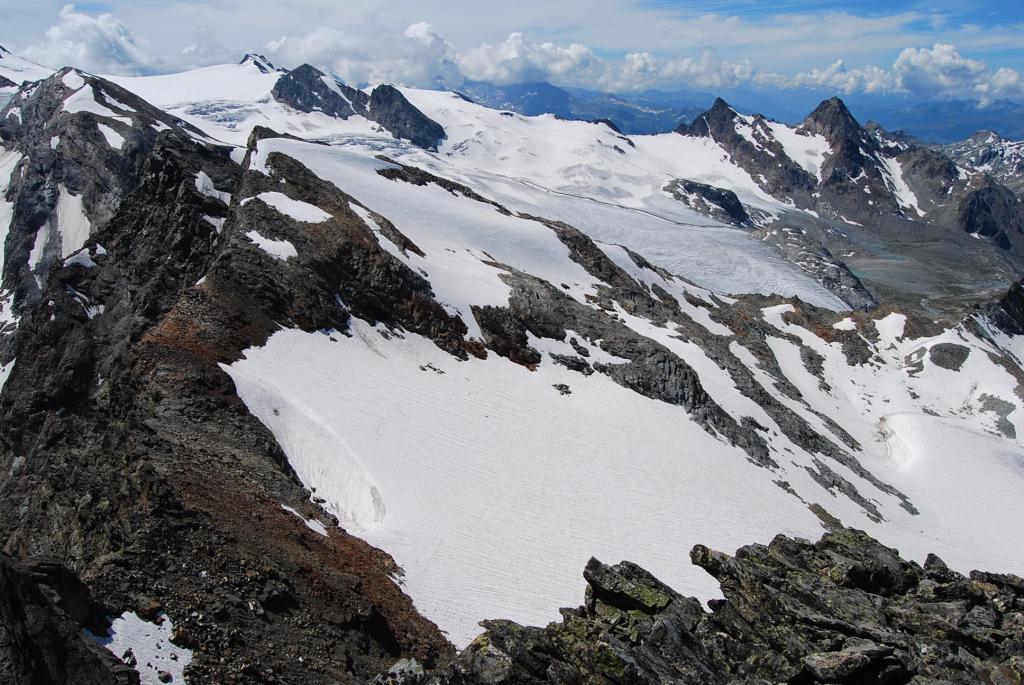
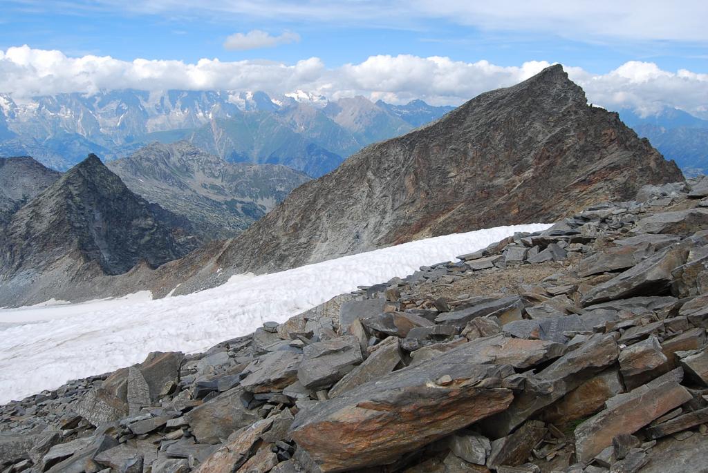
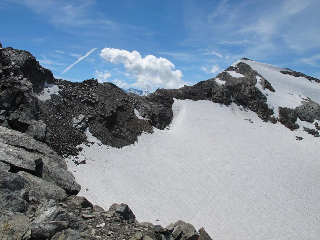
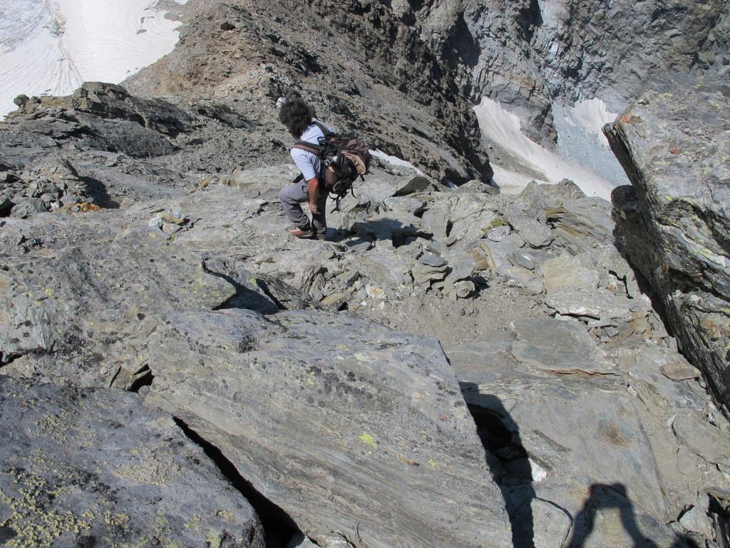
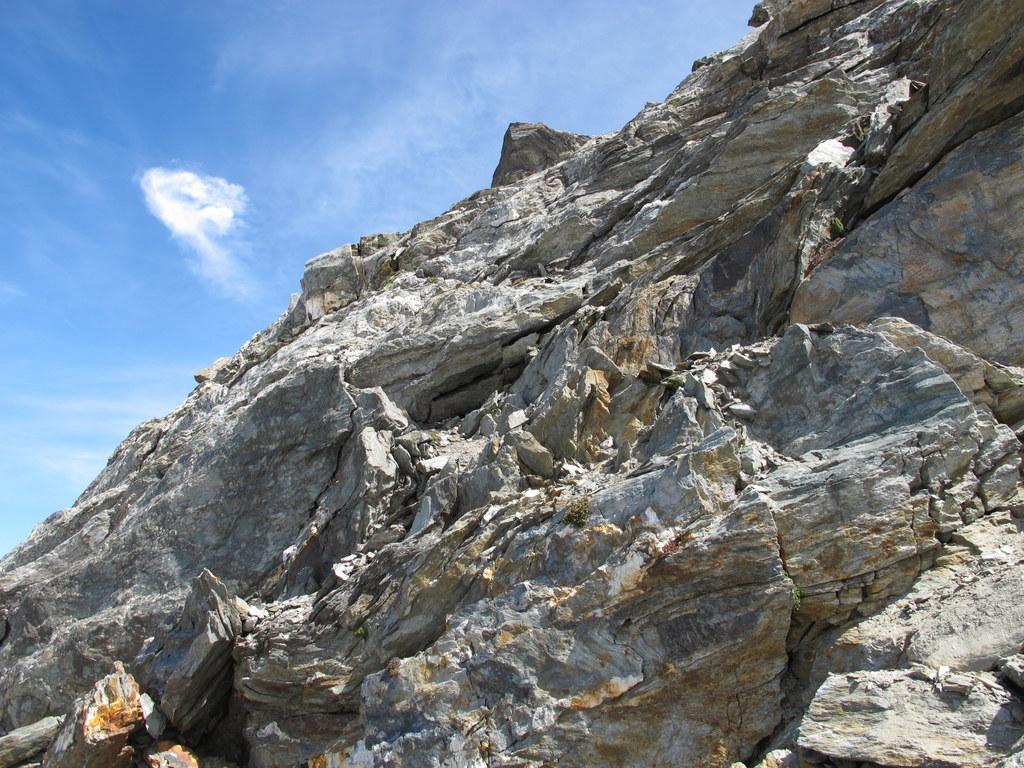
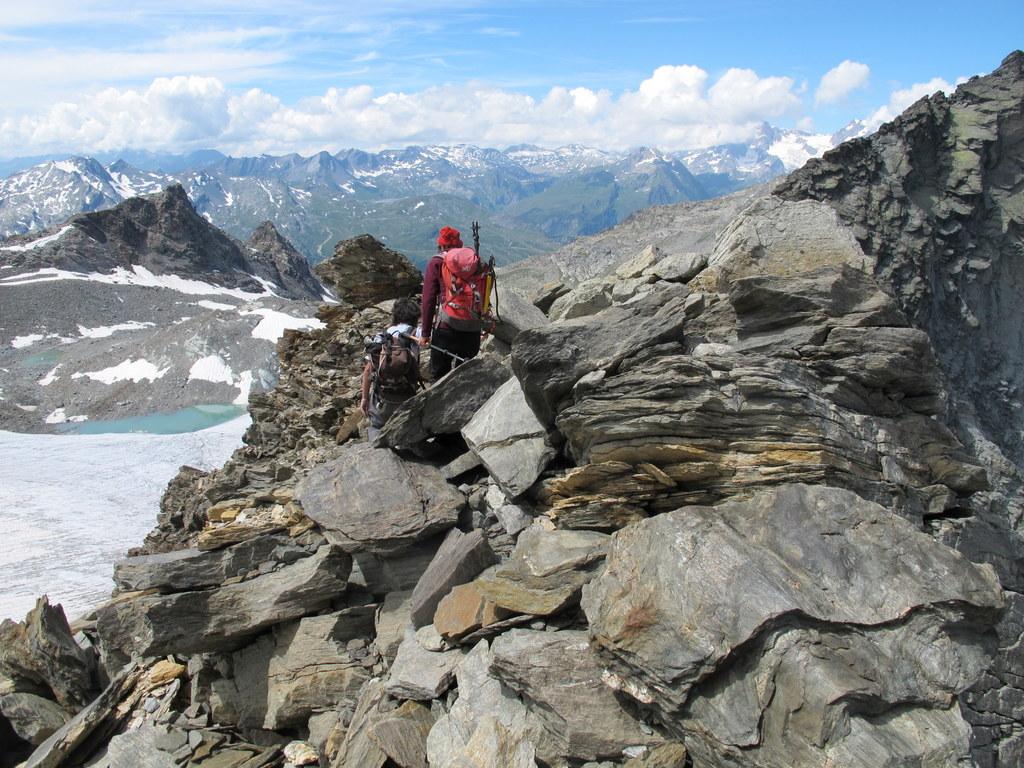
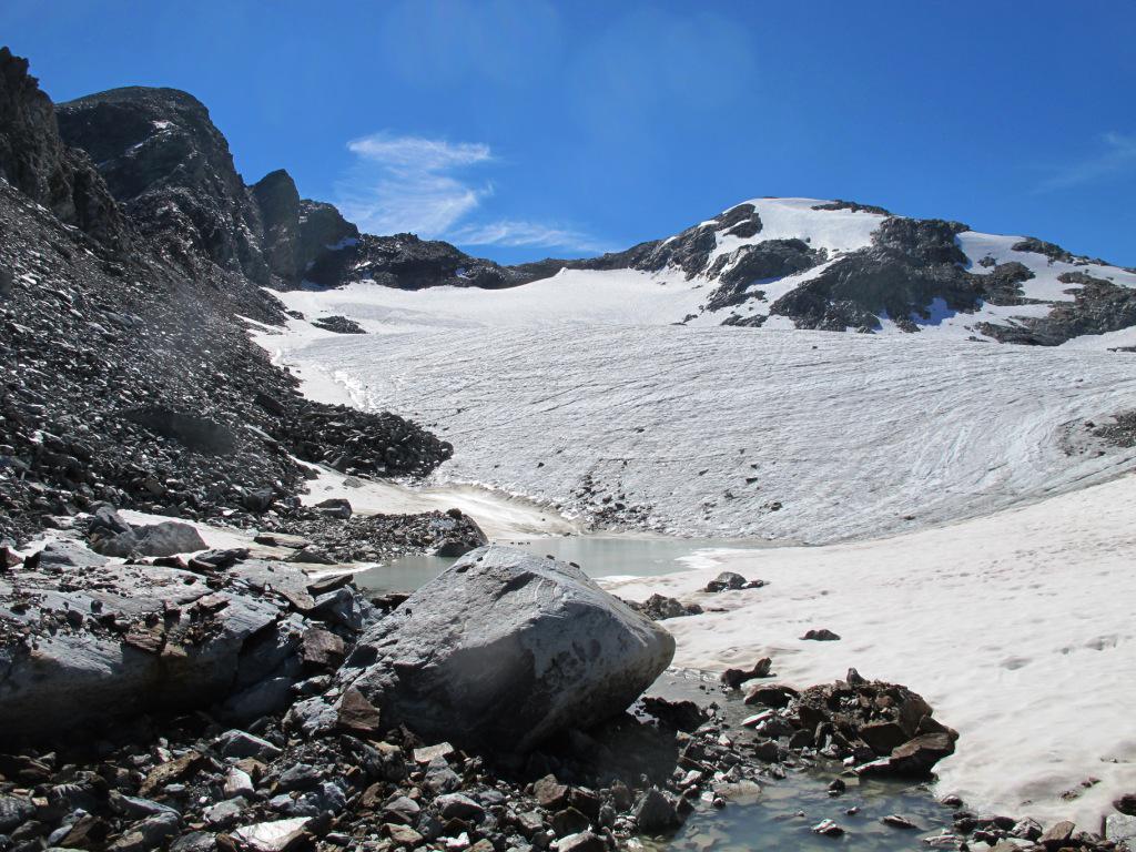
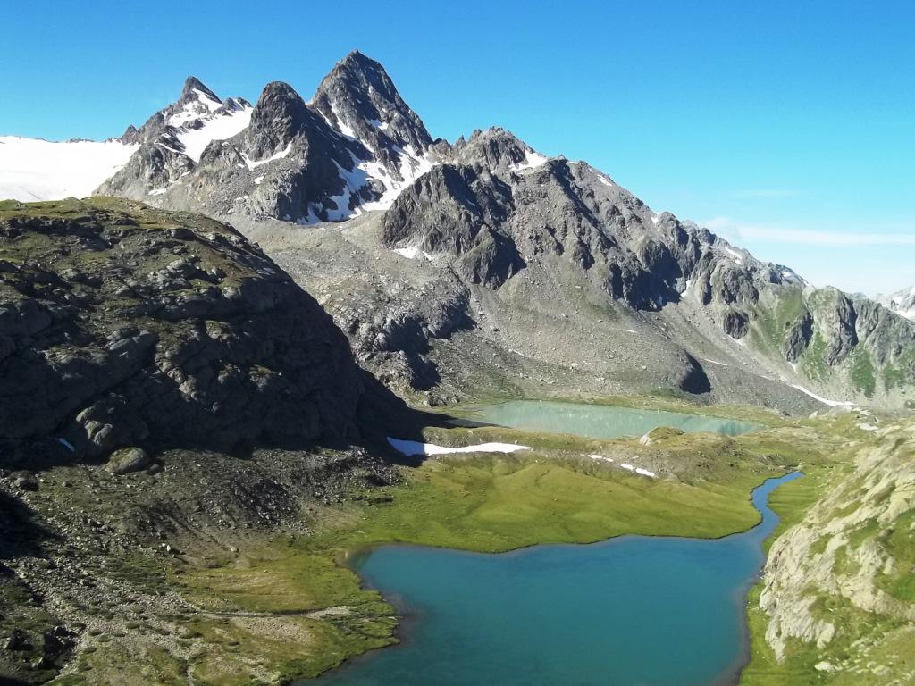
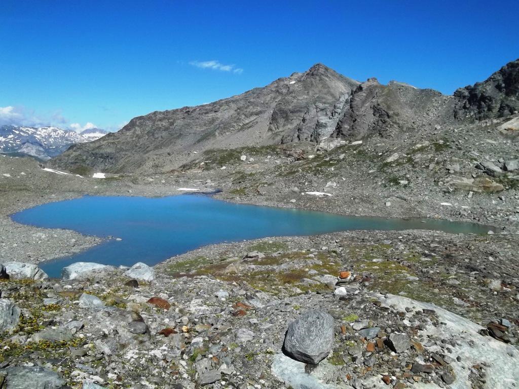
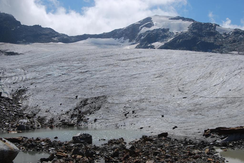
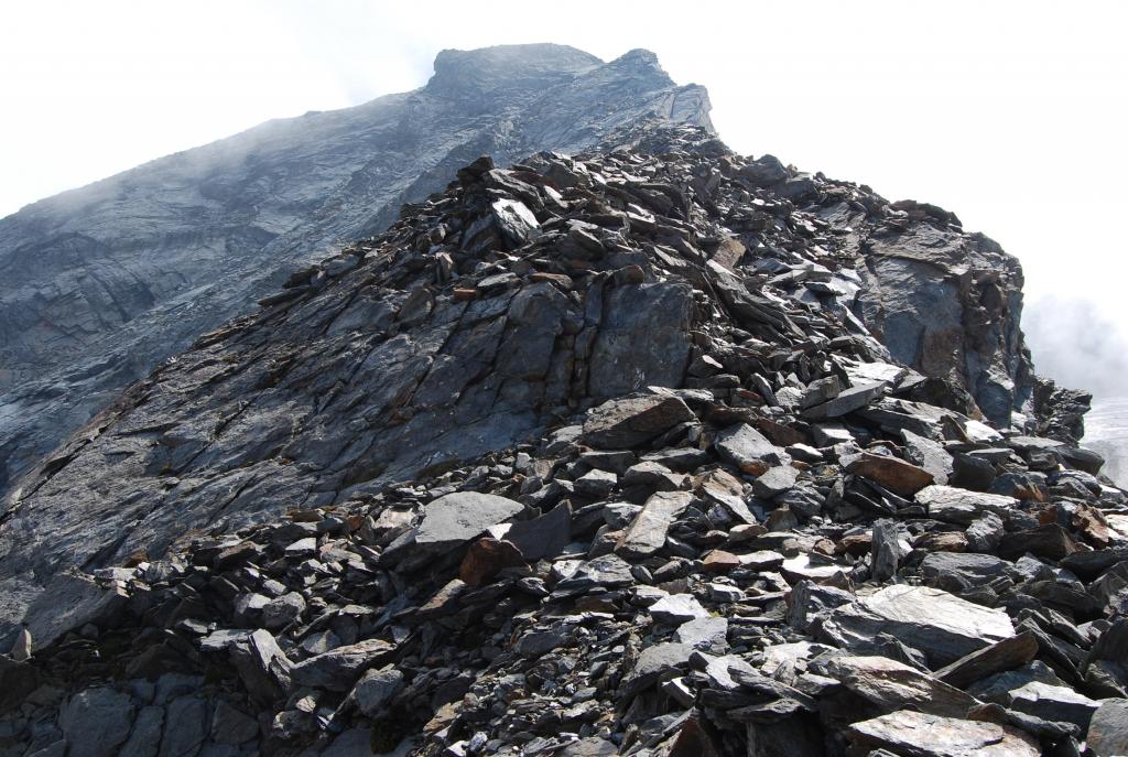
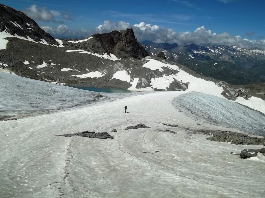
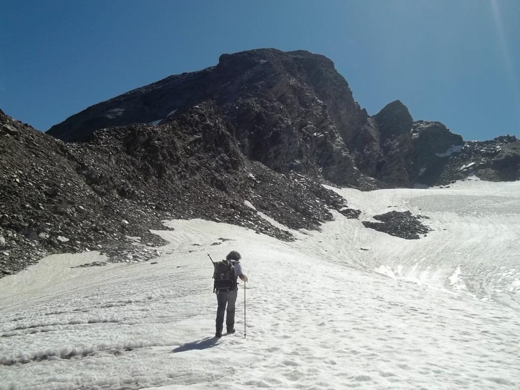
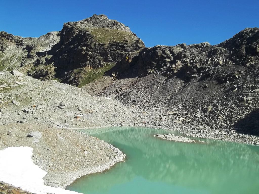
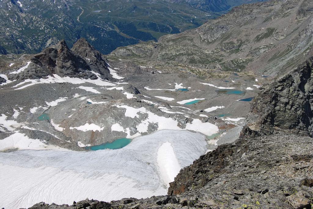
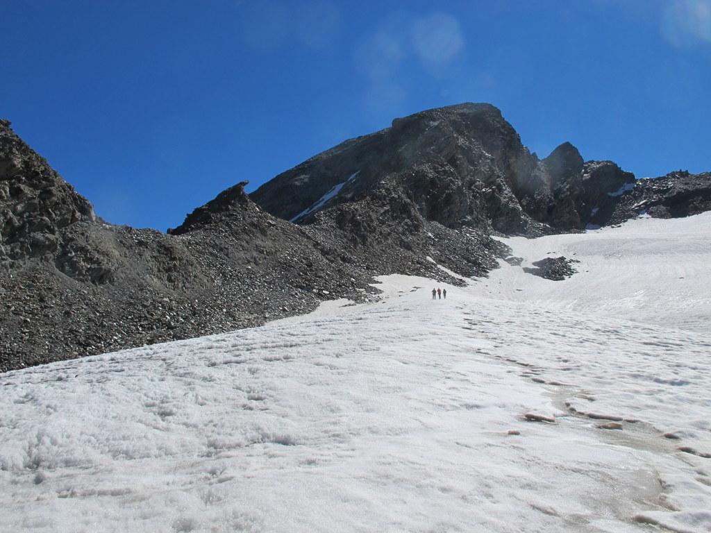
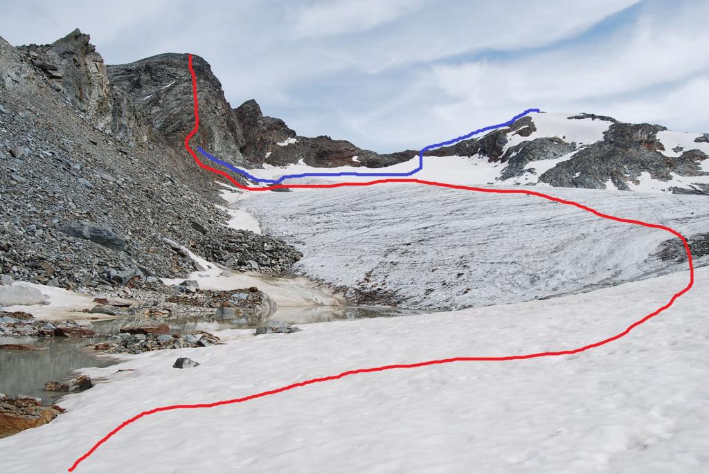
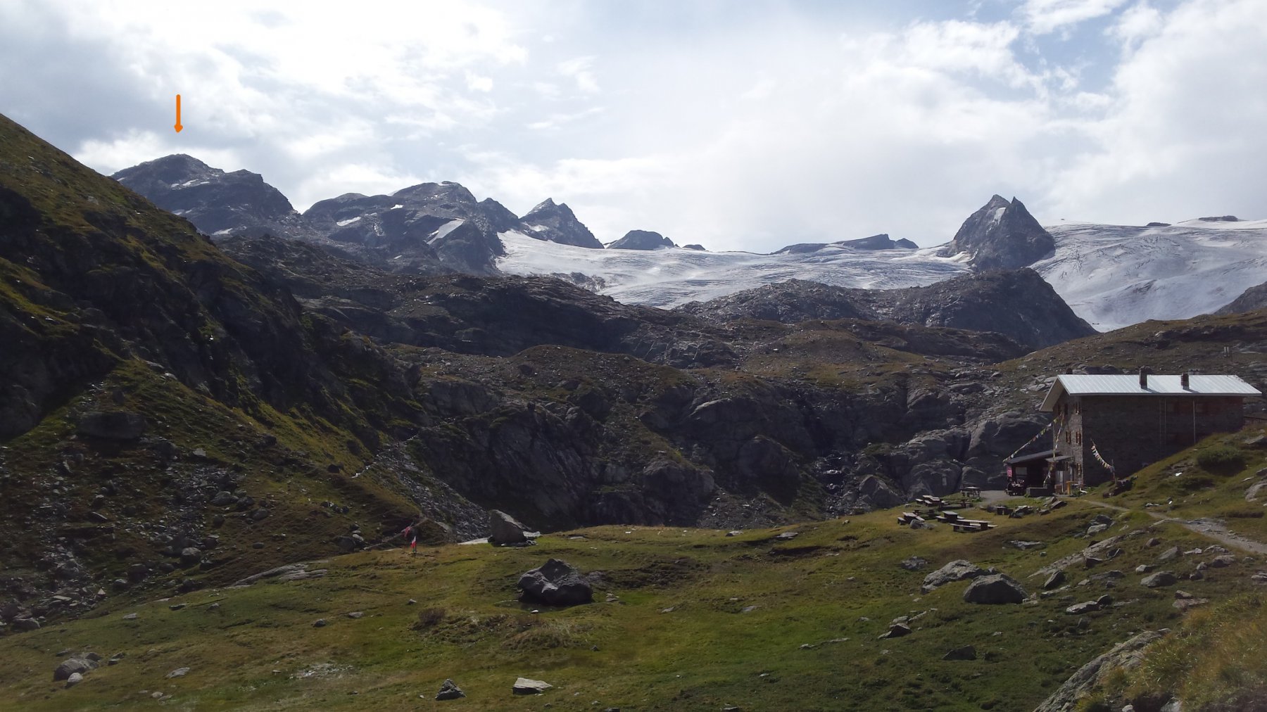
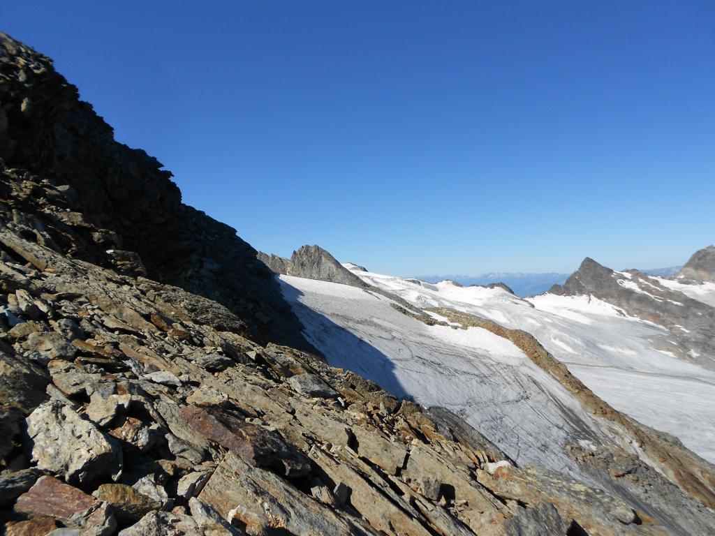
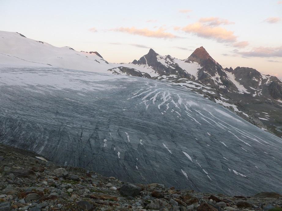
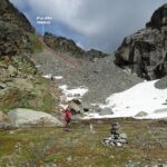
Da La Joux seguire il ben segnalato sentiero che, con percorso piuttosto lungo ma panoramico, porta al Rifugio Deffeyes. Dal Rifugio seguire la traccia di sentiero che, in direzione Nord Est, entra nel Vallone di Ussellettes (indicazione per il Col di Planaval). Successivamente, per pianori erbosi e pietraie si raggiungono i Laghi di Ussellettes, m. 2800. Dai laghi salire sulle morene soprastanti e raggiungere il pianeggiante Glacier des Ussellettes. Tenedosi sulla sinistra (destra orografica) raggiungere, sempre sulla propria sinistra, dopo un breve ma ripido pendio di rocce disgregate, la depressione tra il Monte e la Testa Paramont, detta Pas d’Ussellettes, m. 3025. Il passo è in realtà la terza depressione visibile, posta a destra del torrione a forma di becco d’aquila e cioè quella più vicina al M. Paramont. Seguire sulla destra la Cresta Nord Ovest del Monte Paramont (formata da sfasciumi alternati a tratti su lastroni inclinati) inizialmente sul suo filo per poi spostarsi sulla sinistra, risalendo con traverso ascendente, cenge a tratti esposte (qualche ometto). Segue il superamento di alcune placche inclinate da percorrere con molta attenzione, oltre le quali si raggiunge l’ampio pendio detritico che porta facilmente in vetta. Panorama esteso a perdita d’occhio su tutte le grandi vette della VdA, della Vanoise, dell’Isere..
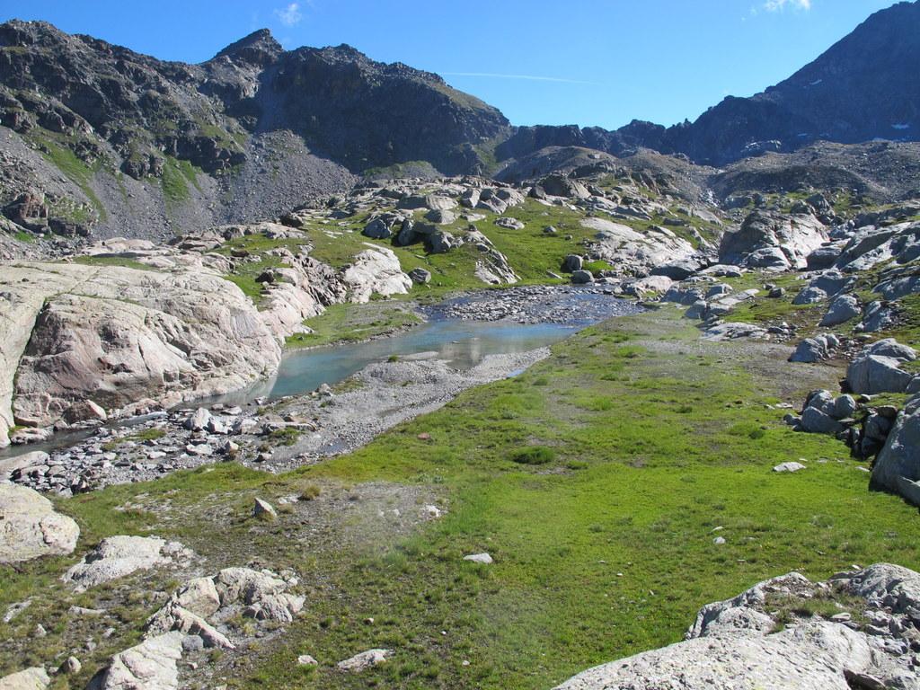
Variante di salita ai laghi dell’Ussellettes: dopo il rifugio Deffeyes, si scende lungo il sentiero e, poco oltre aver oltrepassato il ponticello di legno, si risale a sinistra la ripida bastionata che costeggia il lato destro idrografico della cascata portandosi sul suo filo, dove in alto sono evidenti i tubi dell’acqua. Seguendo vaghe tracce e qualche ometto, si raggiunge il grosso segnale di pietre visibile dal rifugio, raggiunto il quale si prosegue costeggiando il torrente, indifferentemente sulla sponda destra o sinistra (ometti su entrambi i lati). Raggiunto il piano dei laghi dell’Ussellettes si superano le bastionate successive seguendo vari ometti che si dirigono lungo l’articolata fascia montonata nel suo centro, oppure altri che si portano sul lato destro orografico in direzione di un pendio detritico che costeggia parallela la fascia montonata. Raggiunto il glacier des Ussellettes, proseguire come da relazione sopra.
- Cartografia:
- I.G.C. 1:50000 Gran Paradiso
- Bibliografia:
- Guida C.A.I. - T.C.I. Alpi Graie Centrali
Nelle vicinanze Mappa
Itinerari
09/08/2011 AO, La Thuile D+ 1800 m PD- Nord-Ovest
Flambeau per il versante Nord-Ovest
 50m
50m
24/09/2023 AO, La Thuile D+ 1650 m F Nord-Est
Chenal (Punta) da la Joux per il Rifugio Deffeyes
 50m
50m
10/08/2012 AO, La Thuile D+ 306 m F+ Nord-Est
Flambeau Via delle Lose
 50m
50m
06/08/2024 AO, La Thuile D+ 1700 m PD- Tutte
Grand Assaly Via Normale da La Joux
 50m
50m
05/07/2026 AO, La Thuile D+ 2000 m F Nord
Rutor (Testa del) Via Normale da La Joux per il Rifugio Deffejes
 50m
50m
17/08/2018 AO, La Thuile D+ 1900 m F+ Nord-Ovest
Doravidi (Monte, Punta Nord) da La Joux
 50m
50m
16/08/2024 AO, La Thuile D+ 1600 m F+ Varie
Loydon (Pointe) o Petit Assaly da La Joux per il Rifugio Deffeyes
 50m
50m
21/08/2025 AO, La Thuile D+ 1750 m F Nord-Ovest
Paramont (Becca Bianca del) Via Normale da La Joux per il Rifugio Deffeyes
 50m
50m
21/07/2019 AO, La Thuile D+ 2000 m PD Varie
Doravidi (Monte, Punta Nord) e Flambeau traversata sud/nord
 50m
50m
14/08/2025 AO, La Thuile D+ 1580 m F Varie
Paramont (Testa del) da La Joux per il Rifugio Deffeyes
 50m
50m