8.4Km
8.4Km


Note
Storico
 50m
50m
50m
50m
50m
50m
50m
50m
50m
50m
50m
50m
50m
50m
50m
50m
50m
50m
50m
50m
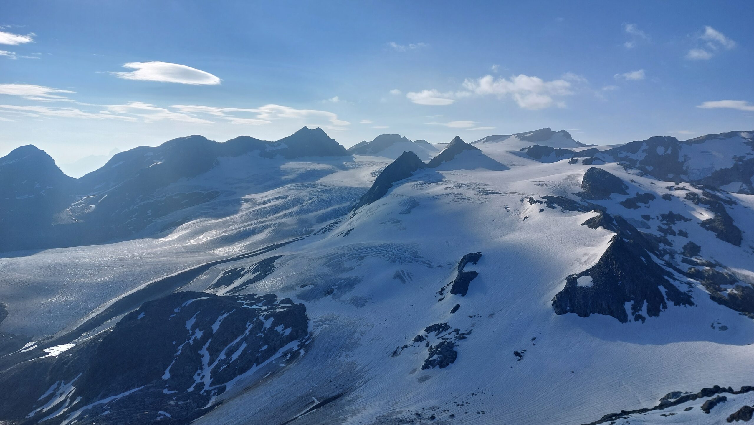
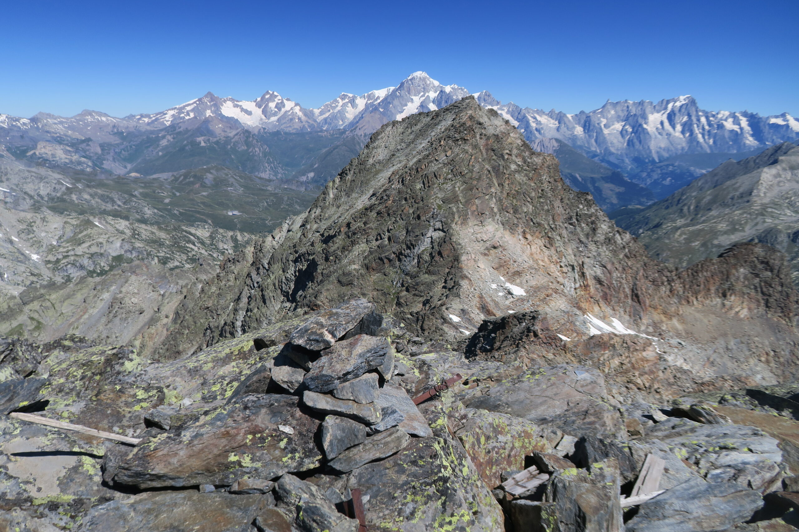
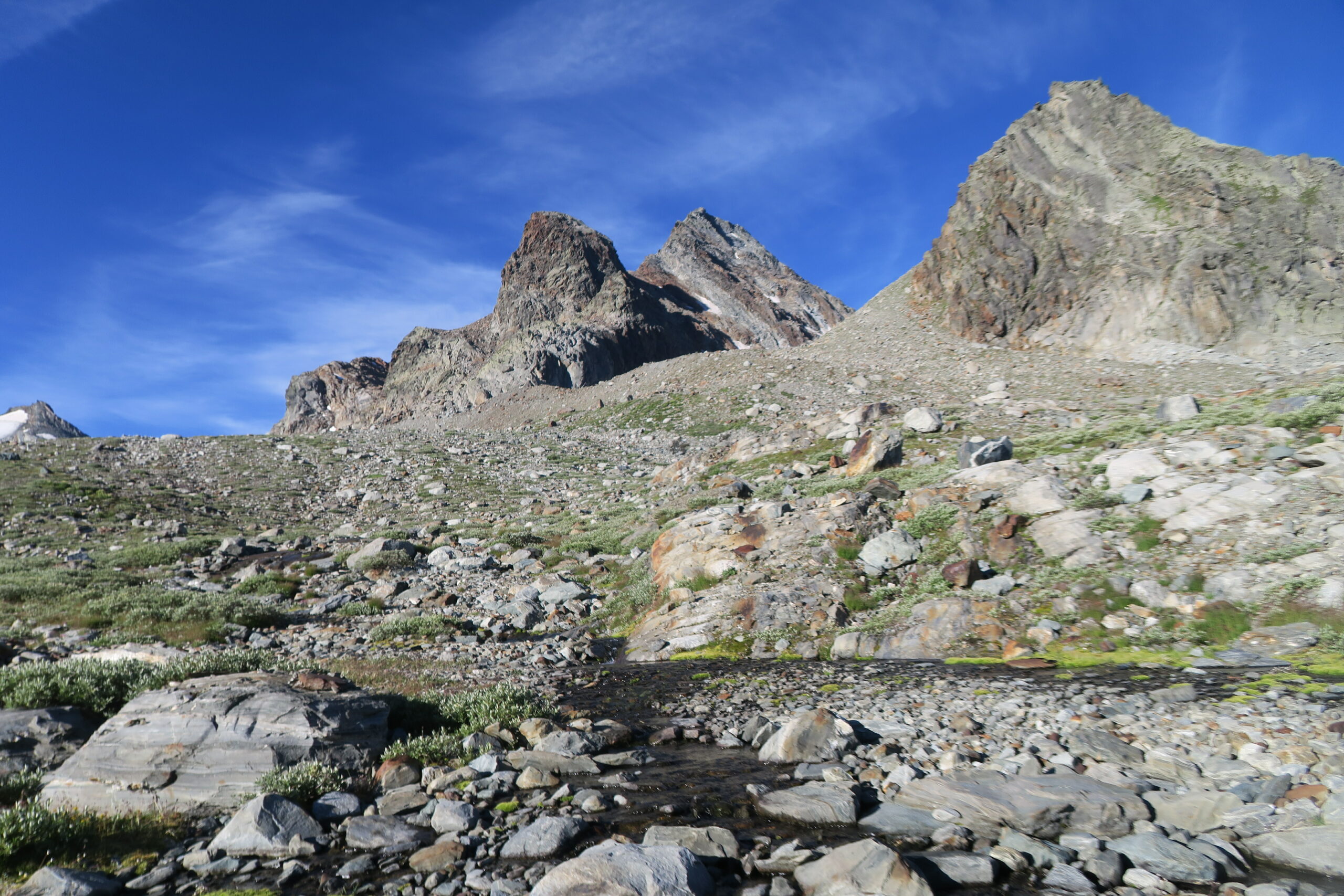
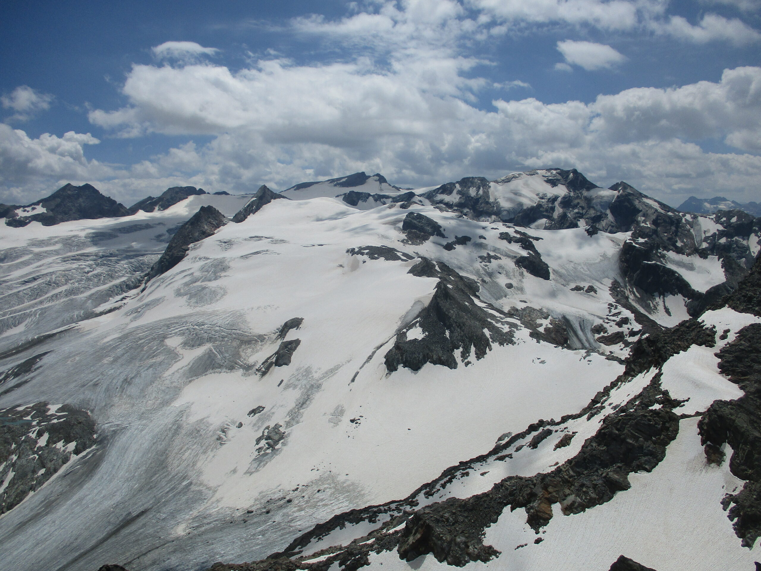
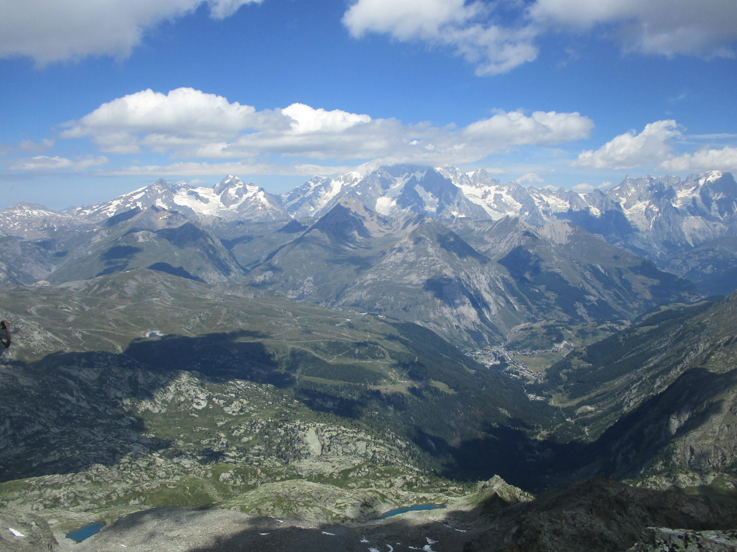
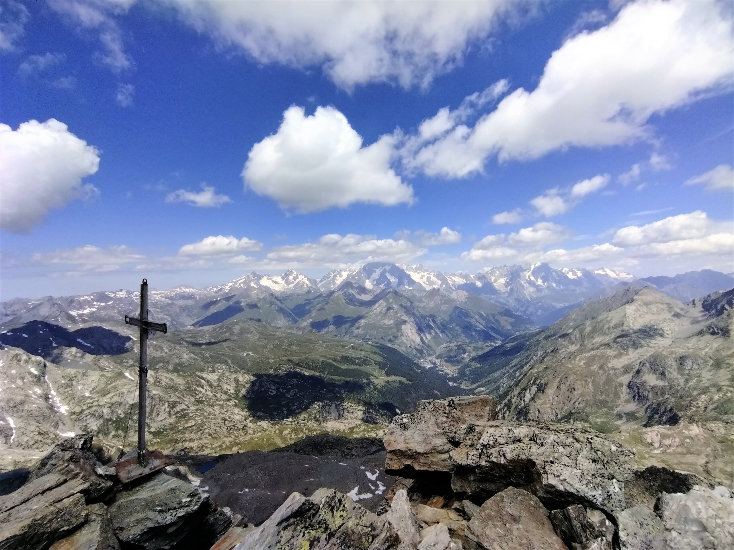
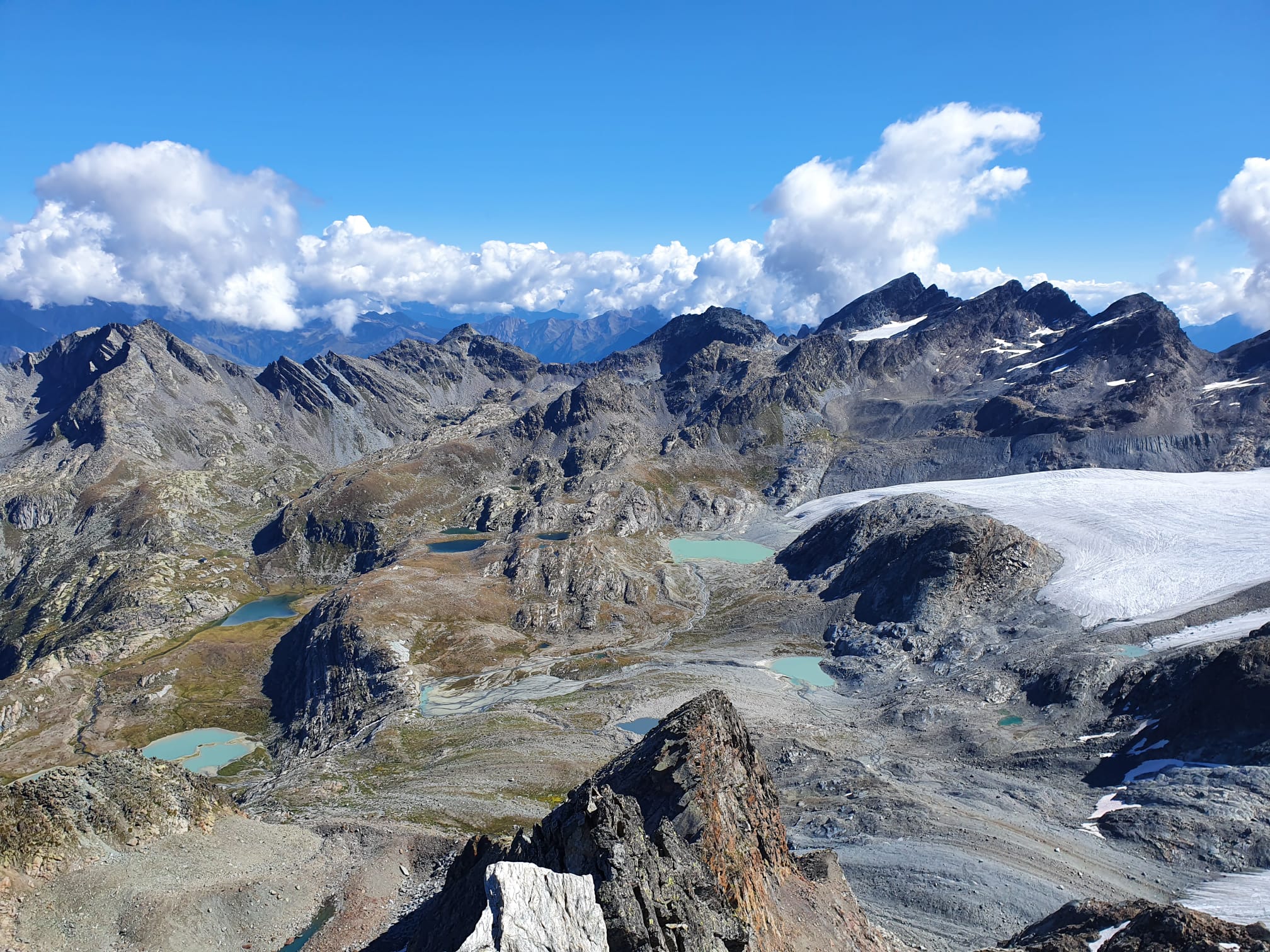
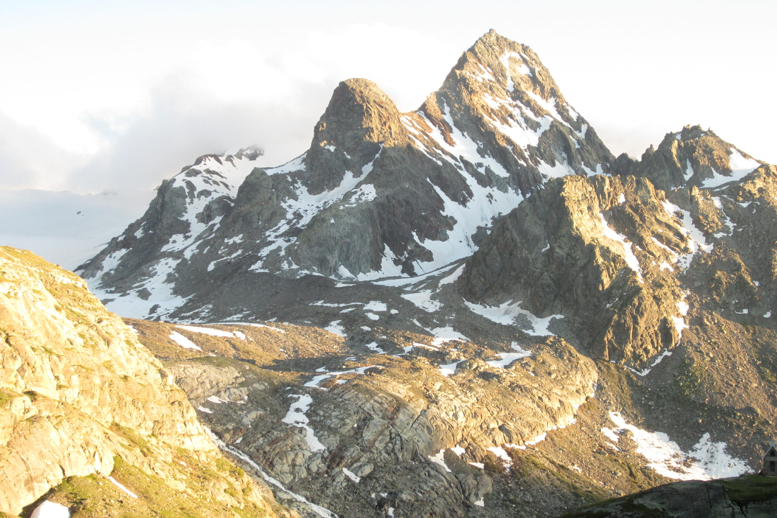
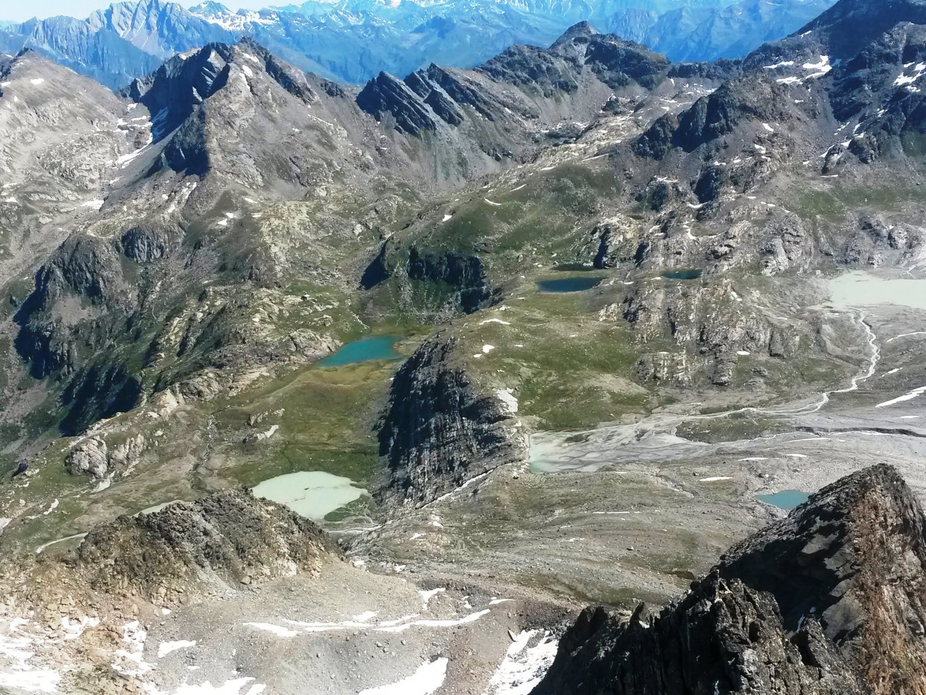
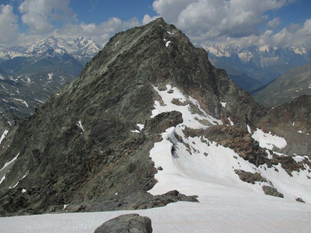
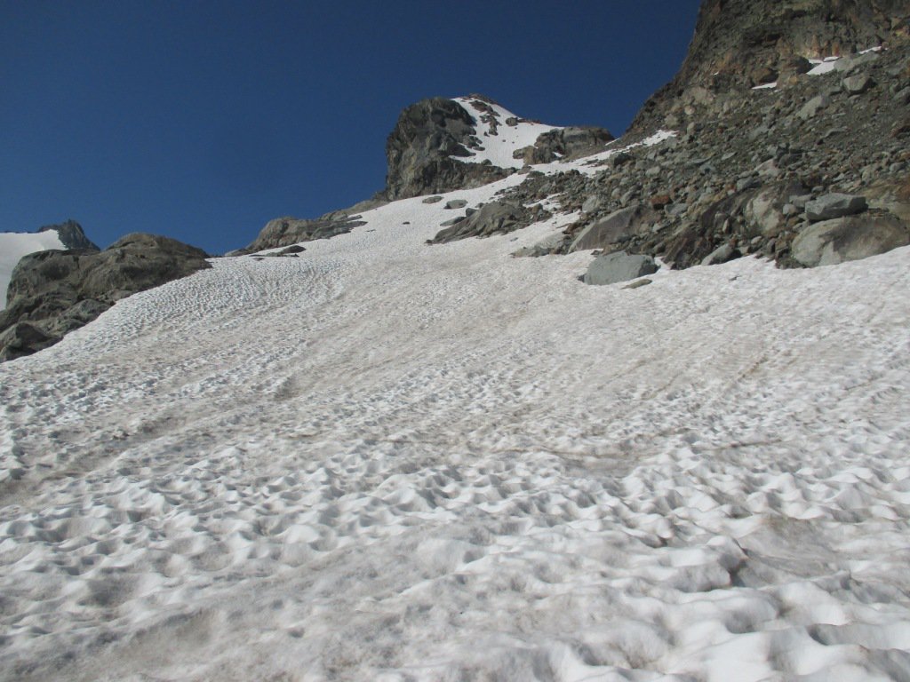
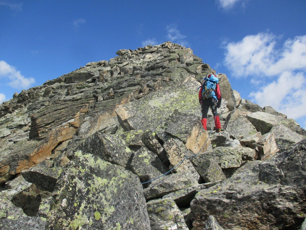
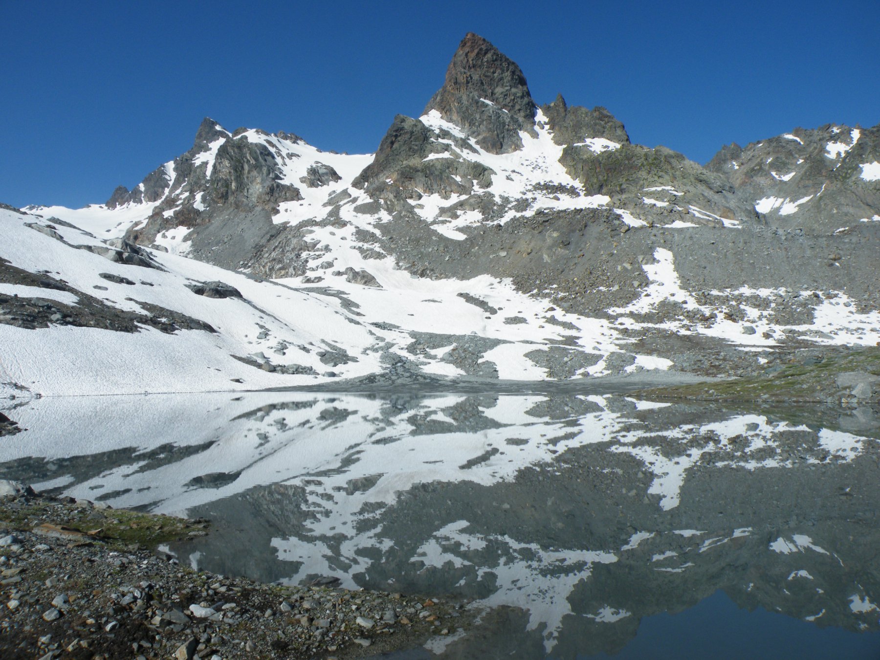
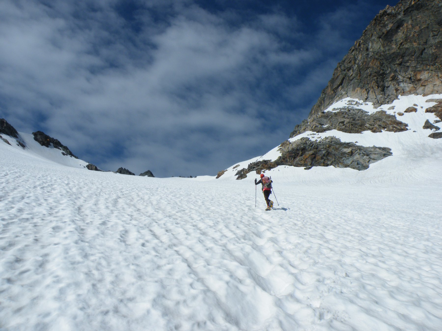
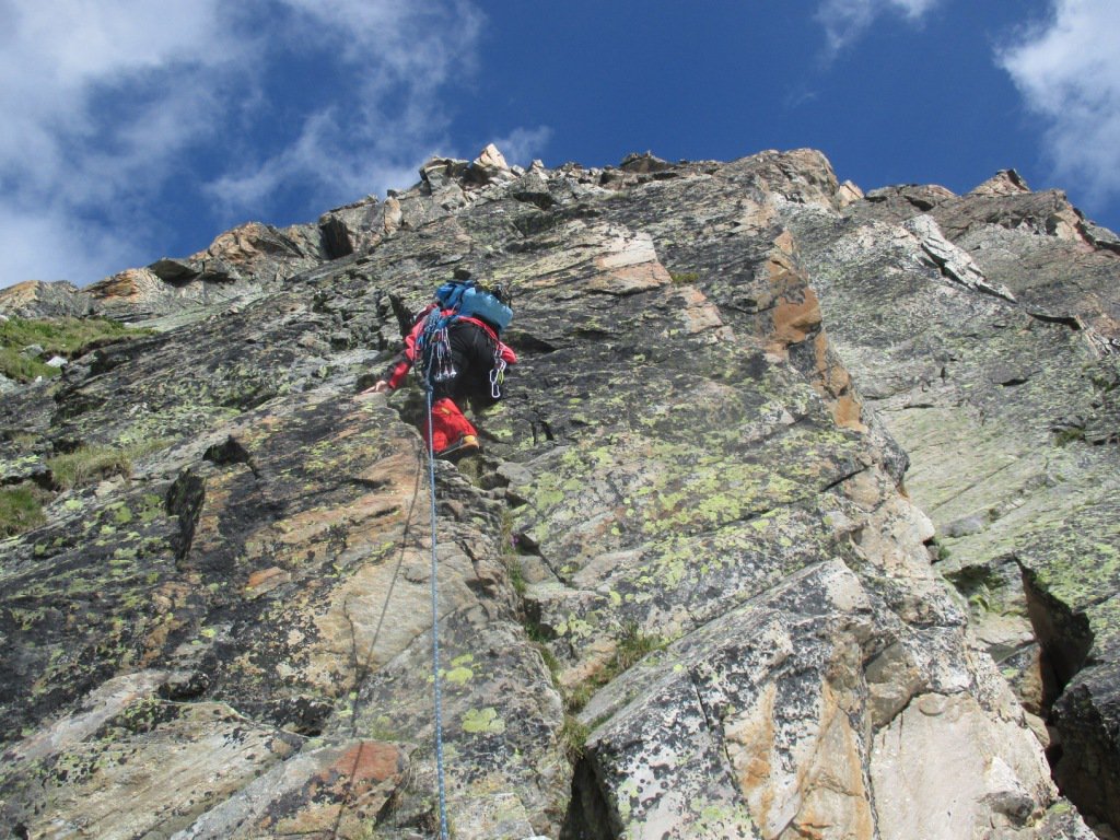
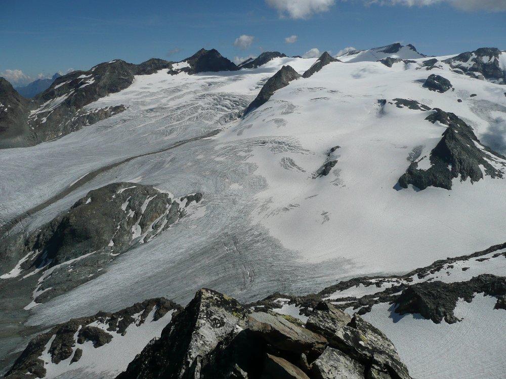
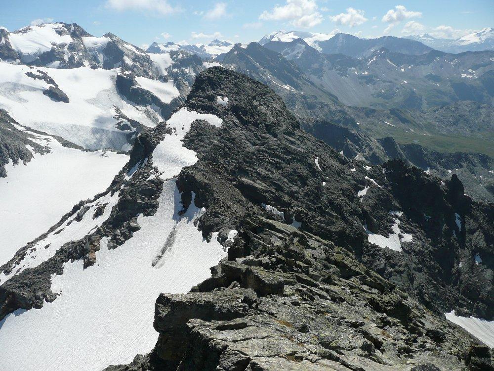
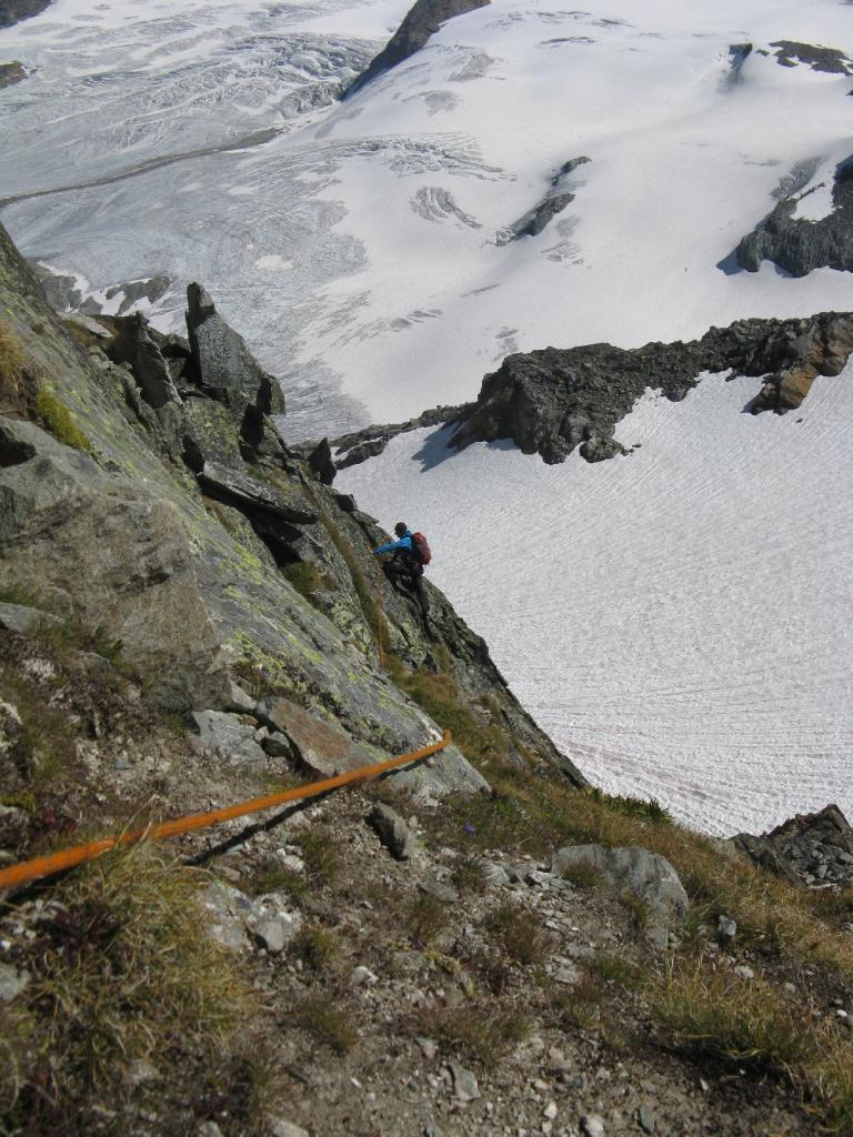
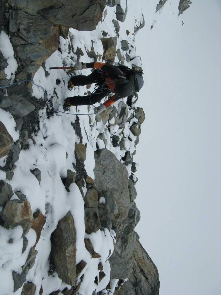
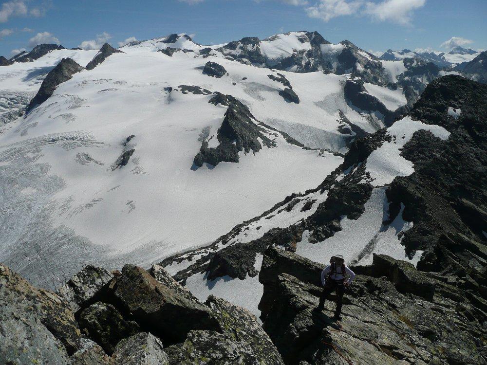
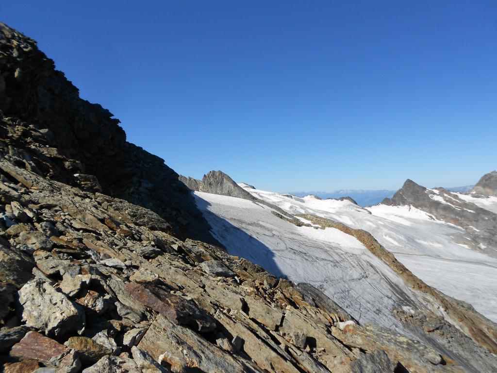
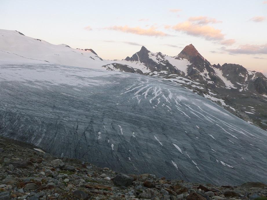
Montagna molto panoramica sul ghiacciaio del Rutor, le cime e i laghi circostanti e più in lontananza sulla catena del Monte Bianco dall'Aig. de Glacier alle Grandes Jorasses; nel complesso poco difficile soprattutto se affrontata a stagione inoltrata con un breve e facile tratto di ghiacciaio con alcuni crepacci facilmente aggirabili nella parte alta e un breve e facile tratto roccioso diagonale esposto ma molto appigliato a metà strada tra il Colle de l'Assaly e la cima.
Avvicinamento
.
Descrizione
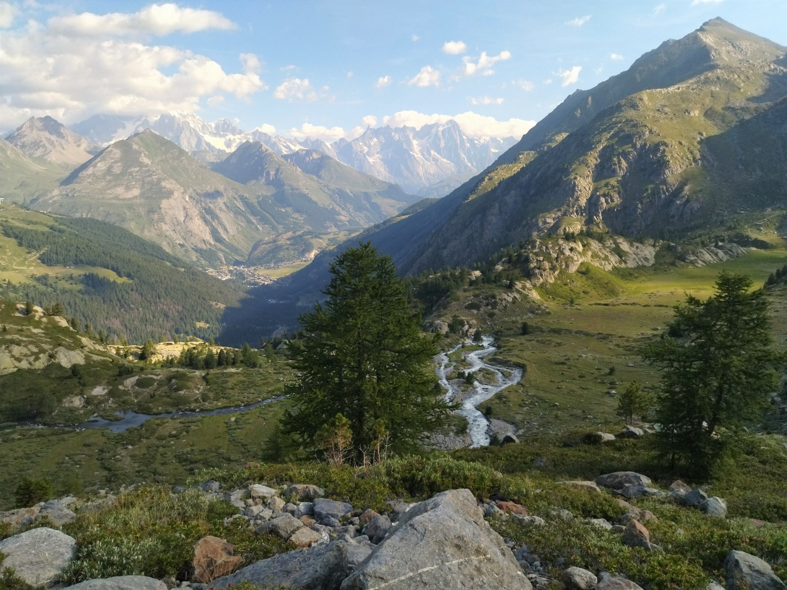
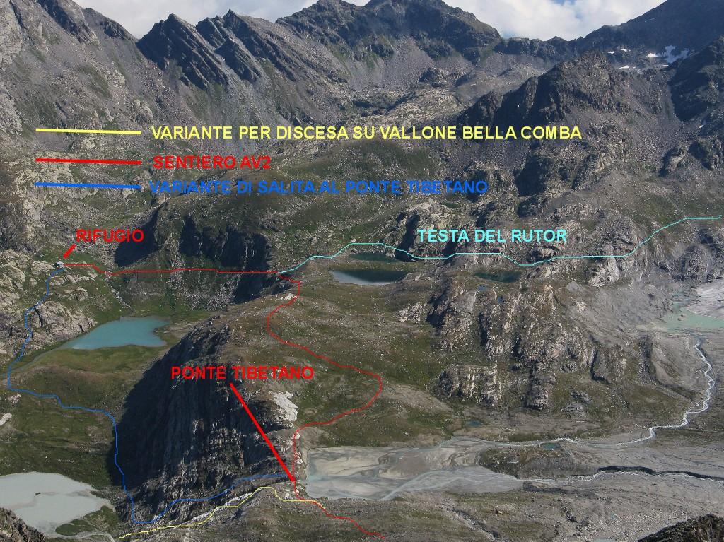
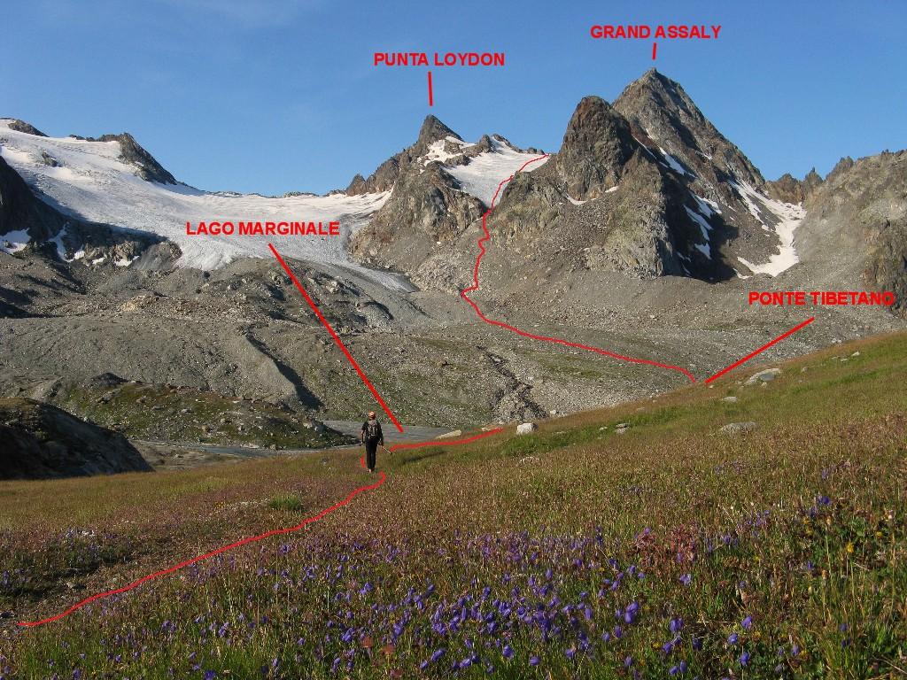
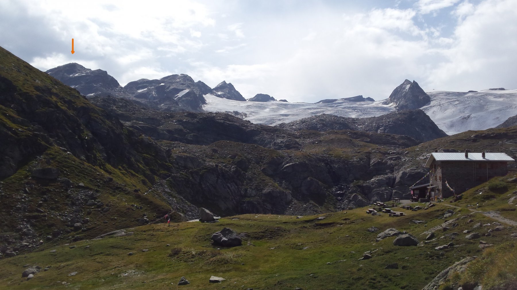
Dal parcheggio davanti al bar Le Cascate si segue facilmente l’ampio sentiero per il Rifugio Deffeyes 2494m.
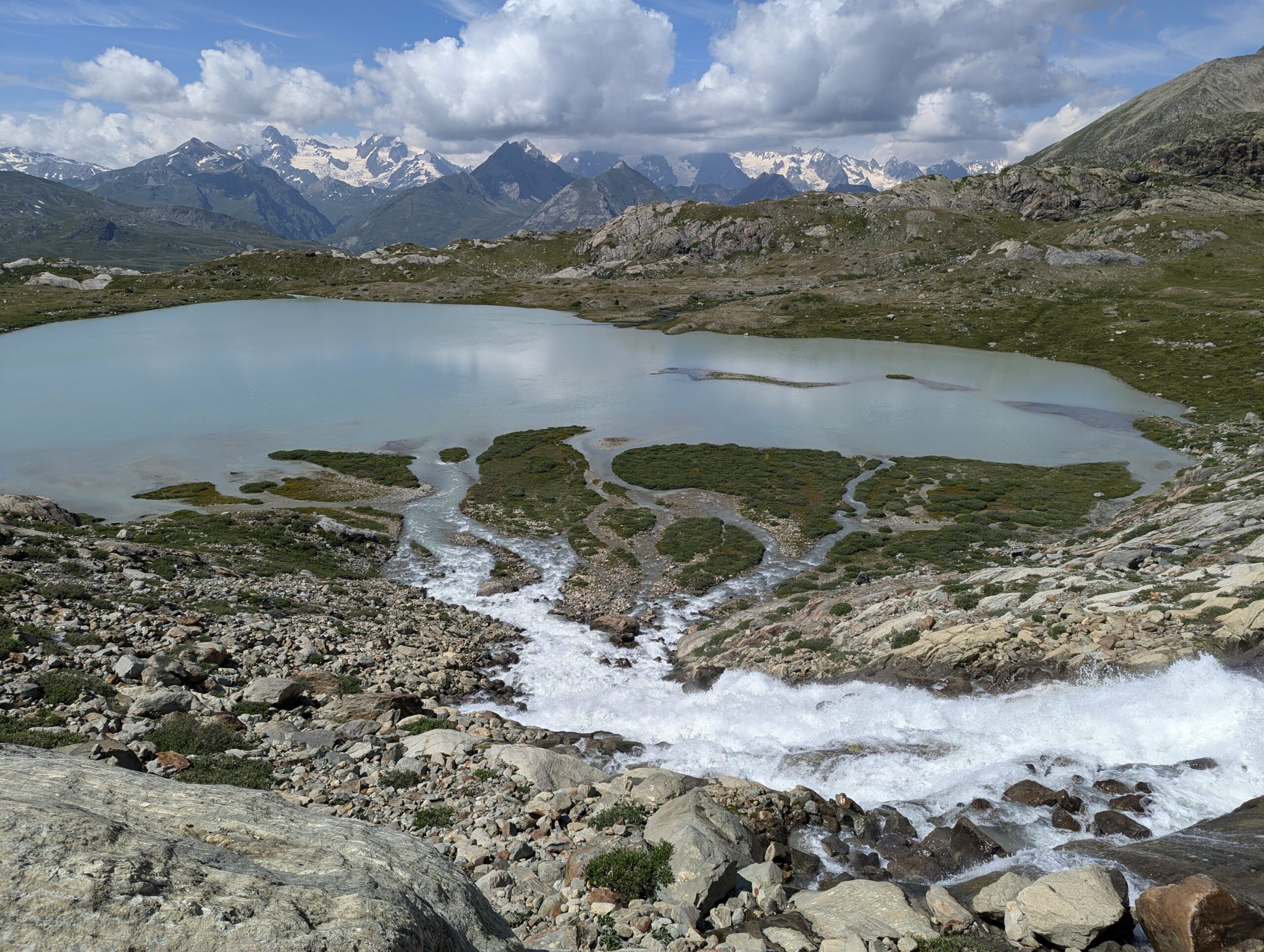
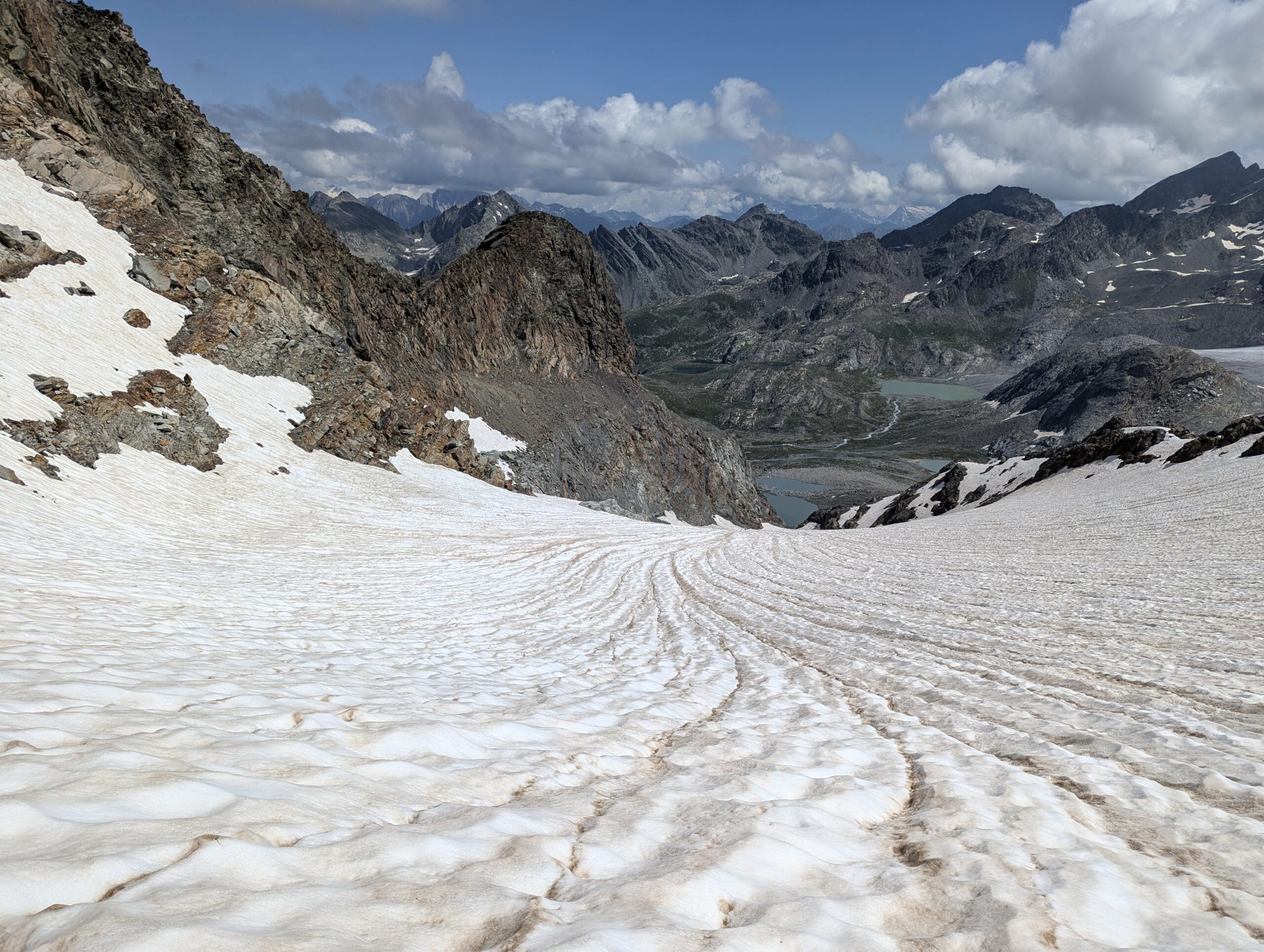
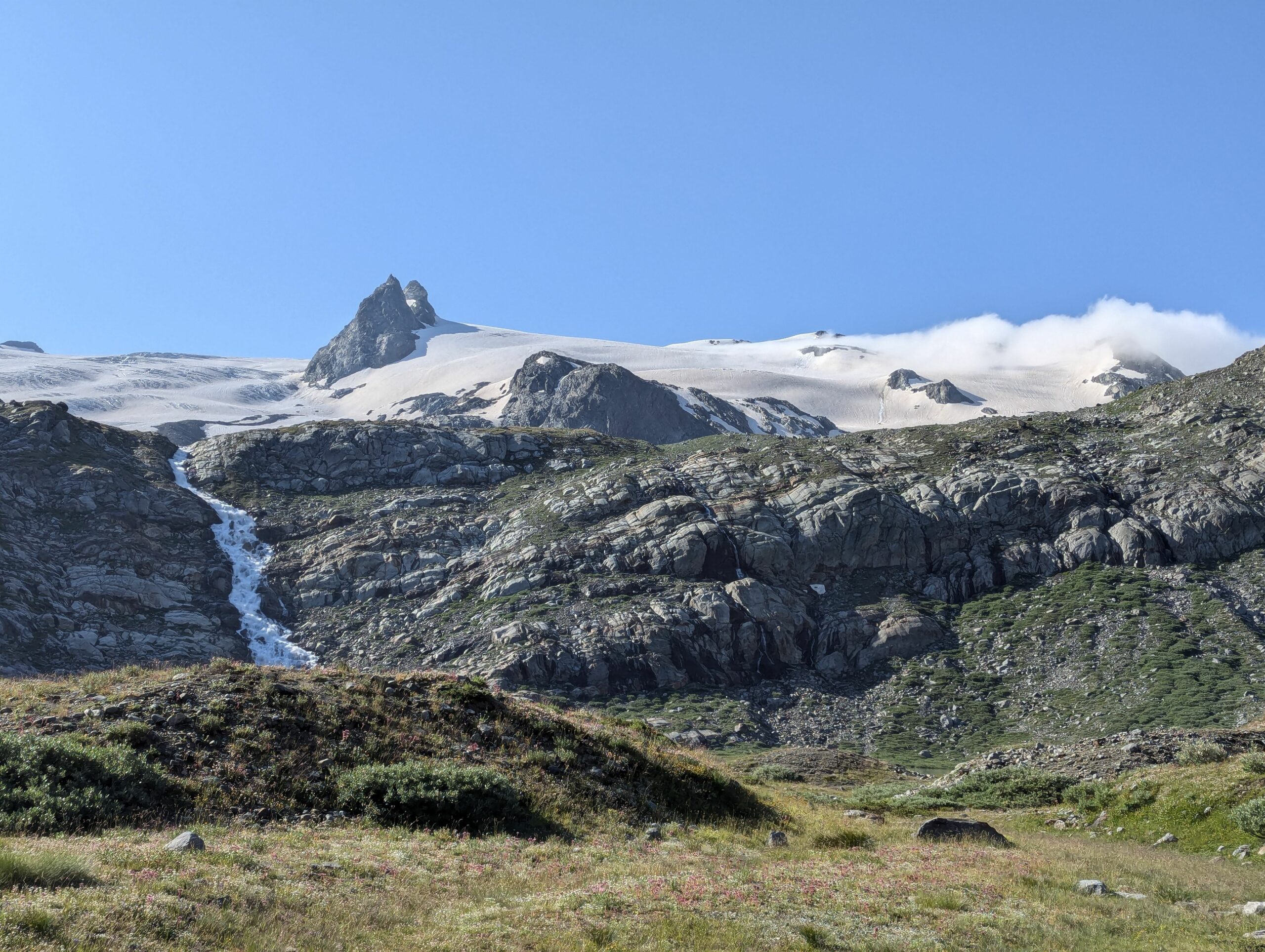
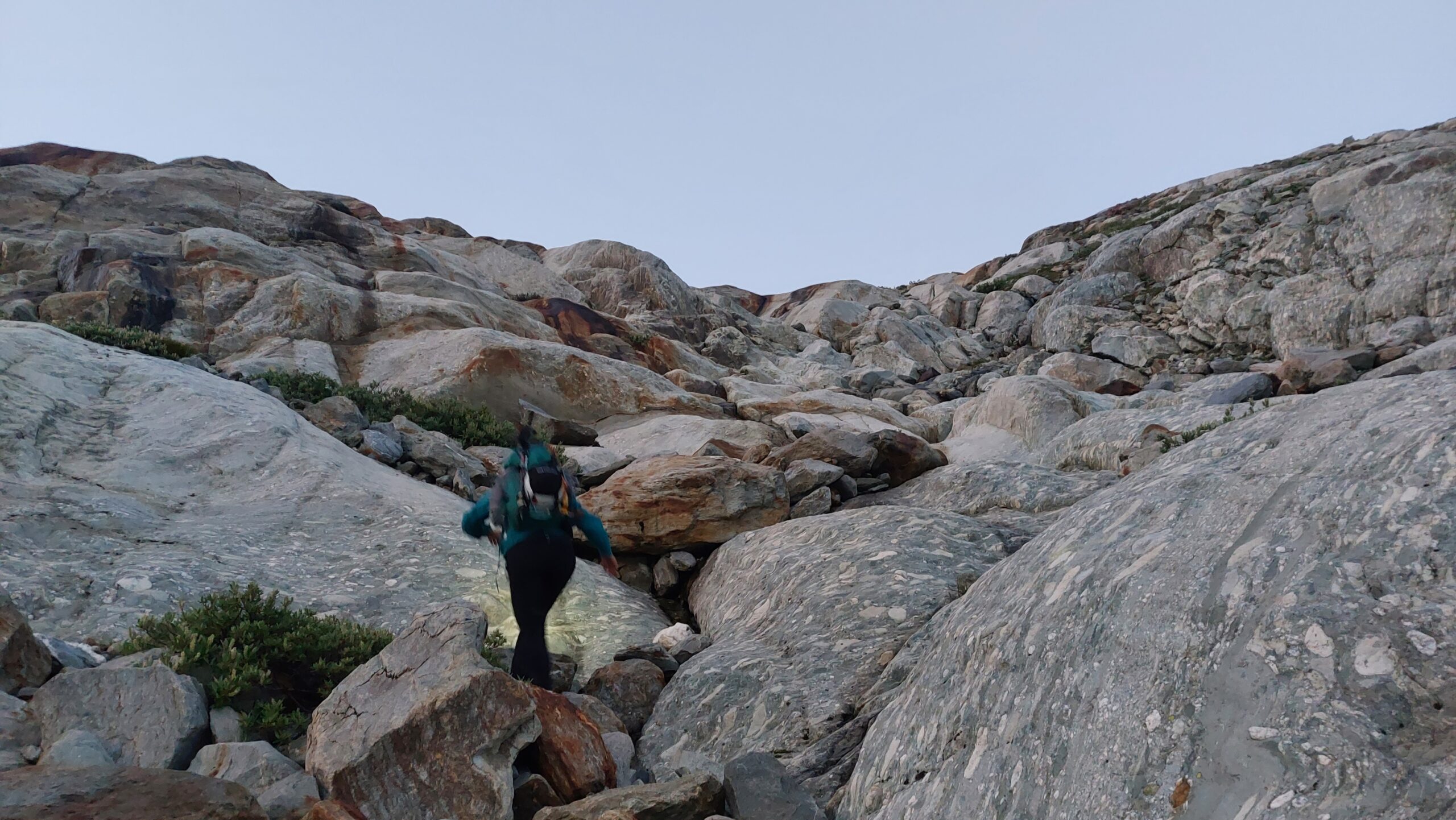
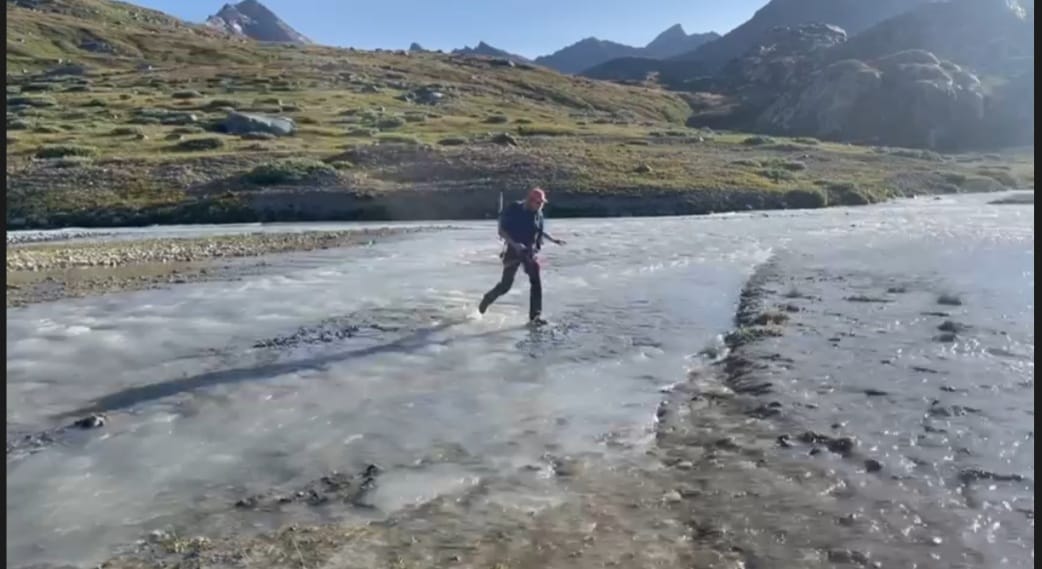
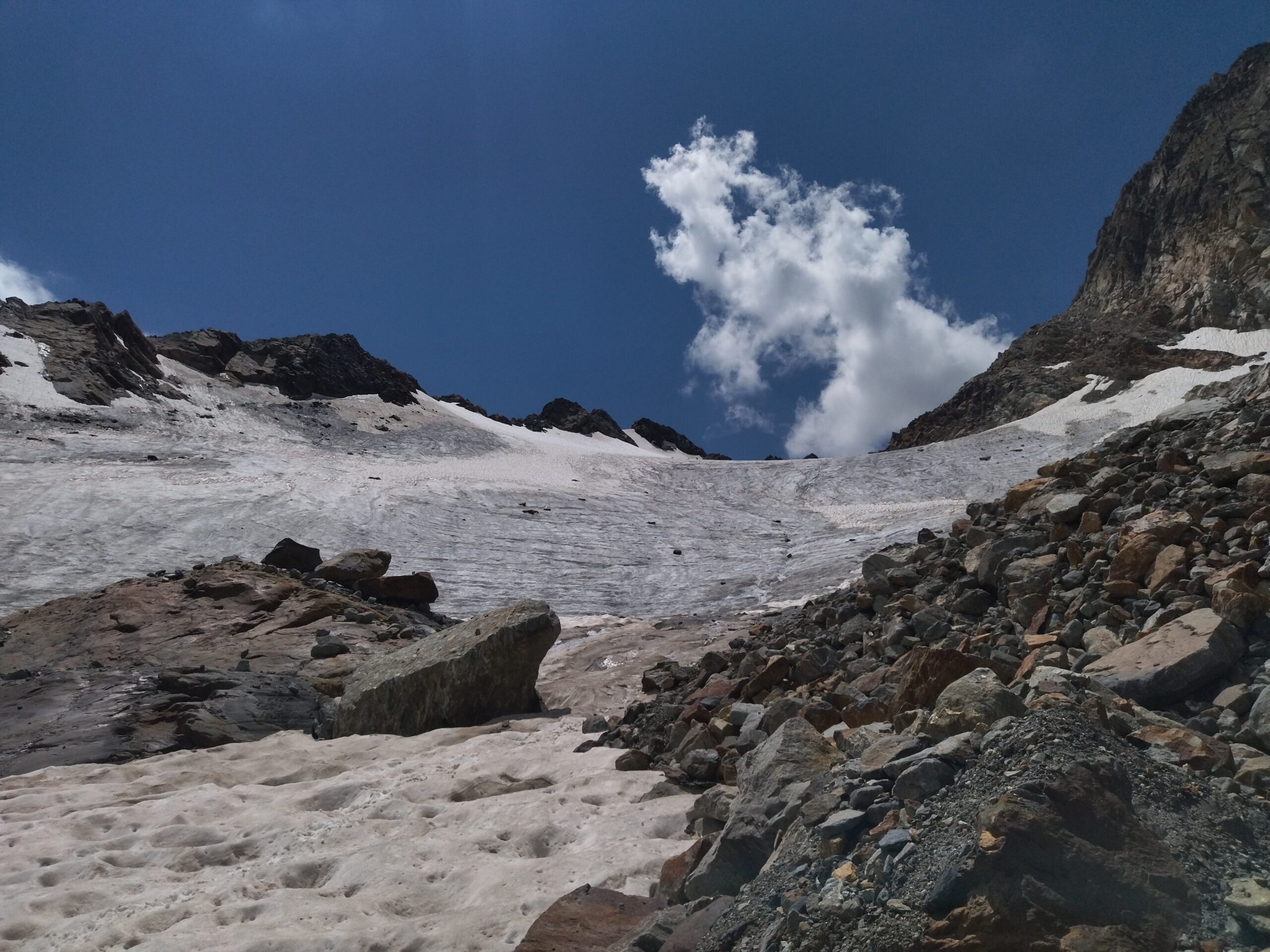
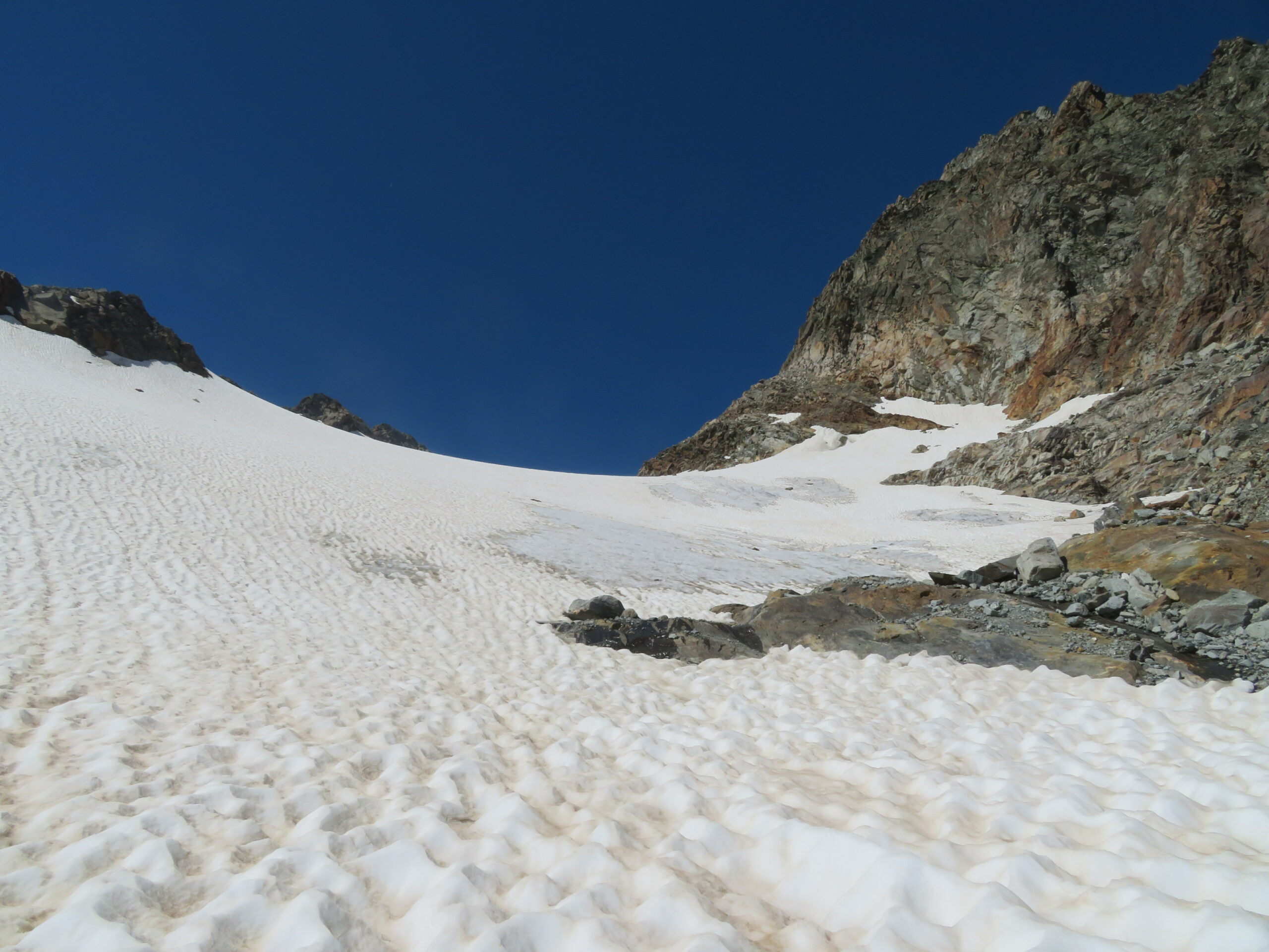
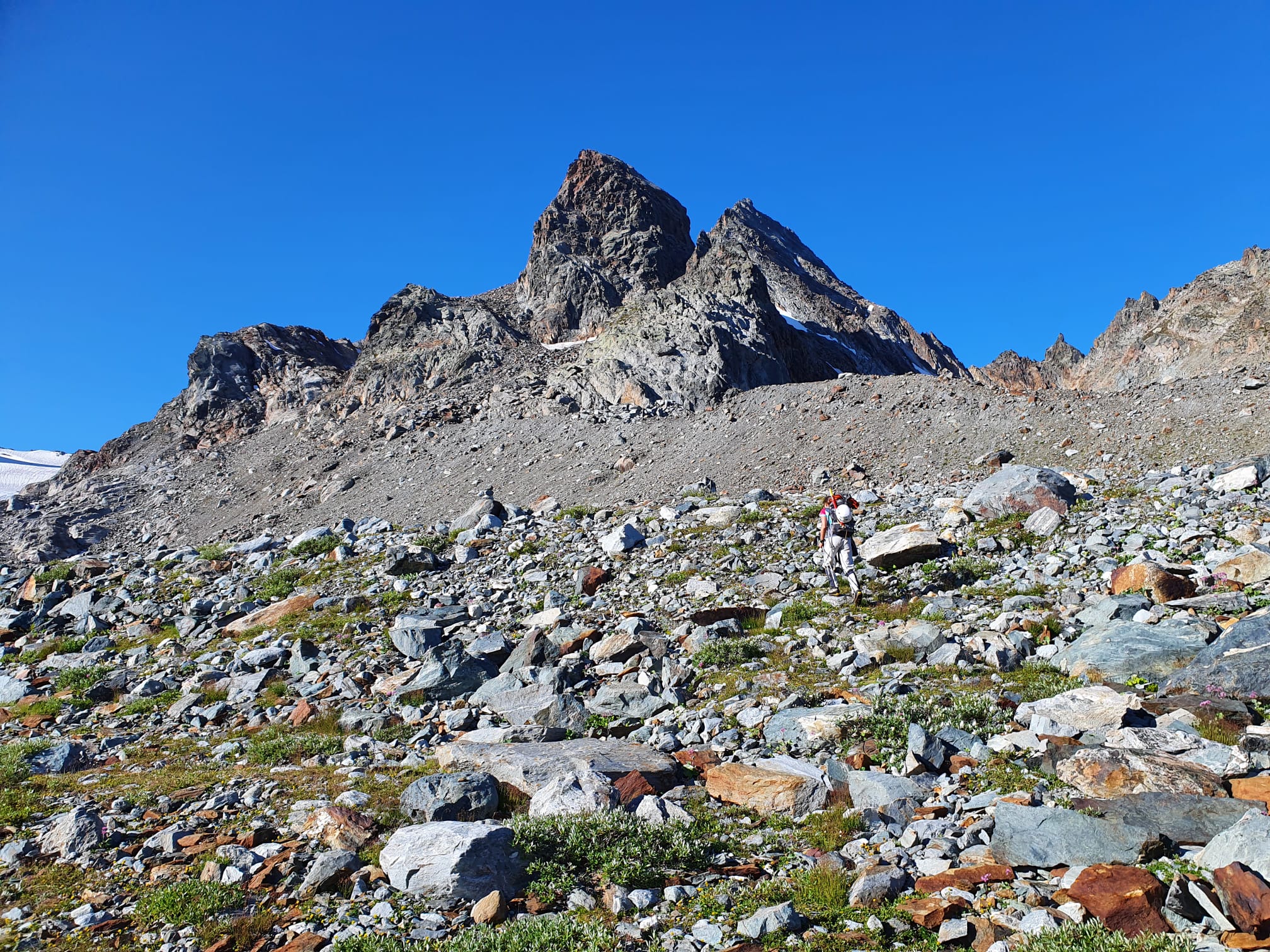
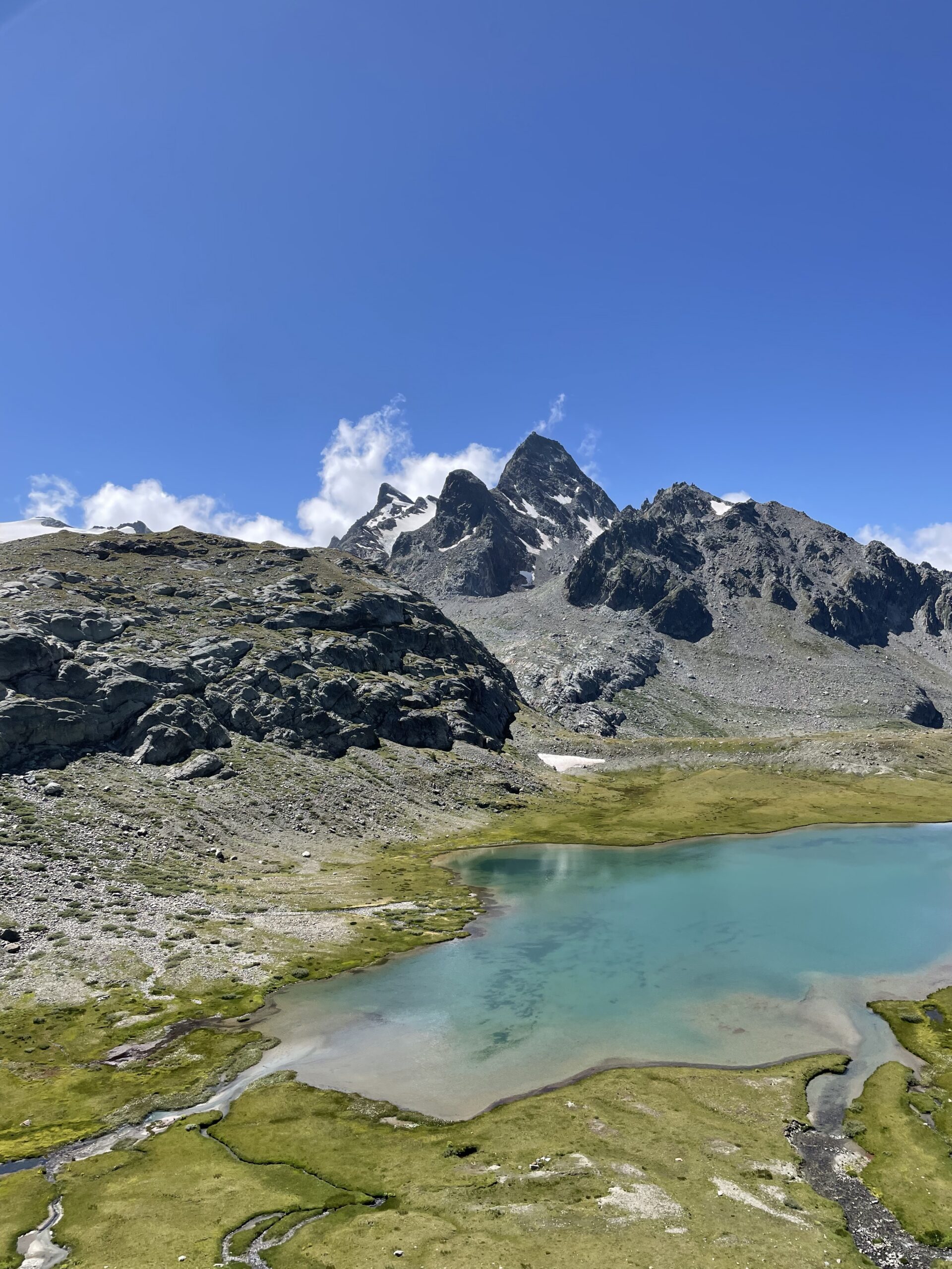
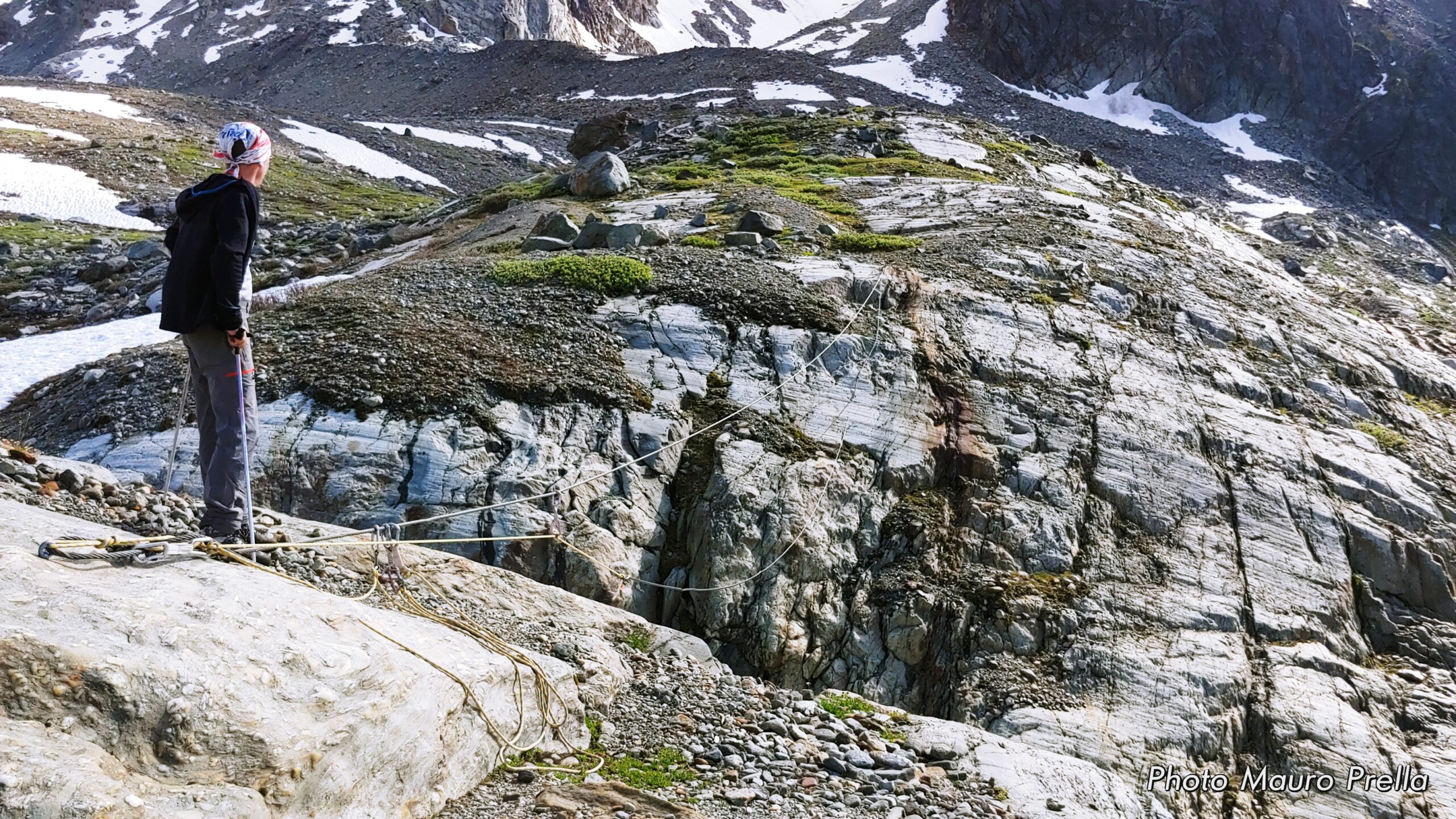
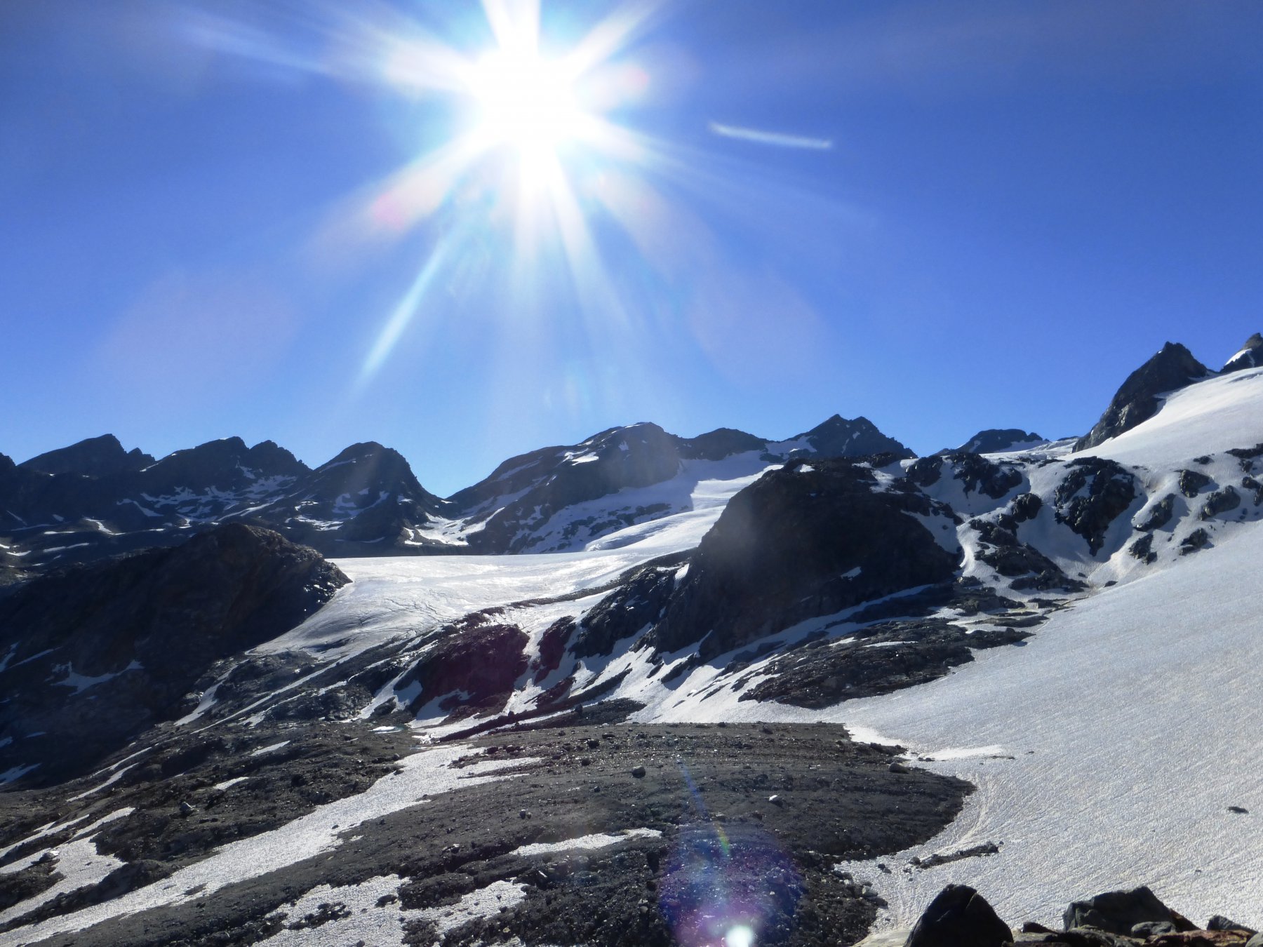
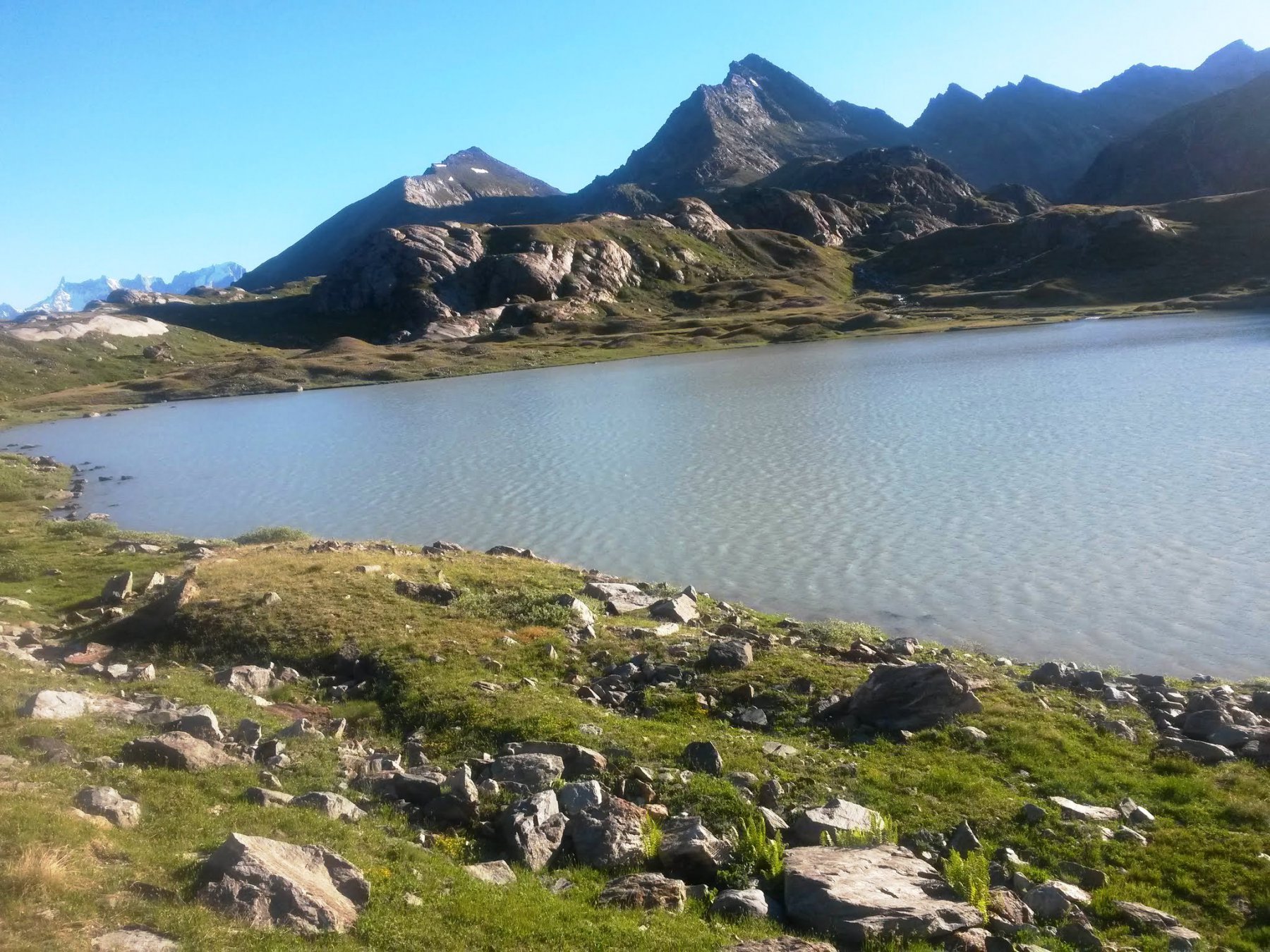
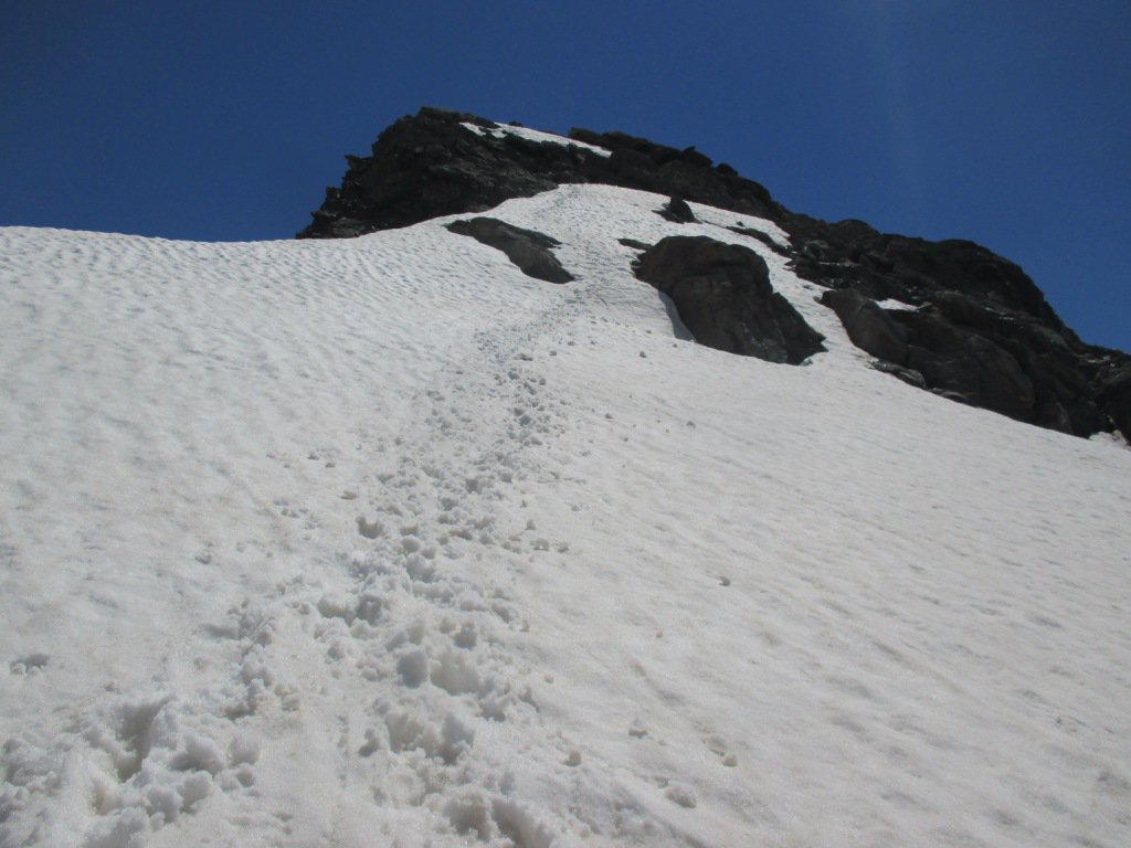
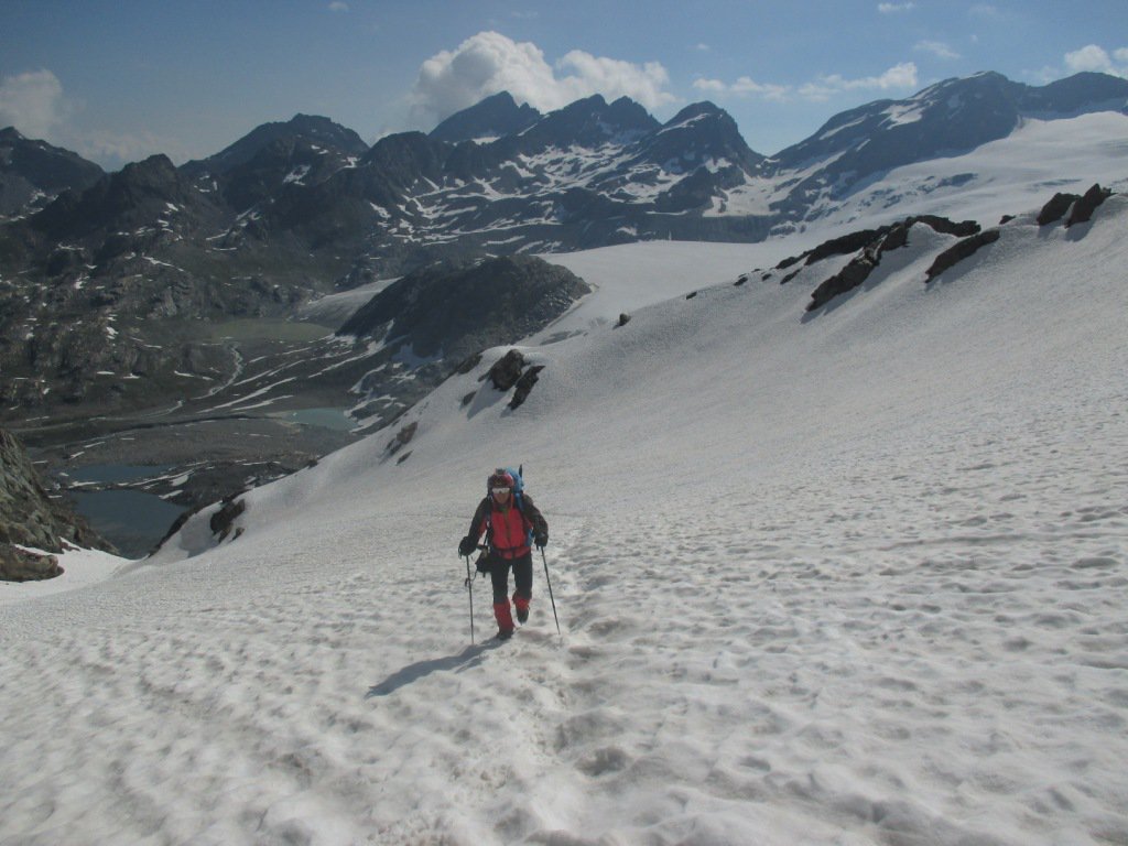
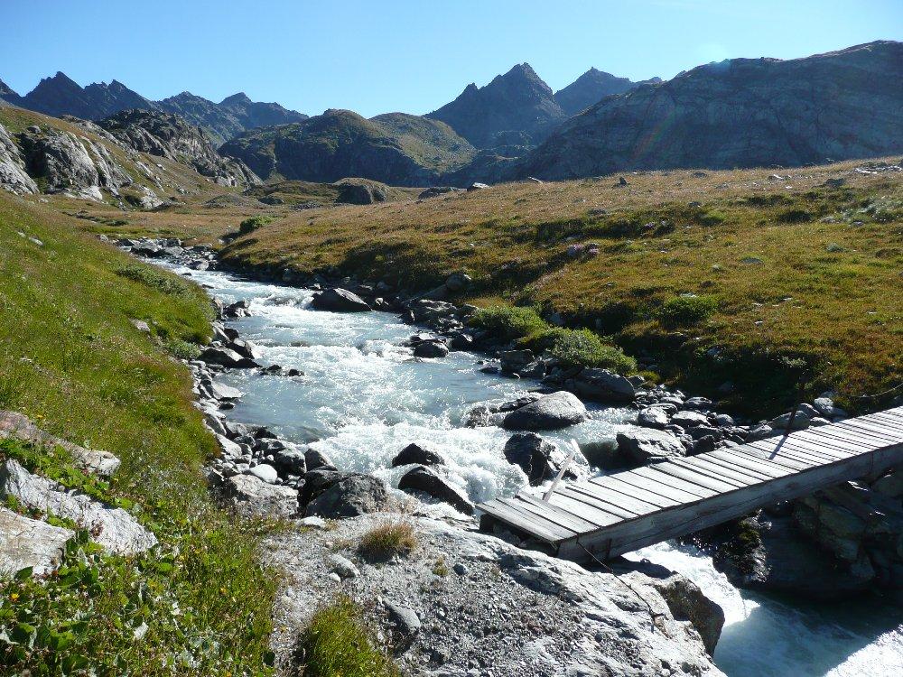
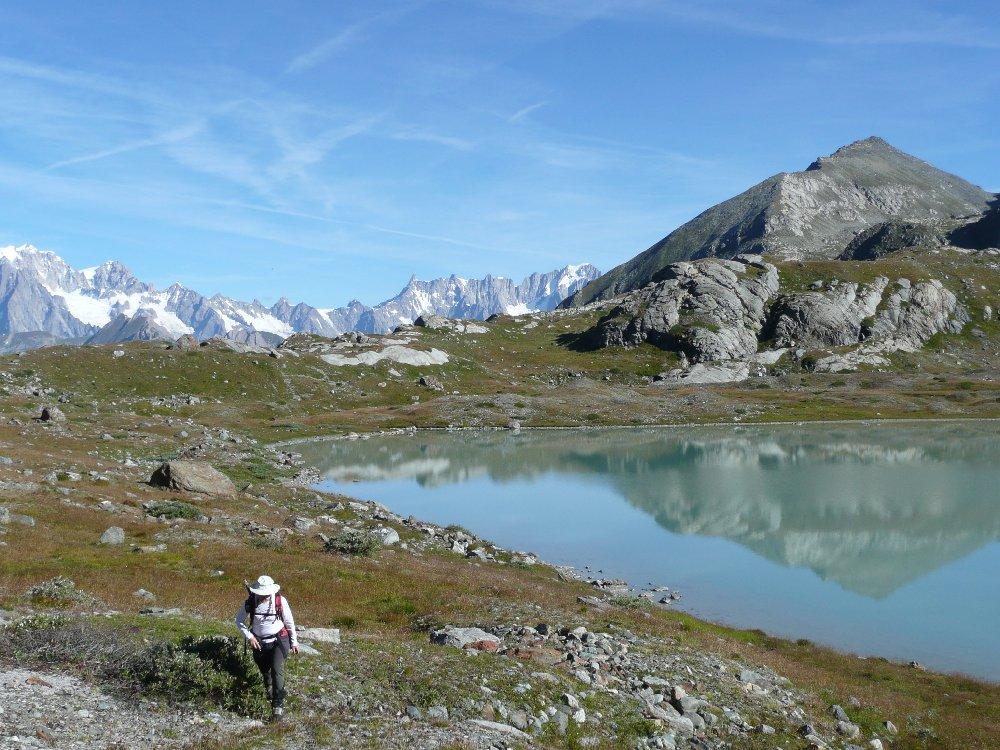
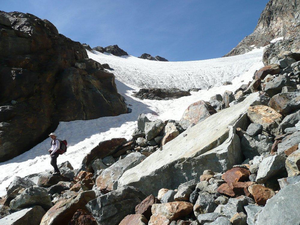
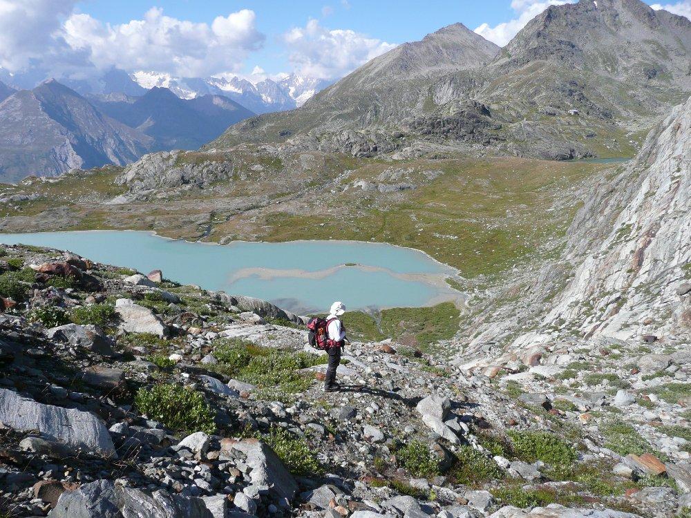
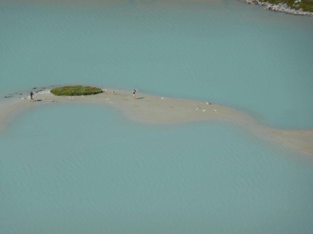
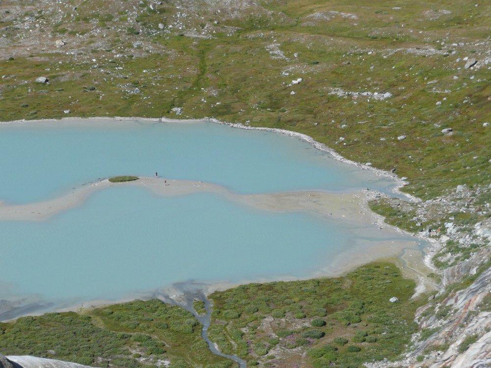
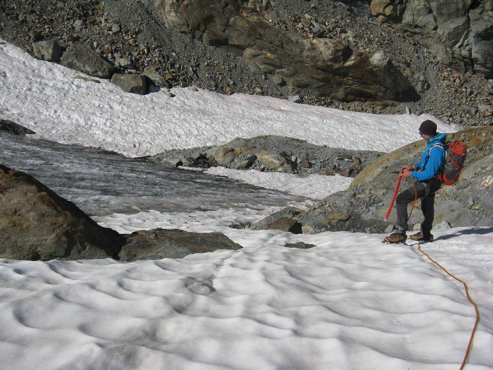
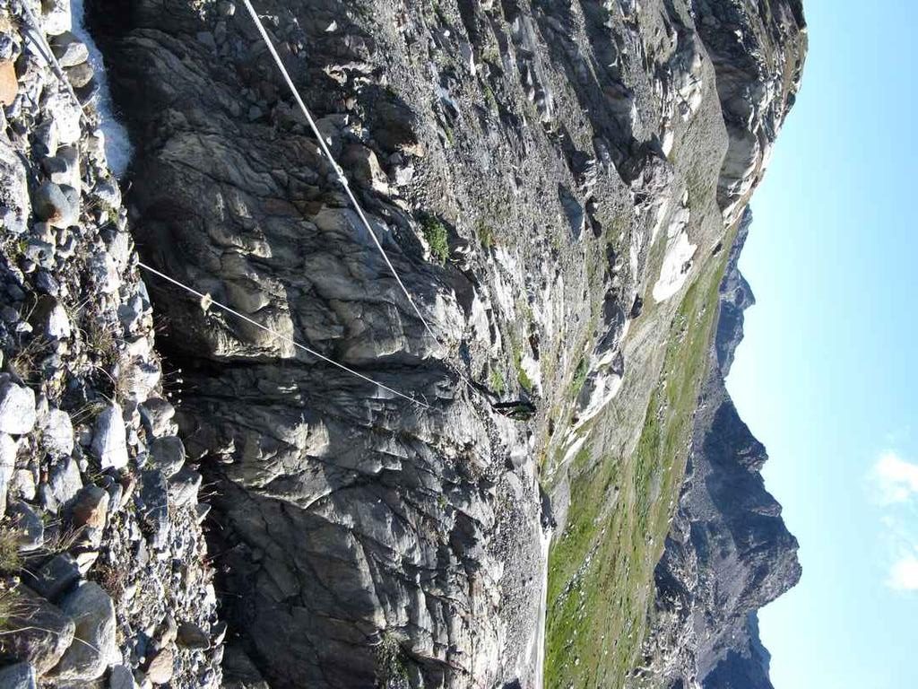
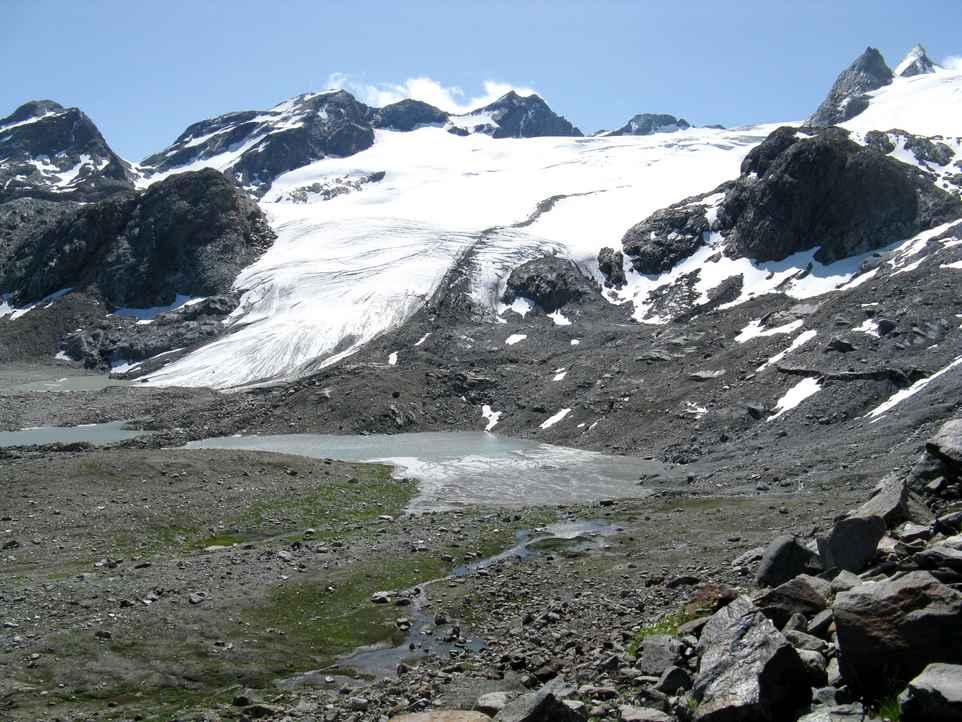
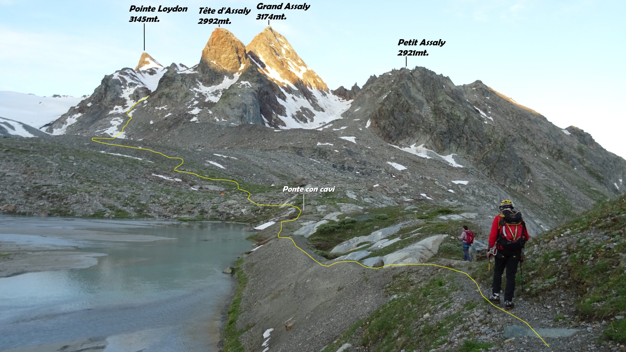
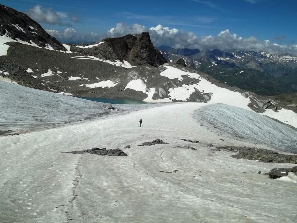
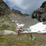
Davanti al rifugio si prende il sentiero in discesa con indicazione Passo di Planaval, risalendo brevemente sull’altro versante si incontra una seconda palina che indica il passo, qui si abbandona il sentiero principale e ci si dirige a destra su una traccia non segnalata che taglia in piano passando accanto al Lago Grigio 2531m e al Lago Glaciale che si contorna sulla destra giungendo al cavo metallico (ponte tibetano) che consente di attraversare il torrente glaciale. Giunti sull’altra sponda si sale per morena e piatraia in direzione del piccolo ghiacciaio che conduce al Colle d’Assaly puntando verso i due promontori rocciosi molto evidenti, poco più in alto si ritrova la traccia che sale accanto al promontorio roccioso di destra e giunge al piccolo ripiano davanti al ghiacciaio, da qui si risale il facile ghiacciaio fino al colle 3002m.
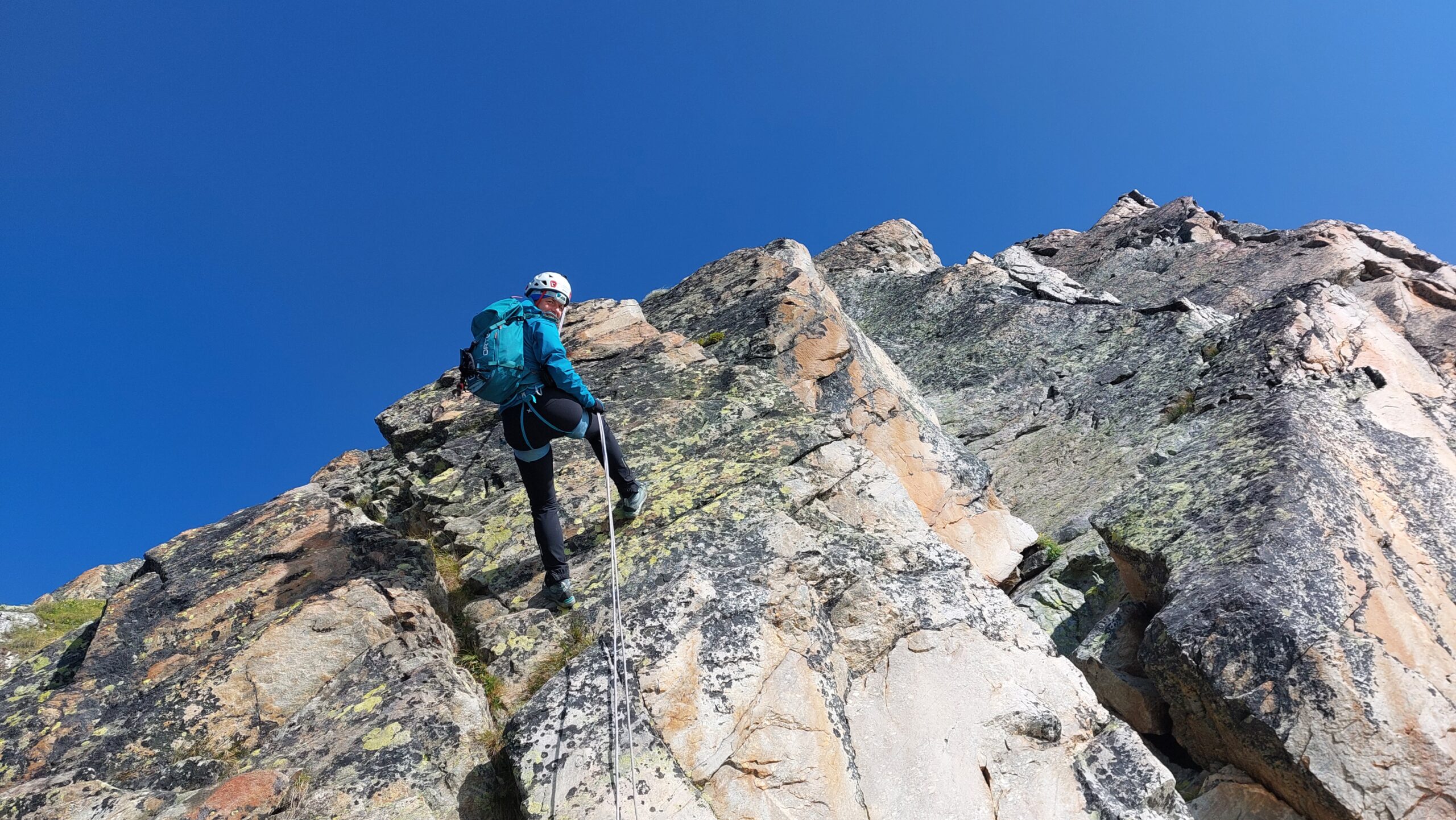
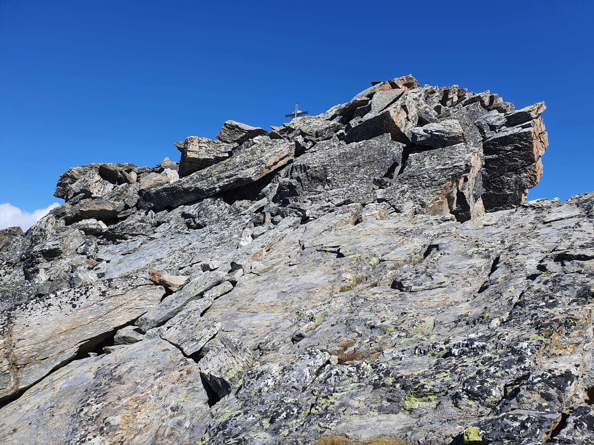
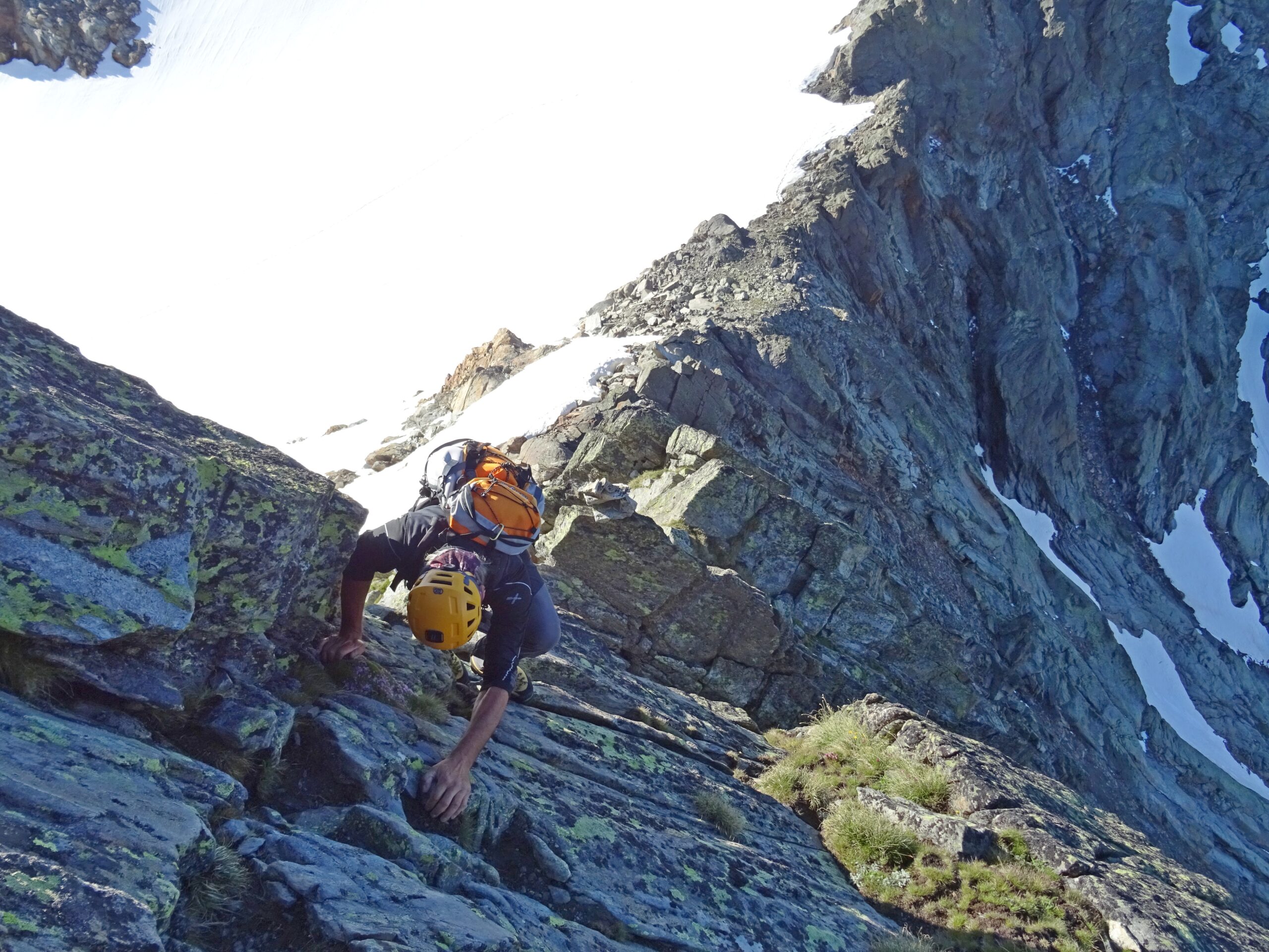
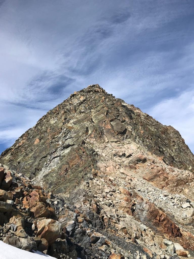
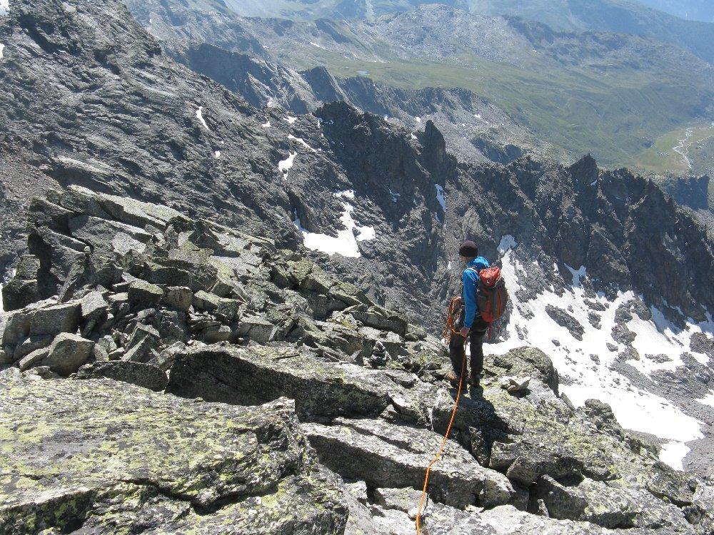
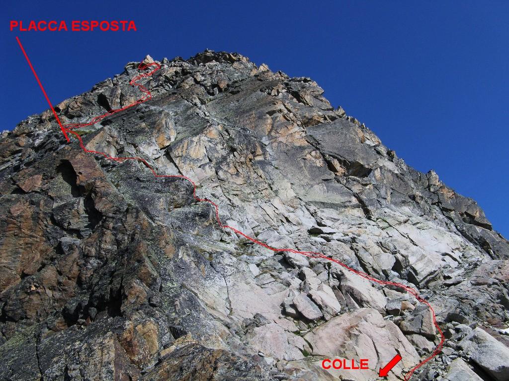
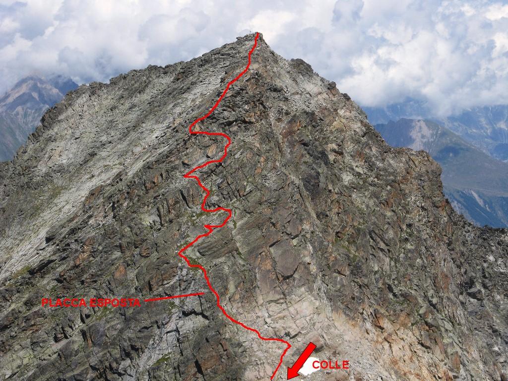
Dal colle si piega a destra verso la cresta sud, seguendo gli ometti e la traccia di sentiero sul versante italiano sempre accanto alla cresta sul si giunge al facile e breve tratto roccioso diagonale che porta sul versante francese dopo di che si continua per tracce di sentiero, alternate a brevi facili passaggi di arrampicata, fino in cima.
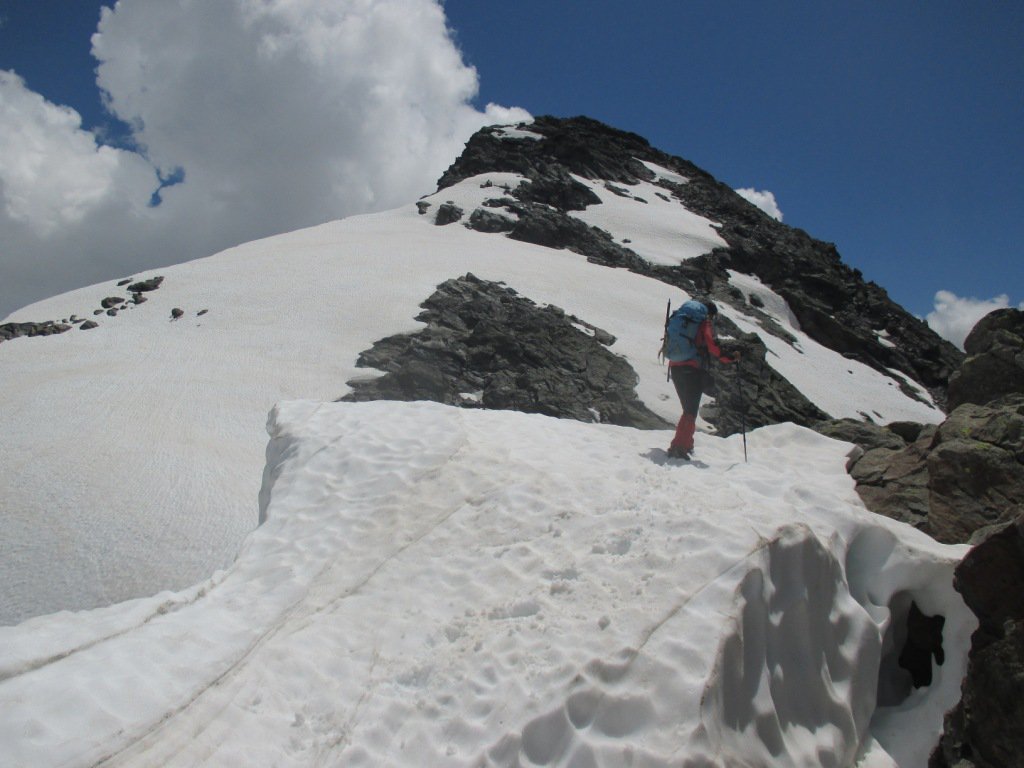
Volendo mettere nel sacco anche una seconda punta, ritornati al colle si può salire la Punta Loydon: si segue la facile dorsale in direzione della cima, si supera il promontorio roccioso di metà strada sulla sua destra (versante francese) e si continua per pietraia fino in cima a Punta Loydon ore 0,30.
Al ritorno giunti all’attraversamento del torrente glaciale se non si vuole più rifare il cavo metallico (Attenzione!! Così facendo non si ripassa al rifugio) si scende accanto al corso d’acqua (sinistra orografica) individuando ometti e radi bolli e frecce gialle che consentono di scendere facilmente tra le cenge della bastionata, giunti sul pianoro si contorna il lago sulla sinistra seguendo gli ometti e radi bolli gialli, si attraversa l’impetuoso corso d’acqua su un ponte di legno e si scende su sentiero nel Vallone di Bella Comba e da qui verso la terza cascata si rientra sul sentiero principale del Rif. Deffeyes e quindi a La Joux.
Se, giunti al Rifugio, si avesse notizia dell'inagibilità del ponte tibetano, si può scendere verso SO al Lago dei Seracchi, oltre il quale si trova il ponte di legno citato nella variante di discesa che si può seguire anche in salita. In questo caso di perdono 100 m di dislivello abbondanti.
- Cartografia:
- igc foglio 107 - 1:25.000 la Thuile - Carta dei sentieri 1:25000 - La Thuile/Piccolo San Bernardo - L'ESCURSIONISTA editore
Nelle vicinanze Mappa
Itinerari
17/08/2018 AO, La Thuile D+ 1900 m F+ Nord-Ovest
Doravidi (Monte, Punta Nord) da La Joux
 50m
50m
10/08/2012 AO, La Thuile D+ 306 m F+ Nord-Est
Flambeau Via delle Lose
 50m
50m
16/08/2024 AO, La Thuile D+ 1600 m F+ Varie
Loydon (Pointe) o Petit Assaly da La Joux per il Rifugio Deffeyes
 50m
50m
21/08/2025 AO, La Thuile D+ 1750 m F Nord-Ovest
Paramont (Becca Bianca del) Via Normale da La Joux per il Rifugio Deffeyes
 50m
50m
21/07/2019 AO, La Thuile D+ 2000 m PD Varie
Doravidi (Monte, Punta Nord) e Flambeau traversata sud/nord
 50m
50m
05/07/2026 AO, La Thuile D+ 2000 m F Nord
Rutor (Testa del) Via Normale da La Joux per il Rifugio Deffejes
 50m
50m
16/08/2023 AO, La Thuile D+ 1800 m F+ Varie
Paramont (Mont) Via Normale da la Joux
 50m
50m
09/08/2011 AO, La Thuile D+ 1800 m PD- Nord-Ovest
Flambeau per il versante Nord-Ovest
 50m
50m
24/09/2023 AO, La Thuile D+ 1650 m F Nord-Est
Chenal (Punta) da la Joux per il Rifugio Deffeyes
 50m
50m
14/08/2025 AO, La Thuile D+ 1580 m F Varie
Paramont (Testa del) da La Joux per il Rifugio Deffeyes
 50m
50m