3.9Km
3.9Km


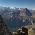
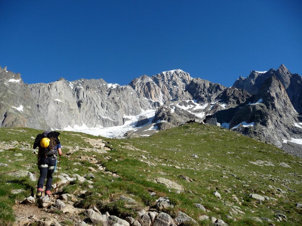
Avvicinamento
 50m
50m
50m
50m
2.5Km
2.5Km
2.5Km
2.5Km
2.5Km
2.5Km
50m
50m
50m
50m
2.5Km
2.5Km
2.5Km
2.5Km
2.5Km
2.5Km
.
Descrizione
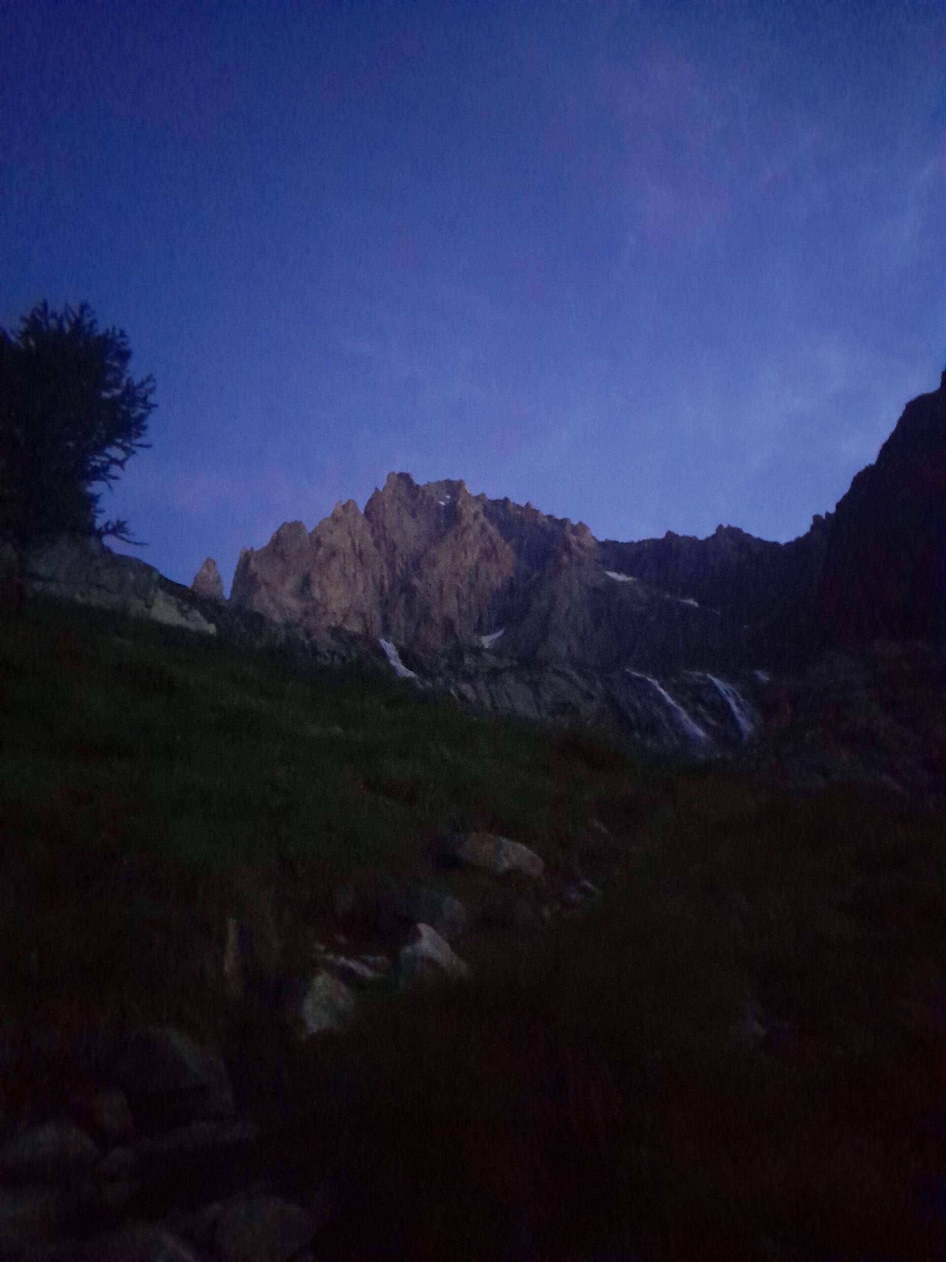
Da Purtud salire al Rifugio Borelli.
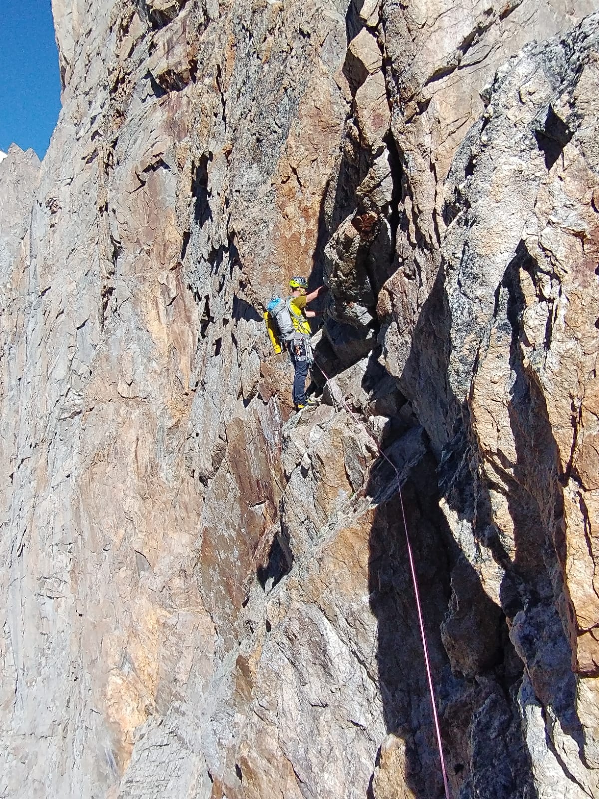
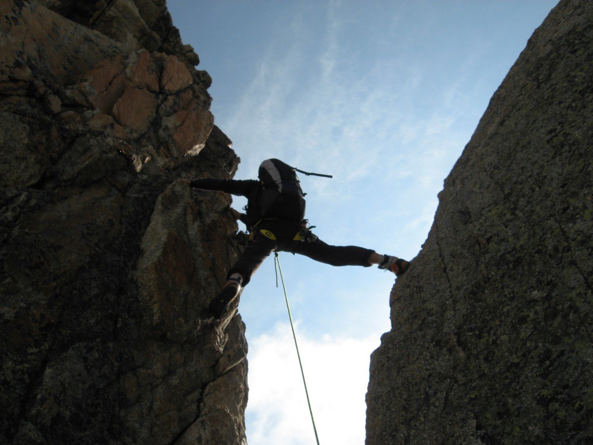
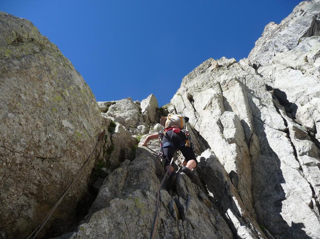
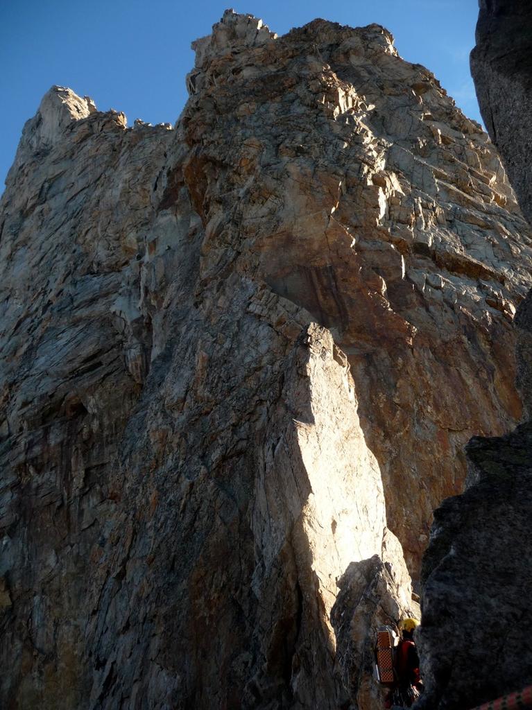
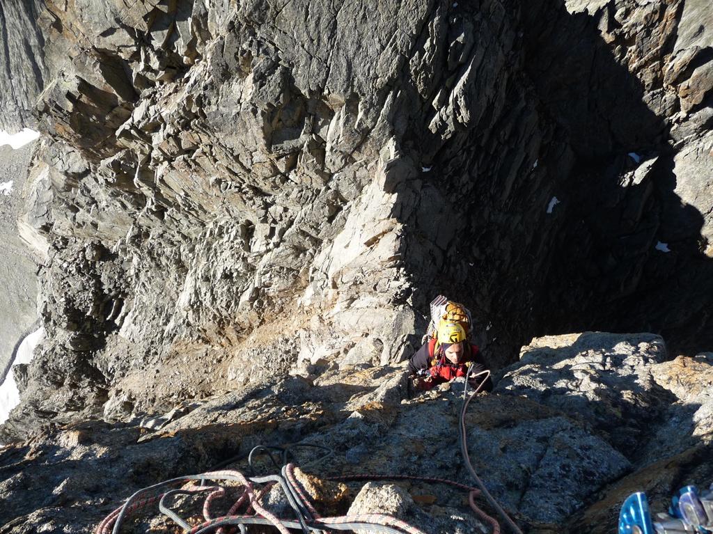
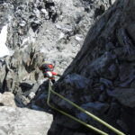
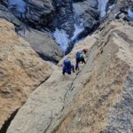
Dal rifugio Boreli (2316 m), raggiungere la base della punta Gamba (2675 m) risalendo una groppa erbosa sulla morena e salendo diagonalmente (vago sentiero). L’attacco si trova circa 20 m a sinistra del canale camino che separa la punta Gamba dalla punta bifida (targa commemorativa).
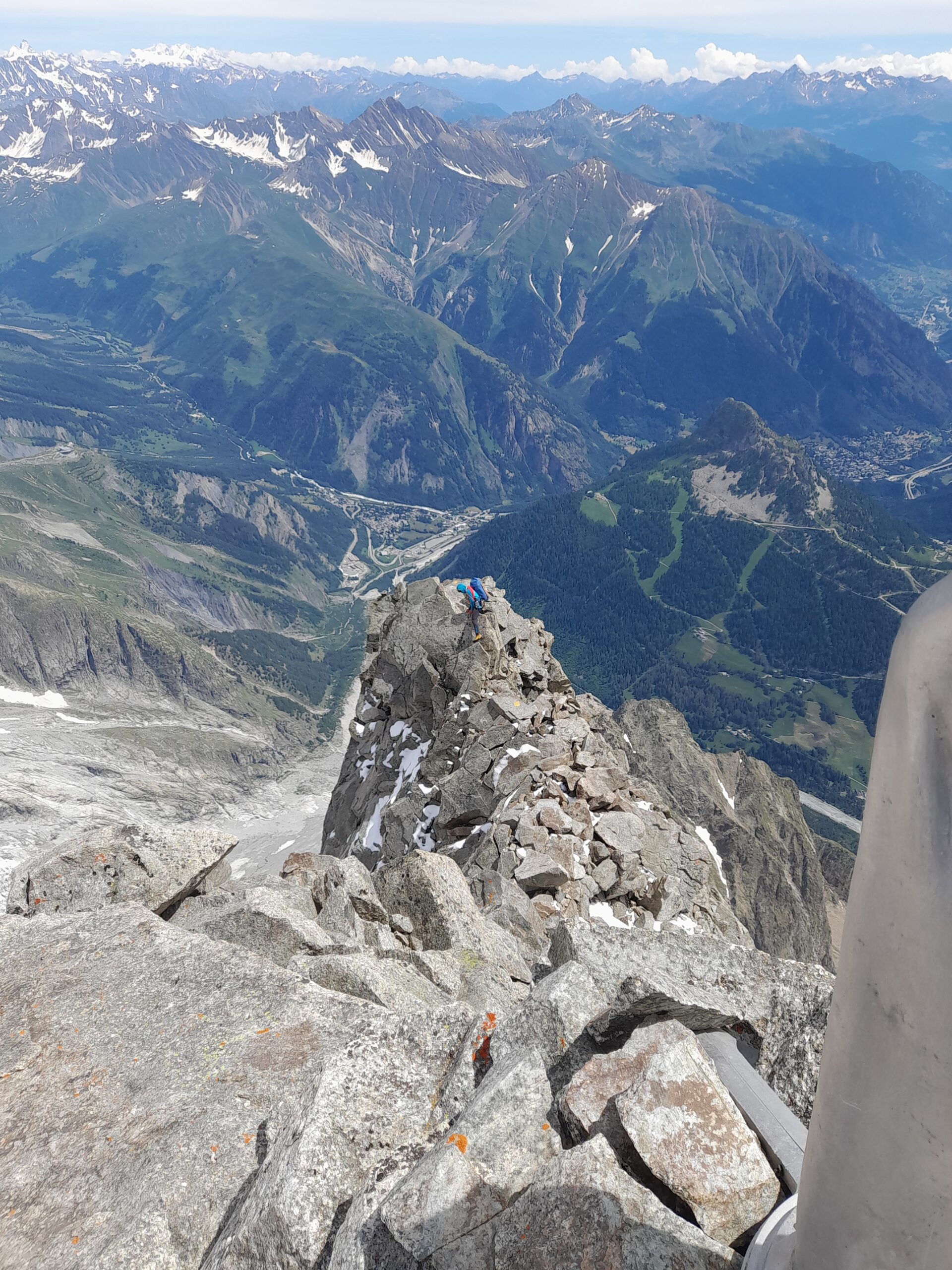
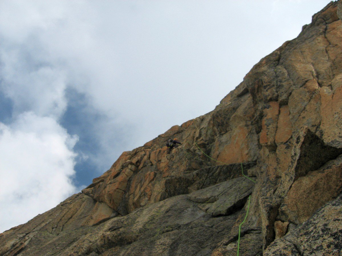
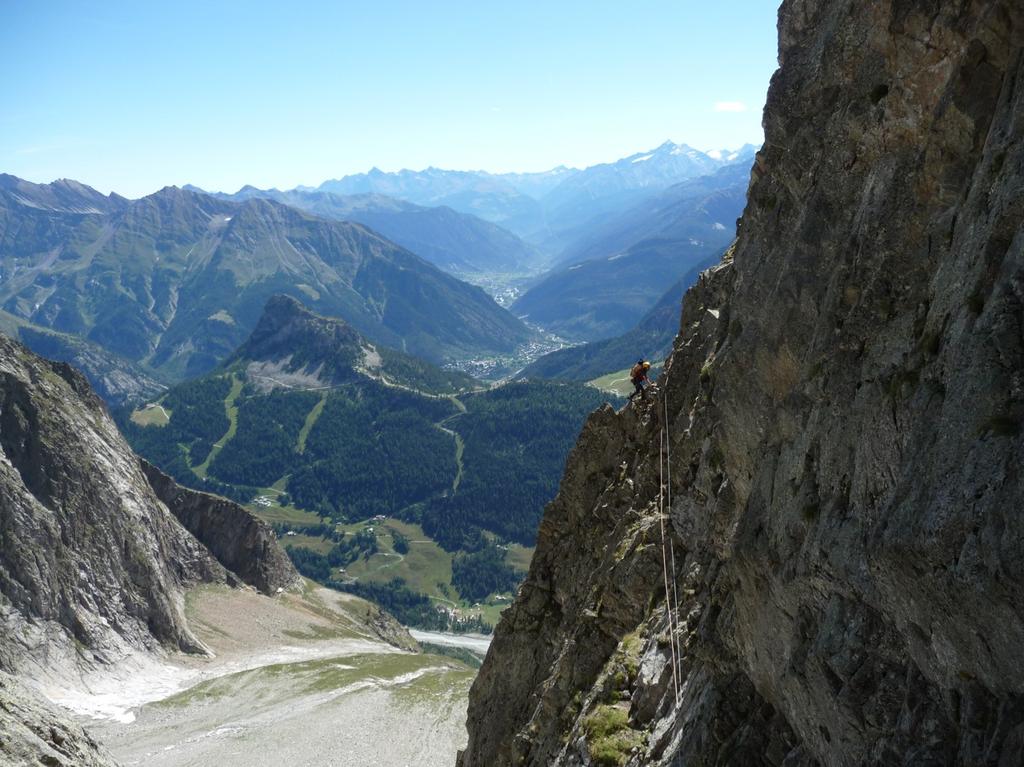
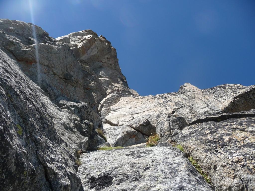
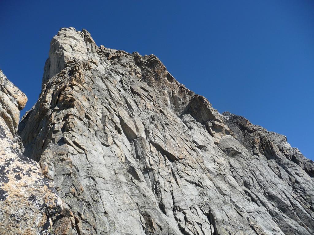
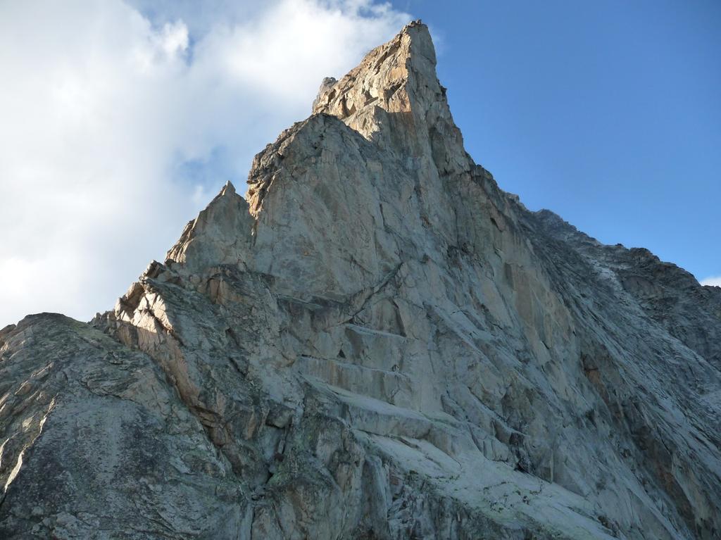
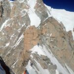
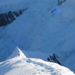
Quindi salire nell’ordine: Col des Chasseurs, Tête des Chasseurs (2802 m), la Punta Gamba (3069 m), le Pointes bifides, la Punta Welzenbach (3355 m), la Pointe Brendel (3497 m, la Pointe Ottoz (3586), la Pointe Bich (3753 m) e infine la vetta della Noire de Peuterey (3773 m).
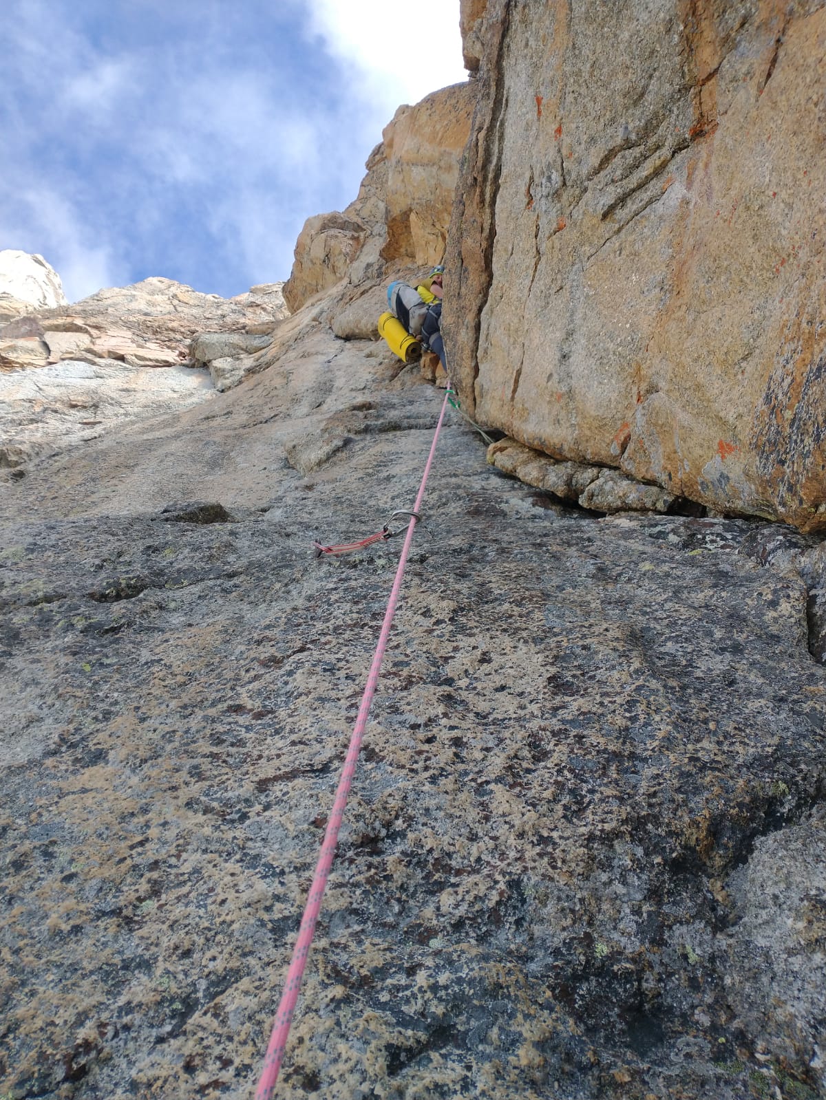
Discesa: è stata segnalata con bolli gialli nel 2022. Sono altresi’ presenti soste a fix con maillon dove necessario. Si puo’ scendere FORSE anche con corda 1×50 mt, ma molto meglio avere 1×60 mt.
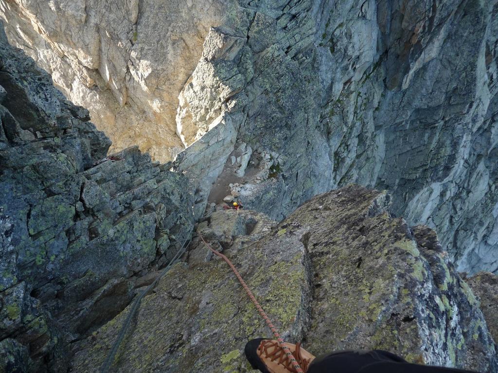
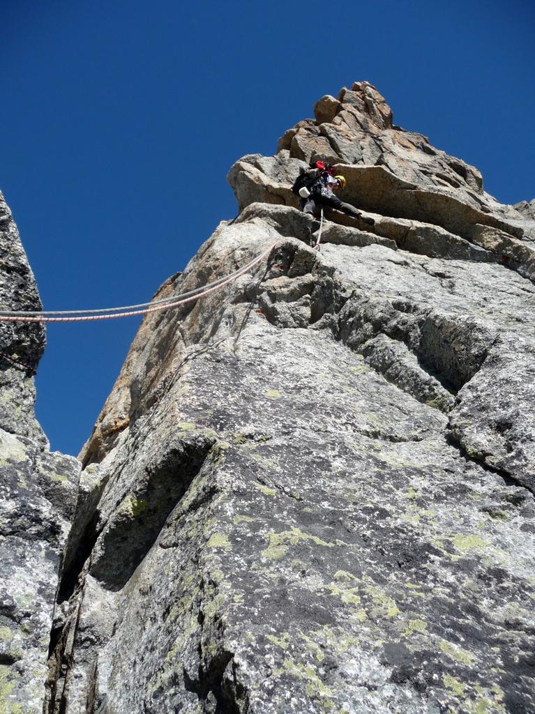
Dalla cima scendere appena a destra della cresta su terreno dritto ma segnato da ometti – dopo circa 50 mt,, NON DI PIU’, GUARDARE A SX SULLA CRESTA, DOVE è MOLTO EVIDENTE UN OMETTO ABBASTANZA ALTO – puntare all’ometto, e da quel punto STARE IN CRESTA PER I PROSSIMI 100 mt circa – si scende abbastanza bene fino ad un terrazzo – circa 150 mt piu’ in basso della cima – si è ora sopra un salto di una ventina di mt molto dritto – a dx ci sarebbero eventualmente posti da bivacco
Scendere due o 3 mt a dx e poi cercare una sosta appena sotto il bordo del terrazzo a sx – DOPPIA fino alla base del salto – NON FARSI INGANNARE DA FACILI CENGE CHE PERMETTEREBBERO DI NON FARE LA DOPPIA FACENDO UNA GRANDE ANSA DX/SX, MA CHE OBBLIGHEREBBERO A PASSARE AL CENTRO DELL’ENORME COLATOIO DELLA PARETE SUD
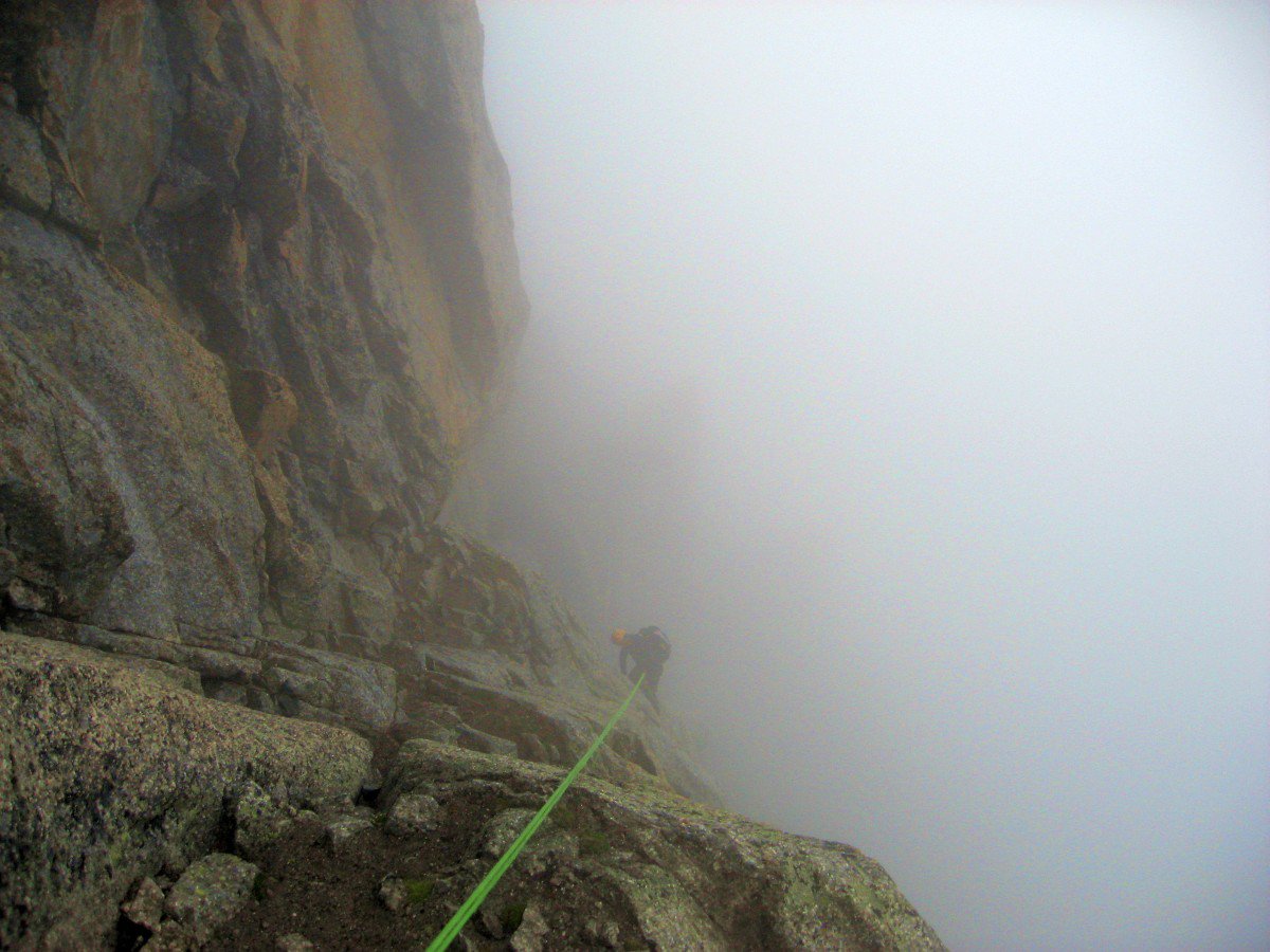
Ora si deve scendere parecchio puntando sempre abbastanza verso sinistra – ad un certo punto si trova una doppia corta (non sono sicuro al 100% della presenza di questa doppia) e poi due fix (il secondo con un piccolo spezzone di corda fissa di due/tre mt) che permettono di proteggere un traverso verso sinistra esposto per poter arrivare ad una prima doppia su roccia grigia – qua si fanno o due o tre doppie su fix sempre tirando verso sx (faccia a valle) fino ad arrivare a dx di alcuni grossi blocchi (guardando faccia valle) – in fondo all’ultima doppia (30 mt) si arriva su un terrazzo – appena sopra c’è posto molto comodo per cliente – scavalcare i grossi blocchi (facile) e arrivare ad una grossa piazzola da bivacco
Da qua si continua a scendere sempre (a tratti parecchio ripido) tirando verso sx per arrivare all’altezza della cima di un gendarme della cresta abbastanza evidente quotato 3374 mt – scendere appena a dx del colatoio che c’è prima del gendarme, e se possibile non entrare in questo colatoio (sassi instabili, anche se non grossi) – mi sembra di ricordare una doppietta ma non sicuro al 100% (o forse mi sarebbe piaciuto se ci fosse stata) – si arriva cosi’ alla base del gendarme – traversare sotto il gendarme tirando a sx in piano e poi leggera salita di pochi metri fino ad arrivare alla cresta (grosso ometto)
Scendere la cresta (facile) fino ad arrivare a circa 30/40 mt prima di due gendarmi abbastanza evidenti (quota 3290) – a dx c’è un camino facile che permette di scendere sul versante sud fino ad una grossa piazzola da bivacco molto molto comoda – ultima possibilità di bivacco comodo da qua al fondo della discesa – se non si vuole fare il camino, pochi metri piu’ avanti c’è una sosta per doppia che si vede abbastanza bene in quanto è proprio sul bordo di cresta, e che permette di arrivare con una calata di 25 mt alla piazzola da bivacco
Bypassare il primo gendarme lato sud ed il secondo lato Brenva (nord) su terreno facile, e poi scendere poco per arrivare ad una terrazza inclinata sopra un grande salto – qua conviene assolutamente fare la doppia in loco (molto ripido/verticale appena sotto la terrazza) – con trenta metri si arriva in un diedro esattamente dove c’è un piccolo spuntone dove si puo’ mettere fettuccia e vincolare cliente, per poi farlo scendere fino ad un comodo terrazzo sulla cresta una decina di mt sotto – puo’’ anche darsi ci sia un altro ancoraggio sopra ma non l’ho visto) – Scendere il diedrino (facilem – 10 mt) fino al terrazzo di cui sopra – da qua si puo’ lasciare definitivamente la cresta est e fare una doppia di circa 20/25 mt (senza maillon) in un canale abbastanza marcio (una ventina di mt) per poi andare subito a sx una ottantina di mt puntando ad una evidente spalla (facile – terra ed erba) – la relazione camptocamp dice invece di continuare qualche metro in cresta fino ad arrivare con un gendarme quadrato alle spalle e poi puntare alla evidente spalla di cui sopra – da qua in poi seguire fedelmente questa spalla che separa due colatoi (di cui quello a dx abbastanza repulsivo) – scendere fino dove si riesce su questa spalla EVITANDO DI FARSI ATTIRARE DA TERRENO APPARENTEMENTE PIU’ FACILE A SX – in fondo alla spalla in corrispondenza dell’ultimo ometto si vede appena a dx dell’ometto una fettuccia nera + vecchio chiodo – NON ANDARCI – CERCARE INVECE APPENA A VALLE E A SX DELL’OMETTO, DIETRO IL BORDO DELLA ROCCIA, UNA EVIDENTE DOPPIA CON DUE FIX+CORDONE – DA QUA SI FANNO 4 COMODISSIME DOPPIE – la seconda doppia va fatta nel lungo diedro che si si ha a dx (faccia a valle) . La prime tre doppie sono su due fix+maillon, l’ultima doppia su 1 fix + tre chiodi vecchi (cambiato cordone) – con l’ultima doppia si arriva sulla grande cengia della via normale, in corrispondenza dell’uscita del colatoio repulsivo di cui sopra.
Traversare la cengia per circa 80/100 mt fino ad una altra larga conca (acqua che cola) – qua c’è uno speroncino erboso che scende a sx, con anche in cima una doppia attrezzata sul suo bordo dx (faccia a valle) – si puo’ scendere questo speroncino (facile disarrampicata) e poi FORSE SI TROVANO DELLE DOPPIE IN FONDO – DA INFO AVUTE E’ COMUNQUE MEGLIO NON FARLO, IN QUANTO COMUNQUE LE DOPPIE SOTTO NON SONO PIU’ STATE ATTREZZATE DAL SOCCORSO E NON SI SA ESATTAMENTE DA QUANTO SIANO – IN PIU’ CON QUESTE DOPPIE SI ARRIVEREBBE SUL GRANDE NEVAIO, CHE PUO’ PARTIRE IN QUALSIASI MOMENTO CON IL CALDO
Quindi meglio traversare questa conca, risalire leggermente e continuare su terreno ripido erboso di traverso ancora per almeno 100/150 mt (via normale di salita) – non abbassarsi mai troppo, si trovano piccoli ometti, che pero’ immagino vengano ogni anno tirati giu’ dalle valanghe – quando ad un certo punto ci si trova una cinquantina di mt sopra la base della parete dove ci sono delle placche ripide – NON SEGUIRE UNA EVIDENTE E COMODA CENGIA COMPLETAMENTE ROCCIOSA CHE PORTEREBBE ANCORA PIU’ A DX, ma tornare indietro verso sx su una cengia inclinata facile, che con pochi passi di facile arrampicata porta ad una ventina di mt dal nevaio – si puo’ disarrampicare (facile) ma piu’ comodo fare una ultima doppietta attrezzata che porta al nevaio del Combalet in un punto sicuro, a 10 mt dalla cima della morena
- Bibliografia:
- Vallot vol.1
Ultima revisione 01/07/2026
Nelle vicinanze Mappa
Itinerari
26/07/2020 AO, Courmayeur D+ 1600 m TD+ Ovest
Peuterey (Aiguille Noire de) – Via Ratti-Vitali
 50m
50m
29/01/2022 AO, Courmayeur D+ 1470 m ED Nord-Ovest
Peuterey (Aiguille Noire de) – Supercouloir de Peuterey
 50m
50m
18/08/2023 AO, Courmayeur D+ 300 m TD- Sud
Gamba (Pic) Cresta Sud – Via Plat
 50m
50m
19/08/2023 AO, Courmayeur D+ 4500 m TD+ Tutte
Bianco (Monte) Cresta Integrale di Peuterey
 50m
50m
28/06/2026 AO, Courmayeur D+ 1600 m AD+ Sud-Ovest
Croux (Aiguille) – Via Cheney alla Cresta SO
 2.5Km
2.5Km
19/07/2010 AO, Courmayeur D+ 3400 m TD+ Sud-Est
Bianco (Monte) Pilier nord de Freney – Via Gervasutti
 2.5Km
2.5Km
12/08/2021 AO, Courmayeur D+ 2600 m AD Est
Bionnassay (Aiguille de) Cresta Est
 2.5Km
2.5Km
10/07/2023 AO, Courmayeur D+ 3250 m D Sud
Bianco (Monte) Cresta del Brouillard integrale
 2.5Km
2.5Km
02/07/2021 AO, Courmayeur D+ 400 m TD+ Sud-Est
Brouillard (Pilastro Rosso del) – Via Bonatti-Oggioni
 2.5Km
2.5Km
09/08/2024 AO, Courmayeur D+ 3400 m ED- Sud-Est
Bianco (Monte) Pilone Centrale Freney – Via classica
 2.5Km
2.5Km