6.2Km
6.2Km

Note
 50m
50m
50m
50m
50m
50m
50m
50m
50m
50m
50m
50m
50m
50m
50m
50m
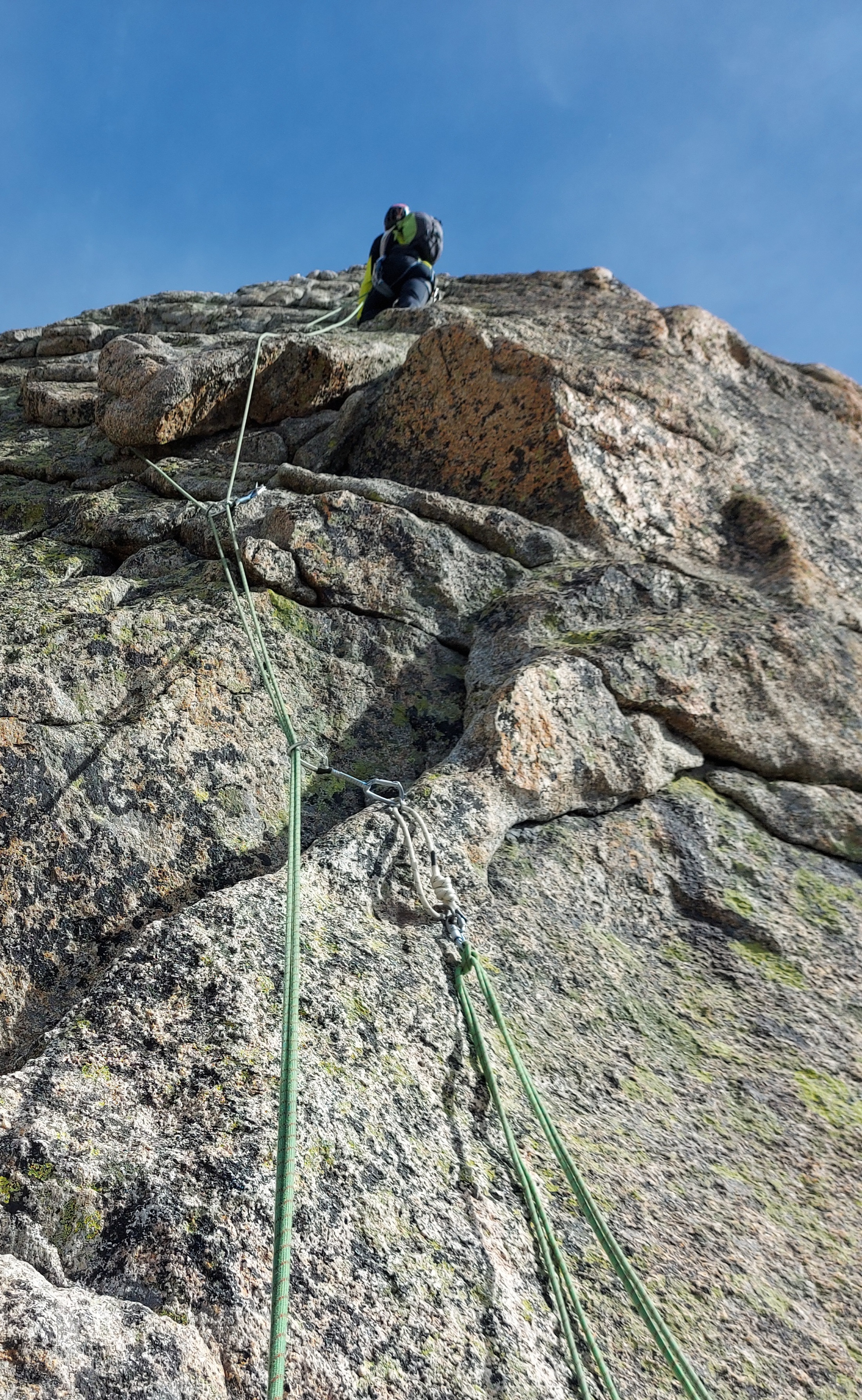
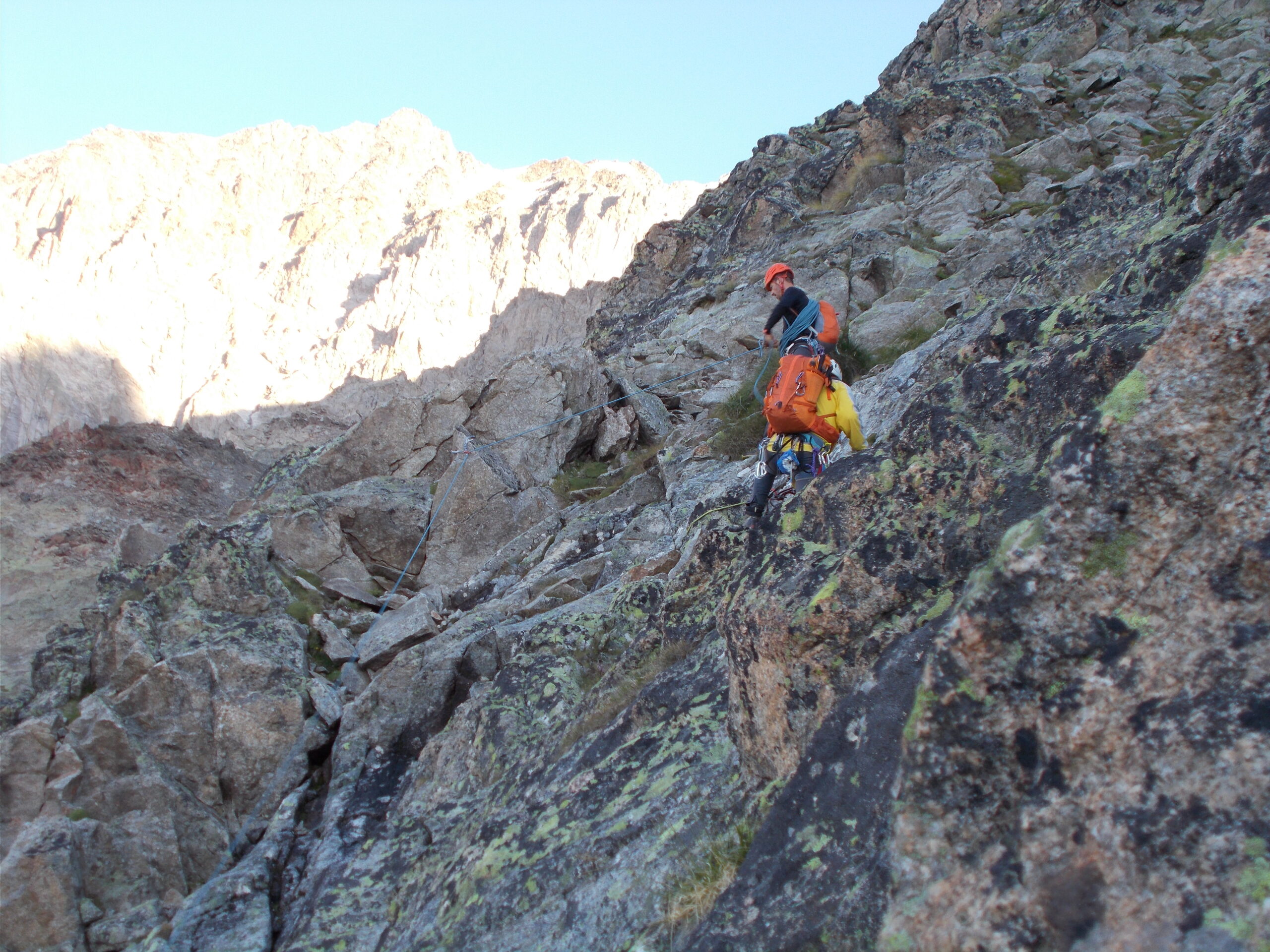
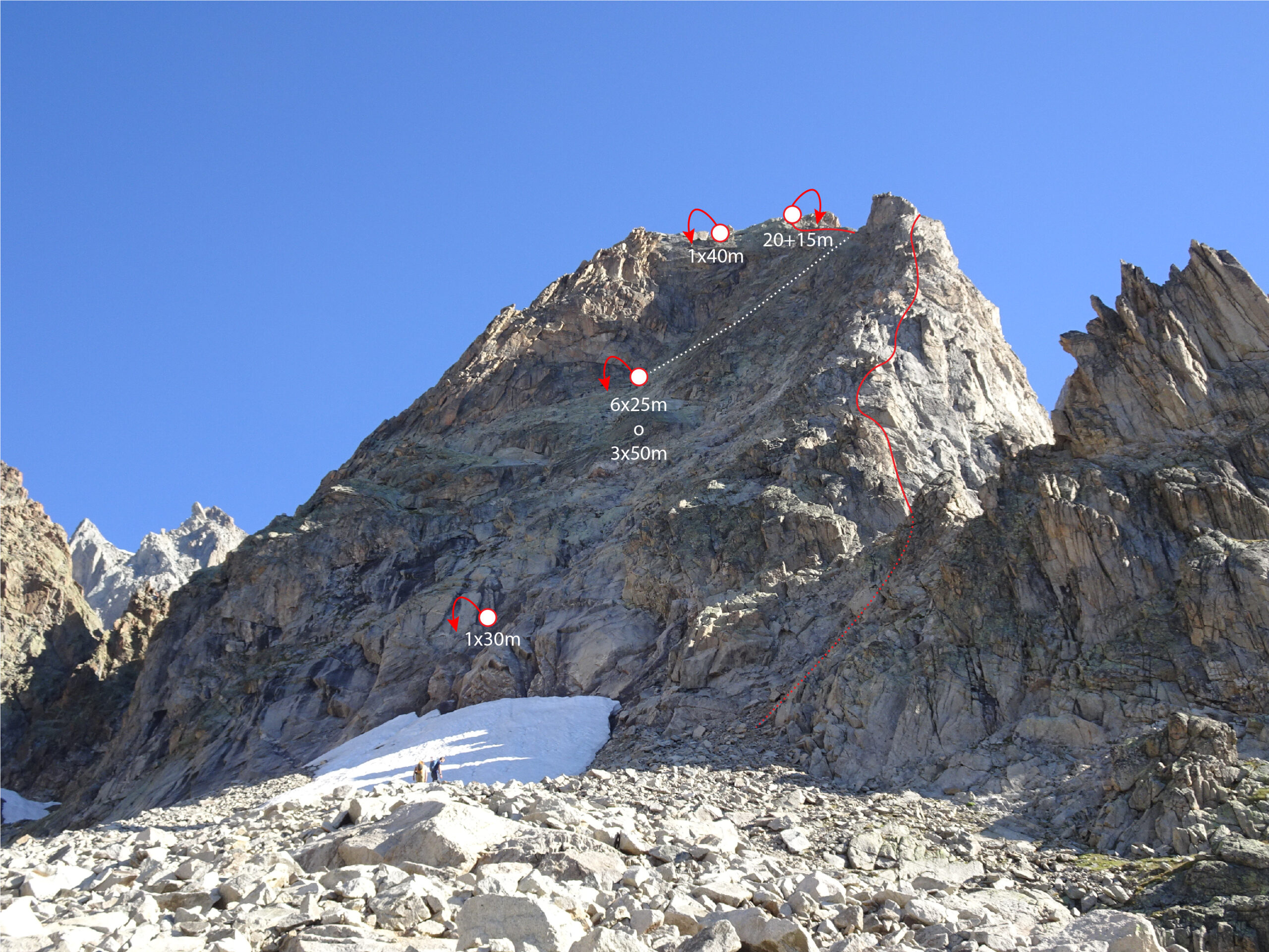
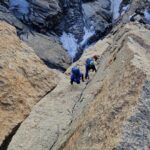
Via ottimamente attrezzata a spit, utili per integrare in alcuni punti friend piccoli e medi, oltre a fettucce varie. Tutti i passi sul IV ben protetti eccetto un salto a metà via. Attrezzate le soste nella parte iniziale (3 lunghezza da circa 25-30m) e sul filo di cresta lungo gli ultimi 2 tiri (25m + 35/40m).
Avvicinamento
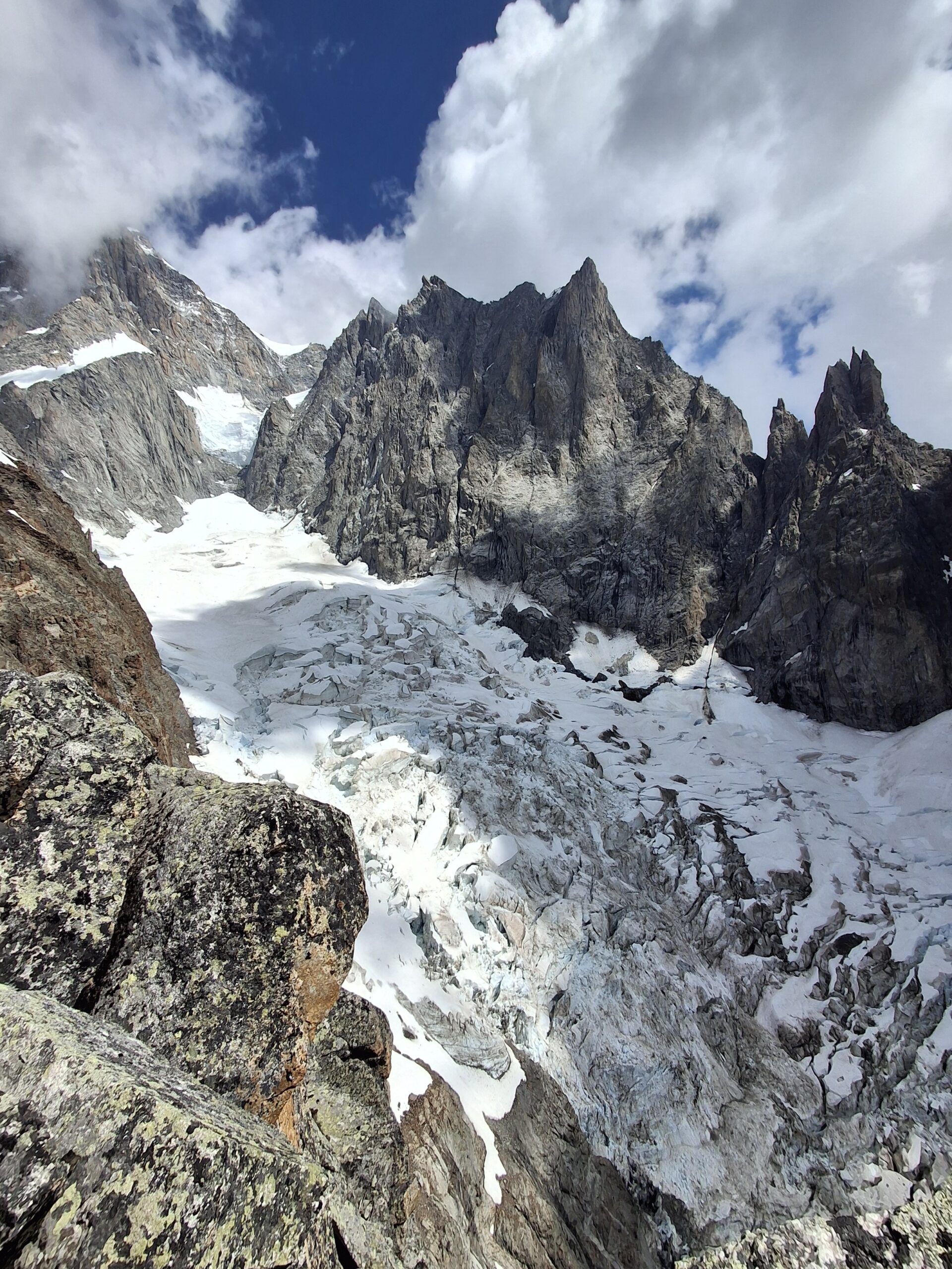
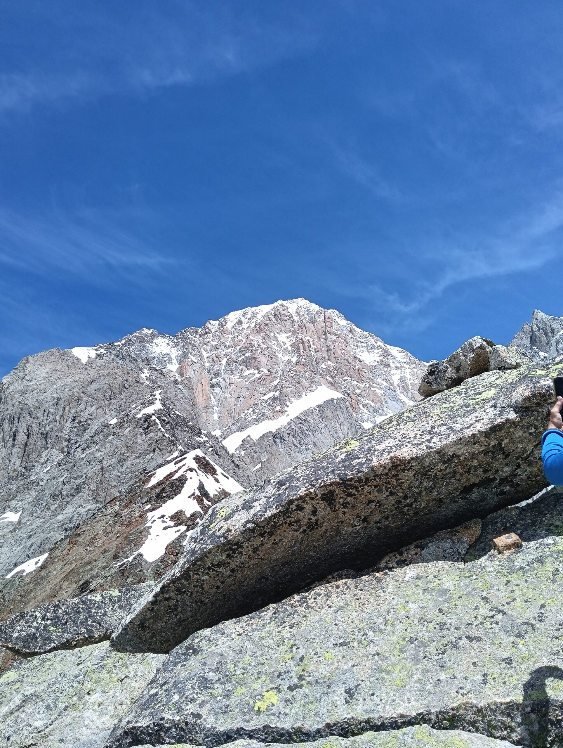
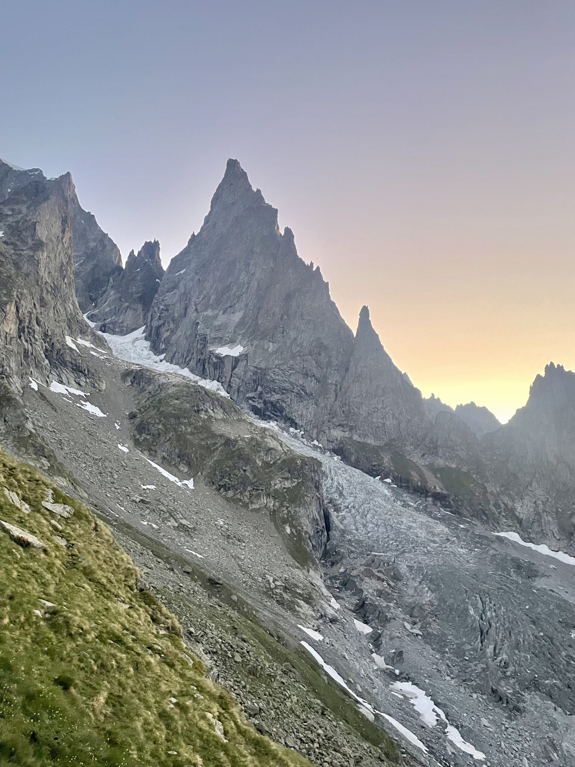
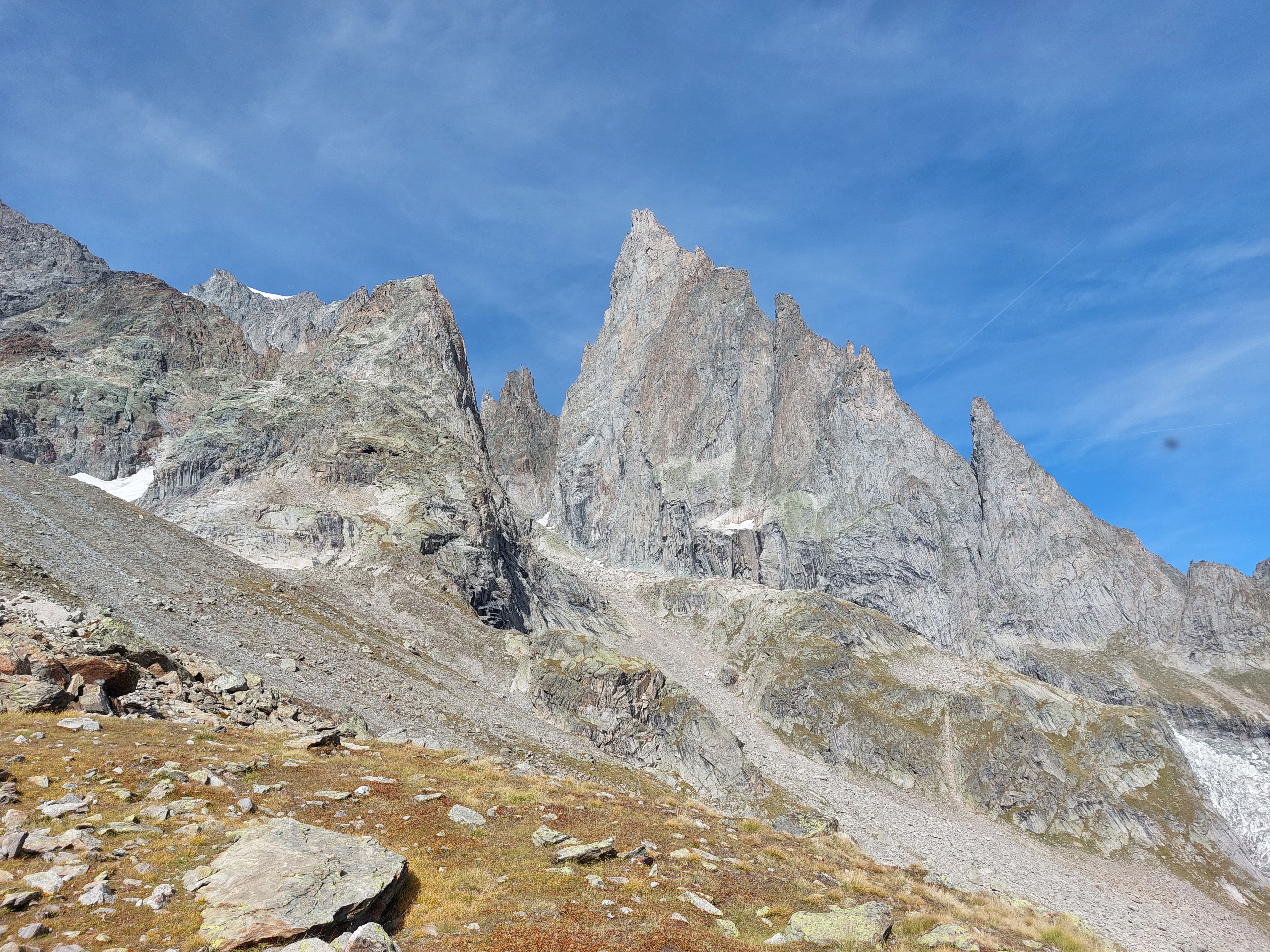
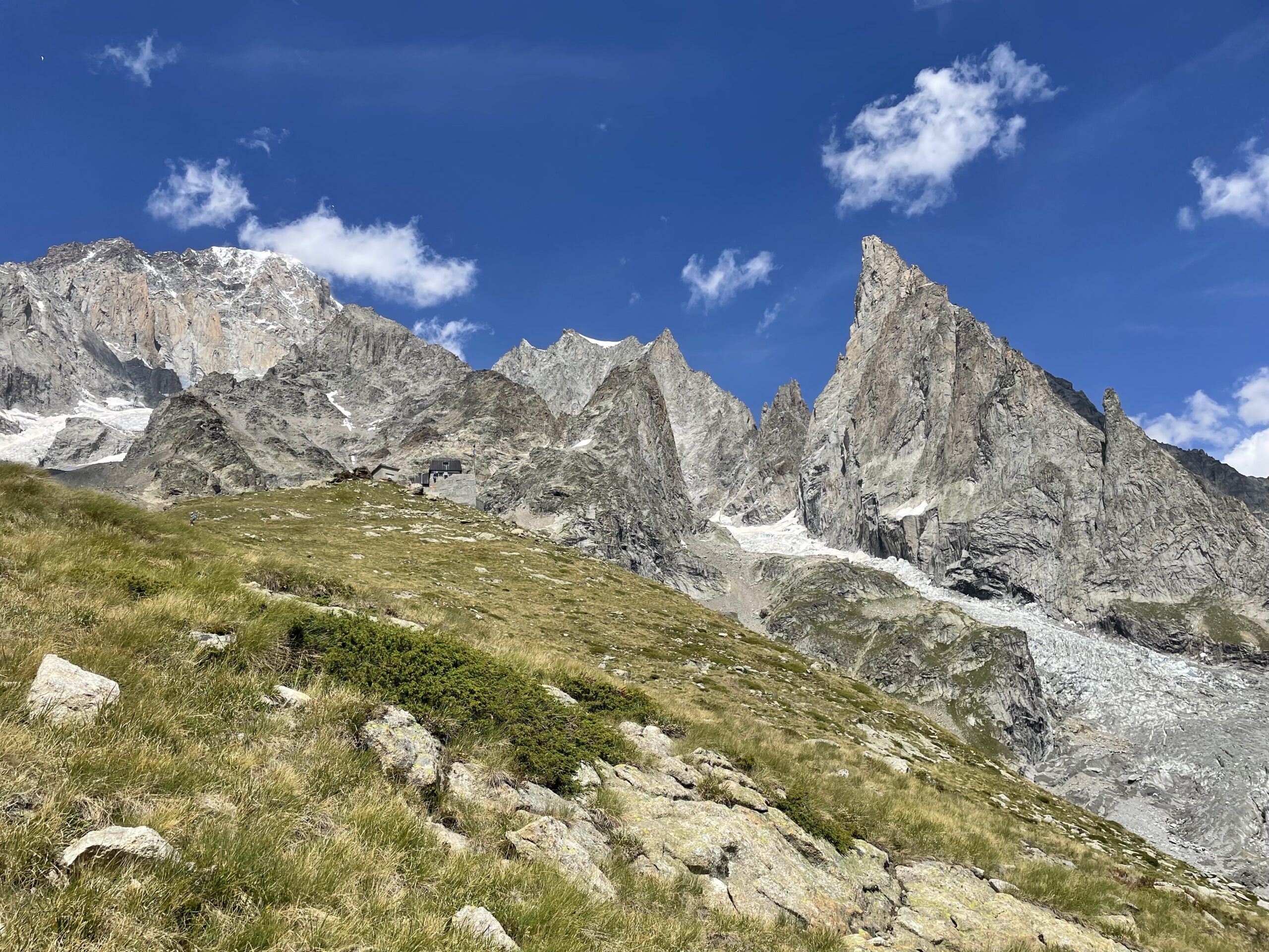
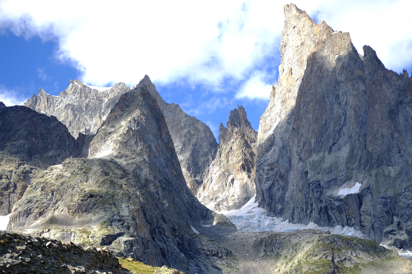
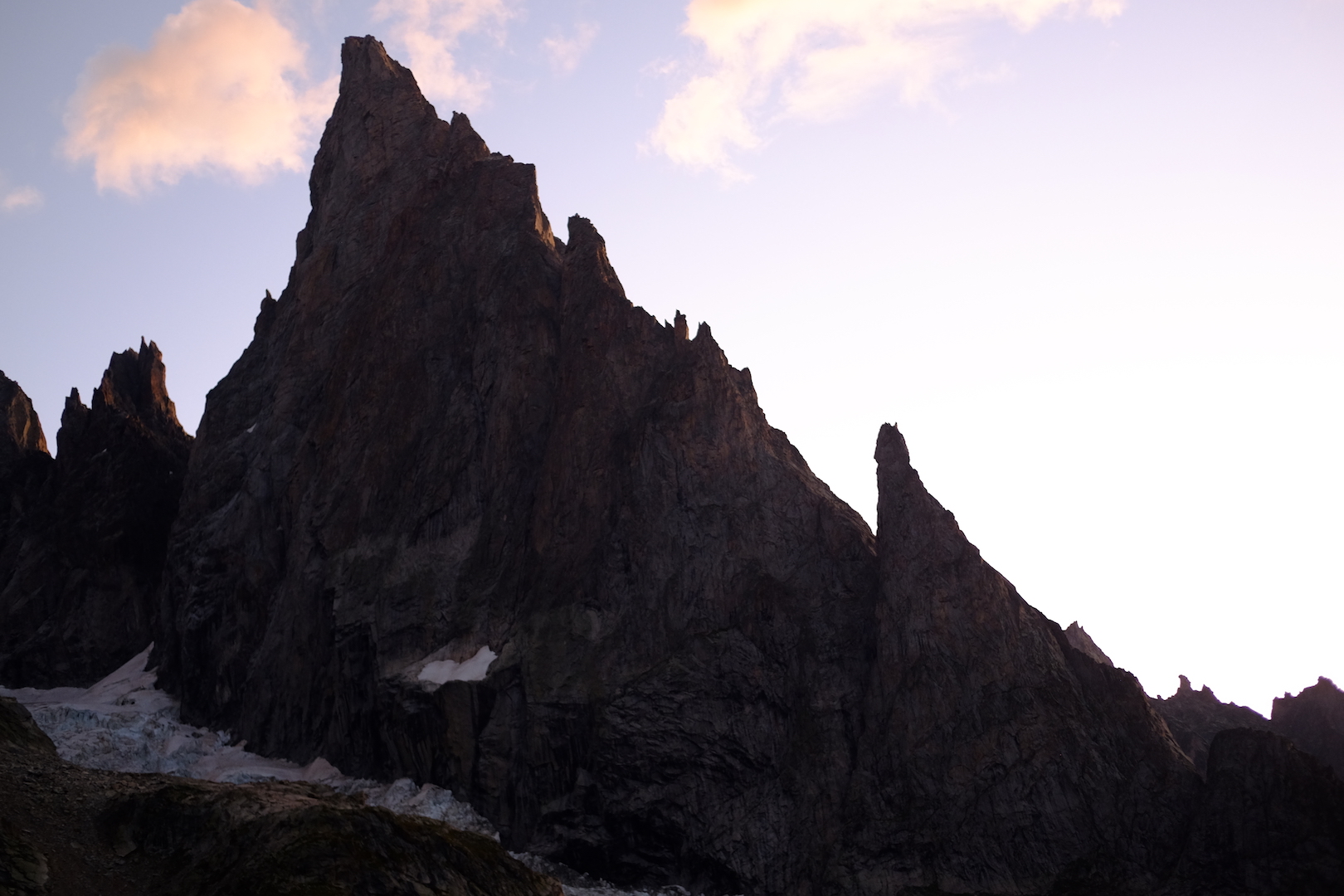
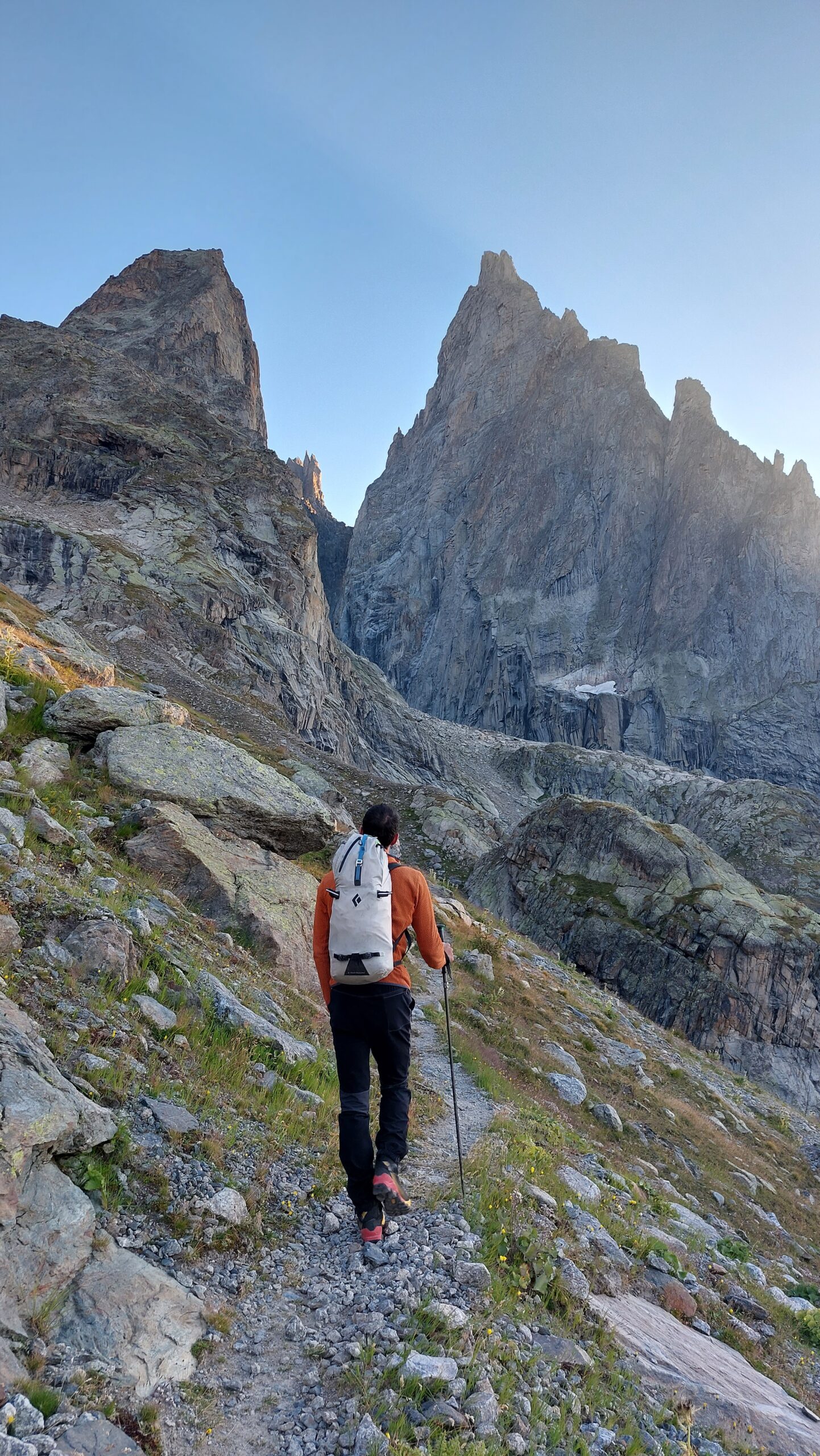
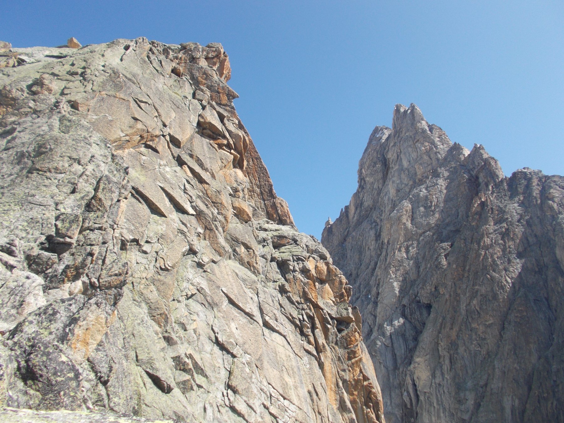
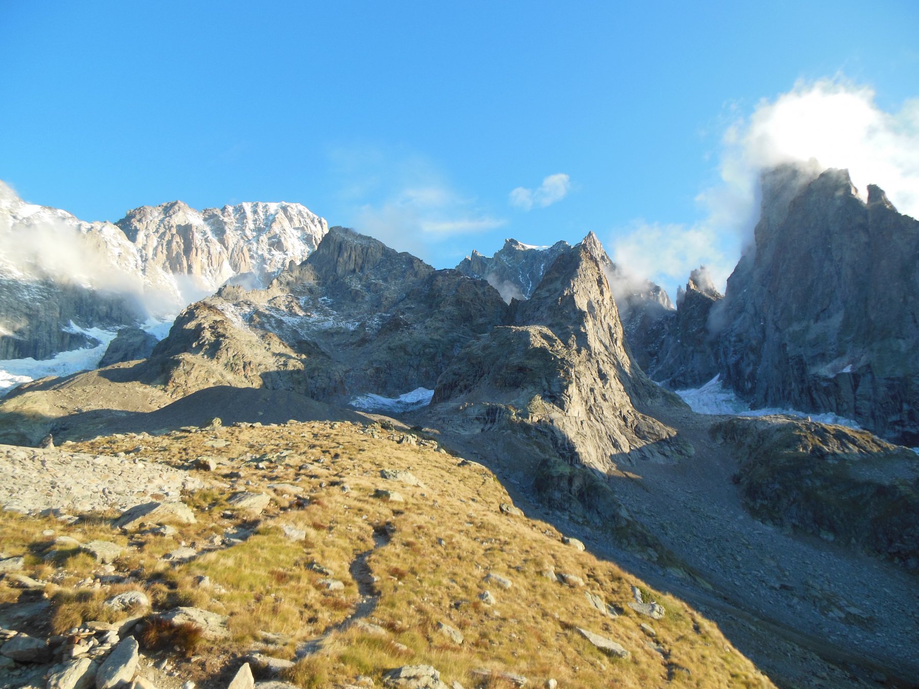
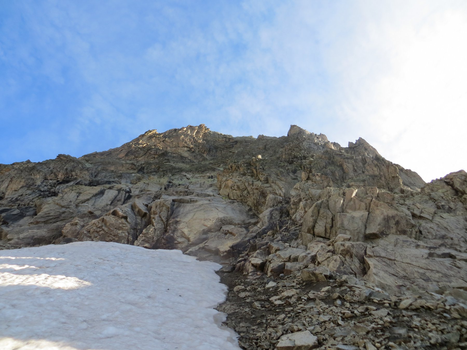
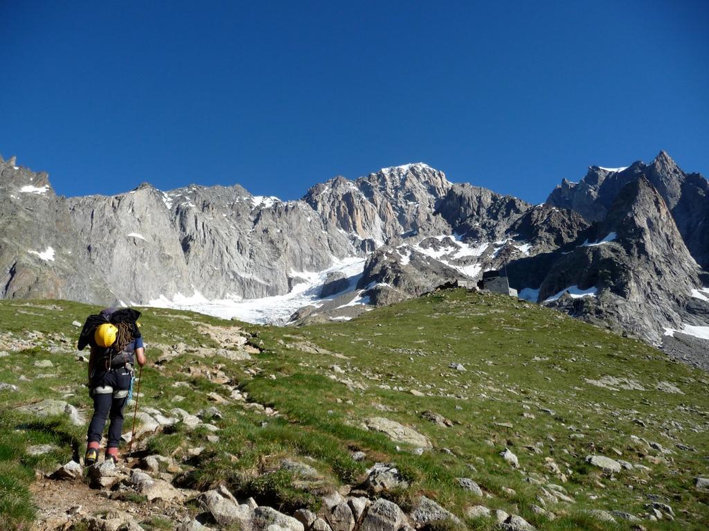
Al Monzino in 2-2:30 h tramite ferrata. Dal Monzino si segue il sentiero con ometti che sale dietro il rifugio, dopo poco si prende la traccia di dx che segue i tubi dell'acqua. Passato un canalino terroso si attraversa il torrente e si prosegue quasi ai piedi dell'avancorpo, dove si abbandona la traccia che scenderà verso la parete sud. Si risale verso N su tracce, seguendo qualche ometto, giungendo alla base dello zoccolo sul suo lato ovest.
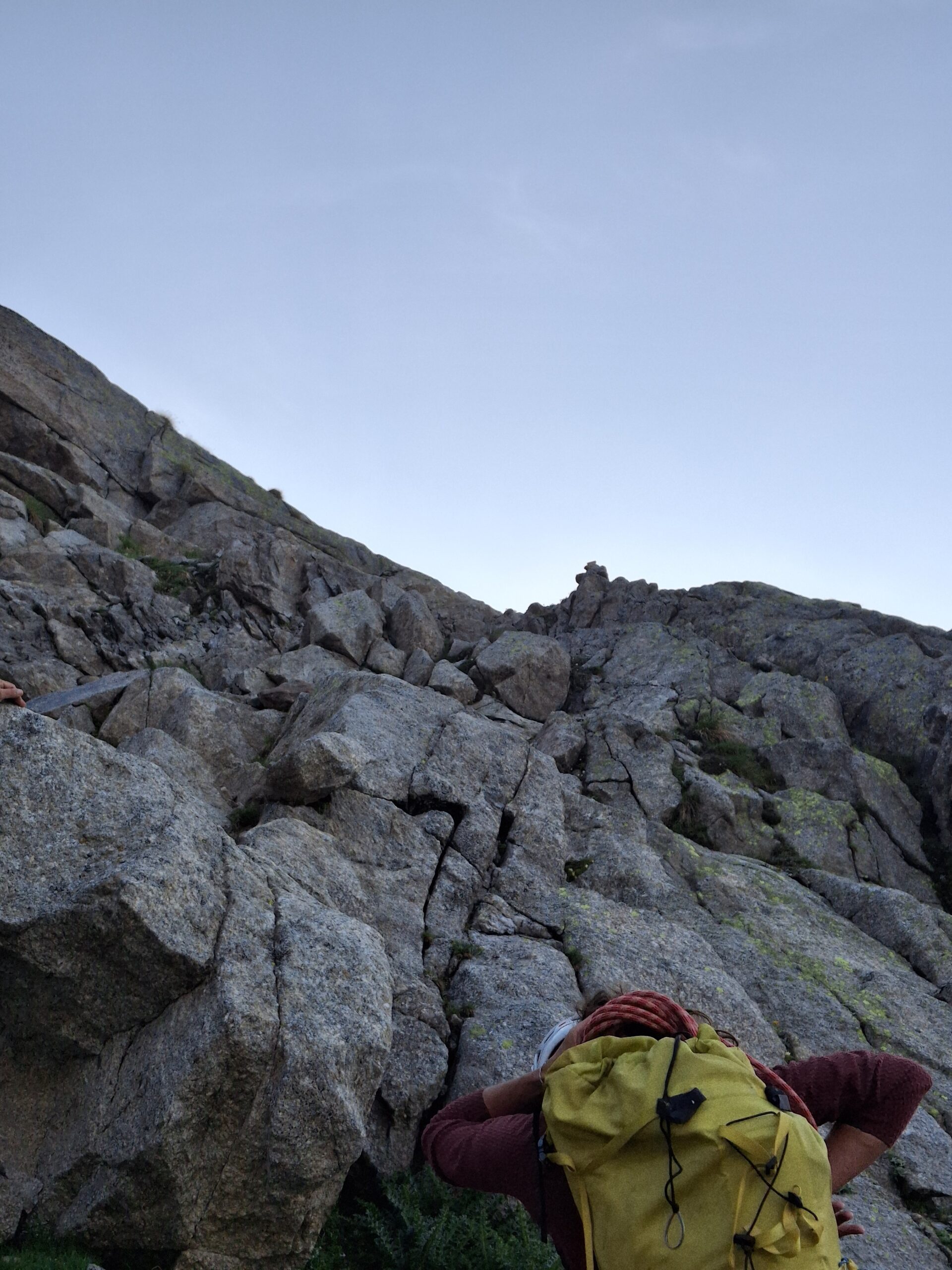
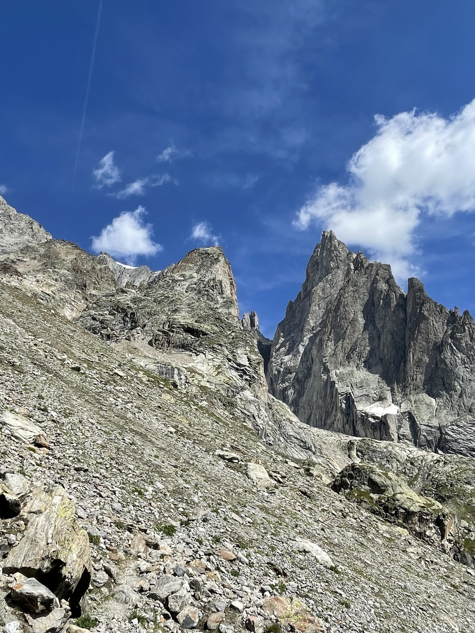
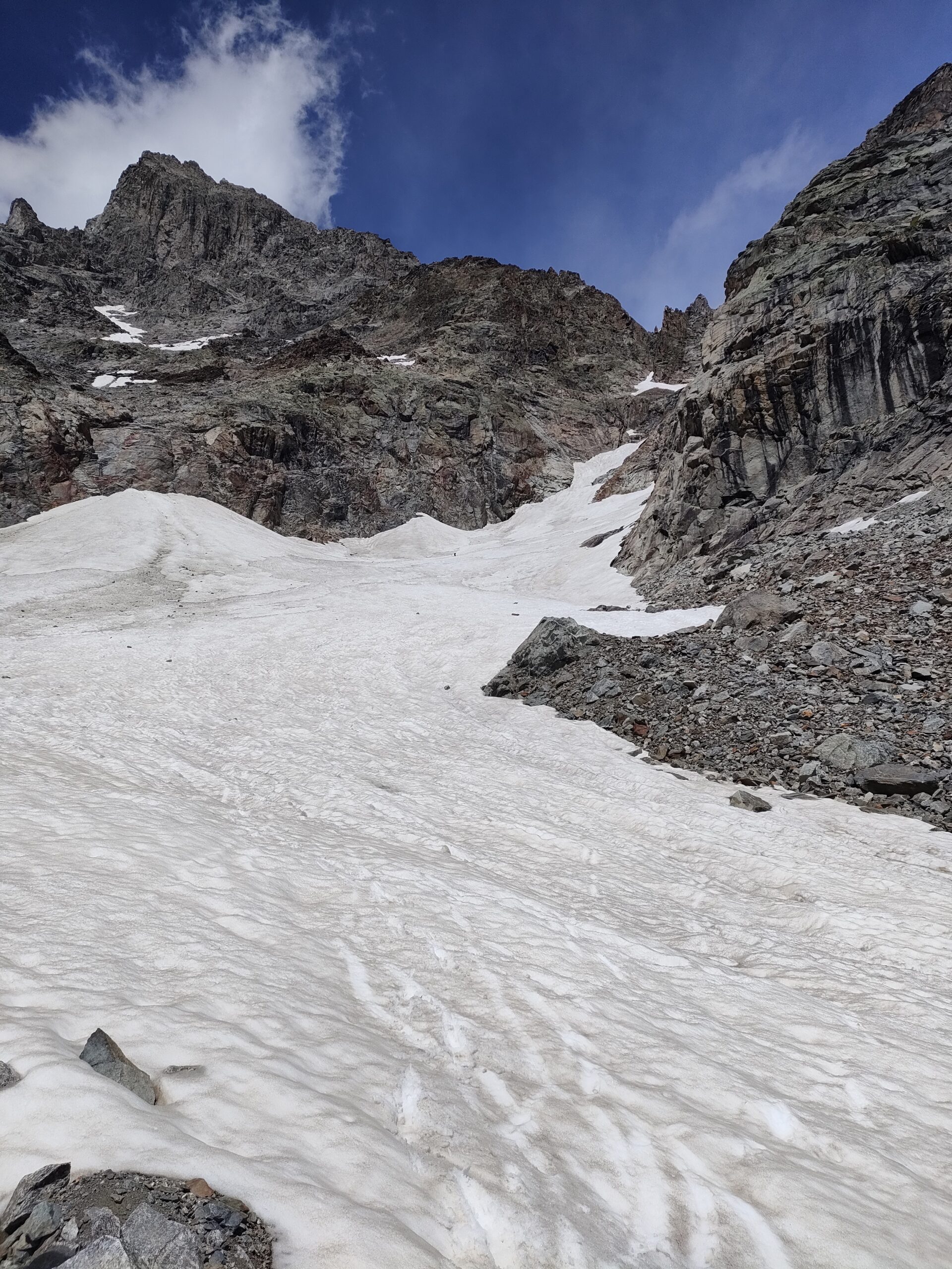
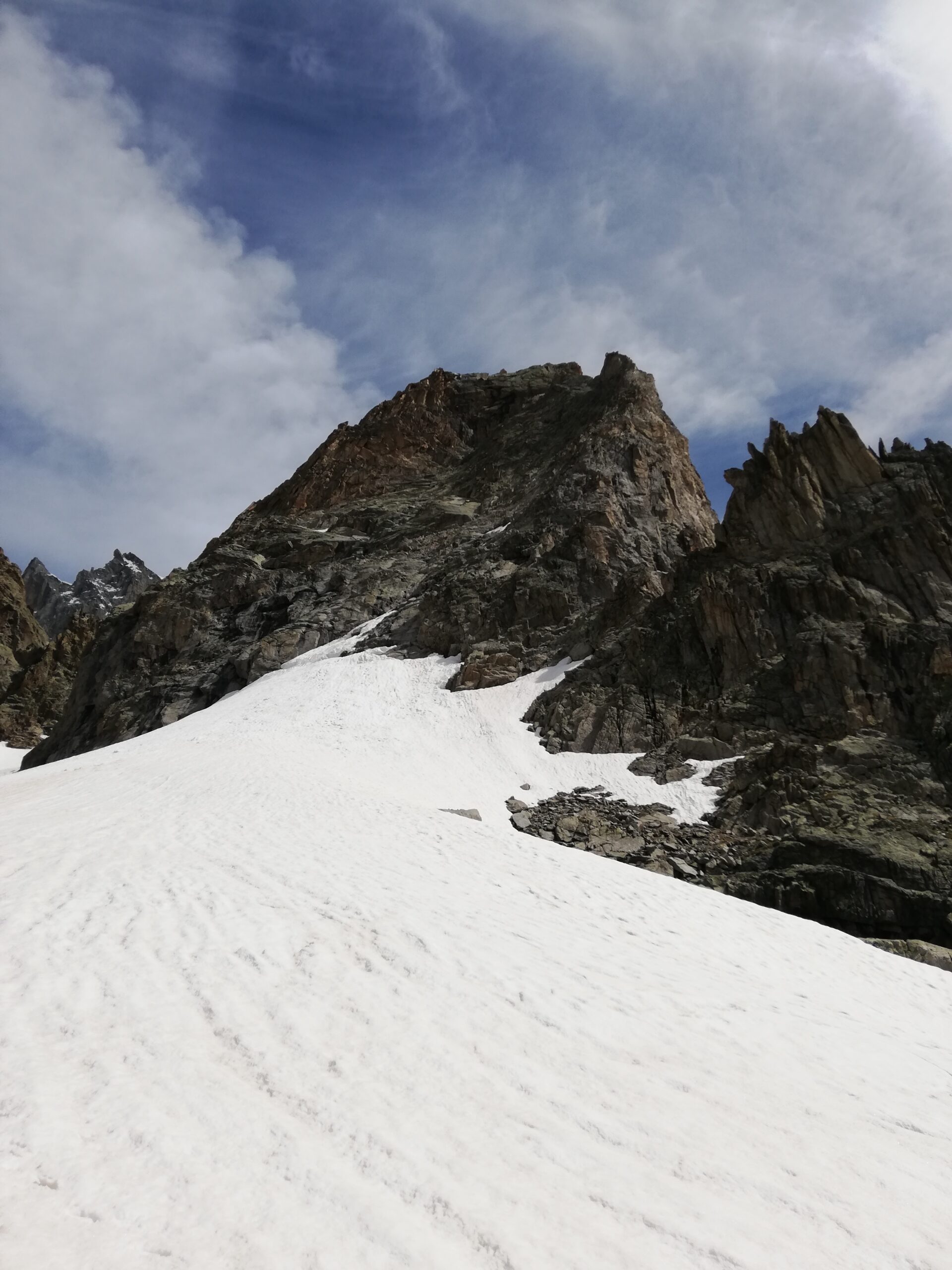
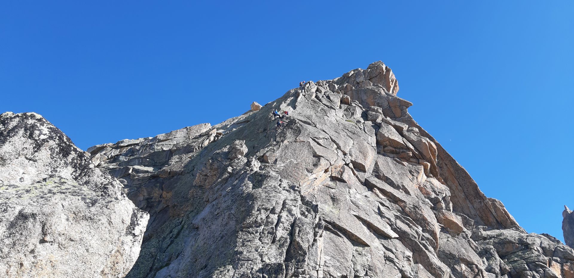
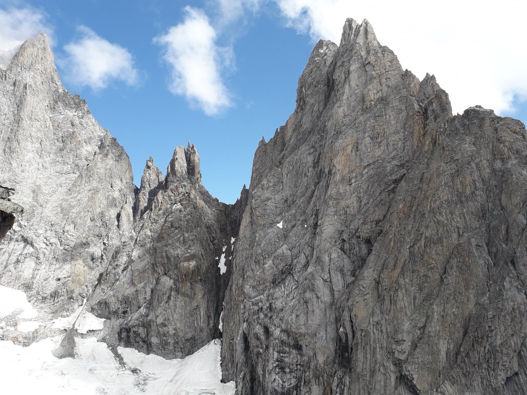
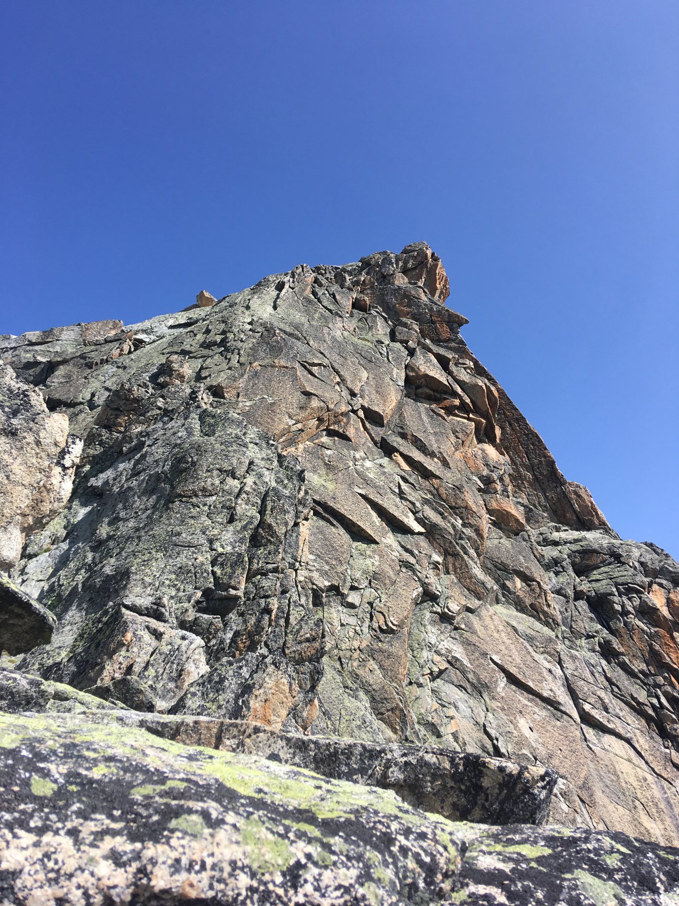
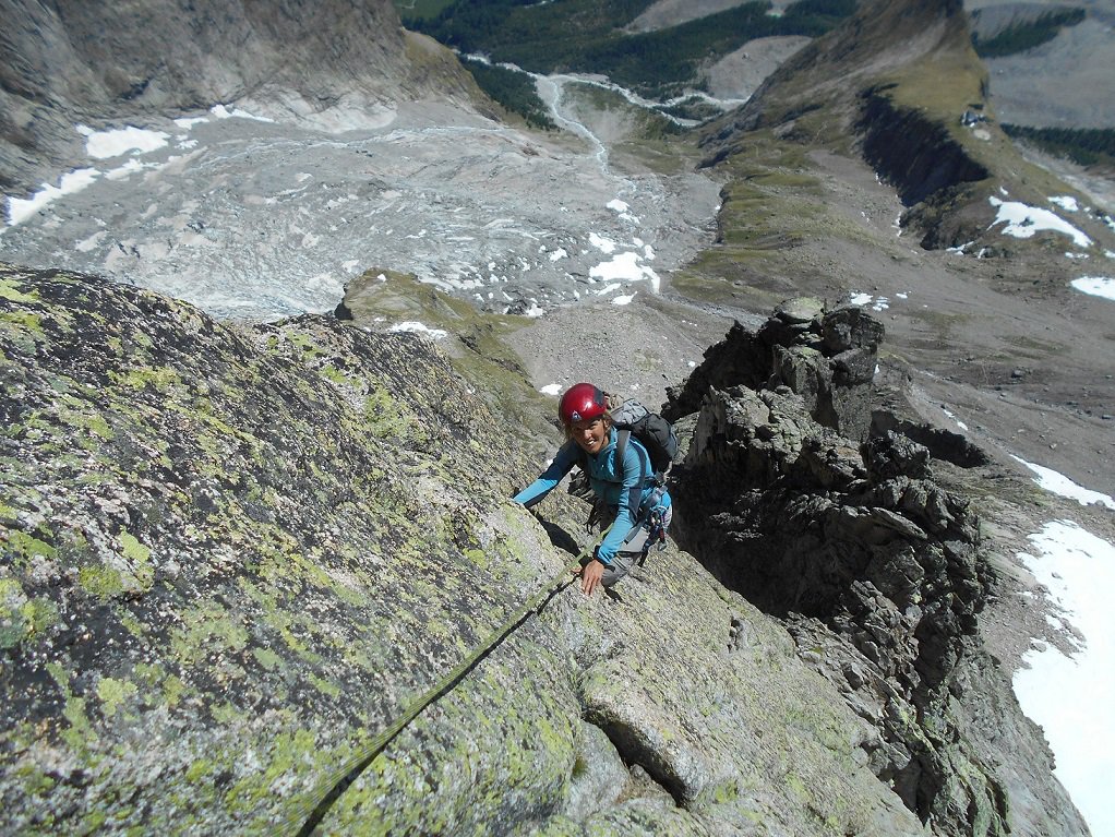
Si inizia a salire su una cengia erbosa che obliqua a dx e si seguono alcuni ometti spostandosi sempre a dx, poi rientrando a sx e pervenendo a un evidente paretina nerastra al termine di una pietraia (fin qui cenge erbose e placconate). La paretina si evita alla sua dx, risalendo poi su sentierino terroso e balzette, arrivando a un intaglio dove si trova un saltino di 4m di III, spit con maillon di calata al suo termine, visibile dal basso. Si prosegue più facilmente su roccette per uscire sulla pietraia dove si trova il nevaio della normale e dove attacca la cresta (1-1,5 h).
Descrizione
Si inizia a salire su una cengia erbosa che obliqua a dx e si seguono alcuni ometti spostandosi sempre a dx, poi rientrando a sx e pervenendo a un evidente paretina nerastra al termine di una pietraia (fin qui cenge erbose e placconate). La paretina si evita alla sua dx, risalendo poi su sentierino terroso e balzette, arrivando a un intaglio dove si trova un saltino di 4m di III, spit con maillon di calata al suo termine, visibile dal basso. Si prosegue più facilmente su roccette per uscire sulla pietraia dove si trova il nevaio della normale e dove attacca la cresta (1-1,5 h).
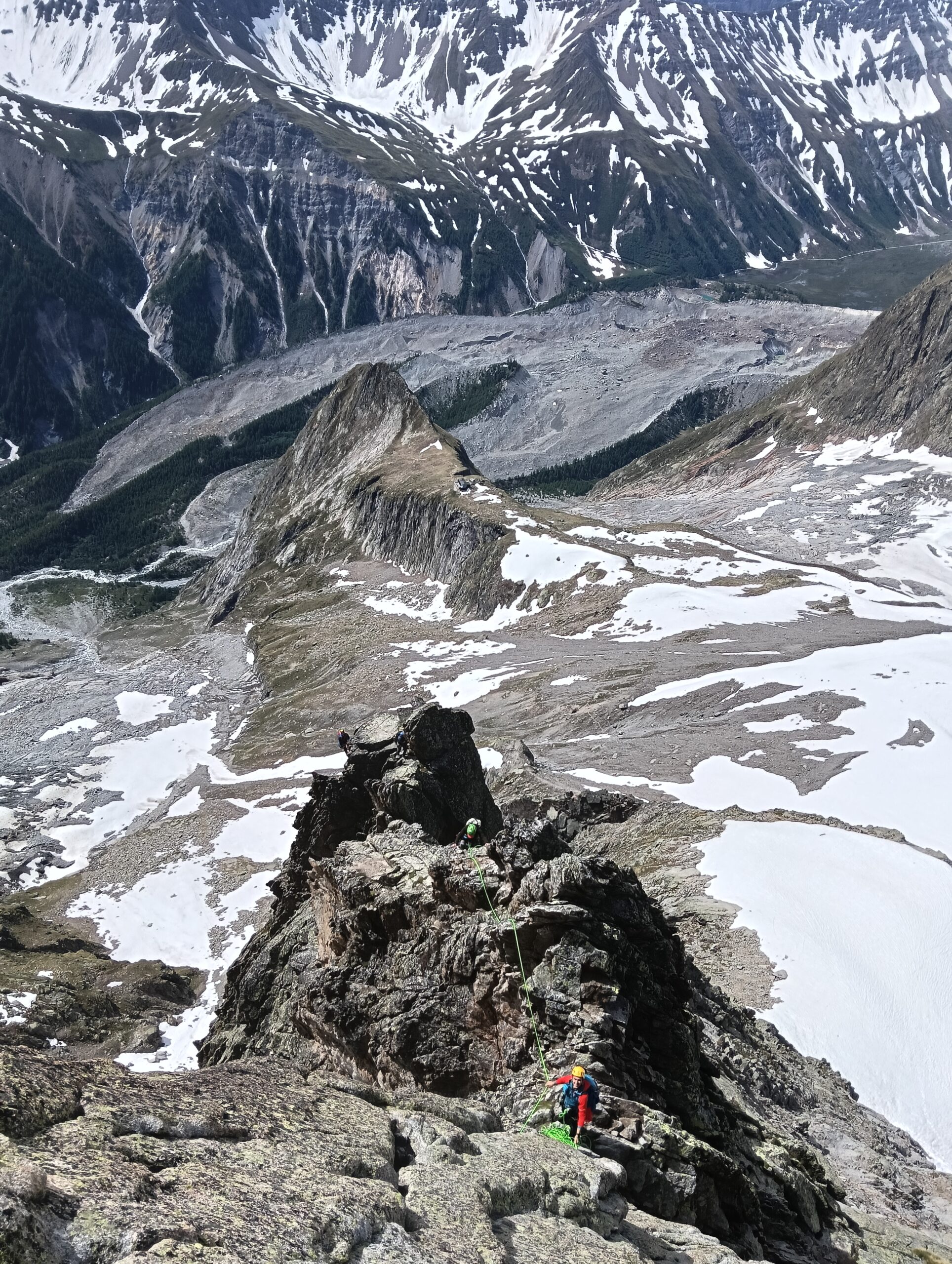
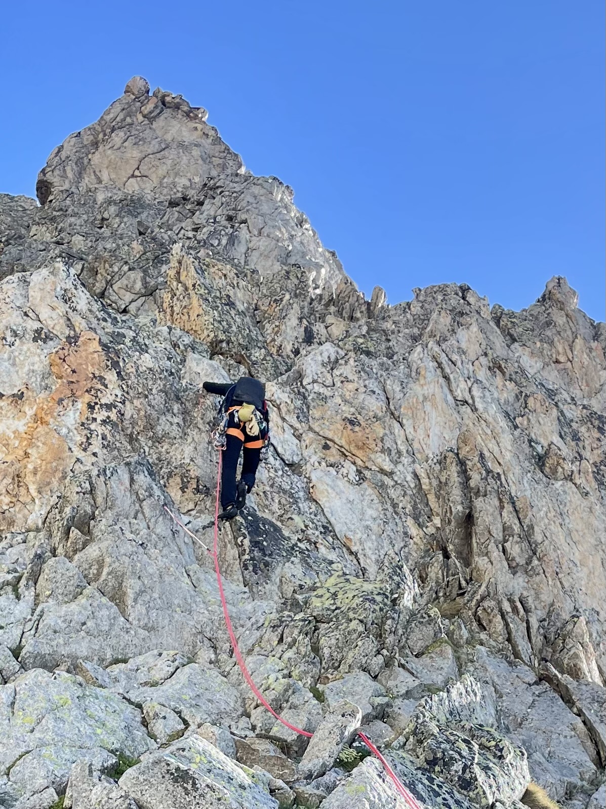
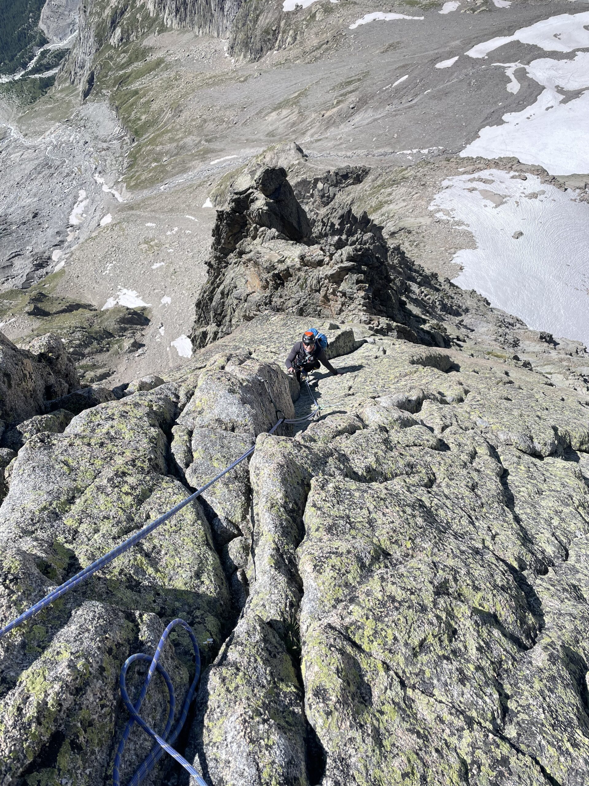
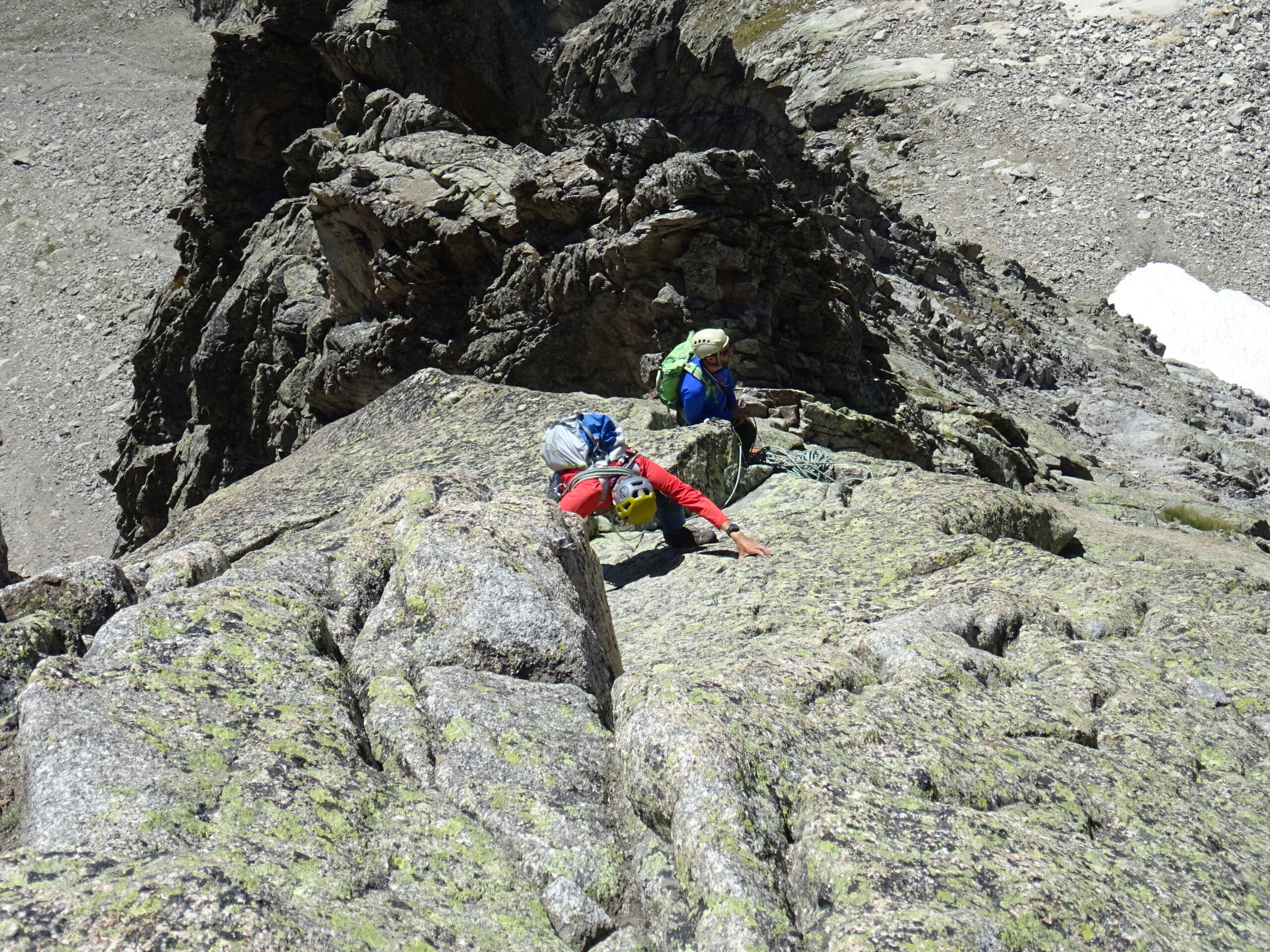
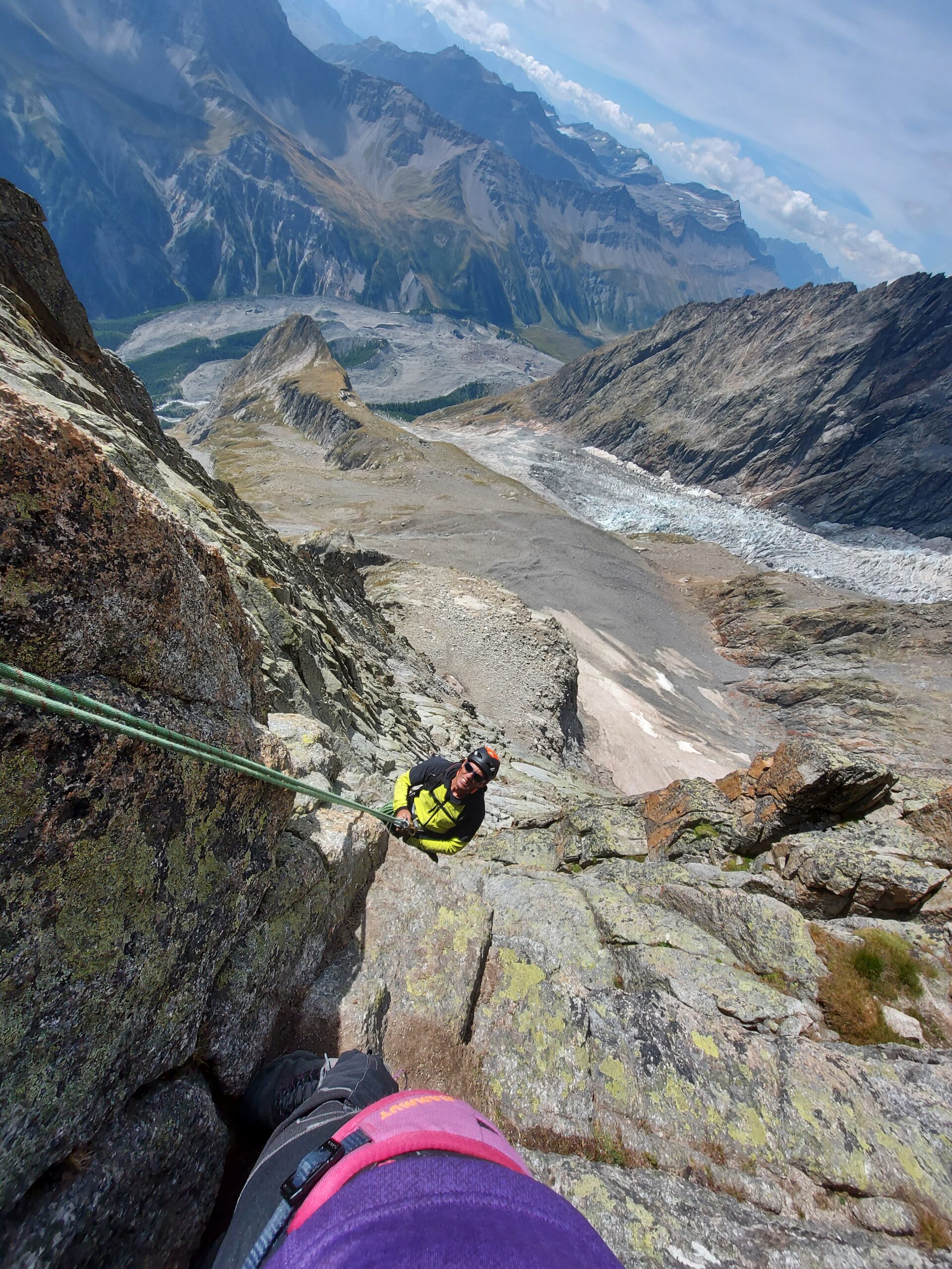
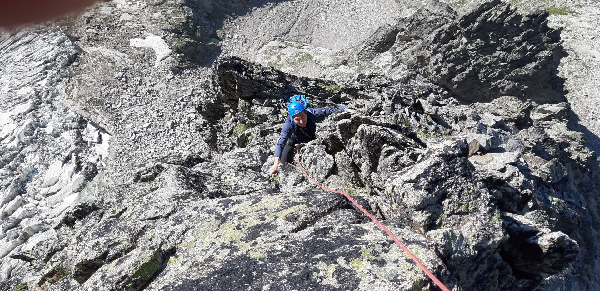
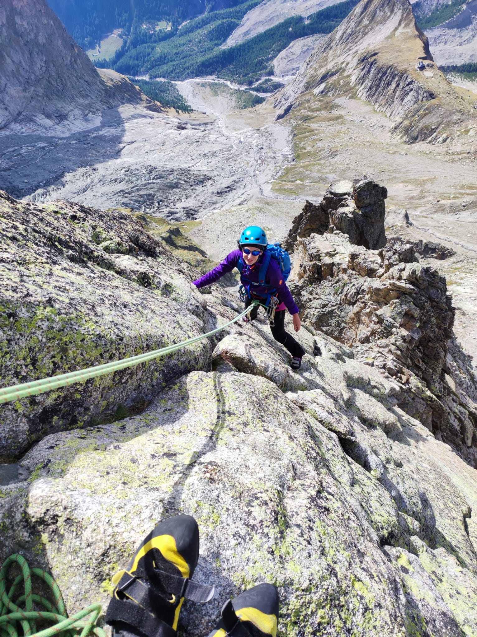
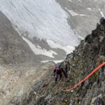
- L1: Si parte una ventina di metri a dx del nevaio in un canalino, primo spit con maillon a circa 5m. Si segue il canalino con facile arrampicata (II, alcuni spit) fino a una forcella sulla cresta (in totale 25m, sosta su spit collegati).
- L2: Partenza con un passo di IV subito sopra la forcellina, poi più semplice sul III a sx del filo (30m, 3-4 spit, sosta su spit collegati).
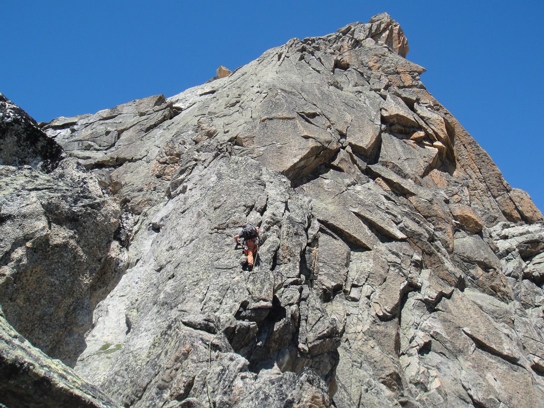
- L3 sempre sui 30 m, più discontinua ma con divertenti passaggi di III-IV, protetti (sosta su spit collegati).
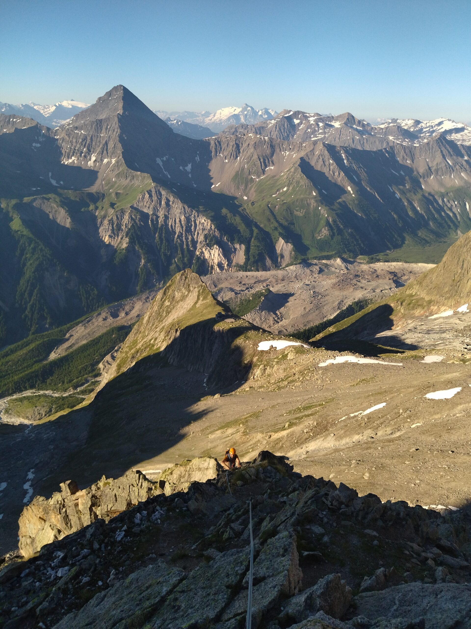
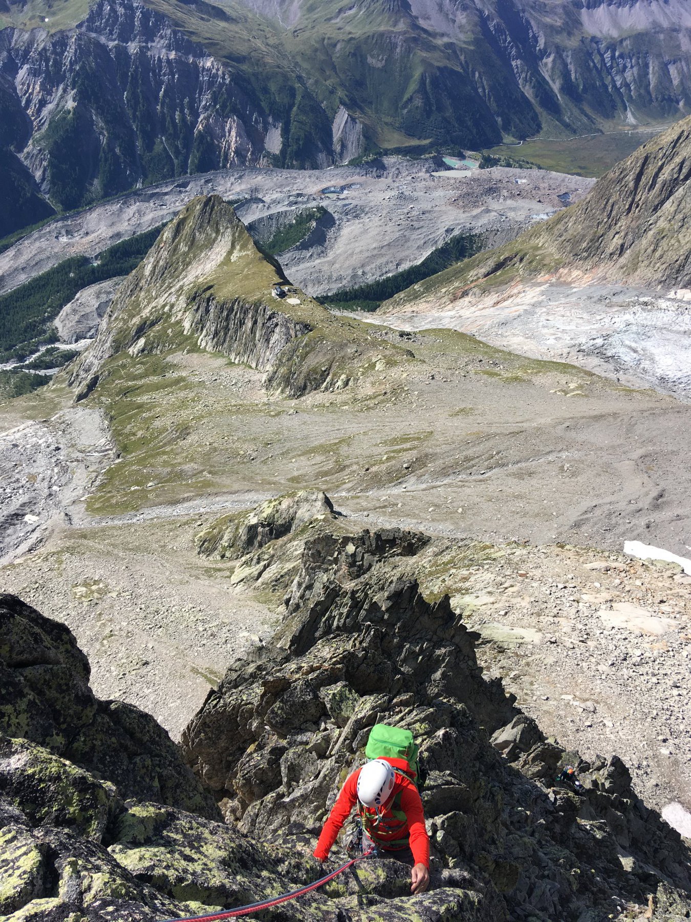
- L4: Da qui c’è una sezione più irregolare dove si scala sempre a sx del filo praticamente a lato delle cenge della normale, arrampicata sul II con alcuni bei passaggi di III.
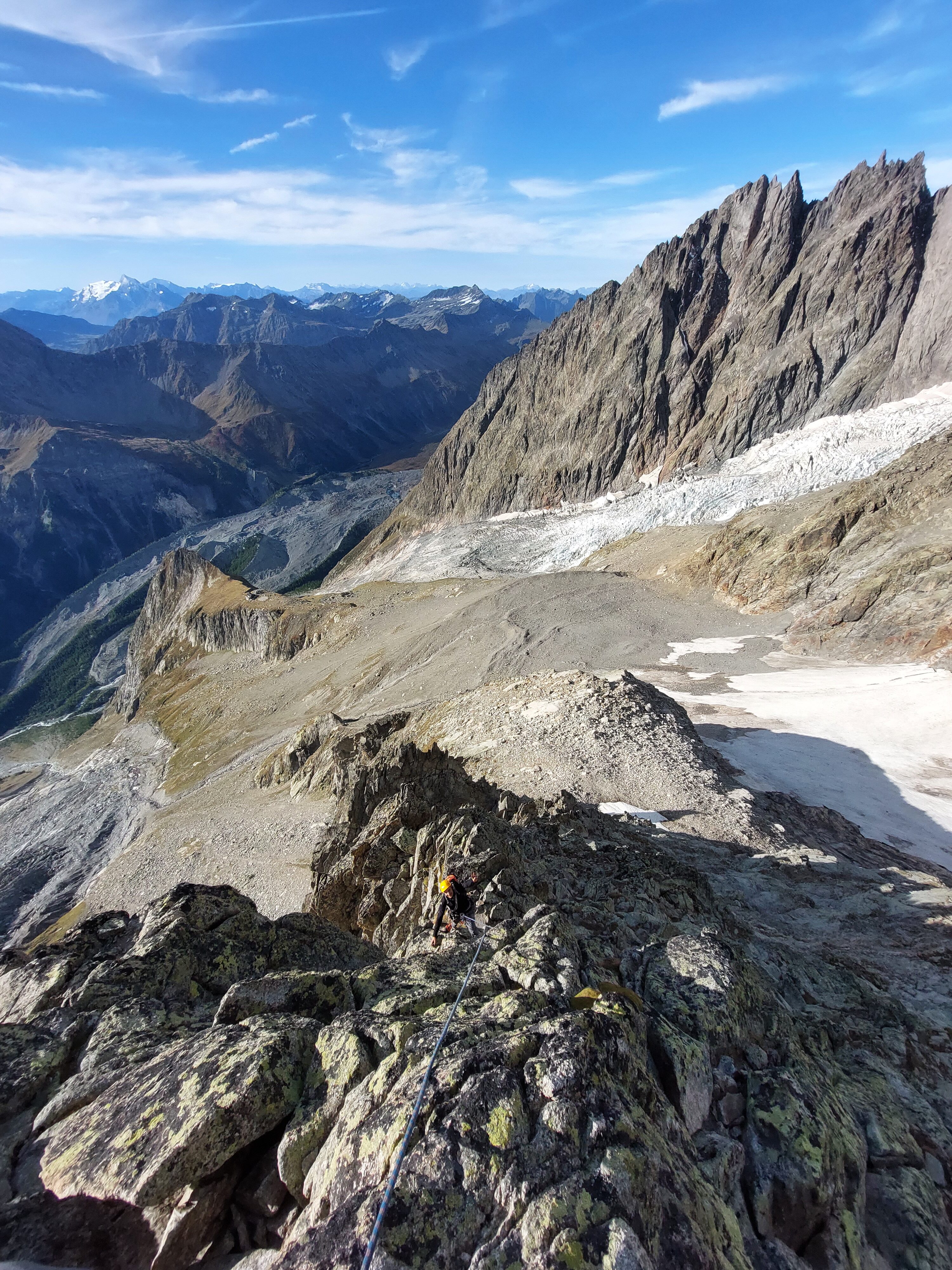
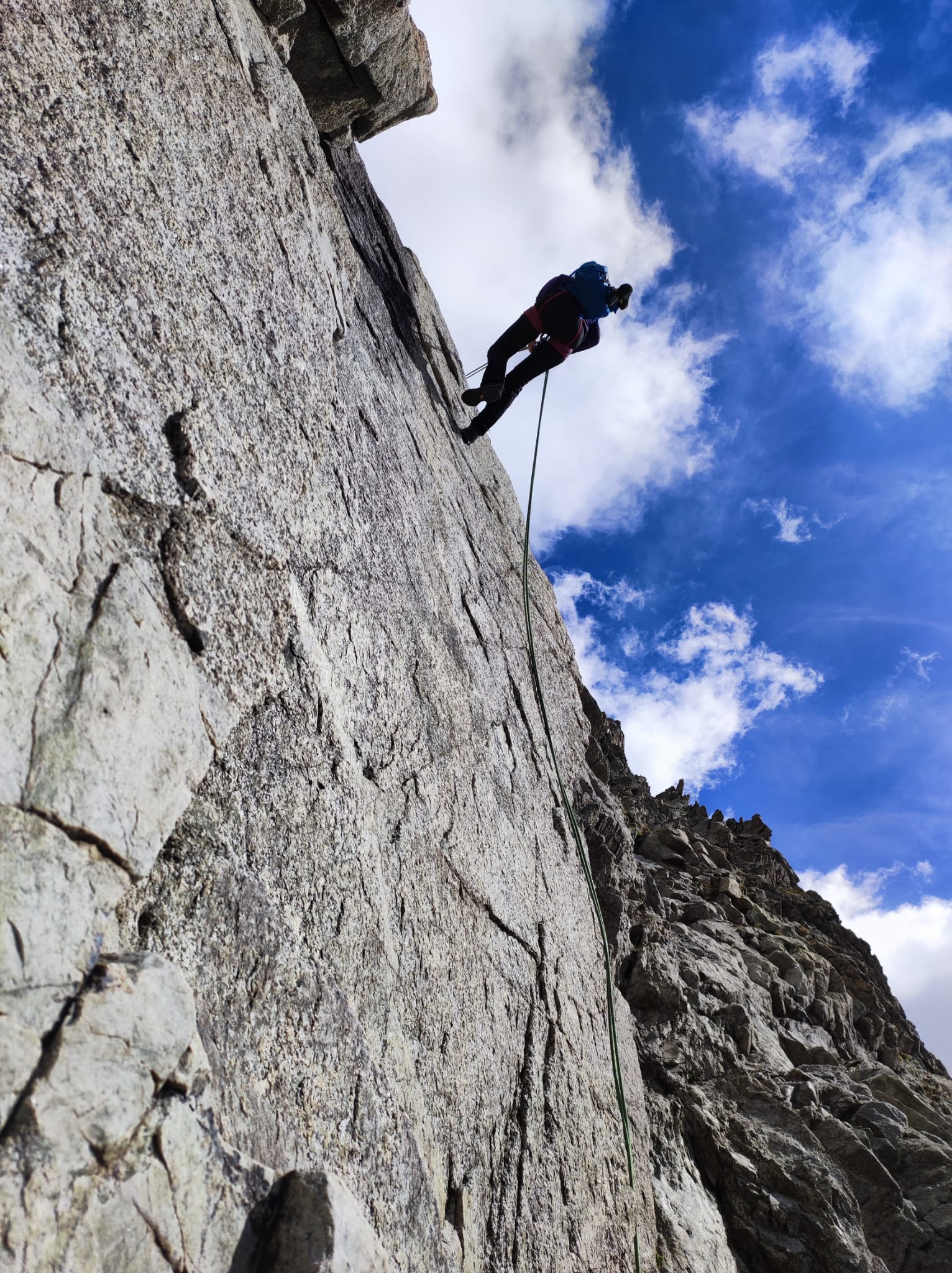
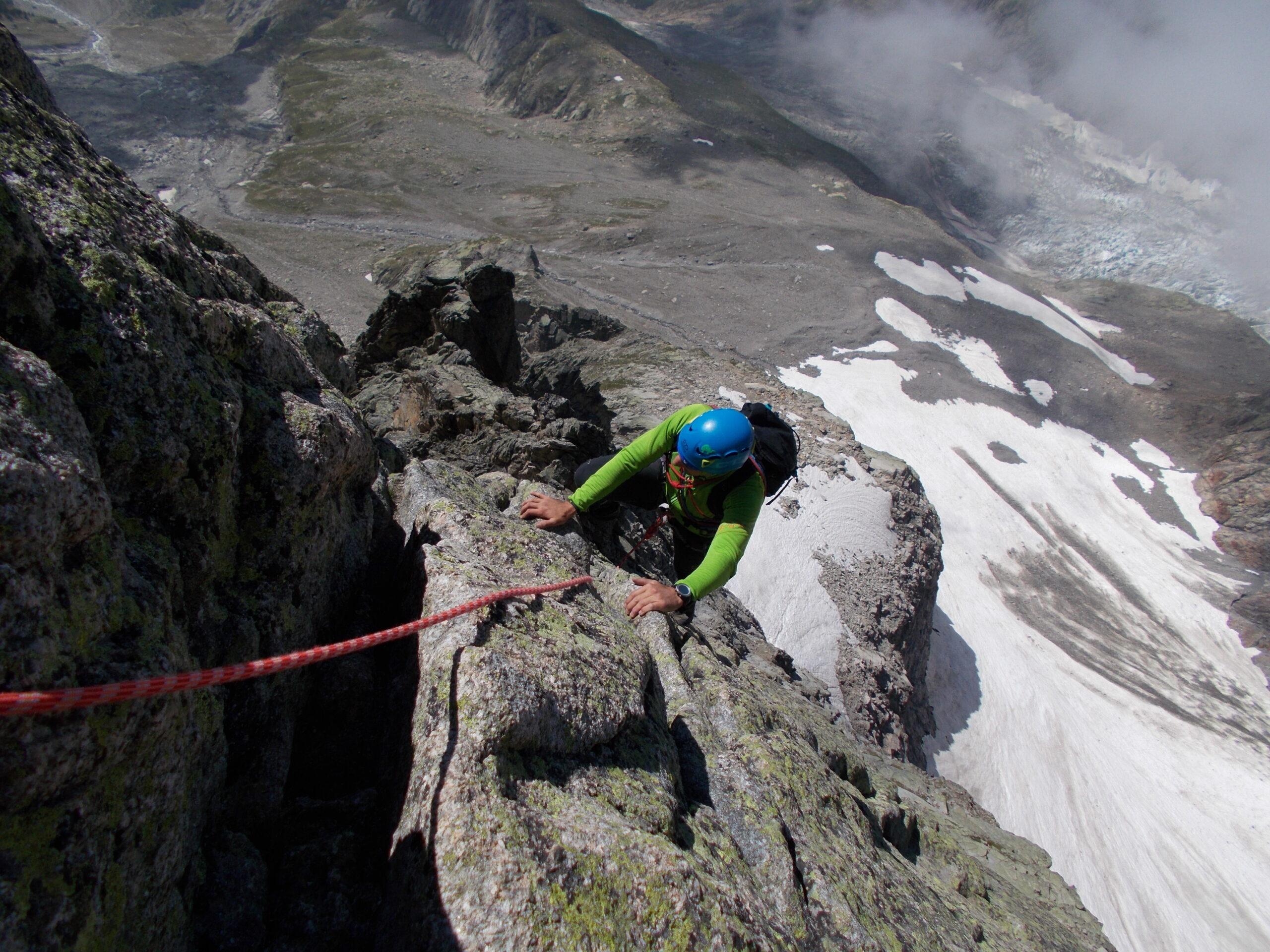
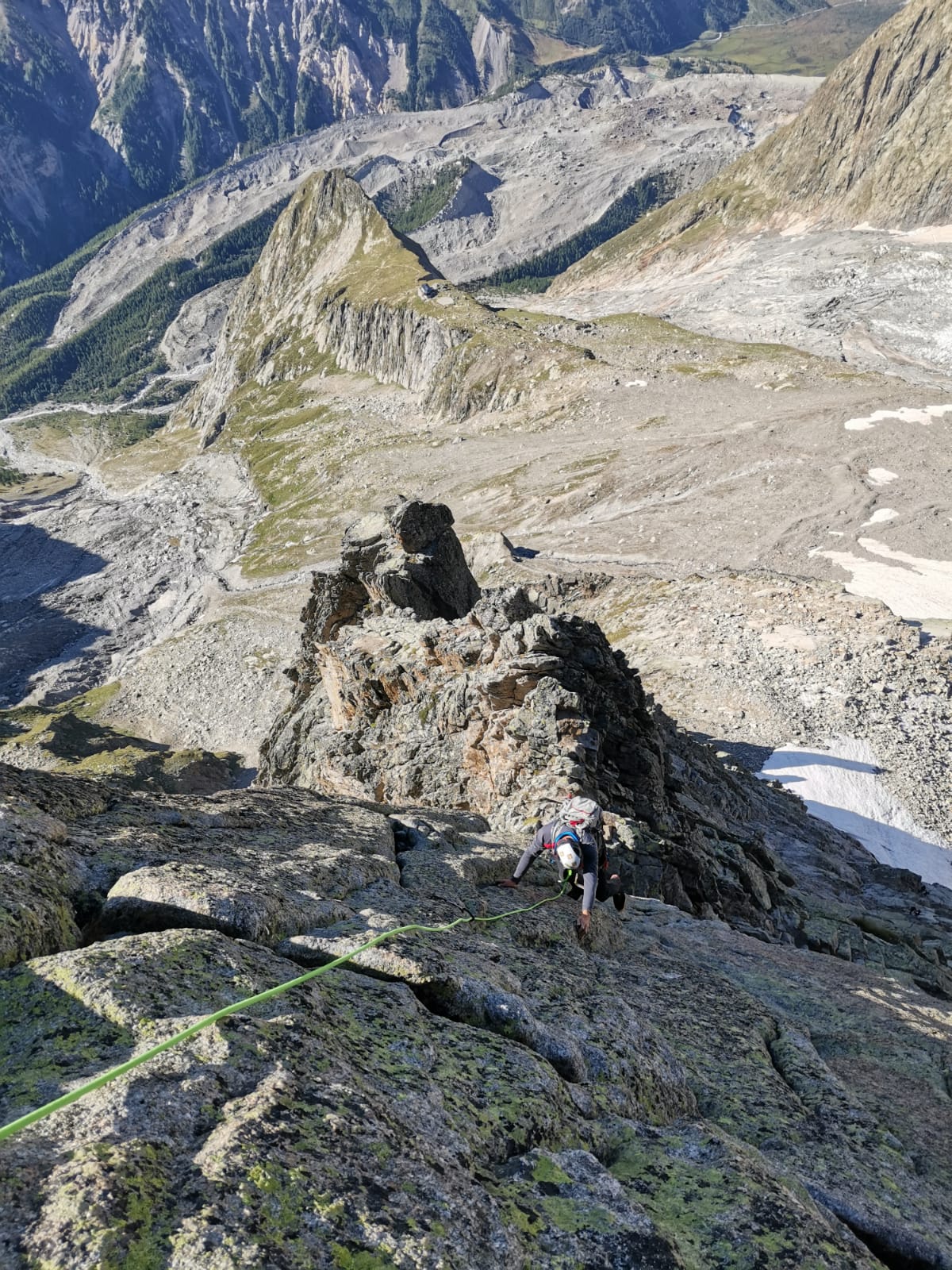
- L5: Ci si sposta con un traverso a dx in piena esposizione sulla parete S, si supera in diagonale un salto di 4m di IV e quindi ci si sposta ancora a dx verso un diedrino. Sosta a sx su una comoda cengia
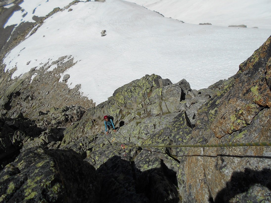
- L6: Con un ultimo saltino si riprende il filo e in breve si raggiunge l’intaglio sulla parete S da cui arriva la via Ottoz (sosta qualche metro sotto ben visibile). Sosta poco oltre con cordino azzurro su una comoda piattaforma.
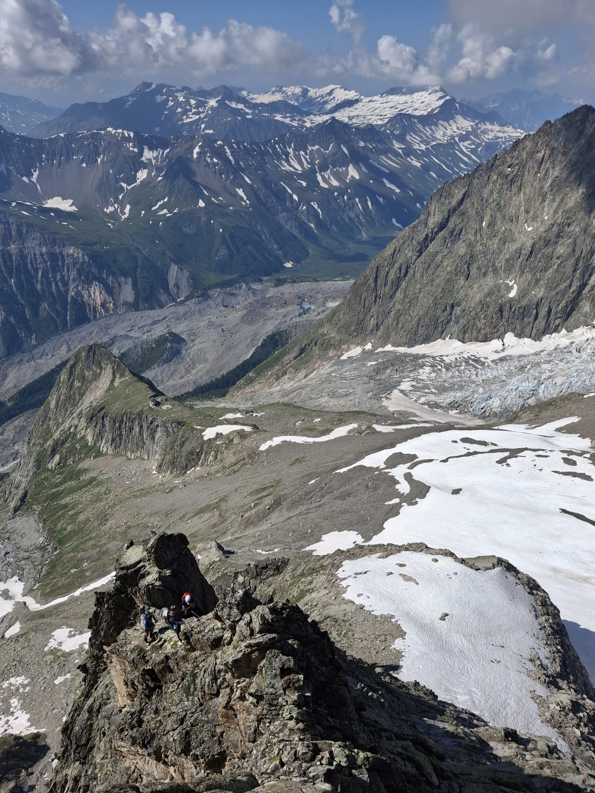
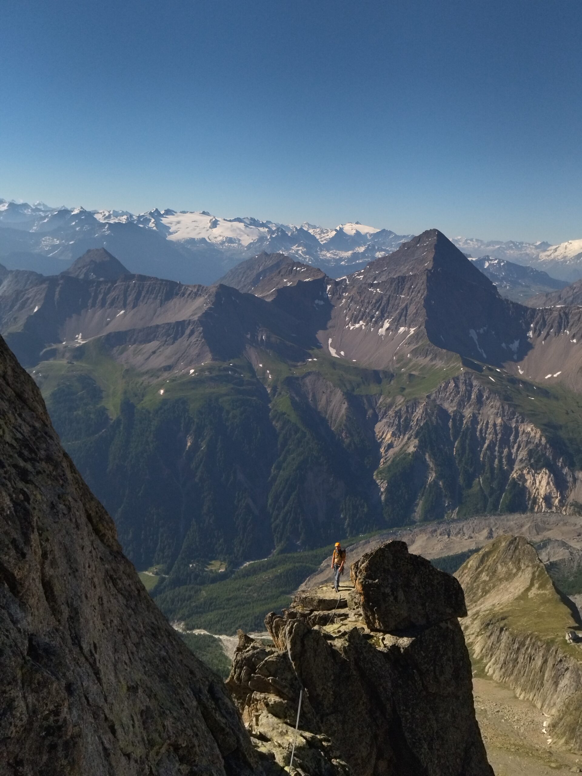
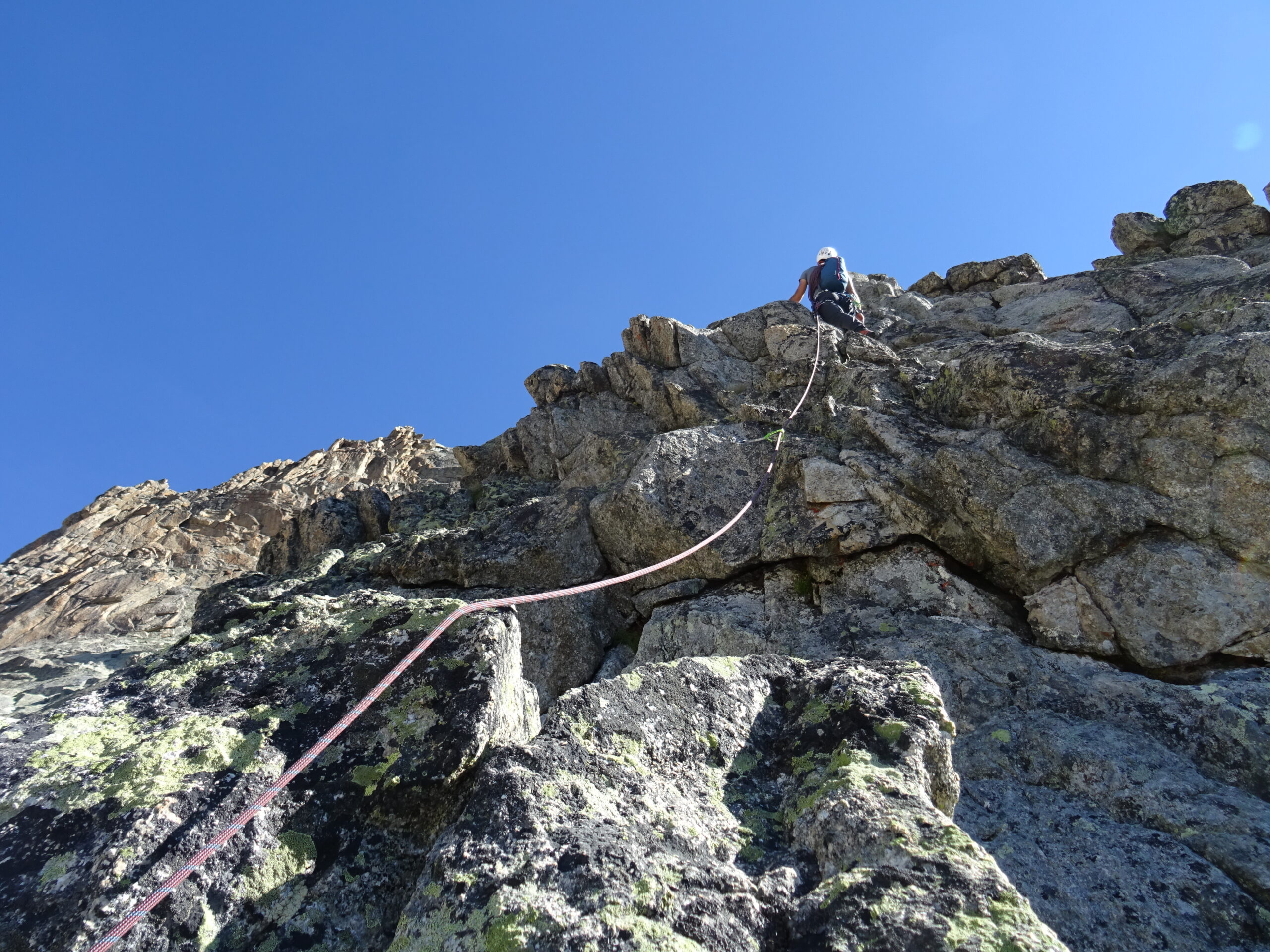
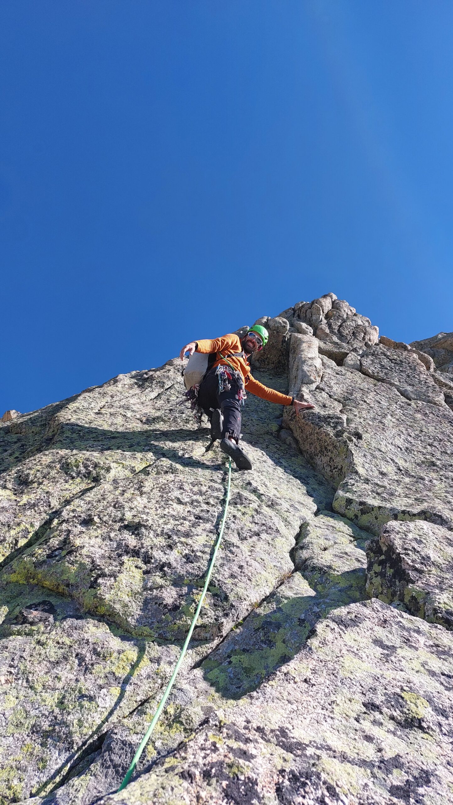
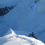
- Si prosegue sul divertente filo di cresta, con alcuni passi di aderenza ed un ultimo esposto ma protetto aggiramento a dx di un gendarmino.
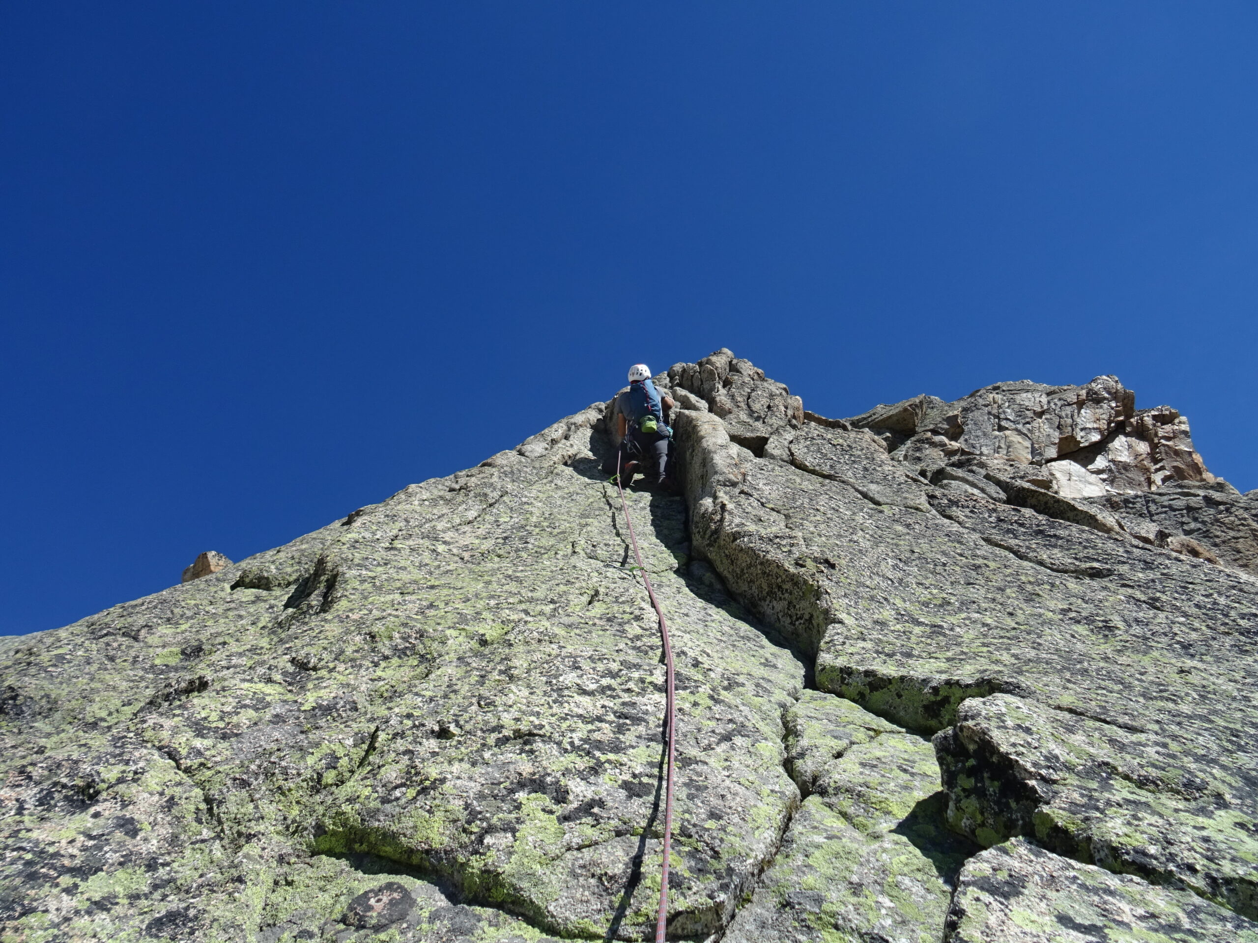
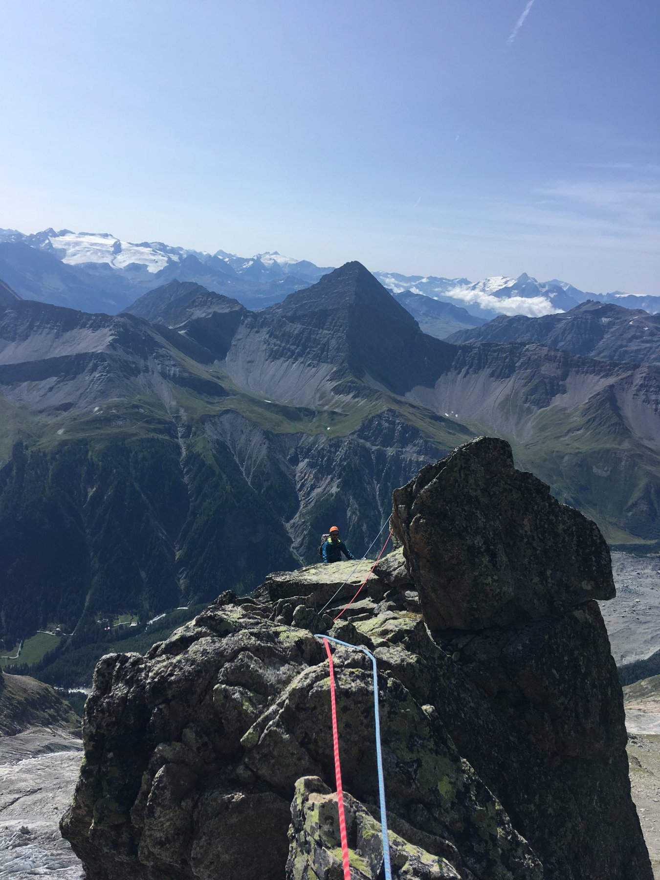
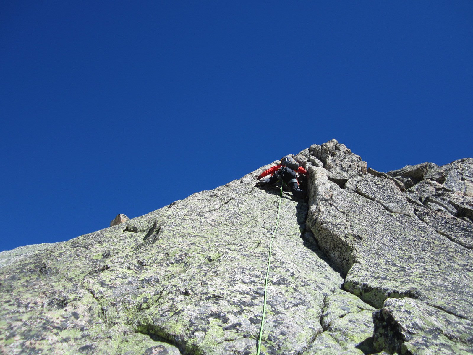
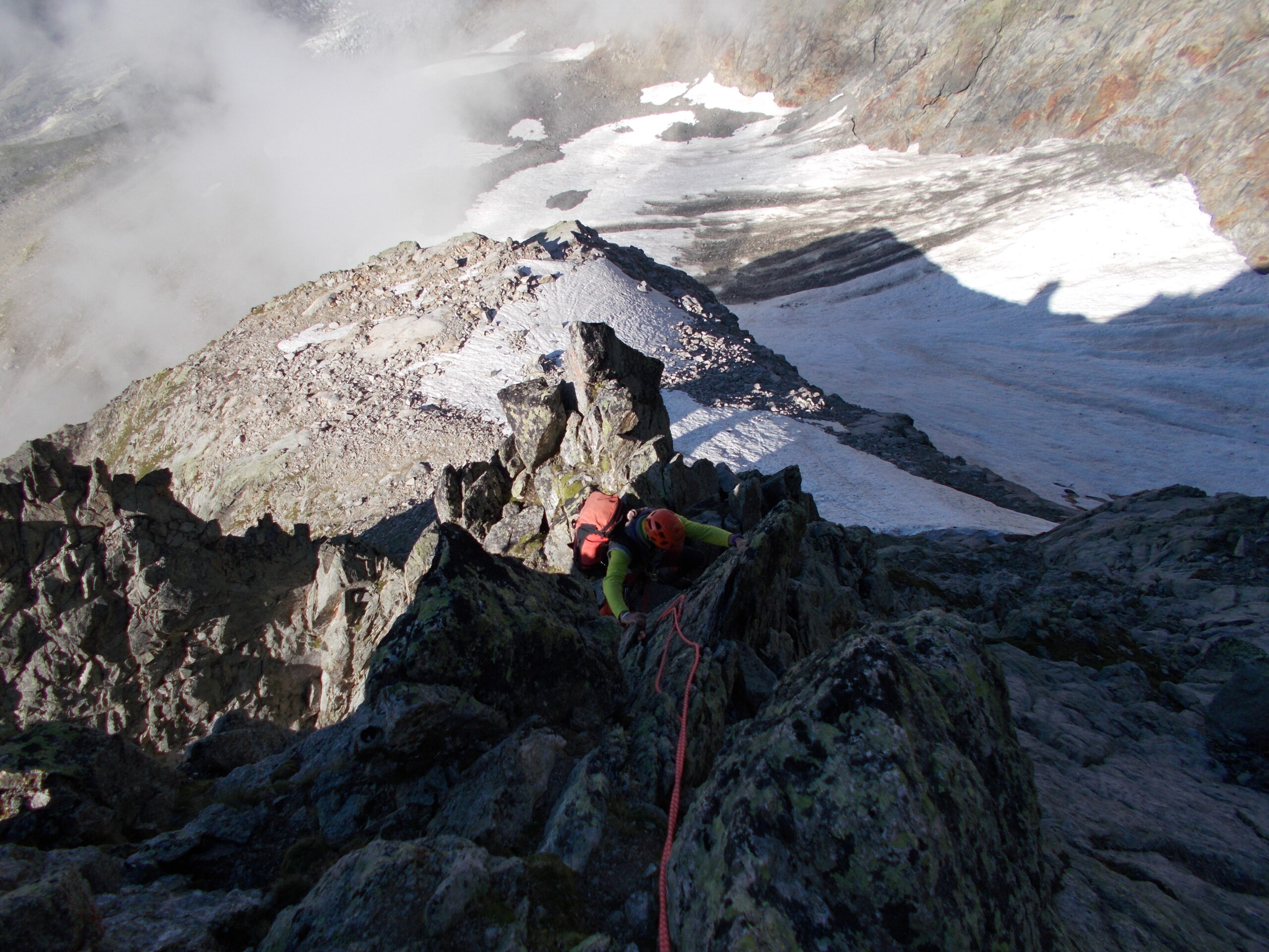
- Ultima lunghezza (35-4om, eventualmente divisibile in 2 tiri, soste a 20 e 15m), IV+ (5b secondo la relazione del Rifugio): si sale una placca con andamento da dx a sx e poi di nuovo a dx. Si oltrepassa una sosta con cordoni (facoltativa) e quindi si supera un diedrino con uscita a sx, raggiungendo una comoda cengia.
Per la vetta si segue la cengia in discesa a sx per circa 10 m, poi si risale una placca bianca (III+, fix) fino ad un enorme strapiombo dove è collocata la prima sosta di calata (dall’attacco 2,5-4h). Per la cima nord si prosegue senza difficoltà tra i grossi blocchi sulla sx.
Discesa:
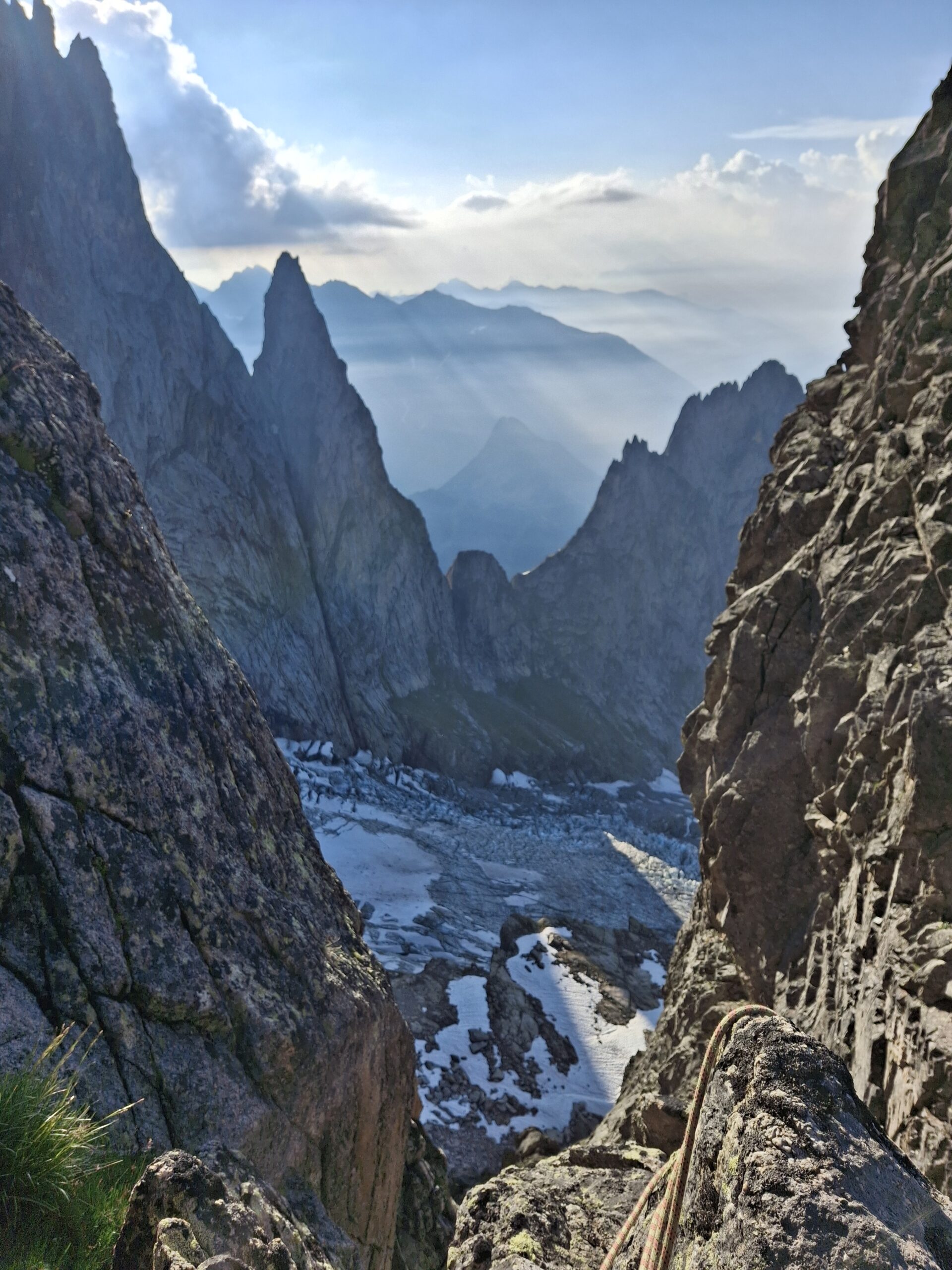
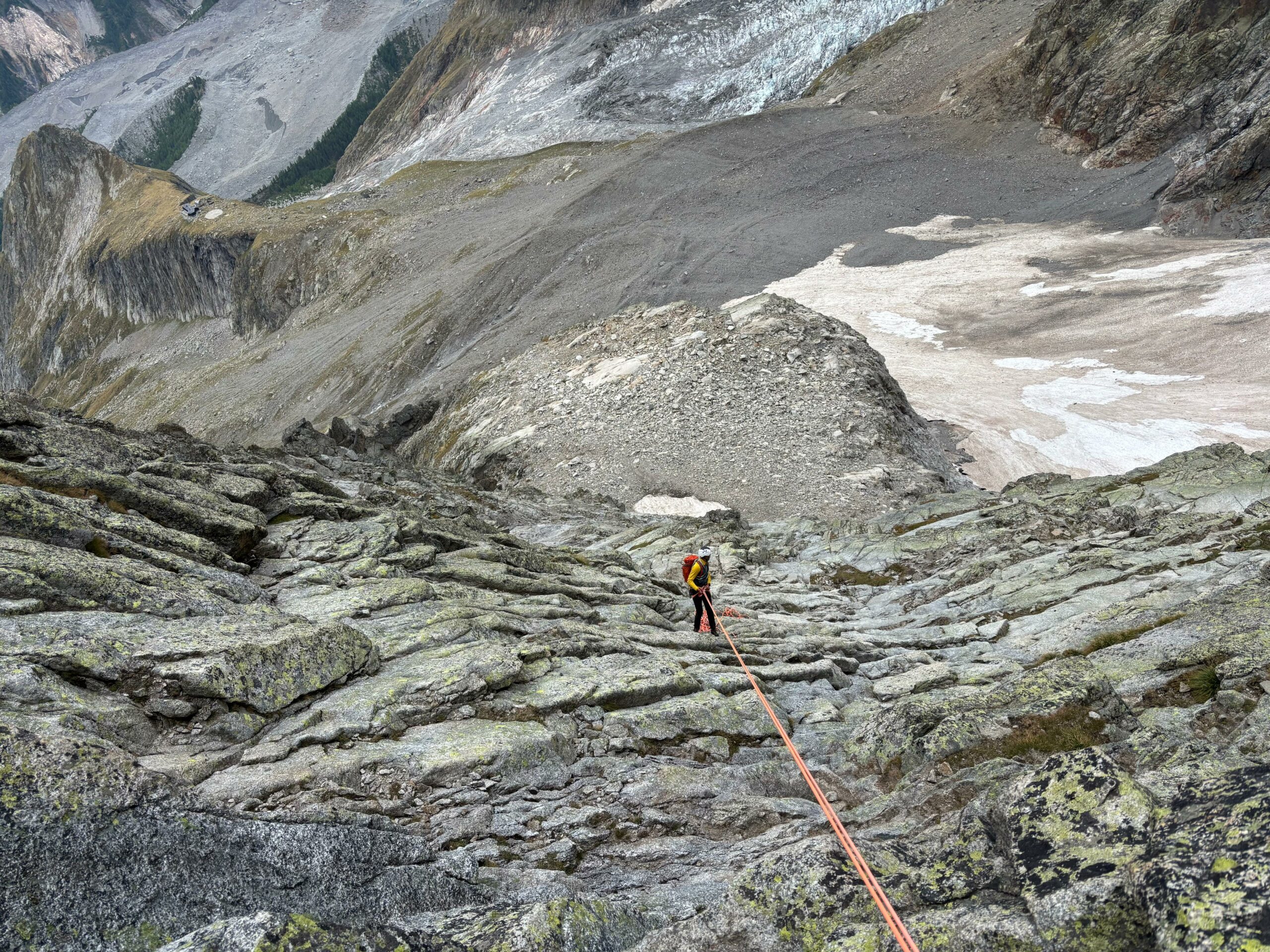
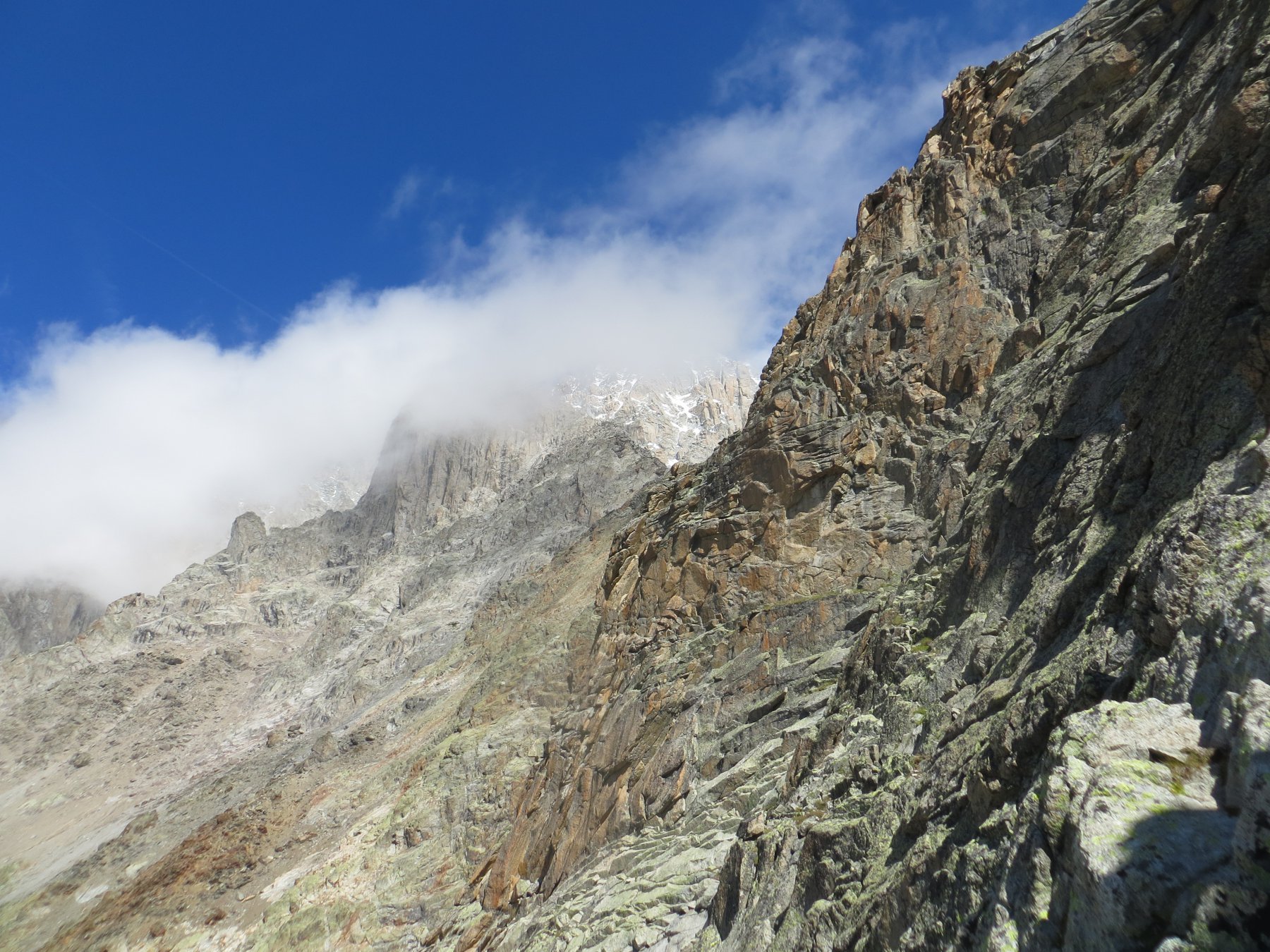
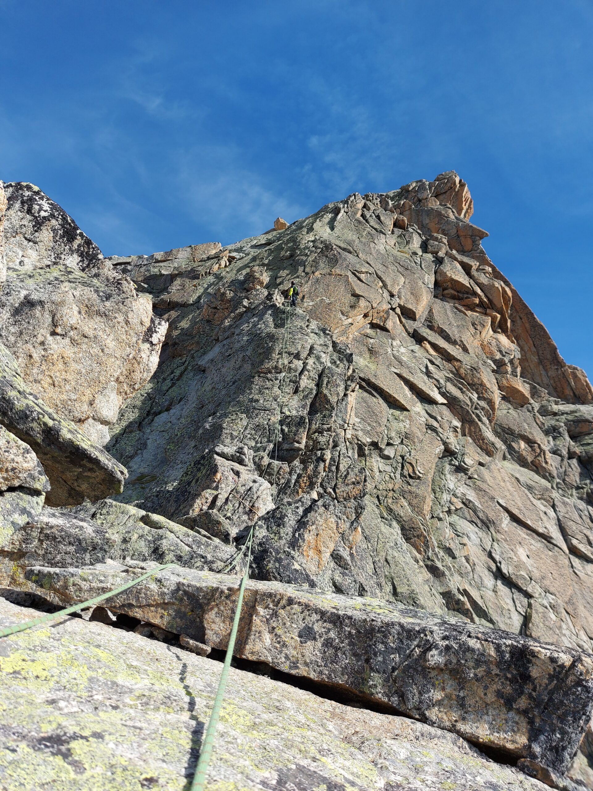
Si torna facilmente all’ultima sosta sotto il grande strapiombo. Da lì una breve calata di 15-20m riporta alla cengia dell’ultima lunghezza. Da qui o calata da 40m (sosta a sx faccia a monte sull’orlo della cengia, 2 fix con anelli di calata) o calata lungo l’ultimo tiro della Ottoz che si è salito (1 da 40m o 2 15+20m, sosta a fix collegate con cordino). Si prosegue in discesa lungo la cengia a dx (faccia a valle) fino a reperire una sosta di calata ad anelli (più o meno sotto la direttiva del camino della normale).
Da lì 6 calate sullo stesso asse da 25m (3/50m) ben reperibili, tutte su fix con anelli, attenzione ai sassi sulle varie cenge. Eventuale ultima calata su fix con anelli non collegati qualche metro sulla sx (faccia a monte, presente anche un fix singolo con maillon) una decina di metri sopra il nevaio per evitare la parte iniziale di questo, ripida.
Da qui:
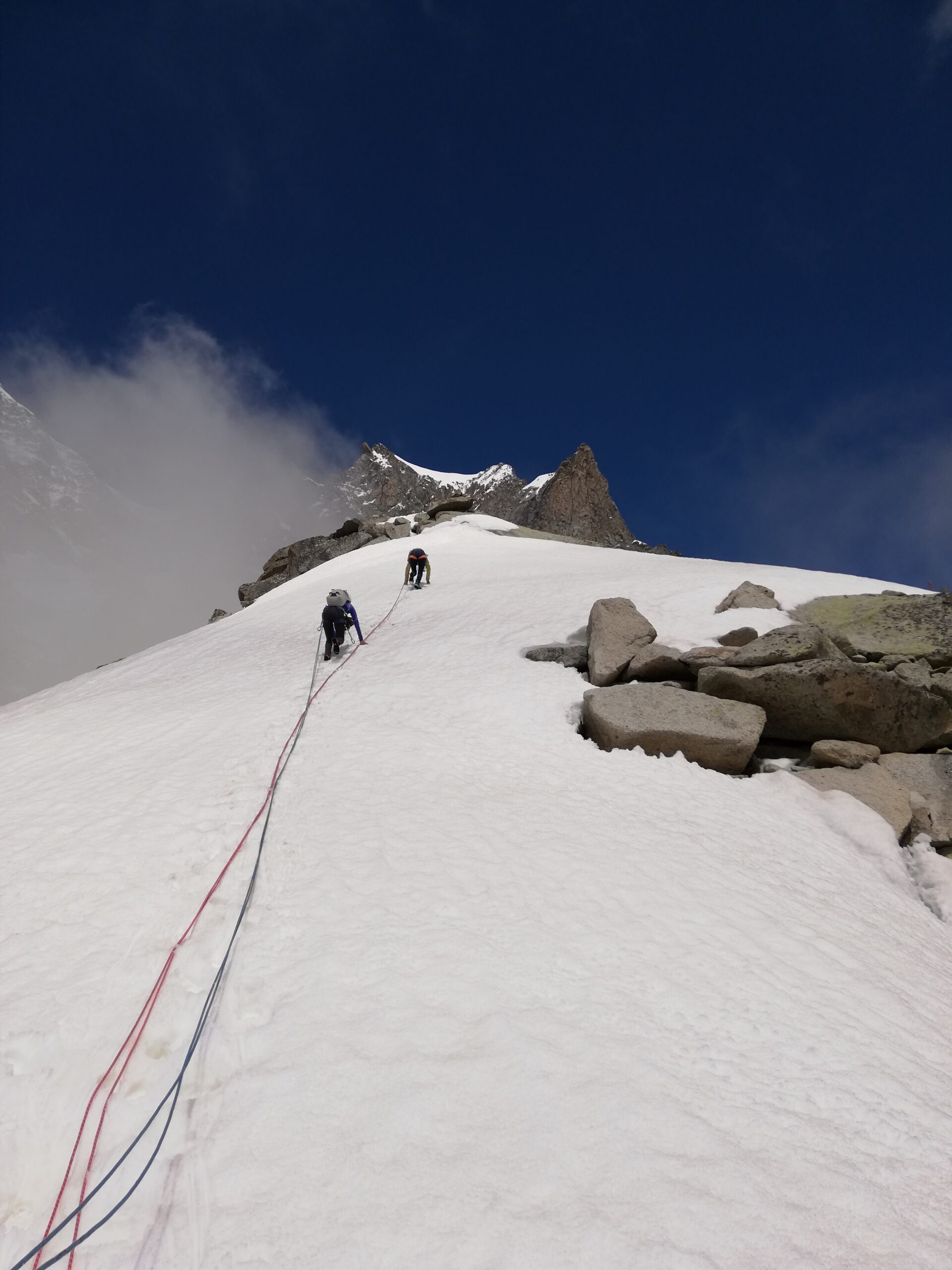
1. Si tiene il lato dx (direzione di marcia) della pietraia e si scende (ometti e bolli gialli) per reperire una sosta su fix per calarsi sul ghiacciaio dello Chatelet (1 calata da 60m, oppure 3 da 25m). Il gh. non è ripido e si scende facilmente a patto che la neve abbia mollato per bene, altrimenti utili i ramponi. Dal termine del gh. si intercetta il sentiero che sale agli Eccles e si rientra al Monzino.
2. Si ripercorre a ritroso il percorso fatto all’andata disarrampicando sul facile zoccolo basale (eventuale breve calata o sicura nel breve muretto di III).
- Bibliografia:
- Monte Bianco classico e plaisir
Nelle vicinanze Mappa
Itinerari
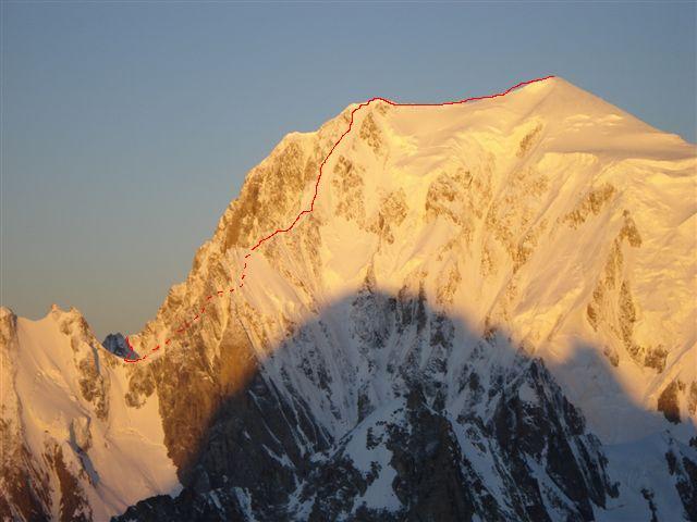
10/07/2023 AO, Courmayeur D+ 3250 m D Sud
Bianco (Monte) Cresta del Brouillard integrale
 50m
50m
19/07/2010 AO, Courmayeur D+ 3400 m TD+ Sud-Est
Bianco (Monte) Pilier nord de Freney – Via Gervasutti
 50m
50m
14/07/2024 AO, Courmayeur D+ 3200 m D- Sud-Ovest
Bianco (Monte) Sperone della Tournette
 50m
50m
24/08/2025 AO, Courmayeur D+ 1400 m PD- Sud
Estellette (Aiguille d’) da La Visaille
 50m
50m
02/04/2021 AO, Cormayeur D+ 950 m ED Sud-Est
Bianco (Monte) Hypercouloir du Brouillard
50m
21/08/2013 AO, Courmayeur D+ 3200 m D+ Sud-Est
Bianco (Monte) Cresta di Peuterey dal Col Eccles
 50m
50m
12/08/2021 AO, Courmayeur D+ 2600 m AD Est
Bionnassay (Aiguille de) Cresta Est
 50m
50m
04/03/2023 AO, Courmayeur D+ 1750 m D Est
Piccolo Monte Bianco o Petit Mont Blanc – Couloir Grassi-Marone-Stratta
50m
09/08/2024 AO, Courmayeur D+ 3400 m ED- Sud-Est
Bianco (Monte) Pilone Centrale Freney – Via classica
 50m
50m
02/07/2021 AO, Courmayeur D+ 400 m TD+ Sud-Est
Brouillard (Pilastro Rosso del) – Via Bonatti-Oggioni
 50m
50m