2.6Km
2.6Km
Note
Storico
 500m
650m
650m
1.6Km
1.7Km
2Km
2Km
2Km
2Km
2Km
500m
650m
650m
1.6Km
1.7Km
2Km
2Km
2Km
2Km
2Km
2.6Km
4.5Km
4.5Km
4.5Km
4.5Km
6.8Km
7.5Km
8.2Km
8.8Km
9.5Km
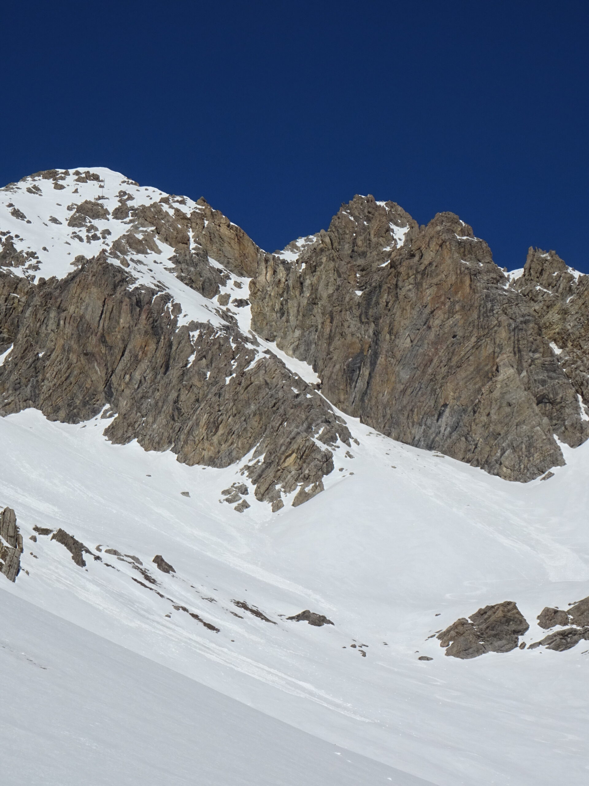
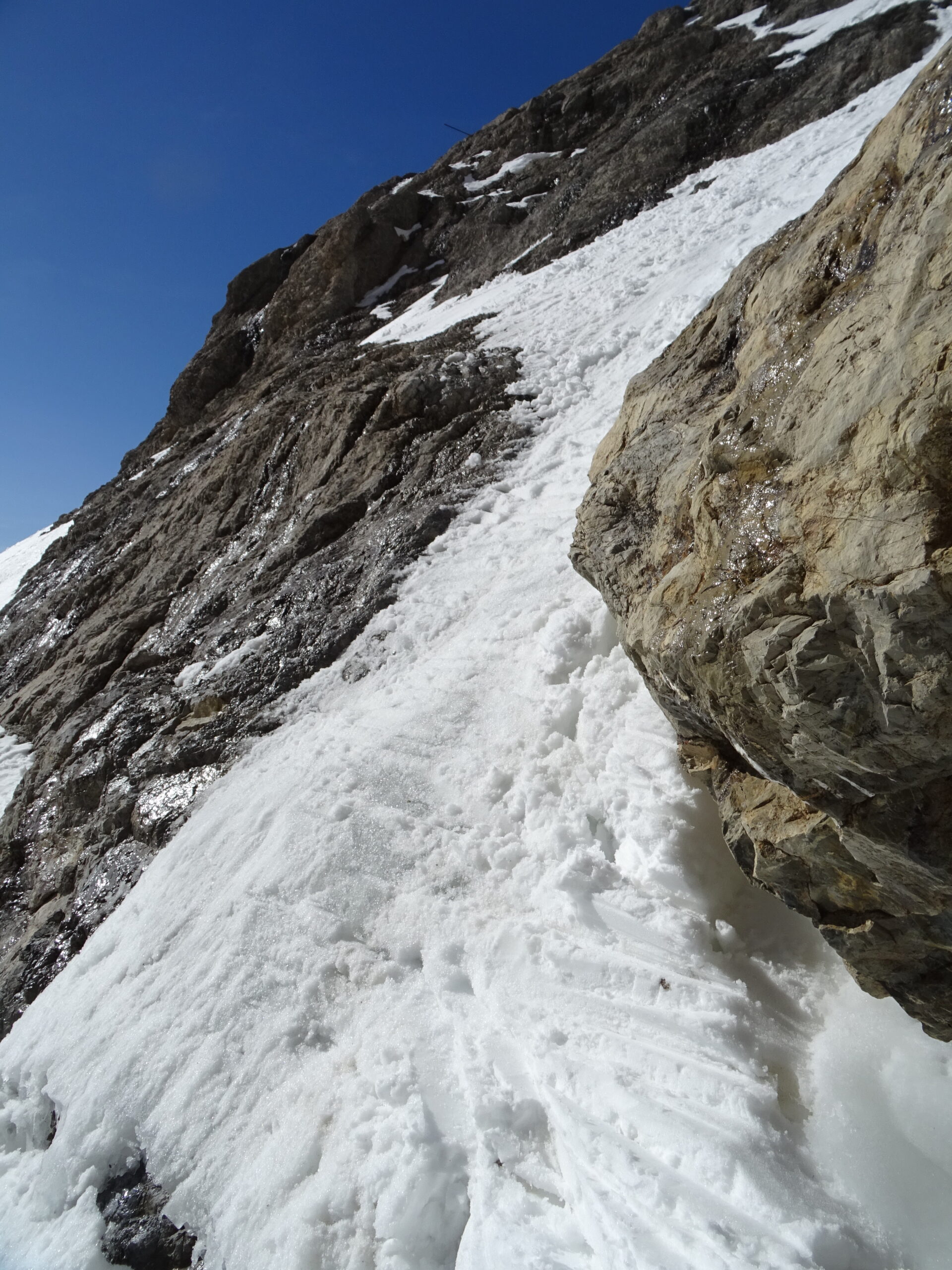
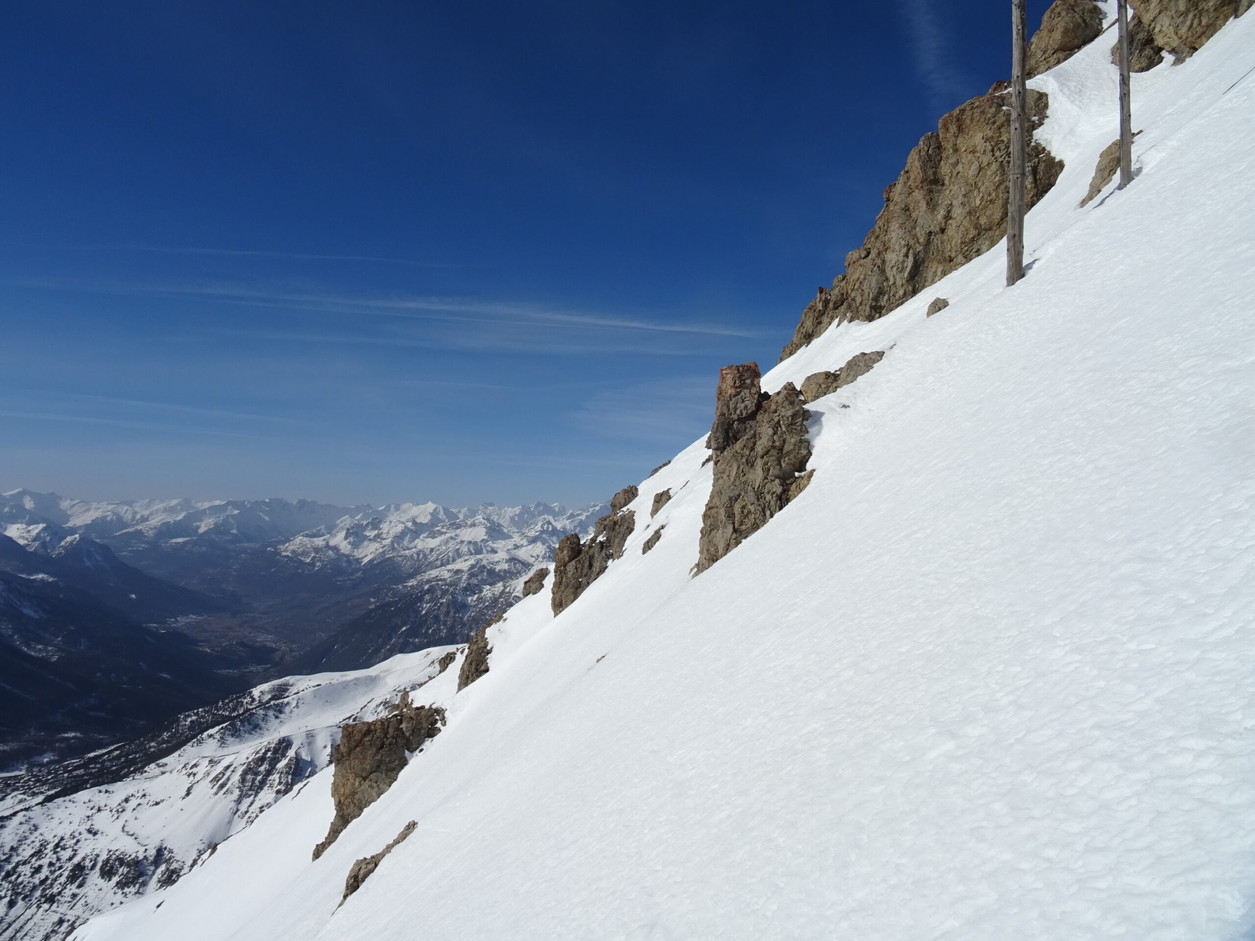
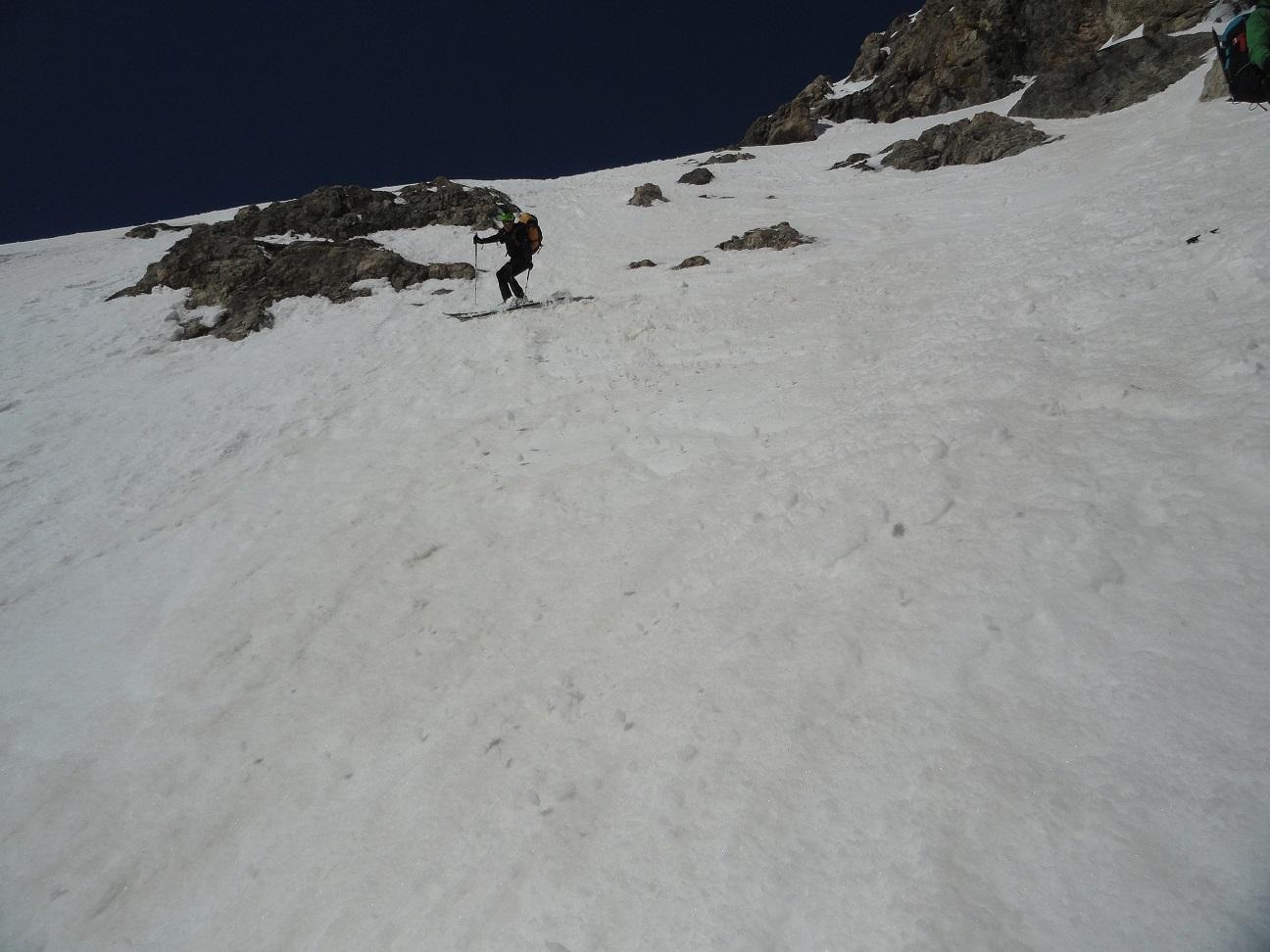
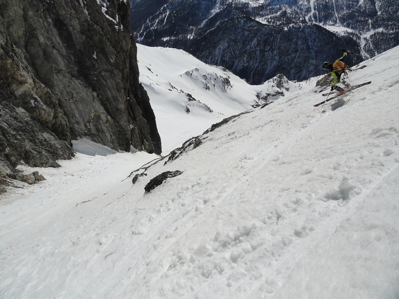
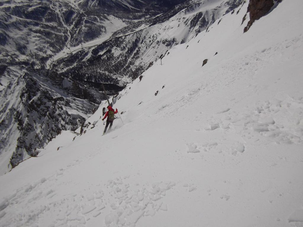
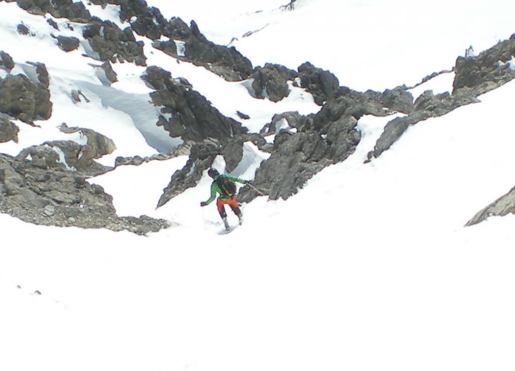
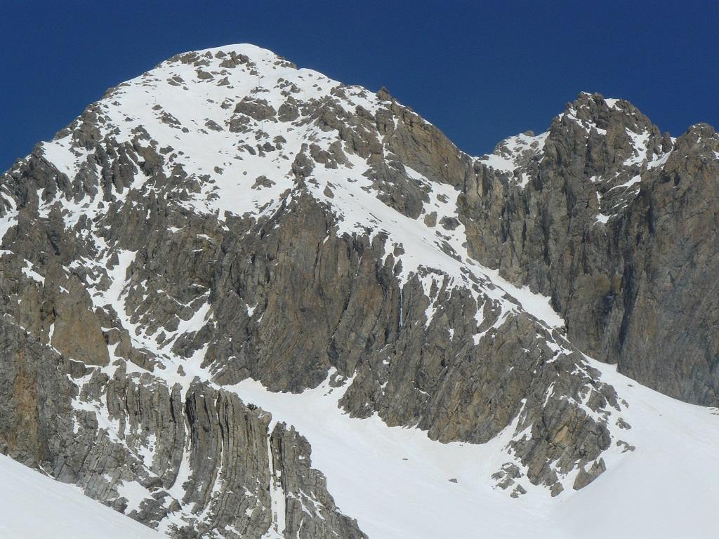
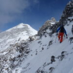
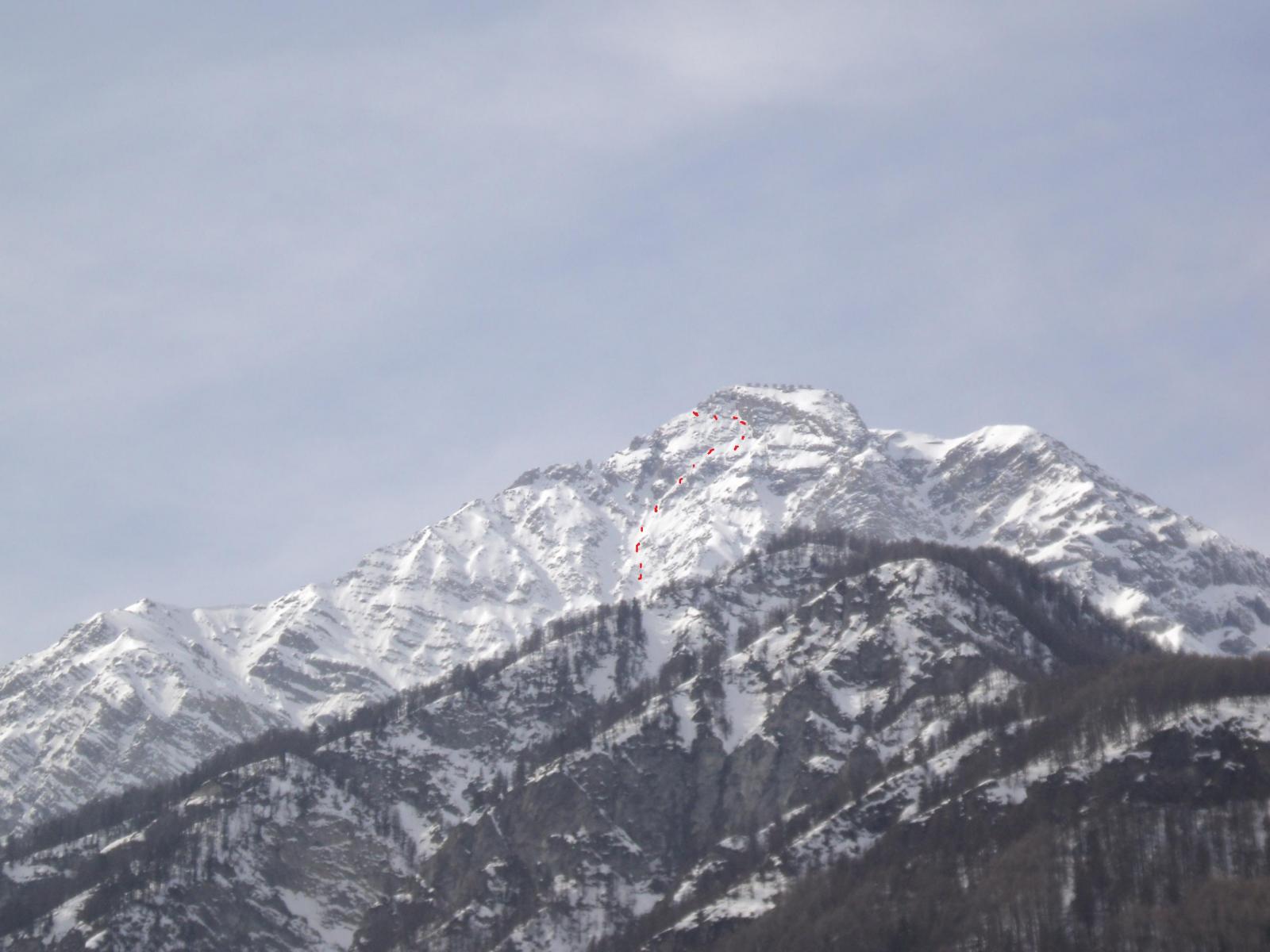
Bel versante molto soleggiato, ambiente interessante e discesa da non sottovalutare: 400m a 40°-45° con strettoia alla base.
Avvicinamento
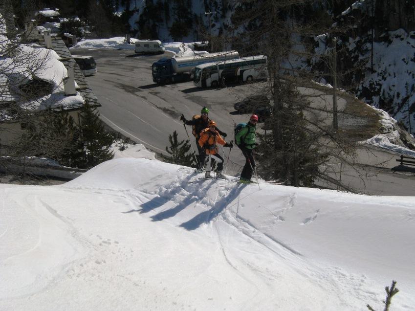
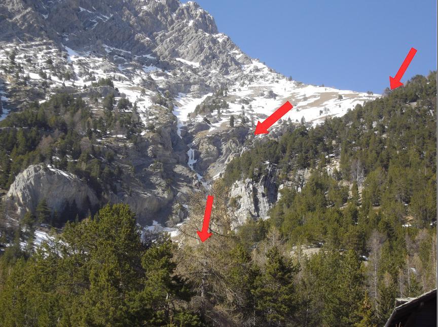
Risalire la val Susa fino a Claviere, dove si lascia l'auto.
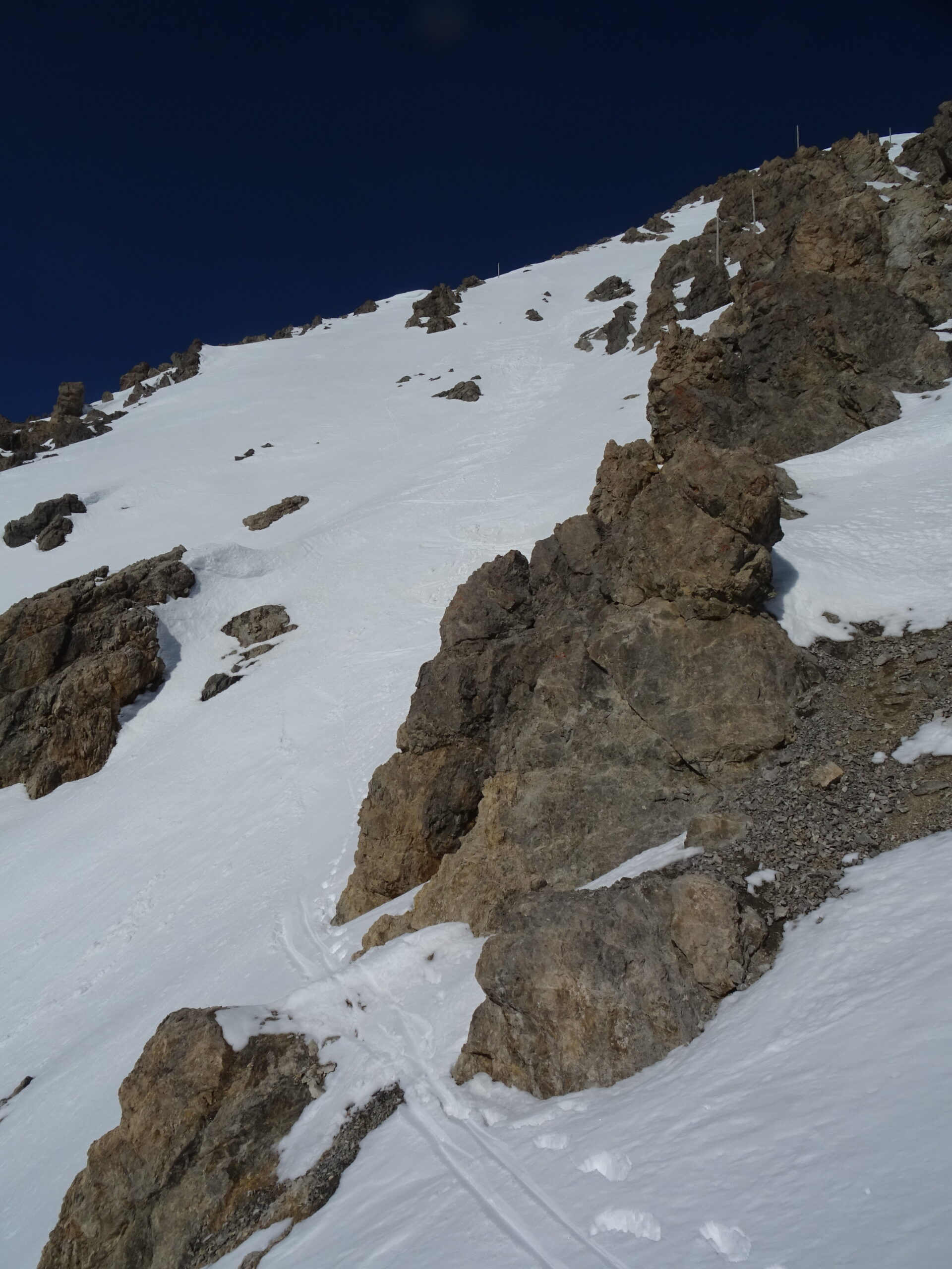
Salire in cima passando dalla normale o da questo itinerario.
Descrizione
Salire in cima passando dalla normale o da questo itinerario.
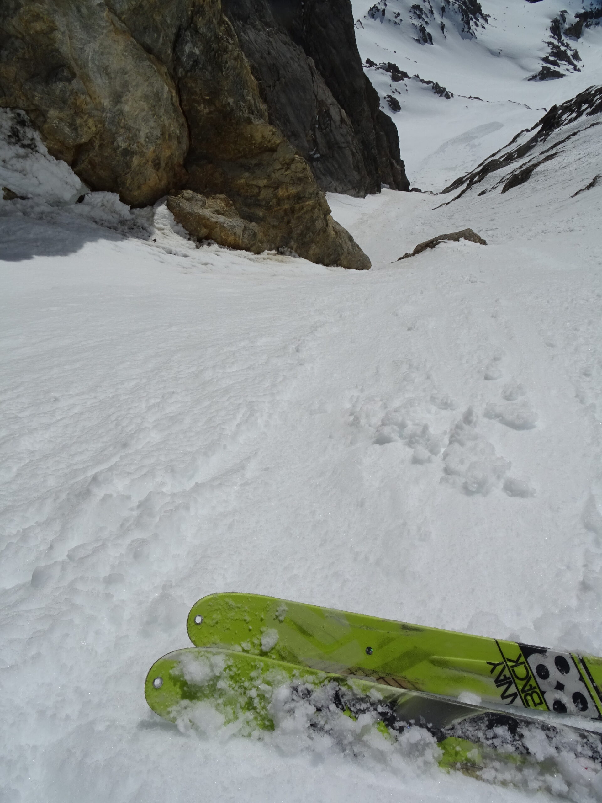
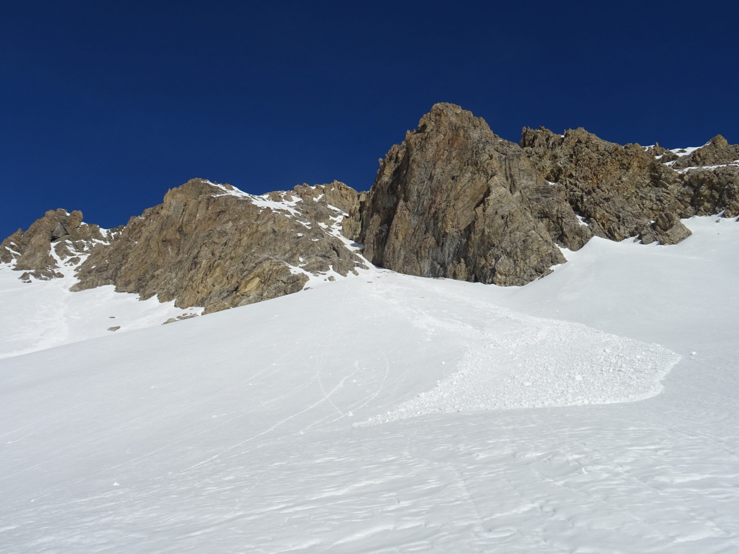
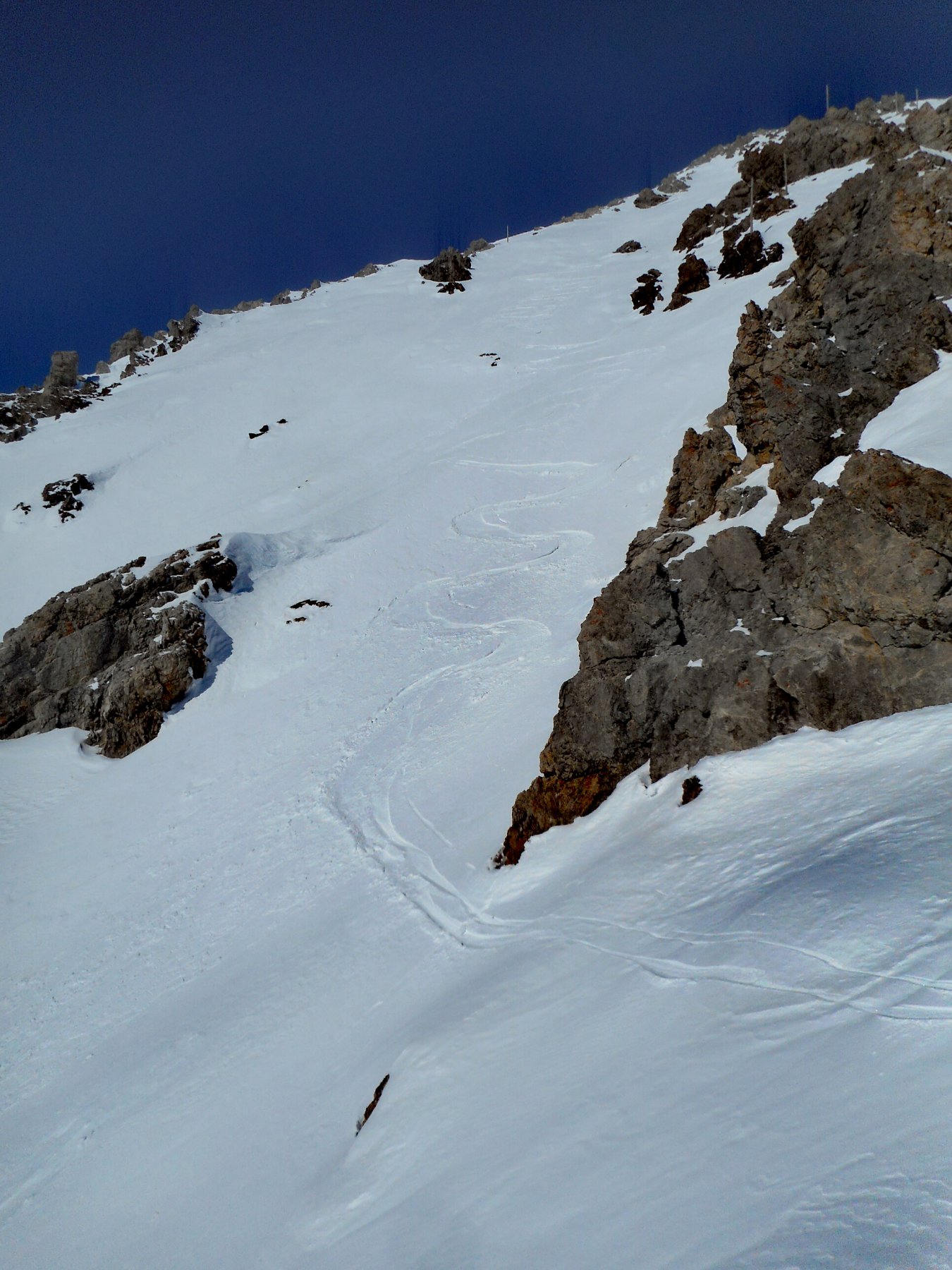
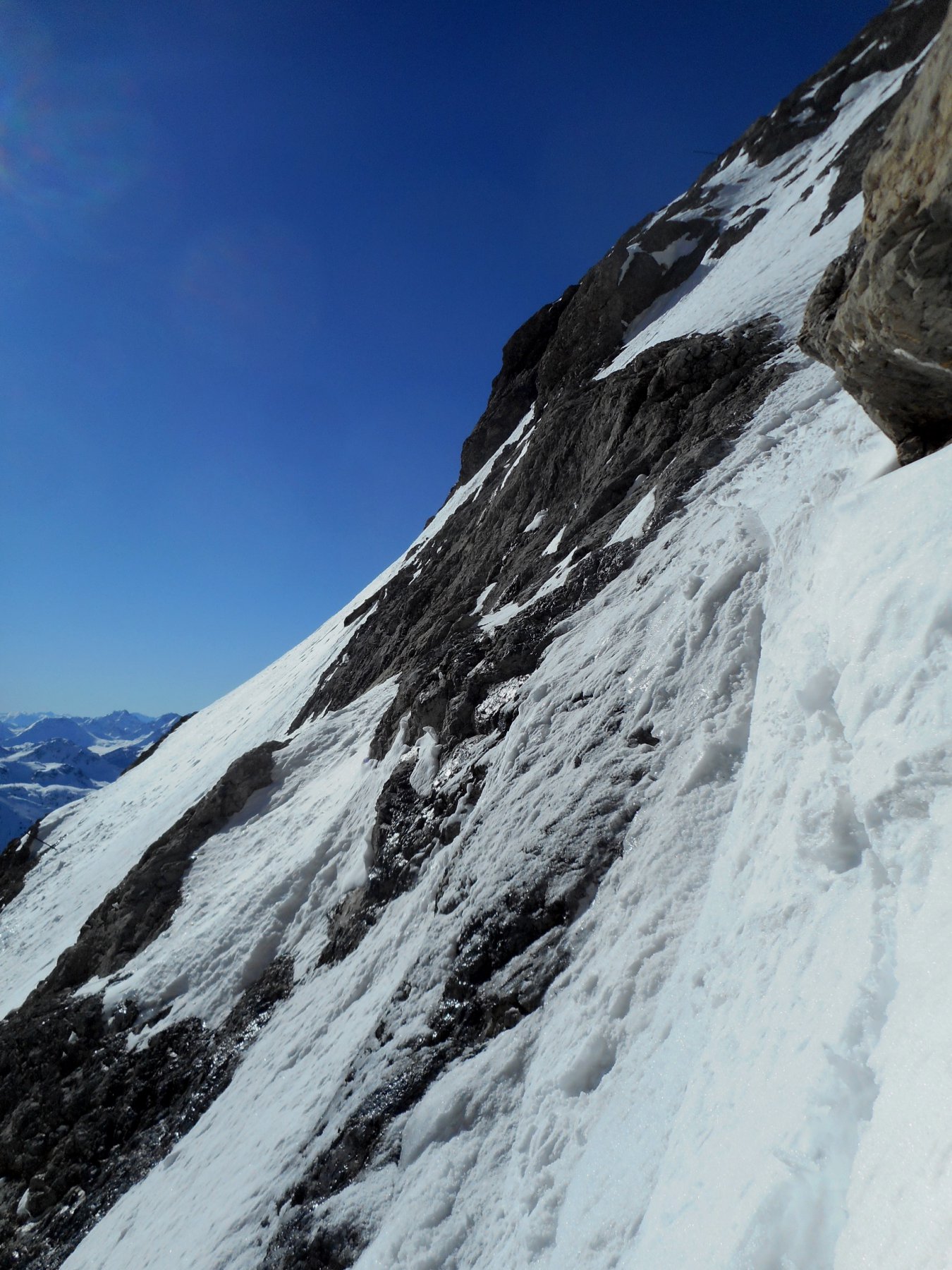
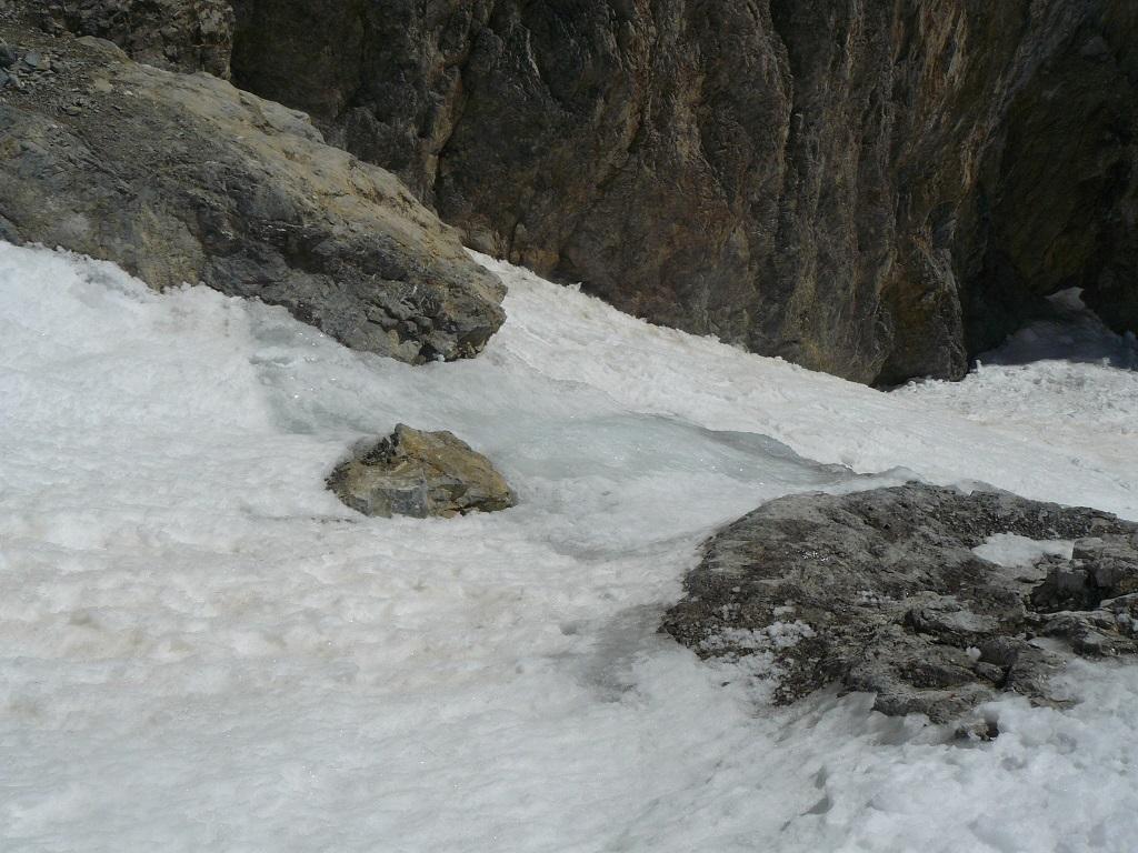
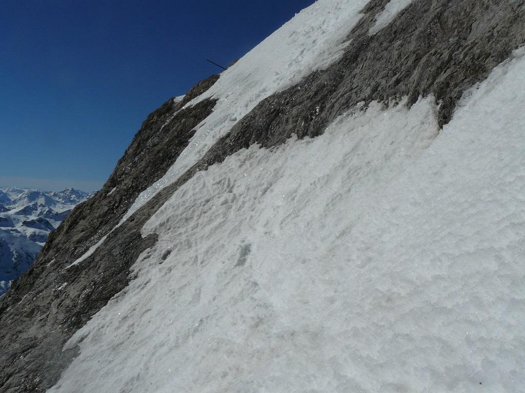
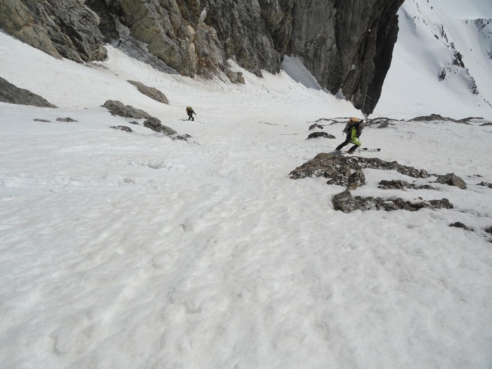
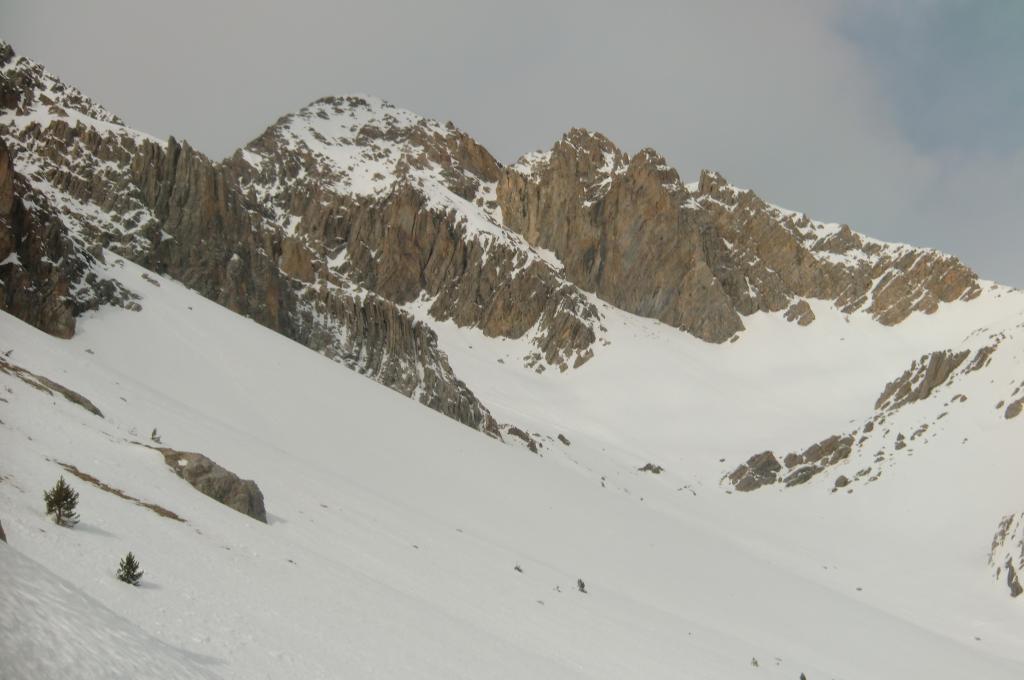
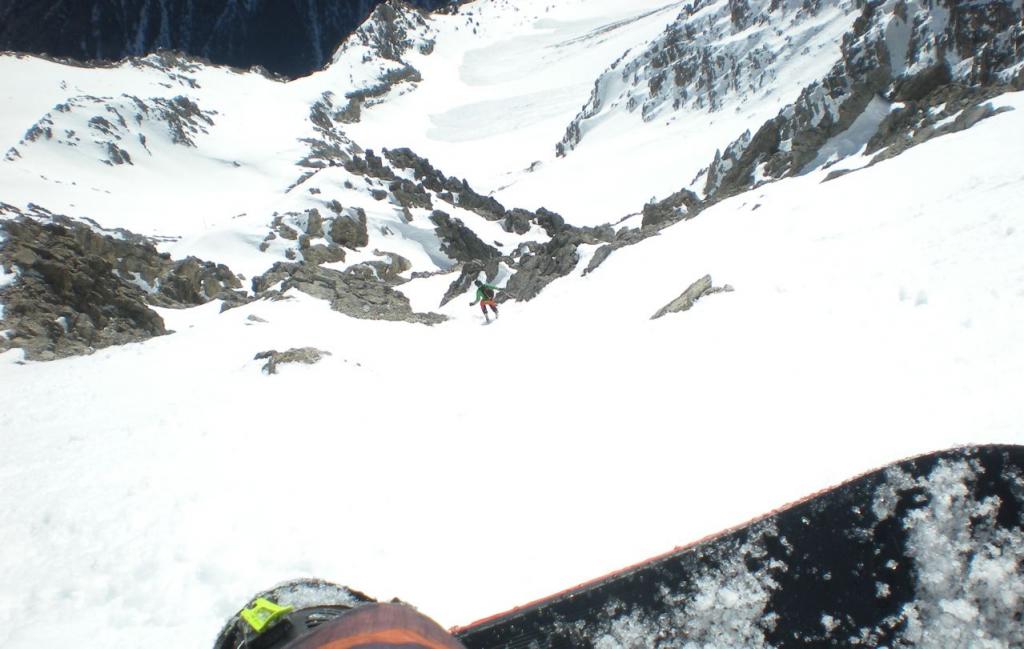
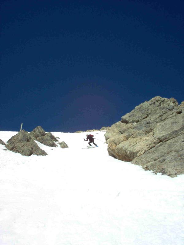
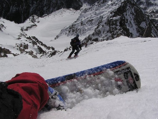
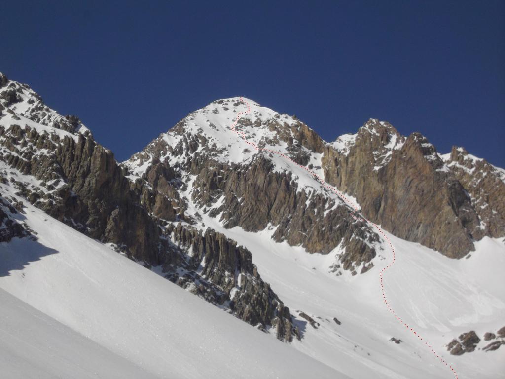
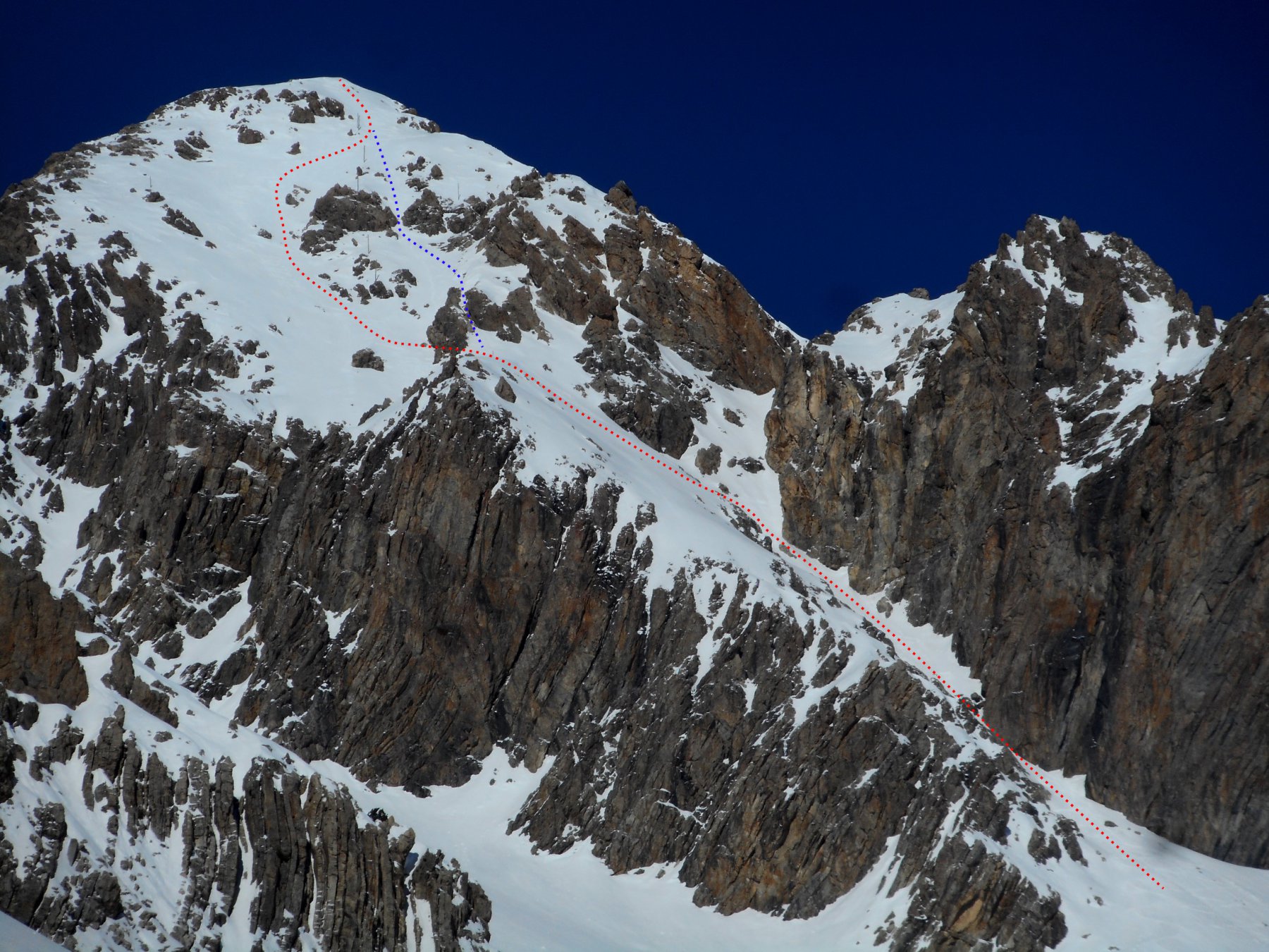
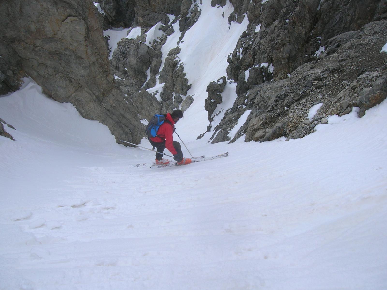
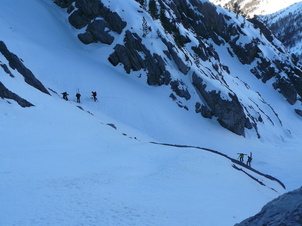
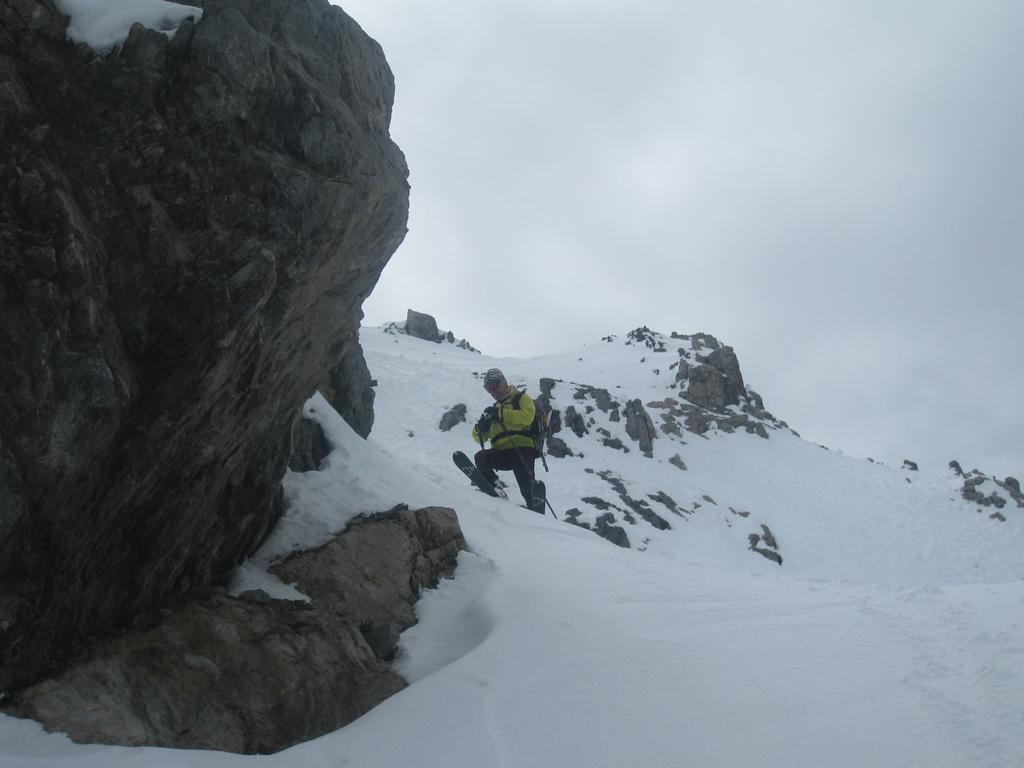
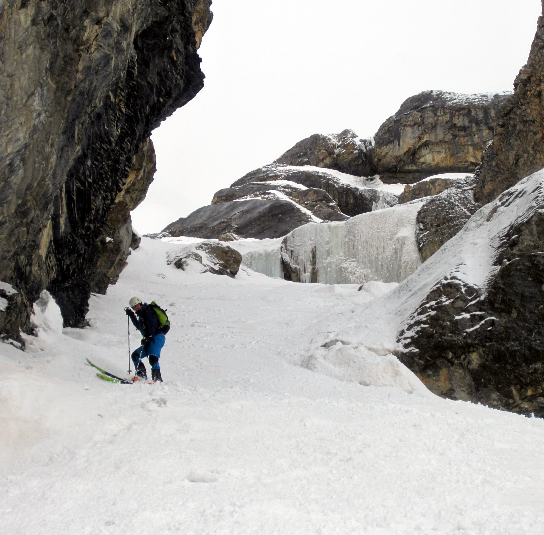
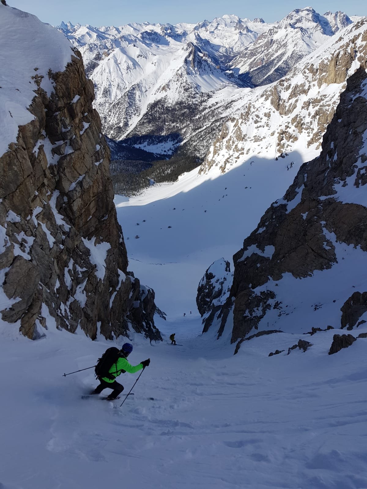
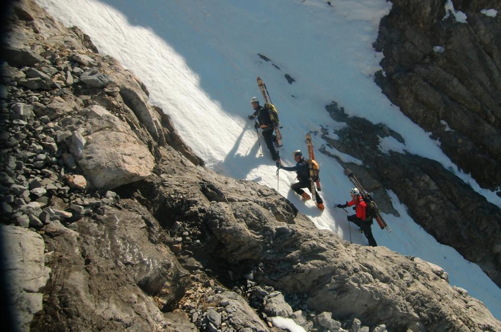
Dalla cima affacciarsi sull’evidente versante SE; scendere il bel pendio superiore tra crestine e pinnacoli (40° sostenuti, max 45°) stando al centro oppure leggermente sulla dx. Giunti a metà pendio è ben evidente sulla sx (faccia a valle) un paletto di metallo: a questo punto è necessario traversare verso la sella col paletto (se si prosegue si arriva su di un’alta balza rocciosa invalicabile). Dalla selletta si imbocca l’evidente canalone che scende sormontato alla sua sx da un’imponente parete; verso la fine è presente una strettoia passabile al centro (breve goulottina di 1-2m solitamente in ghiaccio) o con uno zig-zag sulla dx (spesso per tornare nel canale è presente una paretina di roccia di 1-2m).
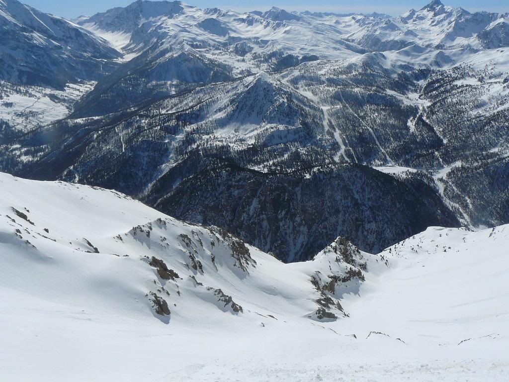
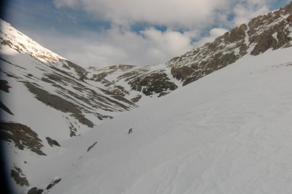
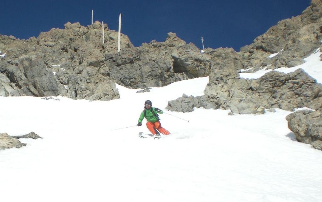
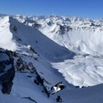
Scendere la bellissima conoide e puntare al fondo del vallone, in direzione Batteria Alta. Da quest’ultima imboccare l’evidente canalone che dapprima passa accanto ad una paretina di roccia (fianco dx del canale scendendo) e quindi una volta passato sotto una cascata di ghiaccio punta dritto fino alle case di Claviere.
M. Bovo e M. Pitet 14/2/1982
- Bibliografia:
- Ripido! Negri, Cardonatti
Nelle vicinanze Mappa
Itinerari
06/04/2014 TO, Claviere D+ 1380 m III, 4.3, E3 Sud
Chaberton (Monte) Versante Sud – variante uscita di sicurezza
 500m
500m
26/03/2016 TO, Claviere D+ 1350 m III, 5.1, E4 Sud
Chaberton (Monte) Parete S
 650m
650m
16/05/2010 TO, Claviere D+ 1261 m 4.2, E4 Ovest
Chaberton (Monte) Versante O – Canale Diretto
 650m
650m
09/04/2022 Hautes-Alpes, Montgenèvre D+ 1900 m II, 4.2, E1 Nord-Ovest
Chalanche Ronde (Pointe de) Couloir NO
 1.6Km
1.6Km
25/04/2018 Hautes-Alpes, Montgenèvre D+ 1300 m I, 4.2, E2 Nord-Est
Chaberton (Monte) Canale NE
 1.7Km
1.7Km
15/03/2014 Hautes-Alpes, Montgenèvre D+ 1280 m IV, 5.2, E4 Est
Chaberton (Monte) Parete Est
 2Km
2Km
06/03/2025 Hautes-Alpes, Montgenèvre D+ 1350 m II, 4.3, E3 Sud-Ovest
Rochers Charniers (Pointe des) Canale Sud-Ovest
 2Km
2Km
04/01/2020 Hautes-Alpes, Montgenèvre D+ 1650 m I, 4.1, E1 Varie
Chalanche Ronde (Pointe des) da Montgenevre, anello per il pas du Curè e il Col des Trois Frère Mineurs
 2Km
2Km
05/04/2014 Hautes-Alpes, Montgenèvre D+ 1336 m III, 4.3, E3 Sud
Chaberton (Monte) Parete S/SO – Combinazione Vincente
 2Km
2Km
25/02/2012 Hautes-Alpes, Montgenèvre D+ 1059 m II, 4.1, E2 Ovest
Portiola (Pointe de la) versante O/SO
 2Km
2Km
Servizi
2.6Km
4.5Km
Casa Cesana Bar
Cesana Torinese
4.5Km
L’Ibarus Rifugio
Cesana Torinese
4.5Km
Piergiorgio Frassati B&B
Cesana Torinese
4.5Km
Ottima Scelta Ristorante
Cesana Torinese
6.8Km
La vachette Bar
Montgenèvre
7.5Km
Centro Ristorante
Cesana Torinese
8.2Km
La Fontana del Thures Rifugio
Cesana Torinese
8.8Km
Terre Rouge Rifugio
Cervières
9.5Km