2.8Km
2.8Km
Note
 200m
200m
2.7Km
2.7Km
3.4Km
3.7Km
4.5Km
5.4Km
5.4Km
200m
200m
2.7Km
2.7Km
3.4Km
3.7Km
4.5Km
5.4Km
5.4Km
2.8Km
5.8Km
5.8Km
6Km
7.1Km
7.5Km
7.8Km
7.8Km
7.9Km
8.1Km
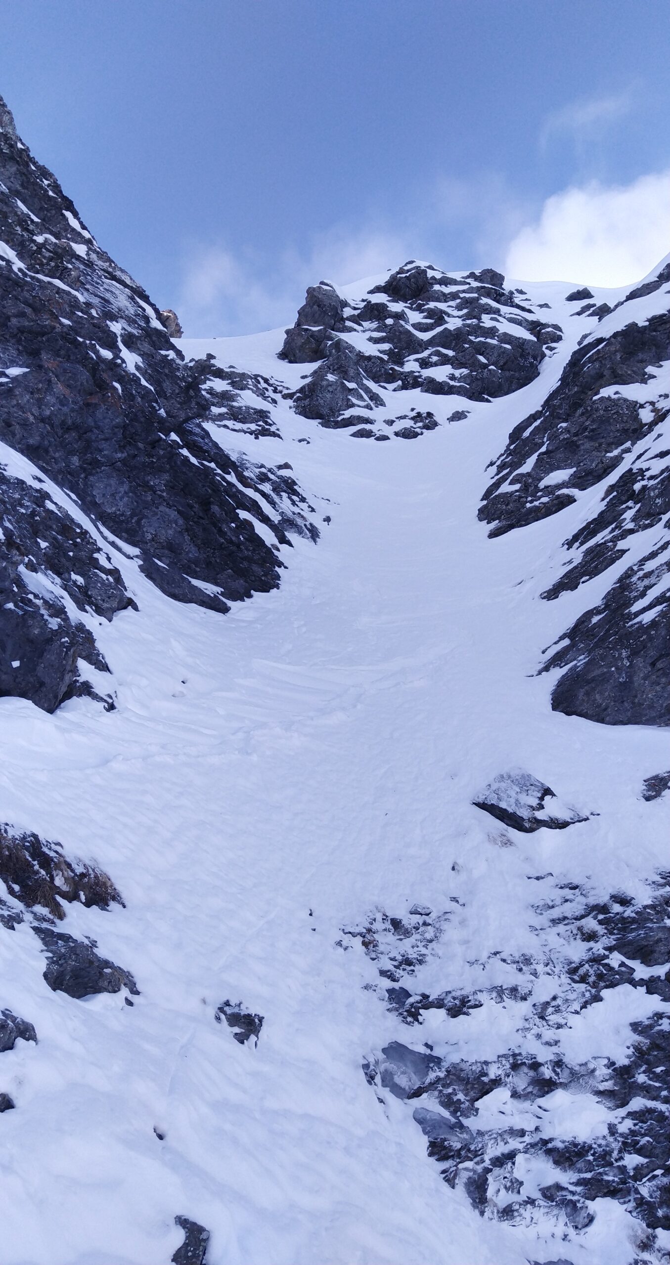
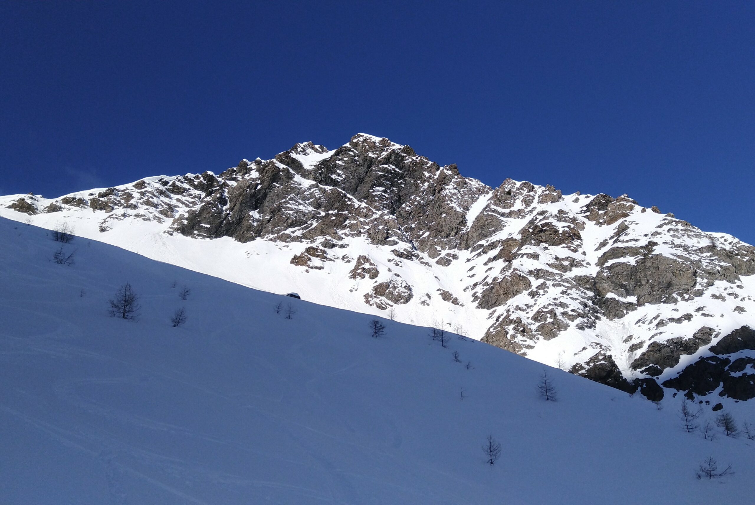
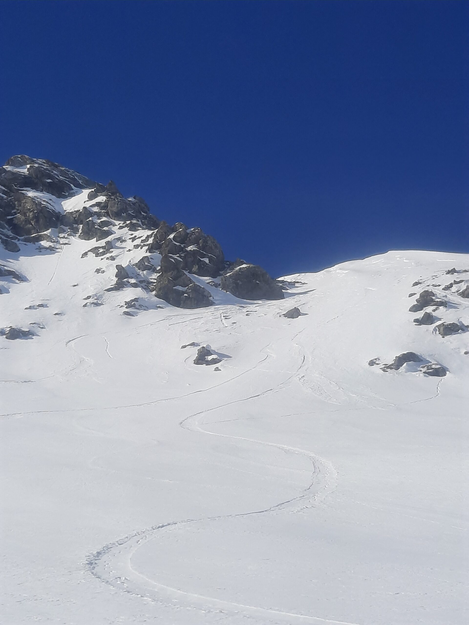
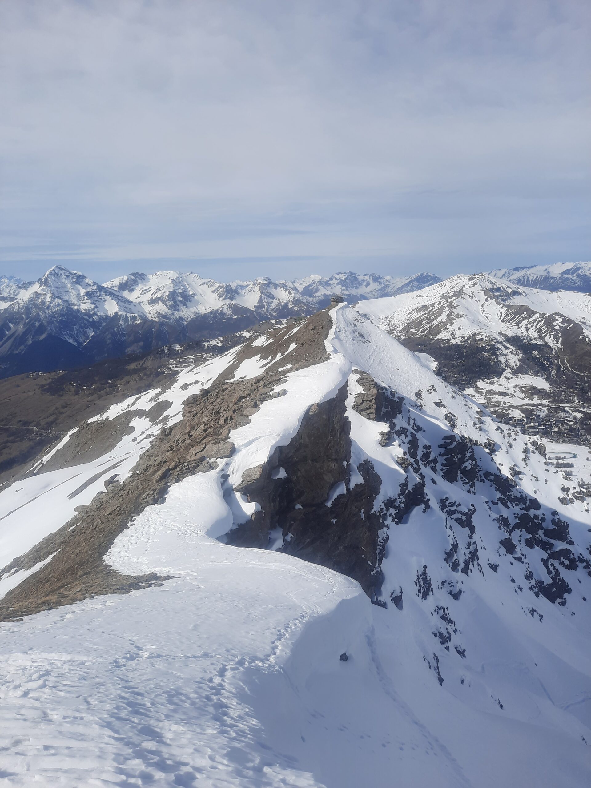
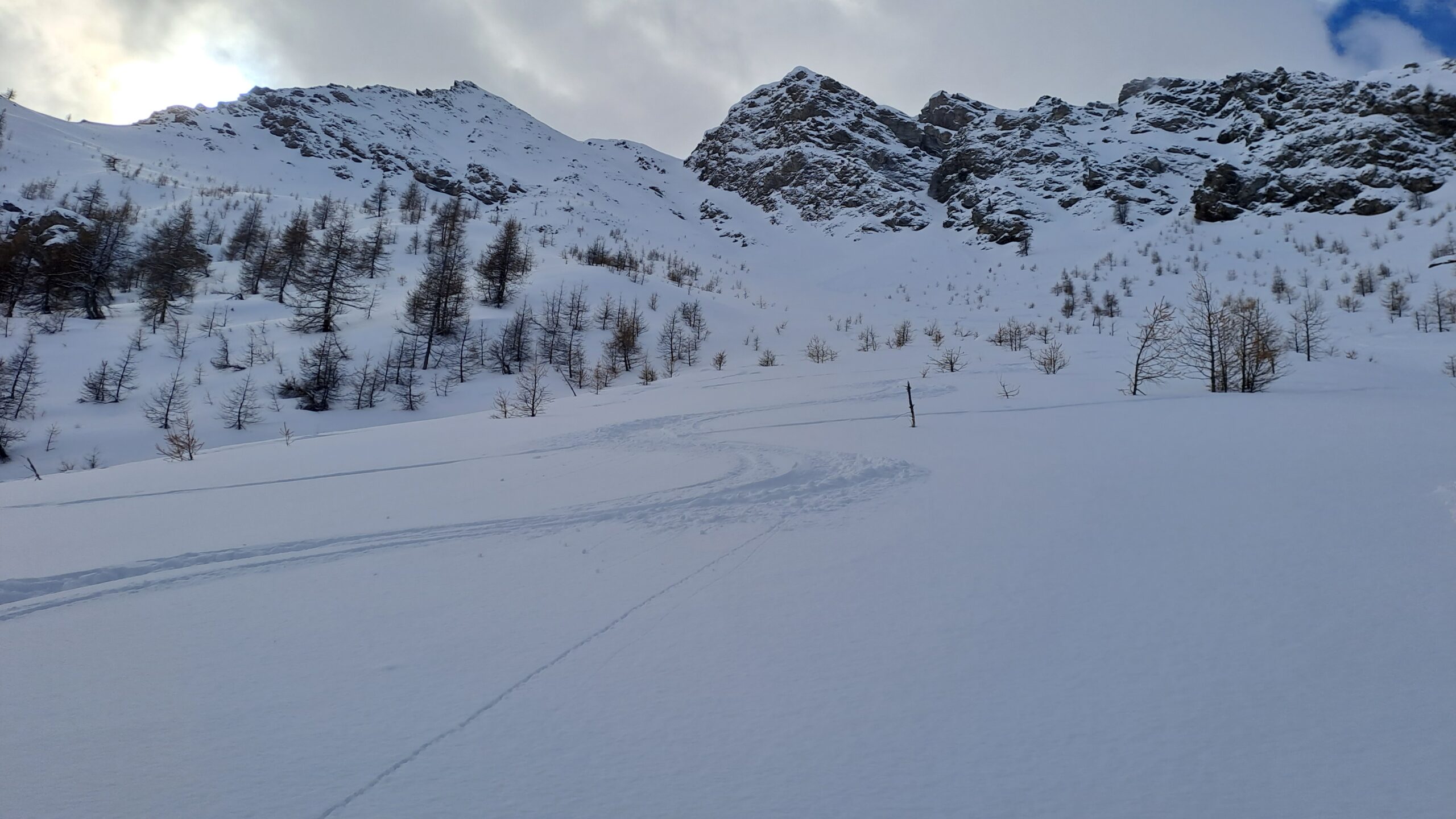
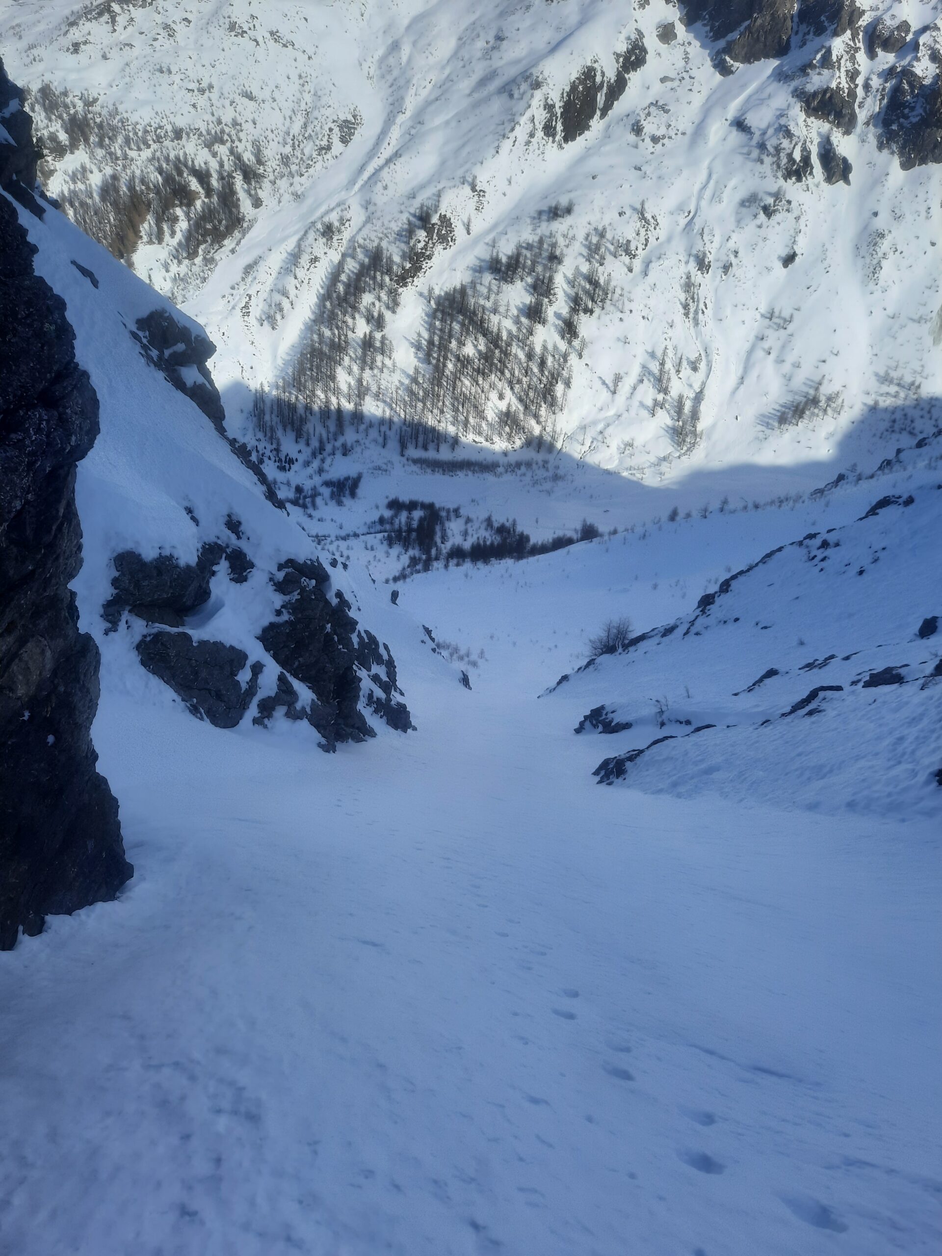
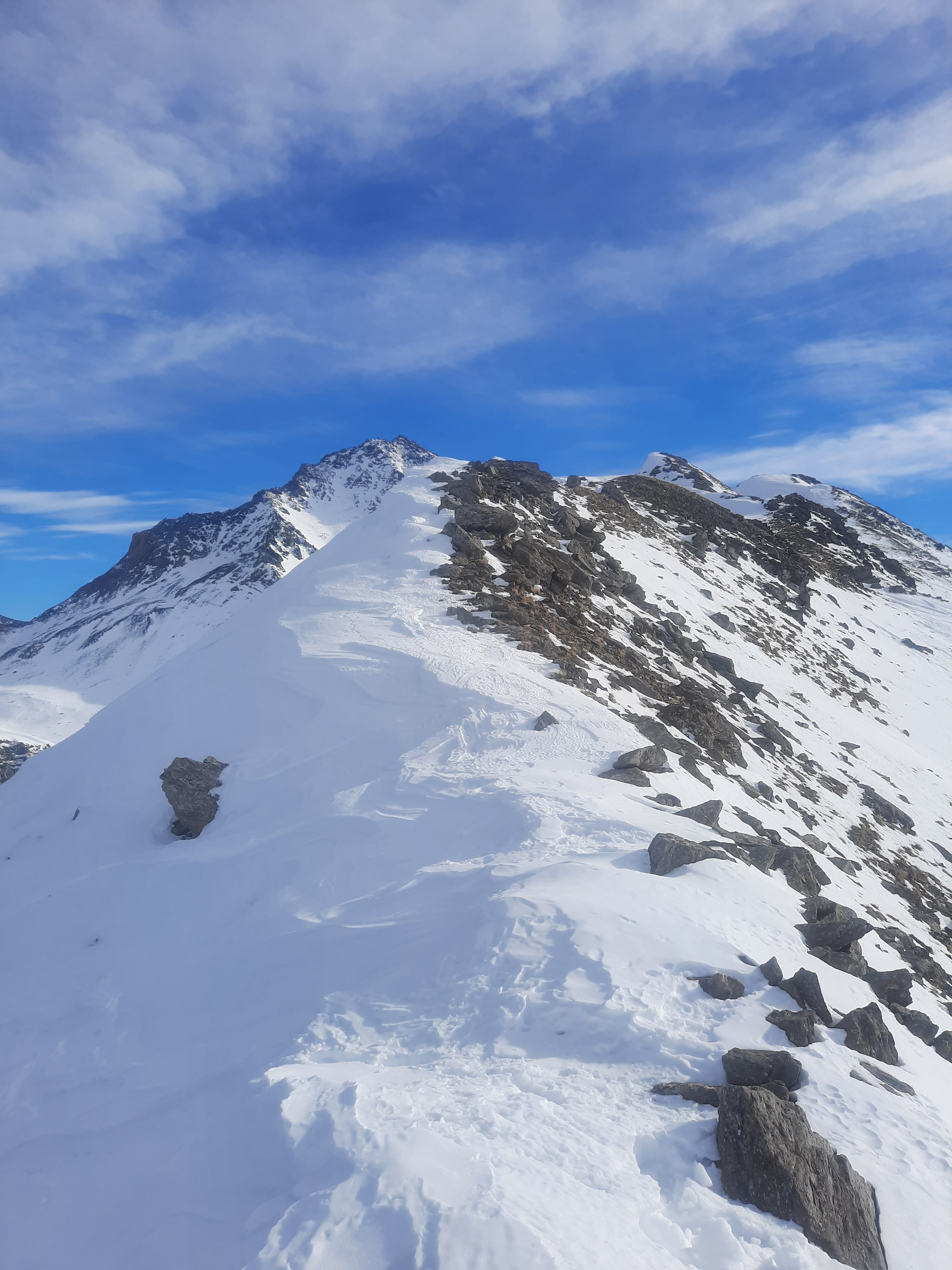
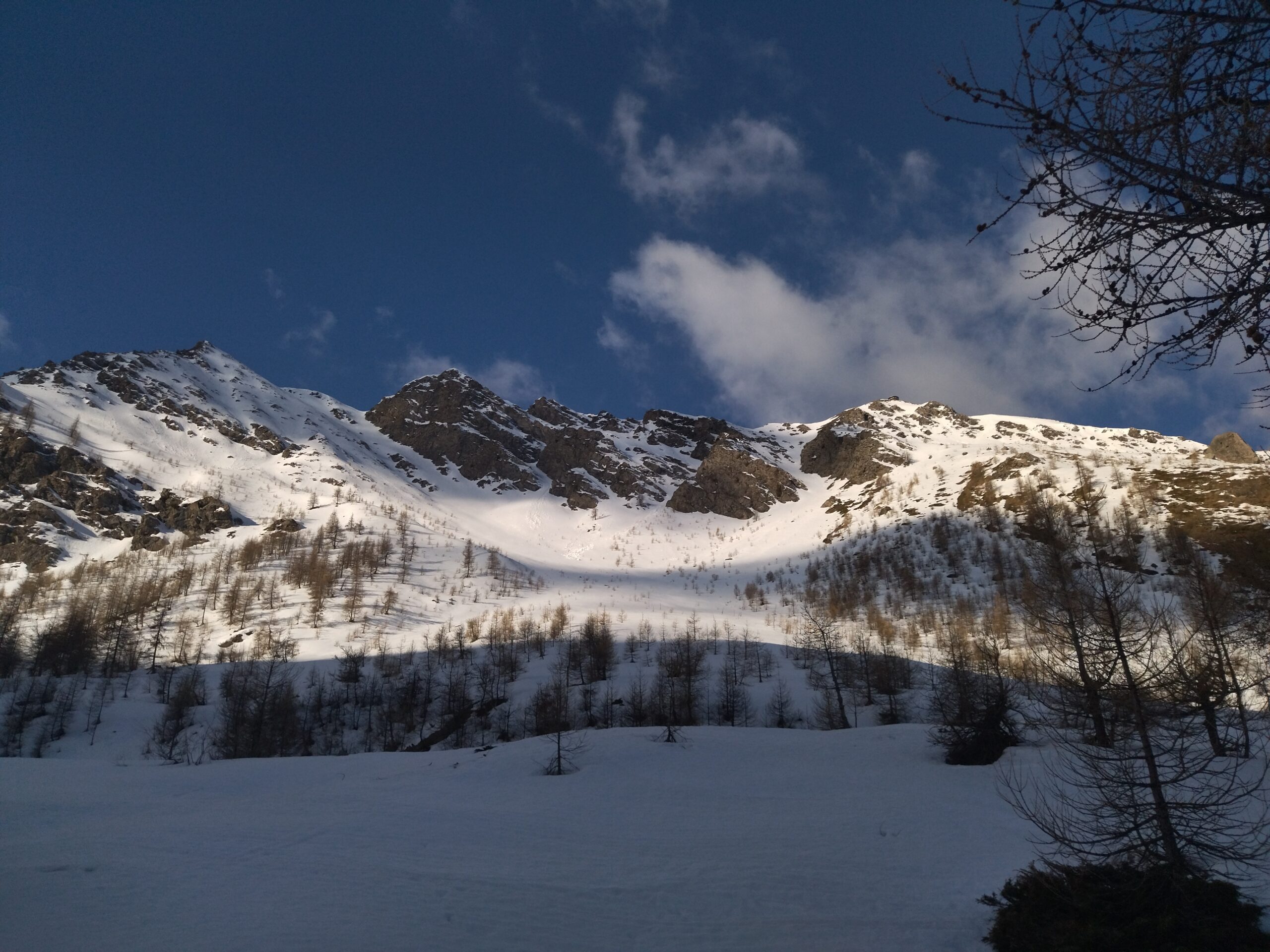
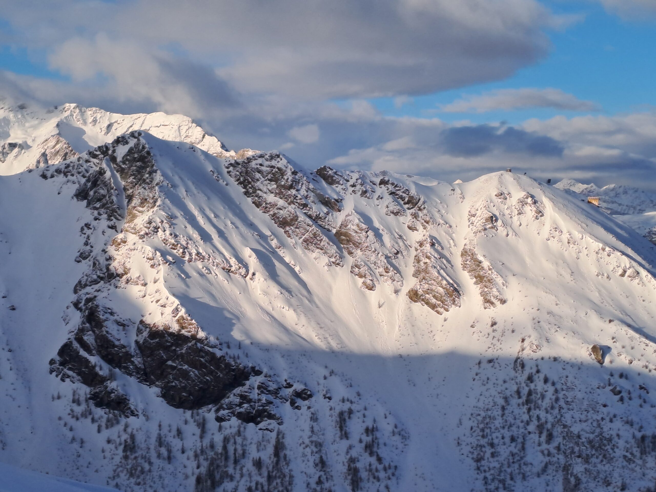
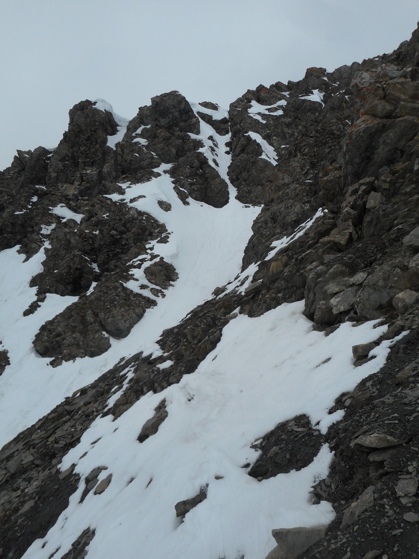
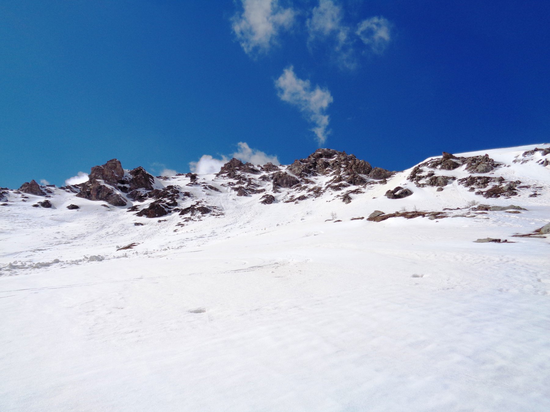
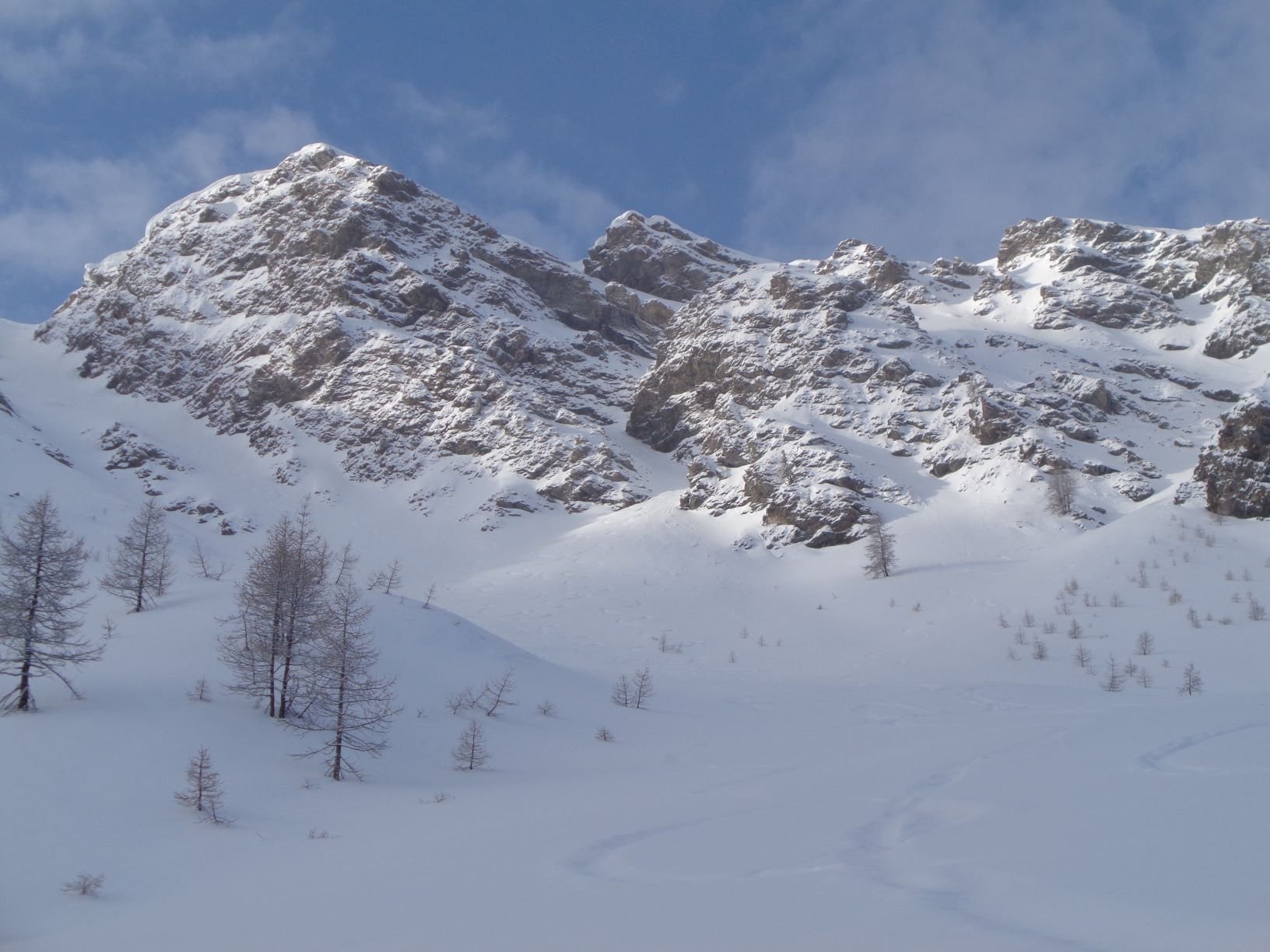
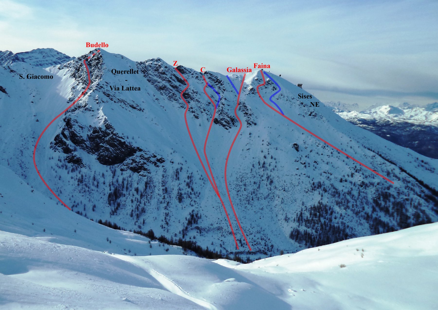
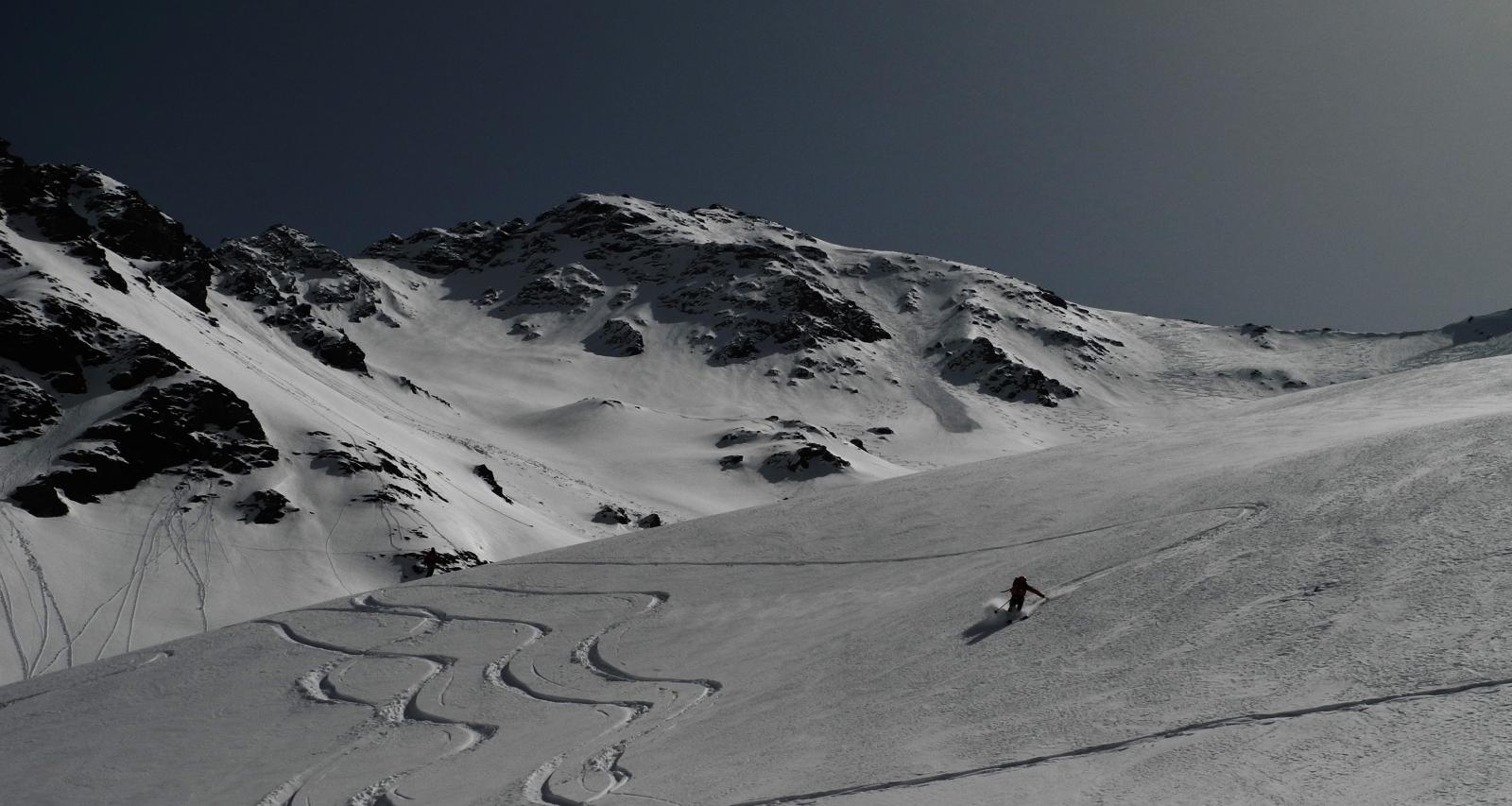
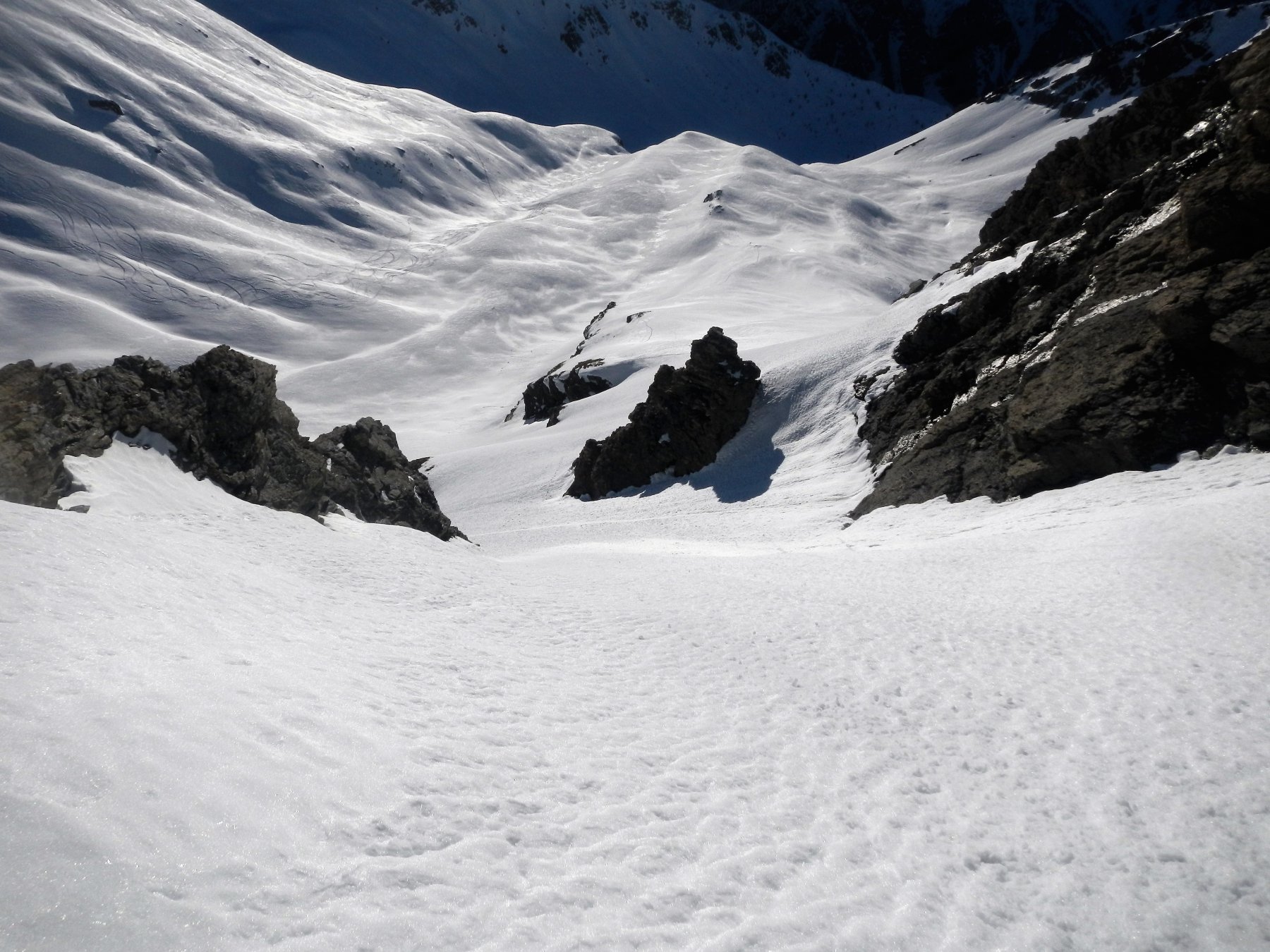
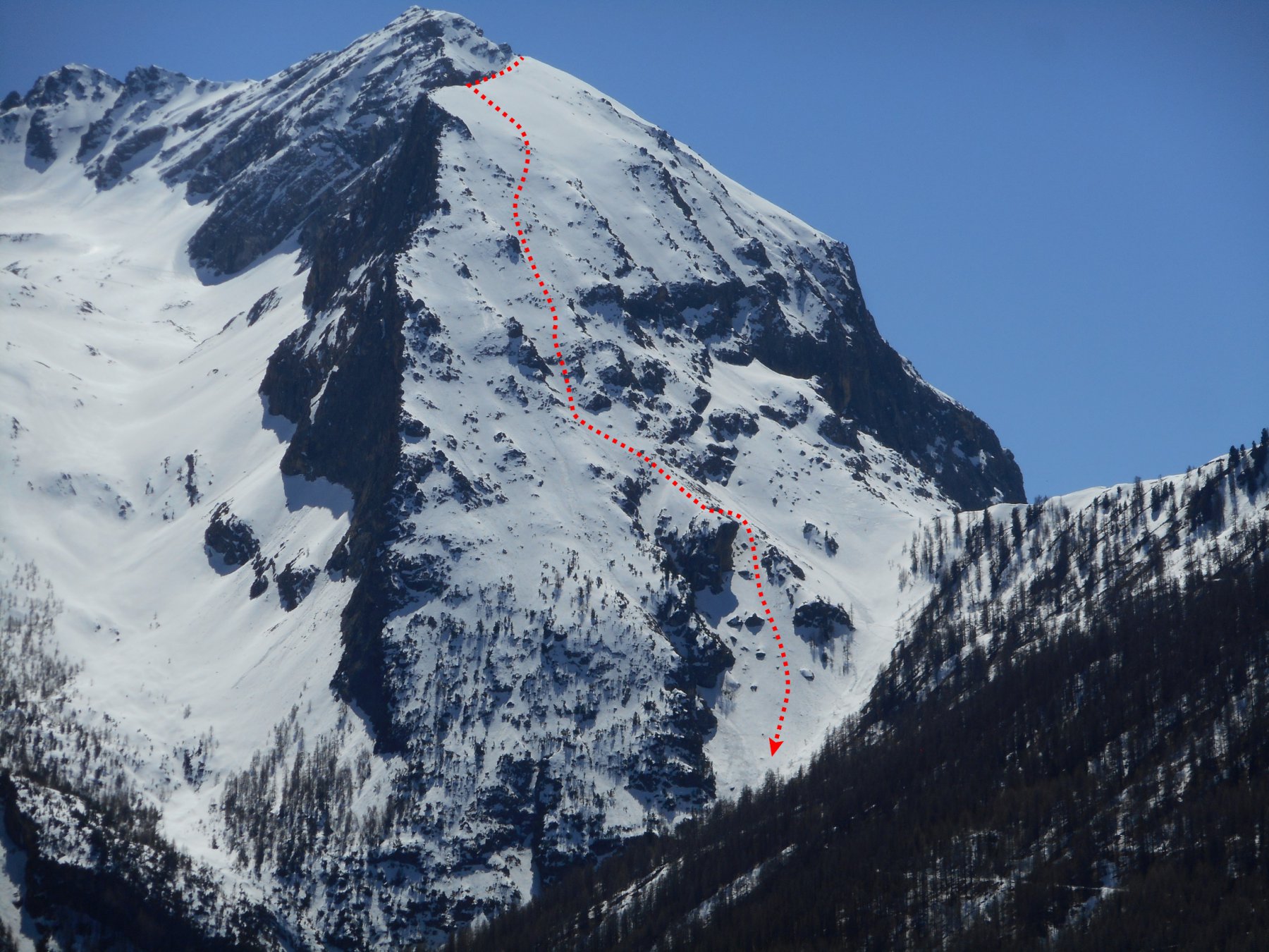
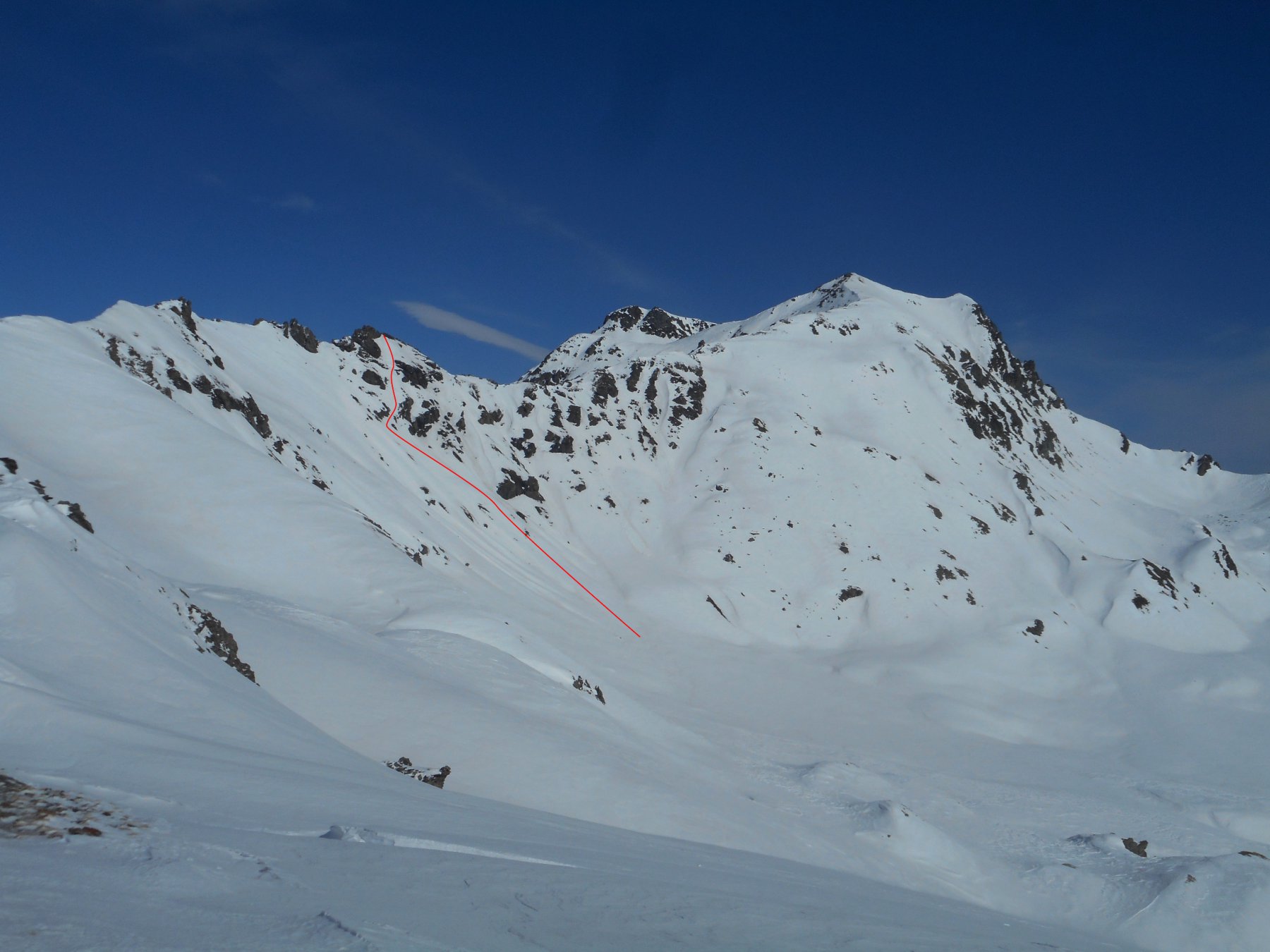
Serie di cinque canali posti lungo la dorsale tra la cima del Sises e quella del Querellet. Pendenze, esposizione e difficoltà variano tra i vari canali. Da effettuare con impianti chiusi.
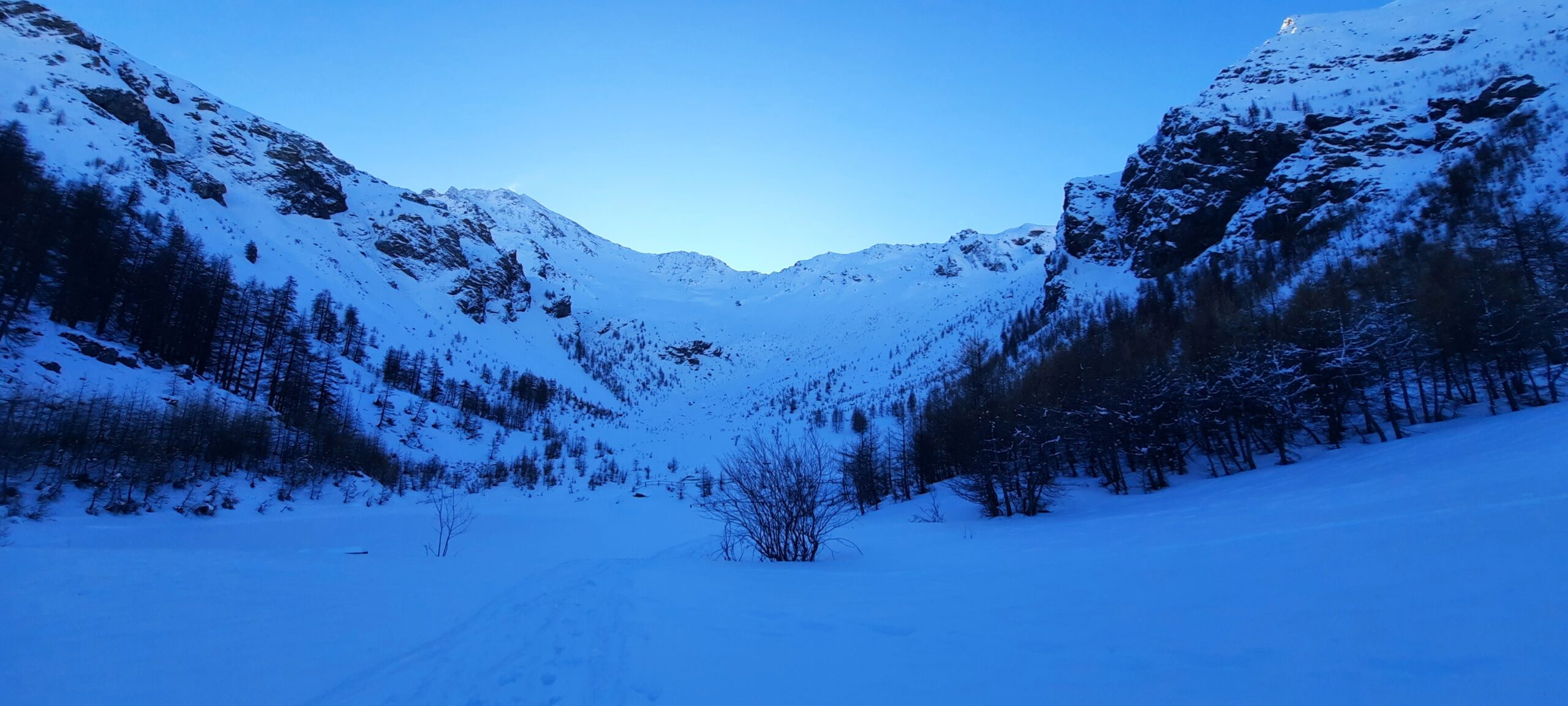
Avvicinamento
.
Descrizione
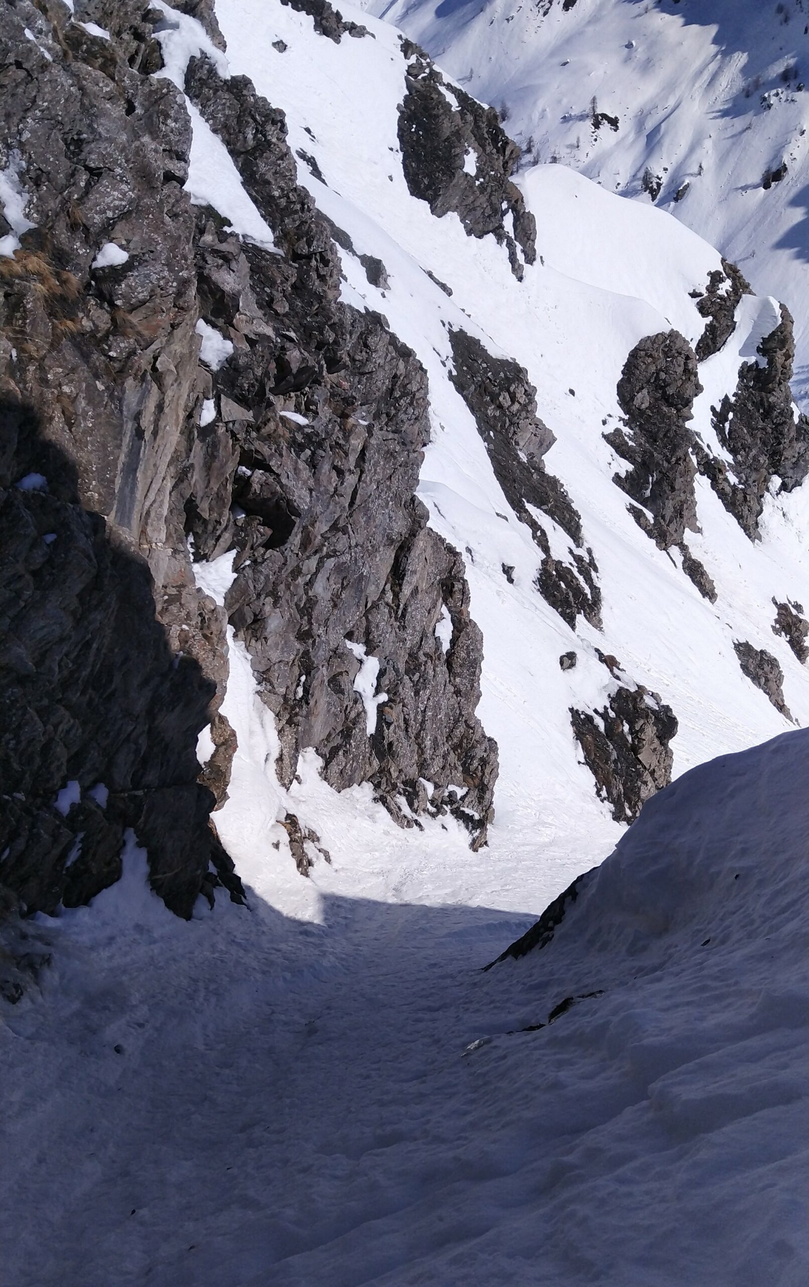
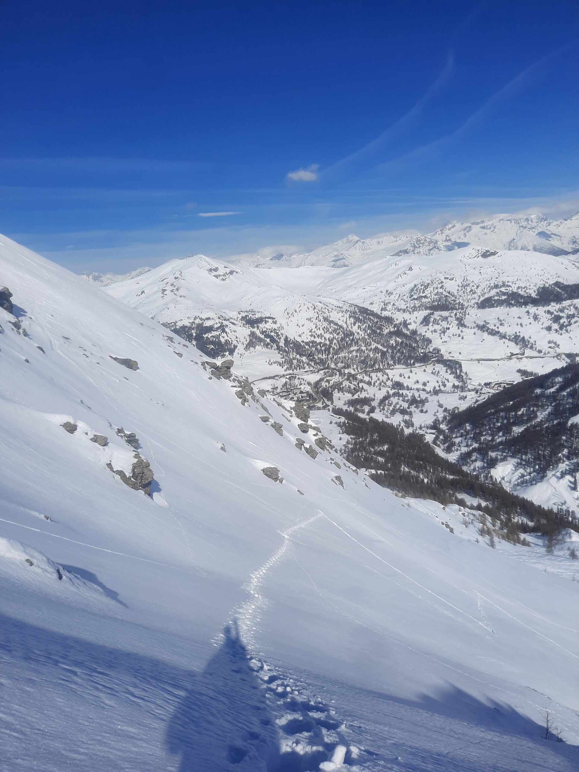
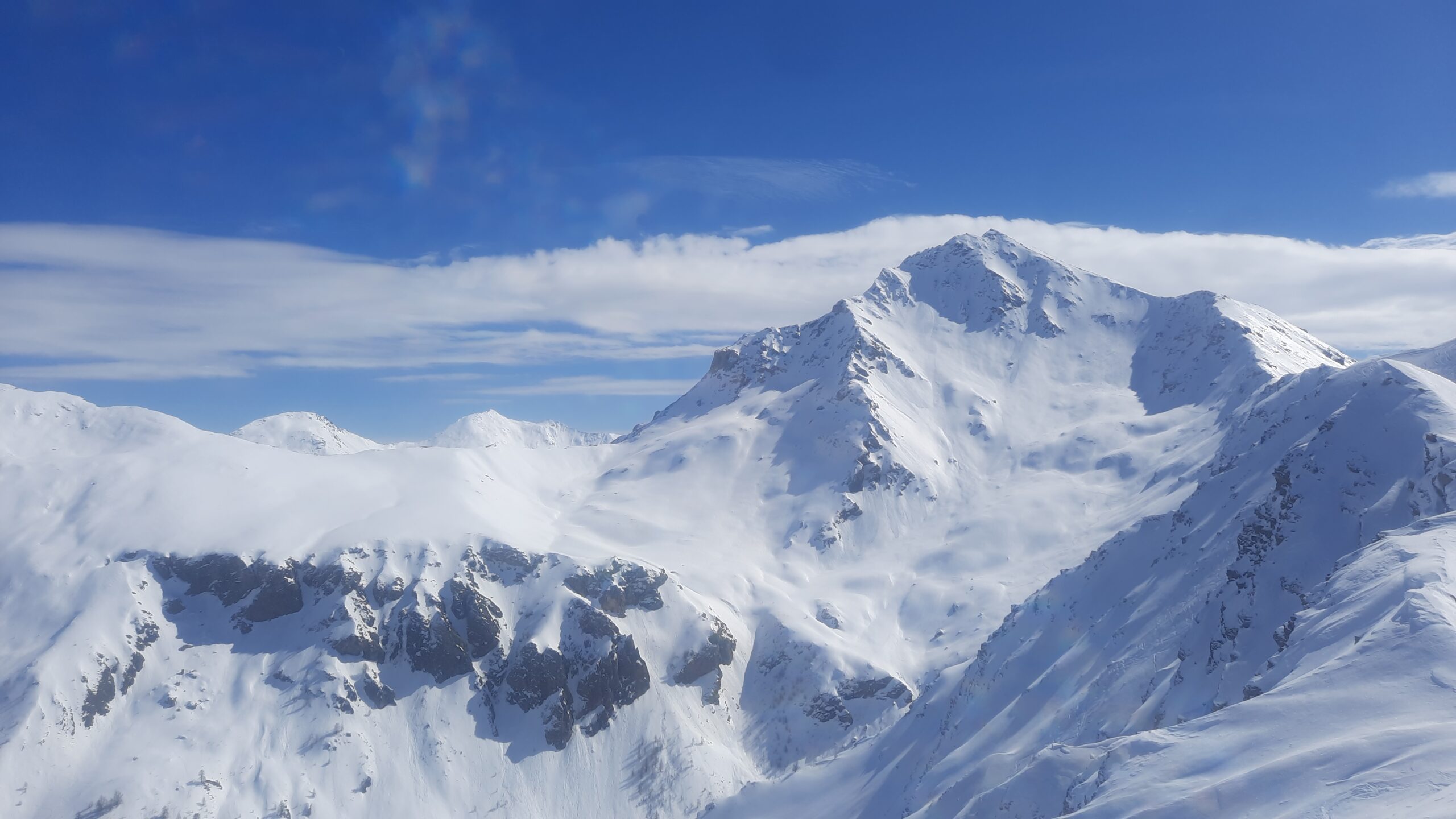
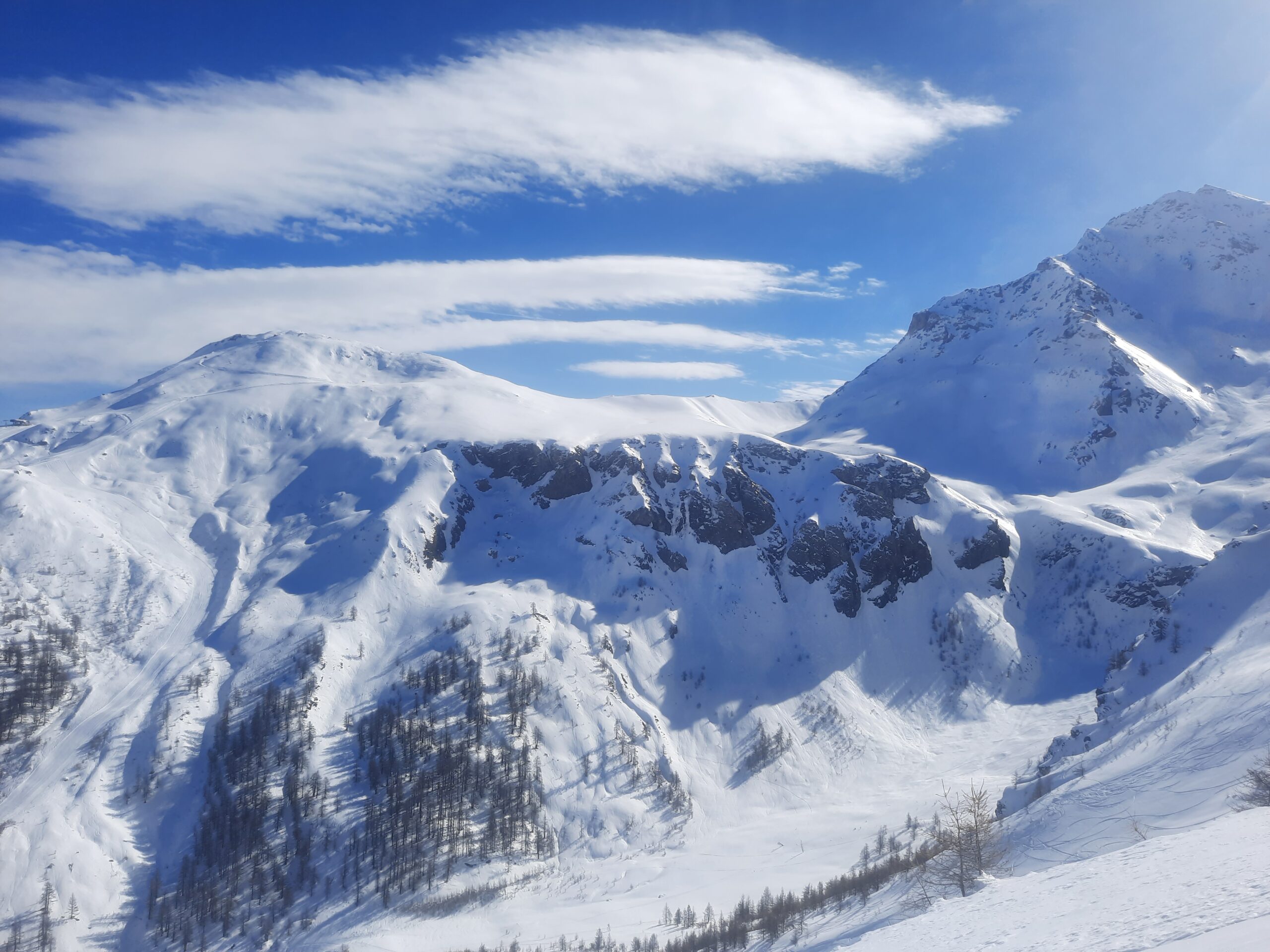
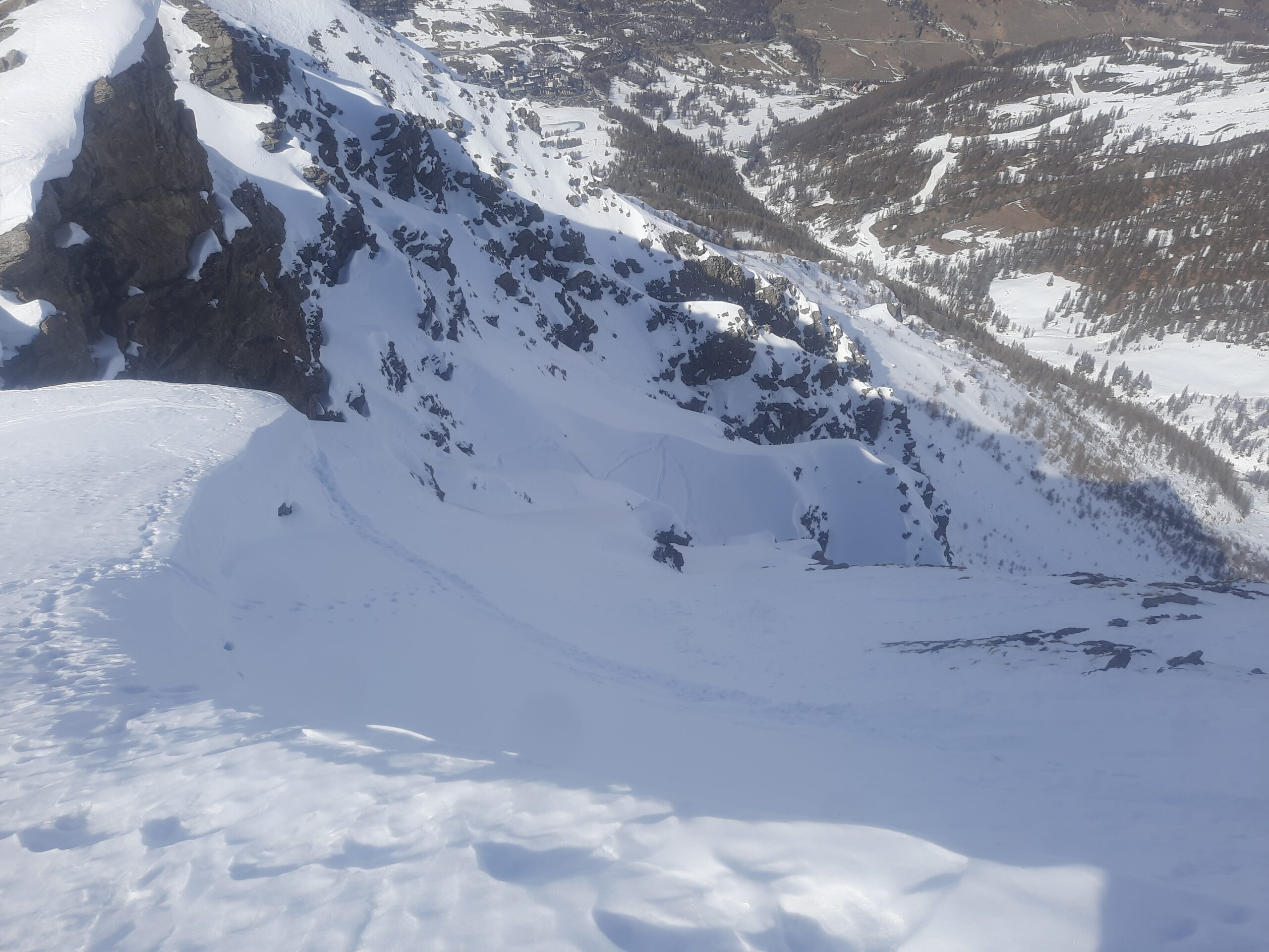
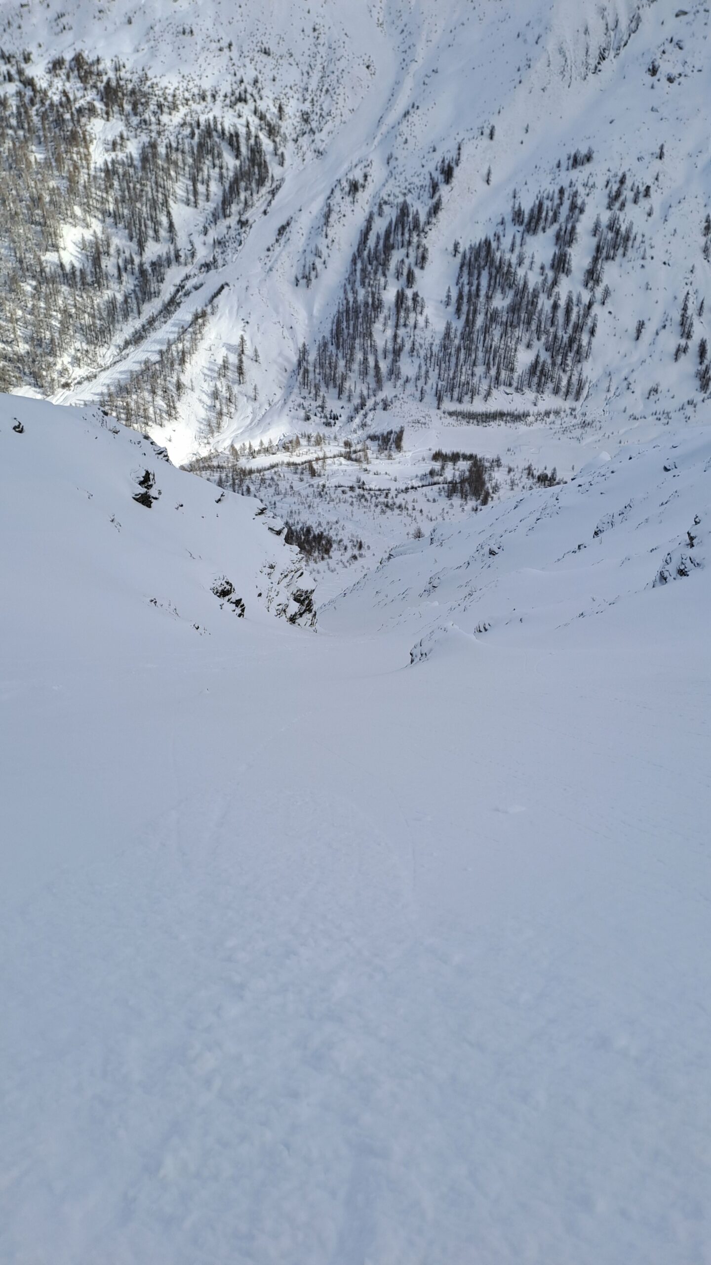
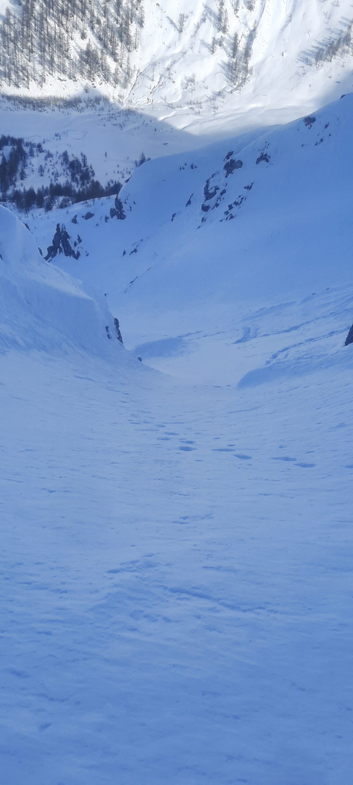
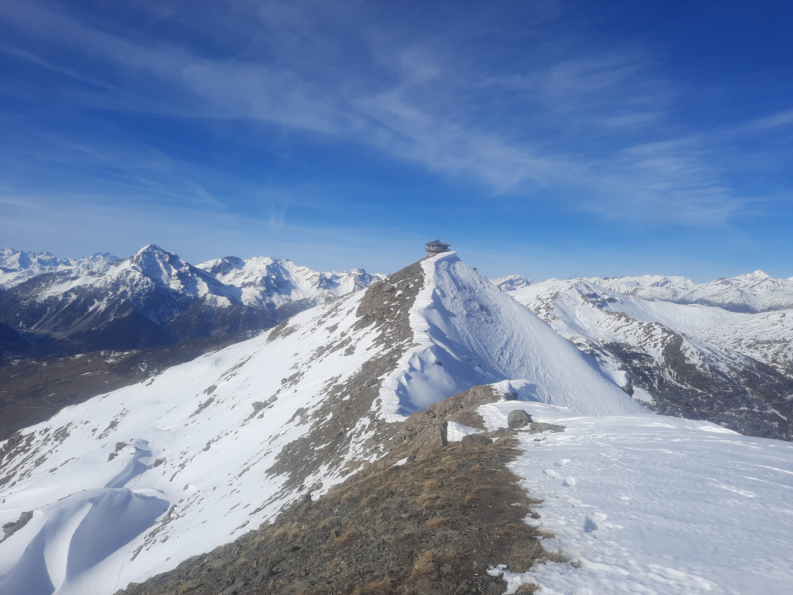
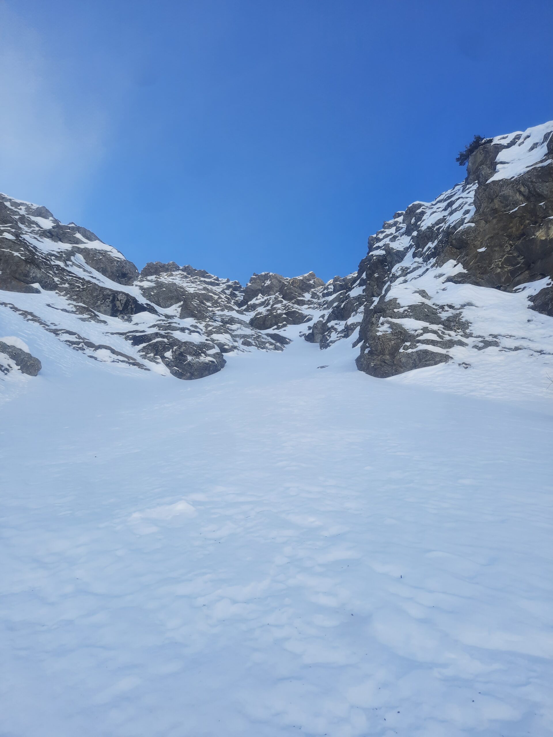
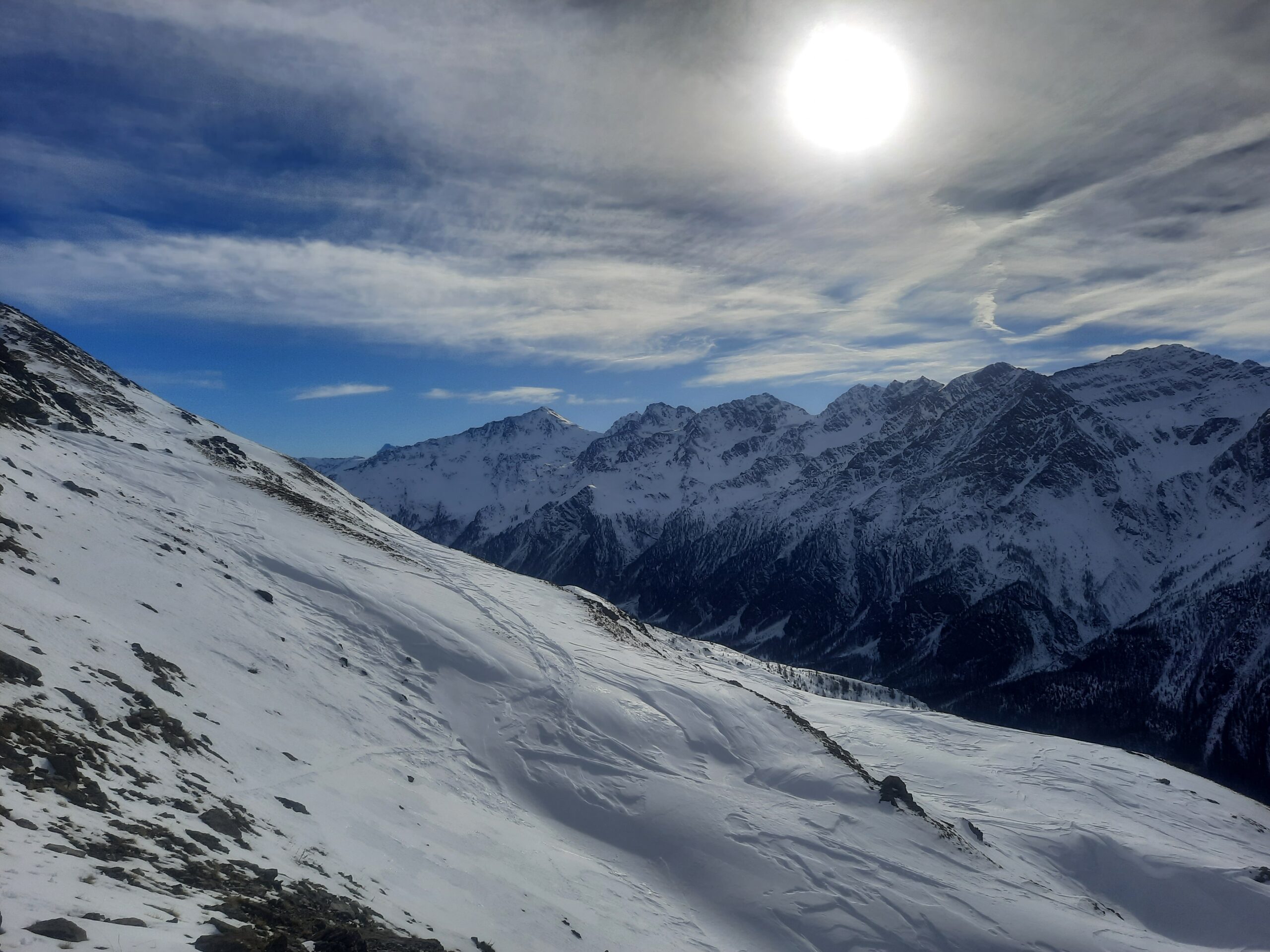
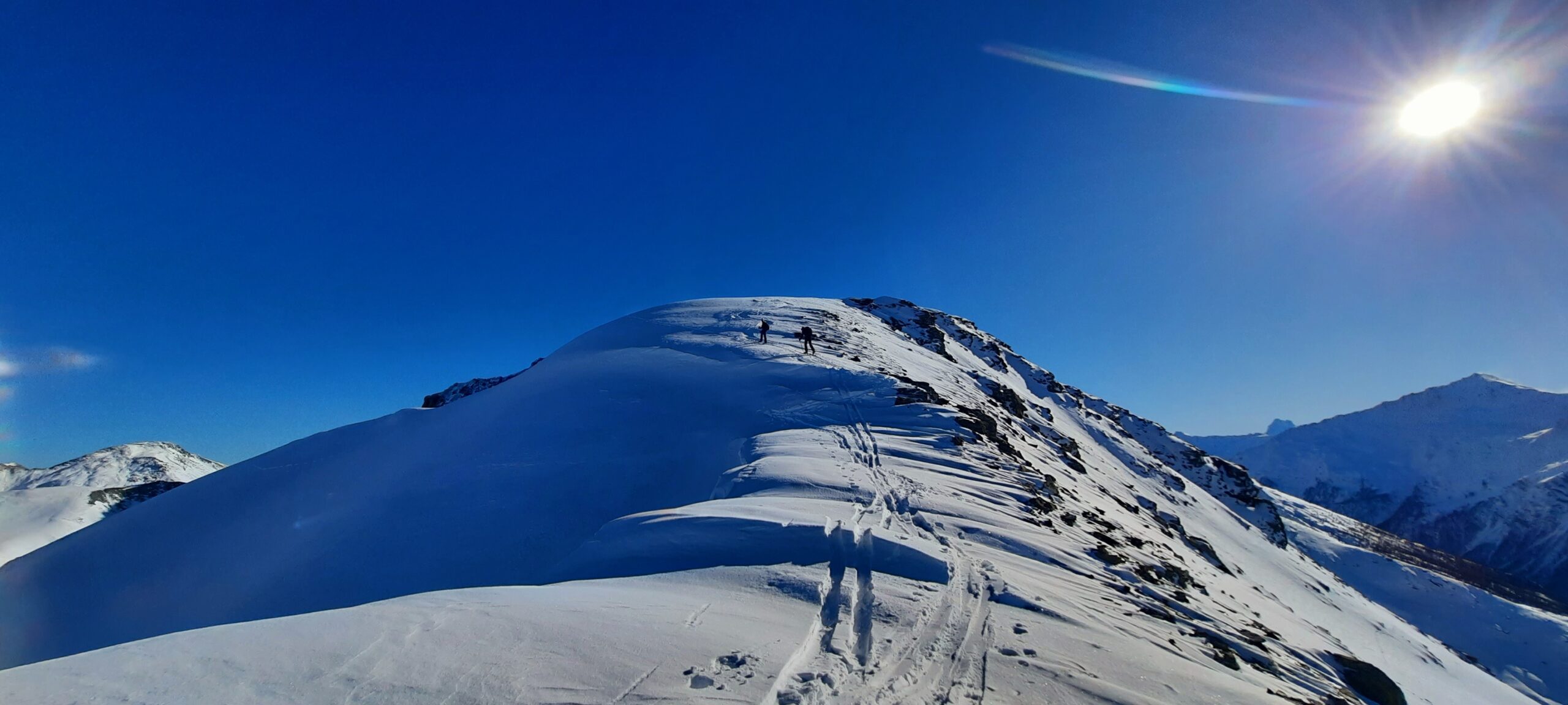
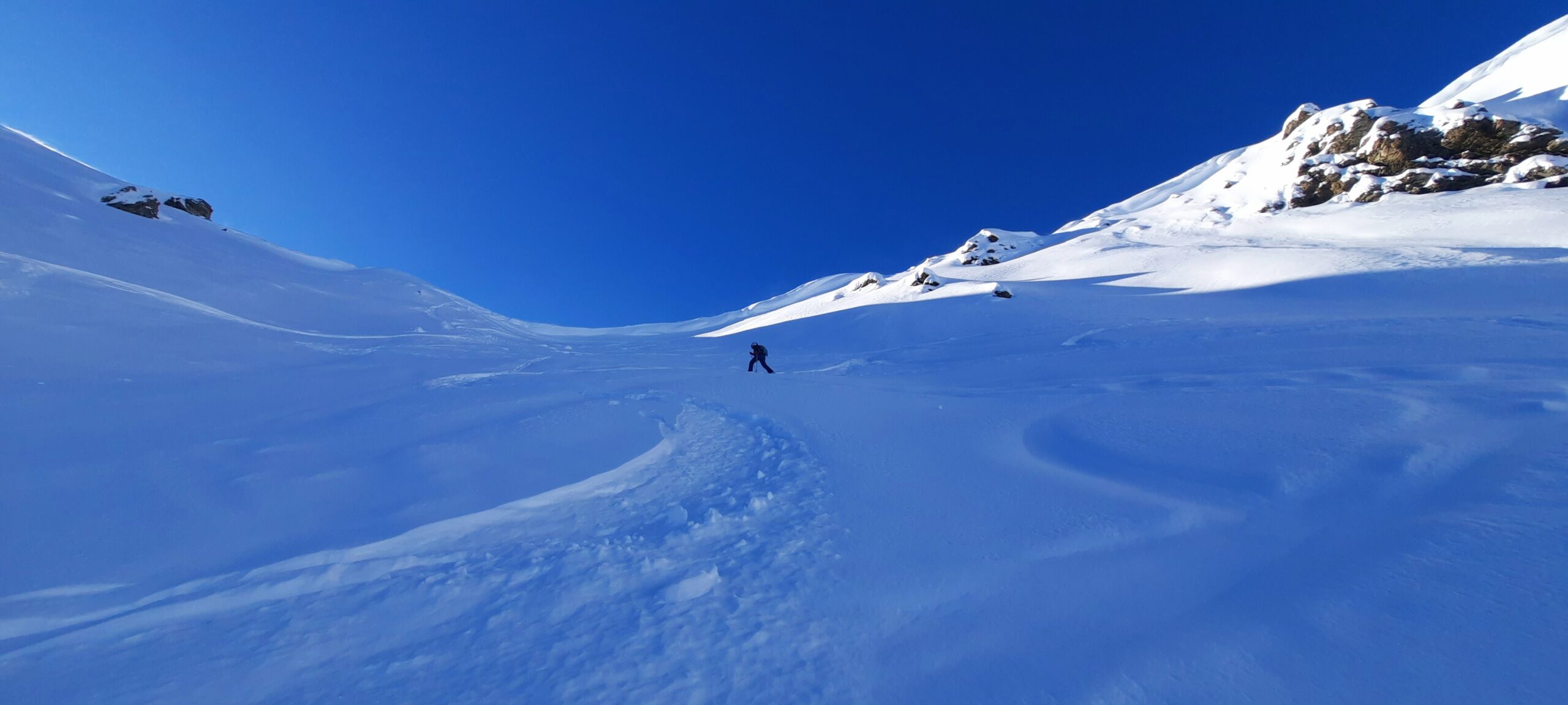
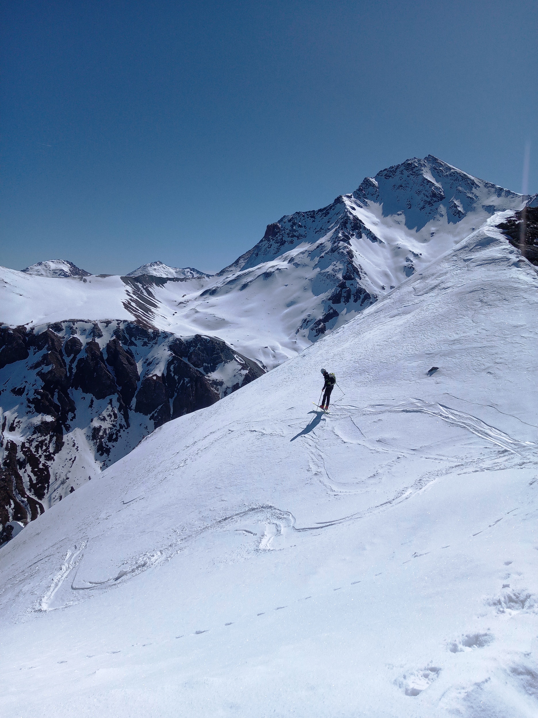
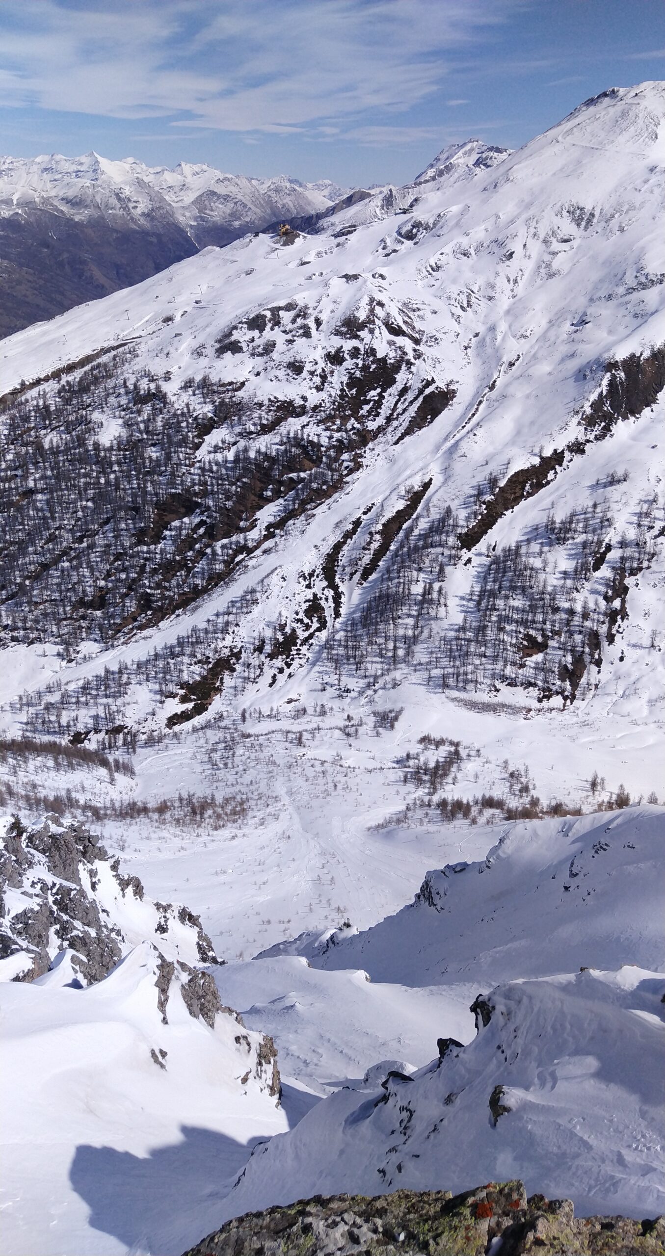
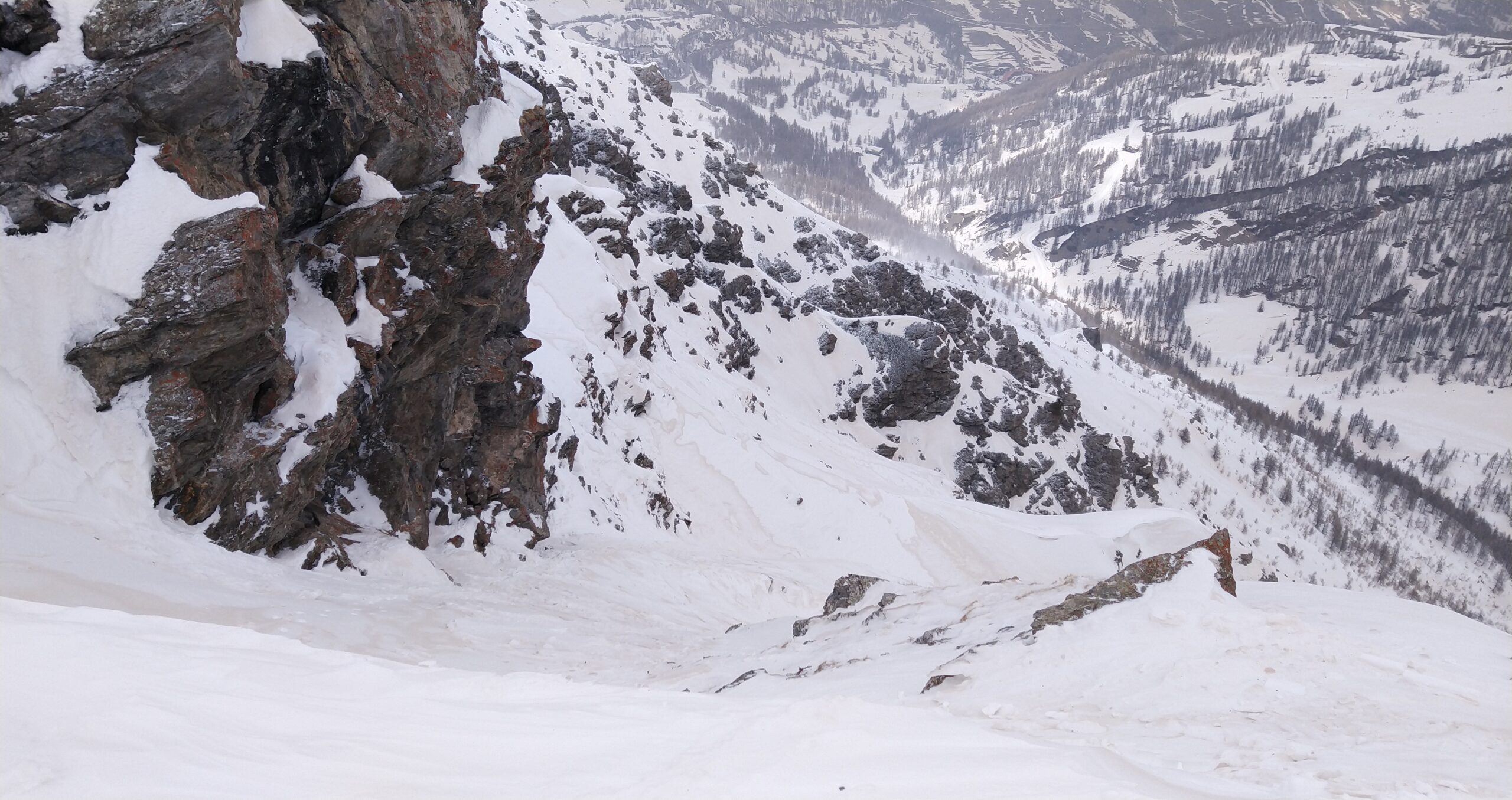
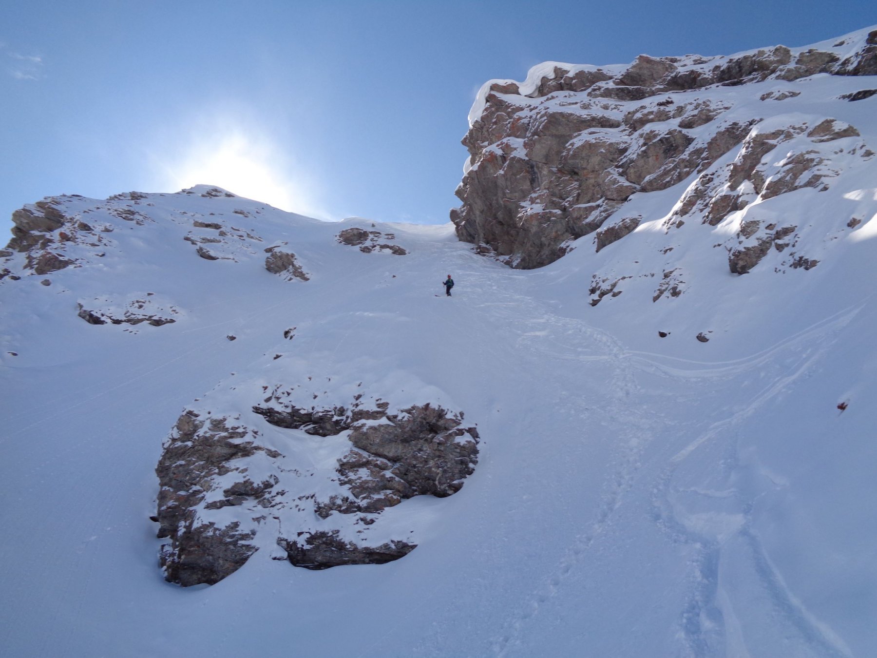
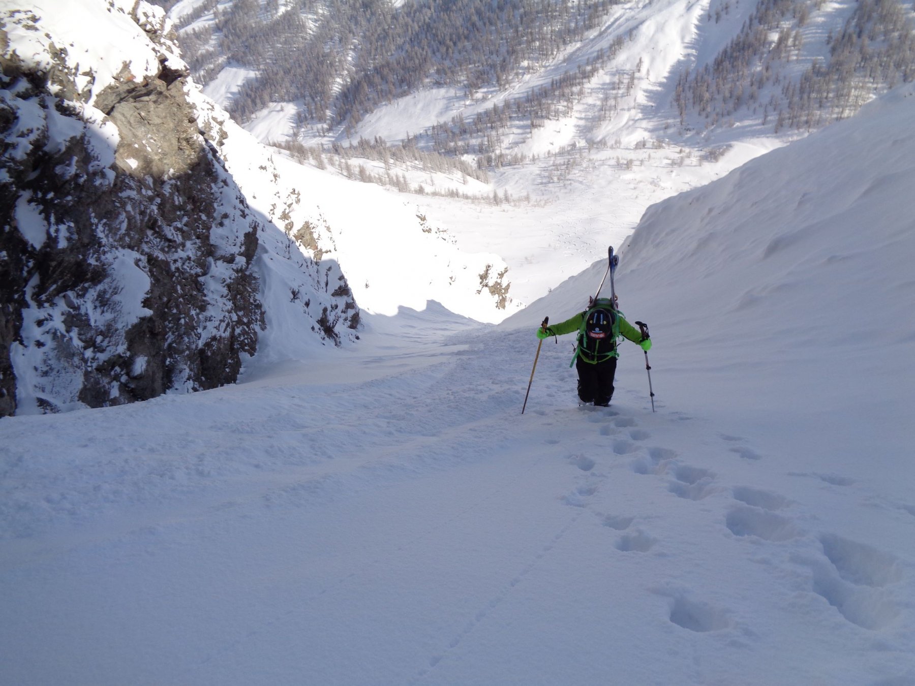
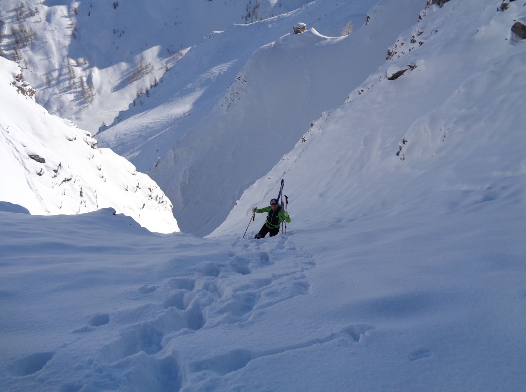
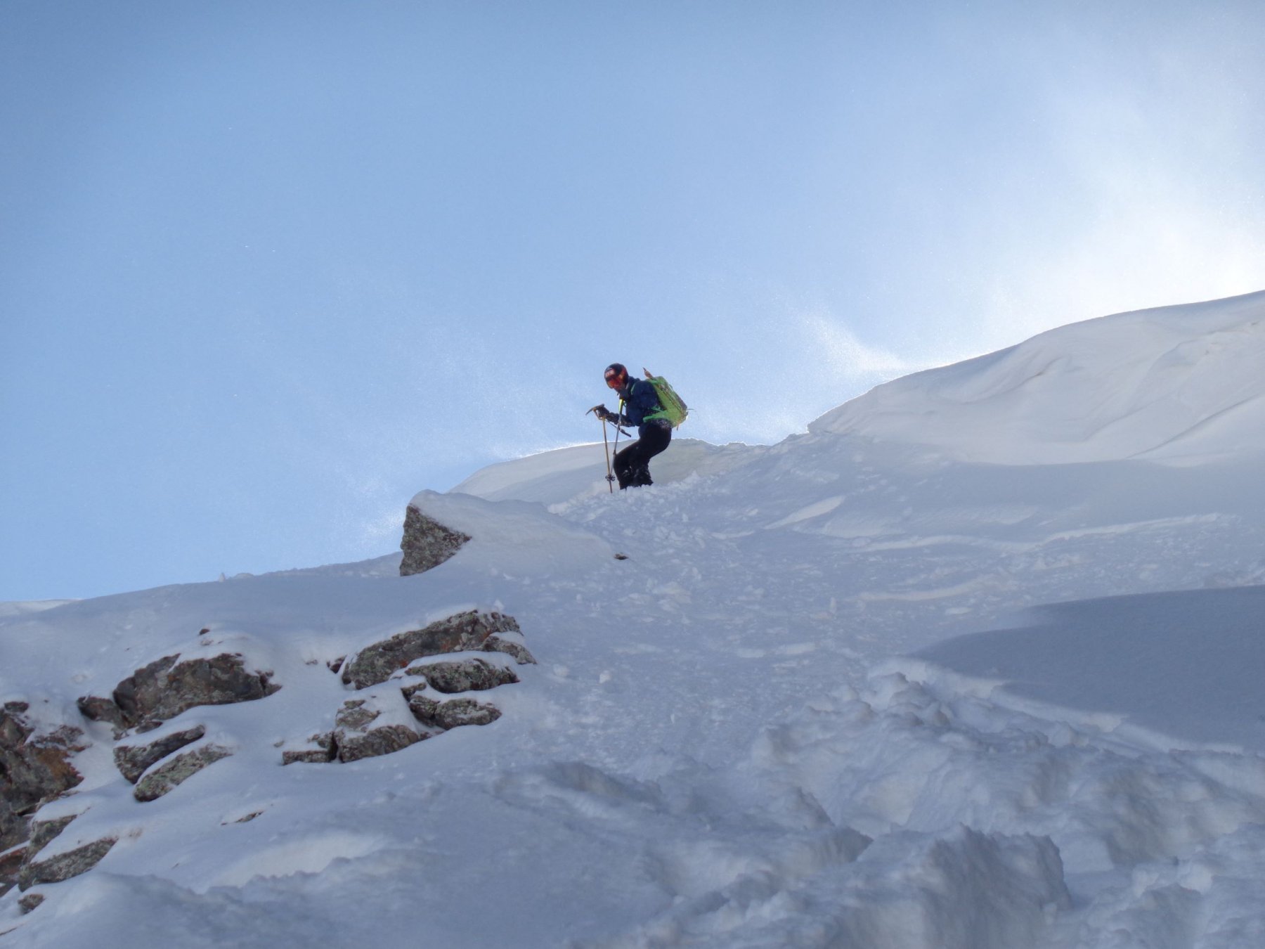
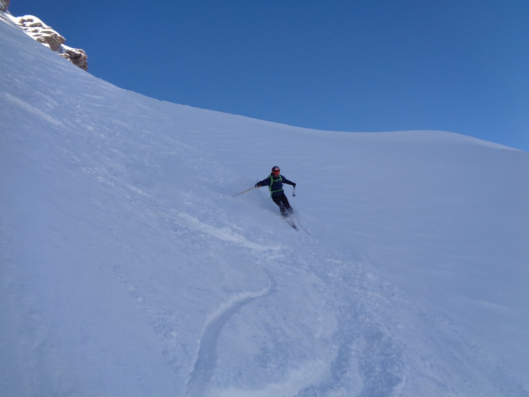
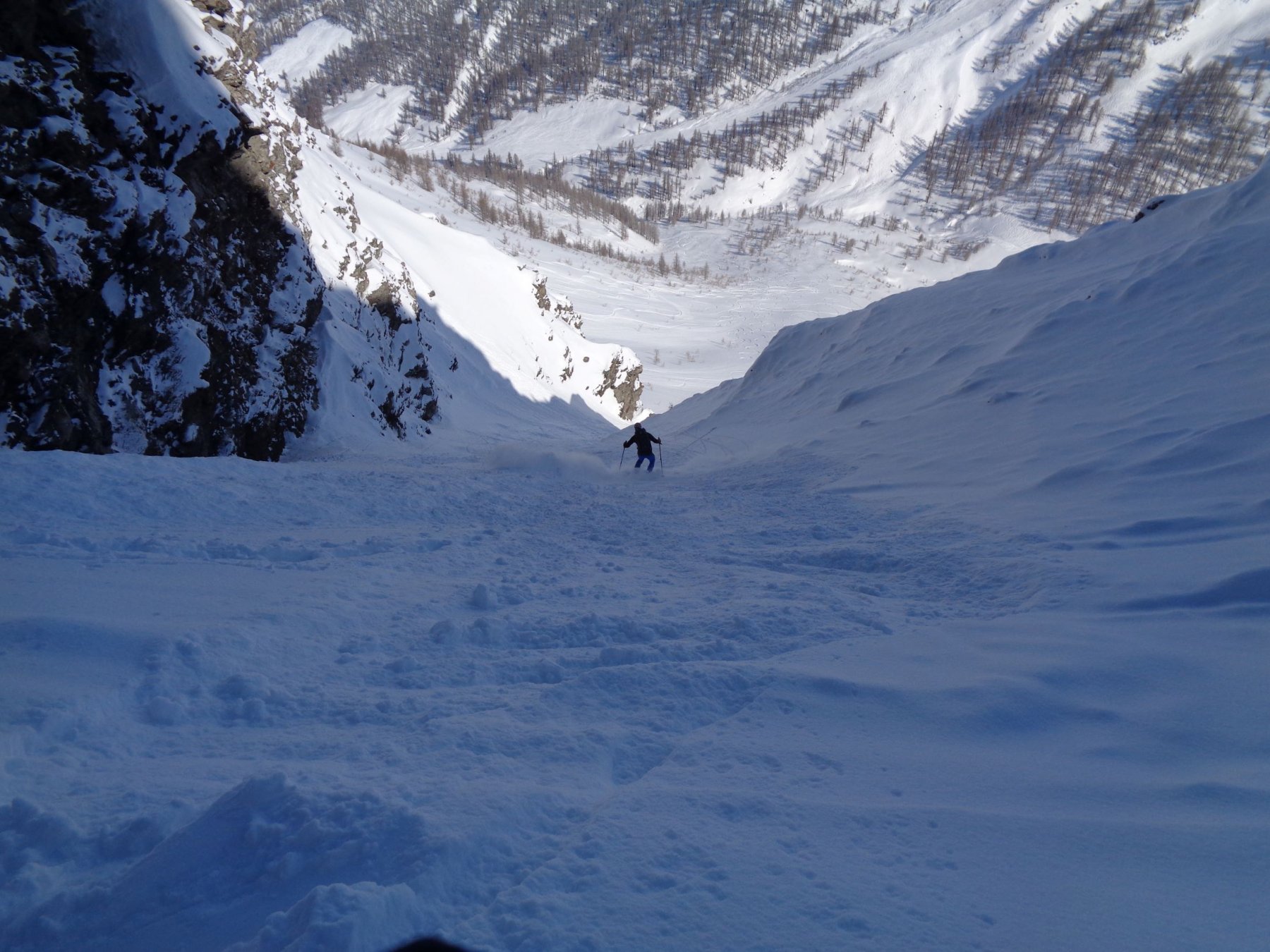
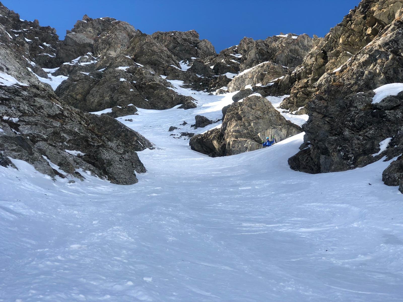
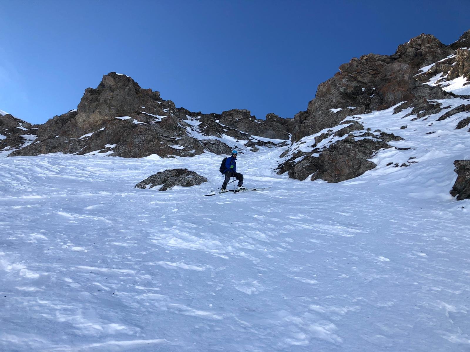
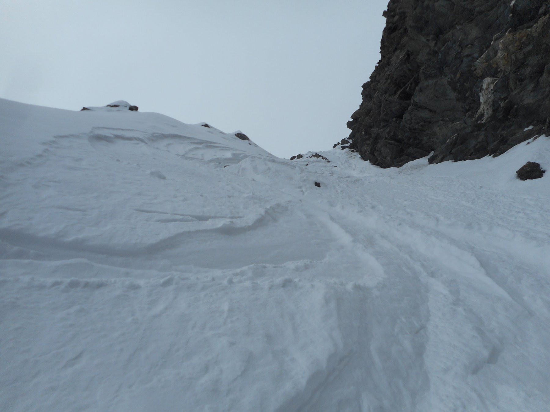
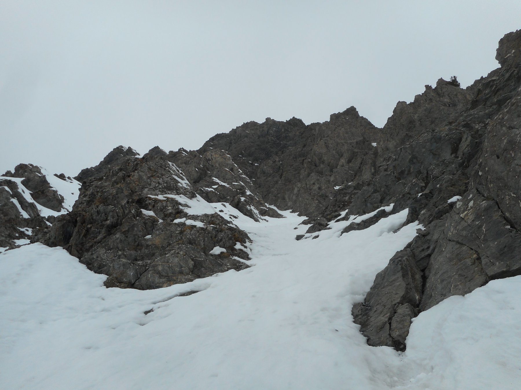
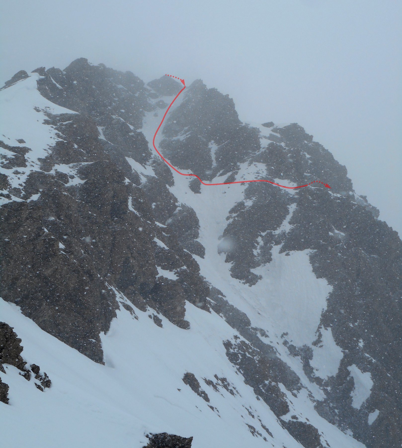
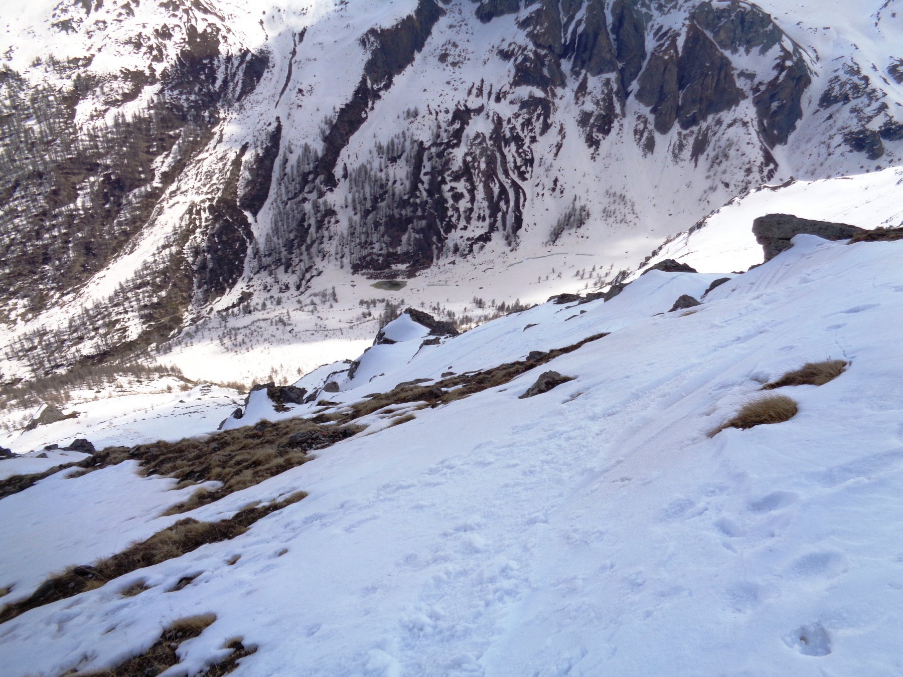
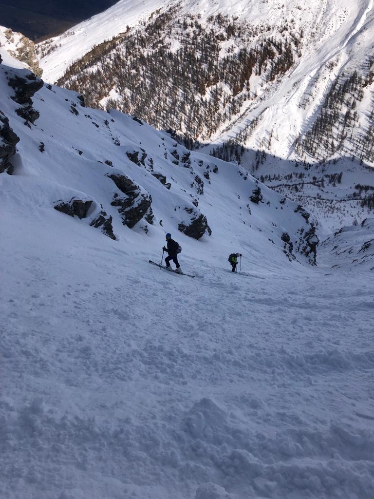
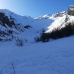
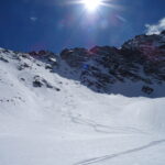
Dalla cima del Sises (raggiungibile lungo le piste di Sestriere) inizia una serie di sei canali che scendono nel vallone del Chisonetto, con generale esposizione a NE-E.
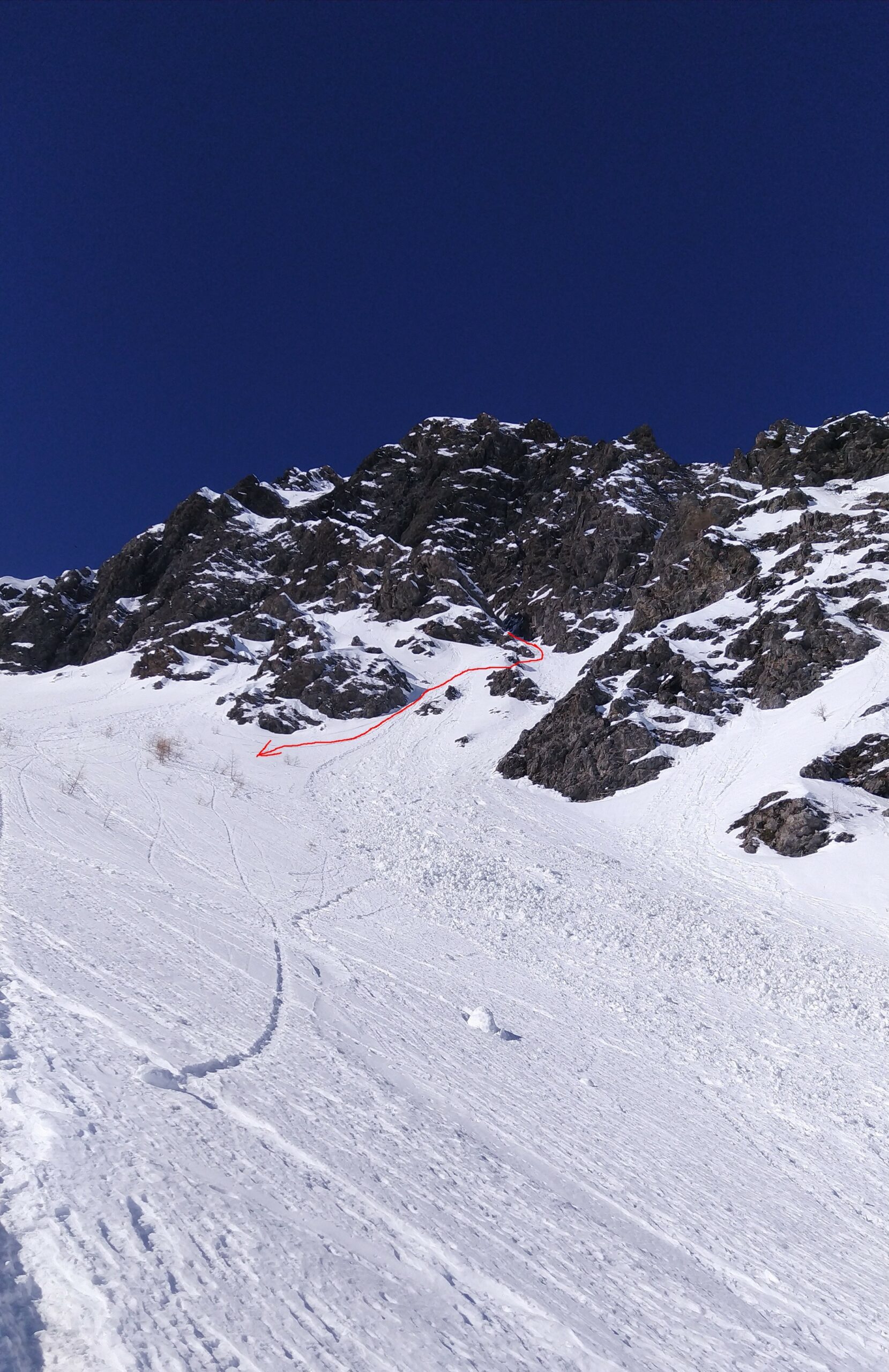
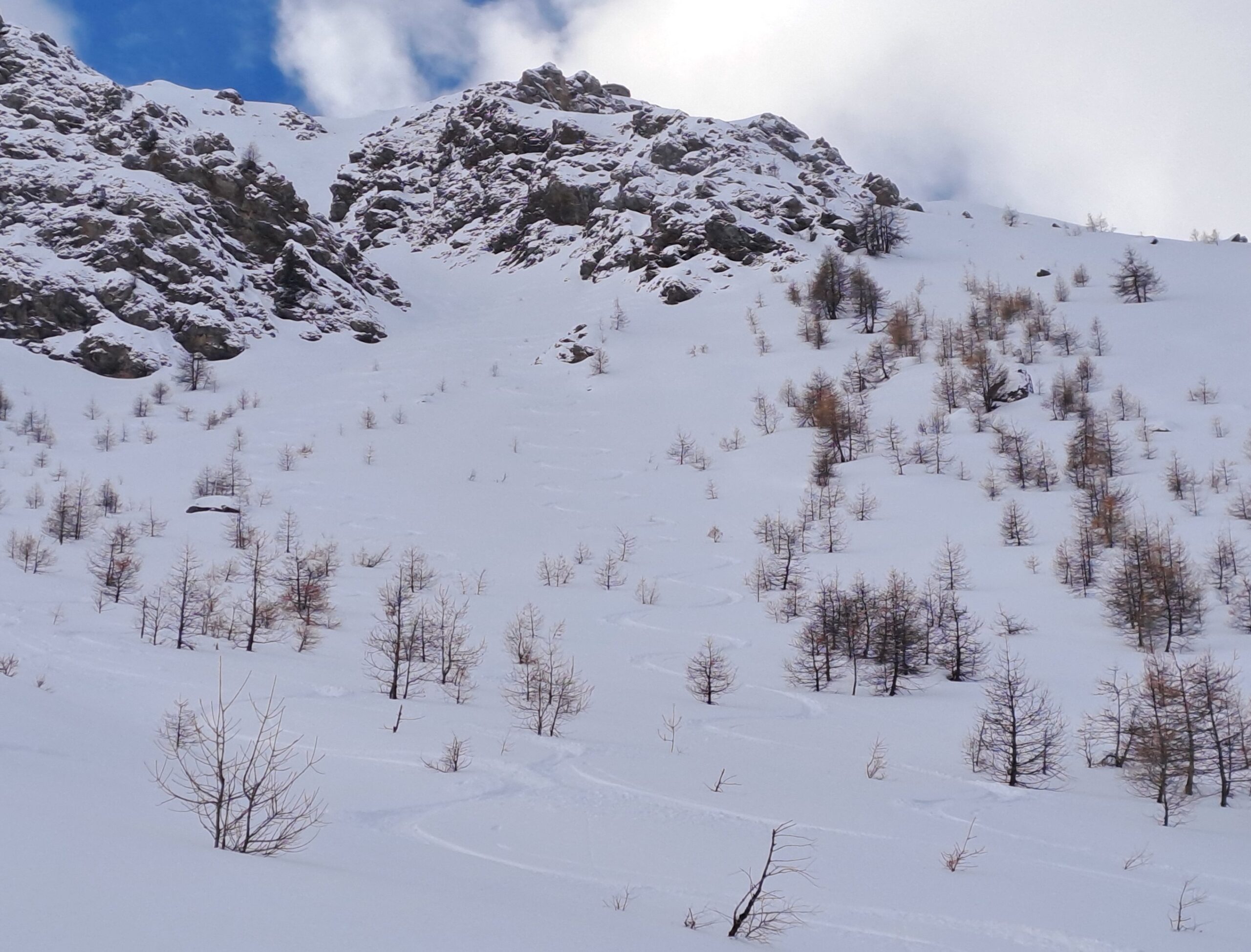
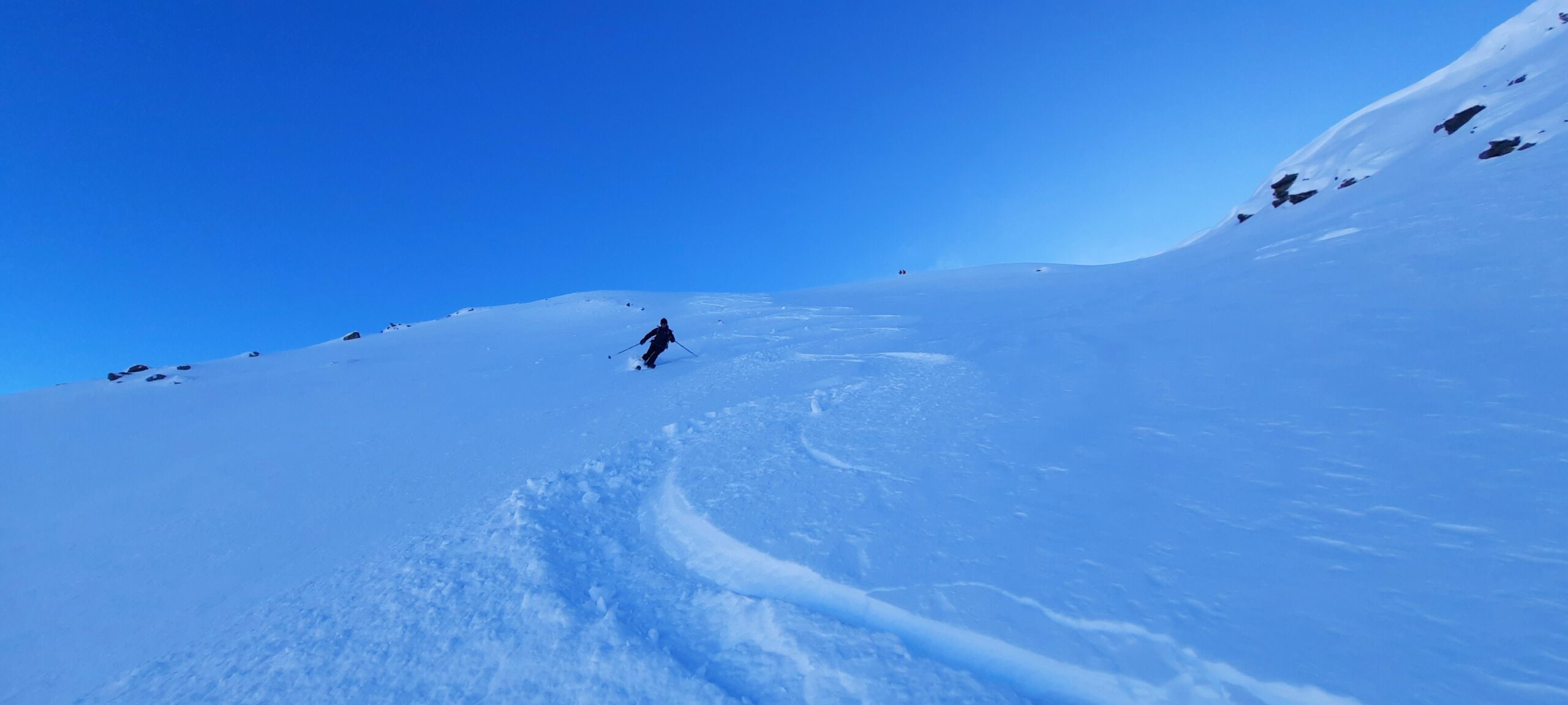
- Faina: parte direttamente dalla costruzione di vetta e scende in mezzo a balze e quinte rocciose in un ambiente bello ma mai troppo ripido (max 40°). Variante di sx consigliabile in caso di scarso innevamento. 4.1 E2
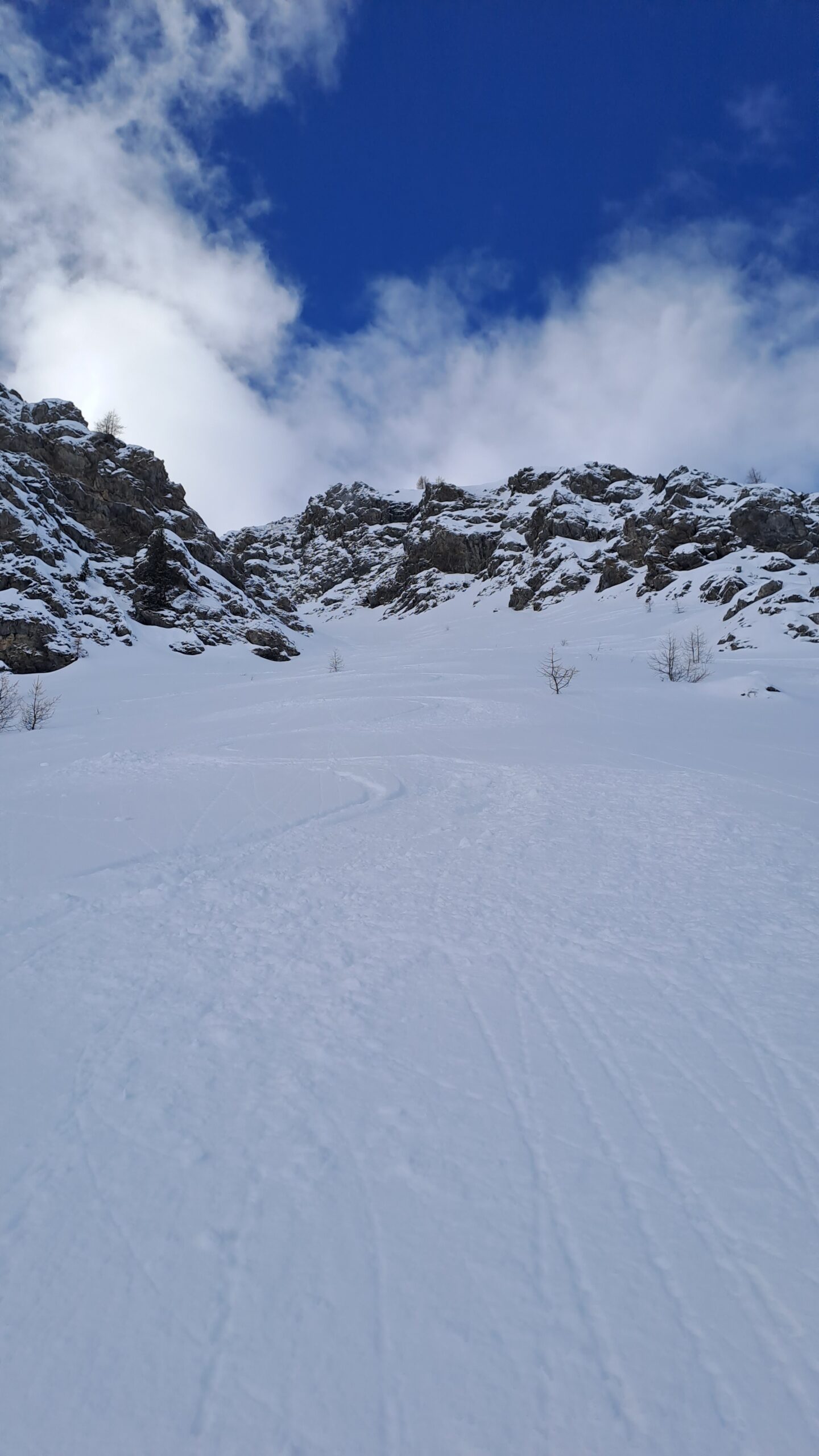
- Galassia: vero e proprio canale rettilineo che parte da dietro la vetta del Sises, esposizione in pieno E e pendenze mai eccessive (35°-40°). 4.1 E1
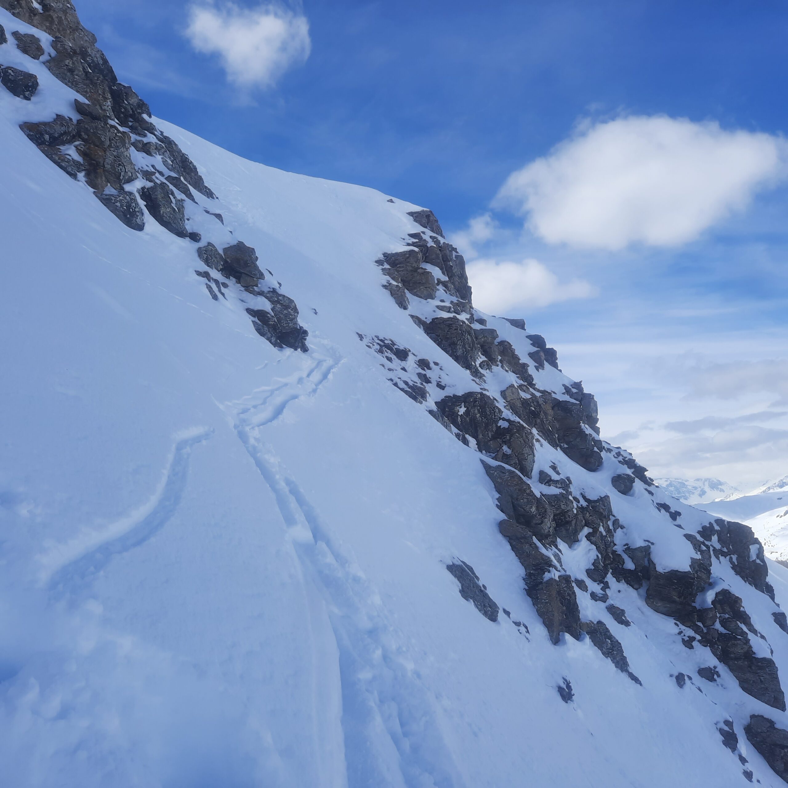
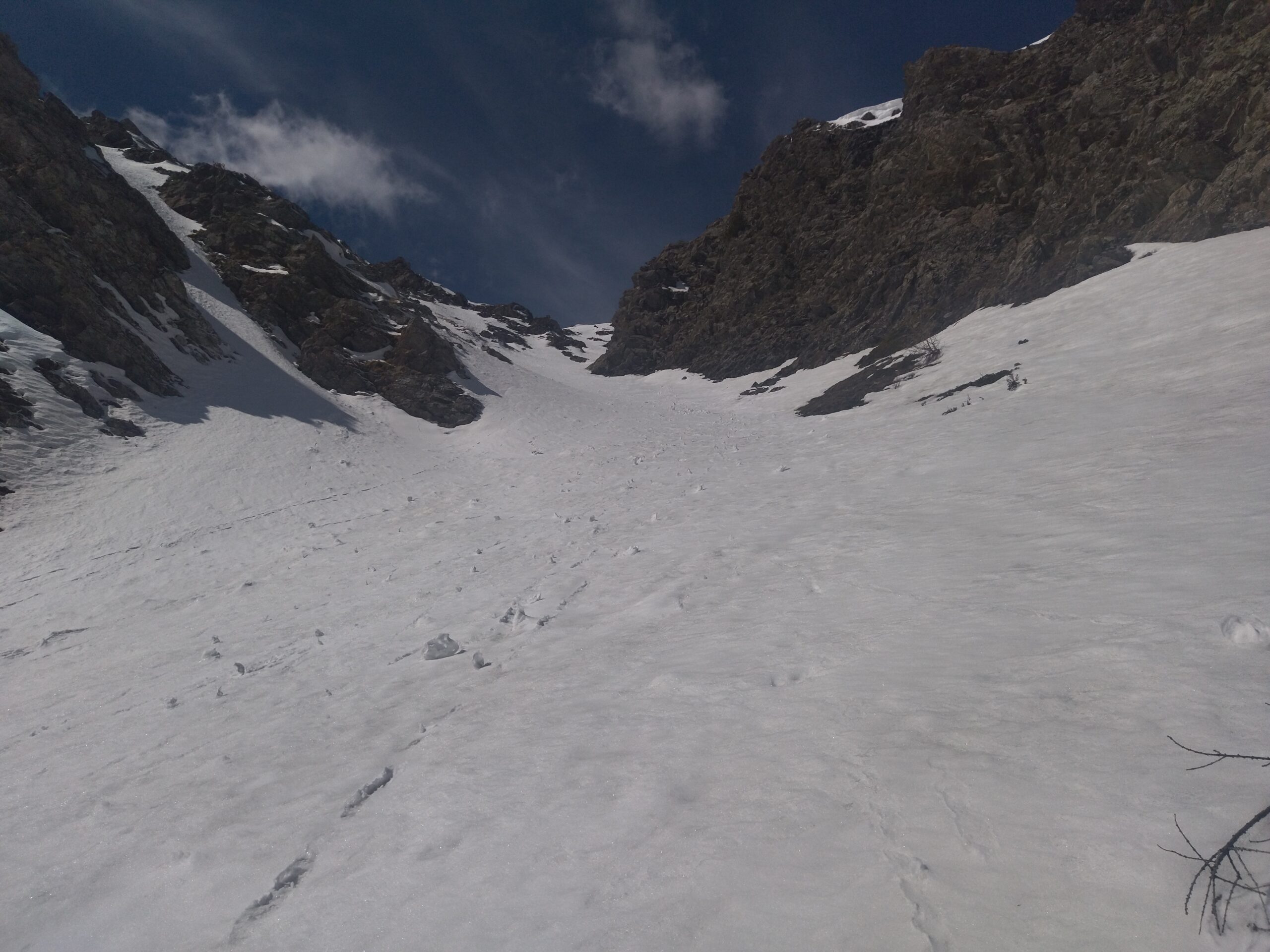
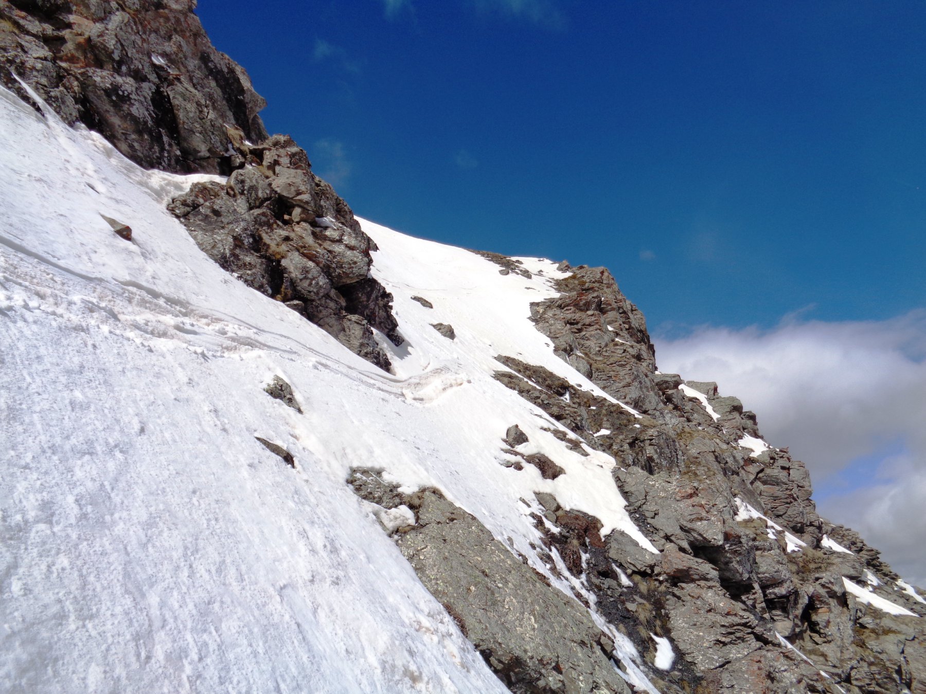
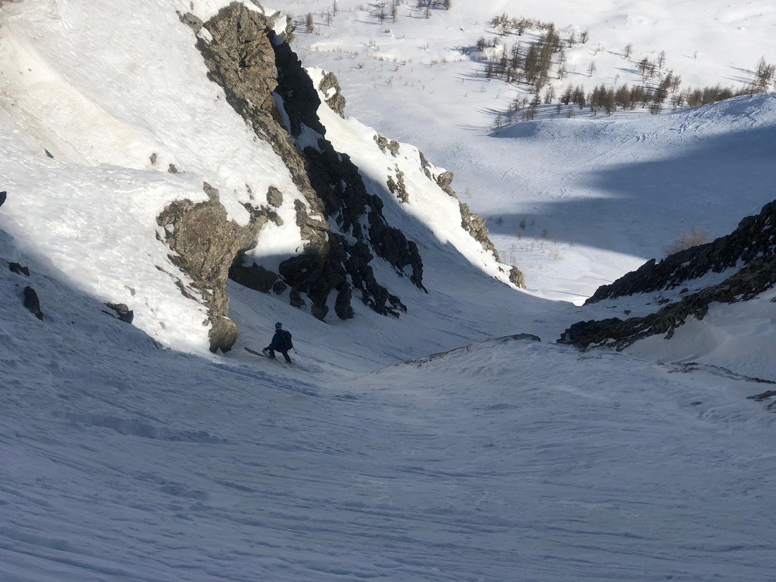
- Canale a “C”: posta a metà tra il Sises e il Querellet, itinerario fra le balze ma sempre abbastanza evidente. Qualora l’entrata diretta dal colletto non fosse in condizioni (cornice e poca neve subito sotto) è possibile percorrere la prima parte dello “Z” e poi traversare alti. 4.1/4.2 E2
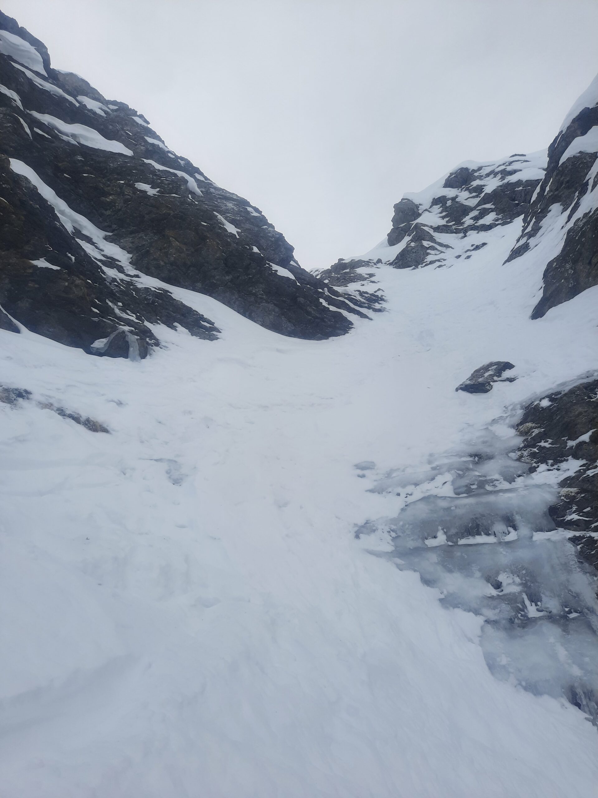
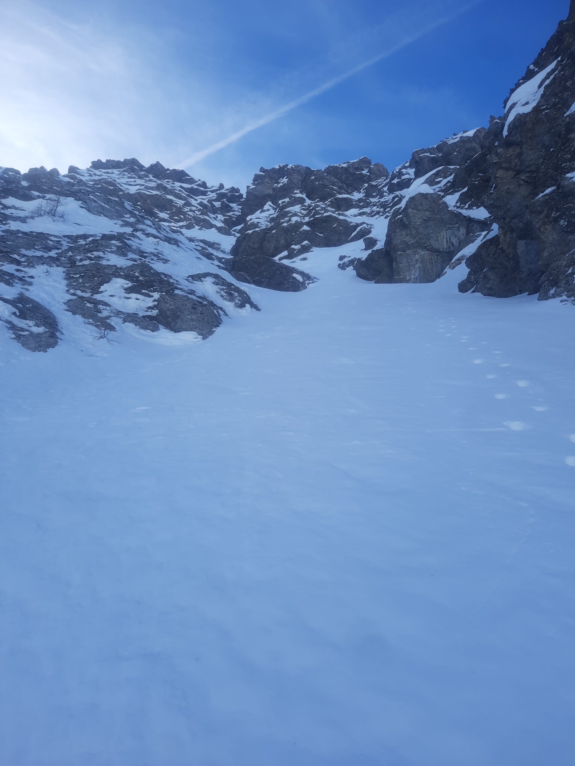
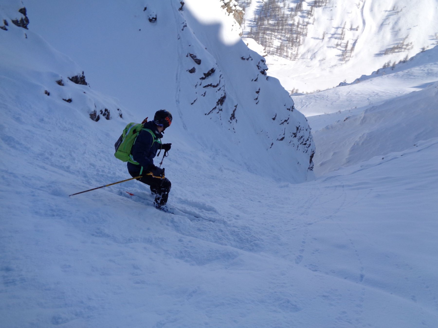
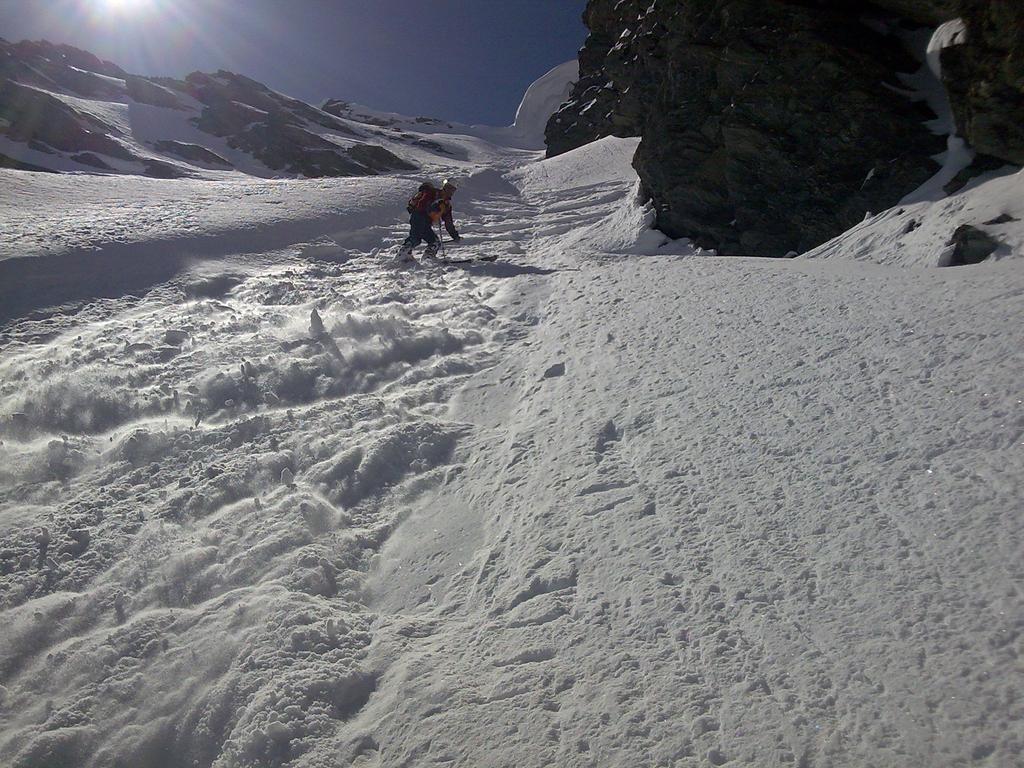
- Canale a “Z”: canale sinuoso e incassato tra le rocce, la parte centrale della “z” non è facilmente visibile e quindi non è sempre così facile valutare la quantità di innevamento (si vede bene solo dalla zona del p.so Banchetta).
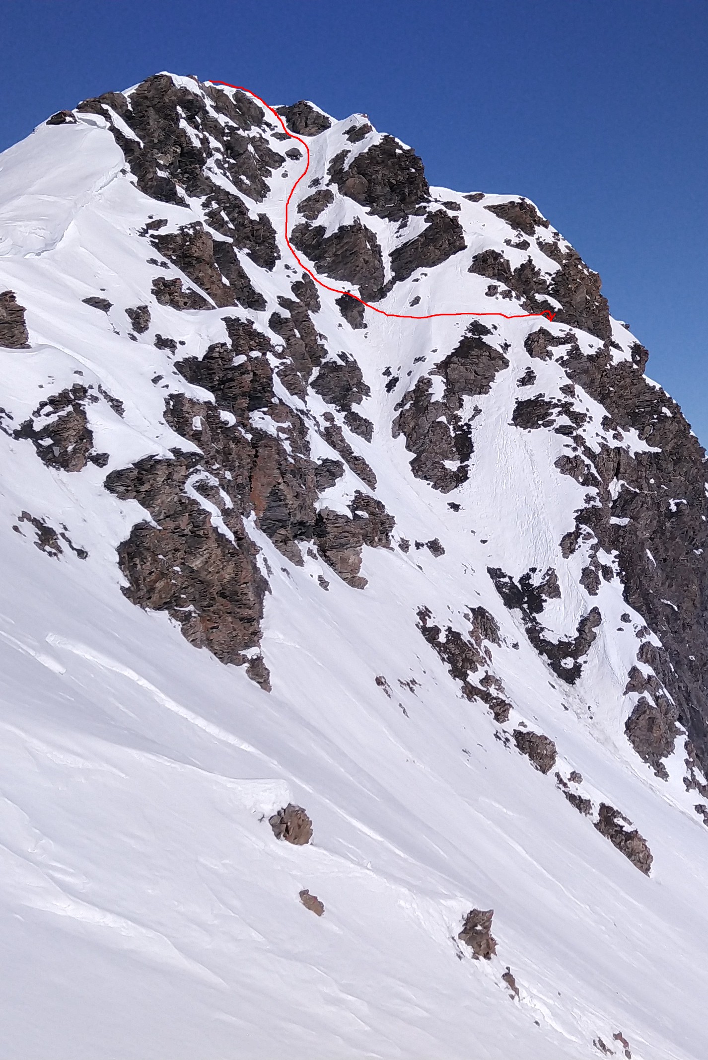
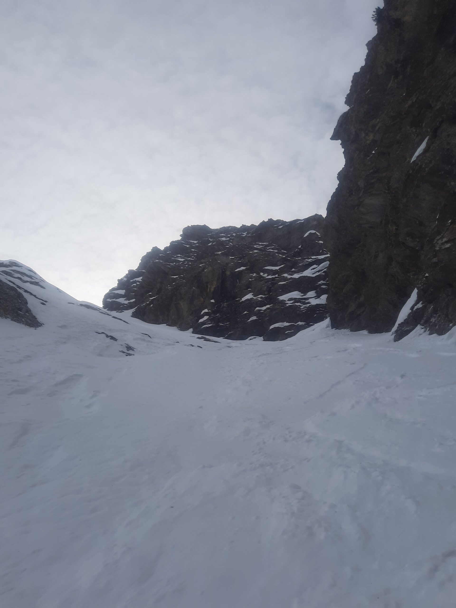
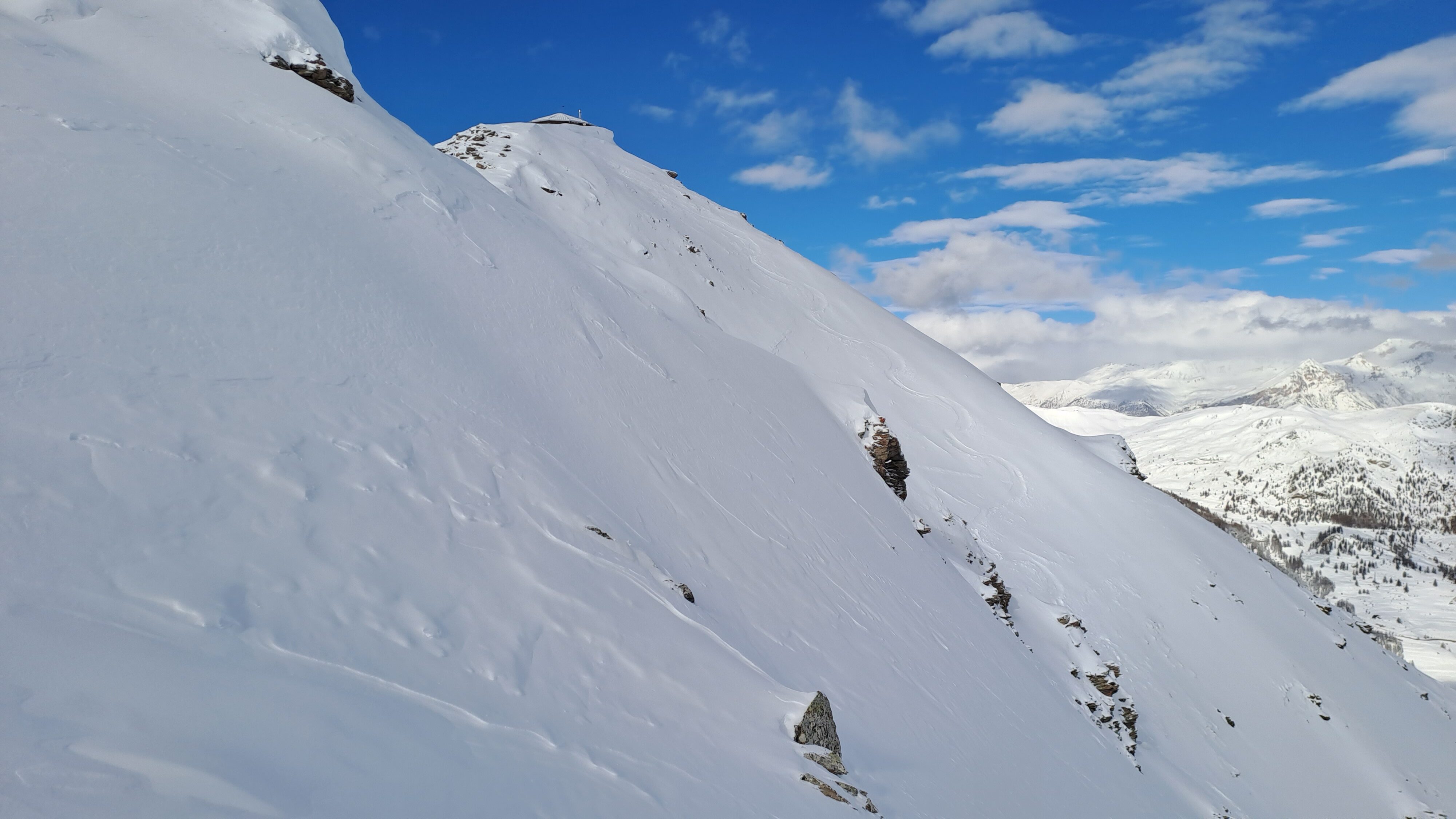
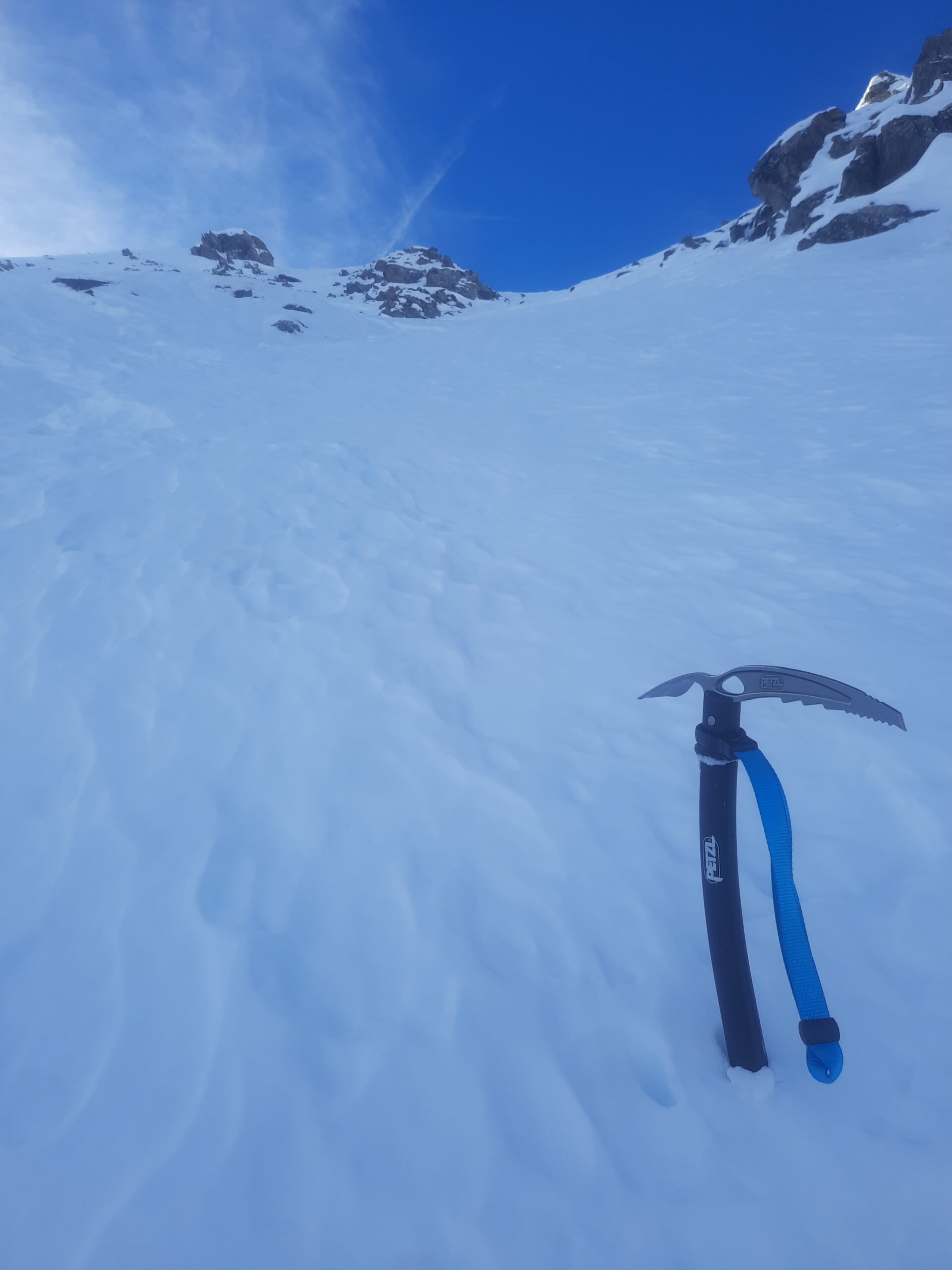
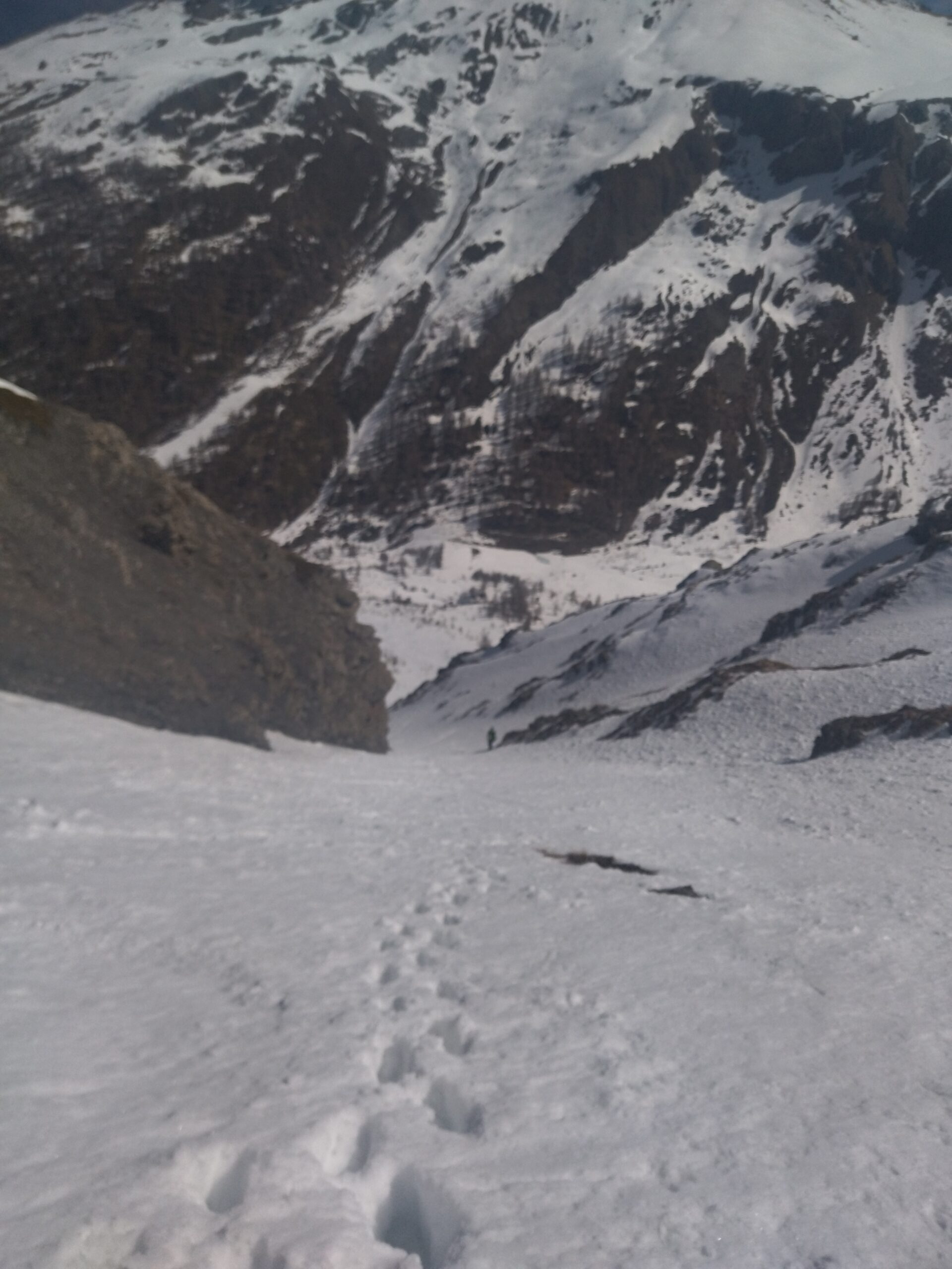
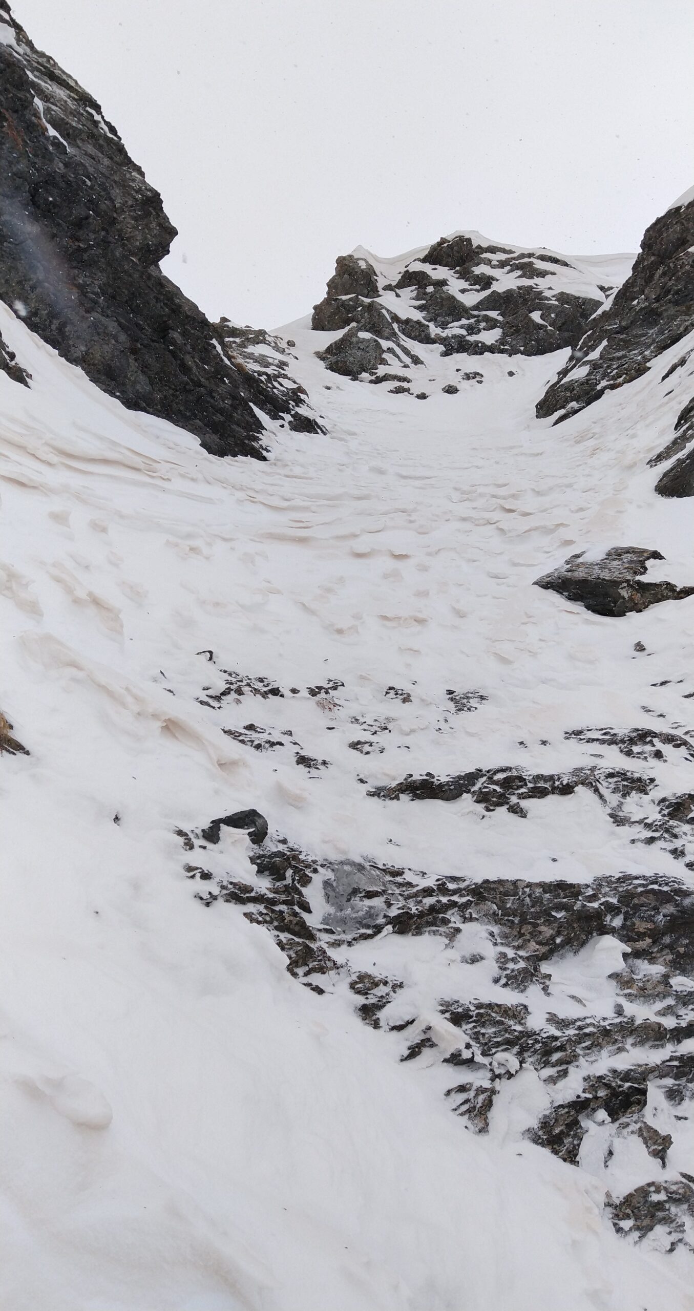
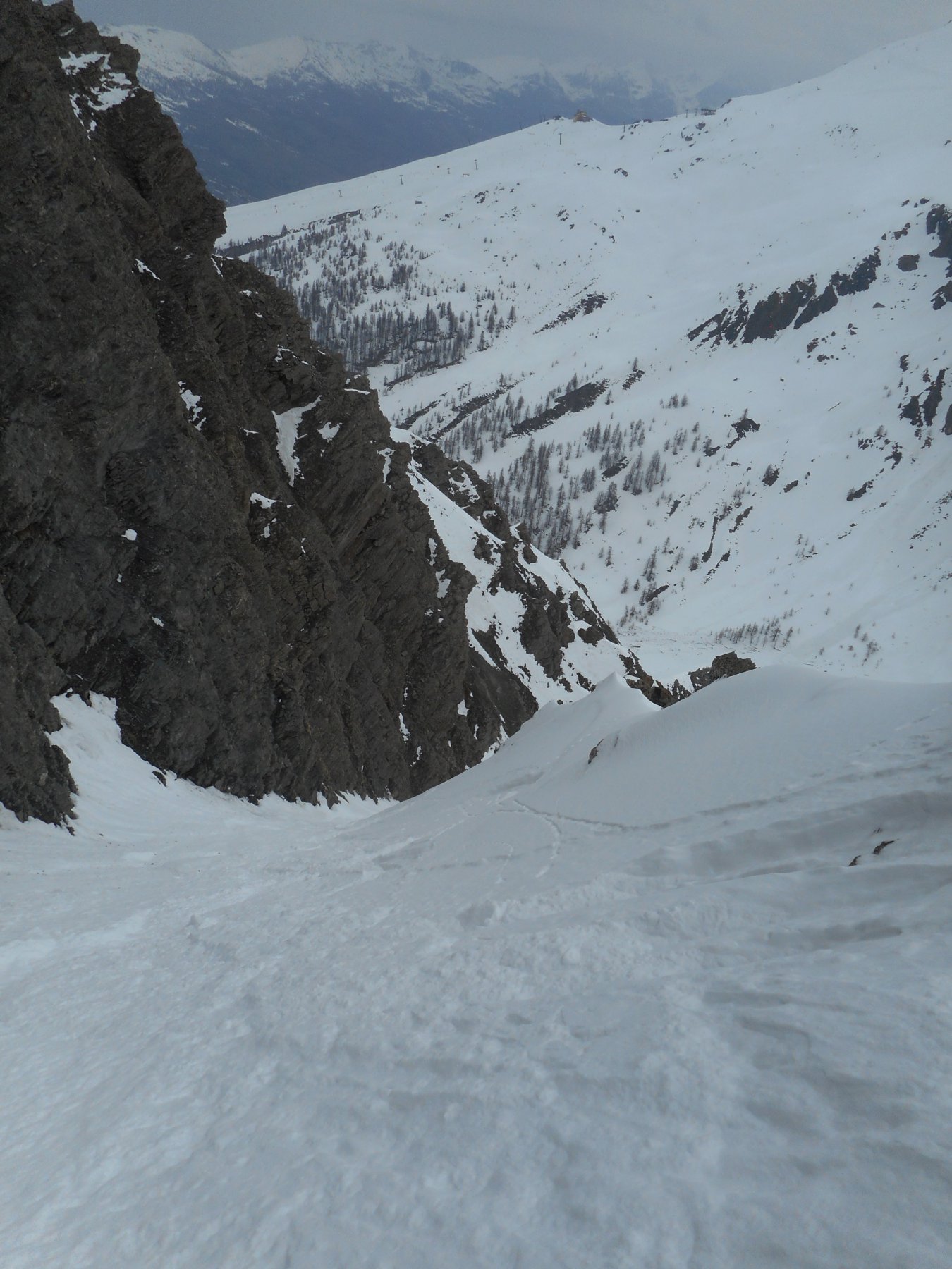
- Canale S: dalla vetta del Querellet affacciarsi a sx e scendere un breve pendio (5-10m) molto esposto, che dà accesso ad una selletta da cui parte il canale S (tutto più vicino ai 45° che ai 40°). Si sbuca sotto il passo san giacomo. 4.2/4.3 E3
- il Budello: seguire il canale S fino alla strettoia, da lì con un traverso da ricercare a sx si arriva ad una selletta da cui parte il canalino del budello: stretto e ripido, primi 100m a 50° poi continuo a 45, finisce con due balze che possono presentare roccia o ghiaccio. 4.3/5.1 E3/4
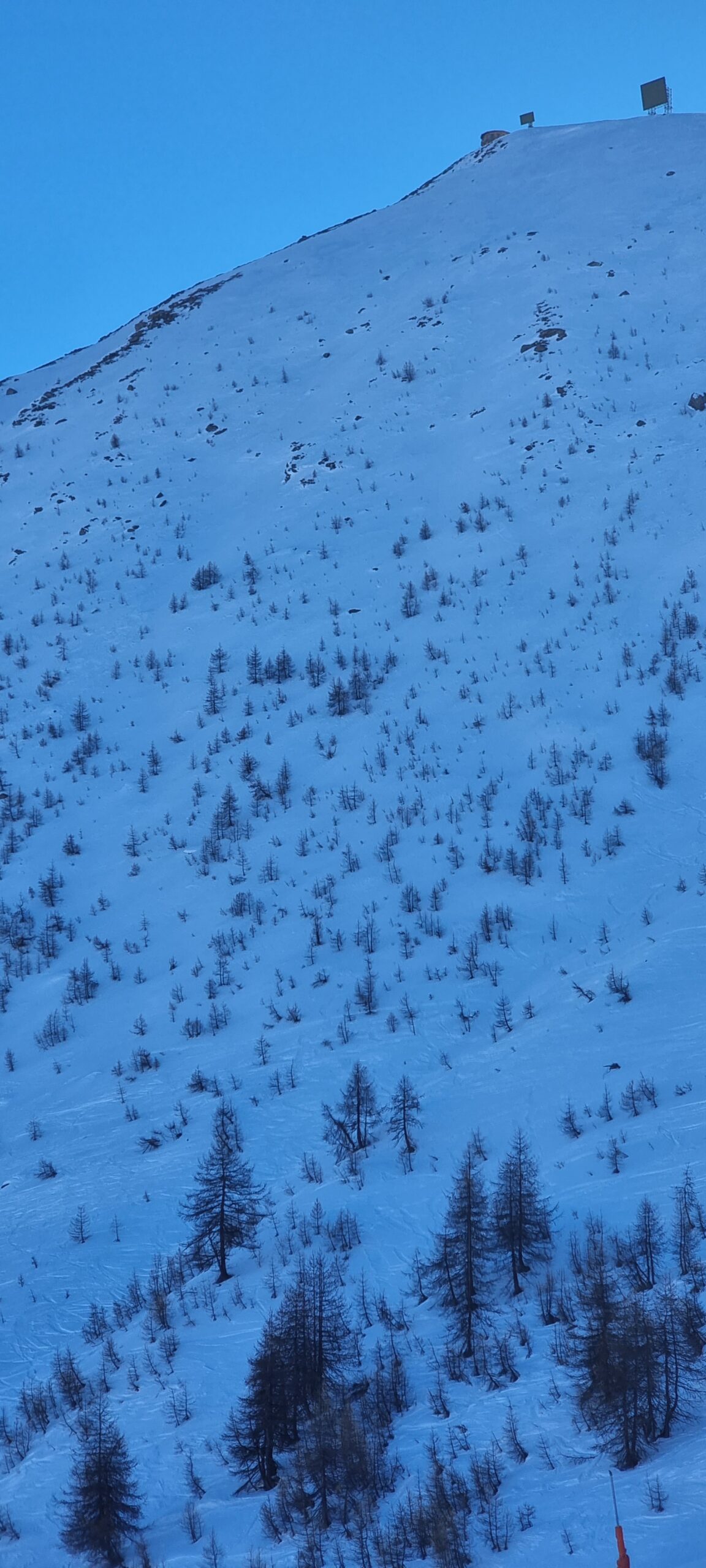
Da tutti gli itinerari si torna a Sestriere seguendo la stradina di fondovalle, volendo con un traverso alto a sx dal canale Faina si torna ancora nella NE del Sises.
Nelle vicinanze Mappa
Itinerari
01/05/2022 TO, Sestriere D+ 800 m 3.3, E1 Nord-Est
San Giacomo (Rocce di) da Sestriere per il vallone del Chisonetto
 200m
200m
08/03/2025 TO, Sestriere D+ 1235 m I, 4.1, E2 Nord-Ovest
Rognosa del Sestriere (Punta) Canale e Parete NO
 200m
200m
13/03/2015 TO, Sestriere D+ 1280 m 5.1, E3 Est
Rognosa del Sestriere (Punta) Parete Est
200m
30/01/2022 TO, Sestriere D+ 1170 m I, 3.3, E2 Sud-Ovest
Rouit (Rocce del) Paretina Sud
 2.7Km
2.7Km
03/01/2022 TO, Sauze di Cesana D+ 1179 m II, 3.3, E2 Sud-Ovest
Platasse (Monte) da Bessen Haut per la Paretina Sud
 2.7Km
2.7Km
23/05/2025 TO, Sauze di Cesana D+ 1620 m 4.2, E2 Nord-Est
Pelvo (Cima del) Canale Morandini
 3.4Km
3.4Km
08/04/2023 TO, Sauze di Cesana D+ 1625 m III, 5.1, E2 Nord-Est
Serpentiera (Punta) Canale NE
 3.7Km
3.7Km
16/04/2017 TO, Sauze di Cesana D+ 1230 m 4.3, E3 Nord-Ovest
Furgon (Monte) Parete NO
 4.5Km
4.5Km
24/05/2025 TO, Pragelato D+ 1228 m 4.3, E2 Nord-Ovest
Barifreddo (Monte) Canale NO
 5.4Km
5.4Km
24/02/2017 TO, Pragelato D+ 1430 m 4.2, E2 Sud
Vallonetto (Punta) Pendio S
 5.4Km
5.4Km
Servizi
2.8Km
5.8Km
Al Mulino Ristorante
Pragelato
5.8Km
La capanna del sole Ristorante
Pragelato
6Km
Mulino di Laval Rifugio
Pragelato
7.1Km
Centro Ristorante
Cesana Torinese
7.5Km
La Fontana del Thures Rifugio
Cesana Torinese
7.8Km
da Carlo Rifugio
Cesana Torinese
7.8Km
La Tana degli Orsi B&B
Cesana Torinese
7.9Km
La Crota B&B
Cesana Torinese
8.1Km