5.3Km
5.3Km


Note
 50m
2.5Km
2.5Km
2.5Km
2.5Km
2.5Km
2.5Km
2.5Km
2.5Km
3.1Km
50m
2.5Km
2.5Km
2.5Km
2.5Km
2.5Km
2.5Km
2.5Km
2.5Km
3.1Km
Percorso non difficile ma va ricercato, specialmente dal Colle del Pelvo alla cima.
Avvicinamento
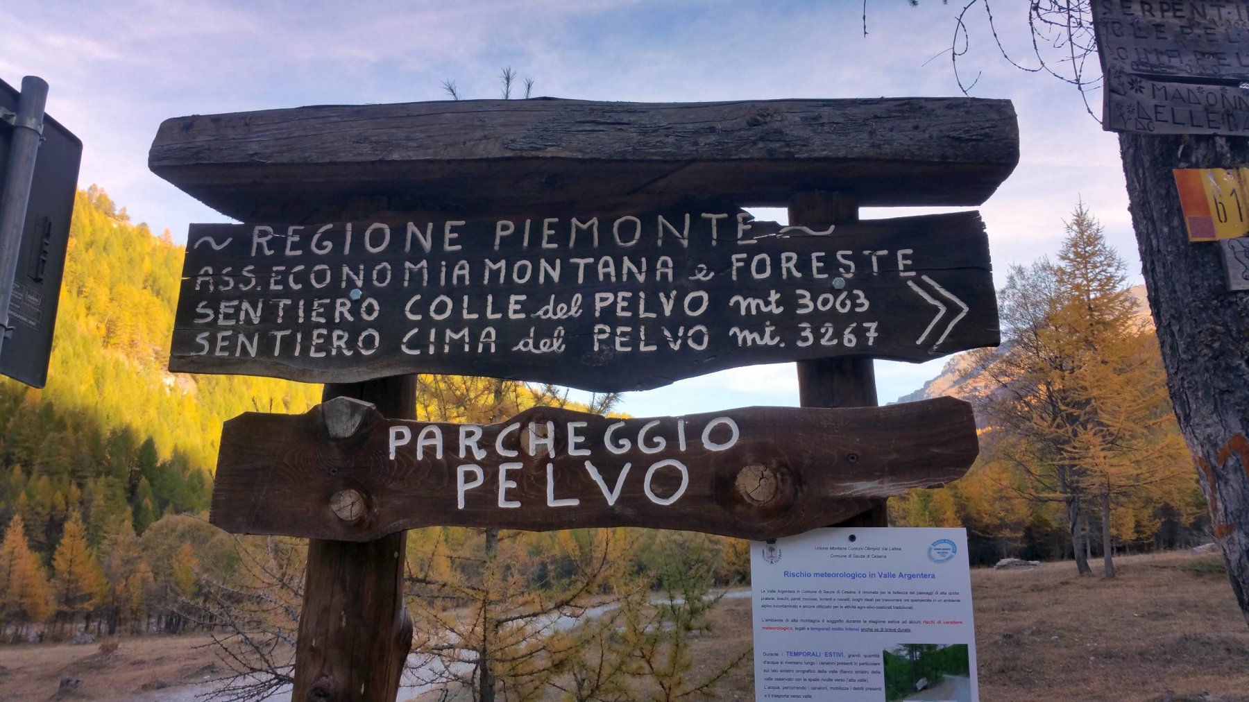
da Sauze di Cesana seguire la strada per Sestriere fino al bivio per la Valle Argentera. Imboccare sulla destra la stretta stradina asfaltata che scende a passare il Torrente Ripa al Ponte Terribile. La strada diventa quasi subito a fondo naturale ma, a perte qualche cunetta, è abbastanza buona. Seguirla fino al parcheggio Pelvo (molti cartelli indicatori) dove si trova il segnavia 614 per il Colle del Pelvo.
Descrizione
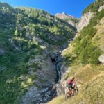
Il sentiero, dopo un breve tratto quasi pianeggiante tra i prati, inizia a salire molto ripido nel bosco. Si ignora il cartello per Madonna delle Balme e si prosegue sulla traccia di sinistra che esce brevemente dal bosco per abbassarsi leggermente sul torrente, lo attraversa e riprende a salire con percorso ripido sul costone boscoso del versante opposto.
Finite le serpentine e superato un tratto erboso dove il sentiero è poco evidente (spostarsi verso destra) un breve rettilineo verso destra conduce a circa 2380 m, in corrispondenza di un torrente (ottima acqua).
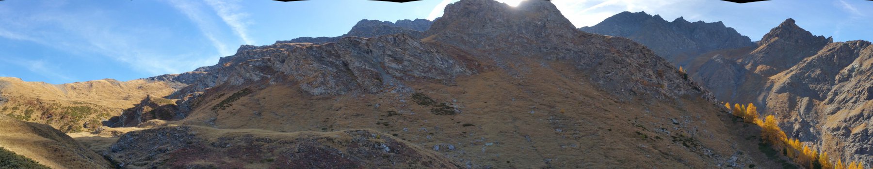
Si vedono sulla destra dei bolli rossi ed arancio, con un marcato sentiero che sale su una sorta di cresta erbosa, non vanno seguiti. Cercare invece sulla sinistra una traccia (due piccole linee rosse su un masso) che si alza ripida per sbucare su un vasto pianoro erboso. Lo si attraversa procedendo verso Sud ed aiutandosi con parecchi ometti e segni rossi, passando sotto una piccola paretina rocciosa che sostiene un prato superiore. Ci si innalza poi su un costone erboso verso destra fino ad una quota di circa 2730 m circa.
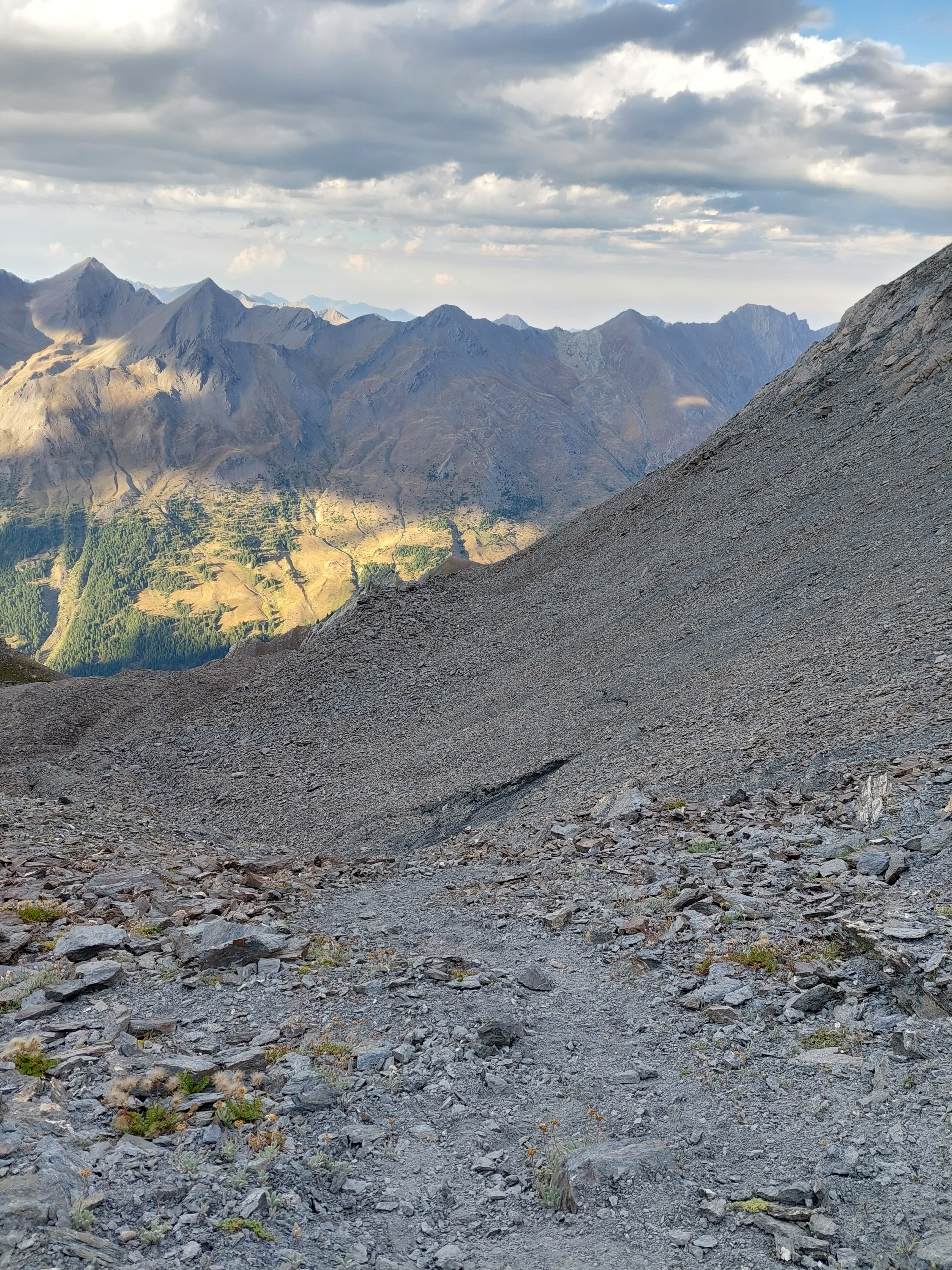
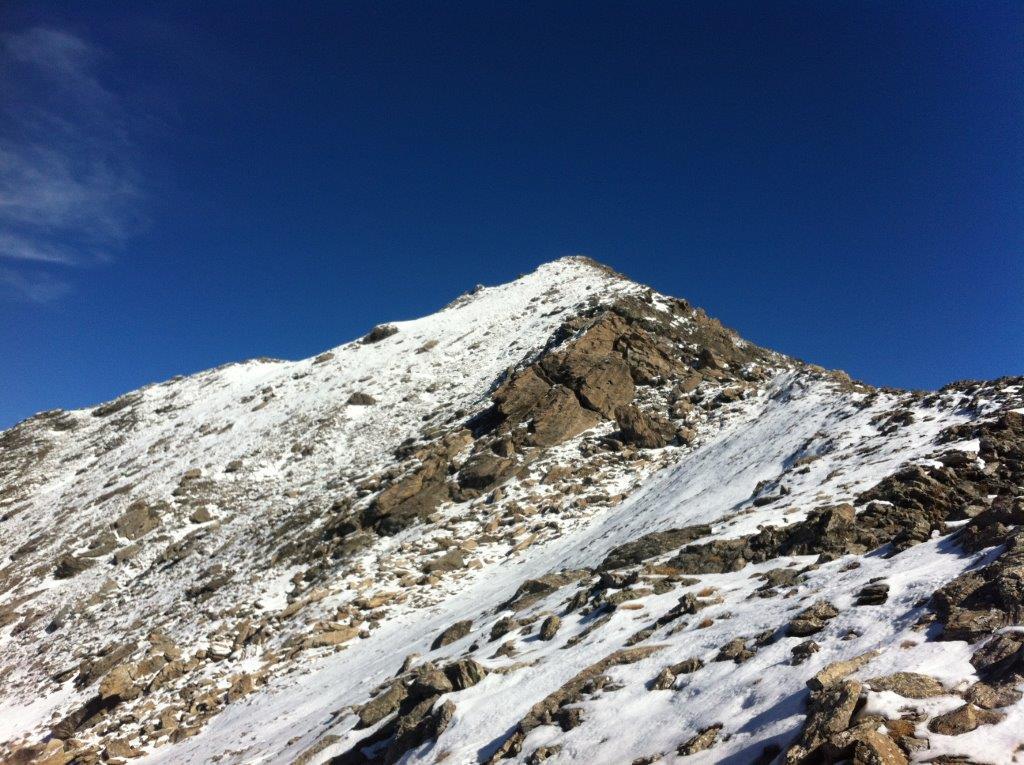
Da questo punto, sempre seguendo i numerosi ometti ed i segni rossi anche essi frequenti ma un po’ sbiaditi, si inizia a percorrere, dapprima su terreno piuttosto ripido, poi con una lunga traversata verso destra e poi ancora su terreno ripido, una pietraia “infinita” che termina poco sotto il Colle del Pelvo.
Il consiglio è di tenersi il più possibile a destra (senza esagerare troppo però) parallelamente ad una poco marcata cresta erbosa che separa il pendio alto da quello più in basso, in modo tale da evitare la fascia di pietraia più ostica e con qualche saliscendi (ci sono ometti anche più in alto, ma tenersi al bordo destro della pietraia è la cosa migliore). Se si ha la fortuna di individuarlo (è più facile in discesa) il sentiero è tutto sommato non male, anche se a tratti si perde e bisogna saltare tra i massi.
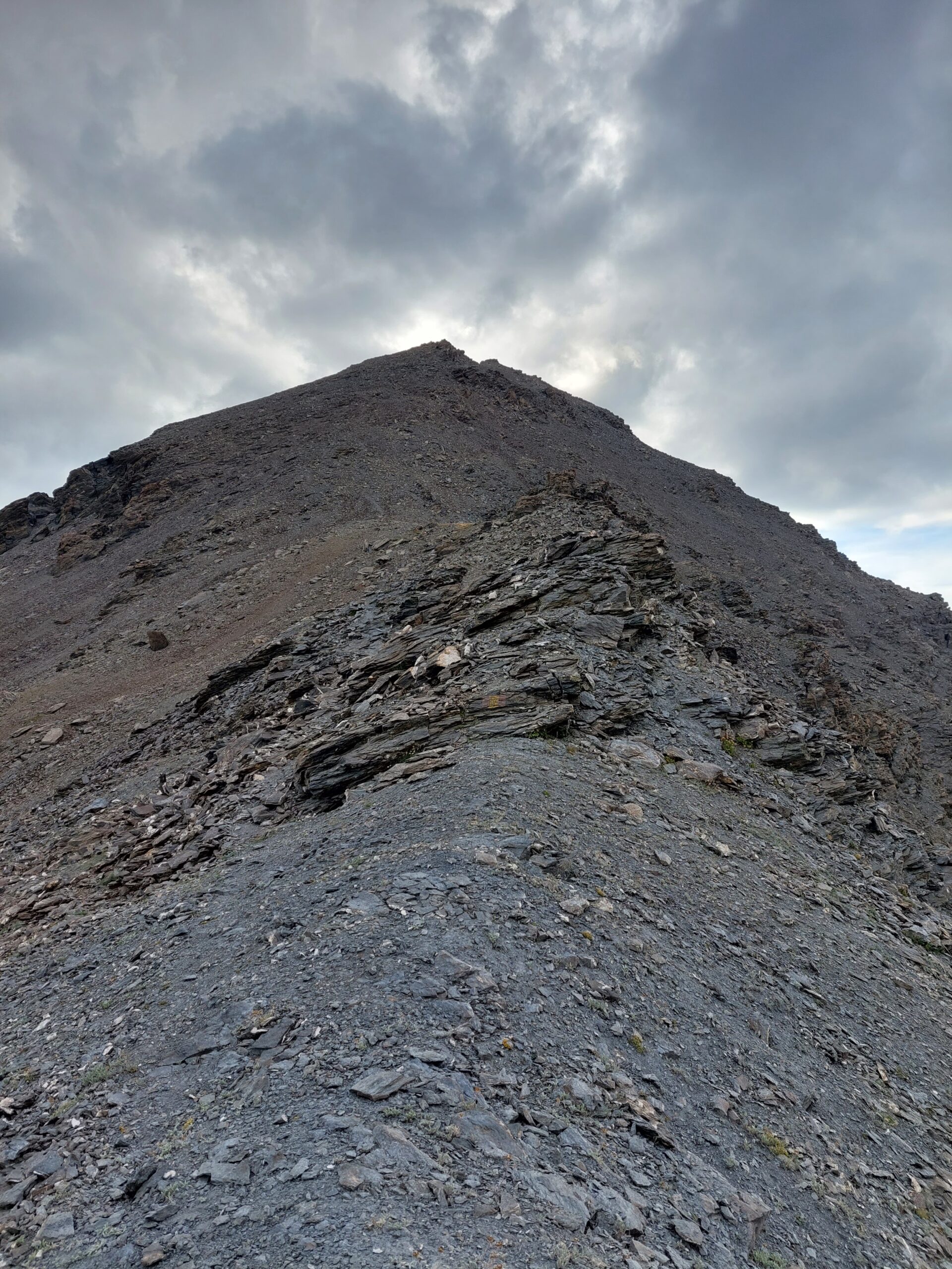
Si supera un colletto con una breve fascia di terriccio, prima di approdare ad una nuova conca pietrosa, dalla quale finalmente appare vicino il colle del Pelvo.
E’ ben visibile la traccia che con un traverso ascendente punta al Colle (nevai a inizio stagione), su terreno friabile e scivoloso, non c’è pericolo ma questo tratto è un po’ faticoso.
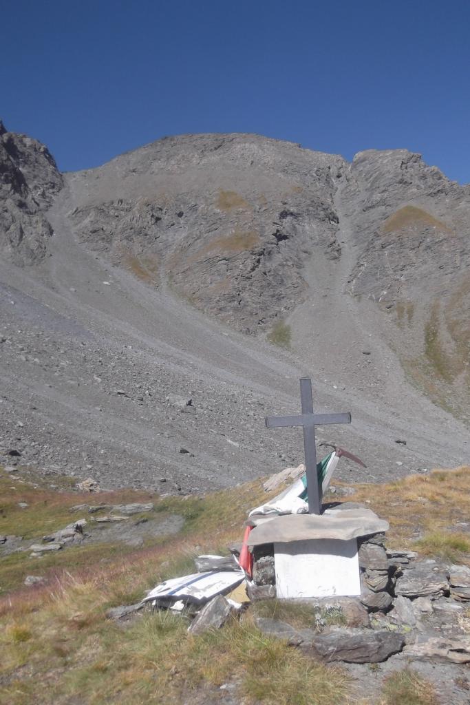
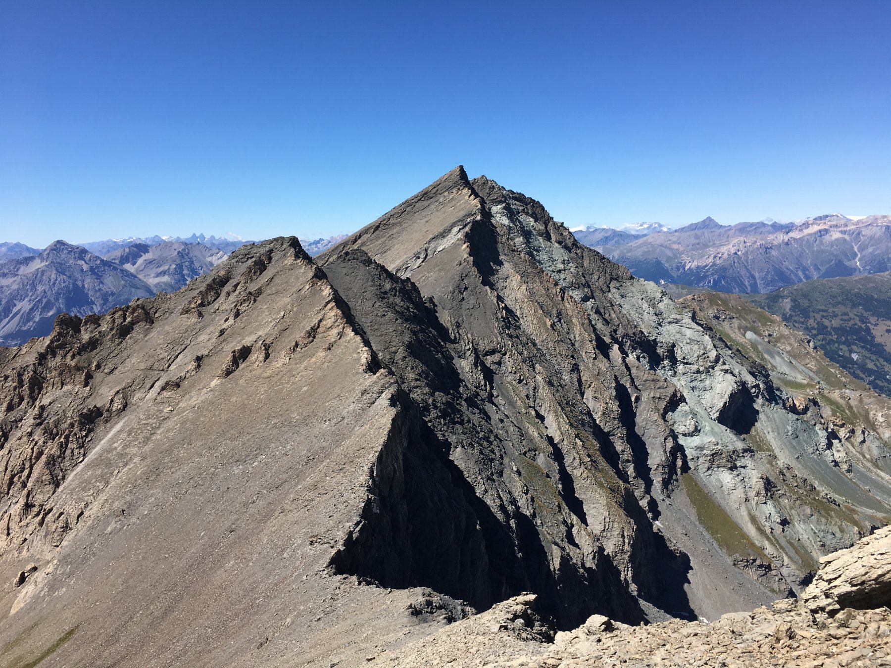
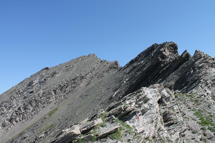
Raggiunto il colle (su un masso indicato il sentiero 614), inizia la fase di ricerca del percorso per la Punta Serpentiera.
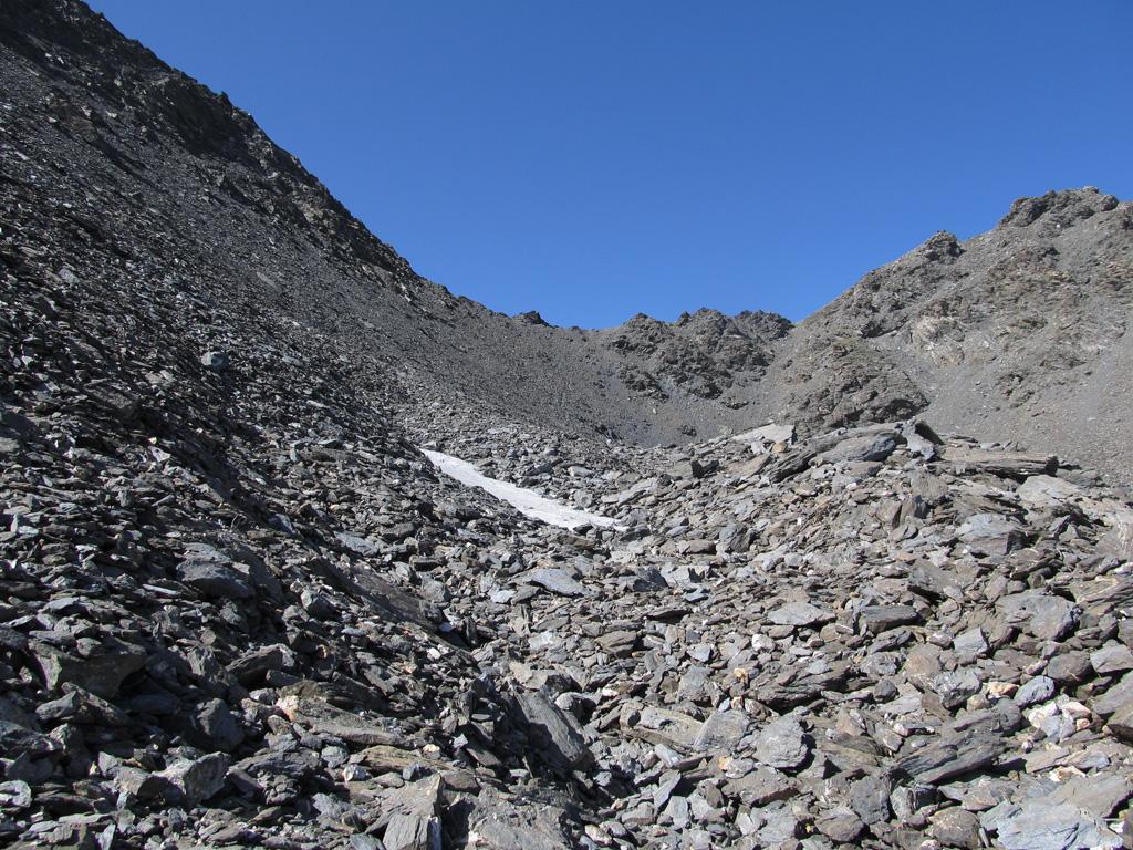
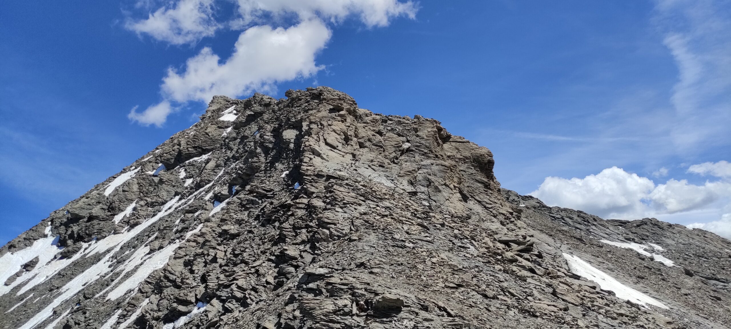
Si segue a sinistra una evidente traccia di sentiero che punta alla cresta rocciosa della Punta Serpentiera. La si segue per poco (a meno di voler seguire integralmente la cresta, roccia marcia e ricoperta di sfasciumi) per poi abbassarsi gradualmente sul versante Val Di Thures. Conviene perdere circa 50 m di dislivello per evitare le placche lisce inclinate, ostiche da superare. In questa zona non sono presenti molti ometti, si deve andare a occhio cercando il percorso migliore per attraversare questa fascia detritica.
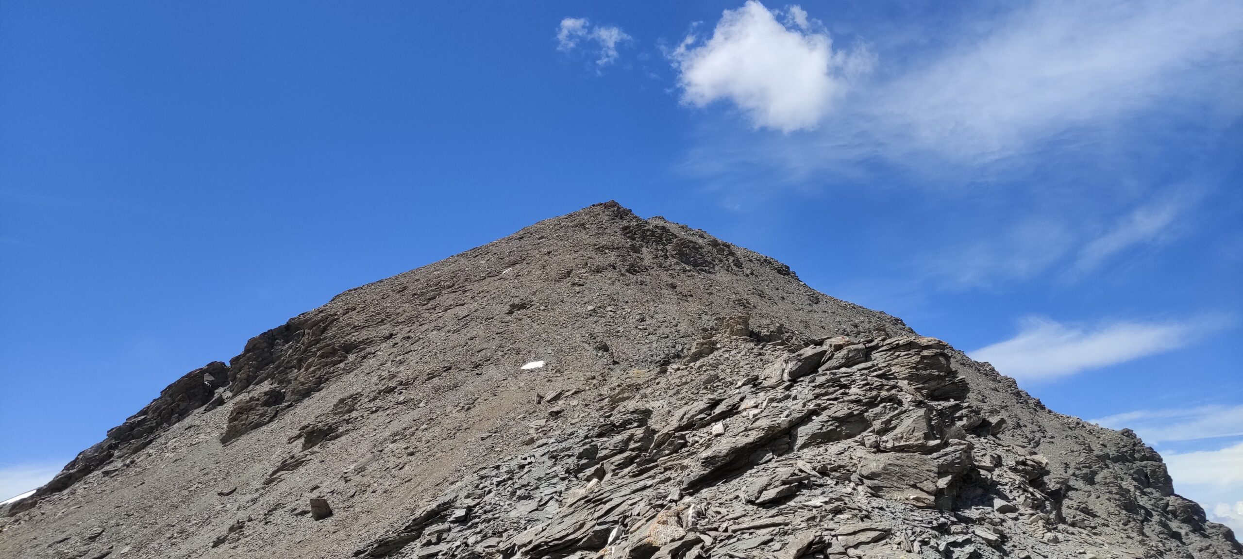
Quando si raggiunge una nervatura del pendio, con una specie di crestina rocciosa, a metà strada tra il colle del Pelvo e la cresta ovest che si vede davanti, si può iniziare a salire, di notano diversi ometti ed il terreno seppur detritico non è cedevole, e alterando brevi tratti con affioramenti erbosi, ad altri di sfasciumi di medie dimensioni, ad altri ancora di tracce di sentiero ghiaioso, si sale in linea verticale, puntando sempre ai massi più grossi di questa nervatura.
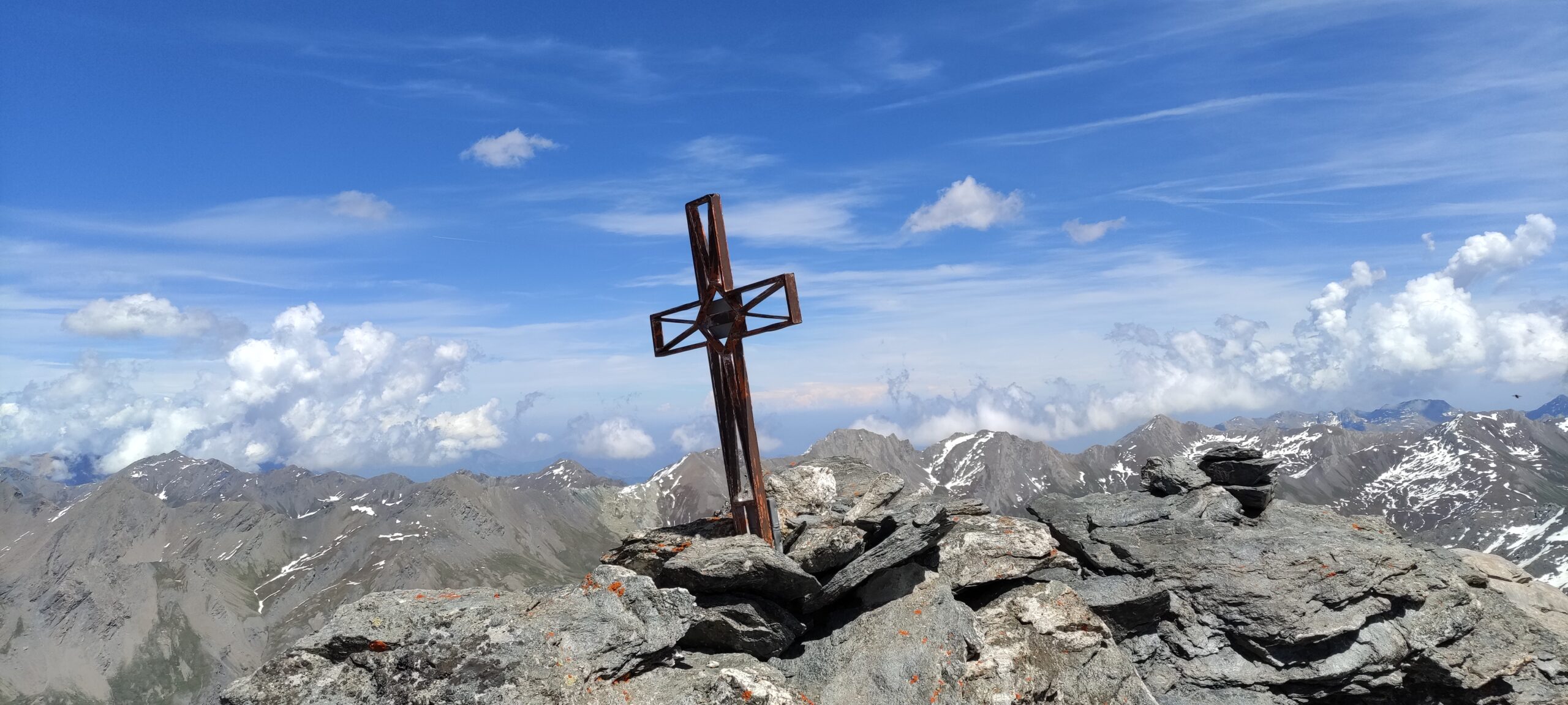
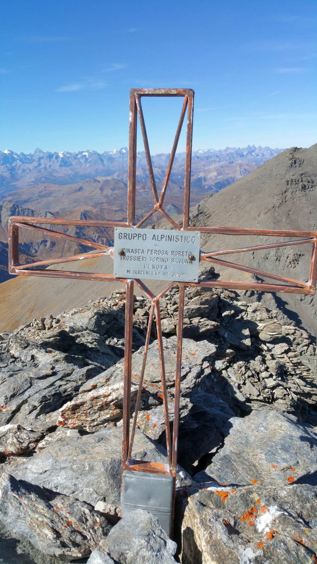
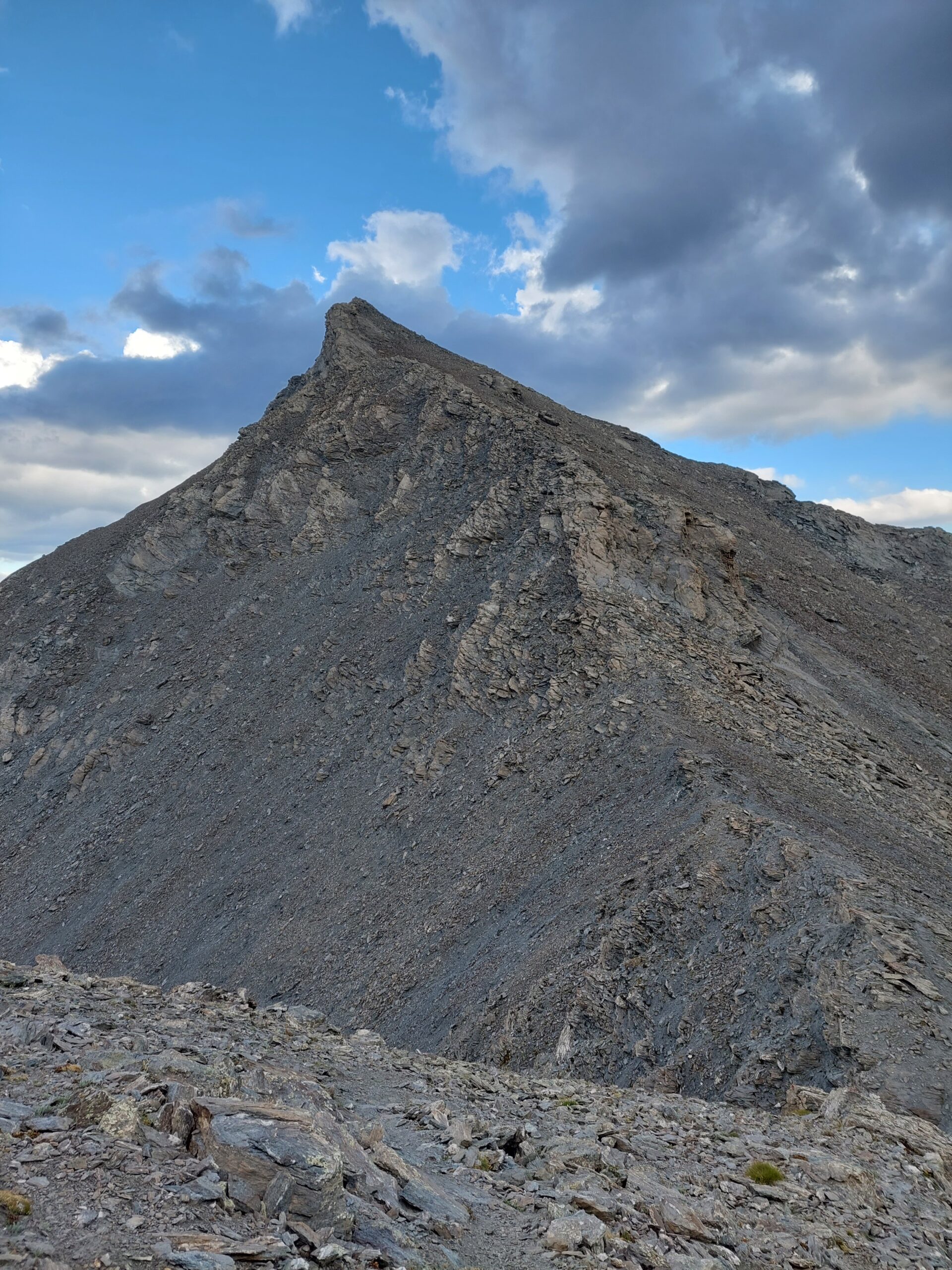
Cercando ometti qua e là, si punta al castello roccioso della cima, che si supera senza alcuna difficoltà, raggiungendo la piccola croce metallica visibile solo all’ultimo.
In discesa la traccia di sentiero risulterà molto più evidente di quanto sembra, e riporterà al Colle del Pelvo con una breve risalita
- Cartografia:
- ICG 1:50000 Valli di Susa Germanasca e Chisone
Nelle vicinanze Mappa
Itinerari
02/08/2024 TO, Sauze di Cesana D+ 1450 m EE Nord-Est
Pelvo (Cima del) dalla Valle Argentera per il Colle del Pelvo
 50m
50m
03/08/2024 TO, Sauze di Cesana D+ 1330 m EE/F Sud-Ovest
Rouit (Rocce del) da Brusà del Plan
 2.5Km
2.5Km
18/10/2025 TO, Sauze di Cesana D+ 1350 m EE Sud-Ovest
Platasse (Monte) da Brusà del Plan
 2.5Km
2.5Km
22/10/2016 TO, Sauze di Cesana D+ 1250 m EE Ovest
Giornalet (Monte) da Brusà del Plan
 2.5Km
2.5Km
20/07/2016 TO, Sauze di Cesana D+ 280 m T Nord-Ovest
Alpe Plane (Rifugio) da Brusà del Plan
 2.5Km
2.5Km
01/07/2021 TO, Sauze di Cesana D+ 1300 m EE Sud-Ovest
Barifreddo (Monte) da Argentera per il Monte Appenna
 2.5Km
2.5Km
11/08/2022 TO, Sauze di Cesana D+ 1090 m EE/F Nord-Ovest
Vergia (Punta) dalla Valle Argentera
 2.5Km
2.5Km
27/07/2025 TO, Sauze di Cesana D+ 1150 m E Sud-Ovest
Appenna (Monte) dalla Valle Argentera
 2.5Km
2.5Km
22/08/2025 TO, Sauze di Cesana D+ 1150 m EE Sud-Est
Gran Queyron e Cima Frappier dalla Valle Argentera
 2.5Km
2.5Km
07/09/2025 TO, Sauze di Cesana D+ 1400 m EE Nord-Ovest
Ramière (Punta) o Bric Froid dalla Valle Argentera
 3.1Km
3.1Km