8.4Km
8.4Km
Note
 50m
50m
50m
50m
2.4Km
2.7Km
2.7Km
2.7Km
50m
50m
50m
50m
2.4Km
2.7Km
2.7Km
2.7Km
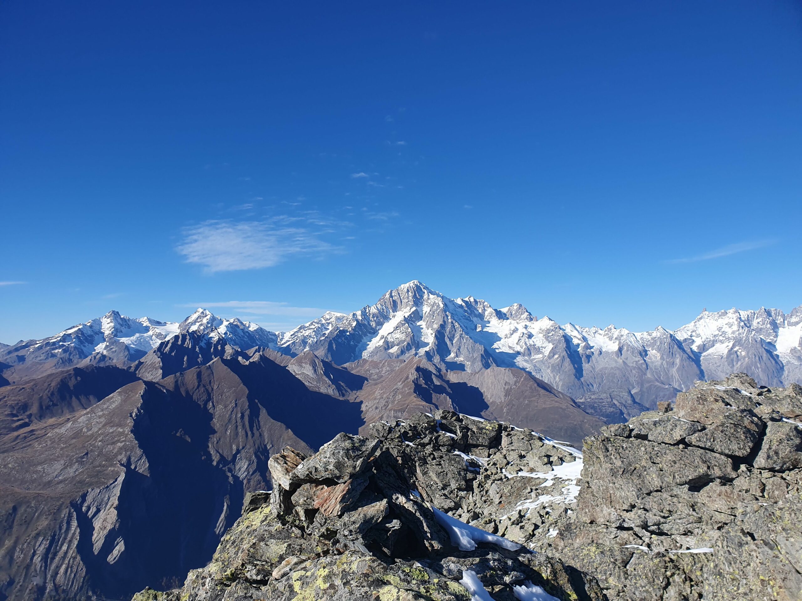
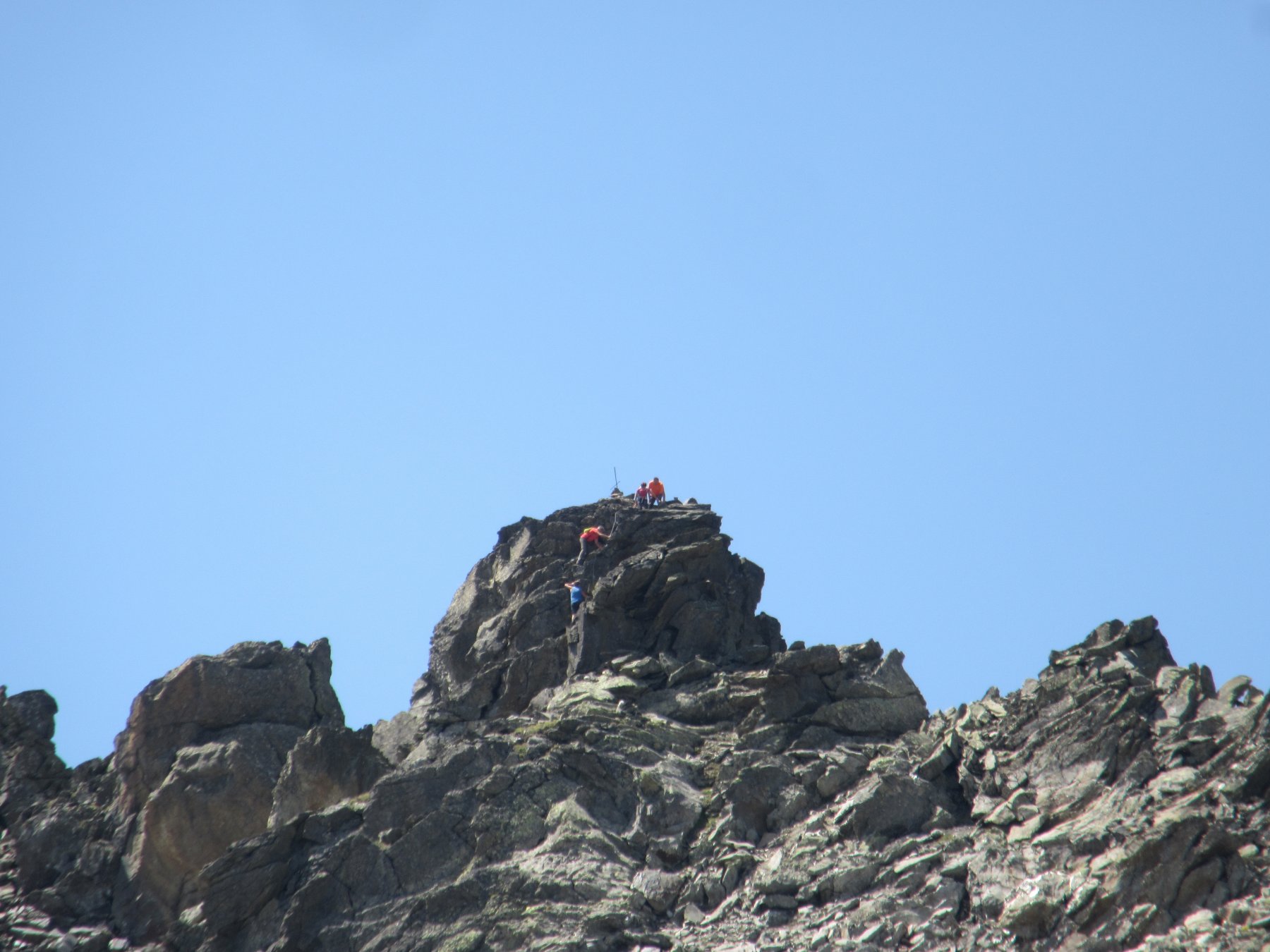
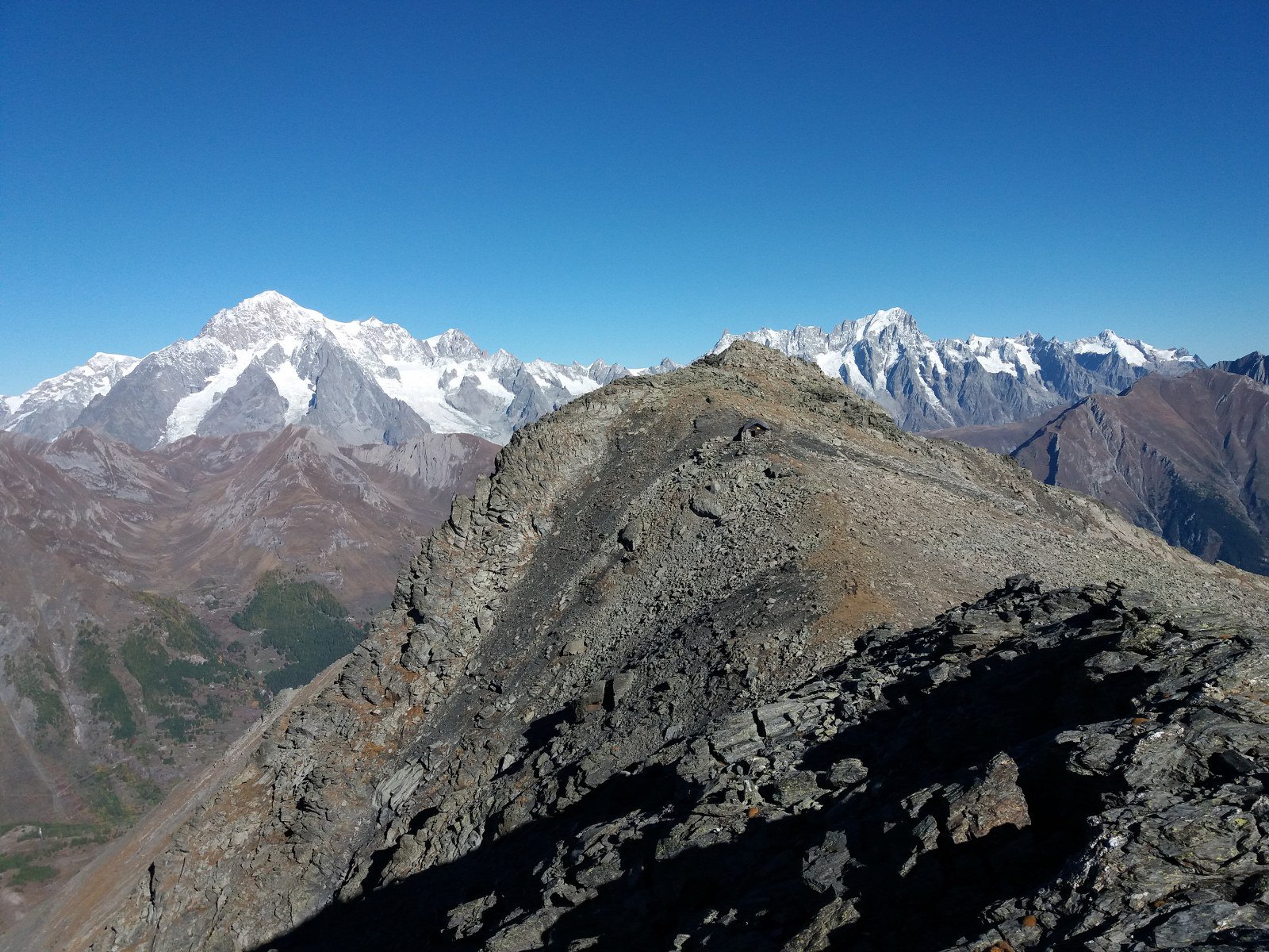
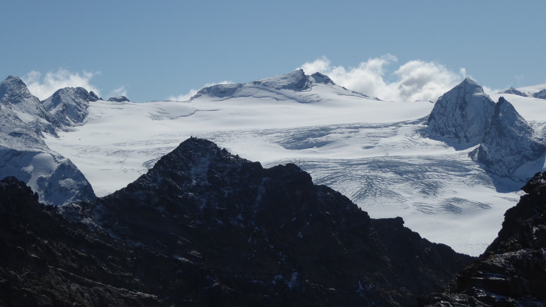
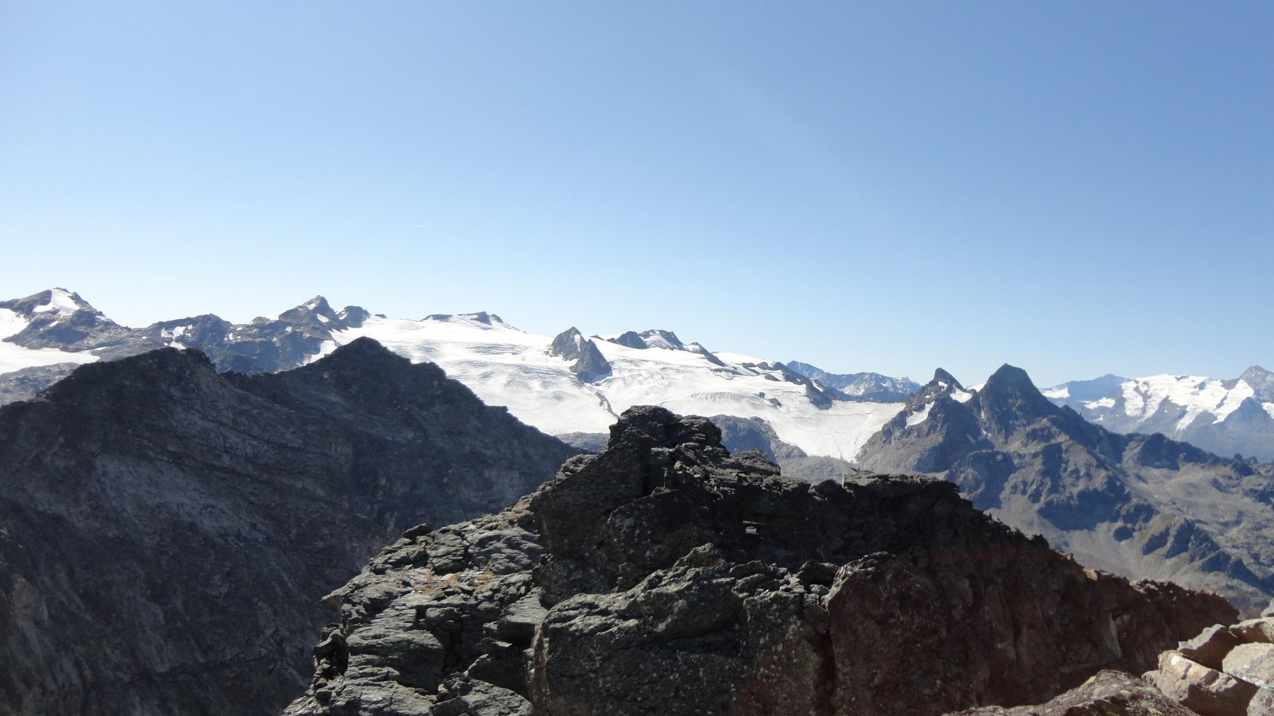
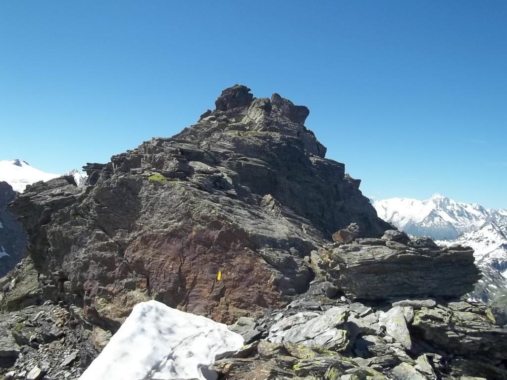
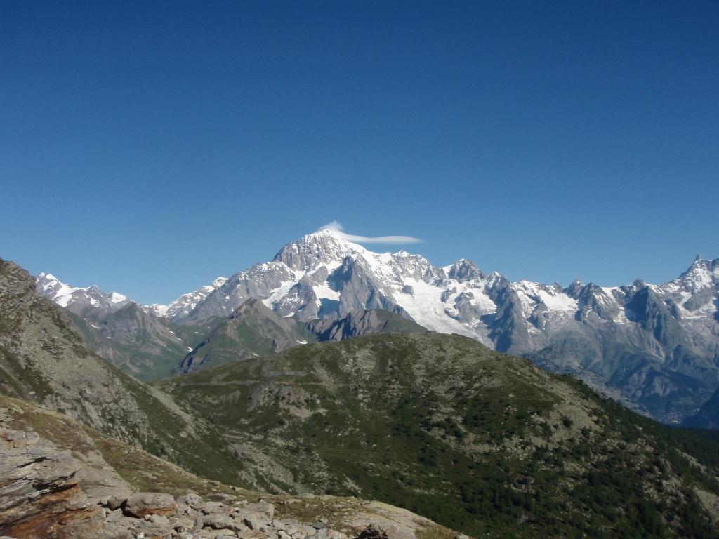
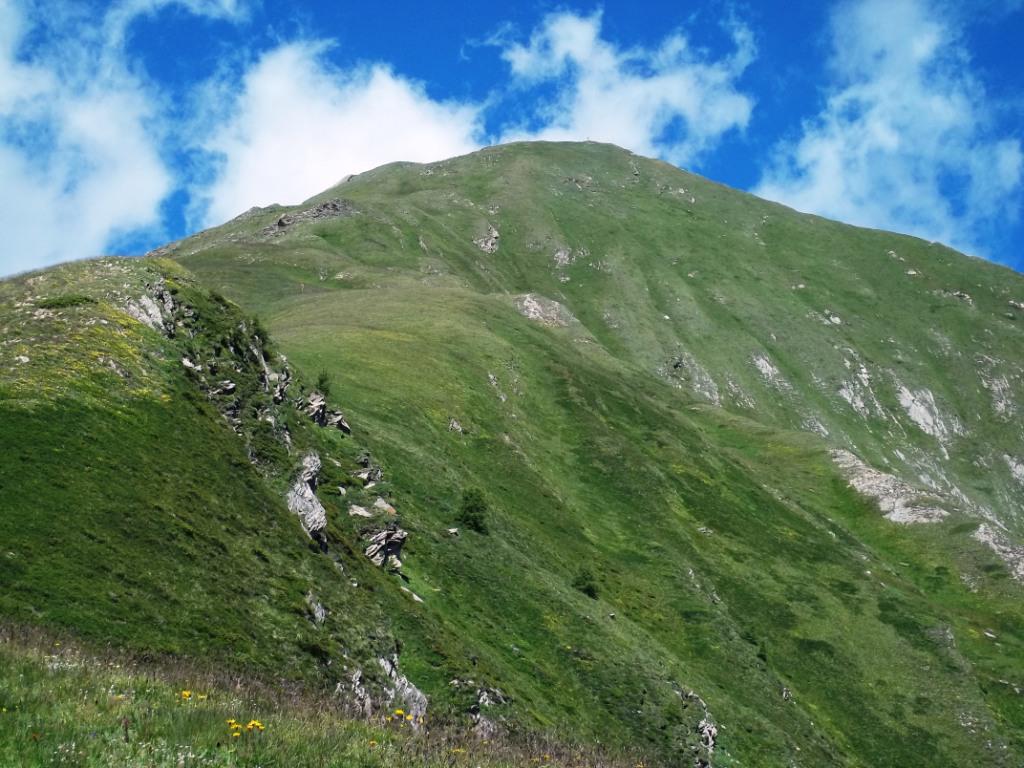
Il Mont Colmet è caratterizzato da due cime di simile altitudine, la cima Nord è puramente escursionistica e non presenta difficoltà, la cima sud invece presenta alcuni tratti di roccette (F).
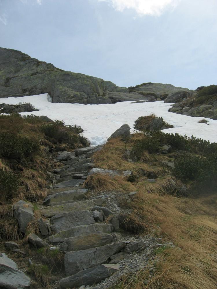
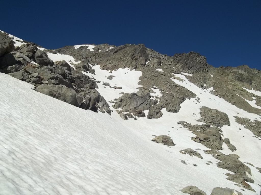
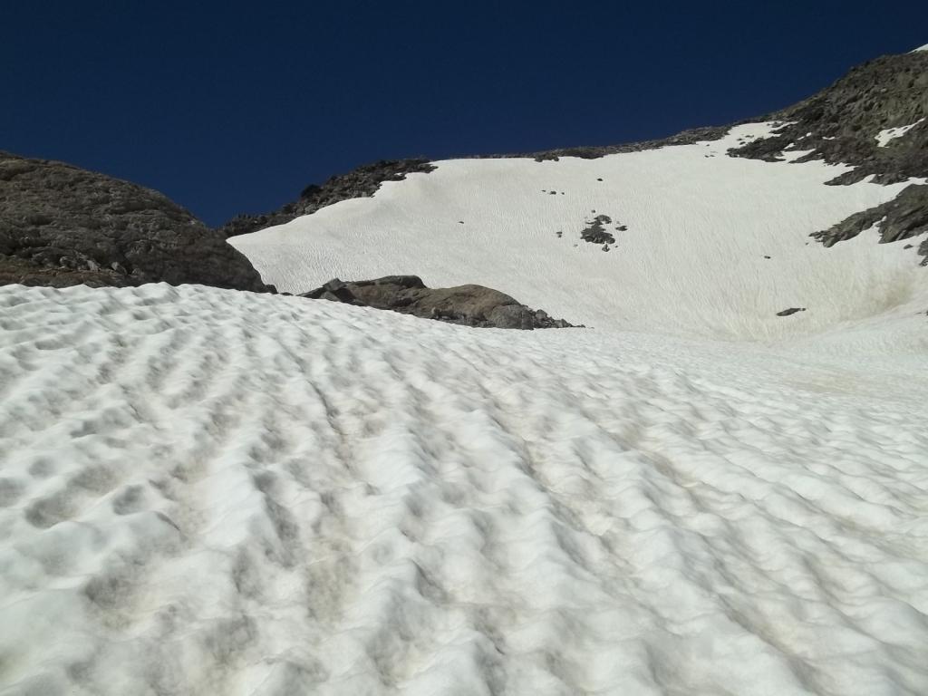
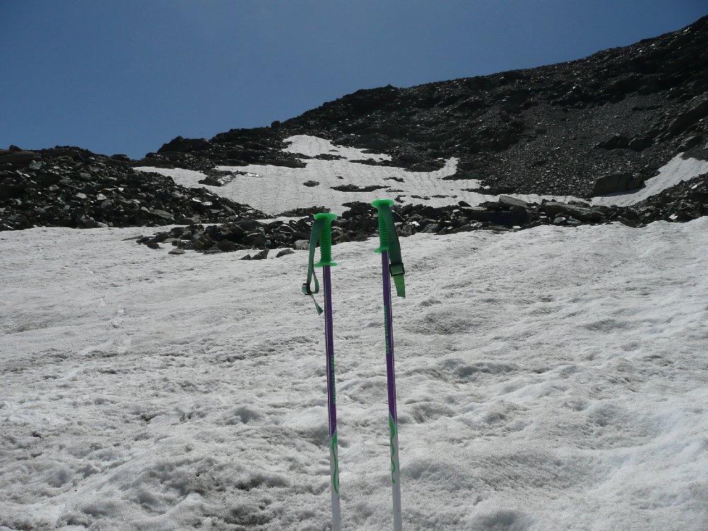
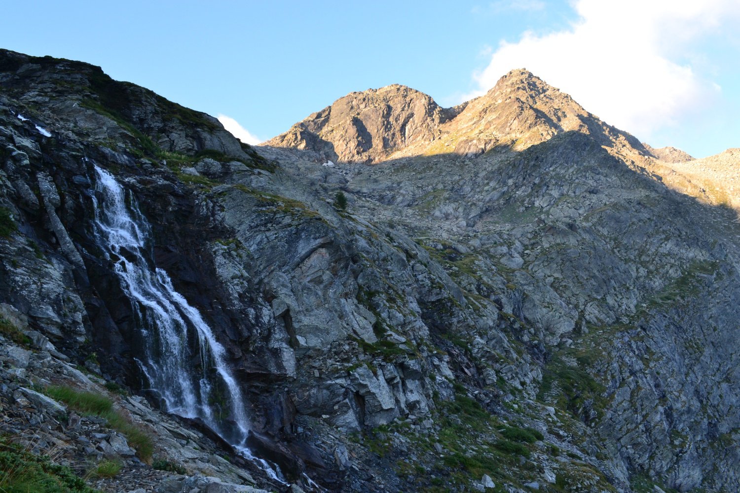
A inizio stagione (giugno-metà luglio) si possono incontrare parecchi nevai nella parte alta del percorso, utili in questo caso ramponi e picozza.
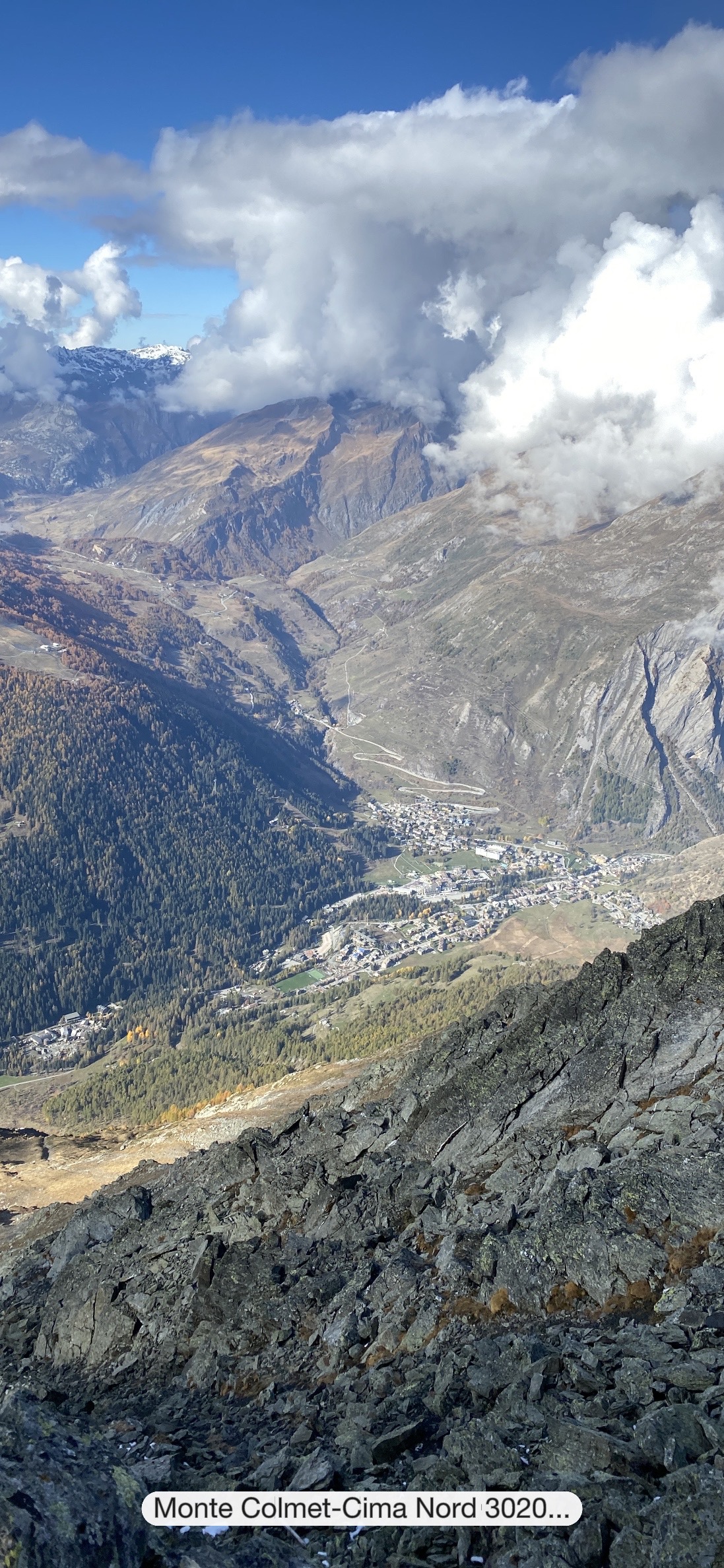
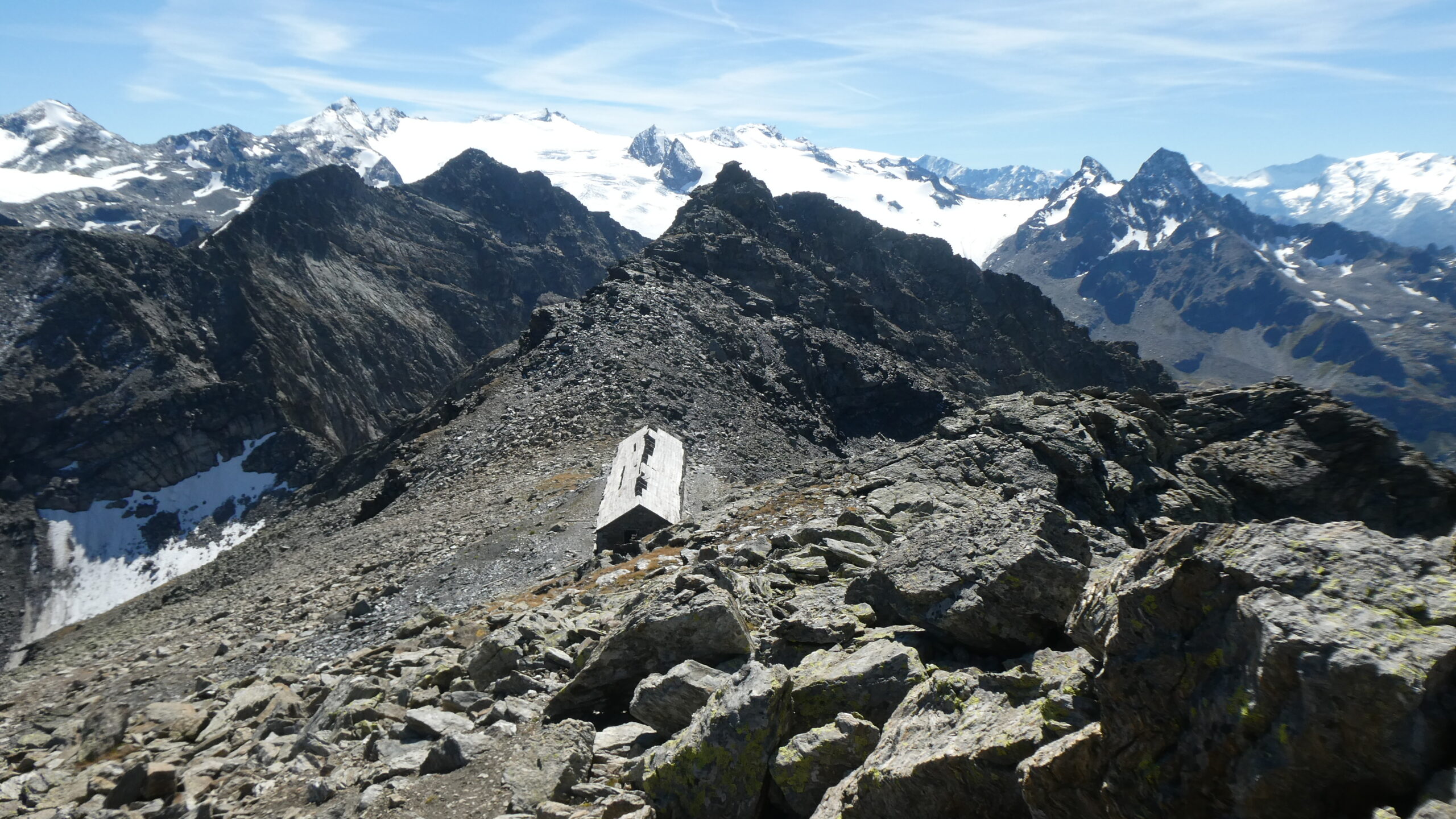
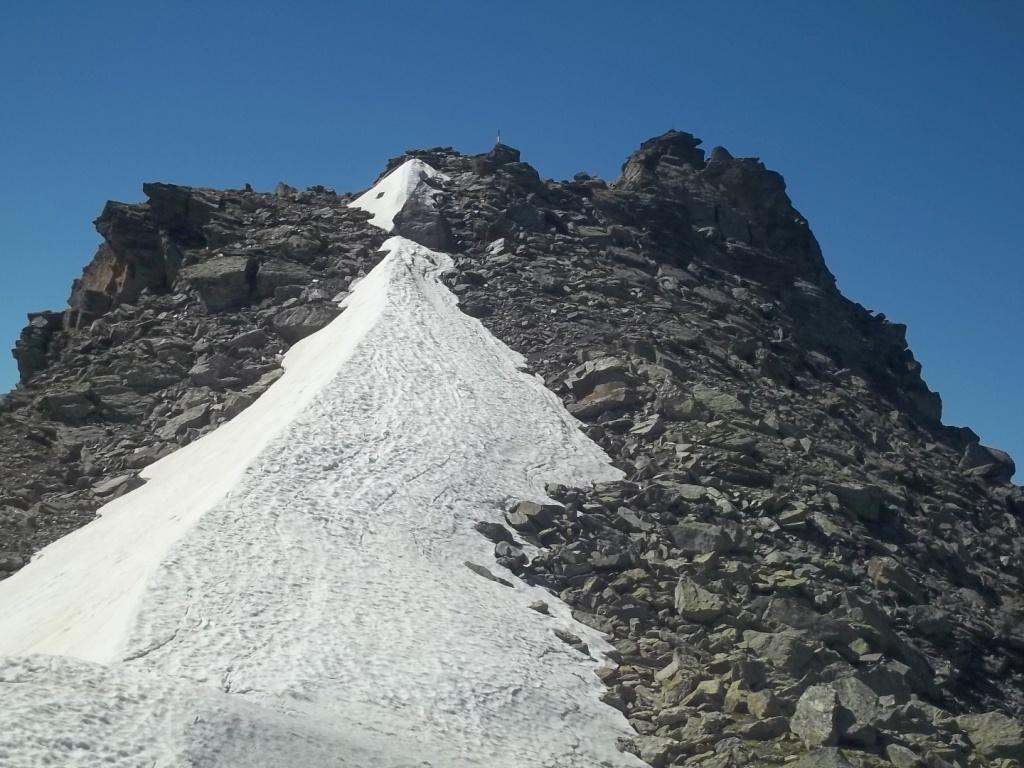
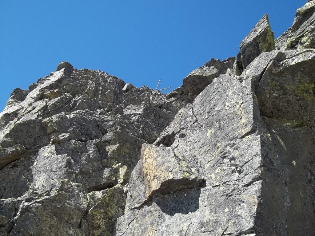
Attenzione: la cima sud e il percorso dal colletto sono stati interessati da un importante crollo (maggio 2025), già guardando dalla casermetta si nota la linea di distacco che porterà certamente a nuovi crolli.
Avvicinamento
A inizio stagione (giugno-metà luglio) si possono incontrare parecchi nevai nella parte alta del percorso, utili in questo caso ramponi e picozza.
Attenzione: la cima sud e il percorso dal colletto sono stati interessati da un importante crollo (maggio 2025), già guardando dalla casermetta si nota la linea di distacco che porterà certamente a nuovi crolli.
Autostrada A5 Torino-Aosta uscita Morgex. Da qui si prosegue per Courmayeur fino a incontrare la deviazione a sinistra per il Colle San Carlo. Dopo 10 km di bella strada in salita si giunge al piazzale del colle, ampio parcheggio.
Descrizione
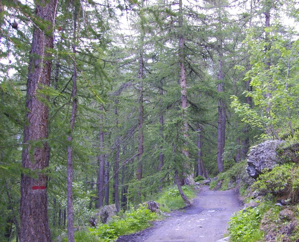
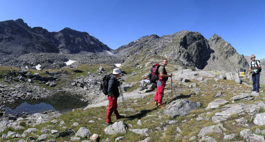
Dal Colle San Carlo si seguono i cartelli che indicano a sinistra la pista nel bosco (indicazioni per Lago d’Arpy, Lago di Terra Rossa, Becca Pougnenta), sentieri n.15 e 19.
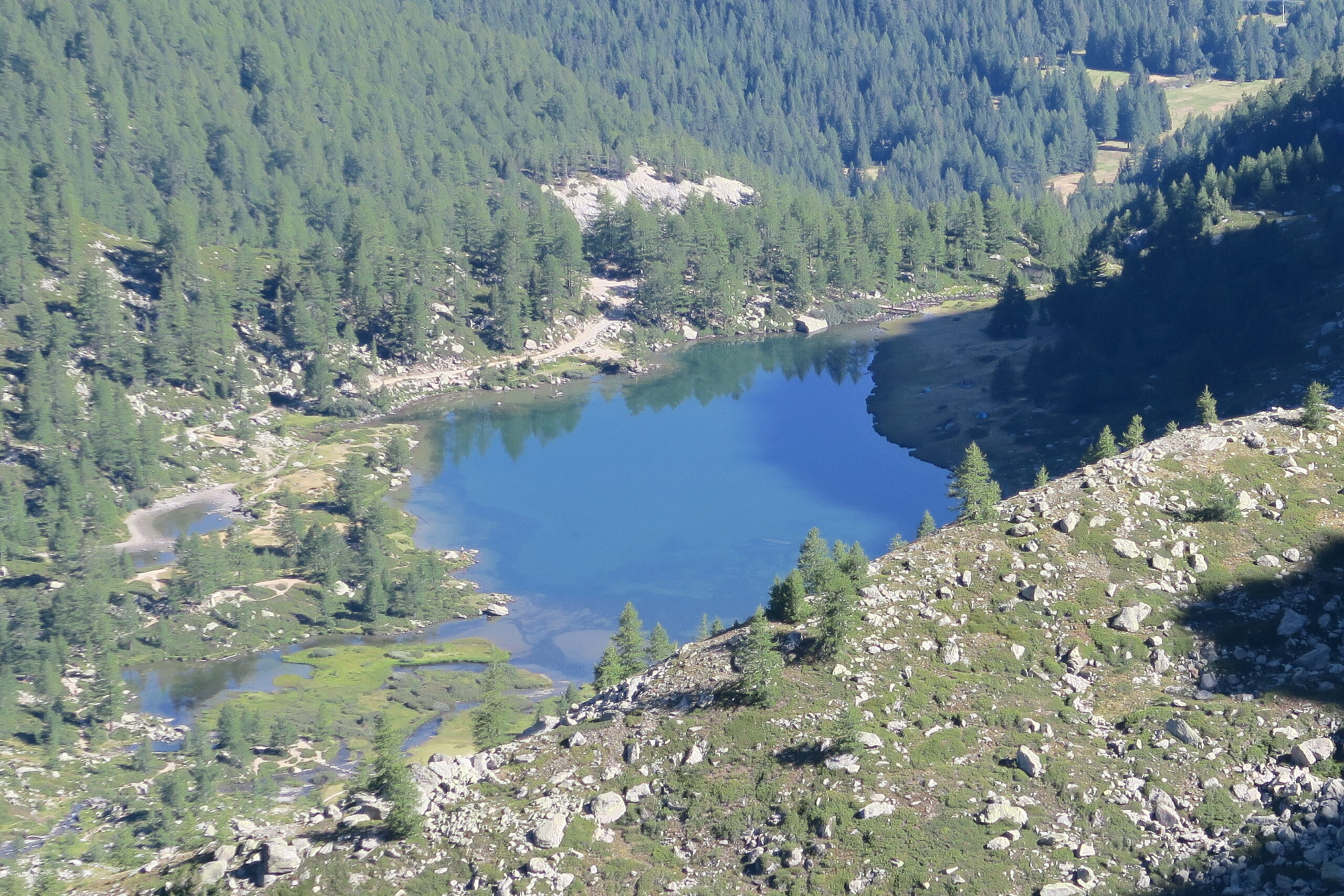
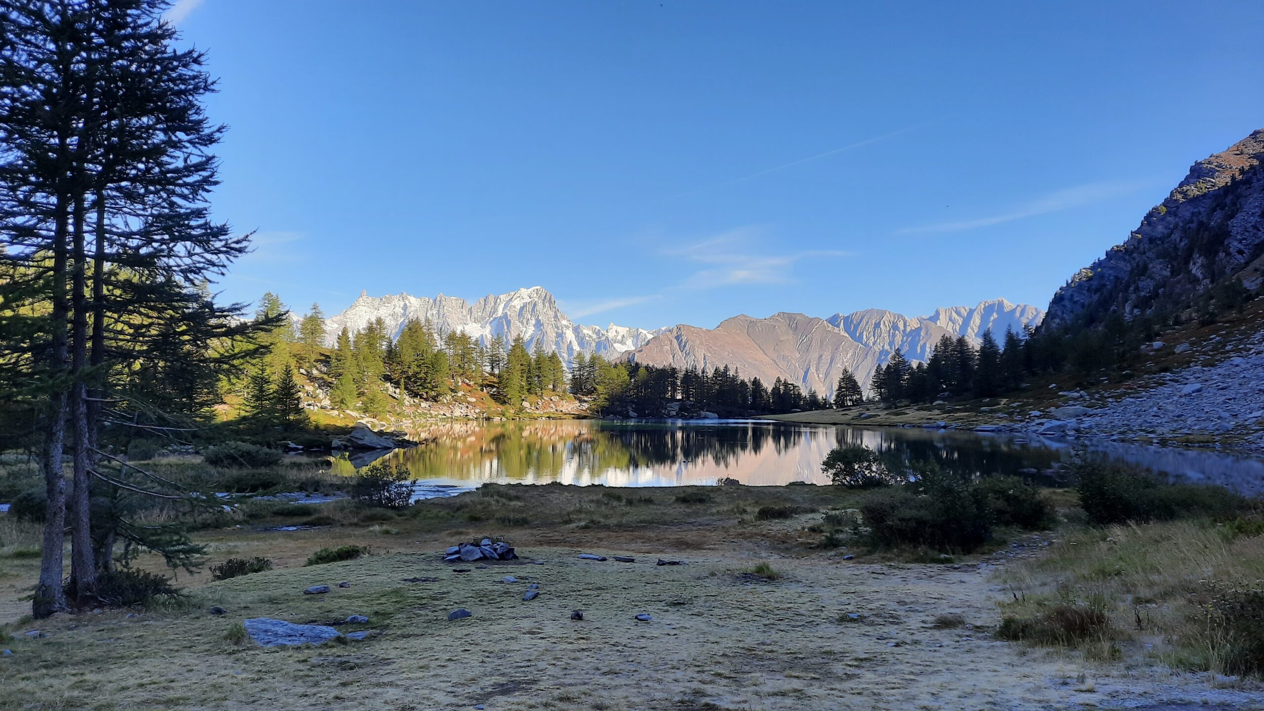
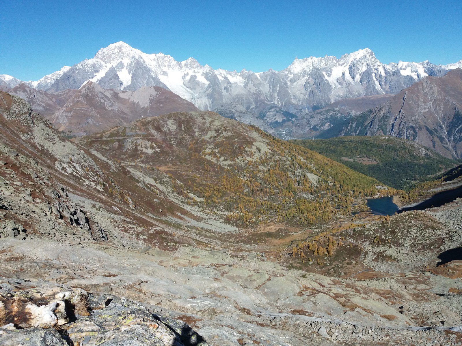
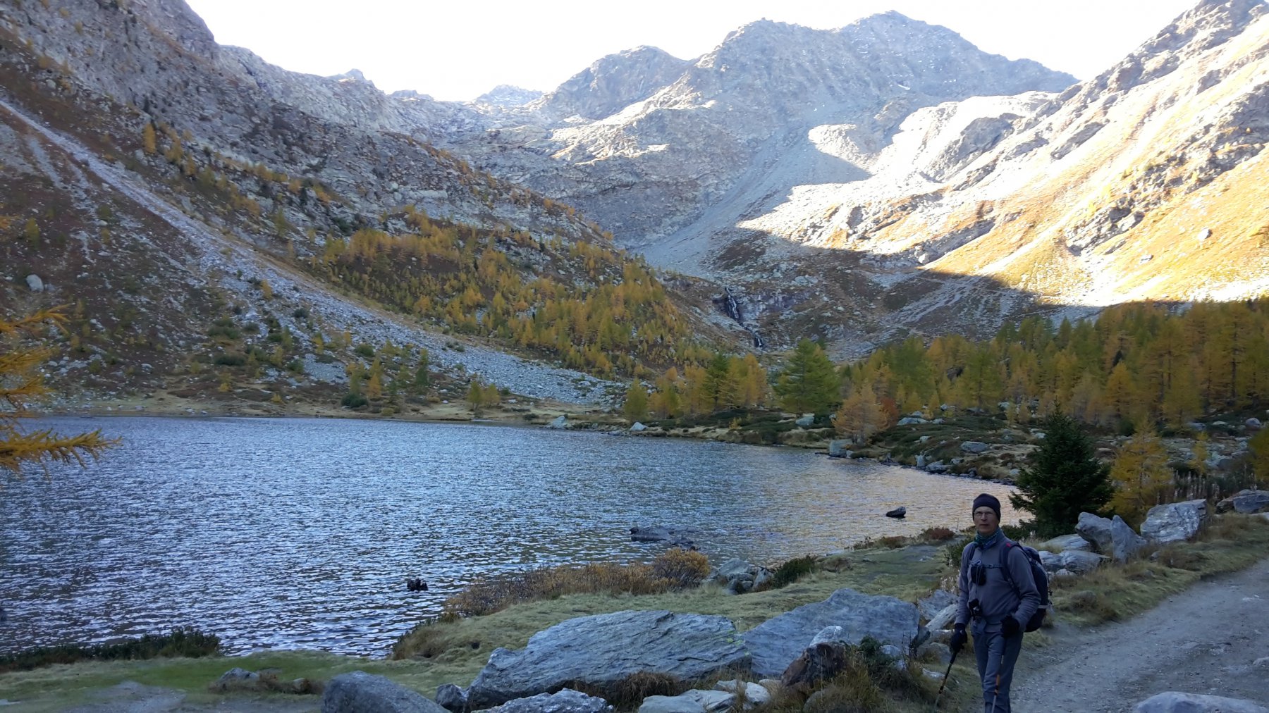
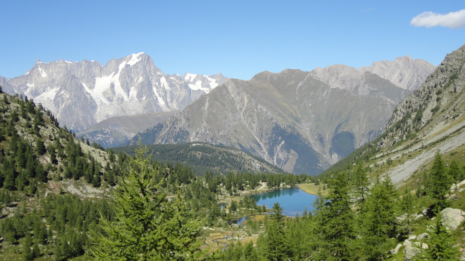
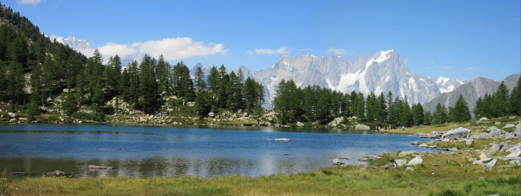
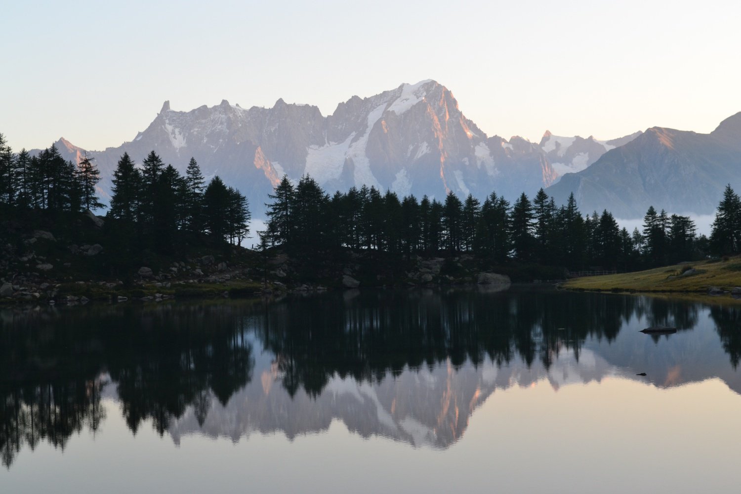
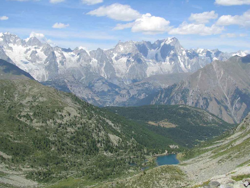
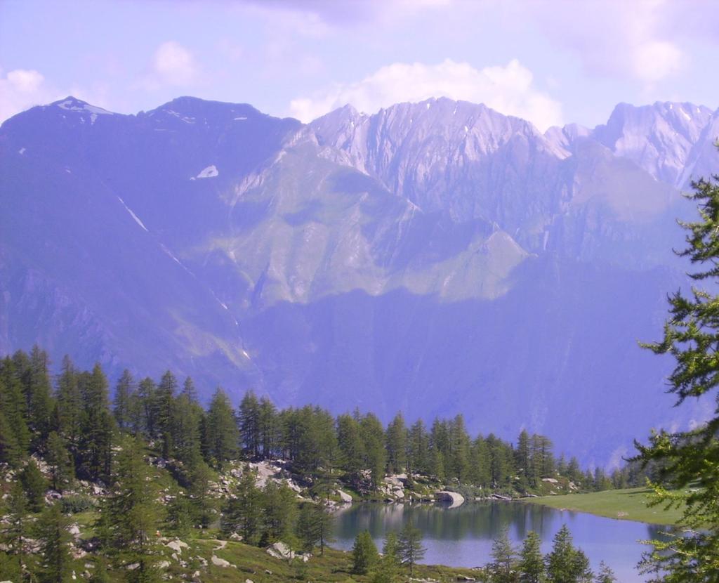
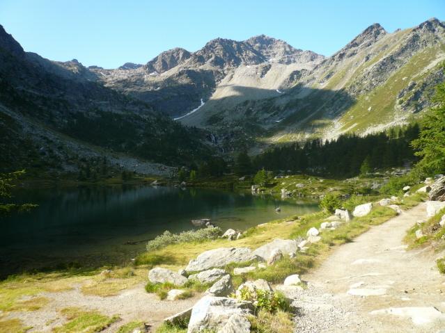
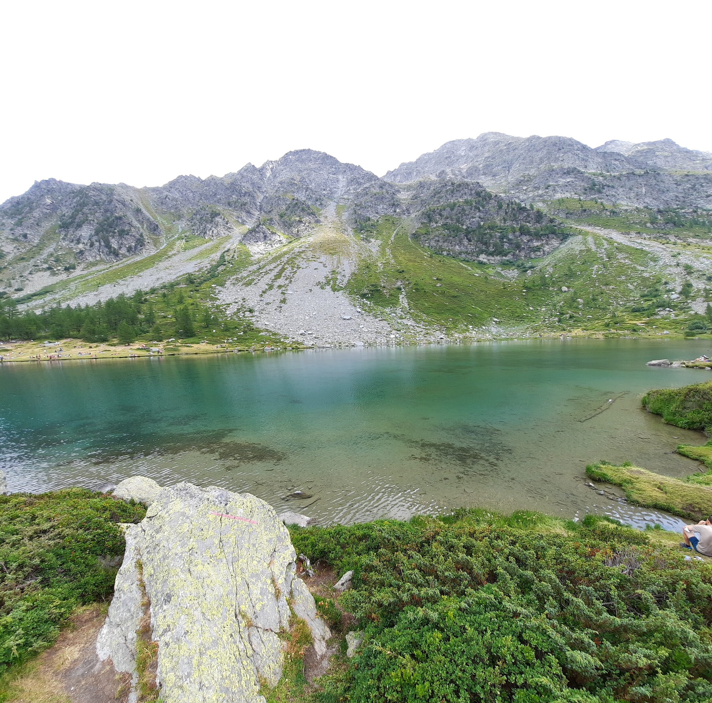
Si prosegue per 30-40′ nel bel bosco di larici, con scorci che via via diventano panoramici, con dislivello pressochè nullo, fino a raggiungere l’anfiteatro in cui si trova il Lago d’Arpy 2062 m.
Ora i sentieri invitano a proseguire sulla sponda destra del lago (senso di salita) per poi attraversare il suo immissario tramite una passerella di pietre; a inizio stagione o con molta acqua questa può risultare inutilizzabile, quindi conviene nel dubbio passare immediatamente sul ponte ad inizio lago, e percorrere la sponda sinistra, e percorrere una evidente traccia di sentiero che si collega con il sentiero ufficiale.
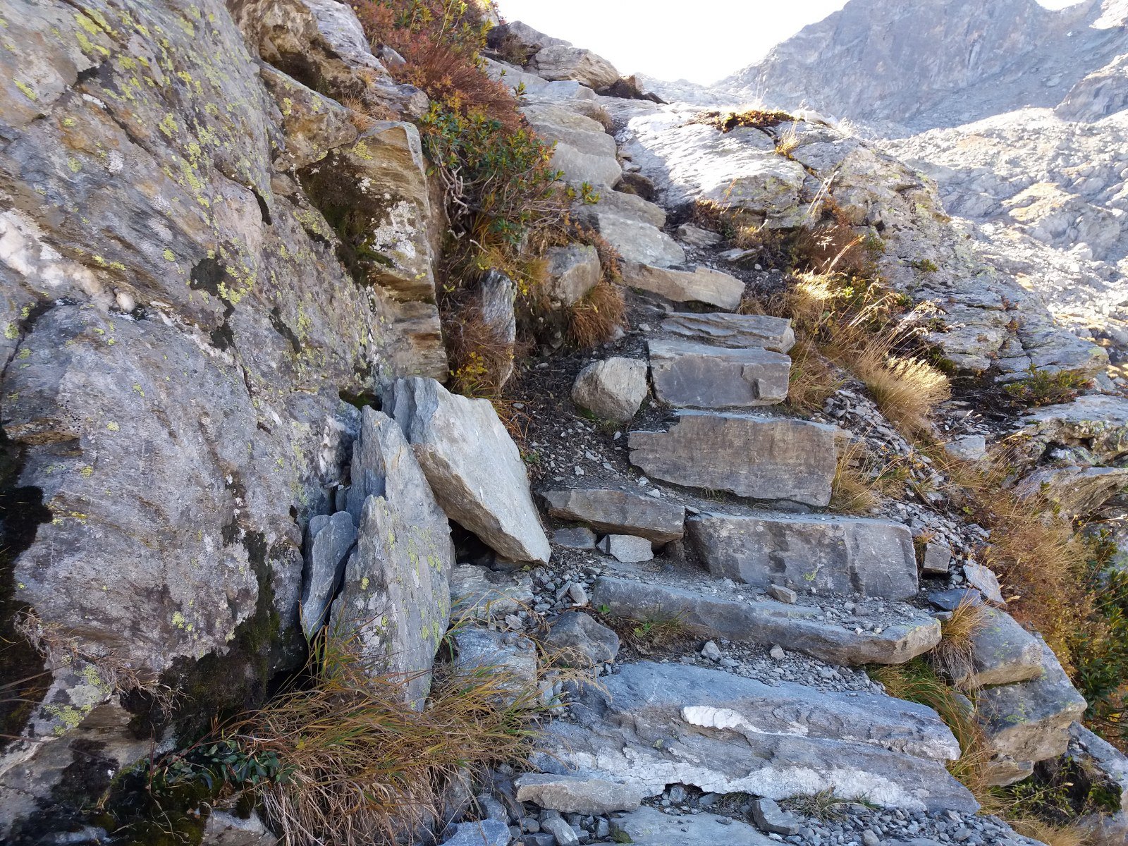
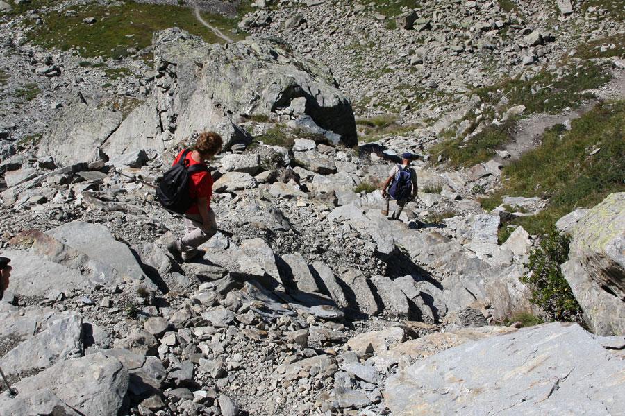
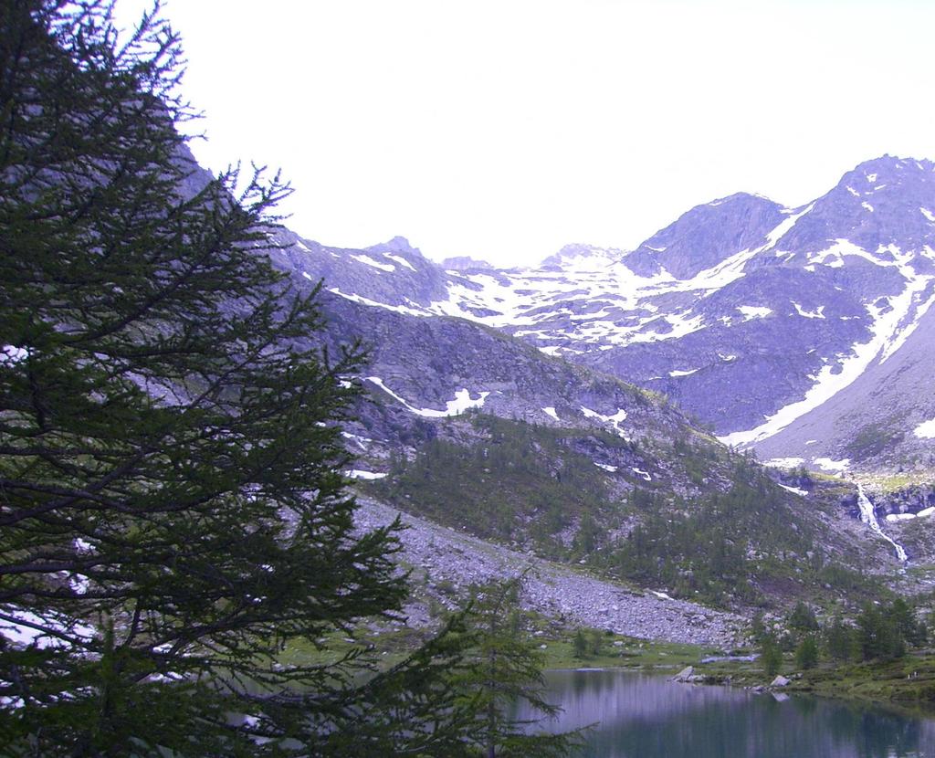
Al termine del lago si inizia a salire di quota, superando una prima balza di rocce ed erba su comodo sentiero, che dà accesso ad un piccolo anfiteatro, con in basso una zona acquitrinosa. Ora il sentiero conduce ad affrontare la seconda parete rocciosa, che sembra inaccessibile mentre è comodamente camminabile grazie ad una scalinata di rocce spettacolare.
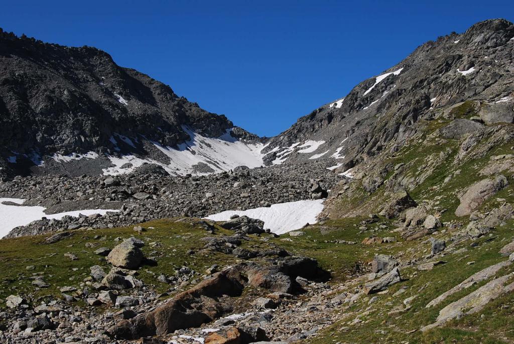
Rapidamente si arriva ad un altro ripiano, a circa 2400 m. Ora il sentiero si sposta al centro del pendio sovrastante (si tralascia una traccia poco evidente che indica il sentiero 19 per la Becca Pougnenta) e lo risale con diagonali (in caso di neve in questo tratto il sentiero risulta poco evidente, ma non ci sono passaggi obbligati).
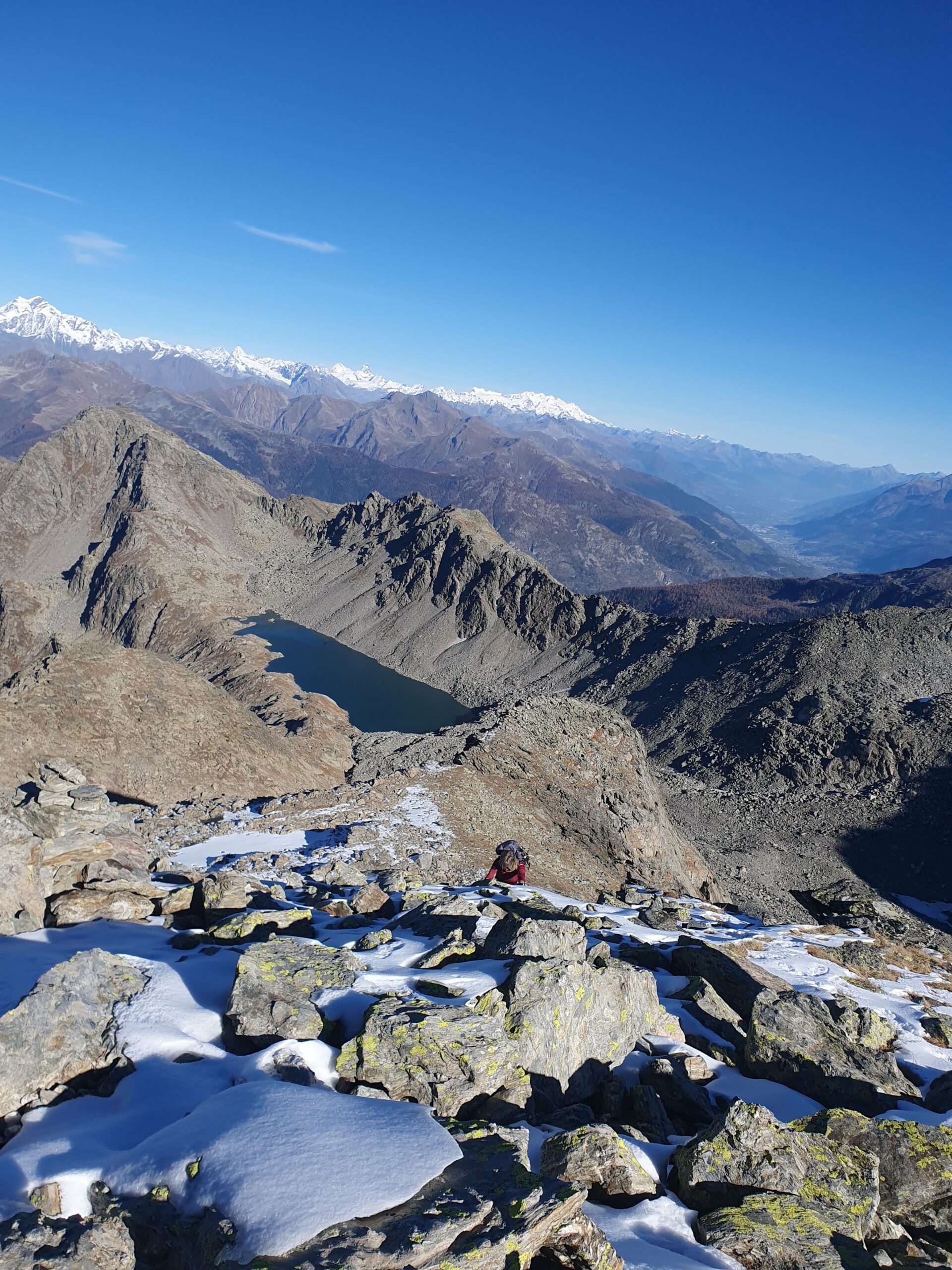
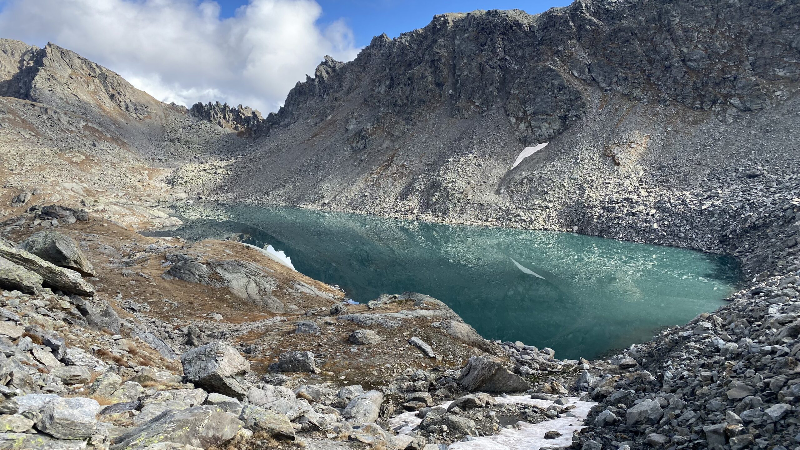
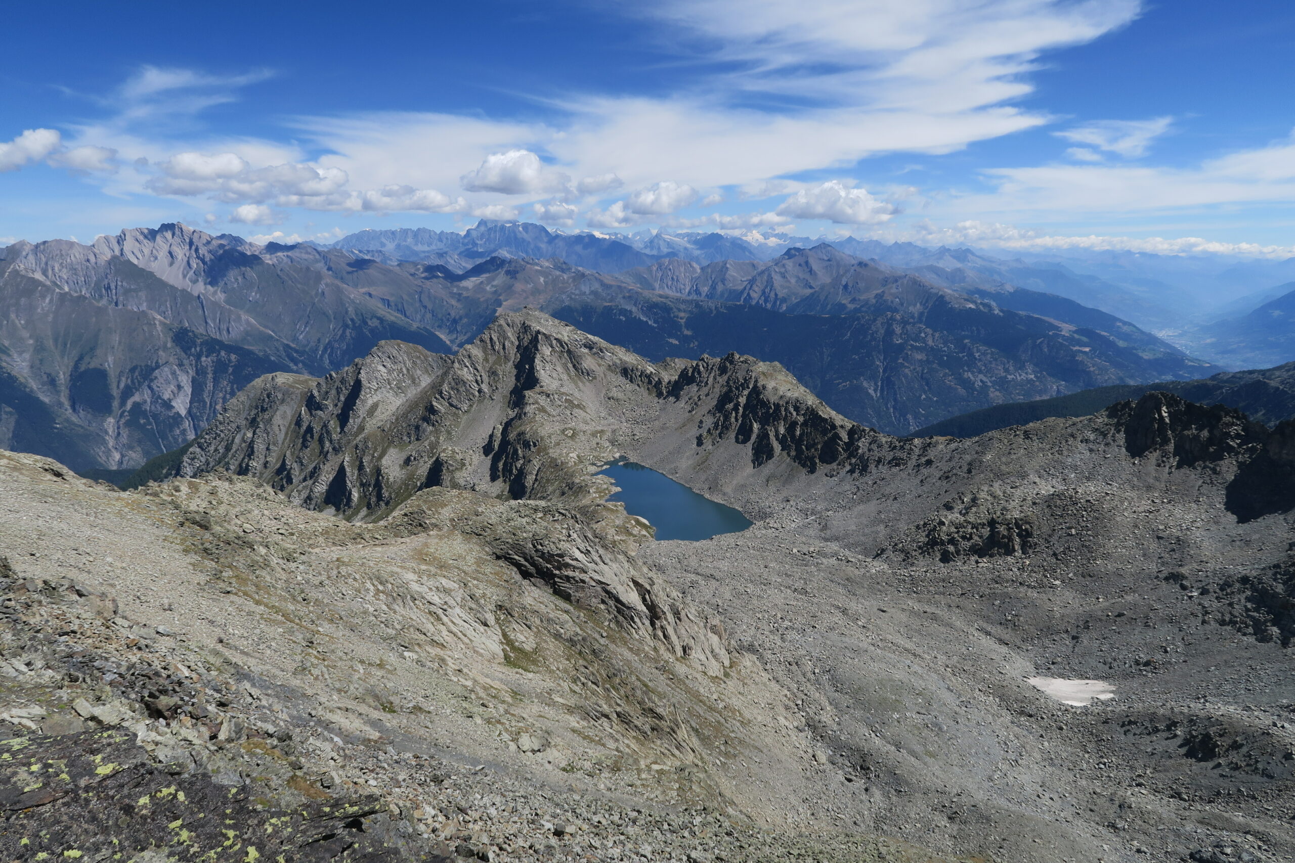
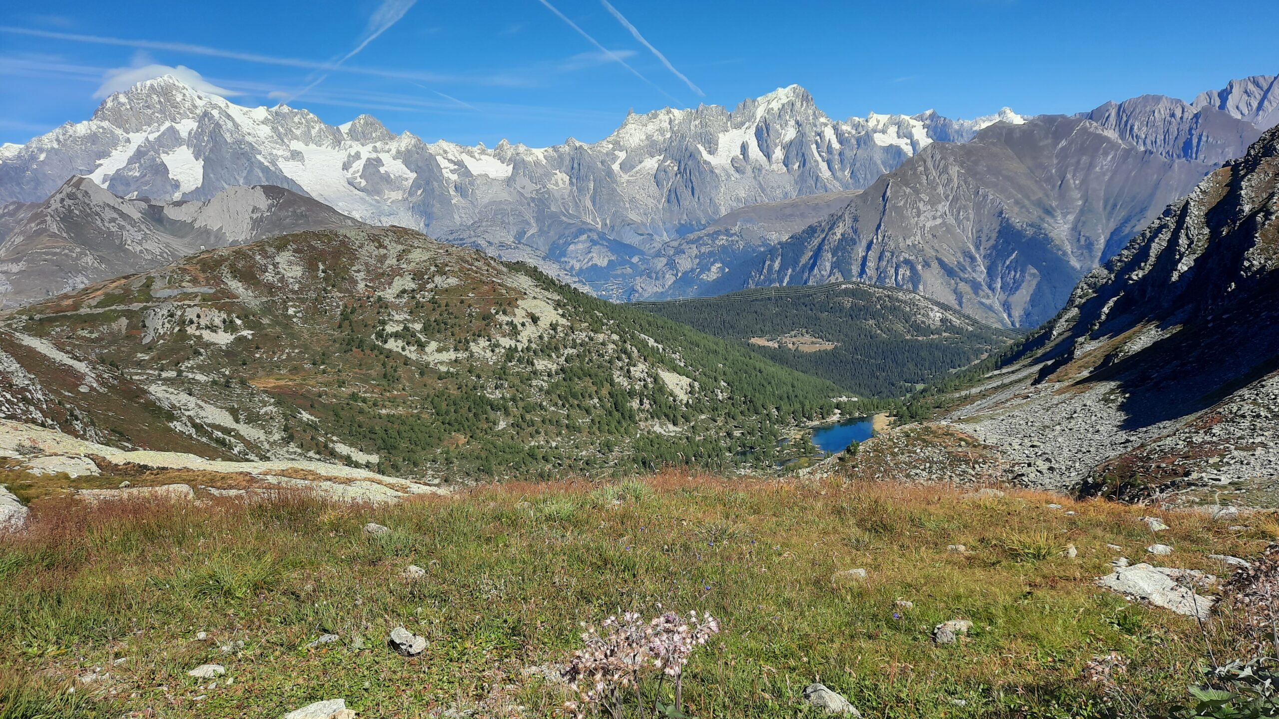
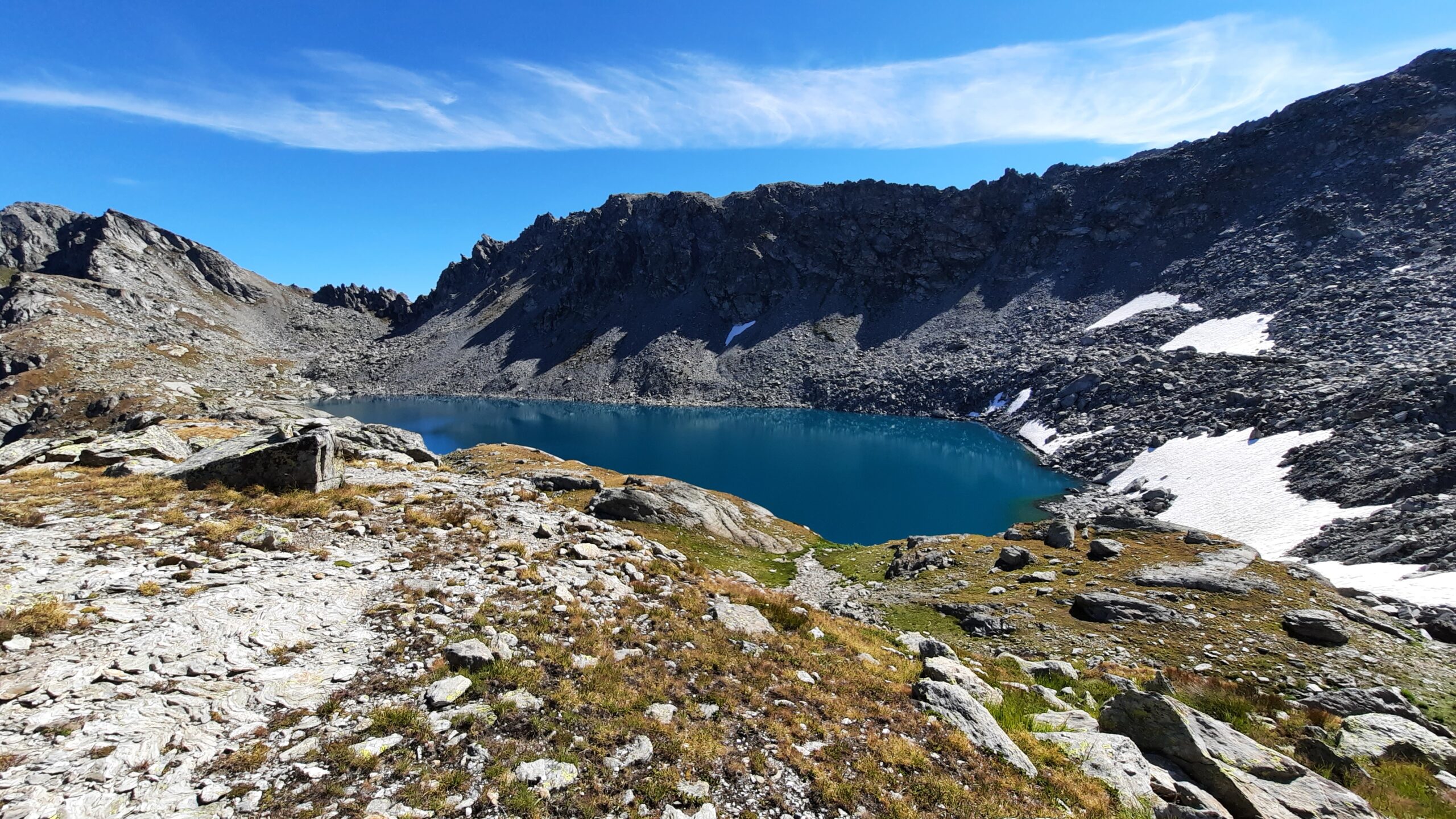
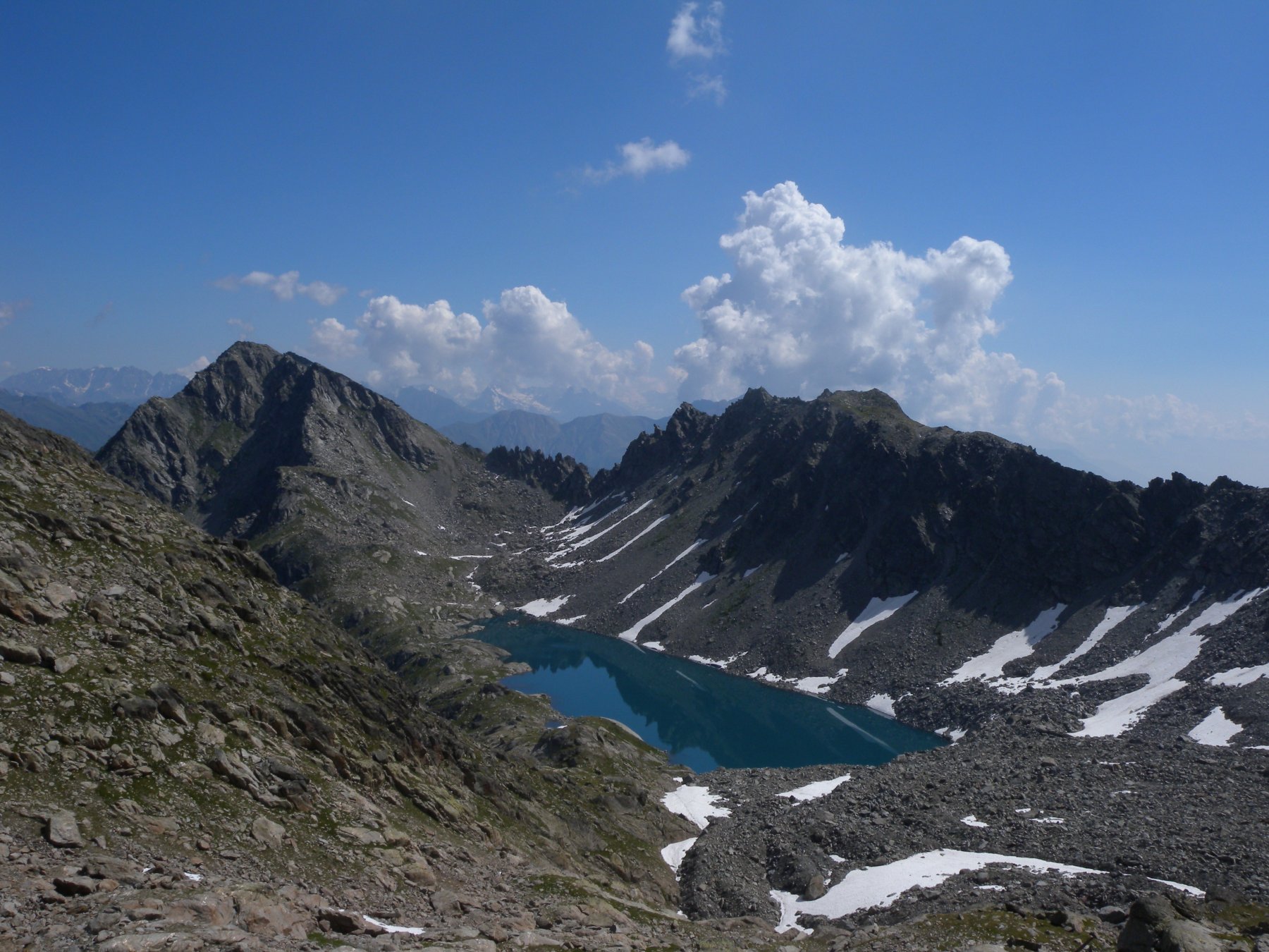
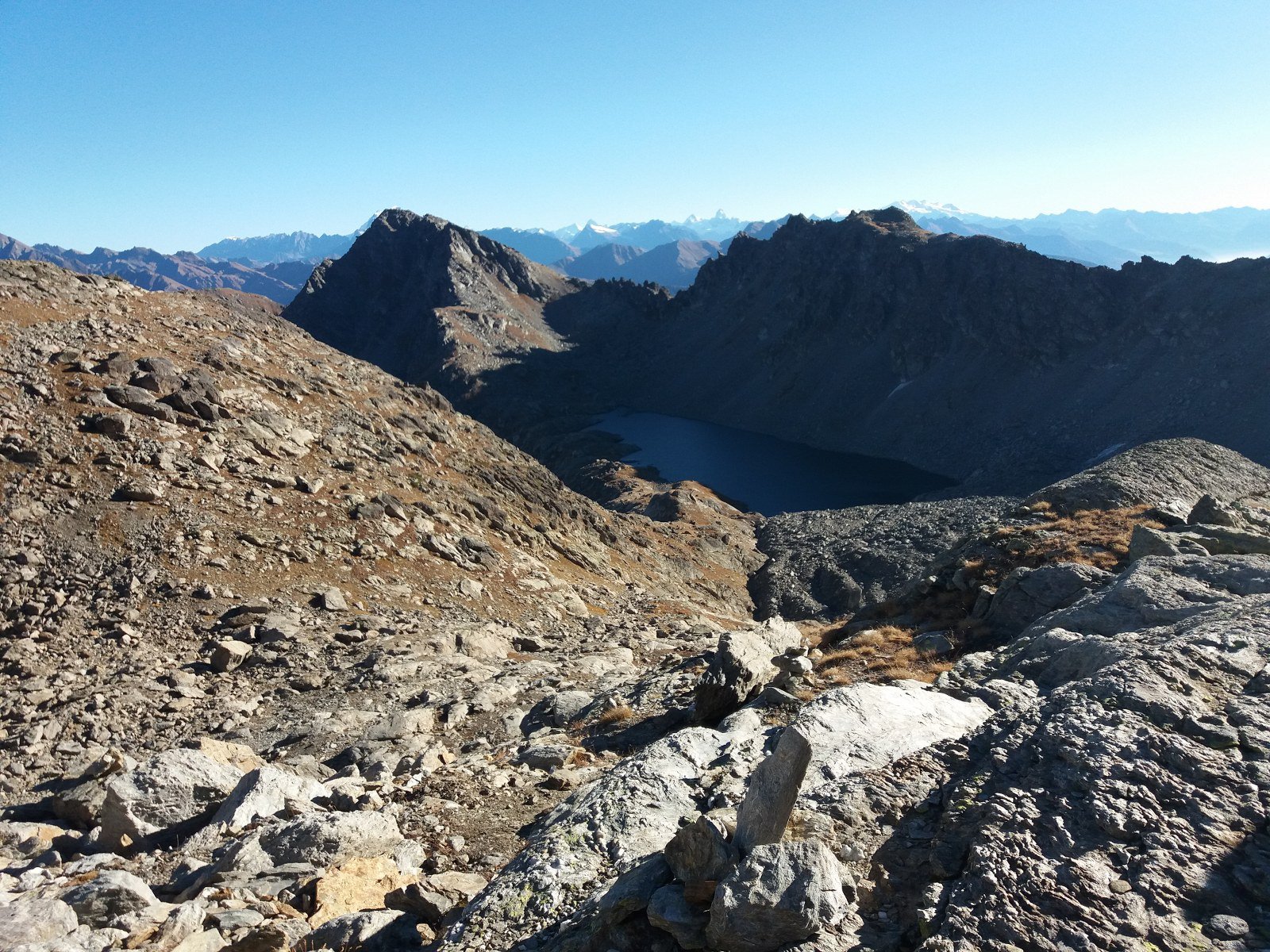
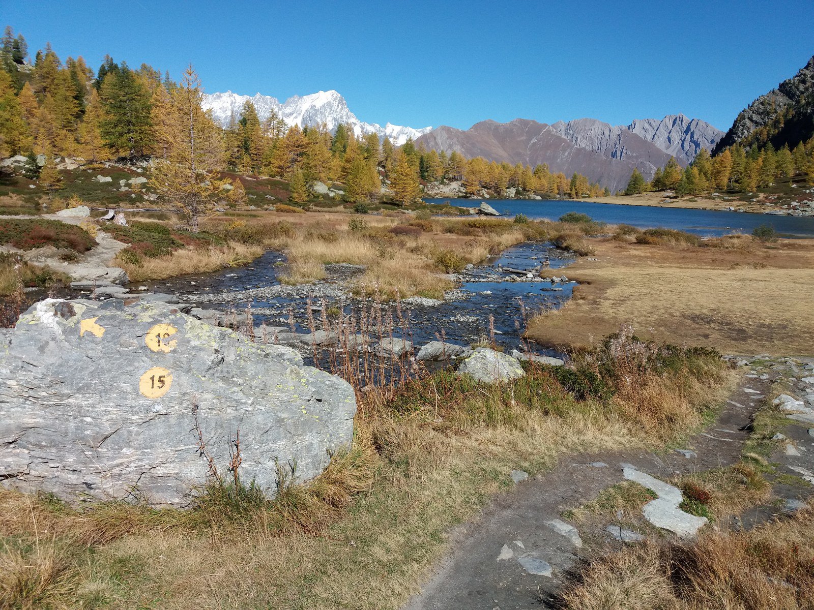
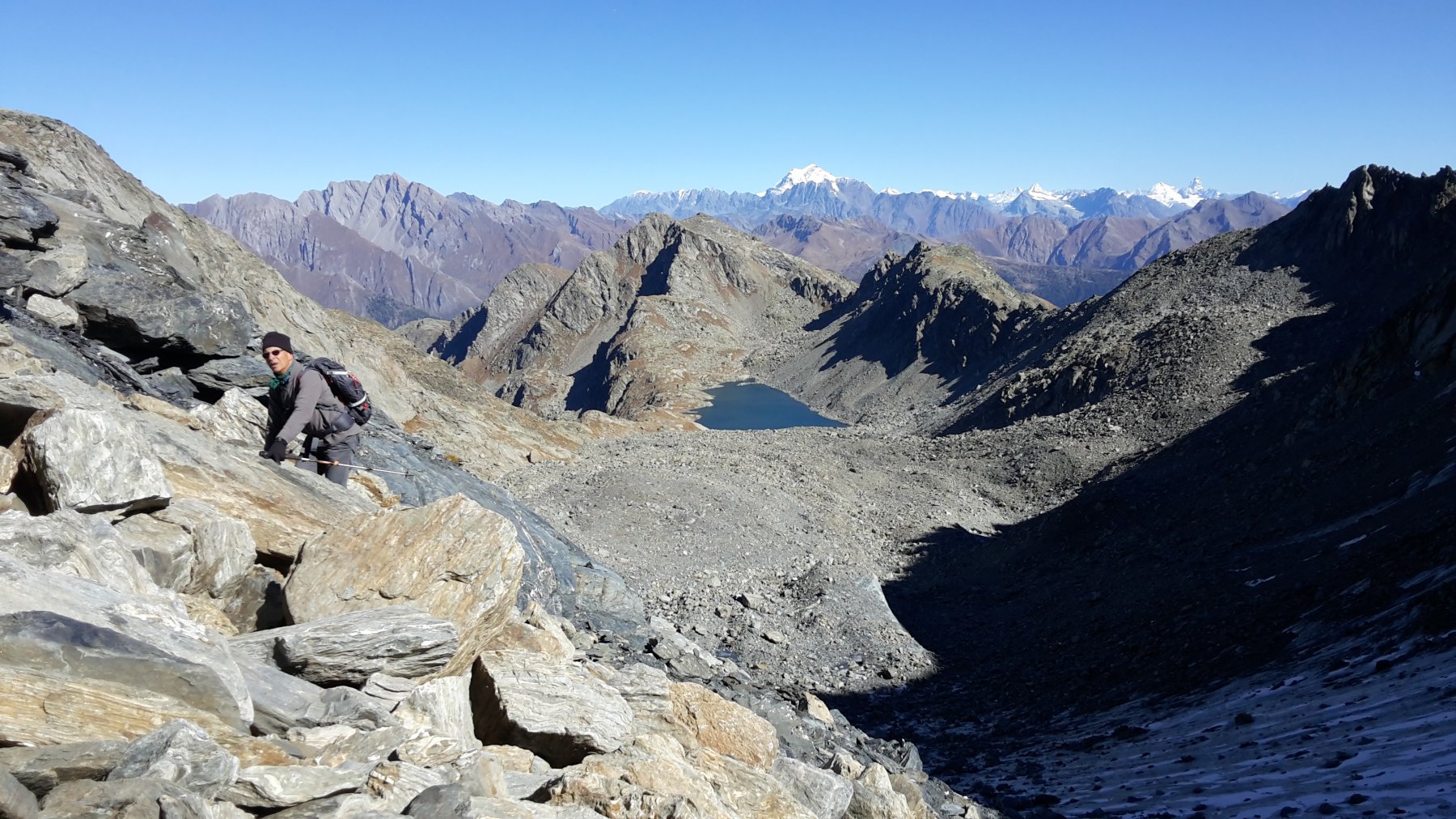
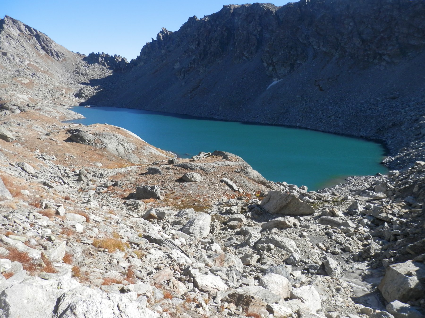
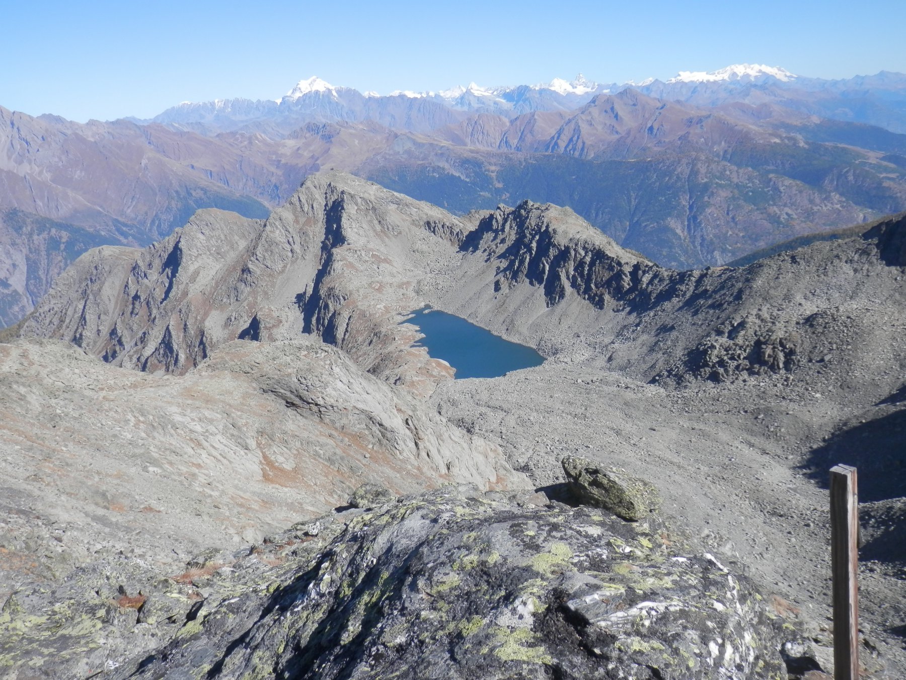
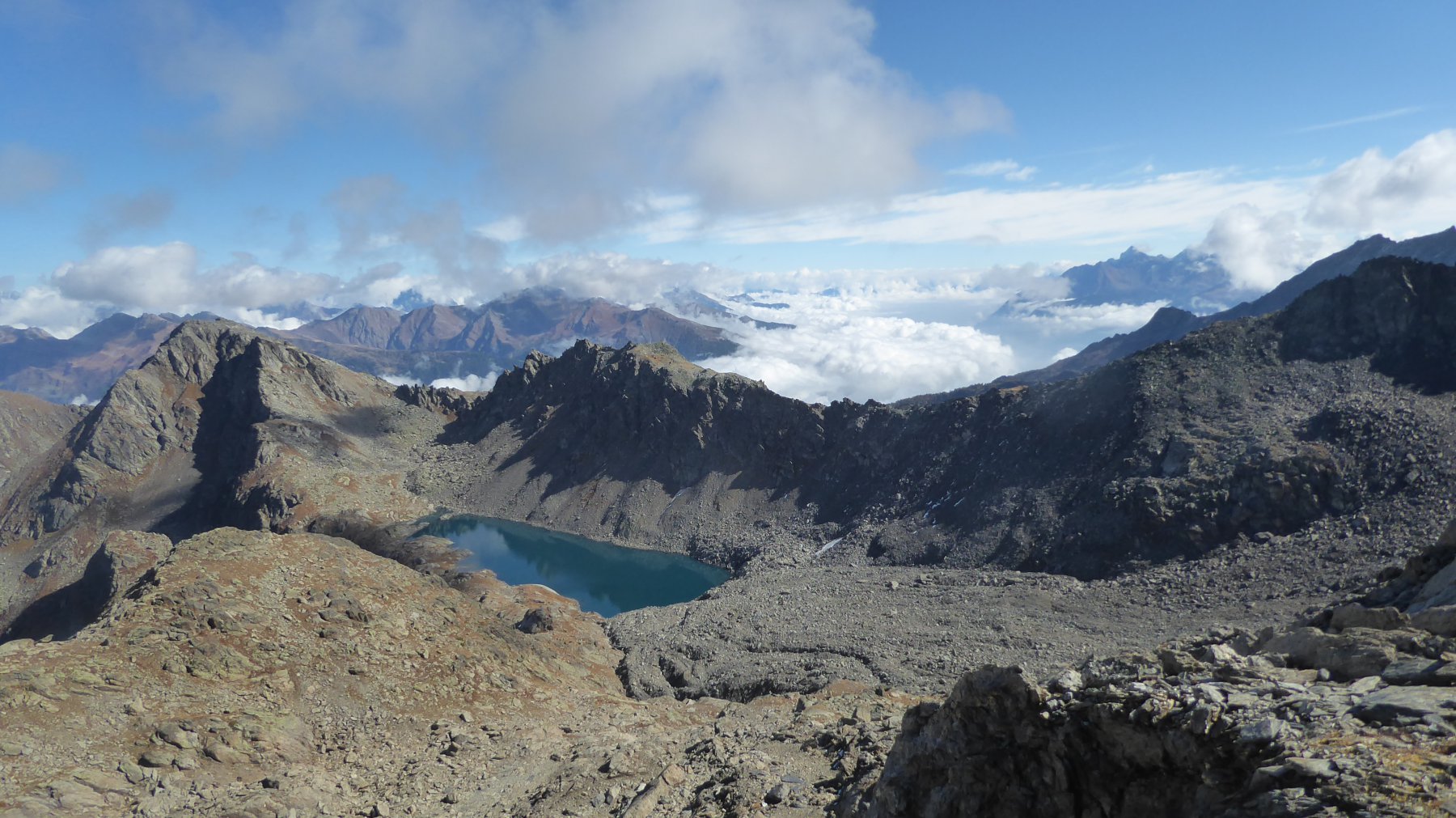
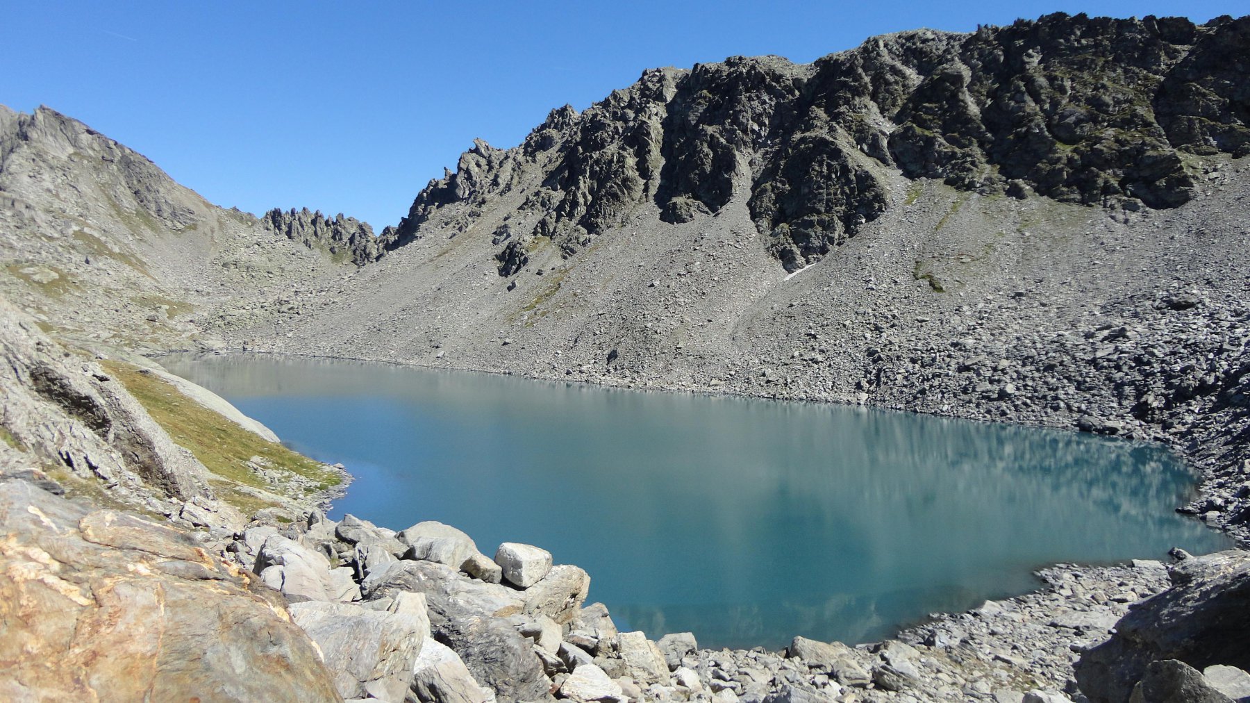
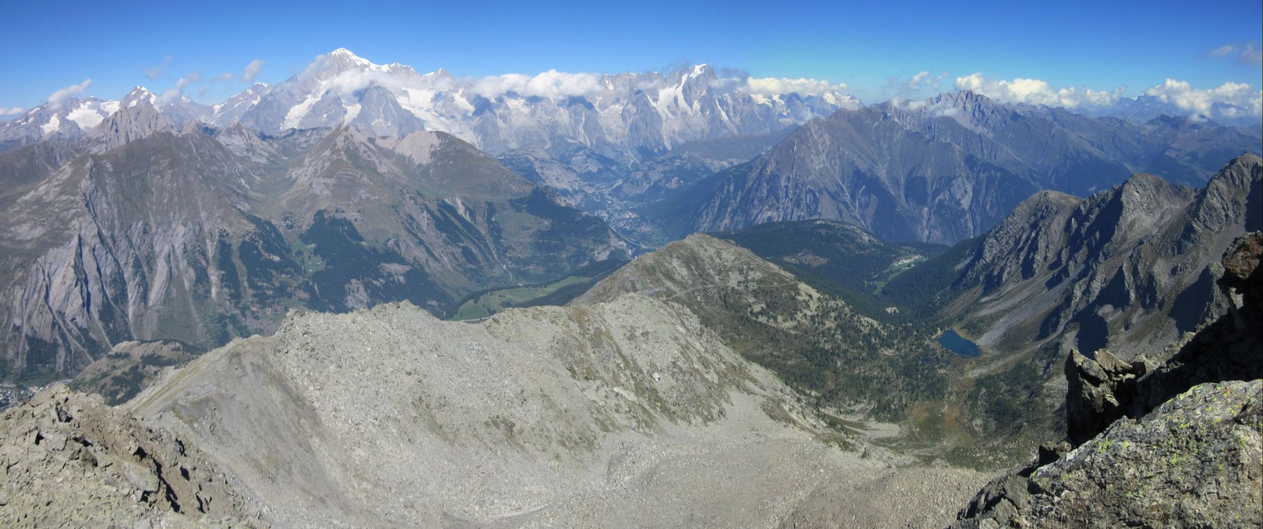
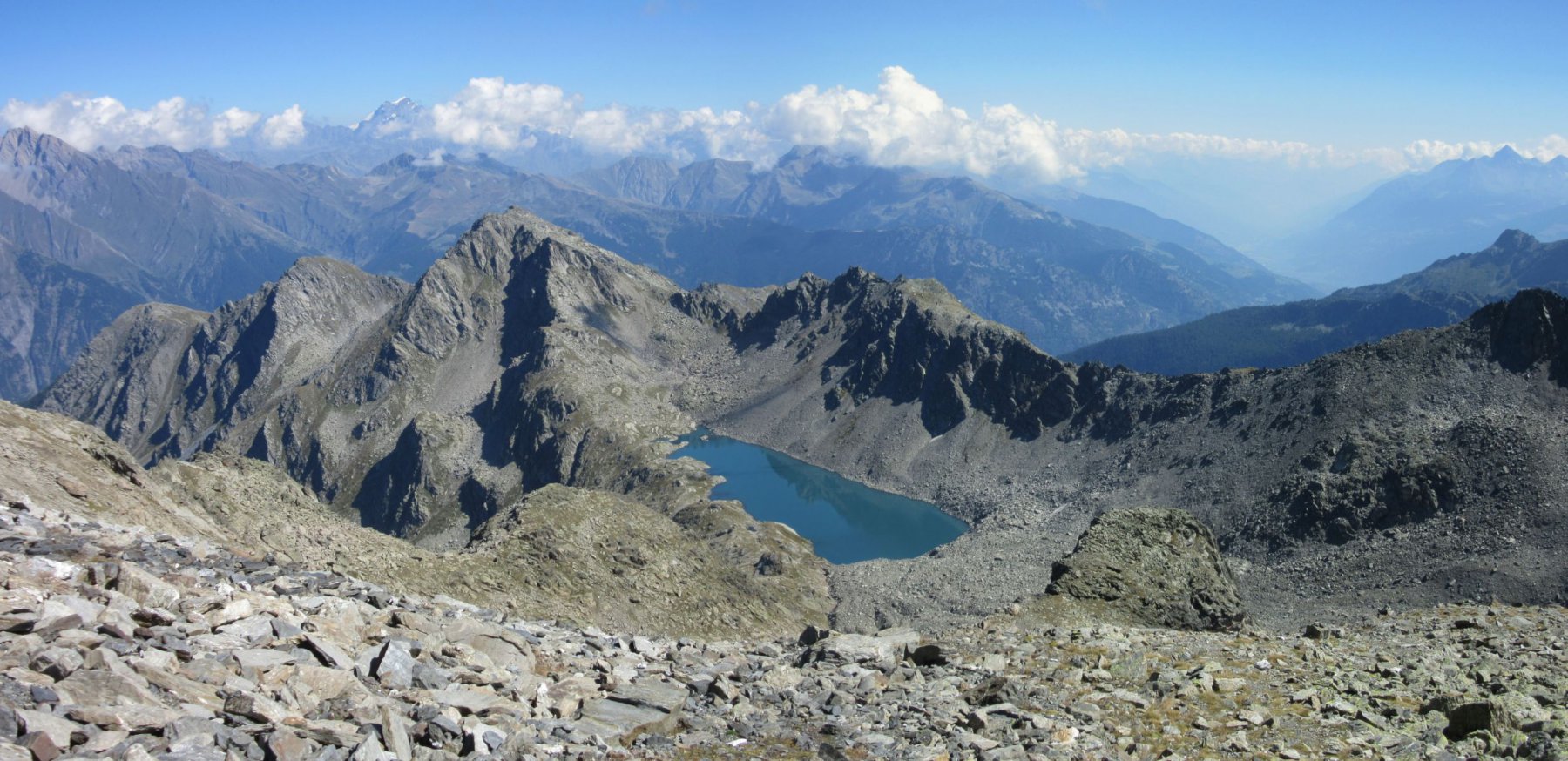
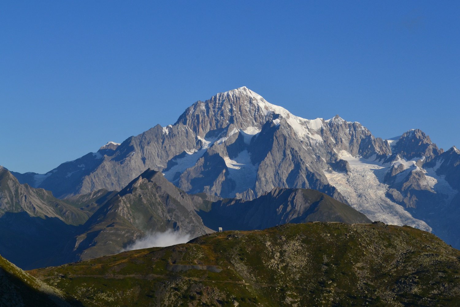
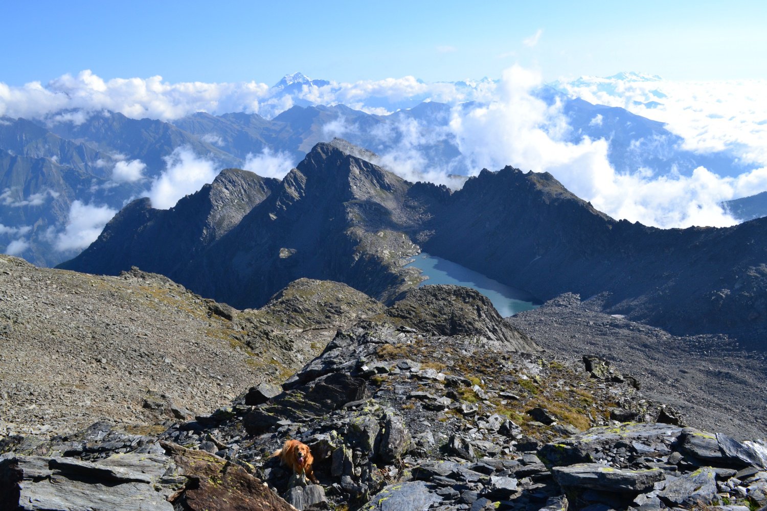
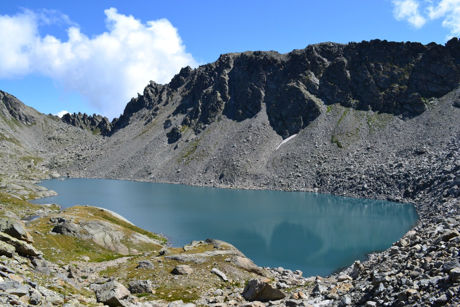
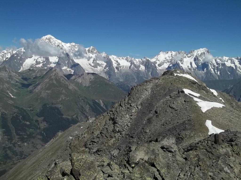
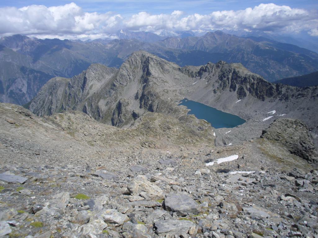
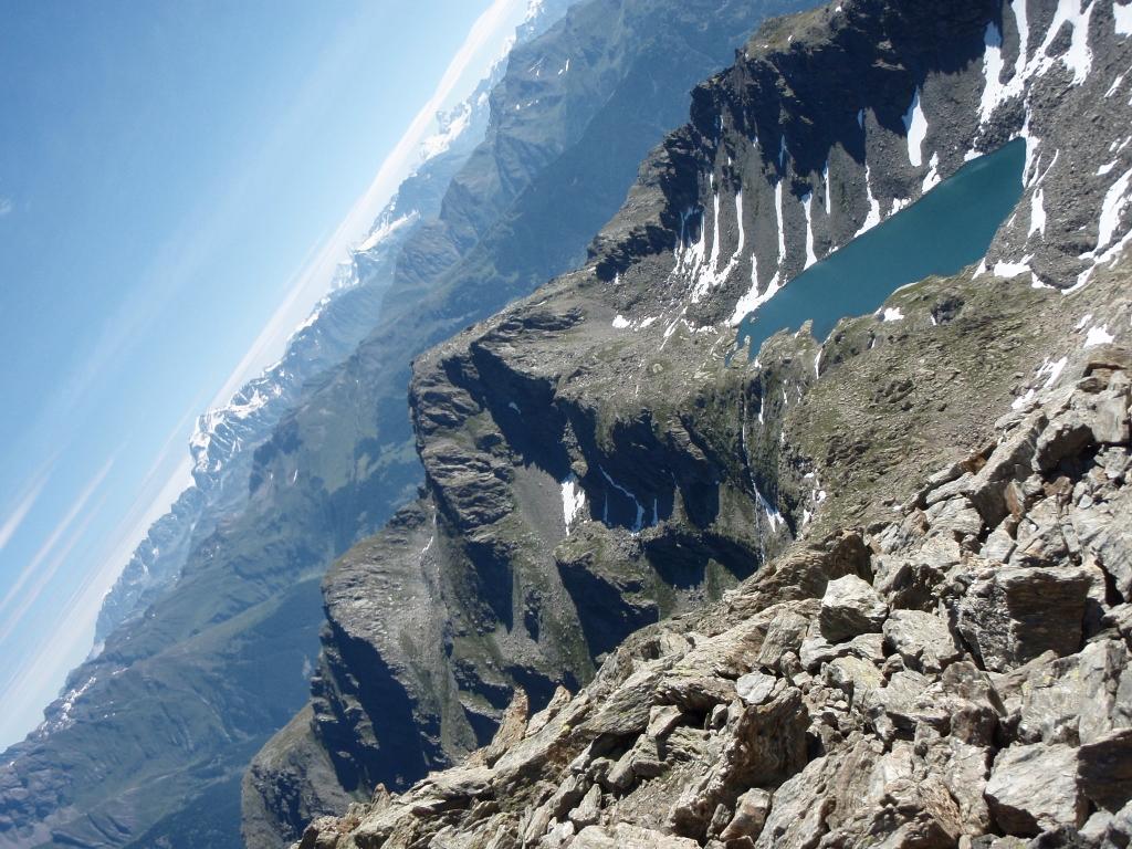
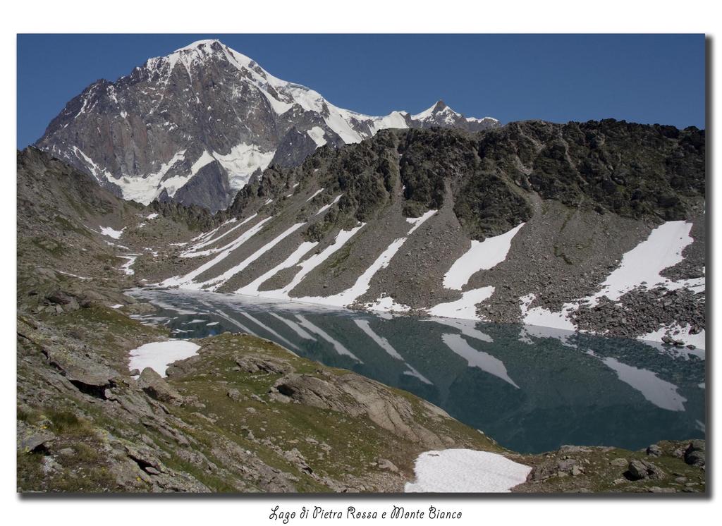
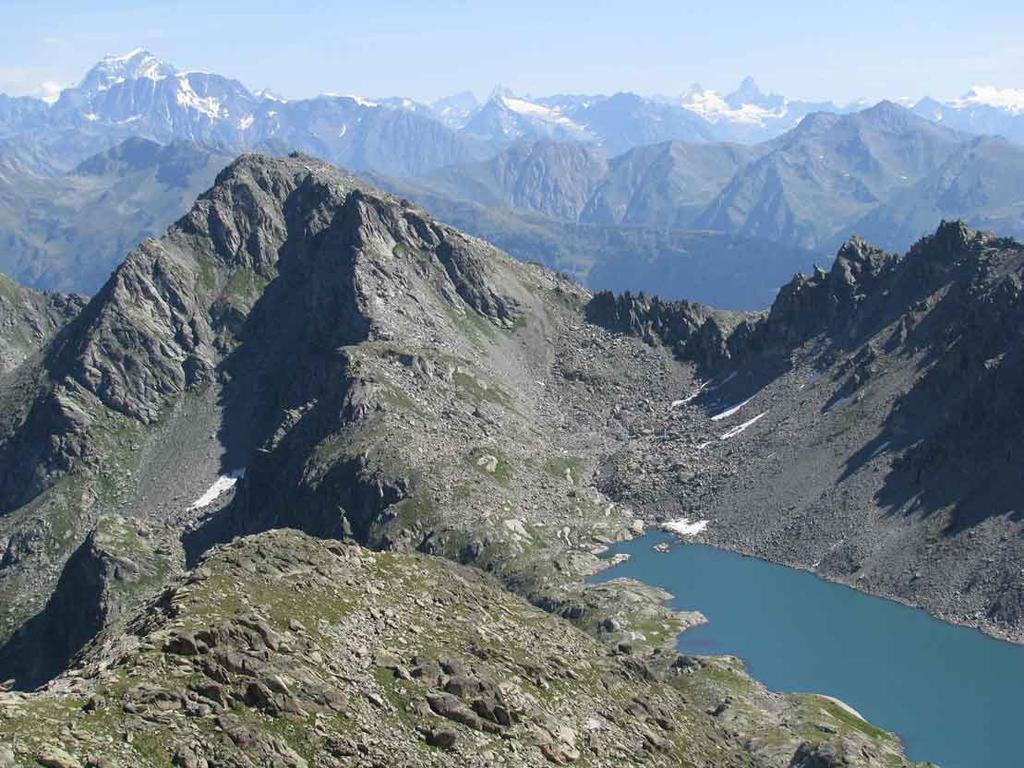
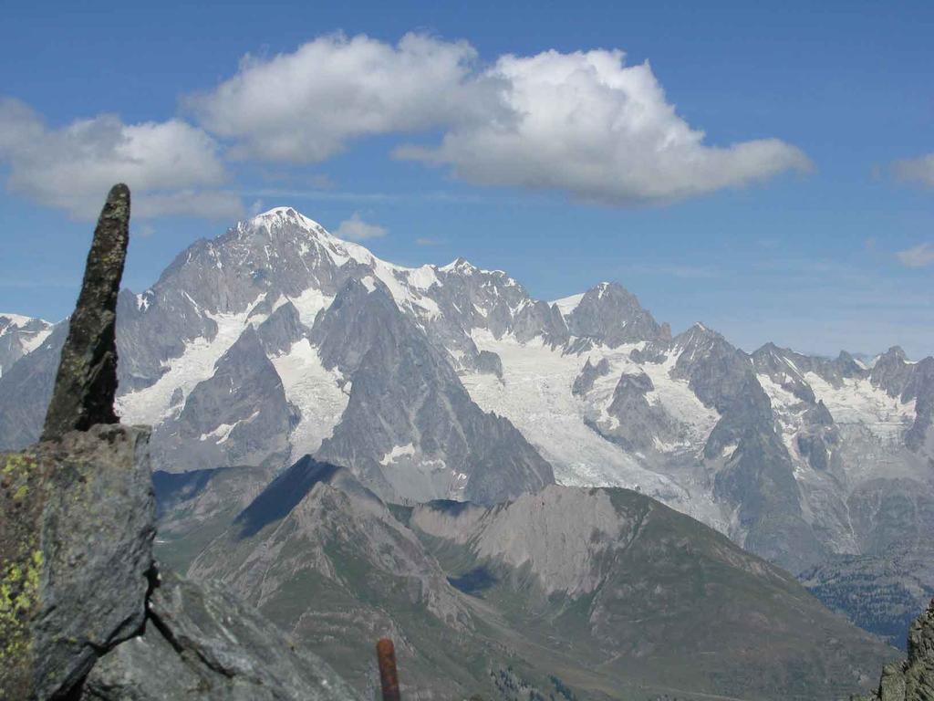
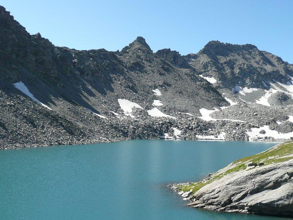
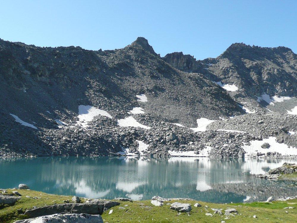
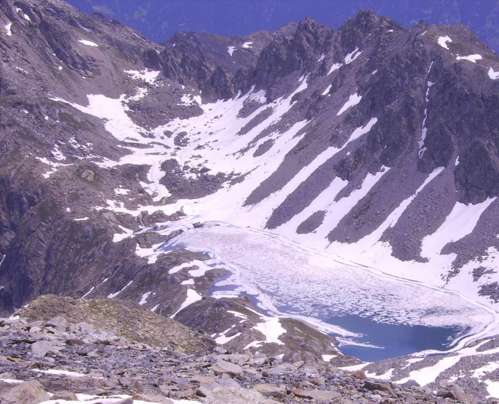
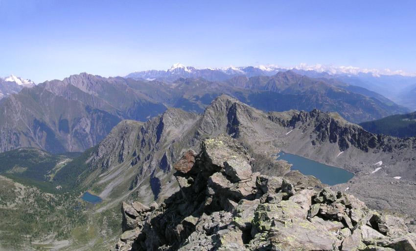
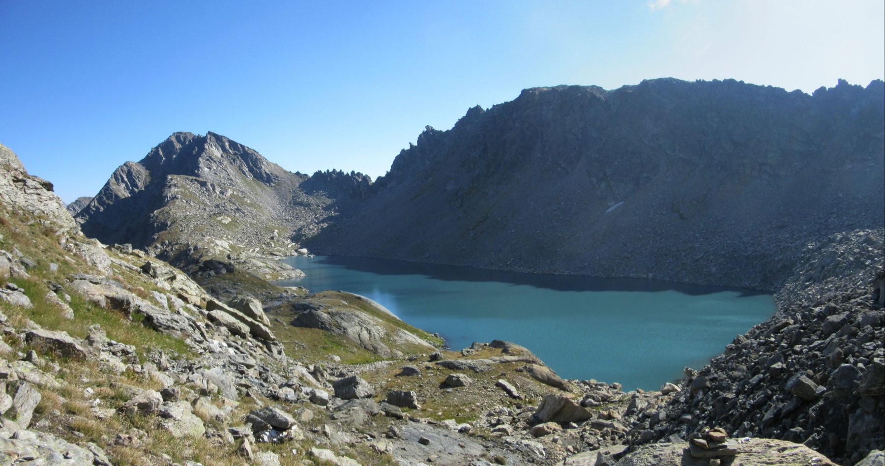
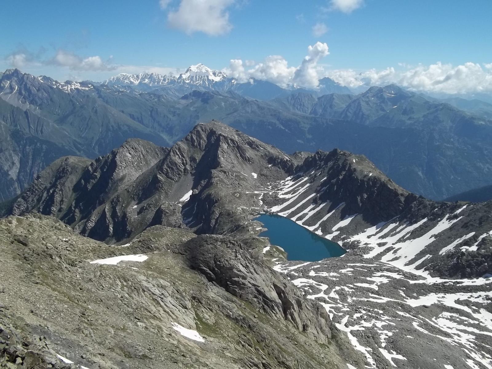
A quota 2600 m si giunge sulla crestina che separa il versante di salita dalla conca del vasto Lago di Pietra Rossa, ben visibile.
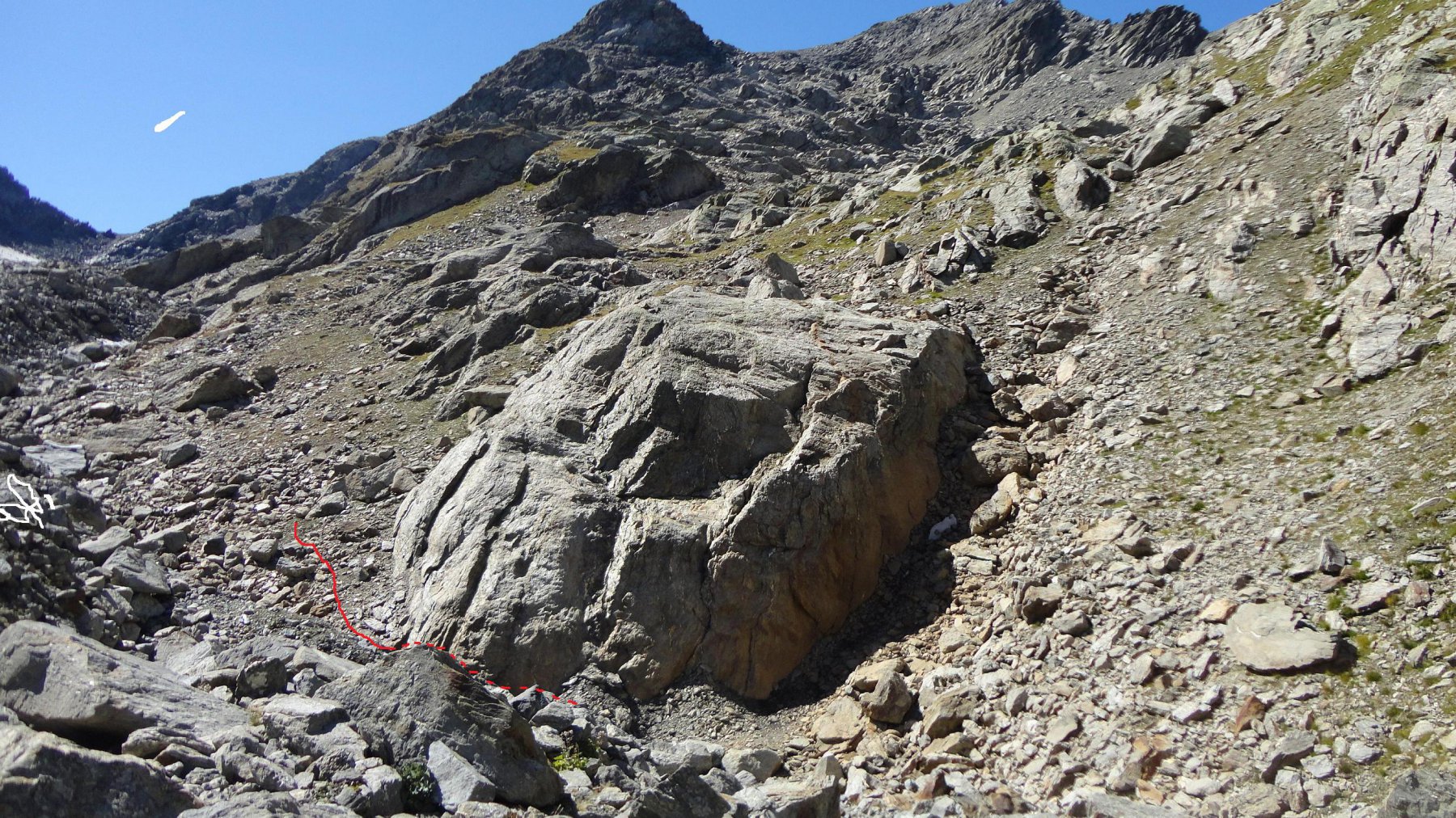
Da qui prendere a destra, ma non seguire la traccia e poi gli ometti che si addentrano sulla morena del vallone che portano ad un lontano colletto con tracce di ghiacciaio, ma cercare il percorso superiore quasi sulla cresta dove dietro un grosso masso c’è una sbiadita indicazione per il Colmet, a cui segue una traccia e alcune frecce di vernice gialla sui massi, che invitano a proseguire aggirando la conca morenica.
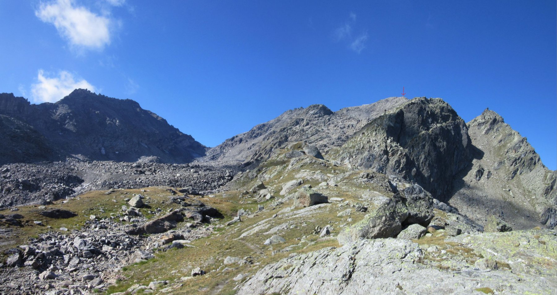
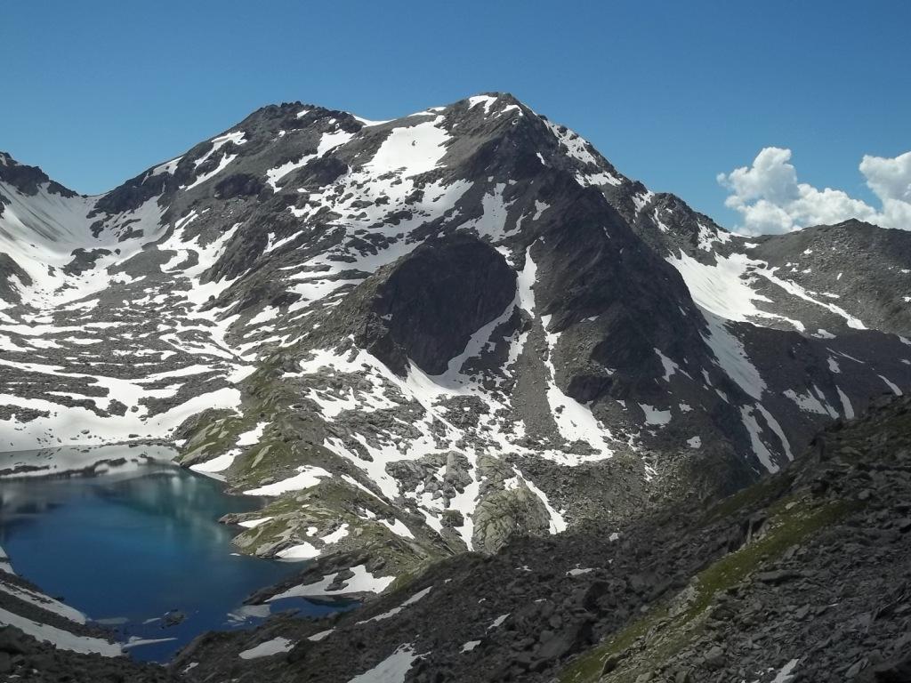
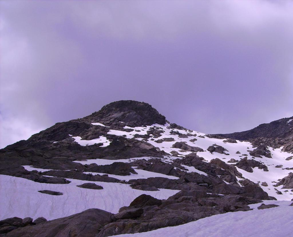
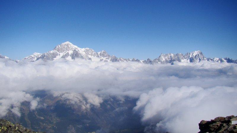
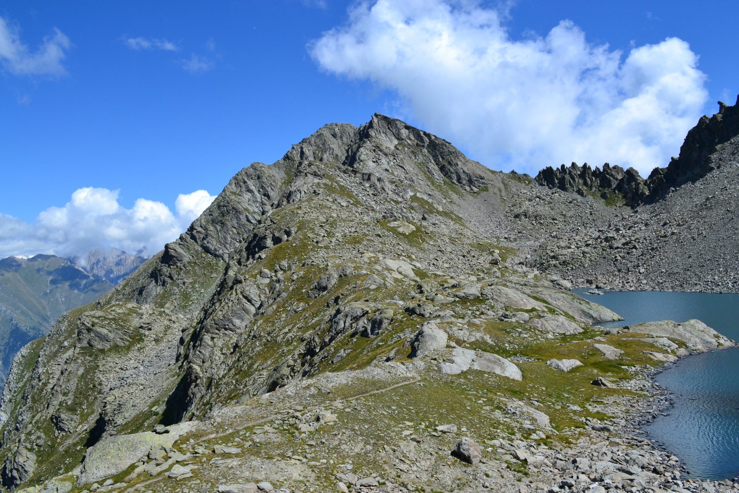
La cima da qui è ben visibile in direzione Ovest, al termine di un vasto pendio di pietrame e nevai residui. Per tracce, ometti e segni di vernice si risale alla meglio questo pendio, portandosi ad una sella detritica poco oltre un promontorio roccioso a 2870 m.
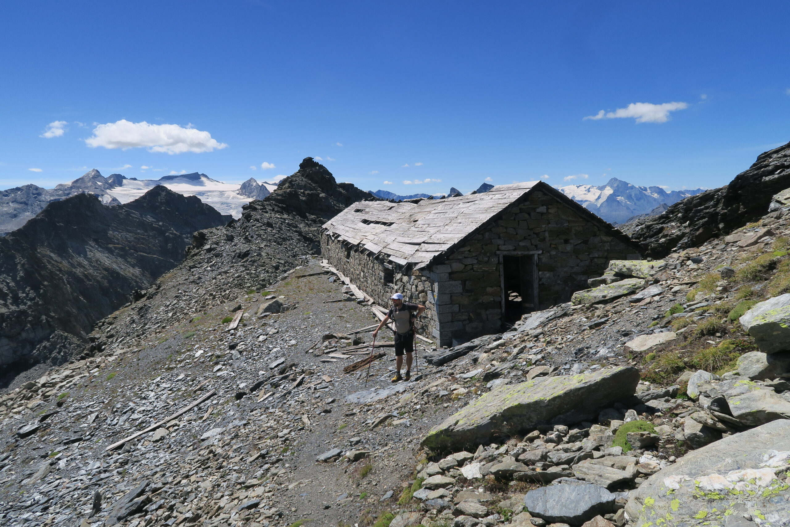
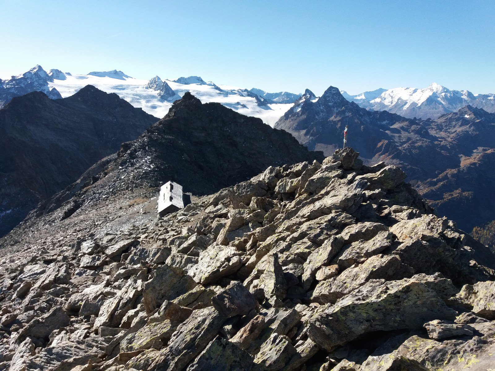
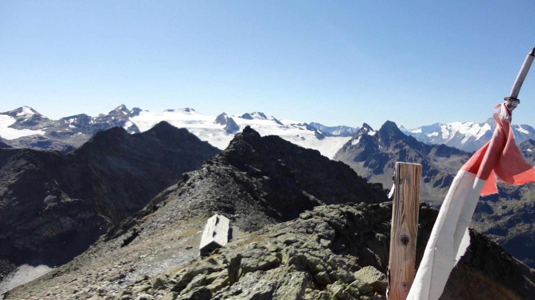
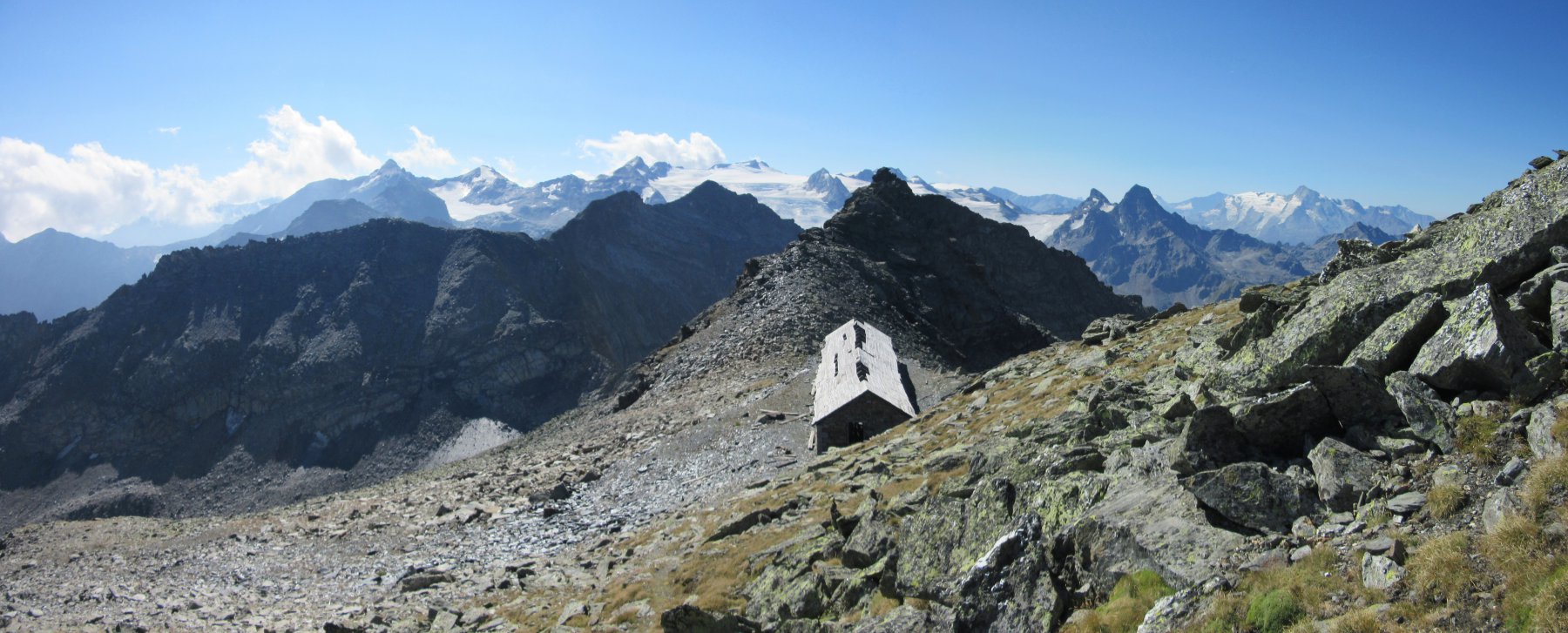
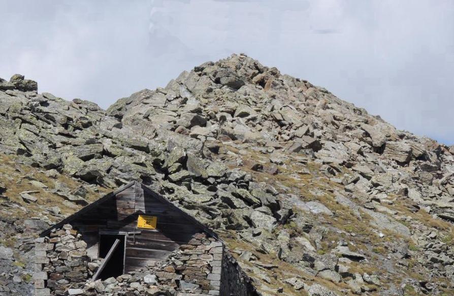
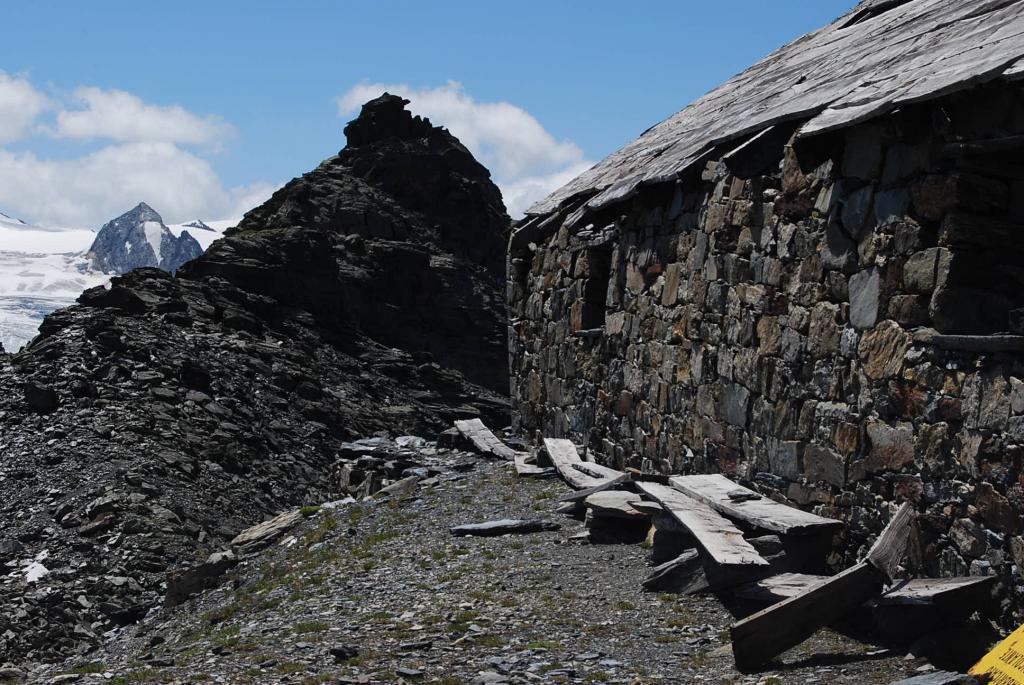
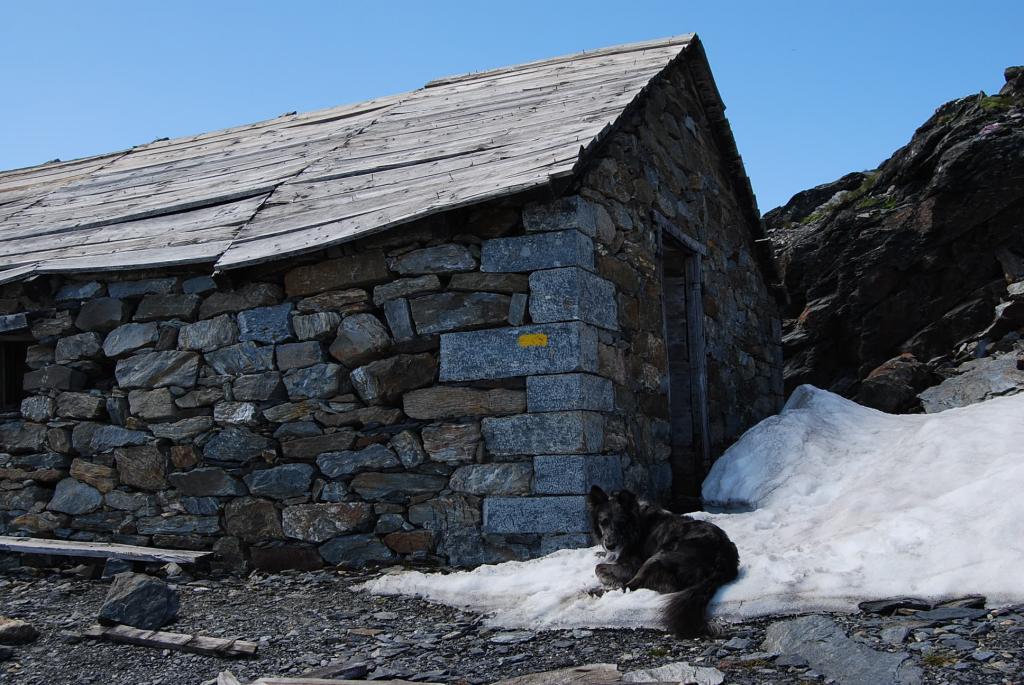
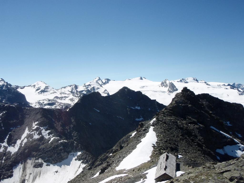
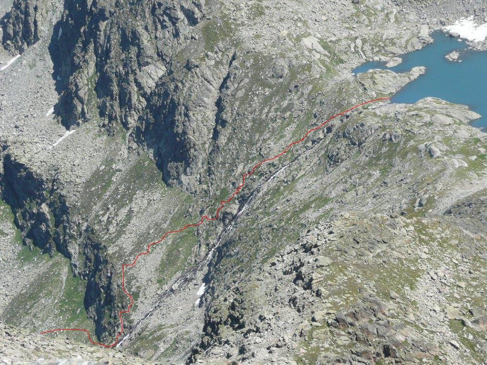
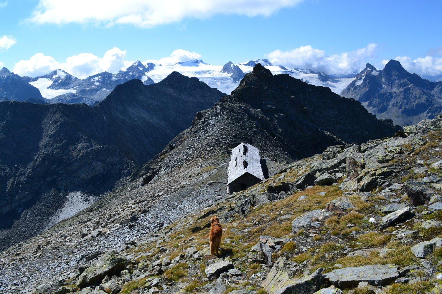
Si continua seguendo la traccia che si districa tra le roccette e i detriti lungo una dorsale, che precede un breve pendio detritico, poco sotto il Ricovero Tenente Chabloz (diroccato e pericolante) 2993 m.
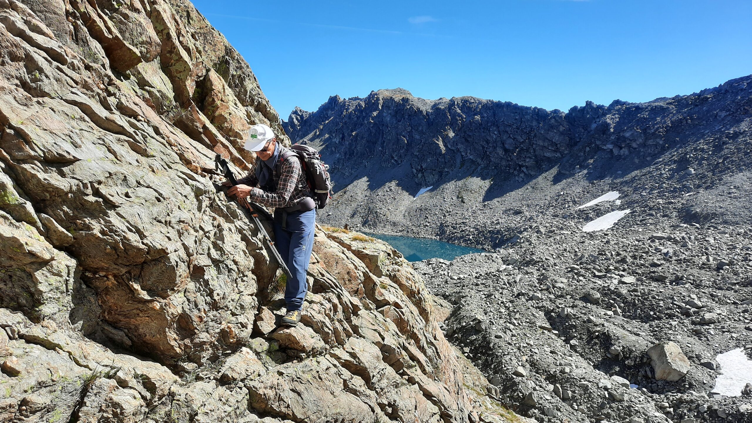
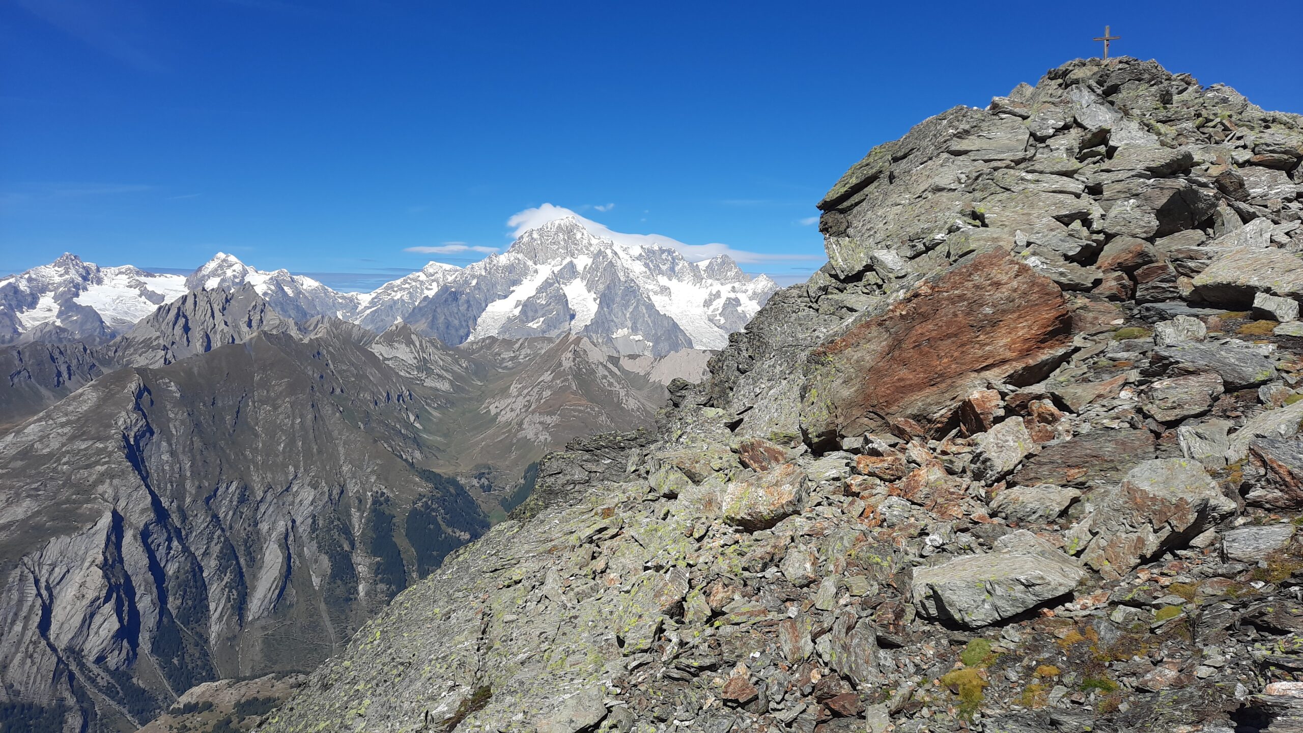
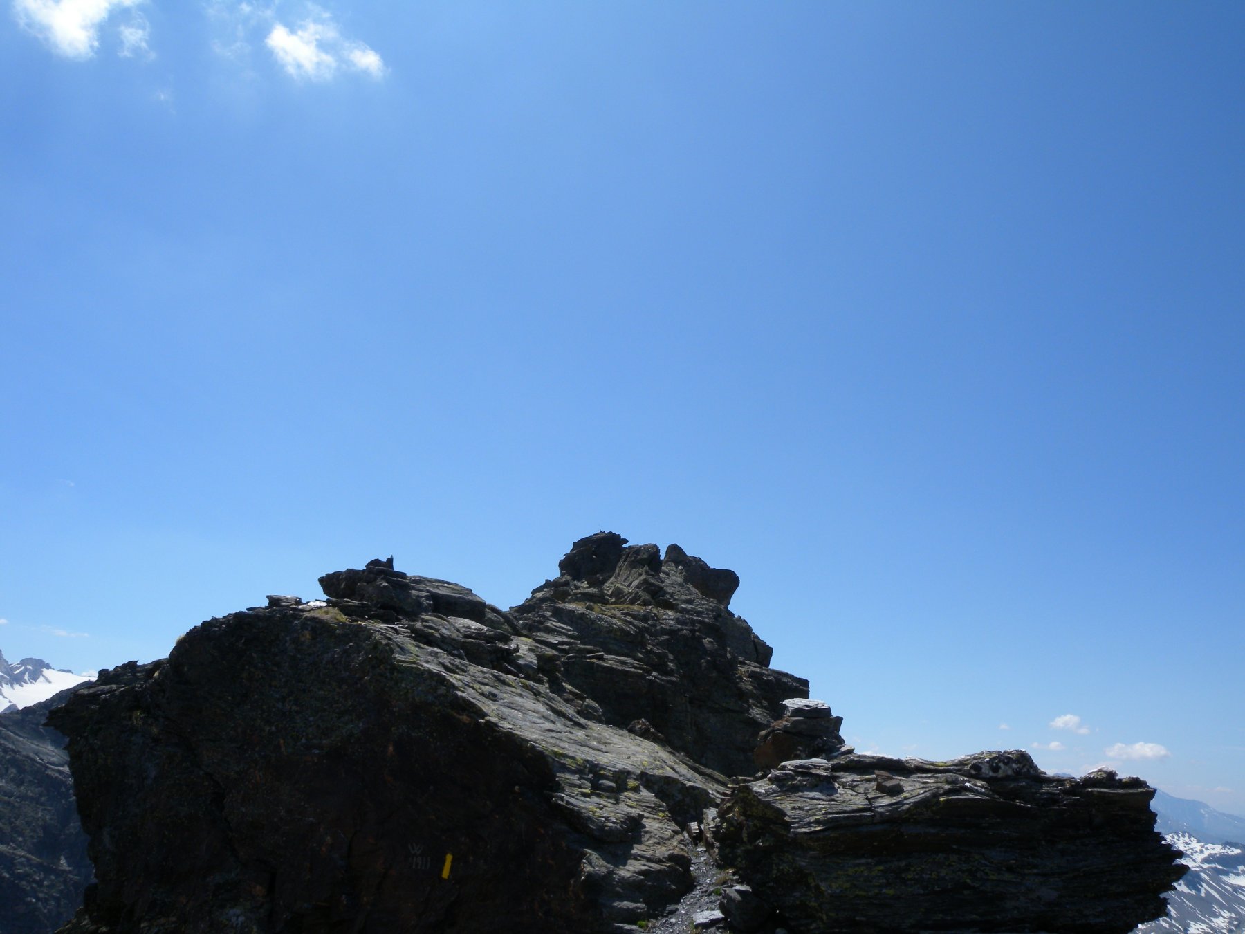
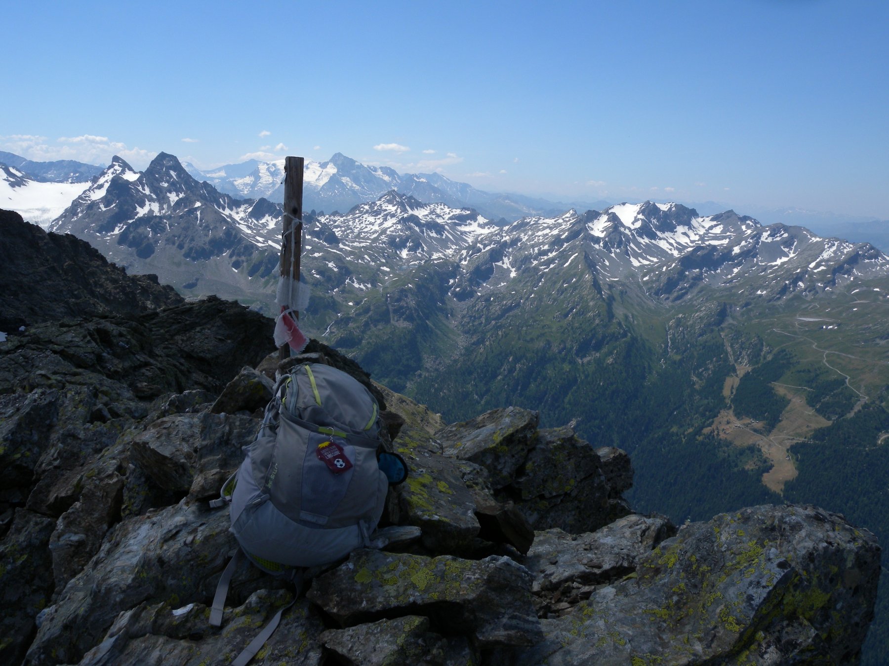
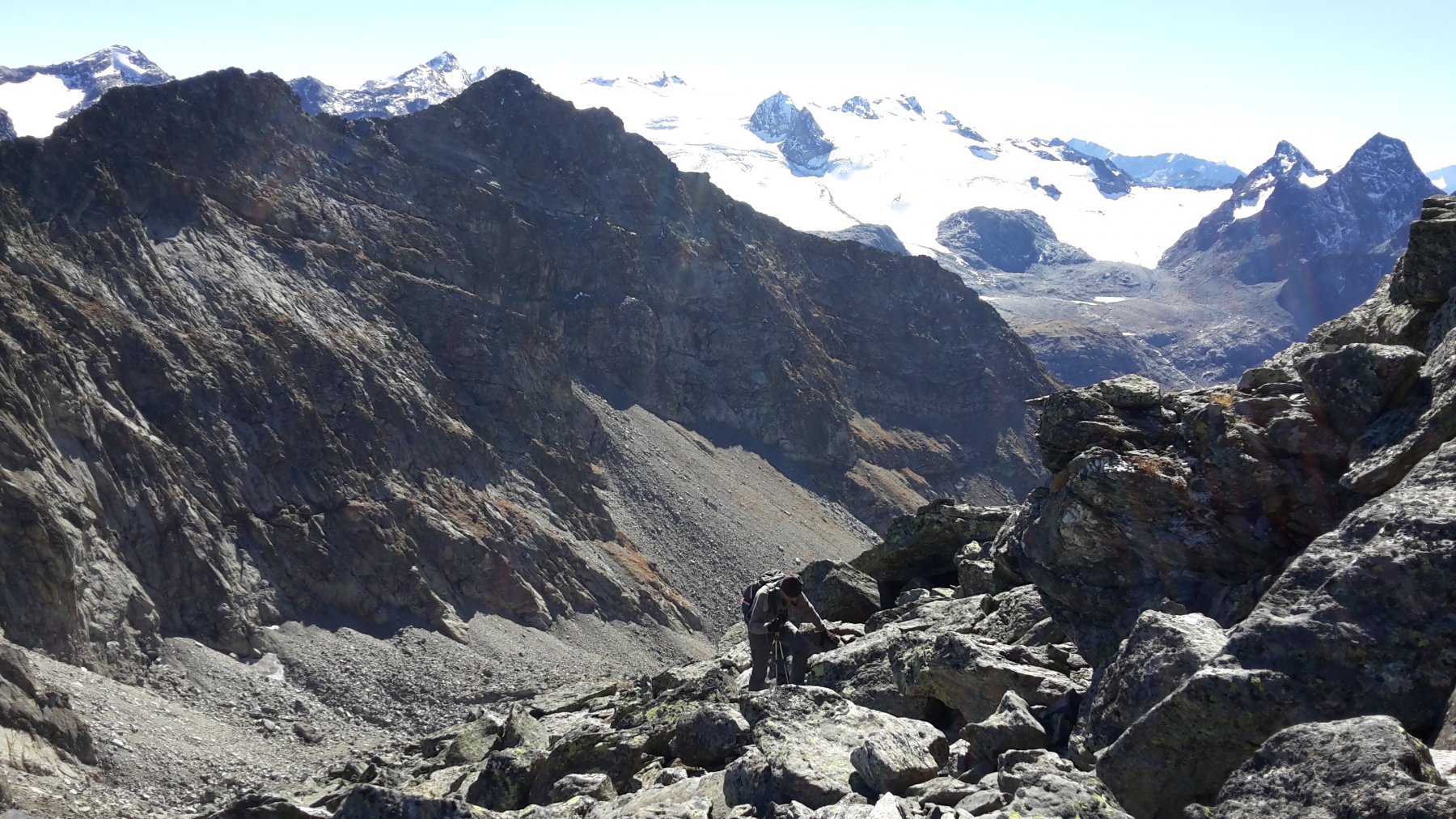
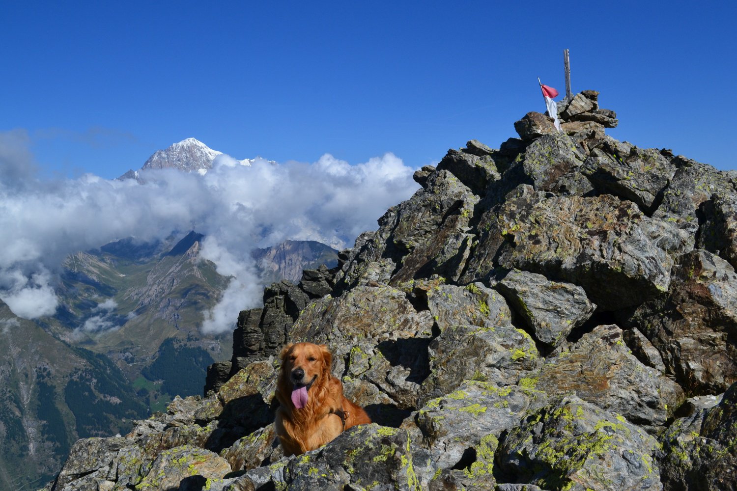
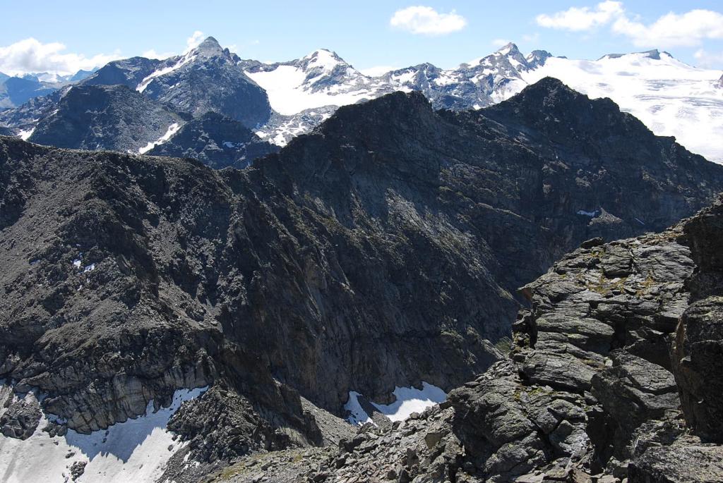
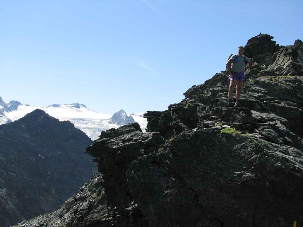
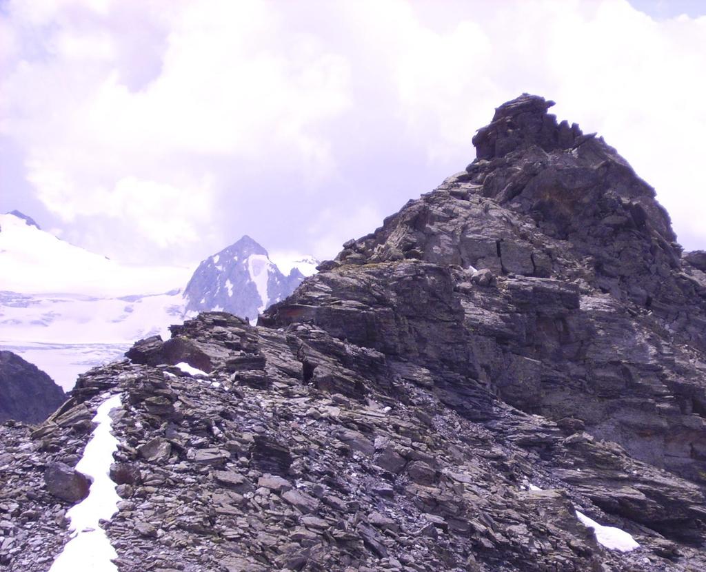
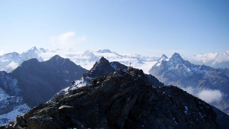
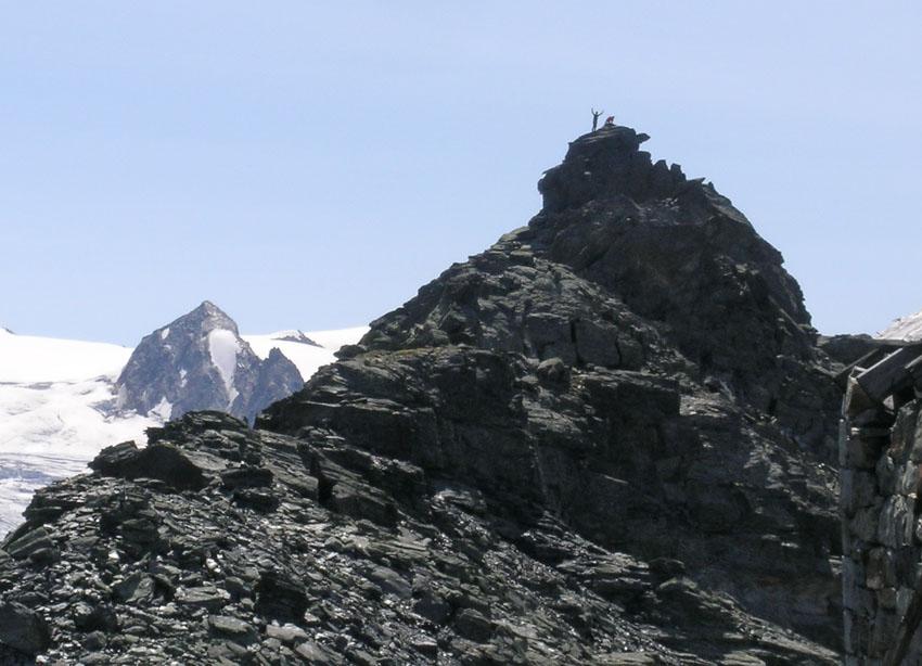
Da questo a destra in pochi istanti si perviene sulla cima nord quotata 3014 m. Per la cima sud invece, occorre ritornare al ricovero e proseguire per la dorsale in direzione sud, fino a che questa presenta un salto roccioso.
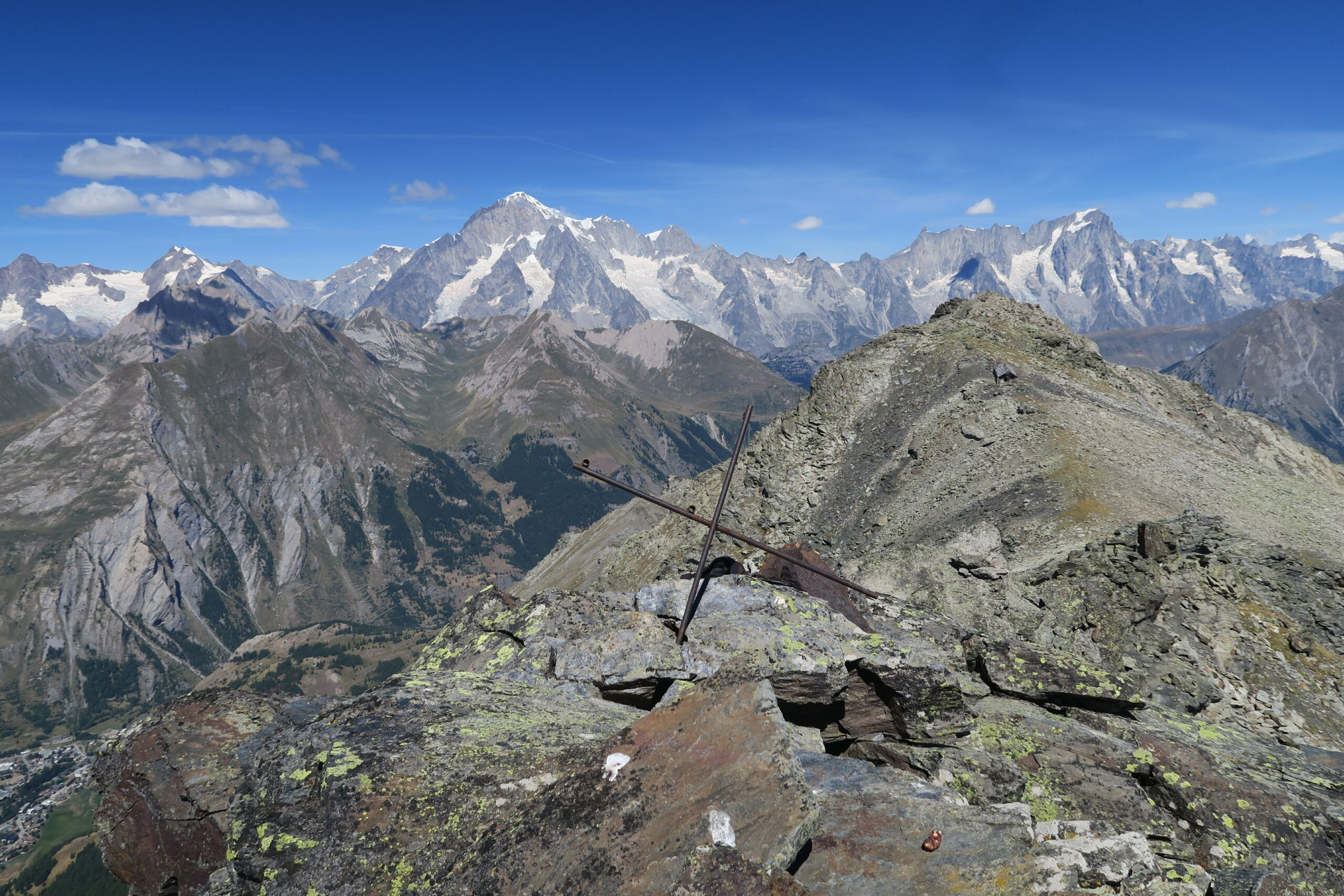
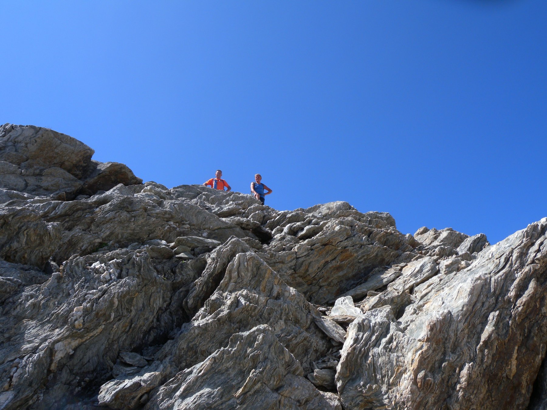
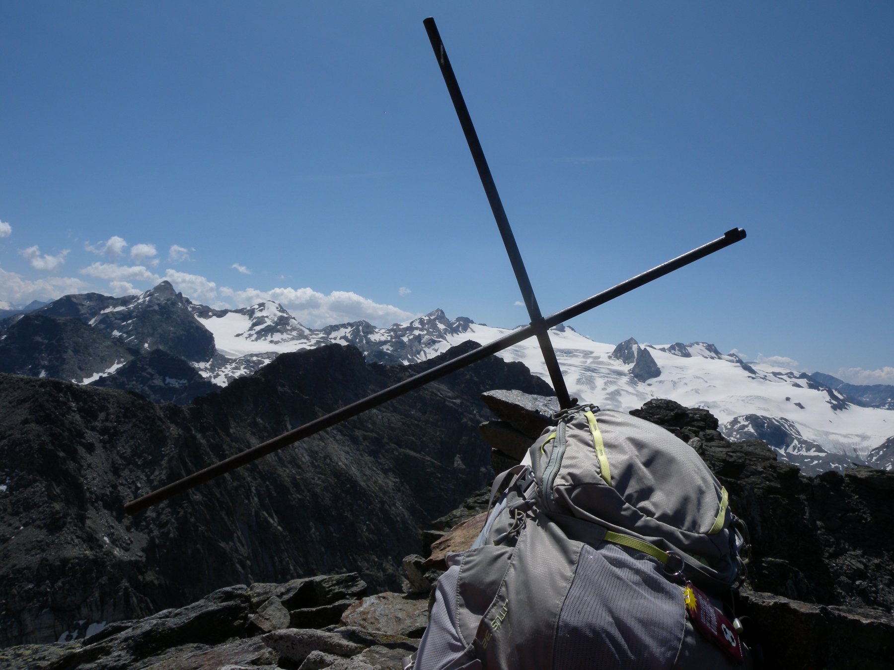
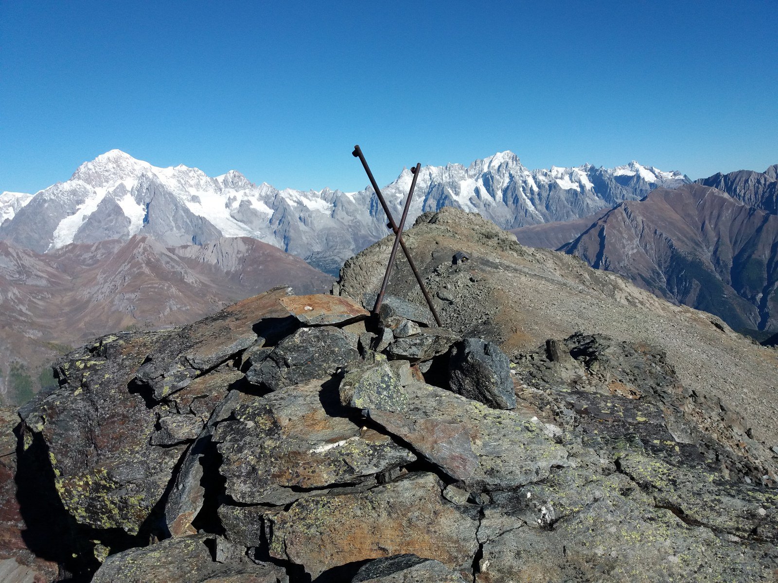
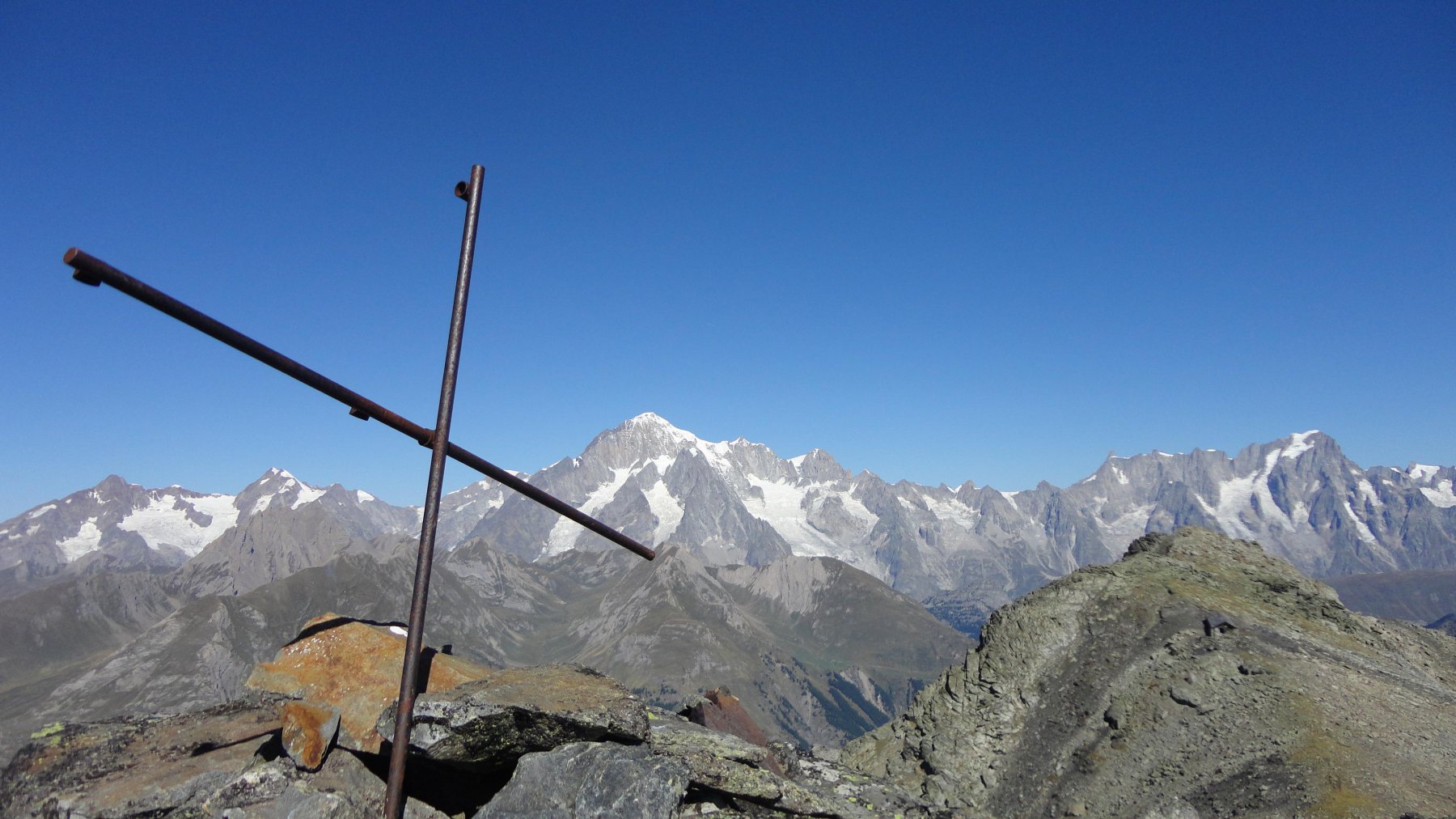
Si scende per aggirarlo sul versante est, dove aiutandosi con gli ometti presenti si alternano tratti di sentiero tra pietraia e sfasciumi, a gradoni rocciosi con passaggi di II. Mantenendosi sempre sotto il filo di cresta, si supera la cima, e poi si risale con ultimi passi di arrampicata fino alla minuscola cima con una piccola croce 3024 m.
- Cartografia:
- IGC. 1:25000 n. 107 M. Bianco - Courmayeur - Chamonix - La Thuile
- Bibliografia:
- Guida Monti Italia - Alpi Graie Centrali - it. 153a - 154a
Nelle vicinanze Mappa
Itinerari
26/07/2025 AO, Morgex D+ 71 m T Sud-Ovest
Arpy (Tete d’) dal Colle San Carlo
 50m
50m
17/10/2025 AO, Morgex D+ 410 m E Est
Croce (Punta e Colle della) dal Colle San Carlo per il Lago d’Arpy
 50m
50m
20/09/2025 AO, Morgex D+ 856 m E Varie
Pouegnenta o Pougnenta (Becca) dal Colle San Carlo per il Lago d’Arpy e Lago di Pietra Rossa
 50m
50m
06/09/2015 AO, Morgex D+ 900 m EE Nord-Ovest
Colmet (Col) dal Colle San Carlo
50m
28/06/2026 AO, Morgex D+ 190 m T Nord
Arpy (Lago d’) dal Colle San Carlo
 50m
50m
16/08/2021 AO, Morgex D+ 1200 m EE/F Nord
Colmet (Col) dal Colle San Carlo
50m
26/05/2018 AO, Pré-Saint-Didier D+ 664 m E Nord
Arpy (Villaggio) da Pré-Saint-Didier
 2.4Km
2.4Km
22/07/2017 AO, Pré-Saint-Didier D+ 1483 m EE Varie
Jeunes (Tete des), anticima 2706 m da Elevaz per Plan Praz
 2.7Km
2.7Km
19/10/2025 AO, Pré-Saint-Didier D+ 1392 m E Sud-Est
Crammont (Mont) da Elevaz, anello per Plan Praz
 2.7Km
2.7Km
17/05/2014 AO, La Thuile D+ 1355 m EE Sud
Torrent (Vallone) colle 2657 m da Elevaz, anello nel Vallone di Youlaz
 2.7Km
2.7Km