1.1Km
1.1Km
Note
 50m
50m
50m
50m
50m
950m
2.6Km
2.6Km
2.6Km
50m
50m
50m
50m
50m
950m
2.6Km
2.6Km
2.6Km
Escursione molto lunga per lo sviluppo, ed il dislivello effettivo è maggiore di quello nominale a causa di alcune perdite di quota.
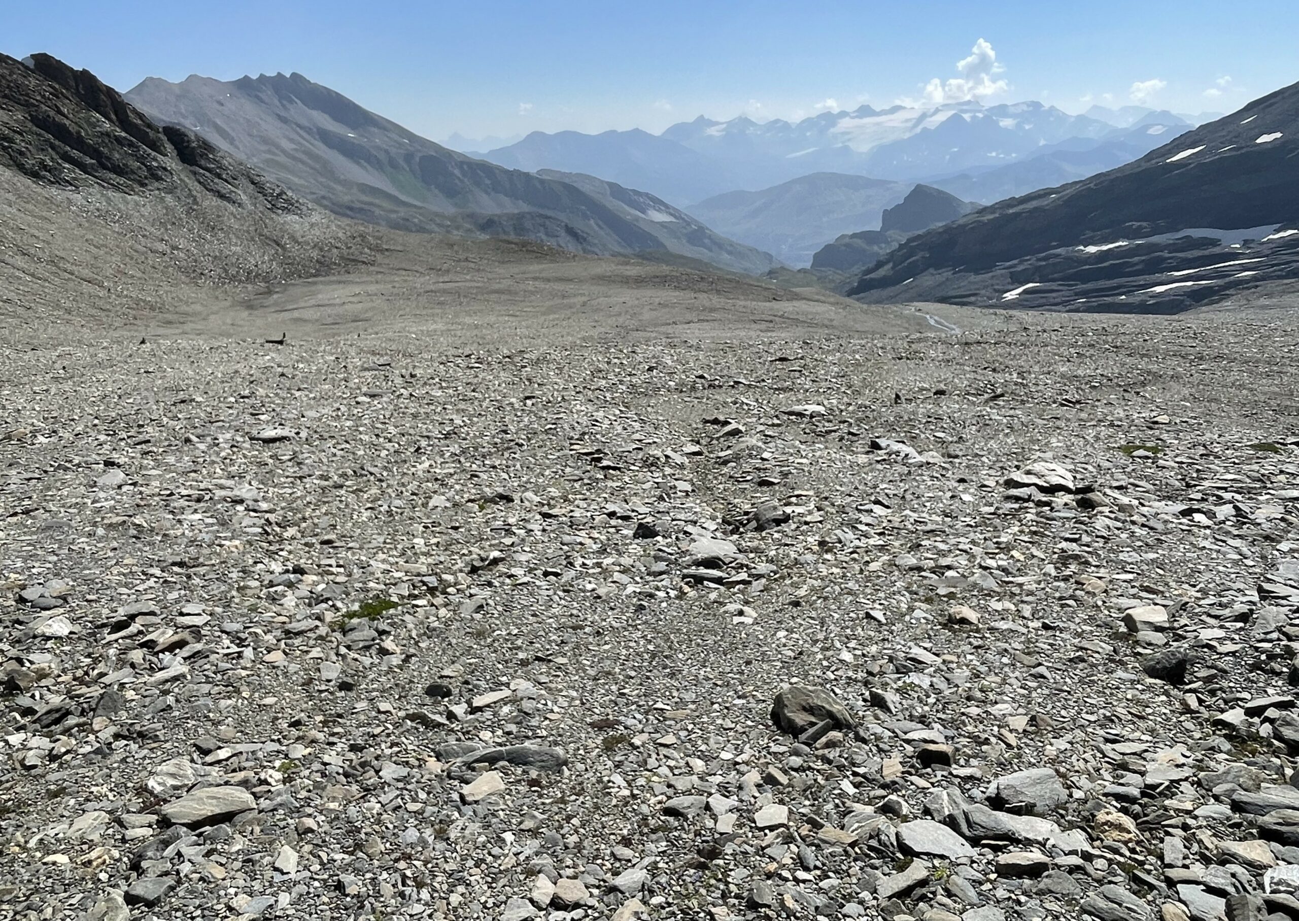
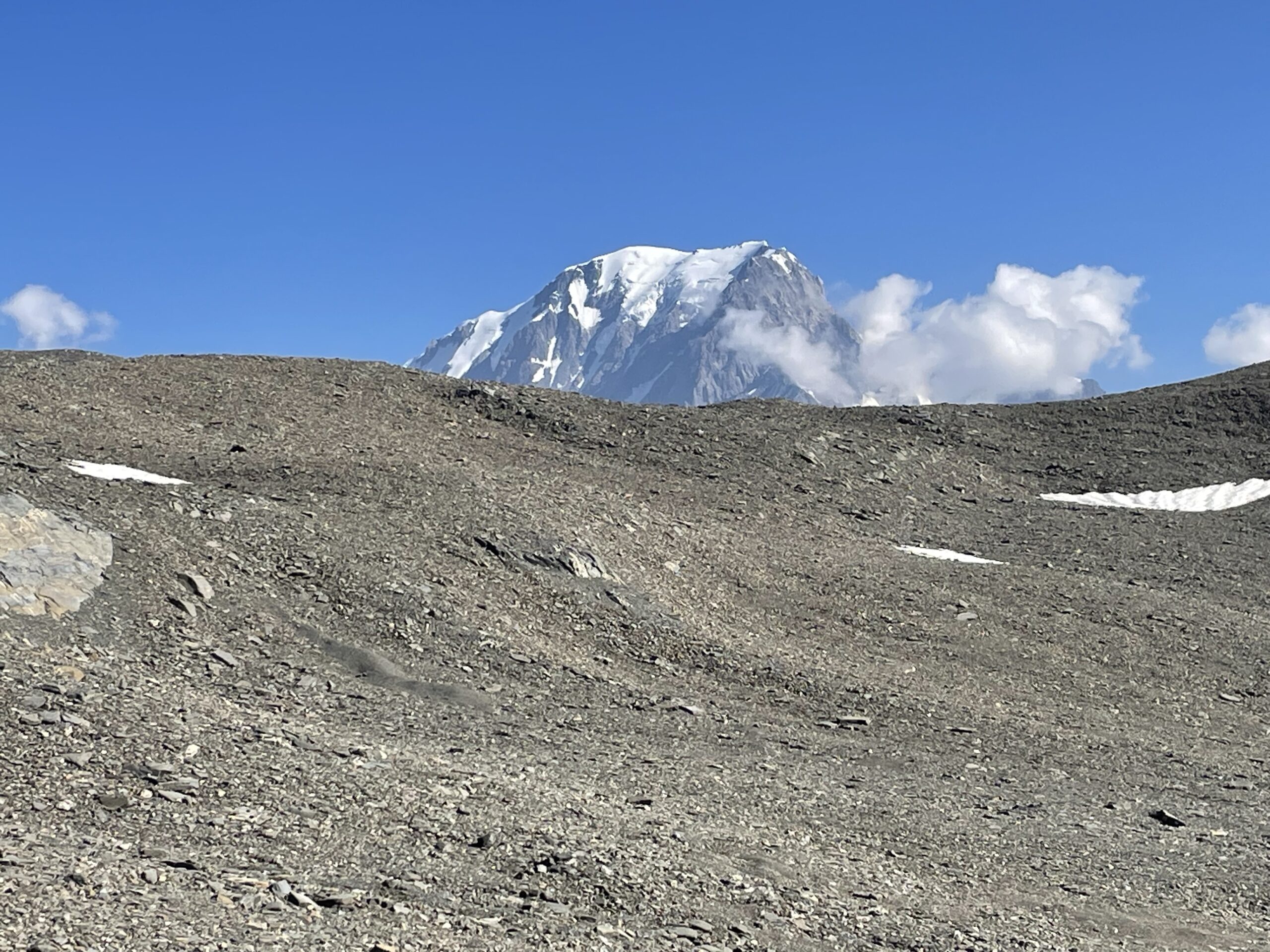
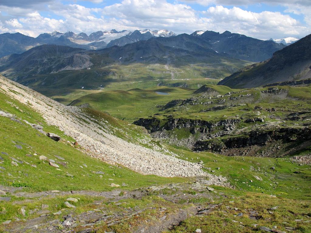
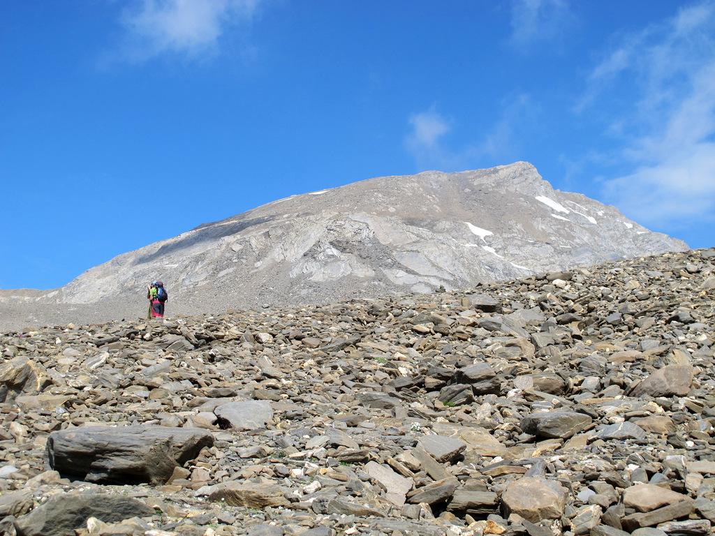
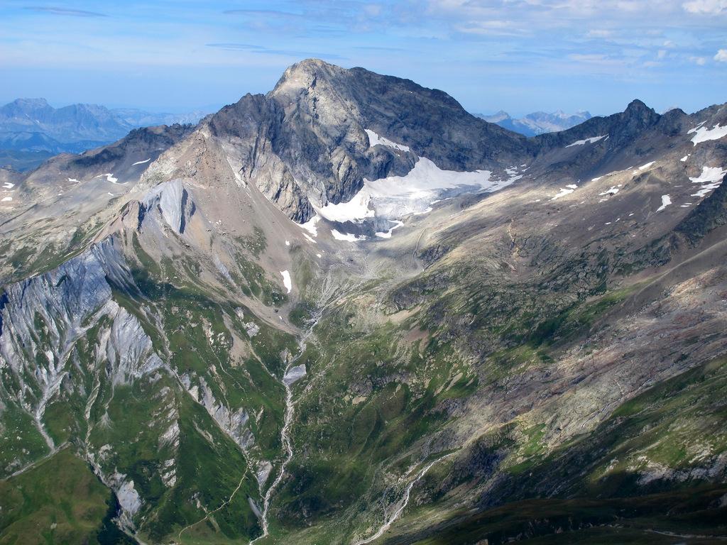
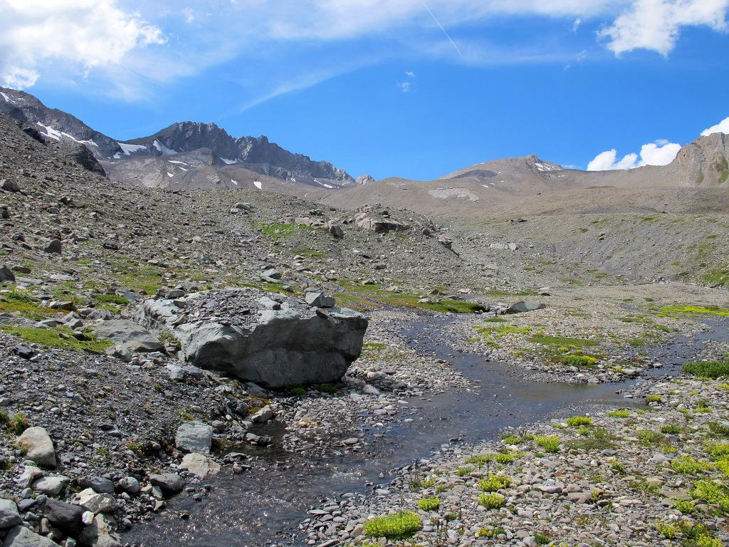
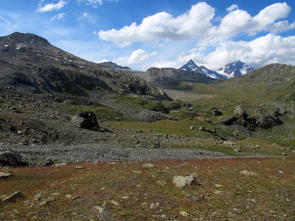
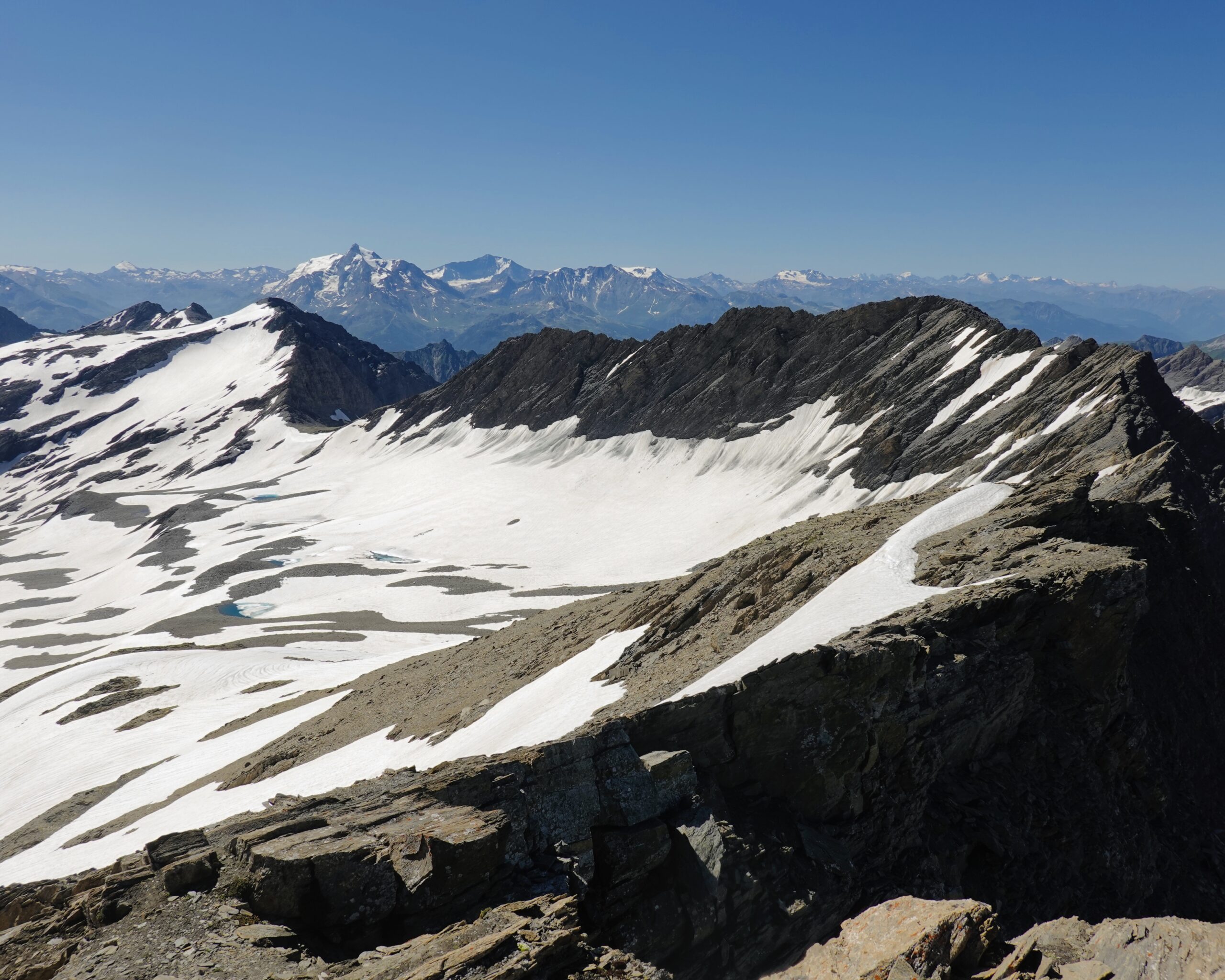
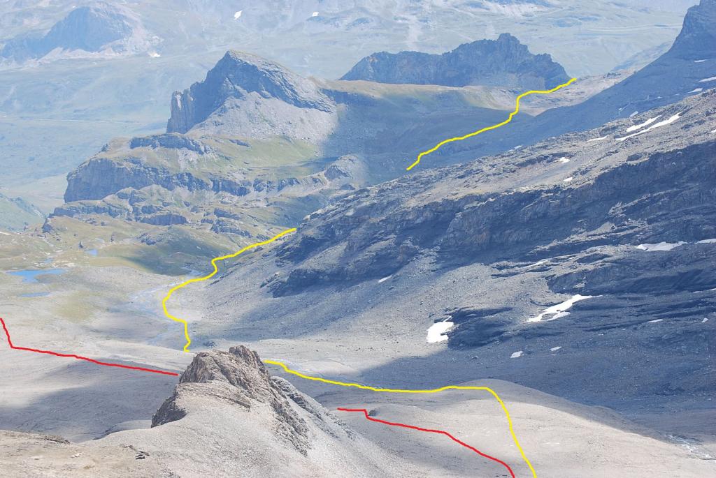
La parte alta del tracciato si svolge in assenza di sentiero e di segnavia, sui resti di quel che era il ghiacciaio del Breuil, ora ridotto ad una enorme distesa di detriti che danno all'ambiente un aspetto lunare.
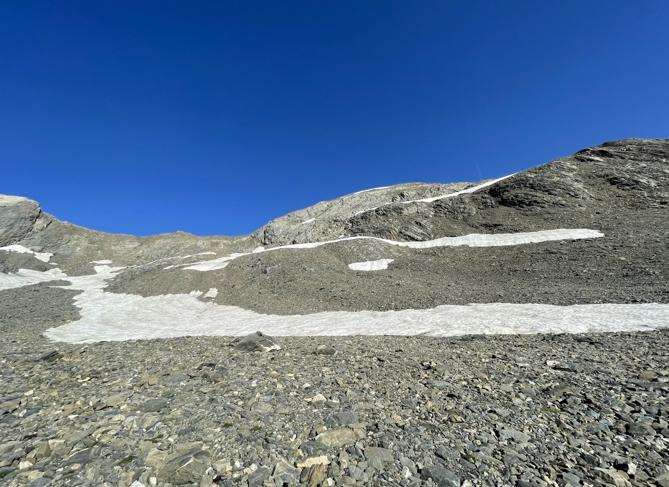
A inizio stagione si possono incontrare dei nevai, nella cui parte finale più ripida potrebbero chiedere l'uso dei ramponi.
Occorre buona visibilità; se si vuol compiere l'anello è consigliabile effettuarlo nel senso descritto.
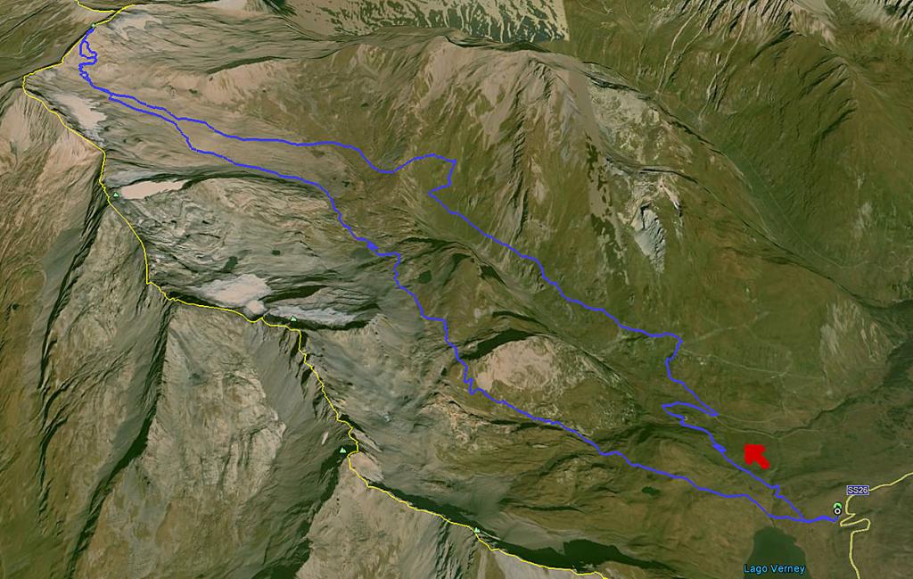
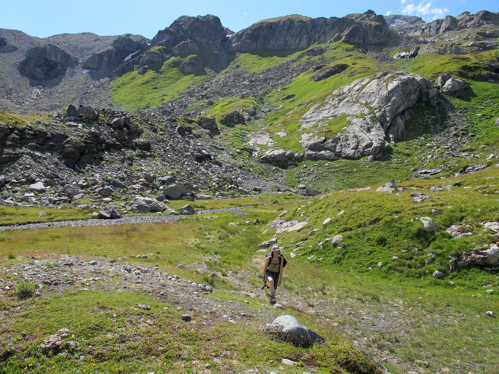
Avvicinamento
La parte alta del tracciato si svolge in assenza di sentiero e di segnavia, sui resti di quel che era il ghiacciaio del Breuil, ora ridotto ad una enorme distesa di detriti che danno all'ambiente un aspetto lunare.
A inizio stagione si possono incontrare dei nevai, nella cui parte finale più ripida potrebbero chiedere l'uso dei ramponi.
Occorre buona visibilità; se si vuol compiere l'anello è consigliabile effettuarlo nel senso descritto.
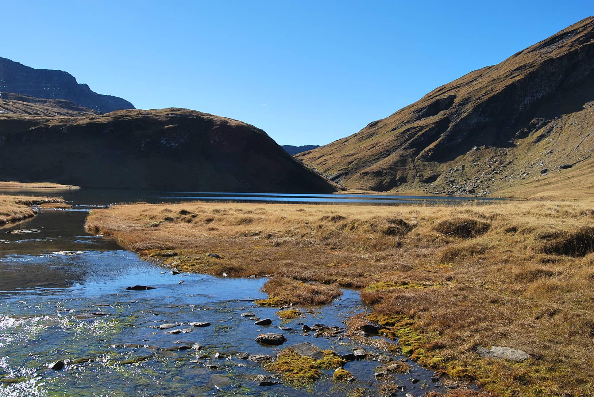
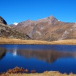
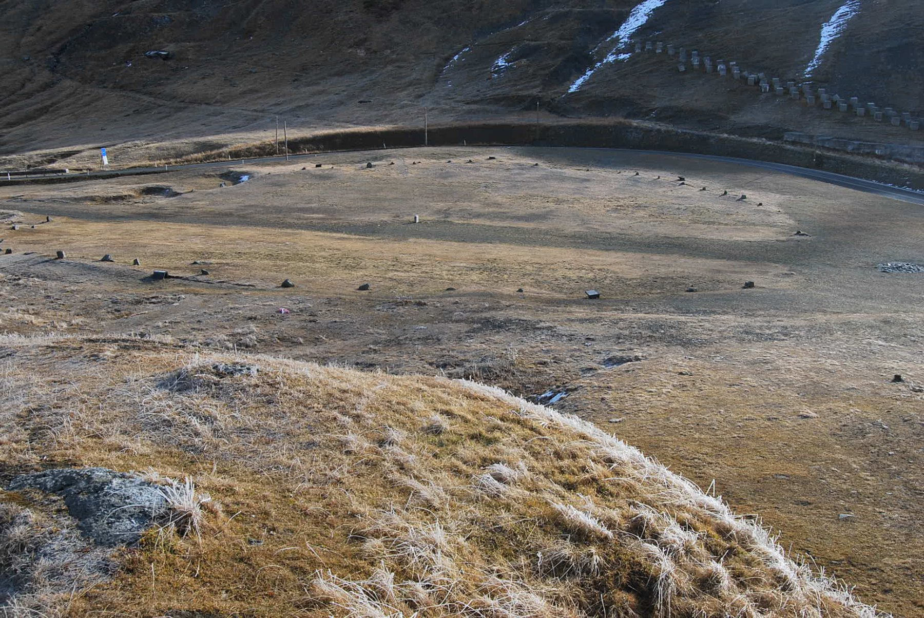
Autostrada A5 Torino Courmayeur uscita Morgex, oppure SS26 del Piccolo San Bernardo fino a Pre Saint Didier, quindi si risale la Valle di La Thuile superando il capoluogo e proseguendo per il Colle del Piccolo San Bernardo. Circa 1 km prima del colle a quota 2088 si trova la breve sterrata a destra, leggermente sconnessa, che porta ad un posteggio sterrato nei pressi del Lago Verney. Altri posteggi disponibili a bordo strada asfaltata.
Descrizione
Costeggiata brevemente la sponda del Lago Verney, si scende subito tramite una sterrata che poi diventa sentiero nel Vallone del Breuil, dirigendosi verso il ponte sul torrente ben visibile nei pressi dell’Alpe Barmettes 1958 m.
Qui si sale ai vicini alpeggi Verney 2018 m dove si incontra il sentiero n.10 che percorrerà tutto il vallone.
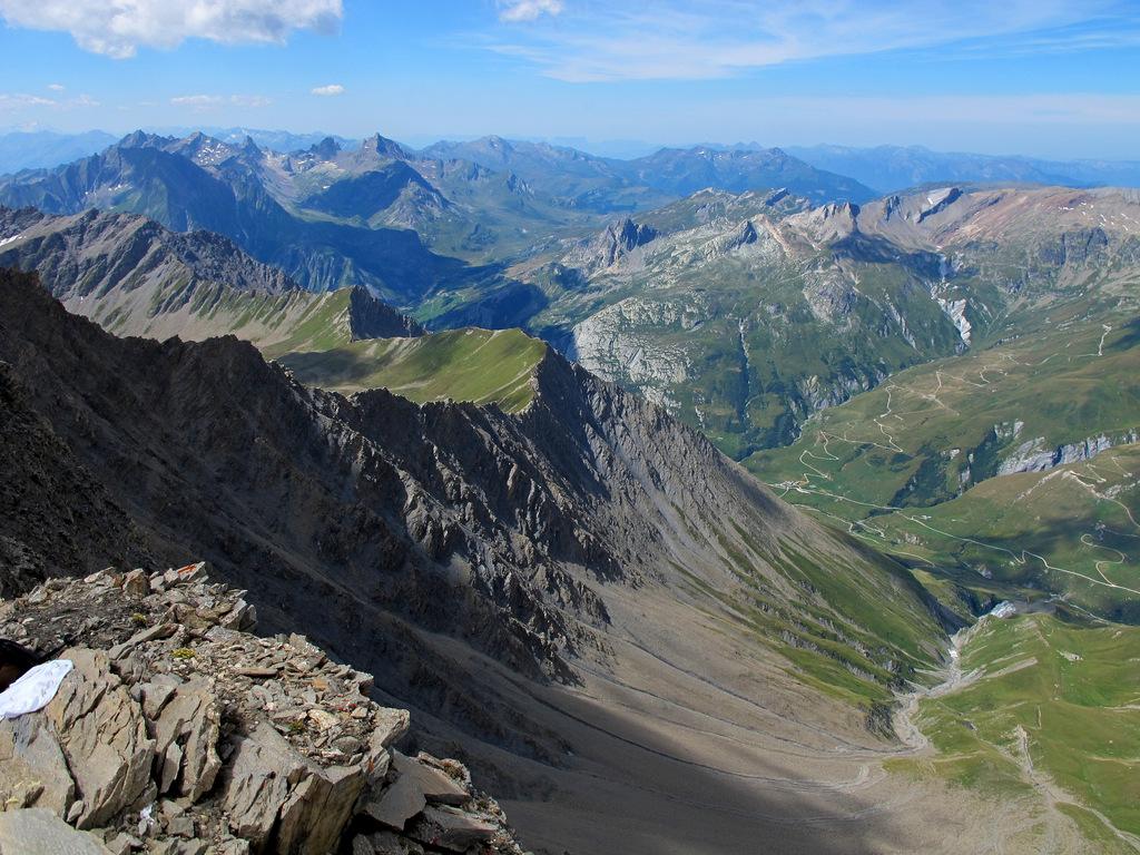
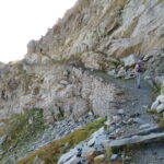
Si sale gradualmente a mezza costa sui costoni erbosi, superando un rudere di alpeggio, quindi a circa 2300 m si affronta un tratto con alcuni canaloni di detriti, dove dall’alto potrebbero cadere pietre (non sostare qui), per poi tornare su pascoli più comodi fino a raggiungere i ruderi di Entre Deux Eaux 2314 m.
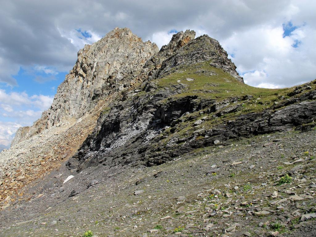
Qui la traccia, poco marcata, inizia a salire a zigzag il costone erboso a destra, divenendo poi più marcata in vista dell’Alpe Crotte 2518 m.
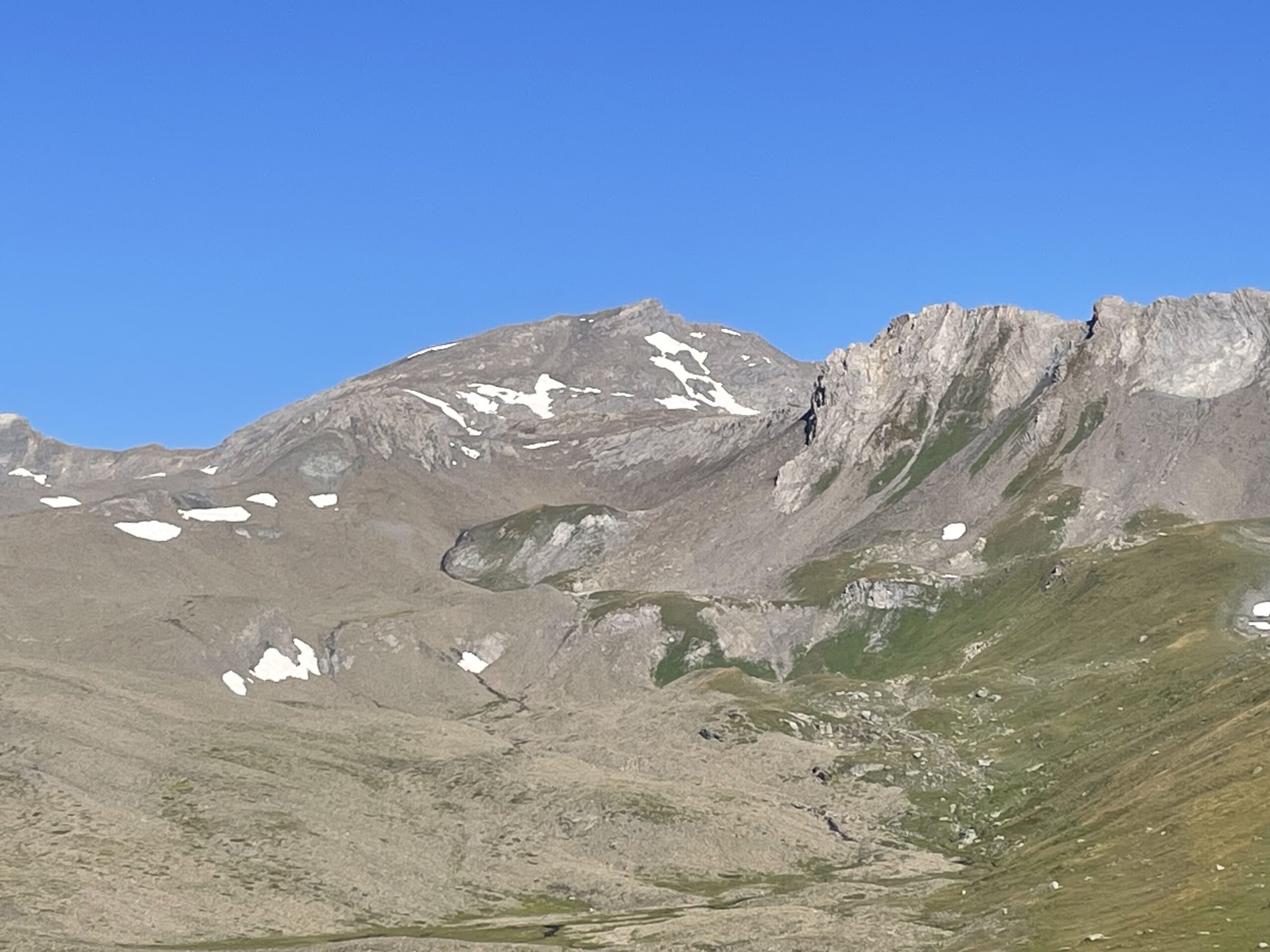
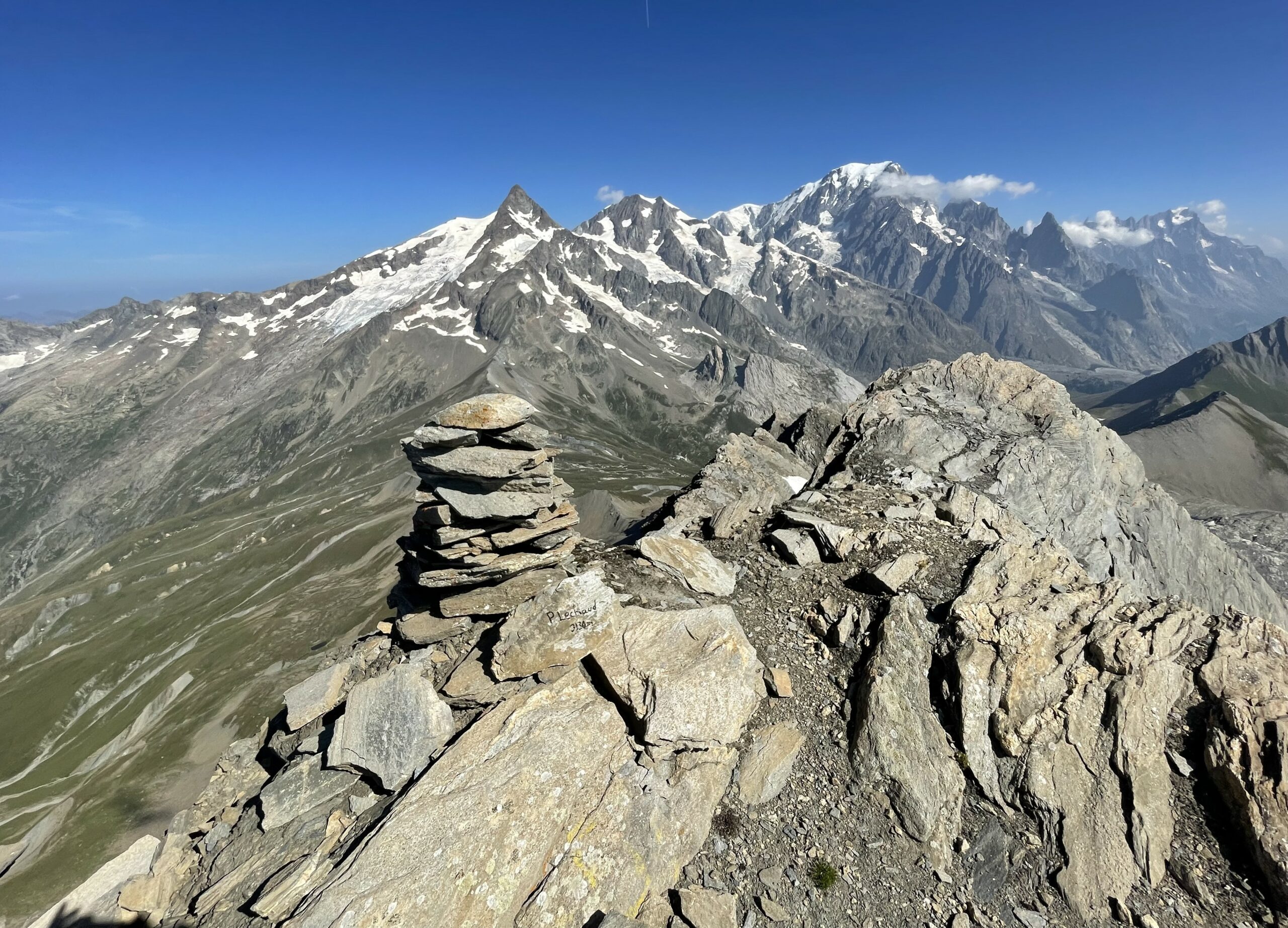
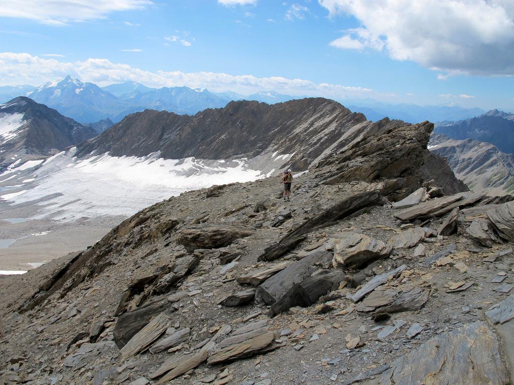
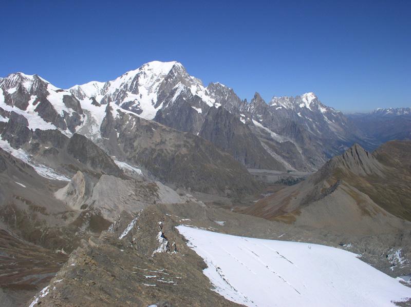
Si percorre ora una ampia cengia verso sinistra, che consente di accedere al vallone superiore alla base dell’ex conca glaciale del Breuil, con la nostra cima ben evidente in fondo.
Il sentiero scende leggermente perdendo circa 50 m di quota, e prosegue via via sulla destra per il Colle di Bassa Serra: questo era l’antico percorso che consentiva di evitare il ghiacciaio. Ora questo percorso non ha più senso ma resta comunque una alternativa; tenere presente che dal colle di Bassa Serra c’è un passaggio un po’ delicato ed esposto per accedere ai ripiani del versante nord est che adducono alla cima.
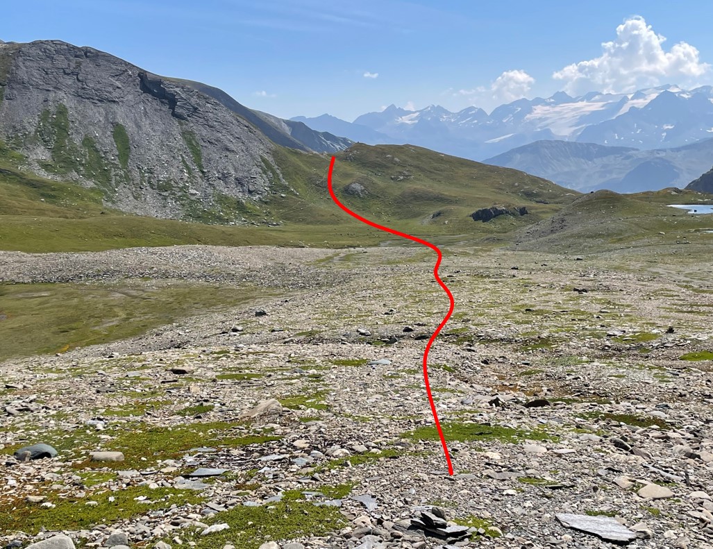
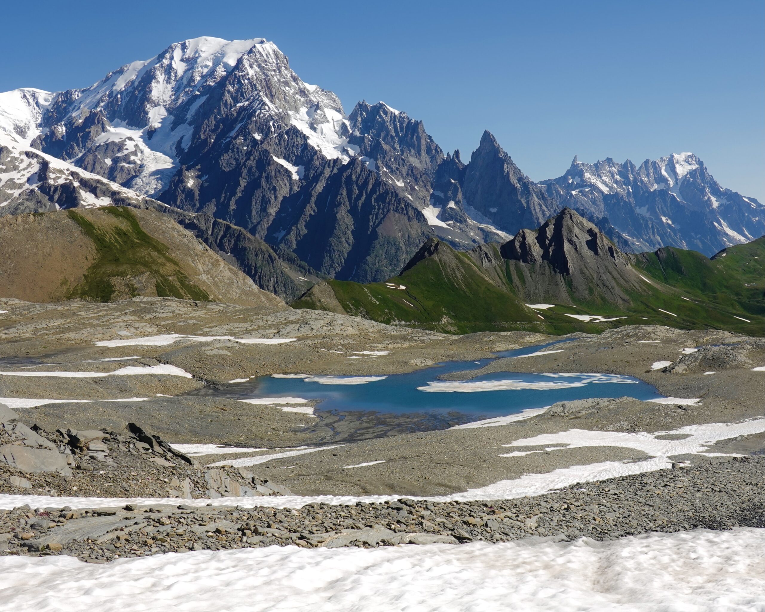
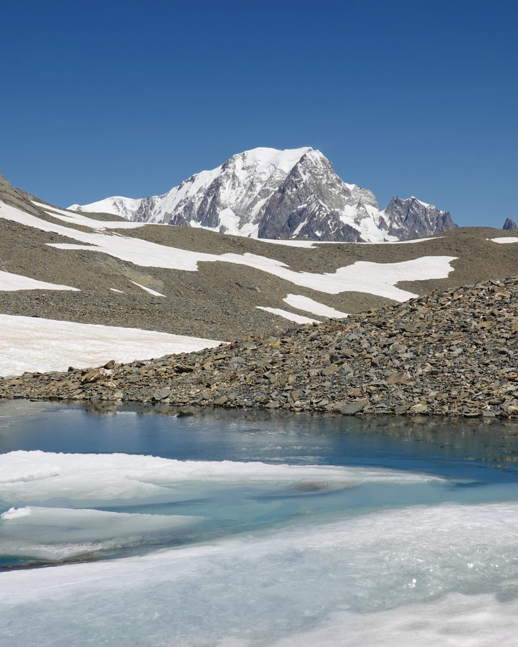
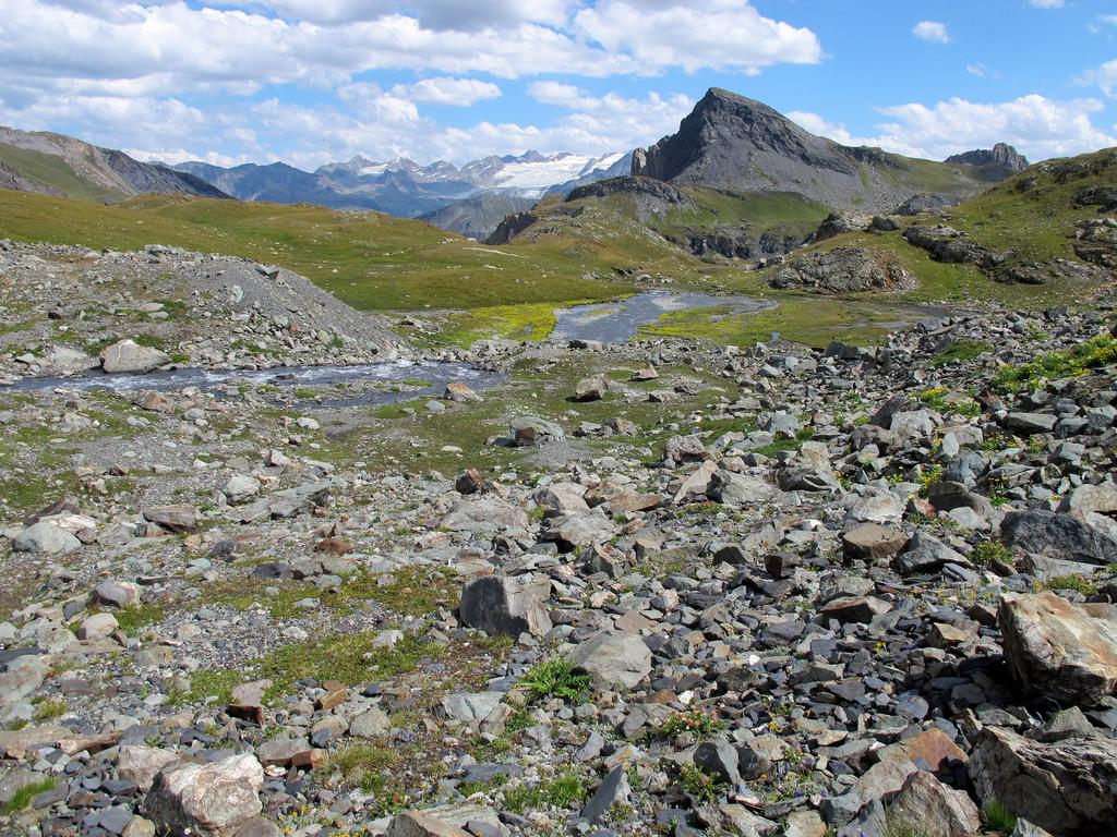
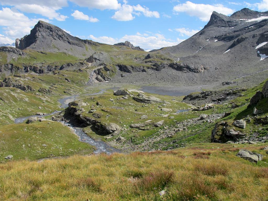
Trascurando invece il sentiero n.10 si continua al centro del vallone, ancora per un tratto su magri pascoli che via via lasciano posto all’immensa distesa detritica (sfasciumi e ciottoli medio piccoli) che si salgono dolcemente con percorso a piacere.
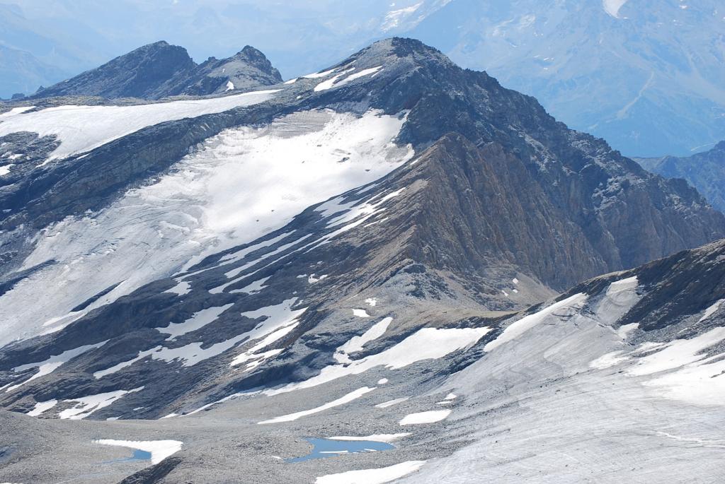
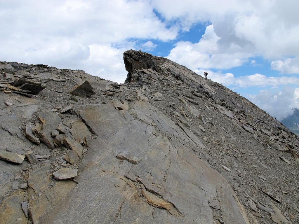
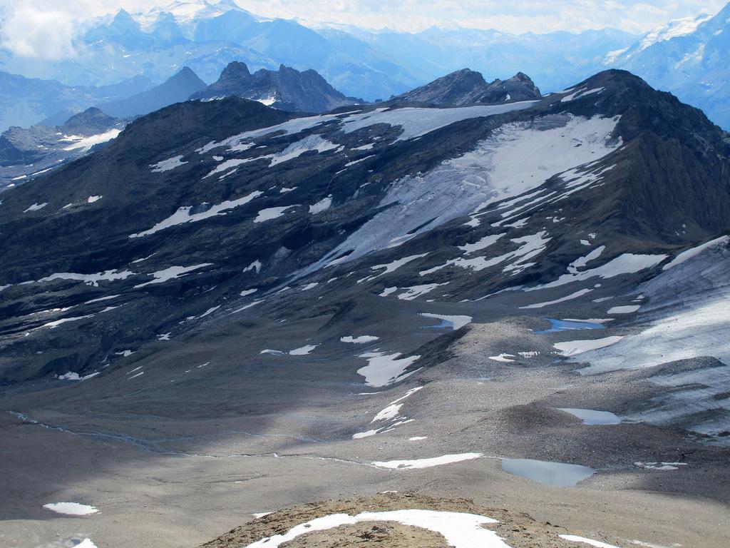
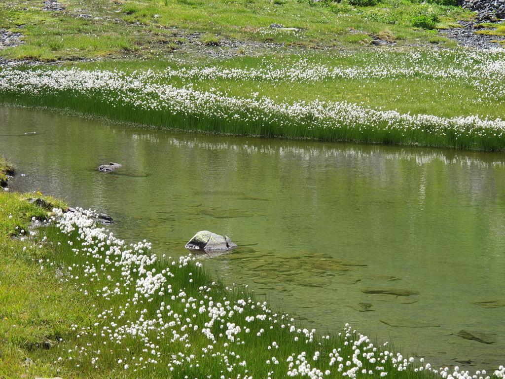
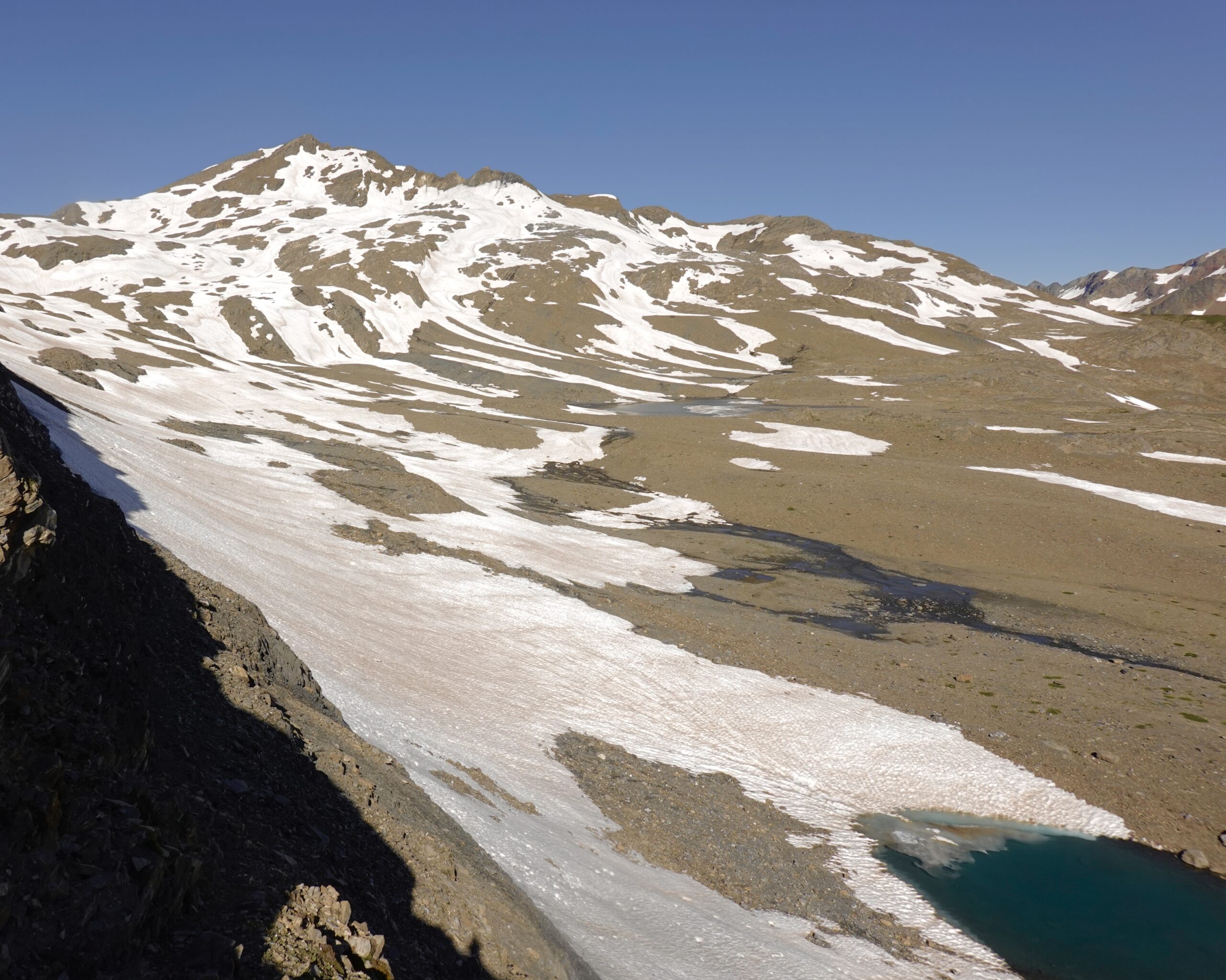
Si percorrono avvallamenti e dossi, innevati a inizio stagione e con dei laghetti di fusione in estate, puntando ad un colletto rossastro (solo come direzione) quotato 2972 m: quando si è di fronte al versante sud della Lechaud, individuata una fascia rocciosa costituita da spalti e gradoni, la si raggiunge per poi salirla (qualche raro ometto ma non ci sono passaggi obbligati).
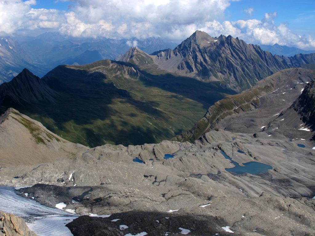
Superata la fascia di roccia si giunge ad un ripiano dove si può trovare un ampio nevaio, che si può aggirare sulla destra per accedere ai pendii detritici superiori.
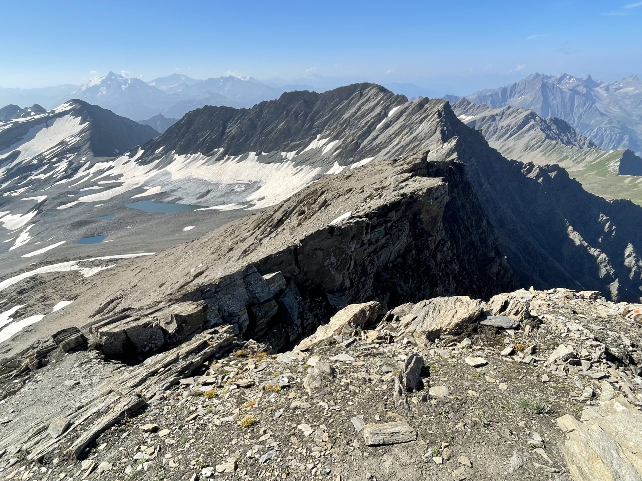
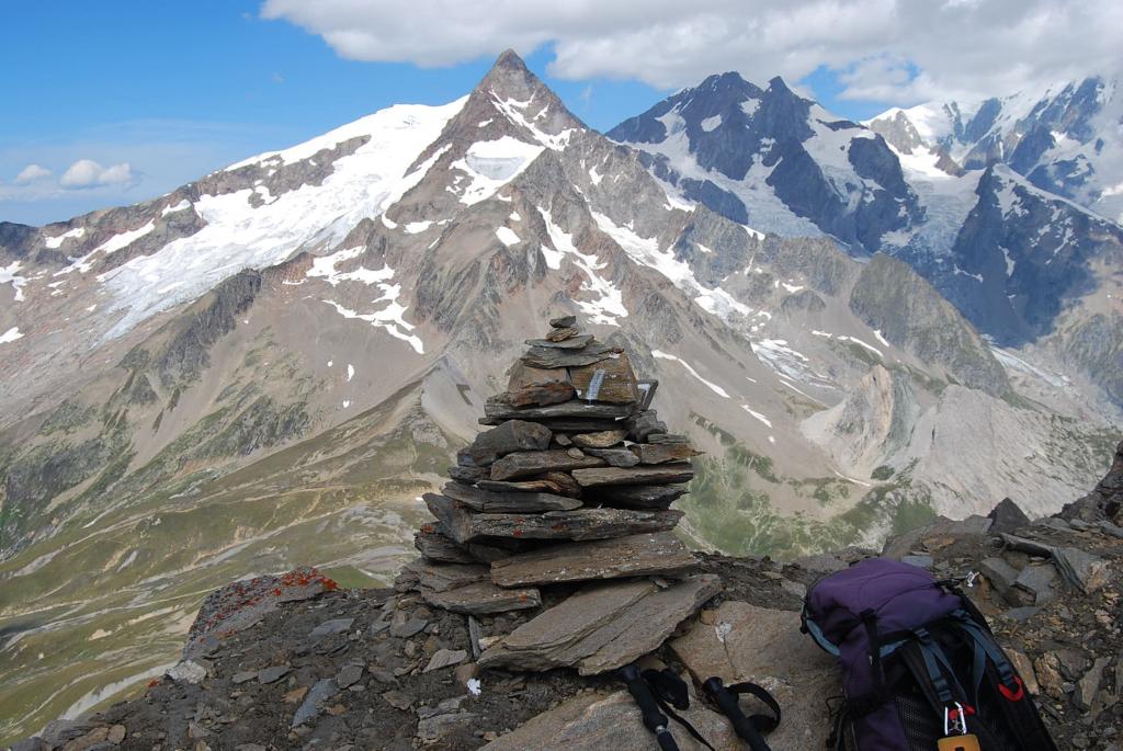
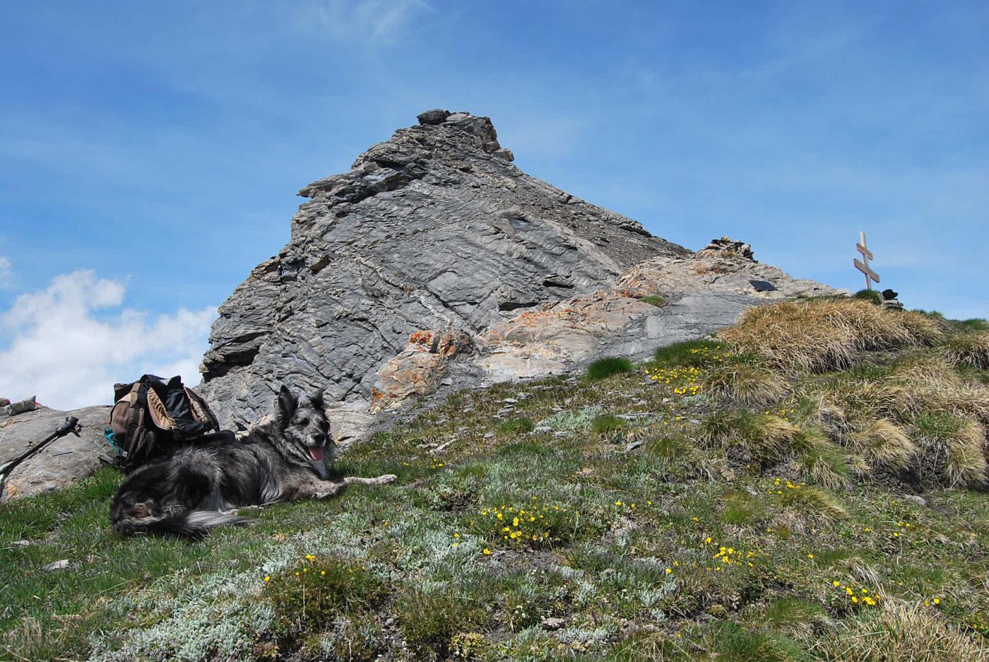
Con libertà di percorso si raggiunge la cresta sud nelle vicinanze della cima: gli ultimi metri sono un po’ aerei (delicati con neve) ma non si usano le mani, basta camminare.
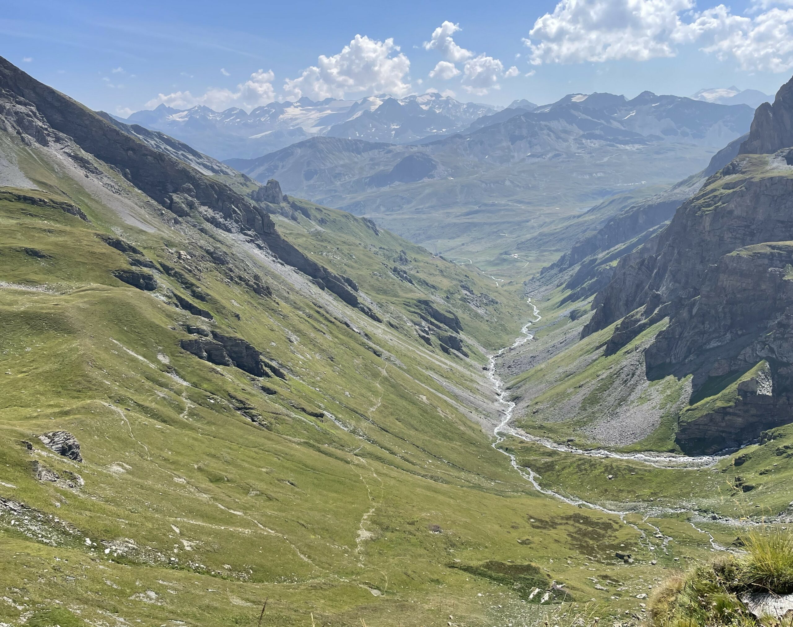
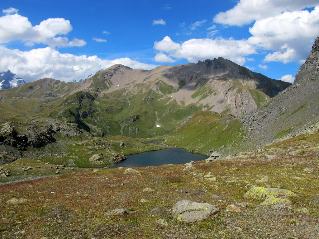
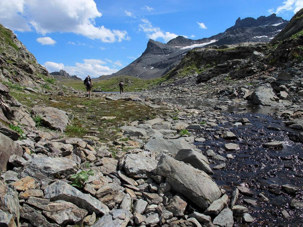
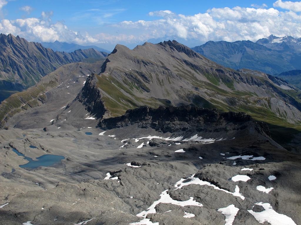
Per la discesa, si ritorna al termine della morena glaciale del Breuil restando nella parte centrale o destra del vallone, puntando ad alcuni curiosi laghetti “sospesi” su un modesto altopiano. Qui si intercetta la traccia del sentiero n.14 che inizierà a salire passando non distante dal Lago Tormotta (che si lascia in basso a destra) e successivamente al colletto sotto la Punta Tormotta.
Da qui si riprende a scendere per rientrare al Lago Verney seguendo il bel sentiero che tuttavia compie qualche leggero saliscendi.
Altro possibile punto di partenza per imboccare il Vallone del Breuil: strada SS26 del Colle del Piccolo San Bernardo quota 1810 m, nei pressi di un tornante, c’è l’inizio del sentiero n.10 (paline)
- Cartografia:
- IGC n. 4 Monte Bianco
- Bibliografia:
- Guida Monti Italia
Nelle vicinanze Mappa
Itinerari
29/06/2026 AO, La Thuile D+ 1200 m EE/F Sud-Est
Miravidi (Monte) e Punta dei Ghiacciai dal Lago Verney
 50m
50m
01/09/2006 AO, La Thuile D+ 980 m EE Sud
Fornet (Punta) dal Lago Verney
50m
30/08/2025 AO, La Thuile D+ 800 m E Varie
Bassa Serra (Colle di) dal Lago Verney
 50m
50m
16/08/2016 AO, La Thuile D+ 751 m EE Tutte
Rousses (Sommet des) dal Lago Verney per il Colle della Pointe Rousse
 50m
50m
30/08/2025 AO, La Thuile D+ 850 m E Sud-Est
Tormotta o Tormottaz dal Lago Verney
 50m
50m
18/08/2025 AO, La Thuile D+ 1050 m EE Varie
Veys (Aiguille) dal Lago Verney
 50m
50m
12/08/2025 AO, La Thuile D+ 850 m EE Varie
Valaisan (Monte) dal Colle del Piccolo San Bernardo, anello
 950m
950m
31/05/2014 Savoie, Séez D+ 258 m E Ovest
Traversette (Col de la) dal Colle del Piccolo San Bernardo
 2.6Km
2.6Km
14/11/2015 Savoie, Séez D+ 734 m EE Varie
Lac Sans Fond (Pointe du) dal Colle del Piccolo San Bernardo
 2.6Km
2.6Km
31/05/2015 Savoie, Séez D+ 615 m EE Nord
Belleface (Roc du) dal Colle del Piccolo San Bernardo
 2.6Km
2.6Km