6.2Km
6.2Km


Note
Storico
 50m
50m
50m
50m
50m
50m
50m
50m
50m
50m
50m
50m
50m
50m
50m
50m
50m
50m
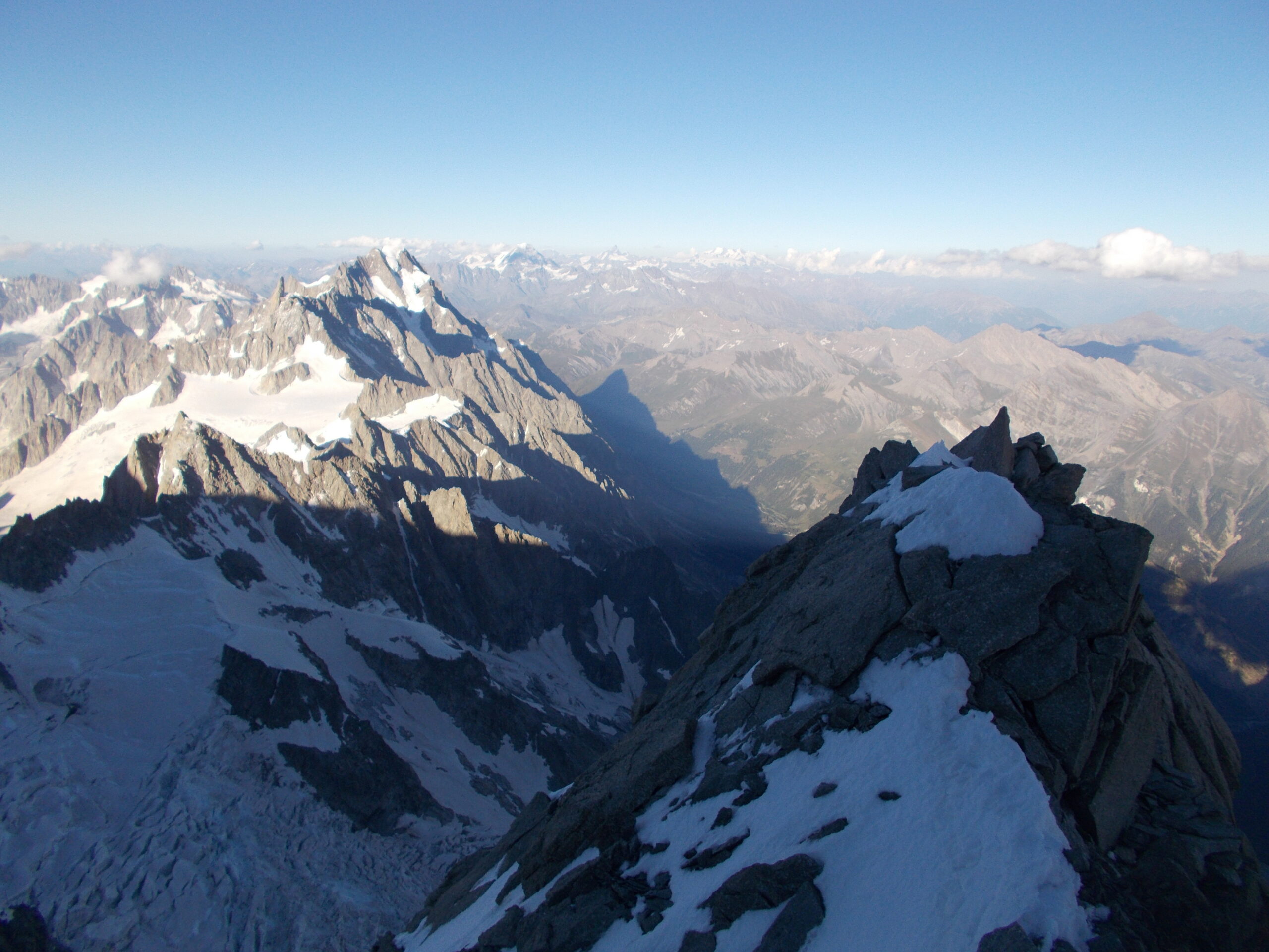
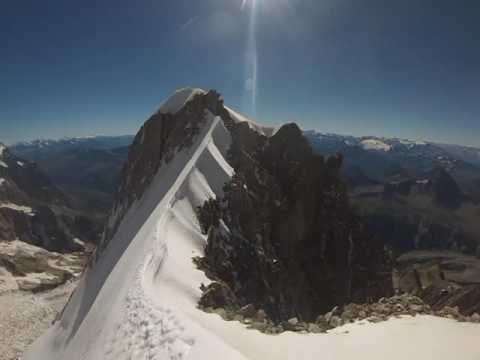
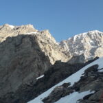
Un’ascensione straordinaria che si svolge costantemente in un ambiente unico e grandioso. È una delle più celebri creste delle Alpi, delle più lunghe come sviluppo e dislivello, sicuramente la più elegante ed estetica per salire il Monte Bianco. Raggiungere la vetta del Monte Bianco dalla vallata, passando per l’Aiguille Blanche, attraversando uno degli angoli più remoti del massiccio e concludendo il viaggio per la parte finale della cresta di Peuterey è un’esperienza stupenda, che ti segna nel profondo.
Salita di ampio respiro, completa (tratti di roccia, misto e ghiaccio). Ambiente severo. Dall’Aiguille Blanche (4114 m.) la strada di casa più sicura e veloce passa per la vetta del Monte Bianco (4810 m.).
Difficoltà: D+ e V per l’impegno complessivo. Dislivello dalla base delle rocce sul ghiacciaio del Fréney: 1800 m. di salita, con sviluppo di circa 3700 m. II e III grado, passo di IV.
Avvicinamento
Salita di ampio respiro, completa (tratti di roccia, misto e ghiaccio). Ambiente severo. Dall’Aiguille Blanche (4114 m.) la strada di casa più sicura e veloce passa per la vetta del Monte Bianco (4810 m.).
Difficoltà: D+ e V per l’impegno complessivo. Dislivello dalla base delle rocce sul ghiacciaio del Fréney: 1800 m. di salita, con sviluppo di circa 3700 m. II e III grado, passo di IV.
Lasciare l’auto in Val Veny località Fréney (1600 m.)
Descrizione
La salita classica della cresta di Peuterey prevede di raggiungere il Col de Peuterey (qui descritto passando per l’Aiguille Blanche), per poi risalire la parete di misto del Grand Pilier d’Angle e continuare sul filo di cresta sino ad uscire sul Monte Bianco di Courmayeur.
Lasciare l’auto in Val Veny località Fréney (1600 m.), proseguire per il sentiero che porta al rif. Monzino (2561 m.). La salita si può affrontare dal rif. Monzino (1550 m. di dislivello per la Blanche + 900 m. dal colle alla vetta massima) oppure si può prevedere un bivacco al Col Peuterey (3900 m.). Chiaramente si può anche dividere la salita in 3 gg con pernottamento al Monzino + bivacco.
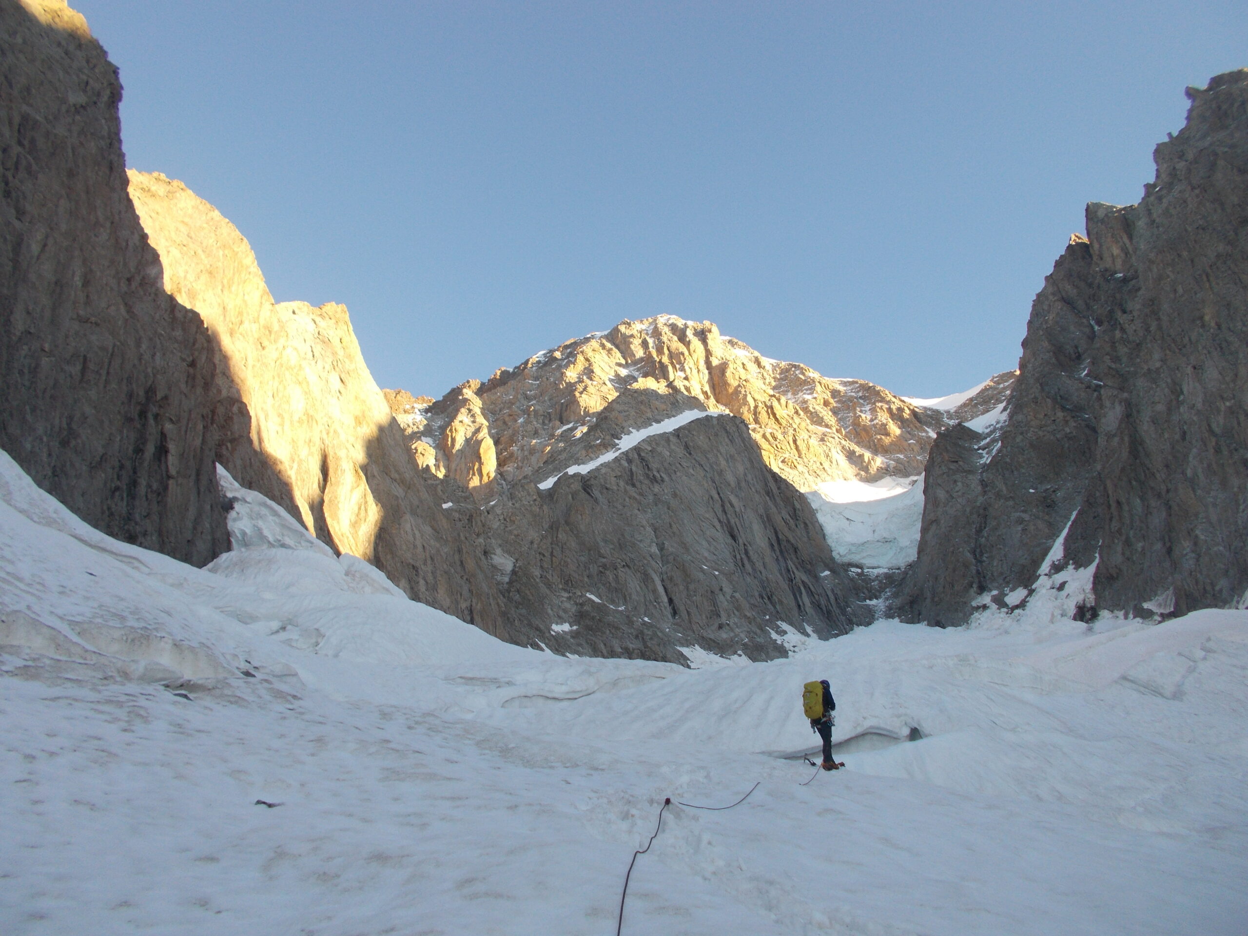
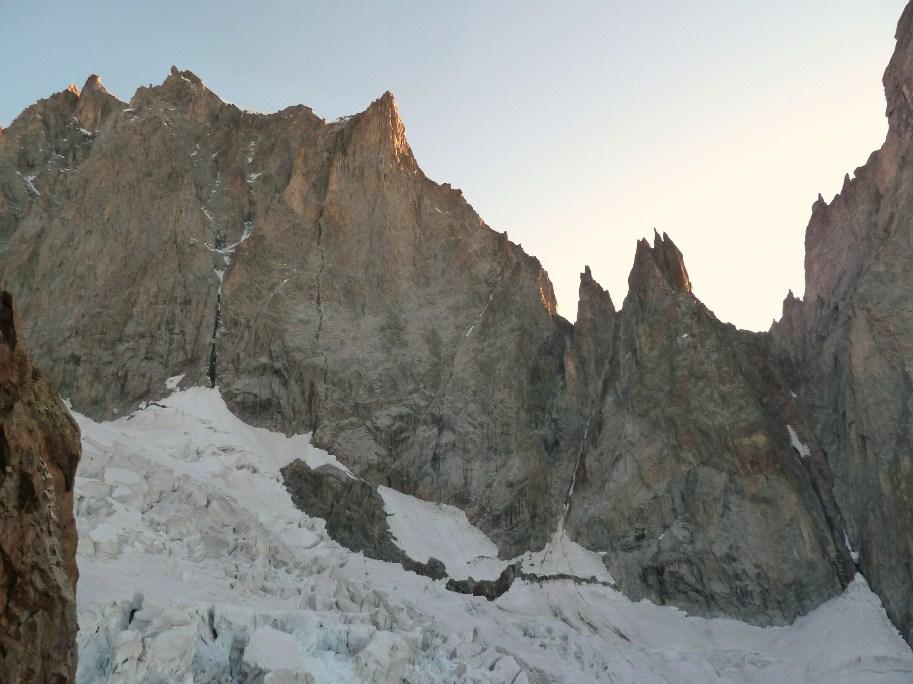
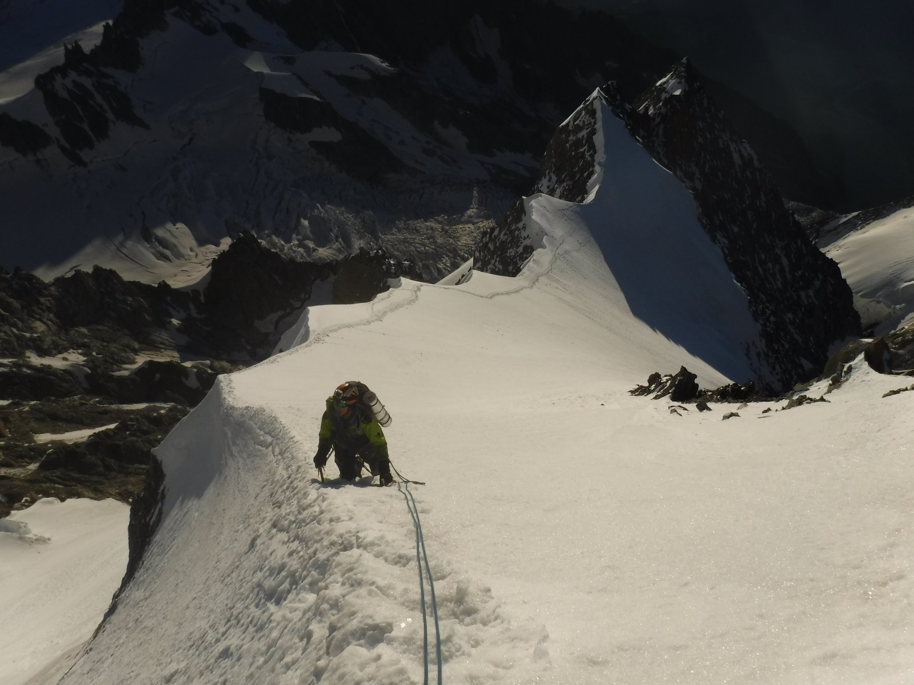
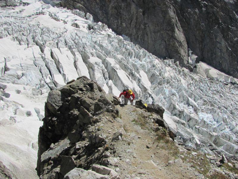
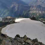
Dal rif. Monzino si prosegue per tracce di sentiero verso l’ex ghiacciaio di Chatelet. Attraverso un canale roccioso si raggiunge il colletto dell’Innominata (3200 m.). Da qui si scende con 3 / 4 corde doppie fin sul ghiacciaio del Fréney. Il ghiacciaio si presenta molto tormentato e l’attraversamento sino all’attacco dell’Aiguille Blanche può risultare molto laborioso a causa di enormi crepacci.
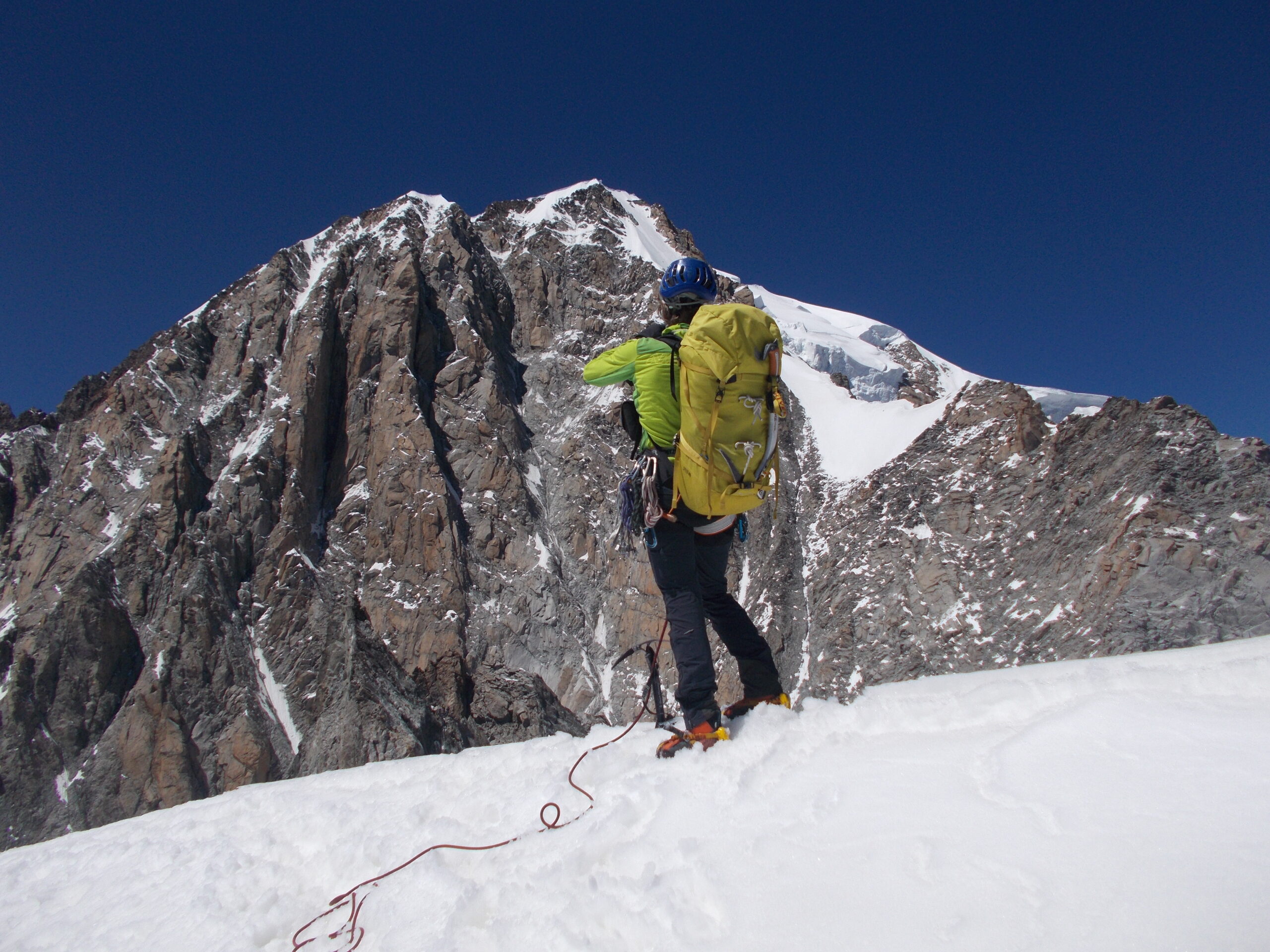
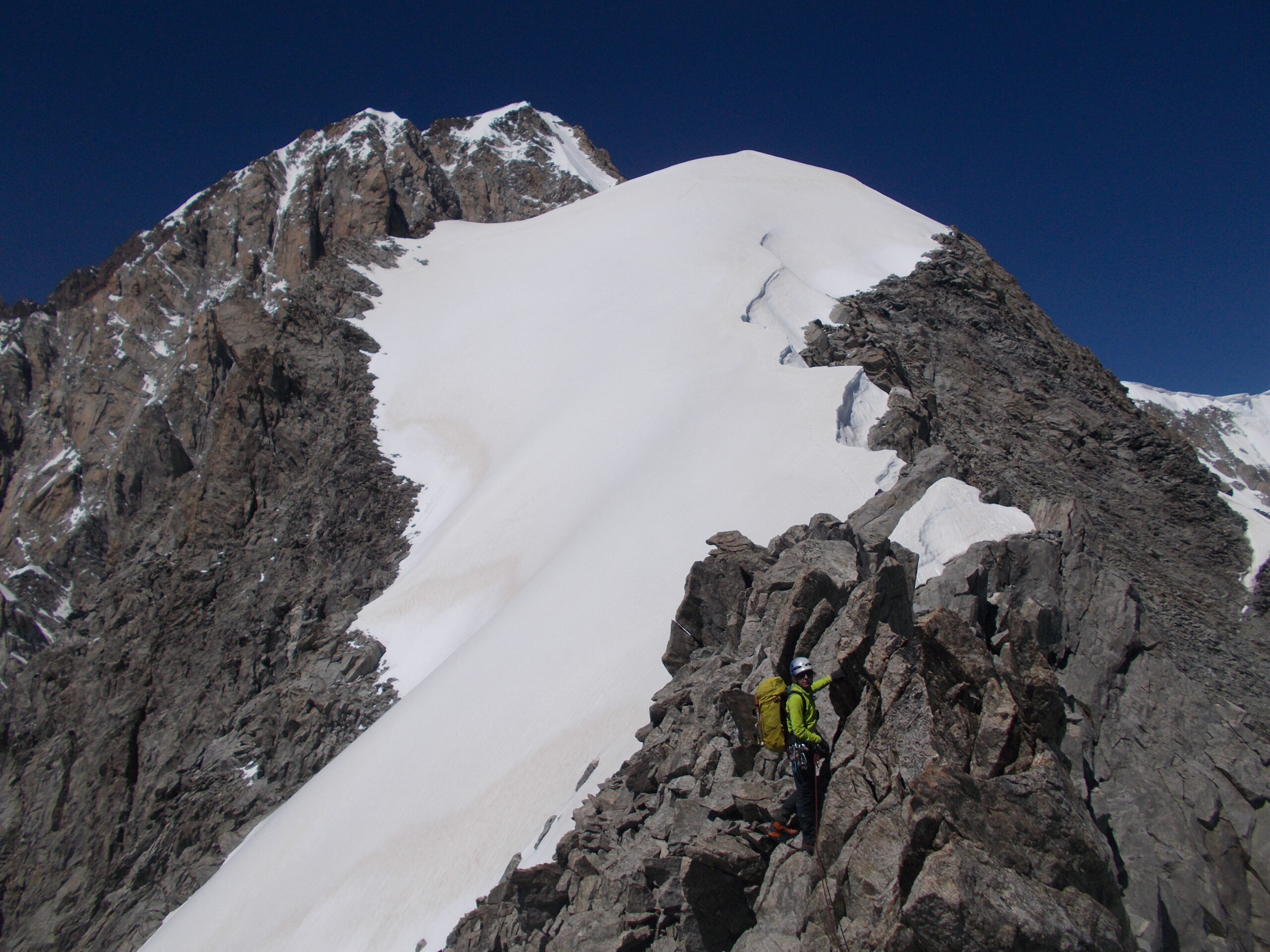
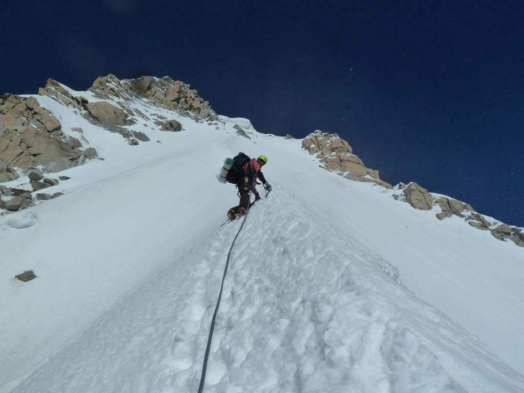
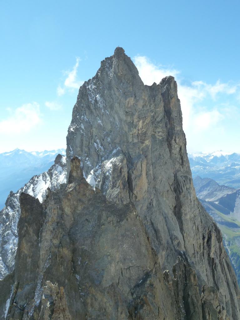
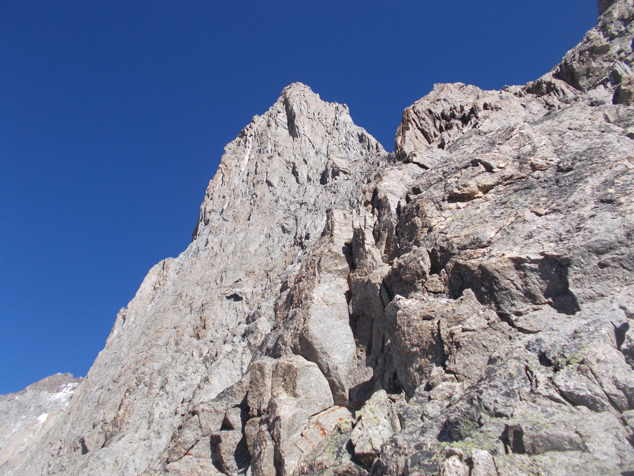
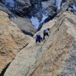
Giunti sotto la Blanche si affronta la sua parete SW per le classiche cenge Schneider (III/IV). Qui si arrampica su roccia a tratti sfasciata, ma la bellezza dell’ambiente fa dimenticare anche questo. Si raggiunge la rocciosa cresta SE aggirando il Pic Gugliermina.
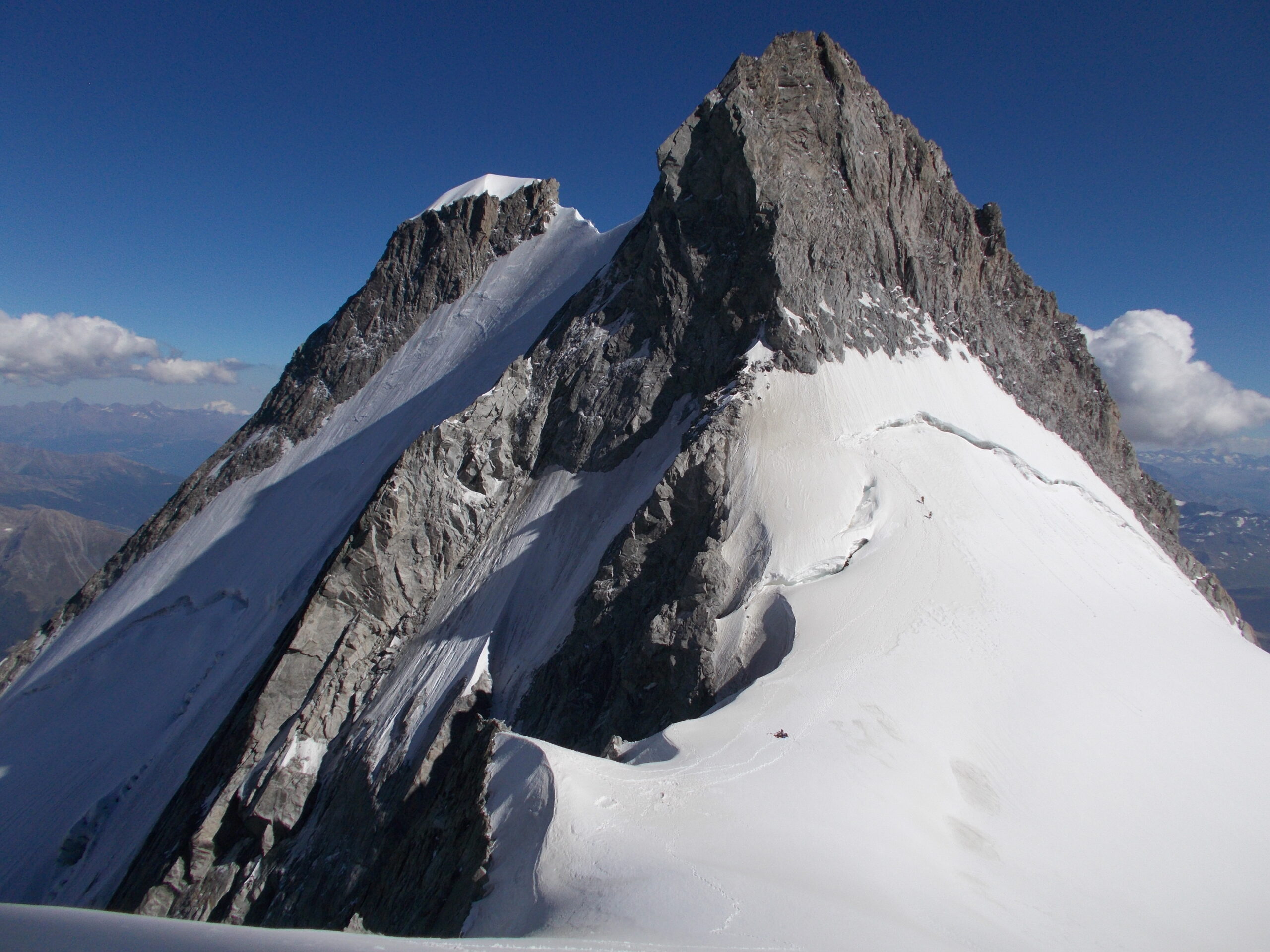
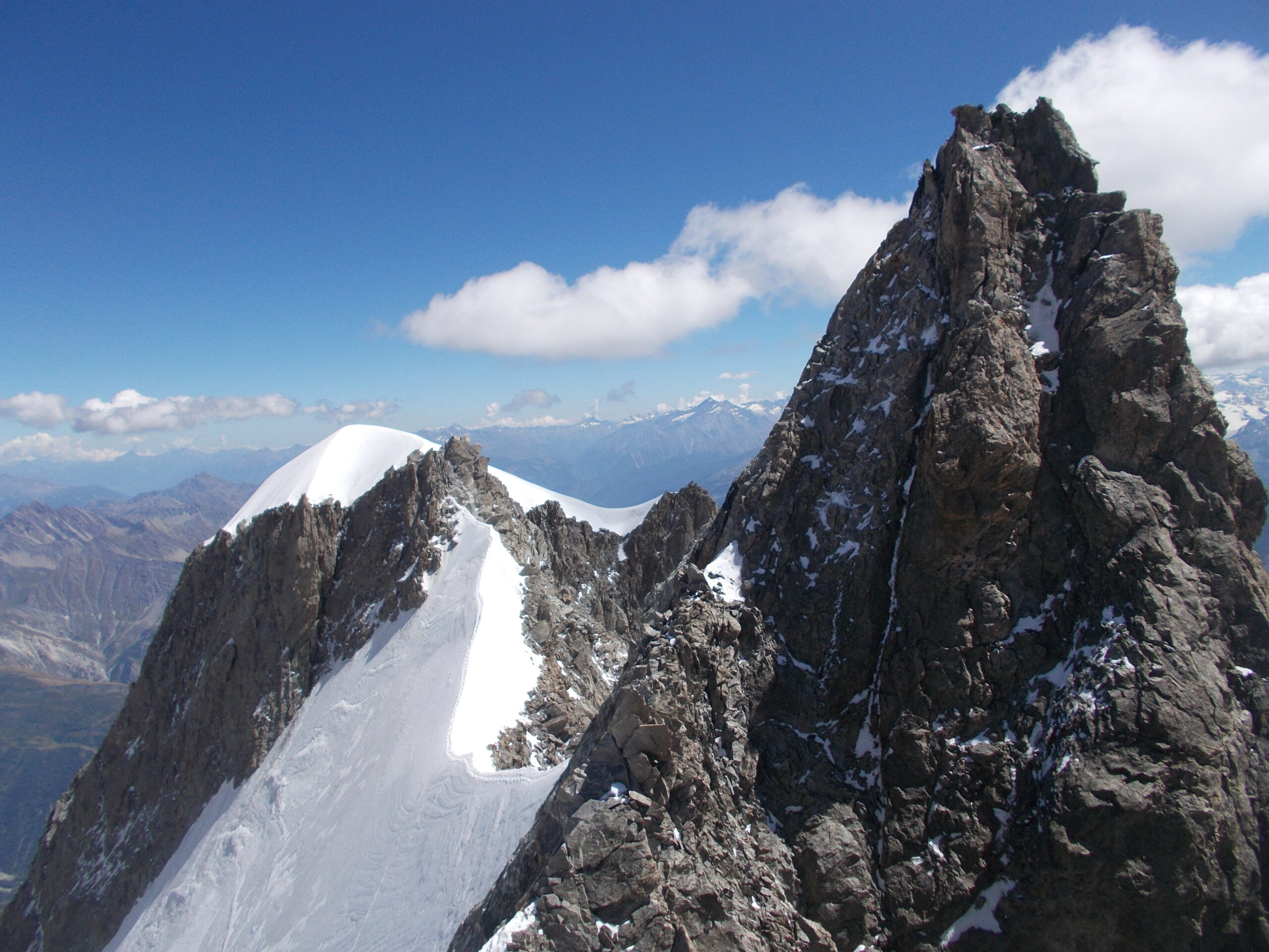
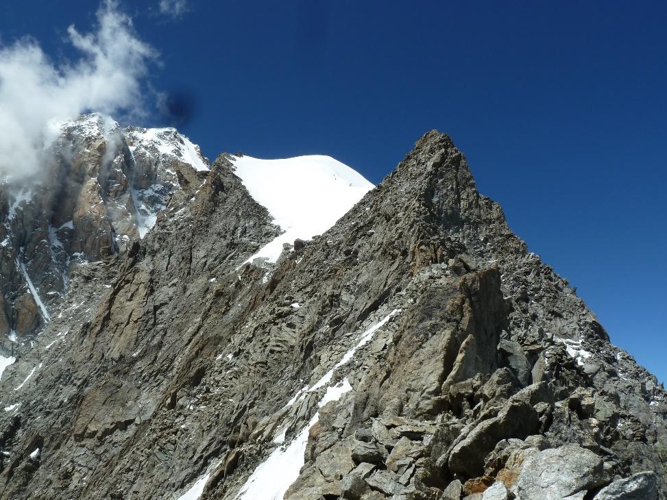
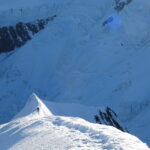
Si prosegue per detta cresta e si raggiunge la calotta glaciale dell’Aiguille Blanche (4114 m.). Dalla vetta SE si deve compiere la traversata dell’affilata cresta sommitale della Blanche, aggirando la punta centrale e giungendo sulla vetta NW.
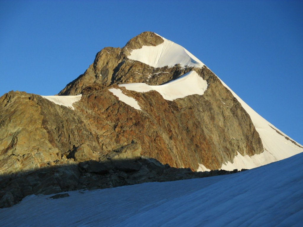
Da qui 5 / 6 corde doppie portano al Col Peuterey (3900 m.). A questo punto ci si trova in un luogo dalla bellezza unica e dalla storia irripetibile. Vicino a noi: la N della Blanche, il Grand Pilier d’Angle, di fronte il Pilone Centrale del Fréney e poco sotto unica scappatoia, in caso di maltempo i rochers Gruber.
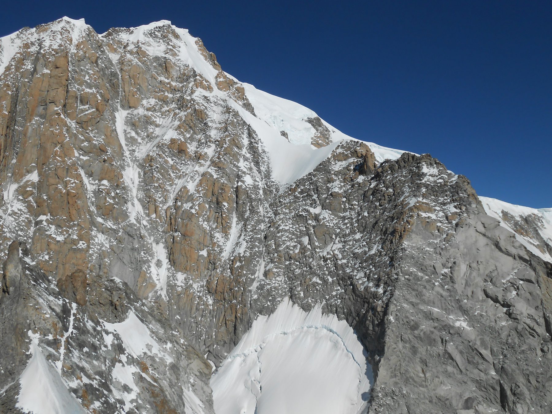
Dal colle la scalata prosegue, dopo aver passato la terminale, sui risalti di terreno misto del Grand Pilier d’Angle (4240 m.). Per raggiungere il filo di cresta nevosa, in alternativa, se le condizioni lo consentono si può risalire il couloir Eccles. Si arriva quindi sulla parte finale della cresta di Peuterey per non lasciarla più sino all’uscita. Sorpassata la cornice sommitale si sbuca sul Monte Bianco di Courmayeur (4765 m.). Attraverso la depressione del Col Major si giunge infine sulla vetta massima del massiccio (4810 m.).
La discesa si affronta per una della vie normali del Monte Bianco.
Prima ascensione della cresta di Peuterey per la cresta delle Dames Anglaises: L. Obersteiner e K. Schreiner luglio 1927. Le cenge per risalire la parete SW della Blanche furuno individuate da E. Schneider e H. Horlin marzo 1929.
- Cartografia:
- Monte Bianco - IGC
- Bibliografia:
- Monte Bianco I CAI-TCI G. Buscaini, Vie del Cielo M. Colonel, Guide Vallot Monte Bianco I
Nelle vicinanze Mappa
Itinerari
28/06/2020 AO, Courmayeur D+ 2300 m PD+ Sud
Trelatete (Aiguille de) cima orientale Via Normale Italiana da la Visaille
 50m
50m
18/08/2021 AO, Courmayeur D+ 1300 m F+ Sud
Gonella Francesco (Rifugio) al Dome da La Visaille
 50m
50m
09/08/2024 AO, Courmayeur D+ 3400 m ED- Sud-Est
Bianco (Monte) Pilone Centrale Freney – Via classica
 50m
50m
02/07/2021 AO, Courmayeur D+ 400 m TD+ Sud-Est
Brouillard (Pilastro Rosso del) – Via Bonatti-Oggioni
 50m
50m
30/07/1978 AO, Courmayeur D+ 2300 m AD Nord
Trelatete orientale (Aiguille de) dal versante Sud per il ghiacciaio sospeso
50m
05/08/2025 AO, Courmayeur D+ 2200 m D Sud
Glaciers (Aiguille des) Cresta SE via Kuffner
 50m
50m
12/08/2021 AO, Courmayeur D+ 2600 m AD Est
Bionnassay (Aiguille de) Cresta Est
 50m
50m
08/07/2022 AO, Courmayeur D+ 1600 m PD Sud
Croux (Aiguille) Cresta Sud
 50m
50m
20/09/2025 AO, Courmayeur D+ 1754 m F Sud-Est
Piccolo Monte Bianco o Petit Mont Blanc da La Visaille
 50m
50m
18/06/2026 AO, Courmayeur D+ 2162 m AD Sud-Est
Innominata (Punta) Cresta Est
 50m
50m