 6.2Km
6.2Km
Note
 0m
50m
50m
50m
50m
50m
50m
50m
50m
0m
50m
50m
50m
50m
50m
50m
50m
50m
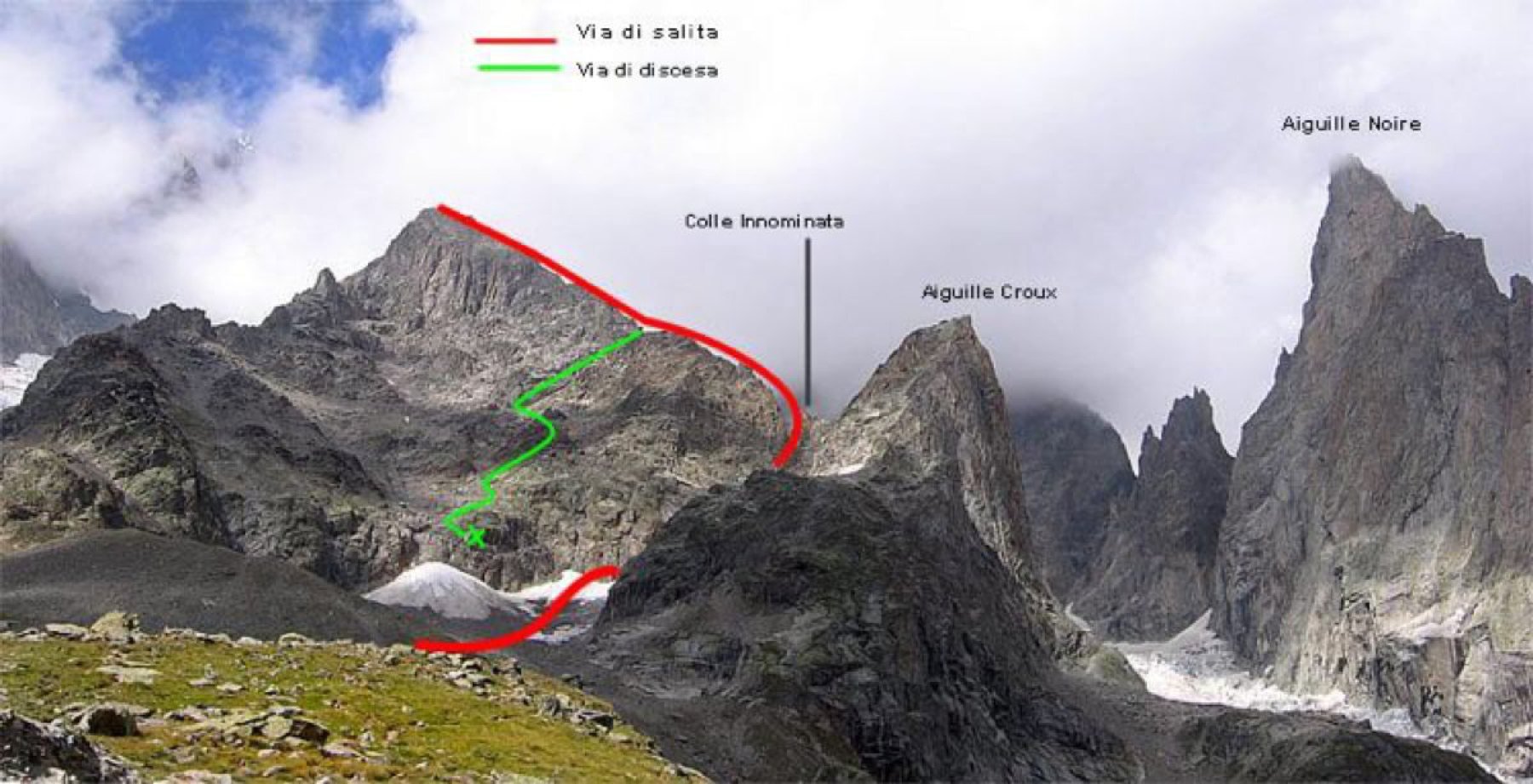
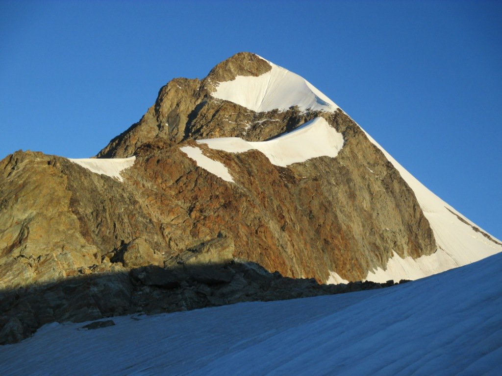
L'Aiguille de Trelatete Orientale è, delle quattro cime del gruppo, la più facilmente raggiungibile dal versante italiano. A differenza della via normale che sale dal Bivacco Rainetto scavalcando il Petit Mont Blanc, questo itinerario comporta un livello di difficoltà decisamente superiore.
Dal Rifugio Elisabetta il dislivello è sostenuto però, a differenza del Bivacco, al Rifugio si hanno più "confort" e si riposa meglio!
Da non sottovalutare la discesa dalla via normale che, seppure non difficile, è decisamente lunga. Non conosco le attuali condizioni del Ghiacciaio della Lex Blanche, ma credo sia comunque percorribile senza grossi problemi.
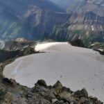
E' sicuramente più utile verificare che sia il ghiacciaio sospeso sia la fascia nevosa che consente di portarsi sotto di esso siano in buone condizioni.
Avvicinamento
Dal Rifugio Elisabetta il dislivello è sostenuto però, a differenza del Bivacco, al Rifugio si hanno più "confort" e si riposa meglio!
Da non sottovalutare la discesa dalla via normale che, seppure non difficile, è decisamente lunga. Non conosco le attuali condizioni del Ghiacciaio della Lex Blanche, ma credo sia comunque percorribile senza grossi problemi.
E' sicuramente più utile verificare che sia il ghiacciaio sospeso sia la fascia nevosa che consente di portarsi sotto di esso siano in buone condizioni.
.
Descrizione
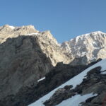
Da La Visaille (sbarra e parcheggio) seguire lo sterrato (eventuali scorciatoie) e raggiungere il Rifugio Elisabetta, m. 2197. Dal Rifugio si sale dapprima in direzione del Col d’Estellette ed arrivati sopra una bastionata rocciosa a circa m. 2700, si raggiunge il ghiacciaio.
Lo si attraversa puntando alle rocce più basse sul versante sud dell’Aiguille de Trelatete Orientale (piuttosto complesso, numerosissimi crepacci e piccoli seracchi).
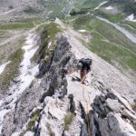
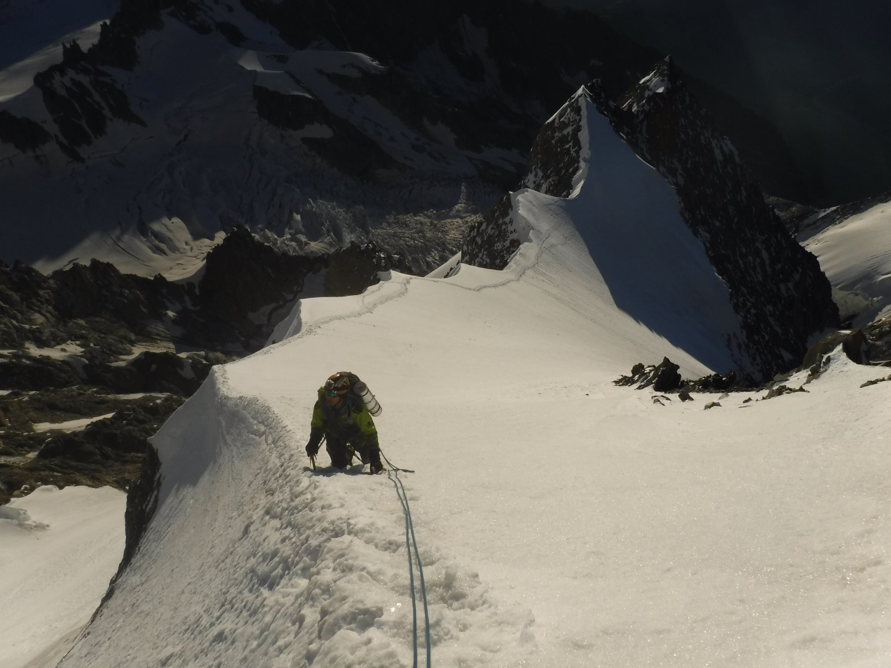
Arrivati a quota 3000 circa innalzarsi verso destra (sempre molti crepacci), in direzione del Petit Mont Blanc, fino a quando, a quota 3200 circa, si raggiunge la fascia nevosa che, verso sinistra, porta proprio alla base del Ghiacciaio Sospeso. Risalirlo direttamente (max 45°) fino a sbucare sulla cresta Nord Est. Da qui in breve, verso sinistra, sull’aerea vetta (attenzione alle cornici!).
Discesa per la via normale passando dal Petit Mont Blanc e dal Bivacco Rainetto.
- Cartografia:
- I.G.C. 1:50000 n.4 Monte Bianco
- Bibliografia:
- Guida C.A.I. - T.C.I. Monte Bianco vol. 1
Nelle vicinanze Mappa
Itinerari
20/09/2025 AO, Courmayeur D+ 1754 m F Sud-Est
Piccolo Monte Bianco o Petit Mont Blanc da La Visaille
 0m
0m
18/06/2026 AO, Courmayeur D+ 2162 m AD Sud-Est
Innominata (Punta) Cresta Est
 50m
50m
22/08/2008 AO, Courmayeur D+ 1300 m TD+ Sud-Ovest
Gugliermina (Pic) Via Gervasutti – Boccalatte
50m
05/08/2025 AO, Courmayeur D+ 2200 m D Sud
Glaciers (Aiguille des) Cresta SE via Kuffner
 50m
50m
30/07/2017 AO, Courmayeur D+ 1922 m F Varie
Glaciers (Dome des) da La Visaille per il Rifugio Elisabetta
 50m
50m
08/07/2022 AO, Courmayeur D+ 1600 m PD Sud
Croux (Aiguille) Cresta Sud
 50m
50m
10/08/2025 AO, Courmayeur D+ 1000 m PD Nord-Est
Pyramides Calcaires, cima SE – Cresta NE
 50m
50m
16/07/2026 AO, Courmayeur D+ 2100 m D Ovest
Innominata (Punta) Via del CAI di Tortona
 50m
50m
28/06/2020 AO, Courmayeur D+ 2300 m PD+ Sud
Trelatete (Aiguille de) cima orientale Via Normale Italiana da la Visaille
 50m
50m
22/07/2021 AO, Courmayeur D+ 3210 m D+ Sud-Est
Bianco (Monte) – Cresta di Peuterey per l’Aiguille Blanche
 50m
50m