7.8Km
7.8Km


Note
 50m
50m
1.3Km
1.3Km
1.3Km
2.7Km
2.7Km
2.7Km
2.7Km
50m
50m
1.3Km
1.3Km
1.3Km
2.7Km
2.7Km
2.7Km
2.7Km
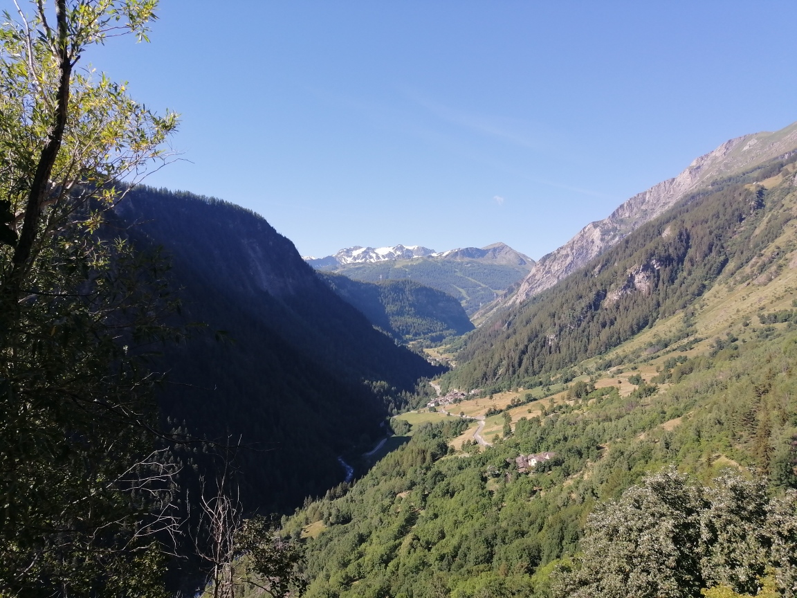
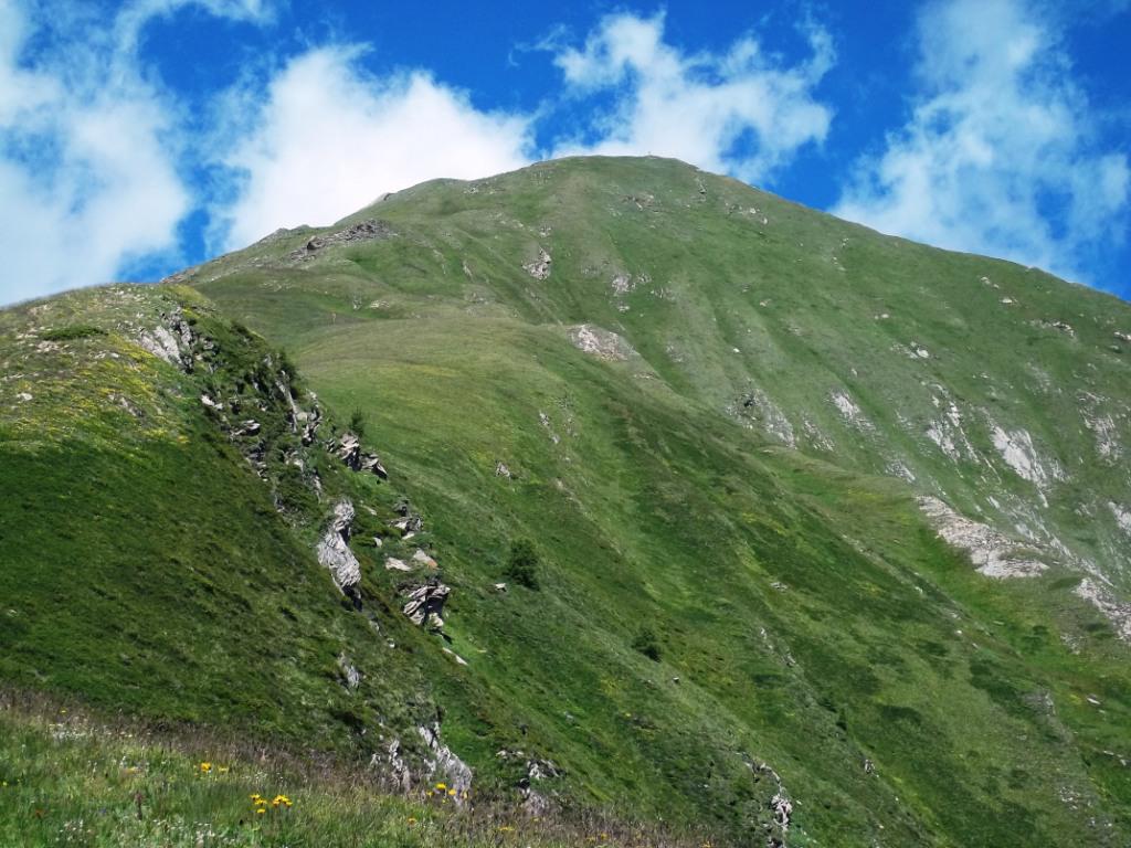
La salita si svolge su un percorso diretto e sostenuto, in alto non ci sono segnavia ma il sentiero è comunque abbastanza evidente. Gli ultimi 300 m di dislivello si svolgono sulla dorsale Est, quindi a inizio stagione (o autunno inoltrato) si possono incontrare residui nevosi.
Considerato il forte soleggiamento del percorso, è consigliabile effettuare la salita nelle mezze stagioni o non nelle giornate più calde.
Ottimo percorso per chi volesse una combo mtb+trekking, salendo in mountain bike fino a Plan Praz.Da Elevaz si segue la strada asfaltata pianeggiante fino alla frazione Torrent 1345 m (volendo si può anche parcheggiare qui) .
Si segue il sentiero tra le case in piano per prati e radure nel bosco, quindi si prosegue a sinistra in salita su sentiero non sempre evidente, finchè si incontra il bivio con il tracciato che proviene dal fondovalle (sentiero n.6) in località Quiedroz (ruderi).
Si sale ora marcatamente toccando presto la aita di Chamossin, dove occorre proseguire sulla sterrata verso sinistra per pochi metri finchè si incontra l’asfalto (si tratta della strada privata che collega Elevaz a Plan Praz). Seguendo i segnavia che indicano il sentiero nel bosco, si interseca diverse volte questa strada, sino a raggiungere (con buon sentiero ma talvolta ripido) la bella località di Chanton a 1800 m circa.
Si prosegue attraversando la strada seguendo sempre il sentiero ai margini del lariceto, che successivamente incrocia la poderale, ora sterrata, che andrà seguita per un tratto, fino ad un bivio (indicazioni su una roccia). Si continua a sinistra sul sentiero n.3 raggiungendo presto la sommità boscosa del Mont de Nona 2016 m, proprio alla base della lunga dorsale est di salita alla cima.
Seguendo la marcata traccia su terreno a volte ripido ma privo di difficoltà, si arriva a circa 2400 m dove si incontra l’unica palina indicatrice, all’incrocio con il sentiero 3A che useremo in discesa.
Senza possibilità di errore si continua sulla dorsale fino alla sommità nord-est del Mont Crammont, che è la cima escursionistica dove è posta una tavola d’orientamento.
Prestare attenzione poco prima della cima, ad un tratto dove (info 2022) era collocata la statua della Madonna, ora rimossa a causa del forte pericolo di crollo di quella porzione della montagna che progressivamente si sta staccando. Un nuovo sentiero infatti è stato tracciato 20 m sotto appunto per evitare questo passaggio, dove tra l’altro vi era stato costruito a fine 1800 un bivacco (visibili ancora i basamenti di pietra.
Per raggiungere l’elevazione sud-ovest del Crammont, occorre proseguire sulla cresta abbastanza esposta e su terreno disagevole, cautela.
Per la discesa si scende a ritroso fino al bivio sulla dorsale a 2400 m, per poi proseguire sull’erboso sentiero 3A (non ci sono segnavia ma è evidente) che si porta nel valloncello del torrente Sec (visibile anche un piccolo laghetto) raggiungendo l’alpeggio di Plan Praz 2100 m circa. Da qui si segue la pista sterrata fino al bivio incontrato al mattino con il segnavia su una pietra, e quindi a Chanton prima di rientrare nel lariceto fino a Torrent ed Elevaz. Ovviamente è anche possibile seguire integralmente la strada, allungando lo sviluppo del percorso.
Avvicinamento
Considerato il forte soleggiamento del percorso, è consigliabile effettuare la salita nelle mezze stagioni o non nelle giornate più calde.
Ottimo percorso per chi volesse una combo mtb+trekking, salendo in mountain bike fino a Plan Praz.Da Elevaz si segue la strada asfaltata pianeggiante fino alla frazione Torrent 1345 m (volendo si può anche parcheggiare qui) .
Si segue il sentiero tra le case in piano per prati e radure nel bosco, quindi si prosegue a sinistra in salita su sentiero non sempre evidente, finchè si incontra il bivio con il tracciato che proviene dal fondovalle (sentiero n.6) in località Quiedroz (ruderi).
Si sale ora marcatamente toccando presto la aita di Chamossin, dove occorre proseguire sulla sterrata verso sinistra per pochi metri finchè si incontra l’asfalto (si tratta della strada privata che collega Elevaz a Plan Praz). Seguendo i segnavia che indicano il sentiero nel bosco, si interseca diverse volte questa strada, sino a raggiungere (con buon sentiero ma talvolta ripido) la bella località di Chanton a 1800 m circa.
Si prosegue attraversando la strada seguendo sempre il sentiero ai margini del lariceto, che successivamente incrocia la poderale, ora sterrata, che andrà seguita per un tratto, fino ad un bivio (indicazioni su una roccia). Si continua a sinistra sul sentiero n.3 raggiungendo presto la sommità boscosa del Mont de Nona 2016 m, proprio alla base della lunga dorsale est di salita alla cima.
Seguendo la marcata traccia su terreno a volte ripido ma privo di difficoltà, si arriva a circa 2400 m dove si incontra l’unica palina indicatrice, all’incrocio con il sentiero 3A che useremo in discesa.
Senza possibilità di errore si continua sulla dorsale fino alla sommità nord-est del Mont Crammont, che è la cima escursionistica dove è posta una tavola d’orientamento.
Prestare attenzione poco prima della cima, ad un tratto dove (info 2022) era collocata la statua della Madonna, ora rimossa a causa del forte pericolo di crollo di quella porzione della montagna che progressivamente si sta staccando. Un nuovo sentiero infatti è stato tracciato 20 m sotto appunto per evitare questo passaggio, dove tra l’altro vi era stato costruito a fine 1800 un bivacco (visibili ancora i basamenti di pietra.
Per raggiungere l’elevazione sud-ovest del Crammont, occorre proseguire sulla cresta abbastanza esposta e su terreno disagevole, cautela.
Per la discesa si scende a ritroso fino al bivio sulla dorsale a 2400 m, per poi proseguire sull’erboso sentiero 3A (non ci sono segnavia ma è evidente) che si porta nel valloncello del torrente Sec (visibile anche un piccolo laghetto) raggiungendo l’alpeggio di Plan Praz 2100 m circa. Da qui si segue la pista sterrata fino al bivio incontrato al mattino con il segnavia su una pietra, e quindi a Chanton prima di rientrare nel lariceto fino a Torrent ed Elevaz. Ovviamente è anche possibile seguire integralmente la strada, allungando lo sviluppo del percorso.
Autostrada Torino Aosta uscita Morgex direzione Courmayeur fino a Prè Saint Didier, oppure SS26. Risalire la Valle di La Thuile per 6 km fino alla frazione Elevaz. Possibilità di qualche parcheggio nella piccola piazzetta del paese, oppure a bordo strada poco prima.
Descrizione
Da Elevaz si segue la strada asfaltata pianeggiante fino alla frazione Torrent 1345 m (volendo si può anche parcheggiare qui) .
Si segue il sentiero tra le case in piano per prati e radure nel bosco, quindi si prosegue a sinistra in salita su sentiero non sempre evidente, finchè si incontra il bivio con il tracciato che proviene dal fondovalle (sentiero n.6) in località Quiedroz (ruderi).
Si sale ora marcatamente toccando presto la baita di Chamossin, dove occorre proseguire sulla sterrata verso sinistra per pochi metri finchè si incontra l’asfalto (si tratta della strada privata che collega Elevaz a Plan Praz). Seguendo i segnavia che indicano il sentiero nel bosco, si interseca diverse volte questa strada, sino a raggiungere (con buon sentiero ma talvolta ripido) la bella località di Chanton a 1800 m circa.
Si prosegue attraversando la strada seguendo sempre il sentiero ai margini del lariceto, che successivamente incrocia la poderale, ora sterrata, che andrà seguita per un tratto, fino ad un bivio (indicazioni su una roccia). Si continua a sinistra sul sentiero n.3 raggiungendo presto la sommità boscosa del Mont de Nona 2016 m, proprio alla base della lunga dorsale est di salita alla cima.
Seguendo la marcata traccia su terreno a volte ripido ma privo di difficoltà, si arriva a circa 2400 m dove si incontra l’unica palina indicatrice, all’incrocio con il sentiero 3A che useremo in discesa.
Senza possibilità di errore si continua sulla dorsale fino alla sommità sud-est del Mont Crammont, che è la cima escursionistica dove è posta una tavola d’orientamento.
Prestare attenzione poco prima della cima, ad un tratto dove (info 2022) era collocata la statua della Madonna, ora rimossa a causa del forte pericolo di crollo di quella porzione della montagna che progressivamente si sta staccando. Un nuovo sentiero infatti è stato tracciato 20 m sotto appunto per evitare questo passaggio, dove tra l’altro vi era stato costruito a fine 1800 un bivacco (visibili ancora i basamenti di pietra.
Per raggiungere l’elevazione nord-ovest del Crammont, occorre proseguire sulla cresta abbastanza esposta e su terreno disagevole, cautela.
Per la discesa si scende a ritroso fino al bivio sulla dorsale a 2400 m, per poi proseguire sull’erboso sentiero 3A (non ci sono segnavia ma è evidente) che si porta nel valloncello del torrente Sec (visibile anche un piccolo laghetto) raggiungendo l’alpeggio di Plan Praz 2100 m circa. Da qui si segue la pista sterrata fino al bivio incontrato al mattino con il segnavia su una pietra, e quindi a Chanton prima di rientrare nel lariceto fino a Torrent ed Elevaz. Ovviamente è anche possibile seguire integralmente la strada, allungando lo sviluppo del percorso.
- Cartografia:
- Monte Bianco - Courmayeur - Carta dei Sentieri 1 - L'Escursionista editore
- Bibliografia:
- Guida Monti d'Italia, Alpi Graie Meriodionali, ediz. CAI-TCI
Nelle vicinanze Mappa
Itinerari
22/07/2017 AO, Pré-Saint-Didier D+ 1483 m EE Varie
Jeunes (Tete des), anticima 2706 m da Elevaz per Plan Praz
 50m
50m
17/05/2014 AO, La Thuile D+ 1355 m EE Sud
Torrent (Vallone) colle 2657 m da Elevaz, anello nel Vallone di Youlaz
 50m
50m
12/09/2021 AO, La Thuile D+ 1261 m E Sud
Arp (Col d’) da la Balme
 1.3Km
1.3Km
10/09/2023 AO, Pré-Saint-Didier D+ 1352 m E Sud-Est
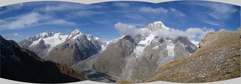
Youla (Col di) da la Balme
 1.3Km
1.3Km
07/07/2023 AO, Pré-Saint-Didier D+ 1113 m EEA Varie
Plate (Lac de la) da La Balme
 1.3Km
1.3Km
01/11/2024 AO, Morgex D+ 1100 m EE/F Nord-Est
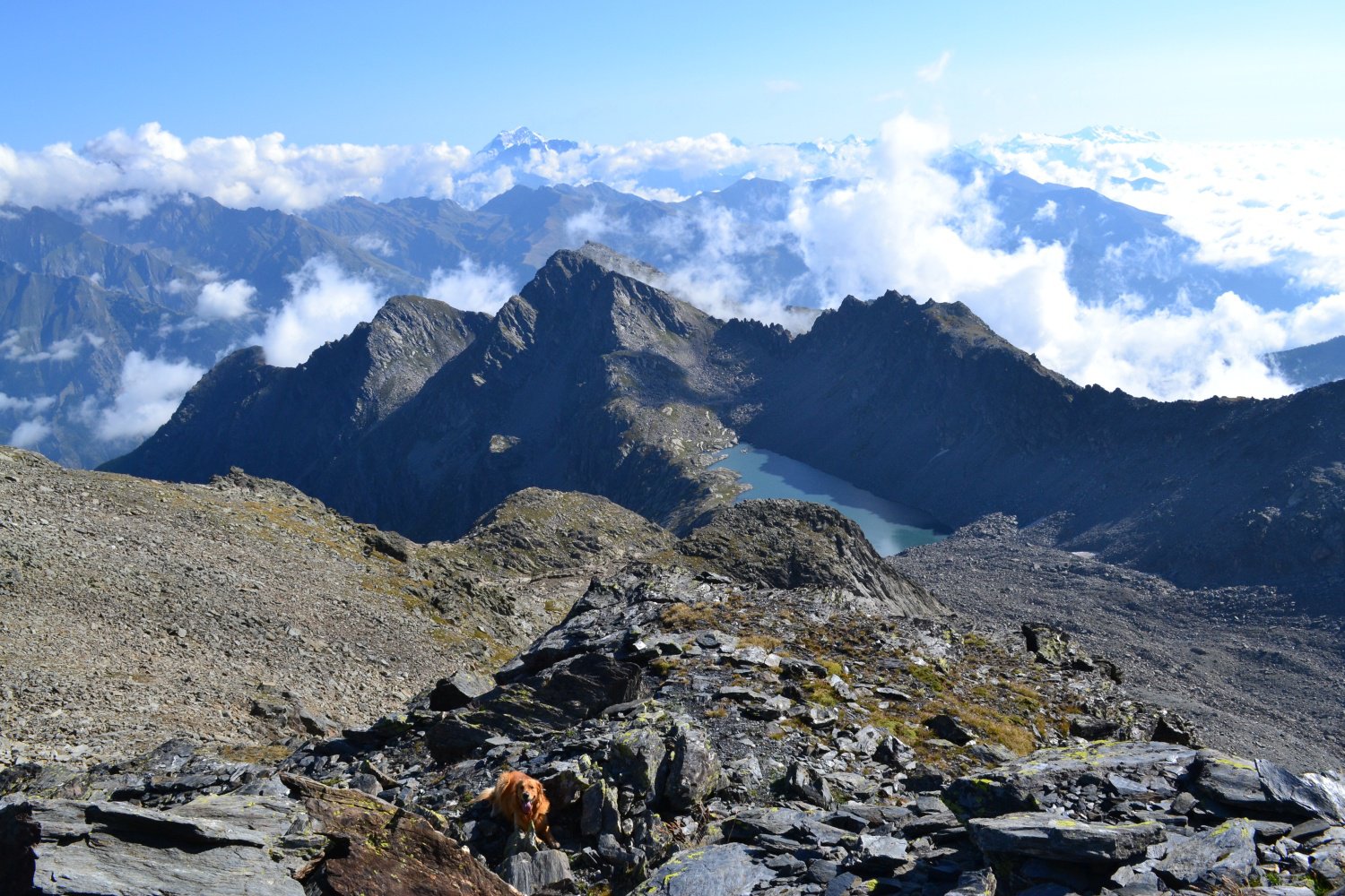
Colmet (Mont) dal Colle San Carlo
 2.7Km
2.7Km
28/06/2026 AO, Morgex D+ 190 m T Nord
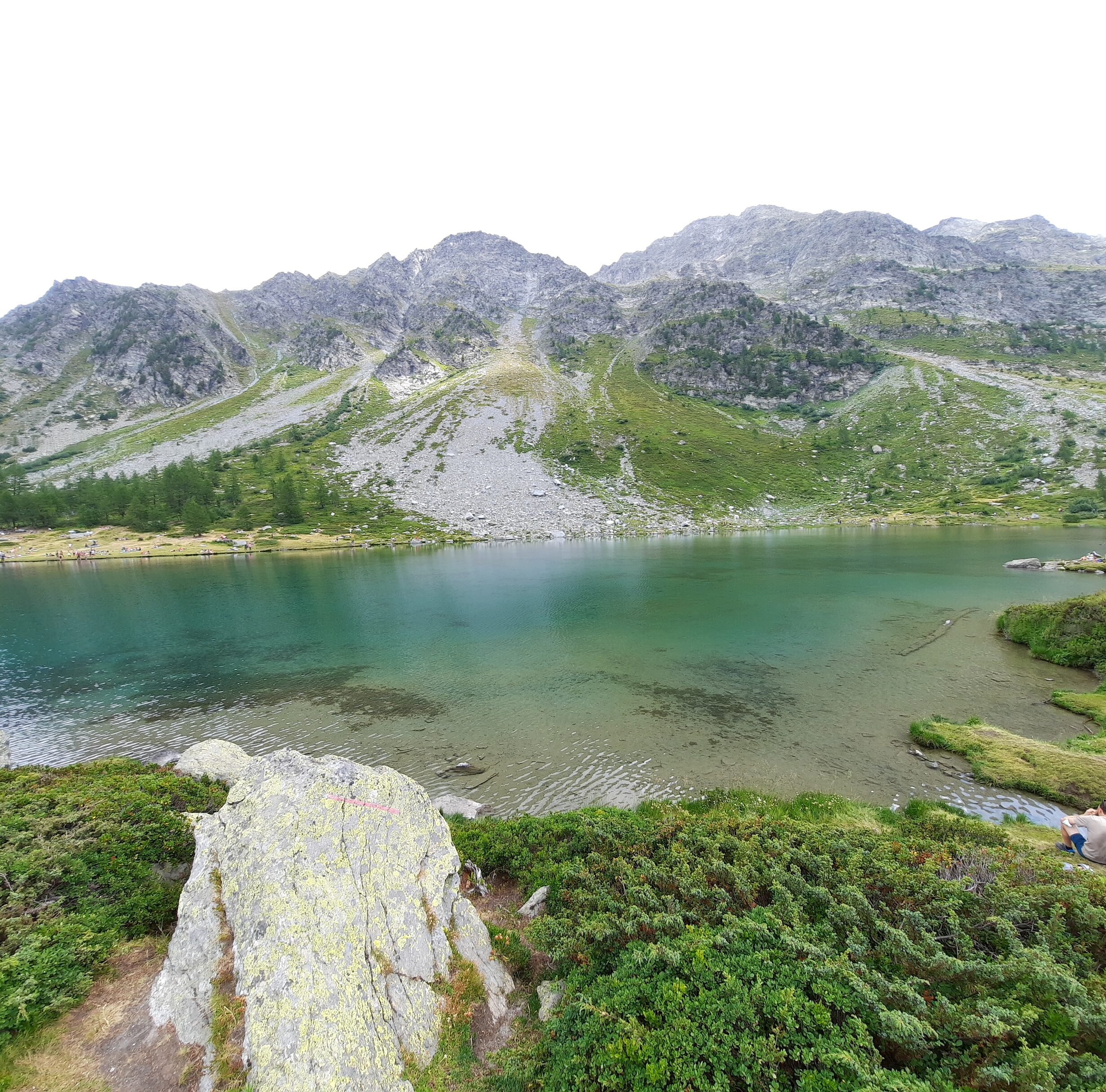
Arpy (Lago d’) dal Colle San Carlo
 2.7Km
2.7Km
26/07/2025 AO, Morgex D+ 71 m T Sud-Ovest
Arpy (Tete d’) dal Colle San Carlo
 2.7Km
2.7Km
17/10/2025 AO, Morgex D+ 410 m E Est
Croce (Punta e Colle della) dal Colle San Carlo per il Lago d’Arpy
 2.7Km
2.7Km
06/09/2015 AO, Morgex D+ 900 m EE Nord-Ovest
Colmet (Col) dal Colle San Carlo
2.7Km