100m
100m
Note
Storico
 50m
100m
1.3Km
2.1Km
2.1Km
2.7Km
2.8Km
3Km
3Km
3Km
50m
100m
1.3Km
2.1Km
2.1Km
2.7Km
2.8Km
3Km
3Km
3Km
100m
1.9Km
4.9Km
4.9Km
5.2Km
5.2Km
7Km
7.2Km
7.6Km
7.6Km
Percorso non difficile ma che nella parte finale a causa della natura instabile del terreno richiede piede fermo e abitudine a questi ambienti. Sconsigliato ai principianti.
Se si parte da Vazon si deve considerare uno sviluppo notevole.
Avvicinamento
Se si parte da Vazon si deve considerare uno sviluppo notevole.
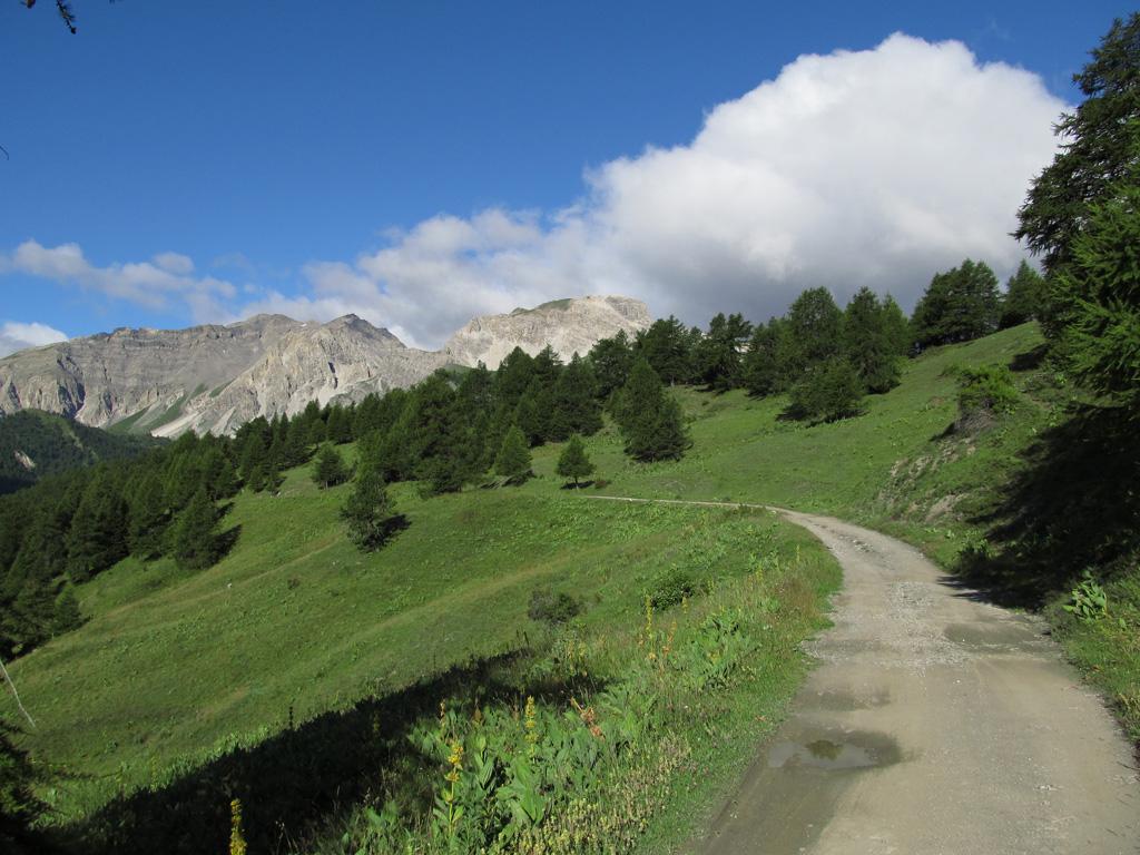
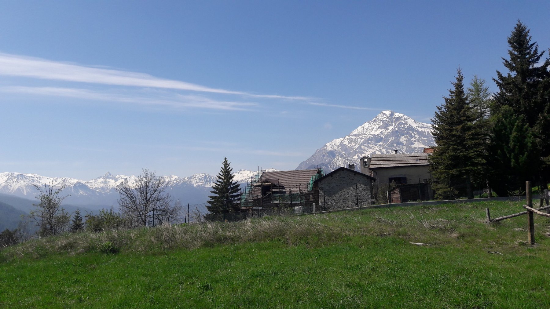
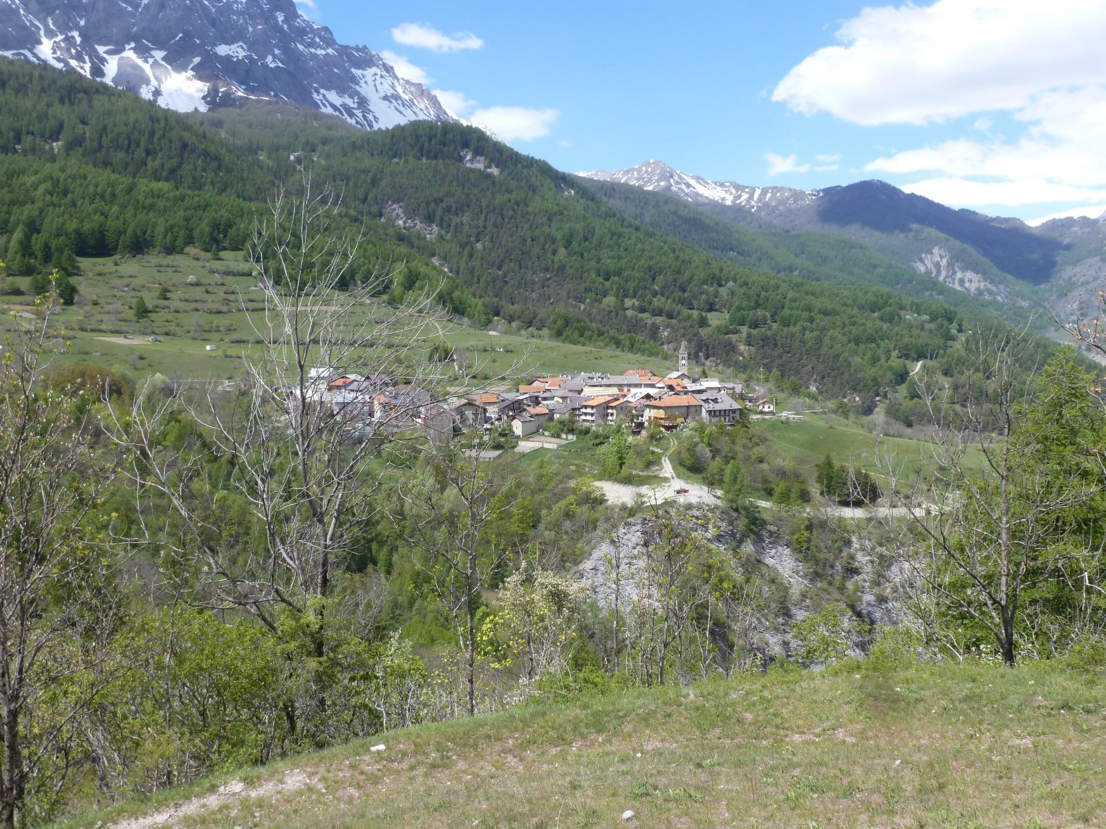
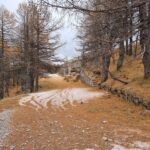
Da Oulx si seguono le indicazioni per Cotolivier, e si sale lungo la strada senza possibilità di errore, fino a scegliere uno dei 3 punti di partenza possibili, in base alle condizioni della strada e della propria autovettura.
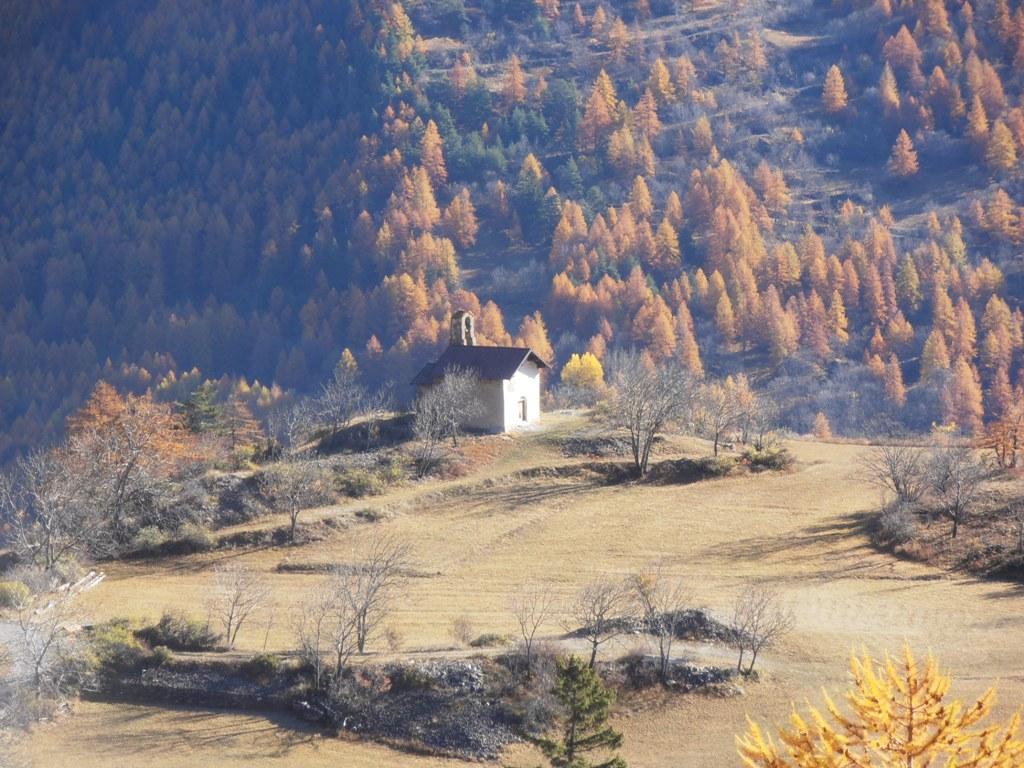
- Vazon 1650 m, dove termina il tratto asfaltato: parcheggiato nello spiazzo dopo la frazione, si segue il sentiero a fianco delle case ben segnalato, sul percorso del KM verticale Oulx-Cotolivier. Il sentiero sale nel bosco con scorci molto panoramici sull’alta valle di Susa, incrocia alcune volte la strada sterrata e conduce in cima al Cotolivier, volendo lo strappo finale è evitabile percorrendo un tratto di strada, questo comporta un po’ meno dislivello e si evita di salire in cima per poi ridiscendere al colletto per Pourachet.
- Colletto Cotolivier 2050 m: si raggiunge in auto su sterrata in discrete condizioni il colletto posto a sud del Cotolivier, dove continuando dritti si percorre la strada per Pourachet.
- Pourachet 2060 m: superato il colletto del Cotolivier si continua sulla sterrata via via in condizioni peggiori fino a giungere nei pressi di Pourachet, dove si parcheggia in uno degli spiazzi (questo tratto di strada è in condizioni variabili di anno in anno)
Descrizione
- Vazon 1650 m, dove termina il tratto asfaltato: parcheggiato nello spiazzo dopo la frazione, si segue il sentiero a fianco delle case ben segnalato, sul percorso del KM verticale Oulx-Cotolivier. Il sentiero sale nel bosco con scorci molto panoramici sull’alta valle di Susa, incrocia alcune volte la strada sterrata e conduce in cima al Cotolivier, volendo lo strappo finale è evitabile percorrendo un tratto di strada, questo comporta un po’ meno dislivello e si evita di salire in cima per poi ridiscendere al colletto per Pourachet.
- Colletto Cotolivier 2050 m: si raggiunge in auto su sterrata in discrete condizioni il colletto posto a sud del Cotolivier, dove continuando dritti si percorre la strada per Pourachet.
- Pourachet 2060 m: superato il colletto del Cotolivier si continua sulla sterrata via via in condizioni peggiori fino a giungere nei pressi di Pourachet, dove si parcheggia in uno degli spiazzi (questo tratto di strada è in condizioni variabili di anno in anno)
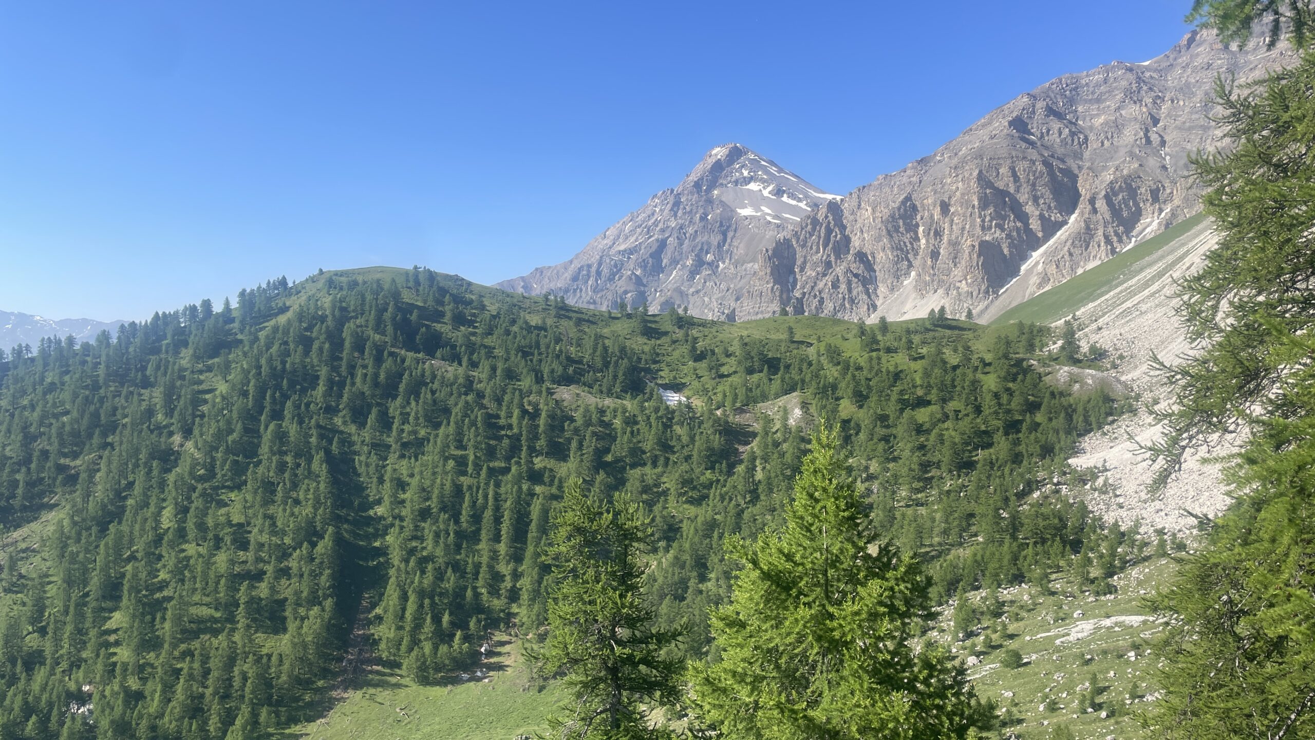
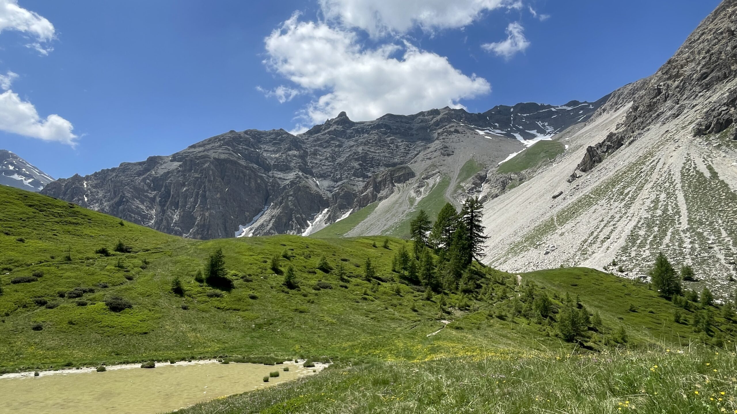
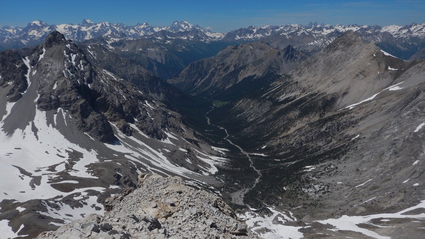
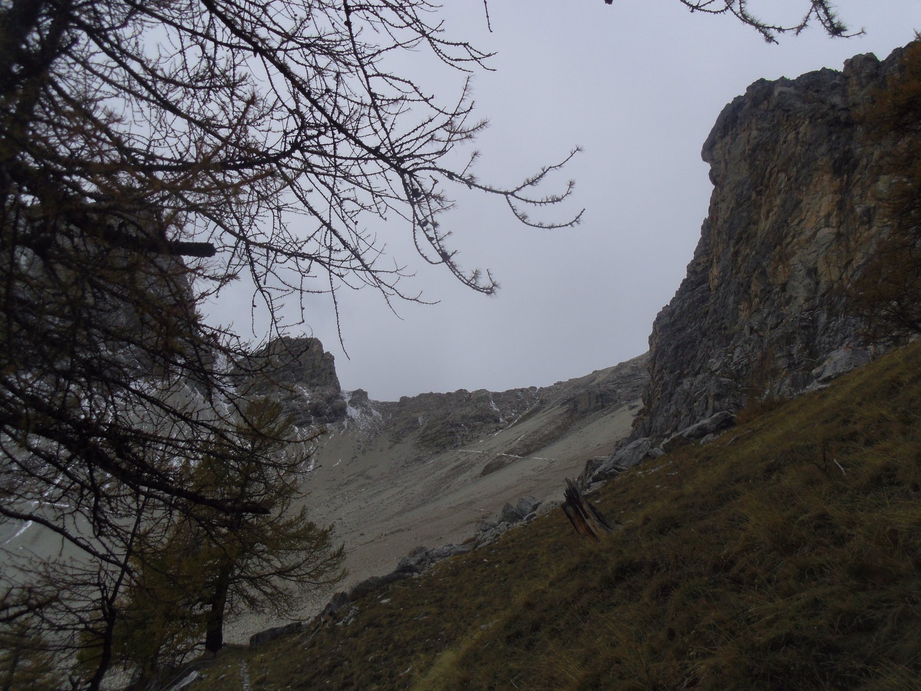
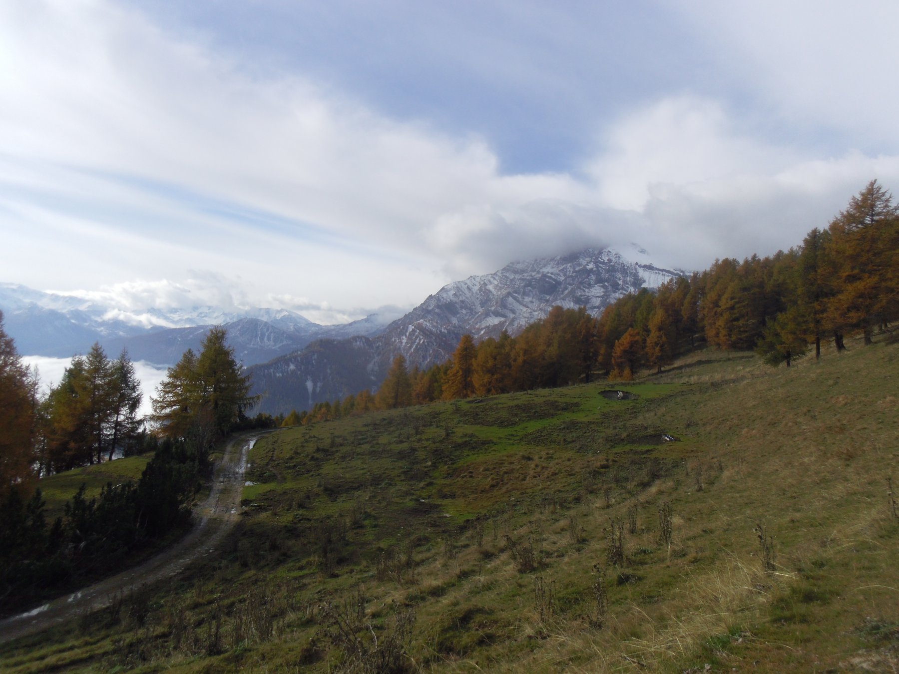
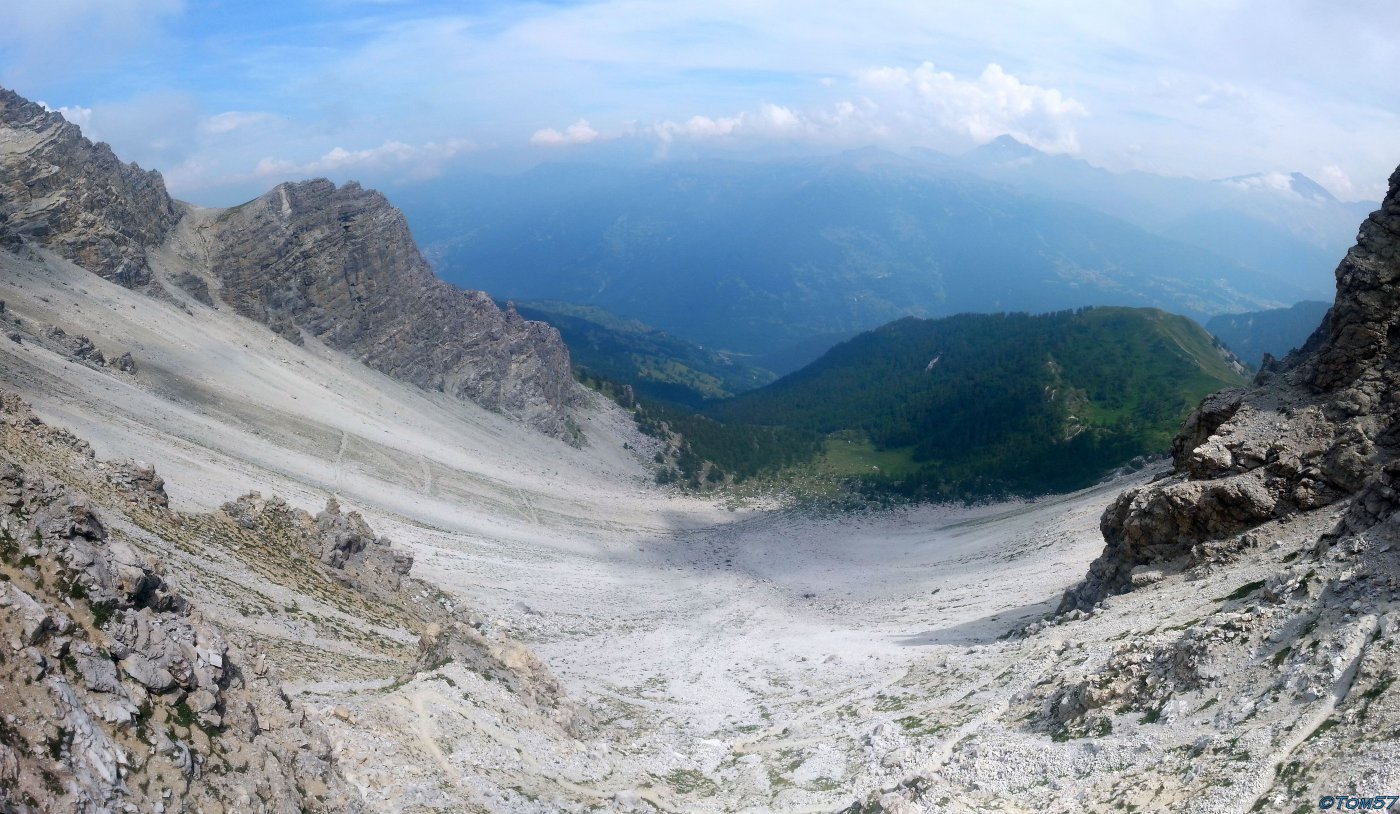
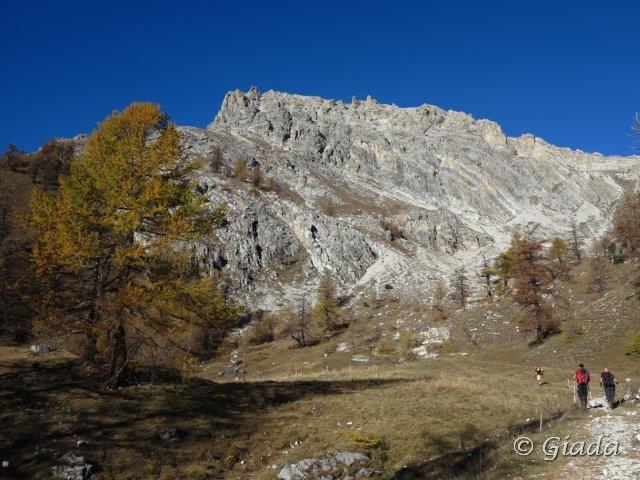
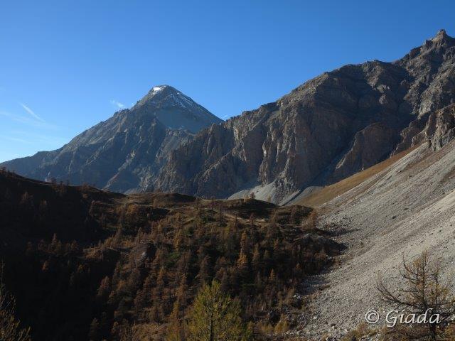
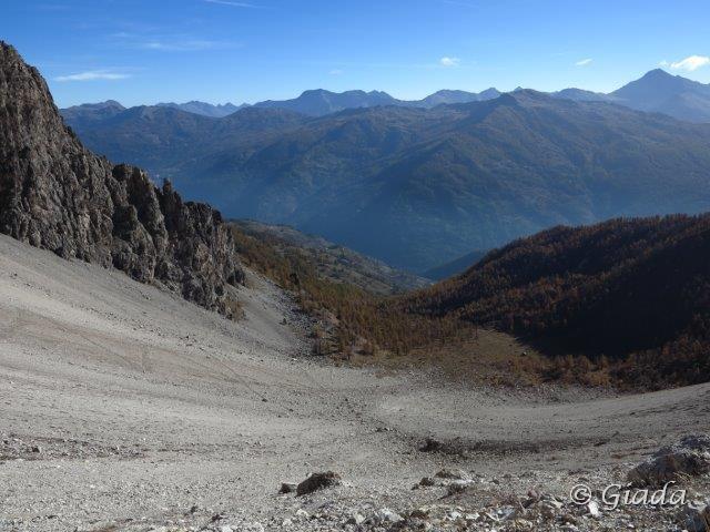
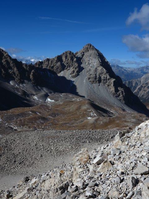
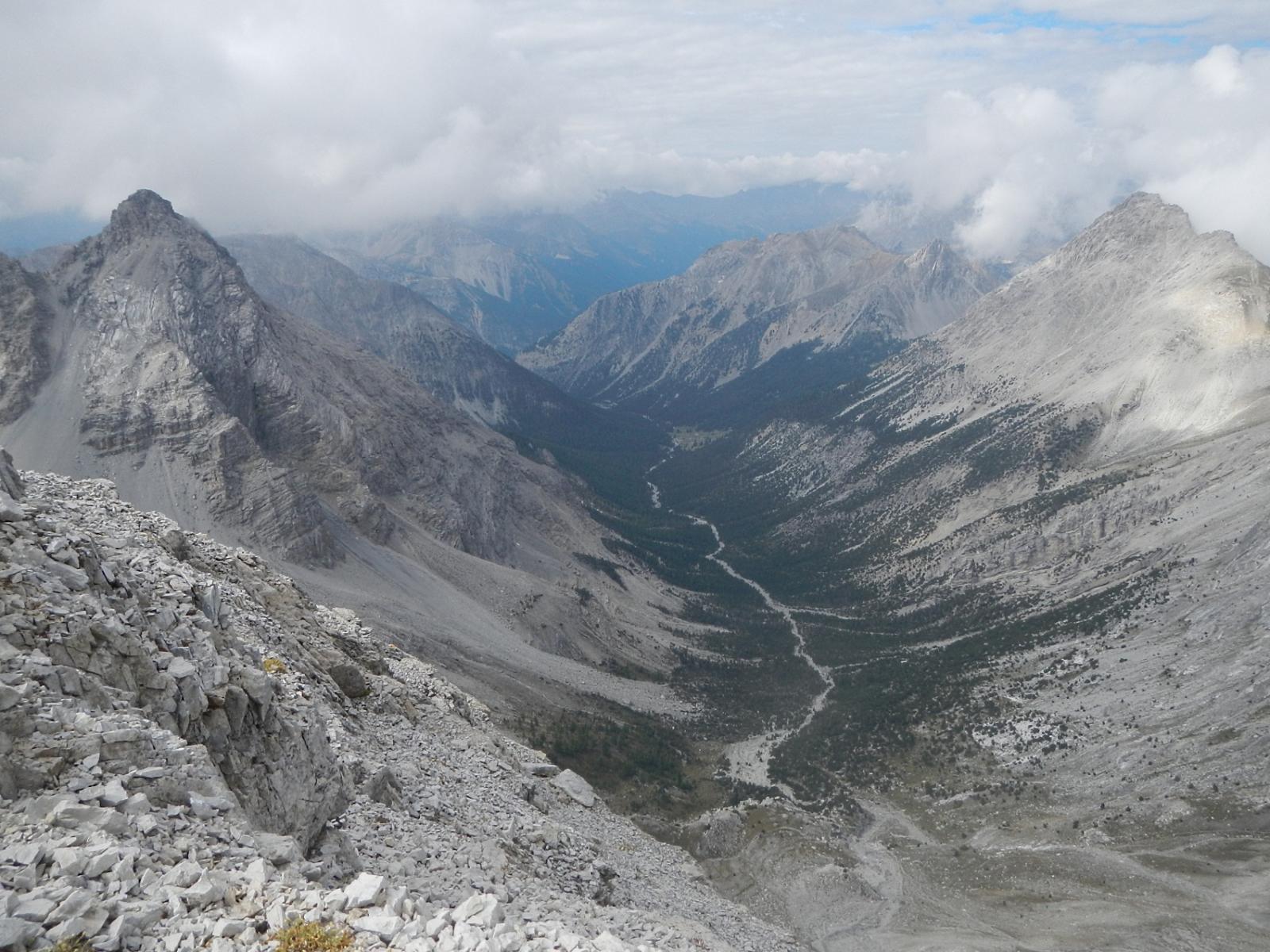
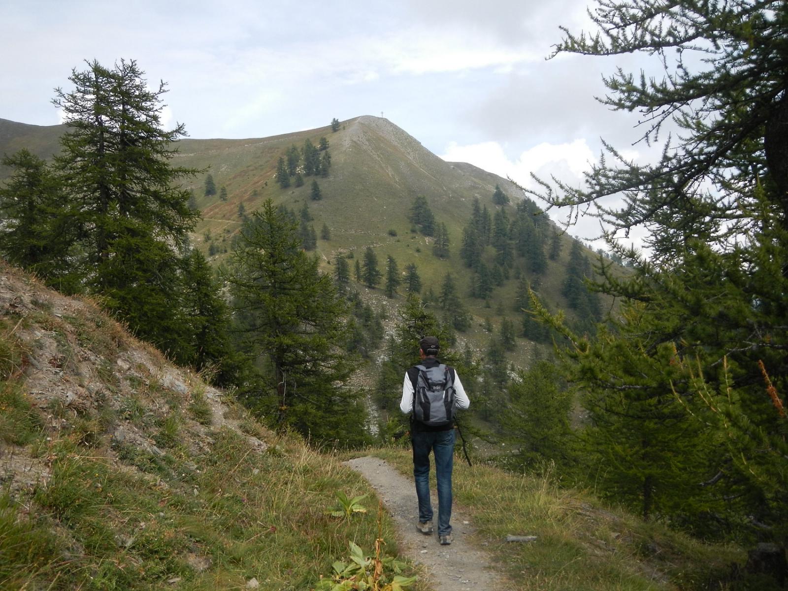
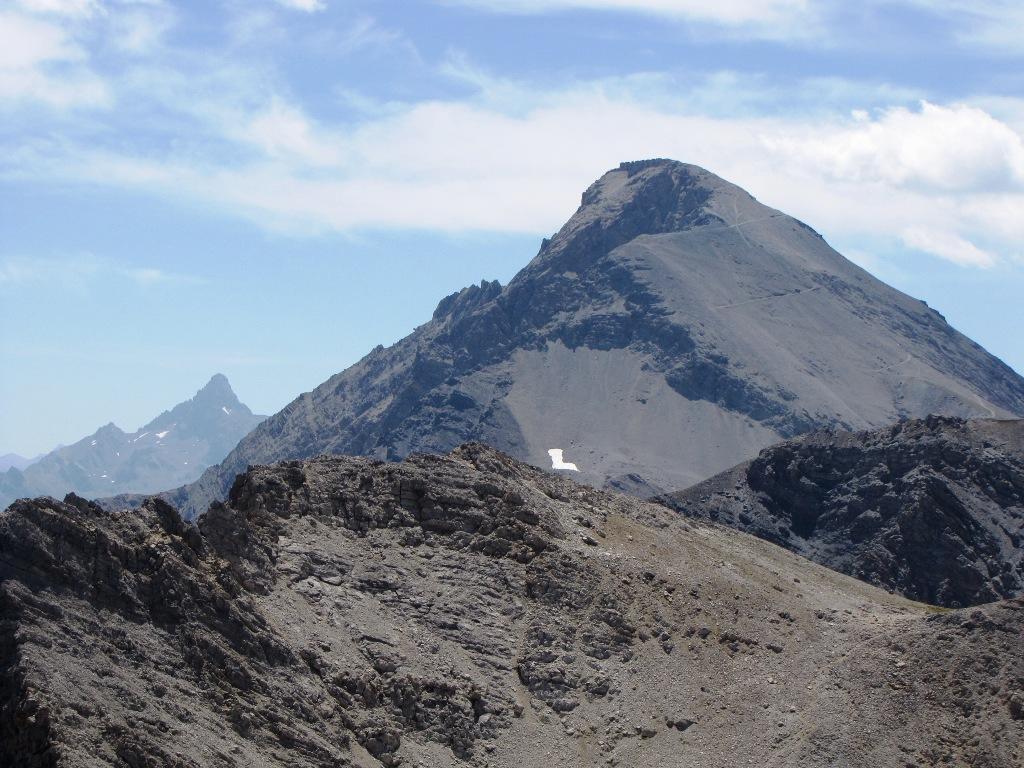
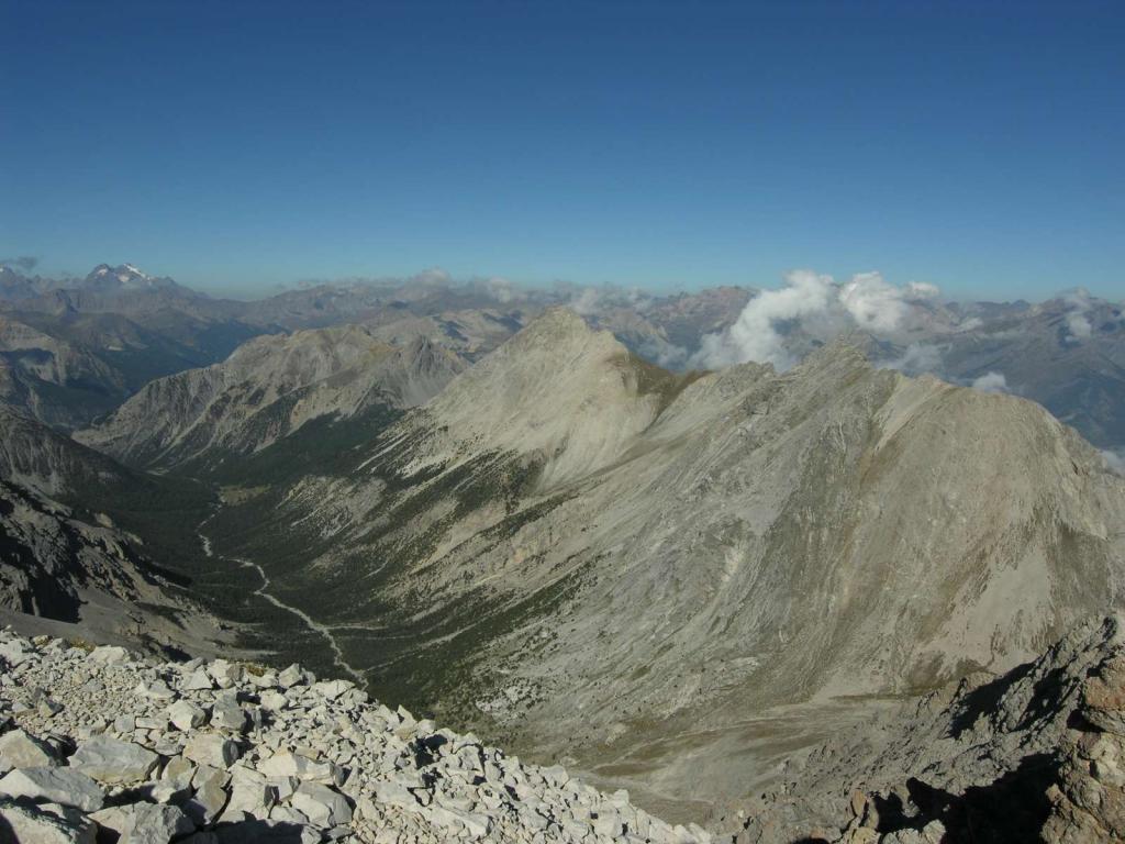
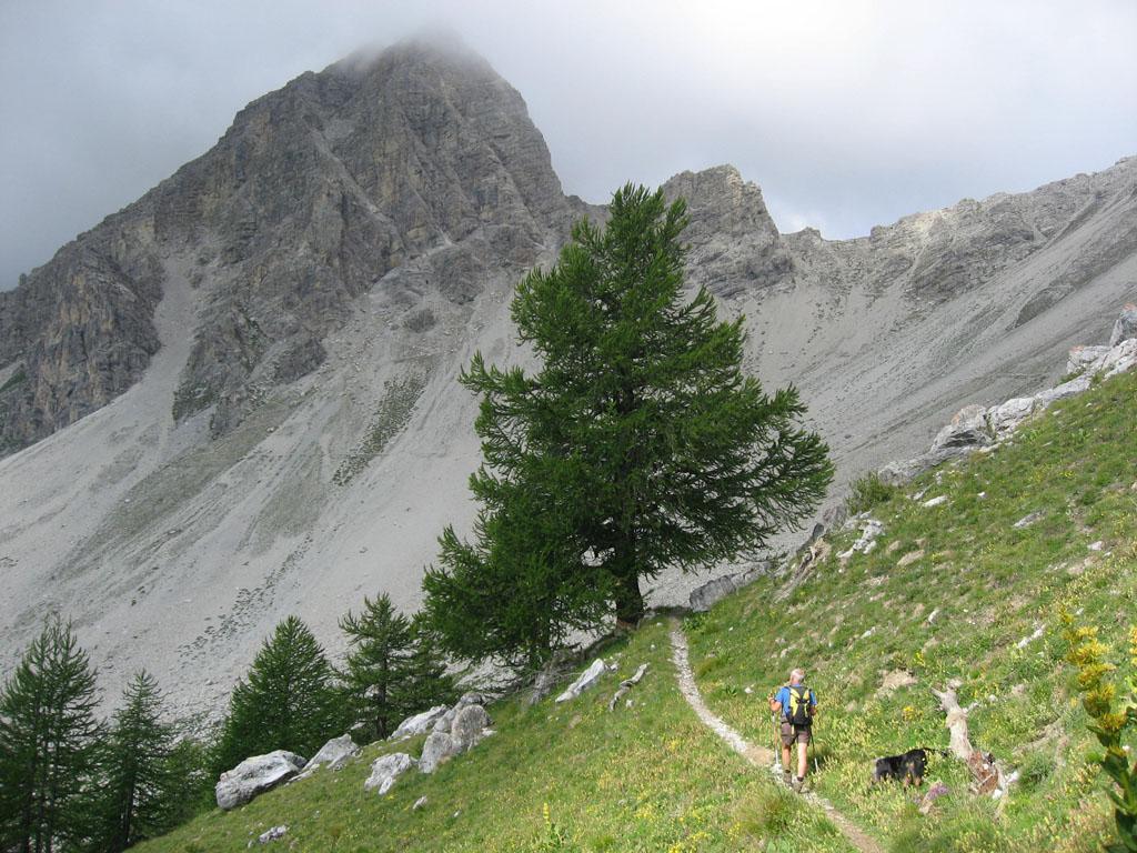
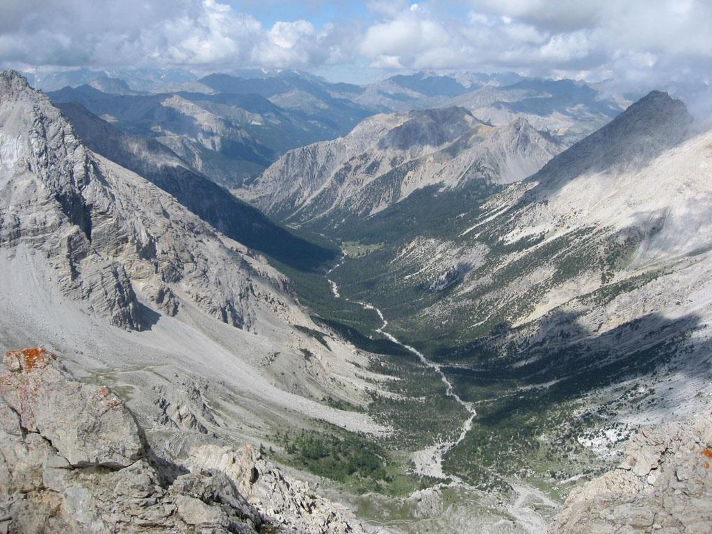
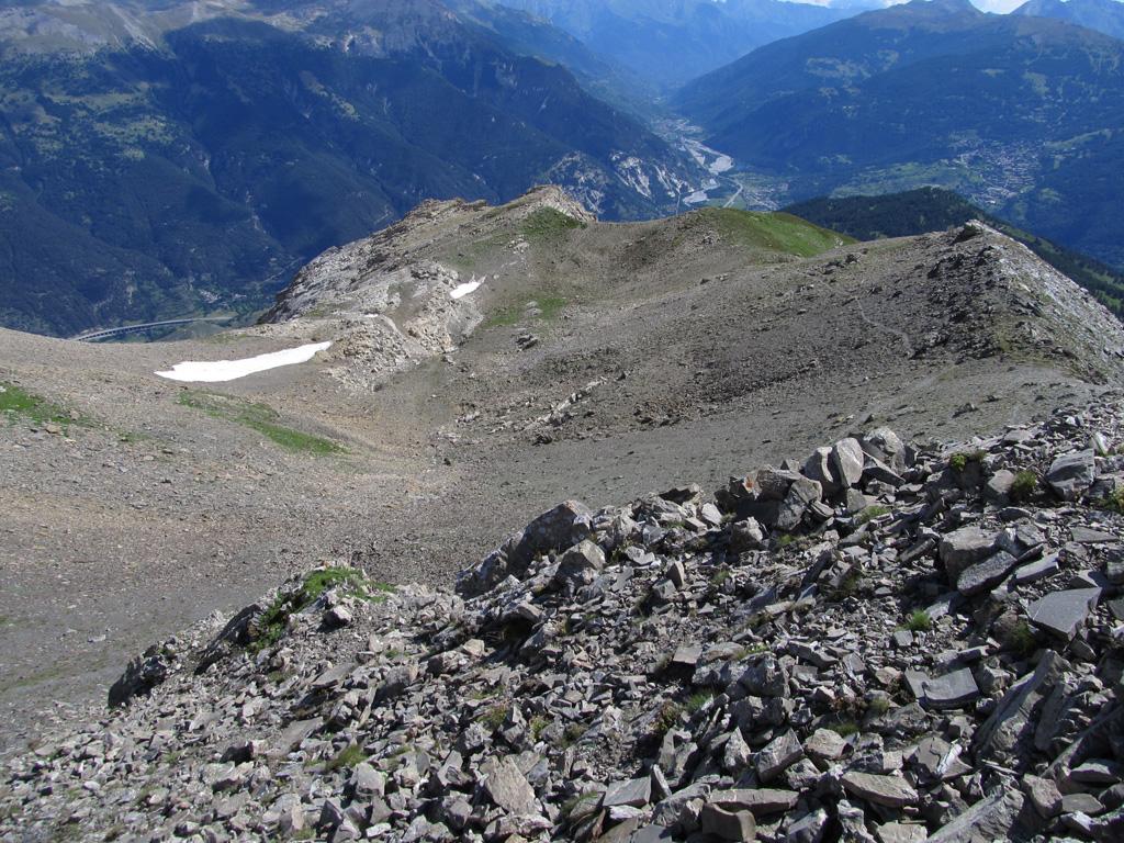
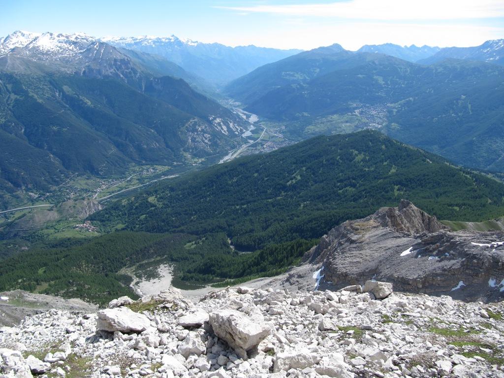
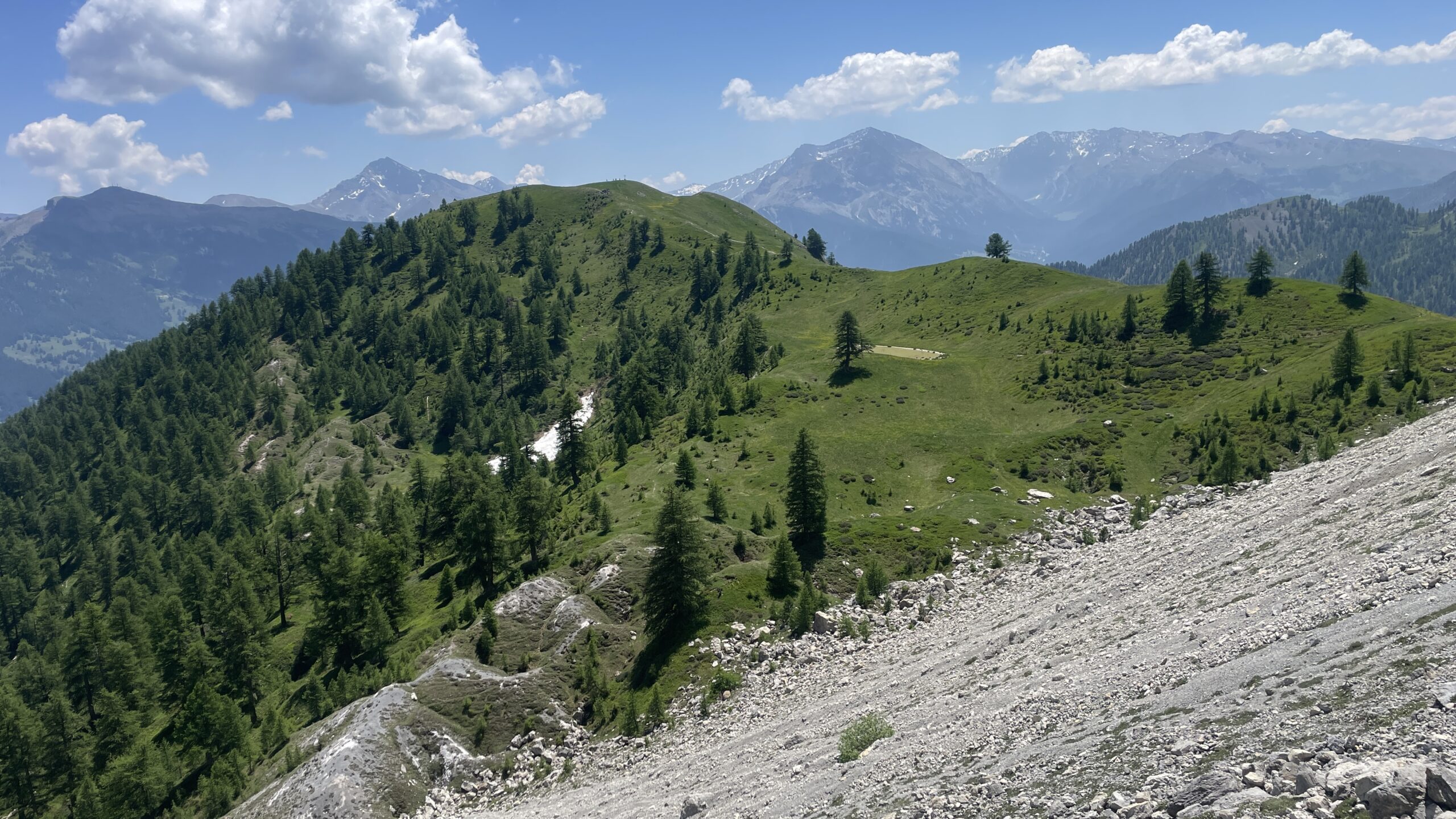
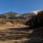
Raggiunto Pourachet con uno dei tre percorsi, si continua lungo la sterrata che poi diventa un largo sentiero, con un lungo tratto quasi pianeggiante. Si passa sotto la Croce di San Giuseppe visibile in alto a destra, si ignora il bivio per raggiungerla così come si ignora un sentiero minore che porta ad una casermetta e si giunge al fondo del vallone con una conca prativa.
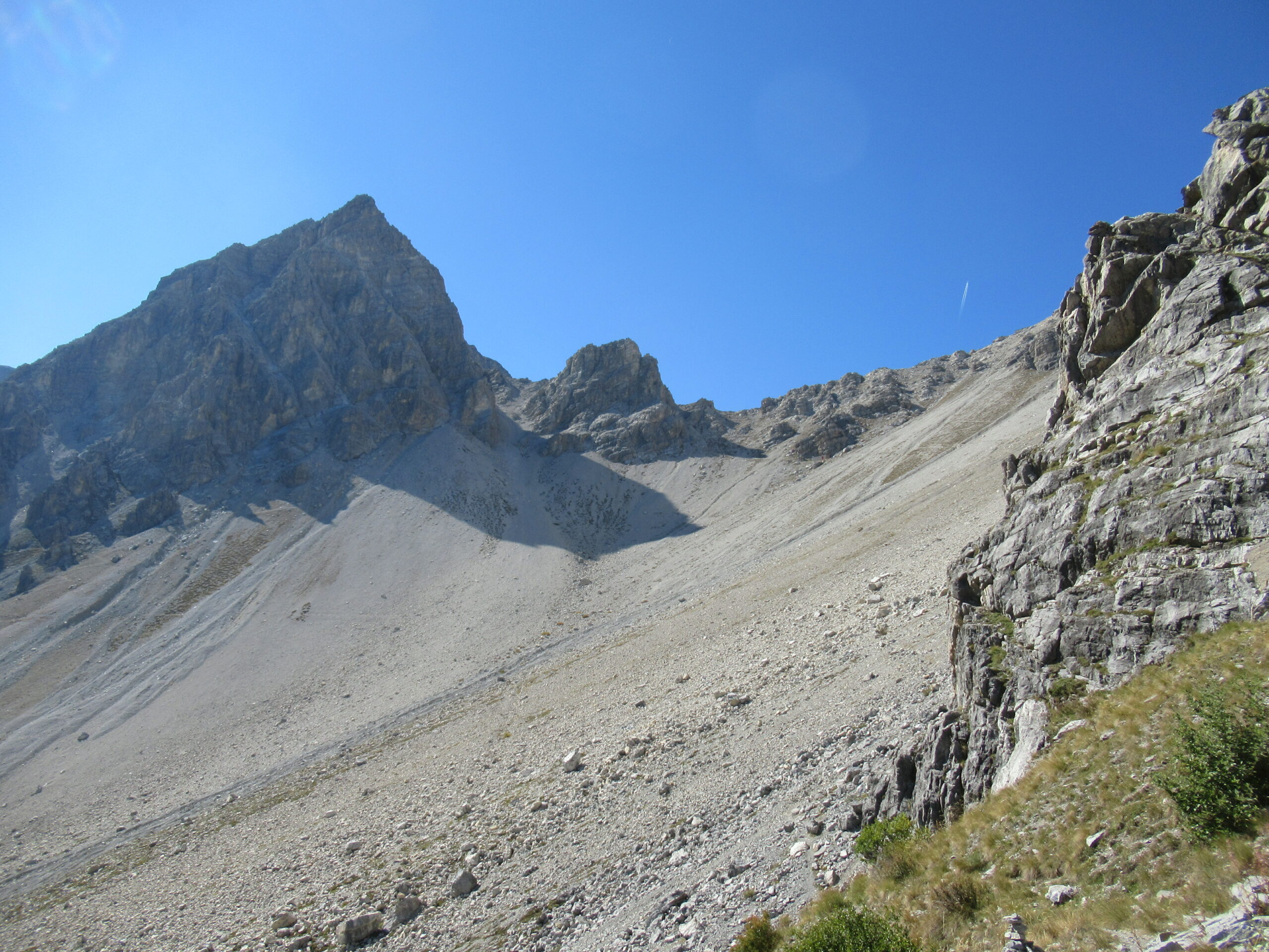
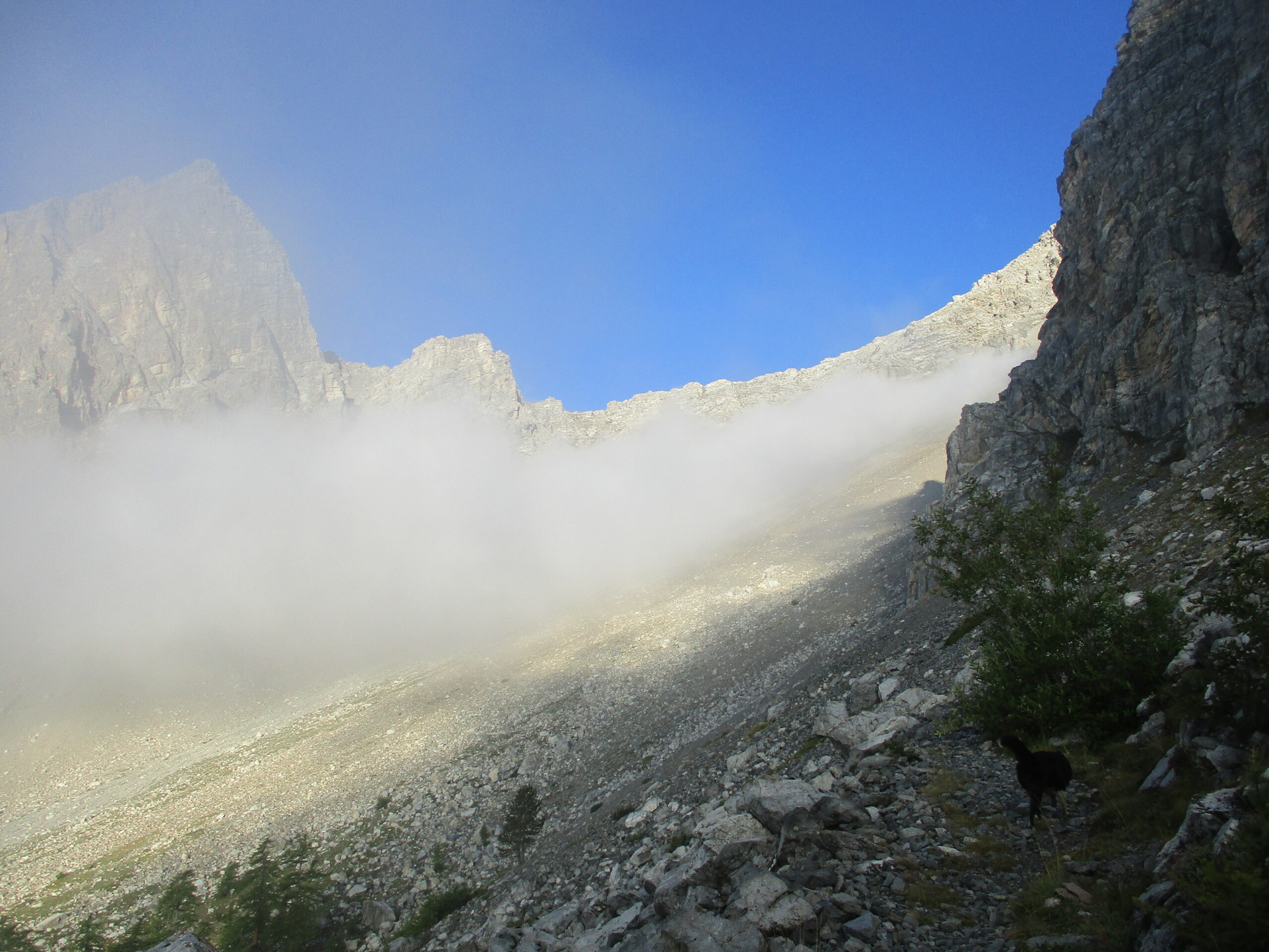
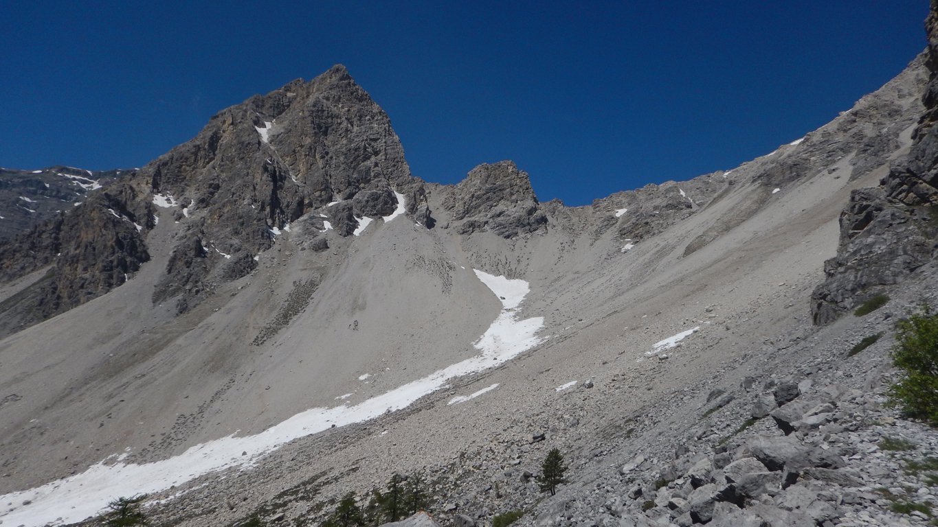
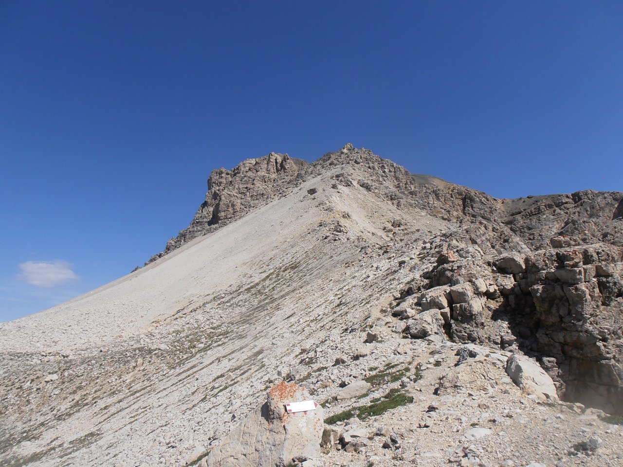
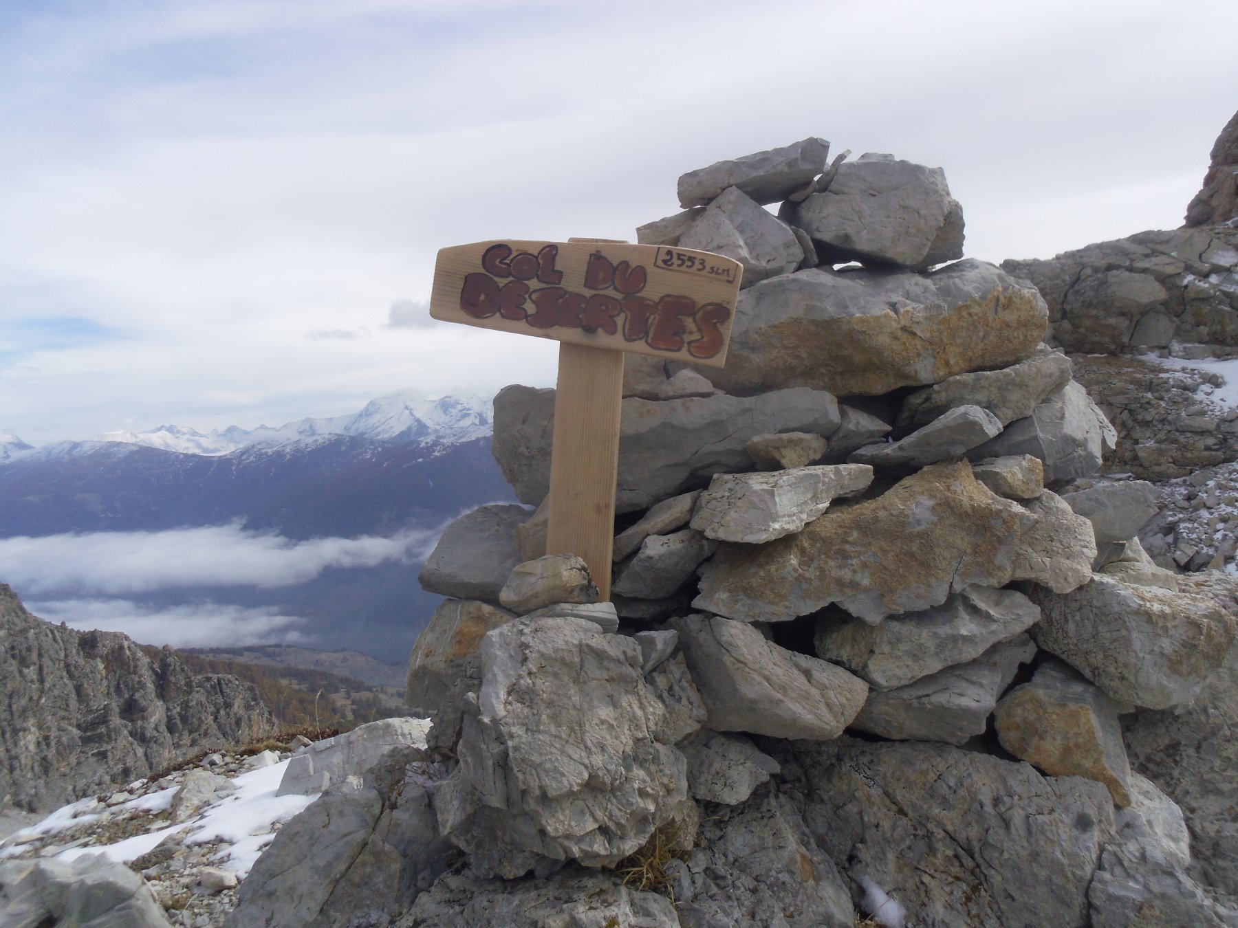
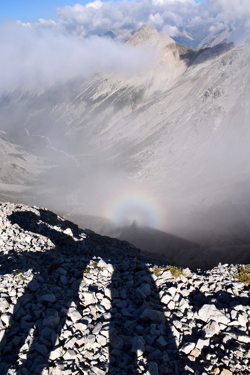
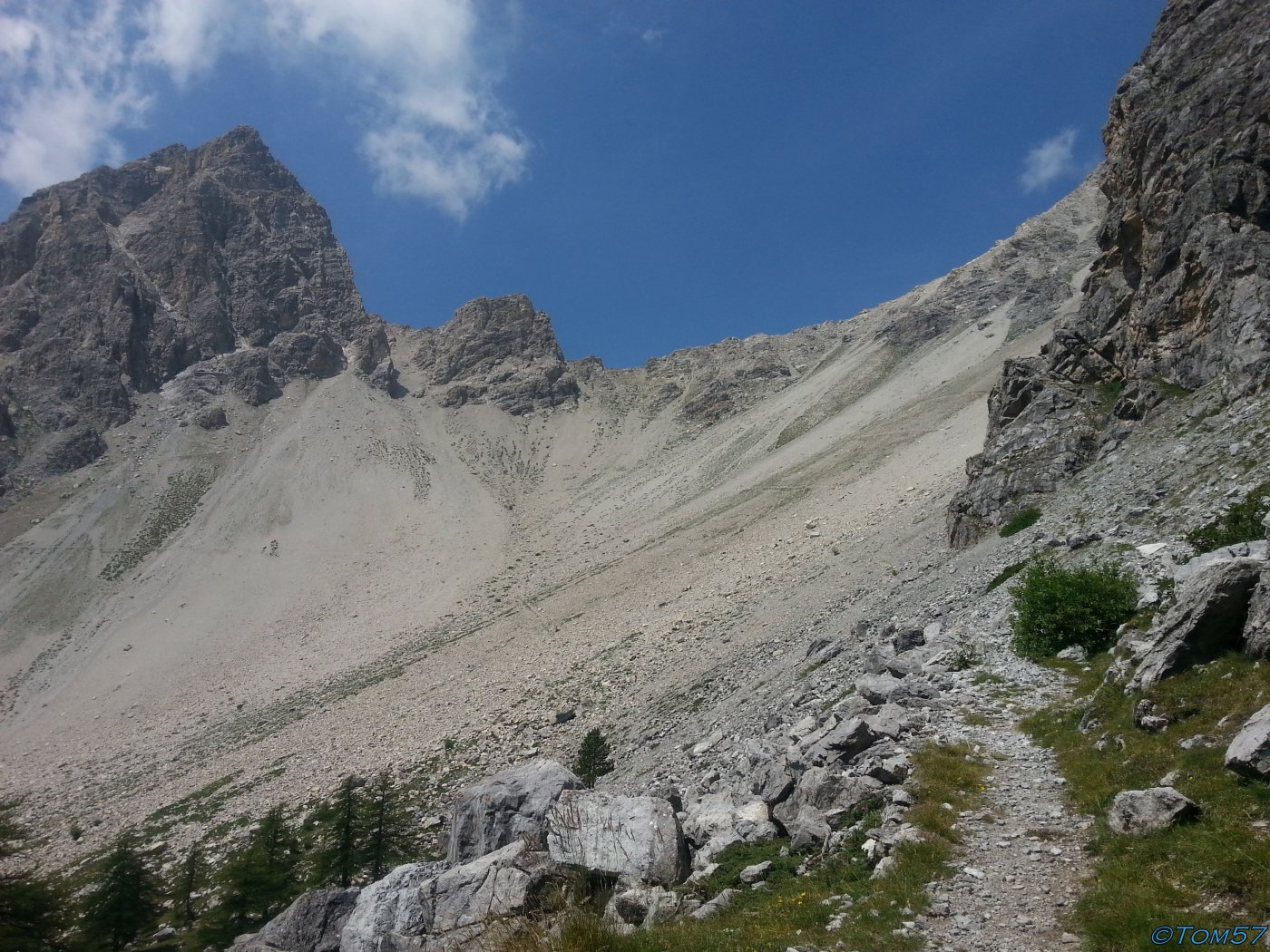
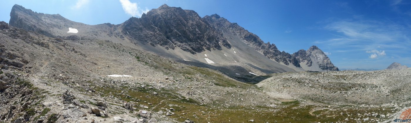
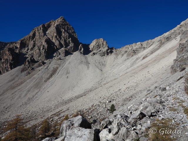
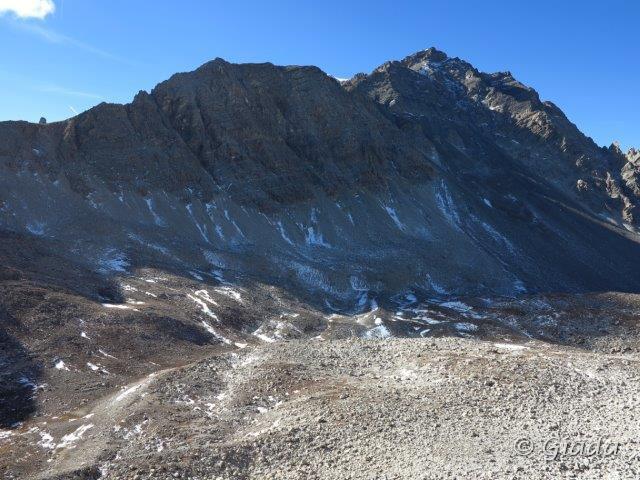
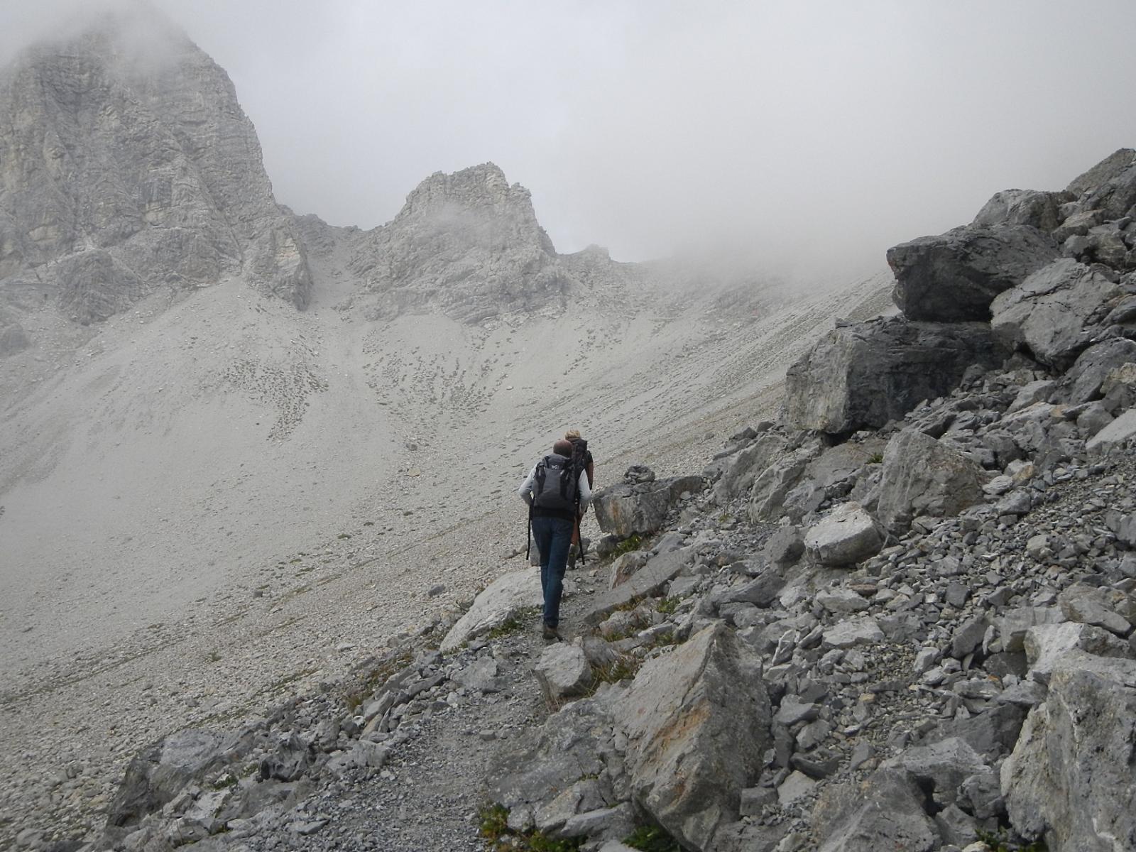
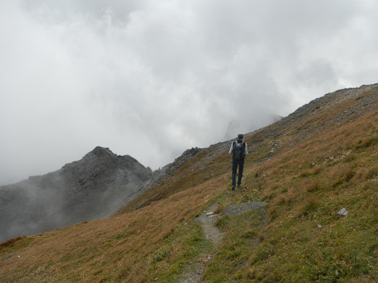
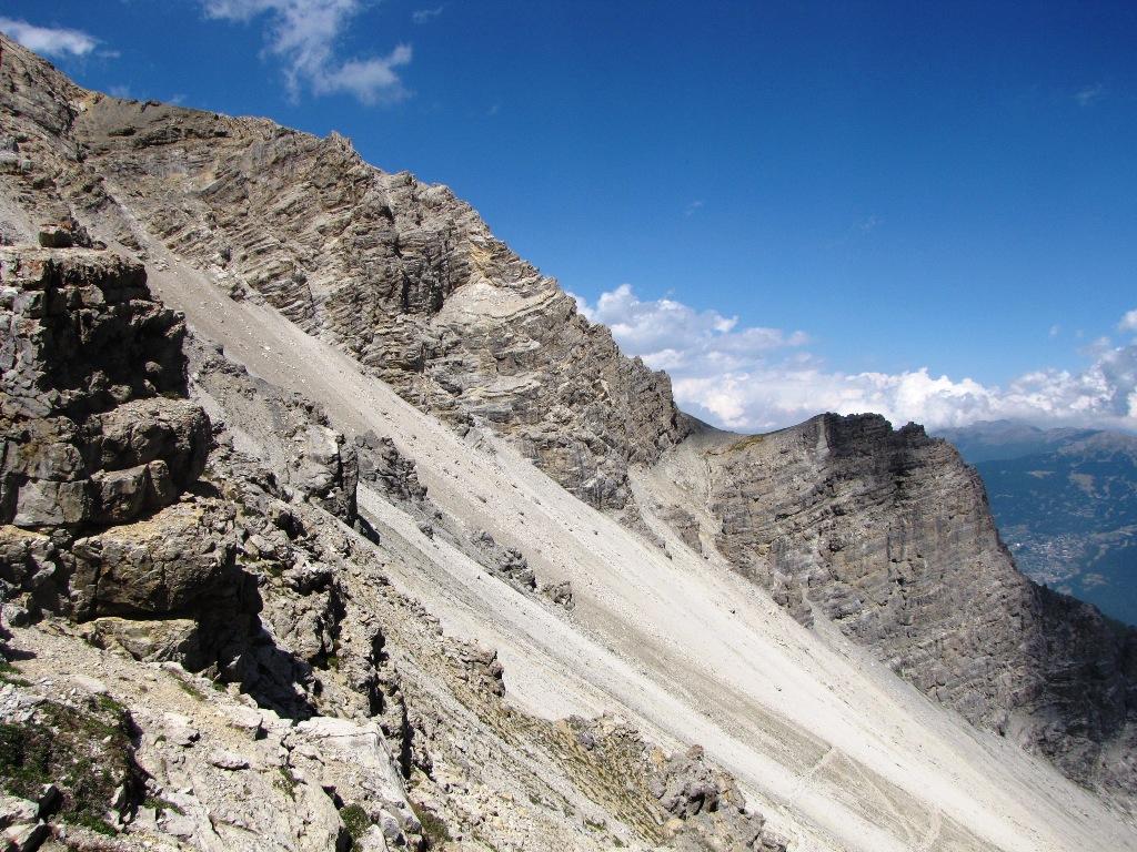
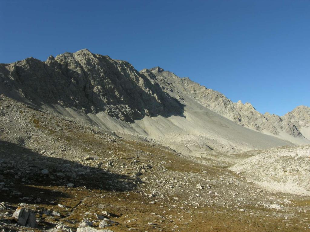
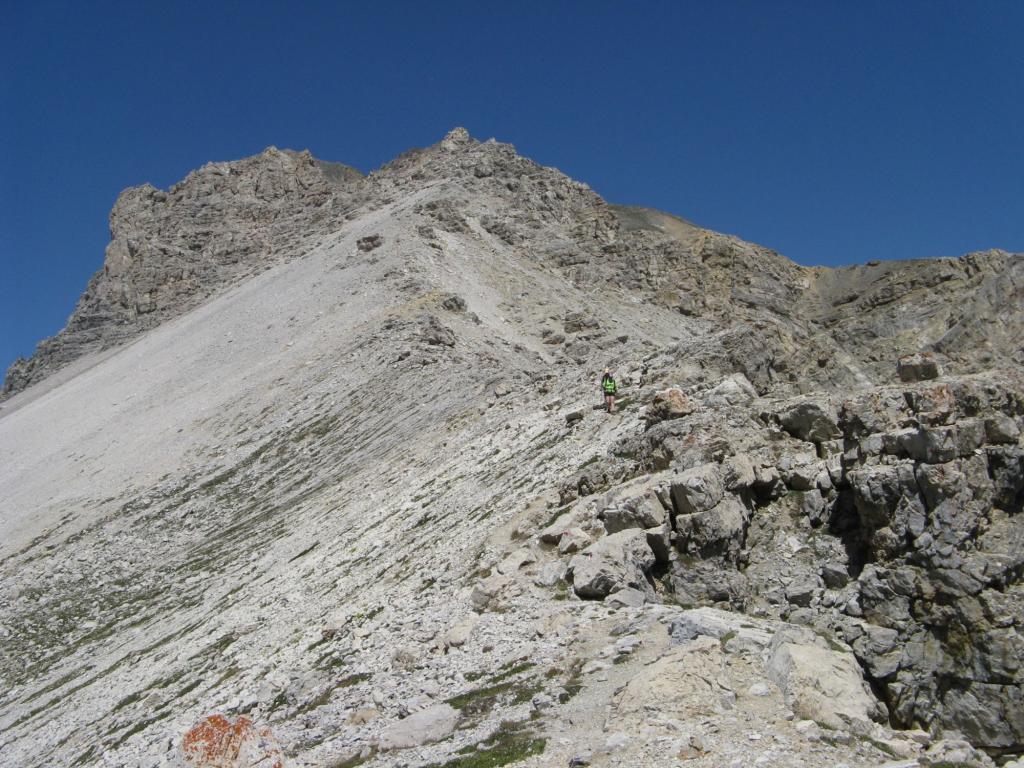
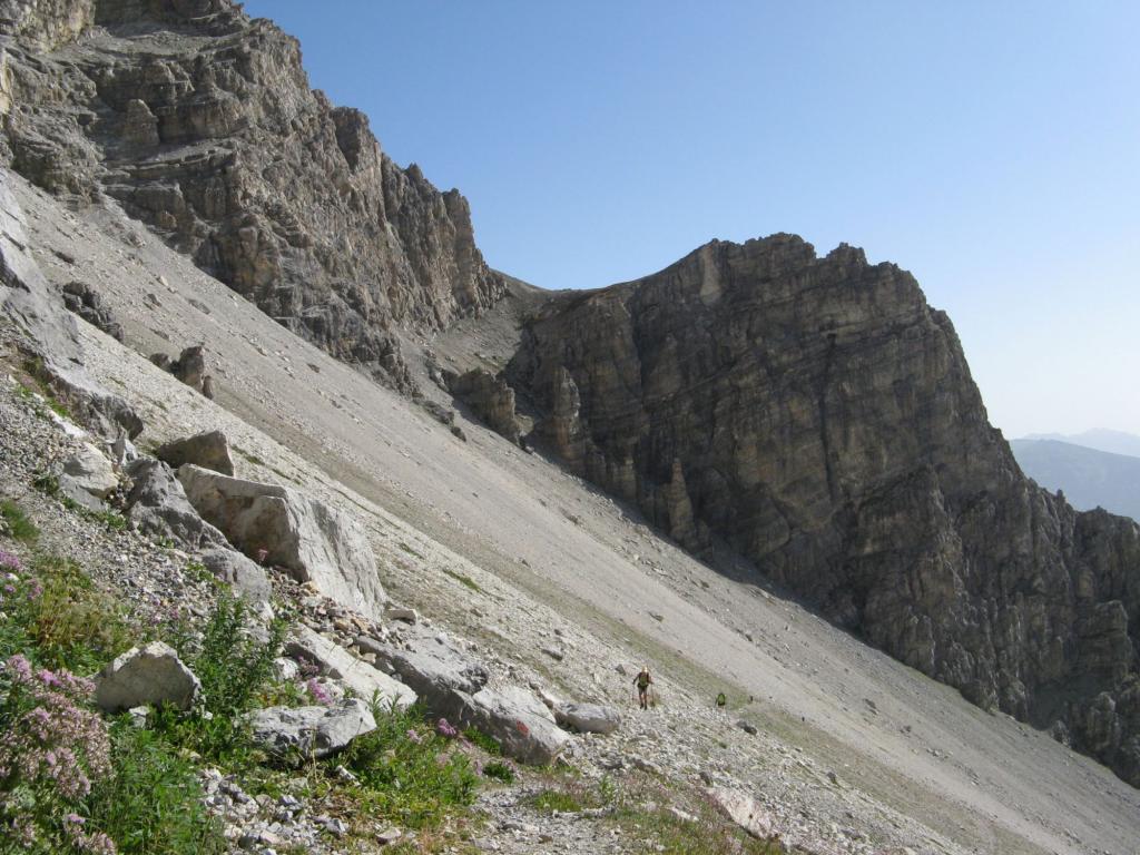
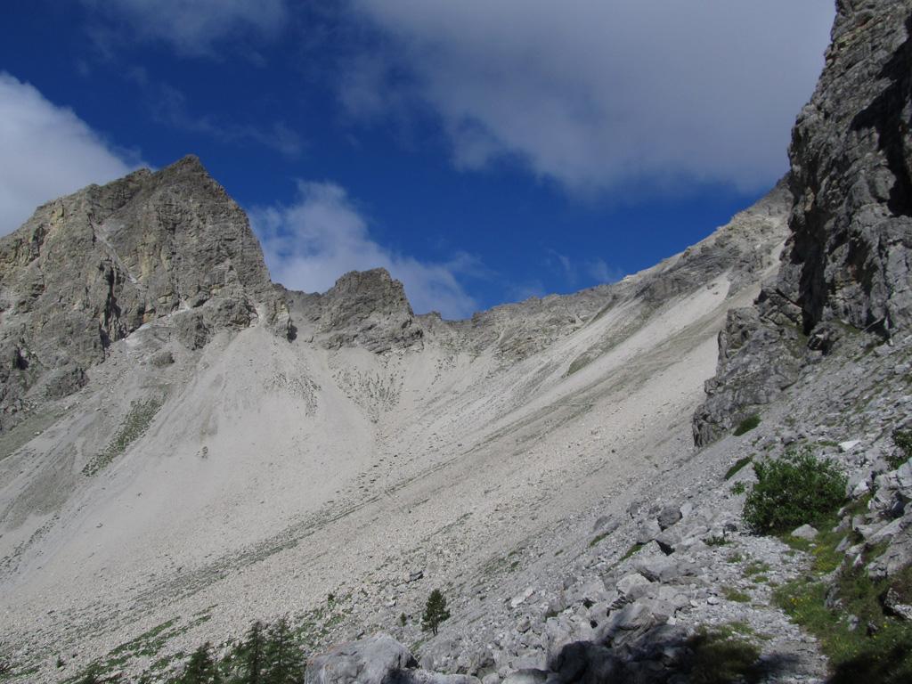
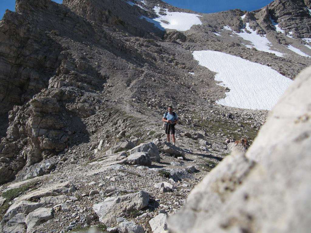
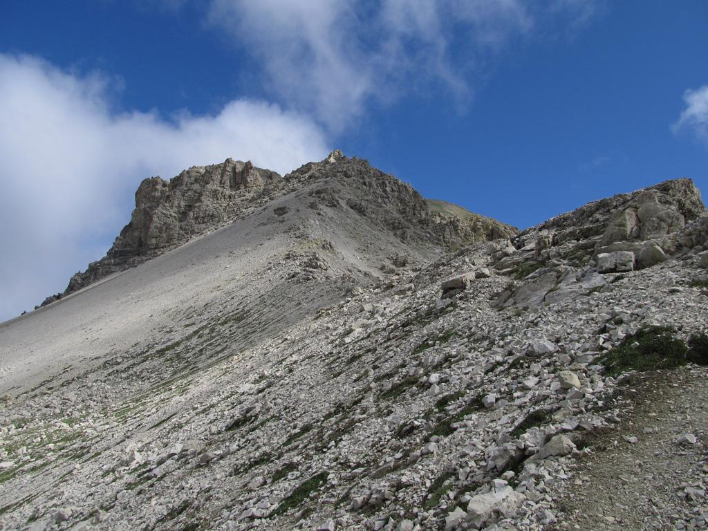
Lasciato in basso a sinistra il bivio per il Lago Desertes, si inizia a salire con alcune svolte tra prati, che danno accesso al vallone detritico che culmina con il Passo Desertes.
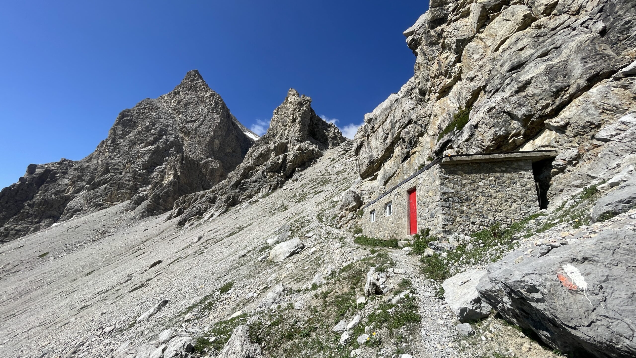
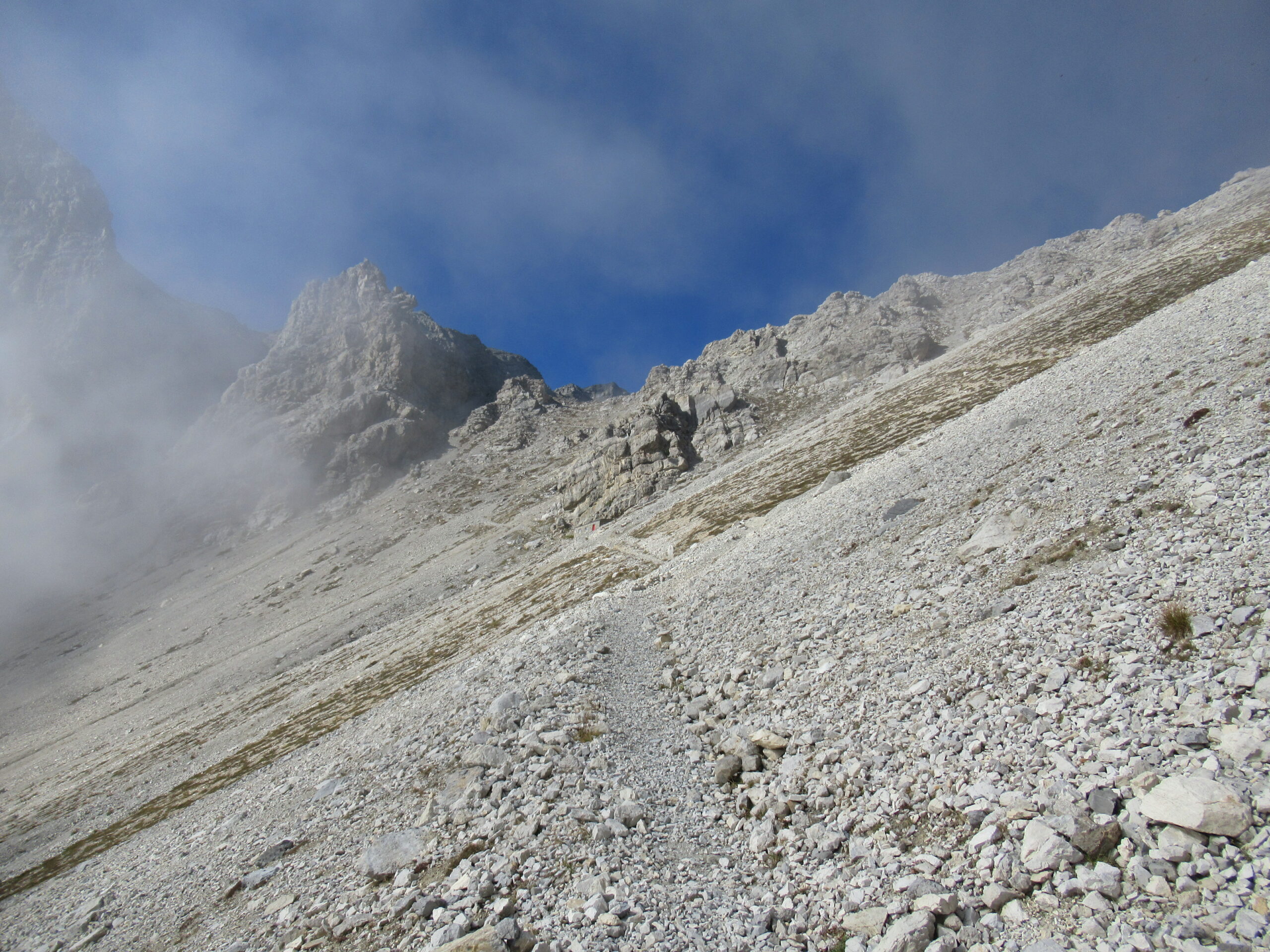
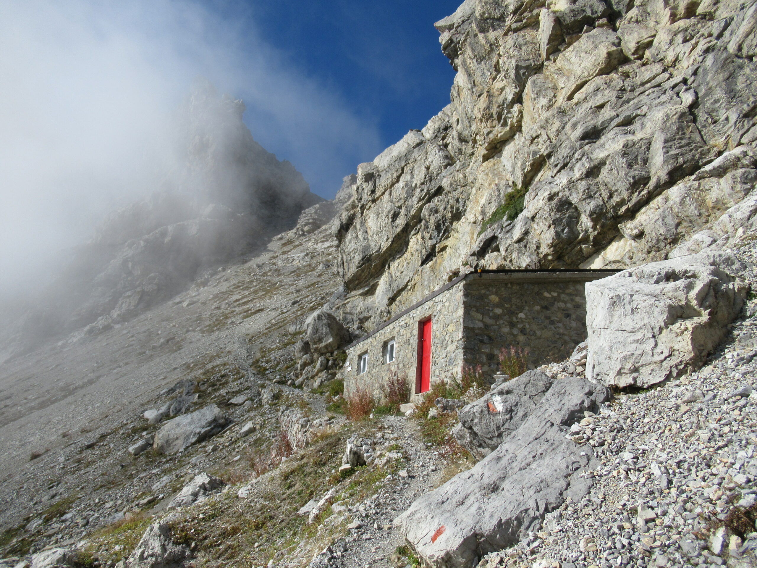
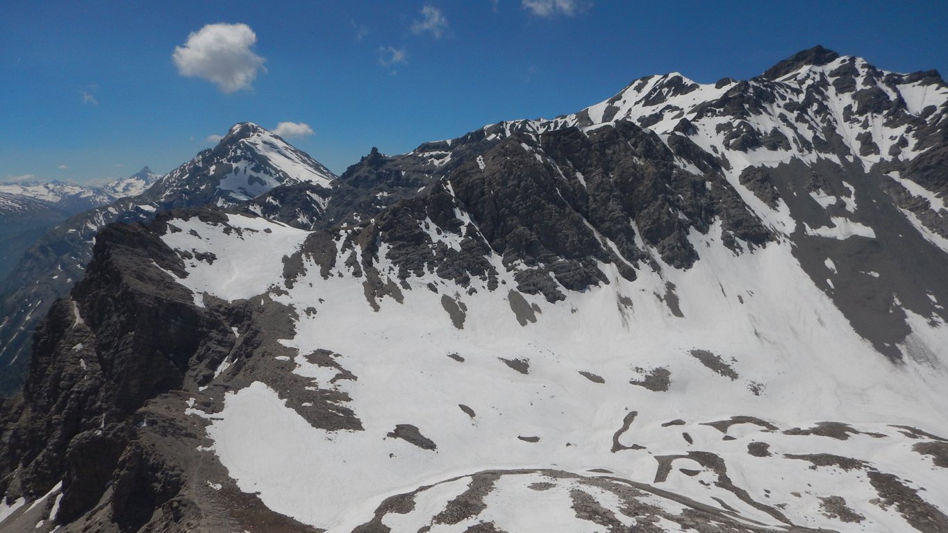
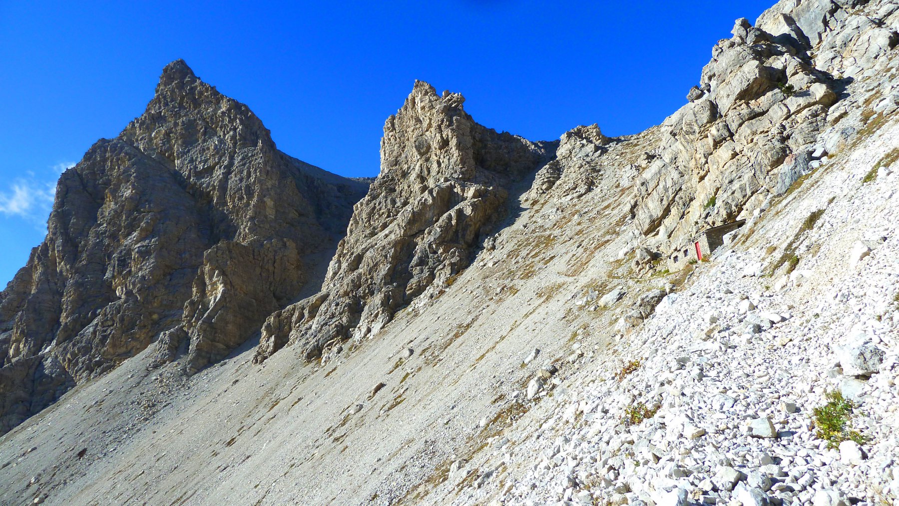
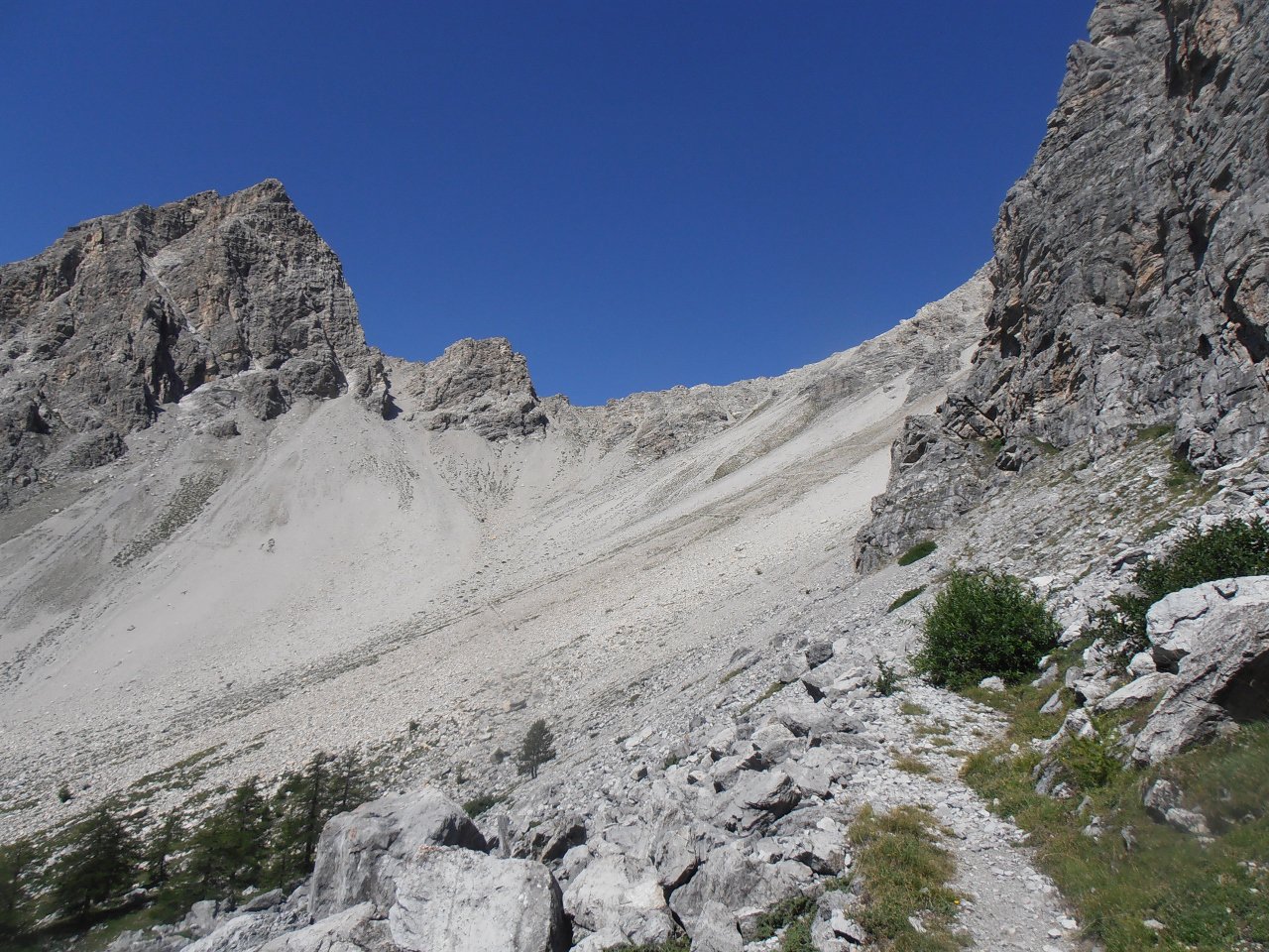
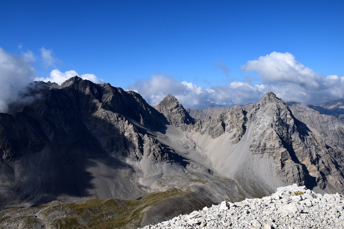
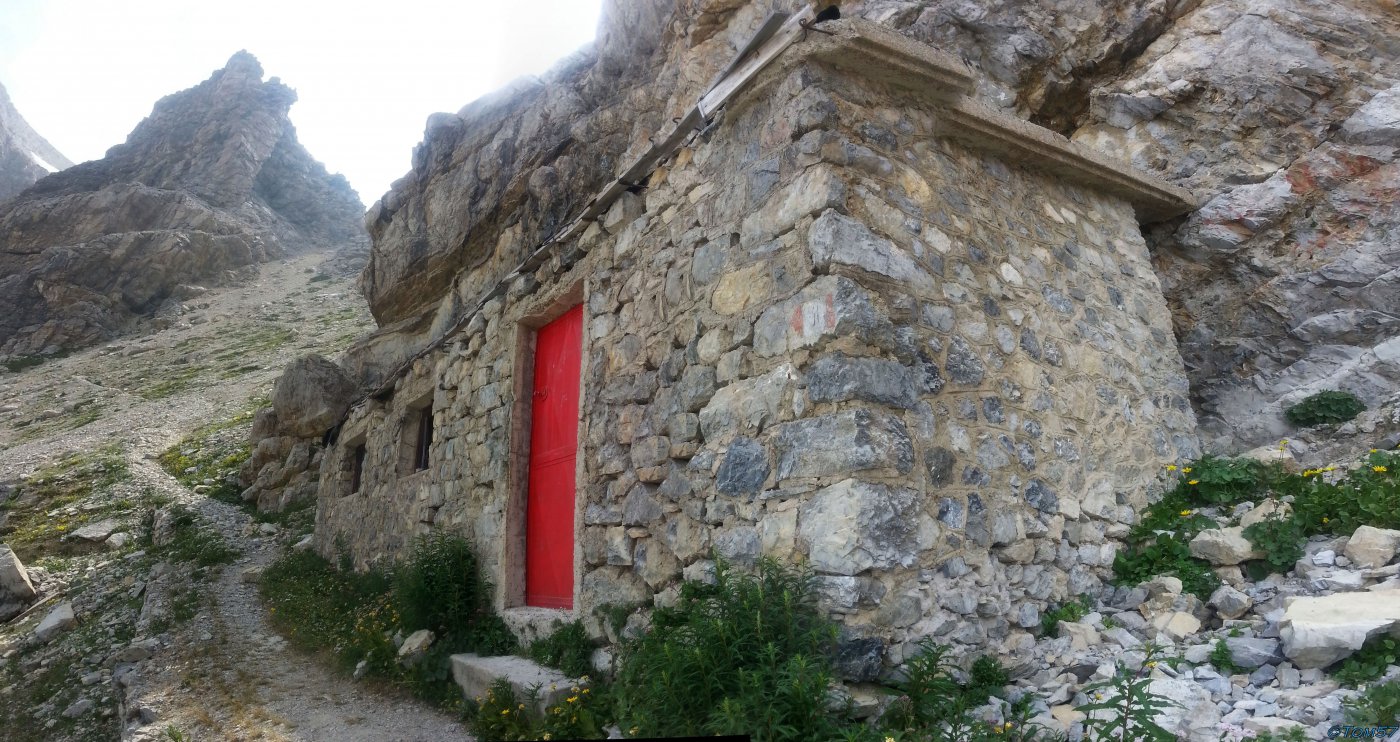
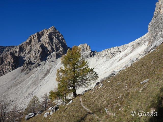
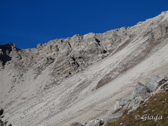
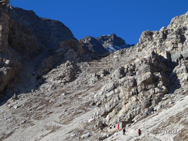
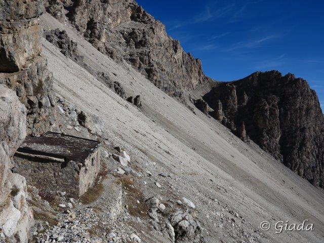
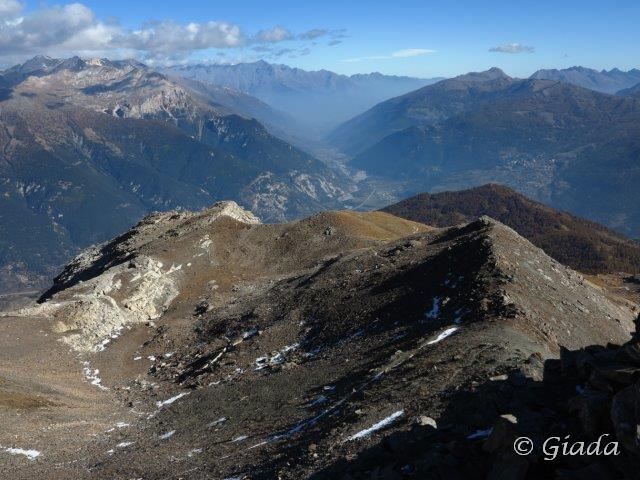
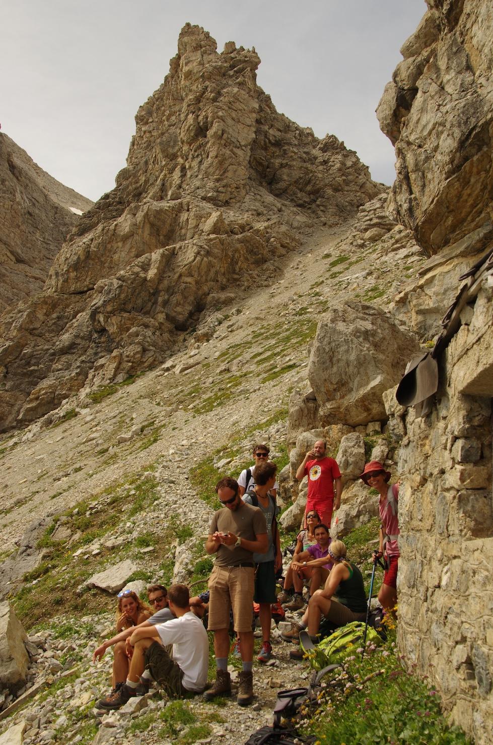
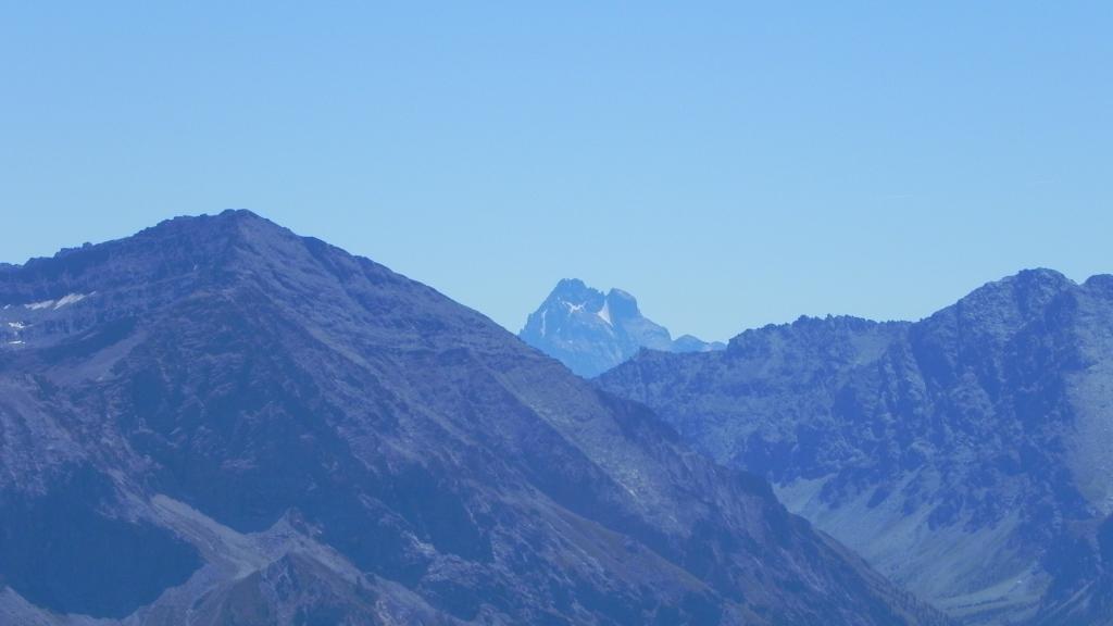
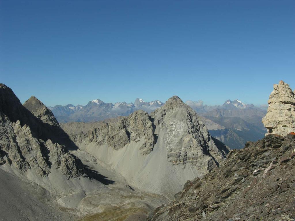
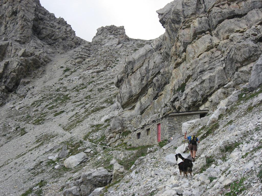
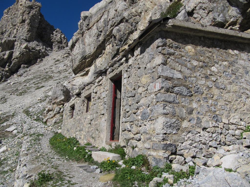
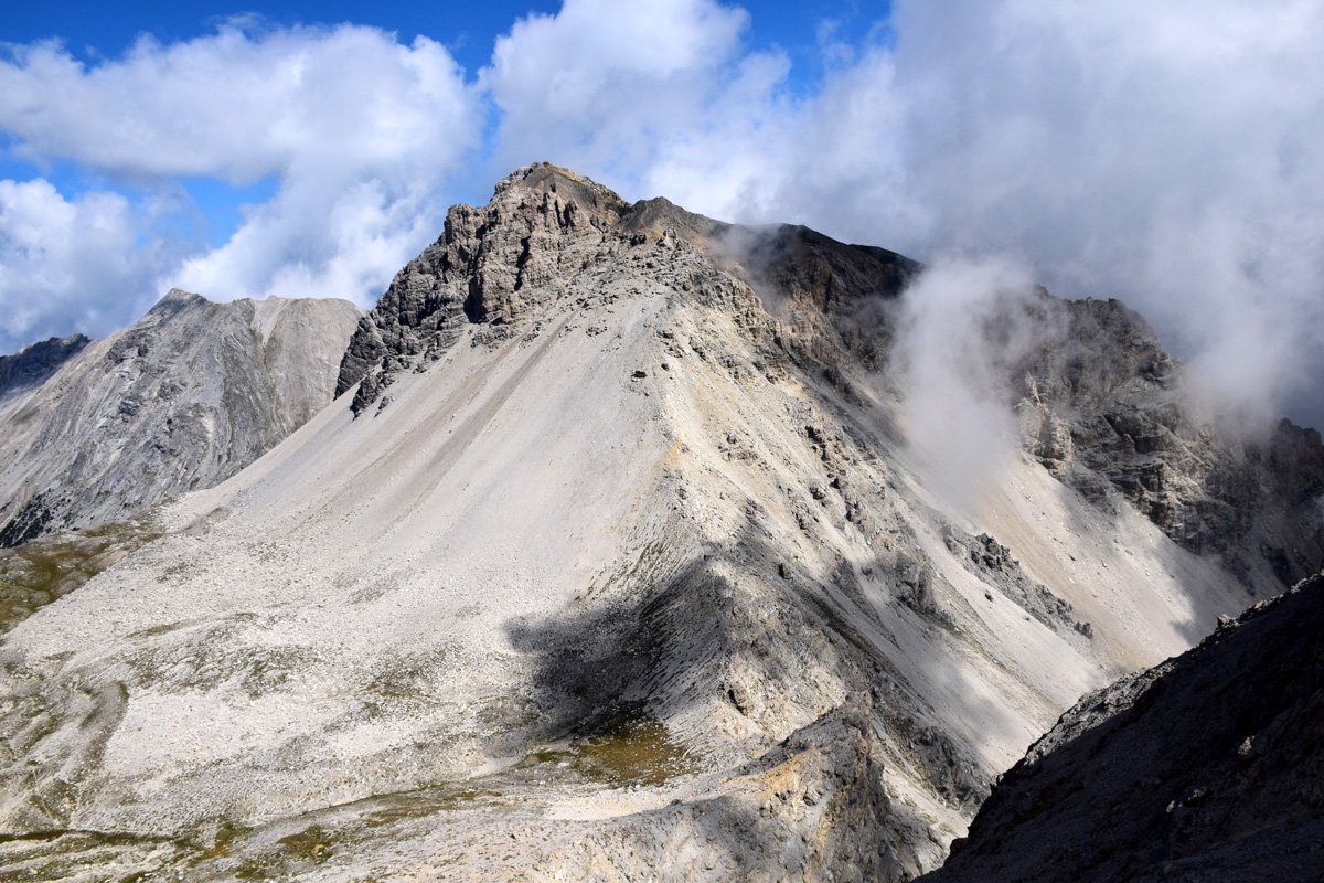
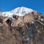
L’ambiente è dolomitico con immensi ghiaioni, ma nonostante ciò che può sembrare si sale comodamente seguendo una vecchia mulattiera militare, i cui muretti a secco sono visibili solo più a tratti. Poco prima del Passo è presente una casermetta recuperata dal soccorso alpino e adibita come bivacco o riparo d’emergenza (spartano ma con stufa a legna). Alcune svolte poi conducono al Passo.
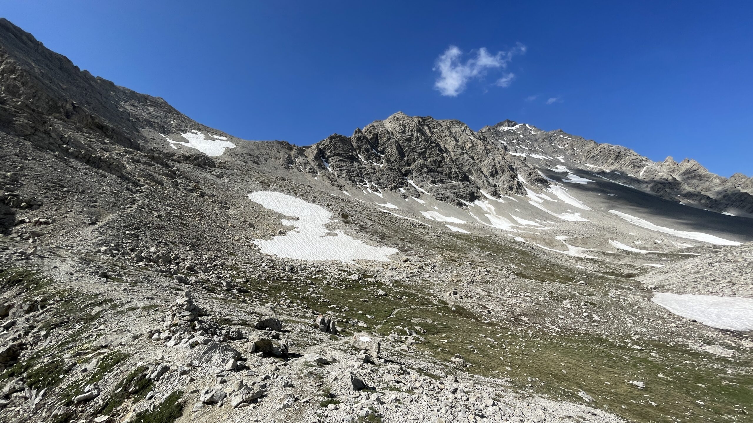
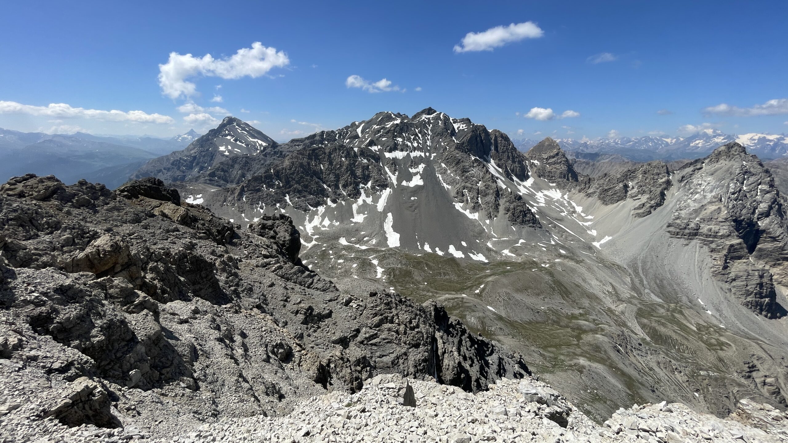
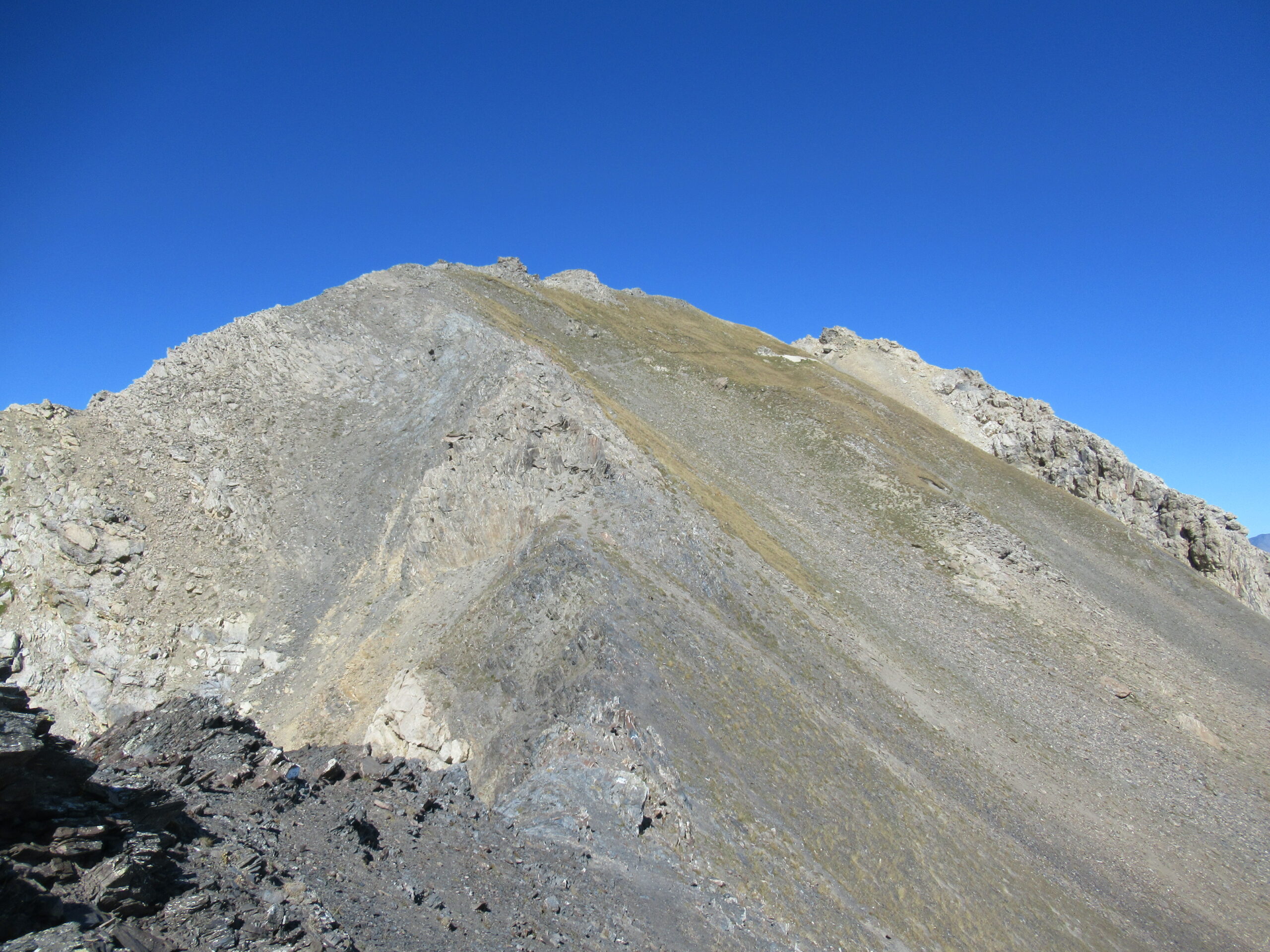
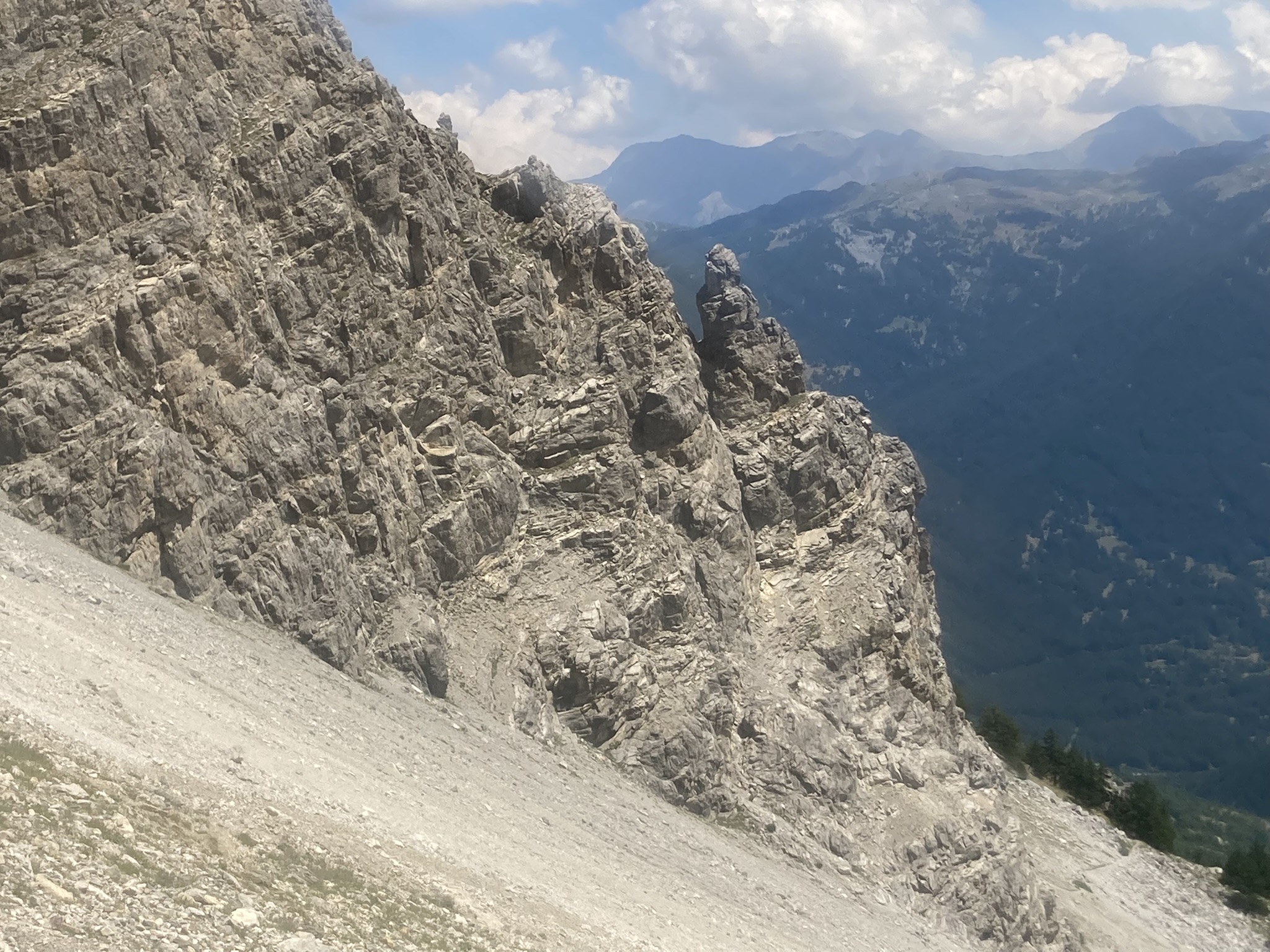
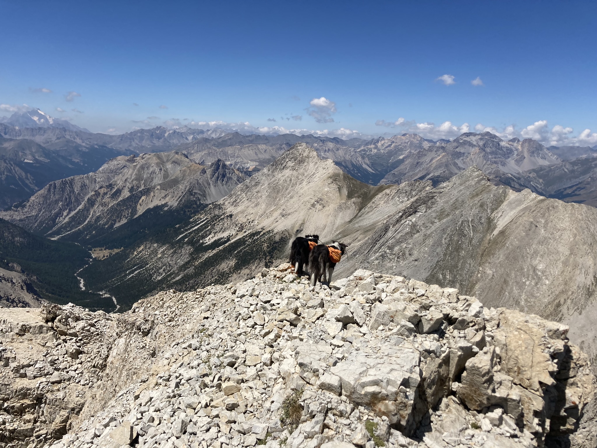
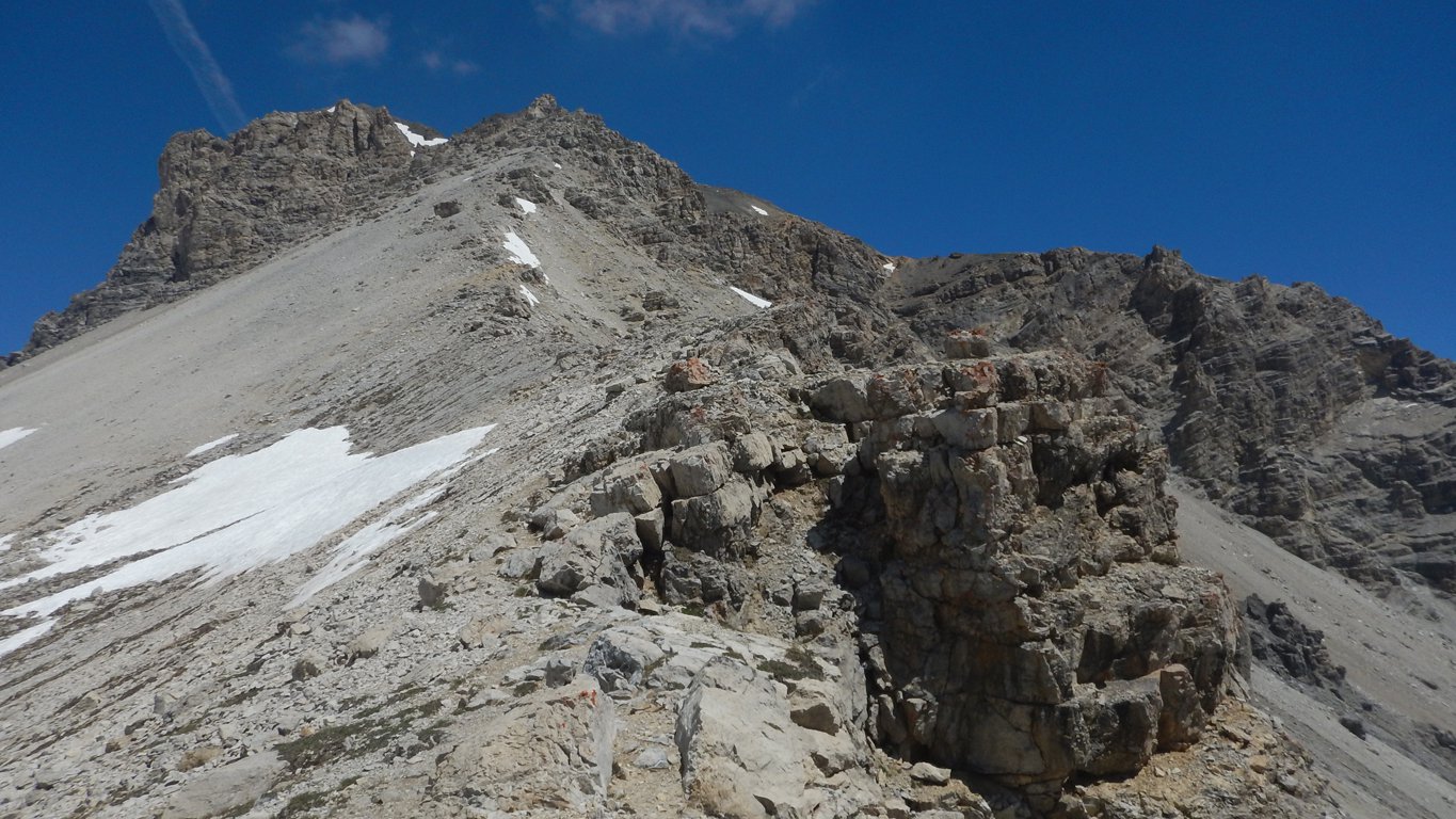
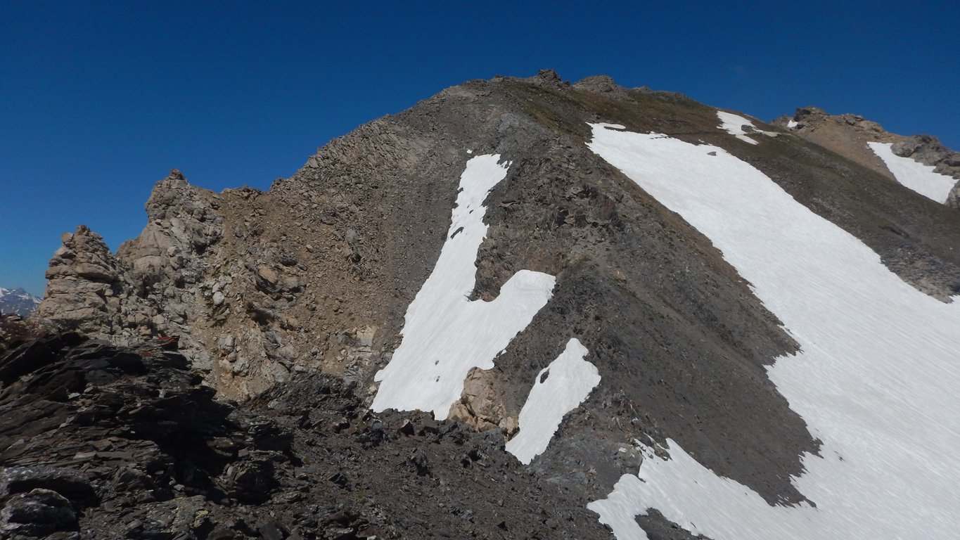
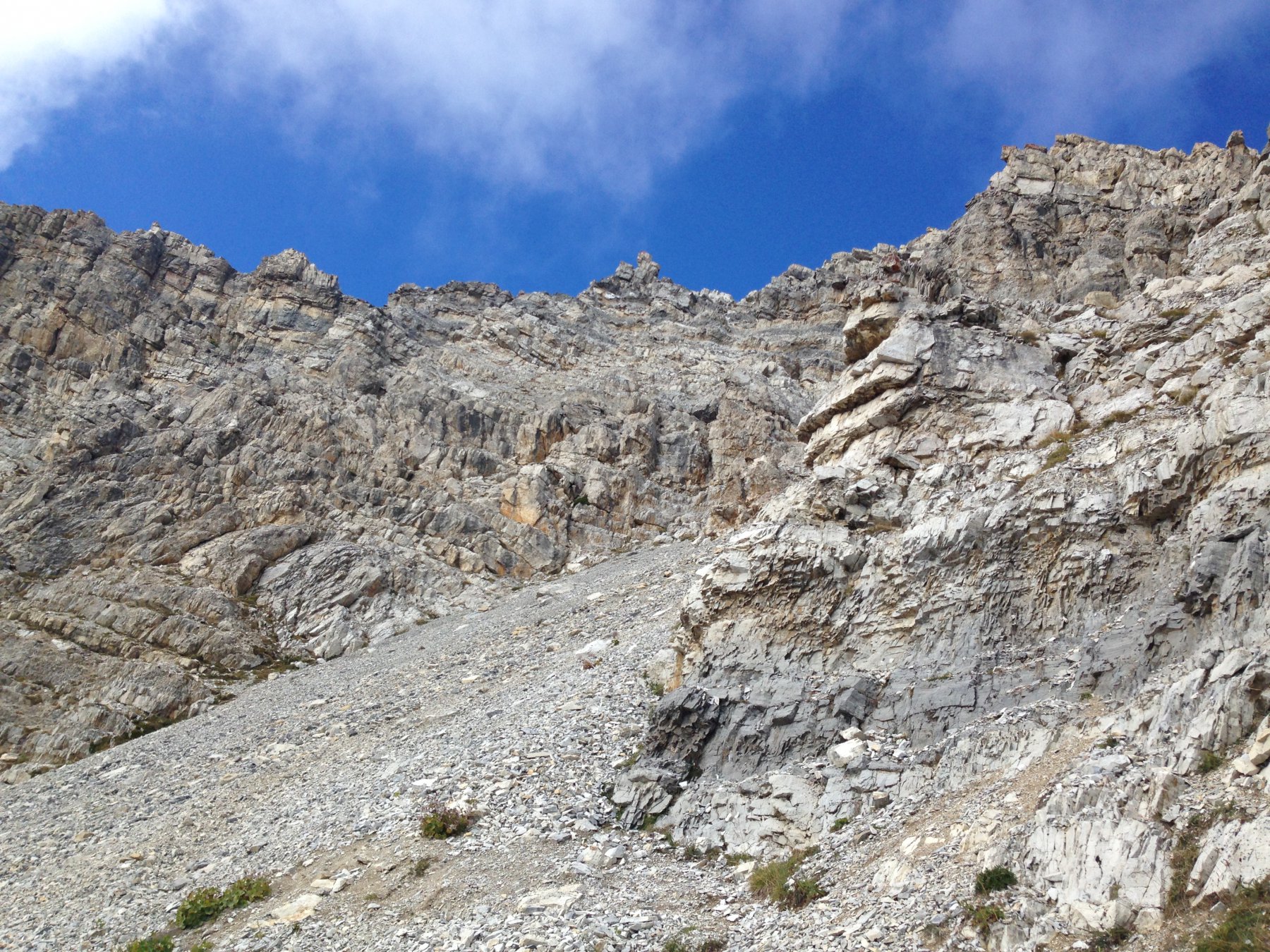
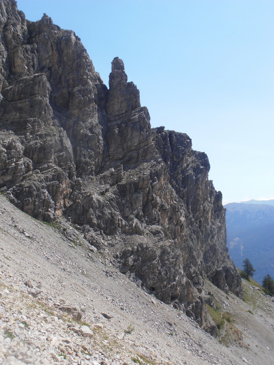
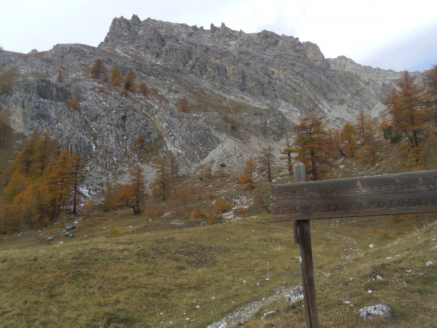
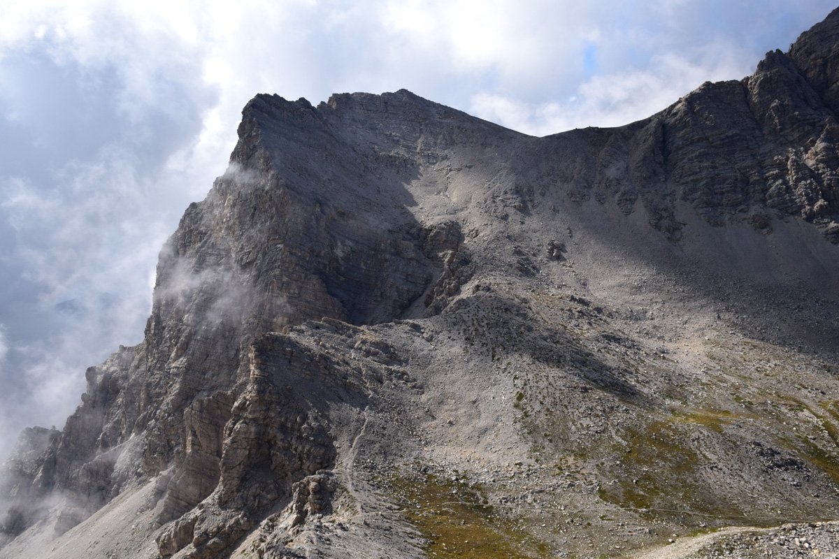
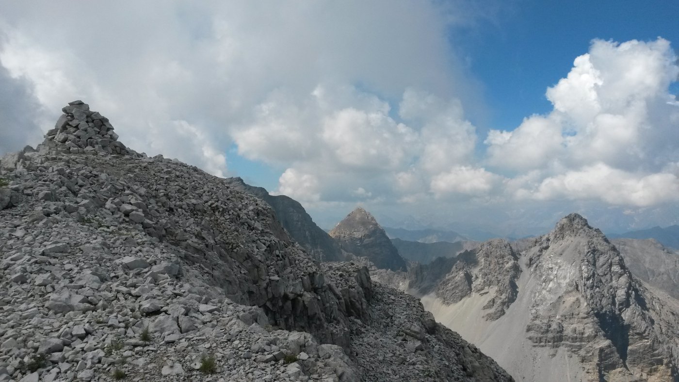
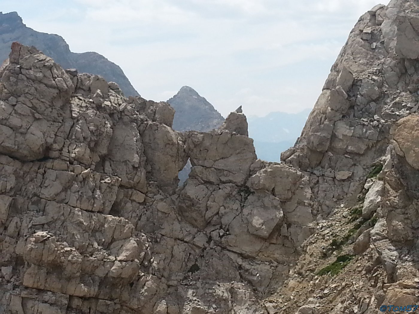
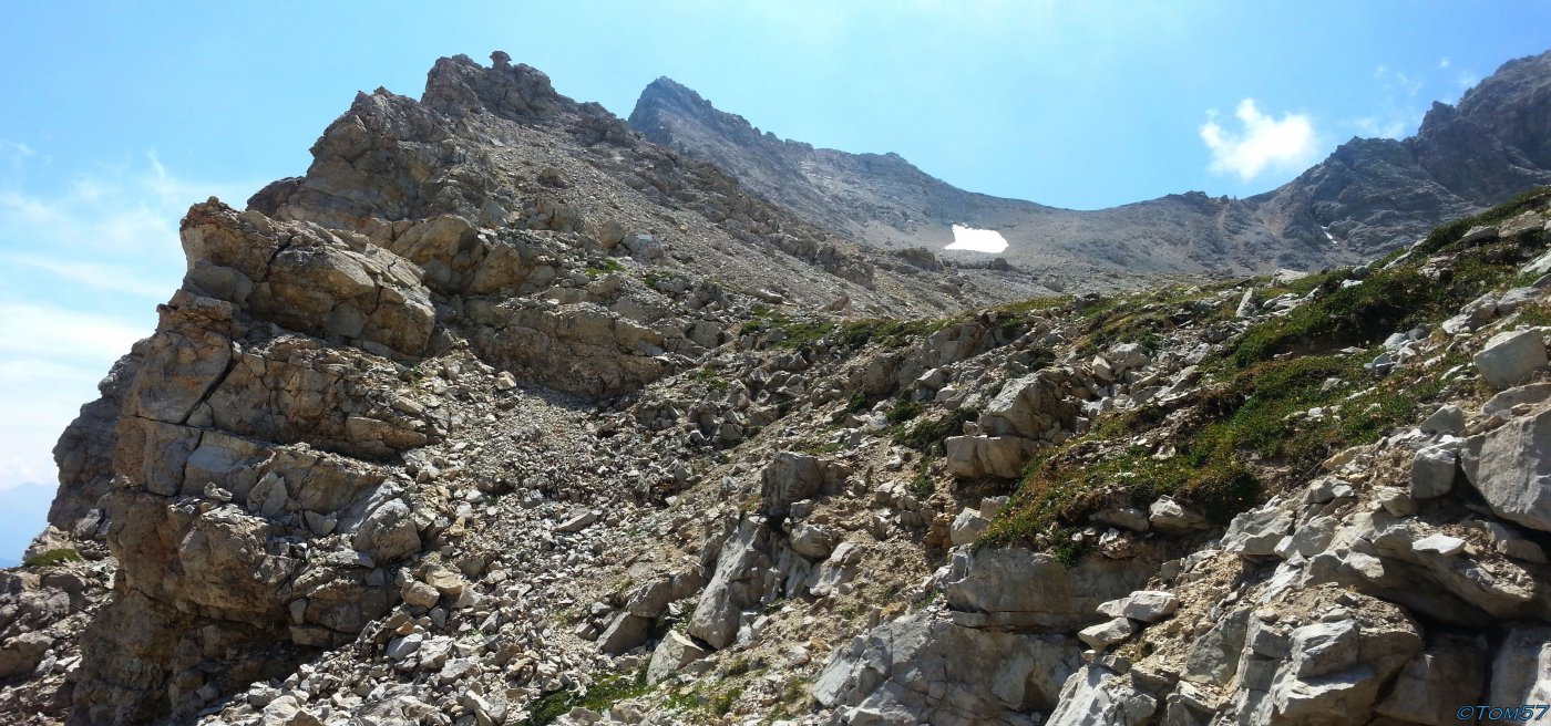
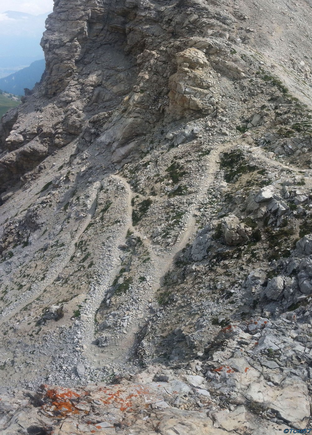
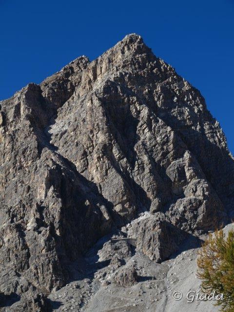
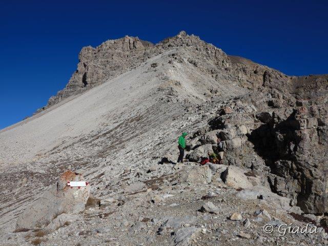
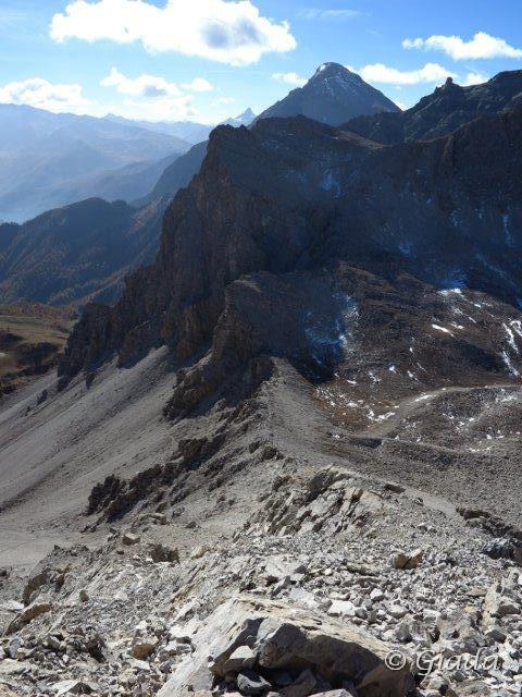
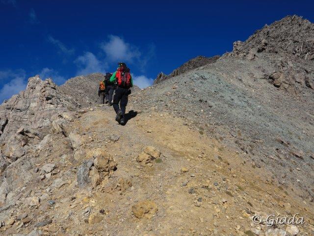
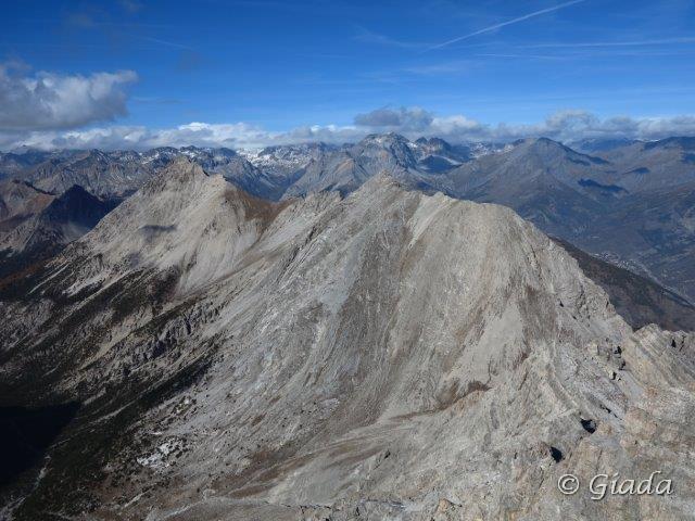
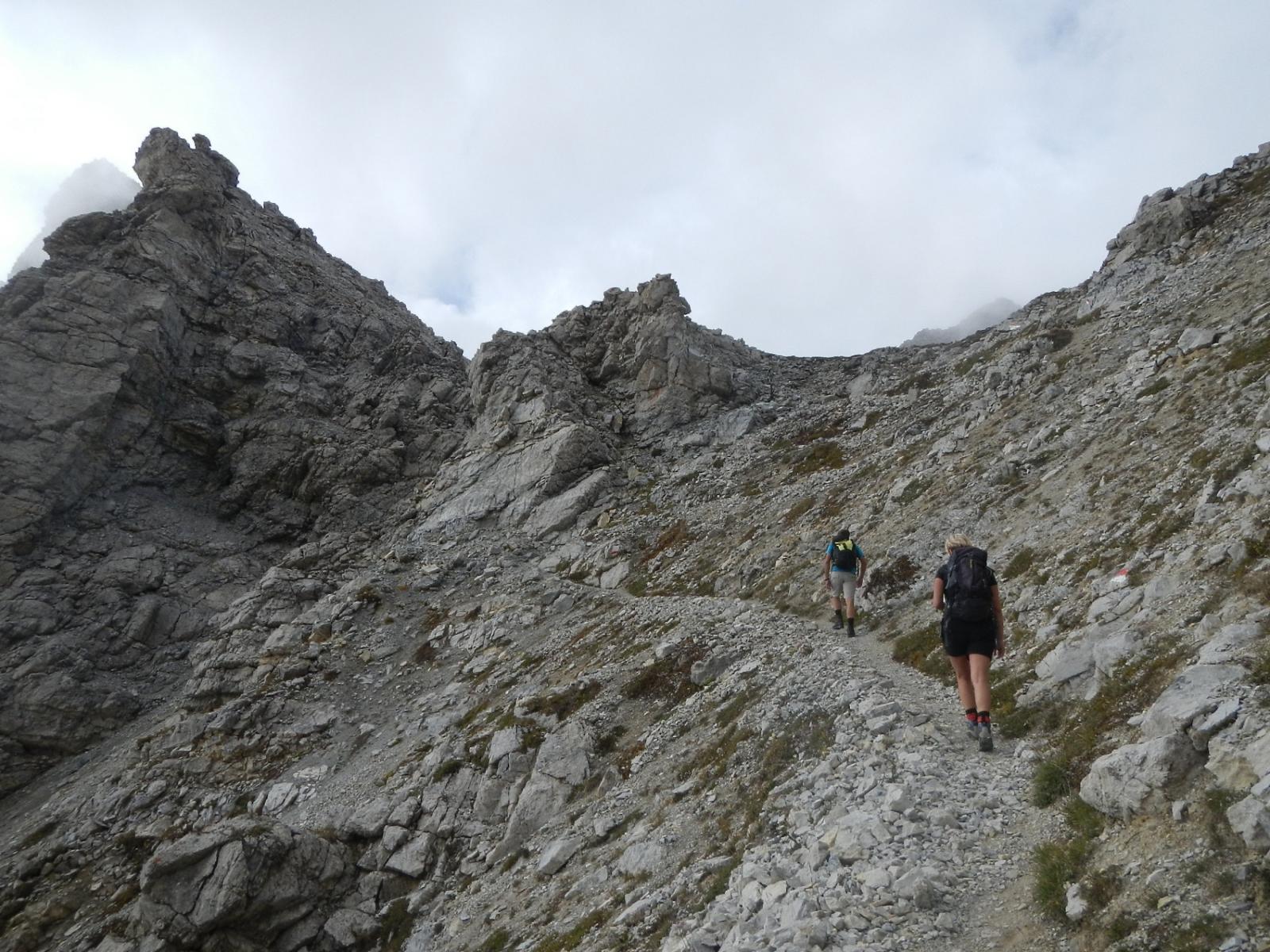
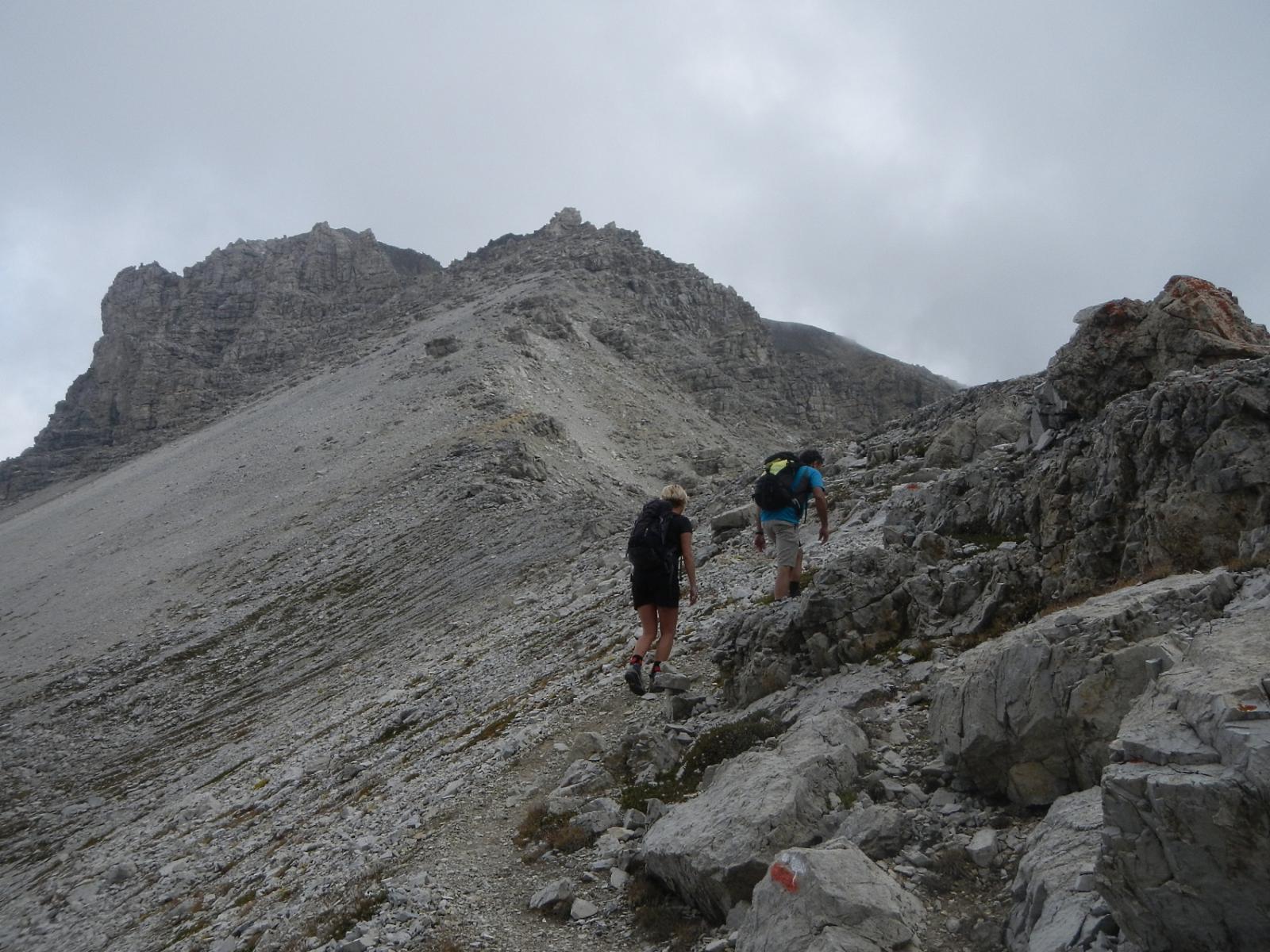
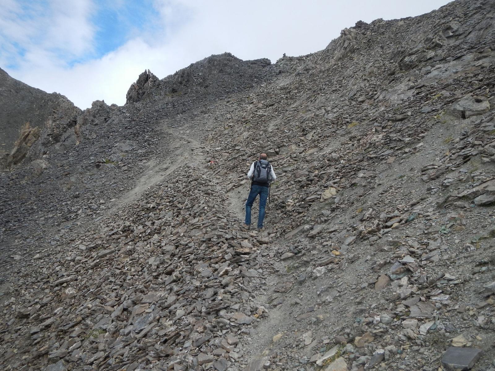
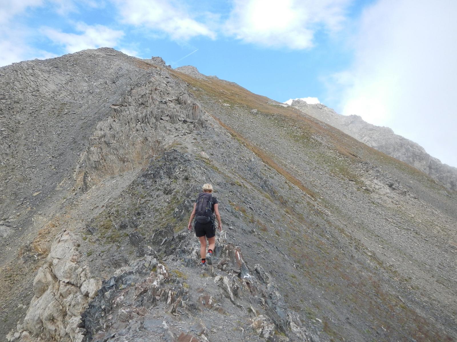
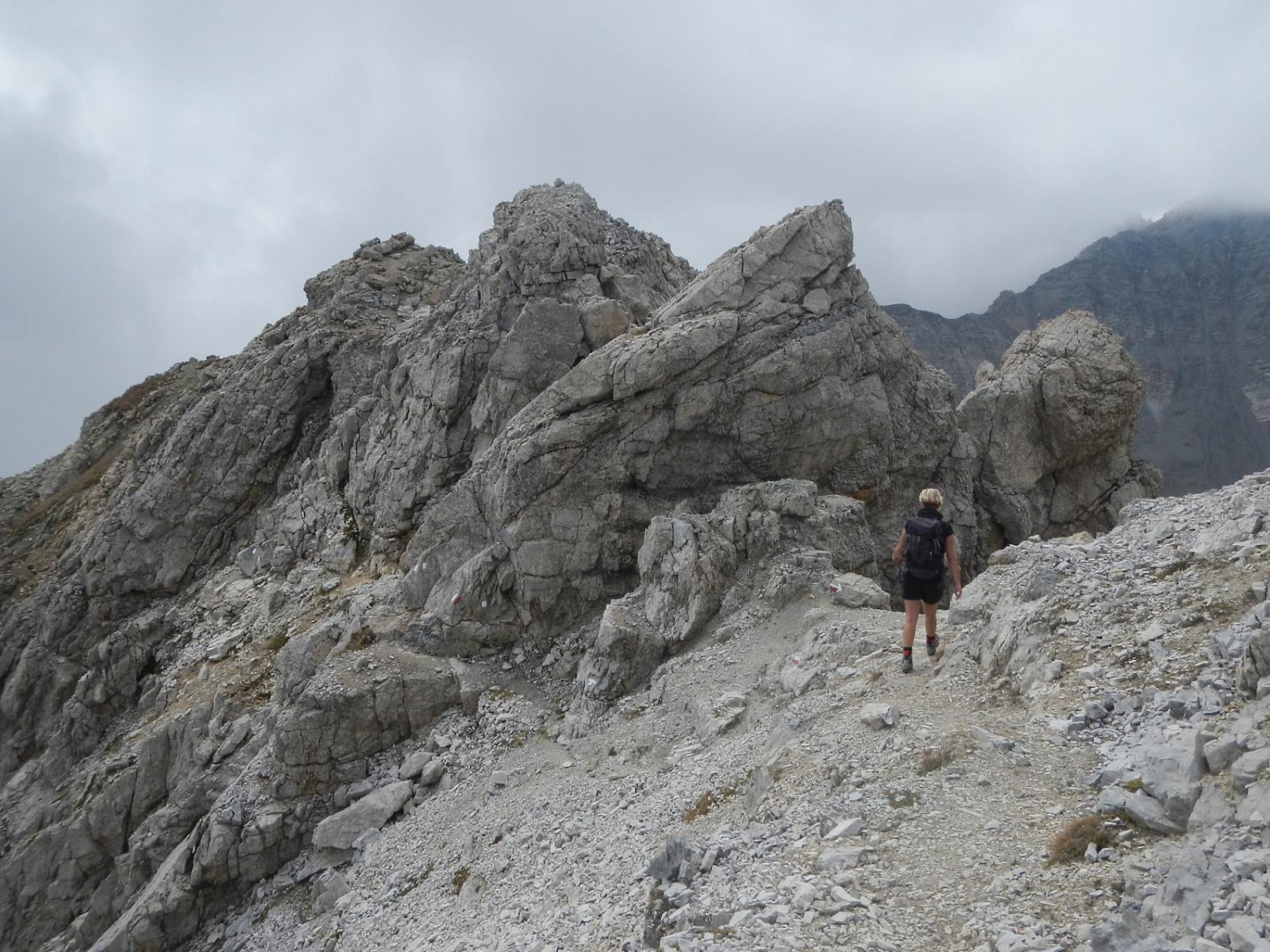
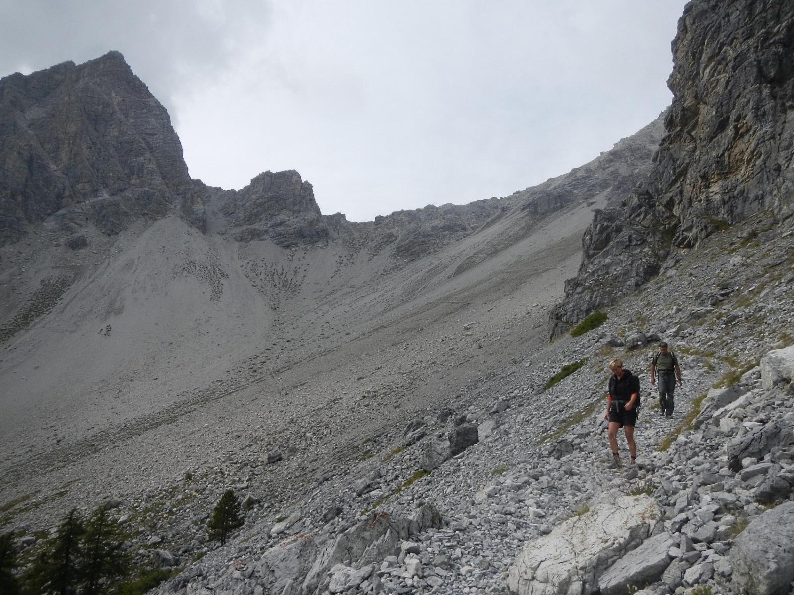
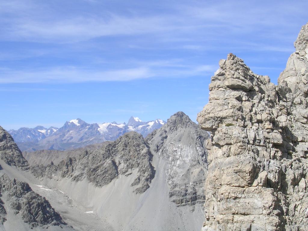
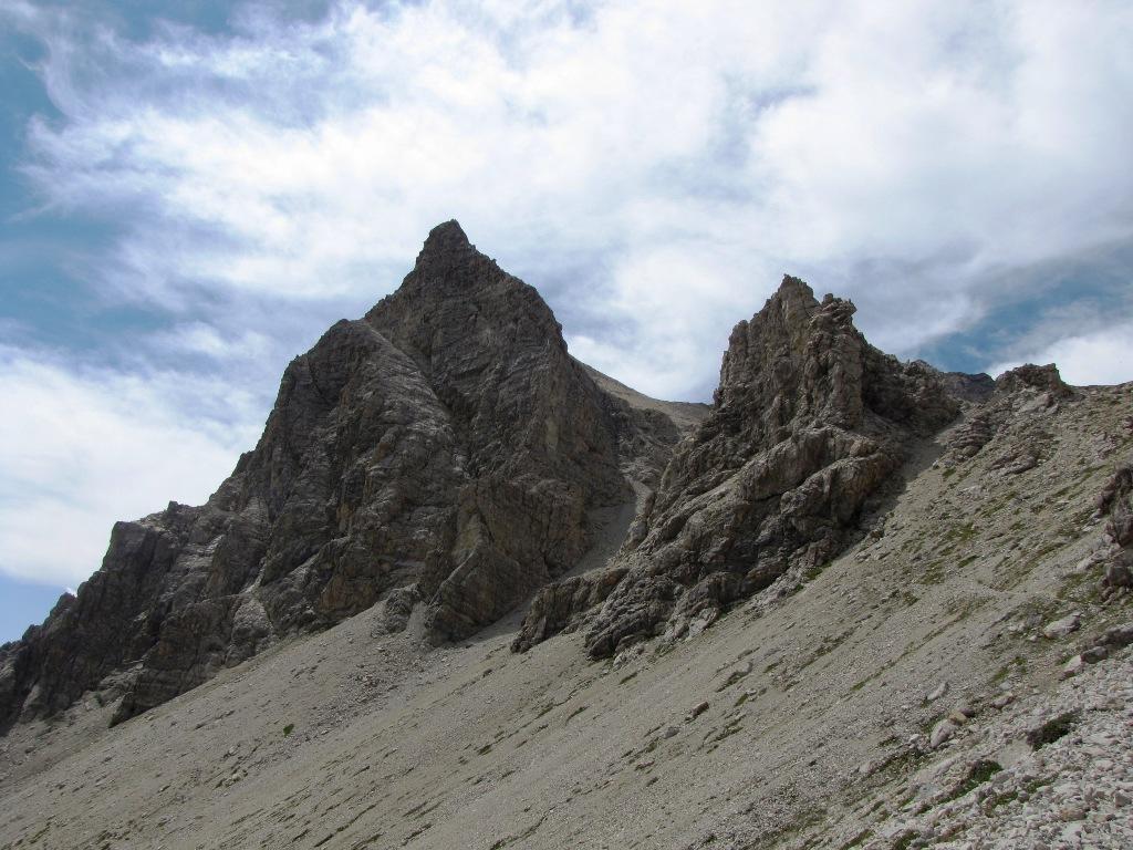
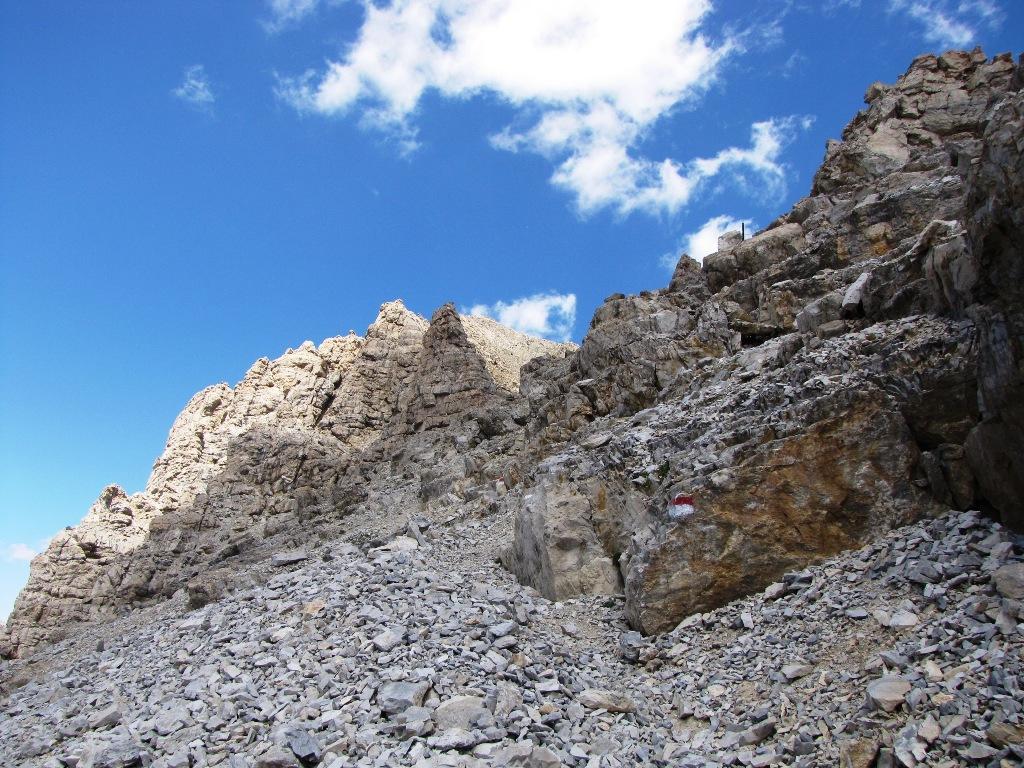
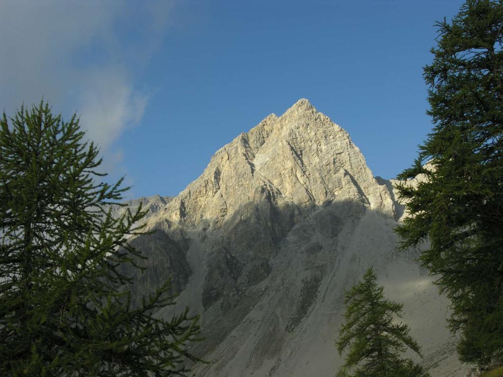
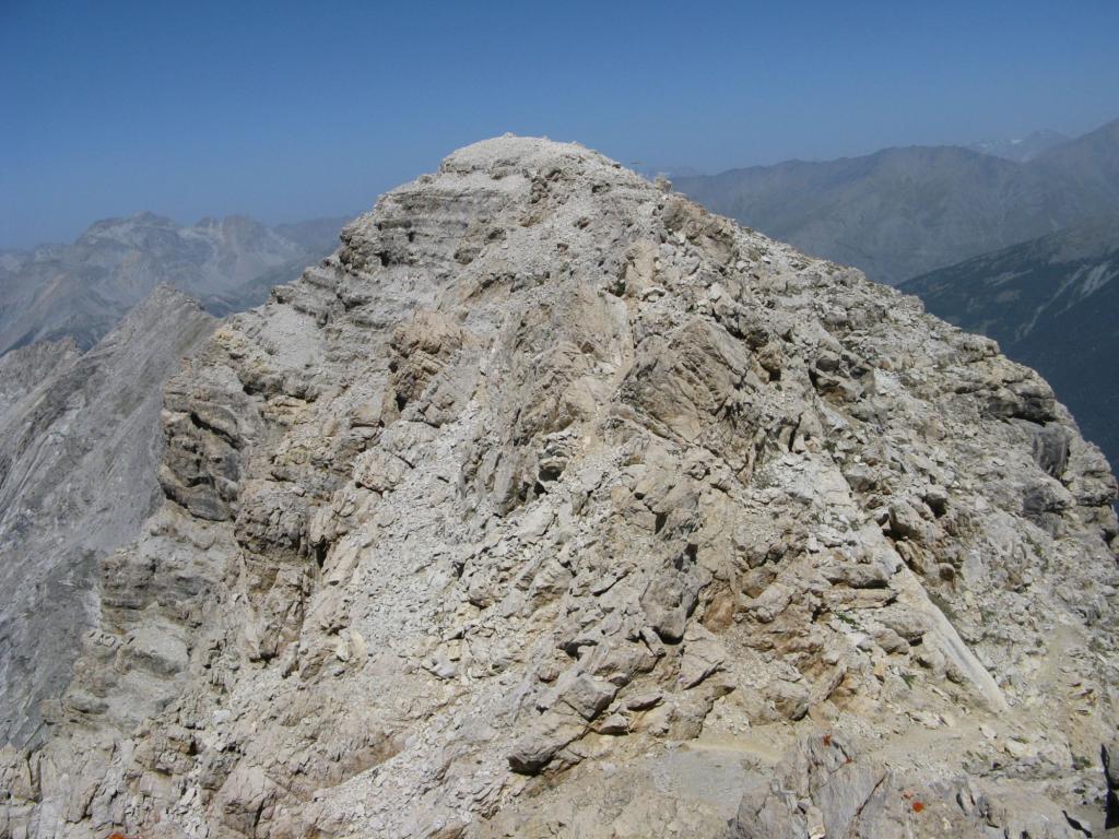
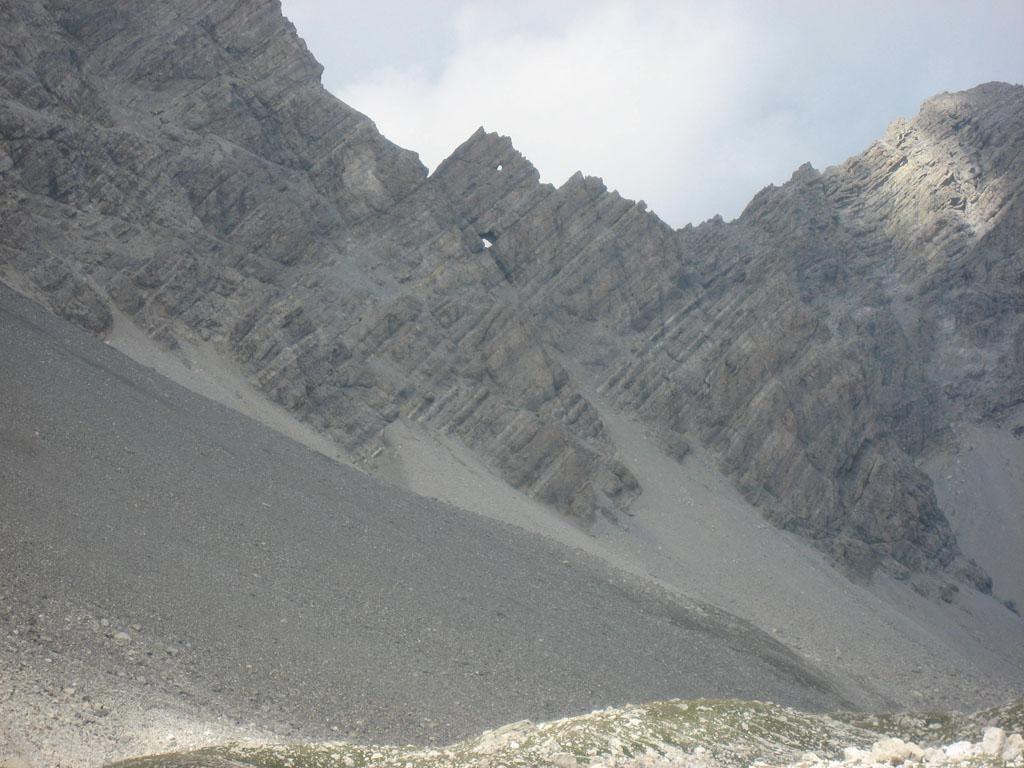
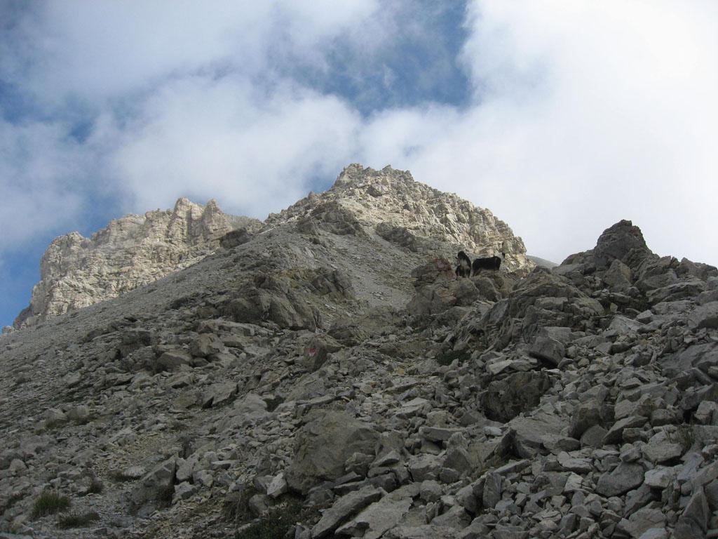
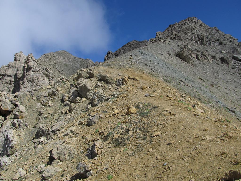
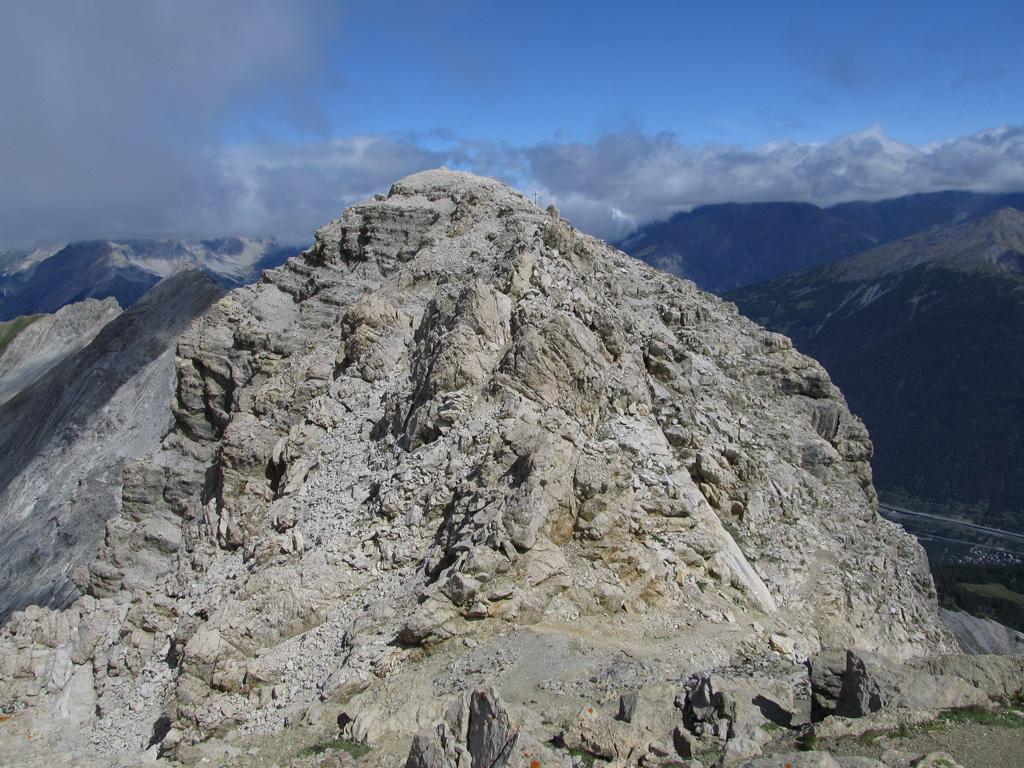
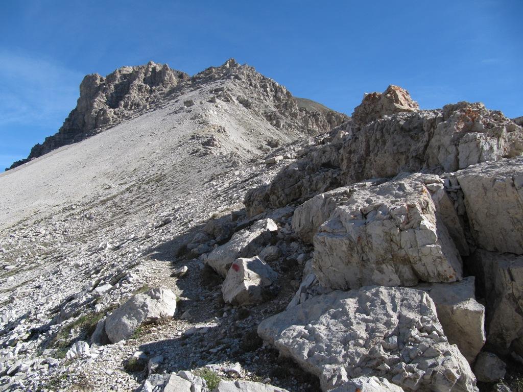
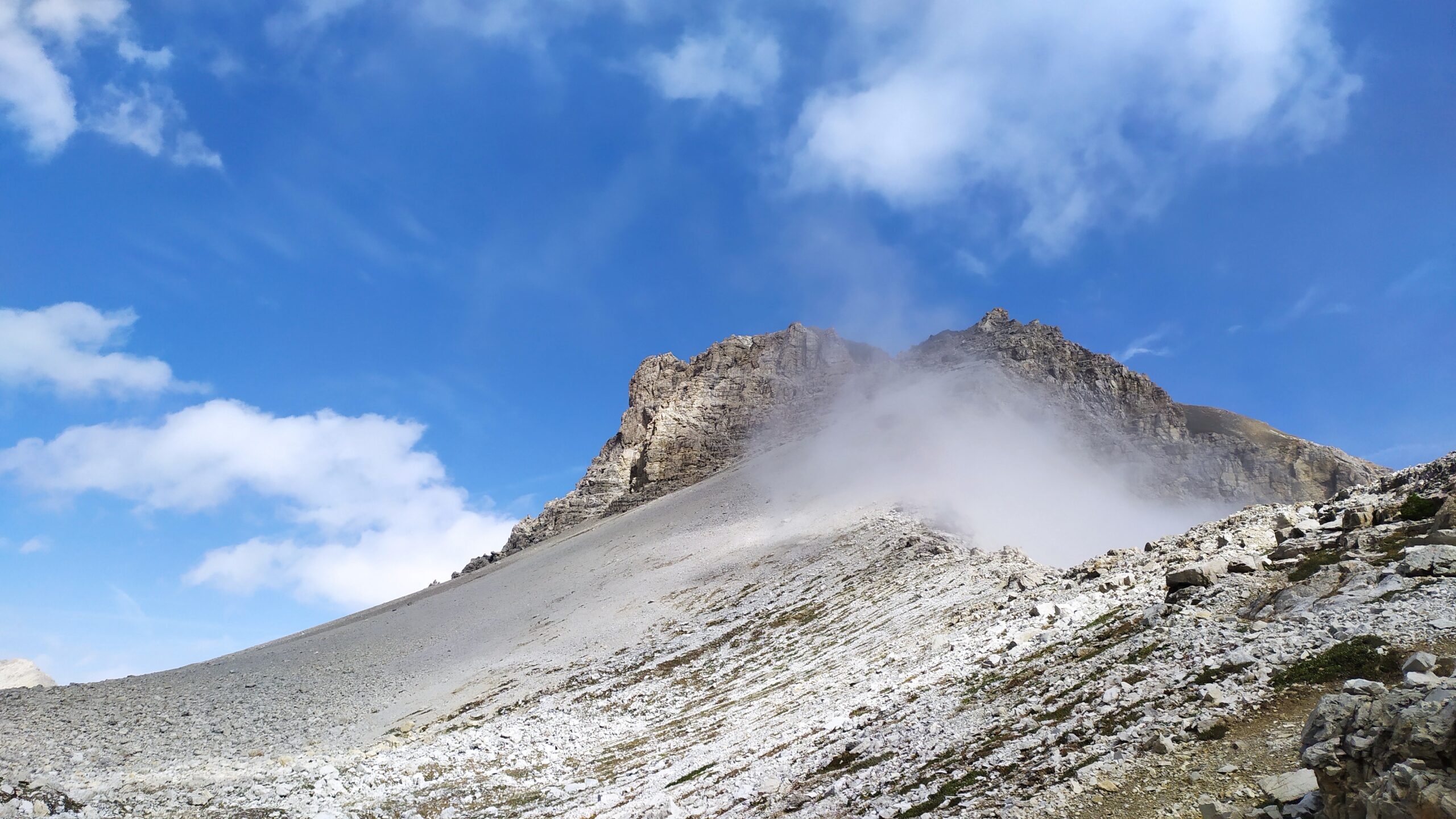
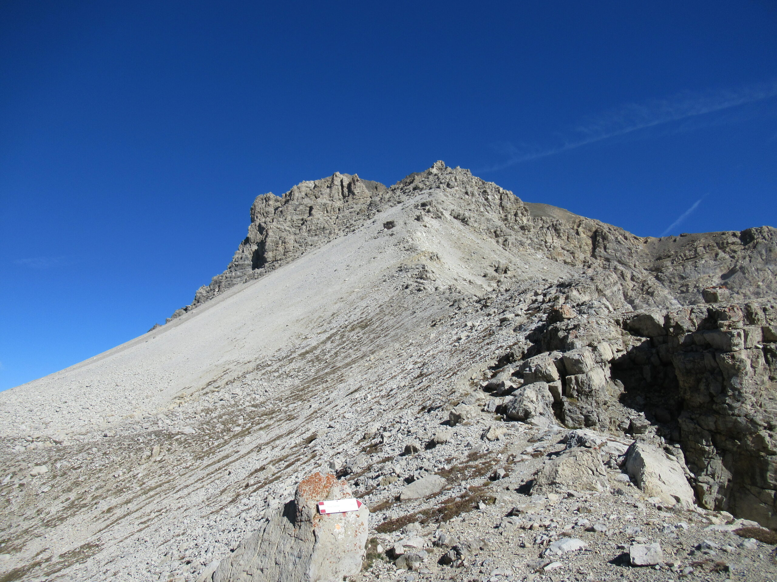
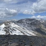
Subito a destra si nota la traccia, contrassegnata da vernice e ometti, che risale il crestone detritico sud di Punta Clotesse. Il percorso non è difficile ma faticoso per via della natura scoscesa del terreno, che alterna tratti di fine ghiaia ad altri di rocce rotte. Si mantiene pressochè il filo di cresta finchè possibile, per poi aggirare le asperità sul versante francese (la traccia è comunque ben evidente) giungendo ad un torrione che sembra insormontabile, e invece si passa sulla sinistra, dove l’ambiente cambia. Per un tratto i detriti lasciano spazio all’erba e si passa in alto rispetto ad una conca erbosa sospesa che non si nota da sotto.
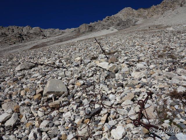
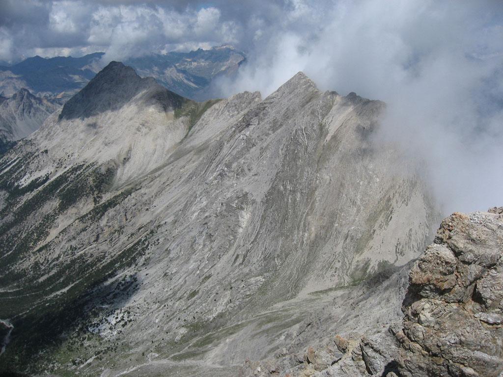
Sono ben visibili alcuni sentieri militari ormai in degrado, che sono le altre vie di salita o dalla Croce di San Giuseppe o da Chateau Beaulard (percosi alpinistici scarsamente frequentati, con tratti molto franosi).
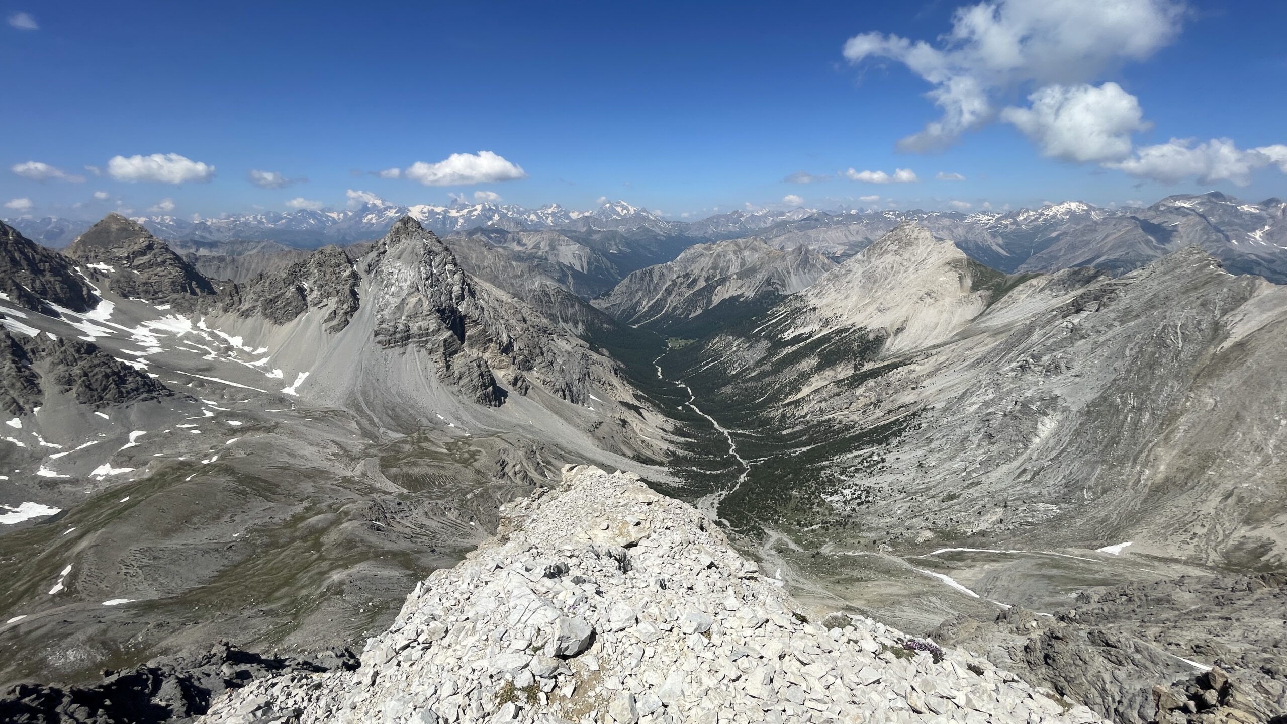
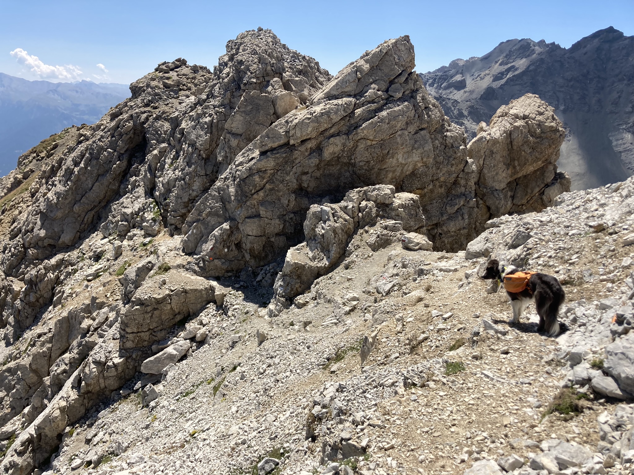
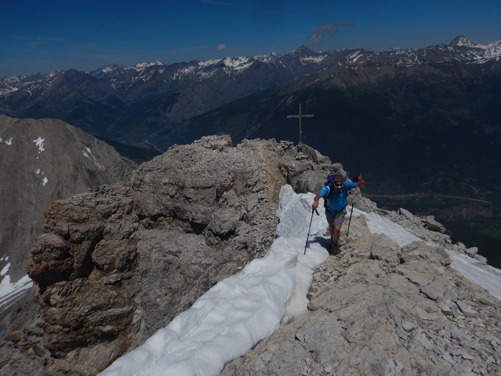
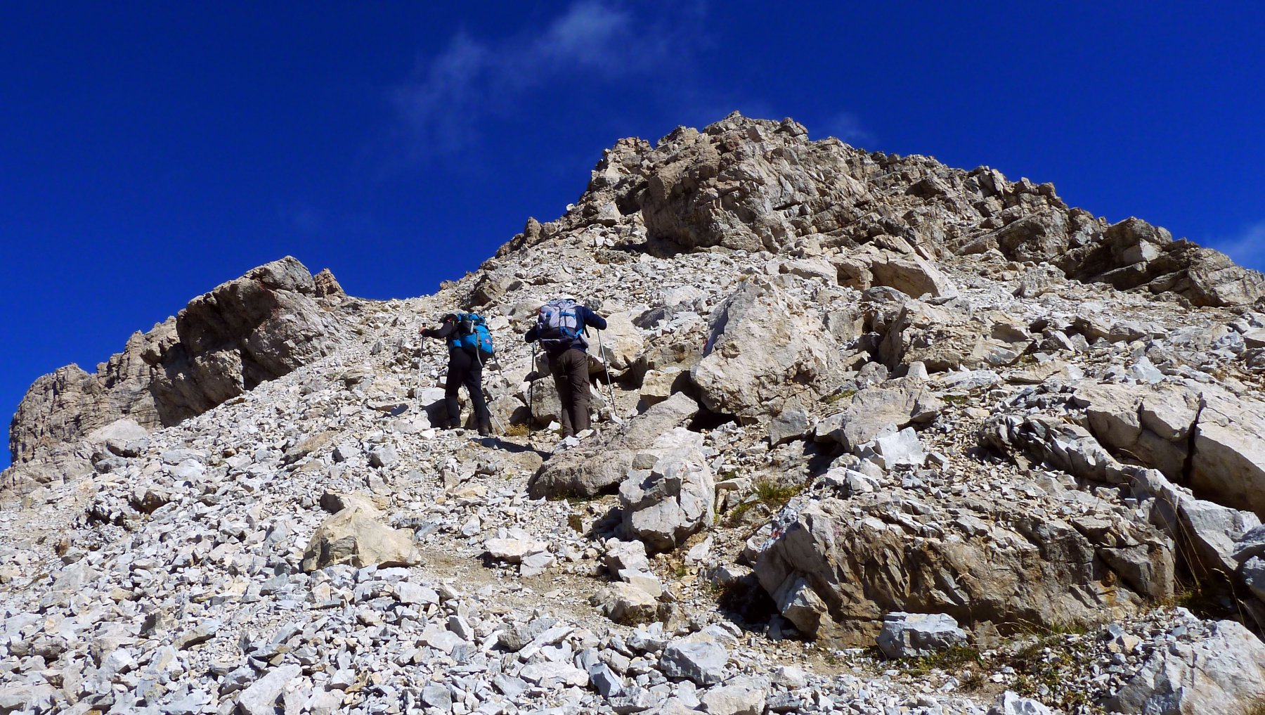
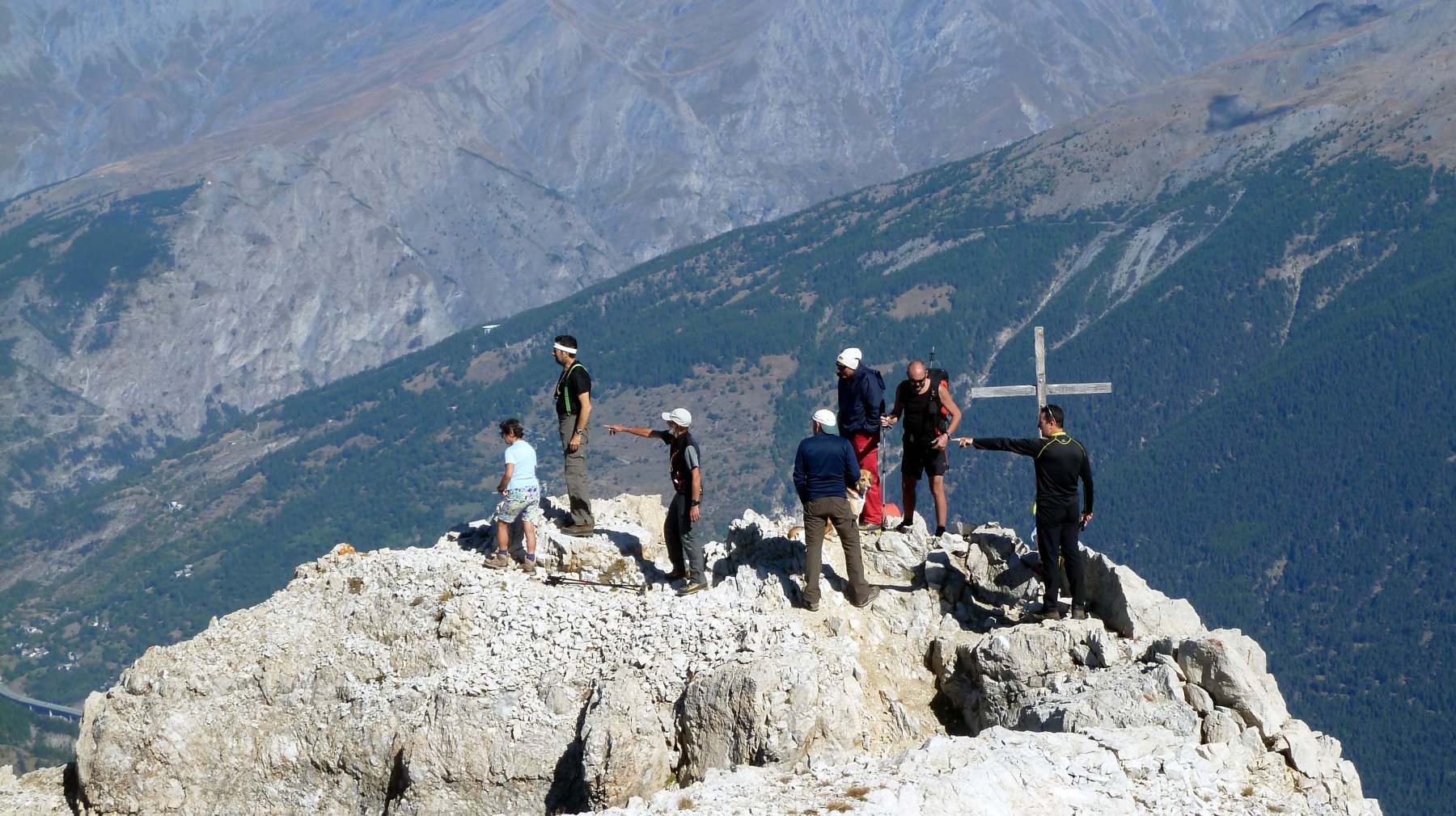
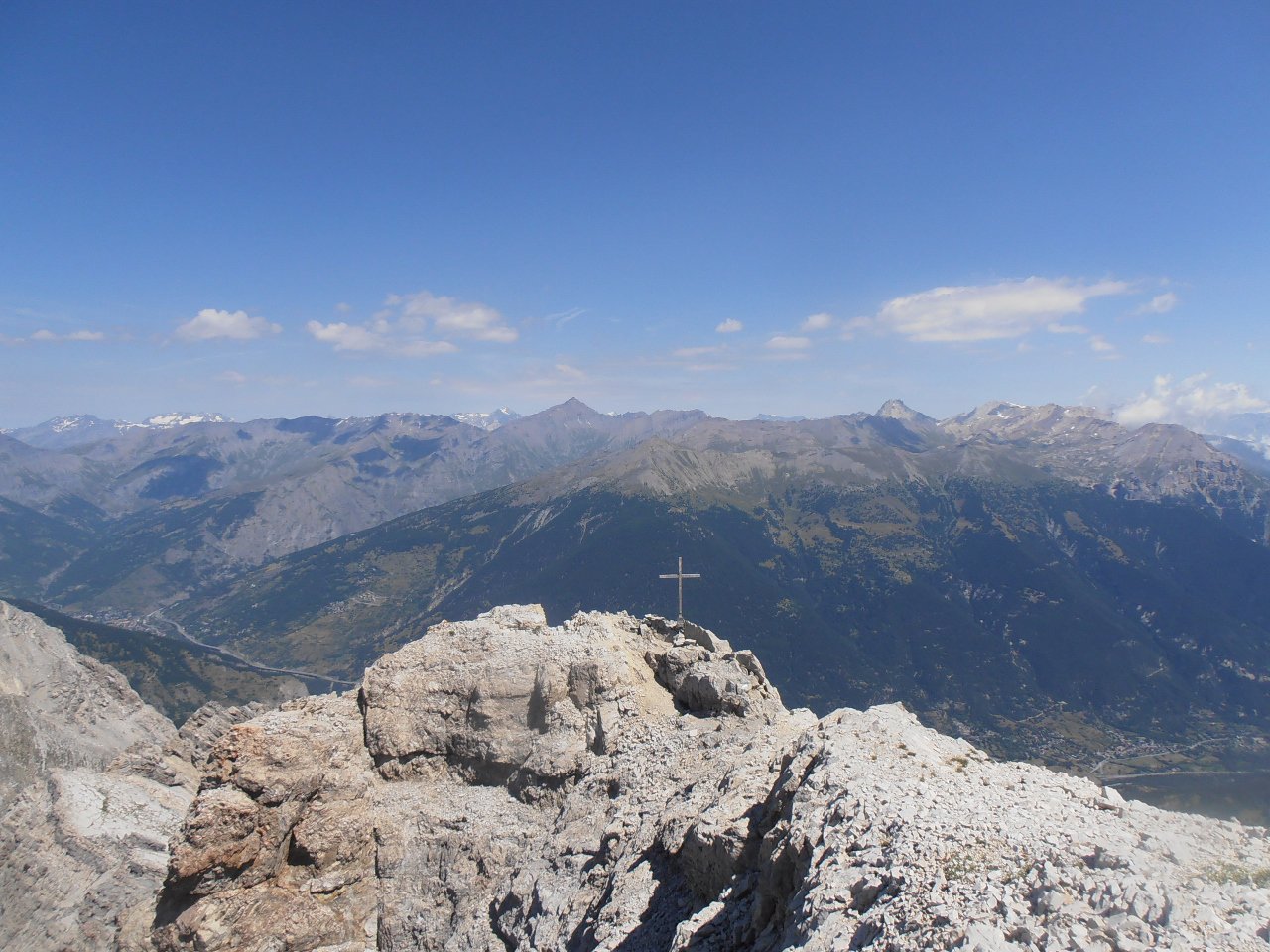
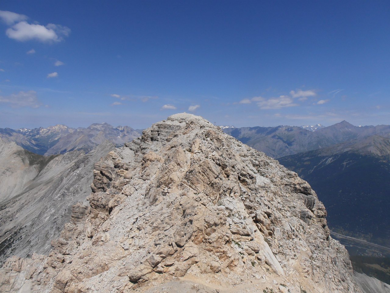
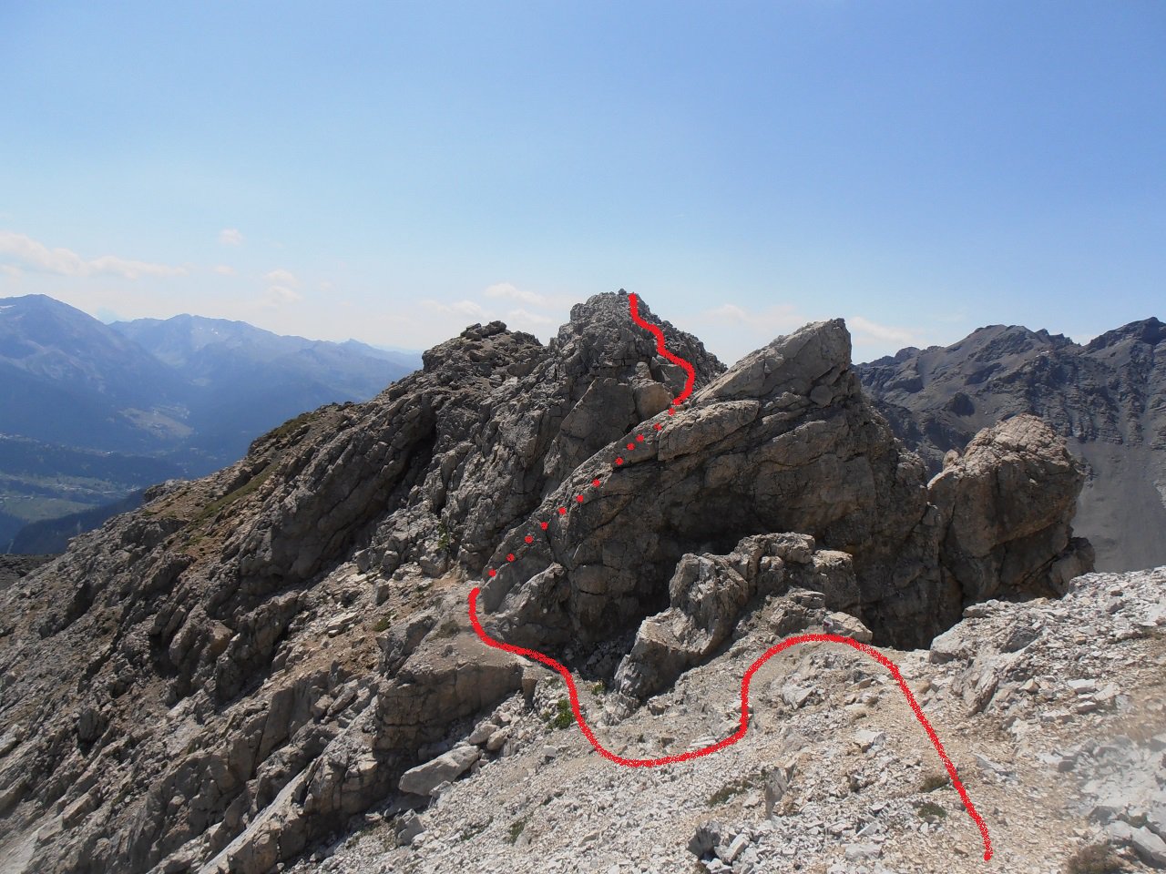
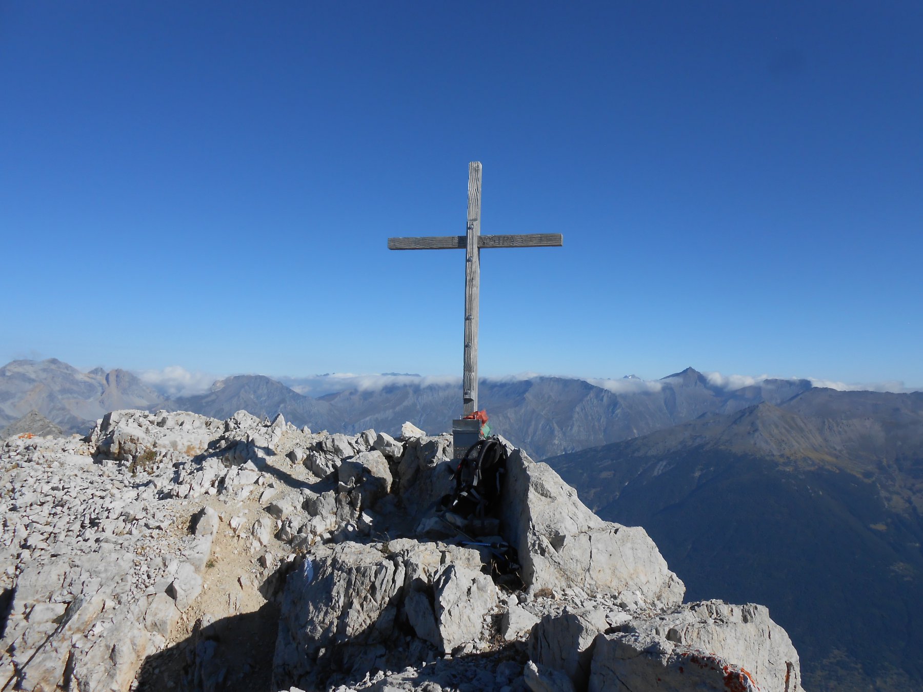
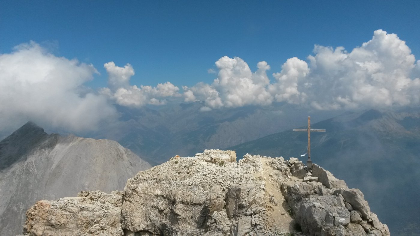
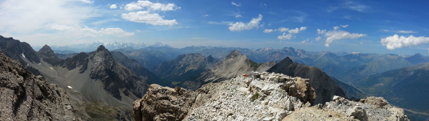
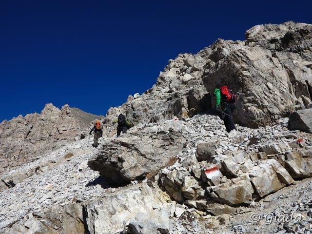
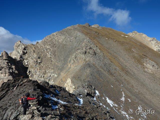
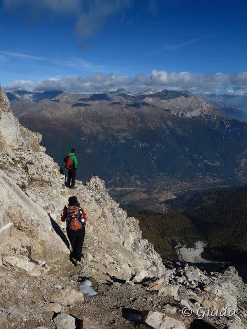
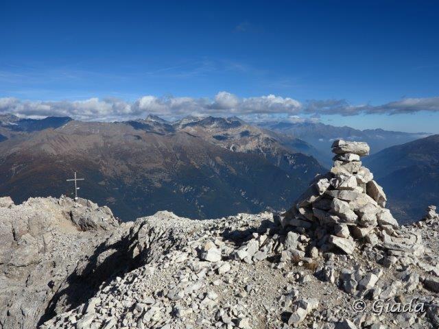
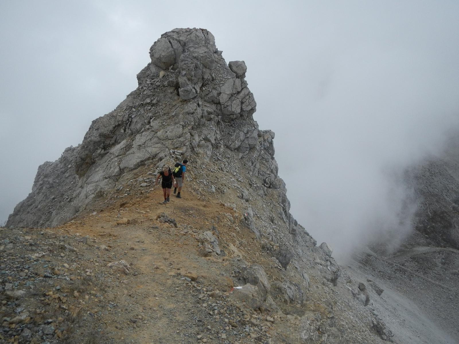
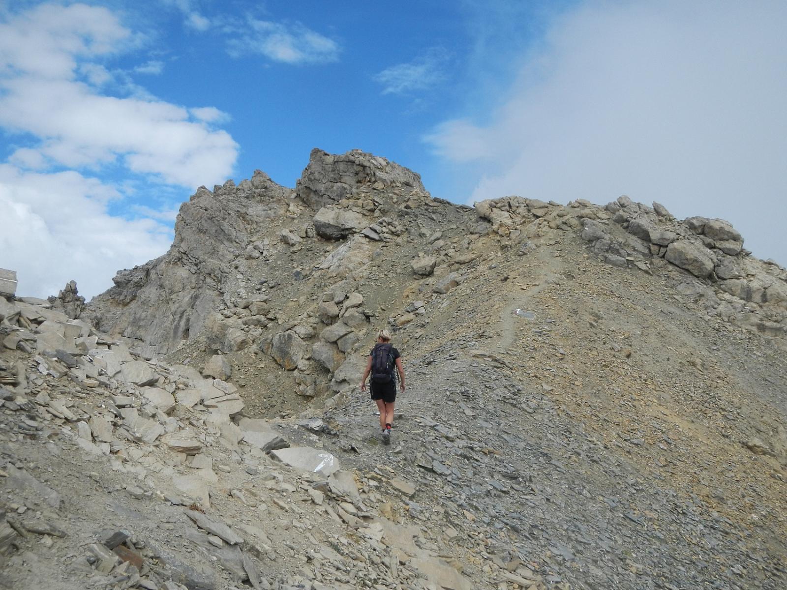
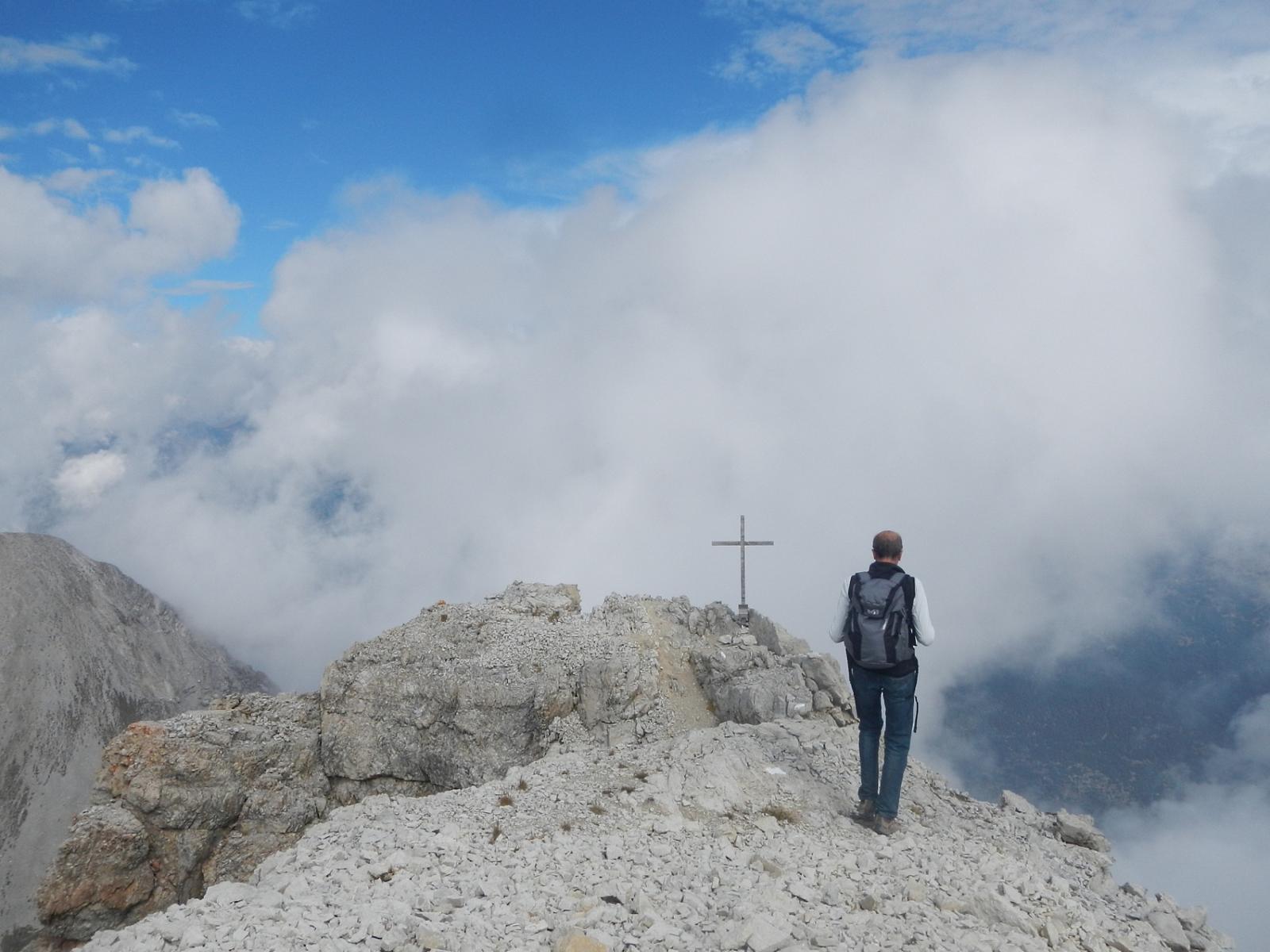
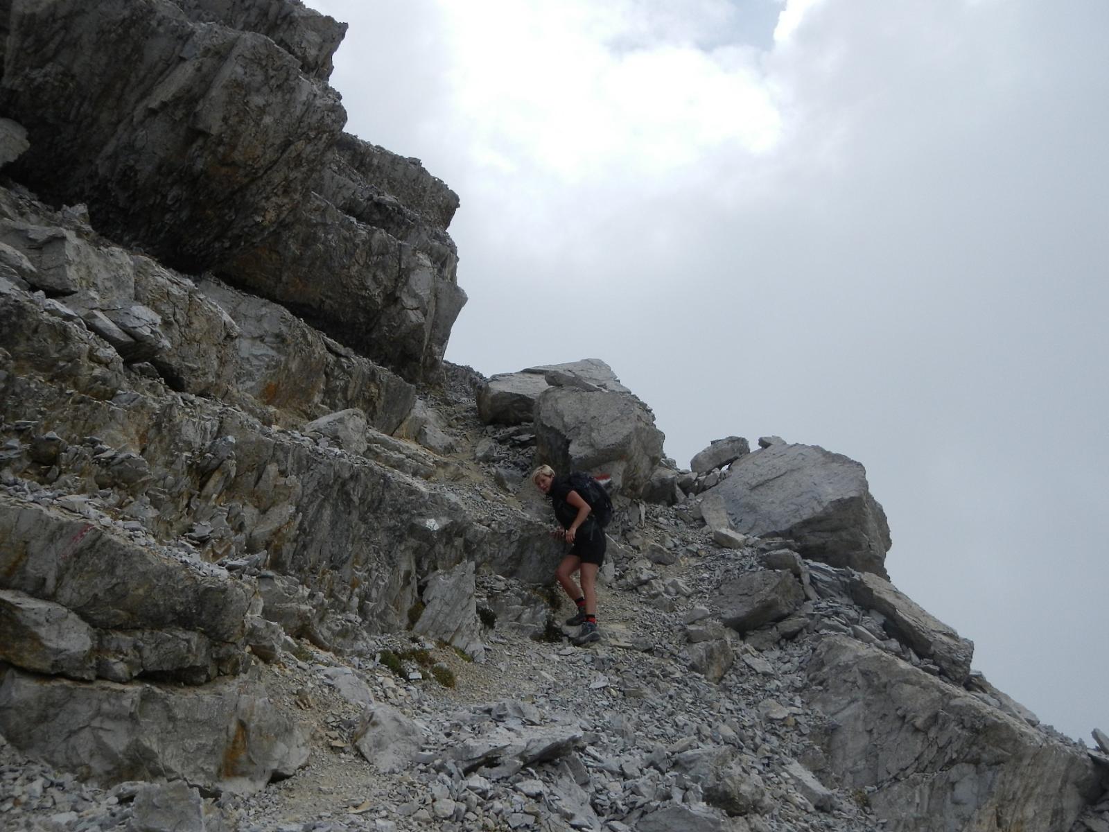
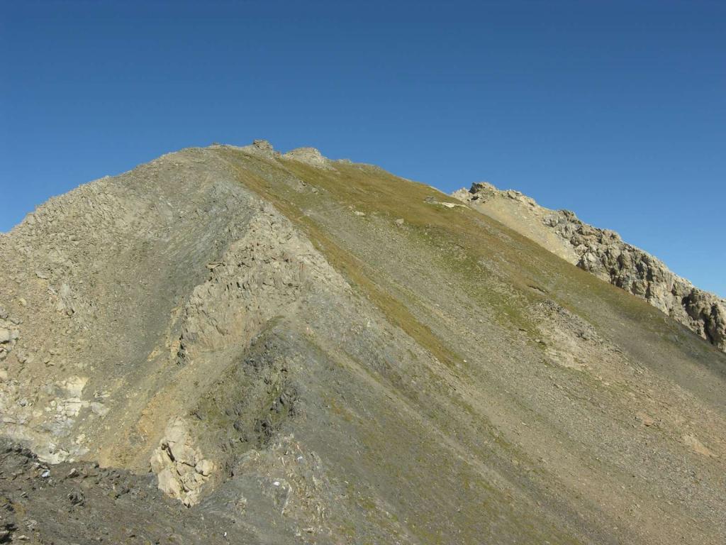
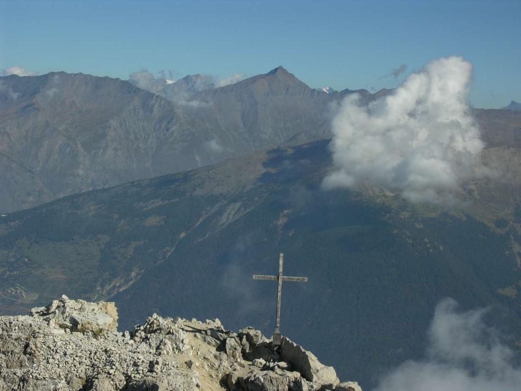
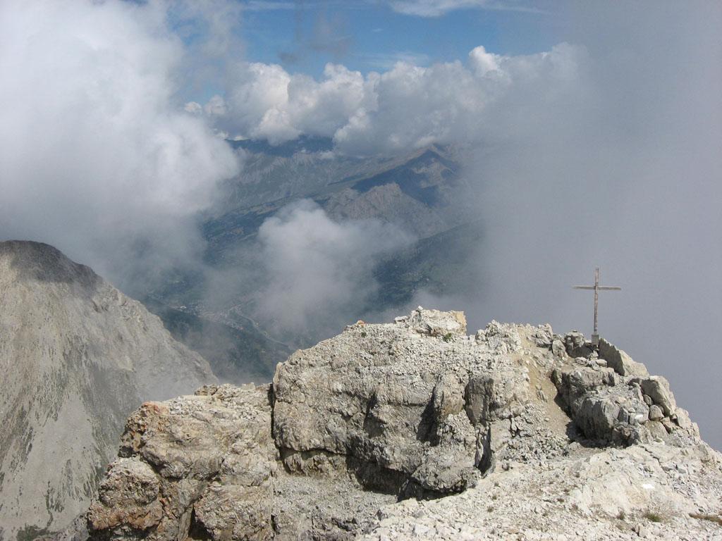
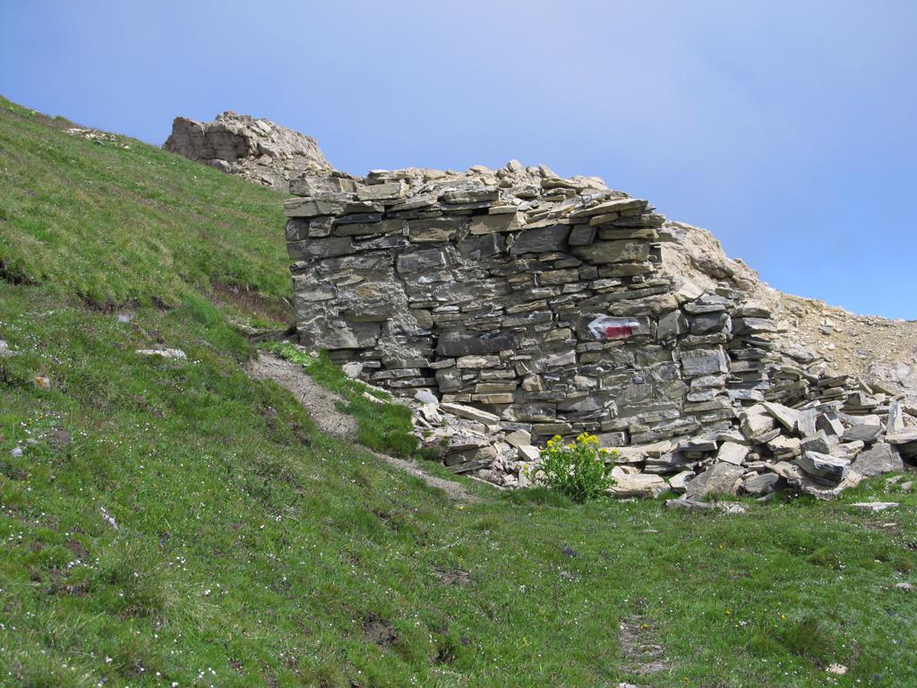
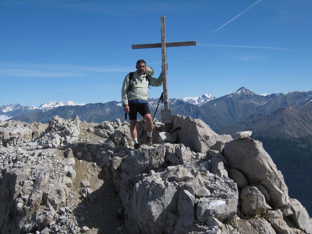
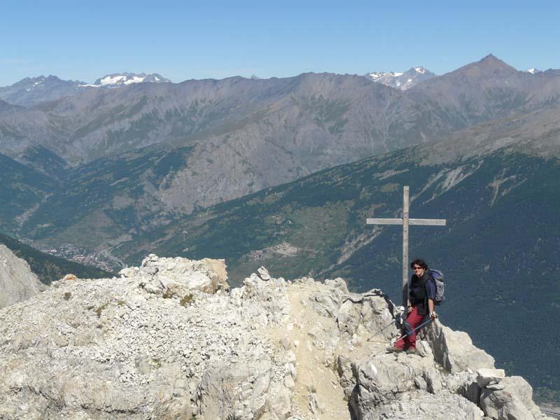
Il sentiero passa accanto ad un rudere militare, che si lascia a destra proseguendo in cresta fino all’anticima. Da qui si deve scendere ad un intaglio dove troviamo il passaggio forse più ostico (nessun problema senza neve o ghiaccio); si passa su una cengia sul versante italiano, comoda e non particolarmente esposta ma resa insidiosa dai detriti che coprono le rocce, occorre passo fermo. Il breve tratto si supera rapidamente arrivando così senza altre difficoltà alla cima contrassegnata da un ometto, e poco più in là alla croce di vetta, o per cresta (esposto sul lato francese) o poco sotto sul versante italiano.
Nel "bivacco Passo di Desertes" a quota 2450, poco sotto il Passo , nel 1948, il regista Mario Soldati girò una scena, nella neve, del film "Fuga in Francia". Un film neorealista che racconta il tentativo di un criminale di guerra italiano di rifugiarsi in Francia. Un'altra scena di questo film girato tra le montagne dell'Alta Valle di Susa fu ripresa presso la diga in Valle Stretta.
- Cartografia:
- IGC Valli Susa Chisone e Germanasca
- Bibliografia:
- CAI TC Alpi Cozie Settentrionali
Nelle vicinanze Mappa
Itinerari
20/06/2026 TO, Oulx D+ 800 m E Sud
San Giuseppe (Croce) da Vazon
 50m
50m
23/05/2026 TO, Oulx D+ 1250 m EE Varie
Gardiol (Punta) da Vazon, anello per Cotolivier, Croce di San Giuseppe e Desertes
 100m
100m
01/03/2026 TO, Oulx D+ 925 m E Sud
Madonna del Cotolivier (Cappella) da Amazas per Soubras e Vazon
 1.3Km
1.3Km
21/12/2024 TO, Oulx D+ 1035 m E Varie
Madonna del Cotolivier (Cappella) da Oulx
 2.1Km
2.1Km
17/05/2014 TO, Oulx D+ 735 m E Nord
Chateau Beaulard (Frazione) da Oulx a Beaulard per il Sentiero Balcone
 2.1Km
2.1Km
18/10/2020 TO, Oulx D+ 700 m E Nord-Ovest
Malafosse, Jouvenceaux (Borgate) da Oulx, anello
 2.7Km
2.7Km
08/07/2023 TO, Oulx E Nord
Sentiero dei Franchi da Oulx a Sant’Ambrogio
 2.8Km
2.8Km
23/05/2026 TO, Oulx D+ 1640 m EE Sud
Vin Vert (Monte) da Beaume per la Serre du Kin e dorsale SE
 3Km
3Km
28/01/2022 TO, Oulx D+ 1166 m E Sud
Quin o Kin (Serre du) da Beaume
 3Km
3Km
21/05/2026 TO, Oulx D+ 1096 m E Nord-Ovest
Pramand (Forte) da Beaume
 3Km
3Km
Servizi
100m
1.9Km
La Moretta Ristorante
Oulx
4.9Km
L’Cantun B&B
Sauze D'oulx
4.9Km
L’Eitabl Ristorante
Oulx
5.2Km
orto del frate Ristorante
Sauze d'Oulx
5.2Km
paddy mc ginty Ristorante
Sauze d'Oulx
7Km
Dell’Orsa Bar
Oulx
7.2Km
Guido Rey Rifugio
Oulx
7.6Km
Ottima Scelta Ristorante
Cesana Torinese
7.6Km