900m
900m

Note
 50m
50m
50m
50m
250m
250m
3Km
3Km
3Km
3Km
50m
50m
50m
50m
250m
250m
3Km
3Km
3Km
3Km
900m
1.6Km
3Km
3.2Km
3.8Km
4.6Km
4.8Km
6.9Km
8.7Km
9.4Km
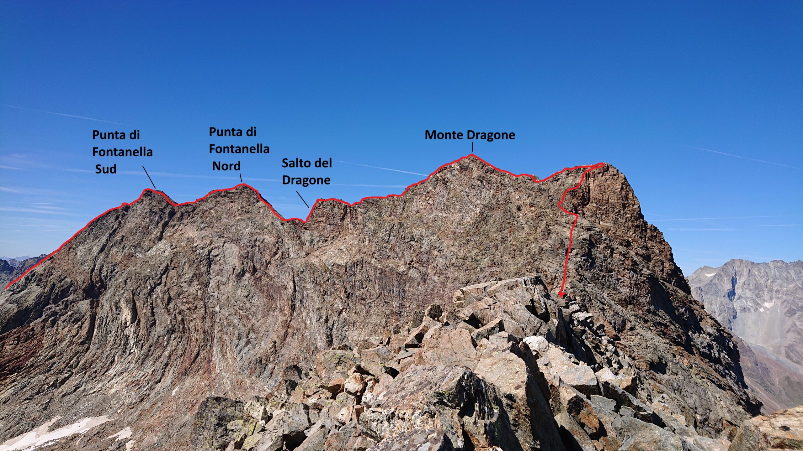
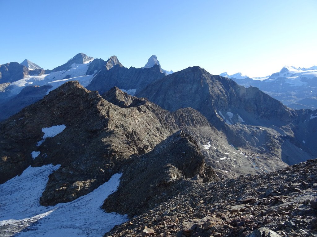
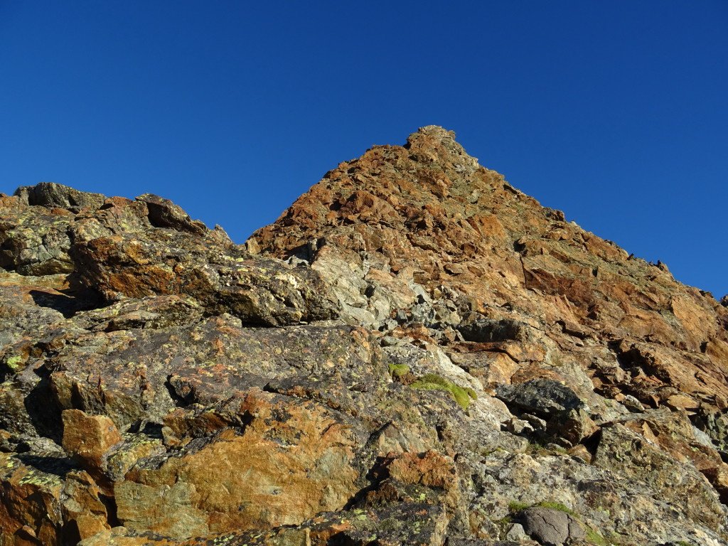
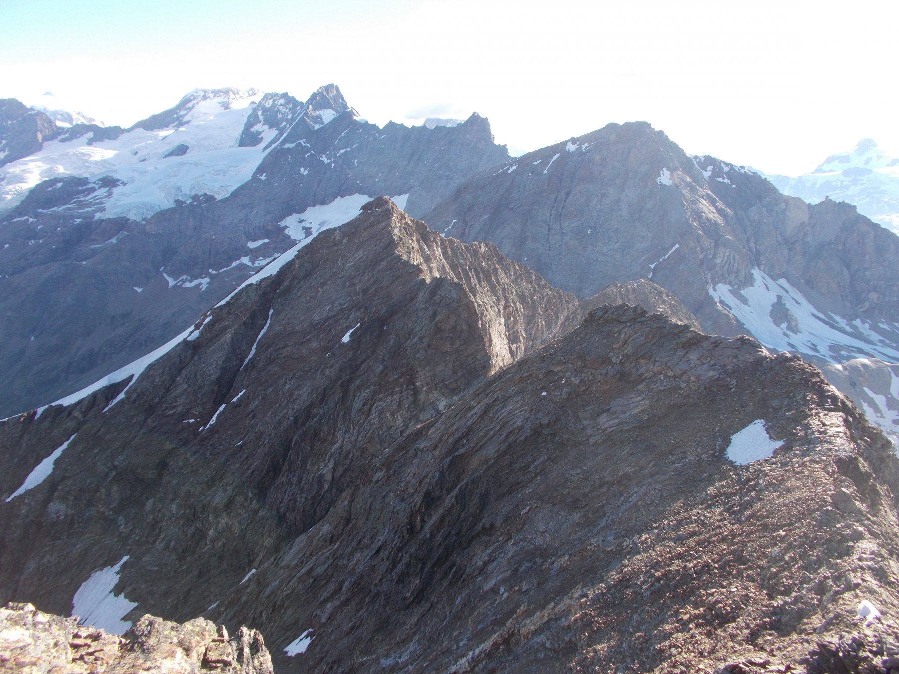
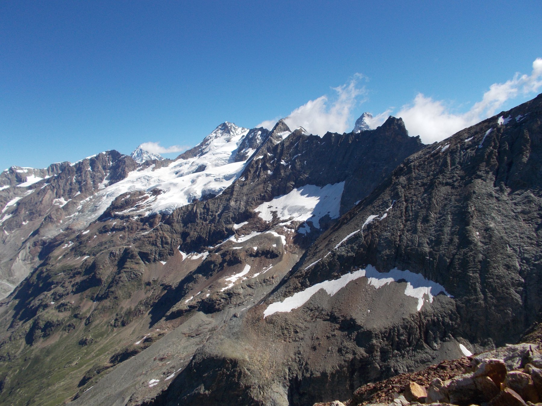
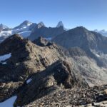
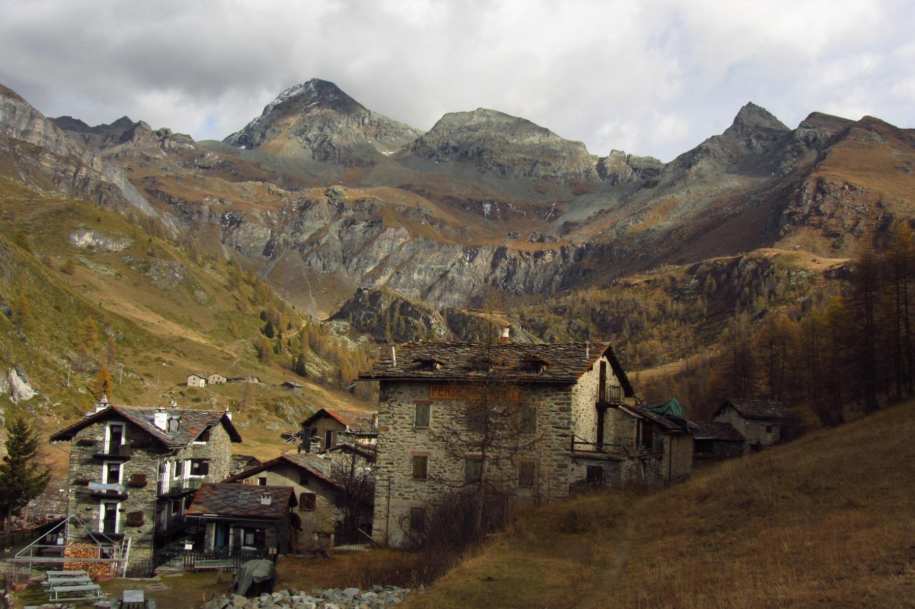
Punta di Fontanella e Monte Dragone sono montagne dalle forme squadrate poste sullo spartiacque Valtournenche/Valpelline. Collegate da una bella e lunga traversata di cresta che non presenta difficoltà tecniche, ma che offre una piacevole scalata in ambiente selvaggio e suggestivo. Con partenza da Valtournenche conviene spezzare la gita in due giorni pernottando al rifugio Perucca Vuillermoz (2909m) in tal caso il dislivello è di 1400m per raggiungere il rifugio e 600m per la traversata.
Avvicinamento
.
Descrizione
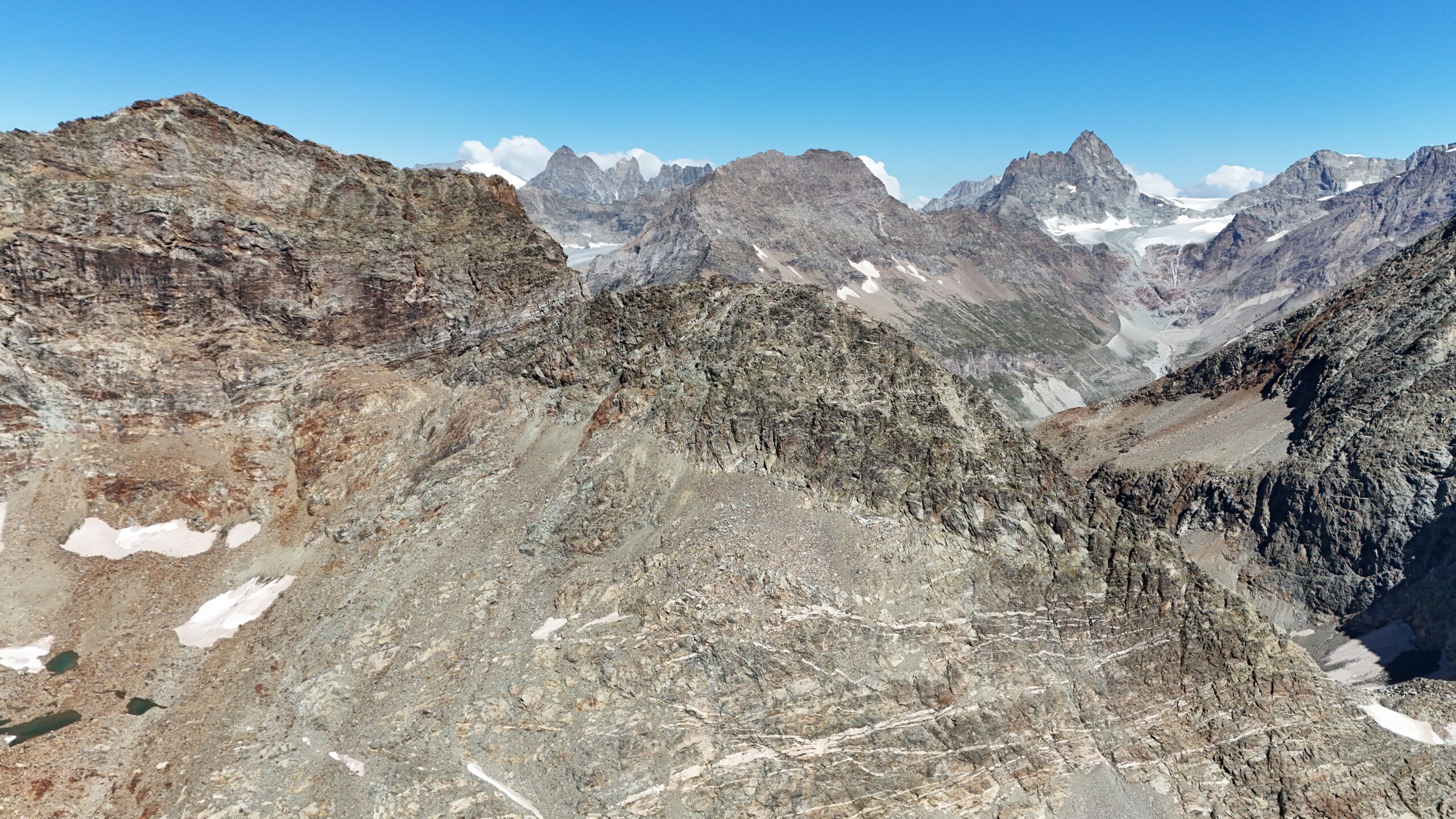
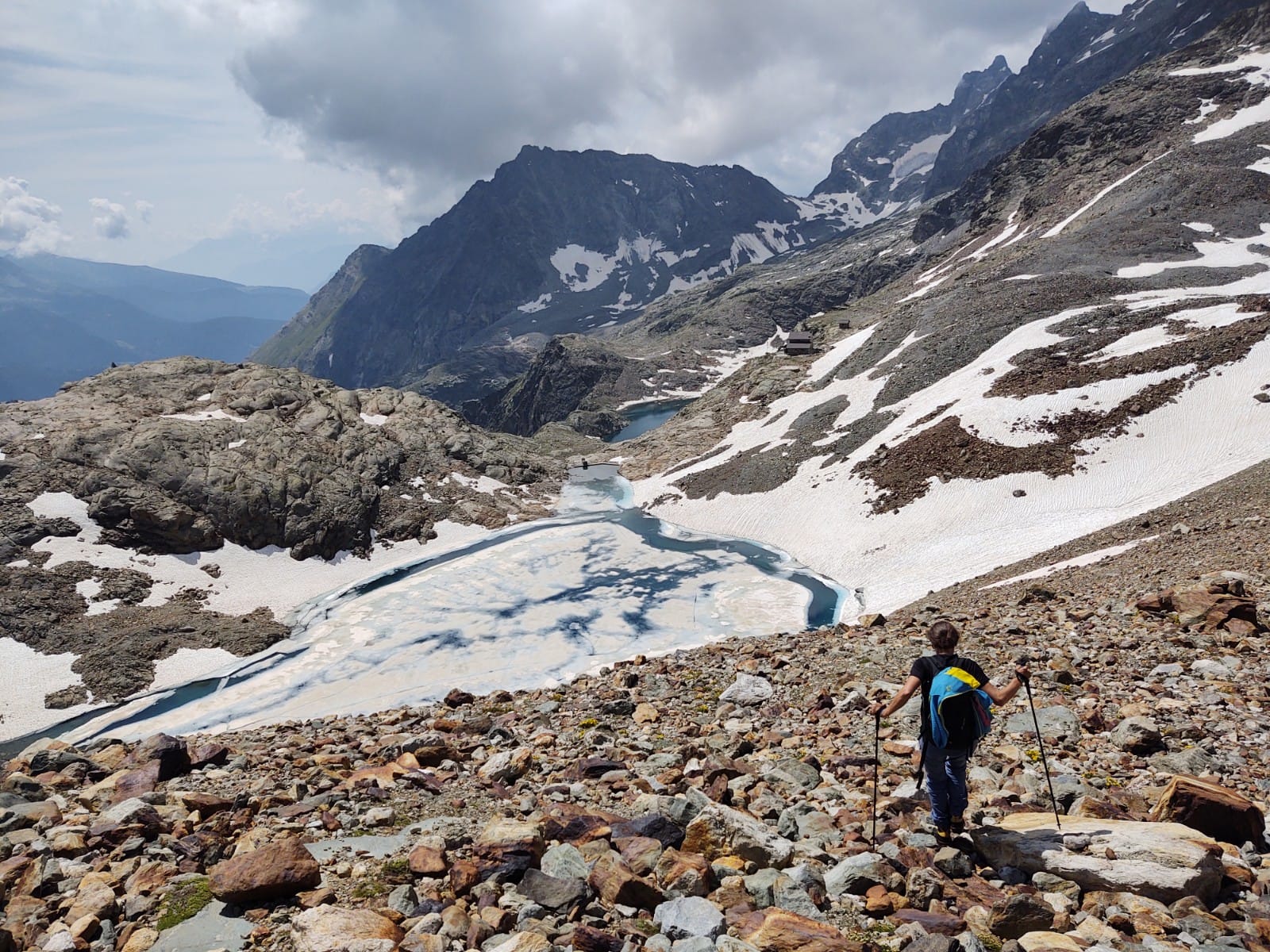
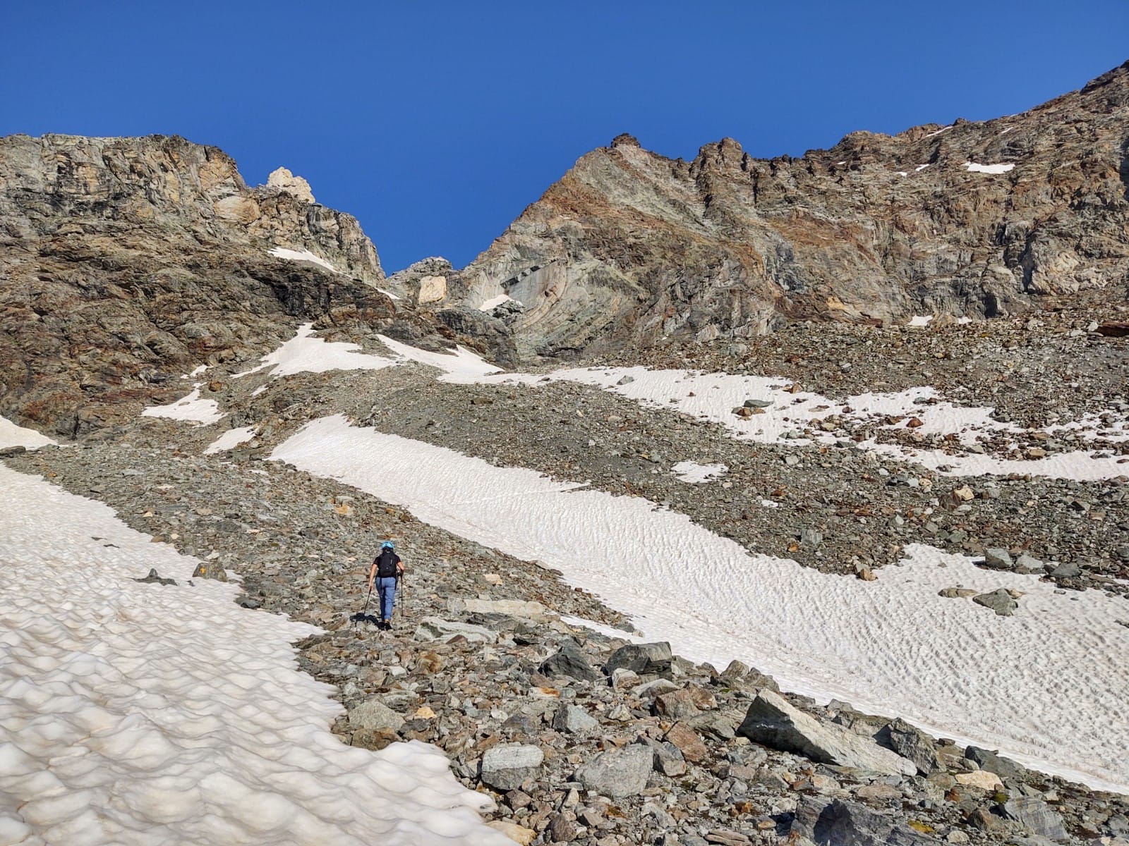
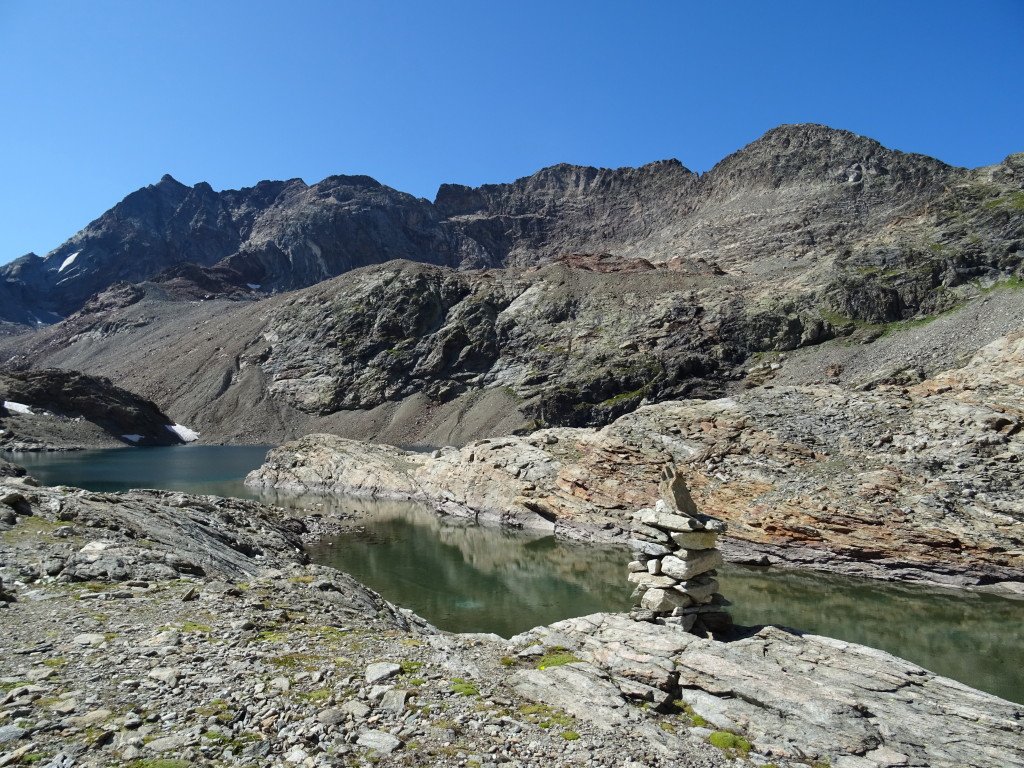
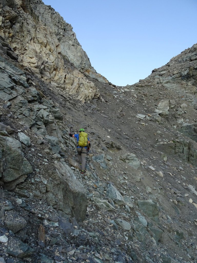
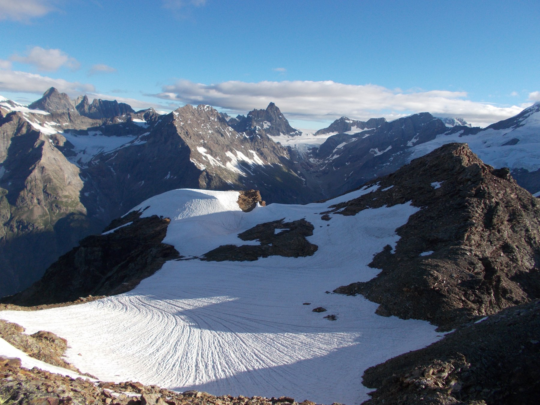
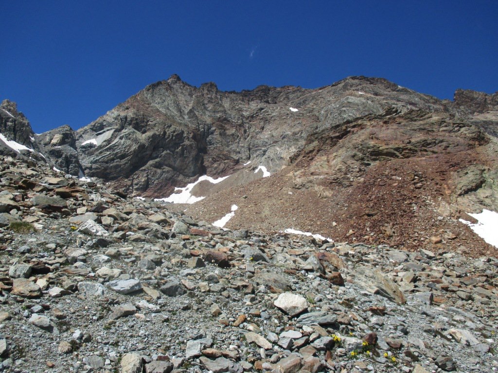
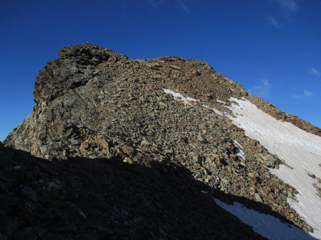
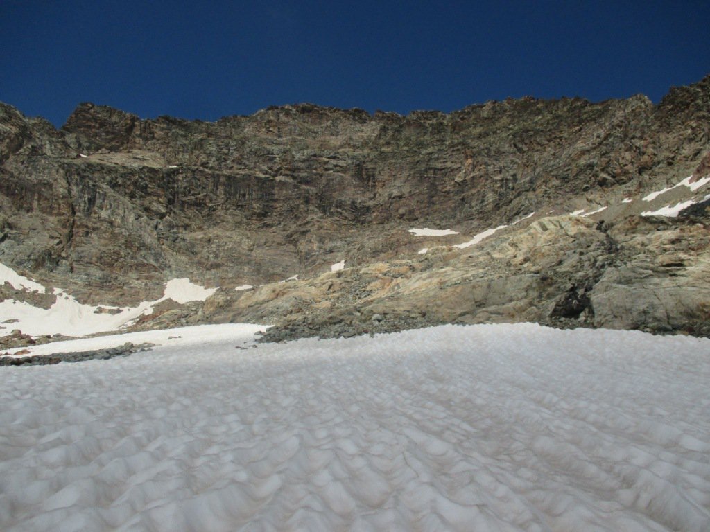
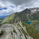
Dal rifugio Perucca-Vuillermoz (2909m, 4 ore da Valmartin di Valtournenche) salire al Colle di Valcornera (3066m) su traccia a monte del rifugio (bolli e freccie gialle). Il pendio al colle potrebbe essere innevato.
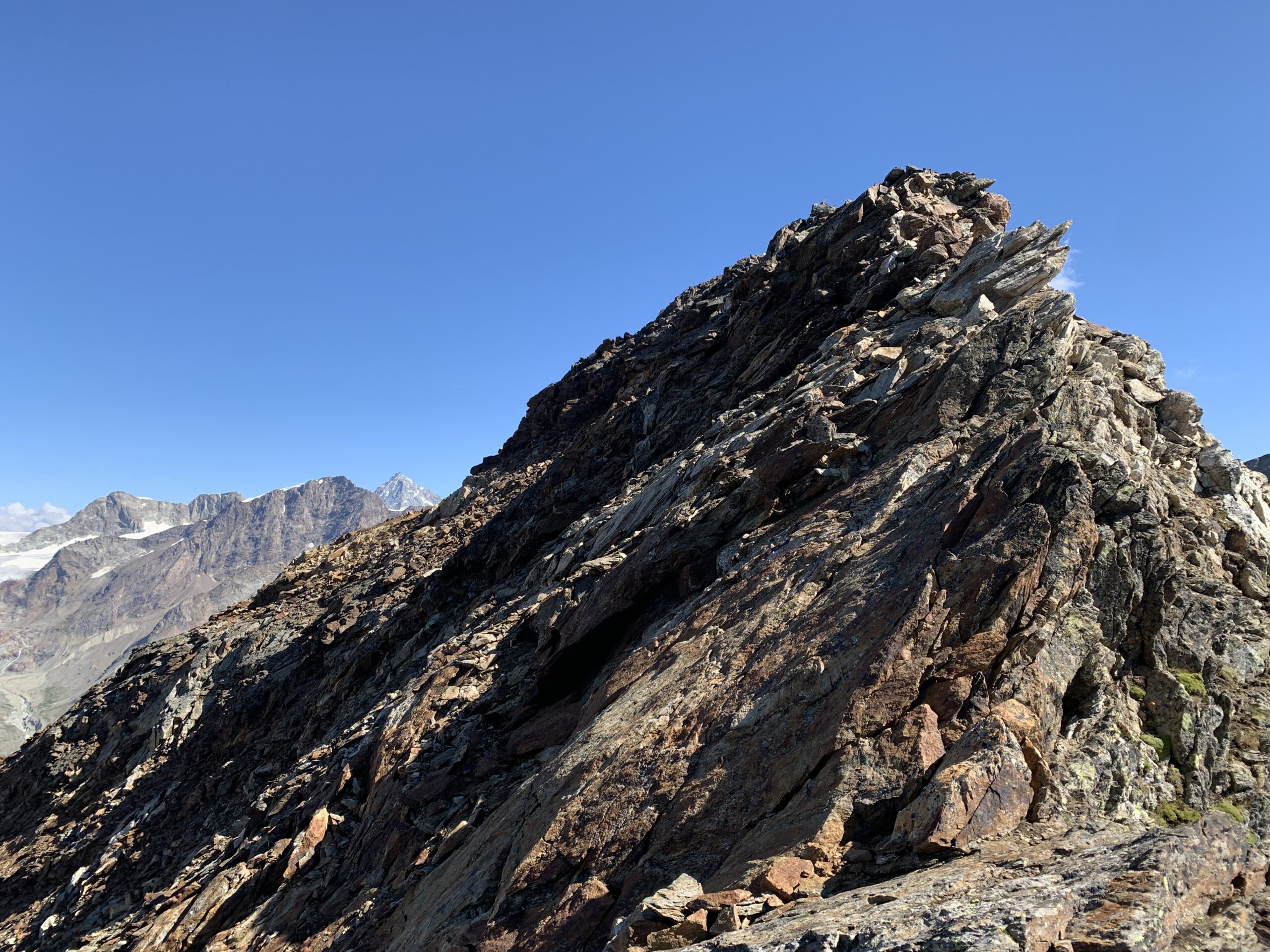
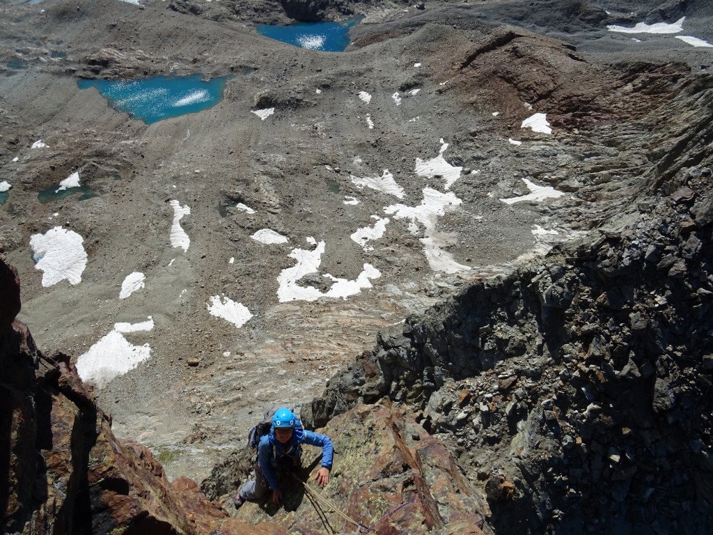
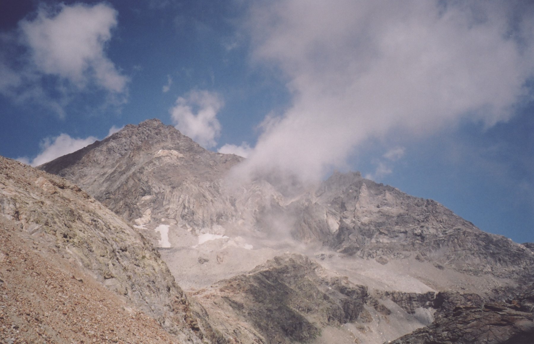
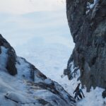
I torrioni che sorgono a nord del colle vanno aggirati traversando orizzontalmente sul versante orientale, risalendo il breve canale che porta all’attacco della cresta. Il versante occidentale risulta (friabile e infido se umido per pioggia recente) porta la risalita del primo grosso torrione dal quale ci si deve calare in doppia (cordone in loco).
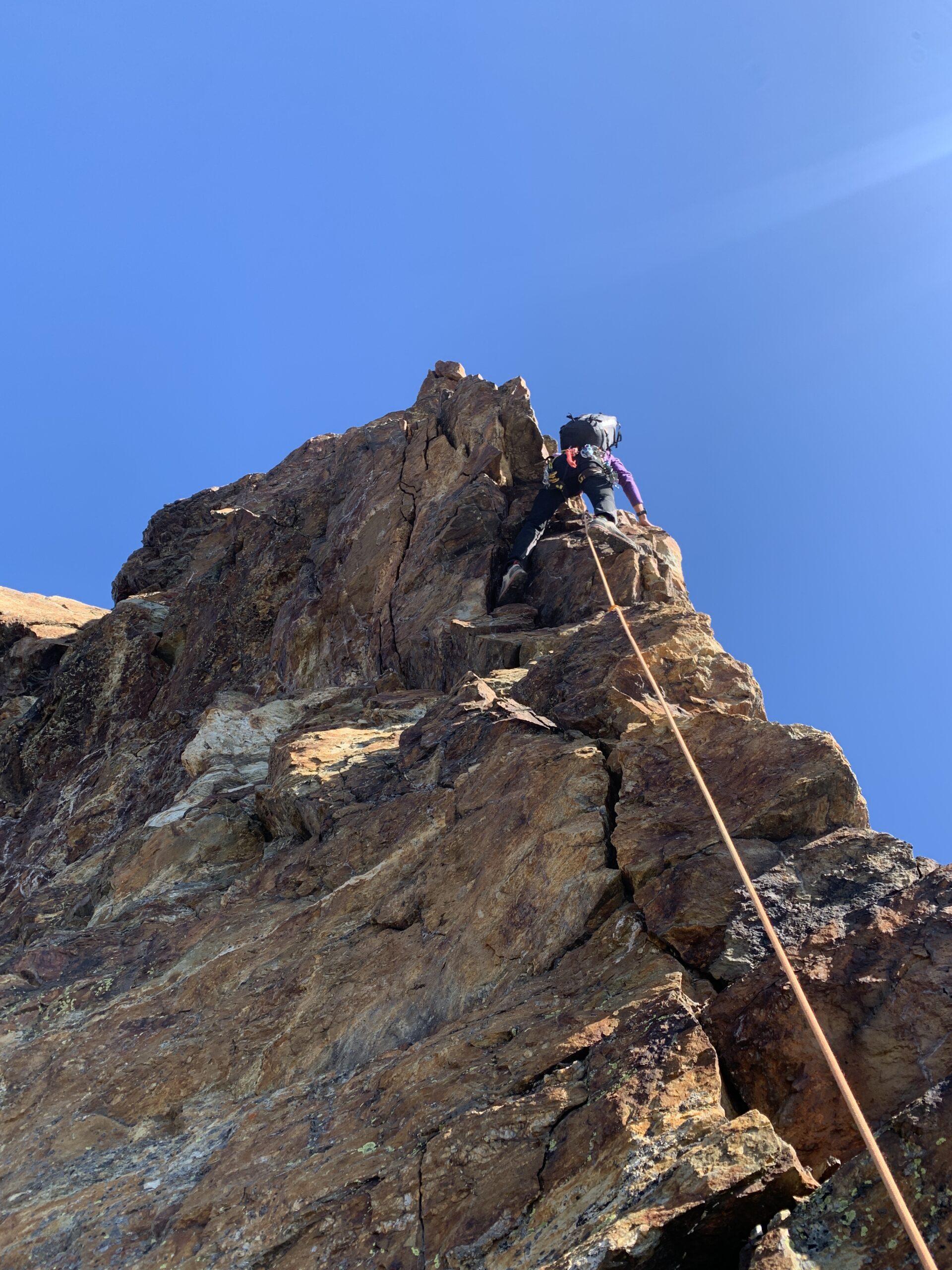
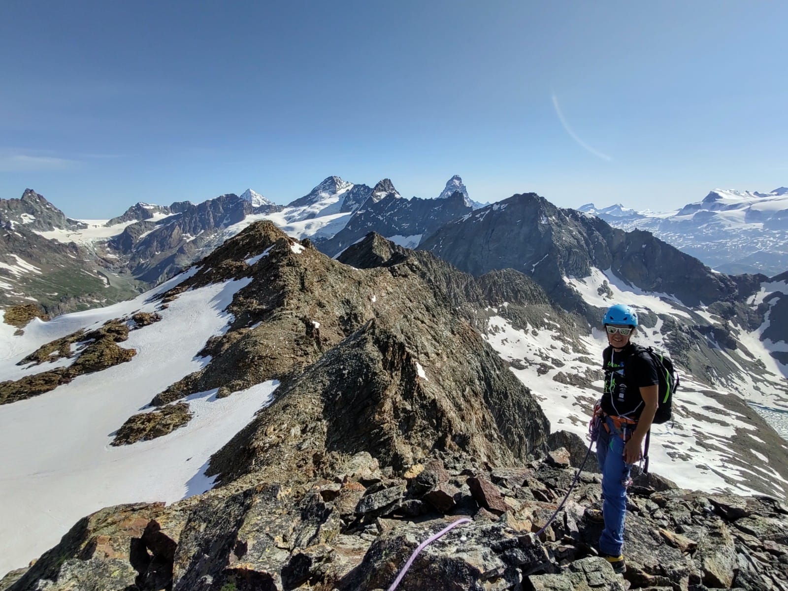
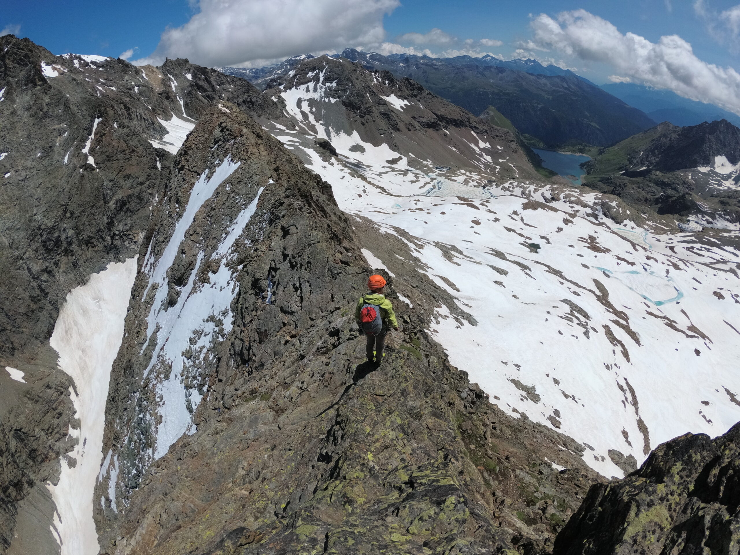
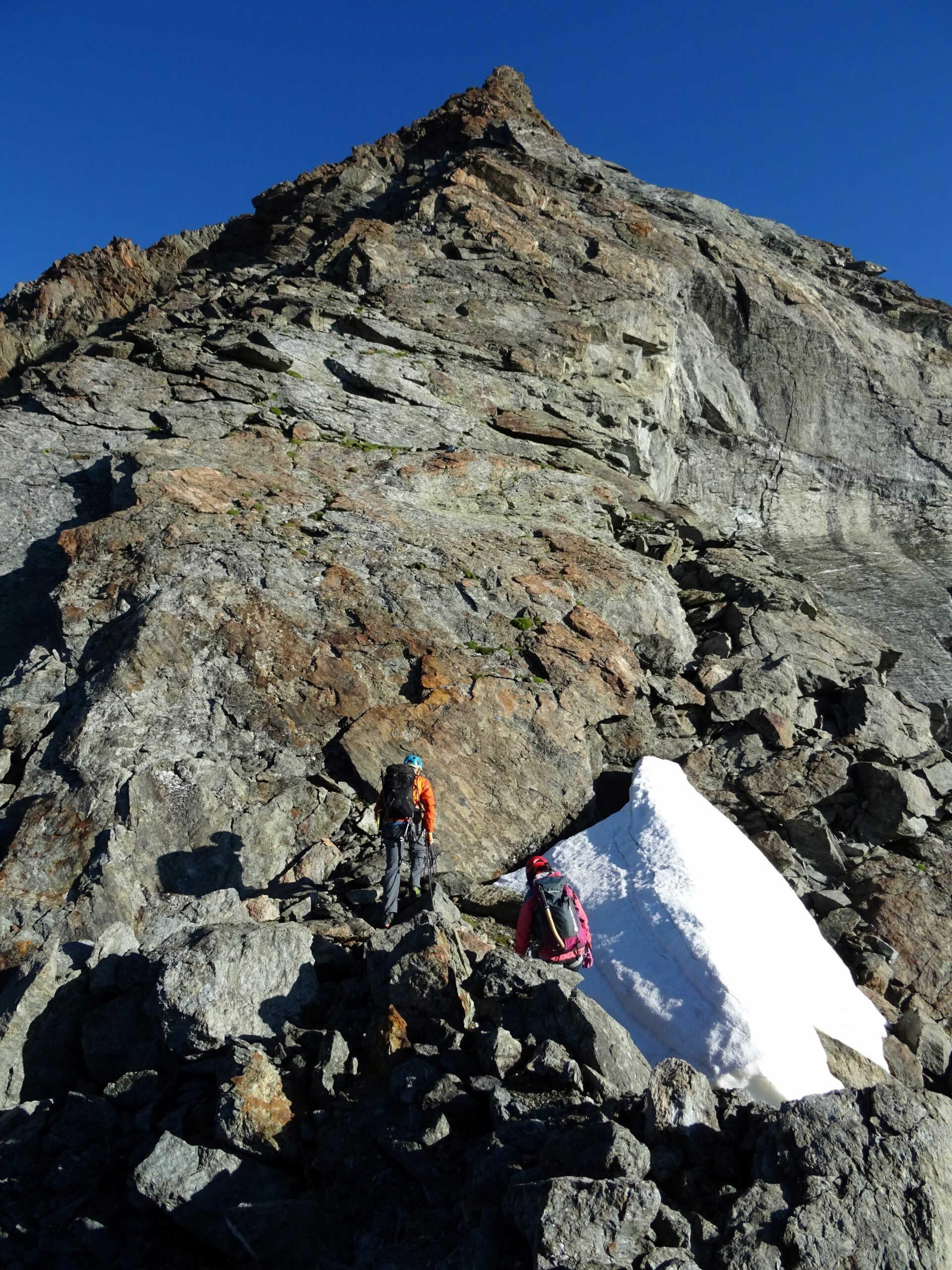
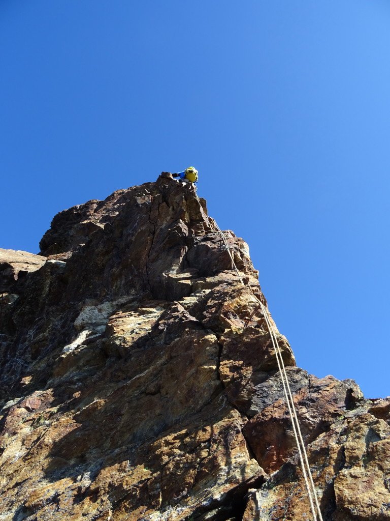
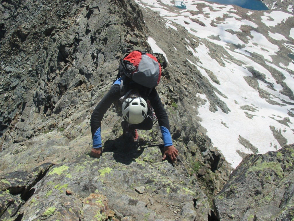
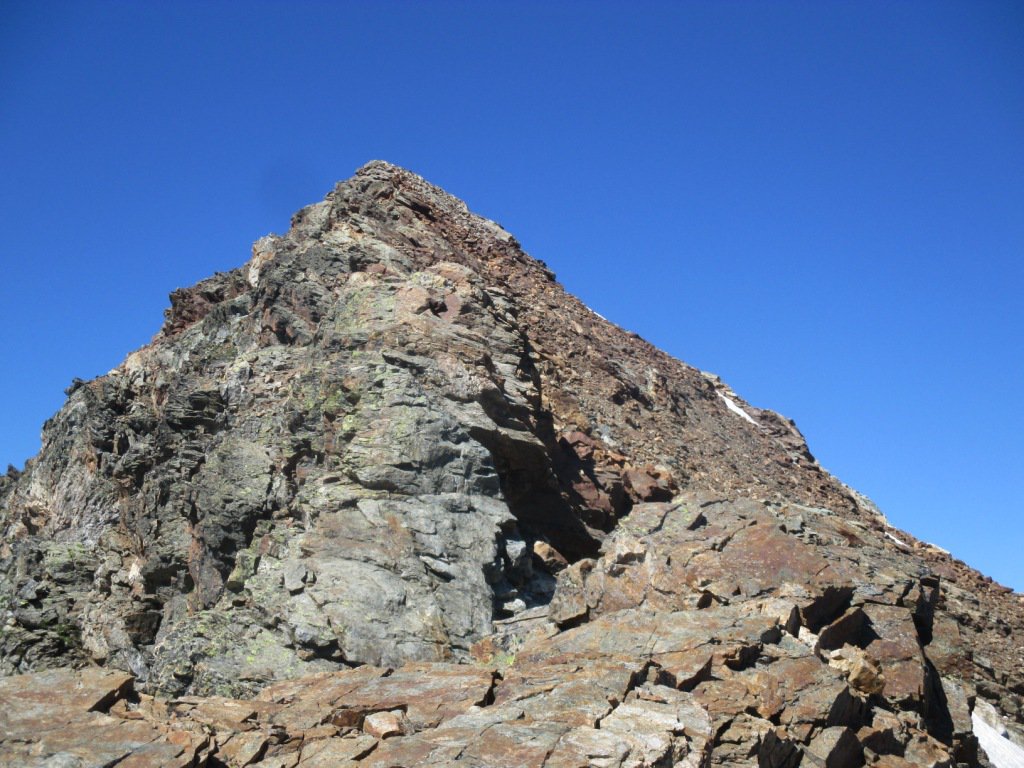
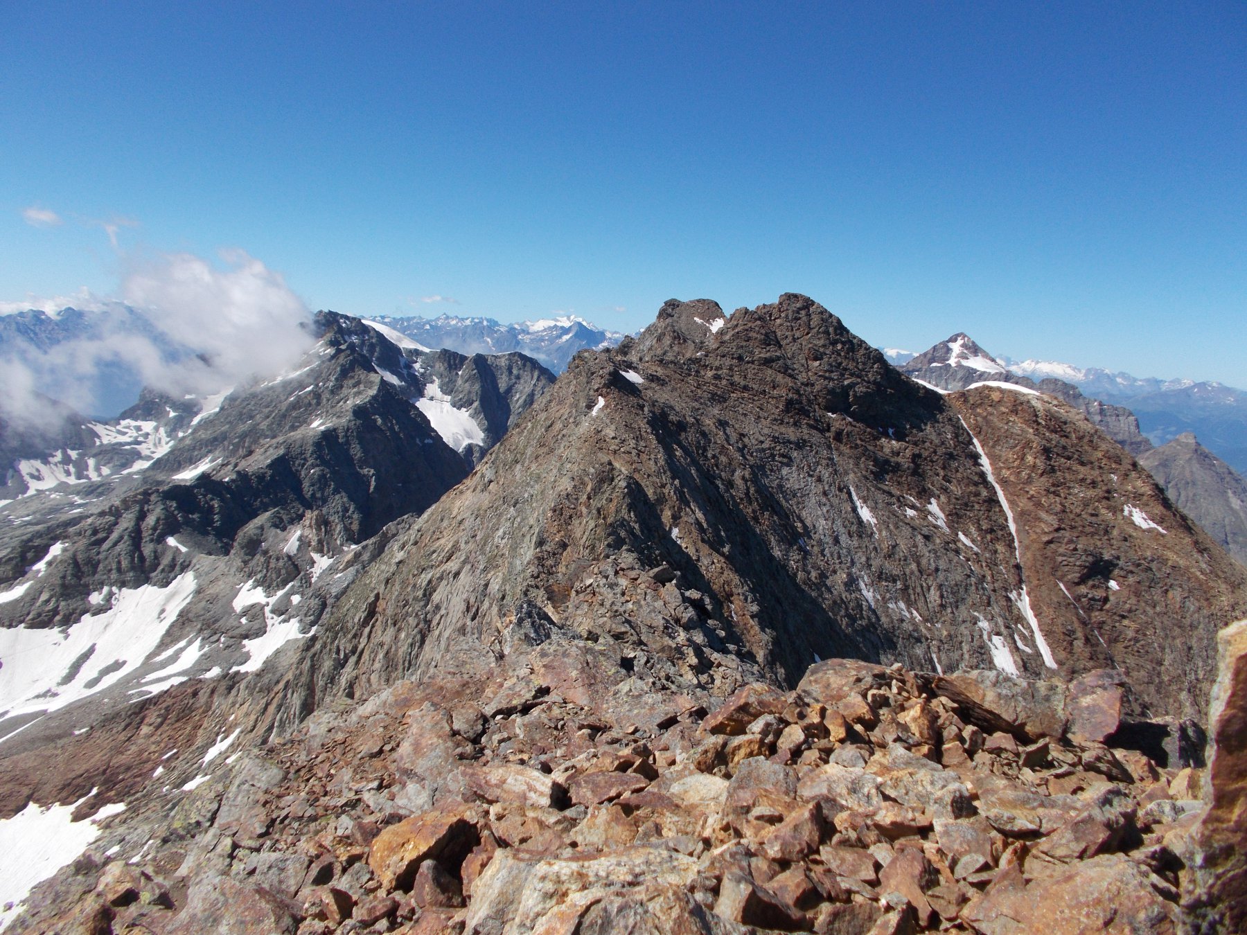
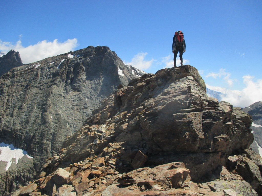
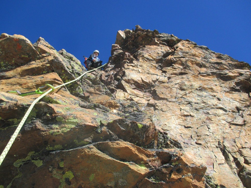
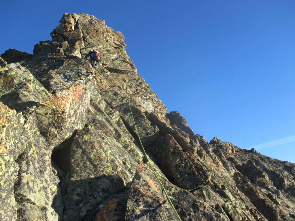
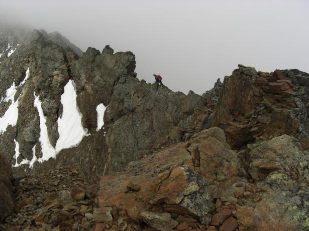
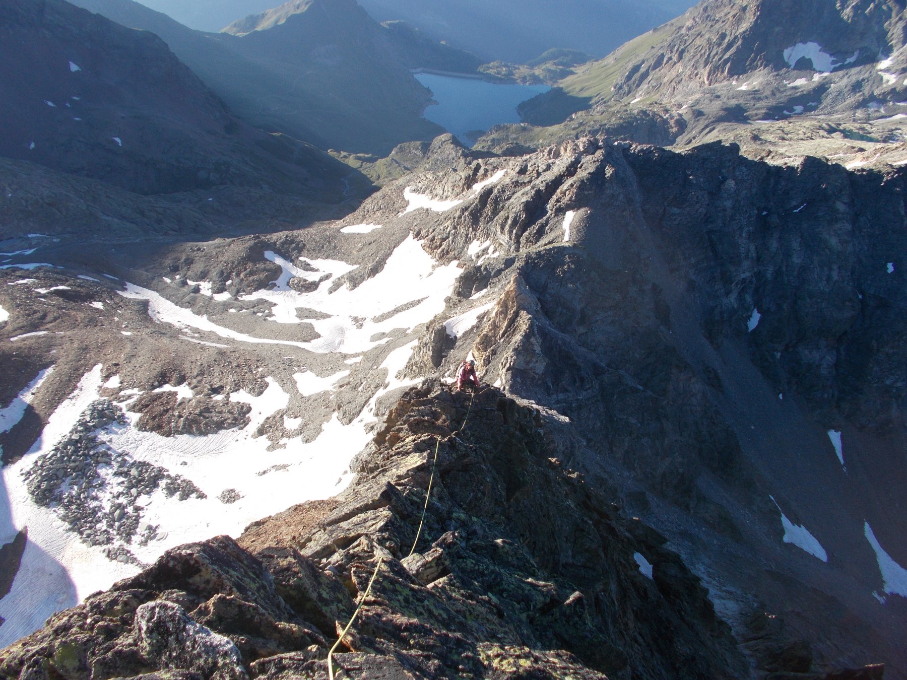
Seguire la cresta (SE, via normale) per via non obbligata e facile arrampicata di II e un paio di passi di III se ci si tiene sul filo.
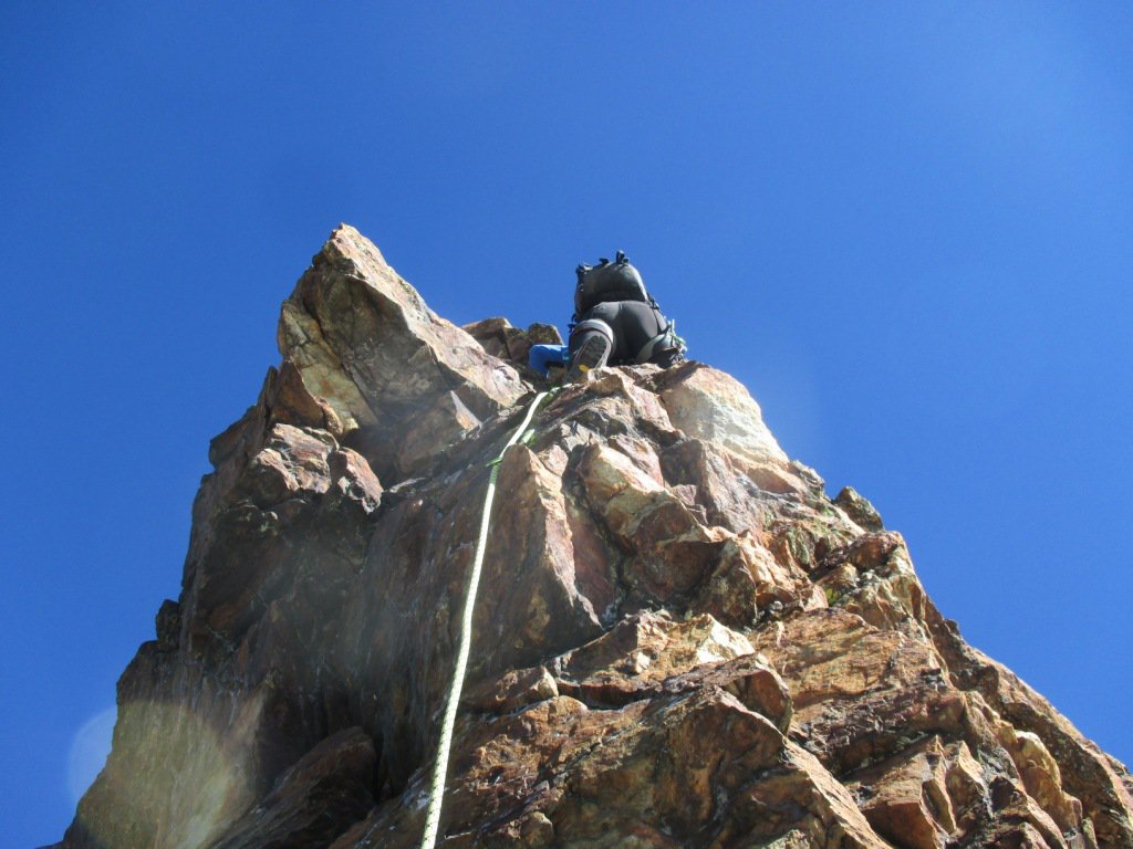
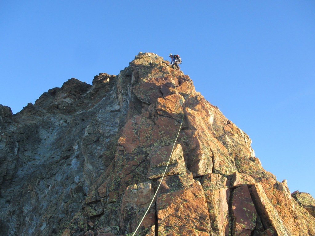
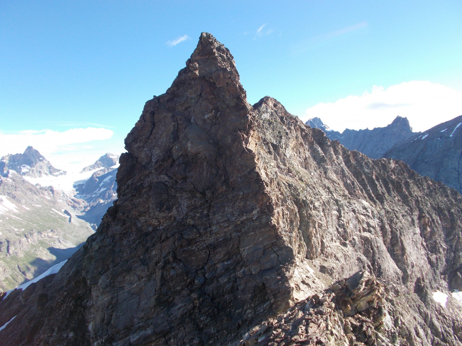
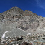
Dopo l’ultimo gendarme si passa per un marcato intaglio che porta all’ultimo risalto. Tale risalto può essere agevolmente superato salendo il canale di sinistra, oppure frontalmente (III) sfruttando una lama, staccata e solida, vicino alla quale è presente un chiodo. Si giunge così sulla cima S della Punta di Fontanella (3384m, piccola croce).
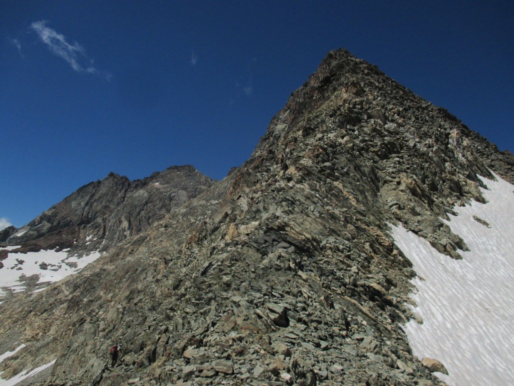
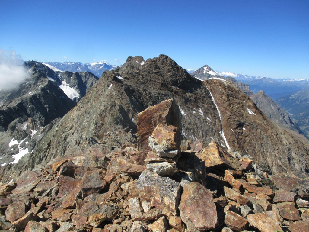
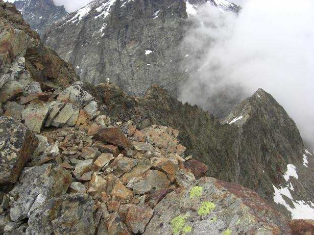
Si continua per cresta, abbassandosi prima alla sella che separa le punte S e NE, e su facile percorso si sale alla Punta di Fontanella NE (3384m). Ora la cresta è più aerea e a tratti affilata ma il percorso non è mai obbligato sul filo anche se spesso più agevole.
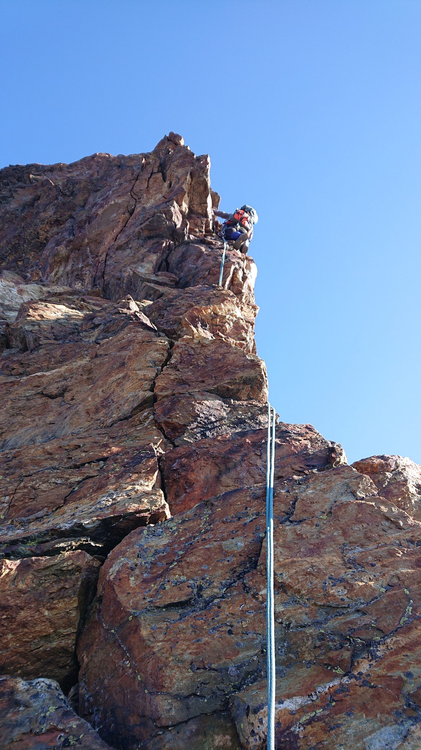
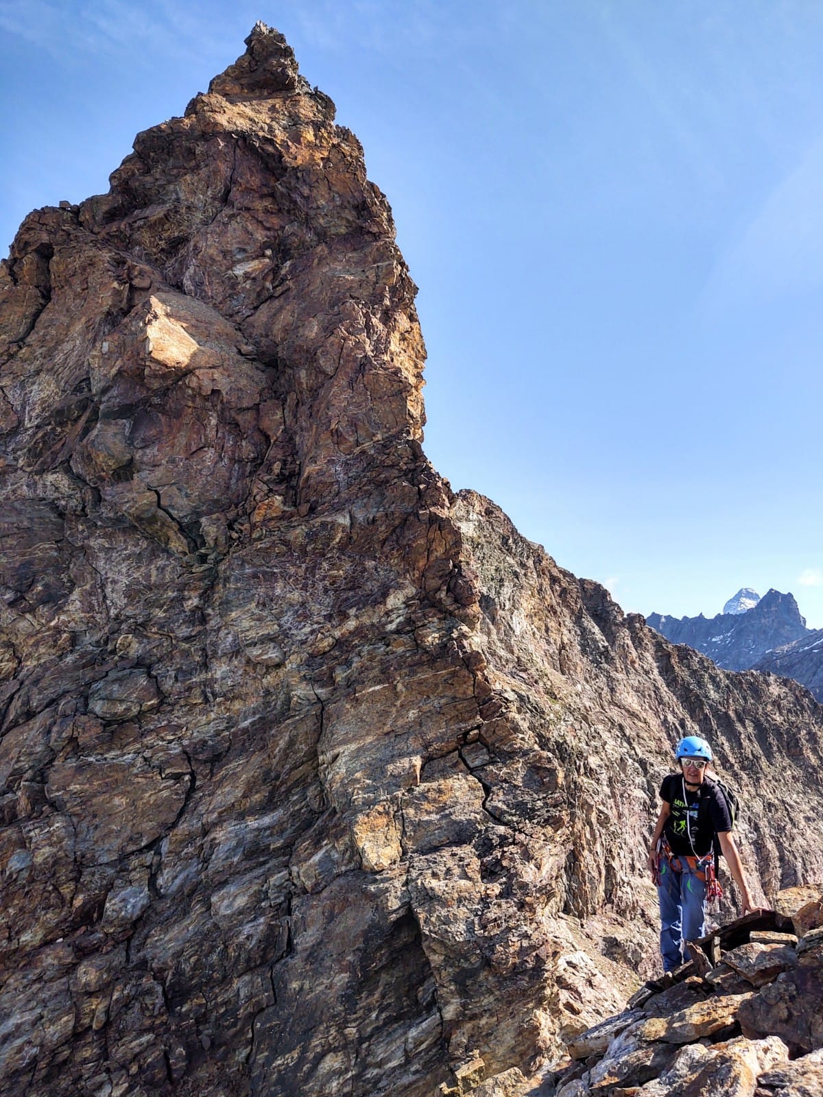
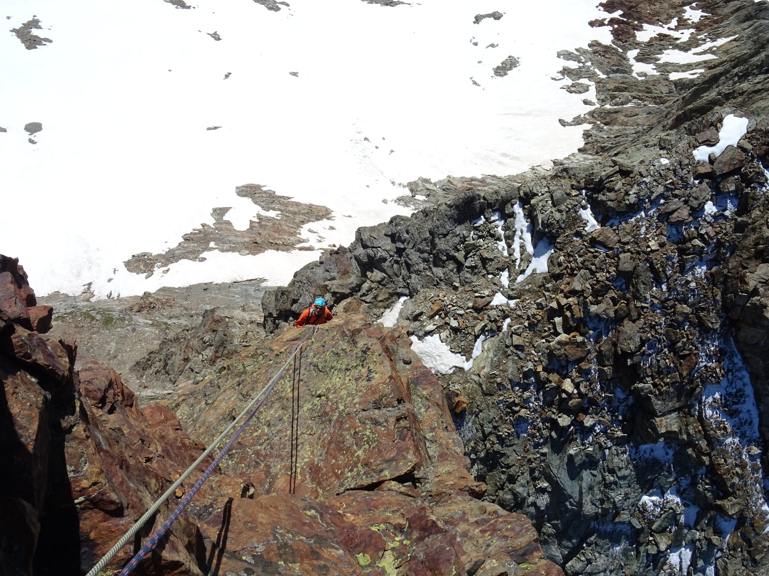
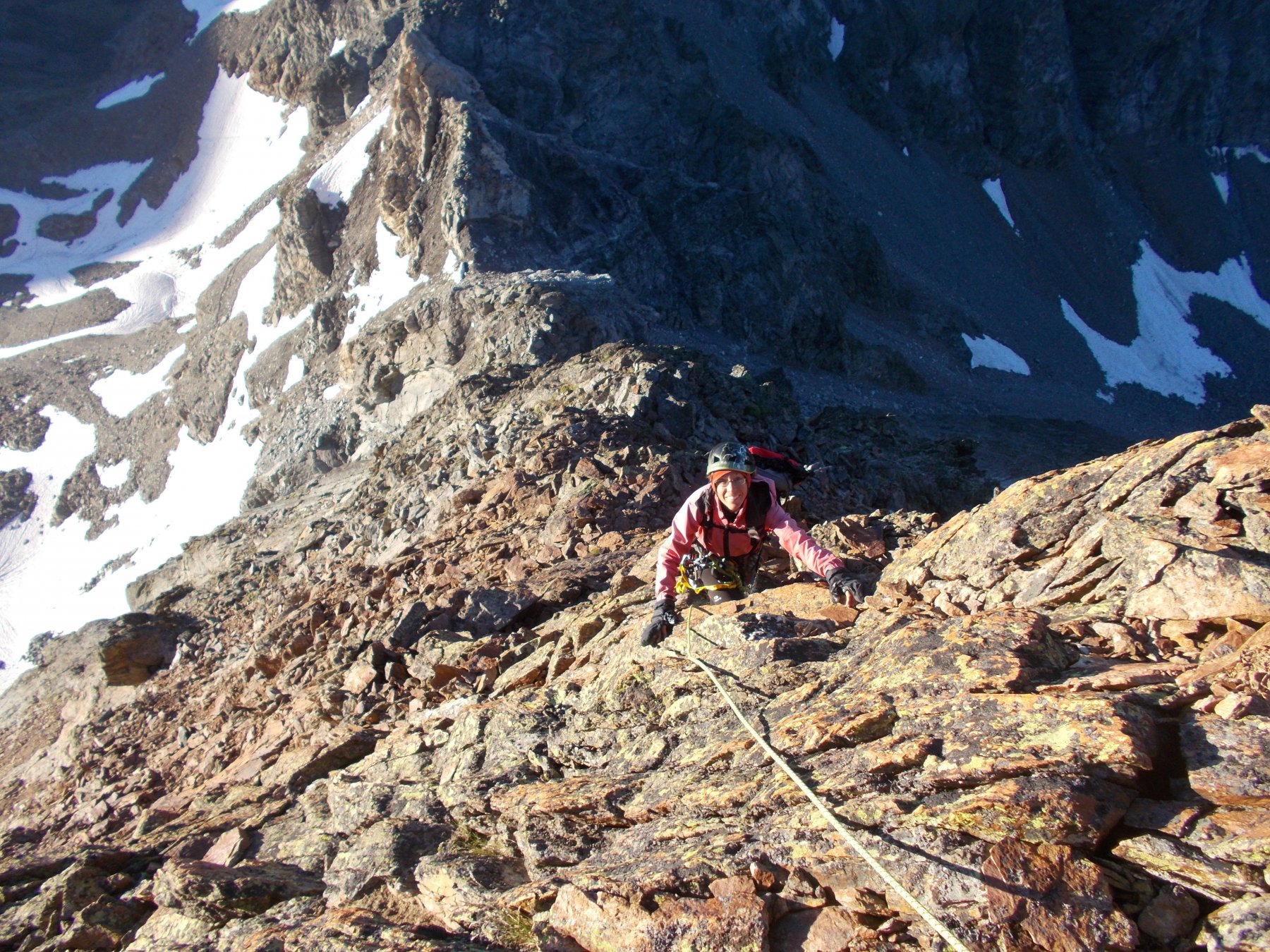
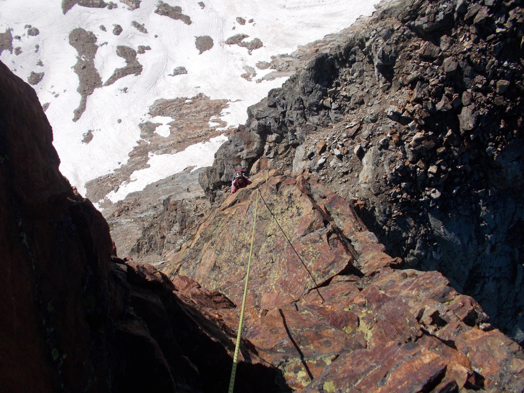
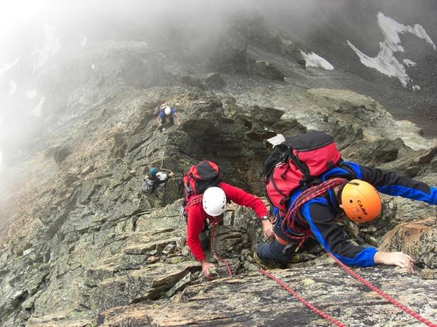
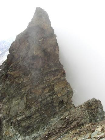
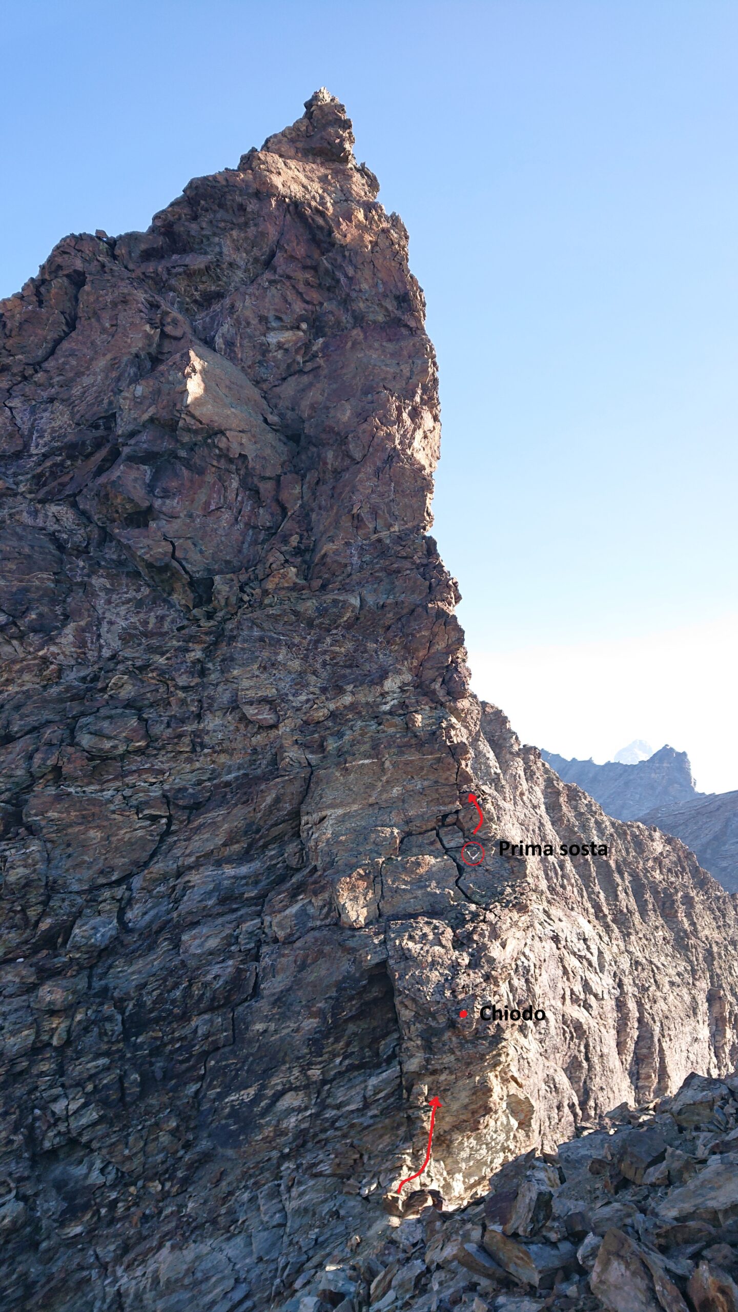
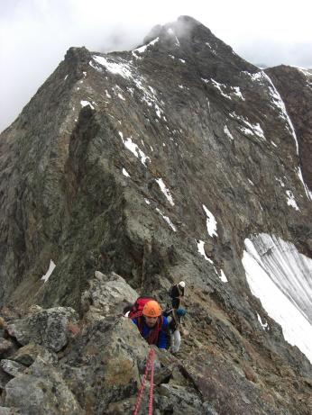
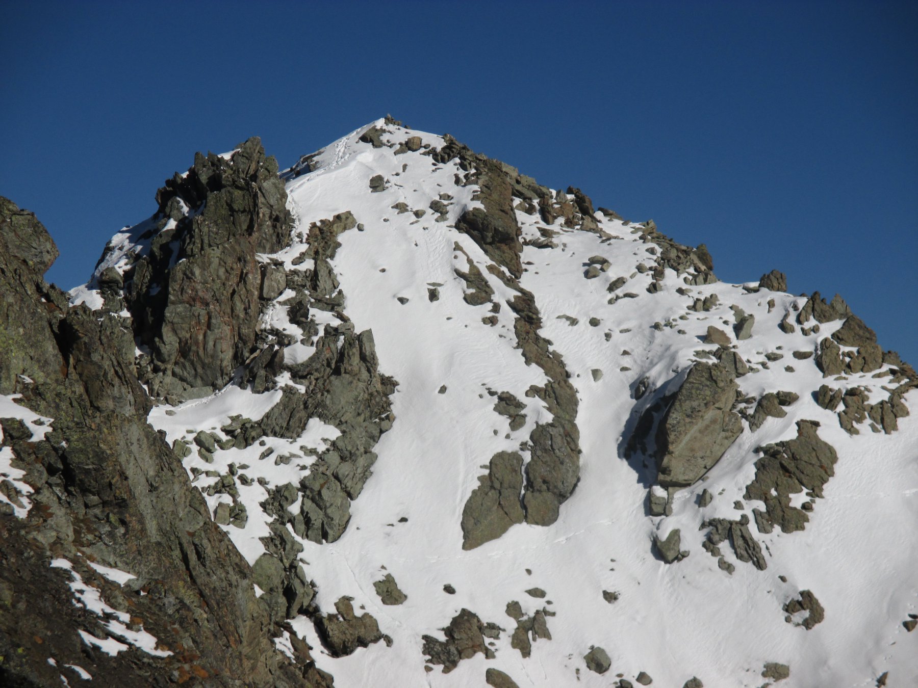
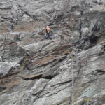
Dopo alcuni sali e scendi, cui prestare attenzione, si perviene al netto intaglio del Passo del Dragone e alla base del grande risalto (40m).
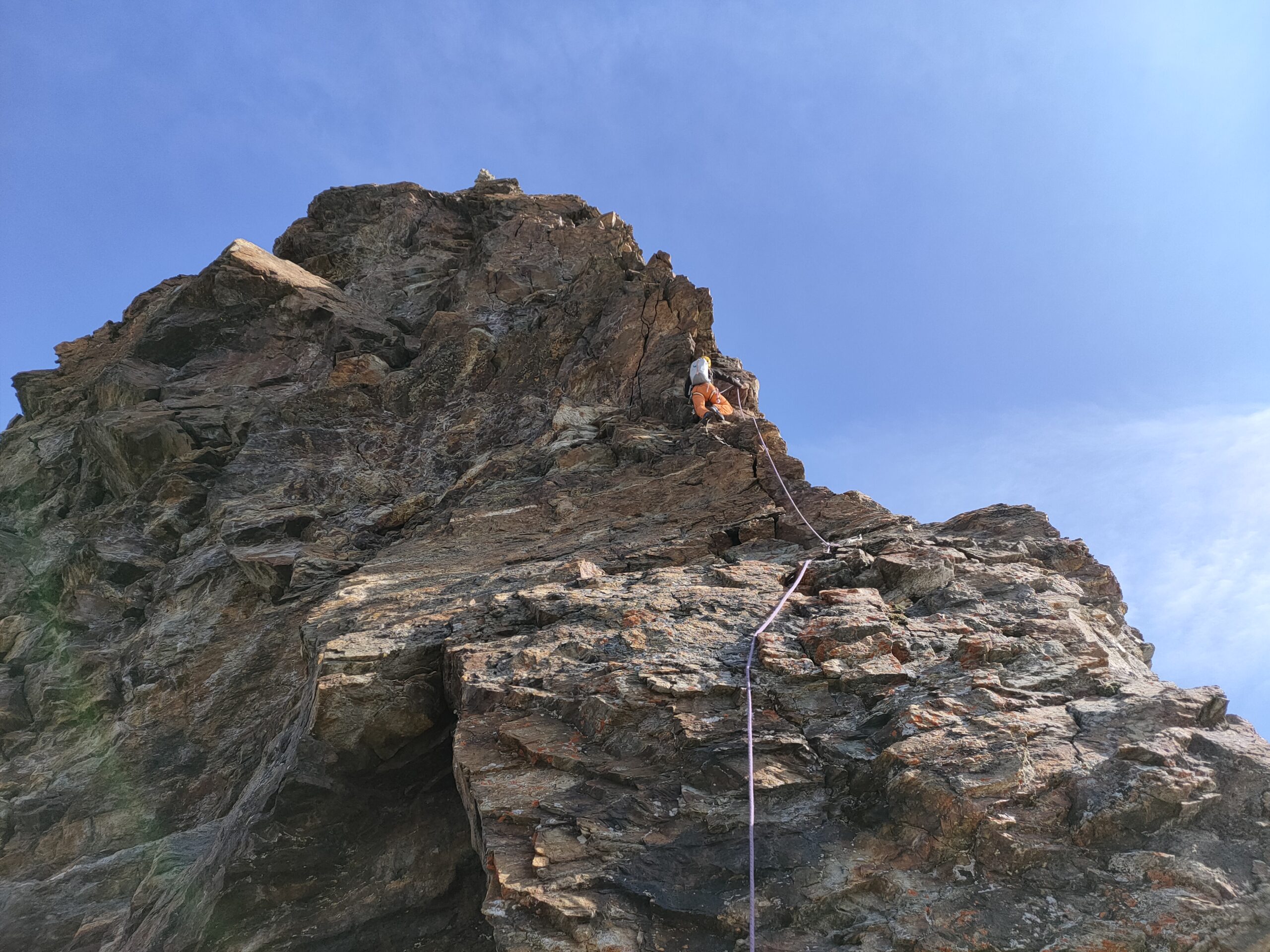
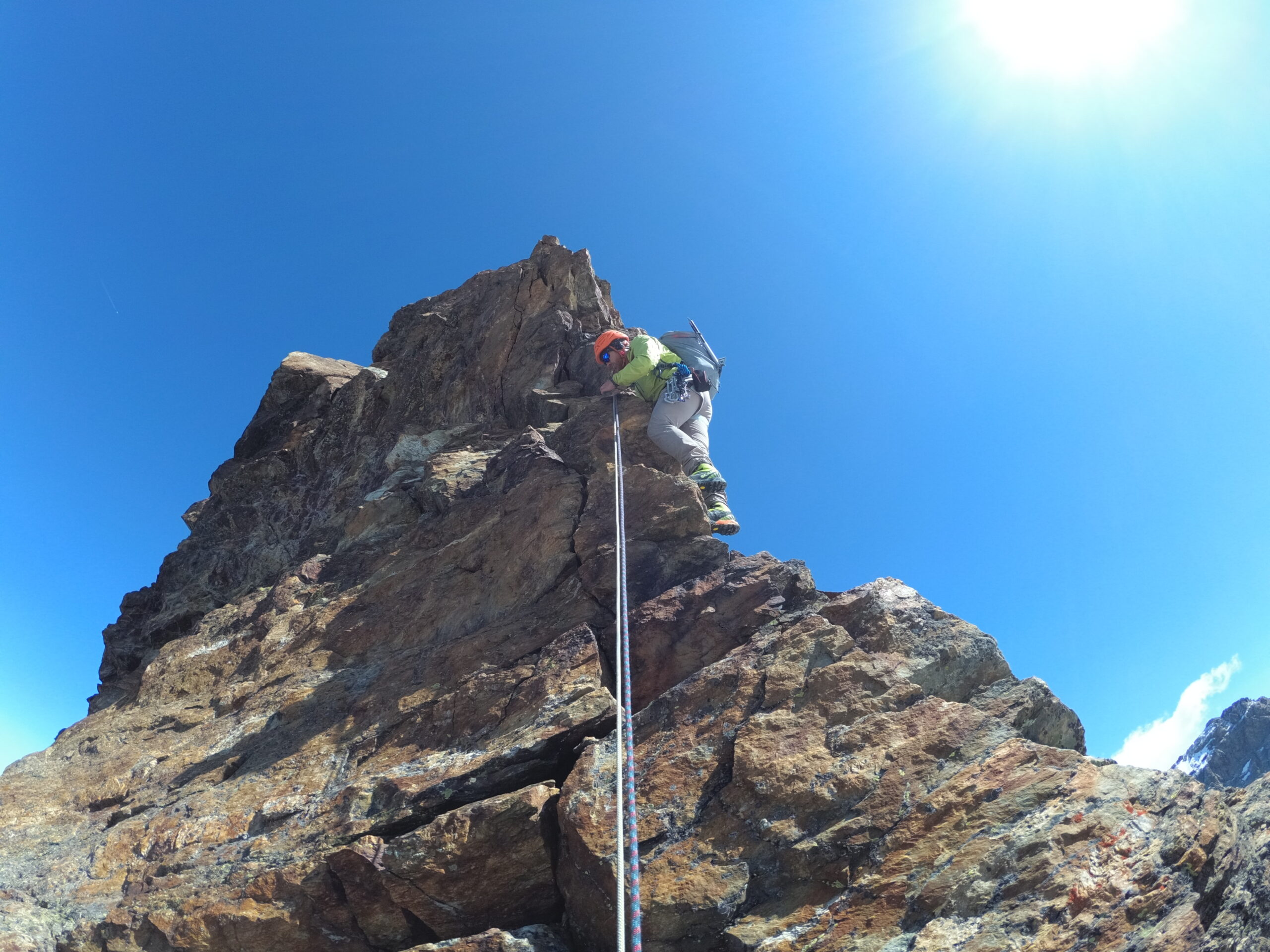
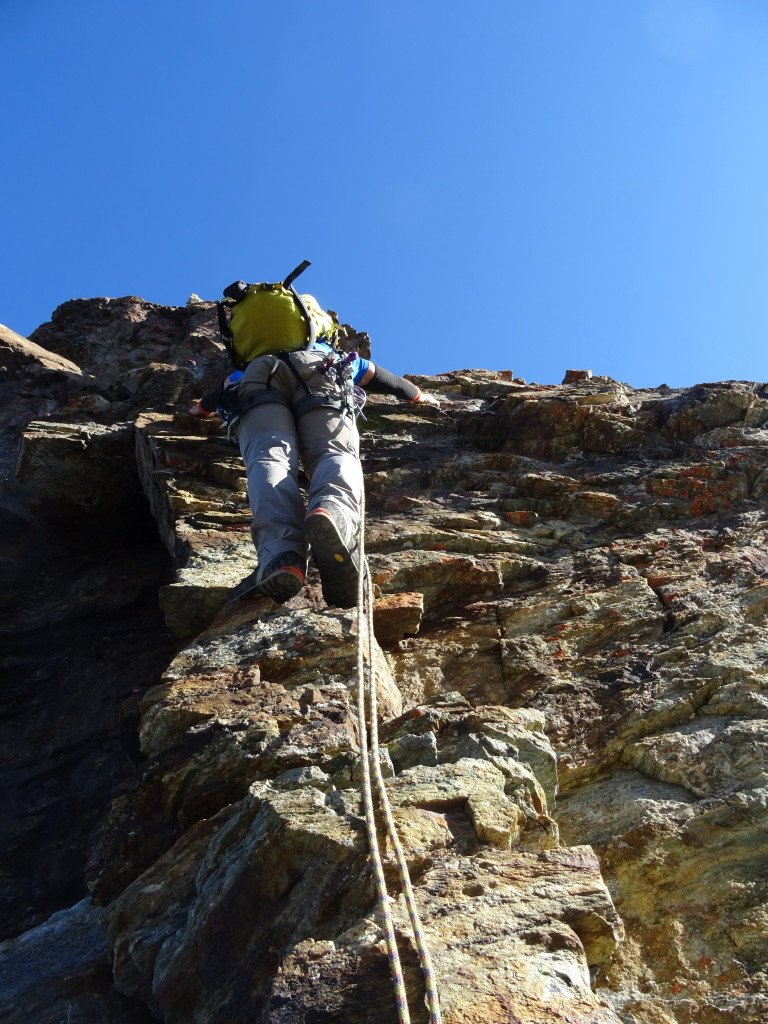
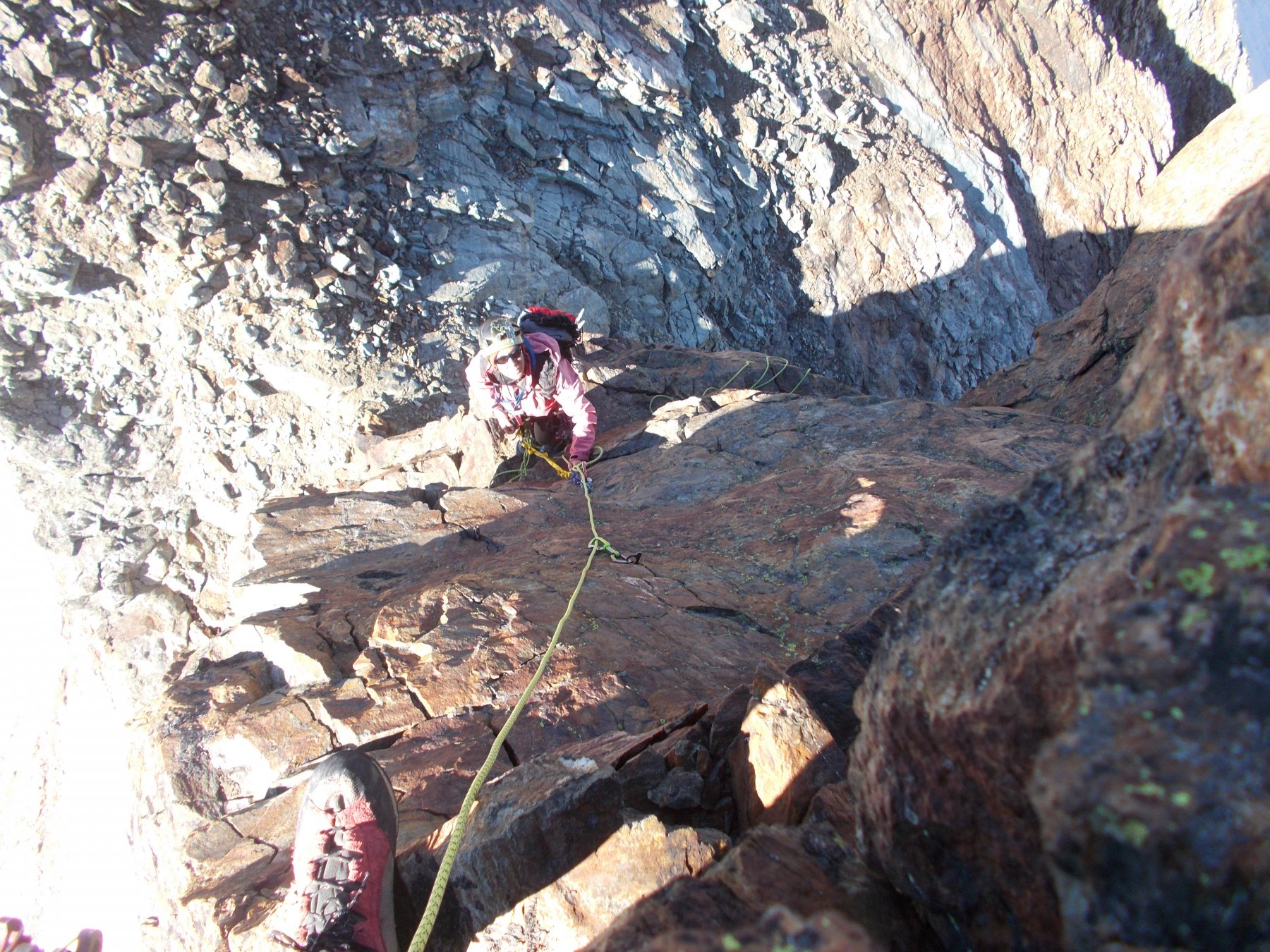
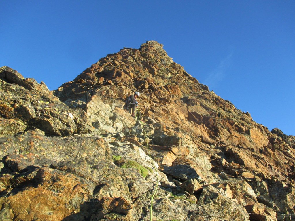
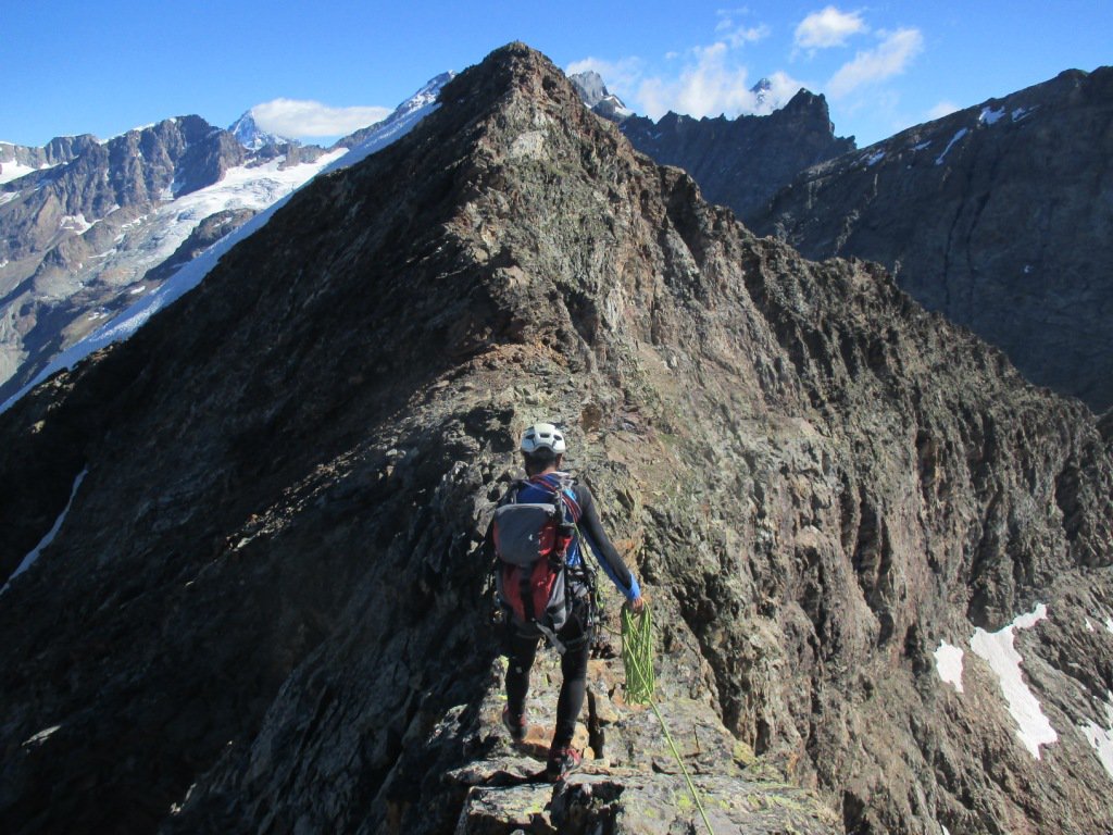
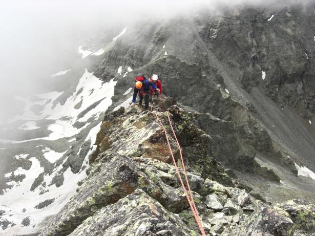
Salire il risalto frontalmente (alcuni appoggi mobili) per 8/10m fino ad una sosta su chiodi collegati da un vecchio cordino. Salire in verticale lungo lo spigolo esposto (IV, vecchi chiodi e 4 spit) pervenendo ad un piccolo ballatoio, con 2 chiodi distanti e uno spit con anello di calata (utile se si percorre la cresta da N a S), sul quale è possibile sostare (20m, conviene per non tirare troppo le corde). Salire verso destra per altri 20 metri (III+, chiodo e spit) poi più facile fino ad uscire in cresta. Da qui si percorre la cresta pianeggiante spesso affilata che poi, gradualmente, sale facile in cima al Monte Dragone (3354).
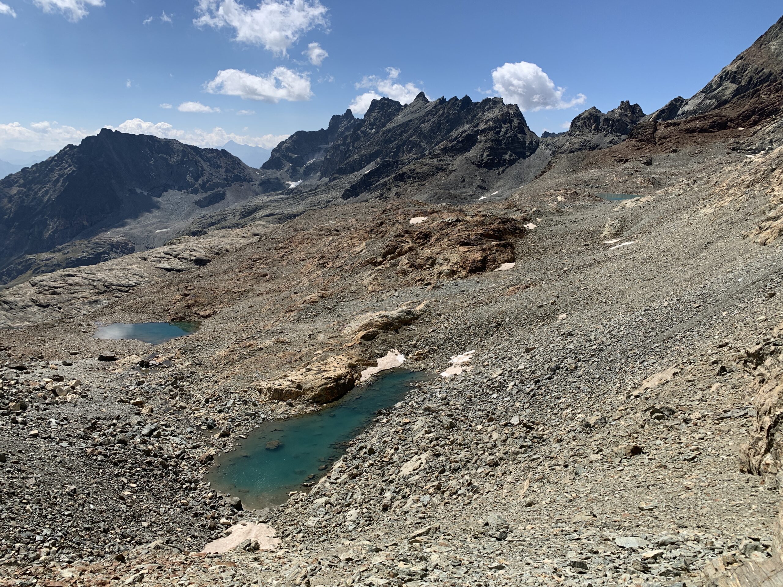
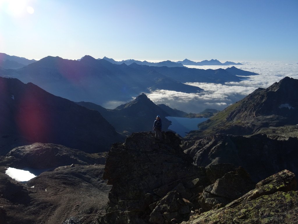
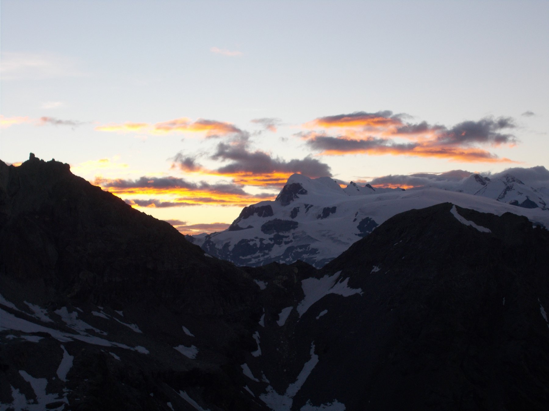
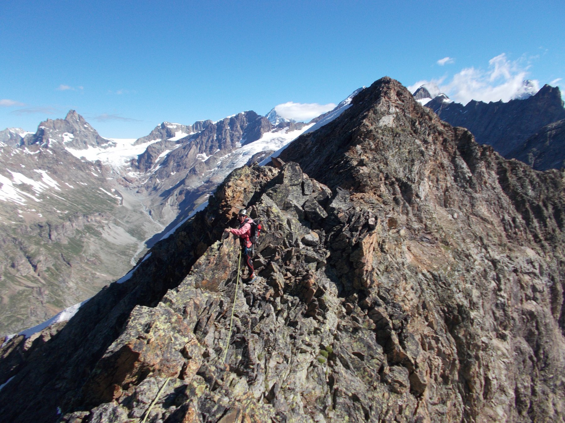
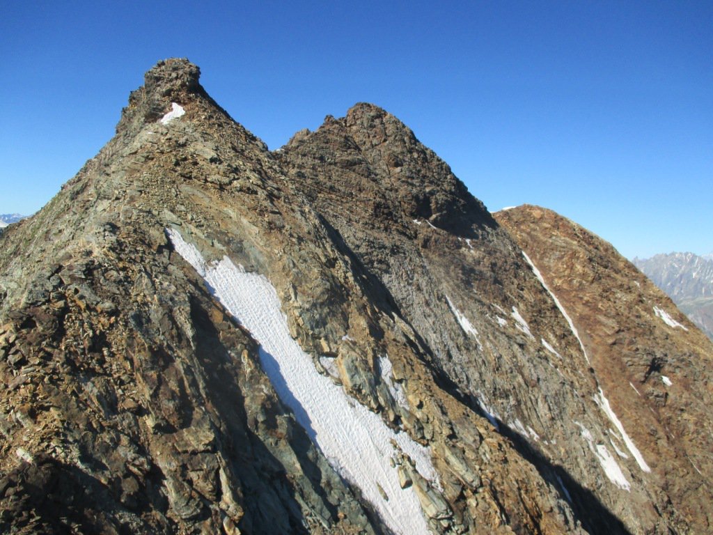
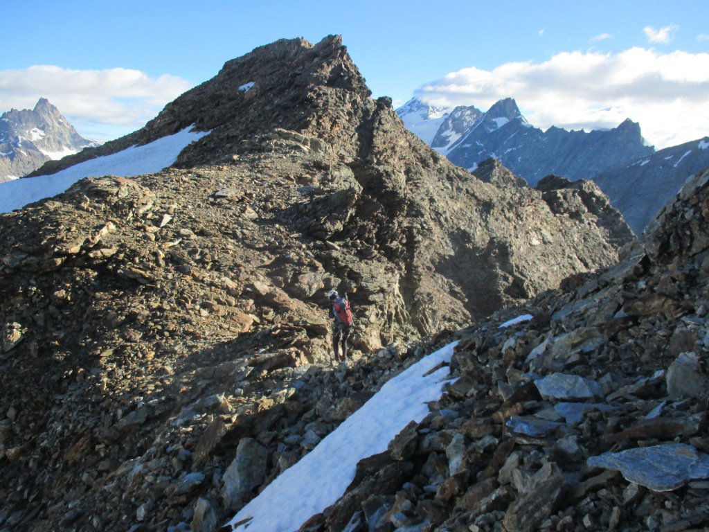
Dalla Cima del Monte Dragone scendere per la cresta N sempre aerea. Quando piega verso ovest nei pressi di un ometto continuare a seguirla scendendo lungo il filo, esposta ma mai difficile.
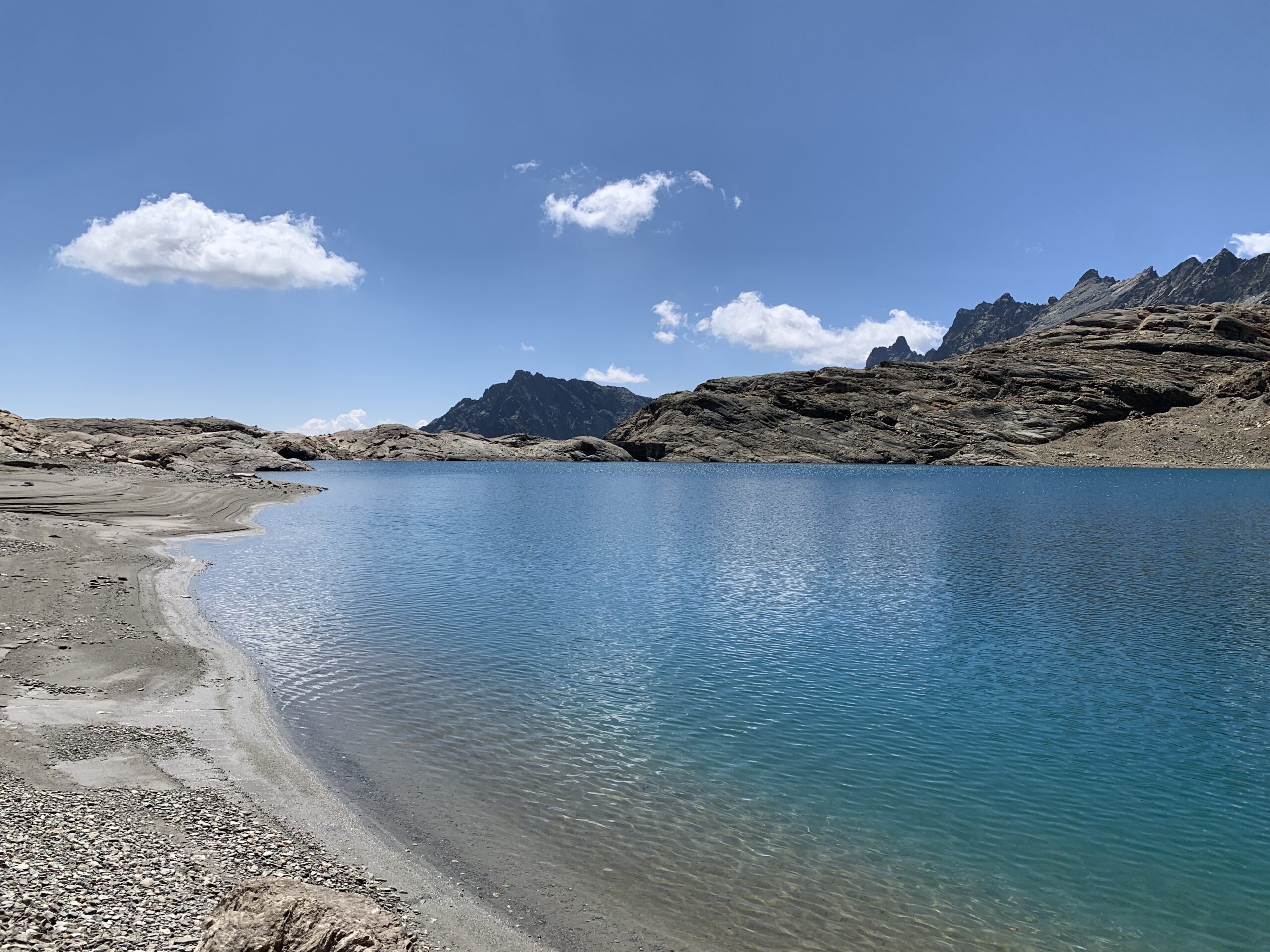
Si giunge così al Colle di Bellatsà e da qui per morena e pietraia si torna al rifugio.
- Bibliografia:
- Alpi Pennine II CAI-TCI
Nelle vicinanze Mappa
Itinerari
17/08/2025 AO, Valtournenche D+ 2000 m PD Tutte
Fontanella (Punta) Traversata punte SE-NE
 50m
50m
24/05/2026 AO, Valtournenche D+ 1125 m D Sud-Ovest
Pancherot (Monte) – Camera con Vista
 50m
50m
23/10/2015 AO, Valtournenche D+ 1750 m PD+ Tutte
Salè (Becca di) traversata creste Sud-Est e Ovest dal Mont Saleron
 50m
50m
09/11/2024 AO, Valtournenche D+ 1121 m AD- Sud-Est
Pancherot (Monte) Cresta SE – Via Bertazzi
 50m
50m
05/09/2004 AO, Valtournenche D+ 2300 m PD Varie
Chateau des Dames da Barmasse, con traversata al Mont Rous
 250m
250m
15/09/2024 AO, Valtournenche D+ 2200 m AD+ Nord
Balanselmo (Cime di) traversata integrale Nord-Sud della Costiera di Balanselmo
 250m
250m
11/05/2024 AO, Valtournenche D+ 1150 m AD Ovest
Petit Tournalin Parete Ovest “Panorama Invernale”
 3Km
3Km
21/08/2023 AO, Valtournenche D+ 1280 m AD Sud-Ovest
Petit Tournalin dalla Cresta del Diavolo e dalla cresta NO della Becca Trecarè
 3Km
3Km
29/06/2025 AO, Valtournenche D+ 1007 m AD- Nord-Ovest
Trécare (Becca) Cresta NO
 3Km
3Km
18/07/2025 AO, Cheneil D+ 1800 m PD+ Varie
Grand e Petit Tournalin e Mont Roisetta da Cheneil, traversata
 3Km
3Km
Servizi
900m
1.6Km
Pankeò B&B
Valtournenche
3Km
Panorama al Bich Ristorante
Valtournenche
3.2Km
da Bruna Ristorante
Chamois
3.8Km
Bellevue Rifugio
Chamois
4.6Km
Maison de Suis B&B
Chamois
4.8Km
Pession Ristorante
Antey-Saint-André
6.9Km
Lo scoiattolo Ristorante
La Magdeleine
8.7Km
Grand Tournalin Rifugio
Ayas
9.4Km