1.6Km
1.6Km

Note
Storico
 2Km
2.1Km
3.9Km
4.4Km
5Km
5.1Km
6Km
6.6Km
2Km
2.1Km
3.9Km
4.4Km
5Km
5.1Km
6Km
6.6Km
1.6Km
1.6Km
1.7Km
1.9Km
2.4Km
2.6Km
2.6Km
4Km
5.2Km
5.3Km
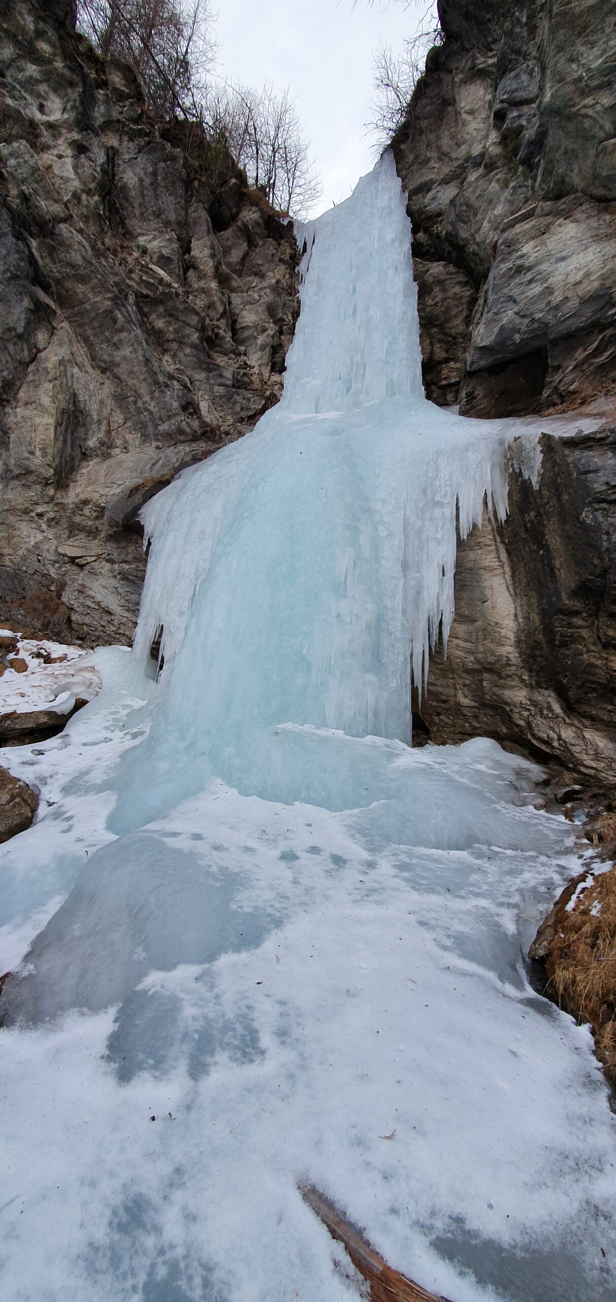
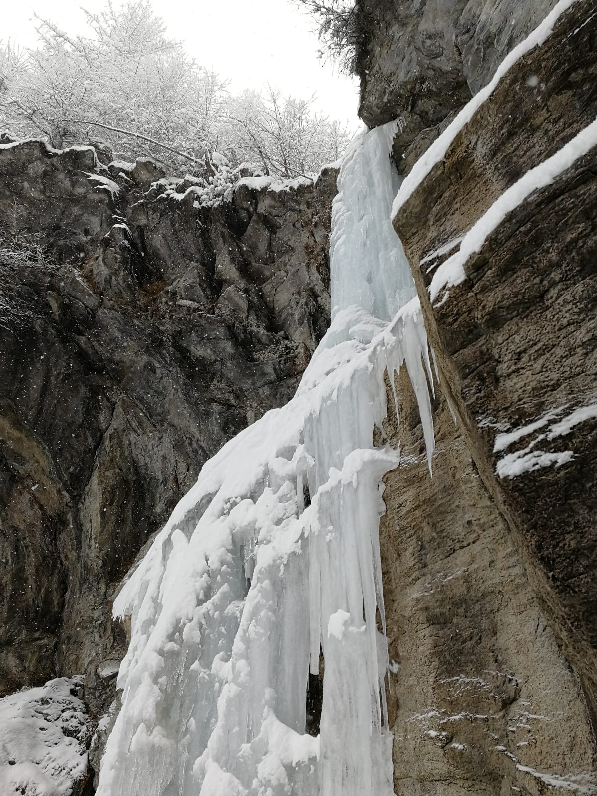
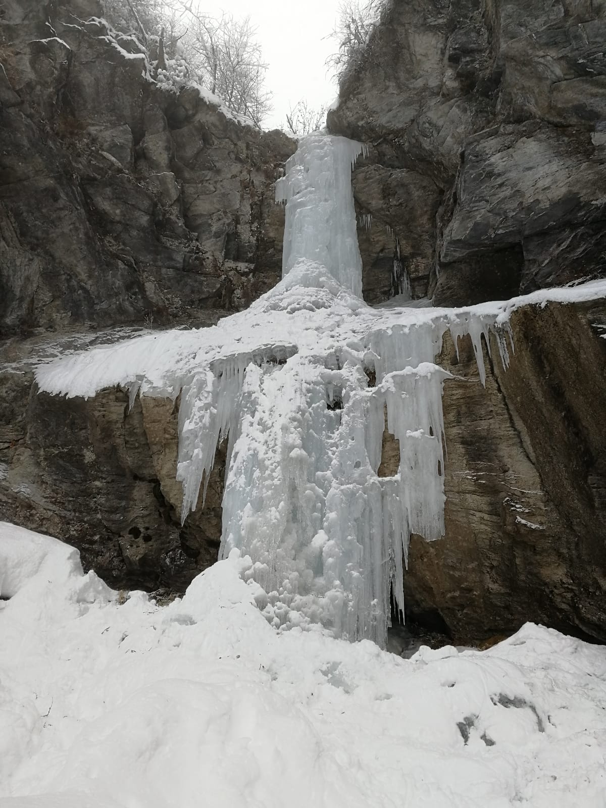
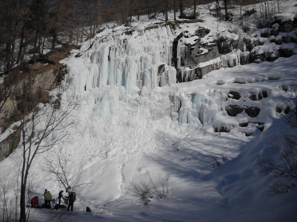
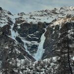
Il salto principale si vede dalla fraz. Traverses dopo Pragelato.
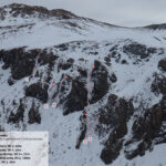
Avvicinamento
Torino-Pinerolo-Pragelato. Imboccare la Val Troncea quindi parcheggiare subito a sx nel park di borg. Traverses
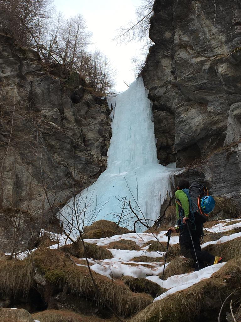
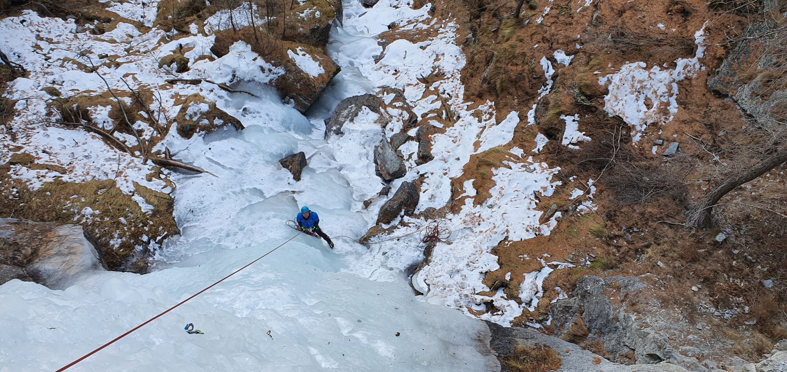
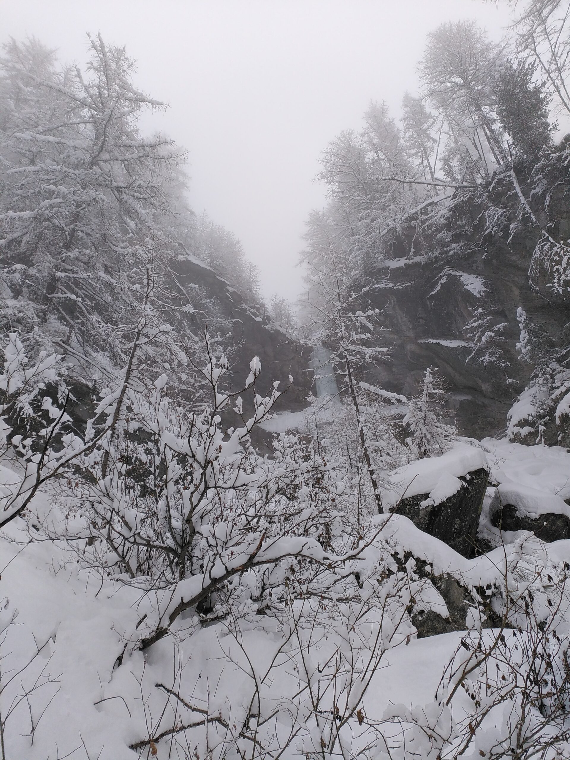
Scendere verso il Chisone, attraversare il ponte della pista di fondo e seguire la strada sterrata che sale il versante dx orografico della valle principale. Al terzo o al quinto tornante si va a sx e si entra nell'alveo del torrente. Risalendone i risalti si giunge alla base della cascata.
In alternativa è possibile proseguire lungo il sentiero, dopo un tornante verso sx si abbandona la traccia e si taglia tutto il bosco in leggera salita, fino a raggiungere la sponda a monte del rio da cui si origina la colata. Scendere lungo il corso del ruscello fino a monte della cascata (sosta sulla sx idrografica a fix).
Descrizione
Scendere verso il Chisone, attraversare il ponte della pista di fondo e seguire la strada sterrata che sale il versante dx orografico della valle principale. Al terzo o al quinto tornante si va a sx e si entra nell'alveo del torrente. Risalendone i risalti si giunge alla base della cascata.
In alternativa è possibile proseguire lungo il sentiero, dopo un tornante verso sx si abbandona la traccia e si taglia tutto il bosco in leggera salita, fino a raggiungere la sponda a monte del rio da cui si origina la colata. Scendere lungo il corso del ruscello fino a monte della cascata (sosta sulla sx idrografica a fix).
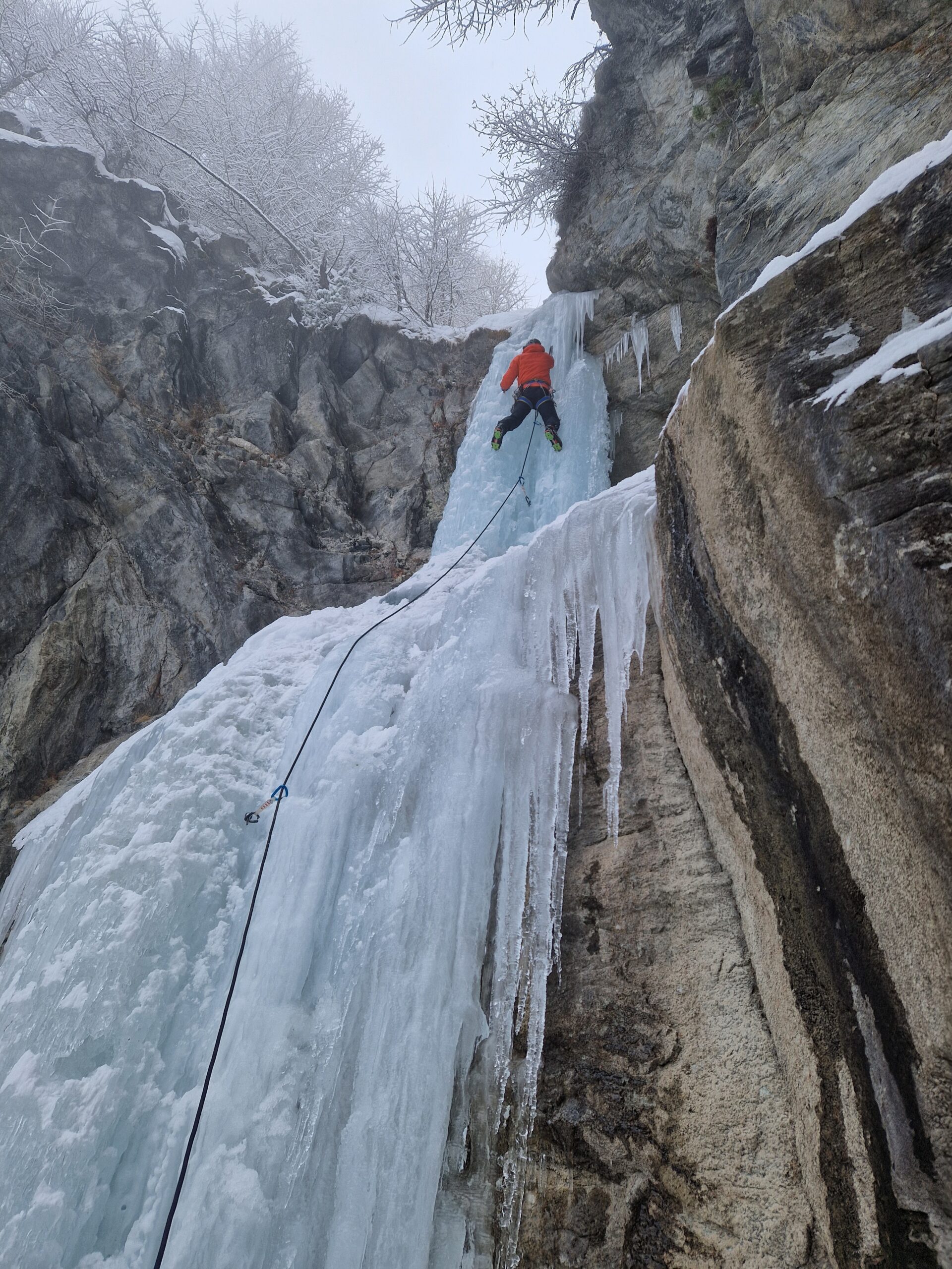
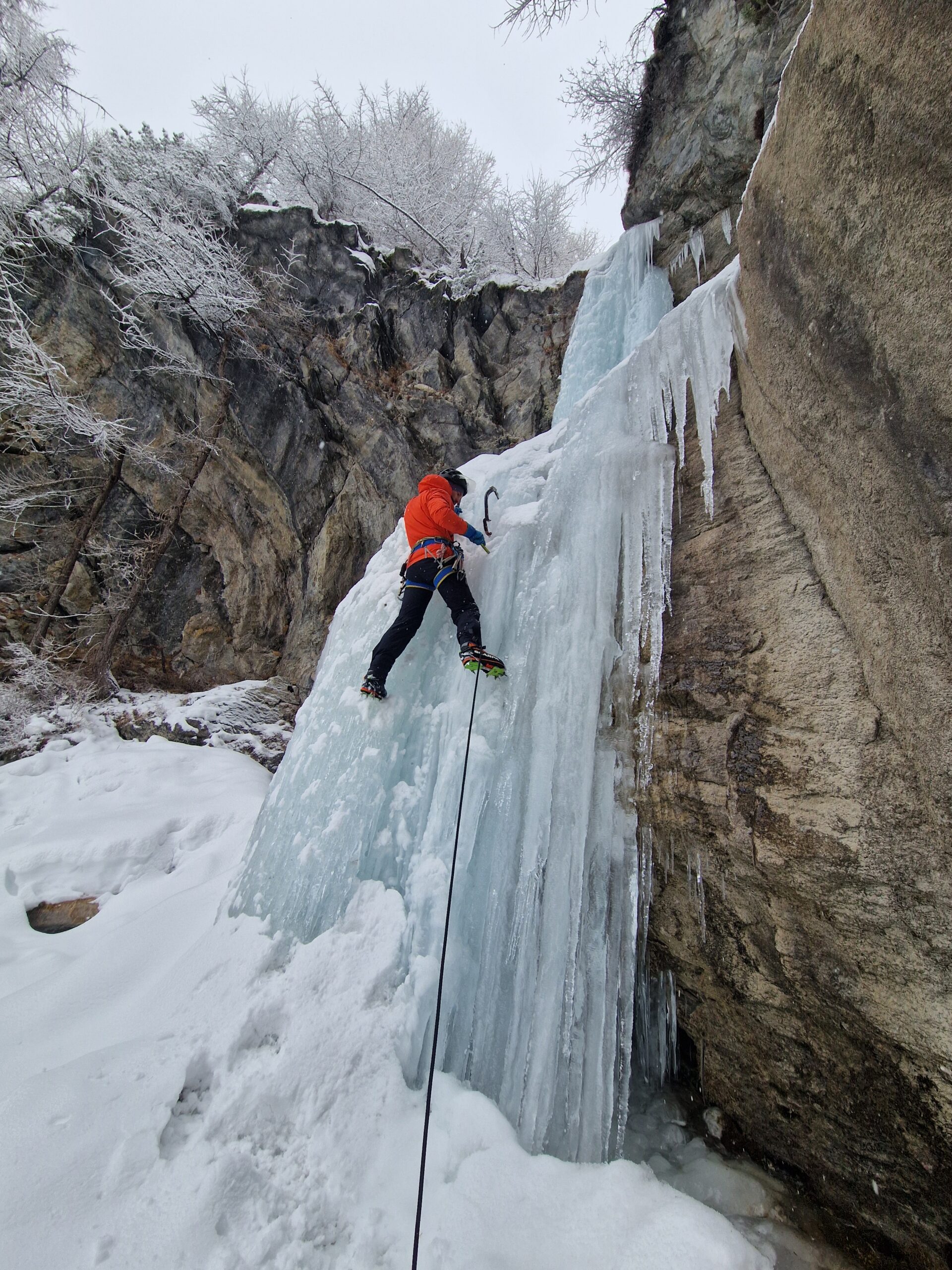
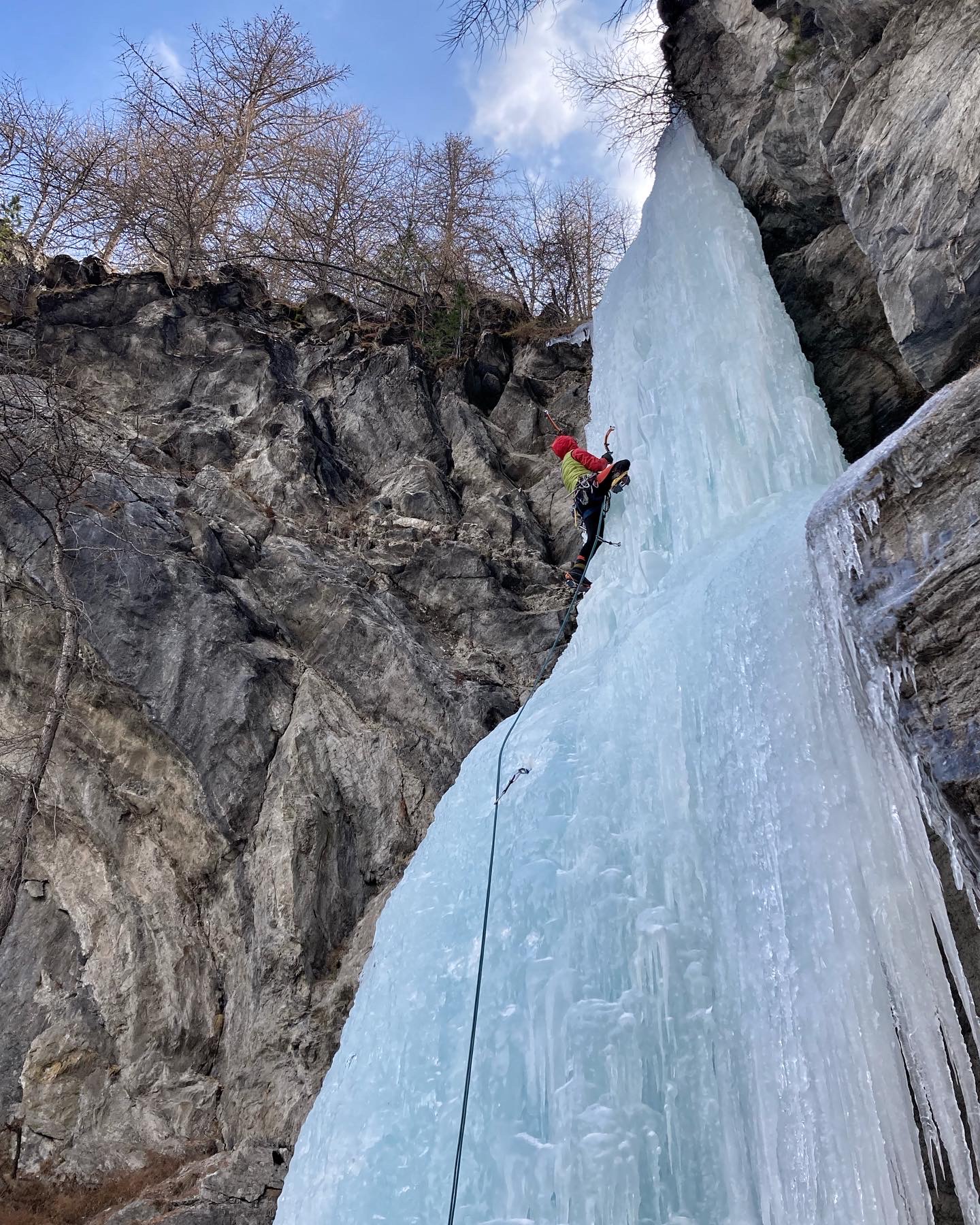
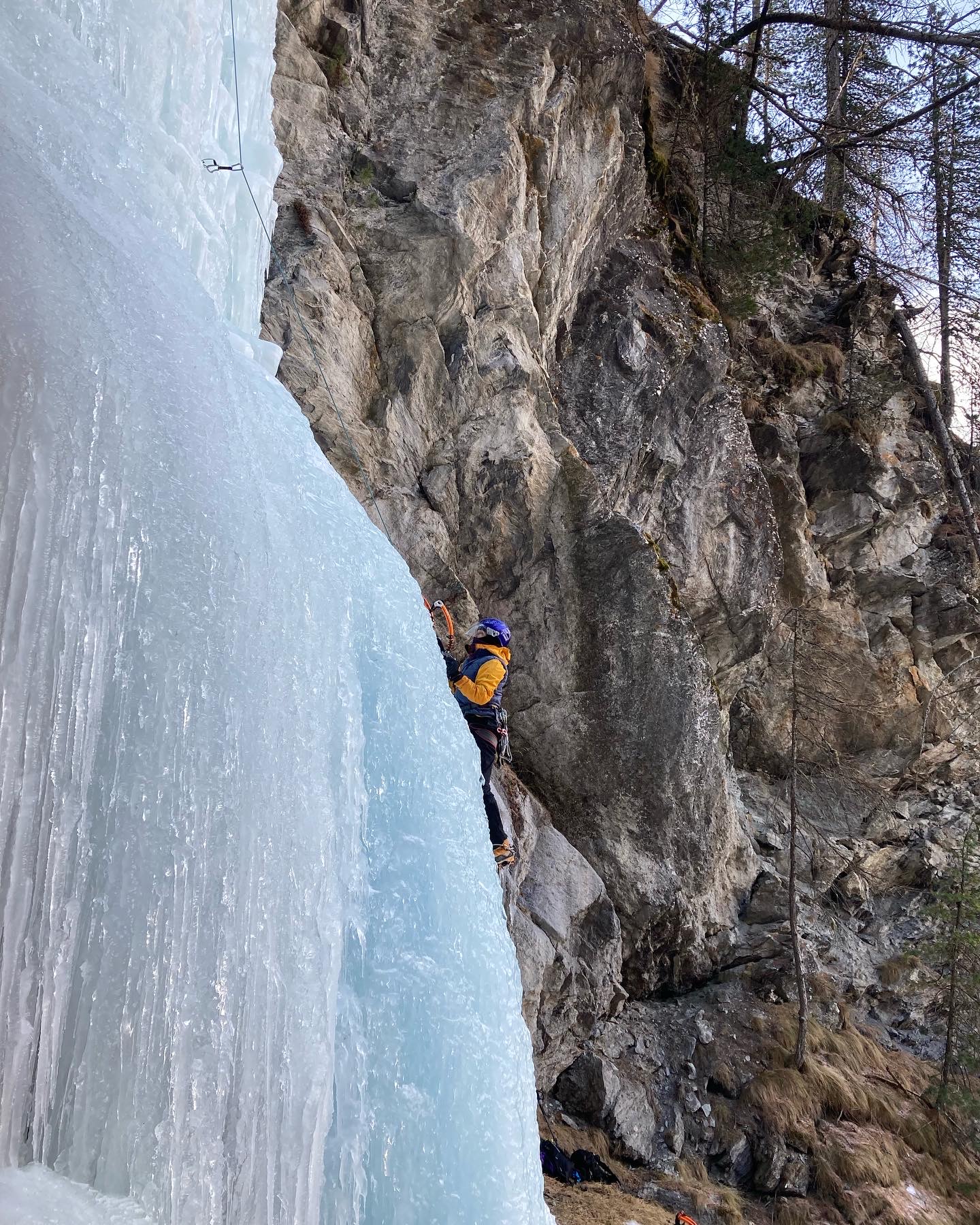
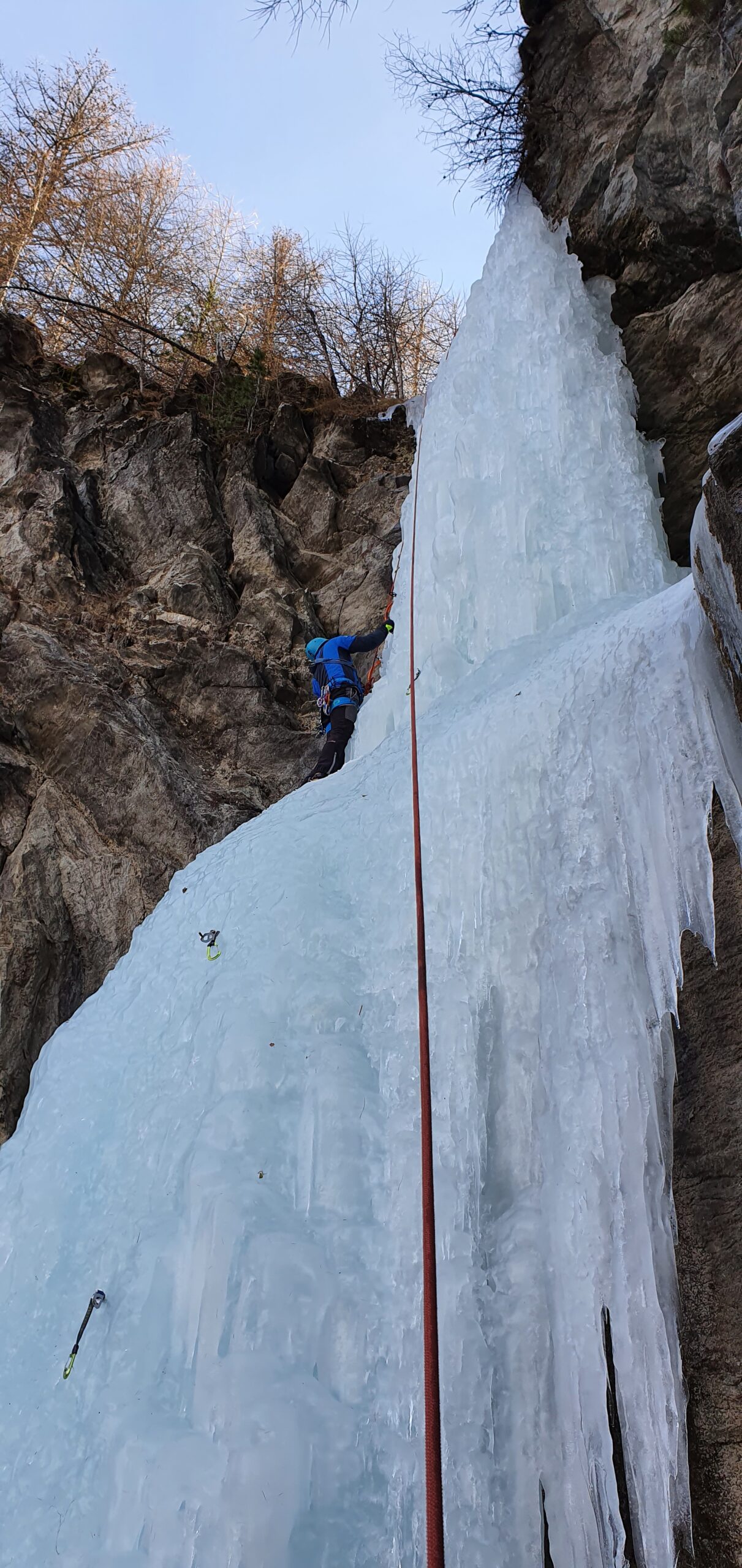
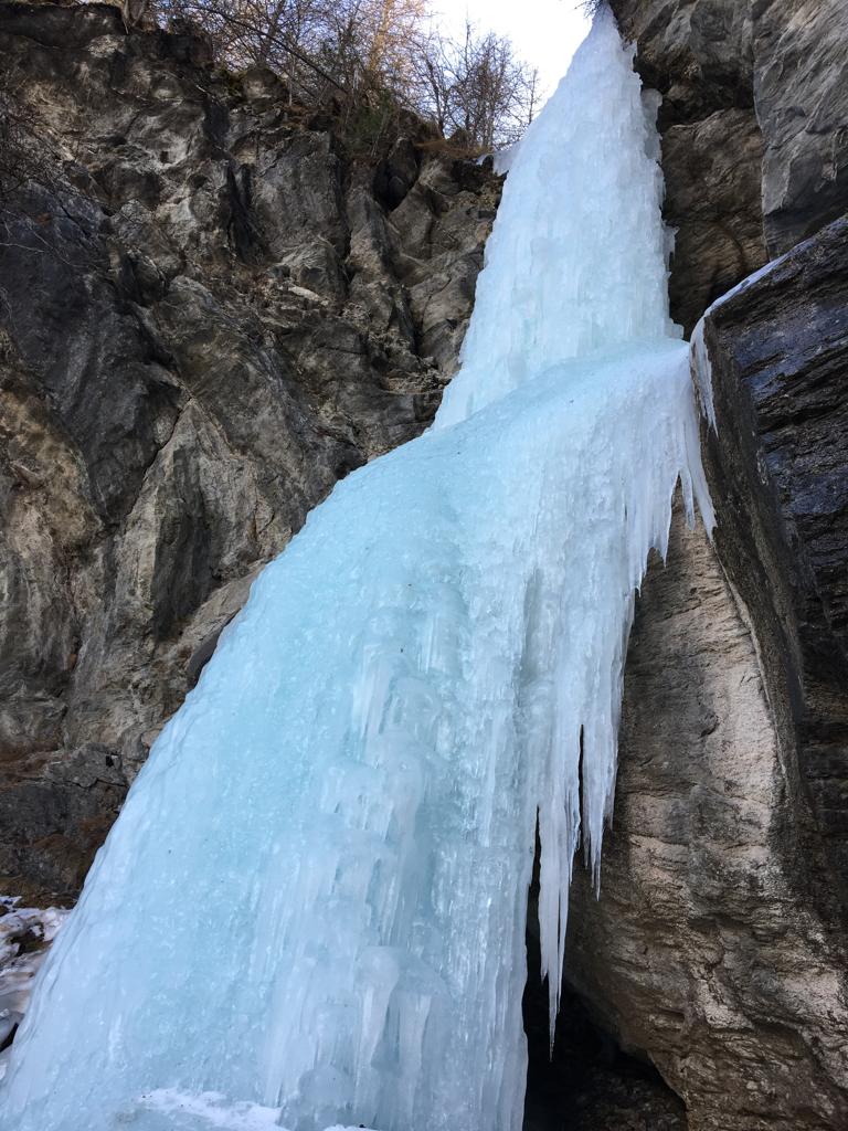
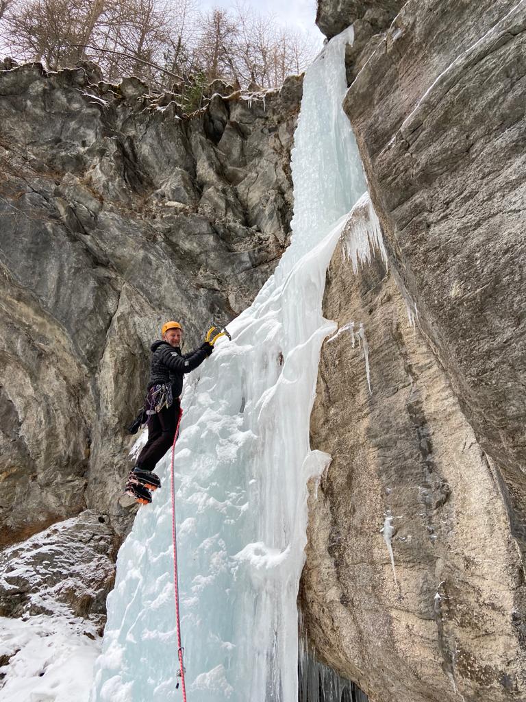
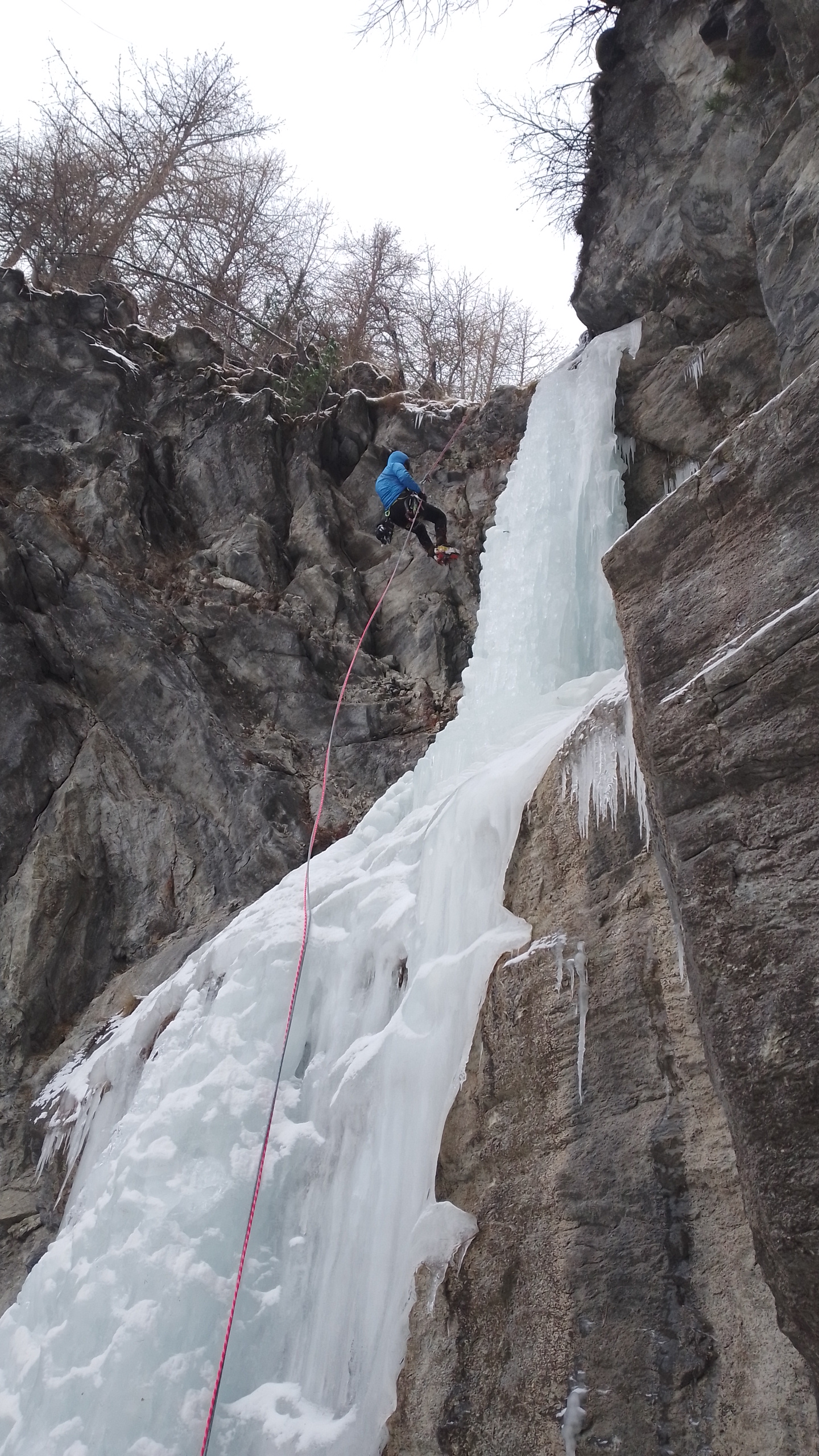
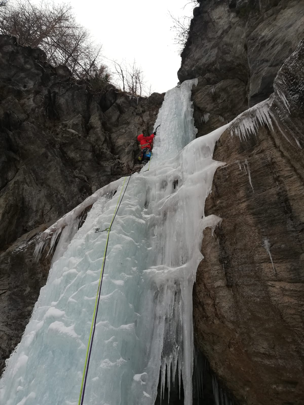
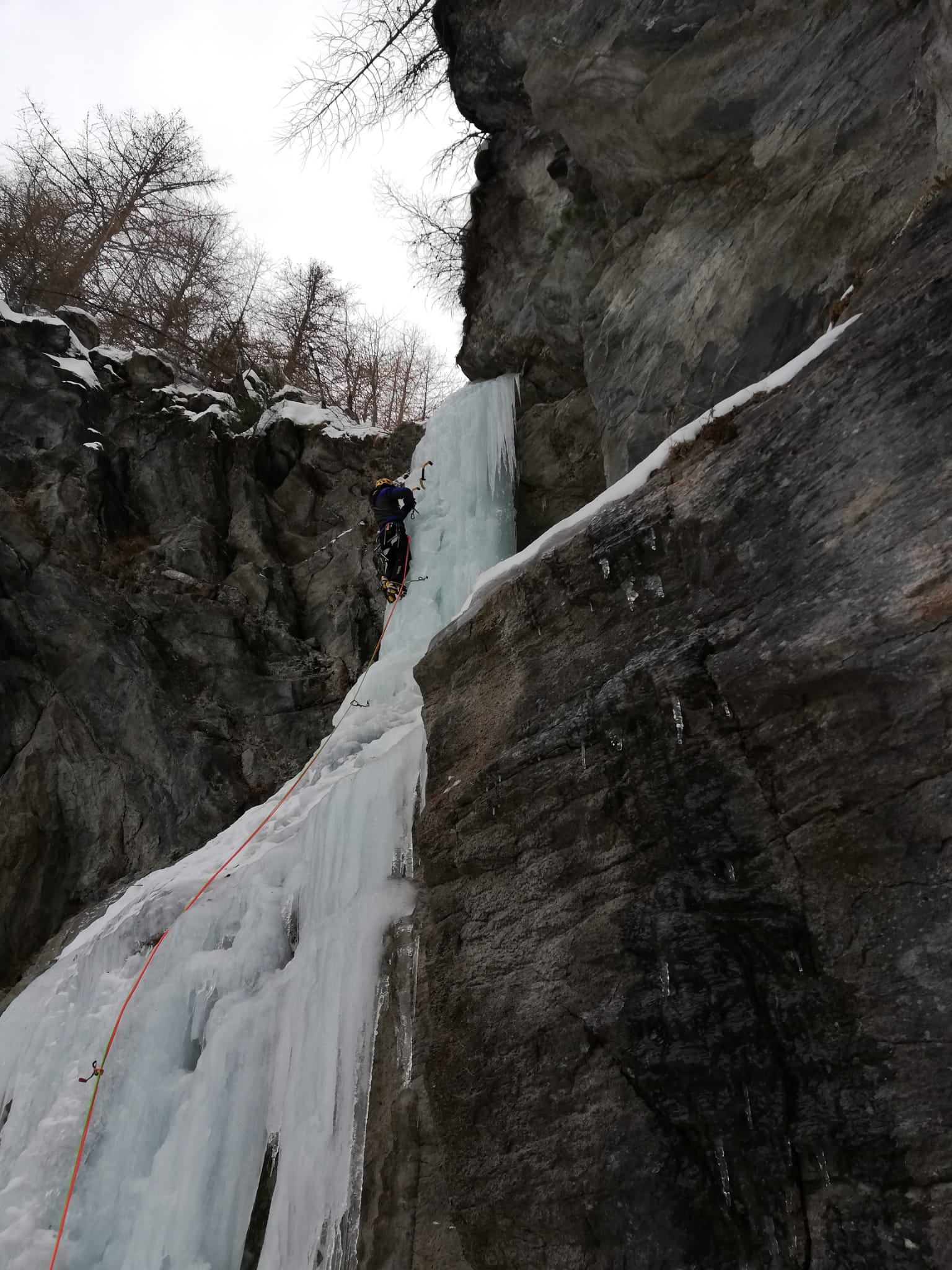
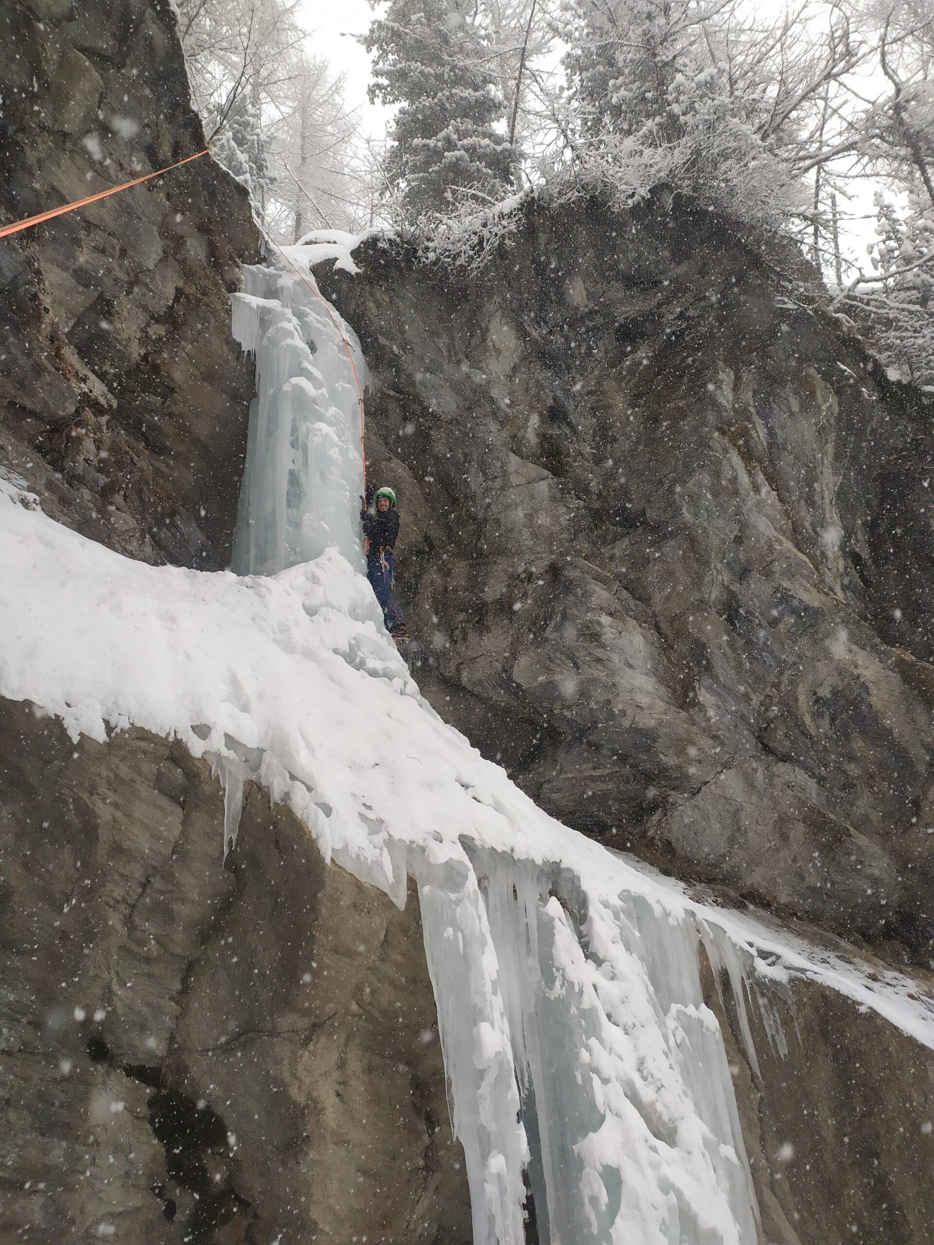
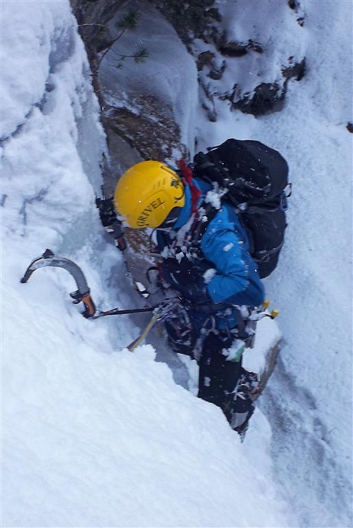
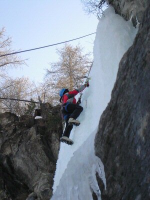
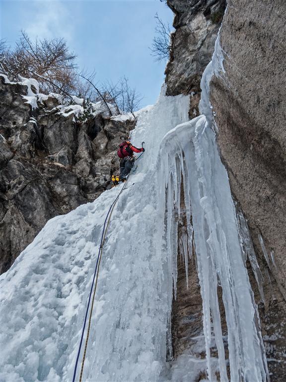
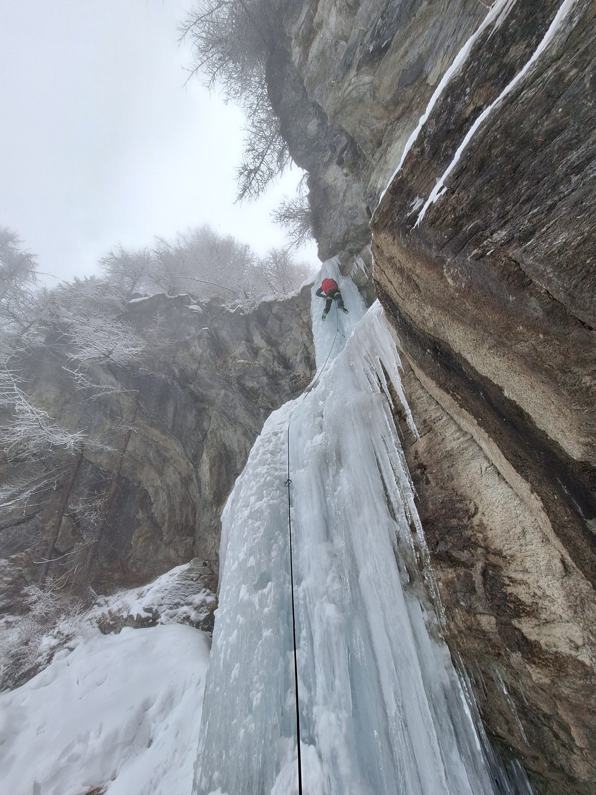
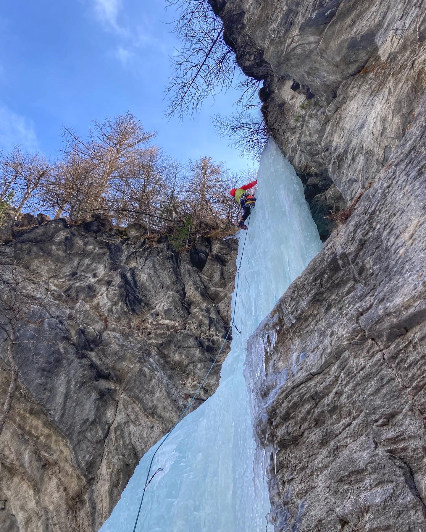
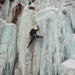
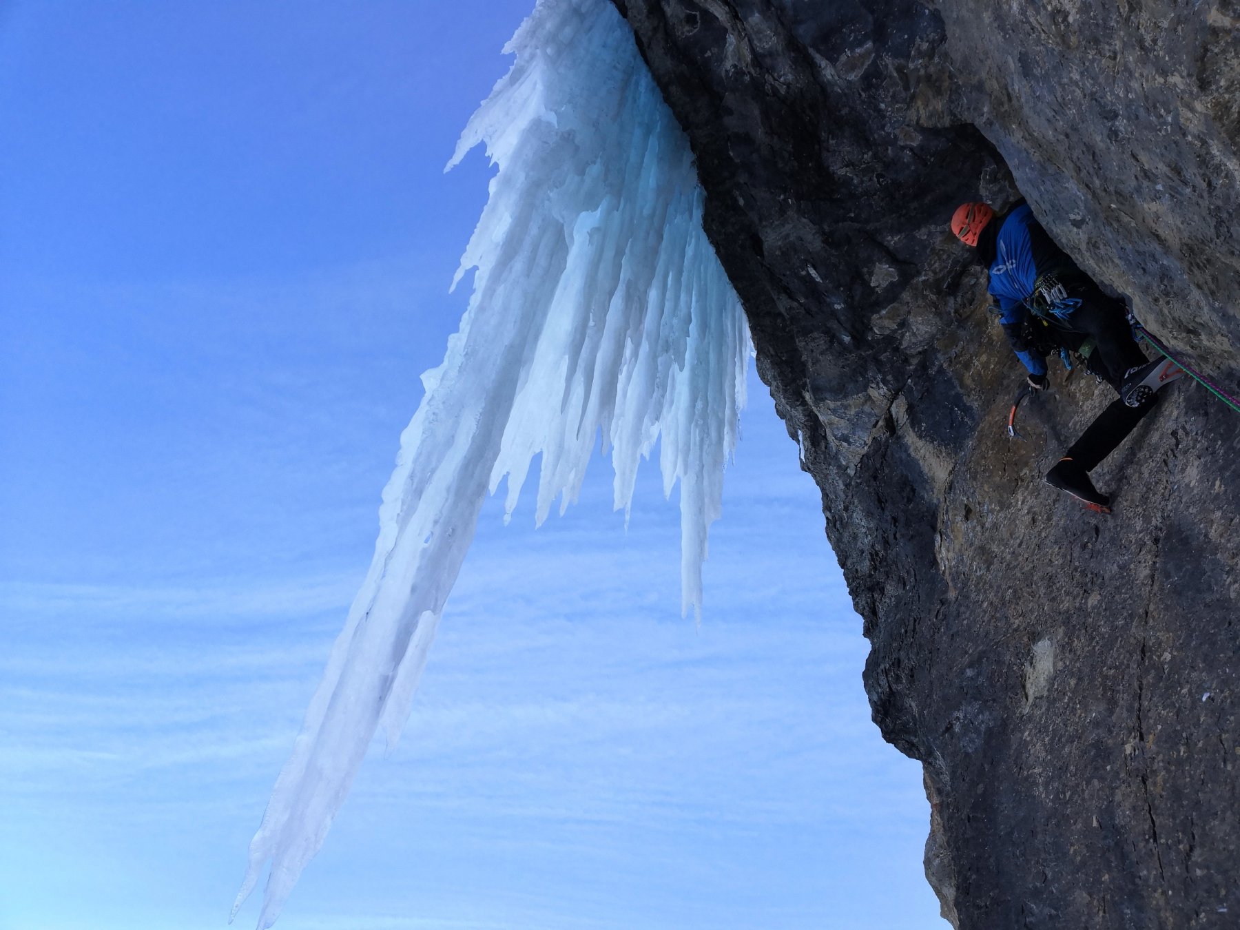
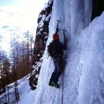
La cascata è costituita da un unico tiro, costituito da un risalto iniziale facile (80°), un pianetto di riposo e poi l’ultimo tratto ripido e continuo (85°). In uscita si trova la nuova sosta sulla dx a fix e gancio di calata.
Discesa: in doppia e poi a ritroso sul percorso dell’avvicinamento oppure sul versante sx orografico del torrente verso i tornanti di cui sopra.
V. Tarizzo il 2.1.81
- Bibliografia:
- Ghiaccio dell'Ovest - G.C.Grassi
Nelle vicinanze Mappa
Itinerari
11/01/2022 TO, Pragelato 25 m I, 2+ Nord
Pragelato – Acquedotto (Cascata dell’)
2Km
18/01/2025 TO, Pragelato 15 m I, 3+ Est
Pragelato – Circus break (Cascata)
 2Km
2Km
11/01/2022 TO, Pragelato 20 m I, 4 Nord-Ovest
Pragelato – Anfiteatro del Ghiaccio (Cascate)
 2.1Km
2.1Km
21/02/1995 TO, Pragelato 120 m IV, 5 Nord-Est
Val Troncea – Pisse Neire (Cascata) VIETATA
 3.9Km
3.9Km
31/12/2018 TO, Sestriere 65 m III, 5+, M8 Nord
Banchetta (Monte) – Alla Bellemmeglio (Cascata)
 4.4Km
4.4Km
25/03/2022 TO, Pragelato 120 m II, 1+ Nord
Pragelato – Fraisse (Cascata di)
 5Km
5Km
27/02/1994 TO, Pragelato 150 m III, 4+ Nord-Est
Val Troncea – Guglietta (Cascata della) VIETATA
 5.1Km
5.1Km
16/12/2023 TO, Sestriere 180 m III, 2 Ovest
Chisonetto (Vallone del) – Principiante e dei Tre (Cascate)
 6Km
6Km
04/01/2011 TO, Pragelato 100 m II, 5+ Est
Val Troncea – Dies Irae (Cascata)
6.4Km
10/01/2026 TO, Pragelato 130 m III, 4 Est
Val Troncea – Rouit (Cascatone del)
 6.6Km
6.6Km
Servizi
1.6Km
1.6Km
Al Mulino Ristorante
Pragelato
1.7Km
Mulino di Laval Rifugio
Pragelato
1.9Km
Refugium – ex. Rif. Belotte Rifugio
Pragelato
2.4Km
Casa degli Escartons Alex Berton B&B
Pragelato
2.6Km
Casa Alpina Rifugio
Pragelato
2.6Km
Passet Ristorante
Pragelato
4Km
L’itialette Ristorante
Pragelato
5.2Km
Troncea Rifugio
Pragelato
5.3Km