250m
250m
Note
Storico
 2.6Km
2.7Km
2.9Km
3Km
3Km
3.4Km
5Km
5.6Km
6.6Km
2.6Km
2.7Km
2.9Km
3Km
3Km
3.4Km
5Km
5.6Km
6.6Km
250m
1.8Km
2.7Km
2.7Km
2.8Km
4.1Km
4.7Km
6.2Km
6.2Km
6.6Km
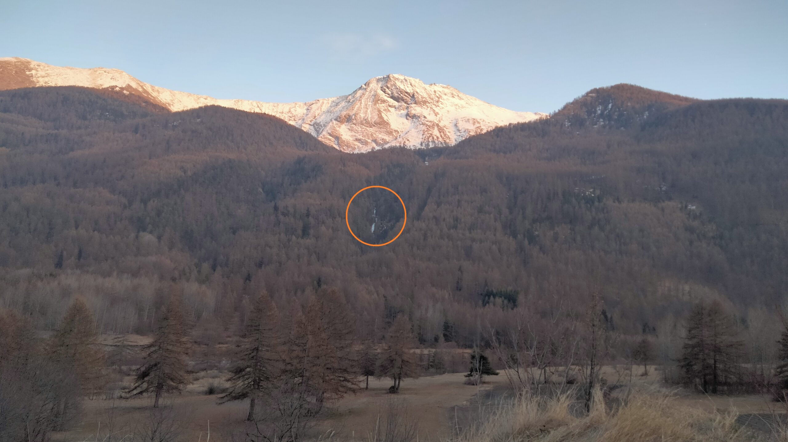
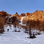
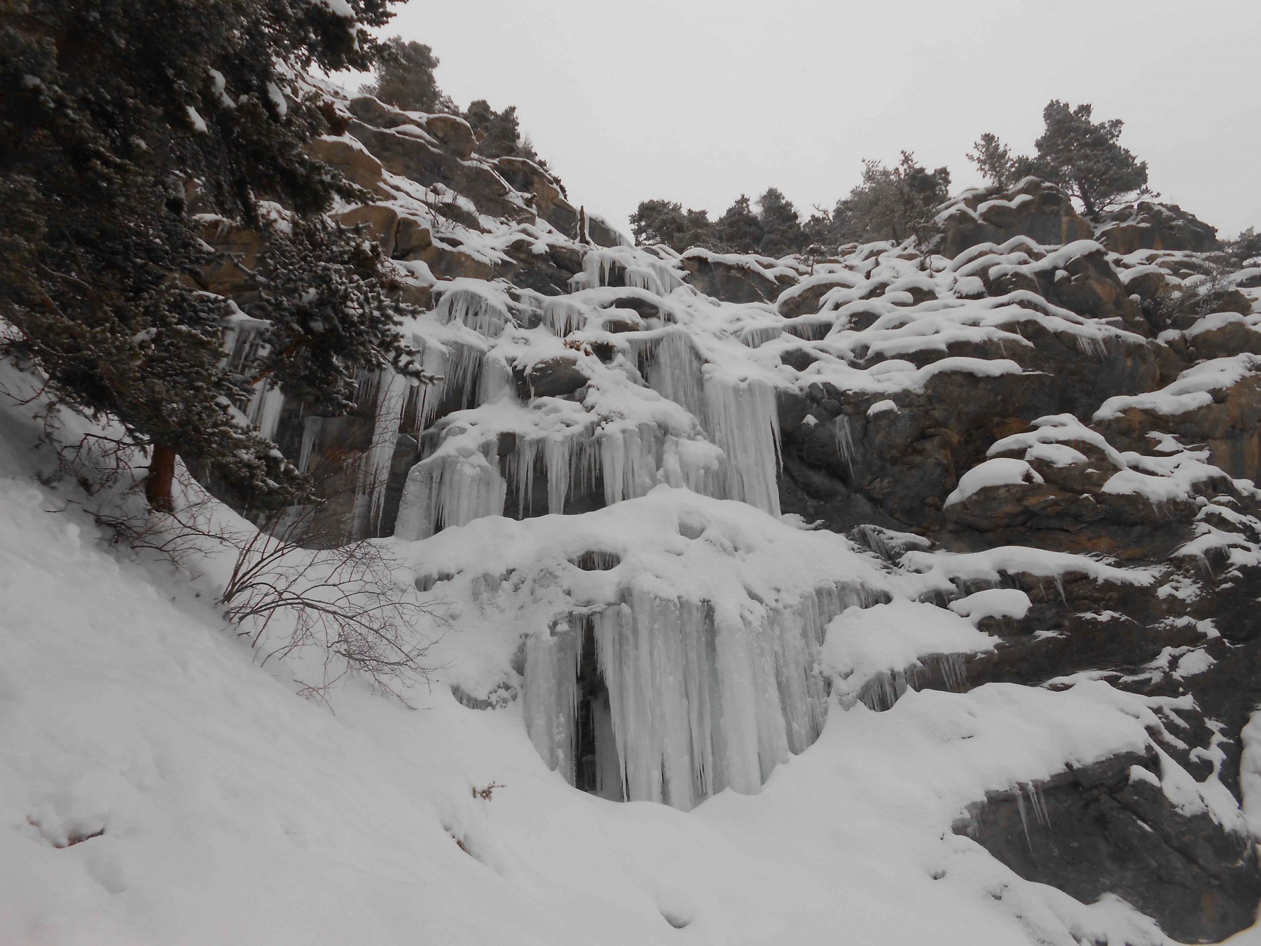
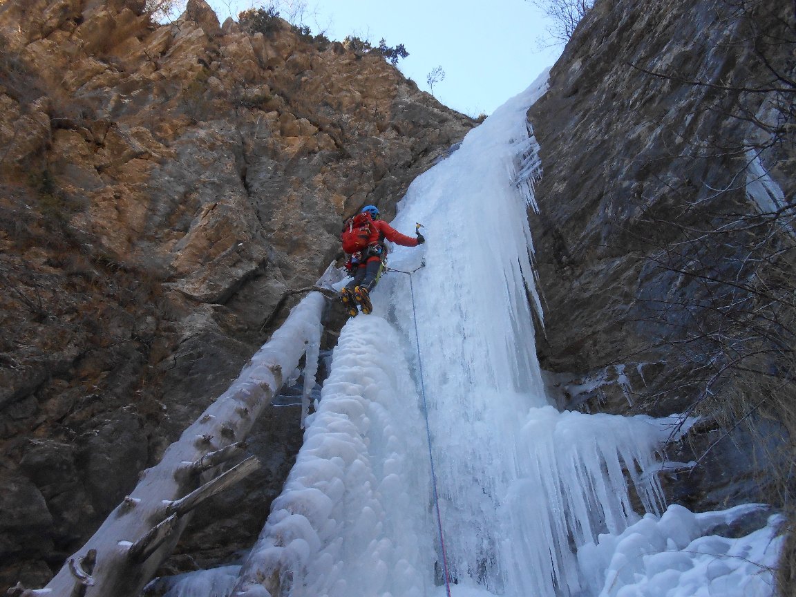
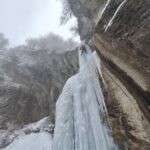
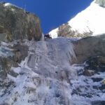
Facile colata, ottima come primo approccio al mondo del cascatismo e priva di pericoli oggettivi. La cascata è anche nota come "cascata dei Sette Baciass". Date le modeste pendenze, il flusso potrebbe essere coperto in caso di innevamento consistente. Le condizioni della colata sono verificabili dalla strada SR23 subito prima di raggiungere l'abitato di Soucheres Basses (piccola piazzola sulla sx salendo).
Sono presenti 4 soste di calata a 30m l'una dall'altra, è sufficiente quindi una corda da 60m usata doppia.
Avvicinamento
Sono presenti 4 soste di calata a 30m l'una dall'altra, è sufficiente quindi una corda da 60m usata doppia.
Dalla SR23 una volta raggiunta la frazione di Soucheres Basses prendere la strada in discesa sulla sx che porta alla frazione vecchia. Seguire la strada di fondovalle che scende verso Fraisse per circa 700-800m. Poco prima di raggiungere il primo rio che attraversa la strada (ponte di legno) prendere un sentiero appena accennato sulla dx, risalendo un prato costeggiato a dx da una fitta abetina. Salire lungo le tracce di sentiero, costeggiando un muretto di spietramento sulla sx fino a raggiungere un rio, attraversarlo e proseguire seguendo il sentiero (a tratti più evidente) che sale deciso costeggiando il rio che si è appena attraversato. Intorno a q. 1560m il sentiero torna verso l'alveo del rio e raggiunge una piccola presa d'acqua, ai piedi del primo salto della cascata.
E' anche possibile partire da Fraisse, risalendo la strada sterrata in dx idrografica. Si attraversa un primo rio e poi il secondo dotato di ponte, ricongiungendosi all'itinerario che arriva da Soucheres Basses.
Descrizione
E' anche possibile partire da Fraisse, risalendo la strada sterrata in dx idrografica. Si attraversa un primo rio e poi il secondo dotato di ponte, ricongiungendosi all'itinerario che arriva da Soucheres Basses.
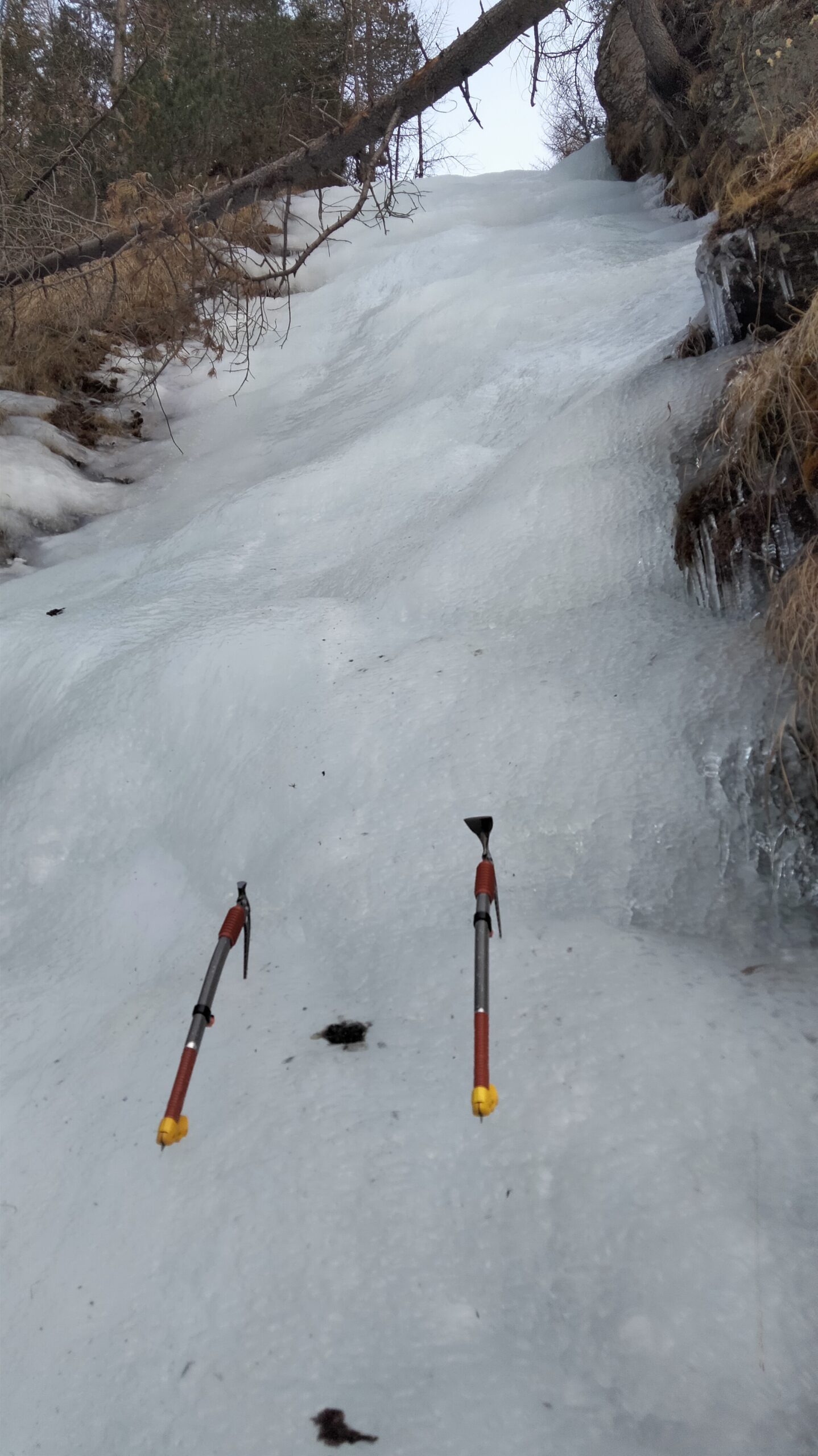
Risalire il flusso appoggiato fino ad un masso che crea un risalto ripido che precede il primo tiro, affrontabile sulla dx (2m a 80°) oppure a sx.
- L1: 30m continui a 65° (sosta dx su 2 golfari da collegare)
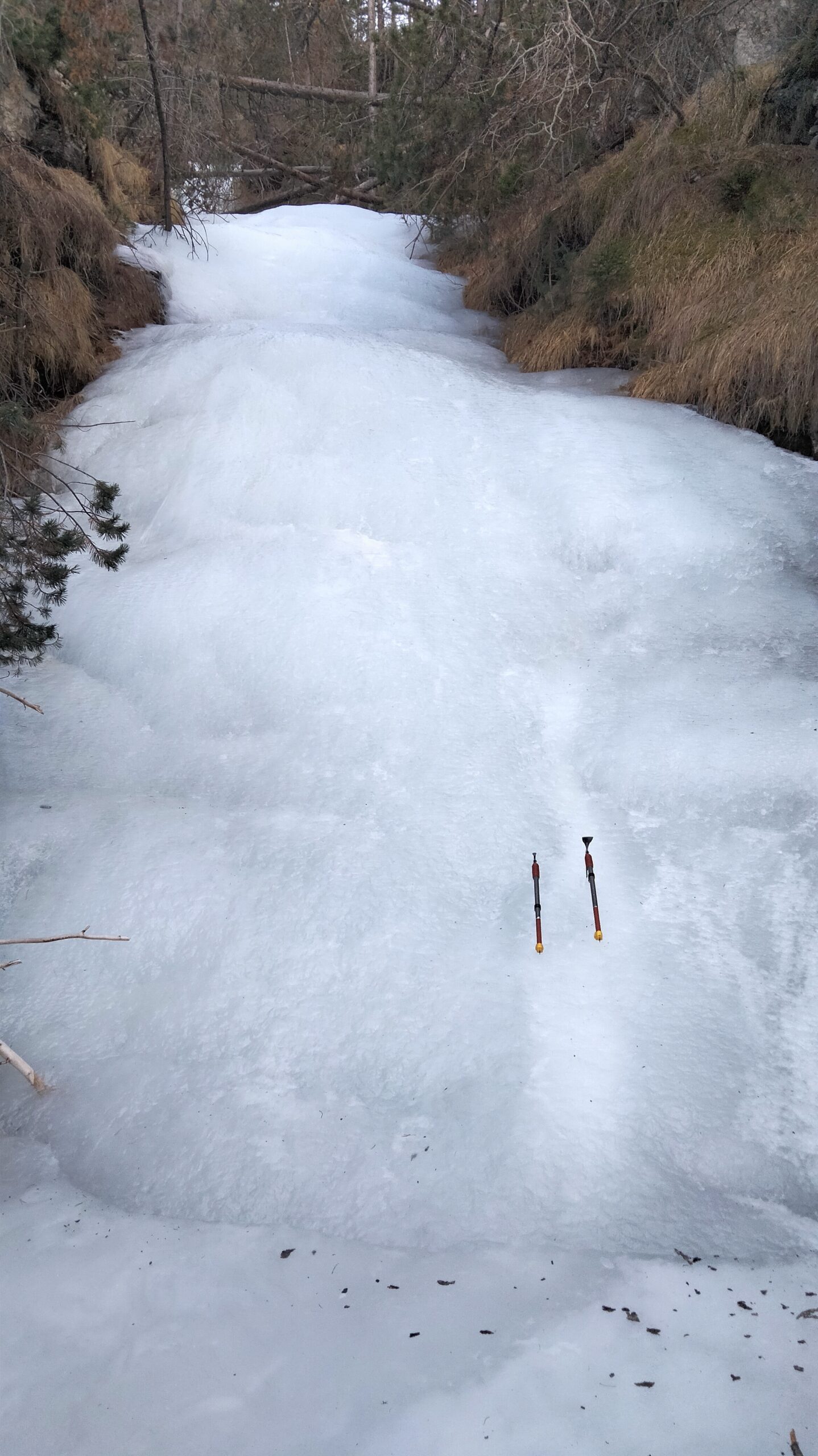
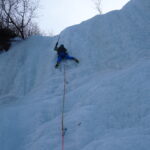
- L2: breve trasferimento e quindi risalto di 20m max 60° (sosta su fettuccia blu con maillon su un grosso larice schiantato sulla dx)
- L3: breve trasferimento e muretto di 20m a 60° (sosta con fettuccia blu e maillon su grosso abete bianco sulla dx appena usciti dal risalto)
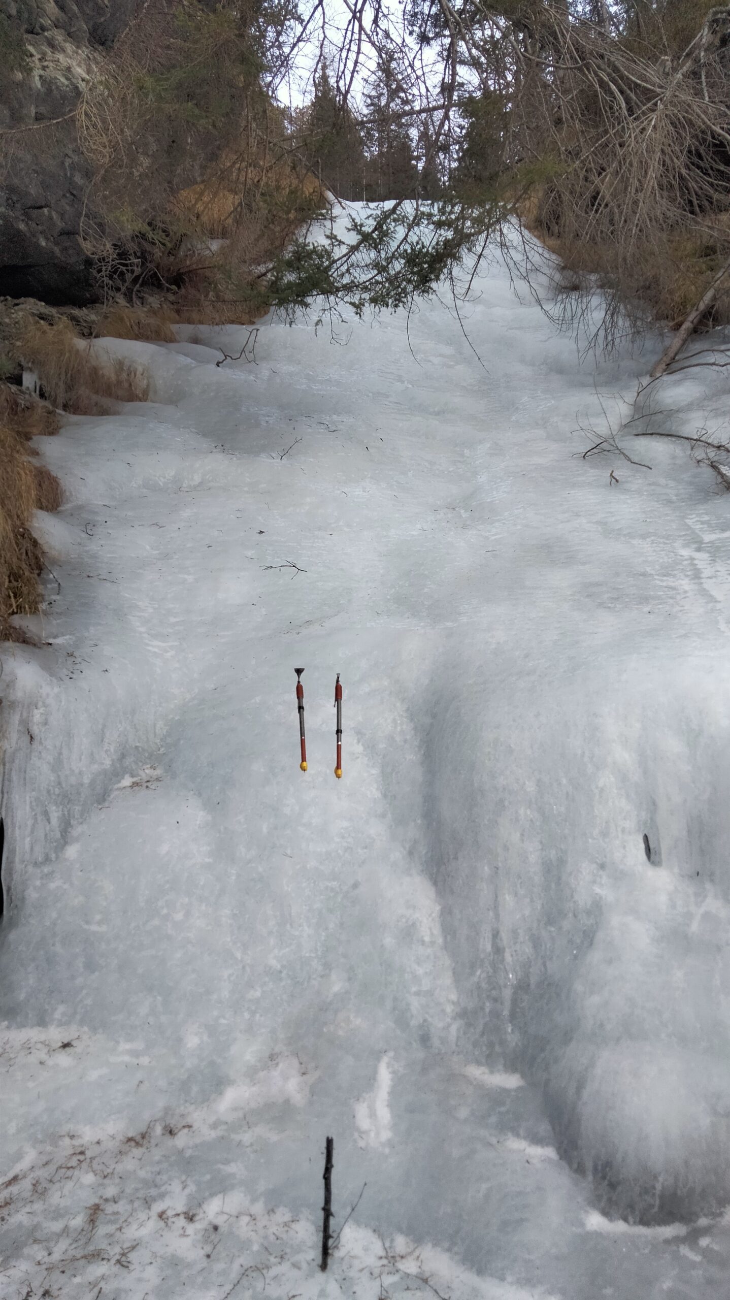
- L4: breve trasferimento e quindi serie di risalti facili intervallati da pianetti (max 60°, sosta a dx su larice con fettuccia rossa e maillon).
Il ruscello prosegue con dei saltini discontinui, brevi e poco interessanti. Con 4 doppie da 30m si torna alla base di L1, per tornare alla presa d’acqua si scende sulla dx del rio costeggiando il bosco ed evitando il risalto ripido sulla dx.
Messina e soci, anni '80
Nelle vicinanze Mappa
Itinerari
15/01/2017 TO, Usseaux 60 m II, 3+, M4 Sud
Fraisse (Bastionata di) – Cristalli d’Annata
 2.6Km
2.6Km
03/03/2018 TO, Usseaux 60 m II, 4 Sud
Fraisse (Bastionata di) – Suggestioni Cristalline
 2.7Km
2.7Km
18/01/2025 TO, Usseaux 60 m II, 4 Nord-Est
Gran Cerogne – Che Rogne! (Cascata)
 2.9Km
2.9Km
03/03/2018 TO, Usseaux 120 m II, 3 Sud
Fraisse (Bastionata di) – Effimere Circostanze (Cascata)
 3Km
3Km
11/01/2022 TO, Pragelato 20 m I, 4 Nord-Ovest
Pragelato – Anfiteatro del Ghiaccio (Cascate)
 3Km
3Km
11/01/2022 TO, Pragelato 25 m I, 2+ Nord
Pragelato – Acquedotto (Cascata dell’)
3.1Km
07/01/2021 TO, Usseaux 30 m I, 3 Sud-Est
Fraisse (Bastionata di) – Rocca del Colle (Cascata di)
 3.4Km
3.4Km
17/01/2026 TO, Pragelato 25 m II, 3+ Nord
Pragelato – Anfiteatro del Vento (Cascata)
 5Km
5Km
11/04/2022 TO, Exilles 90 m IV, 3+ Nord-Ovest
Exilles (Cascata di)
 5.6Km
5.6Km
24/01/2021 TO, Usseaux 120 m III, 4+ Est
Ciabertas (Monte, Cascata del)
 6.6Km
6.6Km
Servizi
250m
1.8Km
L’itialette Ristorante
Pragelato
2.7Km
Casa Alpina Rifugio
Pragelato
2.7Km
Passet Ristorante
Pragelato
2.8Km
Casa degli Escartons Alex Berton B&B
Pragelato
4.1Km
Casa Assietta Rifugio
Pragelato
4.7Km
Refugium – ex. Rif. Belotte Rifugio
Pragelato
6.2Km
Al Mulino Ristorante
Pragelato
6.2Km
La capanna del sole Ristorante
Pragelato
6.6Km