2.7Km
2.7Km
Avvicinamento
Storico
 1.1Km
1.7Km
2.4Km
3.4Km
3.8Km
4.4Km
4.6Km
4.7Km
5.2Km
1.1Km
1.7Km
2.4Km
3.4Km
3.8Km
4.4Km
4.6Km
4.7Km
5.2Km
2.7Km
3.6Km
4Km
4Km
4.7Km
5.2Km
6.7Km
6.8Km
6.8Km
8.3Km
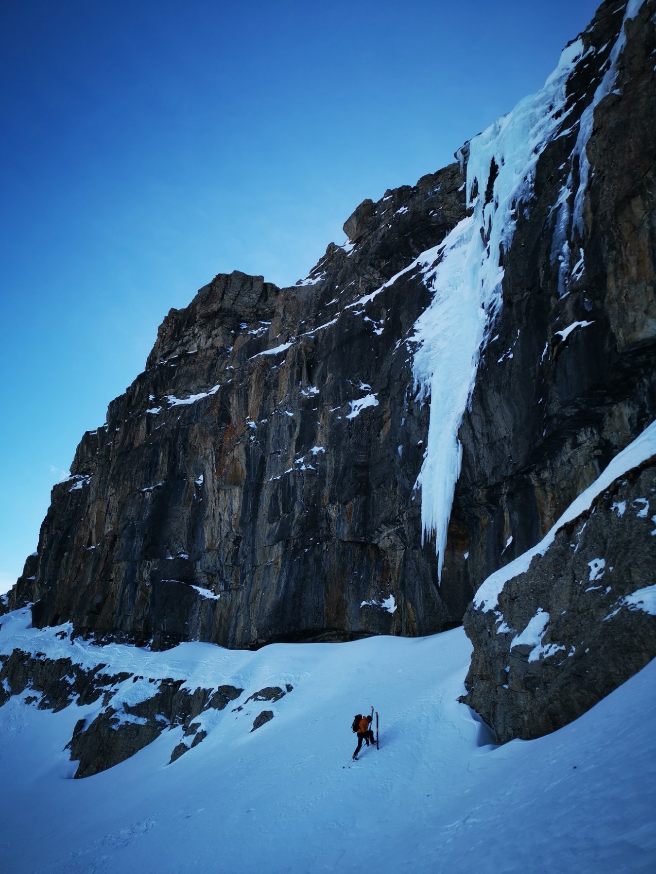
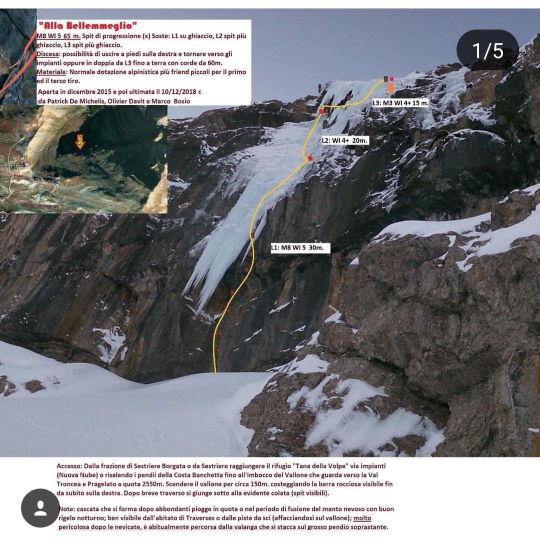
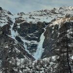
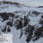
La colata è ben visibile già dalla statale che risale la val Chisone all’altezza di Pragelato guardando in direzione val Troncea. Si tratta di un salto di circa 60m che si forma senza raggiunger terra (lo fece una volta anni addietro ma non fu salita) sulle barre rocciose della Banchetta per fusione dai nevai soprastanti.
Per raggiunger la colata è necessario prender l’impianto della Nuova Nube (corsa singola Euro 7,00) e scendere in direzione val Troncea per circa 150m fino a costeggiare la barra rocciosa. A questo punto la colata diventa visibile.
Descrizione
Per raggiunger la colata è necessario prender l’impianto della Nuova Nube (corsa singola Euro 7,00) e scendere in direzione val Troncea per circa 150m fino a costeggiare la barra rocciosa. A questo punto la colata diventa visibile.
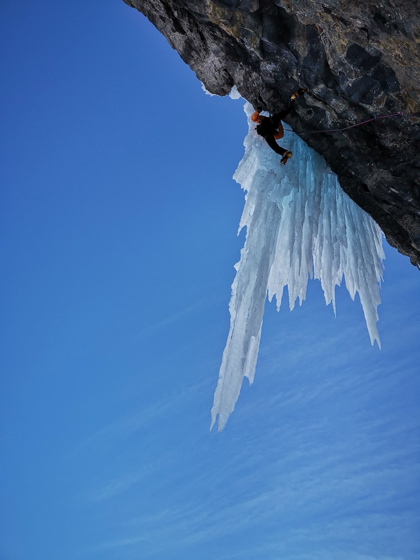
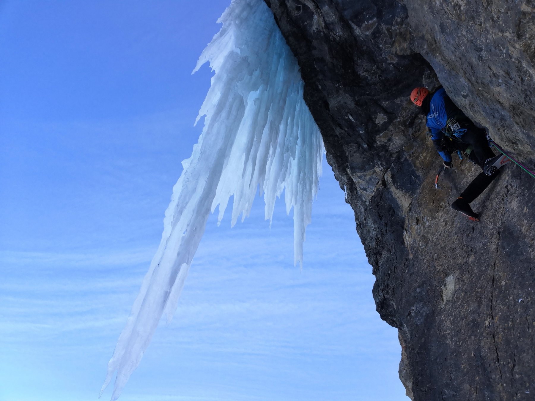
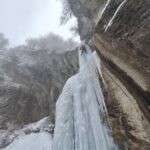
Il primo tiro attacca su roccia, la qualità è più che buona, si segue un evidente fessurino ove è necessario posizionare due microfriends per raggiungere il primo spit. Da questo punto non è più necessario integrare su roccia e si procede su terreno decisamente strapiombante sino ad agganciare l’imponente festone in ghiaccio. Dopo circa una ventina di metri si riesce a sostare in una scomoda nicchietta. Sosta su viti.
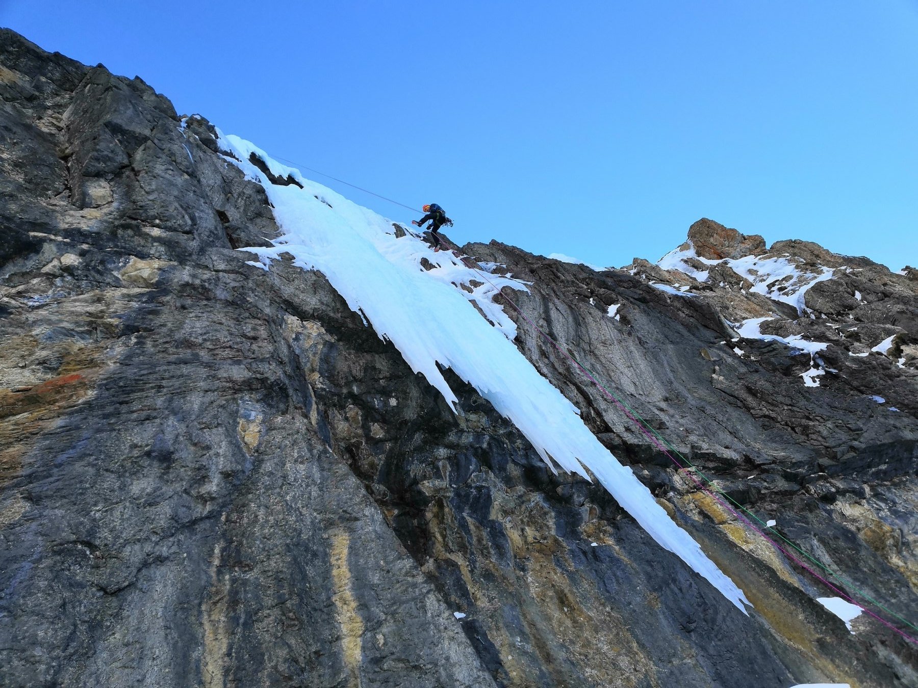
Il secondo tiro è di circa 20m ed è tutto in ghiaccio, obliquante verso sinistra per seguire la linea debole della cascata. E’ anche possibile partire a destra della nicchietta, aumentando le difficoltà in ghiaccio ed uscire sino in sommità con una lunghezza. In caso contrario si sosta su una specie di cengia. Sosta su viti.
Il terzo tiro attacca in traverso, uno spit protegge la parte rocciosa, poi è necessario aggirare una tendina di ghiaccio ed uscire in plein air per affrontare gli ultimi metri sino alla sommità.
Prima salita: P. De Michelis, O. Davit, M. Bosio
Nelle vicinanze Mappa
Itinerari
21/02/1995 TO, Pragelato 120 m IV, 5 Nord-Est
Val Troncea – Pisse Neire (Cascata) VIETATA
 1.1Km
1.1Km
16/12/2023 TO, Sestriere 180 m III, 2 Ovest
Chisonetto (Vallone del) – Principiante e dei Tre (Cascate)
 1.7Km
1.7Km
27/02/1994 TO, Pragelato 150 m III, 4+ Nord-Est
Val Troncea – Guglietta (Cascata della) VIETATA
 2.4Km
2.4Km
18/01/2025 TO, Pragelato 15 m I, 3+ Est
Pragelato – Circus break (Cascata)
 3.4Km
3.4Km
04/01/2011 TO, Pragelato 100 m II, 5+ Est
Val Troncea – Dies Irae (Cascata)
3.5Km
10/01/2026 TO, Pragelato 130 m III, 4 Est
Val Troncea – Rouit (Cascatone del)
 3.8Km
3.8Km
17/01/2026 TO, Pragelato 25 m II, 3+ Nord
Pragelato – Anfiteatro del Vento (Cascata)
 4.4Km
4.4Km
22/12/2025 TO, Sestriere 60 m III, 4 Ovest
Chisonetto (Vallone del) – Ghiacciolo Gigante e Cascata delle Goulottes (Cascate)
 4.6Km
4.6Km
24/01/2026 TO, Pragelato 100 m IV, 4+ Est
Val Troncea – Platasse (Cascata della)
 4.7Km
4.7Km
15/12/2024 TO, Pragelato 100 m IV, 5 Est
Val Troncea – Lacrime Ibernate (Cascata)
 5.2Km
5.2Km
Servizi
2.7Km
3.6Km
Troncea Rifugio
Pragelato
4Km
La capanna del sole Ristorante
Pragelato
4Km
Al Mulino Ristorante
Pragelato
4.7Km
Refugium – ex. Rif. Belotte Rifugio
Pragelato
5.2Km
Misun La Font Ristorante
Sauze di Cesana
6.7Km
Casa degli Escartons Alex Berton B&B
Pragelato
6.8Km
Casa Alpina Rifugio
Pragelato
6.8Km
Passet Ristorante
Pragelato
8.3Km