 2.3Km
2.3Km
Note
Storico
 1.1Km
1.6Km
2.7Km
3.3Km
3.4Km
3.9Km
4.1Km
4.7Km
5Km
1.1Km
1.6Km
2.7Km
3.3Km
3.4Km
3.9Km
4.1Km
4.7Km
5Km
2.3Km
2.6Km
3.9Km
3.9Km
3.9Km
6.1Km
6.3Km
6.3Km
6.3Km
7.7Km
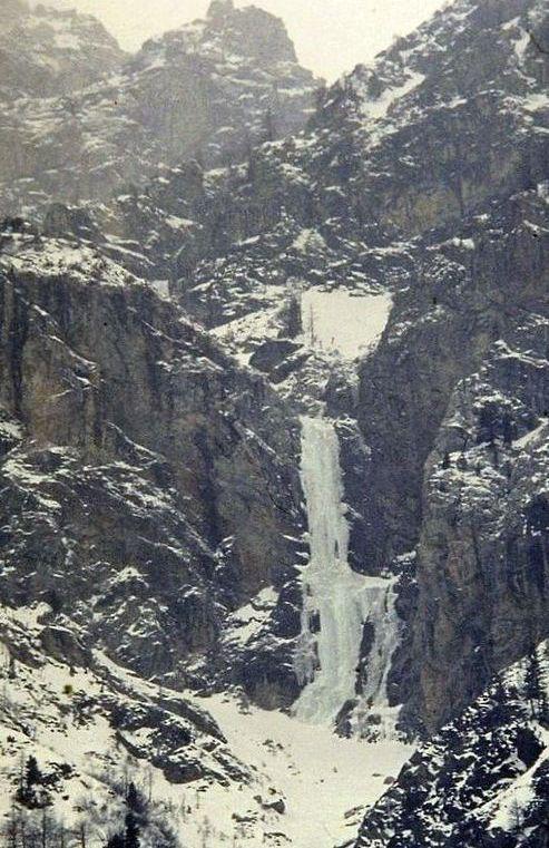
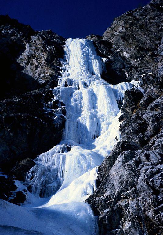
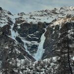
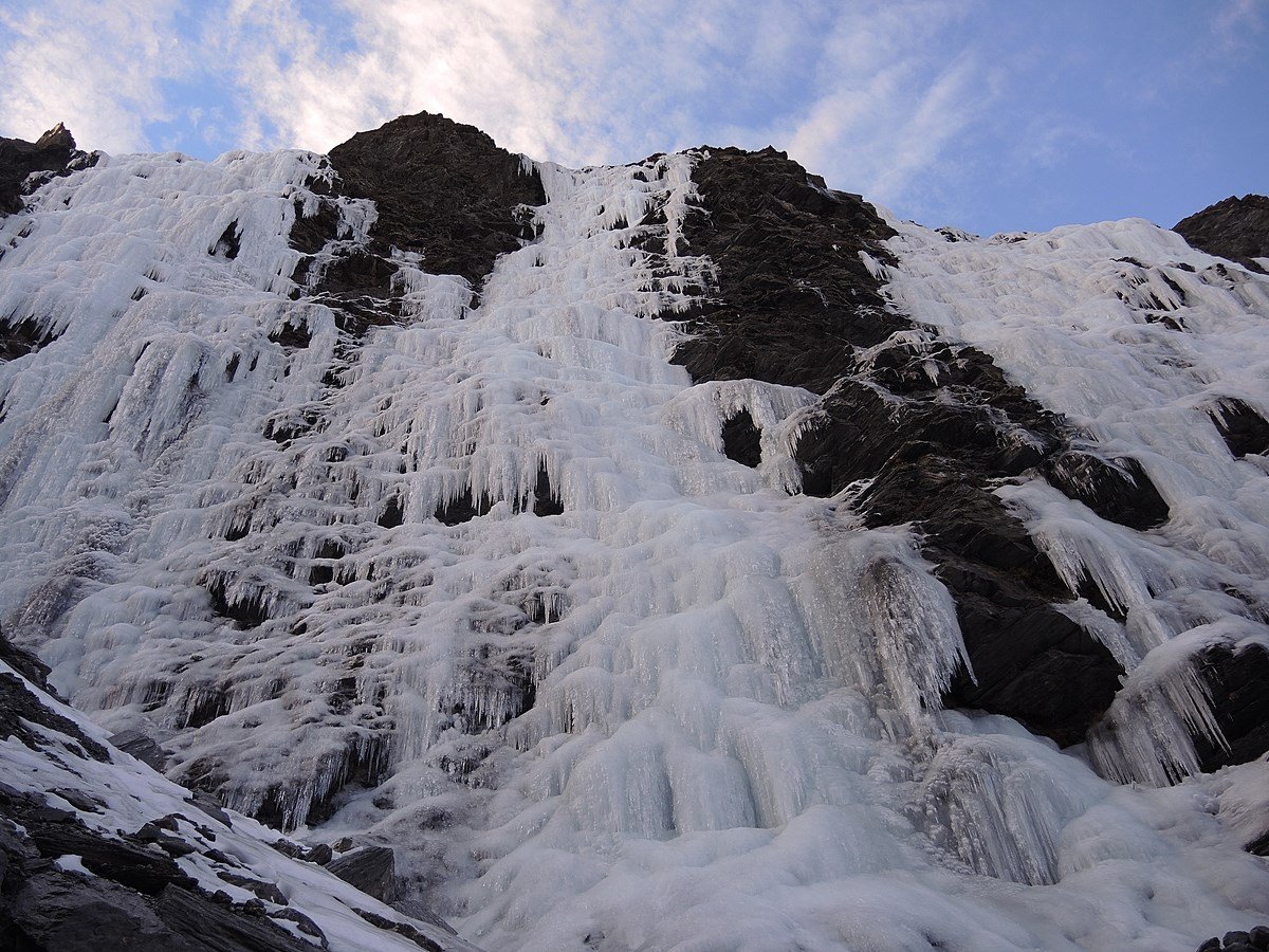
Cascata vietata in quanto zona di nidificazione dell'aquila. I guardiaparco del Parco Val Troncea non mancheranno di controllarvi. Le sanzioni sono molto pesanti. Informarsi c/o i guardiaparco per eventuali variazioni ai divieti.
Avvicinamento
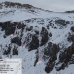
Risalire la val Troncea in sinistra idrografica fino alla salita che precede la discesa della strada verso la località Fonderia. Quindi risalire il canalone sotto l'evidente candela.
Descrizione
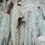
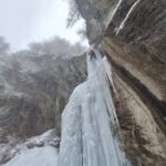
Primo tiro vs sinistra (cavolfiori), spostarsi a ds nel centro della colonna e con un tiro espostissimo andare a sostare a dx.
Discesa con 2 doppie.
G.C. Grassi e D. Lachance il 24.2.83
Nelle vicinanze Mappa
Itinerari
31/12/2018 TO, Sestriere 65 m III, 5+, M8 Nord
Banchetta (Monte) – Alla Bellemmeglio (Cascata)
 1.1Km
1.1Km
27/02/1994 TO, Pragelato 150 m III, 4+ Nord-Est
Val Troncea – Guglietta (Cascata della) VIETATA
 1.6Km
1.6Km
16/12/2023 TO, Sestriere 180 m III, 2 Ovest
Chisonetto (Vallone del) – Principiante e dei Tre (Cascate)
 2.7Km
2.7Km
04/01/2011 TO, Pragelato 100 m II, 5+ Est
Val Troncea – Dies Irae (Cascata)
3Km
10/01/2026 TO, Pragelato 130 m III, 4 Est
Val Troncea – Rouit (Cascatone del)
 3.3Km
3.3Km
18/01/2025 TO, Pragelato 15 m I, 3+ Est
Pragelato – Circus break (Cascata)
 3.4Km
3.4Km
17/01/2026 TO, Pragelato 25 m II, 3+ Nord
Pragelato – Anfiteatro del Vento (Cascata)
 3.9Km
3.9Km
24/01/2026 TO, Pragelato 100 m IV, 4+ Est
Val Troncea – Platasse (Cascata della)
 4.1Km
4.1Km
15/12/2024 TO, Pragelato 100 m IV, 5 Est
Val Troncea – Lacrime Ibernate (Cascata)
 4.7Km
4.7Km
05/01/2025 TO, Pragelato 120 m III, 4 Sud-Est
Val Troncea – Paretone del Rio Faurì (Cascate)
 5Km
5Km
Servizi
2.3Km
2.6Km
Troncea Rifugio
Pragelato
3.9Km
La capanna del sole Ristorante
Pragelato
3.9Km
Al Mulino Ristorante
Pragelato
3.9Km
Refugium – ex. Rif. Belotte Rifugio
Pragelato
6.1Km
Casa degli Escartons Alex Berton B&B
Pragelato
6.3Km
Casa Alpina Rifugio
Pragelato
6.3Km
Passet Ristorante
Pragelato
6.3Km
Misun La Font Ristorante
Sauze di Cesana
7.7Km


