200m
200m

Note
Storico
 100m
150m
1.8Km
2.4Km
3.7Km
3.8Km
3.8Km
3.8Km
3.9Km
3.9Km
100m
150m
1.8Km
2.4Km
3.7Km
3.8Km
3.8Km
3.8Km
3.9Km
3.9Km
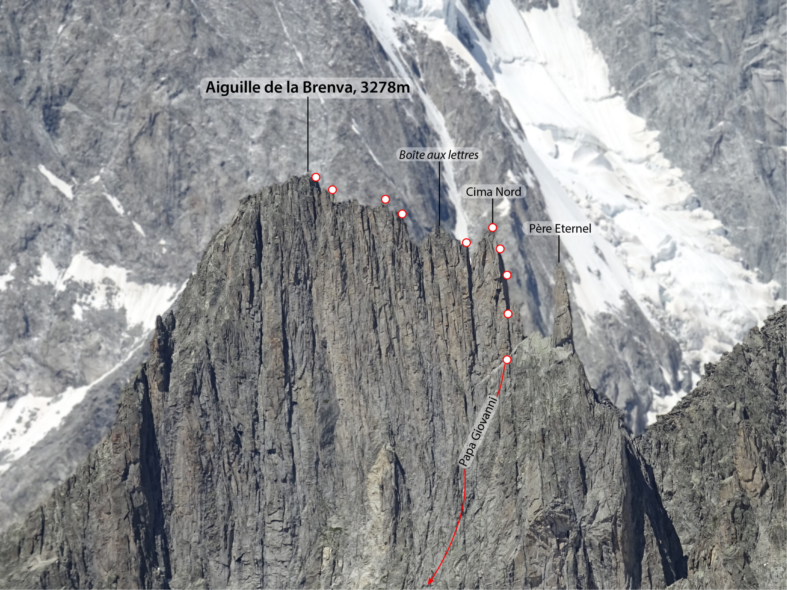
Lunga ascensione in ambiente solitario e selvaggio, recentemente riattrezzata con qualche fix e le soste, soprattutto nella vertiginosa traversata verso Nord, che permette di scendere in doppia dalla via Papa Giovanni Paolo II (alla base del Pere Eternel).
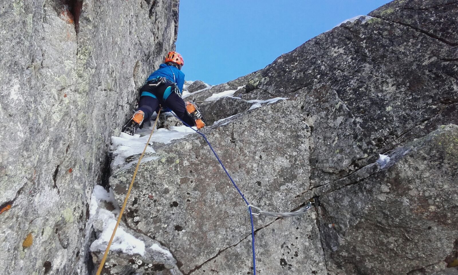
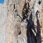
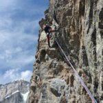
Bella scalata su roccia compatta, con passaggi di IV/+ e un tiro di V+ (evitabile).
Materiale necessario: 6 rinvii, friend, cordini, corda da 60m
Avvicinamento
Bella scalata su roccia compatta, con passaggi di IV/+ e un tiro di V+ (evitabile).
Materiale necessario: 6 rinvii, friend, cordini, corda da 60m
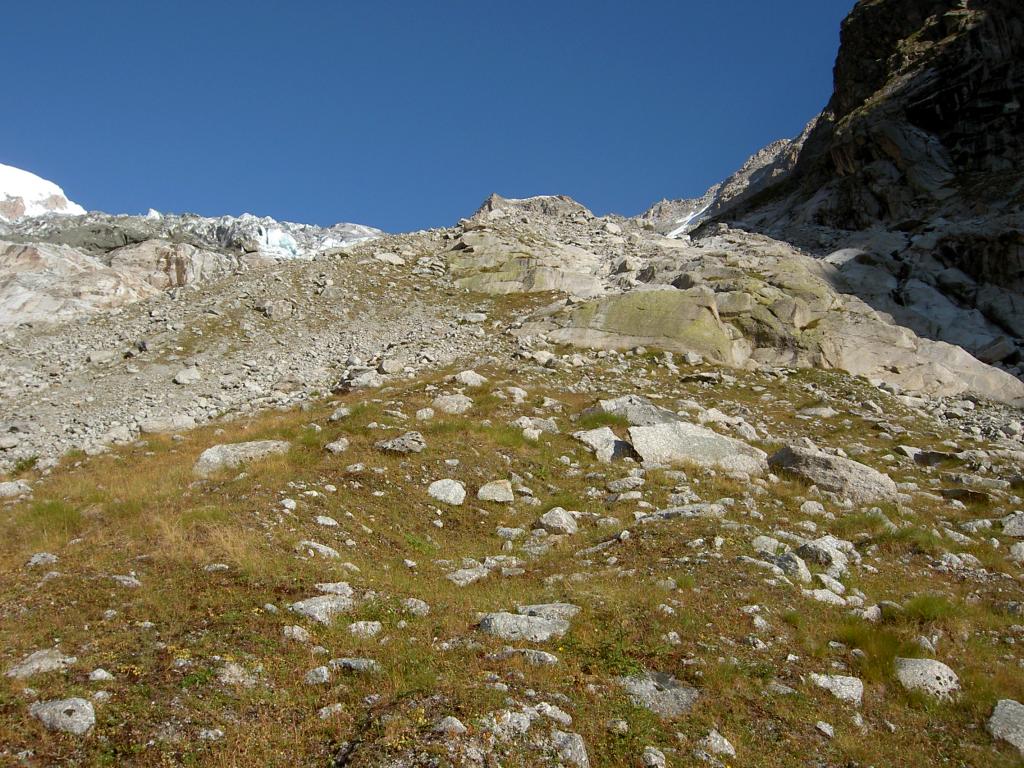
Due possibilità di avvicinamento:
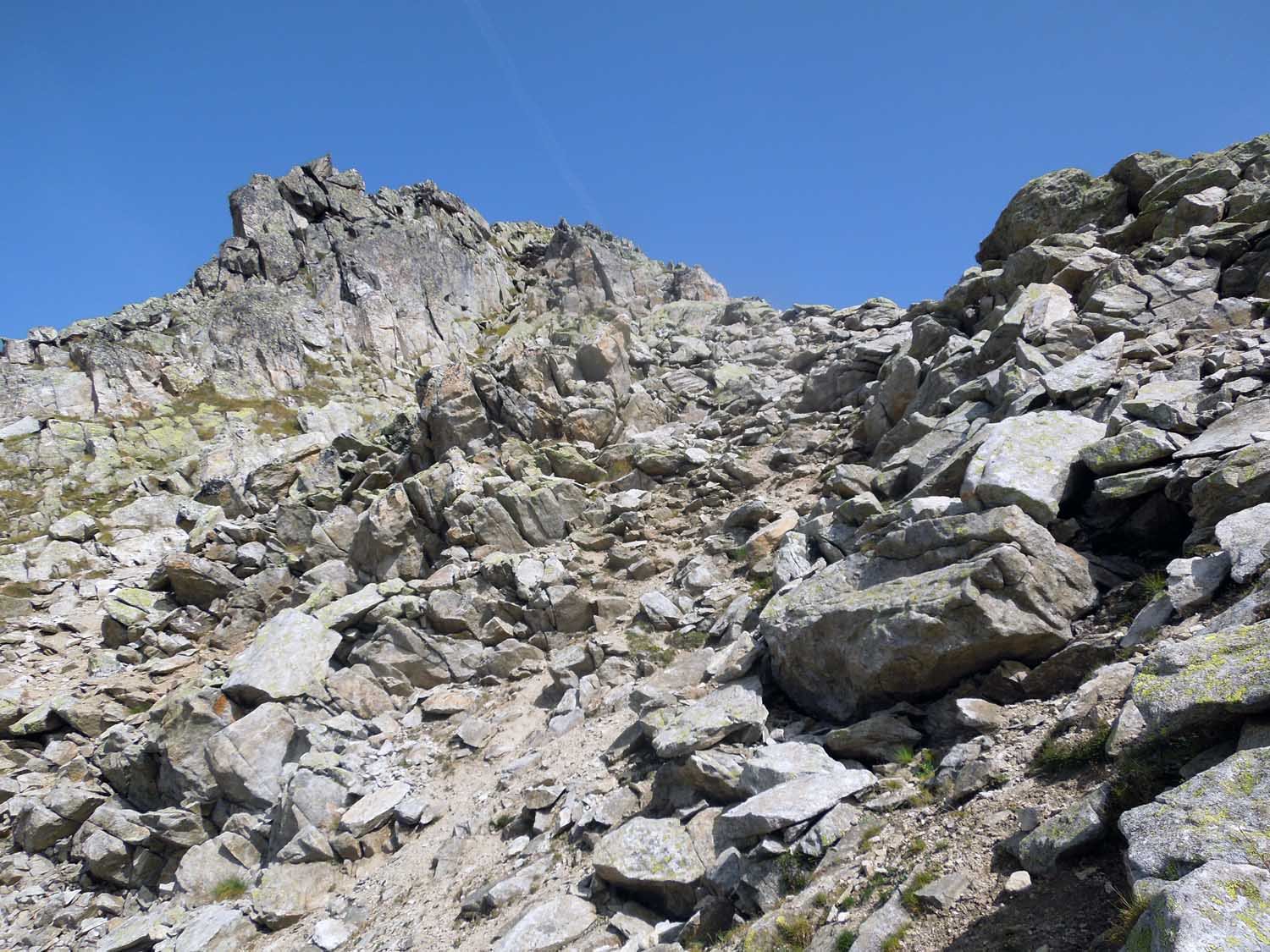
- a piedi dal basso: lasciare l'auto in zona piazzale funivia Val Veny e imboccare la strada sterrata che sale verso il fronte del ghiacciaio della Brenva (volendo se ne può fare un tratto in auto). Proseguire per il sentiero del bivacco della Brenva (bolli gialli) che supera i ruderi dei casolari della Brenva e poi si inoltra nella valletta a lato della morena; dove termina la valletta salire verso dx un canalone (comba del Lupo) e poi traversare a sx su erba per 100m.
Si prosegue nel bosco ripido e poi su prati esposti fino ad attraversare il torrente; poi si salgono il dosso e il pendio successivo fin contro la morena, che si percorre senza via obbligata; infine si piega a dx arrivando ai prati e al nevaio sotto la parete sud dell'Aiguille (sentiero poco battuto ma molti segni gialli e qualche ometto).
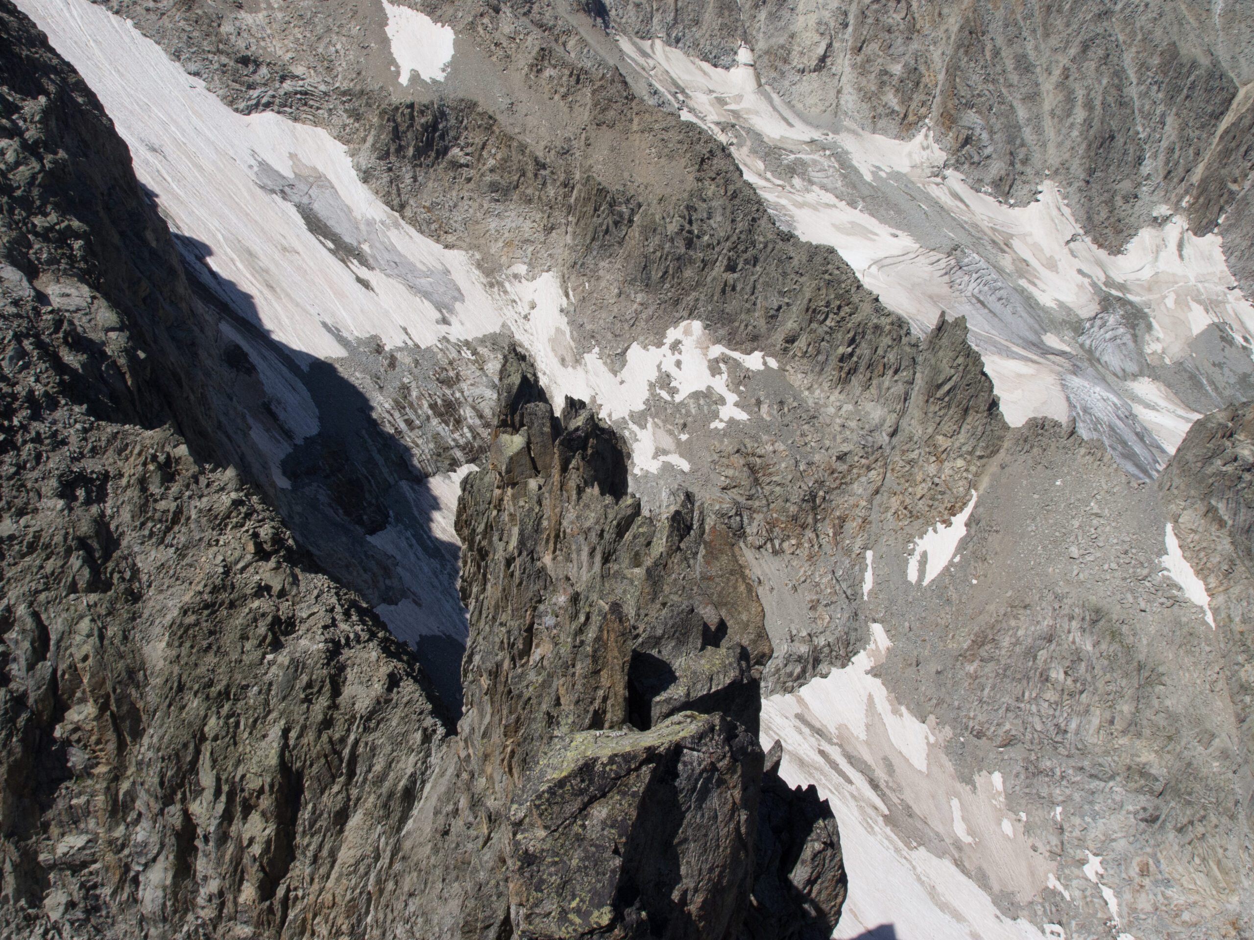
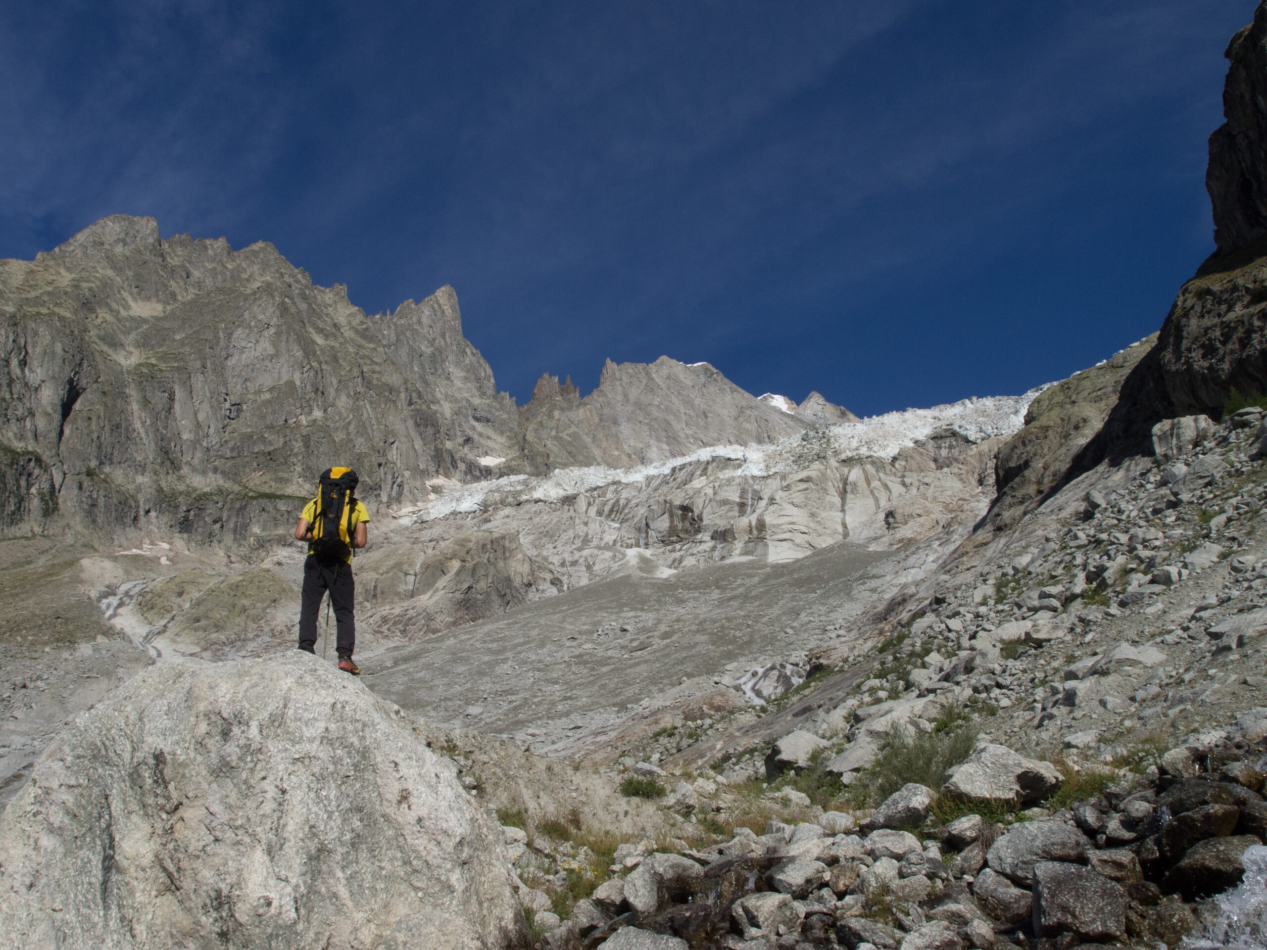
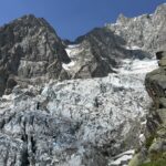
- con Skyway fino al Pavillon: seguire il sentiero per il Rif. Torino e quindi prendere a sx il sentiero a sali-scendi (si perdono circa 150m di dislivello) per il Belvedere della Brenva (q.2400m). Proseguire quindi per prati ripidi e roccette verso Nord, verso il Mont de la Brenva. Non esiste un vero sentiero ma si trovano saltuariamente tracce di passaggio. Intorno a 2750m (prima che la cresta si raddrizza) si devia sx (fix con cordino bianco) e si traversa un canale (fix con cordino). Si raggiunge così una spalla (ometto) che permette di divallare verso la Brenva. Scendere per terreno ripido un canale erboso, alternato a facili placche montonate, stando sempre sulla sx (2 soste di calate con cordino bianco) per obliquare poi in ultimo verso dx e raggiungere così un nevaio. Traversare verso dx senza perdere troppa quota, quindi puntare ad una zona di placche montonate che permettono di arrivare alla pietraia sottostante (q. 2650m circa, 2 soste per eventuali breve calate). Raggiunta la pietraia si punta all'evidente nevaio alla base dell'Aiguille de la Brenva.
Descrizione
- a piedi dal basso: lasciare l'auto in zona piazzale funivia Val Veny e imboccare la strada sterrata che sale verso il fronte del ghiacciaio della Brenva (volendo se ne può fare un tratto in auto). Proseguire per il sentiero del bivacco della Brenva (bolli gialli) che supera i ruderi dei casolari della Brenva e poi si inoltra nella valletta a lato della morena; dove termina la valletta salire verso dx un canalone (comba del Lupo) e poi traversare a sx su erba per 100m.
Si prosegue nel bosco ripido e poi su prati esposti fino ad attraversare il torrente; poi si salgono il dosso e il pendio successivo fin contro la morena, che si percorre senza via obbligata; infine si piega a dx arrivando ai prati e al nevaio sotto la parete sud dell'Aiguille (sentiero poco battuto ma molti segni gialli e qualche ometto).
- con Skyway fino al Pavillon: seguire il sentiero per il Rif. Torino e quindi prendere a sx il sentiero a sali-scendi (si perdono circa 150m di dislivello) per il Belvedere della Brenva (q.2400m). Proseguire quindi per prati ripidi e roccette verso Nord, verso il Mont de la Brenva. Non esiste un vero sentiero ma si trovano saltuariamente tracce di passaggio. Intorno a 2750m (prima che la cresta si raddrizza) si devia sx (fix con cordino bianco) e si traversa un canale (fix con cordino). Si raggiunge così una spalla (ometto) che permette di divallare verso la Brenva. Scendere per terreno ripido un canale erboso, alternato a facili placche montonate, stando sempre sulla sx (2 soste di calate con cordino bianco) per obliquare poi in ultimo verso dx e raggiungere così un nevaio. Traversare verso dx senza perdere troppa quota, quindi puntare ad una zona di placche montonate che permettono di arrivare alla pietraia sottostante (q. 2650m circa, 2 soste per eventuali breve calate). Raggiunta la pietraia si punta all'evidente nevaio alla base dell'Aiguille de la Brenva.
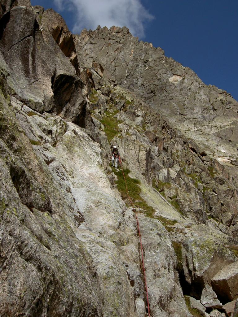
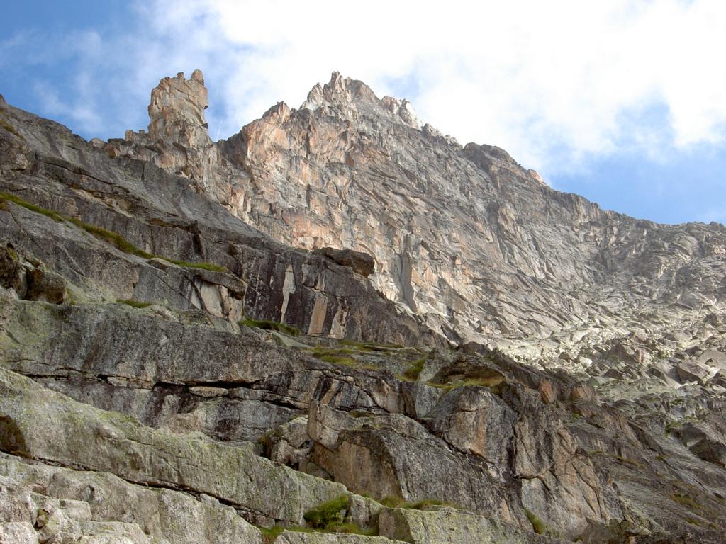
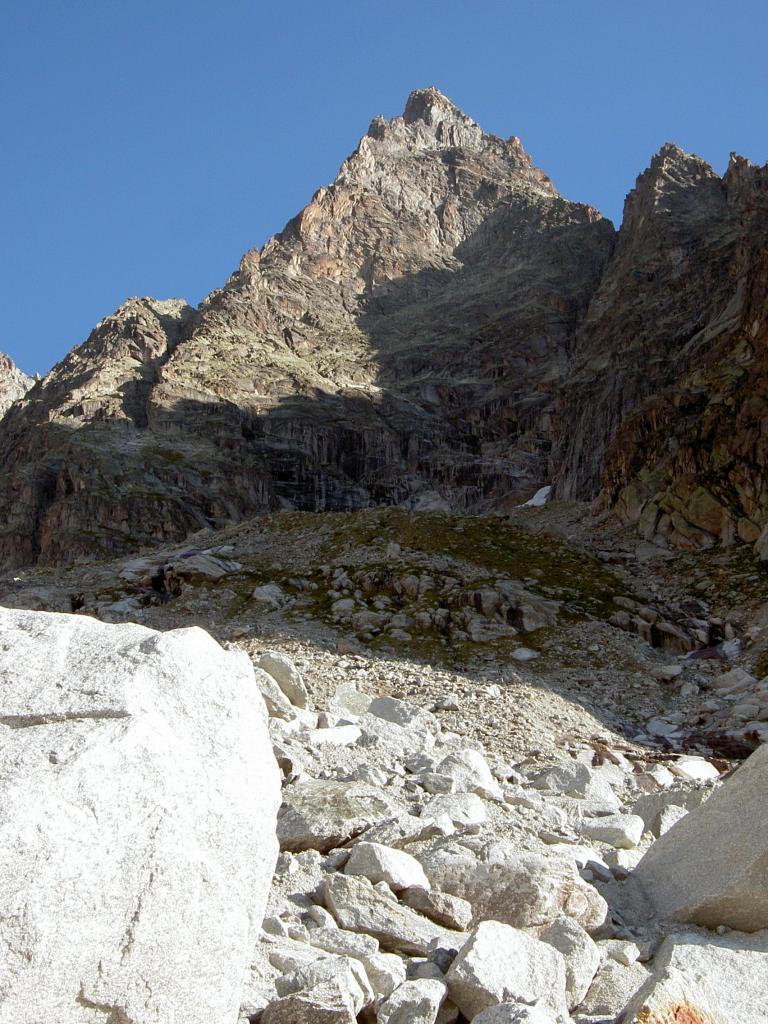
Risalire il nevaio verso sx e puntare ad un un facile canalino, che porta alla terrazza superiore alla base della cresta SW.
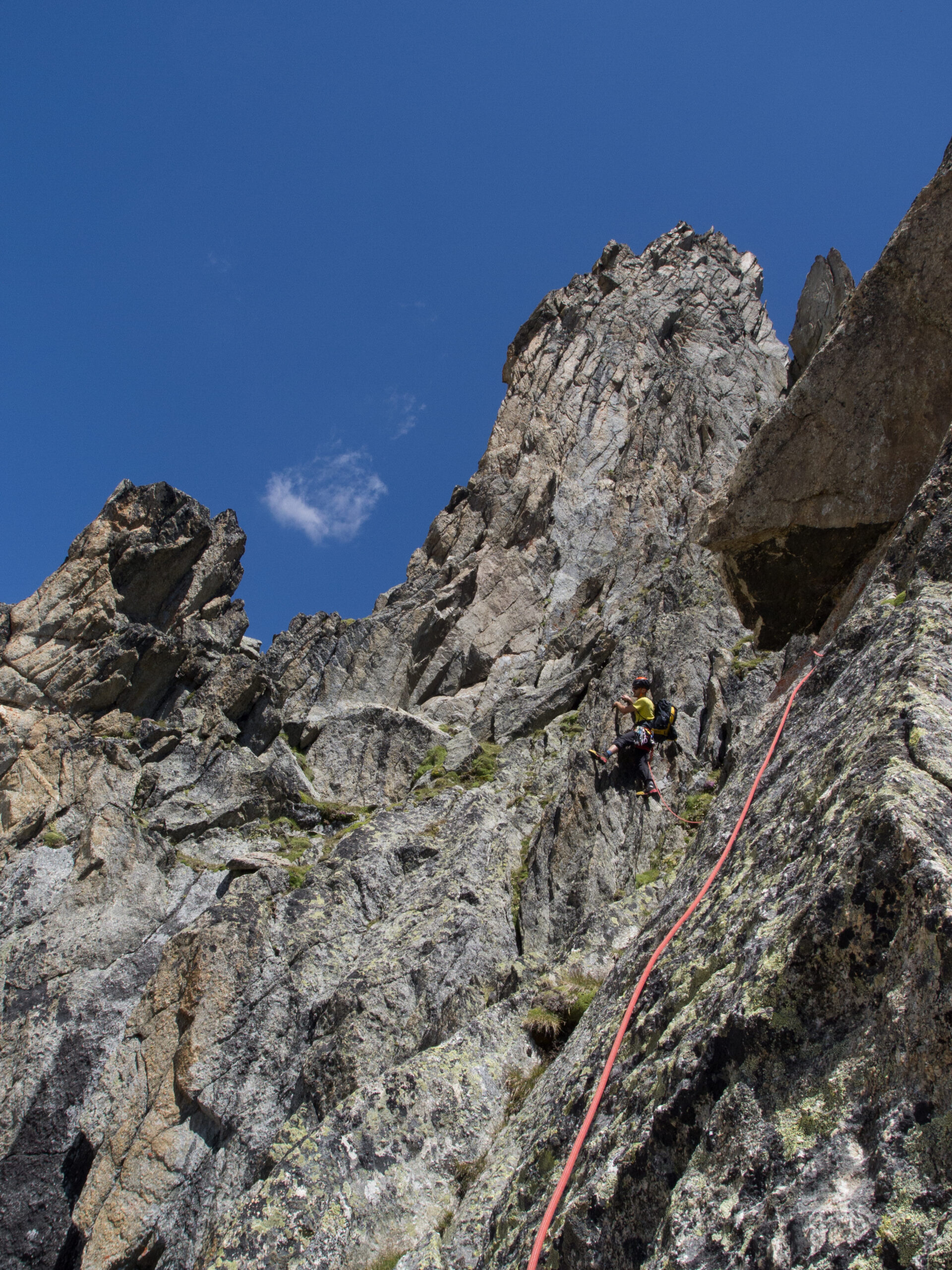
Salire il canale (passi di II-III) oppure tenersi 50m alla sua sx (ovest) per placche compatte alternate a tratti erbosi; dove il canale è sbarrato da un muro verticale, uscire a dx su terrazze più facili verso la base di un evidente gendarme (facilmente evitabile a sx per cenge).
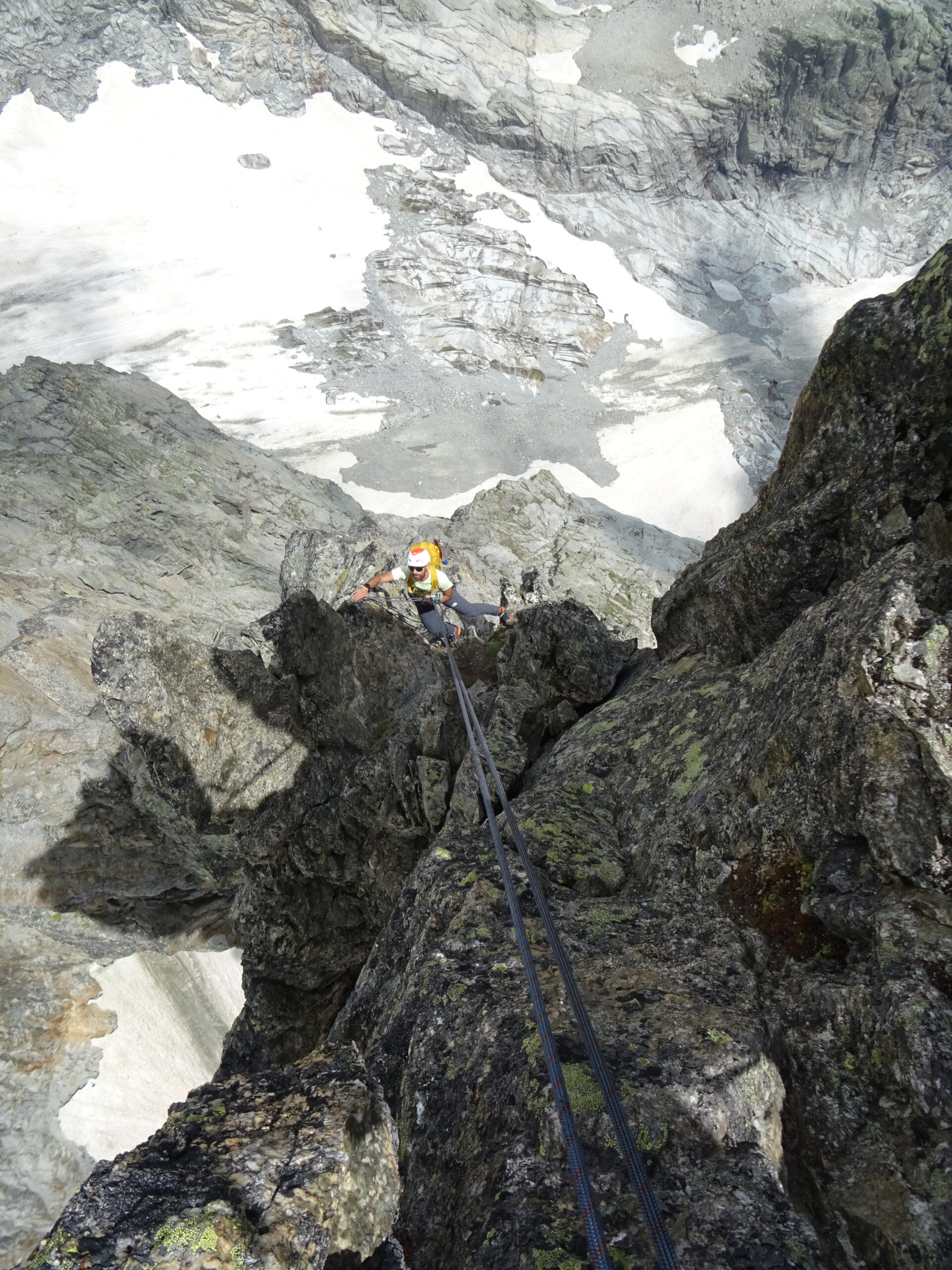
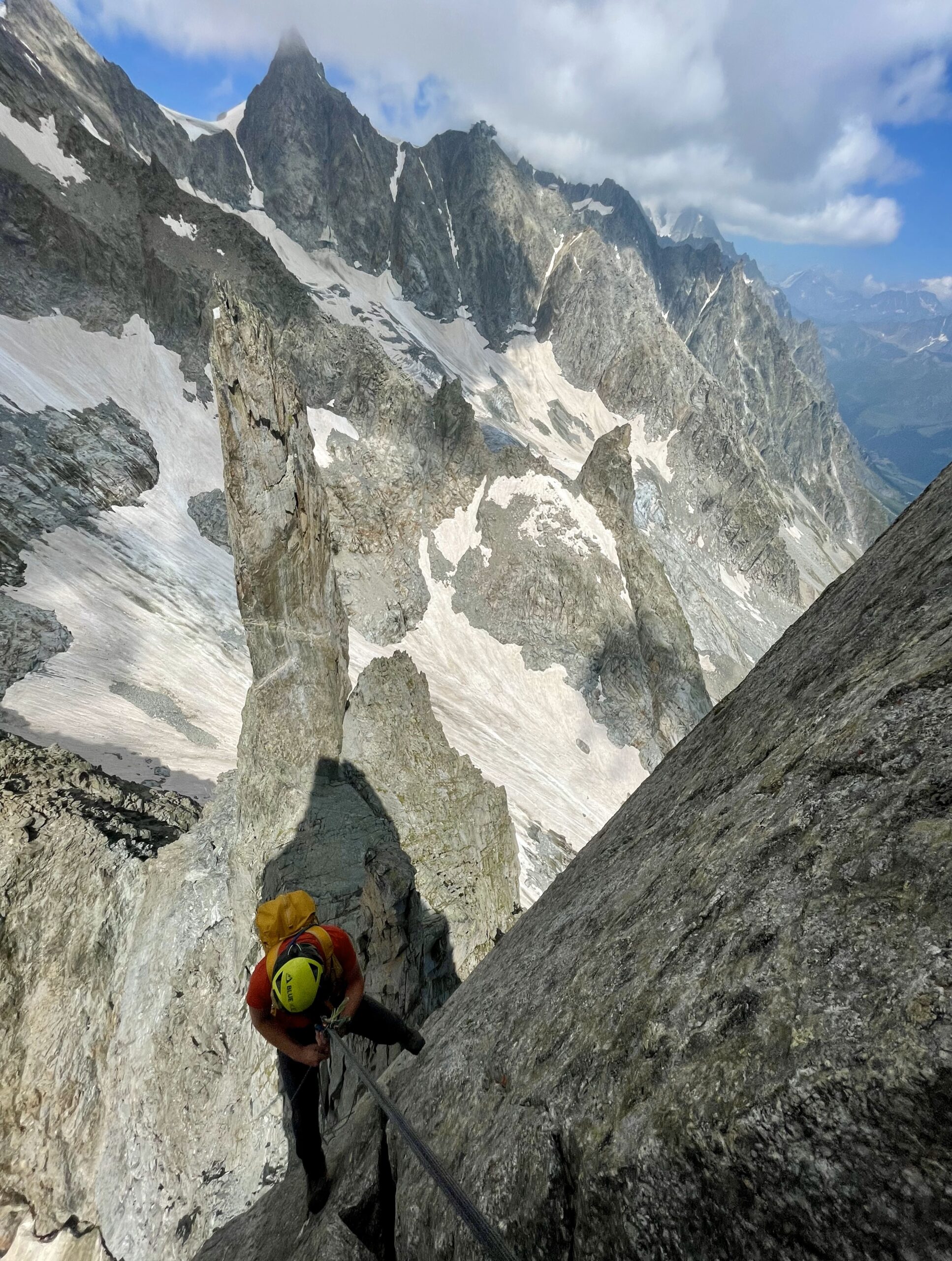
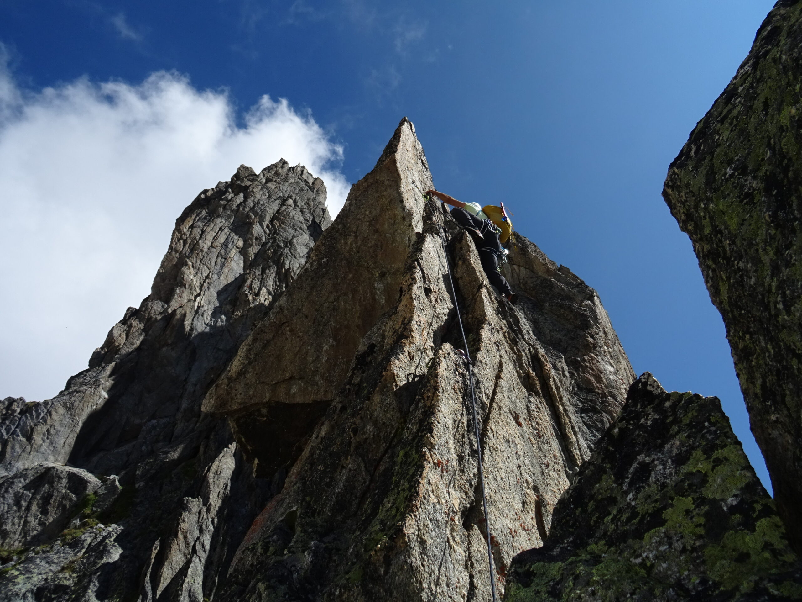
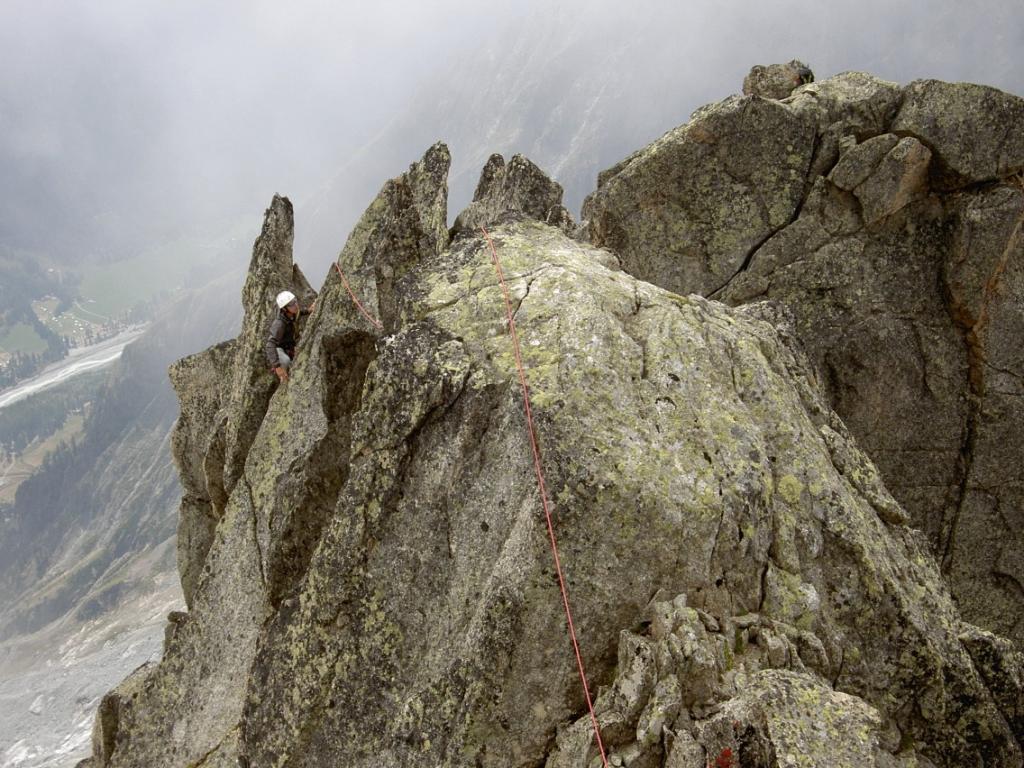
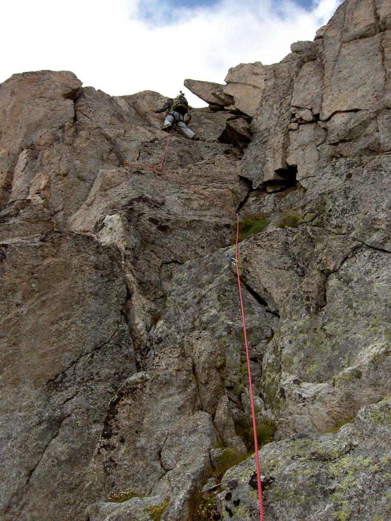
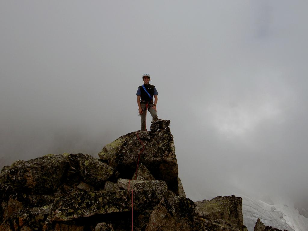
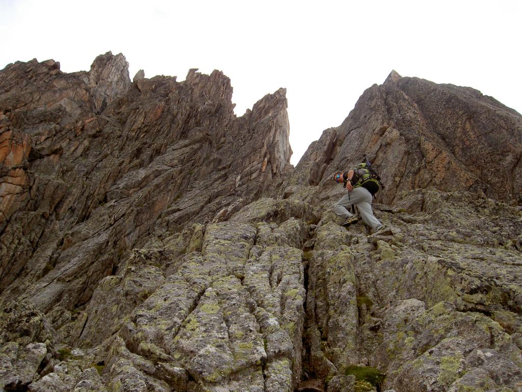
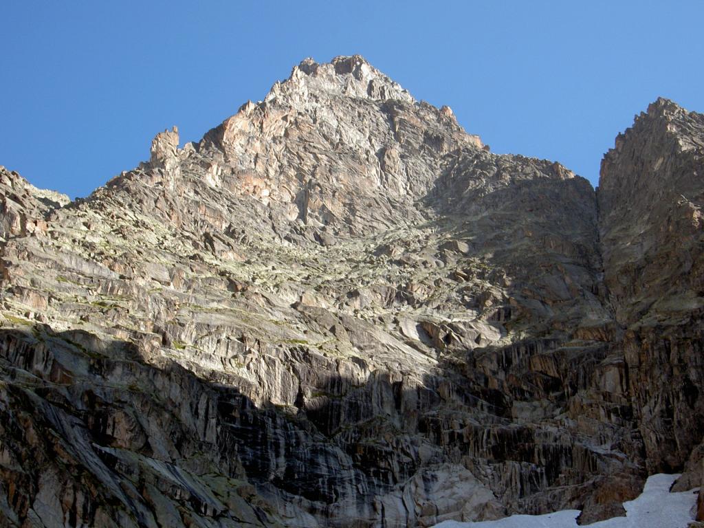
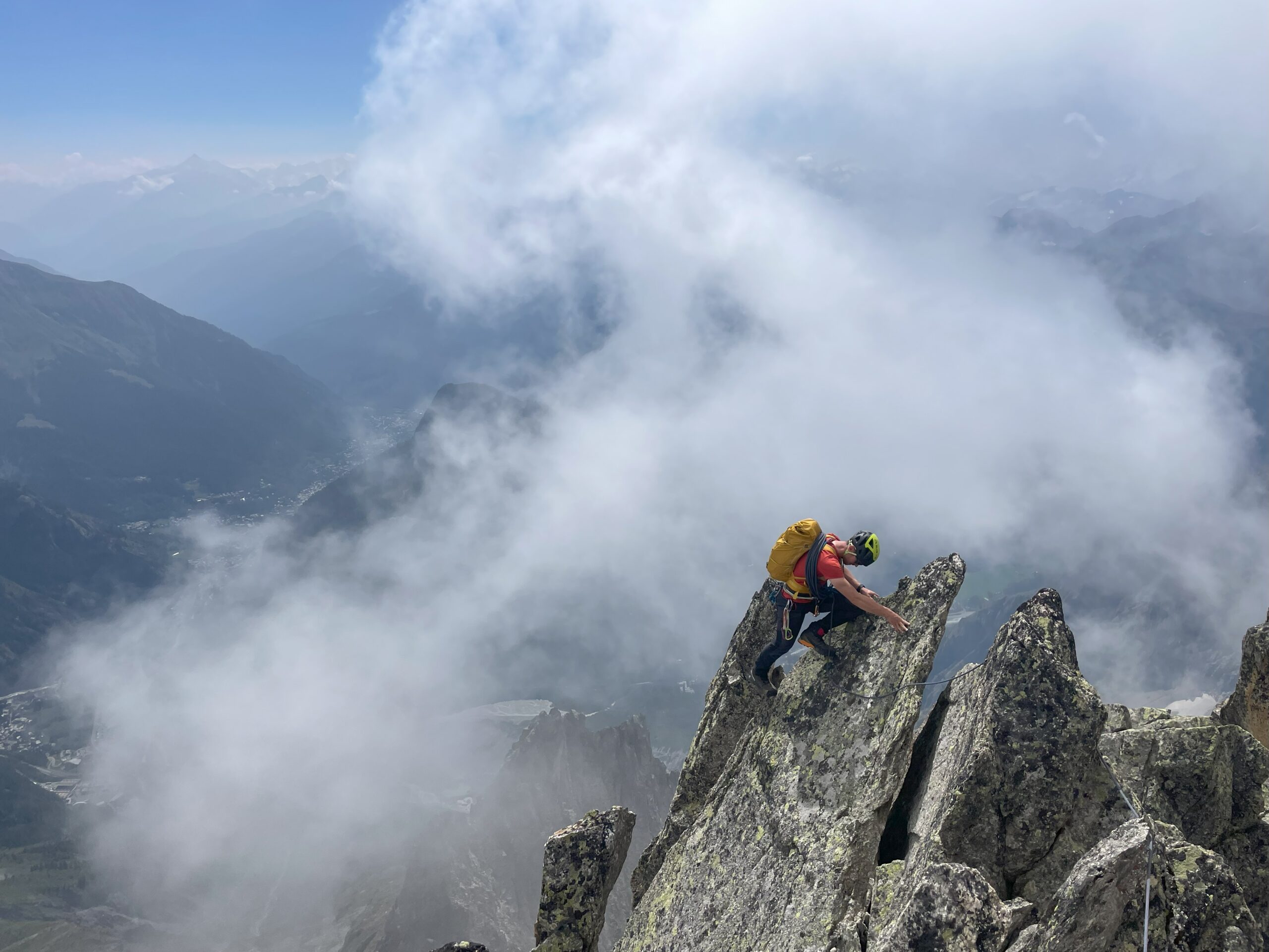
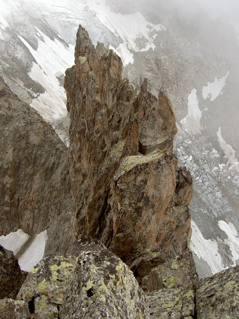
Superato il gendarme, si inizia la cresta vera e propria, che si affronta generalmente sul suo lato sx, con frequenti passaggi di III/+ (fix con cordino bianco). Superato un primo tratto più appoggiato si raggiunge un risalto più ripido, che si vince frontalmente (tiro di V+ attrezzato a fix) oppure per roccia più rotta a sx. Segue un tratto sempre in cresta sul IV/+, di bellissima roccia fessurata. Si attraversa con disarrampicata esposta e delicata un dentino in un tratto orizzontale di cresta (passo di IV in discesa o breve calata da attrezzare) e quindi si riprende a salire sul filo di ottima roccia (IV). Si scontorna a sx un tratto più verticale tramite un bel diedro-camino e quindi si esce di nuovo sul filo, qui più facile (III/+) e proprio a picco sulla parete sud. Ci si sposta brevemente verso dx per superare dei gradini ripidi (passi di IV) e quindi si raggiunge la terrazza alla base dell’ultimo salto (affrontabile al centro o a sx). Si scende brevemente a sx e quindi in breve, dopo un tratto più orizzontale molto scenografico (passo di IV), si raggiunge la cima dell’Aiguille de la Brenva (3297m).
Da qui due possibilità di discesa: dalla via normale della cresta (e poi versante Sud) e ritorno dal percorso di salita;
oppure (consigliato)
traversata della cresta Nord verso il colletto del Pere Eternel
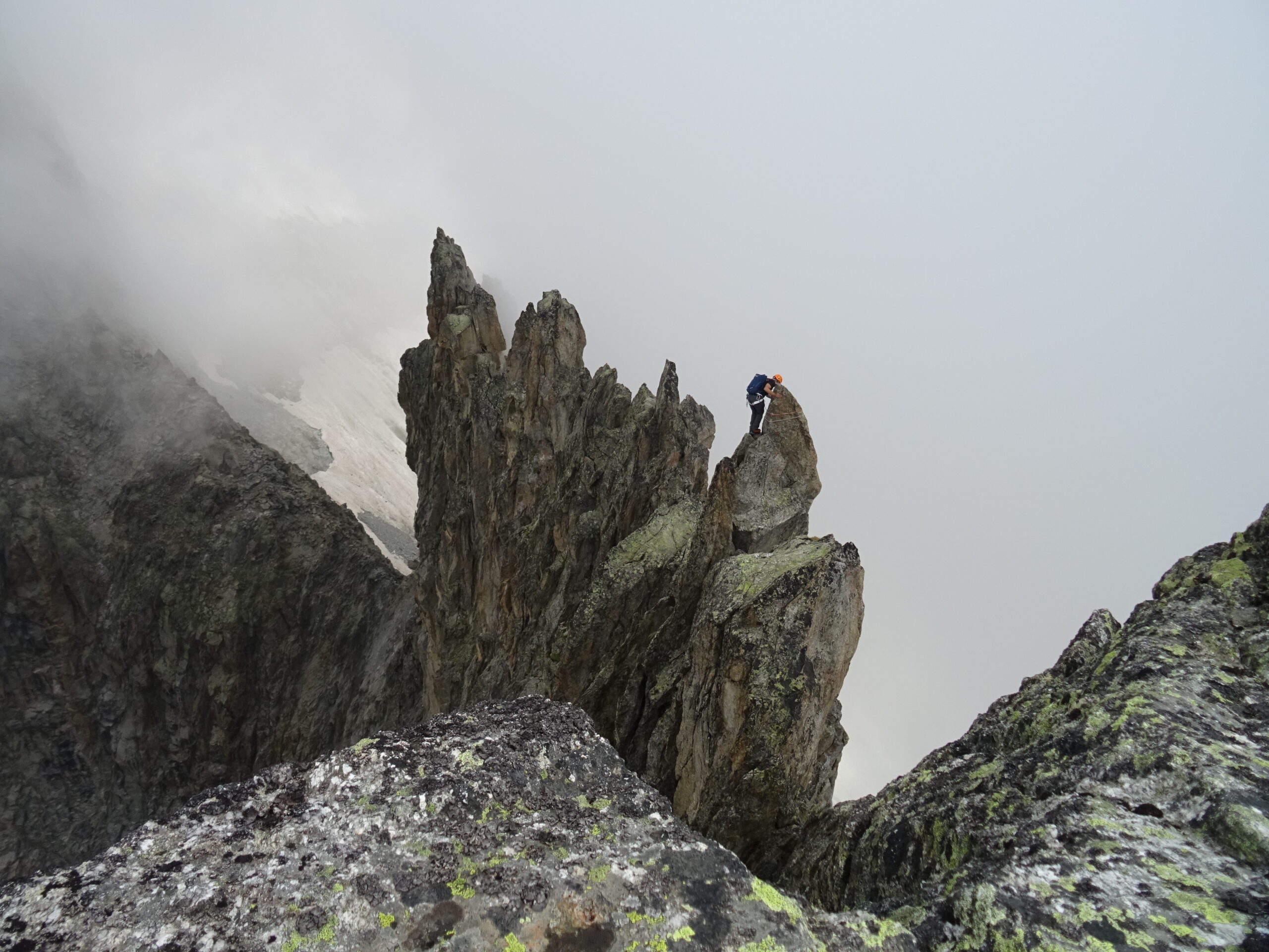
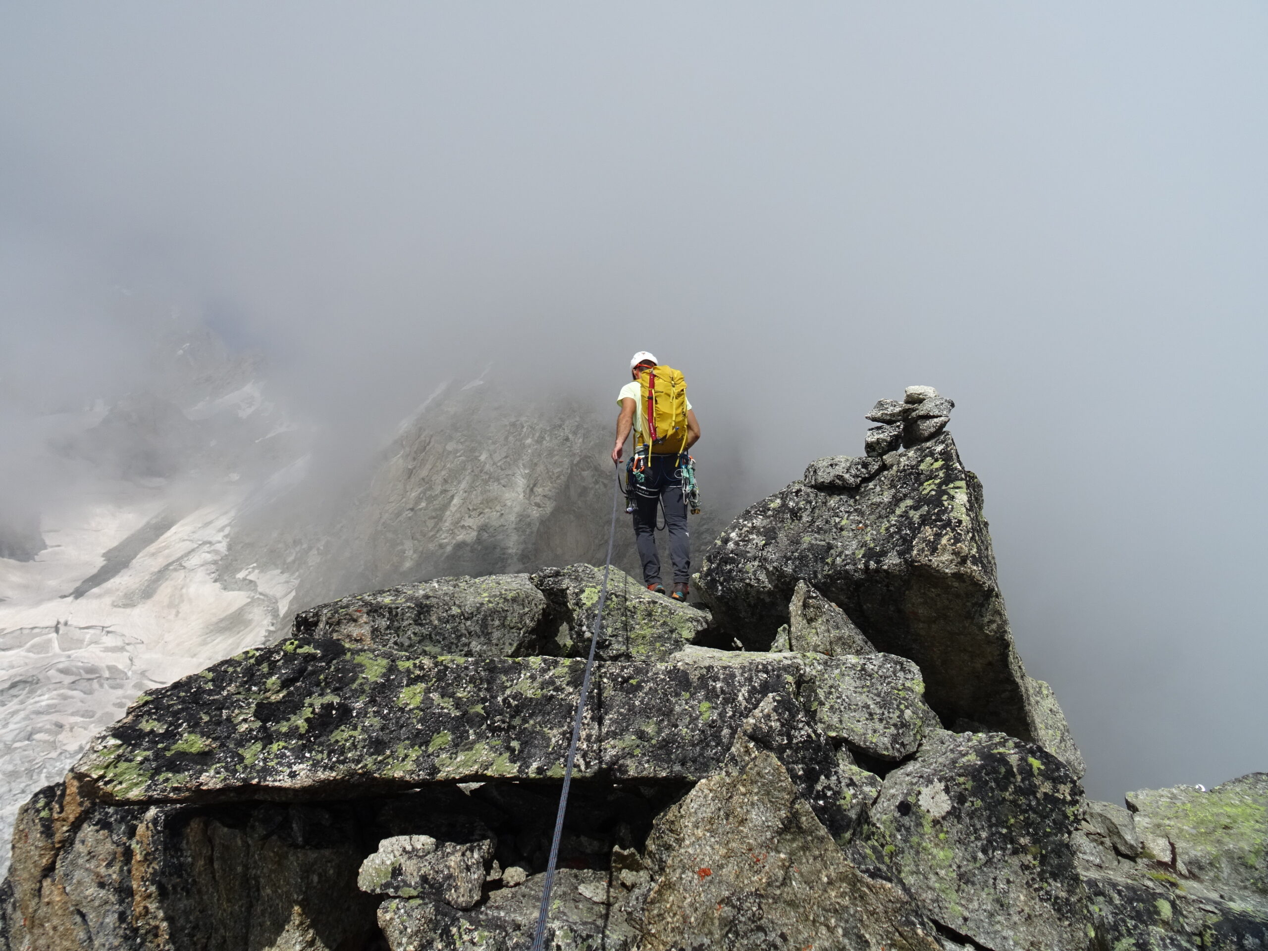
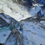
Dalla cima proseguire verso Nord e quindi effettuare subito una breve calata (sosta a fix, 7m). Proseguire brevemente in cresta, da questo punto in poi espostissima. Risalire un gradino roccioso (III) e quindi raggiungere una seconda calata (cordini su spuntone con maillon, eventualmente disarrampicabile, III+). Proseguire sul filo della cresta, in questo tratto quasi orizzontale ma non più largo di qualche metro. Segue un’altra breve calata (sosta a fix) e quindi un’altra in diagonale verso sx di una quindicina di metri. Si risale la cresta fino al passaggio della boit a lettre (suggestiva e non più larga di 70cm). Quindi si prosegue in cresta orizzontale (un ch. con cordino permette di scendere un gradino ripido e scomodo di 2m). Si raggiunge così l’ultima calata prima della cima Nord, da effettuare sempre un po’ in diagonale a sx. Dalla strettissima forcella risalire o a sx (lame aggettanti) o a dx (larga fessura) (in ogni caso passi di IV/+) fino in cima all’ultimo torrione della cresta (o cima Nord). Da qui si scende con 3 calate (15+25+30m) fino alla base della cima nord, in una stretta forcella con un gendarme che precede il Pere Eternel.
Calarsi quindi verso Est in un camino, raggiunti i fix della Papa Giovanni non farsi tentare da una sosta a dx ma scendere ancora verso sx (faccia a monte) verso una sosta un po’ nascosta (a monte di un salto verticale).
Da qui iniziano le 9-10 calate sulla via Papa Giovanni, tutte da max 30m e attrezzate a fix con anello di calata e cordone. In generale le prime vanno abbastanza rettiline, sulla sx di un canale. Quindi si attraversa il canale con una calata abbastanza diagonale (sosta non molto visibile) e quindi ci si cala lungo il filo di uno sperone per 2 doppie. Quindi decisamente a sx su belle placche compatte fino alla terminale (un’ultima calata tra parete e neve permette di raggiungere una piattaforma più a valle).
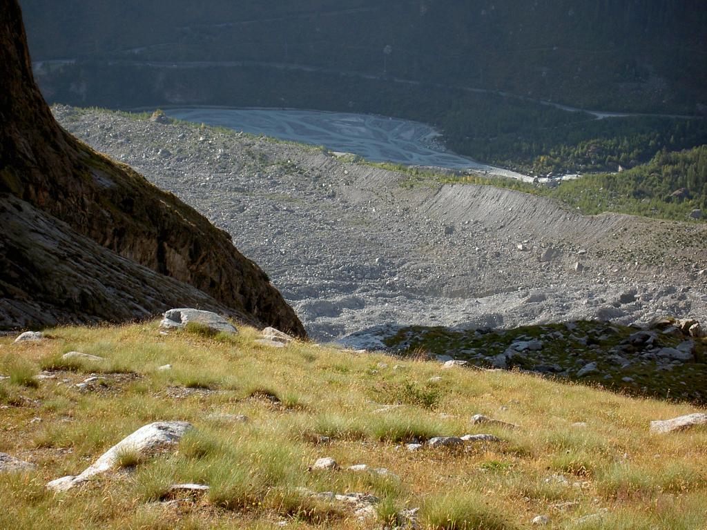
Dalla base della parete si scende verso dx la conca glaciale (nevai fino a stagione avanzata) e quindi al termine si traversa decisamente verso sx in direzione di una morena. Oltrepassata un grosso blocco si traversa decisamente verso sx cercando di perdere quota il meno possibile (intorno ai 2500m) fino a raggiungere il filo di una dorsale omettata, che in breve (sempre in traverso verso sx) porta al sentiero del Belvedere della Brenva (che si raggiunge intorno ai 2300m). Da lì in breve al Pavillon.
Lepiney
Riattrezzata 23-24 dalla GA F. Civra Dano e soci
Riattrezzata 23-24 dalla GA F. Civra Dano e soci
- Cartografia:
- L'Escursionista - Monte Bianco - fg 1 - 1:25000
- Bibliografia:
- Monte Bianco vol.1 - Gino Buscaini
Nelle vicinanze Mappa
Itinerari
13/08/2017 AO, Courmayeur D+ 1800 m PD+ Sud
Brenva (Bivacco della) da Entreves
 100m
100m
29/08/2017 AO, Courmayeur PD Sud-Ovest
Brenva (Bivacco della) dal Pavillon per il Mont de la Brenva
 150m
150m
06/07/2022 AO, Courmayeur D+ 1350 m TD Sud
Marbrées (Aiguilles), Cresta dello Jetoula – Via Panei-Chiornio
 1.8Km
1.8Km
27/09/2013 AO, Courmayeur D+ 1500 m AD Sud-Est
Bouteille de Triolet (la) da Arpnuva per il ghiacciaio del Triolet e la cresta E
 2.4Km
2.4Km
15/12/2016 AO, Courmayeur D+ 400 m ED- Est
Brenva (Aiguille de la) Milions Reasons
 3.7Km
3.7Km
12/09/2025 AO, Courmayeur D+ 1200 m F Sud-Est
Boccalatte-Piolti (Rifugio) da Planpincieux
 3.8Km
3.8Km
22/08/2024 AO, Courmayeur D+ 2200 m TD Sud
Peuterey (Aiguille Noire de) – Cresta Sud
 3.8Km
3.8Km
18/08/2023 AO, Courmayeur D+ 300 m TD- Sud
Gamba (Pic) Cresta Sud – Via Plat
 3.8Km
3.8Km
19/08/2023 AO, Courmayeur D+ 4500 m TD+ Tutte
Bianco (Monte) Cresta Integrale di Peuterey
 3.9Km
3.9Km
29/01/2022 AO, Courmayeur D+ 1470 m ED Nord-Ovest
Peuterey (Aiguille Noire de) – Supercouloir de Peuterey
 3.9Km
3.9Km