3.7Km
3.7Km

Note
 50m
3.3Km
4.1Km
4.1Km
4.1Km
4.3Km
4.5Km
4.5Km
50m
3.3Km
4.1Km
4.1Km
4.1Km
4.3Km
4.5Km
4.5Km
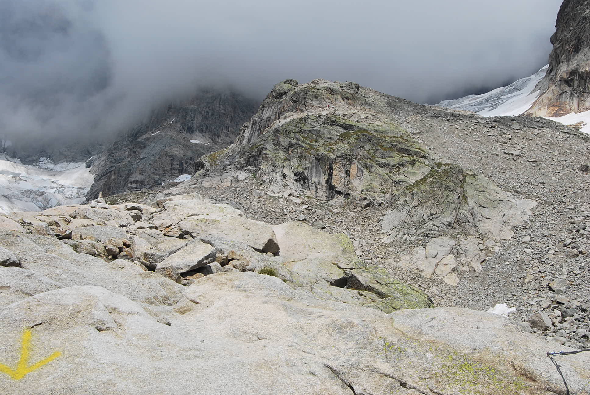
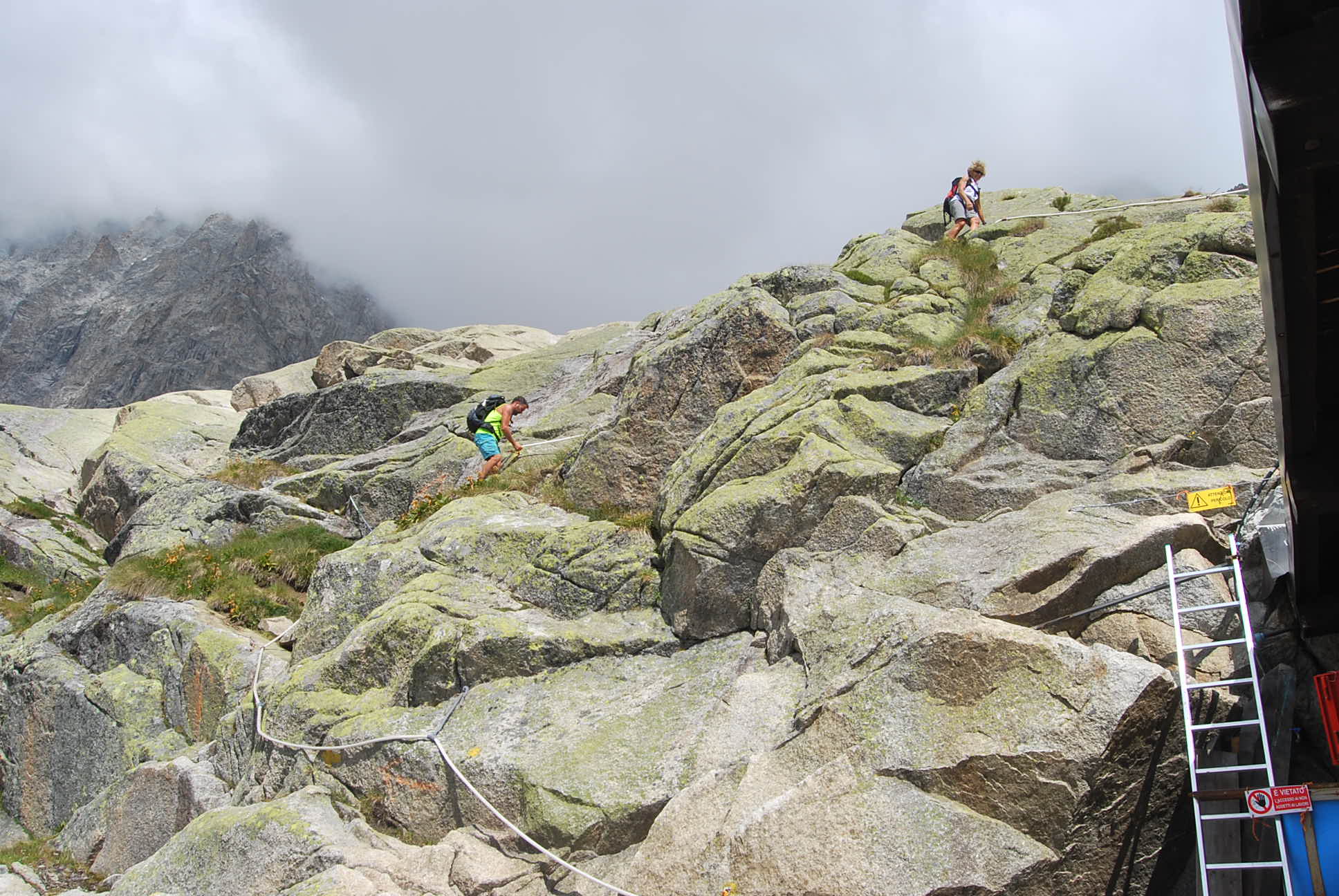
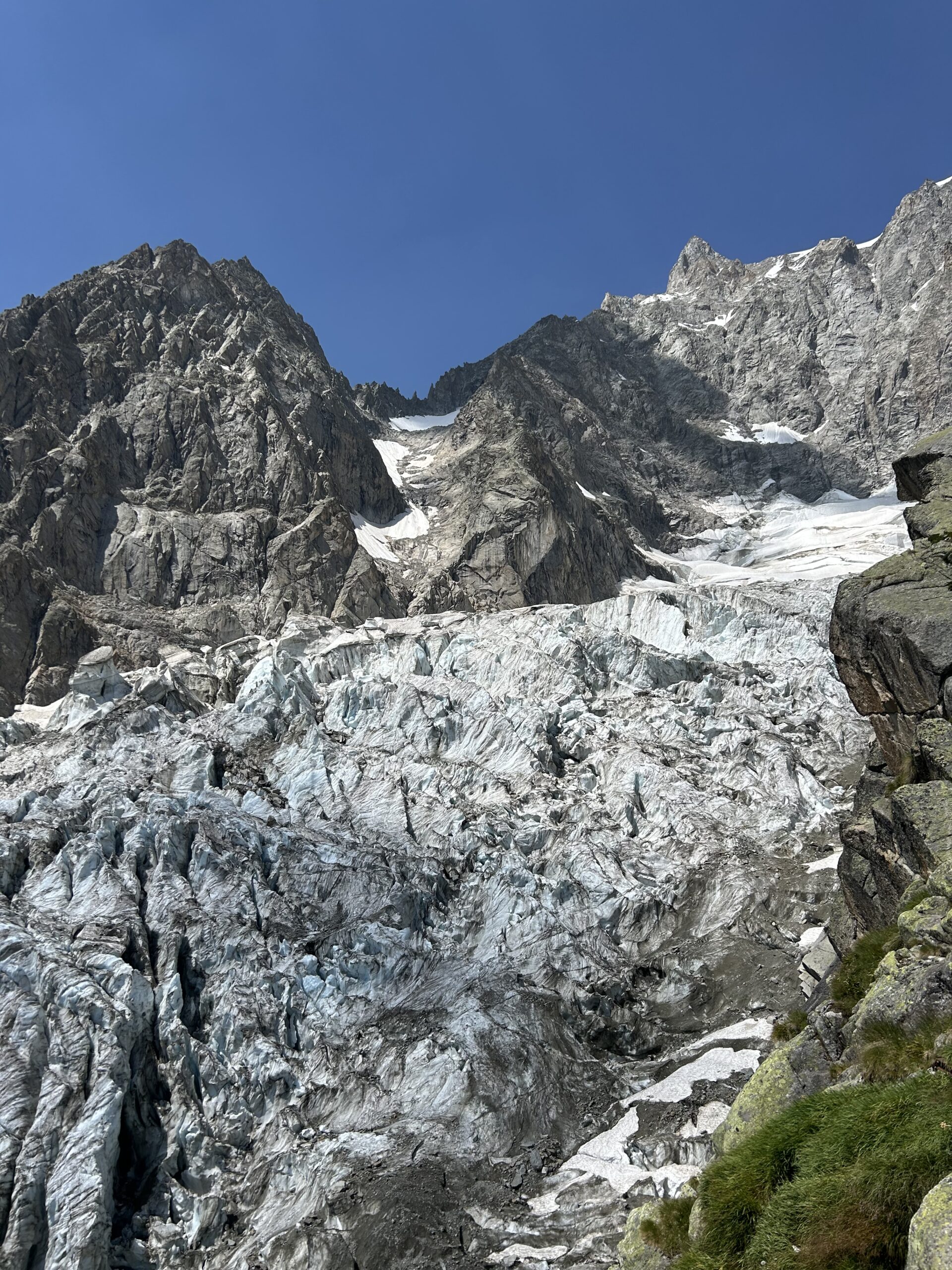
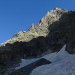
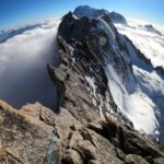
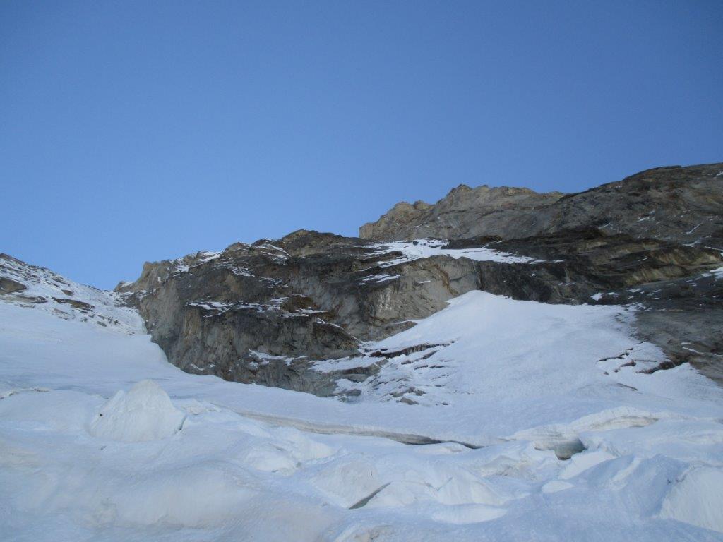
Prestare attenzione al traverso fra la morena e l'ultimo risalto con corde fisse: il ghiacciaio soprastante può riservare brutte sorprese (grossi blocchi di ghiaccio).
Avvicinamento
da Courmayeur lungo la Val Ferret fino a Planpincieux
Descrizione
Dal centro di Planpincieux prendere il sentiero indicato con segnavia n°21.
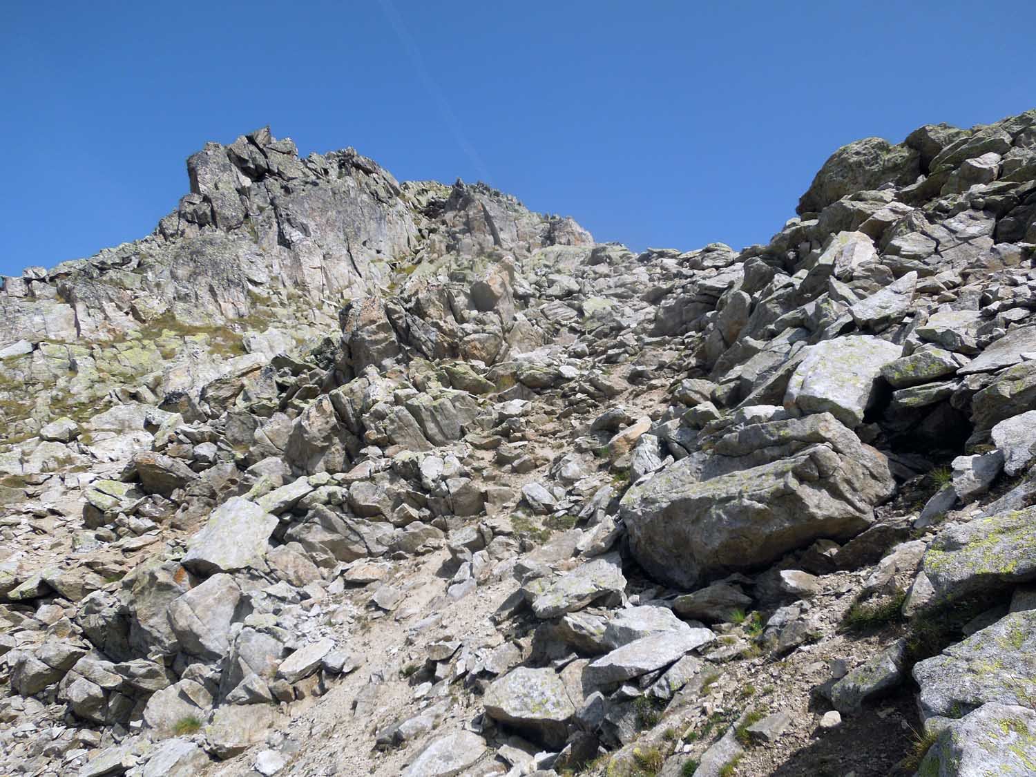
Inizialmente si sentiero percorre ampi pendii erbosi a cui segue un costone morenico in direzione della barriera di rocce oltre la quale si intravedono i seracchi del ghiacciaio di Planpinceaux.
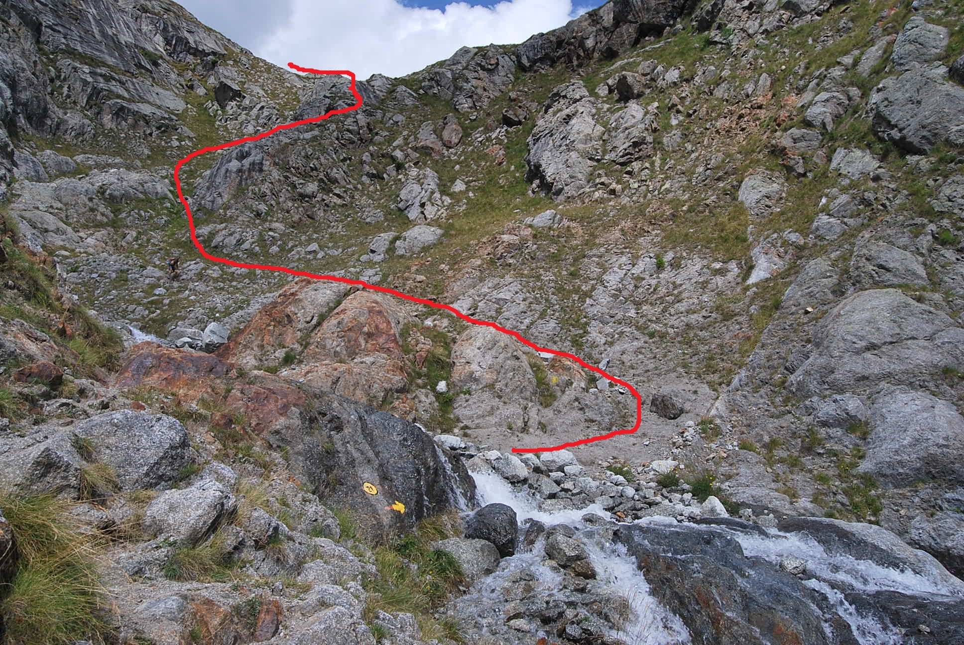
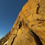
Raggiunta la base della bastionata (2000 mt circa) la si costeggia verso dx attraversando due canali (l’attraversamento del torrente può essere più complessa nelle ore più calde) e si risale la ripida traccia sul fianco opposto fino ad arrivare a un camino in cui una scala metallica facilità la risalita.
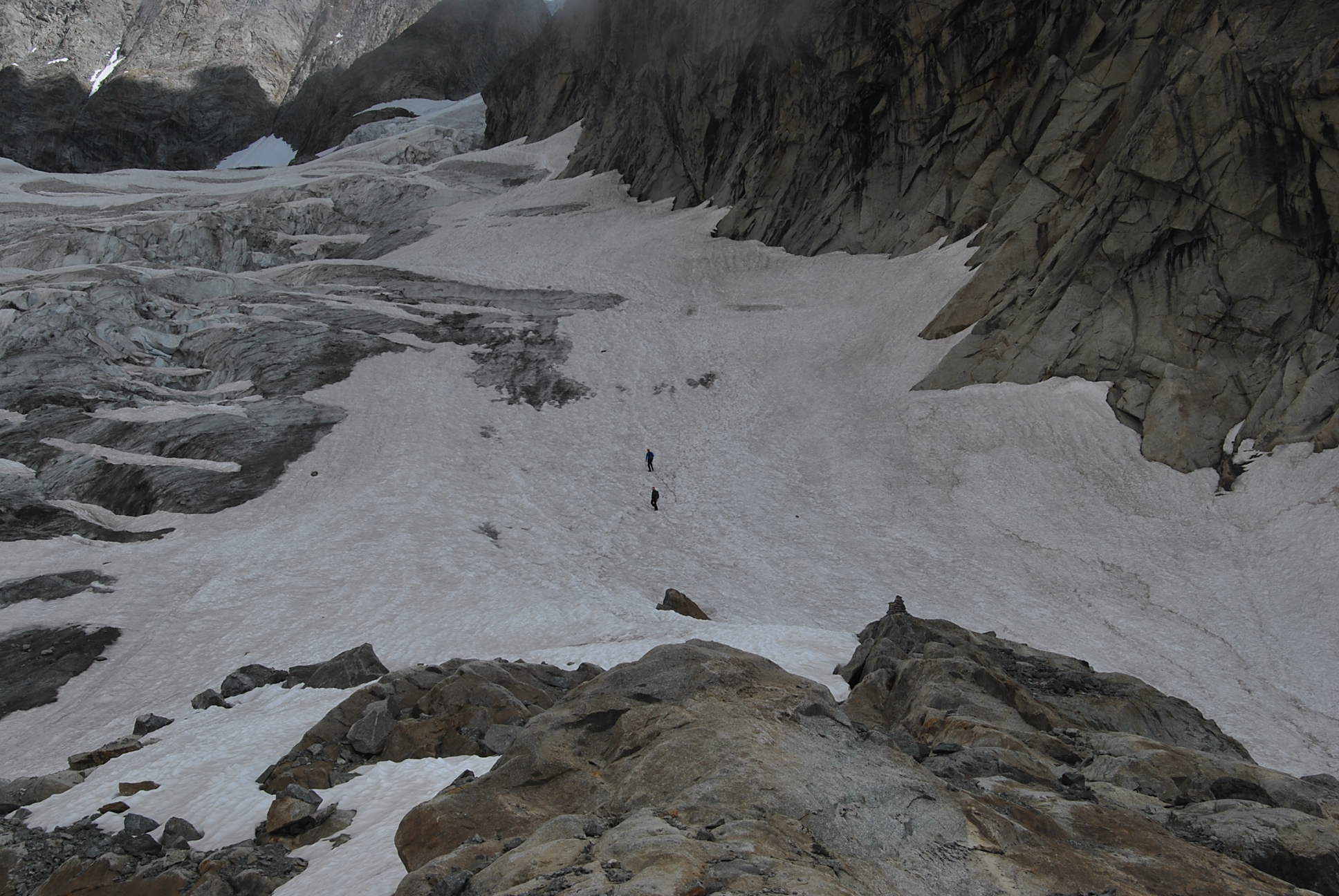
Il sentiero segue ora la morena tra il ghiacciaio di Planpincieux e quello delle Grandes Jorasses.
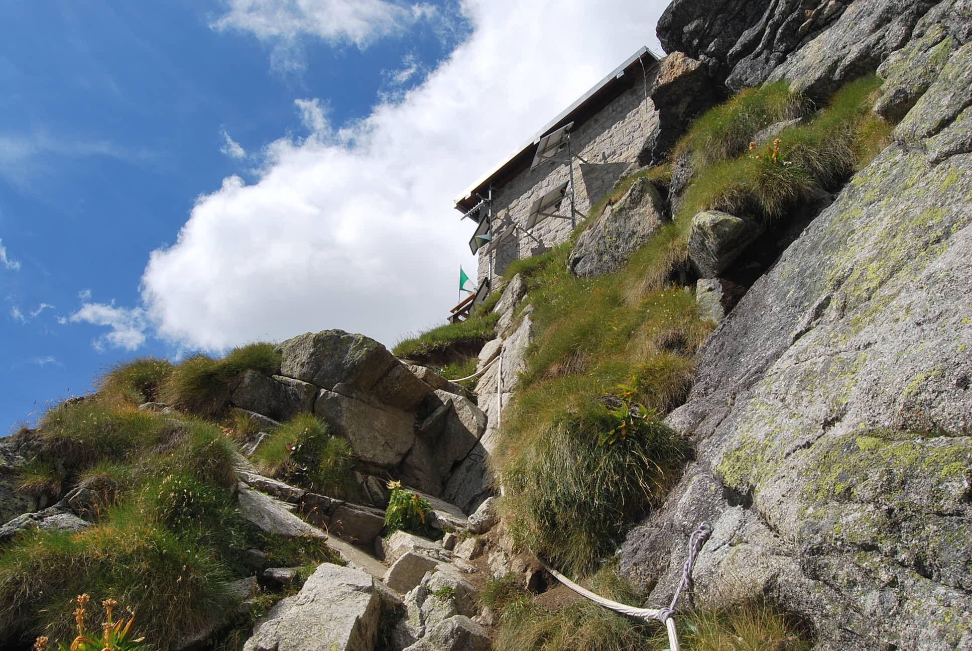
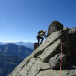
Al termine si traversa a sinistra sotto la fronte del ghiacciaio (attenzione a possibili crolli!) e si raggiunge lo sperone sopra il quale e posto il rifugio che si supera con l’aiuto di qualche corda fissa.
Superato l’ultimo esposto passaggio si raggiunge il rifugio.
Nelle vicinanze Mappa
Itinerari
09/07/2024 AO, Courmayeur D+ 2625 m AD Sud-Ovest
Grandes Jorasses Via Normale dal Rifugio Boccalatte-Piolti
 50m
50m
26/06/2018 AO, Courmayeur TD- Sud-Est
Grandes Jorasses, Punta Walker – Cresta Tronchey
2.2Km
20/11/2005 AO, Courmayeur ED Sud-Est
Grandes Jorasses – Ipercouloir
3.2Km
13/08/2017 AO, Courmayeur D+ 1800 m PD+ Sud
Brenva (Bivacco della) da Entreves
 3.3Km
3.3Km
06/06/2026 AO, Courmayeur D+ 1350 m TD Sud
Marbrées (Aiguilles), Cresta dello Jetoula – Via Panei-Chiornio
 4.1Km
4.1Km
29/08/2017 AO, Courmayeur PD Sud-Ovest
Brenva (Bivacco della) dal Pavillon per il Mont de la Brenva
 4.1Km
4.1Km
23/08/2024 AO, Courmayeur D+ 2000 m D Sud-Ovest
Brenva (Aiguille de la) cresta SO e traversata
 4.1Km
4.1Km
08/08/2025 AO, Courmayeur D+ 750 m ED Est
Grandes Jorasses, parete Est – Via Gervasutti-Gagliardone
 4.3Km
4.3Km
28/07/2024 AO, Courmayeur D+ 1800 m D Varie
Grandes Jorasses – Cresta Ovest
 4.5Km
4.5Km
13/09/2014 AO, Courmayeur D+ 650 m TD Nord
Grandes Jorasses – Petite MacIntyre
 4.5Km
4.5Km