3.5Km
3.5Km


Avvicinamento
 0m
50m
50m
50m
50m
750m
750m
750m
750m
0m
50m
50m
50m
50m
750m
750m
750m
750m
3.5Km
4.9Km
6.4Km
6.5Km
6.5Km
6.5Km
7.7Km
9.4Km
9.9Km
Risalita la Val di Susa per la SS24 o autostrada A32 uscita Oulx, si prosegue fino a Cesana, e poi per il Colle del Monginevro. Superata la ex dogana francese, senza arrivare nell'abitato di Montgenevre, si devia a destra per il Village du Soleil, ma poco prima di raggiungerlo si parcheggia a bordo strada in corrispondenza del cartello che indica lo Chaberton.
Descrizione
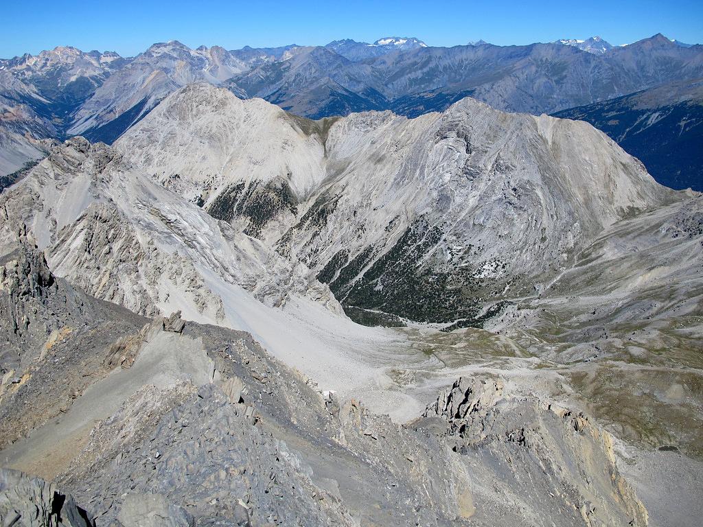
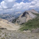
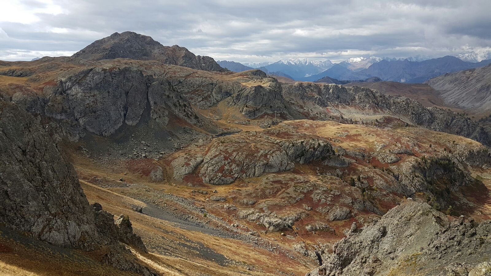
Da Claviere, risalire il vallone des Baisses e trascurando il sentiero di dx per lo Chaberton, proseguire per aperti pendii raggiungendo il Colle des Trois Freres Mineurs.
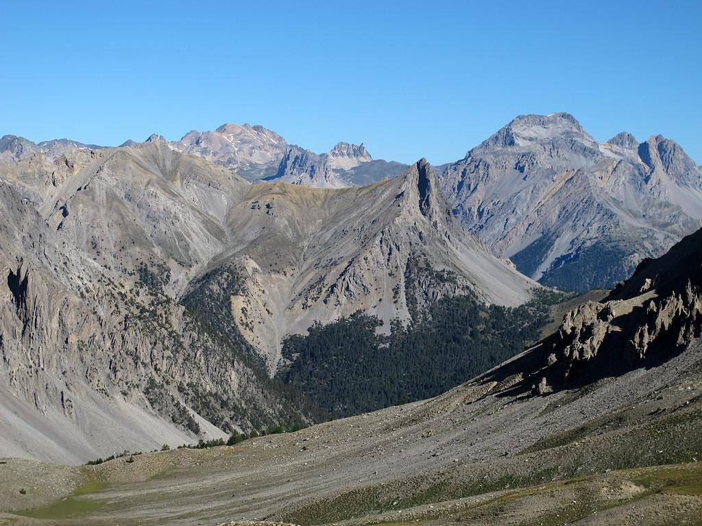
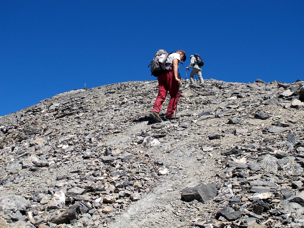
Scendere per un centinaio di metri sul versante opposto, quindi deviando a dx risalire alla meglio il pendio via via più ripido di sfasciumi e detriti (presente qualche vago ometto) raggiungendo il Passo dell’Asino.
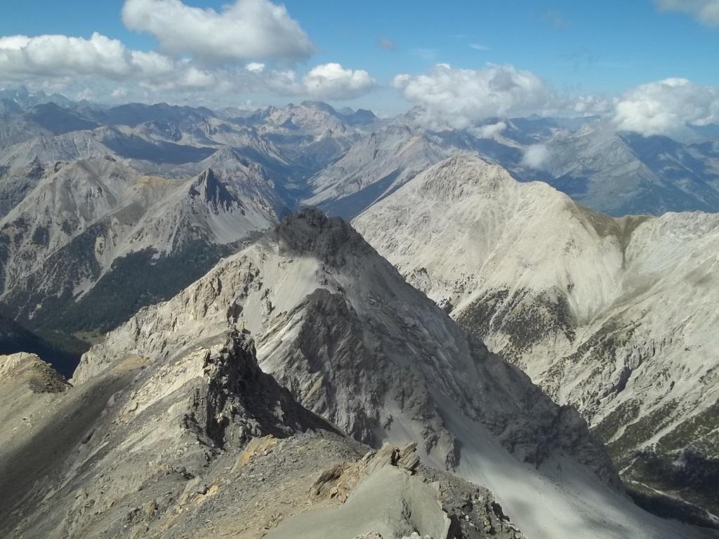
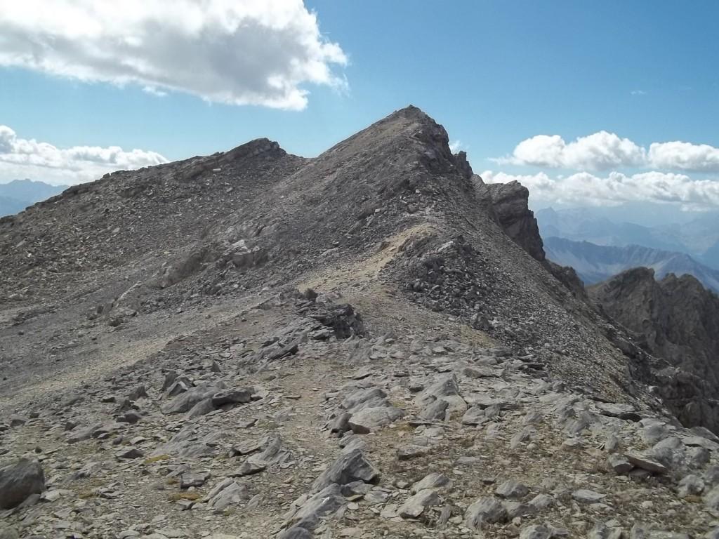
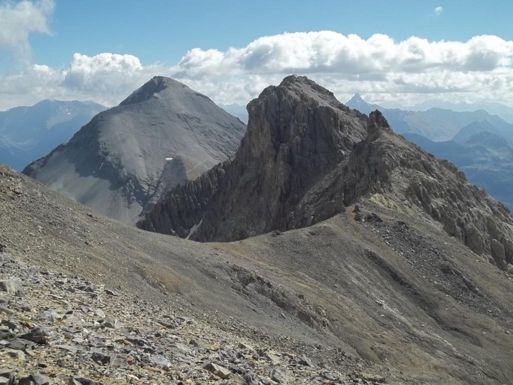
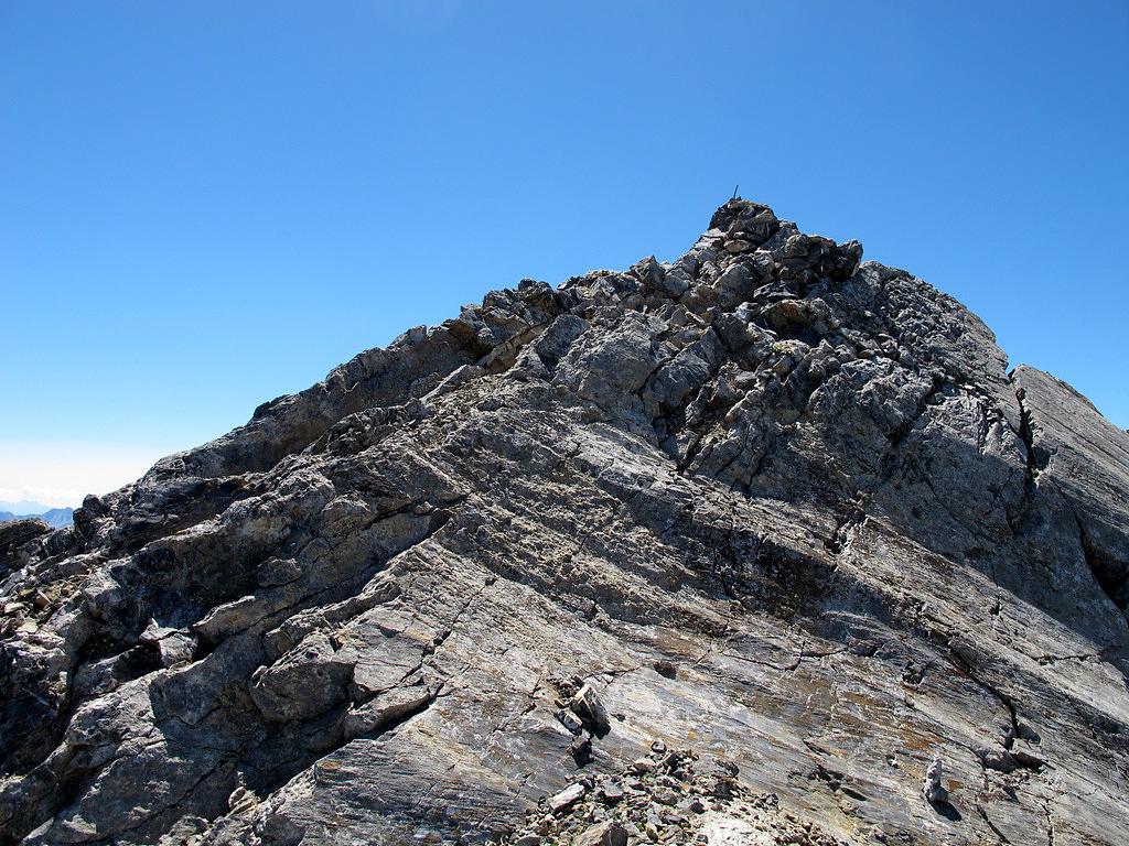
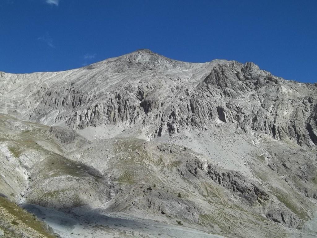
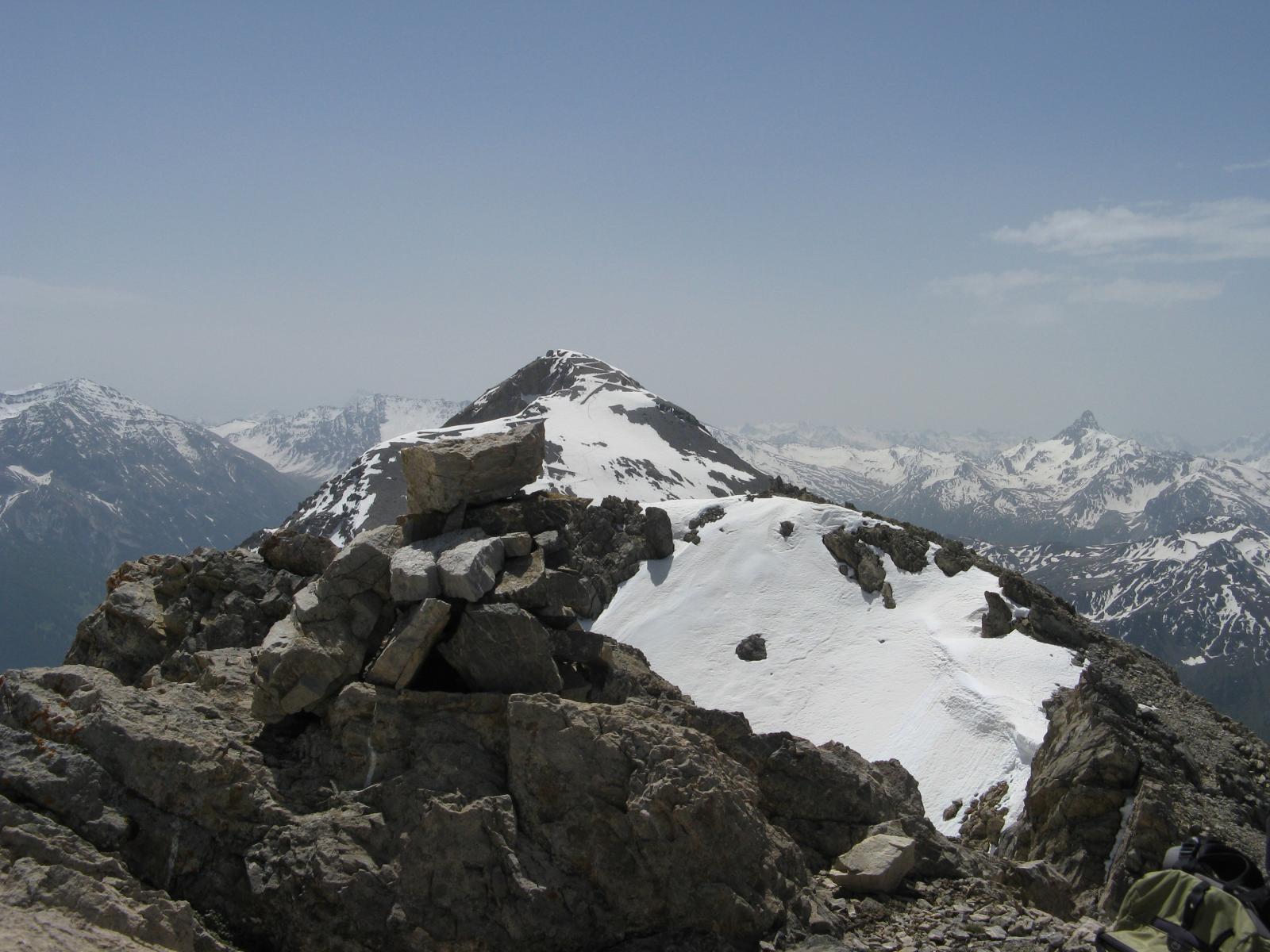
Volgendo ora a sinistra, per facile cresta, in breve si raggiunge la Pointe de Chalance Ronde (croce di legno). Ritornati al passo, proseguendo a destra aggirando un torrione sul suo lato destro, risalita una china di detriti si toccano in successione la Punta 3047 m, e poi piegando leggermente a destra si arriva ad un altopiano alla base delle roccette della Point des Rochers Charniers 3067 m, che si salgono senza difficoltà.
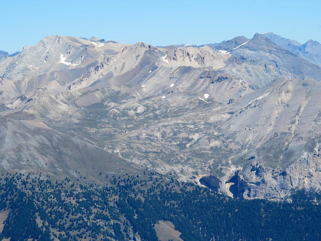
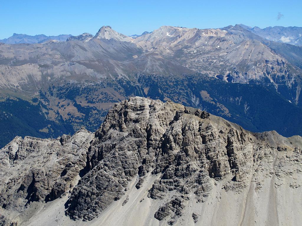
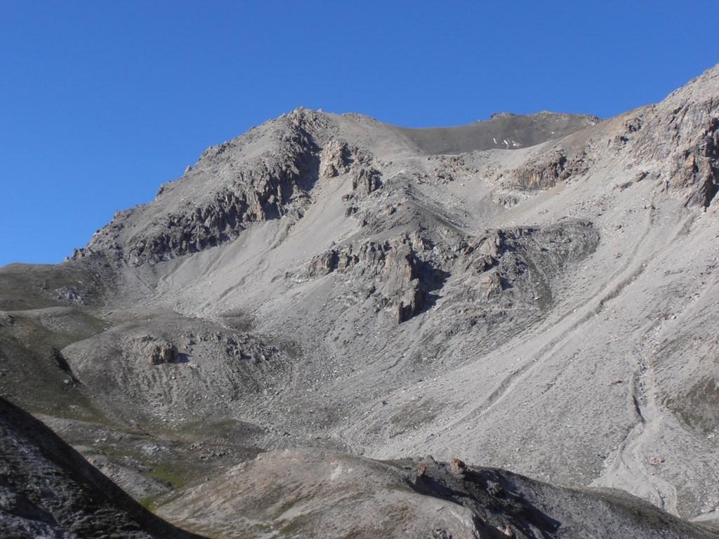
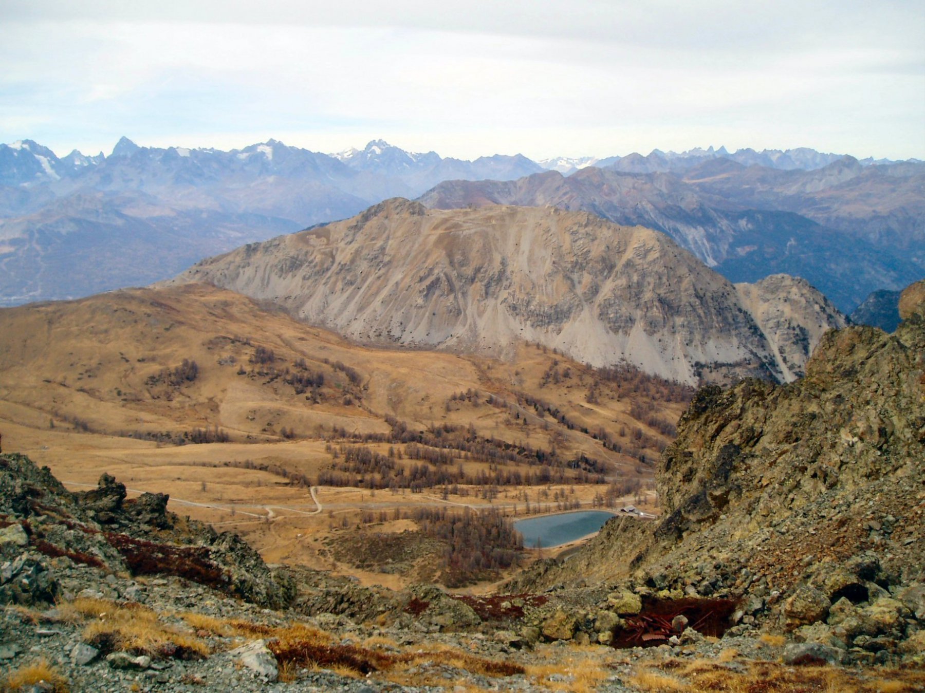
Per la discesa, senza rifare il percorso dell’andata che prevede il ritorno al Passo dell’Asino, la discesa e poi la risalita di 100 m al col des Trois Freres Mineurs, è possibile proseguire dai Rochers Charniers verso sud-ovest, evitando un primo canalone che scende molto direttamente, per proseguire su un pendio di moderata pendenza (sfasciumi) che termina con un pianoro innevato a inizio stagione. Da questo un secondo pendio-canalone con tracce prevalentemente sul lato destro (terreno più solido) consente di scendere rapidamente nel Vallon des Baisses, dove si ritrova il sentiero percorso all’andata.
- Cartografia:
- Fraternali 1:25000 n.1 Alta Valle di Susa
Nelle vicinanze Mappa
Itinerari
09/07/2026 Hautes-Alpes, Montgenèvre D+ 1251 m E Varie
Chaberton (Monte) da Montgénevre per il Colle dello Chaberton
 0m
0m
11/09/2016 Hautes-Alpes, Montgenèvre D+ 1050 m EE/F Sud
Curé (Pas du) da Montgenevre per il Col des Trois Frères Mineurs
 50m
50m
28/06/2026 Hautes-Alpes, Montgenèvre D+ 1200 m E Sud
Lauzin (Pic du) da Montgenevre, anello per Pointe Dormillouse, Grand Chalvet, Serre Thibaud
 50m
50m
08/06/2014 Hautes-Alpes, Montgenèvre D+ 1176 m EE Sud
Trois Scies (Pointe des) da Montgenevre per il Colle dello Chaberton
 50m
50m
20/07/2017 Hautes-Alpes, Montgenèvre D+ 1213 m EE/F Sud-Ovest
Rochers Charniers (Pointe des) da Monginevro per il canalone S-O
 50m
50m
30/08/2025 Hautes-Alpes, Montgenèvre D+ 790 m E Nord
Gimont (Mont) o Grand Charvia da Montgenèvre per la Valle dei Mandarini e il Colletto Verde
 750m
750m
20/06/2017 Hautes-Alpes, Montgenèvre D+ 750 m EE/F Sud-Ovest
Verde (Colletto) da Montgenèvre per il Colletto Guignard
 750m
750m
20/07/2025 Hautes-Alpes, Montgenèvre D+ 750 m E Ovest
Plane (Monte la) da Montgenevre per la Valle dei Mandarini e Col Guignard
 750m
750m
11/08/2025 Hautes-Alpes, Montgenèvre D+ 830 m E Varie
Chenaillet (le) da Montgenèvre
 750m
750m
31/12/2006 TO, Claviere D+ 268 m E Varie
Quitaine (Mont) da Claviere
1.1Km
Servizi
3.5Km
4.9Km
La vachette Bar
Montgenèvre
6.4Km
Casa Cesana Bar
Cesana Torinese
6.5Km
L’Ibarus Rifugio
Cesana Torinese
6.5Km
Piergiorgio Frassati B&B
Cesana Torinese
6.5Km
Ottima Scelta Ristorante
Cesana Torinese
7.7Km
Terre Rouge Rifugio
Cervières
9.4Km
Centro Ristorante
Cesana Torinese
9.9Km