 600m
600m


Note
 50m
50m
50m
50m
700m
700m
950m
2.6Km
2.6Km
50m
50m
50m
50m
700m
700m
950m
2.6Km
2.6Km
600m
3.3Km
3.5Km
3.5Km
5.3Km
7.1Km
7.3Km
8.7Km
8.7Km
8.9Km
La Rocca Cernauda è situata sulla costa che dalla Rocca Beccas sale fino alla cima del M.Tibert,e che comprende il M.Chialmo,Plum,e Rocca Albert,poi Costa Balòu e Cernauda. La gita quì descritta permette di scoprire un angolino poco conosciuto della valle Grana con delle bellissime borgate ristrutturate come Valliera e Betuira,oltre al paesino abbandonato con abitazioni crollate o pericolanti di l'Arbona o Narbona situato in un luogo così lontano e isolato,abitato fino alla fine degli anni 50. A Narbona si possono seguire due itinerari il Primo porta alla Bassa di Narbona (ind.M.Crosetta Monte Tibert, Santuario di San Magno sentiero R17) che salendo la comba si superano dei rii la grange Casalas un altro rio (nel periodo invernale si trovano ghiacciati)fino ad arrivare quasi al termine della comba sulla distesa prativa superiore,seguendo le tracce e paletti di legno si raggiunge il sentiero GTA che proviene dal colle Crocetta,seguendolo si incontra una palina segnaletica si seguono le ind. Bassa di Narbona,una volta raggiunta si segue la sterrata abbandonandola poco più avanti per seguire sulla dx la traccia in direzione della montagnola più alta che è la cima Cernauda. Dalla cima si scende in direzione est fino alla palina della cresta Balòu si seguono i paletti di legno e la traccia lungo la Cresta del Babon fino a giungere sulla strada sterrata,seguendola dopo un centinaio di metri si giunge presso la Rocca la Bercia dove si trovano le indicazioni per Colletto. Il Secondo itinerario è quello della descrizione.Inoltre volendo si può salire con la macchina fino a Valliera e seguire a piacimento più itinerari.
Avvicinamento
Da Cuneo seguire le indicazioni valle Grana,si superano i paesi di Caraglio e Pradleves salendo con direzione Santuario di S.Magno,prima di Campomolino si incontra una deviazione a dx per Colletto,si posteggia l'auto nel parcheggio antistante la borgata.
Descrizione
Da Colletto si scende per un cinquantina di metri seguendo la strada asfaltata,si gira a dx si sale per una sessantina di metri fino a seguire un bel sentiero sulla sx con indicazioniNarbona R9, si raggiunge un punto panoramico con edicola della Madonna,dall’alto si può ammirare il fascino del torrente Narbona sempre ghiacciato nel periodo invernale,poi tra saliscendi si sale la comba di Narbona fino a giungere al paesino abbandonato di Narbona. Arrivati all’incrocio dei sentieri seguire il sentiero indicazioni Rocca Cernauda, dopo poco si raggiunge un altro punto panoramico,si prosegue fino a giungere alla grange Coulbertrand dove si incontra la strada sterrata che perviene da Valliera, la si segue per un tratto pianeggiante fino a giungere nei pressi della Rocca la Bercia (dove volendo al ritorno la si può salire) dove inizia la Cresta del Babon lunga circa 2 km ed un dislivello di circa 600 m. Prima di arrivare a Rocca la Bercia si incrocia a sx una strada la si segue e dopo una cinquantina di metri si sale per prati a sx seguendo la traccia fino a raggiungere la palina della cresta Balòu,si gira a sx e si prosegue in direzione dell’ometto della cima. Al ritorno raggiunta la sterrata la si segue fino alla Rocca Bercia dove si trova la palina con indicazioni per Colletto e completare il giro ad anello.
- Cartografia:
- I.G.C. n°7 Valli Maira Grana e Stura
Nelle vicinanze Mappa
Itinerari
30/10/2020 CN, Castelmagno D+ 200 m E Sud-Ovest
Narbona (Borgata) da Colletto
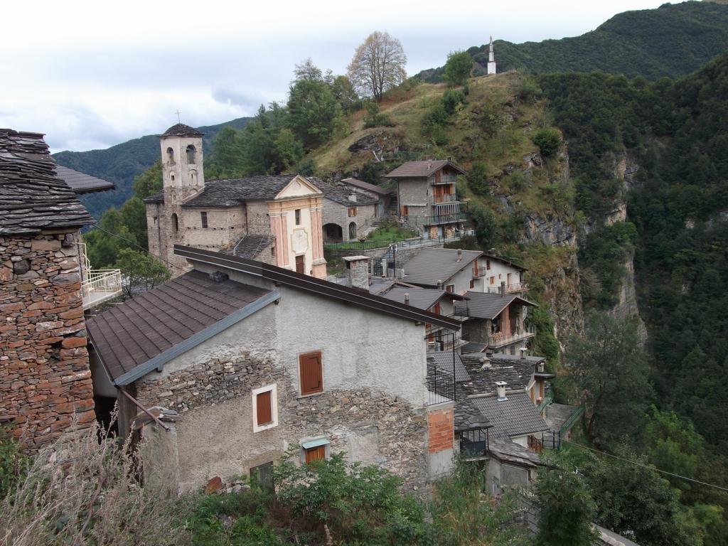 50m
50m
10/11/2024 CN, Castelmagno D+ 851 m E Sud-Est
Plum (Monte) da Colletto
 50m
50m
10/11/2024 CN, Castelmagno D+ 1150 m EE Sud
Cernauda (Rocca della) da Colletto per il Colle della Margherita, Monte Plum e cresta del Balou
 50m
50m
10/04/2023 CN, Pradleves D+ 750 m E Sud
Chialmo (Monte) da Colletto per il Colle Margherita
 50m
50m
28/05/2025 CN, Castelmagno D+ 1044 m E Varie
Cucuja o Cucuia (Rocca) da Campomolino
 700m
700m
04/07/2021 CN, Castelmagno D+ 1054 m E Nord-Ovest
Crosetta (Monte) da Campomolino per il Vallone di Narbona
 700m
700m
16/11/2022 CN, Pradleves D+ 1250 m E Sud
Cernauda (Rocca della) anello per il Monte Chialmo e Monte Plum
 950m
950m
04/11/2017 CN, Pradleves D+ 1270 m E Sud
Chialmo (Monte) da Praldeves per Borgate Narbona, Batuira e Valliera
1.8Km
27/11/2024 CN, Castelmagno D+ 1250 m E Sud
Chialmo (Monte) per il versante Sud e le Punte Freura, Cauri e Mezzogiorno
 2.6Km
2.6Km
14/05/2012 CN, Castelmagno D+ 850 m EE Sud
Rio (Rocche del) da Pravdleves, anello per Cauri e Campofei
 2.6Km
2.6Km
Servizi
600m
3.3Km
Monte Tibert Rifugio
Castelmagno
3.5Km
Des Martin B&B
Castelmagno
3.5Km
La Valliera Rifugio
Castelmagno
5.3Km
La Font Albergo
Castelmagno
7.1Km
La Pace Locanda del Castelmagno Albergo
Pradleves
7.3Km
Tre verghe d’oro Albergo
Pradleves
8.7Km
Locanda Rifugio
Celle di Macra
8.7Km
Carbonetto Rifugio
Demonte
8.9Km



