150m
150m


Note
Storico
 50m
50m
2Km
2.5Km
2.6Km
2.7Km
2.7Km
2.7Km
2.7Km
2.7Km
50m
50m
2Km
2.5Km
2.6Km
2.7Km
2.7Km
2.7Km
2.7Km
2.7Km
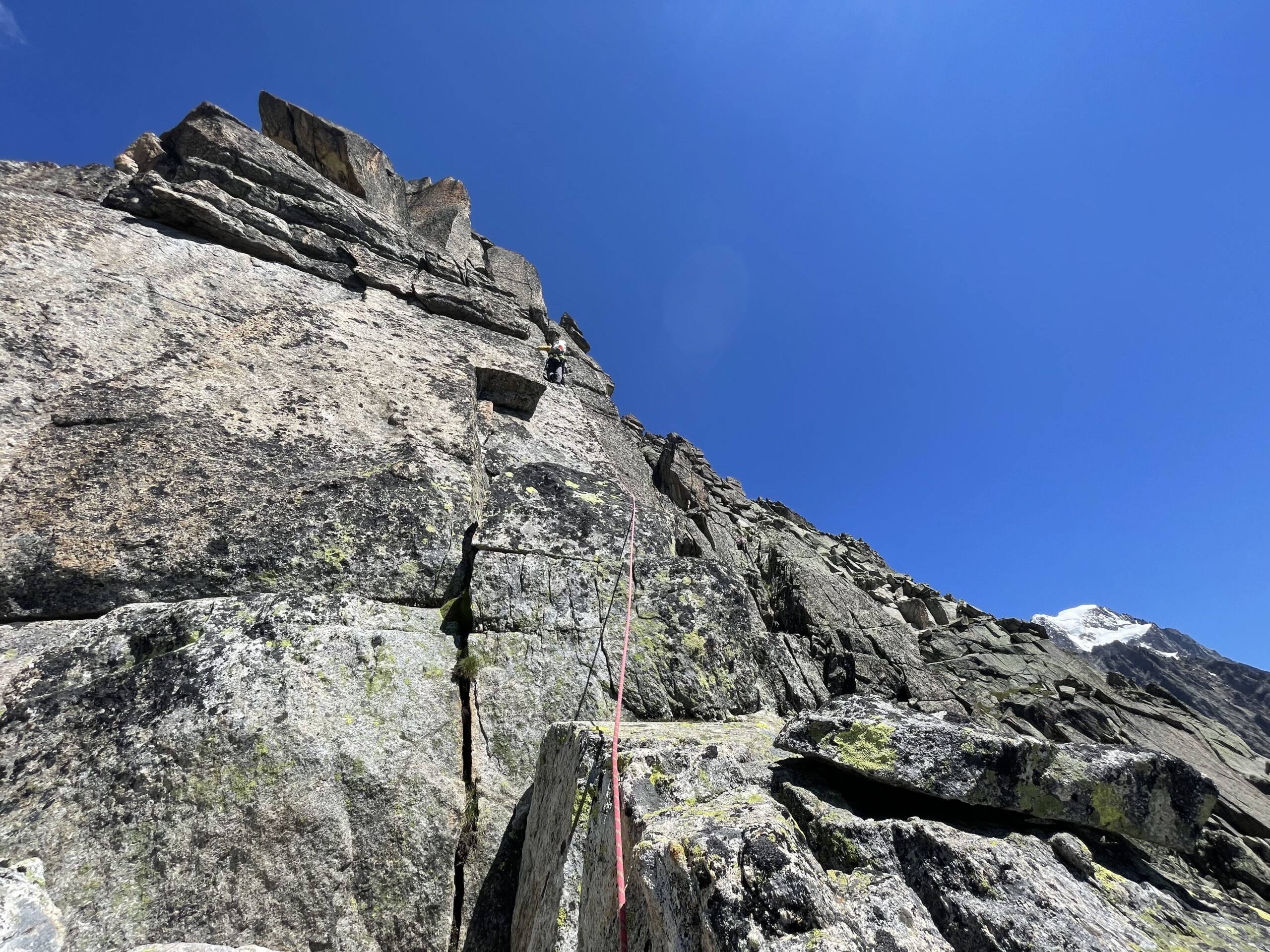
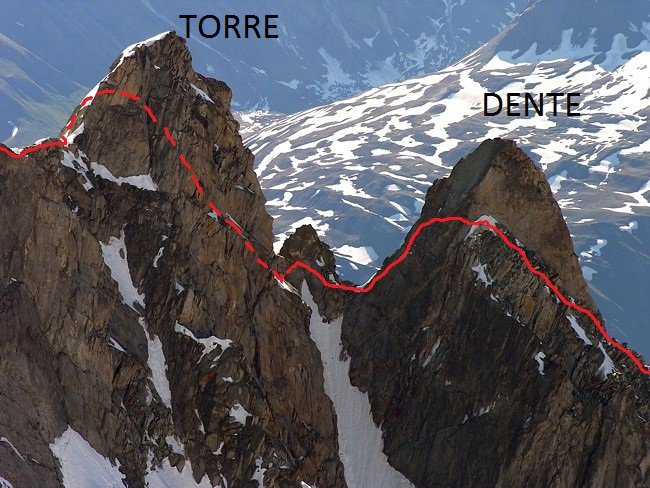
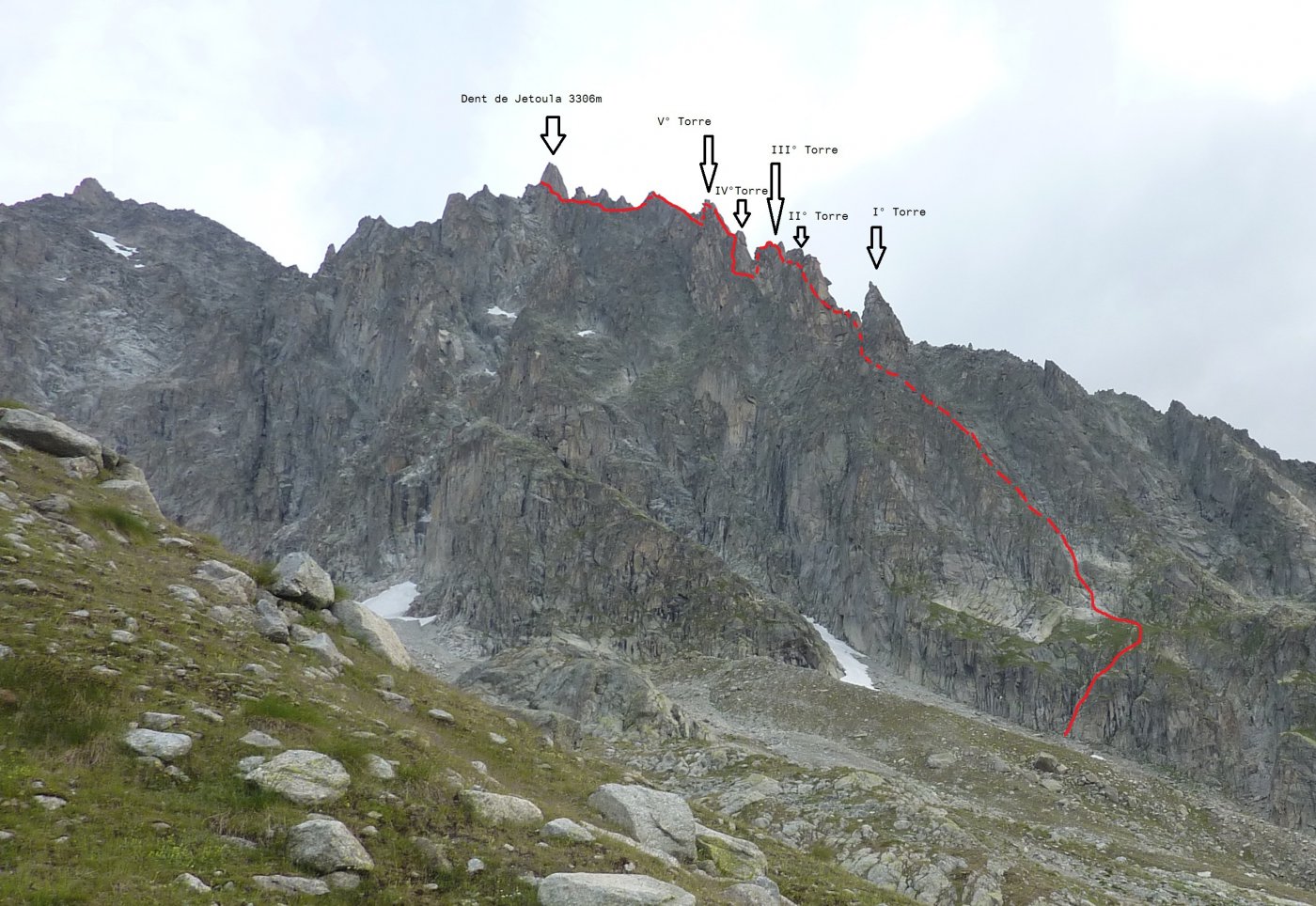
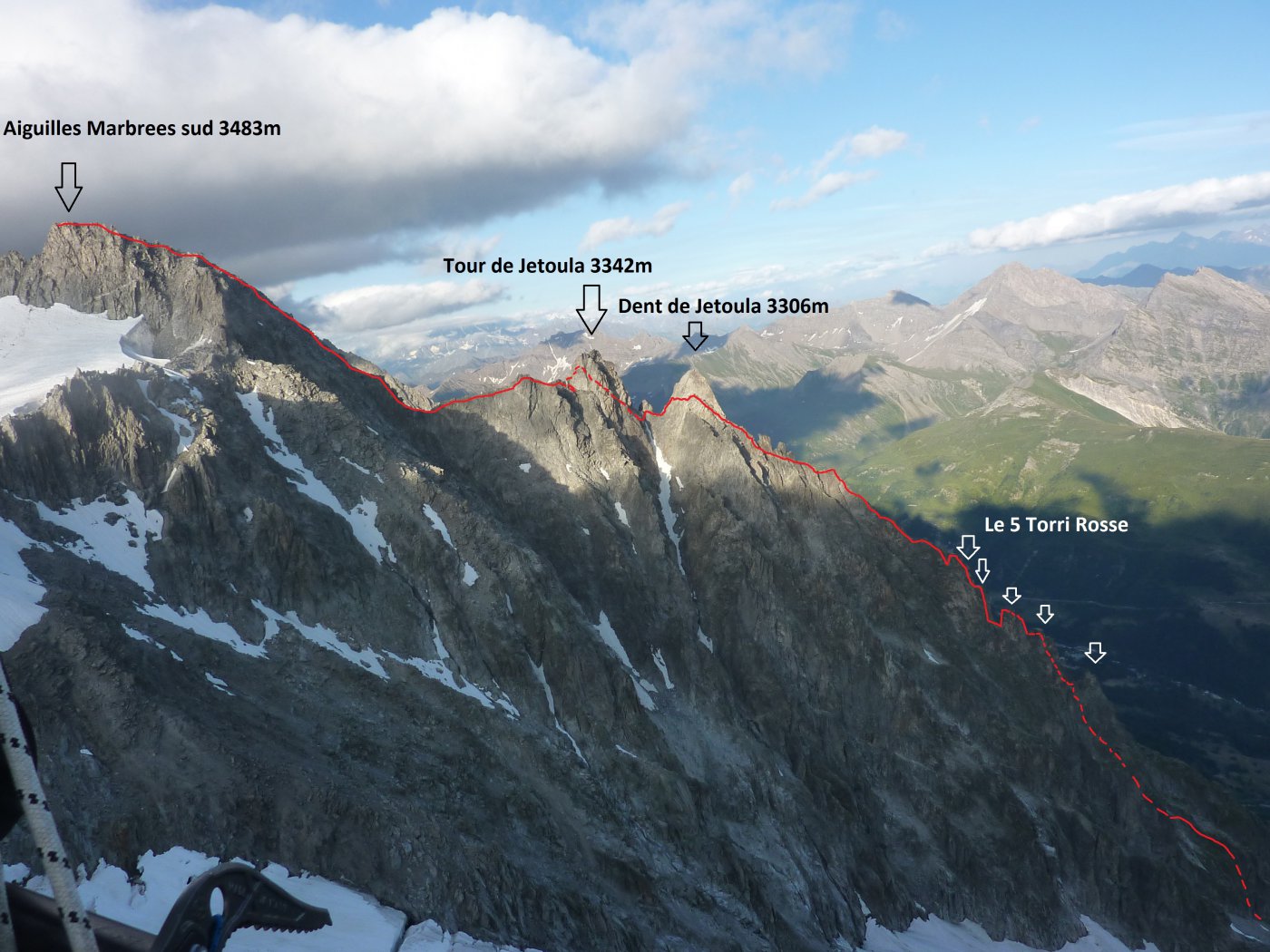
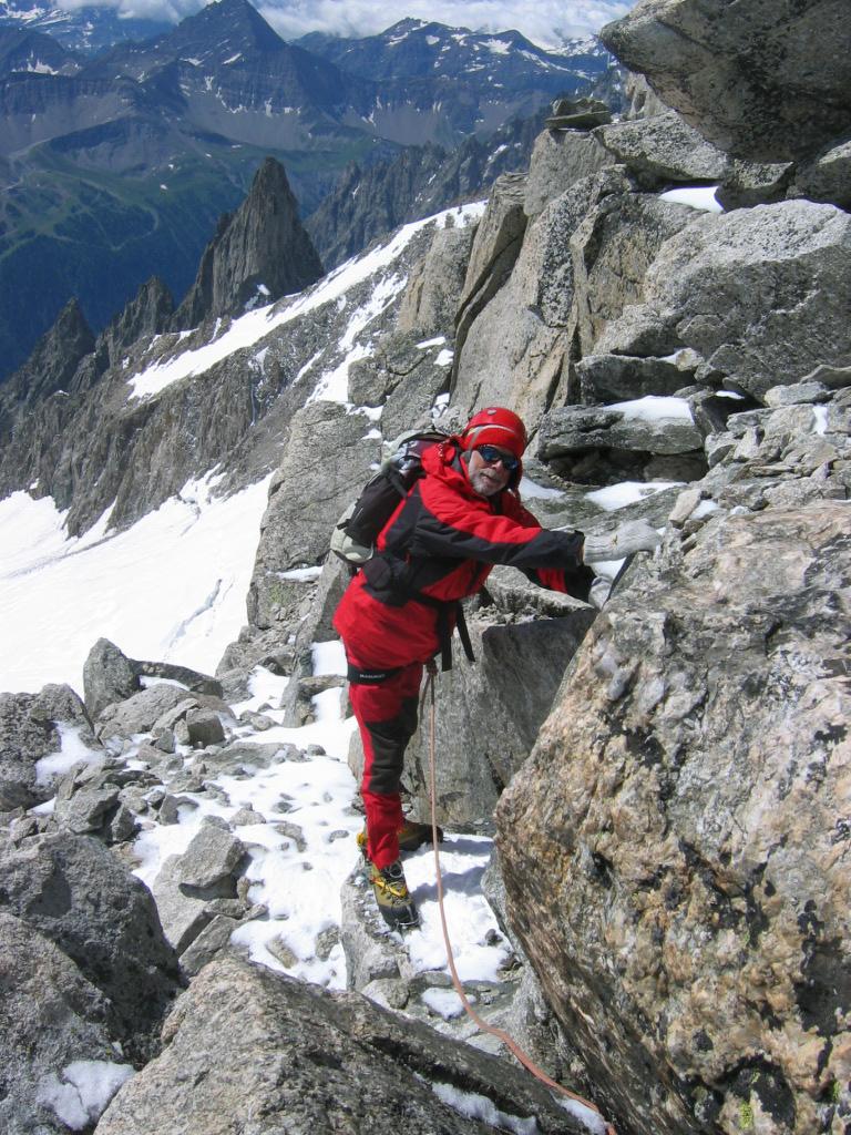
Via classica a torto dimenticata, che sale elegantemente la cresta sud-sud-est della Tour dello Jetoula, continuando poi per la cresta sud delle Marbrees. Via di notevole ingaggio e bellezza, che ha come parte più emozionante la scalata delle 4 torri rosse centrali, le quali sono caratterizzate da un eccellente granito rossastro. Questa cresta si può suddividere in più parti: zoccolo iniziale; canale del forcellino tra Prima e Seconda torre; torri rosse; Dente; Torre; Marbrees.
Ottima esperienza prima delle più ardite creste classiche del versante sud del Monte Bianco.
-Materiale: N.D.A. + 1 serie di friend fino al 3, nuts, chiodi, martello e cordini.
Avvicinamento
Ottima esperienza prima delle più ardite creste classiche del versante sud del Monte Bianco.
-Materiale: N.D.A. + 1 serie di friend fino al 3, nuts, chiodi, martello e cordini.
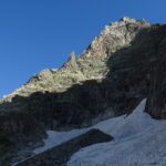
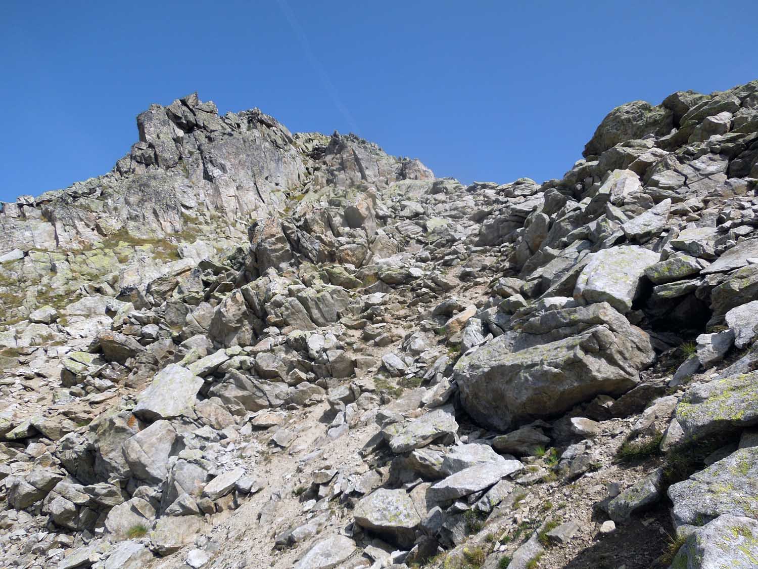
Dal rif. Pavillon (raggiungibile con la funivia di Punta Helbronner oppure con sentiero da La Palud) seguire il sentiero per il rif. Torino fino al primo tornante verso sinistra. Da qui si abbandona il sentiero e si comincia a risalire il pendio in obliquo a destra puntando l’attacco della via. Si risalgono pietraie e zone di massi, si traversa sempre di più verso destra superando qualche ruscello, sino a scorgere il canale di attacco.
Descrizione
Risalire il canale di rocce mediocri e detriti sino a sbucare su una crestina d’erba. Salire per pochi metri e traversare poi verso sinistra puntando l’evidente canalone di roccia biancastra.
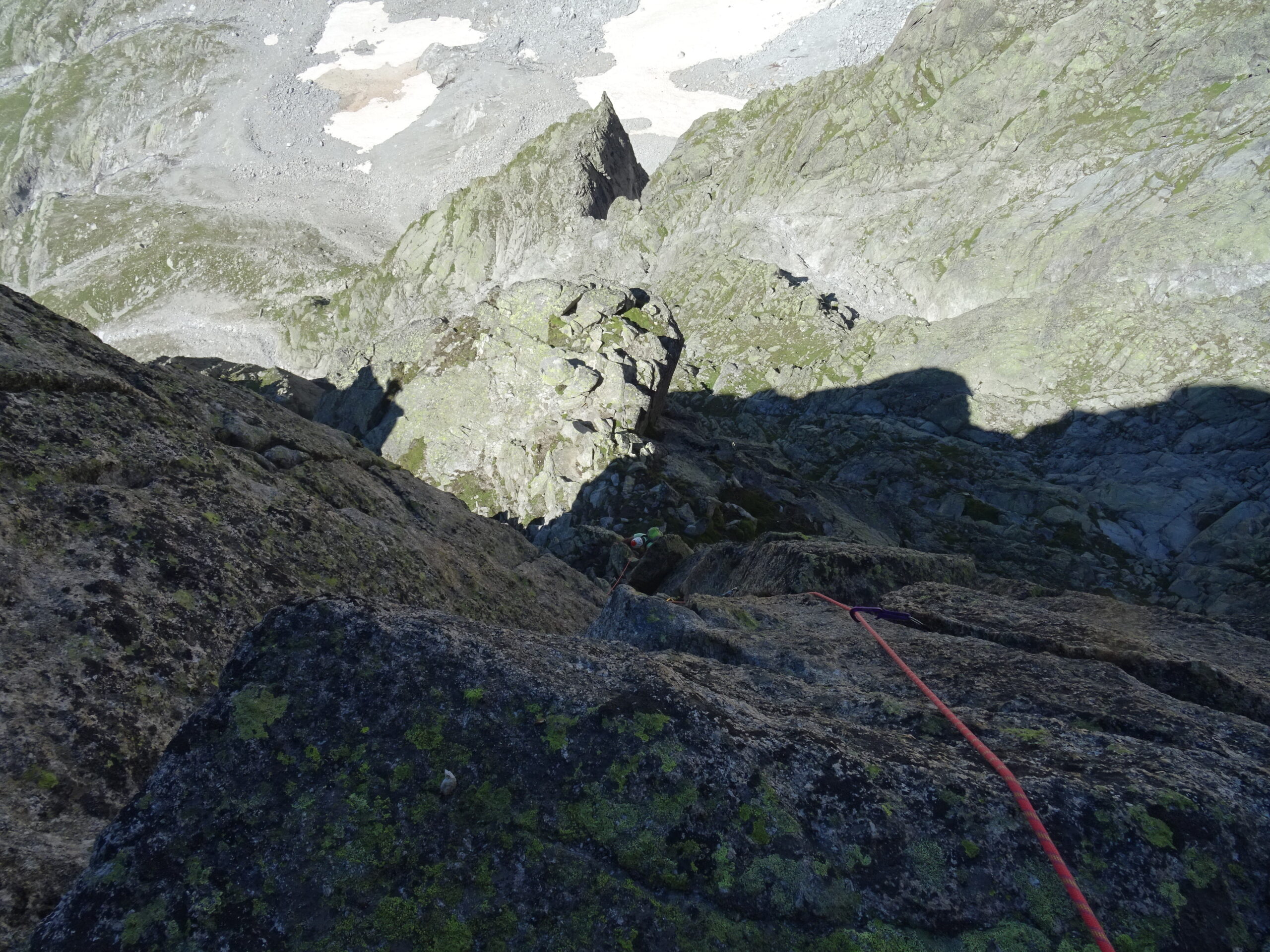
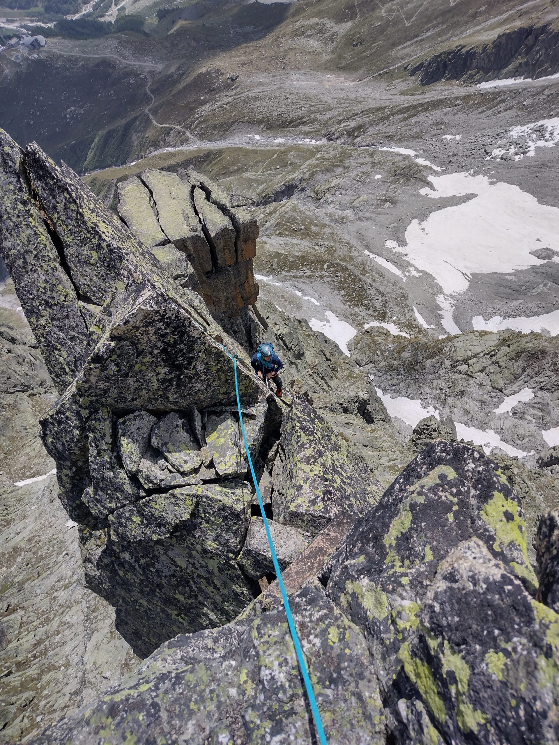
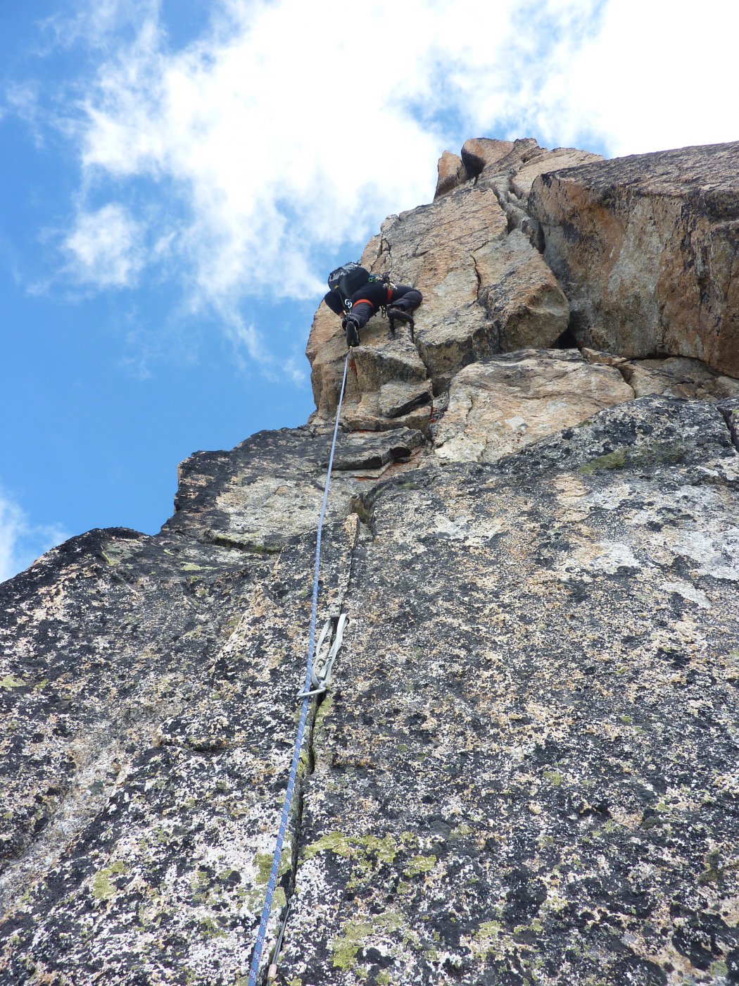
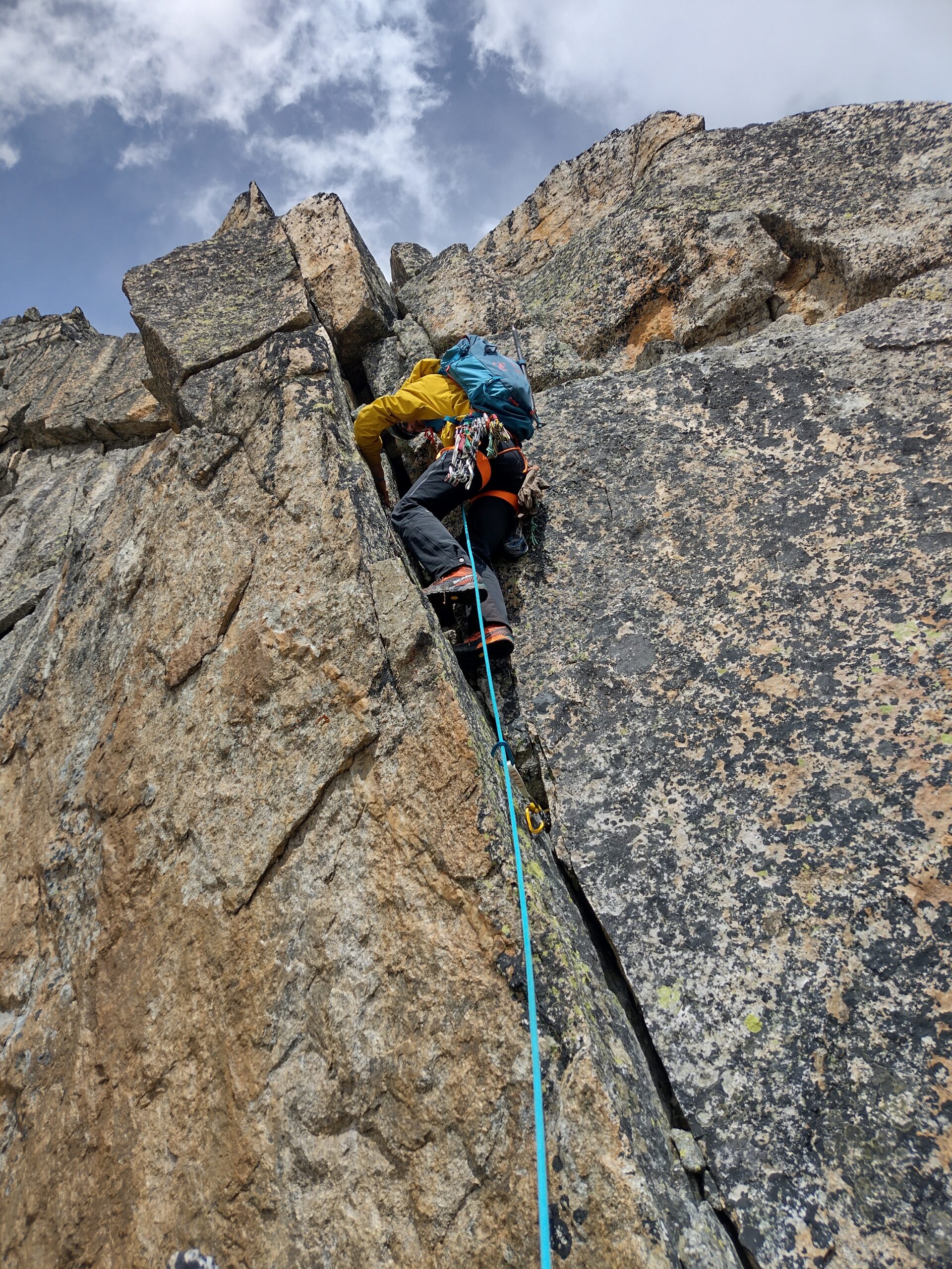
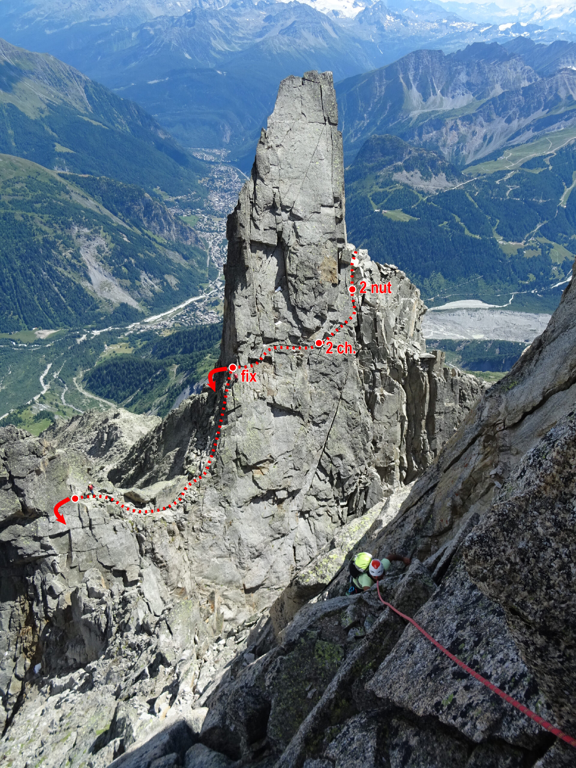
Arrampicare lungamente su tutto il canale di roccia buona ma spesso parzialmente umida o bagnata (passaggi fino al IV, qualche chiodo), arrivando al forcellino tra la prima torre e la seconda torre, che si raggiunge da Est dopo un tratto erboso.
Da qui attaccare la seconda torre sulla destra per un lungo camino con passaggi di forza (IV) fin sopra le difficoltà. Cordino bianco 4/5 m dalla base della fessura/camino.
Proseguire per un facile canale sostando sotto una piccola pancia. Risalire la pancia andando successivamente verso sinistra. Arrivati in prossimità di un terrazzo, traversare decisamente destra per una evidente cengetta, 10 m circa, arrivando sotto un diedro fessurato più verticale (III). Sfruttare la fessura per alzarsi e portarsi sulla sommità della seconda torre (IV).
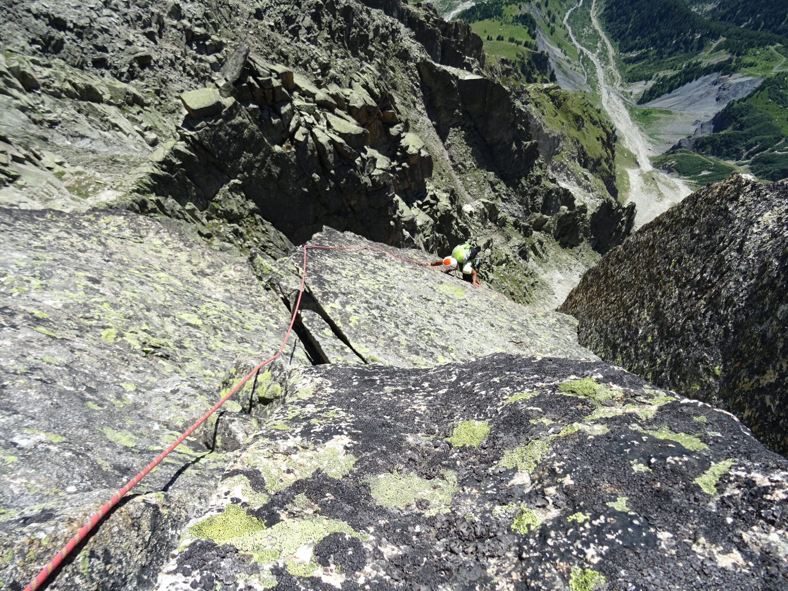
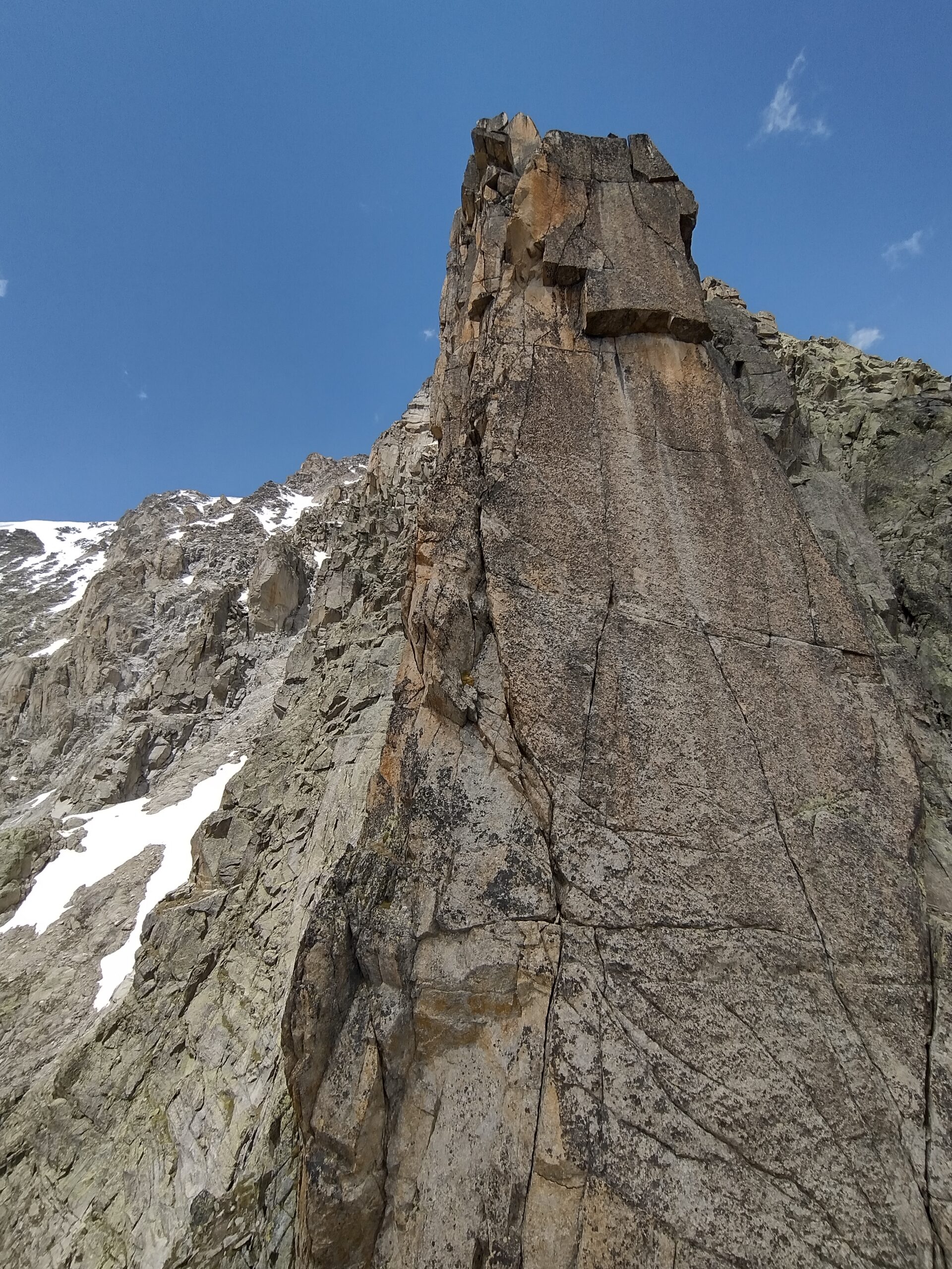
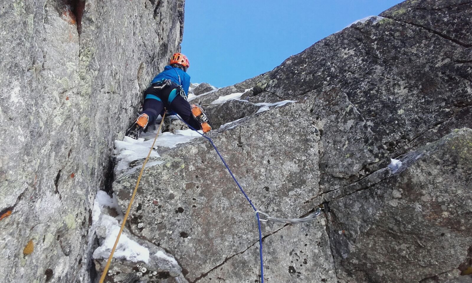
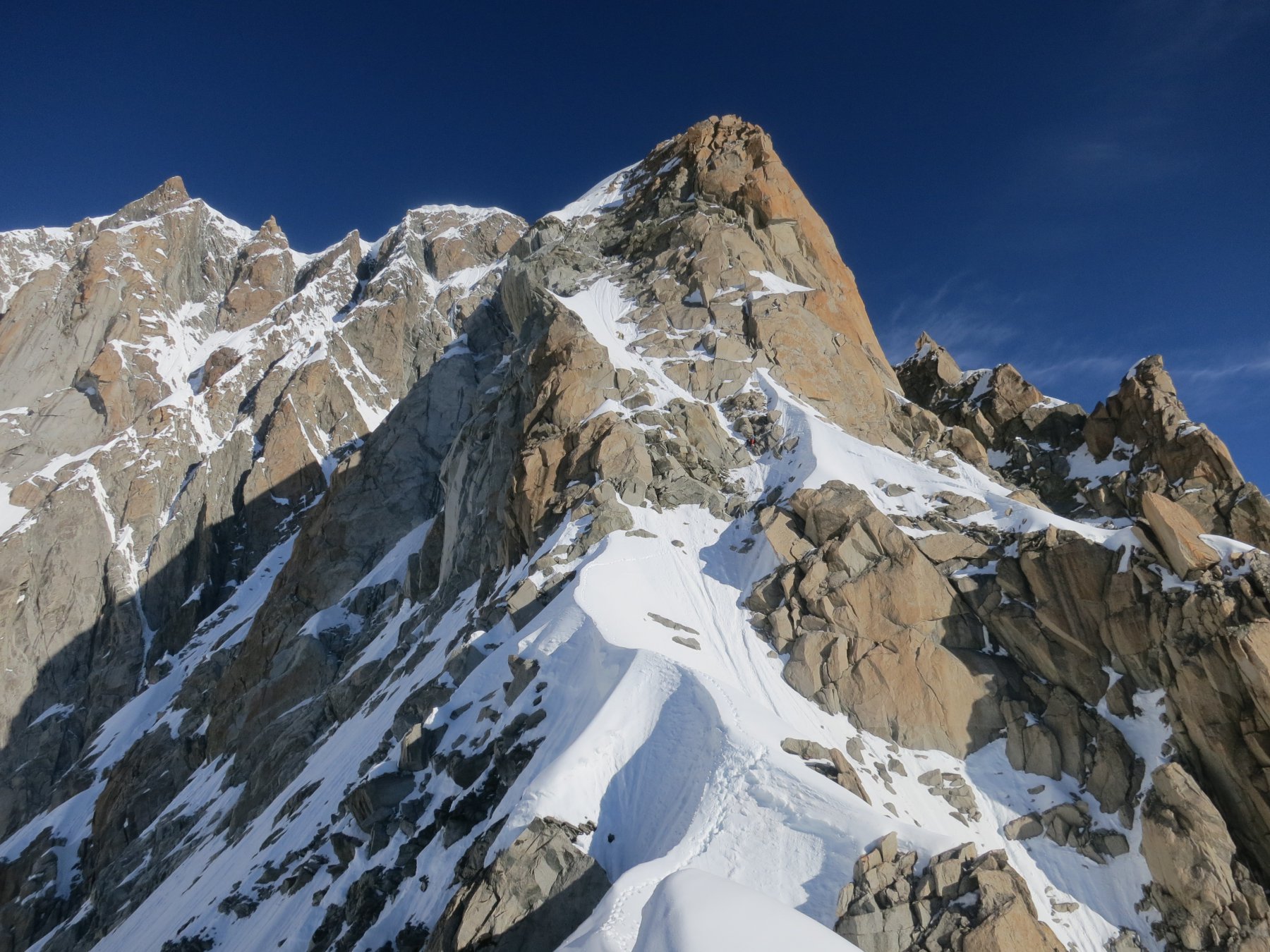
Traversare a destra arrivando sotto la terza torre caratterizzata da una bella parete verticale (II). Risalire faticosamente tutta la fessura abbondante di chiodi (V+ e A0), passando poi sul lato ovest prima in traverso e poi risalendo una fessura in placca che porta in cima alla torre. Scendere in corda doppia da uno spuntone (20m) e proseguire senza difficoltà fino all’attacco di un sistema di fessure (il primo che si incontra arrivando) sul lato ovest della quarta torre. Risalire le fessure sempre più verticali (da IV+ a V+), arrivando sotto una fessura a pancia con 3 vecchi cunei inutilizzabili. Risalire faticosamente la fessura (V+/VI) e continuare per placche fessurrate (V) fino ad uno spazioso terrazzo.
Portarsi leggermente a destra e scalare un sistema di fessure e diedri (IV, V-) sino in cima alla quinta torre (1 ch. e 1 cordone).
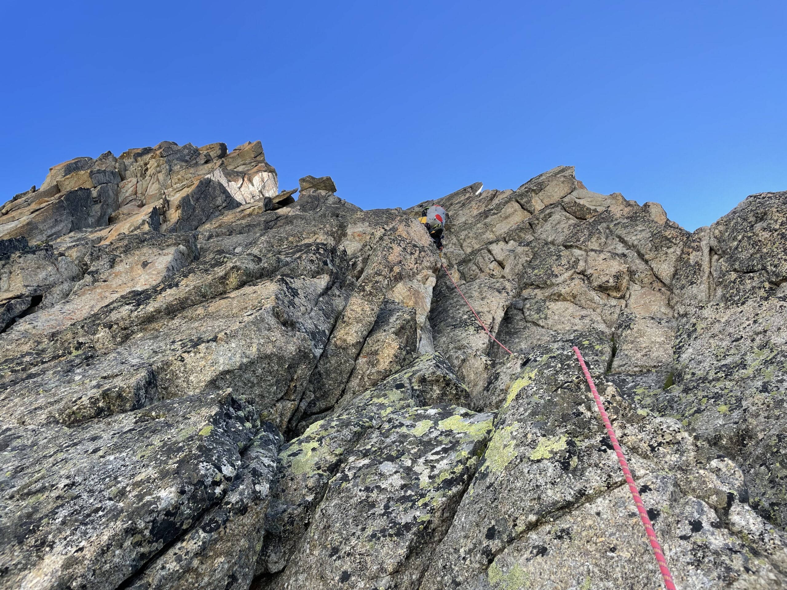
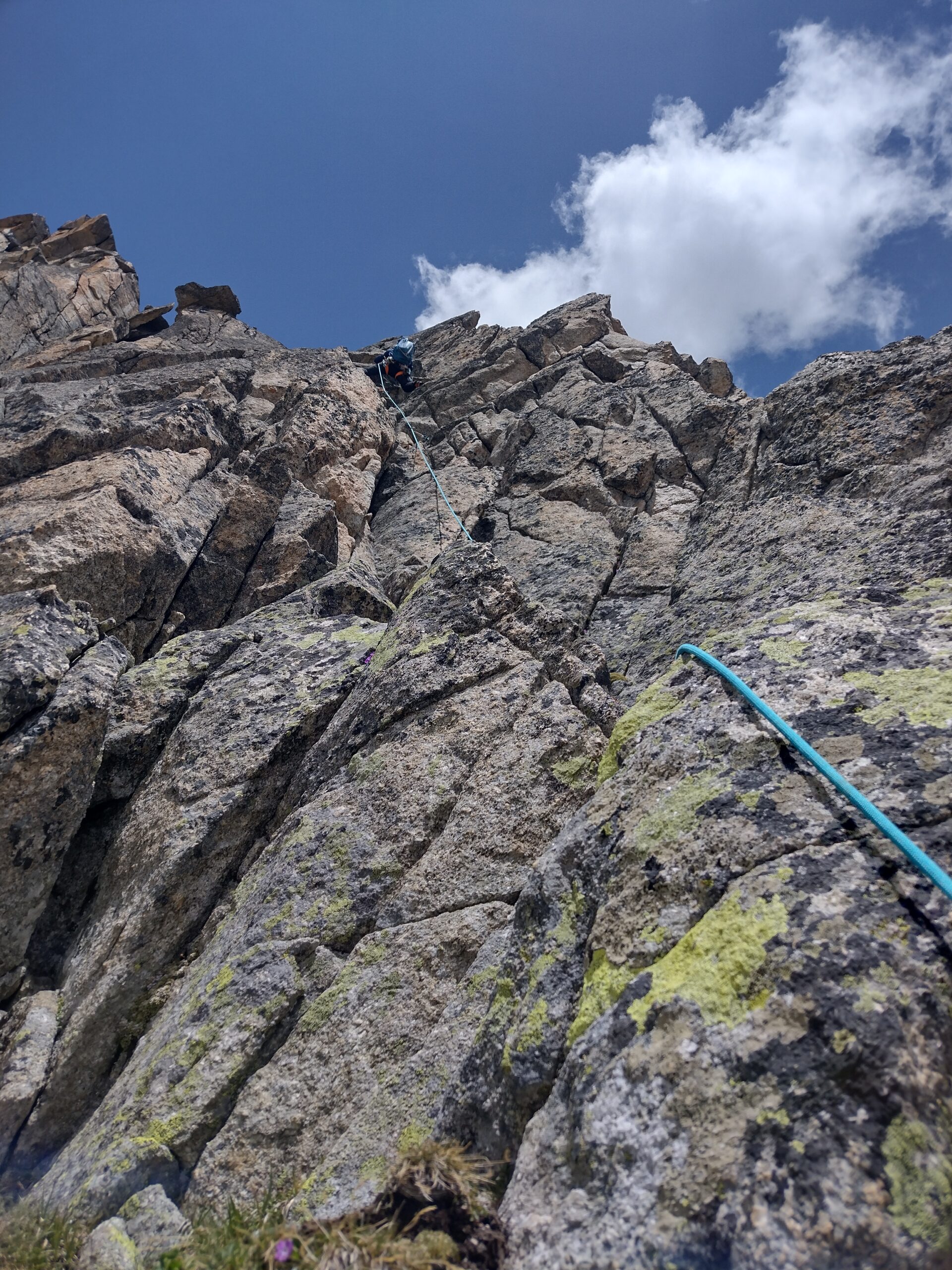
Scendere in corda doppia per meno di 10m verso Est e spostarsi a destra sotto una fessura obliqua. Salirla facilmente arrivando sullo spigolo e proseguendo fino ad una selletta (IV, qualche chiodo).
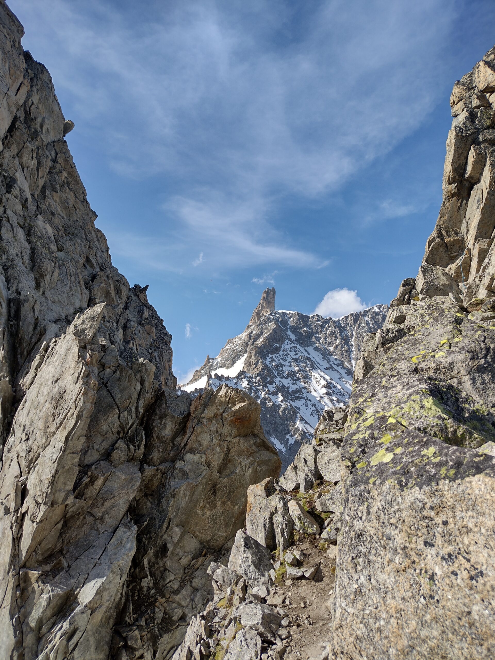
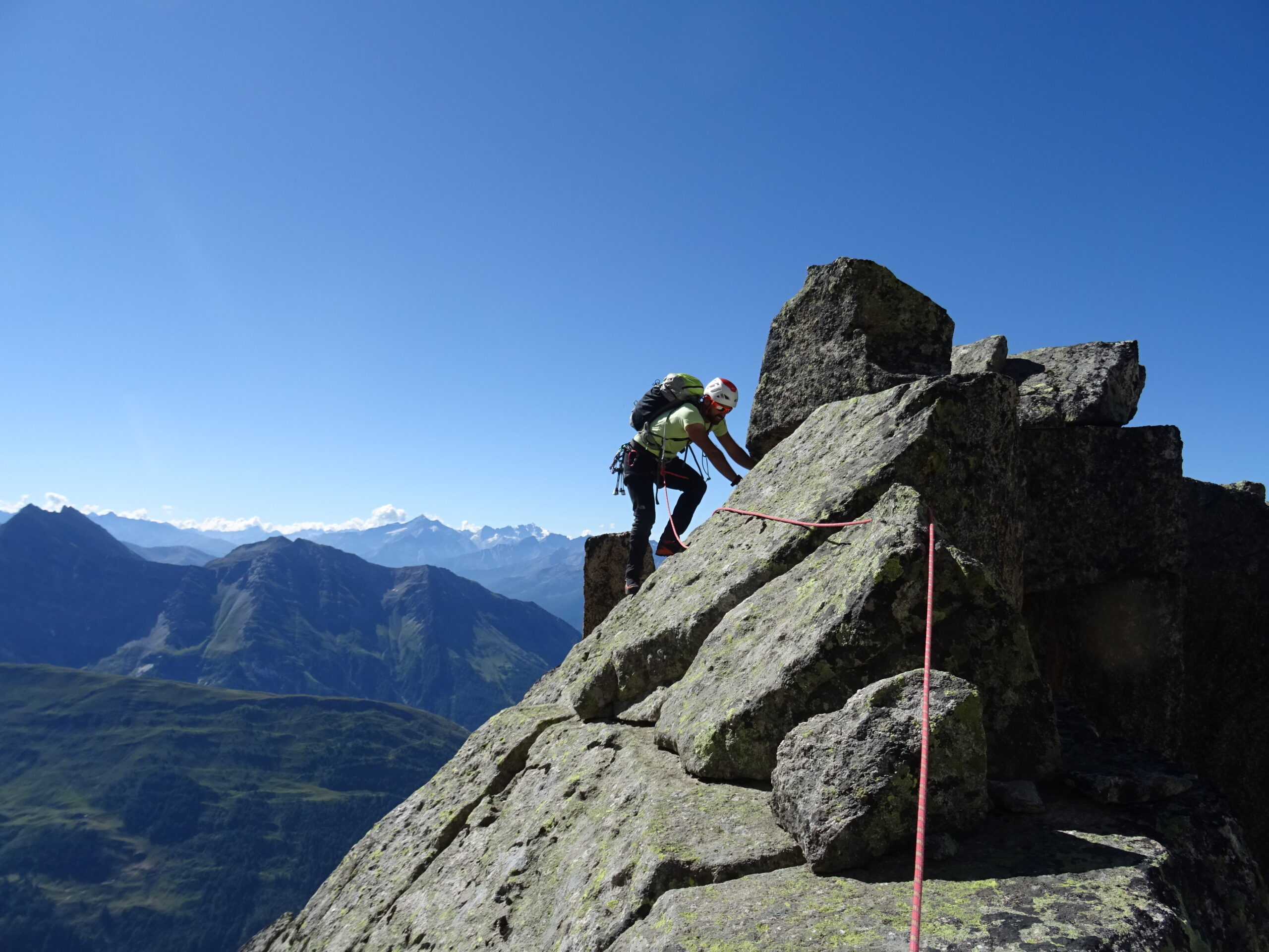
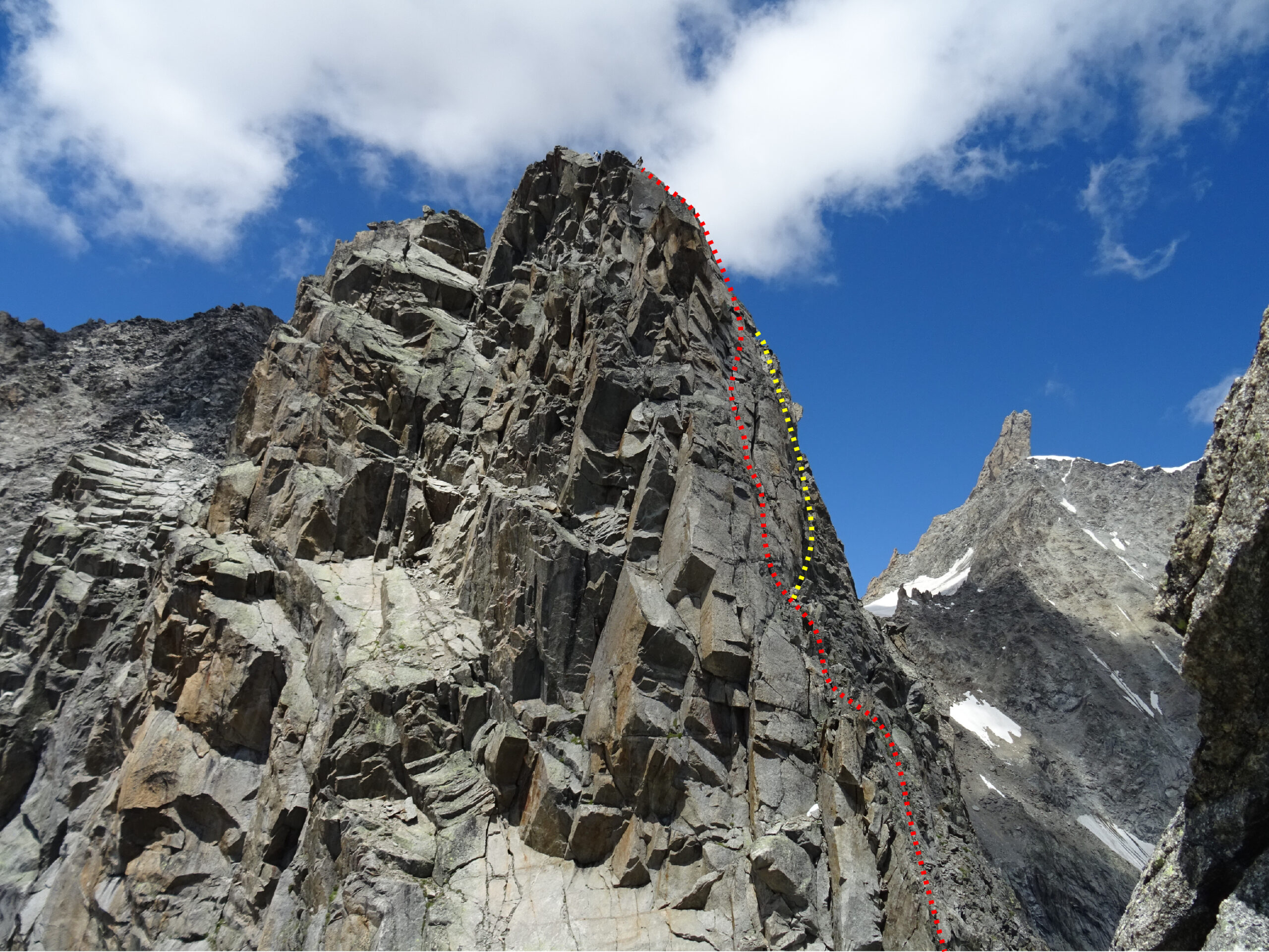
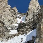
Continuare ancora nei pressi dello spigolo fino a quando ci si può abbassare alla sua sinistra, in una zona di rocce rotte che precede il Dente dello Jetoula. Tenersi sempre leggermente a sinistra (II e tracce di sentiero) fino ad una fascia più verticale (III/+ in base al percorso) che dà accesso alla base del Dente.
Qui 2 opzioni:
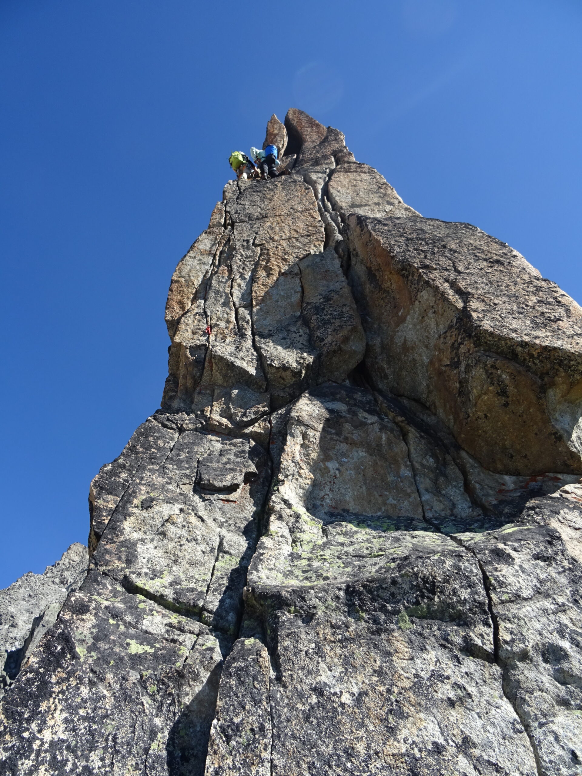
1) salire la Dent lungo la fessura 1m a dx del filo (10m di 6a delicati in partenza, 4 fix, necessari friend piccoli per integrare). Dalla sommità si scende con due doppie attrezzate fino a ricongiungersi con l’opzione 2;
2) scontornare il dente restando contro la sua parete ovest. Arrivati sul culmine della gengiva bisogna scendere brevemente dall’altro lato fino ad una sosta su due nut, cordone e maillon. Disarrampicando delicatamente per 2-3m si arriva scorgere un passaggio delicato ed esposto tra le rocce verso est (destra faccia a valle) che lascia traversare senza particolari difficoltà fino alla placca nord del Dente (sosta su due chiodi con cordino). Si prosegue traversando in piano (ch. giallo con cordino) e disarrampicando brevemente fino ad un pilastrino (fix con maillon) sullo spigolo NE del Dente, da cui si scende disarrampicando o in doppia fino ad una prima selletta dove si trova una sosta a fix con moschettone per l’ultima discesa in doppia (caos di cordoni poco sopra ben visibile).
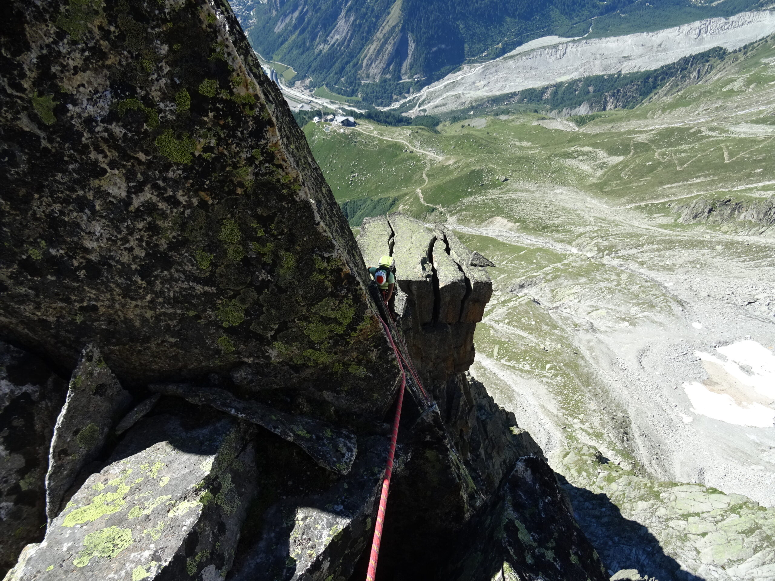
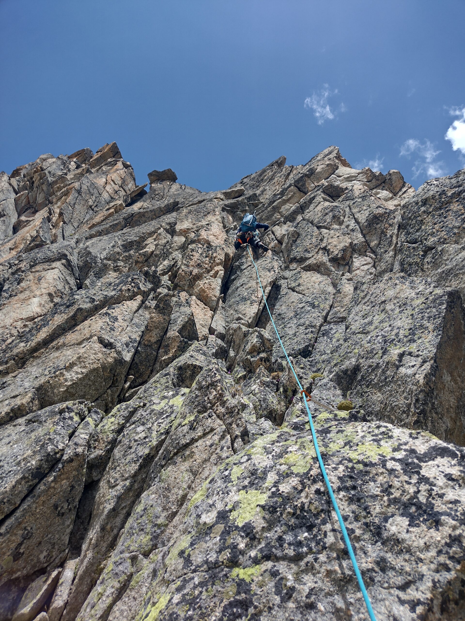
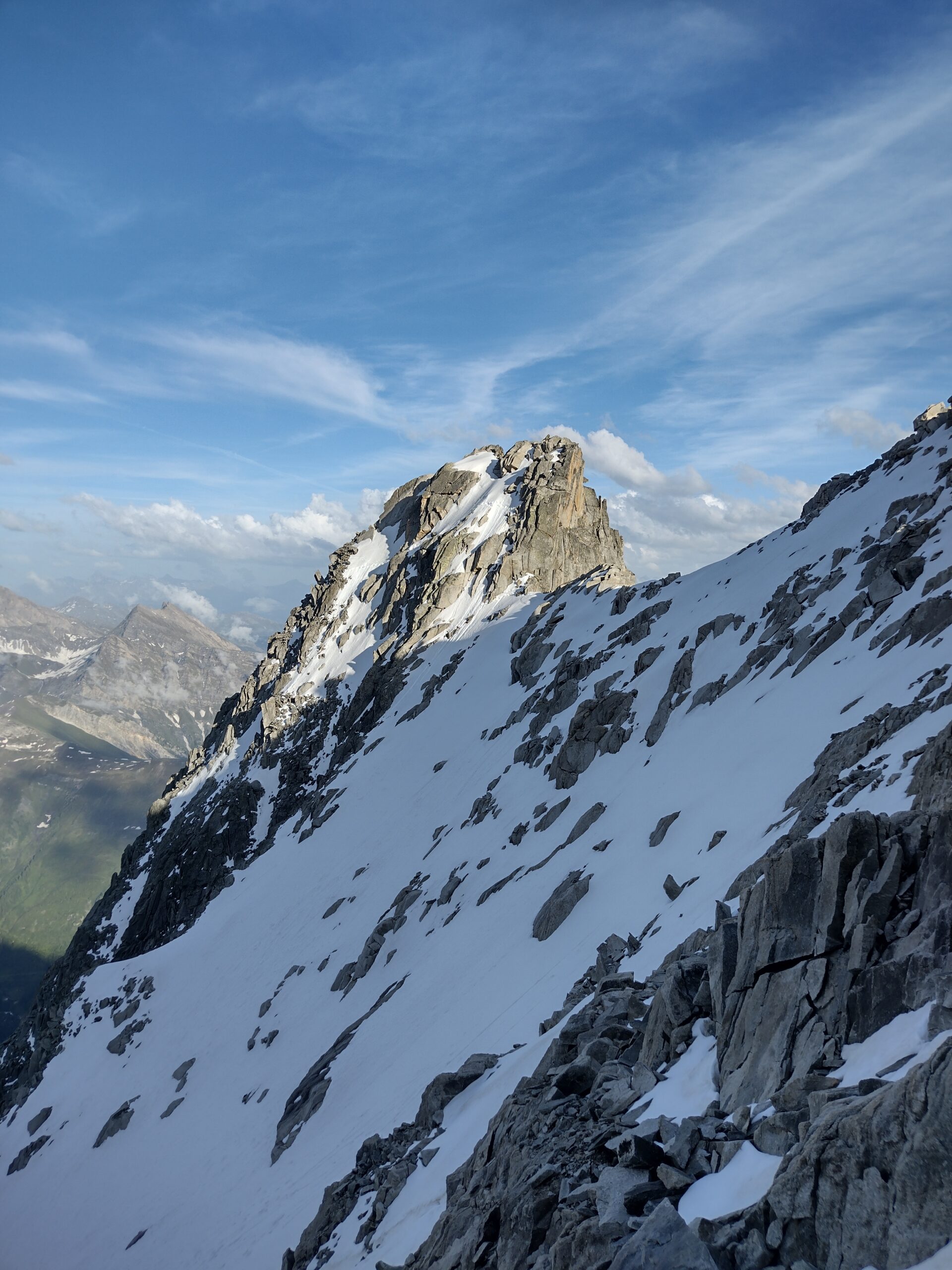
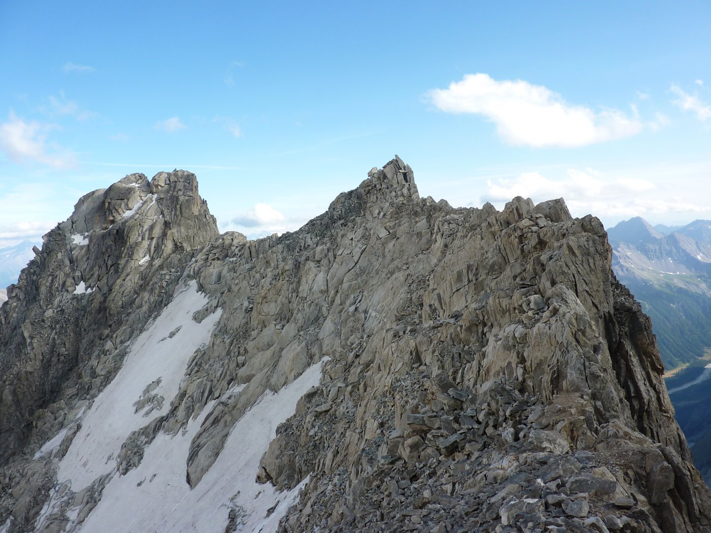
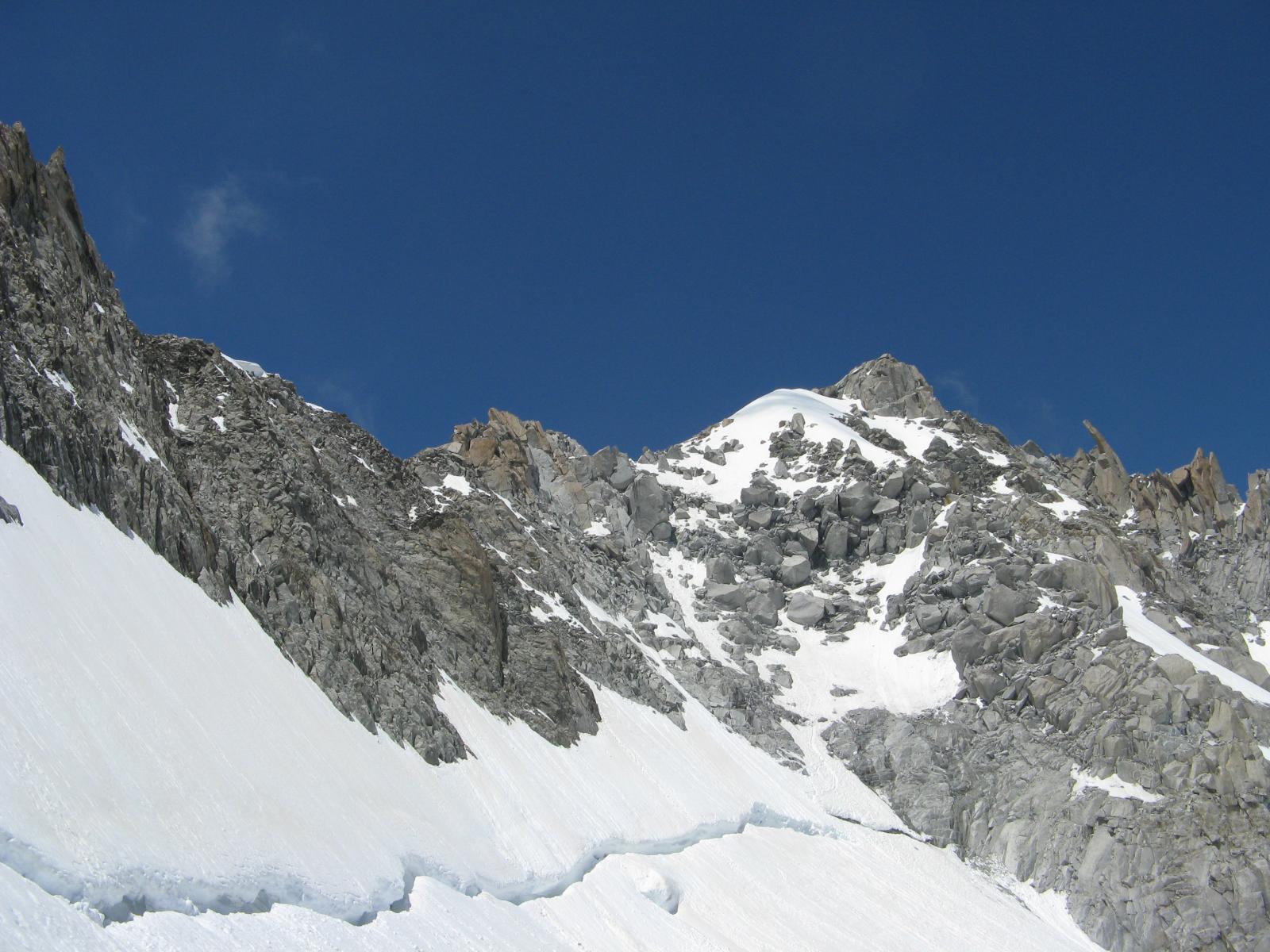
Attraversare una zona di rocce rotte e poi proseguire verso la parete S della Tour (massi instabili). Risalire le belle placche fessurate (IV, passi di IV+, nessun protezione in loco) oppure piegare sulla dx e prendere una rampa-camino nerastra che sale in obliquo, fino a raggiungere la piatta sommità della Tour.
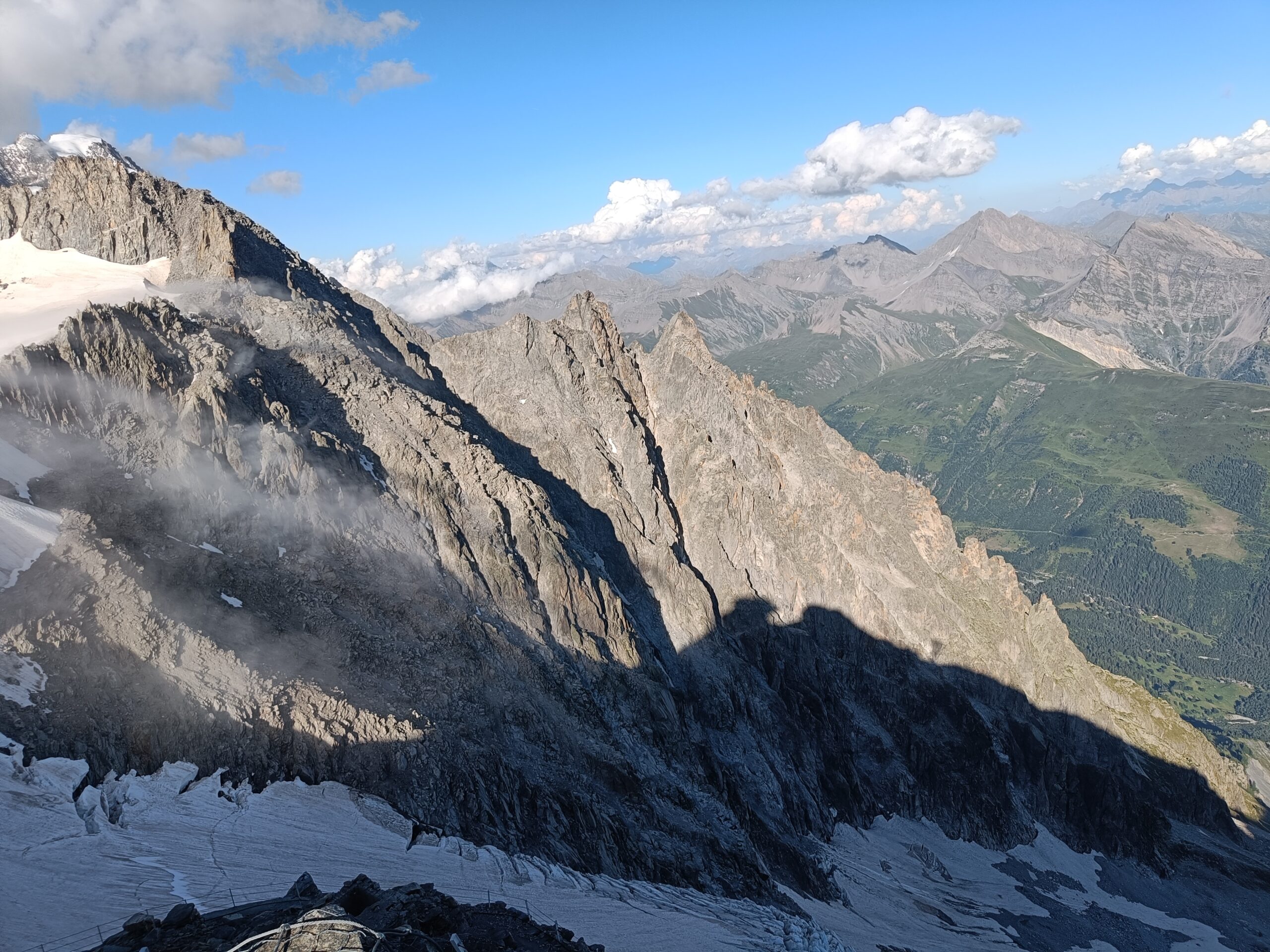
Scendere sull’altro lato, facendo attenzione alle numerose rocce instabili, traversare poi a sinistra andando a prendere la quasi pianeggiante cresta che, diventando poi pendio di detriti e massi, porta sulla cima sud dell’Aiguilles Marbrees.
Discesa:
Scendere per la cresta ovest fino al ghiacciaio nei pressi del Colle del Gigante e da qui facilmente al Rif. Torino.
Oppure, più facile e consigliato, continuare lungo la cresta dei marbrées fino a reperire prima una sosta a spit da dove si effettua a doppia di 15m circa e poi le calate a spit (2 da 25 m) della marbré classica, che portano sul ghiacciaio di fronte al rifugio Torino.
Via aperta in più riprese tra il 1947 e il 1950 da Chiornio L., Panei G., Salomone G., Borio N., Russo E. e Viotto S.
Nelle vicinanze Mappa
Itinerari
23/08/2024 AO, Courmayeur D+ 2000 m D Sud-Ovest
Brenva (Aiguille de la) cresta SO e traversata
 50m
50m
29/08/2017 AO, Courmayeur PD Sud-Ovest
Brenva (Bivacco della) dal Pavillon per il Mont de la Brenva
 50m
50m
13/08/2017 AO, Courmayeur D+ 1800 m PD+ Sud
Brenva (Bivacco della) da Entreves
 2Km
2Km
15/12/2016 AO, Courmayeur D+ 400 m ED- Est
Brenva (Aiguille de la) Milions Reasons
 2.5Km
2.5Km
28/03/2026 AO, Courmayeur D+ 250 m D+ Nord
Marbrées (Aiguilles) – Directe des Cristalliers
 2.6Km
2.6Km
17/06/2026 AO, Courmayeur D+ 800 m D+ Sud
Tacul (Mont Blanc du) – Aiguille du Diable Traversata dal Rifugio Torino
 2.7Km
2.7Km
13/04/2019 AO, Courmayeur D+ 700 m PD+ Nord-Est
Tour Ronde Via Normale per il Colle Freshfield
 2.7Km
2.7Km
10/04/2025 AO, Courmayeur D+ 200 m TD+ Nord
Grand Flambeau, settore Cuori di Ghiaccio – Koala Pirla
 2.7Km
2.7Km
21/02/2023 AO, Courmayeur D+ 212 m F Sud-Est
Toules (Aiguille des) Via Normale
 2.7Km
2.7Km
18/06/2026 AO, Courmayeur D+ 1300 m D Sud-Est
Maudit (Mont) Cresta Kuffner
 2.7Km
2.7Km