6.8Km
6.8Km

Note
Storico
 650m
1.2Km
1.4Km
1.6Km
2.2Km
2.4Km
2.5Km
2.6Km
650m
1.2Km
1.4Km
1.6Km
2.2Km
2.4Km
2.5Km
2.6Km
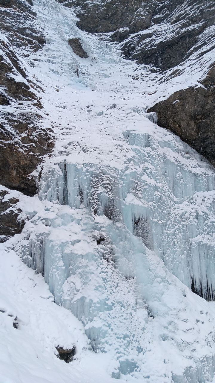
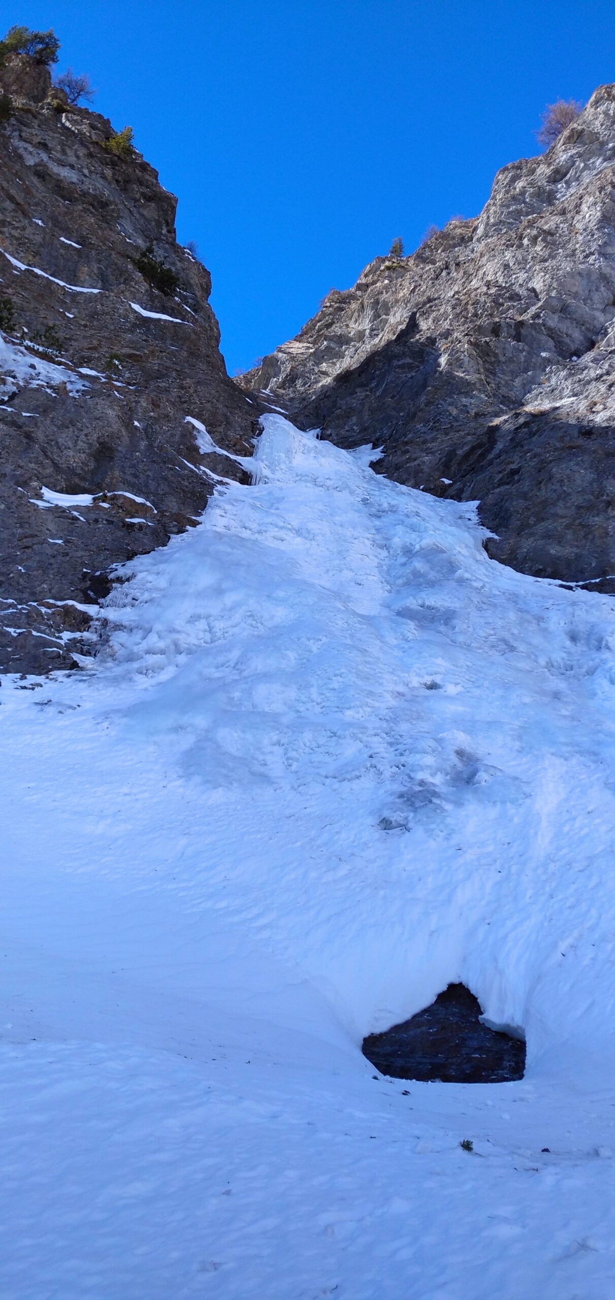
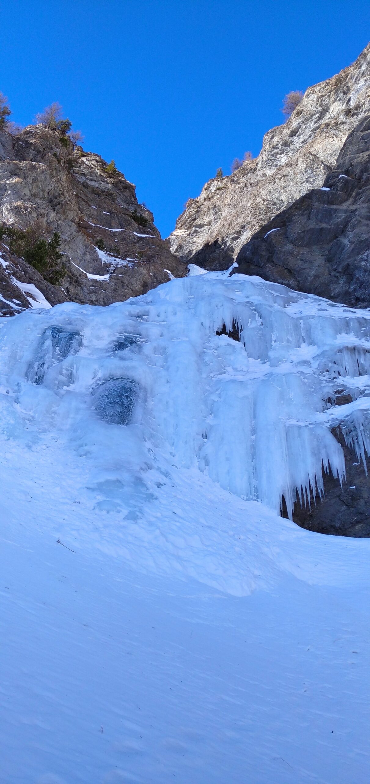
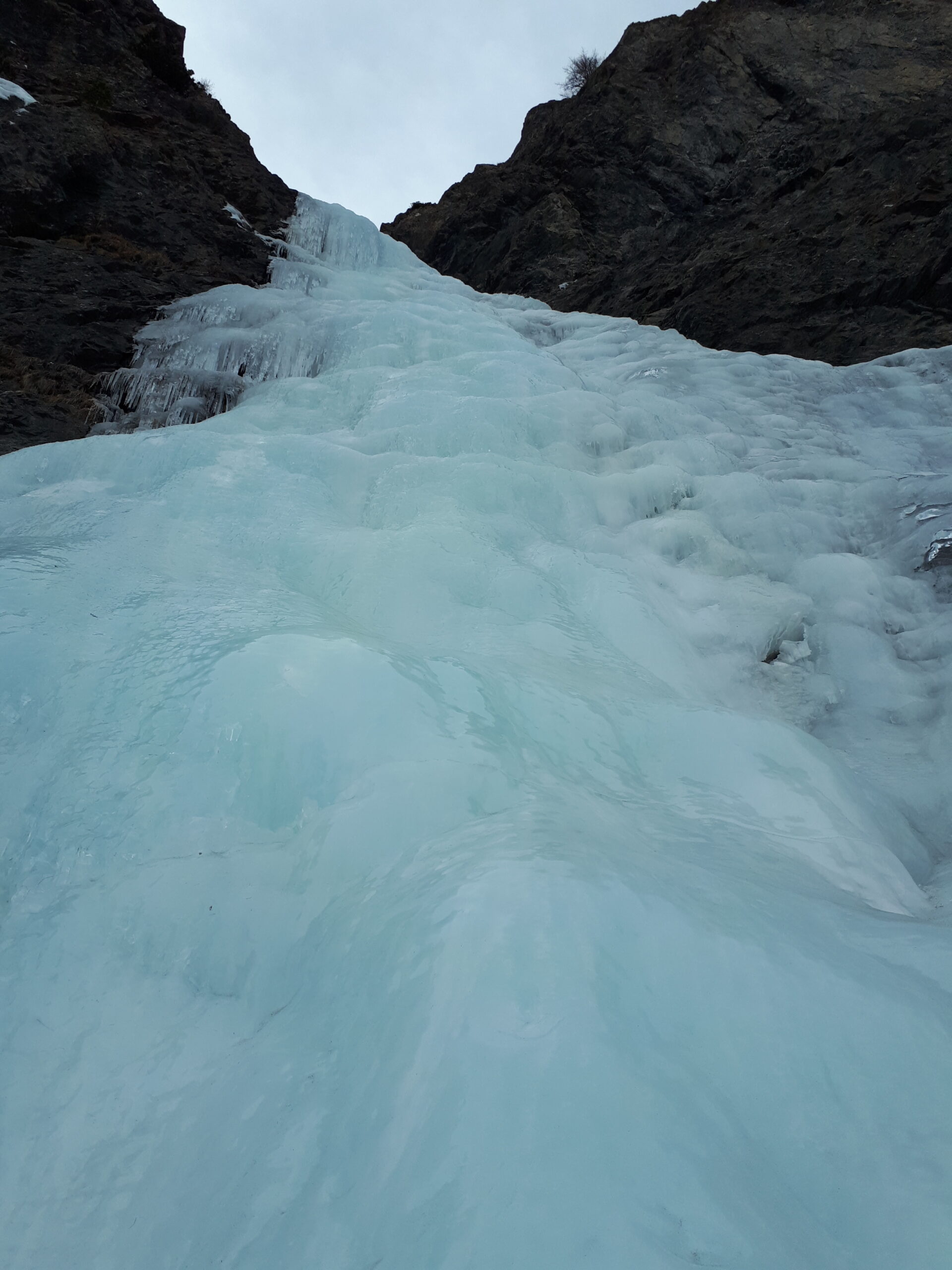
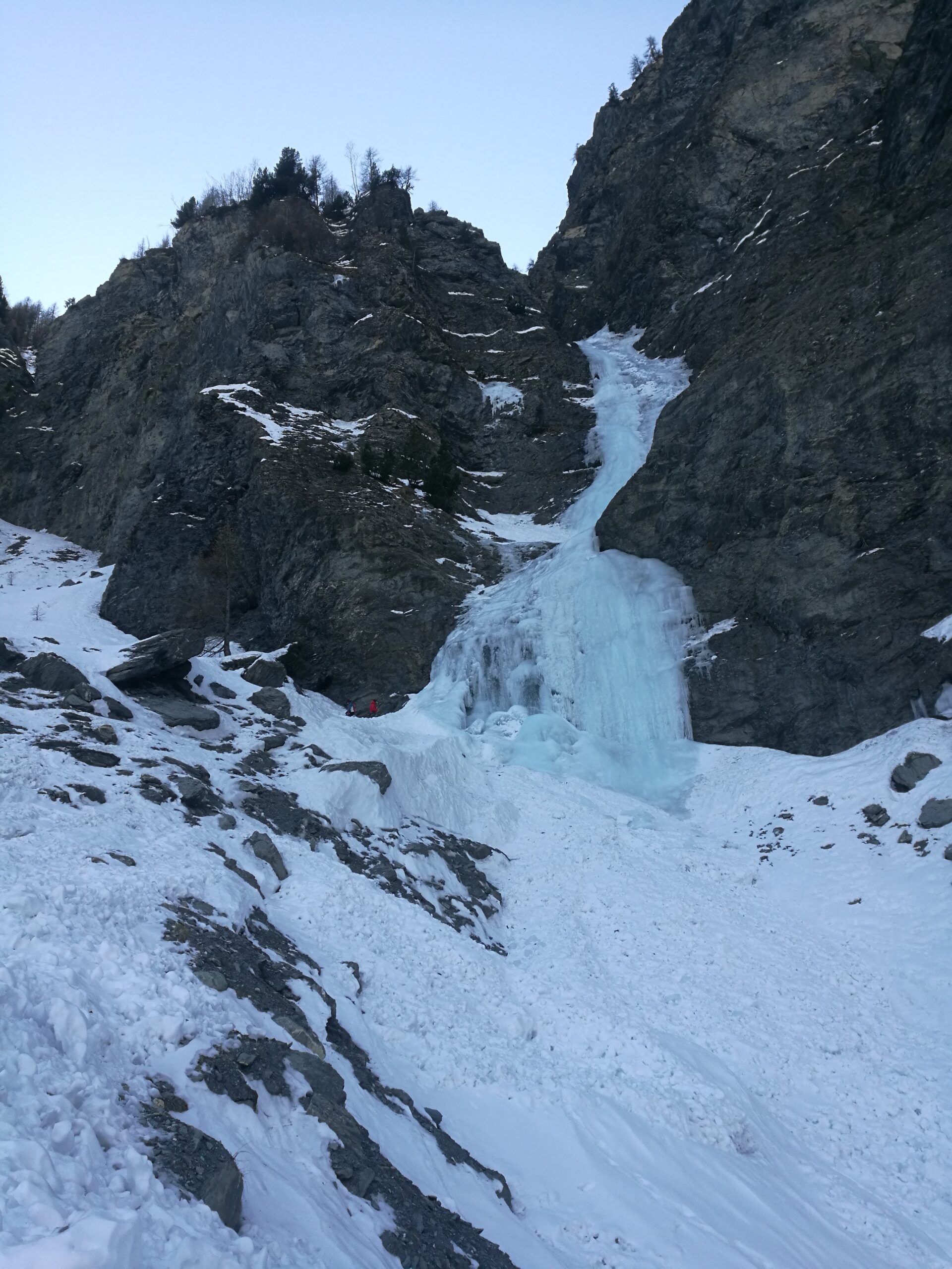
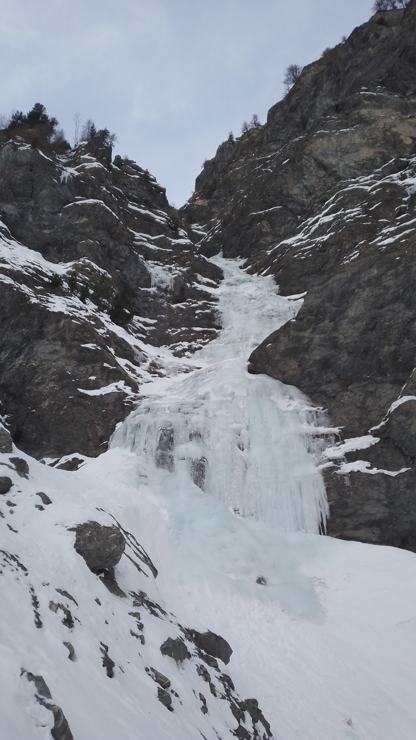
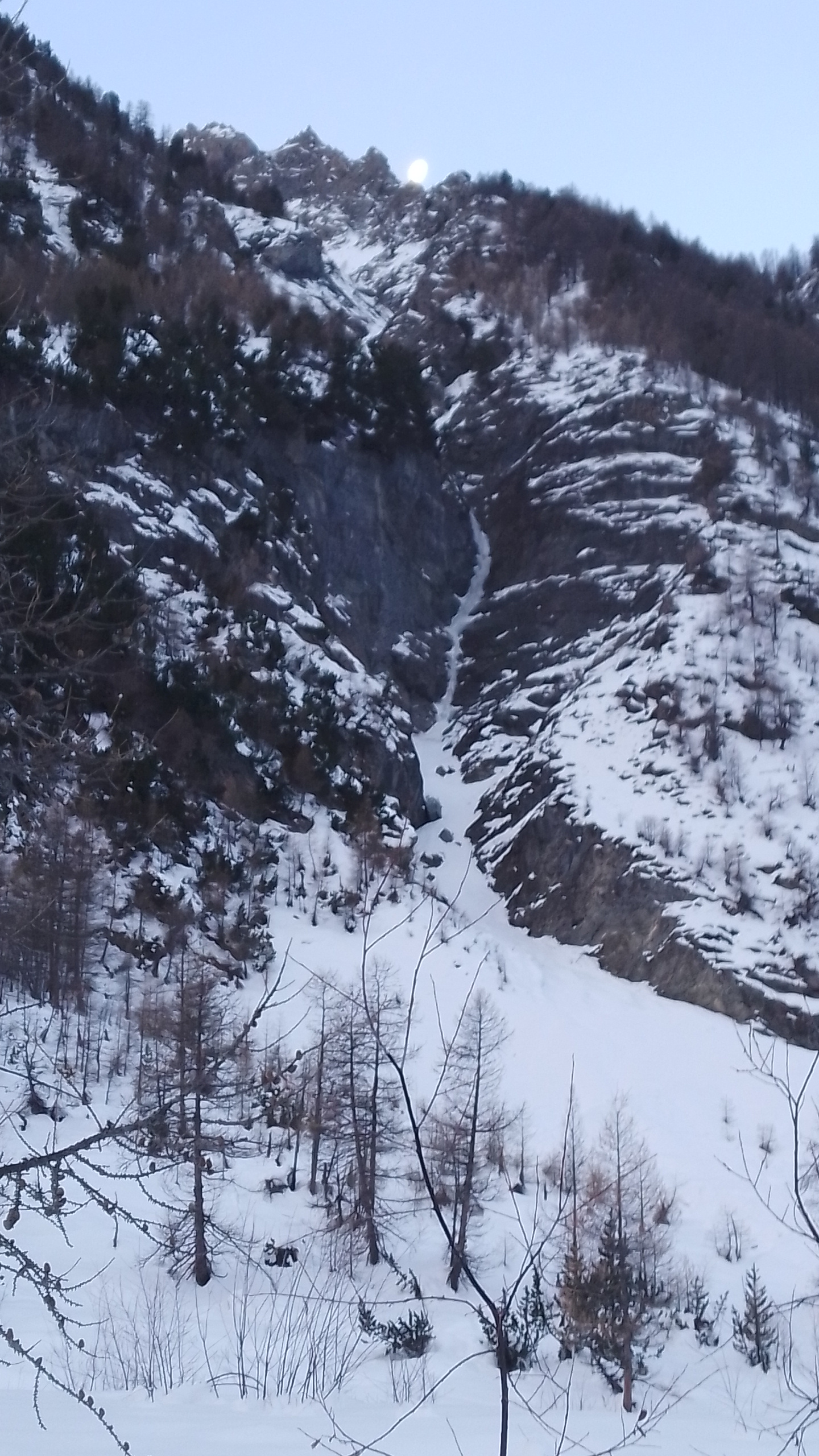
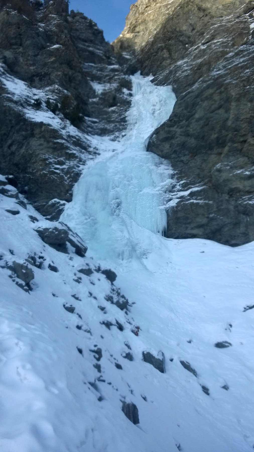
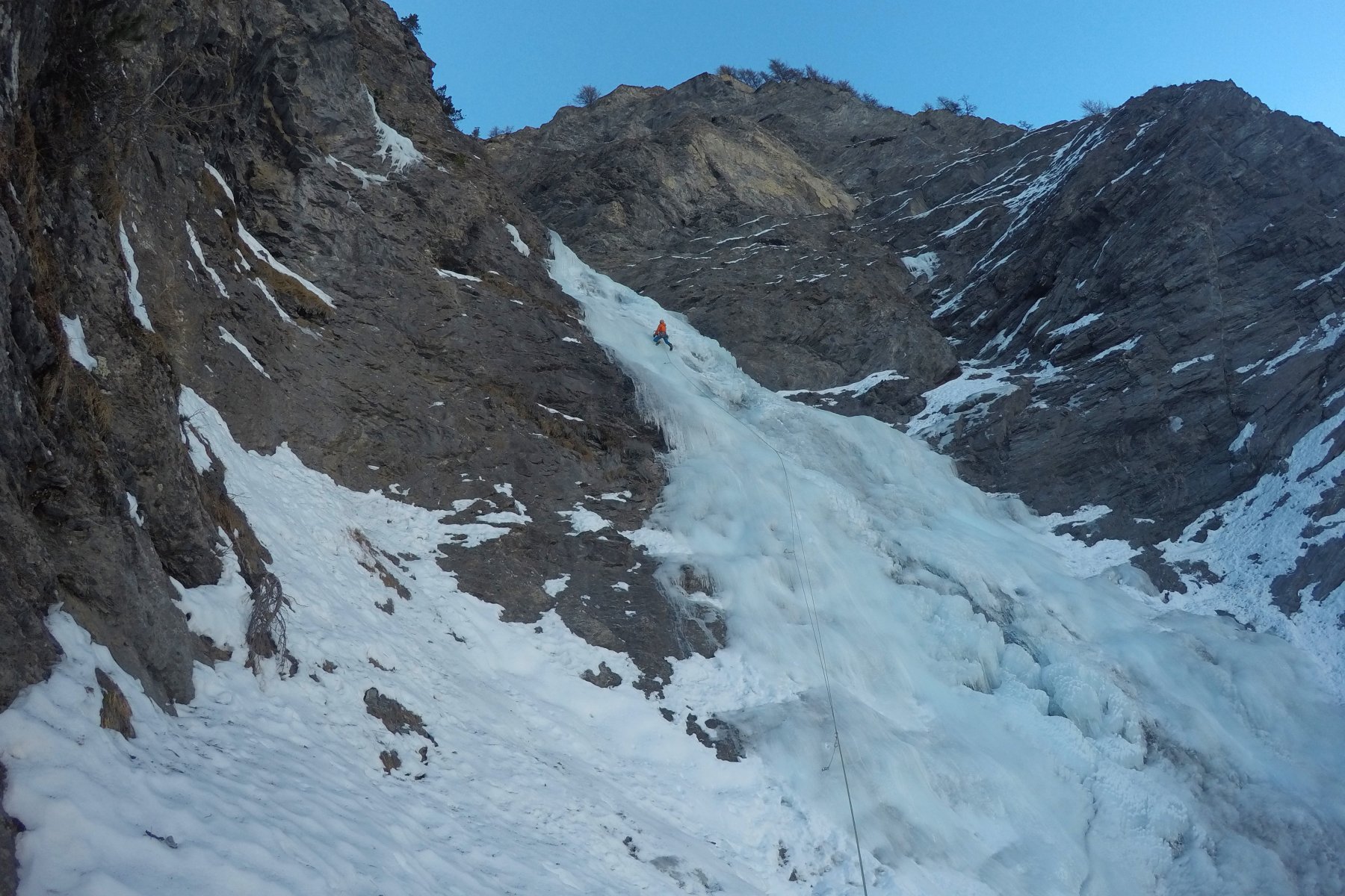
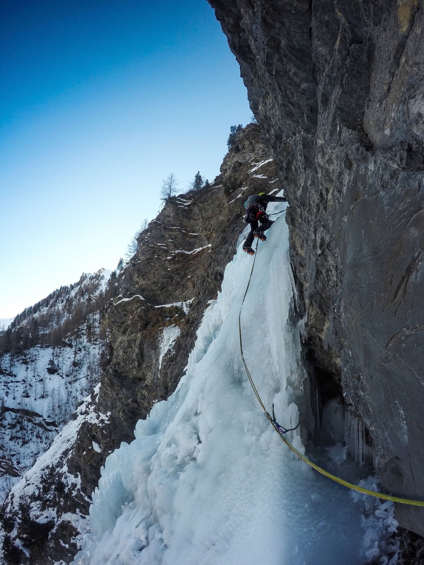
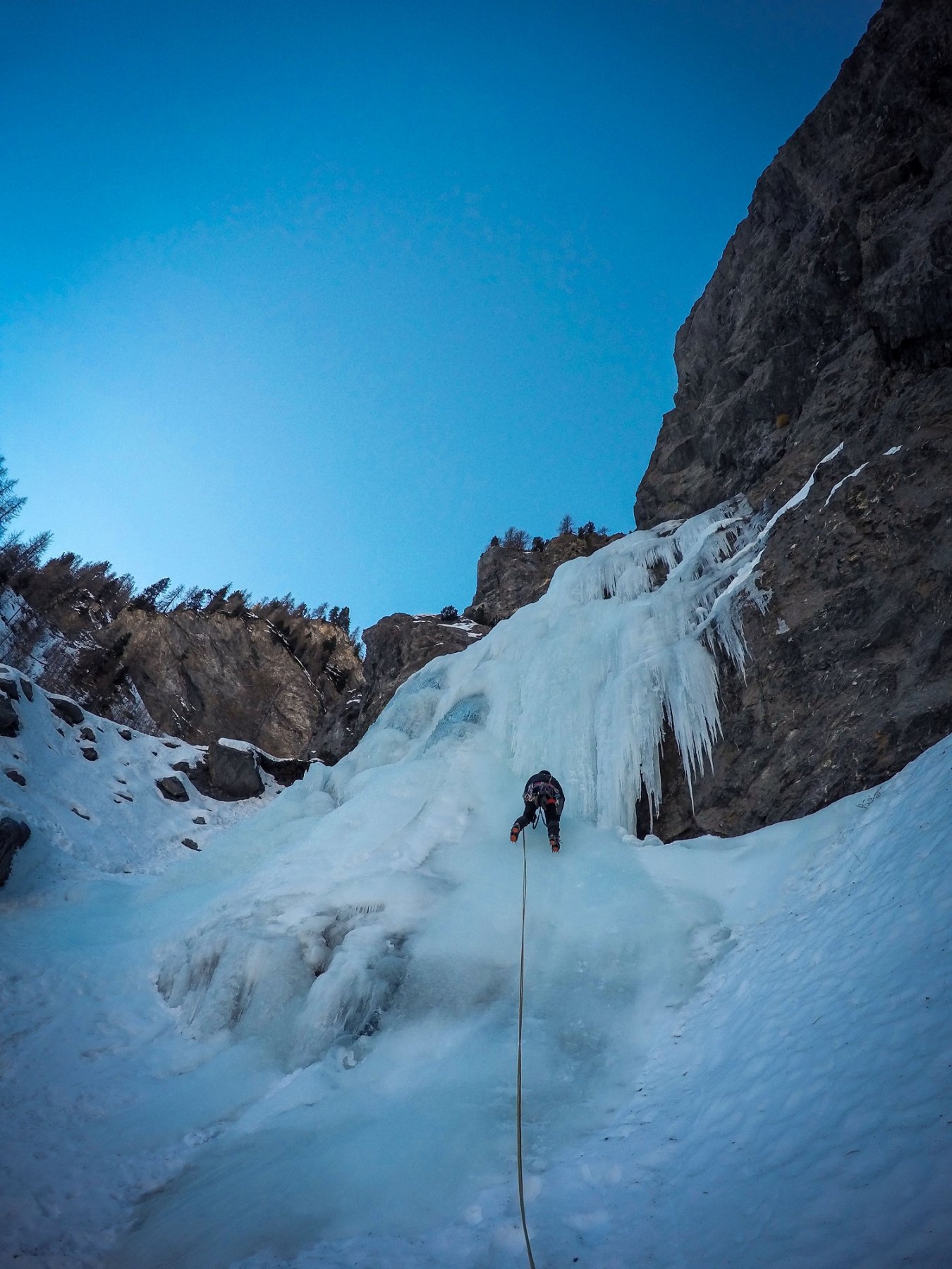
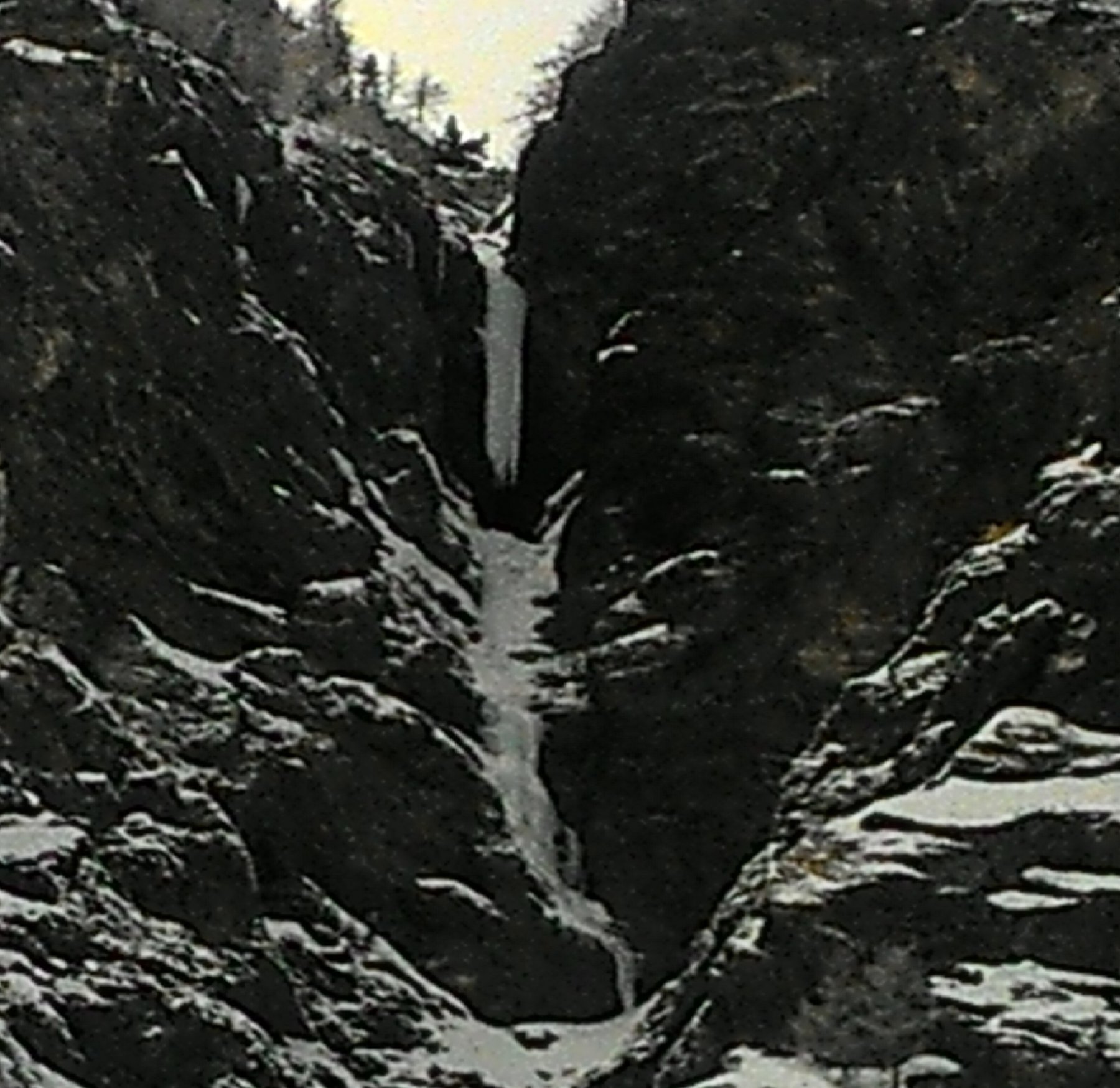
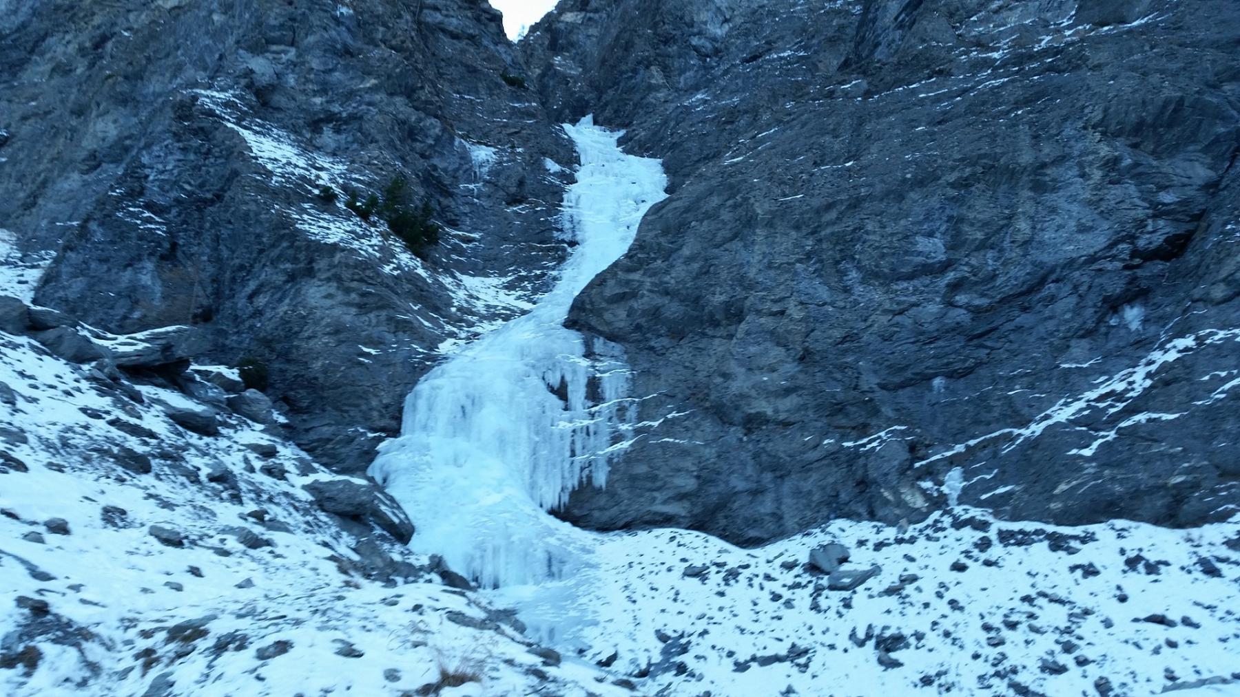
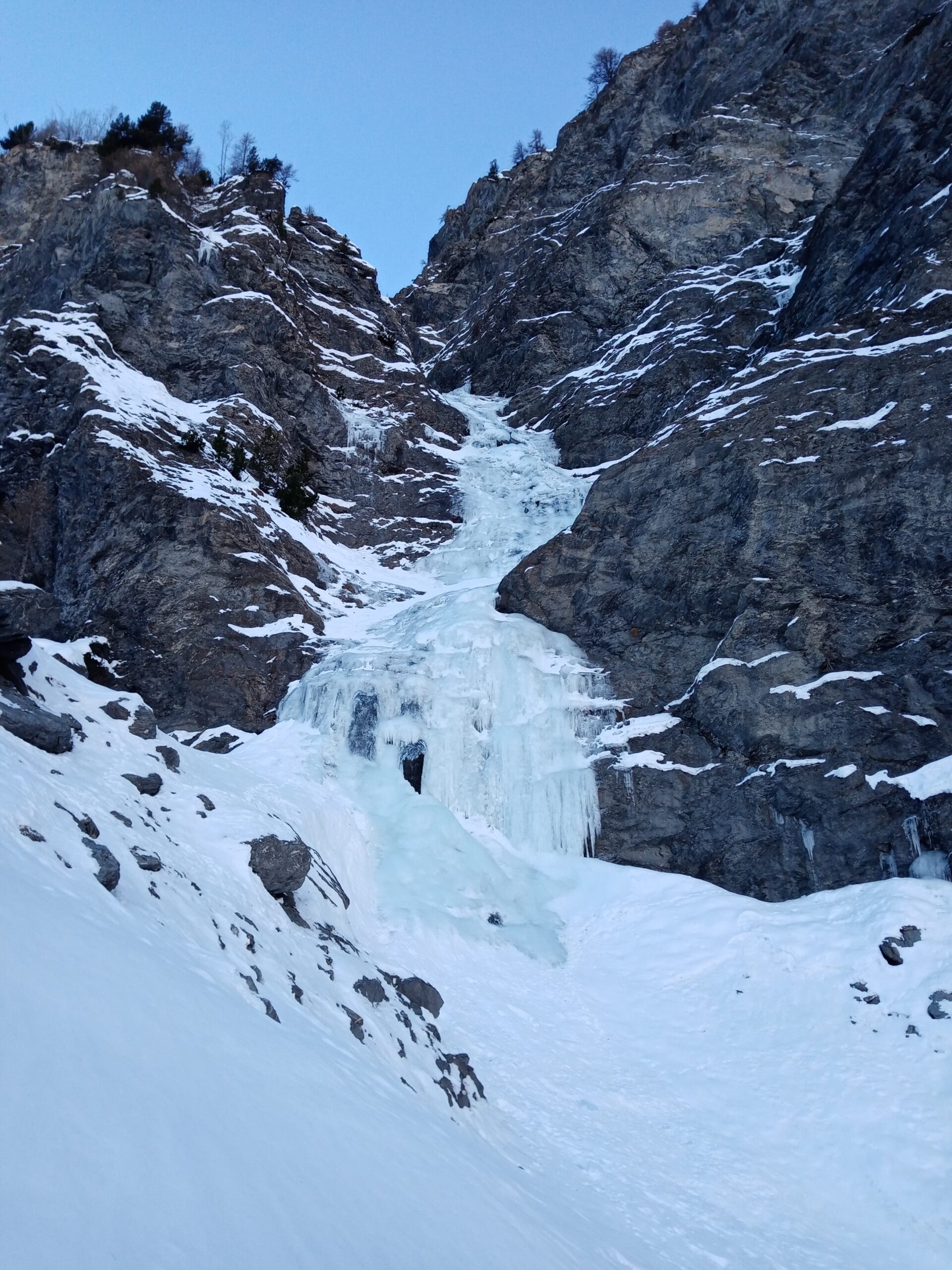
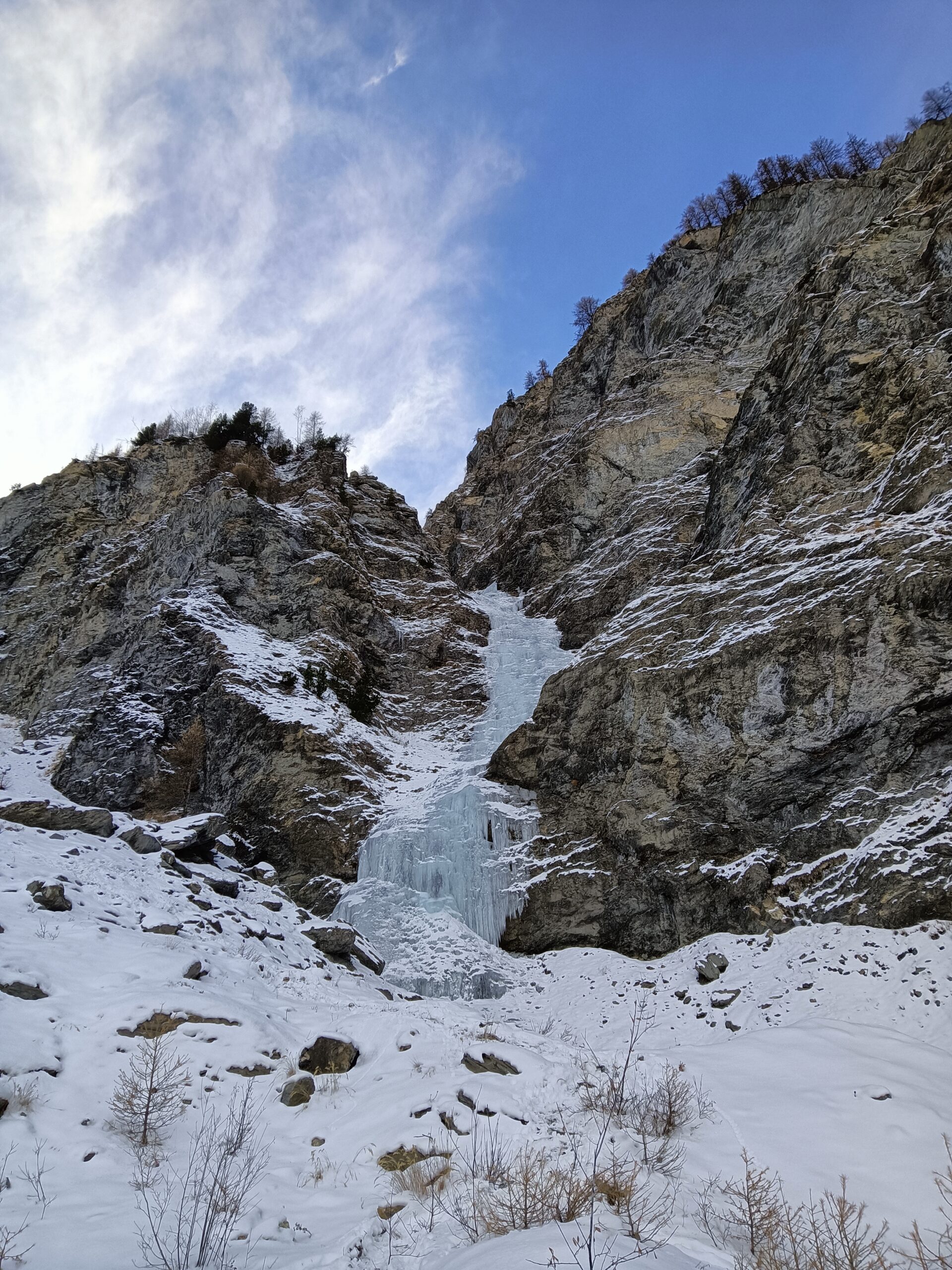
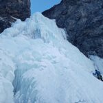
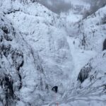
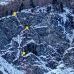
La colata molto evidente, si presenta come un vero e proprio torrente.
Ideale per le prime esperienze, è oggi diventata la classica della valle, percorsa dall’autunno alla primavera. I pericoli oggettivi sono limitati con neve assestata.
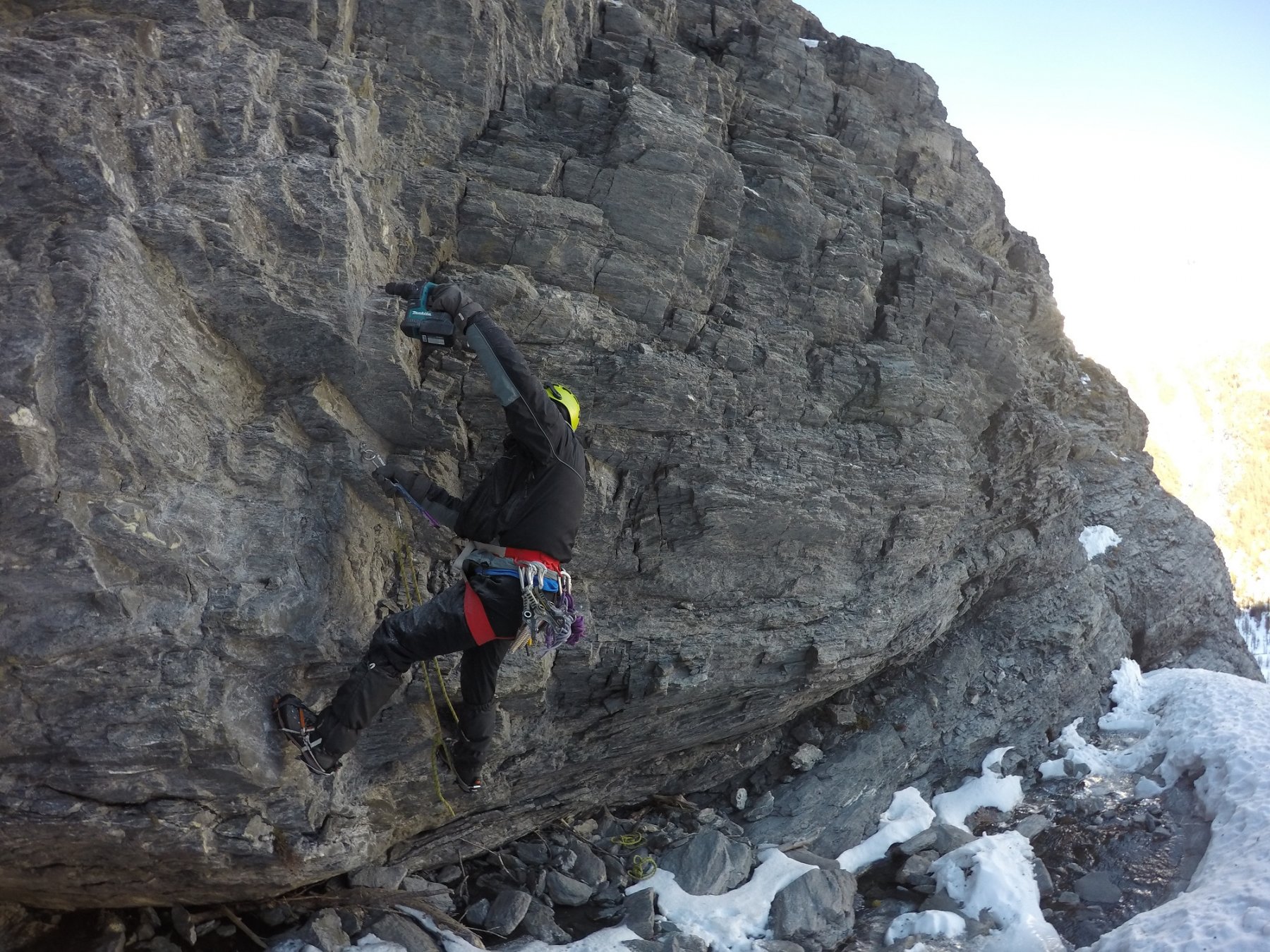
Soste su roccia ai bordi della colata, tutte a chiodi e cordoni vetusti.
Avvicinamento
Ideale per le prime esperienze, è oggi diventata la classica della valle, percorsa dall’autunno alla primavera. I pericoli oggettivi sono limitati con neve assestata.
Soste su roccia ai bordi della colata, tutte a chiodi e cordoni vetusti.
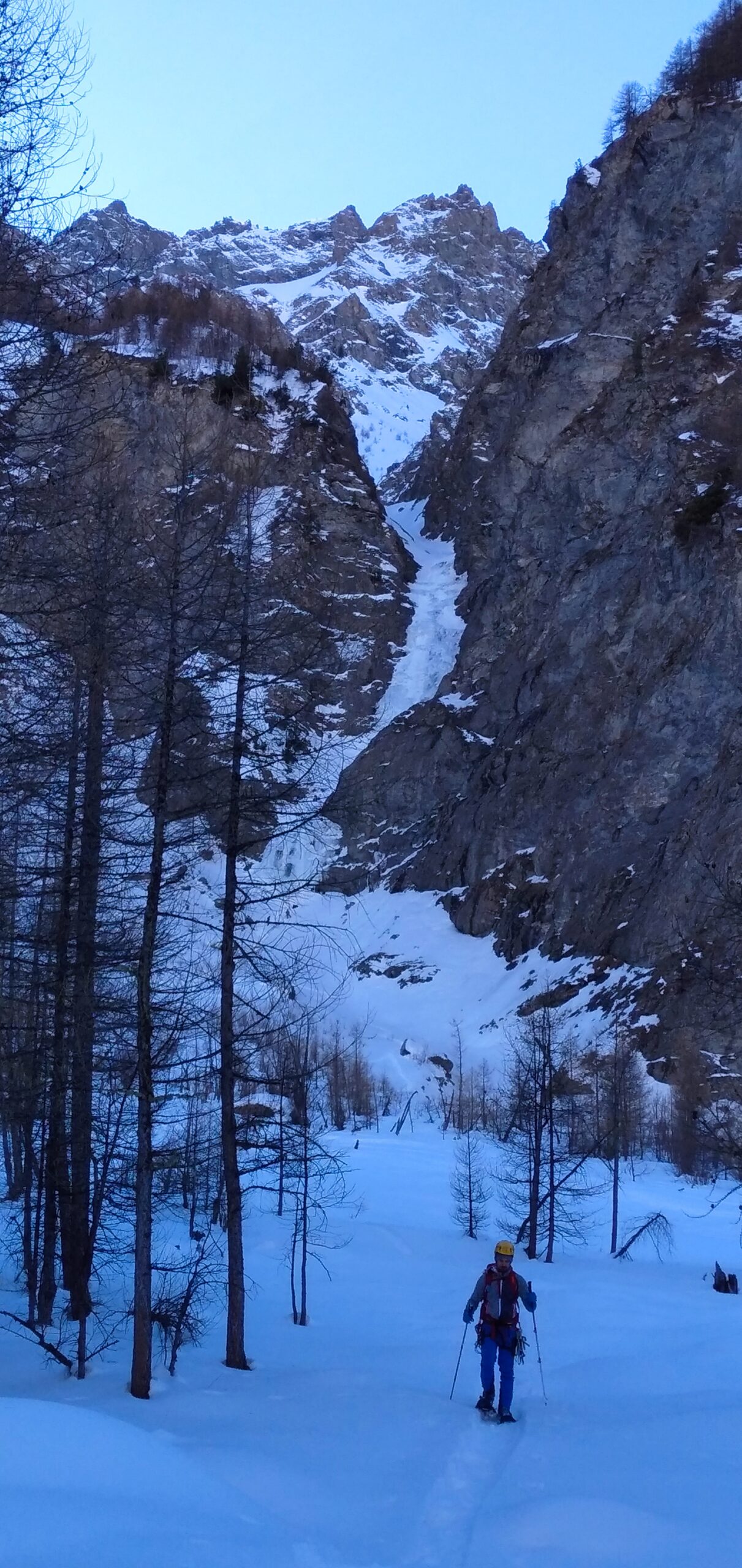
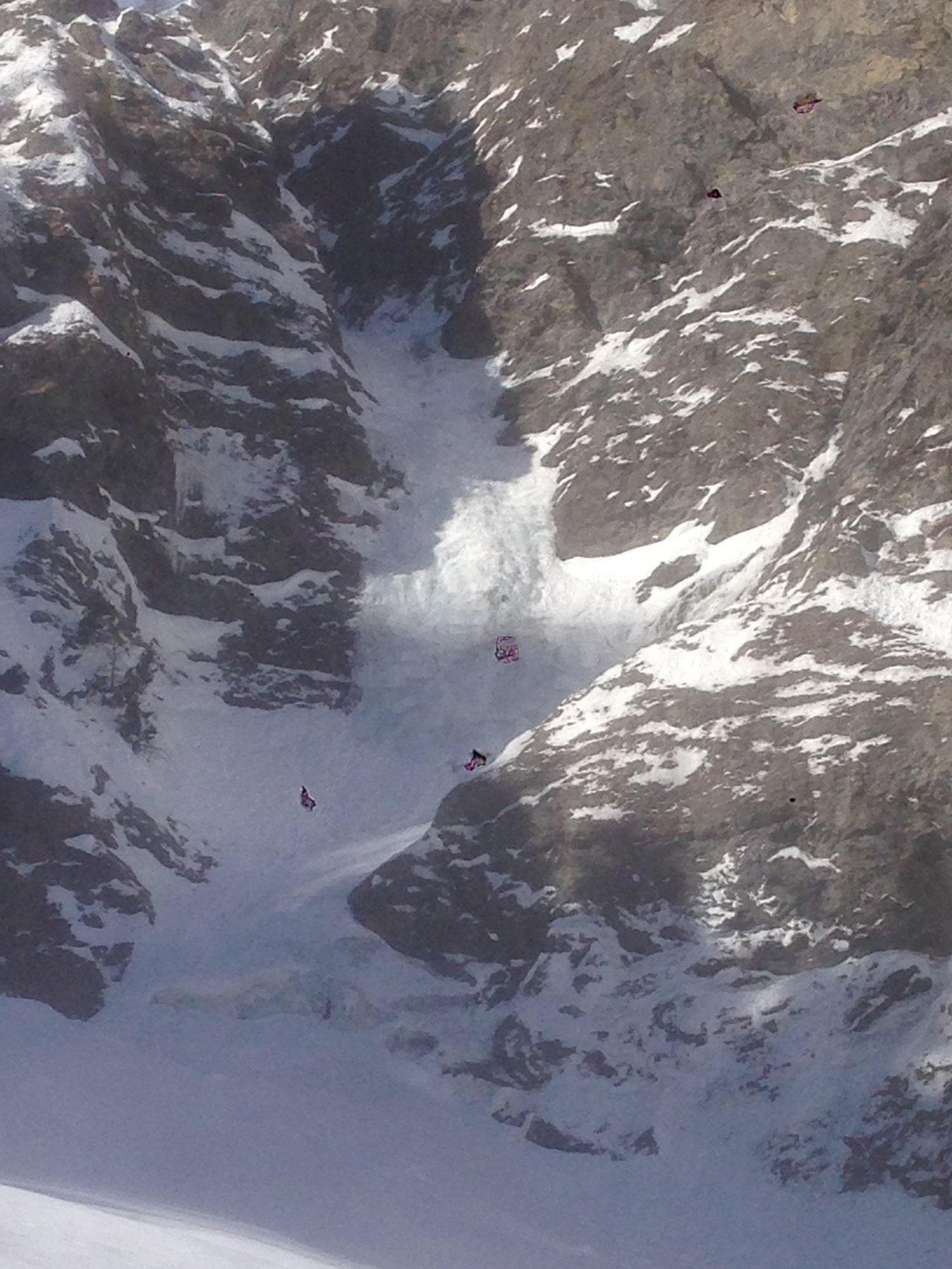
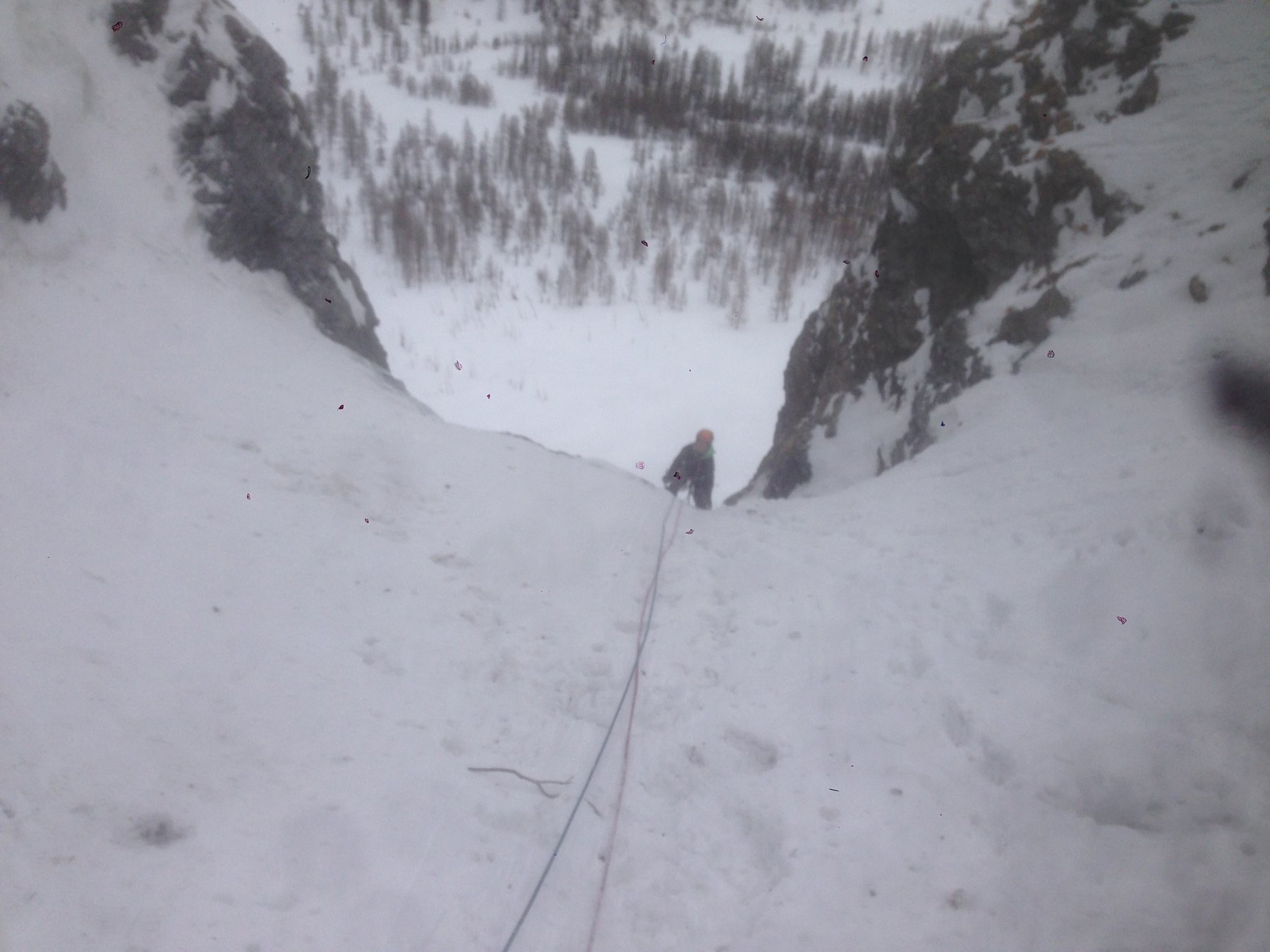
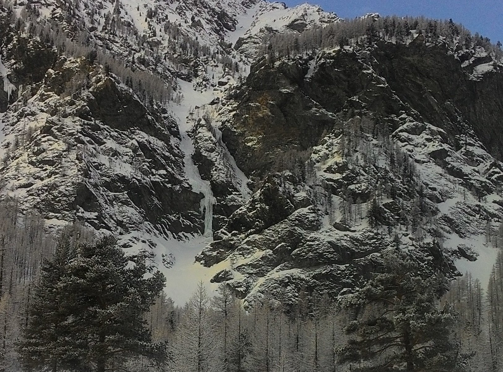
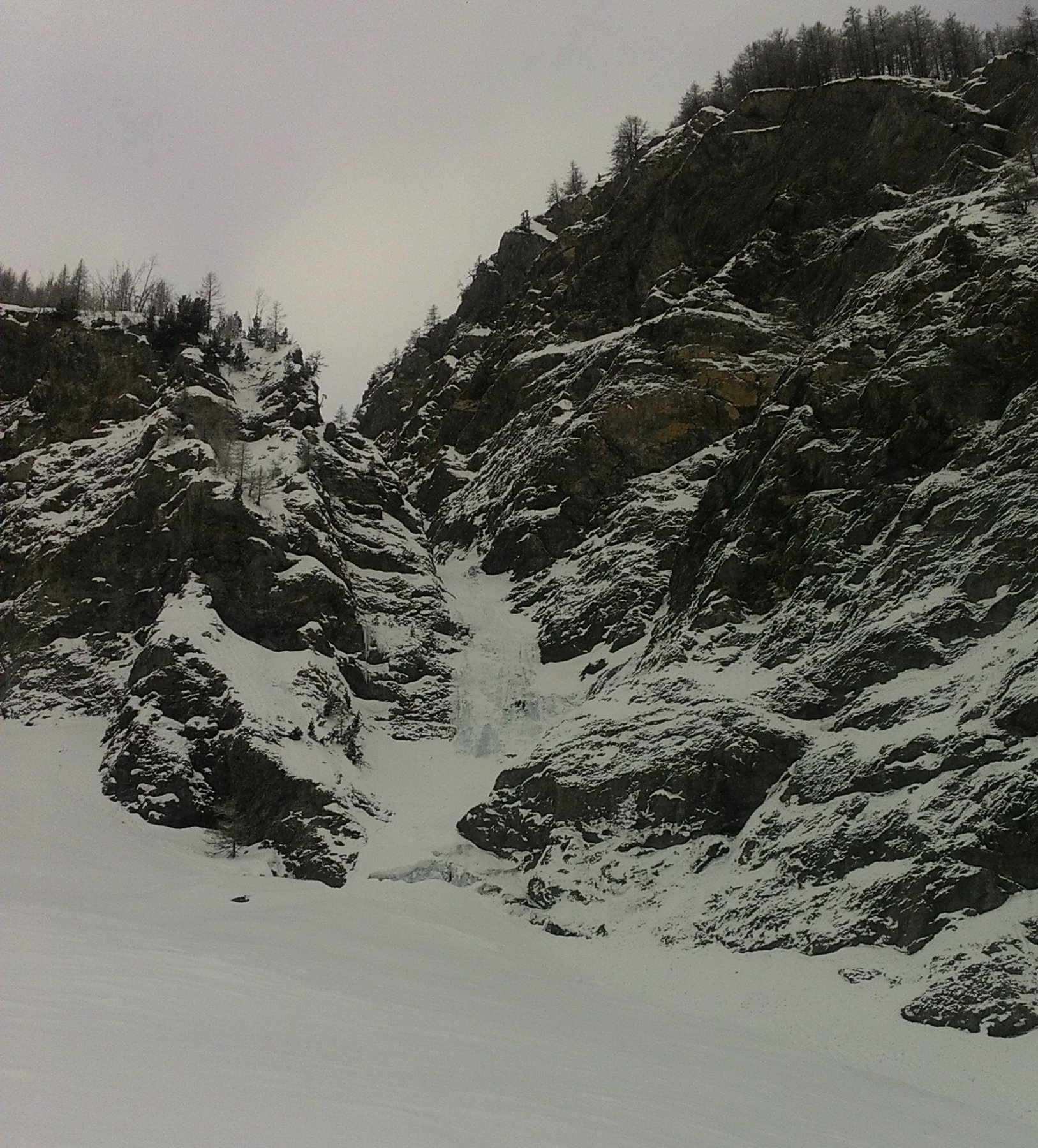
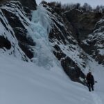
Seguendo la carrozzabile estiva oltrepassato tutto il pianoro di Brusà des Planes, proseguire verso il fondovalle, oltrepassate le prime cascate la strada costeggia una parete di roccia strapiombante, oltre la quale si incontra la goulotte del Rio Gentira. Proseguire ancora per qualche centinaio di metri sulla sterrata estiva, fin sotto la cascata che si raggiunge per dolci pendii (1.45 h da Pont Terrible).
Descrizione
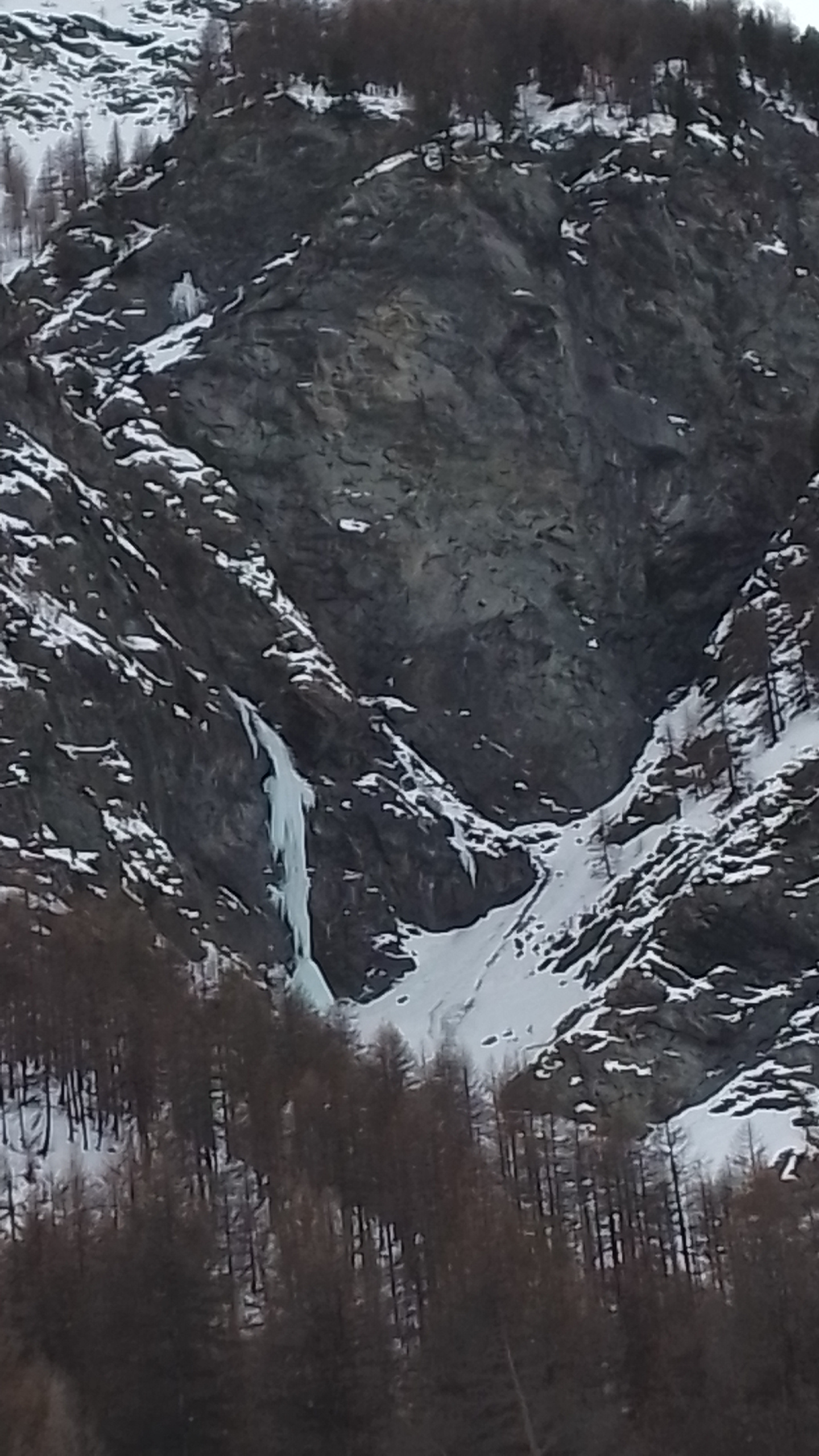
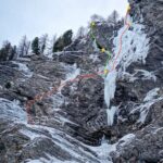
Lunghezza della cascata variabile a seconda della quantità di neve.
Solitamente si individuano 2 salti intervallati da un terrazzo.
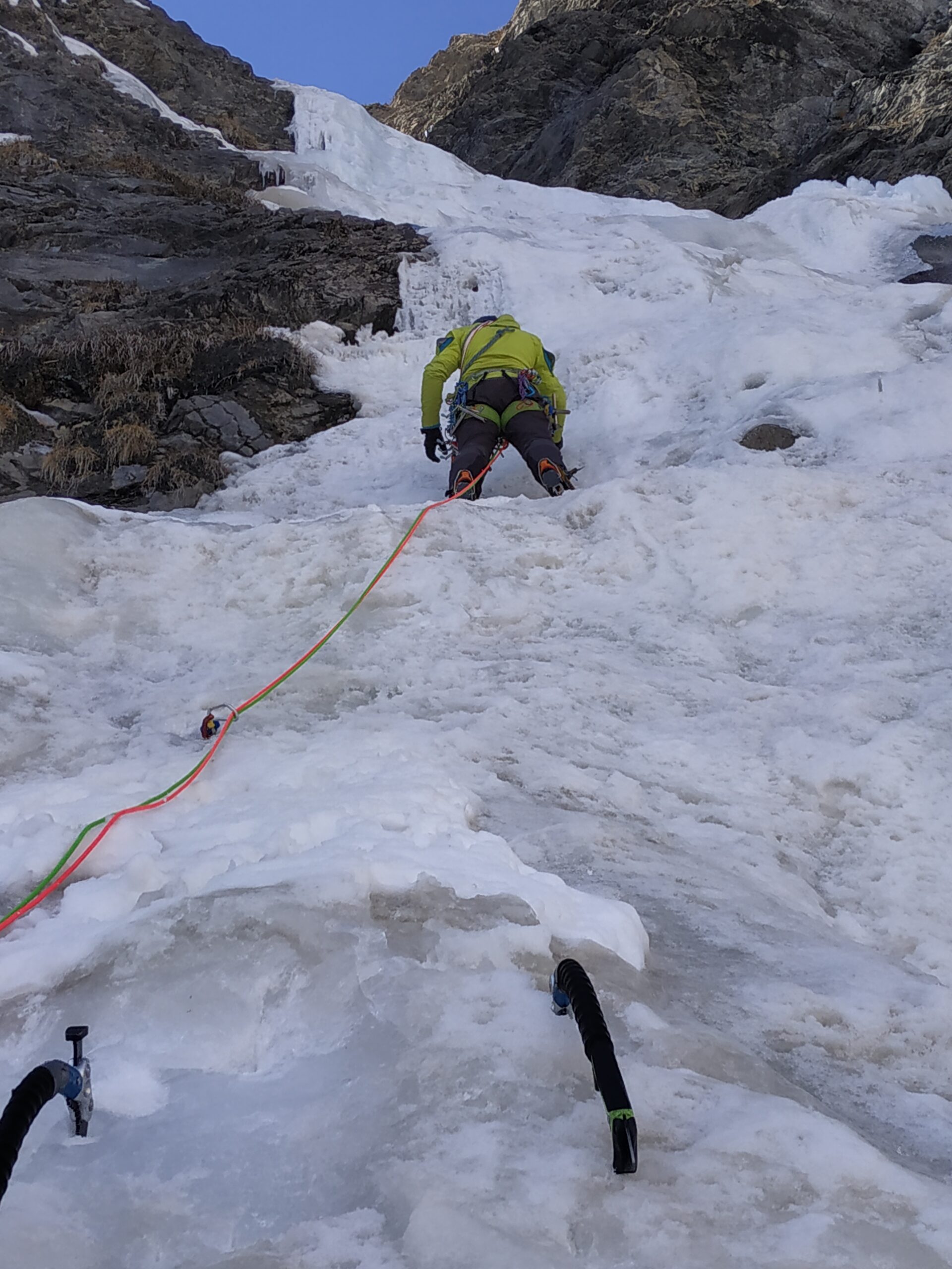
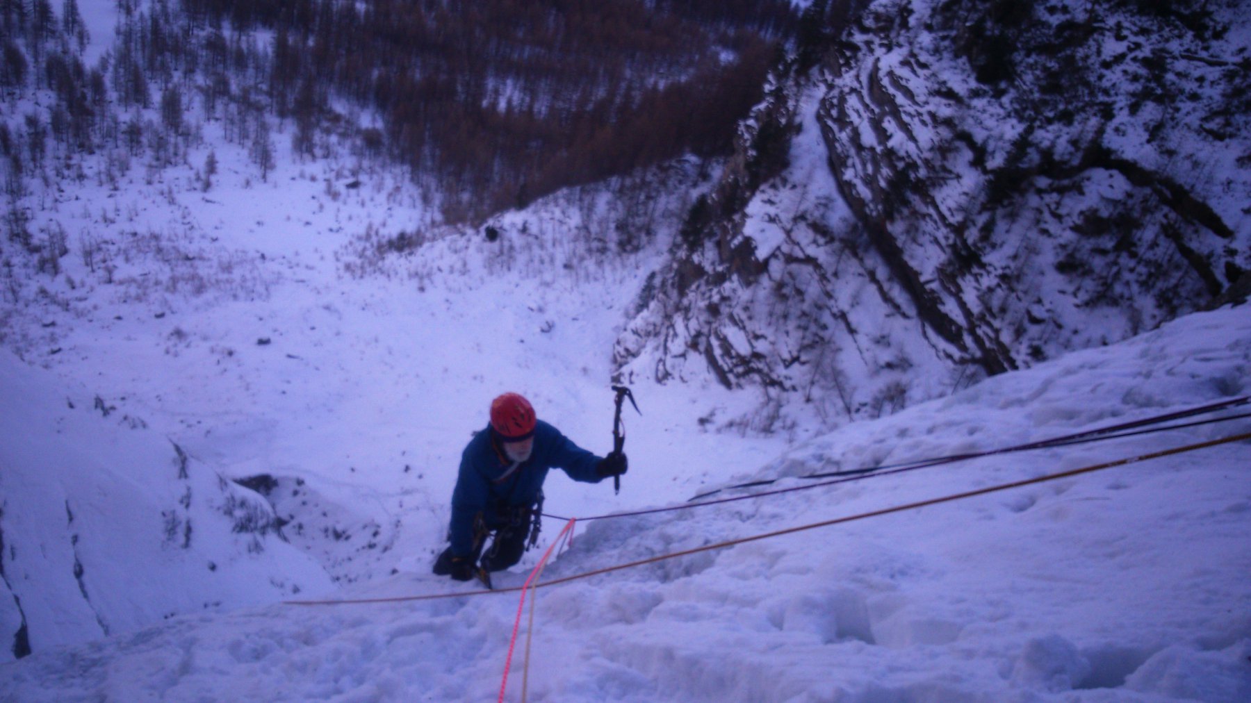
Il primo salto è più breve e si può salire sulla dx (più ripido, 80°) e più facilmente sulla sx. In caso di abbondante innevamento è molto corto e coperto.
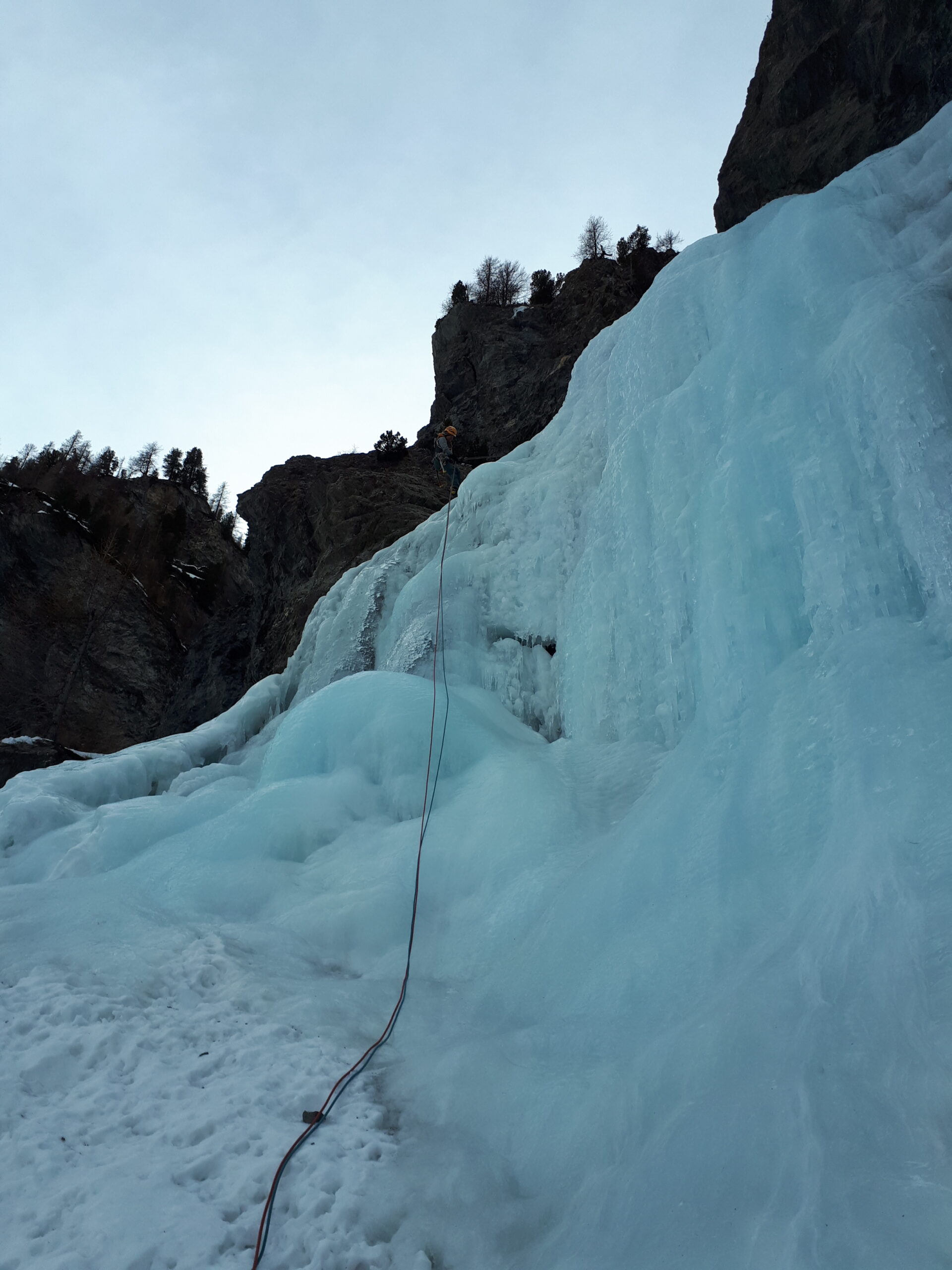
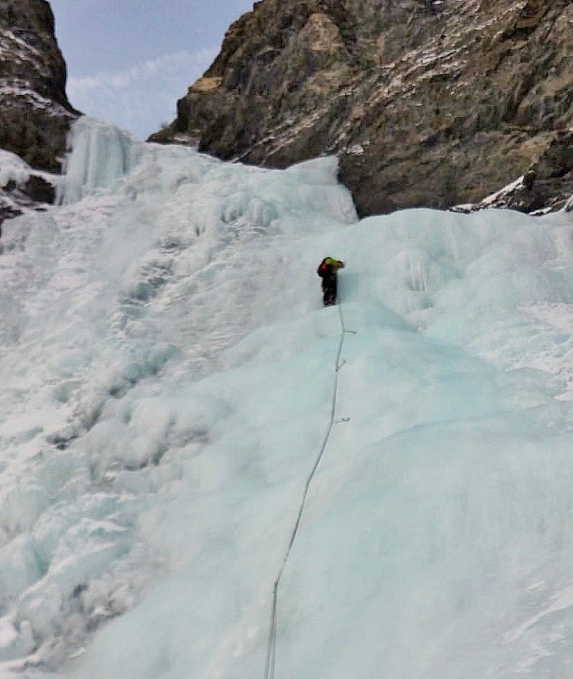
Il secondo salto è più alto, largo e consente più linee. C’è una sosta sulla sx (a 30 m dal terrazzo) e due soste sulla sx (a 30 e 50 m dal terrazzo).
Sosta terminale dove la colata spiana, sulla dx (a 55 m dalla sosta inferiore sulla sx e a 30/50 m dalle soste sulla dx).
Il salto inferiore si discende con una doppia su abalakov o, se in neve, disarrampicando.
G. Andreotta, L. Gally e P. Sobrà il 15 novembre 1981
Nelle vicinanze Mappa
Itinerari
21/12/2024 TO, Sauze di Cesana 100 m III, 4 Est
Valle Argentera – Rio Calso (Cascata del)
 650m
650m
11/01/2025 TO, Sauze di Cesana 50 m III, 3+ Nord
Valle Argentera – Rio Adriet (Cascata del)
 1.2Km
1.2Km
01/02/2026 TO, Sauze di Cesana 90 m III, 4 Nord-Est
Valle Argentera – Rio Pelvo (Cascatone del)
 1.4Km
1.4Km
11/01/2025 TO, Sauze di Cesana 100 m III, 4 Nord-Est
Valle Argentera – Stalattite di Fumo (Cascata)
 1.6Km
1.6Km
09/01/2023 TO, Sauze di Cesana 110 m III, 3+ Nord-Est
Valle Argentera – Anni di Ghiaccio (Cascata)
2Km
06/02/2024 TO, Sauze di Cesana 140 m III, 3 Est
Valle Argentera – Candelino dell’Elefantasma (Cascata)
2Km
21/12/2025 TO, Sauze di Cesana 110 m III, 3 Nord-Est
Valle Argentera – Rio Gentira (Cascata del)
 2.2Km
2.2Km
23/01/2024 TO, Sauze di Cesana 100 m II, 4+, M6 Nord
Valle Argentera – Pand’ice e Fuga dalla Panda (Cascate)
 2.4Km
2.4Km
11/01/2020 TO, Sauze di Cesana 30 m I, 3+ Nord-Est
Valle Argentera – Ipercoop (Cascata)
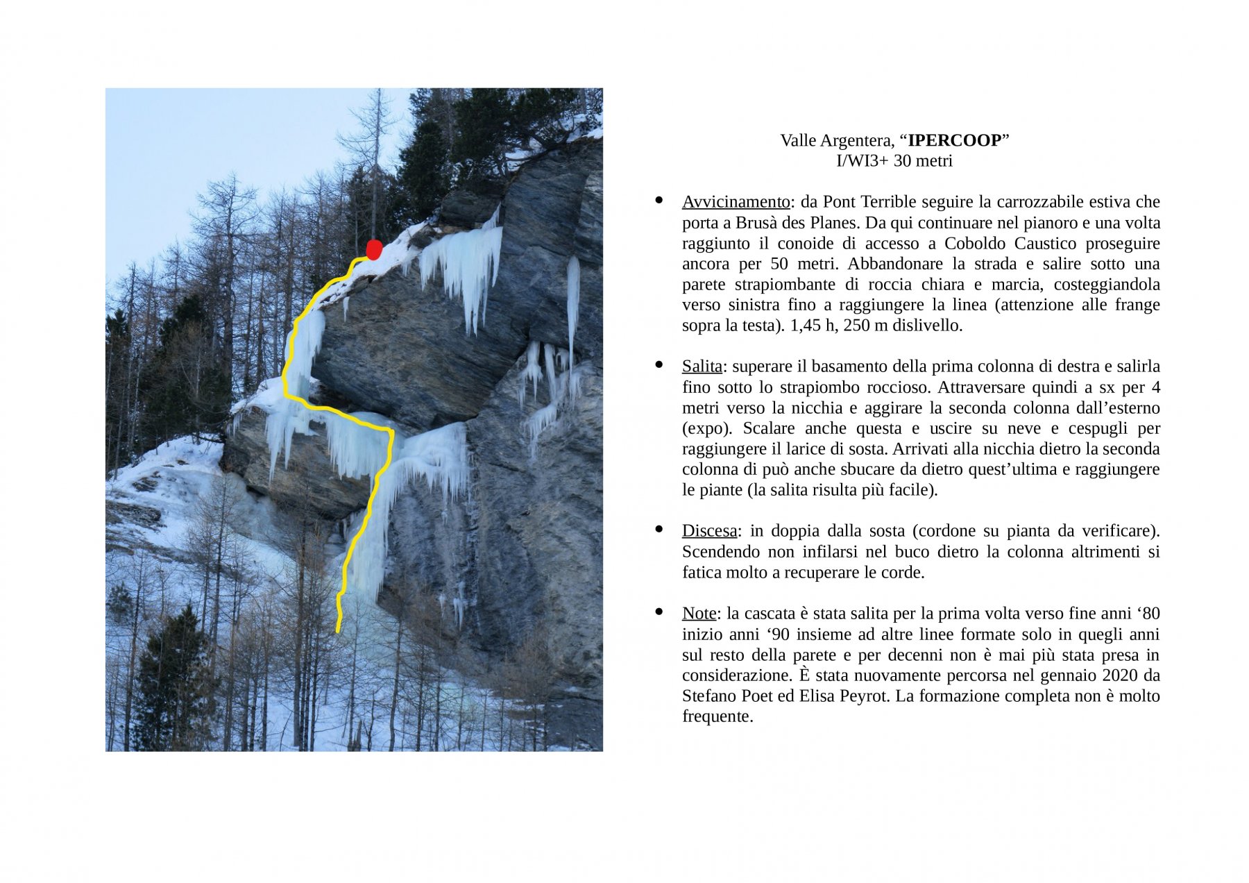 2.5Km
2.5Km
17/01/2024 TO, Sauze di Cesana 100 m III, 5, M5 Nord
Valle Argentera – La chiave perduta (Cascata)
 2.6Km
2.6Km