 3.1Km
3.1Km
Note
 700m
4.6Km
5.1Km
5.1Km
5.1Km
6.1Km
700m
4.6Km
5.1Km
5.1Km
5.1Km
6.1Km
3.1Km
3.2Km
3.2Km
4.2Km
6Km
6.1Km
6.1Km
7.5Km
7.7Km
8.1Km
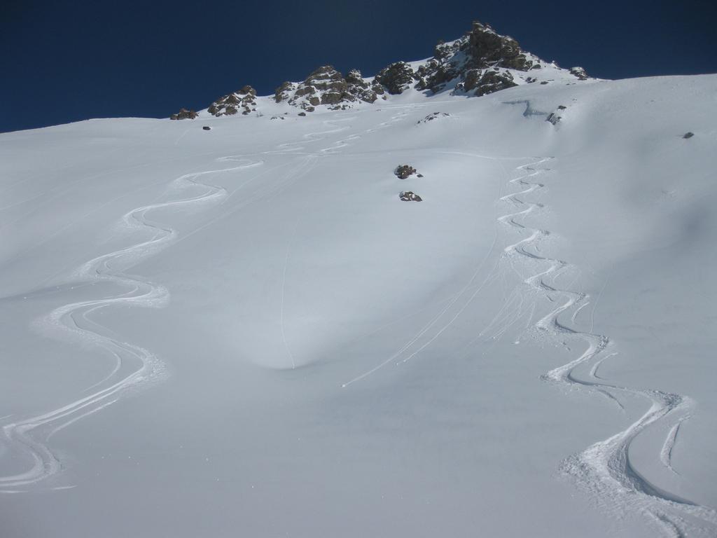
Fuoripista classicissimo, anche se non molto battuto, a causa della bassa quota di arrivo, che permette raramente di trovare abbastanza neve fino in fondo e ancor più raramente, neve bella bella.
E' addirittura segnato con paline nere, ma diffidate, non é così facile da individuare, né da seguire.
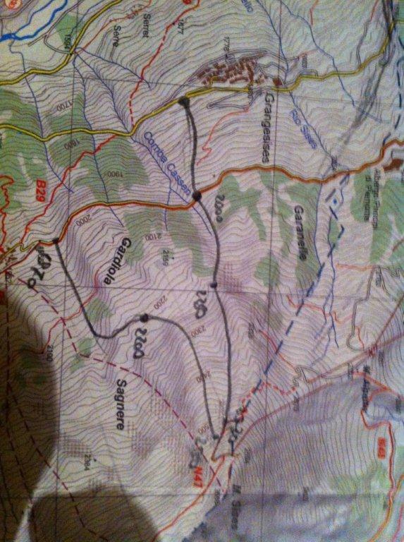
Descrizione
E' addirittura segnato con paline nere, ma diffidate, non é così facile da individuare, né da seguire.
Si comincia dalla partenza dello Ski lift del Rio Nero a 2280 m già nel bosco, raggiungibile dal Fraiteve (2701 m), con i bei fuoripista alti (alcuni pericolosi). E’ importantissimo tenersi molto a sinistra, seguendo, se si riesce il tracciato e le paline, onde non finire nel Rio Nero che intorno ai 2000 m si incassa con sponde molto ripide dalle quali é veramente difficile uscire. ATTENZIONE!
Si prosegue quindi per bei pendii boscosi via via più fitti fino al cosidetto Pian delle Bambole (1635 m).
Di qui la pendenza diminuisce (con neve lenta si fa problematico), meglio seguire il tracciato e le paline. Nuovamente tratto ripido fra i 1500 e i 1400, dove si perde inesorabilemente il tracciato (boschina). Si recupera e si riperde una stradina, che a tratti permette qualche curva, fino al traverso finale verso destra già visibile dalla strada statale che arriva 10 m valle della Pizzeria Rio nero, ottima per mangiarci….
- Cartografia:
- Fraternali N°2, IGC N°1 -Valli di Susa, Chisone e Germanasca
Nelle vicinanze Mappa
Itinerari
15/12/2012 TO, Sauze D'oulx D+ 1029 m 3.2, E2 Nord
Barracano
 700m
700m
17/03/2013 TO, Sauze D'oulx D+ 580 m 3.2, E1 Nord
Sportinia-Prariond
1.6Km
24/12/2025 TO, Sestriere D+ 1000 m 3.1, E1 Nord
Sestriere Boschi
 4.6Km
4.6Km
12/03/2013 TO, Sestriere D+ 595 m 3.1, E1 Sud-Est
Basset (Col) dal Fraiteve
5.1Km
14/02/2018 TO, Sestriere D+ 720 m 3.2, E1 Ovest
Grangesises dal Sises
 5.1Km
5.1Km
22/12/2012 TO, Sestriere D+ 580 m 3.2, E1 Sud-Ovest
Sises (Monte) discesa a Bessen Haut
 5.1Km
5.1Km
23/01/2015 TO, Sestriere 3.1, E1 Varie
Sestriere Pali della luce, Sotto Rognosa, Colombiere
 5.1Km
5.1Km
23/12/2016 TO, Pragelato D+ 1000 m 3.1, E1 Nord
Pragelato Fuoripista Vari
 6.1Km
6.1Km
01/12/2012 TO, Sestriere D+ 540 m 1.1, E1 Sud
Chalmettes – Rollieres da San Sicario
6.3Km
10/03/2013 TO, Cesana Torinese D+ 1720 m 3.1, E1 Sud
Alpes (Granges des) da San Sicario
6.4Km
Servizi
3.1Km
3.2Km
paddy mc ginty Ristorante
Sauze d'Oulx
3.2Km
orto del frate Ristorante
Sauze d'Oulx
4.2Km
La Moretta Ristorante
Oulx
6Km
La Chardouse Rifugio
Oulx
6.1Km
La capanna del sole Ristorante
Pragelato
6.1Km
Al Mulino Ristorante
Pragelato
7.5Km
Mulino di Laval Rifugio
Pragelato
7.7Km
Misun La Font Ristorante
Sauze di Cesana
8.1Km


