 2.7Km
2.7Km
Note
 0m
300m
2.3Km
4.5Km
5.1Km
6.2Km
0m
300m
2.3Km
4.5Km
5.1Km
6.2Km
2.7Km
6.2Km
6.2Km
6.4Km
6.7Km
7.1Km
7.4Km
7.4Km
7.5Km
8.1Km
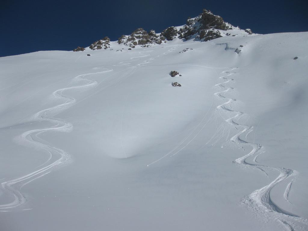
Bel fuoripista gemello di quello di Grangesises, forse ancora si più d' ambiente, orientato verso la valle Argentera. più penalizzato come esposizione.
Avvicinamento
.
Descrizione
Partenza dalla variante alta facile della Pista Sises, subito dopo il tornante (2560 m).
Due possibilità:
1) Scendere a sinistra seguendo il percorso scialpinistico direttamente su Bessen Haut, pendii molto ripidi, esposti in alto in pieno sud, molto ventati, da fare in codizioni sicure.
2) Tenersi più a destra, a fianco del fuoripista di Grangesises, traversando poi più in basso; viene descritta questa seconda opzione.
Tenersi sui bei pendii a destra del costone, con percorso non obbligato; verso i 2250 cominciare a traversare brevemente a sinistra fino ad un pianoro a quota 2200, da cui si riscollina su Bessen Haut.
Ripido pendio a destra evitabile traversando a sinistra, fino a raggiungere una comba molto bella che conduce alla strada alla curva prima del paese (1970 m). E’ possibile punatare a sinistra fino al paese ma ci si perde la bella comba….
- Cartografia:
- Fraternali N°2, IGC N°1 -Valli di Susa, Chisone e Germanasca
Nelle vicinanze Mappa
Itinerari
12/03/2013 TO, Sestriere D+ 595 m 3.1, E1 Sud-Est
Basset (Col) dal Fraiteve
0m
14/02/2018 TO, Sestriere D+ 720 m 3.2, E1 Ovest
Grangesises dal Sises
 0m
0m
23/01/2015 TO, Sestriere 3.1, E1 Varie
Sestriere Pali della luce, Sotto Rognosa, Colombiere
 300m
300m
24/12/2025 TO, Sestriere D+ 1000 m 3.1, E1 Nord
Sestriere Boschi
 2.3Km
2.3Km
08/12/2012 TO, Sauze di Cesana D+ 940 m 3.1, E1 Sud
Roccia Rotonda da Sansicario
2.9Km
15/12/2012 TO, Sauze D'oulx D+ 1029 m 3.2, E2 Nord
Barracano
 4.5Km
4.5Km
01/12/2012 TO, Sestriere D+ 540 m 1.1, E1 Sud
Chalmettes – Rollieres da San Sicario
4.7Km
22/12/2012 TO, Sauze D'oulx D+ 1110 m 3.2, E1 Nord-Ovest
Rio Nero
 5.1Km
5.1Km
23/12/2016 TO, Pragelato D+ 1000 m 3.1, E1 Nord
Pragelato Fuoripista Vari
 6.2Km
6.2Km
17/03/2013 TO, Sauze D'oulx D+ 580 m 3.2, E1 Nord
Sportinia-Prariond
6.4Km
Servizi
2.7Km
6.2Km
Al Mulino Ristorante
Pragelato
6.2Km
La capanna del sole Ristorante
Pragelato
6.4Km
Mulino di Laval Rifugio
Pragelato
6.7Km
Centro Ristorante
Cesana Torinese
7.1Km
La Fontana del Thures Rifugio
Cesana Torinese
7.4Km
da Carlo Rifugio
Cesana Torinese
7.4Km
La Tana degli Orsi B&B
Cesana Torinese
7.5Km
La Crota B&B
Cesana Torinese
8.1Km


