850m
850m
Note
 3.6Km
3.7Km
4.1Km
4.2Km
4.3Km
4.3Km
5.3Km
5.3Km
5.4Km
5.4Km
3.6Km
3.7Km
4.1Km
4.2Km
4.3Km
4.3Km
5.3Km
5.3Km
5.4Km
5.4Km
850m
850m
850m
850m
4.2Km
4.4Km
5.5Km
7.1Km
7.1Km
7.1Km
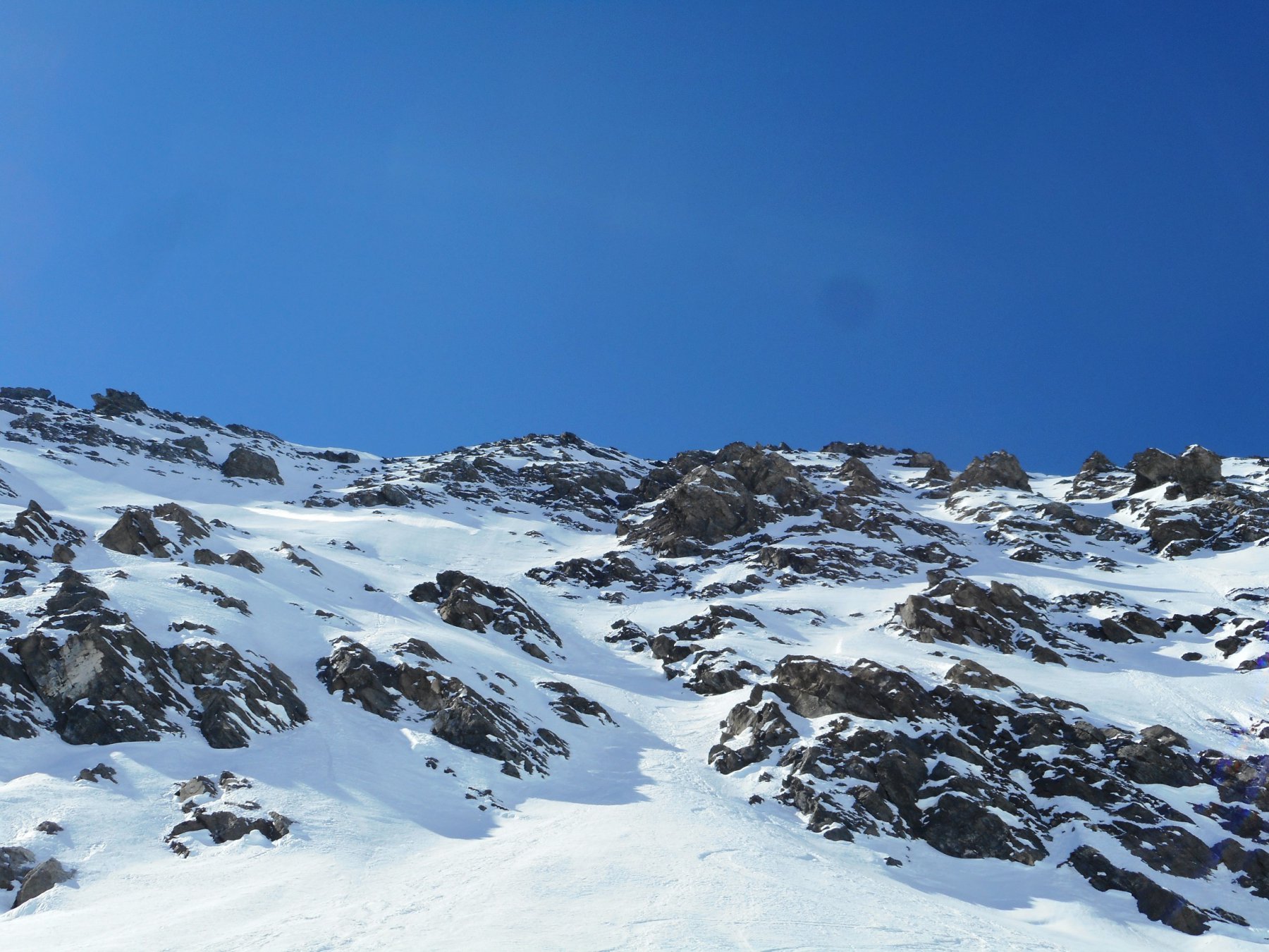
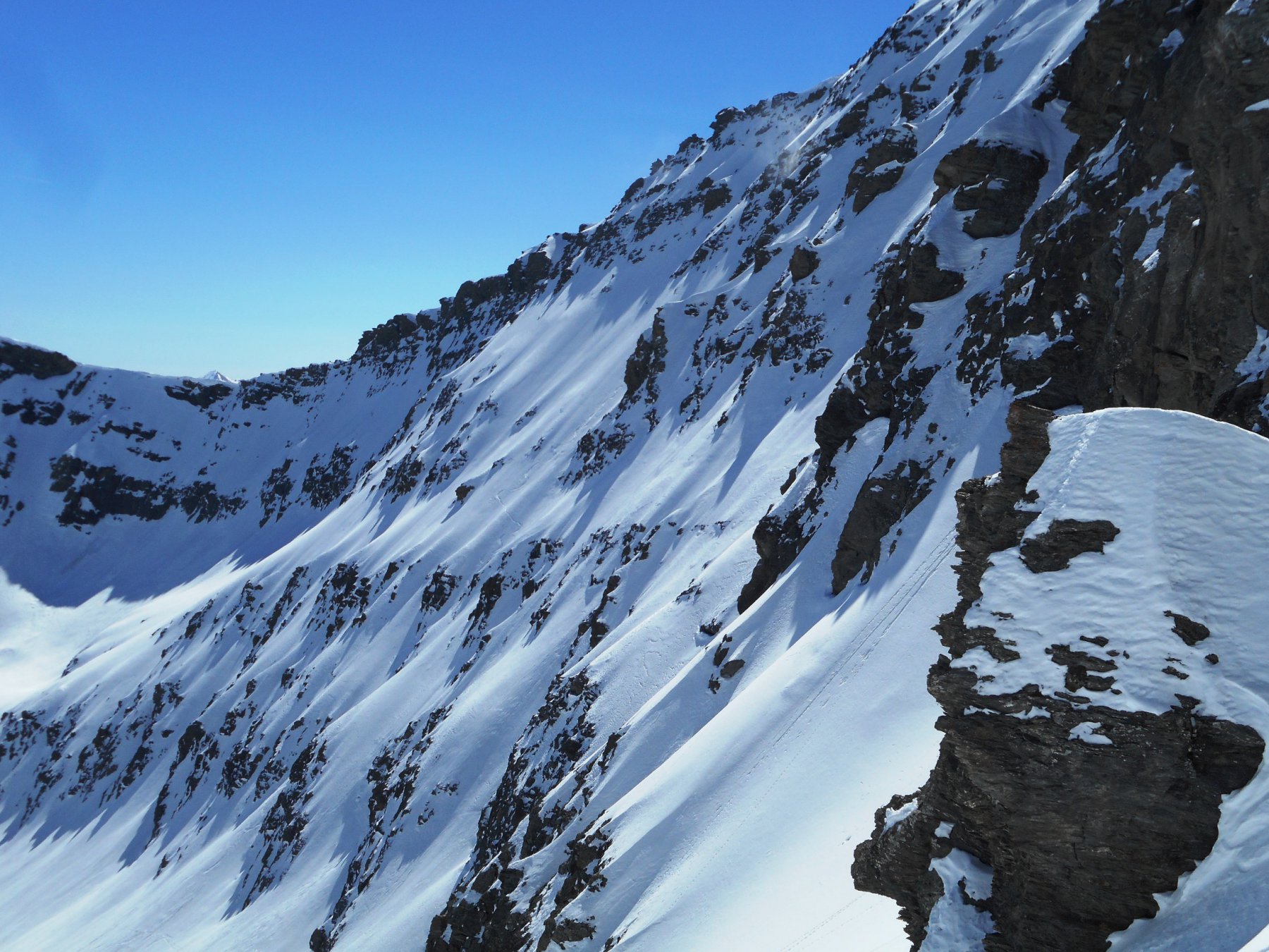
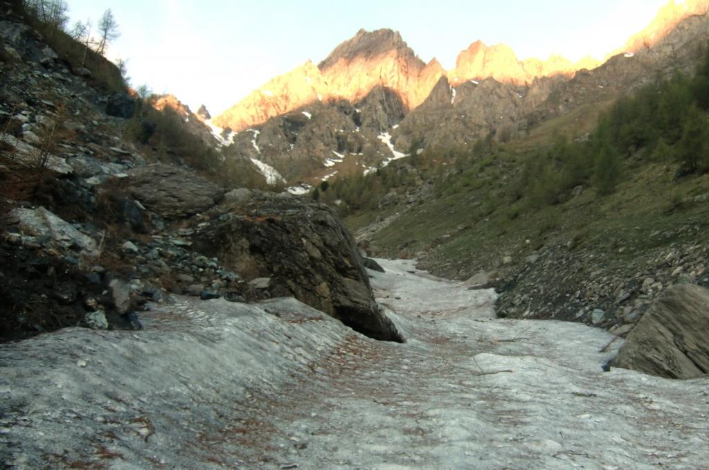
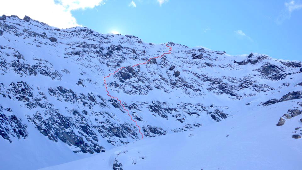
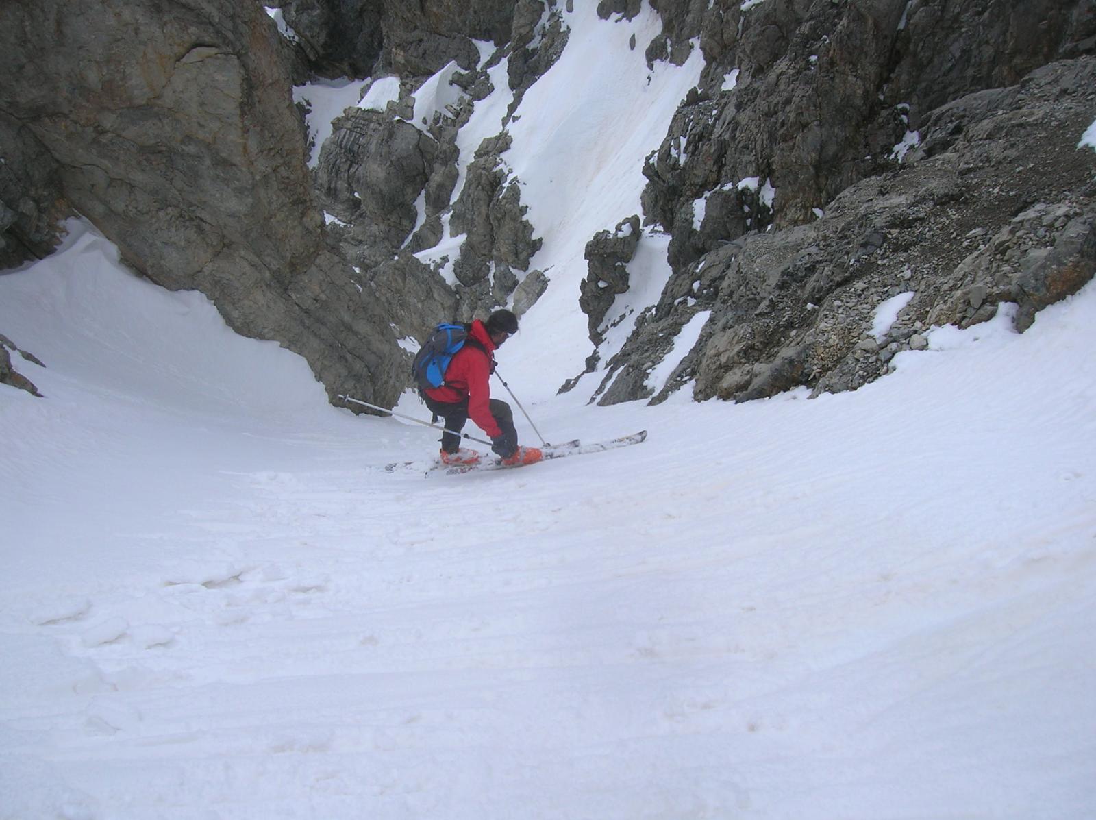
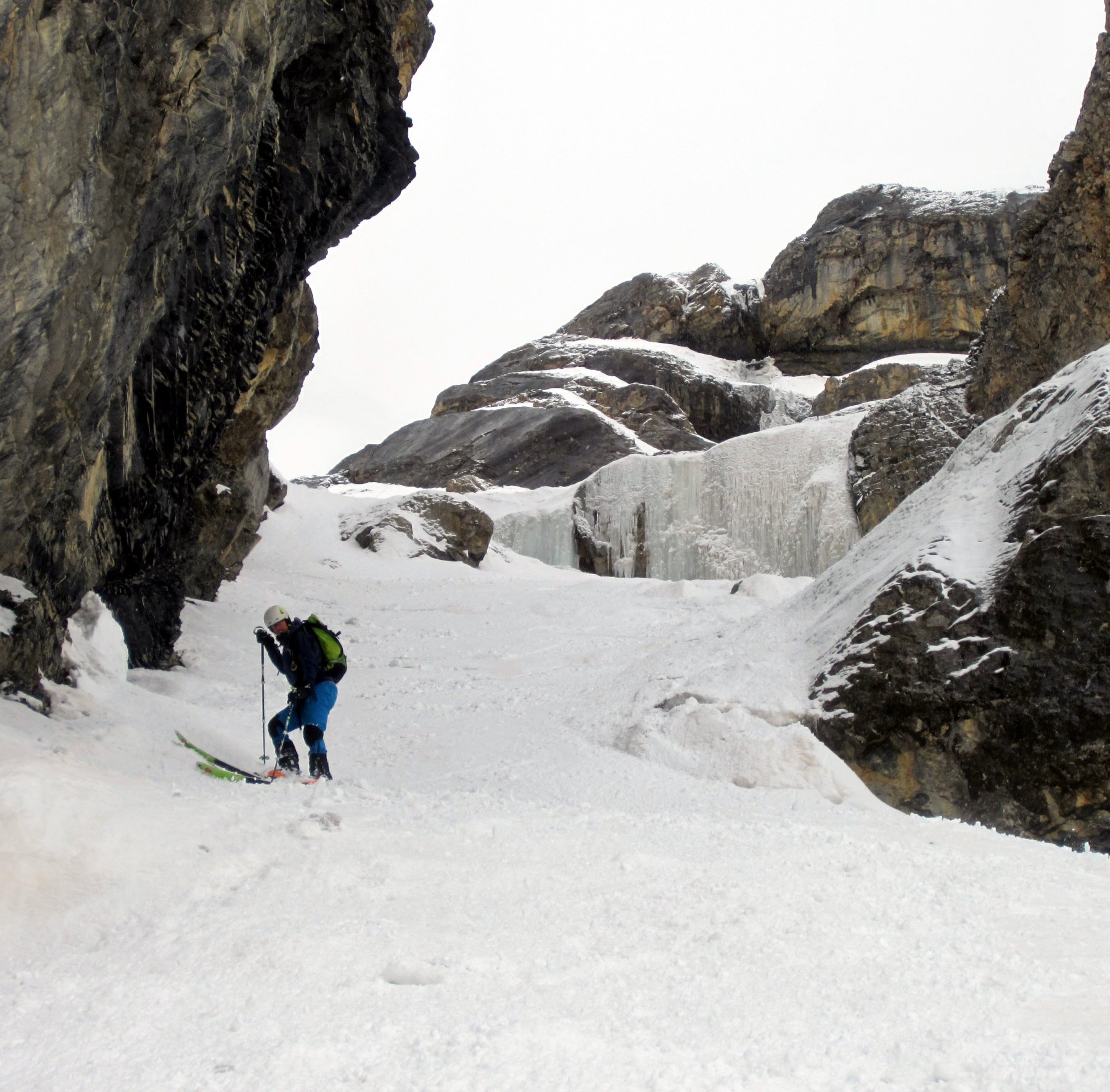
Gita in ambiente isolato e selvaggio anche se poco distante dalla strada della valle Argentera.
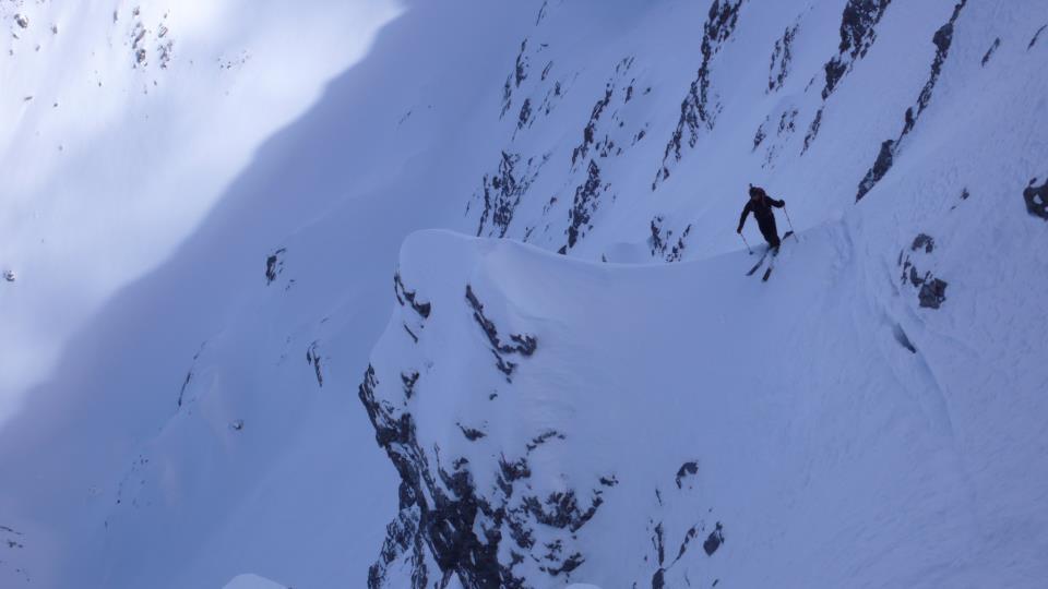
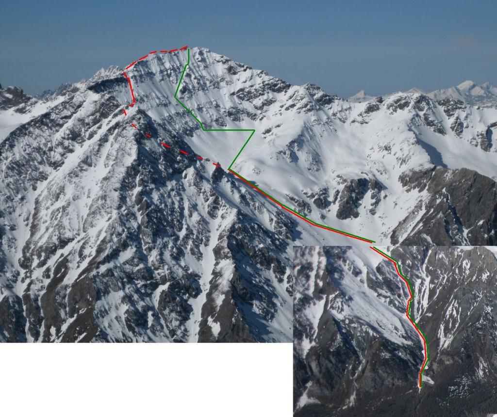
La parte ripida e modesta rispetto alla lunghezza della gita (max 300 mt), questa però è compensata dai pendii e canali precedenti quasi sempre sostenuti.
Descrizione
La parte ripida e modesta rispetto alla lunghezza della gita (max 300 mt), questa però è compensata dai pendii e canali precedenti quasi sempre sostenuti.
Parcheggia appena oltre il ponte.
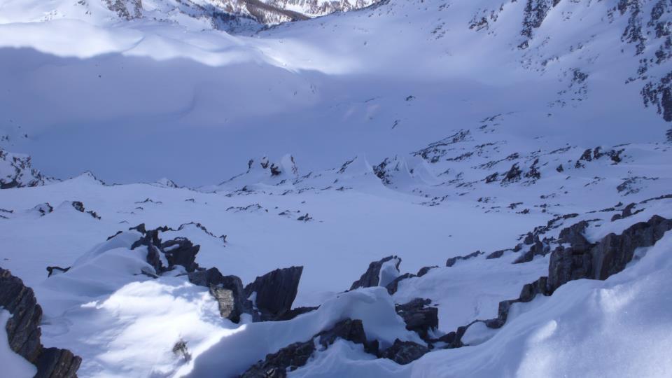
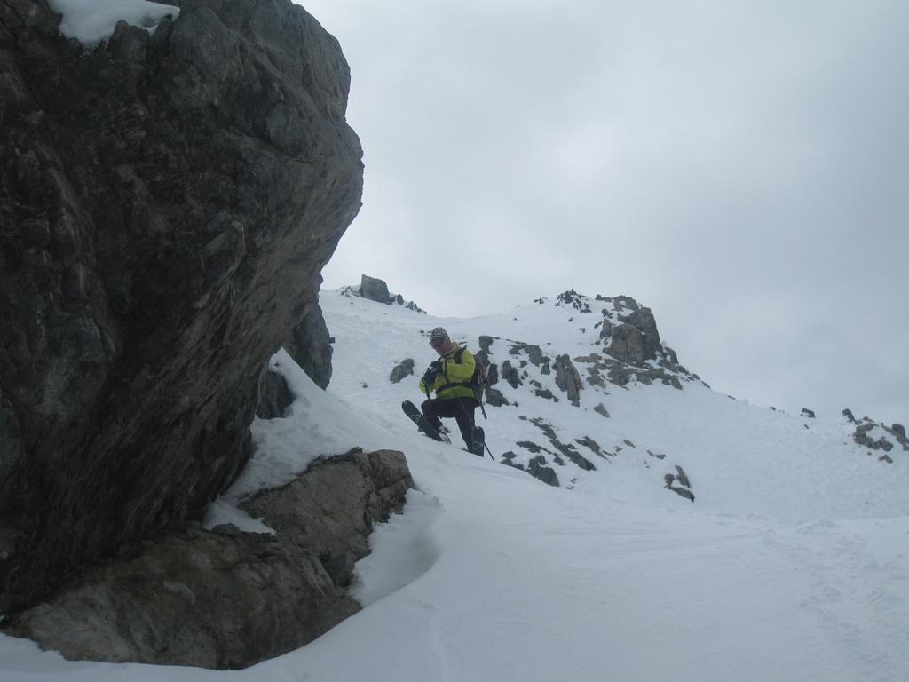
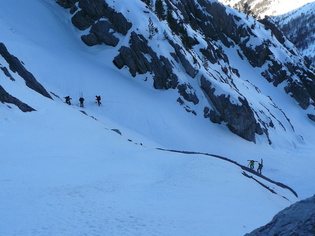
Salire nel bosco lungo la sponda destra orografica del torrente Ripa. Entrare nella gorgia formato dal torrente stesso, proseguire sul letto del torrente fino a dove la gorgia si apre.
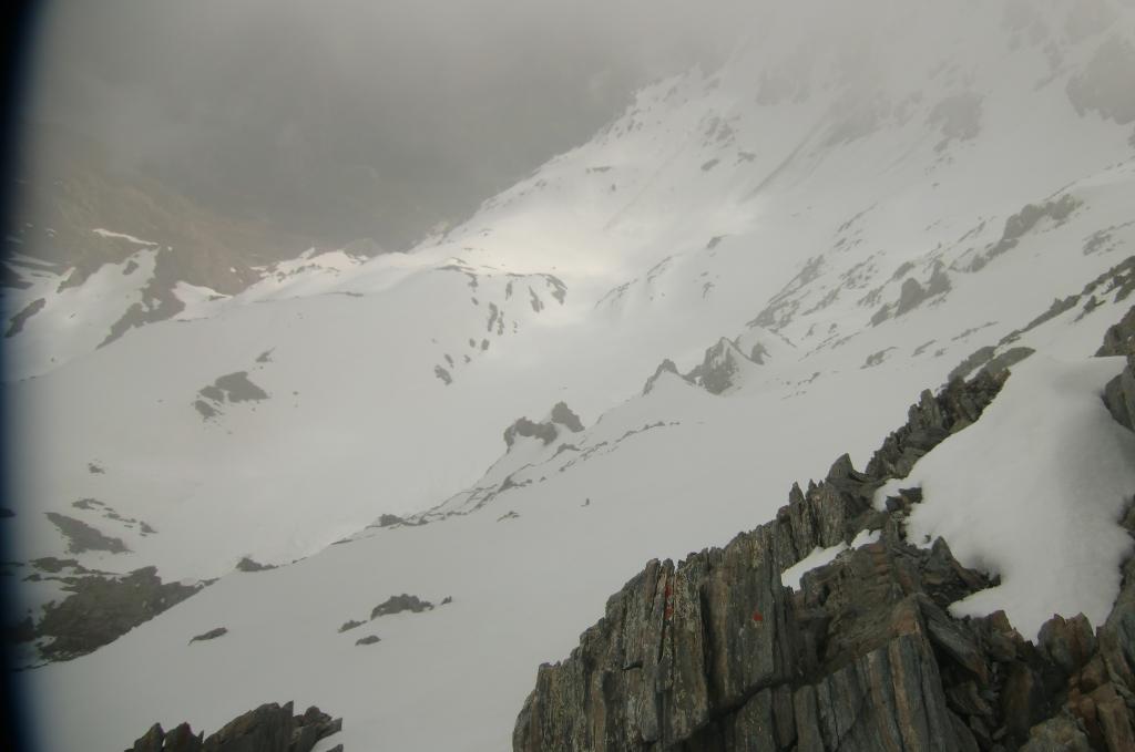
Da lì prendere il canale più a destra (faccia a monte), che pora all’ampia conca sotto la parete.
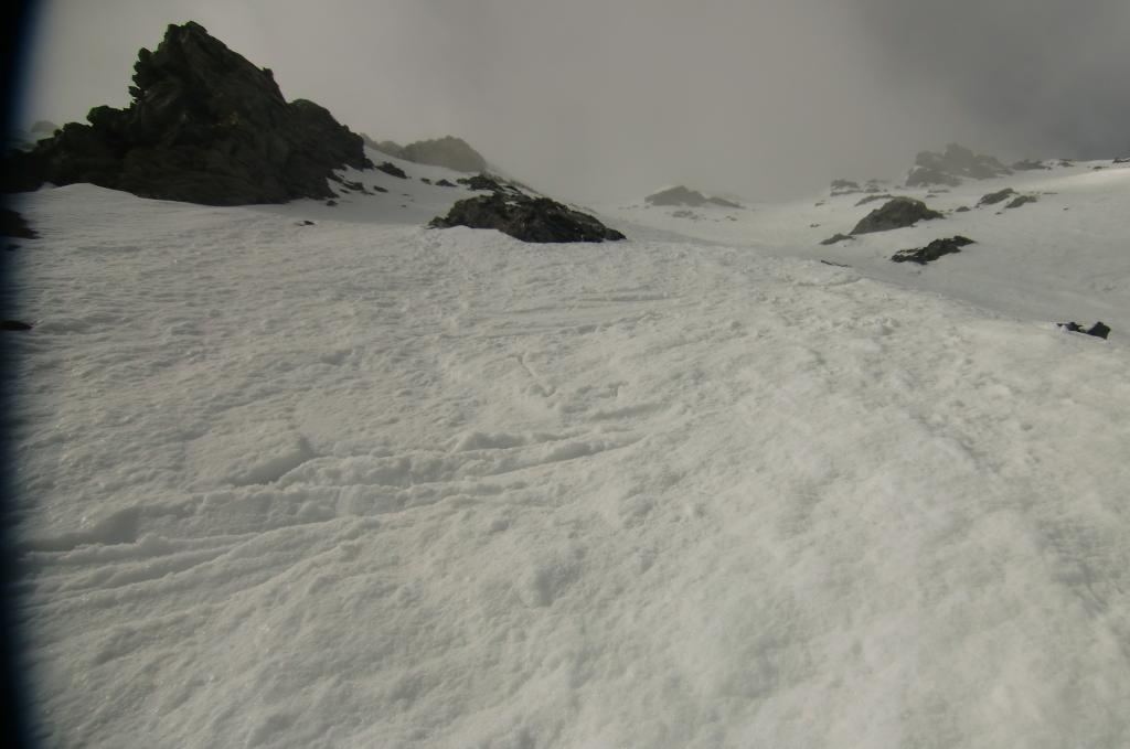
Proseguire a piacere in direzione della parete e risalirla dove si preferisce fino alla croce di vetta.
Discesa lungo itinerario di salita.
- Cartografia:
- IGC 105 1:25000
- Bibliografia:
- Ripido! di Negri,Cardonatti
Nelle vicinanze Mappa
Itinerari
12/04/2014 TO, Cesana Torinese D+ 1600 m III, 3.3, E2 Tutte
Clotesse (Punta) Canale SO
 3.6Km
3.6Km
17/02/2024 TO, Claviere D+ 1380 m 4.3, E3 Sud-Est
Chaberton (Monte) Versante Sud-Est
 3.7Km
3.7Km
02/01/2020 TO, Cesana Torinese D+ 1200 m II, 4.2, E3 Sud-Est
Clotesse (Punta) quota 2805 m Canale SE – degli Orsi
 4.1Km
4.1Km
06/04/2014 TO, Claviere D+ 1380 m III, 4.3, E3 Sud
Chaberton (Monte) Versante Sud – variante uscita di sicurezza
 4.2Km
4.2Km
16/05/2010 TO, Claviere D+ 1261 m 4.2, E4 Ovest
Chaberton (Monte) Versante O – Canale Diretto
 4.3Km
4.3Km
26/03/2016 TO, Claviere D+ 1350 m III, 5.1, E4 Sud
Chaberton (Monte) Parete S
 4.3Km
4.3Km
09/04/2022 Hautes-Alpes, Montgenèvre D+ 1900 m II, 4.2, E1 Nord-Ovest
Chalanche Ronde (Pointe de) Couloir NO
 5.3Km
5.3Km
25/04/2018 Hautes-Alpes, Montgenèvre D+ 1300 m I, 4.2, E2 Nord-Est
Chaberton (Monte) Canale NE
 5.3Km
5.3Km
19/03/2026 TO, Cesana Torinese D+ 1317 m II, 4.1, E1 Nord
Clausi (Cima) o Cime de Clausis Parete Nord
 5.4Km
5.4Km
05/06/2010 TO, Cesana Torinese D+ 1650 m II, 4.1, E2 Nord-Est
Merciantaira (Punta) – Cima Clausi, costiera Cresta di Terra Rossa (Cresta di) Versante NE
 5.4Km
5.4Km
Servizi
850m
850m
L’Ibarus Rifugio
Cesana Torinese
850m
Piergiorgio Frassati B&B
Cesana Torinese
850m
Ottima Scelta Ristorante
Cesana Torinese
4.2Km
Baita Gimont Rifugio
Claviere
4.4Km
Centro Ristorante
Cesana Torinese
5.5Km
La Fontana del Thures Rifugio
Cesana Torinese
7.1Km
La Crota B&B
Cesana Torinese
7.1Km
da Carlo Rifugio
Cesana Torinese
7.1Km