950m
950m

Note
 50m
50m
50m
50m
50m
50m
50m
50m
50m
50m
50m
50m
50m
50m
50m
50m
50m
50m
50m
50m
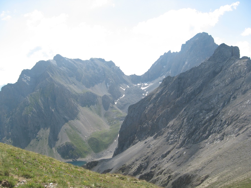
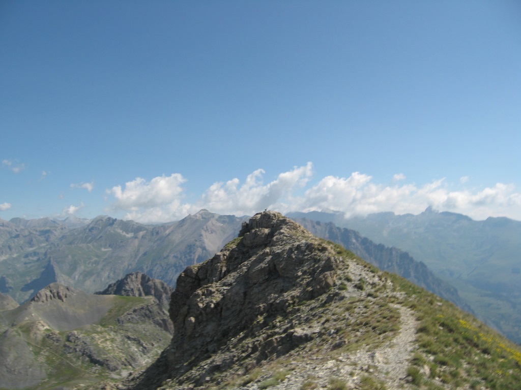
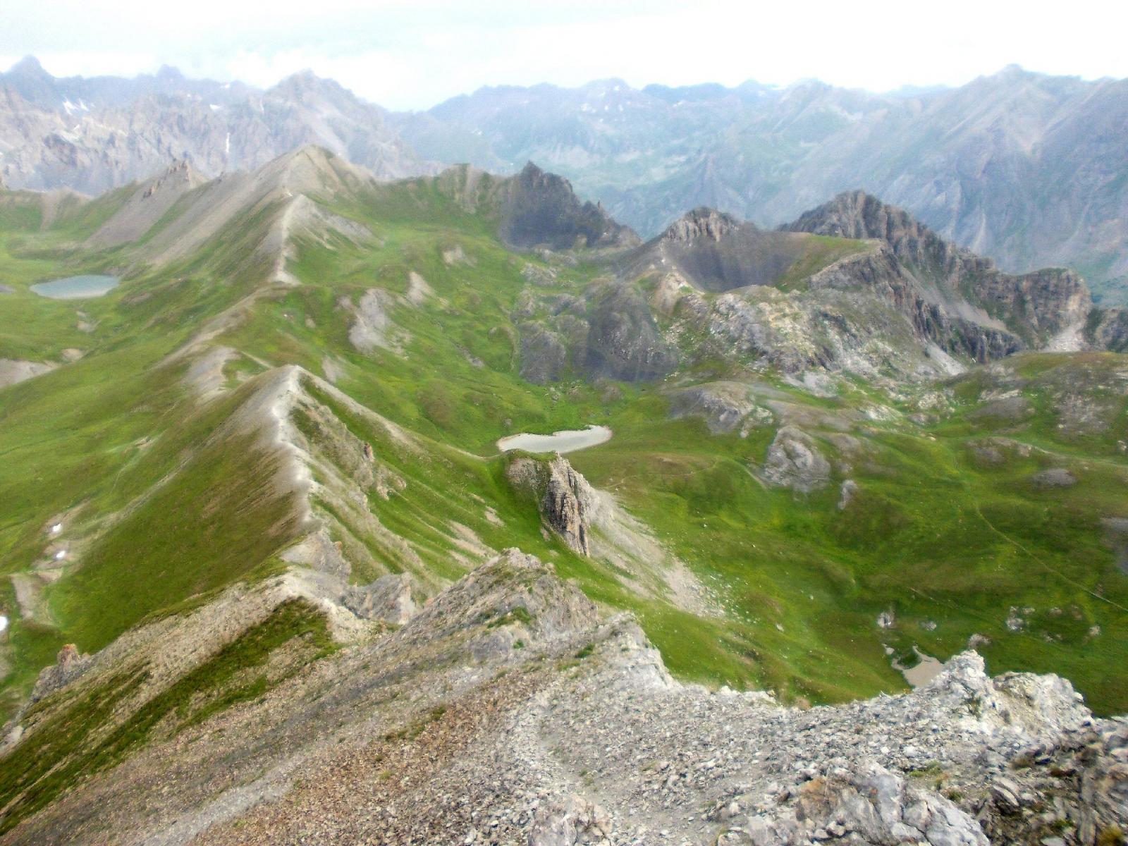
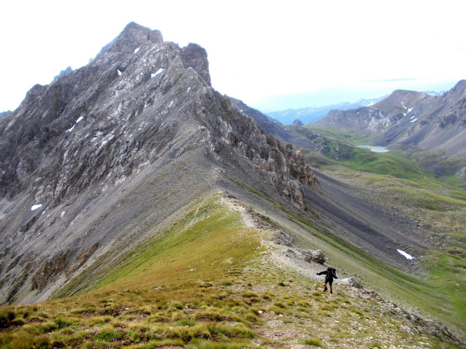
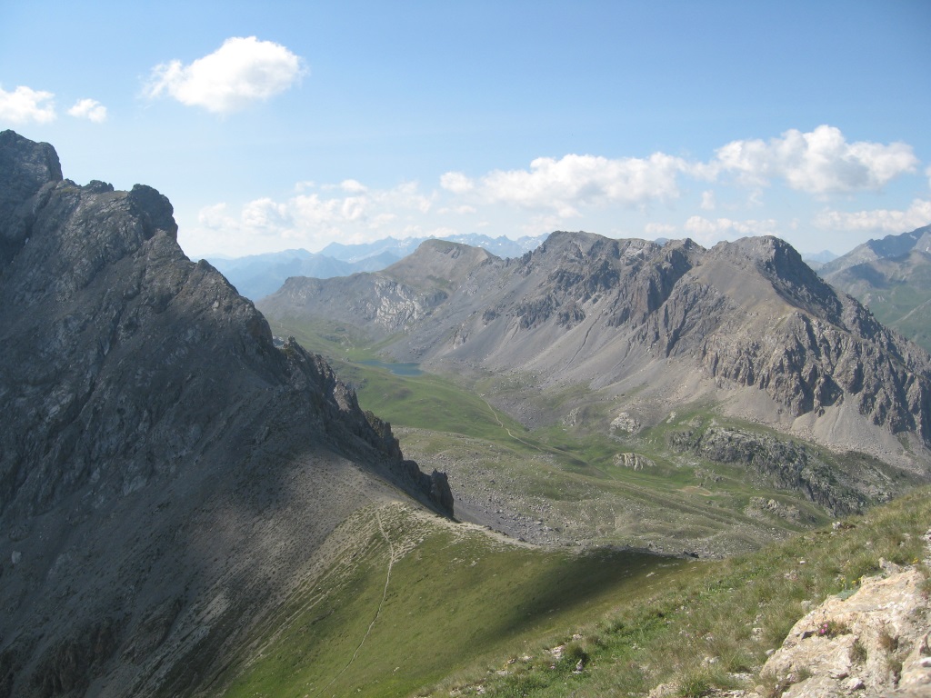
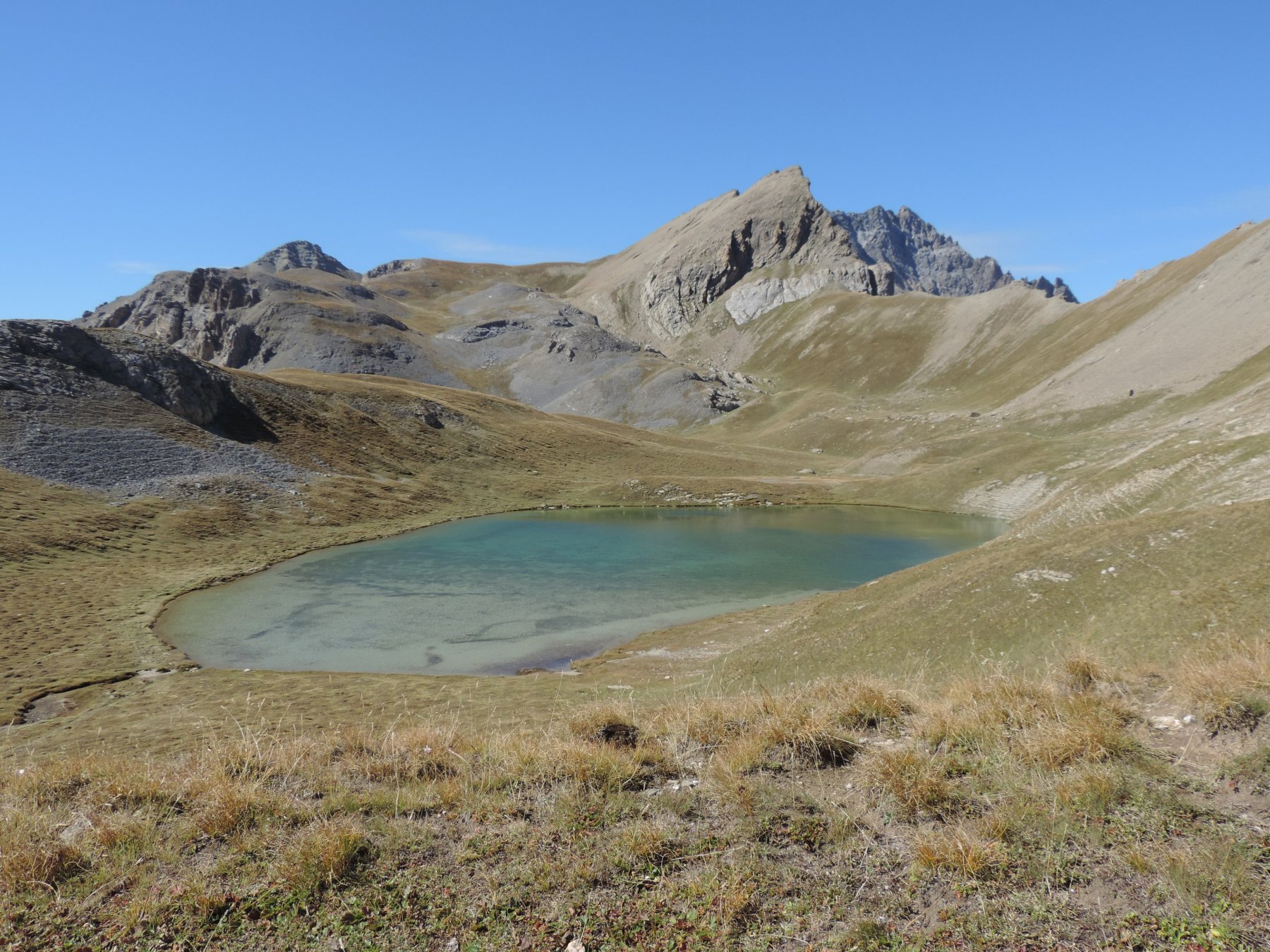
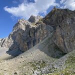
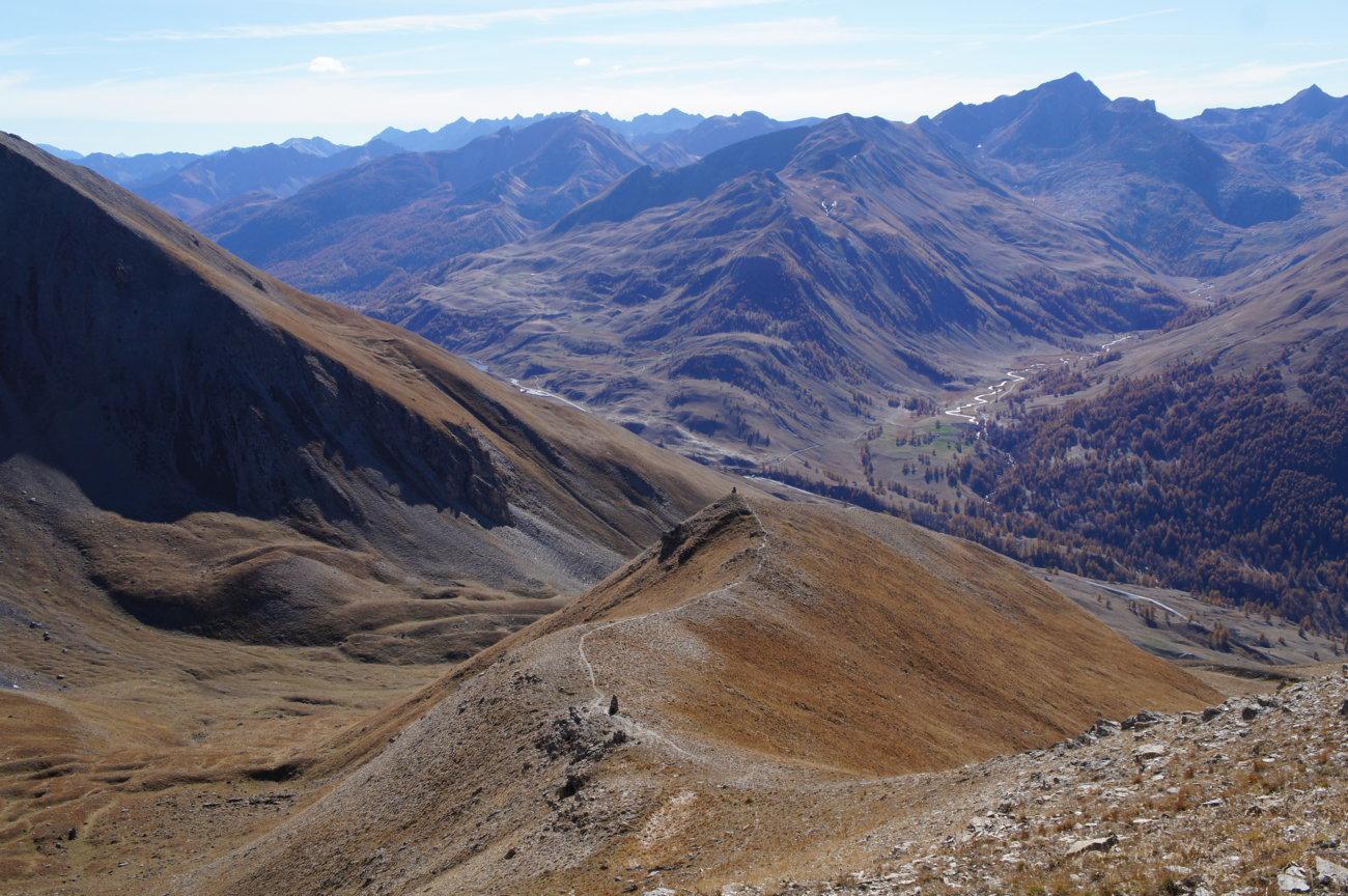
Cima fasciata da detriti e corta erba raggiunta salendo al meglio gli avvallamenti erbosi. Bel panorama in particolare sull'Auto Vallonasso e sul Bec du Lievre.
Avvicinamento
Poco dopo il Colle della Maddalena scendere brevemente in Francia e parcheggiare sulla destra presso un ponticello sul torrente Oronaye.
Descrizione
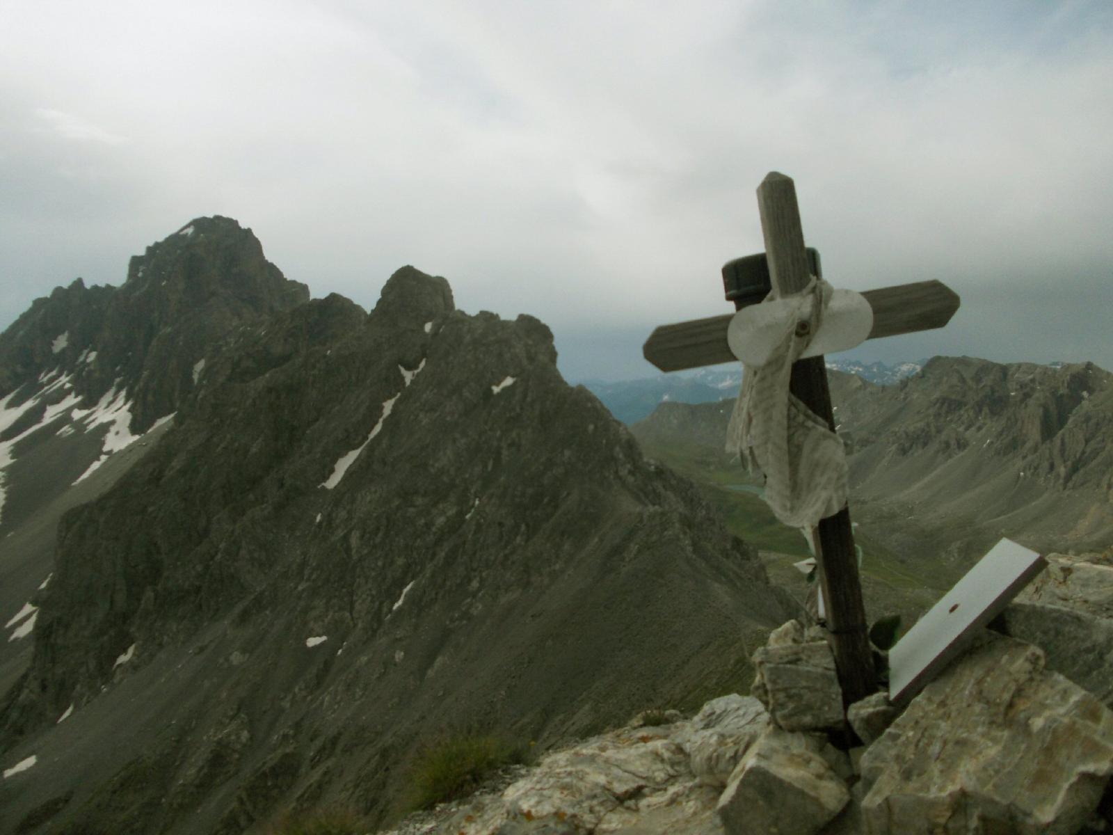
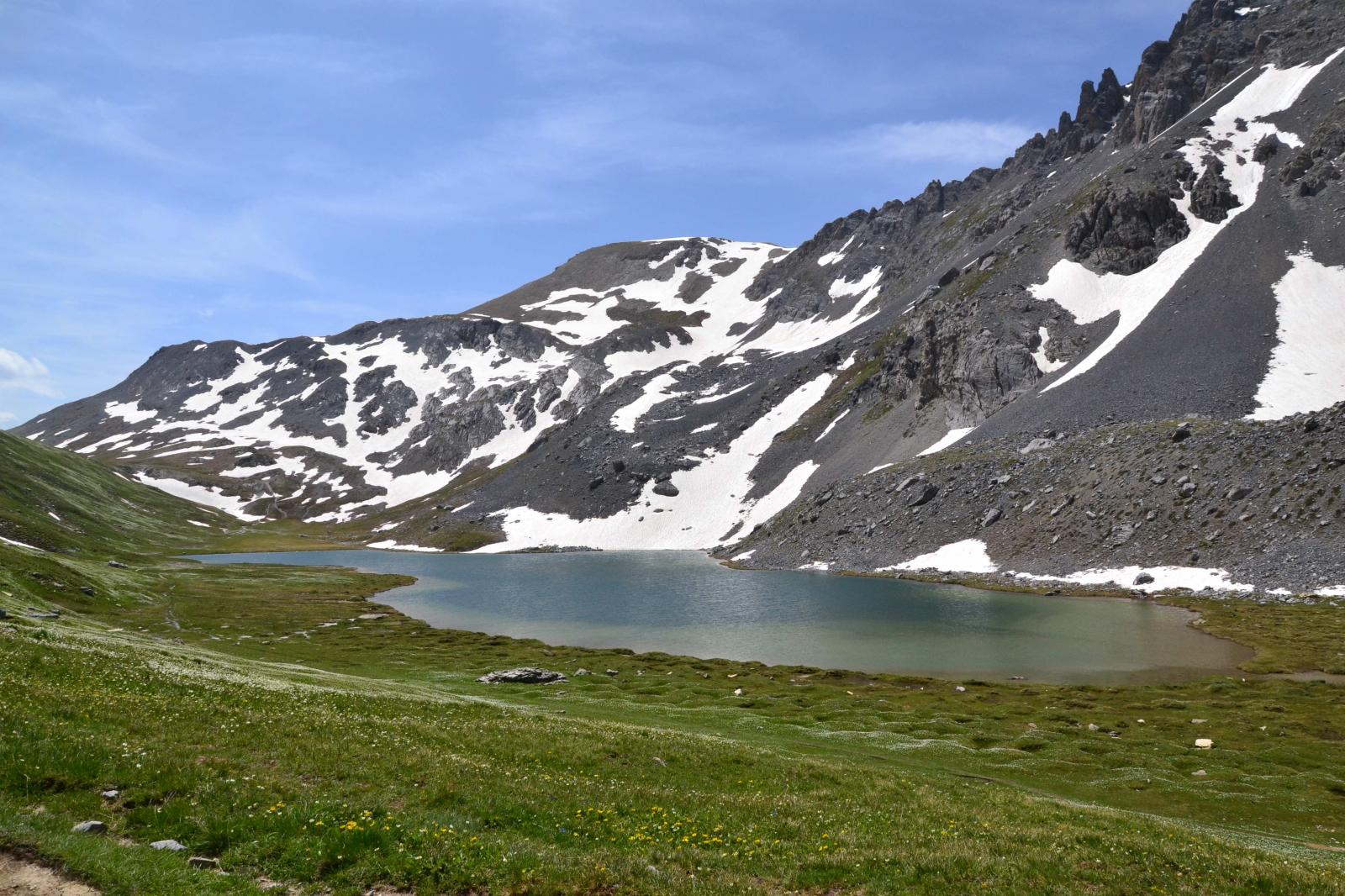
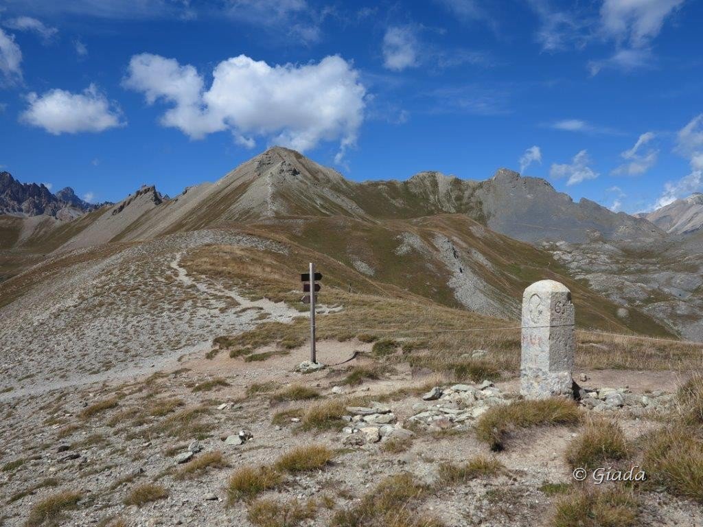
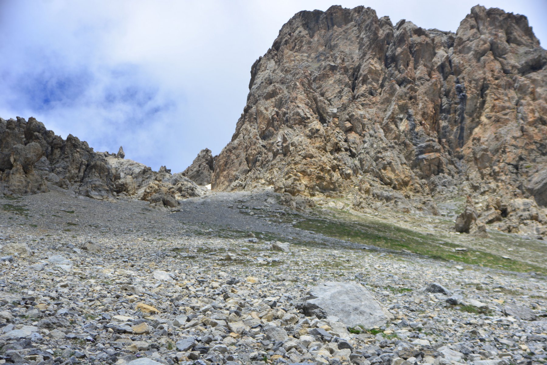
Dal luogo di partenza si segue l’ampio sentiero per il Colle di Roburent fino al bivio per il Colle de la Gipiere de l’Oronaye, presso un piccolo ricovero di pastori (q. 2320 circa, palina). Abbandonare il sentiero e salire direttamente per il ripido pendio di prato sbucando su una terrazza pianeggiante con i resti di un vecchio pluviometro, ben visibile dal sentiero. Proseguire per dossi erbosi e superare un secondo pendio erboso-detritico, sbucando su una seconda terrazza semipianeggiante. Seguendo tracce e ometti portarsi verso destra e risalire un altro ripido pendio erboso fino a portarsi sul bordo della conca terminale. A destra alto sul pendio detritico e’ visibile il tracciato del sentiero Roberto Cavallero che si raggiunge per una traccia segnalata da ometti verso destra, al bordo della conca. Raggiunto il sentiero Cavallero (segnavia rosso-blu), seguirlo verso sinistra in diagonale ascendente passando sotto alcuni bei torrioni giallastri e raggiungere il Colle Villadel (m 2631). Dal colle si risale il largo crestone Sud-Est che conduce alla cresta sommitale, seguendo la quale verso destra (Est) si raggiunge l’aerea vetta rocciosa della Cima delle Manse (m 2727, piccola croce in legno e quaderno di vetta).
- Cartografia:
- IGN 1:25000 Col de Larche
- Bibliografia:
- In cima Cozie Meridionali M.Bruno ediz.BLU - Tra Maira, Varaita e Ubaye, Andrea Parodi Editore
Nelle vicinanze Mappa
Itinerari
25/08/2024 Alpes-de-Haute-Provence, Val-d'Oronaye D+ 600 m E Varie
Roburent (Colle e Laghi di) da le Pontet per il Lago dell’Oronaye
 50m
50m
26/09/2019 Alpes-de-Haute-Provence, Val-d'Oronaye D+ 680 m E Sud
Reculaye (Lac de la) da le Pontet
 50m
50m
29/08/2024 Alpes-de-Haute-Provence, Val-d'Oronaye D+ 1450 m EE Varie
Villadel, Enchiausa, Feuillas (Colli) da le Pontet, giro dell’Oronaye
 50m
50m
18/07/2026 Alpes-de-Haute-Provence, Val-d'Oronaye D+ 780 m E Varie
Soubeyran (Monte) o Tete de l’Alp da le Pontet
 50m
50m
02/10/2021 Alpes-de-Haute-Provence, Val-d'Oronaye D+ 813 m EE Varie
Pierassin (Monte) e Punta di Roburent da le Pontet per il Colle di Roburent
 50m
50m
13/10/2019 Alpes-de-Haute-Provence, Val-d'Oronaye D+ 885 m EE/F Varie
Oronaye (Aiguille orientale d’) da le Pontet
 50m
50m
23/07/2025 Alpes-de-Haute-Provence, Val-d'Oronaye D+ 800 m EE Sud
Dure (Tete) da le Pontet, giro del Bec du Lievre per il Col de la Gypiere
 50m
50m
29/06/2025 Alpes-de-Haute-Provence, Val-d'Oronaye D+ 926 m EE Varie
Vanclava (Monte) o Tète de Vauclave da le Pontet
 50m
50m
25/06/2019 Alpes-de-Haute-Provence, Val-d'Oronaye D+ 1138 m EE Varie
Manse (Cima delle) o Tete de Villadel e Monte Soubeyran da le Pontet, giro
 50m
50m
29/08/2024 Alpes-de-Haute-Provence, Val-d'Oronaye D+ 900 m EE Varie
Scaletta (Monte) da le Pontet
 50m
50m