6.2Km
6.2Km

Note
 50m
50m
2.5Km
6.4Km
25.1Km
50m
50m
2.5Km
6.4Km
25.1Km
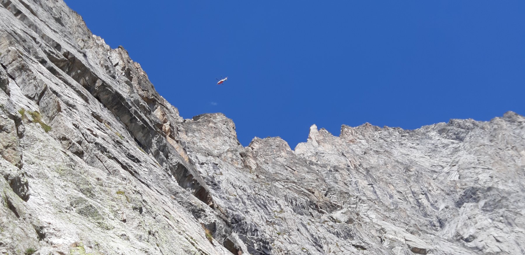
Bellissimo giro ad anello che si sviluppa concatenando diverse ferrate e tratti attrezzati e che ha il suo punto più alto ai 2741 metri del Col des Chasseurs.
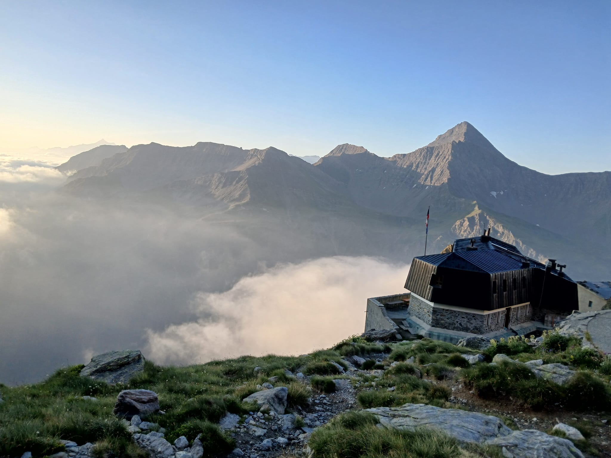
L'escursione si può comodamente organizzare in un paio di giorni con pernottamento al Rifugio Monzino. In questo caso si consiglia una visita alla punta dello Châtelet, dalla quale si gode di una vista incomparabile (attrezzata con cavi la parte finale).
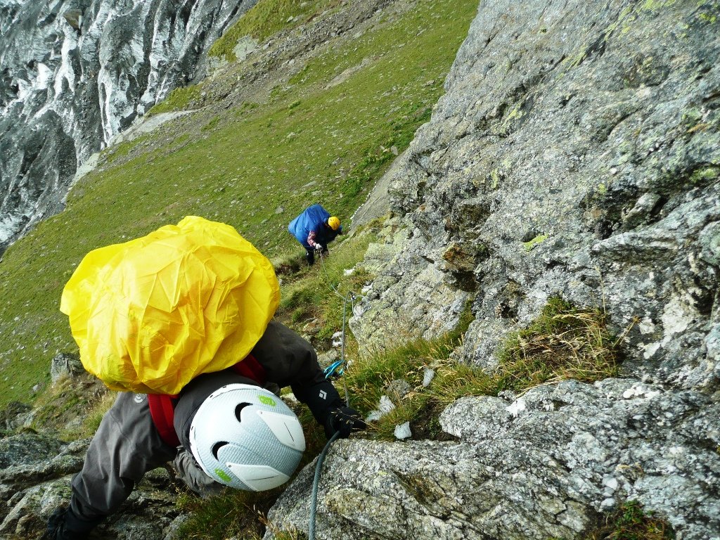
Materiale: scarponi da montagna, Imbrago, kit da ferrata, Casco.
Pur essendo alla portata di camminatori mediamente allenati, rimane un itinerario di stampo alpinistico, che richiedono tutte le opportune precauzioni.
Avvicinamento
L'escursione si può comodamente organizzare in un paio di giorni con pernottamento al Rifugio Monzino. In questo caso si consiglia una visita alla punta dello Châtelet, dalla quale si gode di una vista incomparabile (attrezzata con cavi la parte finale).
Materiale: scarponi da montagna, Imbrago, kit da ferrata, Casco.
Pur essendo alla portata di camminatori mediamente allenati, rimane un itinerario di stampo alpinistico, che richiedono tutte le opportune precauzioni.
Partenza da parcheggio del Freney in Val Veny.
Descrizione
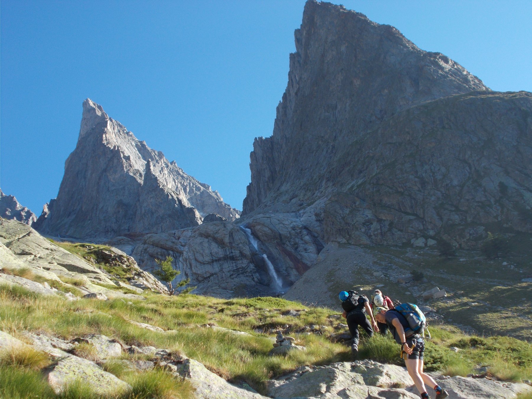
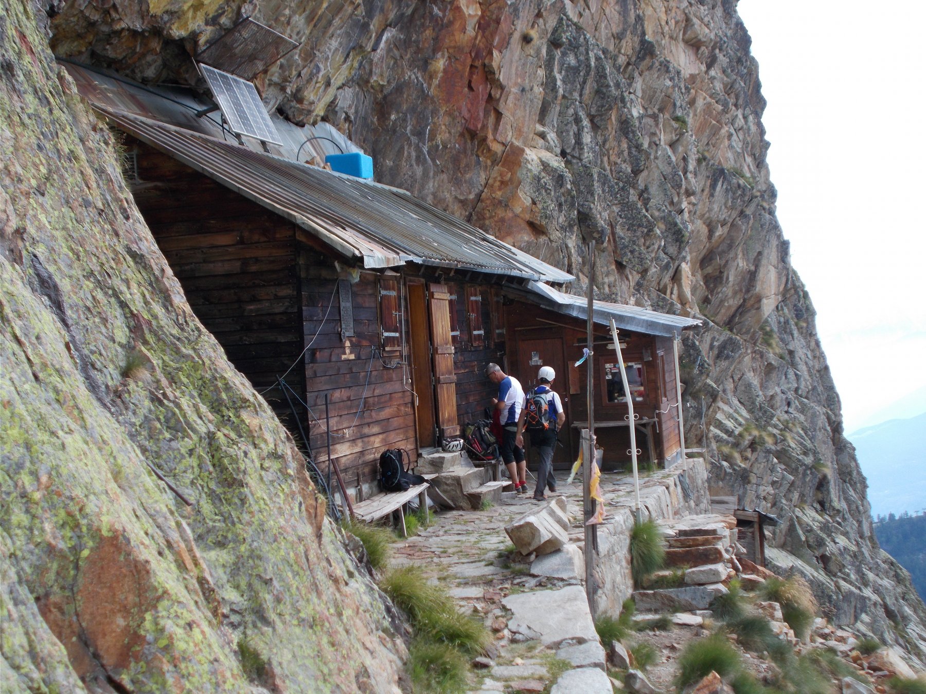
Salita al Rifugio Monzino per il vecchio sentiero della Capanna Gamba. (4-5 ore)
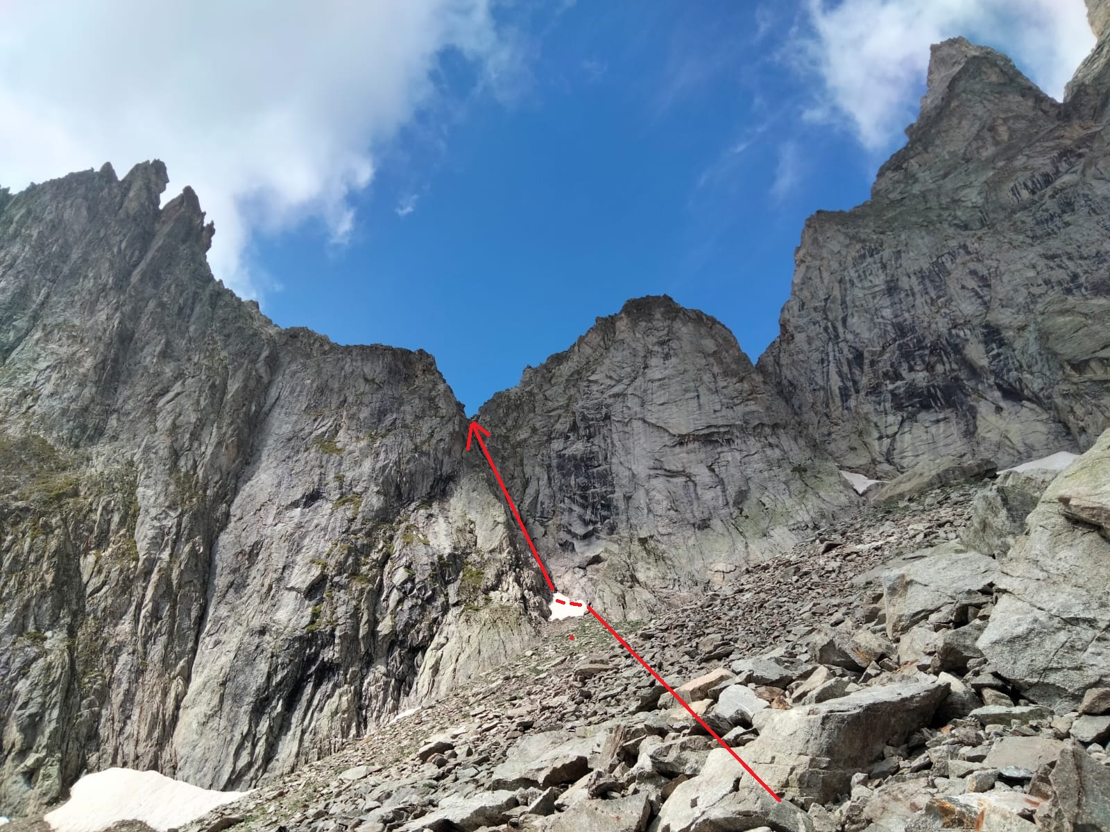
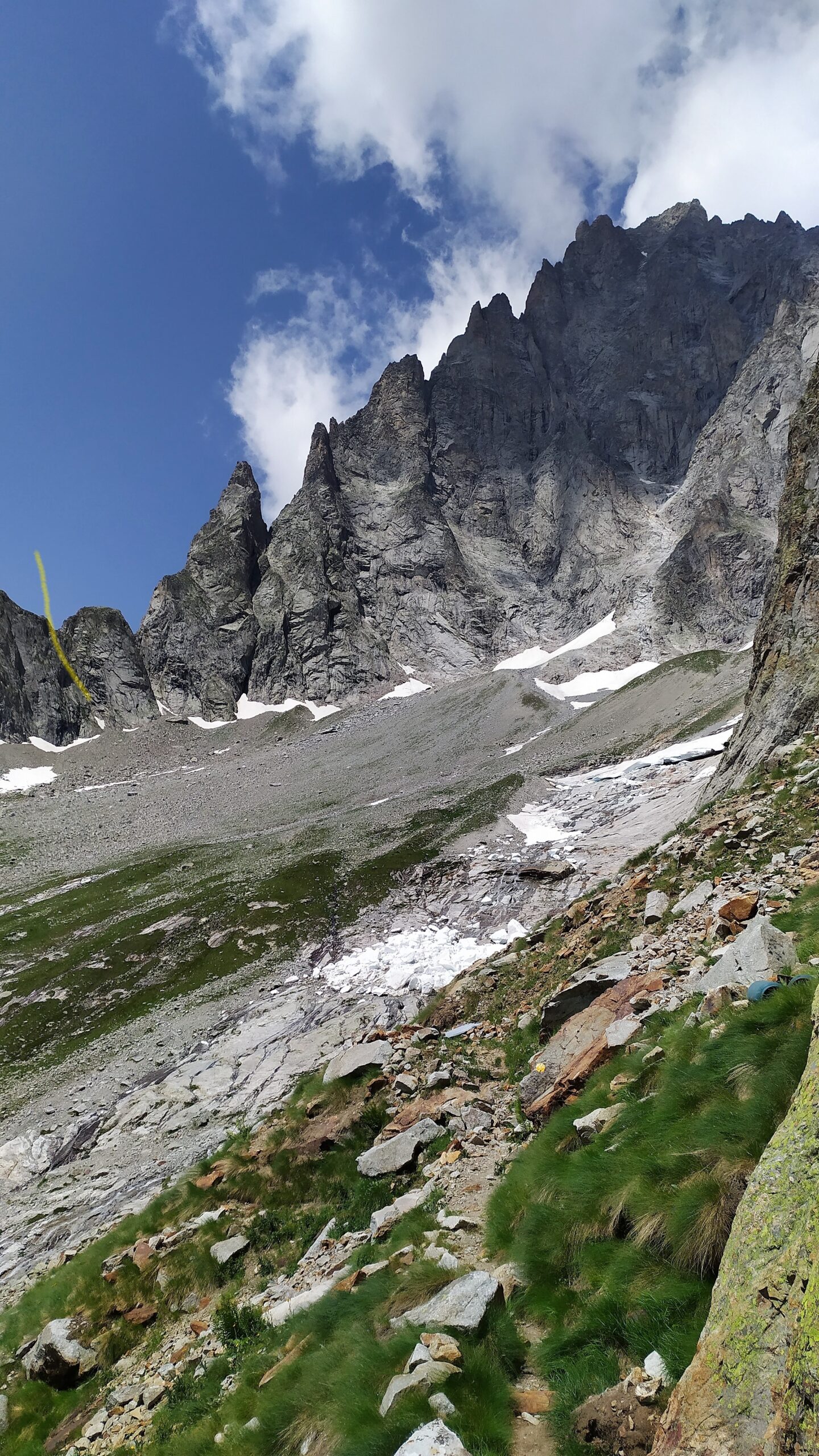
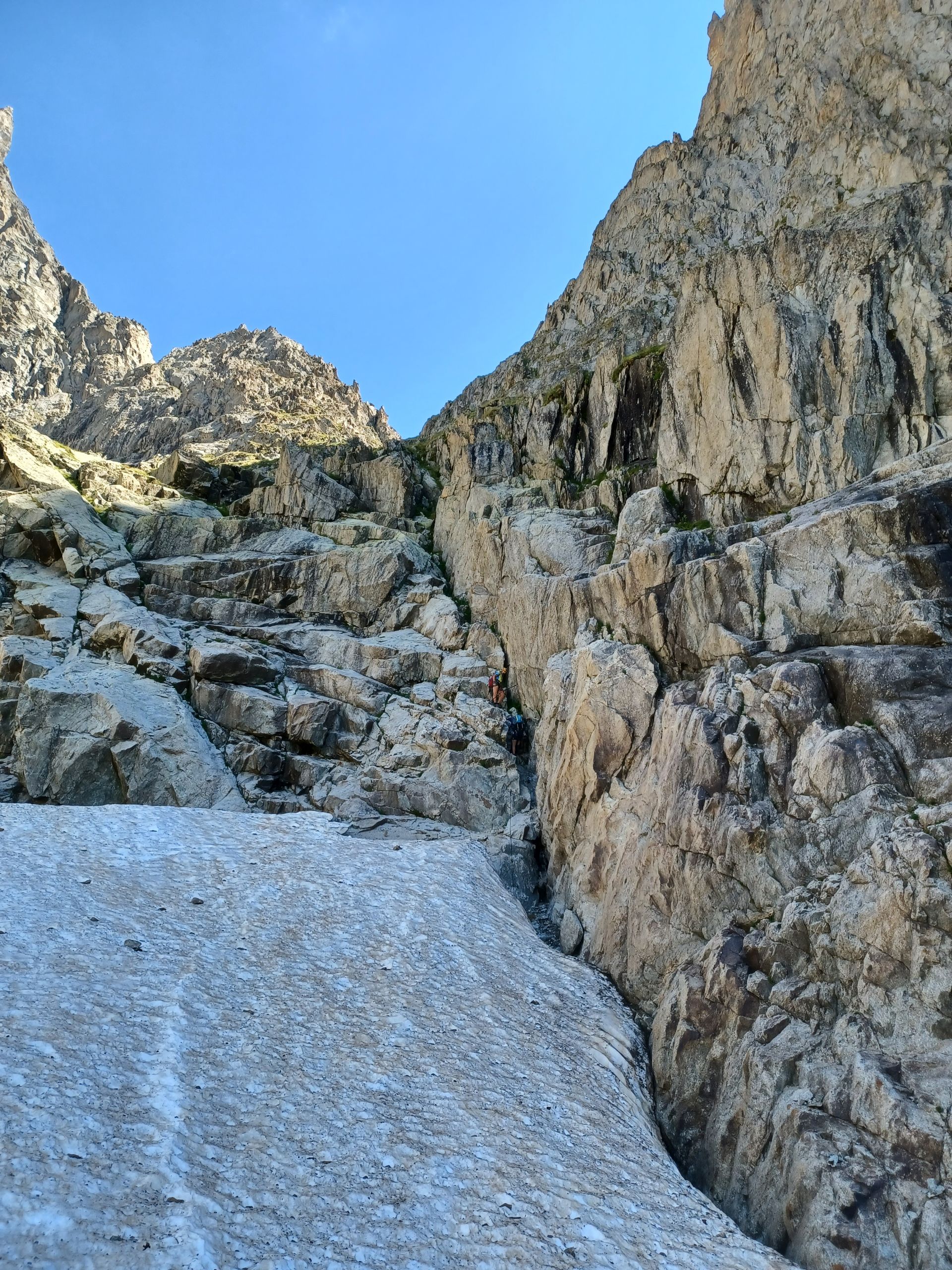
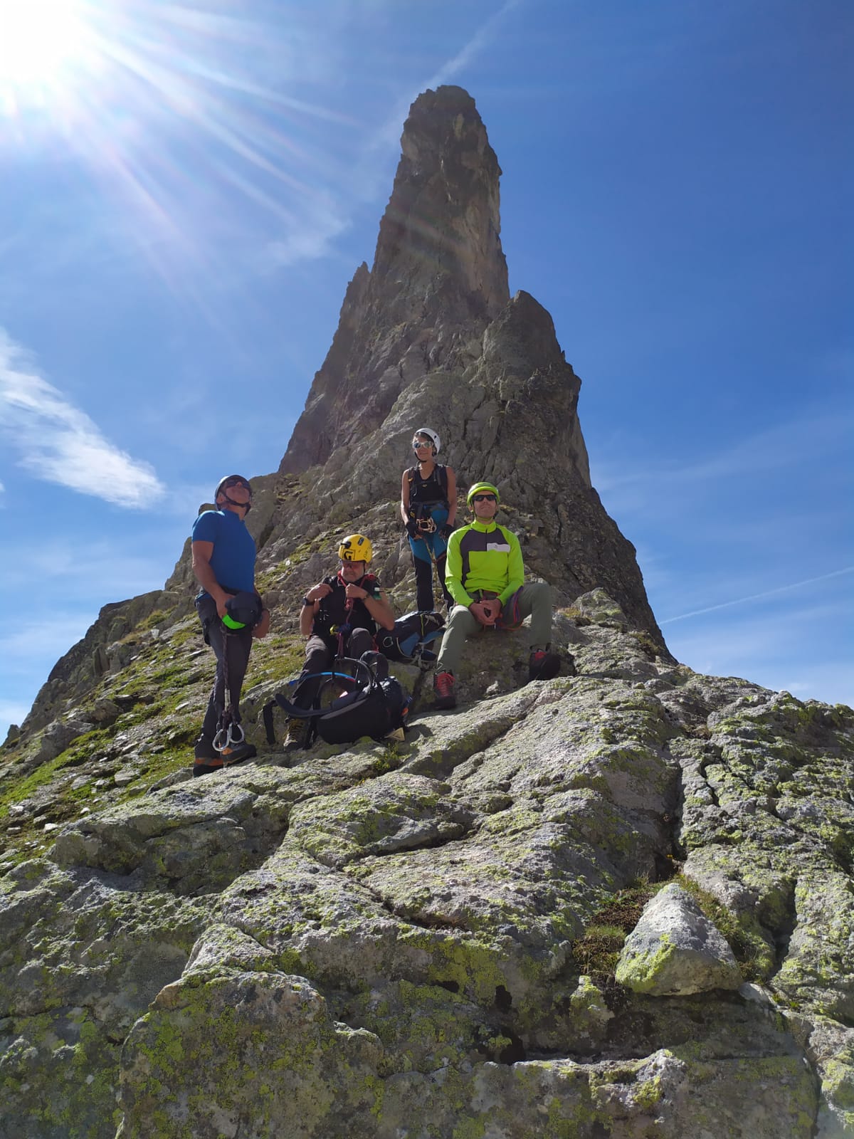
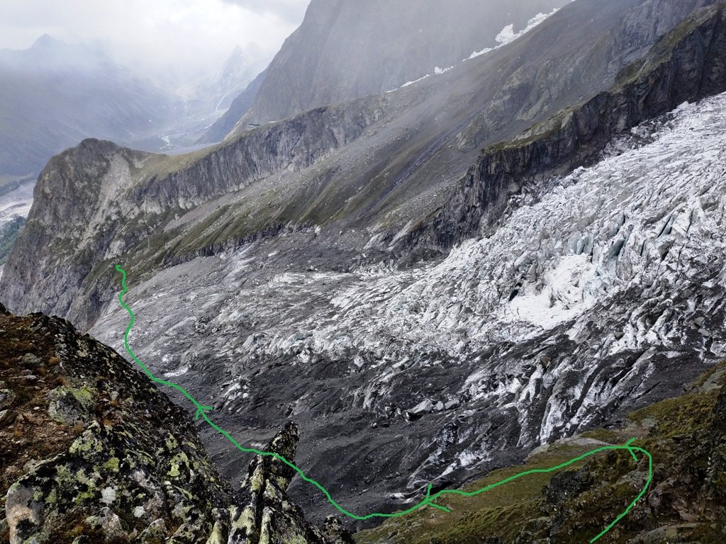
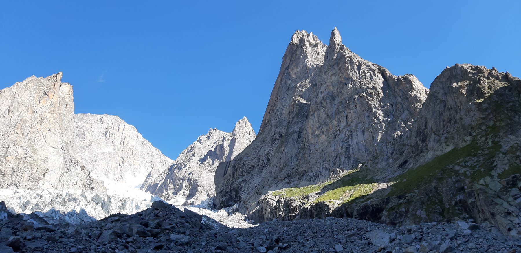
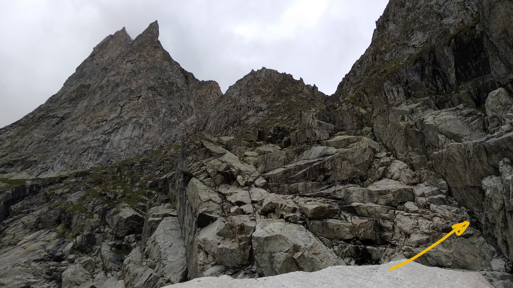
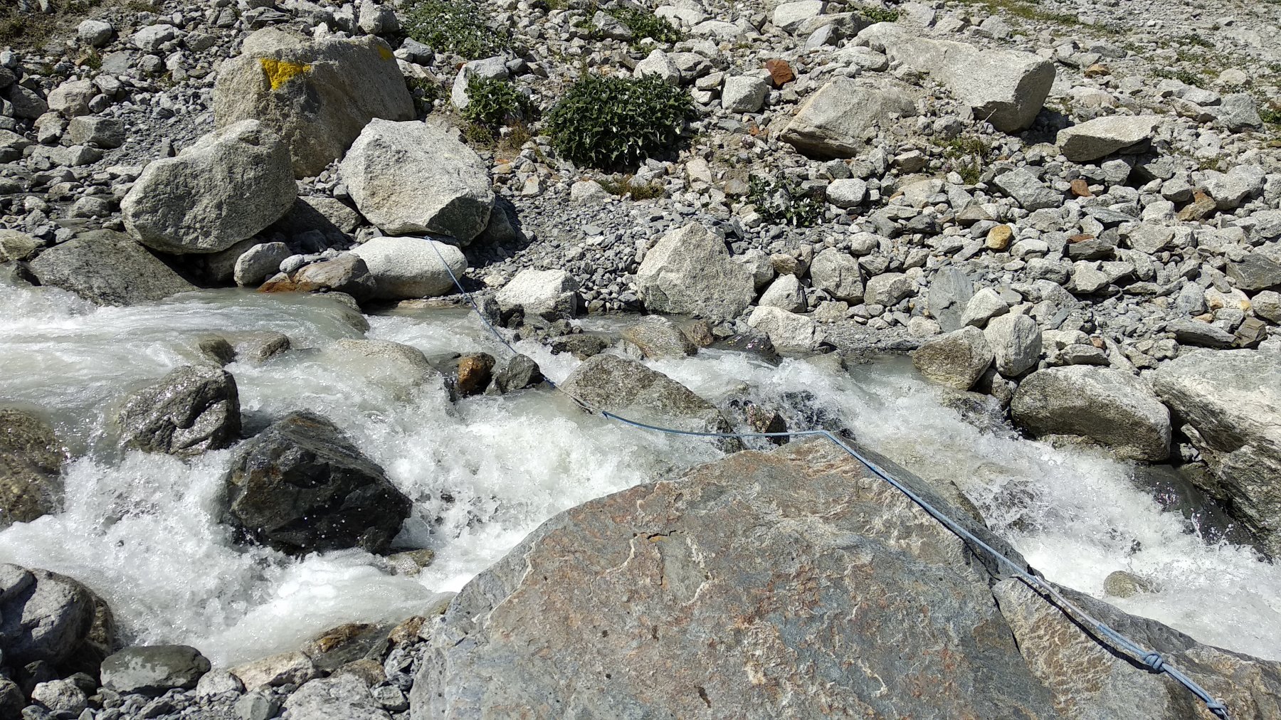
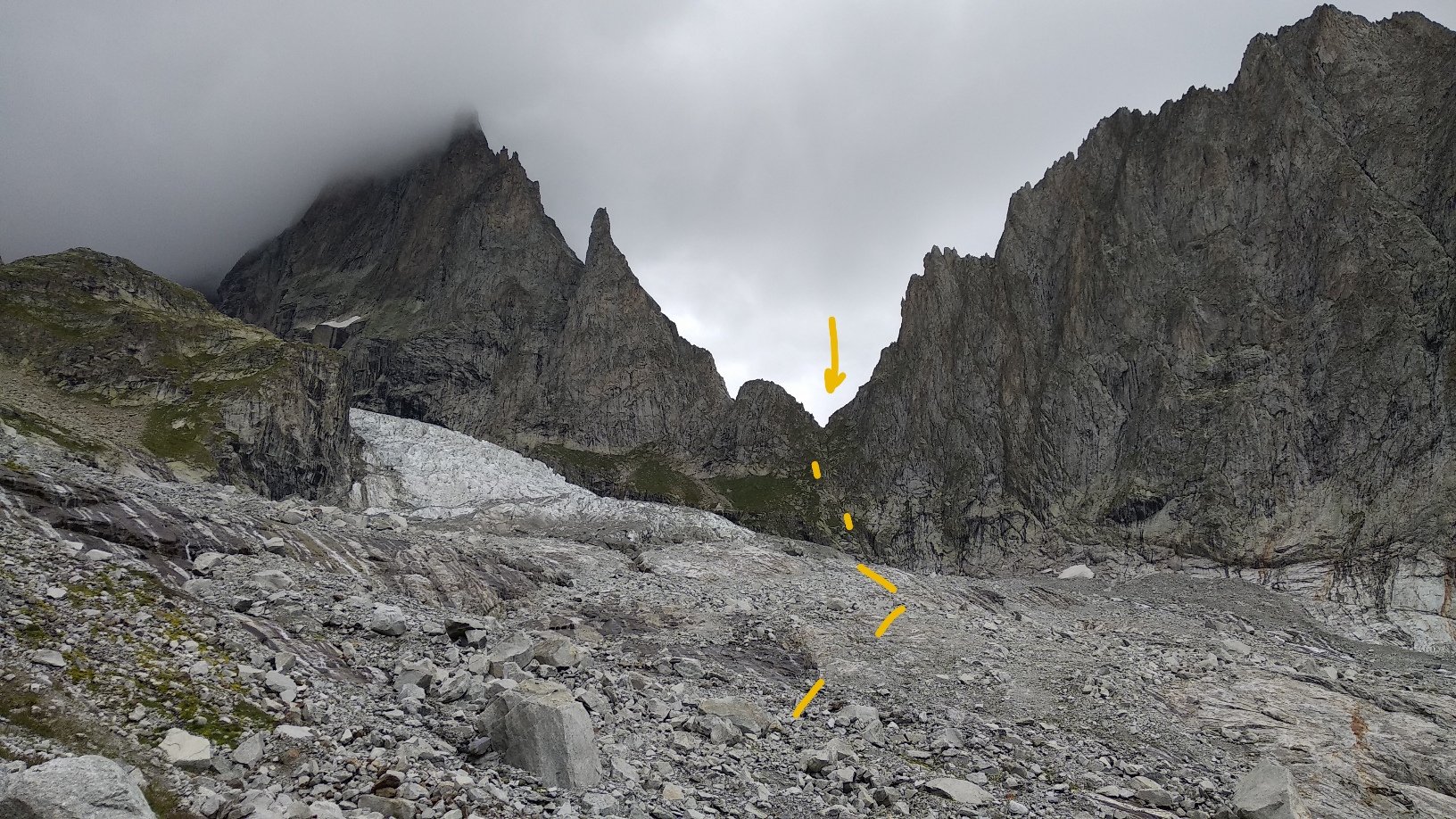
Prendere il sentiero per il Lago delle Marmotte. Oltrepassare il bivio per il sentiero classico del Rifugio Monzino. Proseguire verso la morena del Miage. Poco oltre, in corrispondenza di un grande masso, partono i bolli gialli che conducono all’evidente canale ad ovest dell’Aiguille du Châtelet.
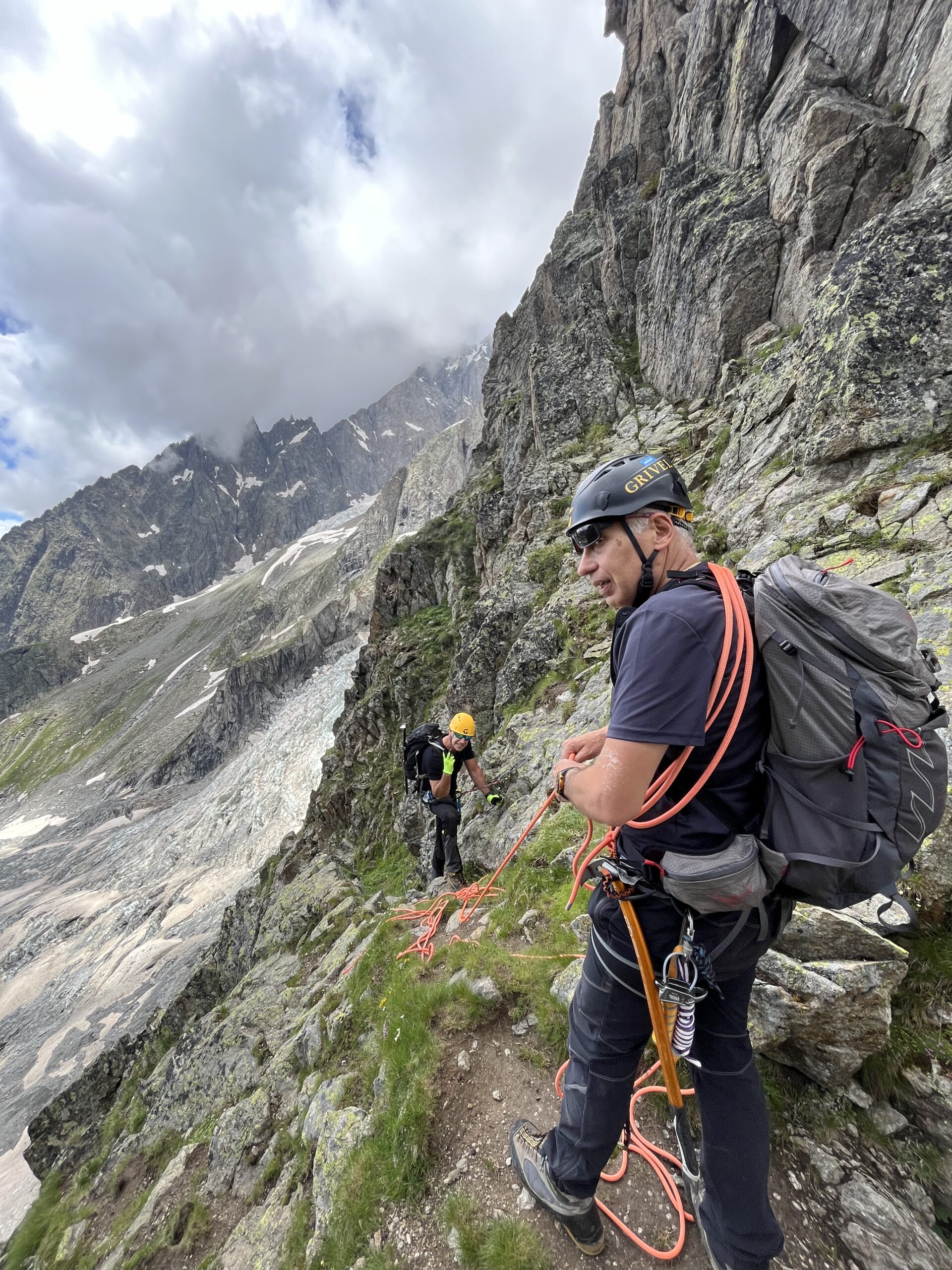
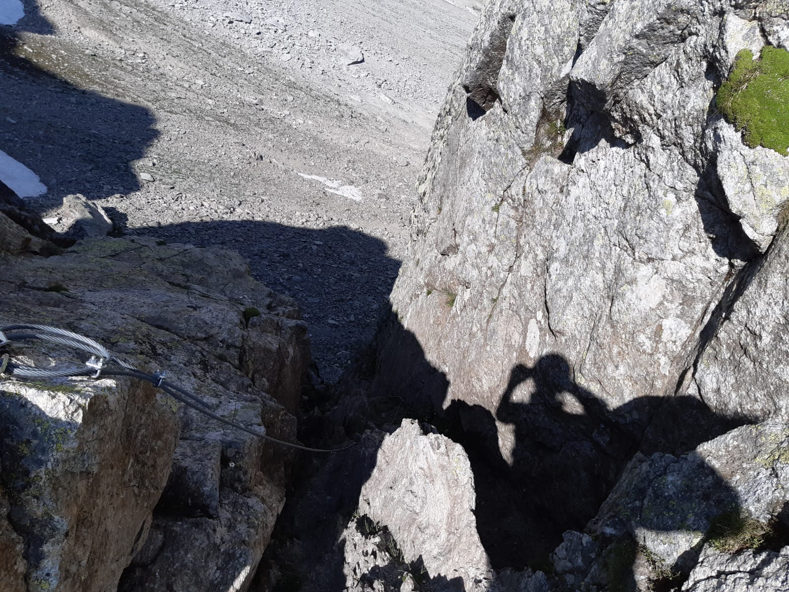
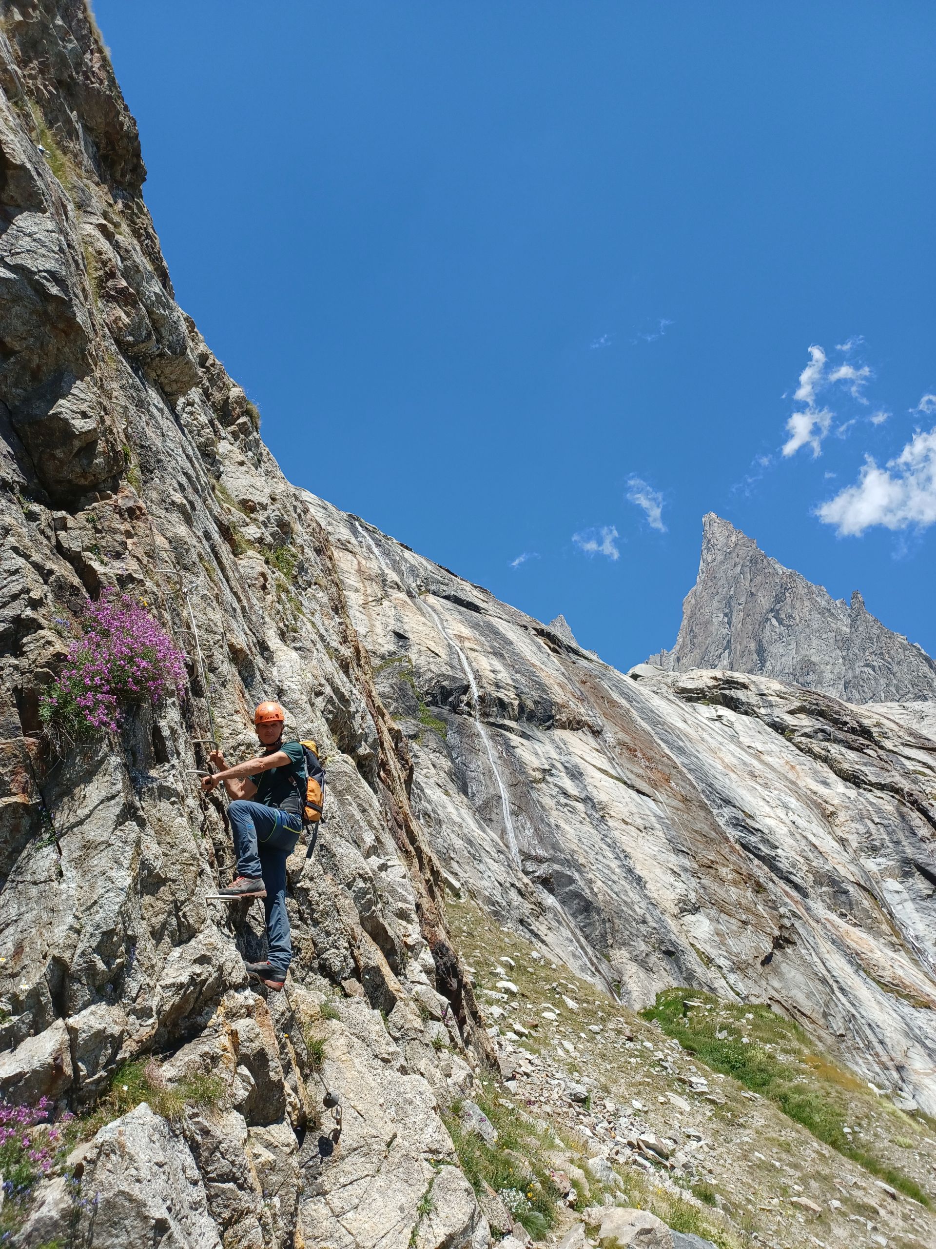
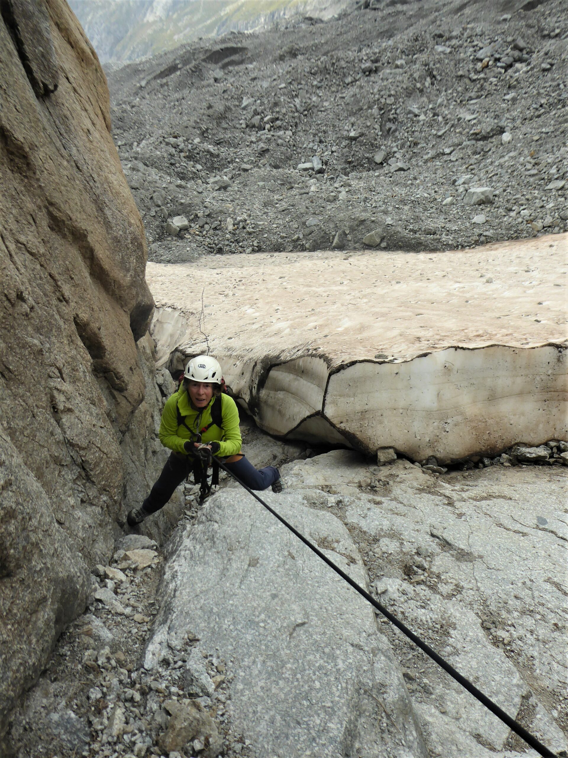
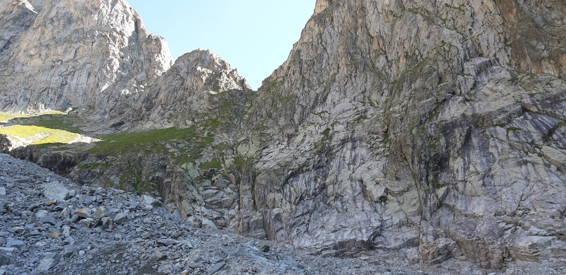
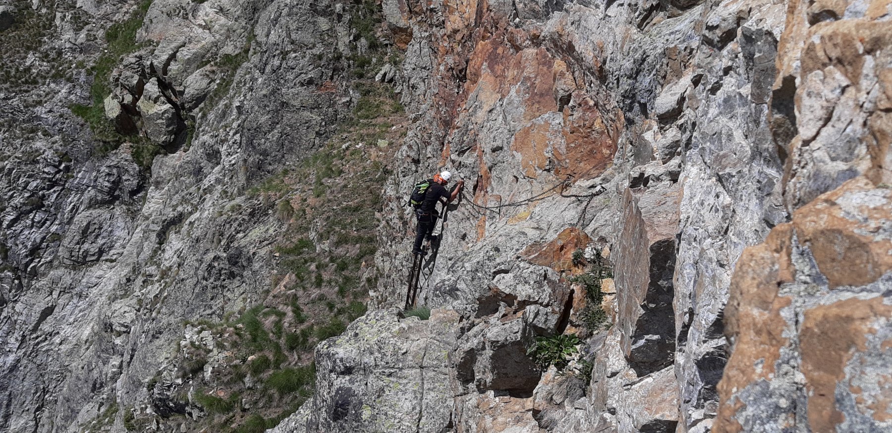
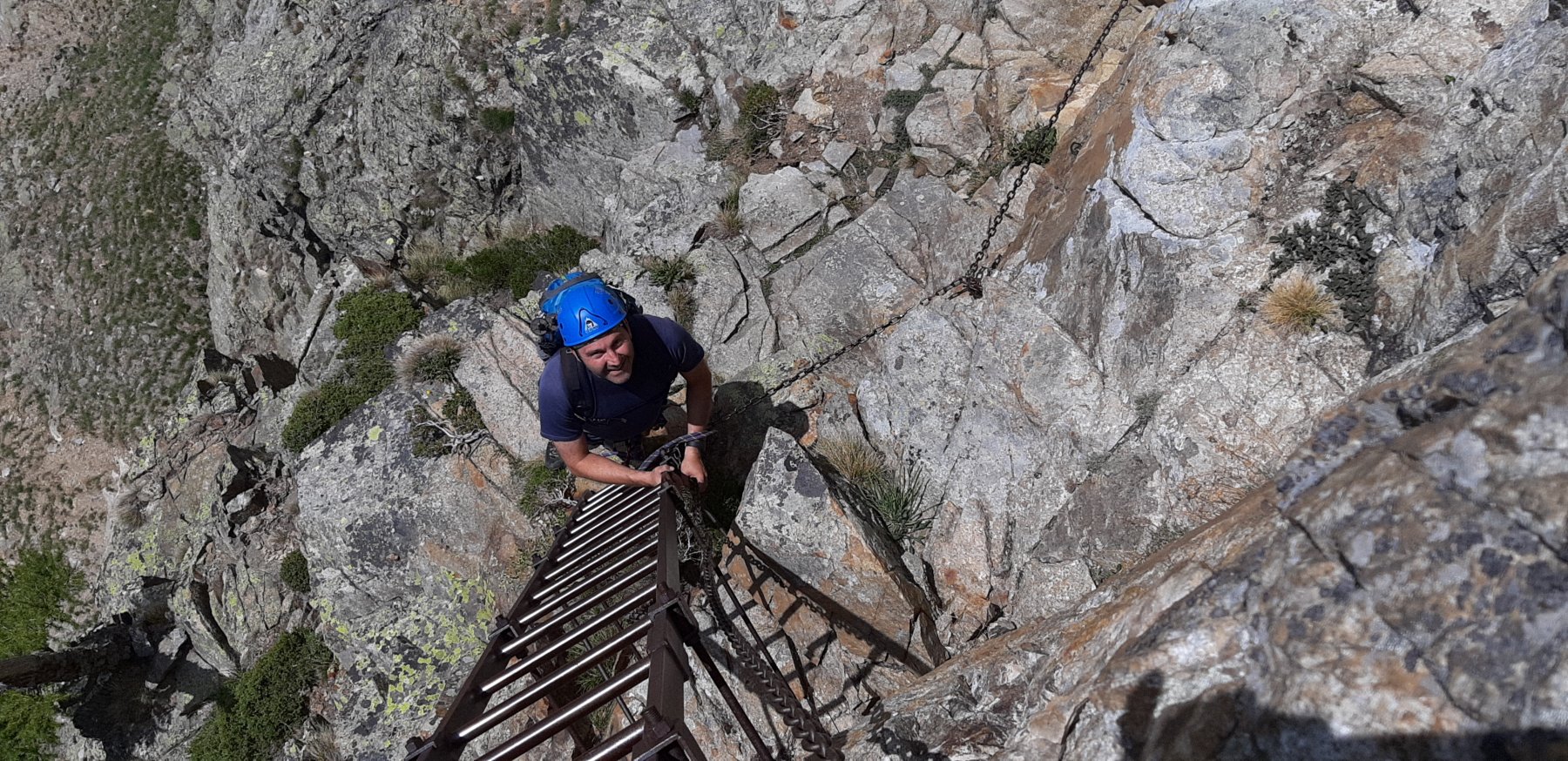
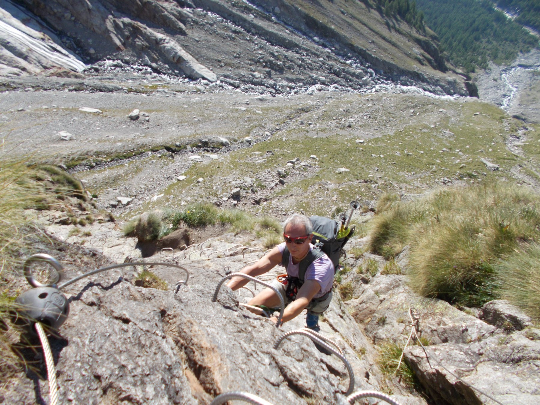
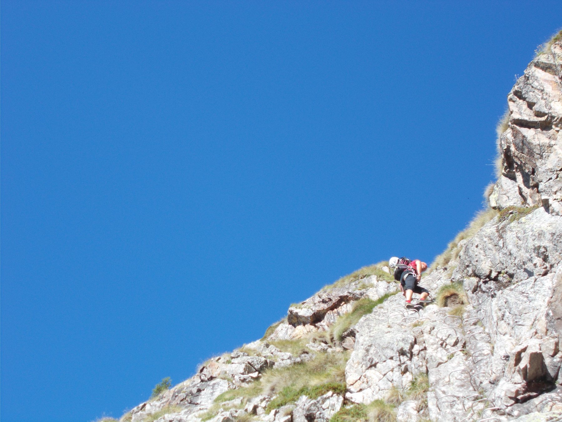
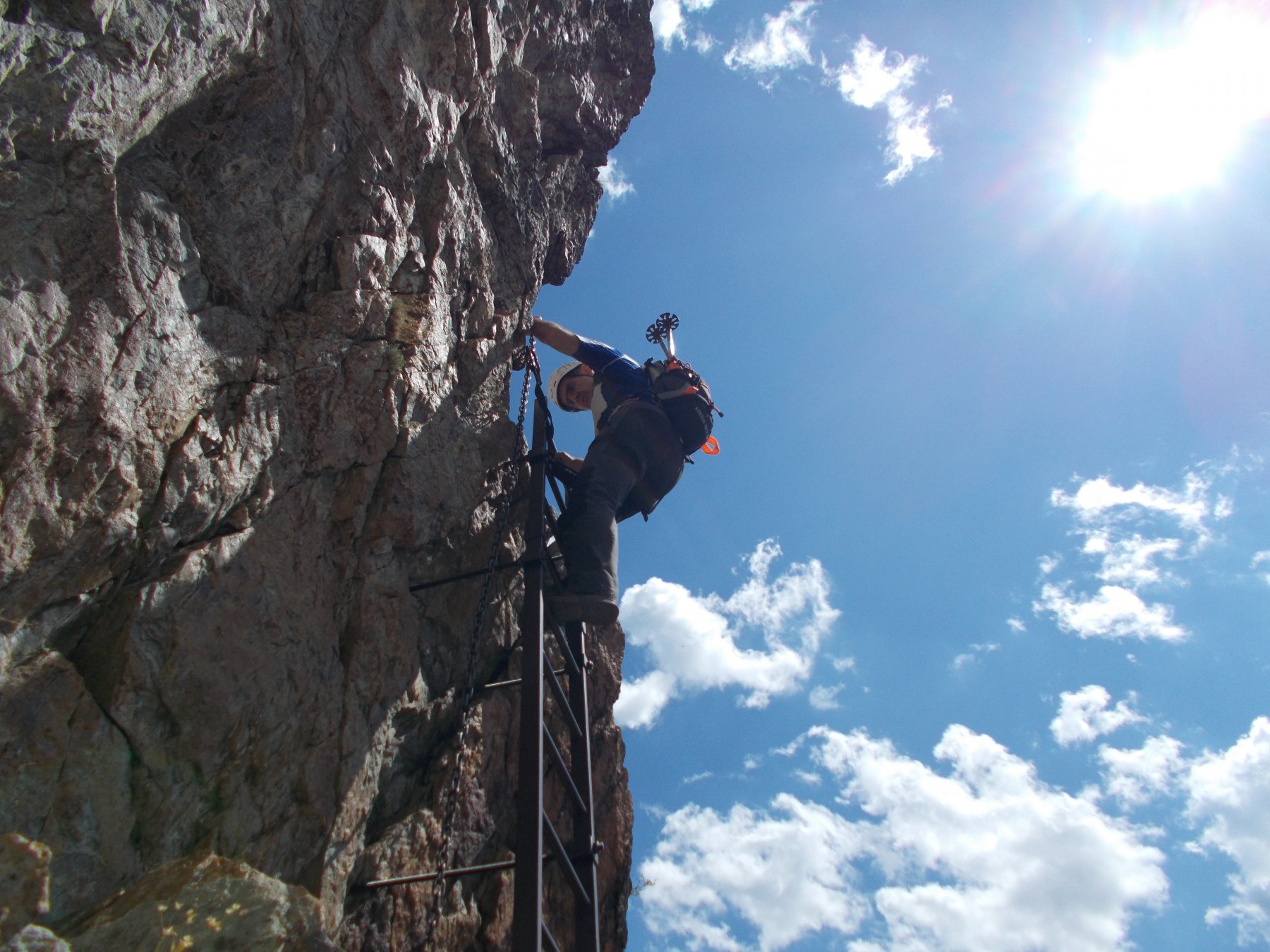
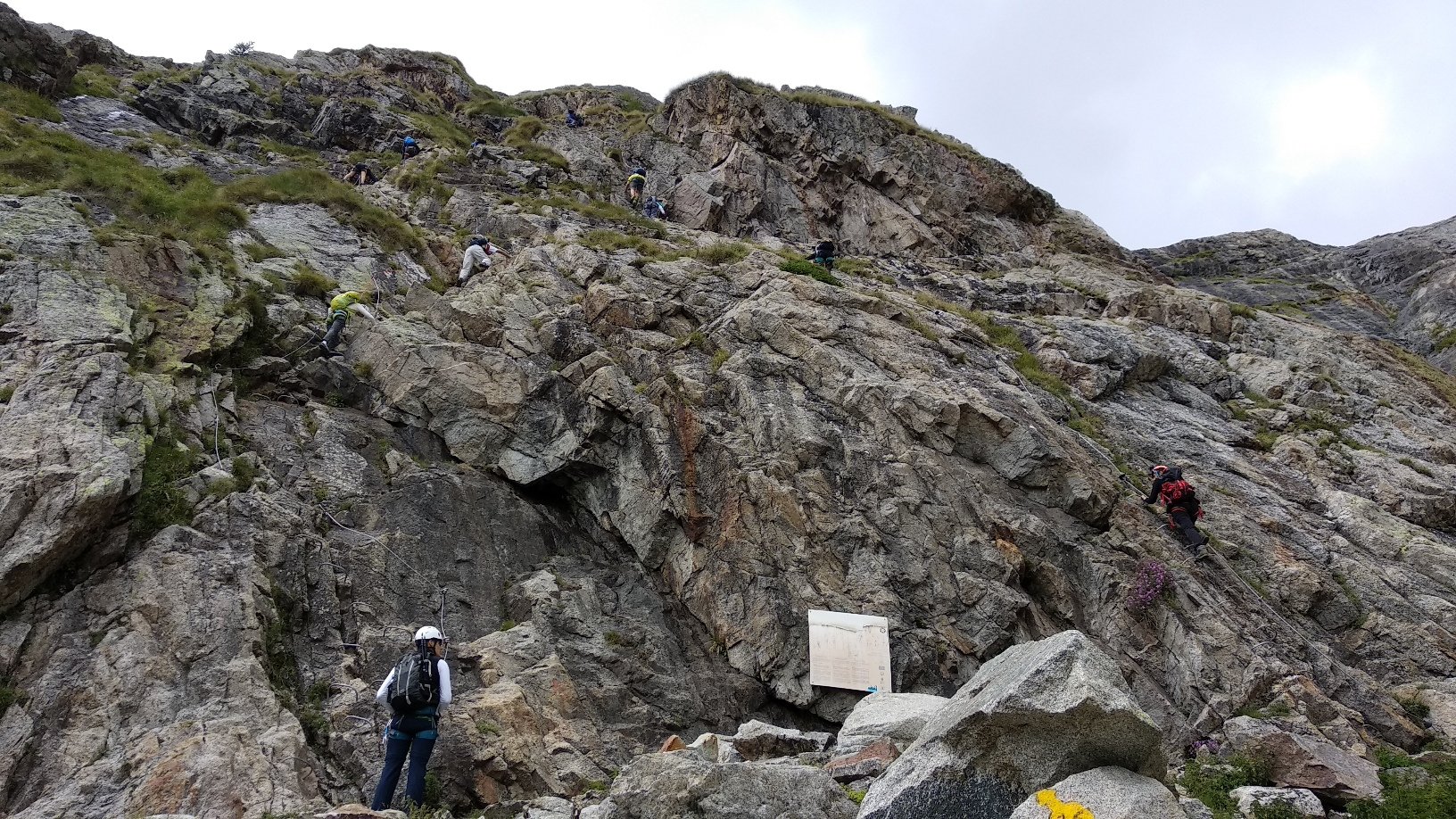
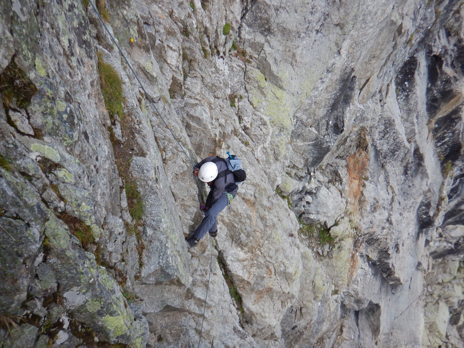
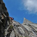
Da questo punto partono i cavi della ferrata Luigi Glarey, che faranno da segnavia per la prima parte di salita.
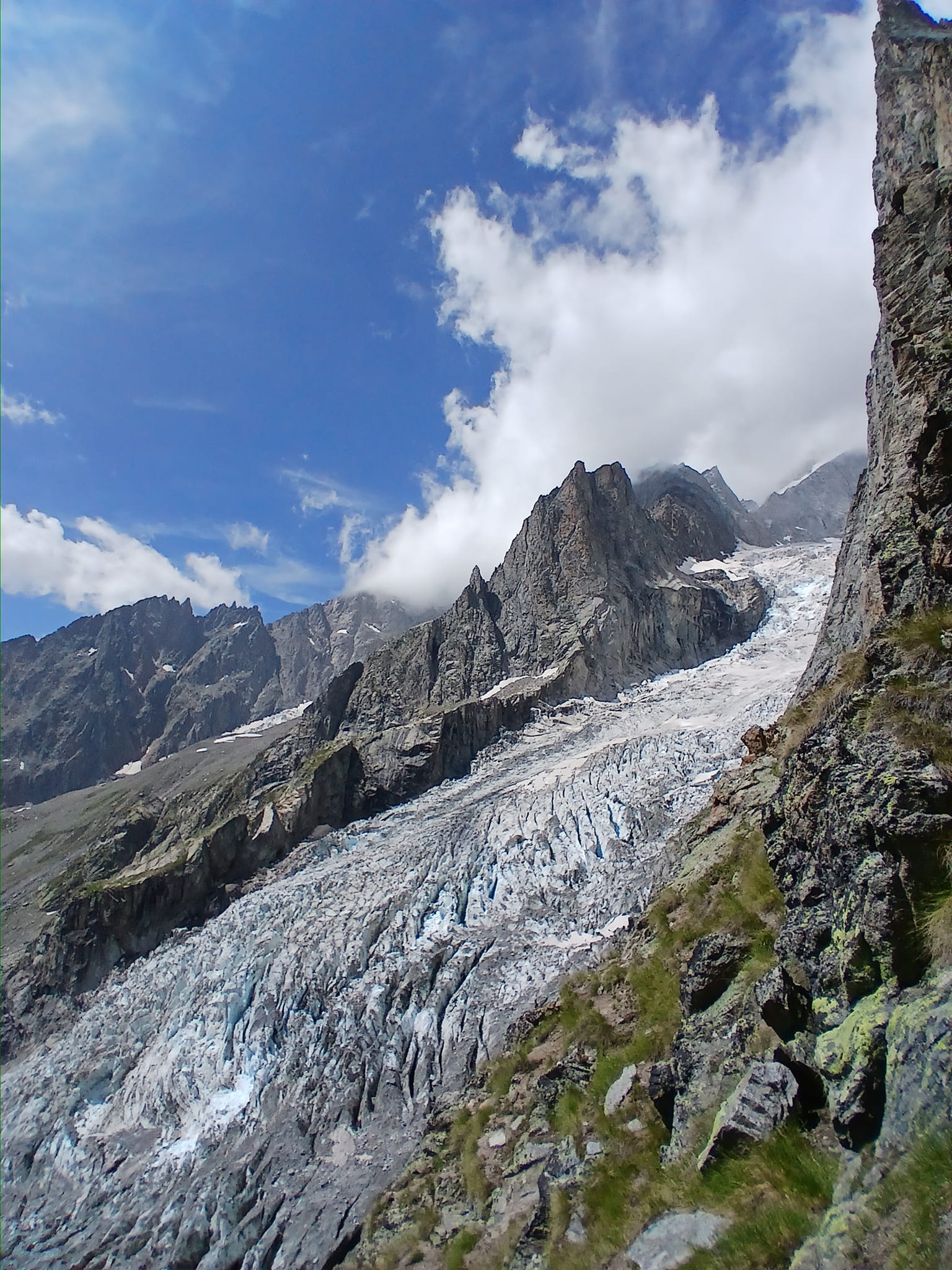
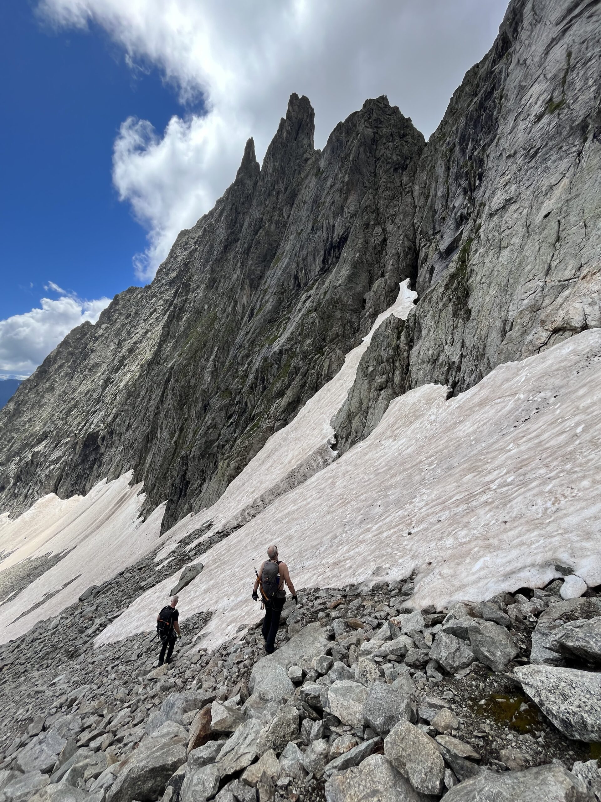
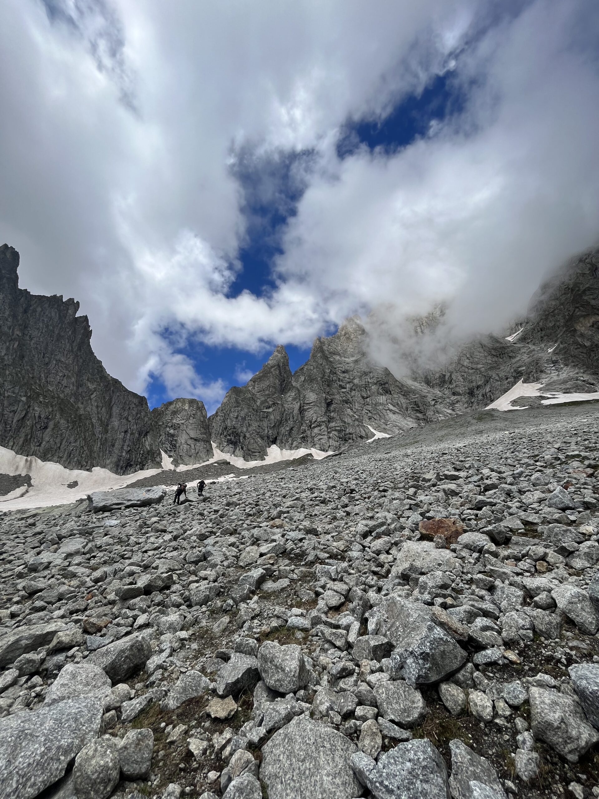
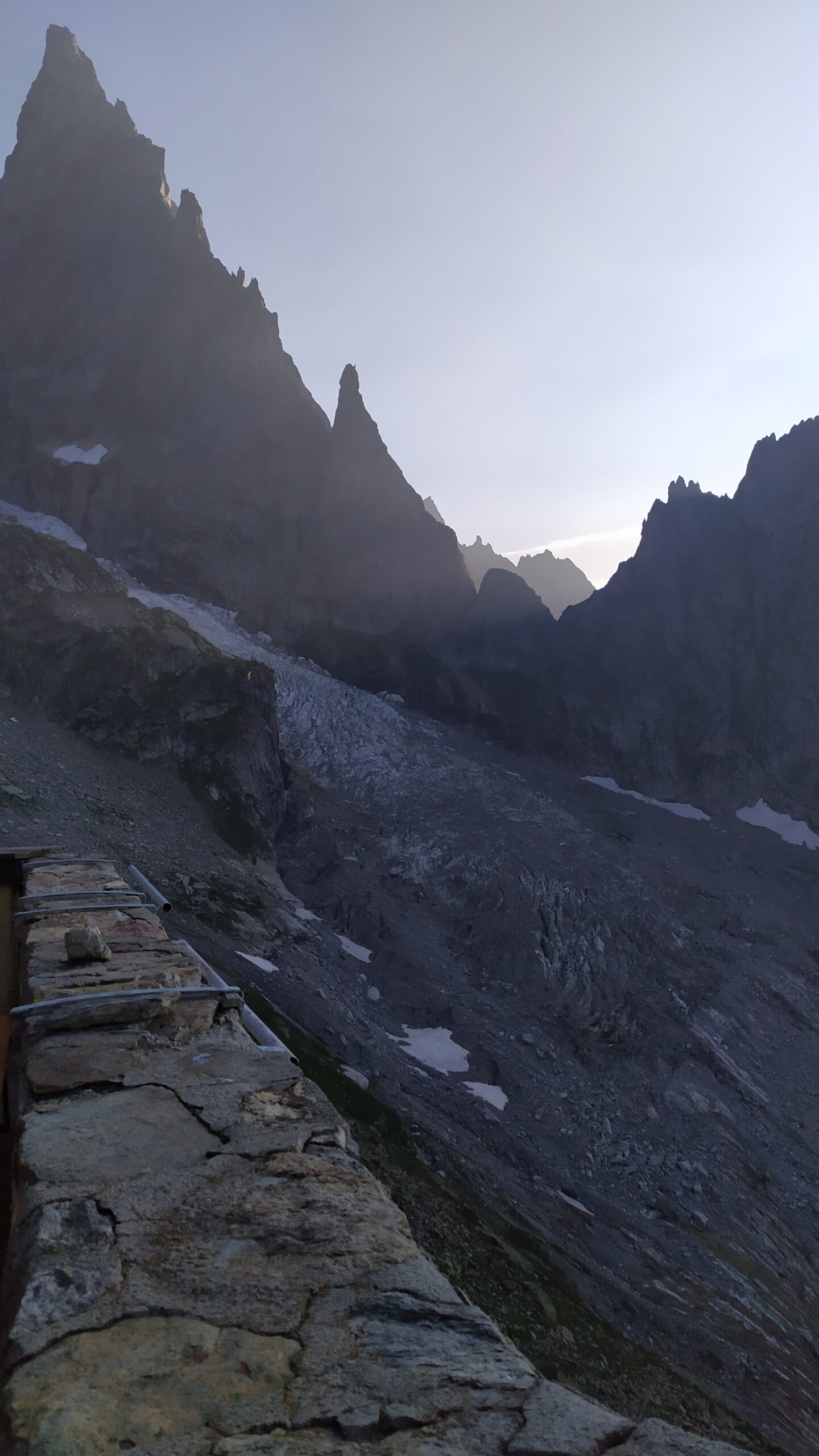
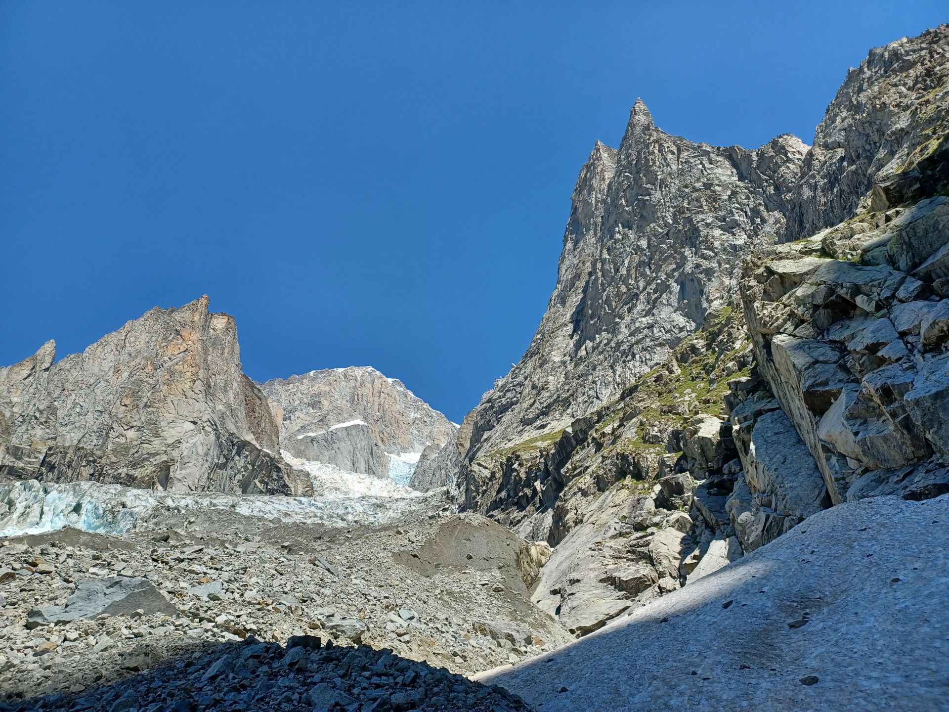
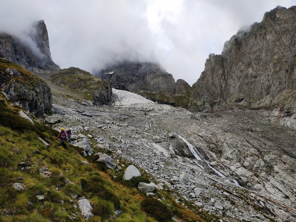
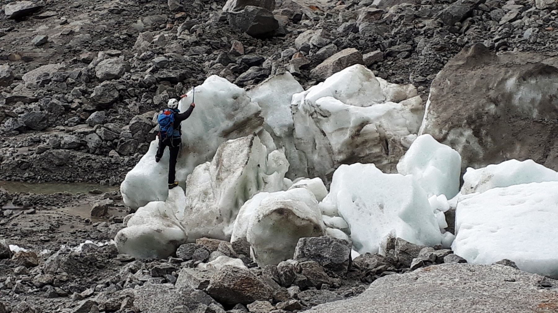
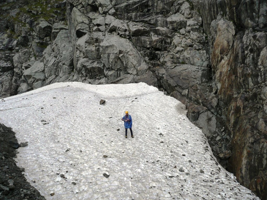
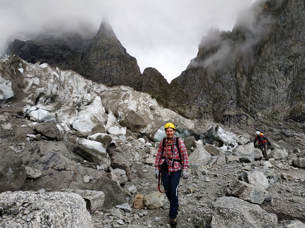
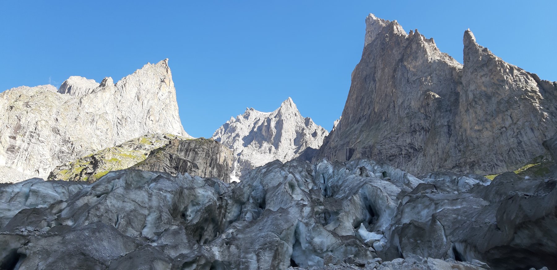
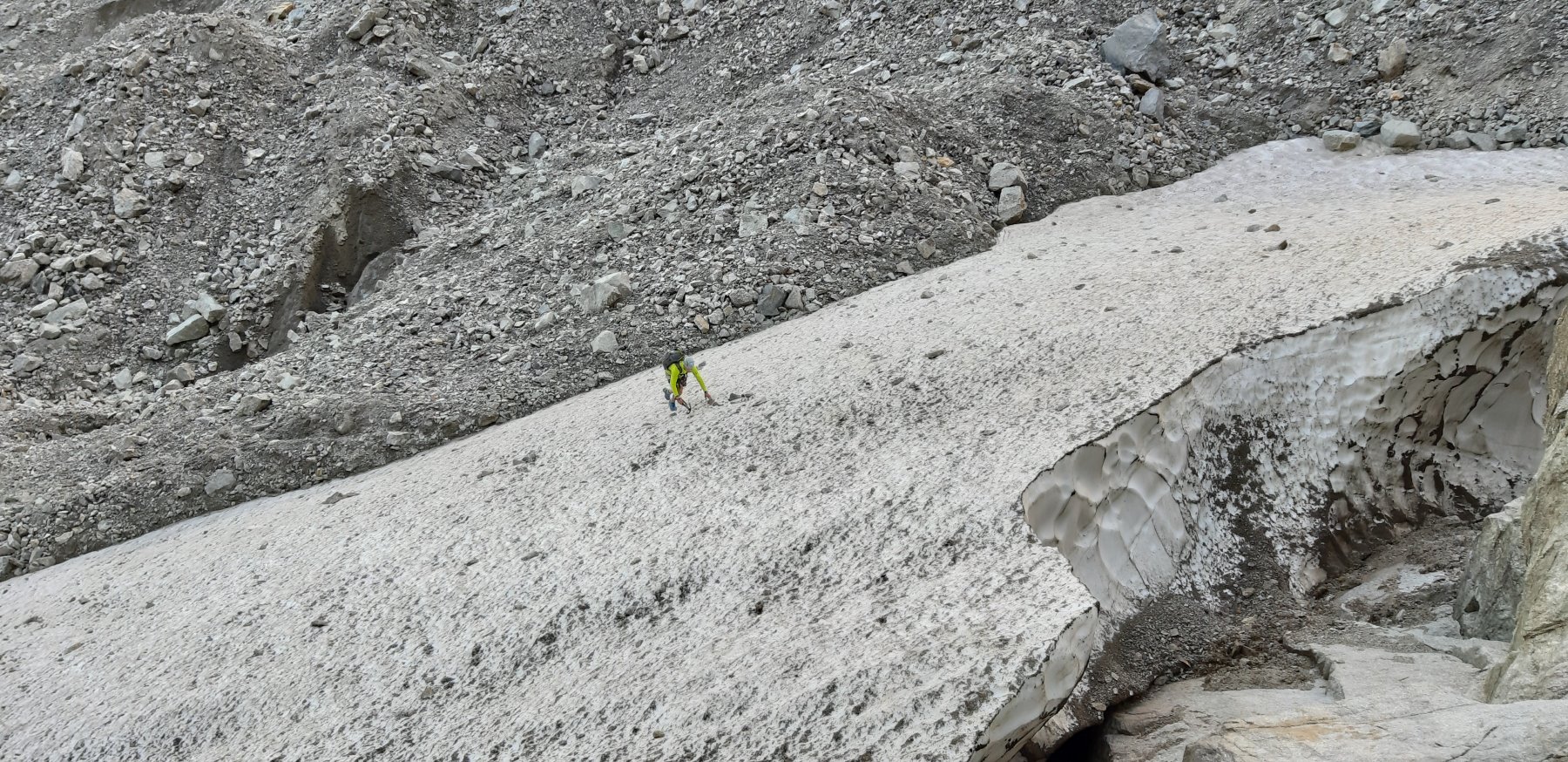
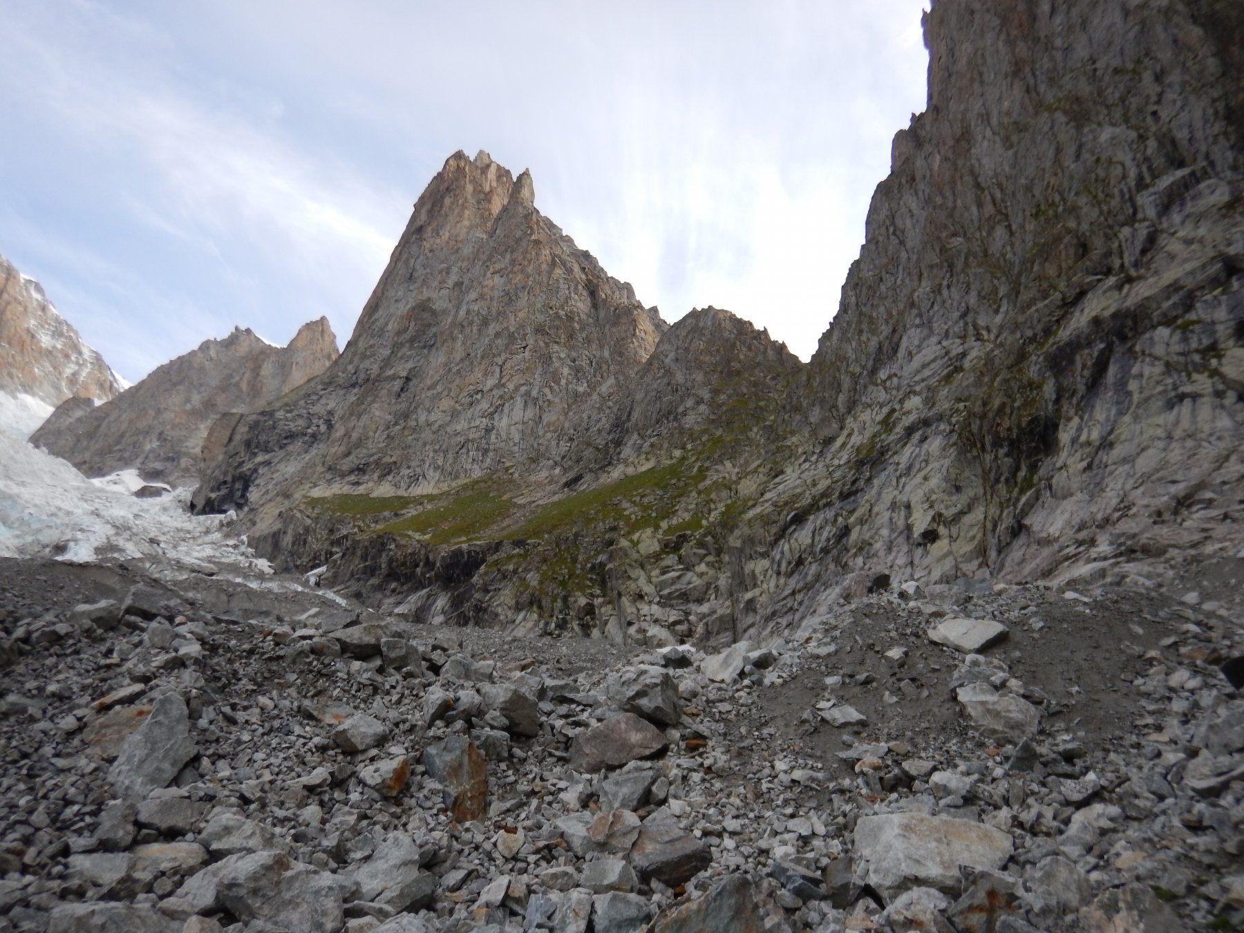
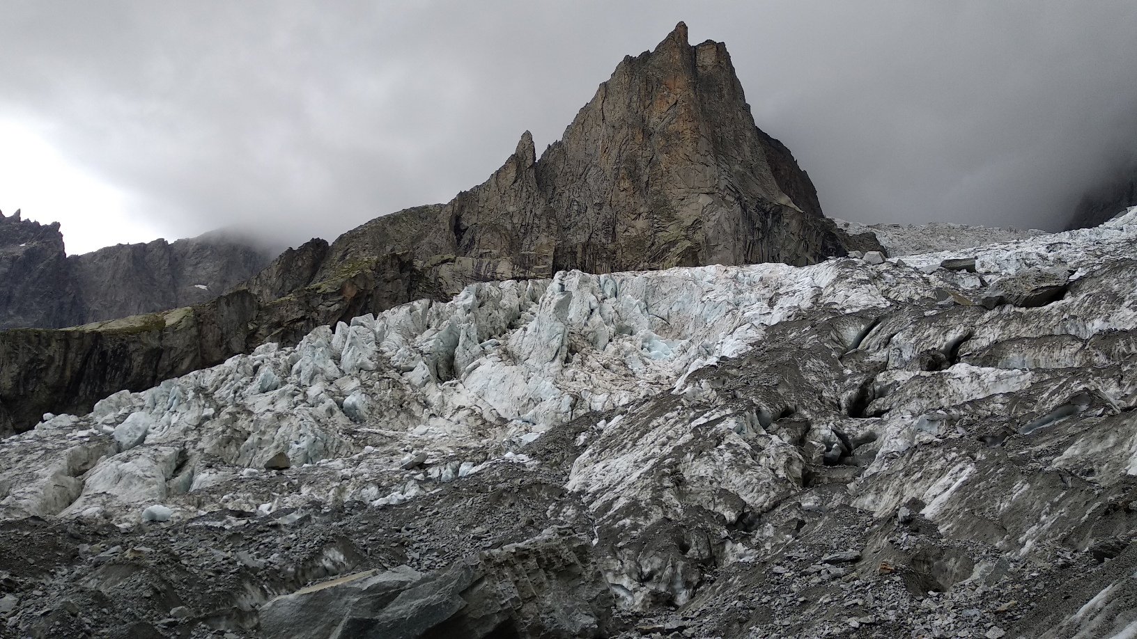
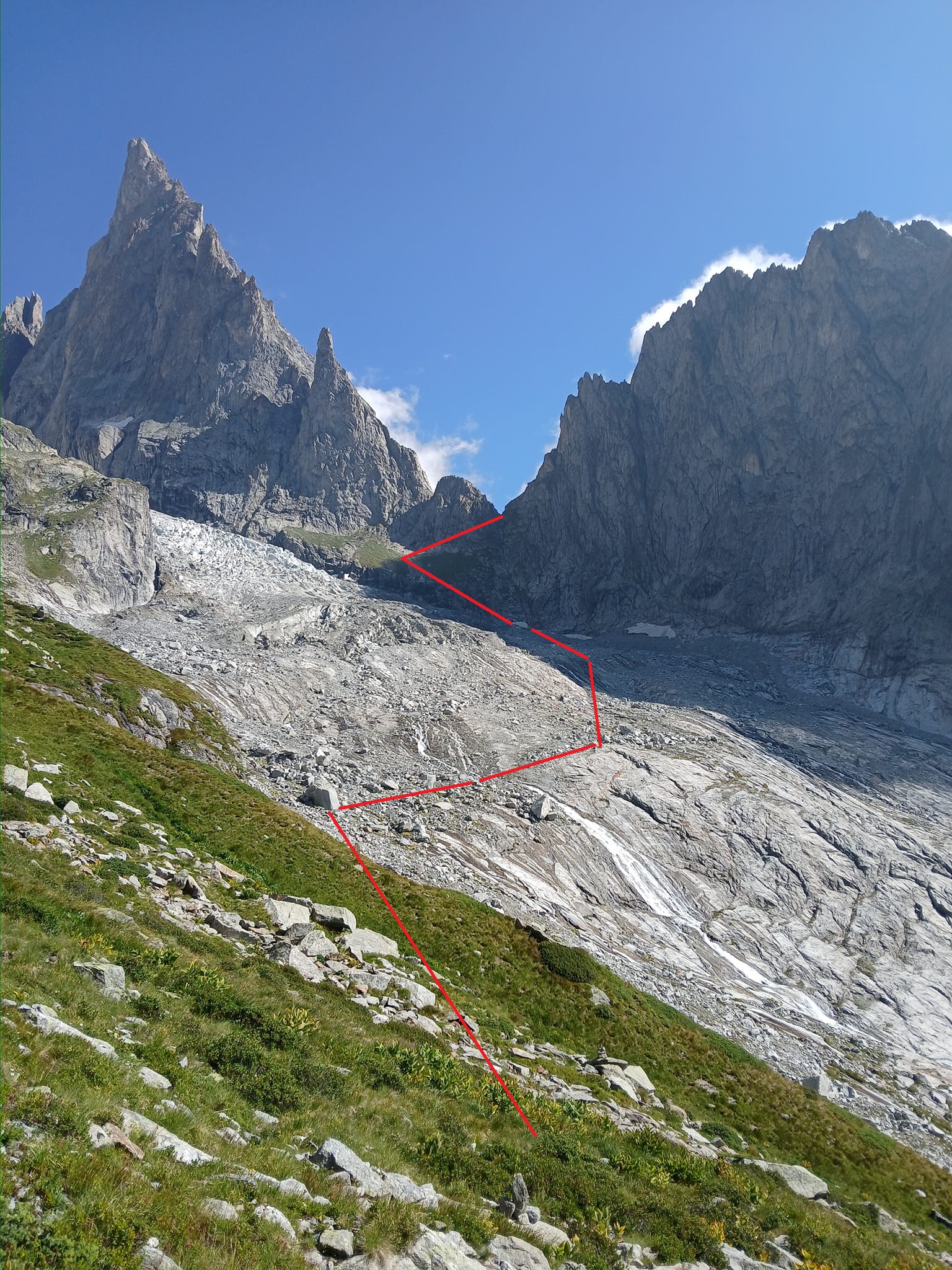
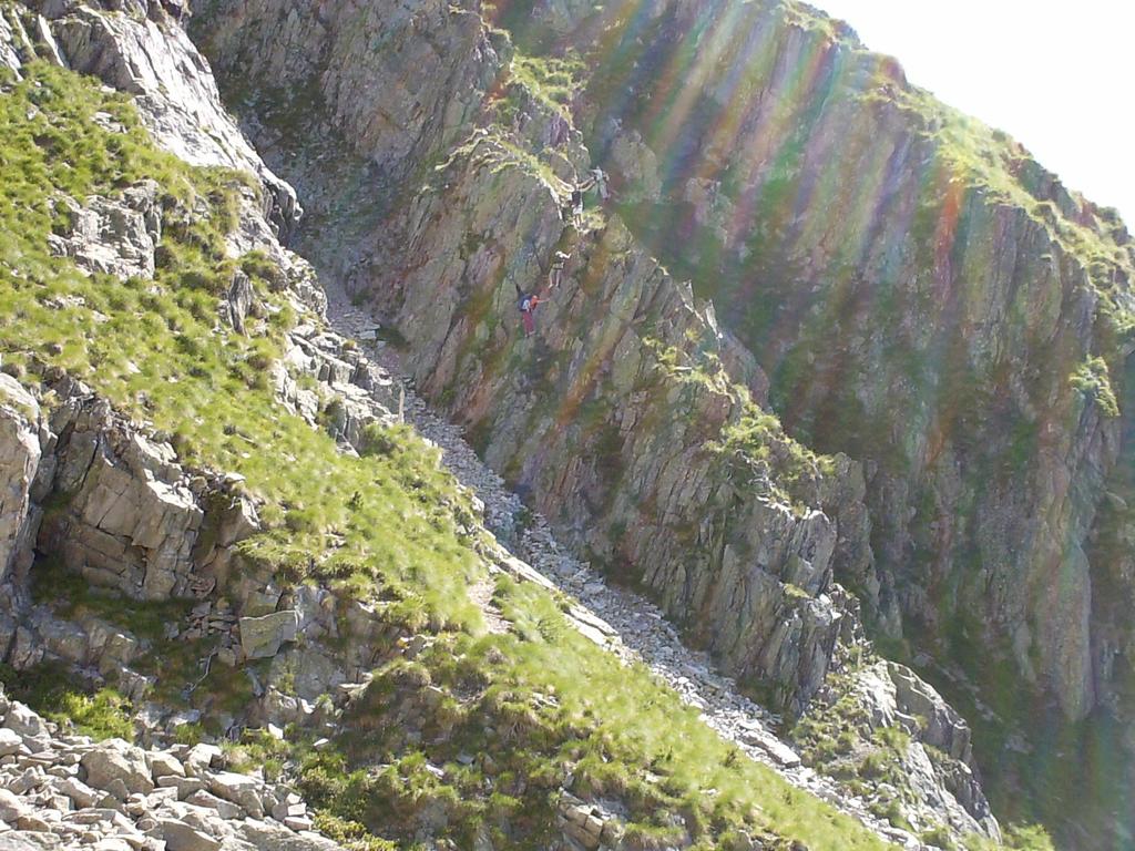
Una volta fuori dal canale, si costeggia il pendio erboso che fiancheggia l’Aiguille du Châtelet (bolli gialli, omini), fino ad arrivare ai piedi della morena del Brouillard. Risalirla per tracce, fino ad arrivare alla base del Ghiacciaio, dove ci si può inoltrare nella prima parte pianeggiante, anche senza l’ausilio dei ramponi.
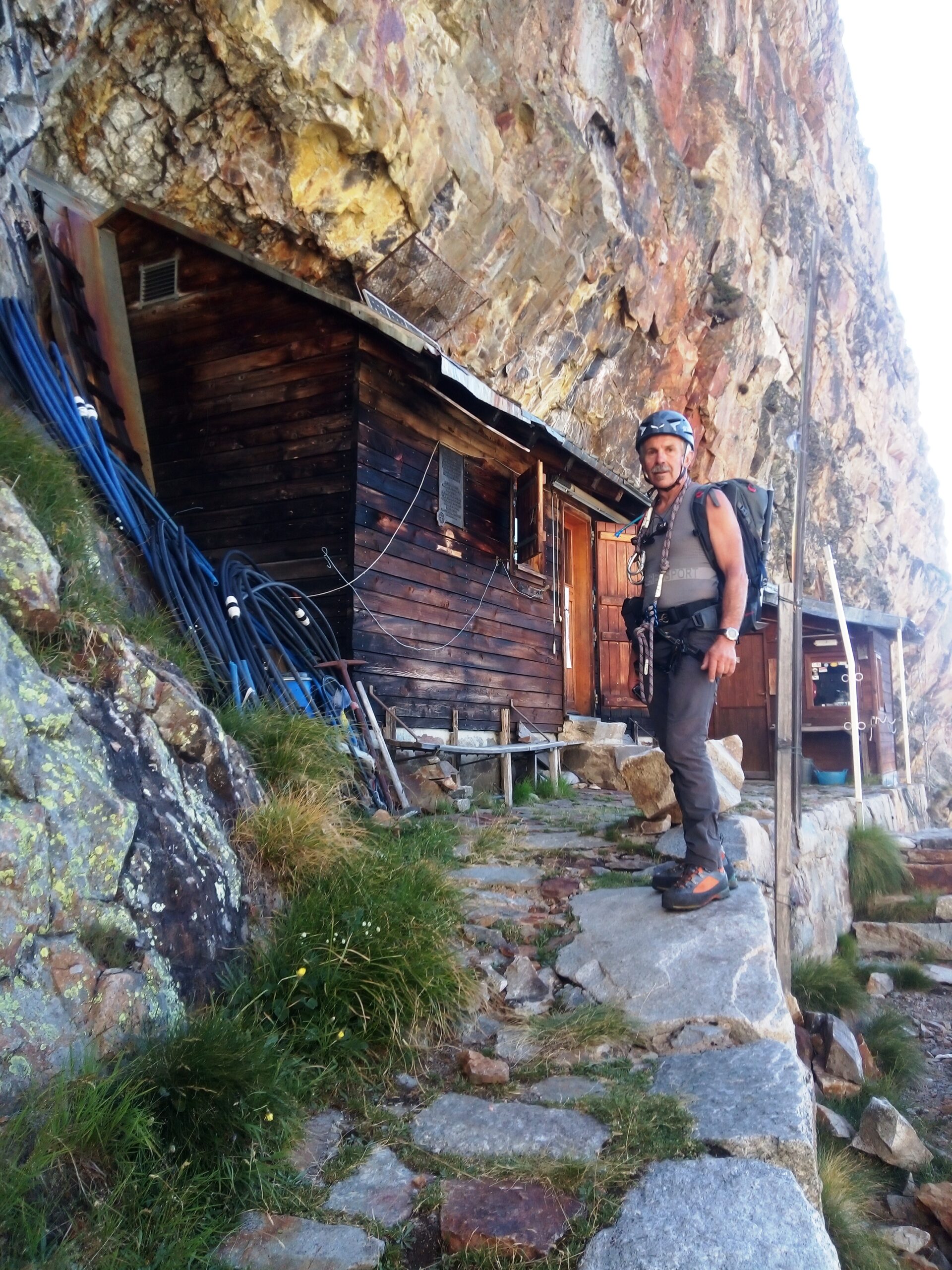
Una volta terminata la visita al ghiacciaio, ci si riporta sulla spalla dello Châtelet, fino ad incrociare il comodo sentiero che porta al Rifugio Monzino, passando per ciò che rimane della storica Capanna Gamba.
Traversata al Rifugio Borelli e rientro per il Col Chasseur. (6-8 ore)
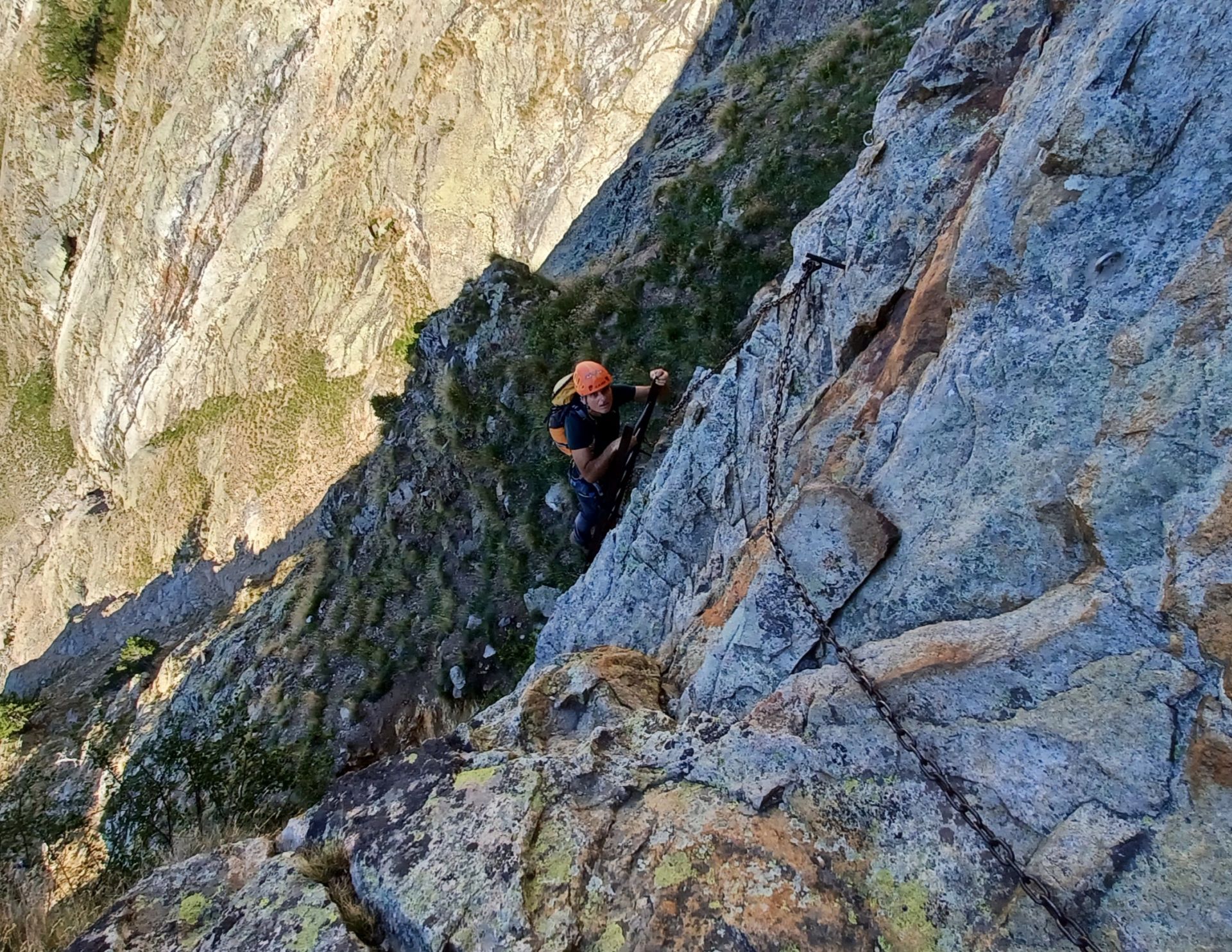
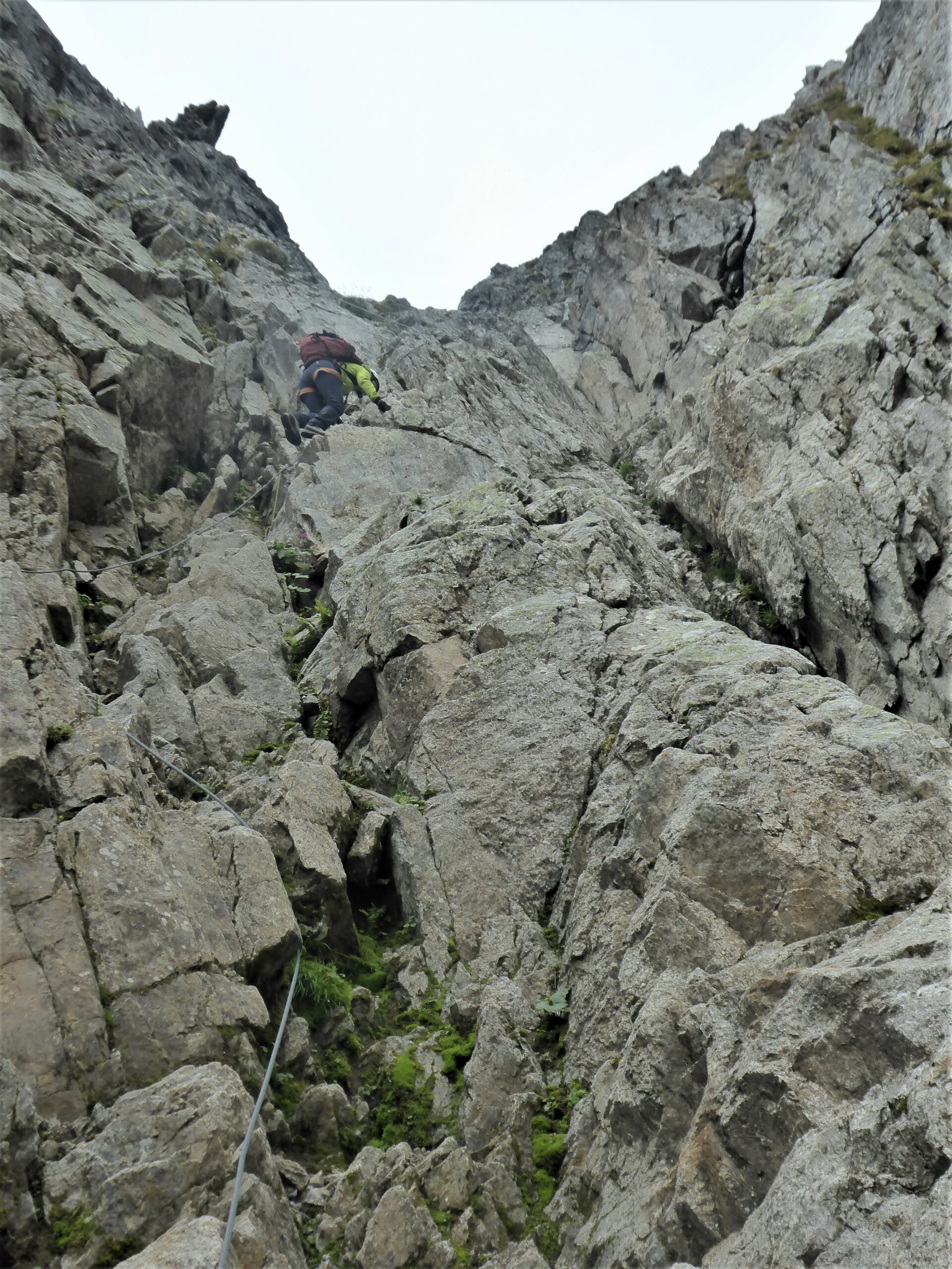
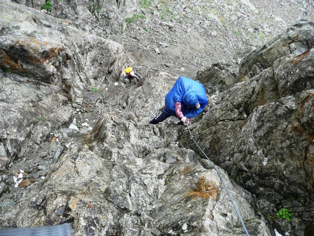
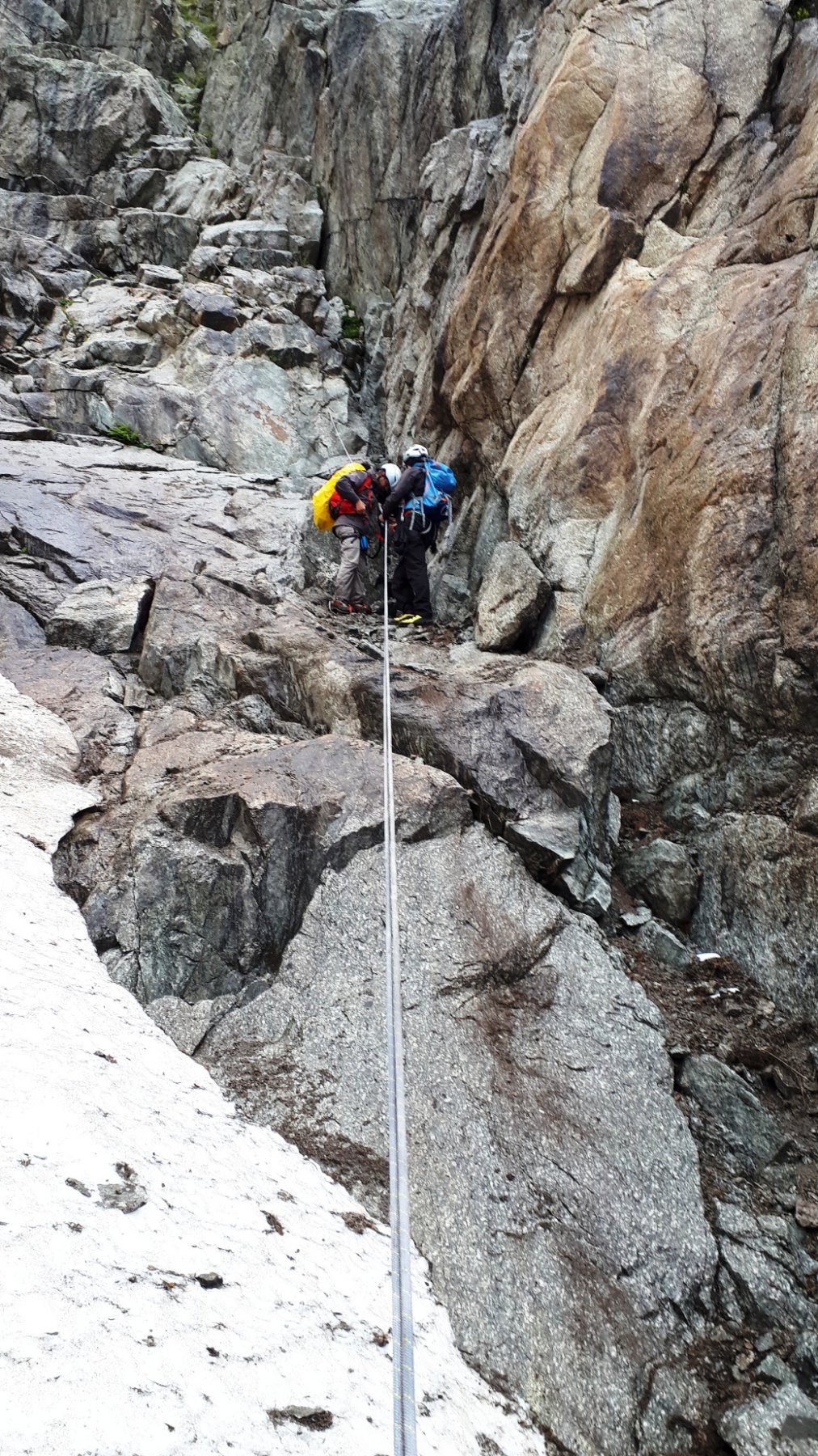
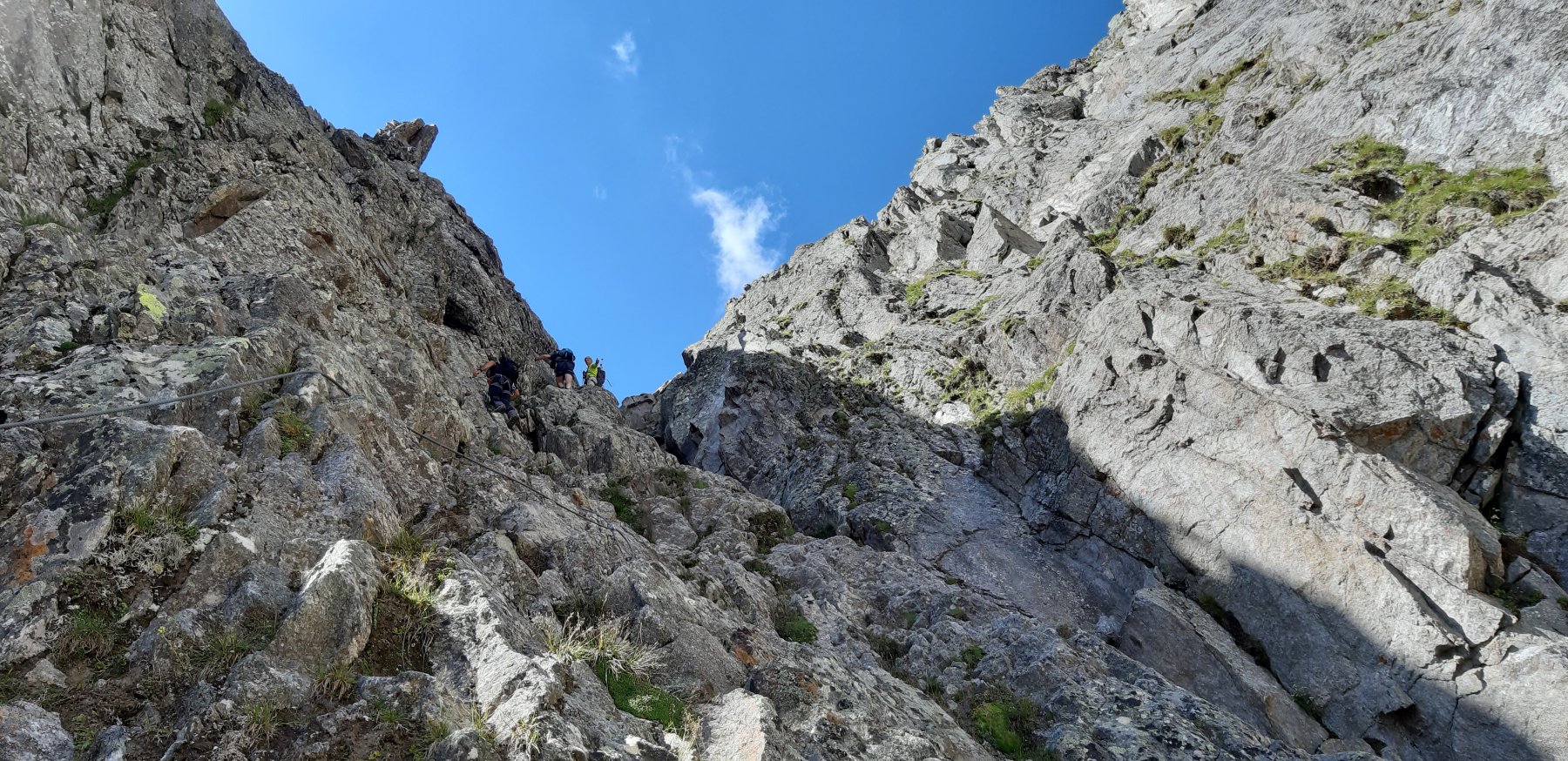
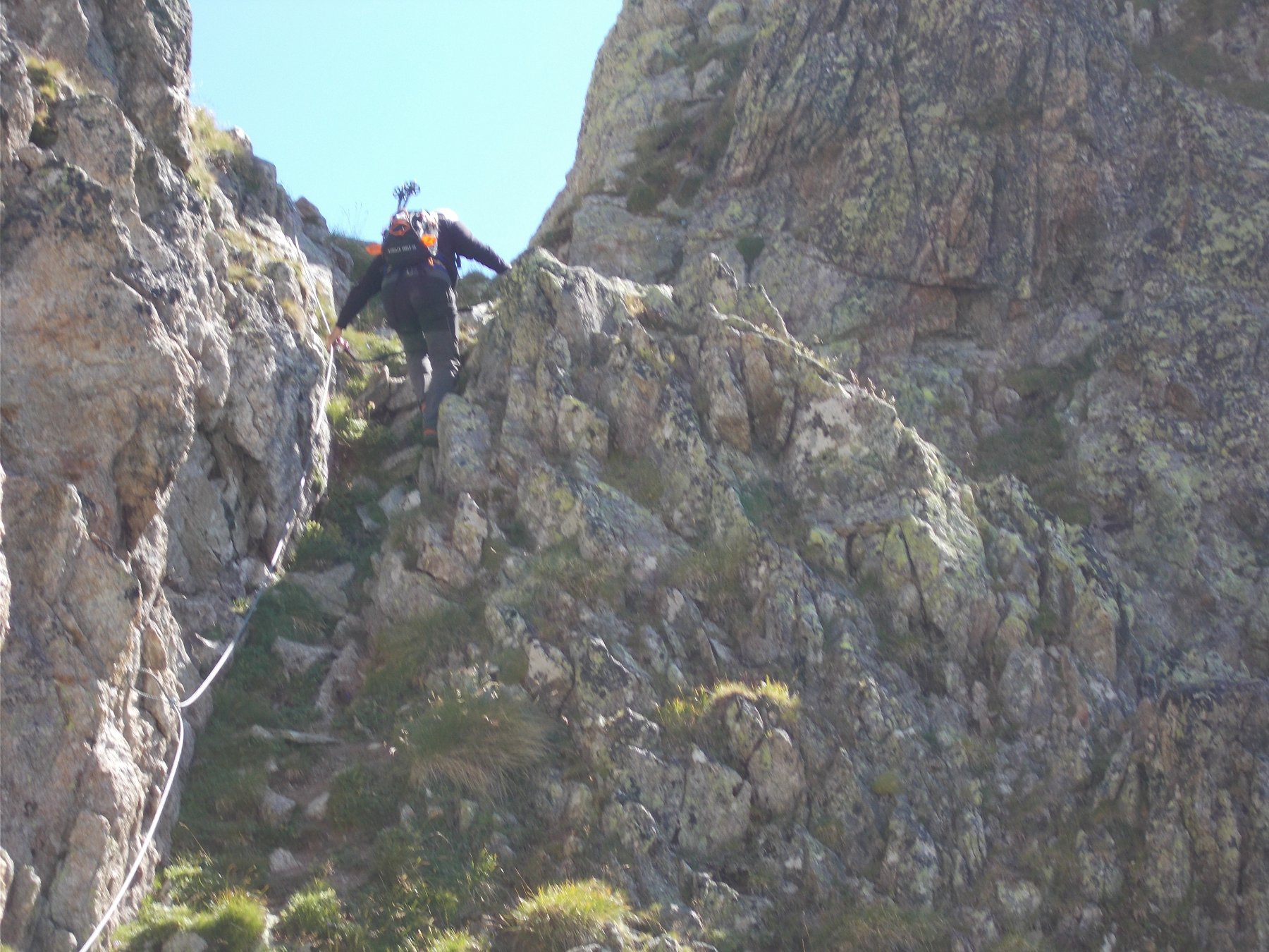
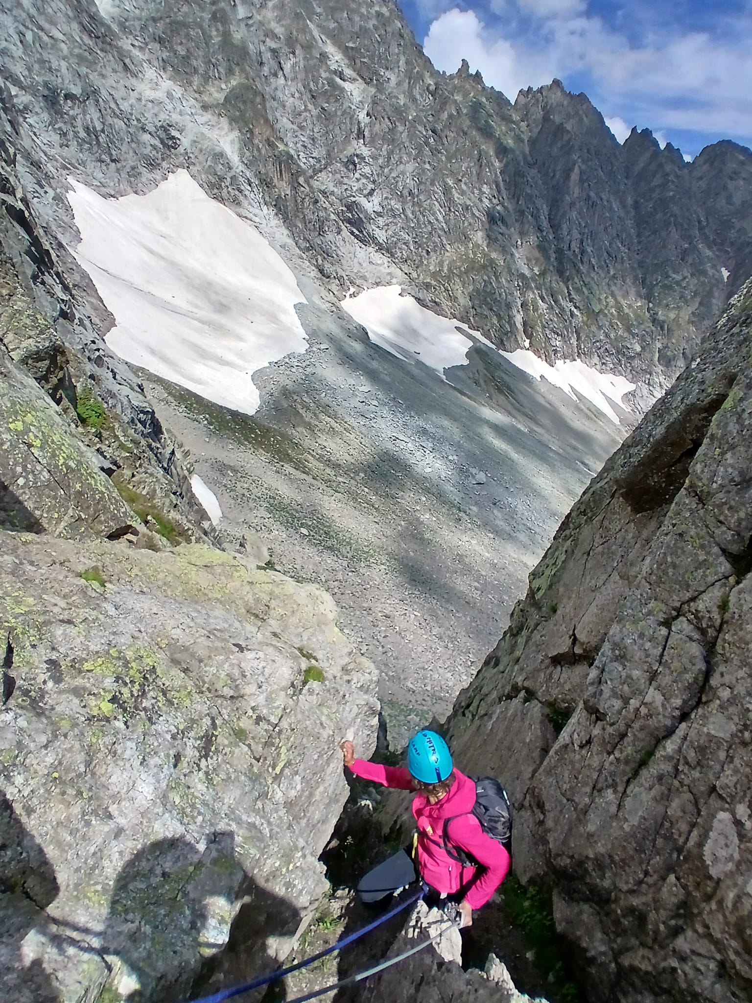
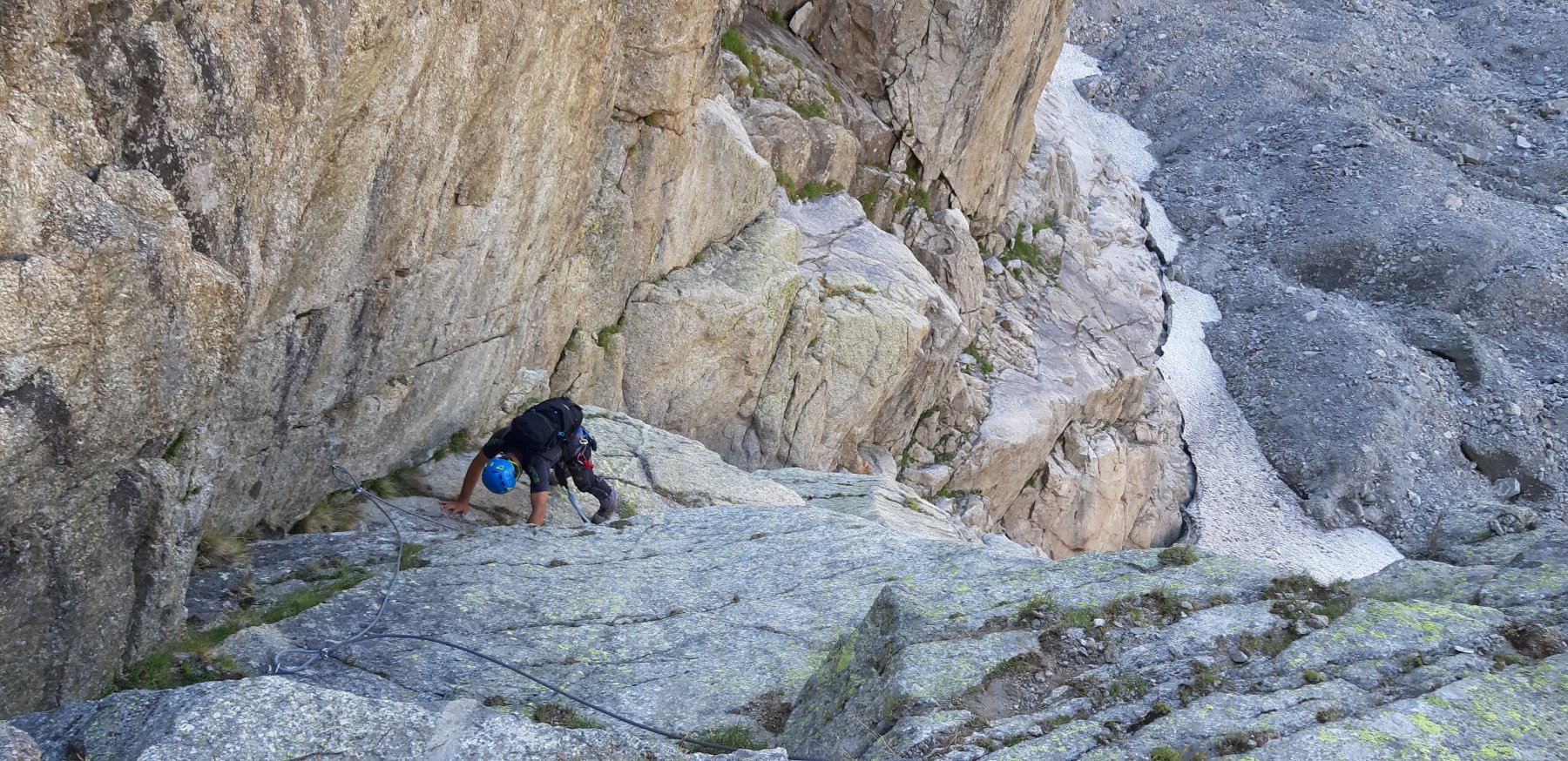
Si parte scendendo i primi due tratti di via ferrata del sentiero normale di accesso al Rifugio Monzino.
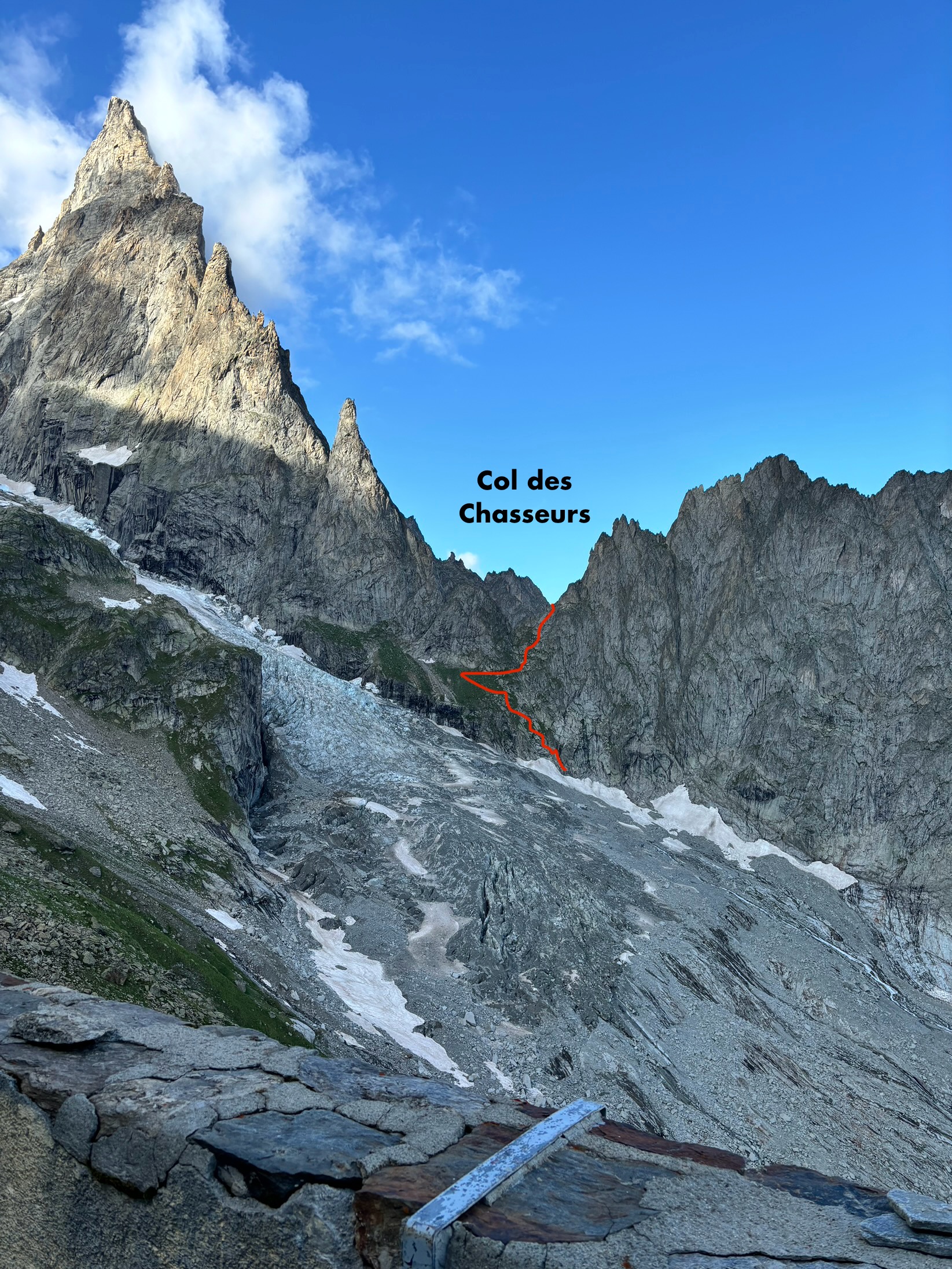
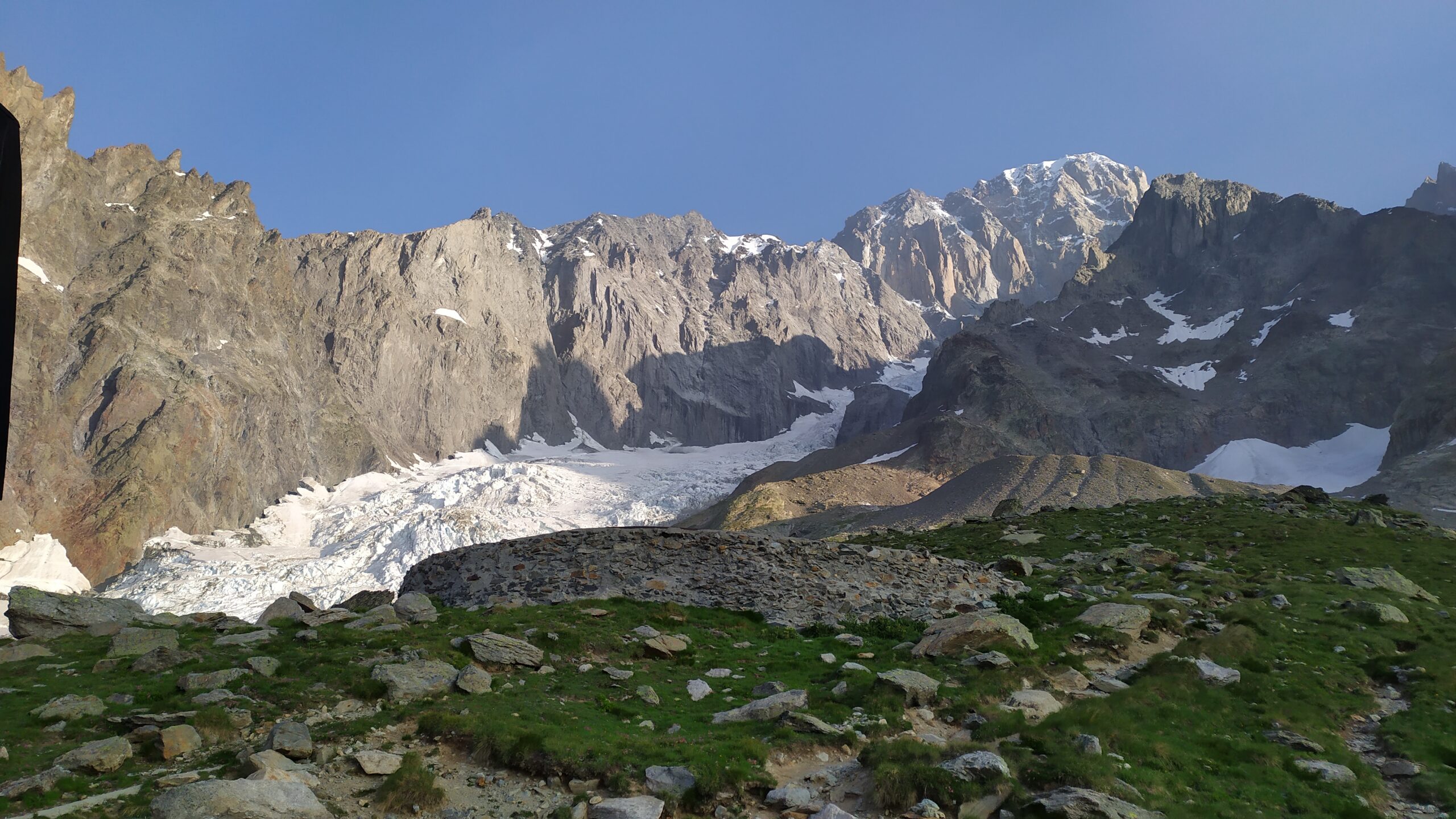
Una volta all’altezza della lingua del Ghiacciaio del Freney, si attraversa in piano verso il Mont Rouge du Peuterey.
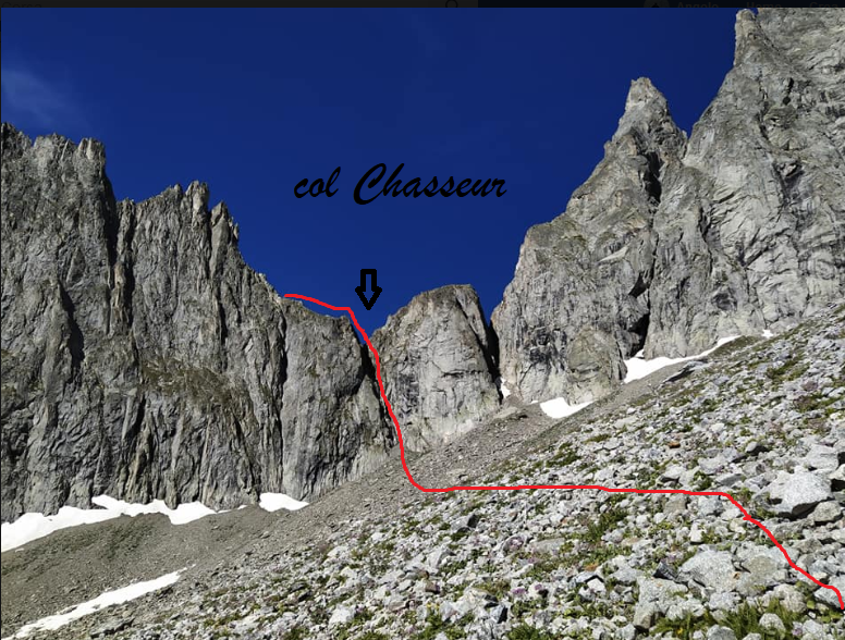
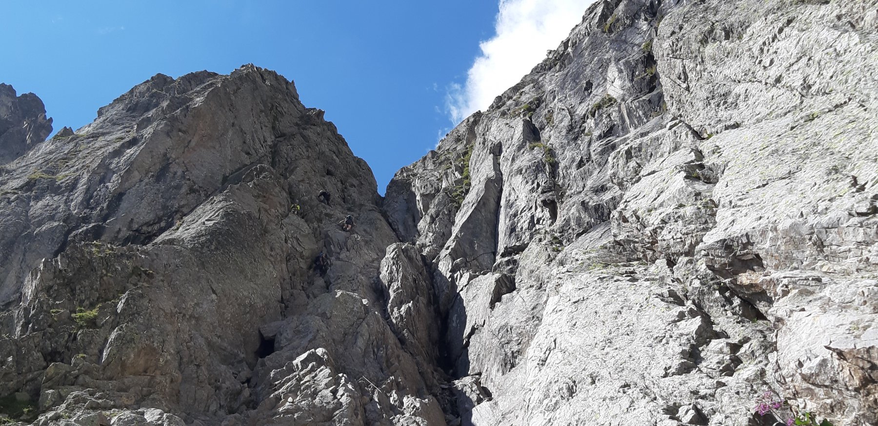
Salendo in corrispondenza di un grosso diedro/couloir, incontriamo i cavi della ferrata di Peuterey, che conducono al Col Chasseur.
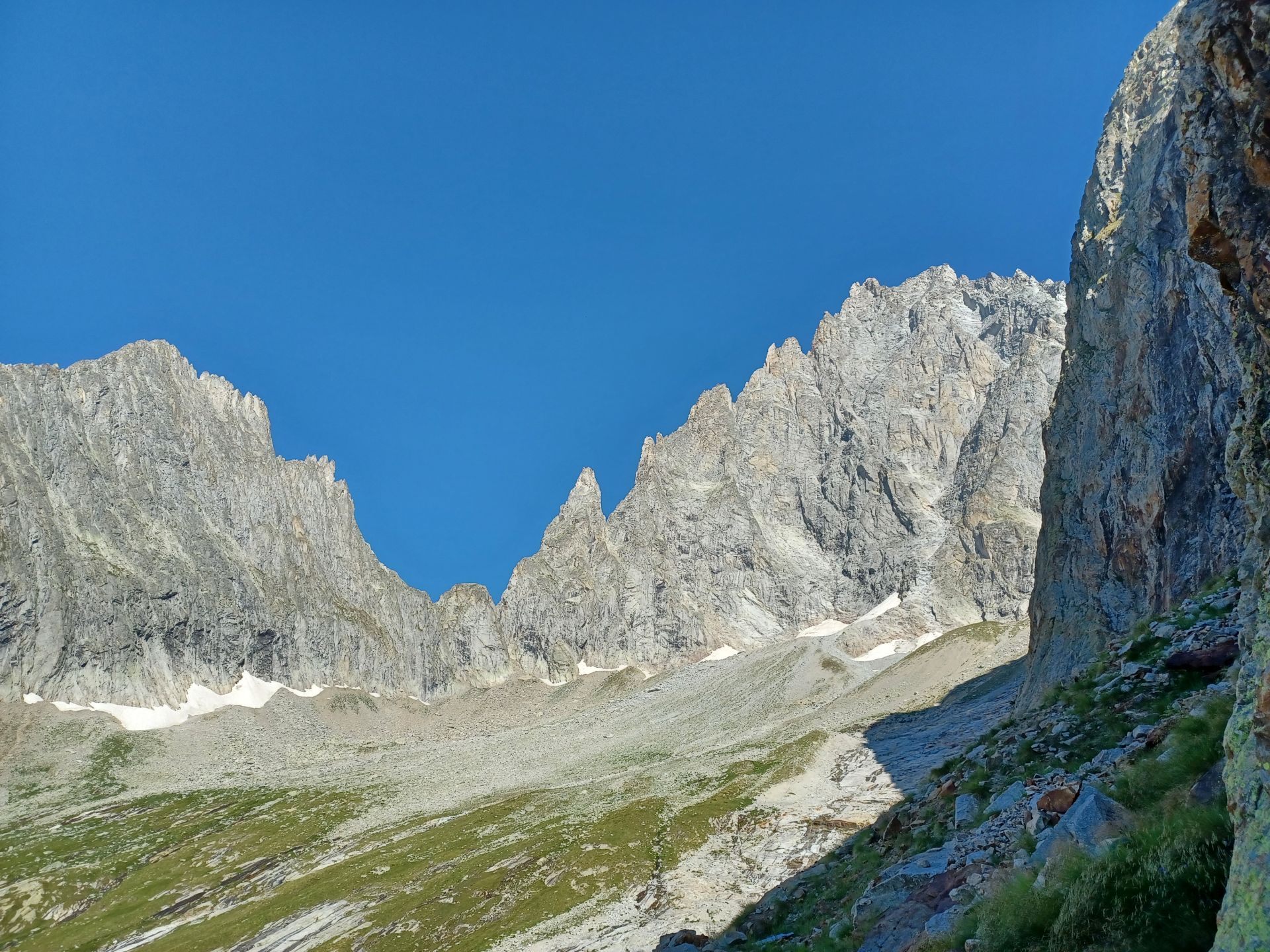
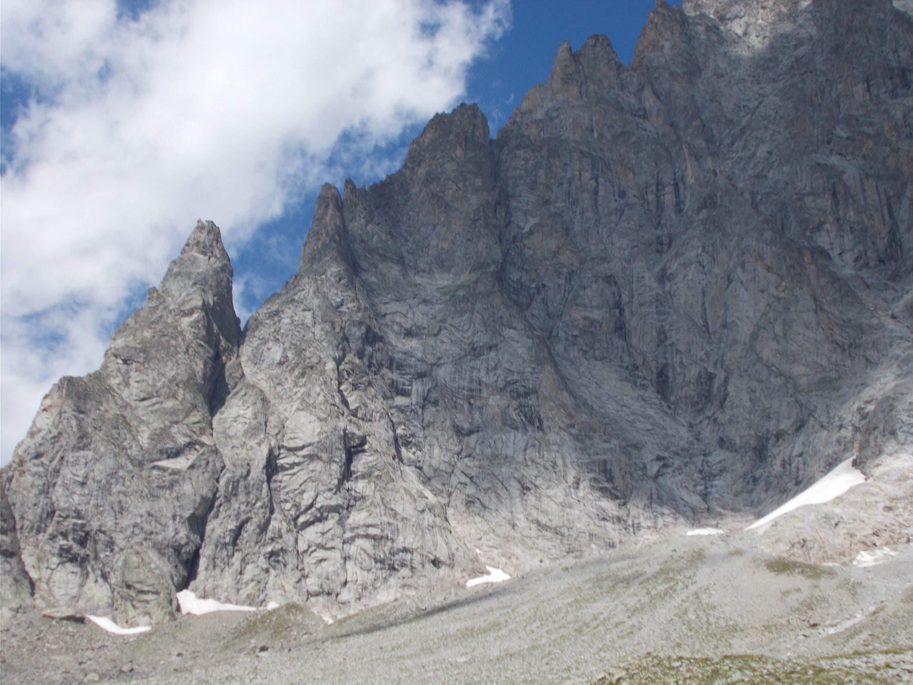
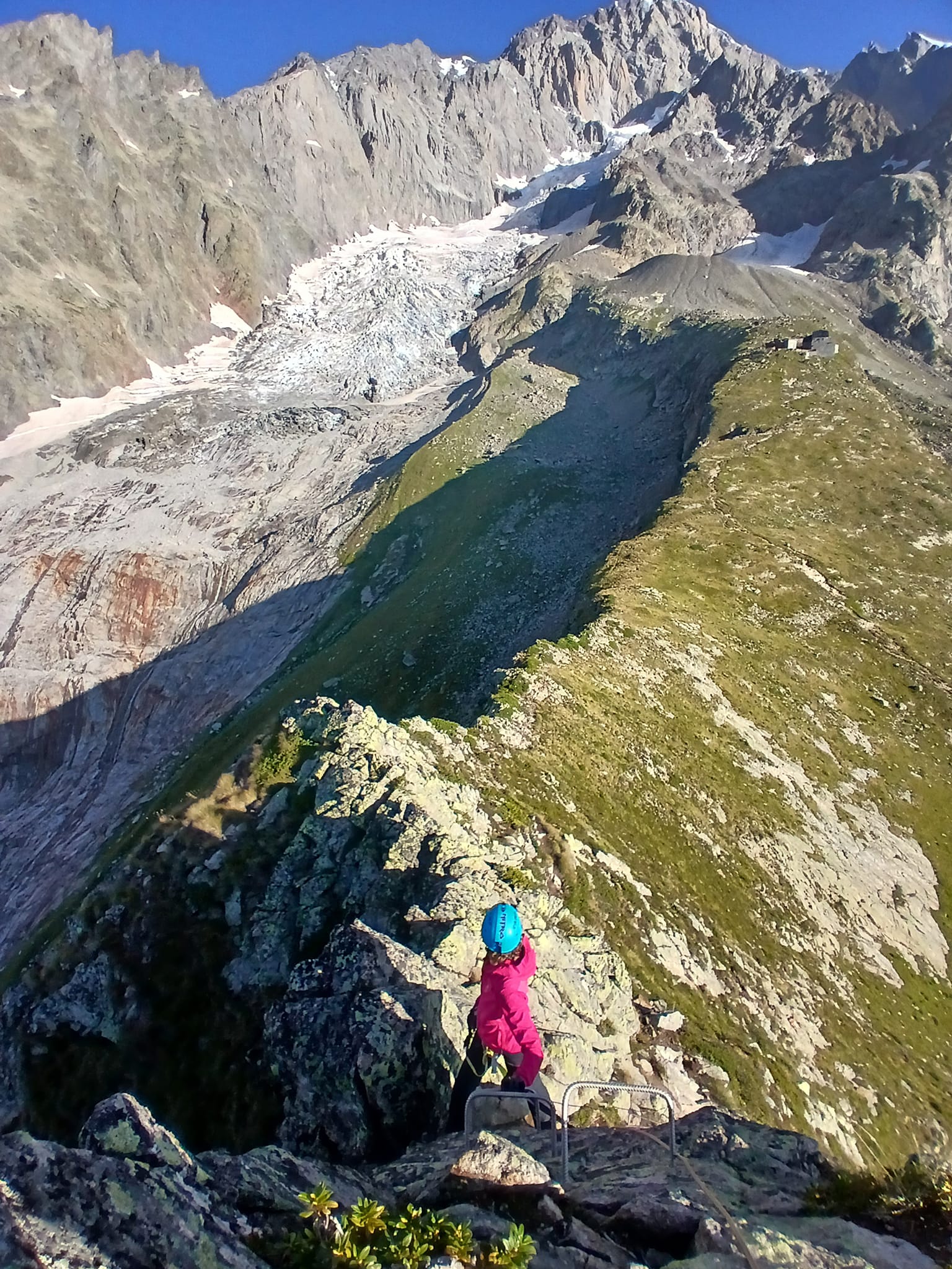
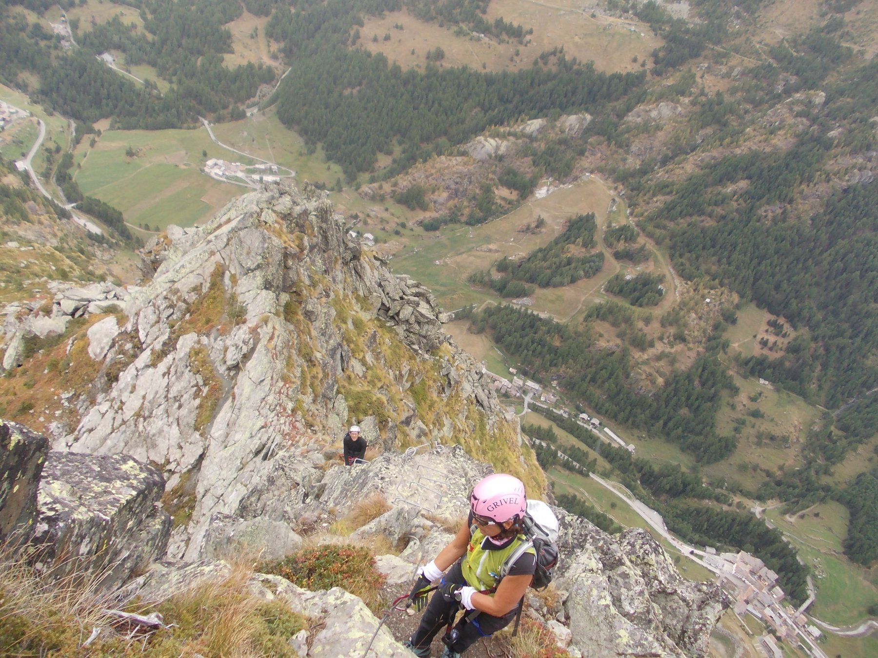
Dal colle, salendo ancora una cinquantina di metri verso il Mont Rouge, si raggiungono facilmente la prima e la seconda “Platta de Zaneno”, due comodi belvedere pianeggianti con vista sull’Aiguille Noire, sui Rocher Gruber, sui Piloni del Freney e su tutta la Val Veny.
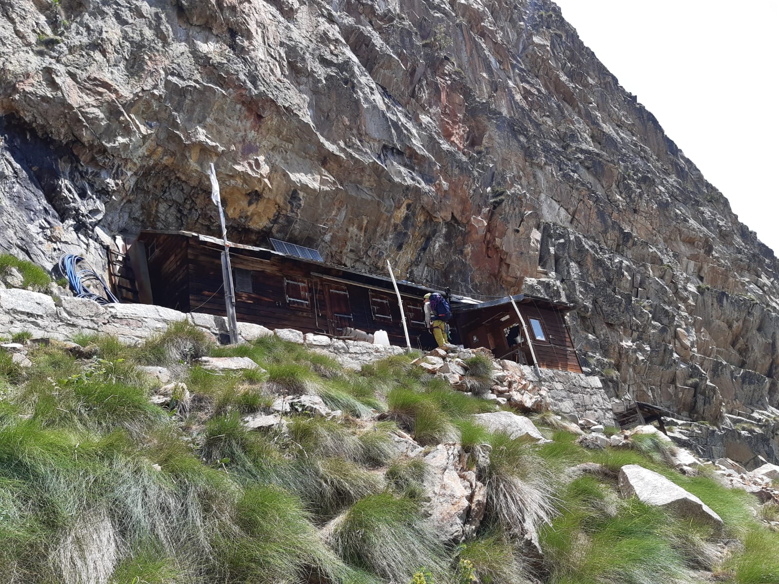
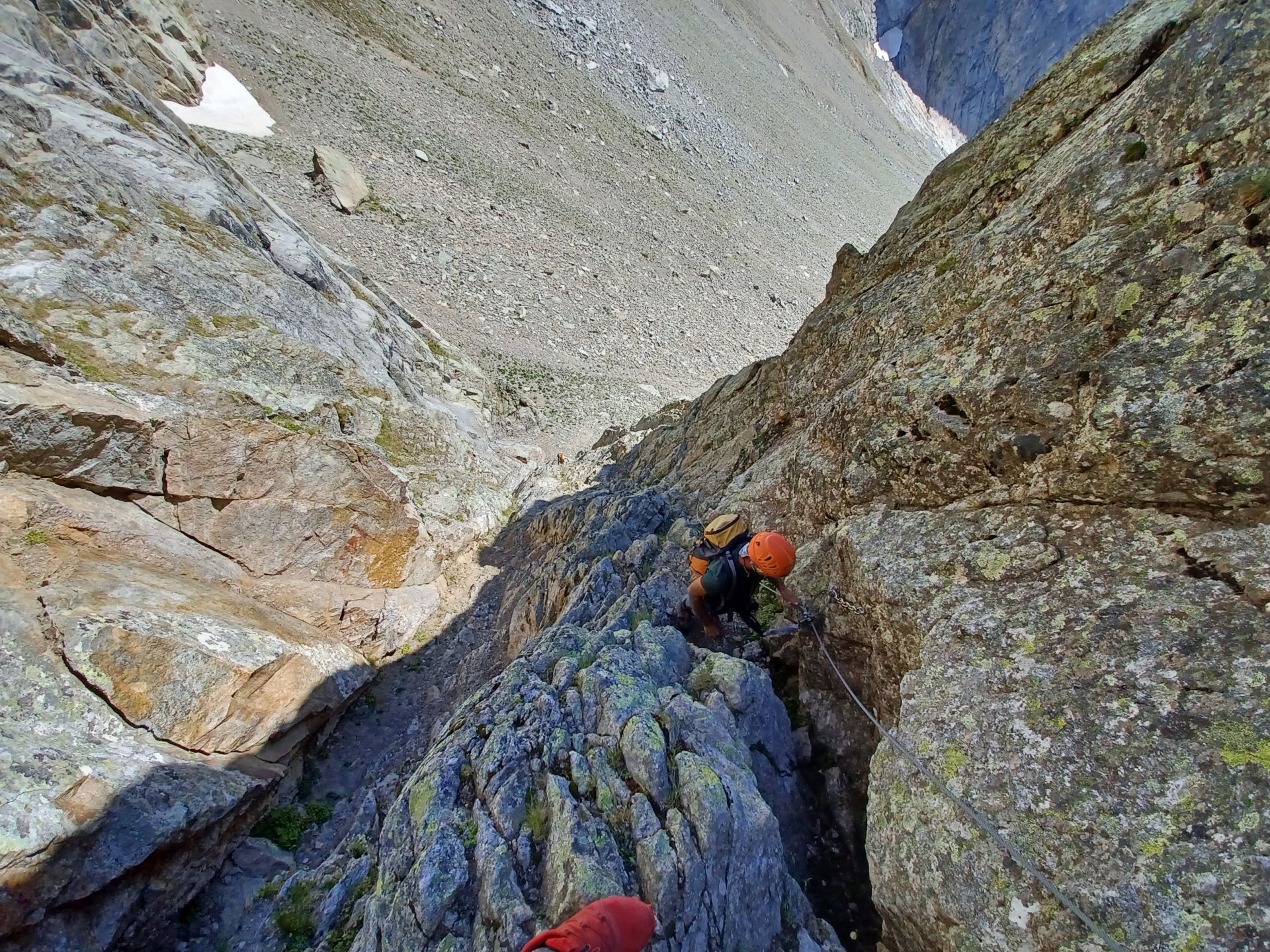
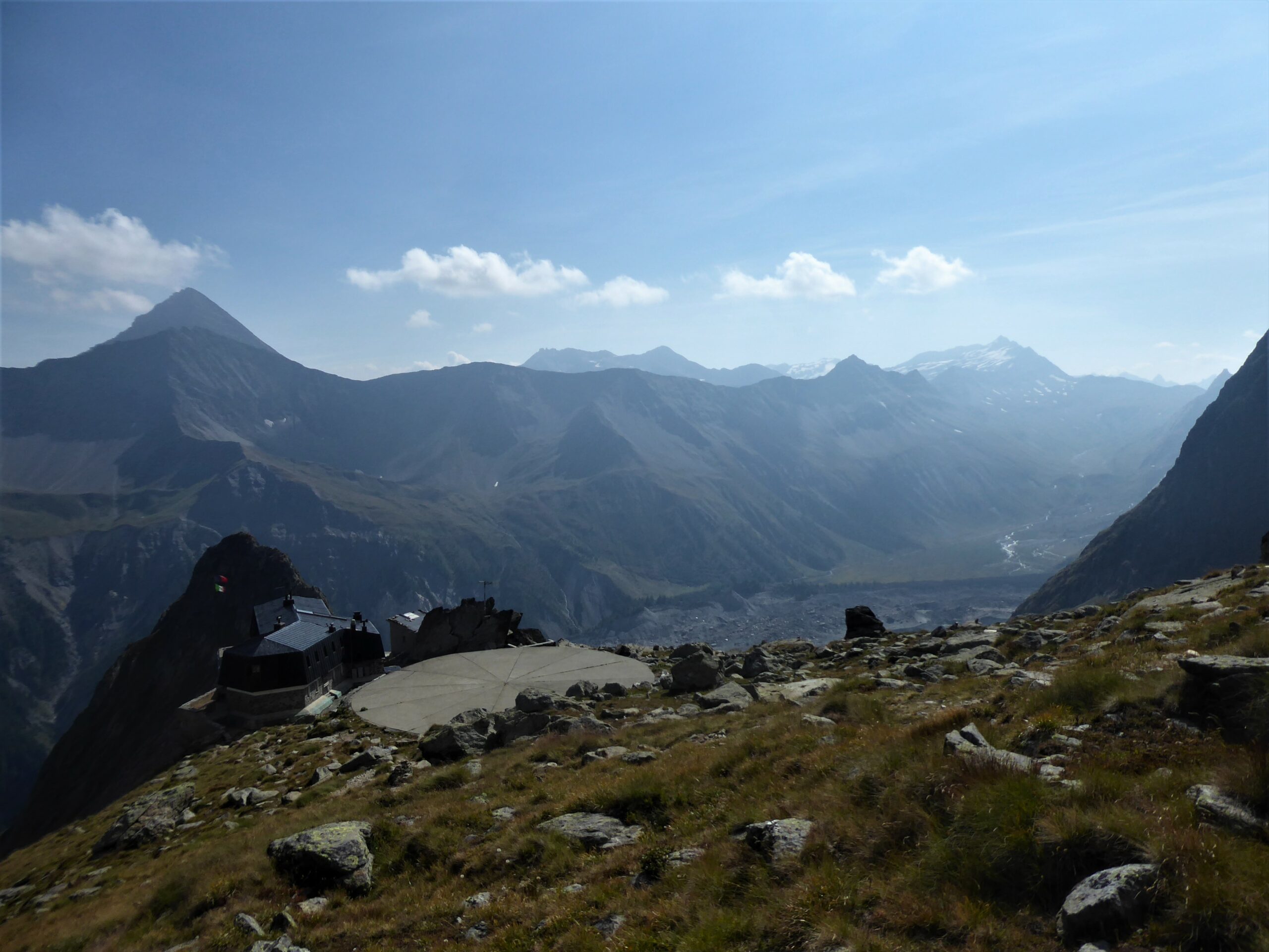
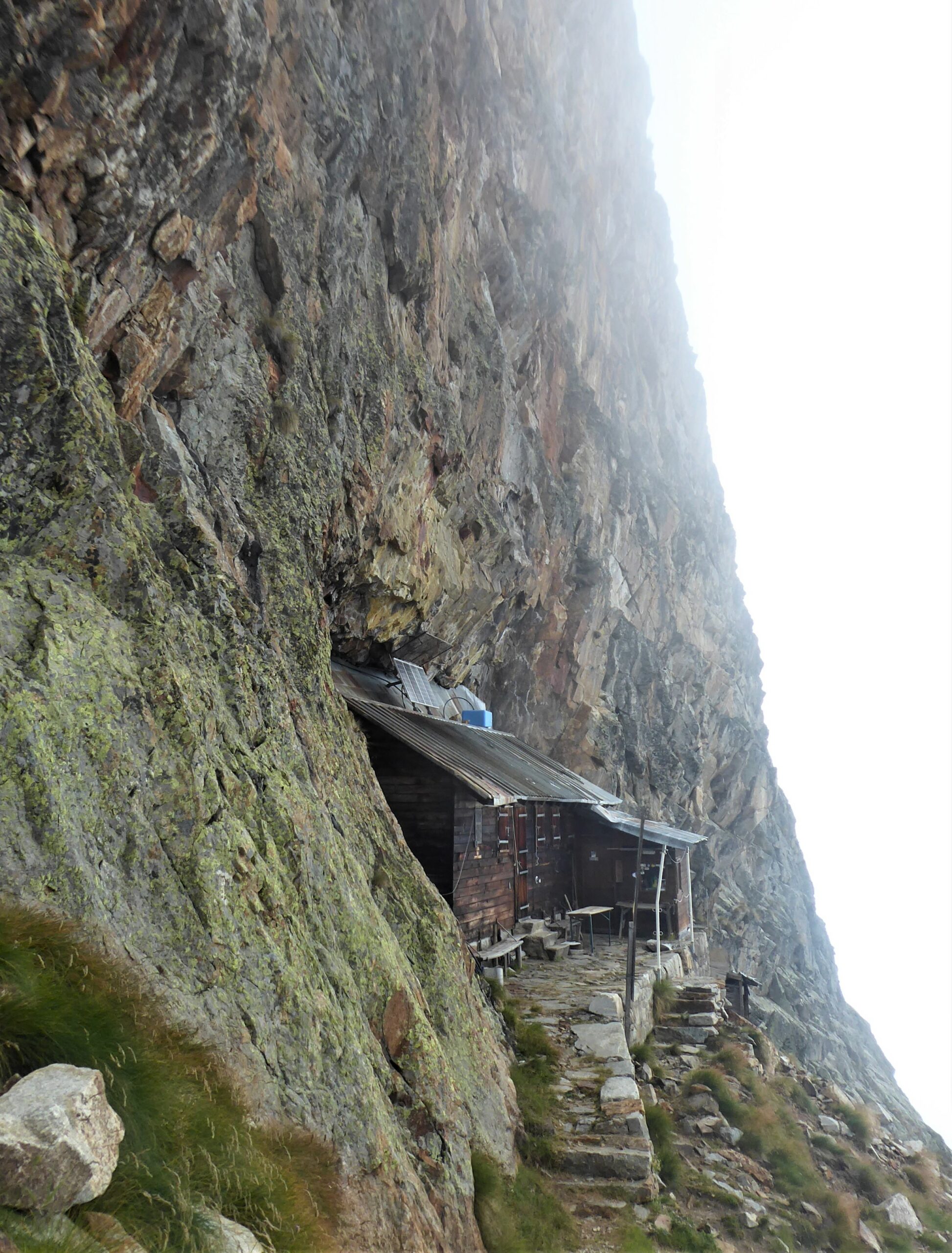
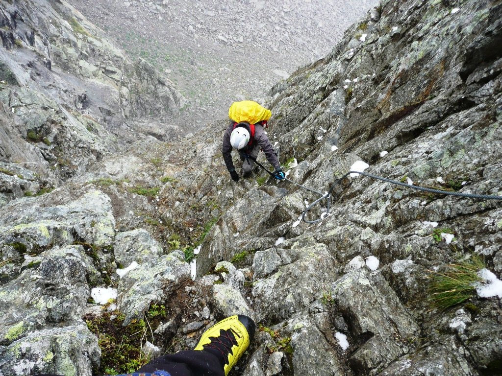
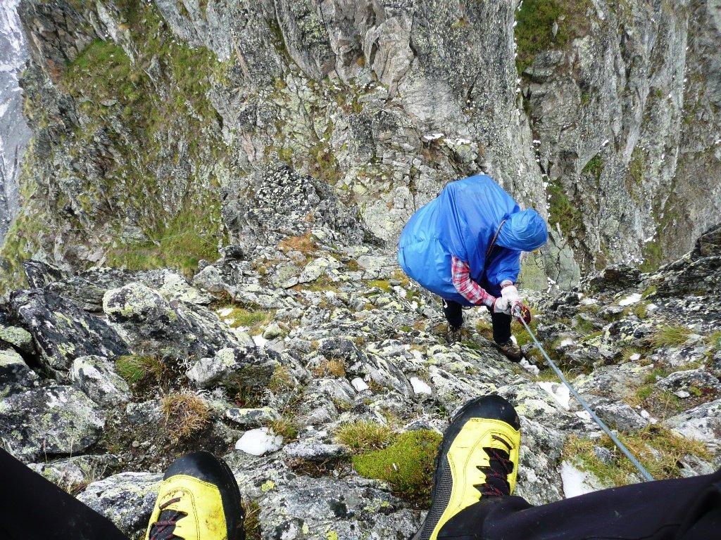
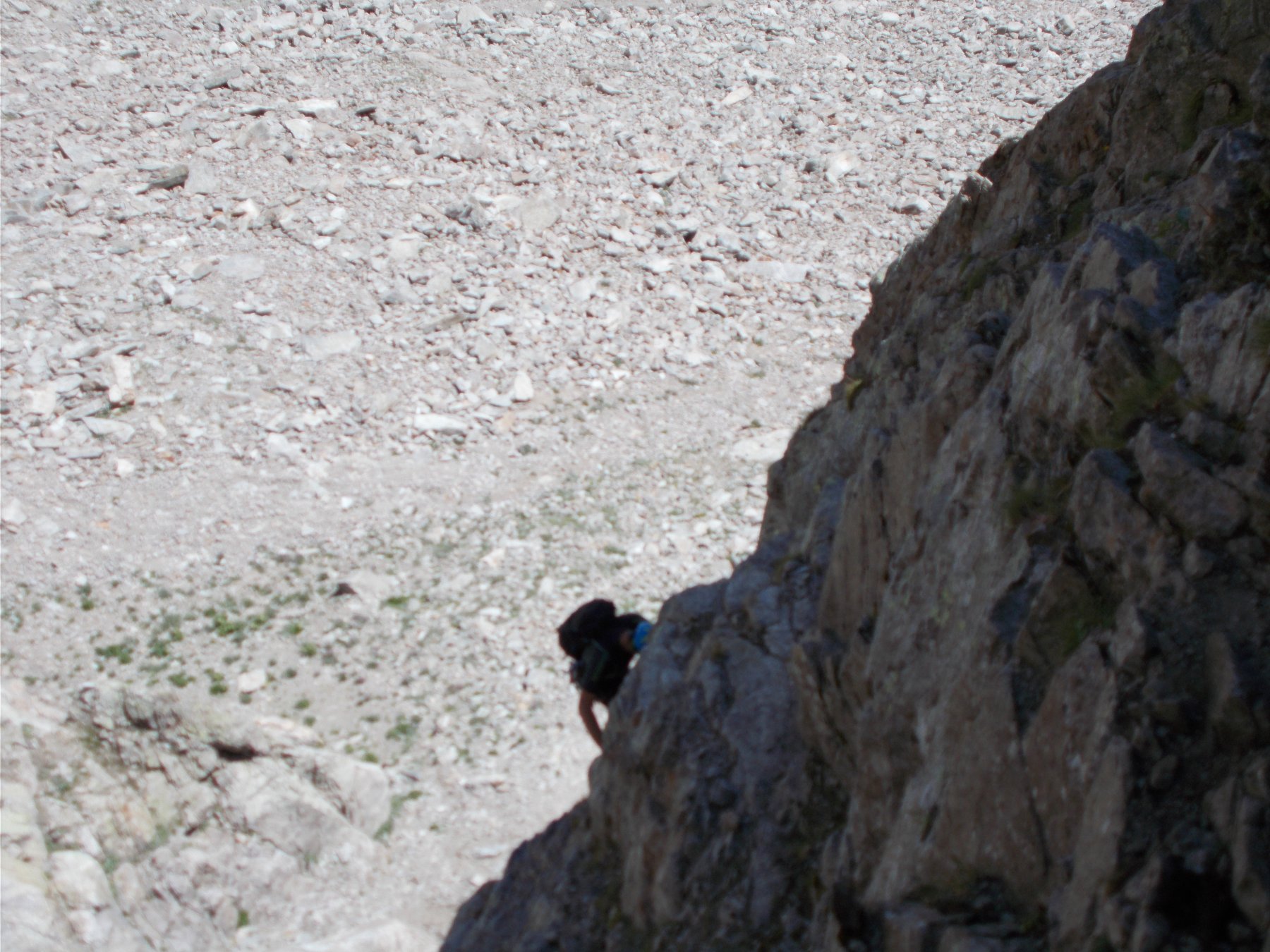
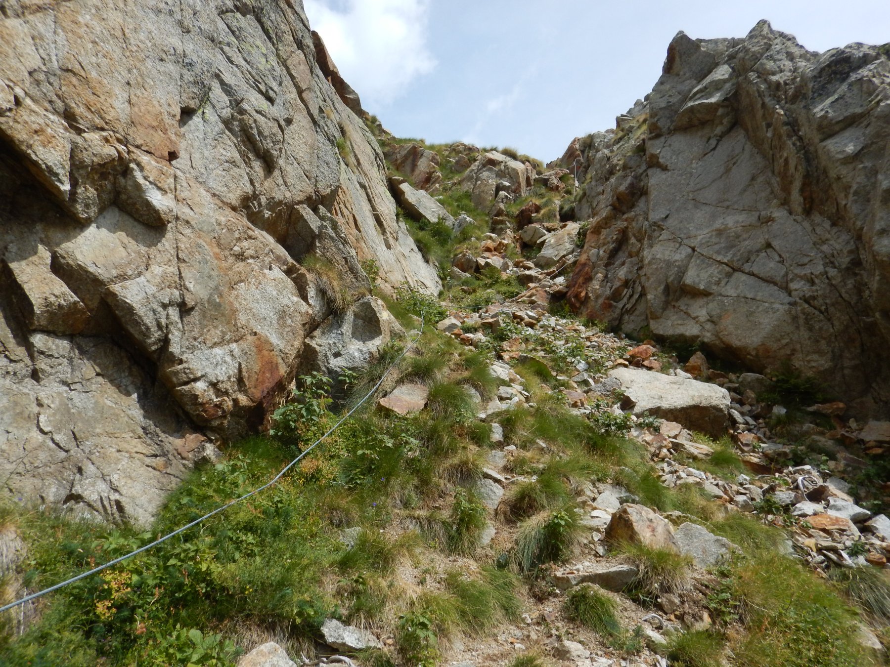
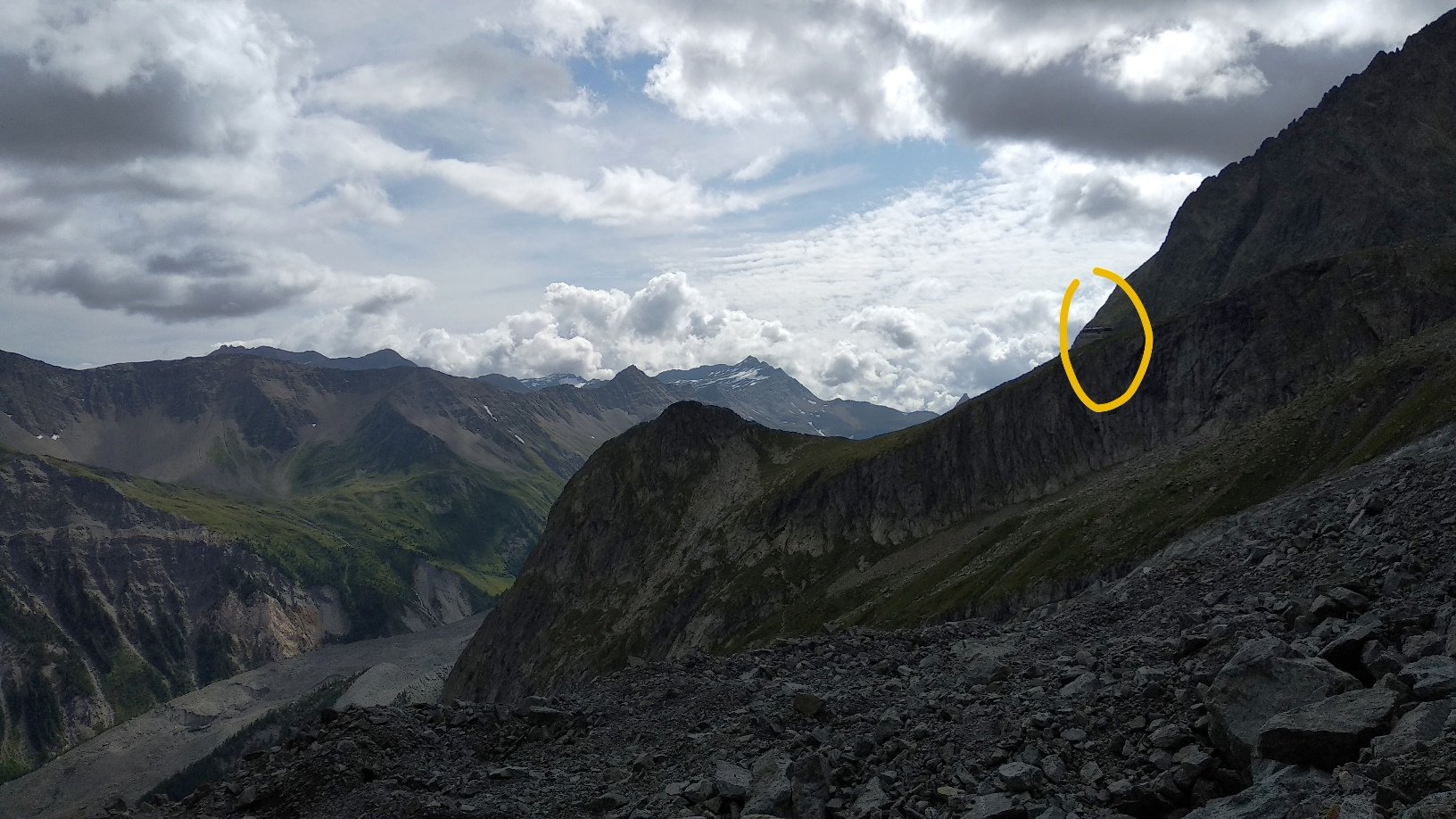
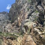
Si ridiscende al Col Chasseur, dove riprendendo il sentiero attrezzato con cavo metallico, in breve si raggiunge il Fauteuil des Allemands e quindi il Rifugio Borelli.
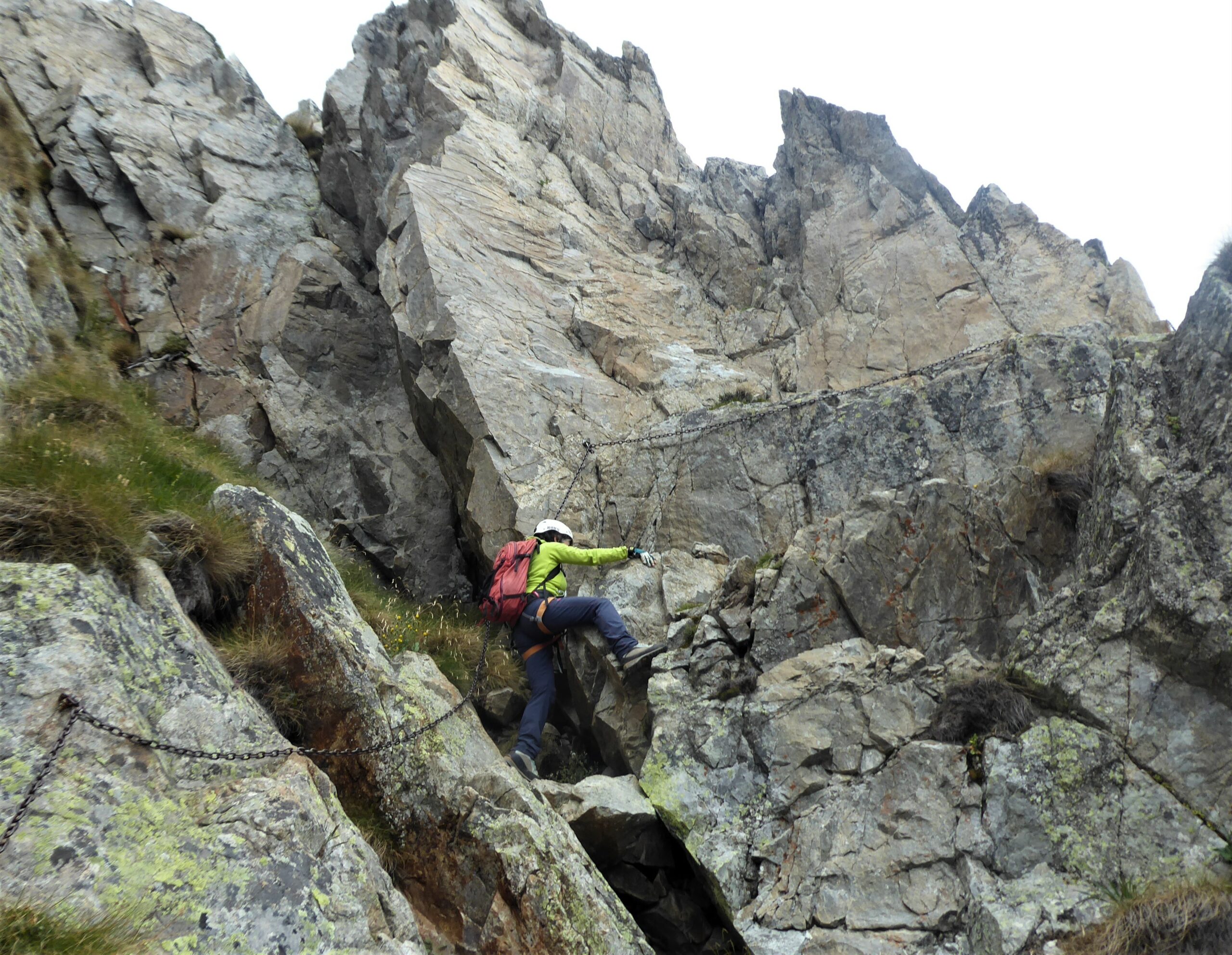
Dal rifugio ci aspetta ancora il tratto di via ferrata del sentiero che collega il piano del Peuterey al Borelli.
Raggiunto il fondovalle il sentiero sulla sinistra orografica della Dora riconduce in breve al parcheggio del Freney.
Nelle vicinanze Mappa
Itinerari
18/07/2026 AO, Courmayeur 300 m F Sud
Monzino Franco (Rifugio) Via Ferrata Franco Garda
 50m
50m
09/08/2021 AO, Courmayeur F Sud-Ovest
Monzino Franco (Rifugio) da la Visaille, vecchio sentiero Capanna Gamba
 50m
50m
25/06/2026 AO, Courmayeur 300 m PD Sud
Borelli – Pivano (Rifugio, Ferrata del) da Peuterey
 2.5Km
2.5Km
13/08/2022 AO, Courmayeur 130 m AD Est
Brenva (Monte della) Sentiero Francesco e Giuditta Gatti
 6.4Km
6.4Km
19/08/2025 AO, Valgrisenche 1300 m PD Varie
Aouille (Becca dell’) Via Ferrata Bethaz-Bovard
 25.1Km