200m
200m

Avvicinamento
 50m
50m
50m
50m
1.2Km
3.8Km
3.8Km
3.8Km
3.8Km
50m
50m
50m
50m
1.2Km
3.8Km
3.8Km
3.8Km
3.8Km
200m
4.1Km
4.2Km
5.1Km
5.9Km
7Km
8.9Km
9.1Km
9.1Km
9.2Km
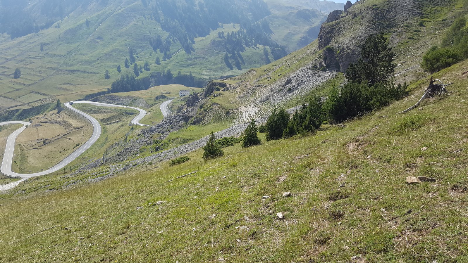
si risale la Valle Stura fino al centro di Argentera, superata la chiesa si lascia l'auto in un ampio piazzale sterrato sulla sinistra.
Descrizione
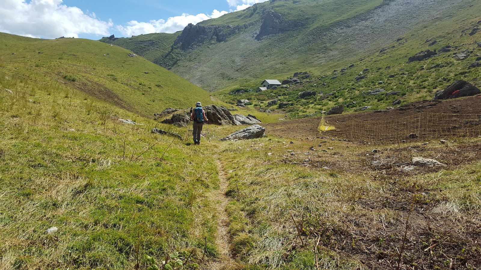
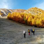
Dal centro abitato di Argentera, nella piazzetta accanto alla chiesa, si nota il cartello indicatore del sentiero per i Laghi di Roburent, e si inizia subito a salire prendendo quota nel rado bosco di pini mughi.
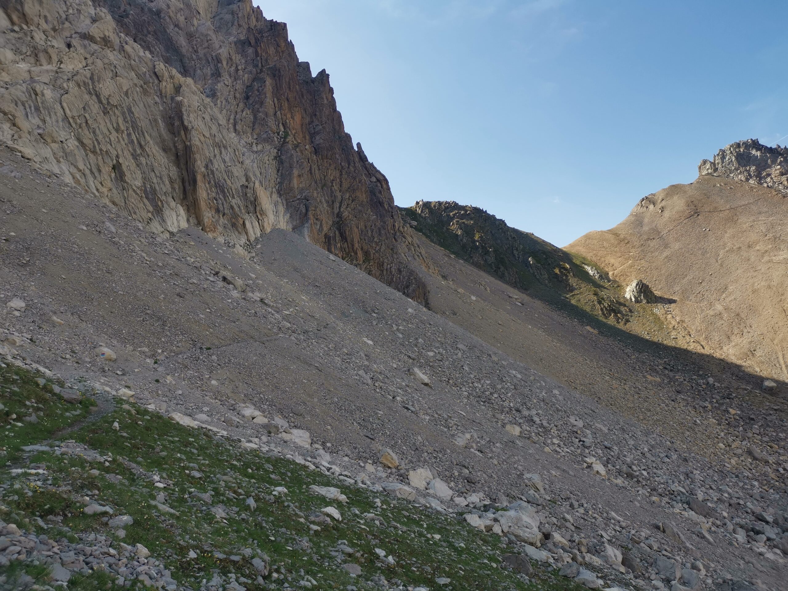
Si giunge alla località “La Tinetta” ottimo punto panoramico, dove si piega a sinistra e con un breve tratto pianeggiante si entra nel cuore del vallone di salita.
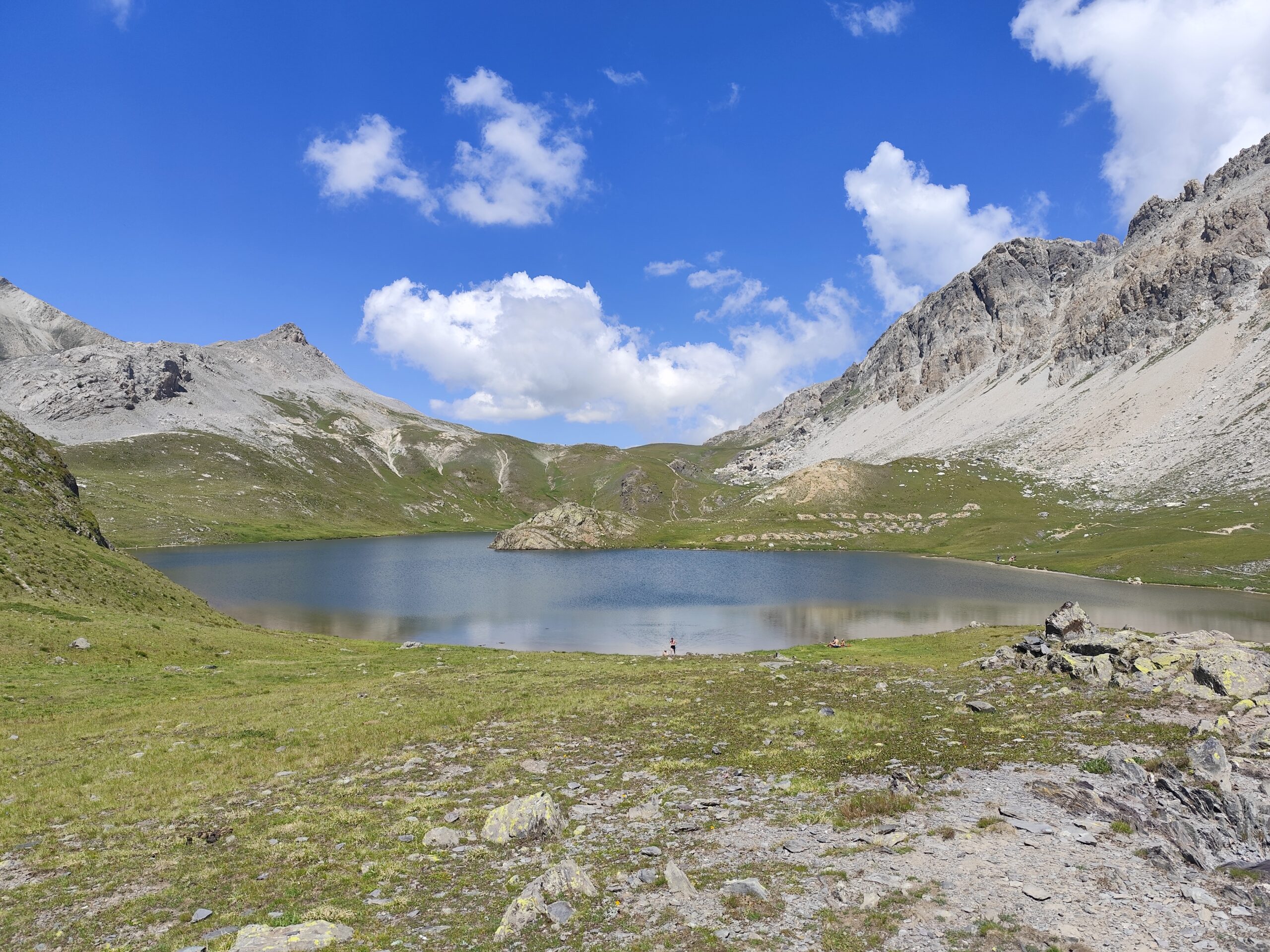
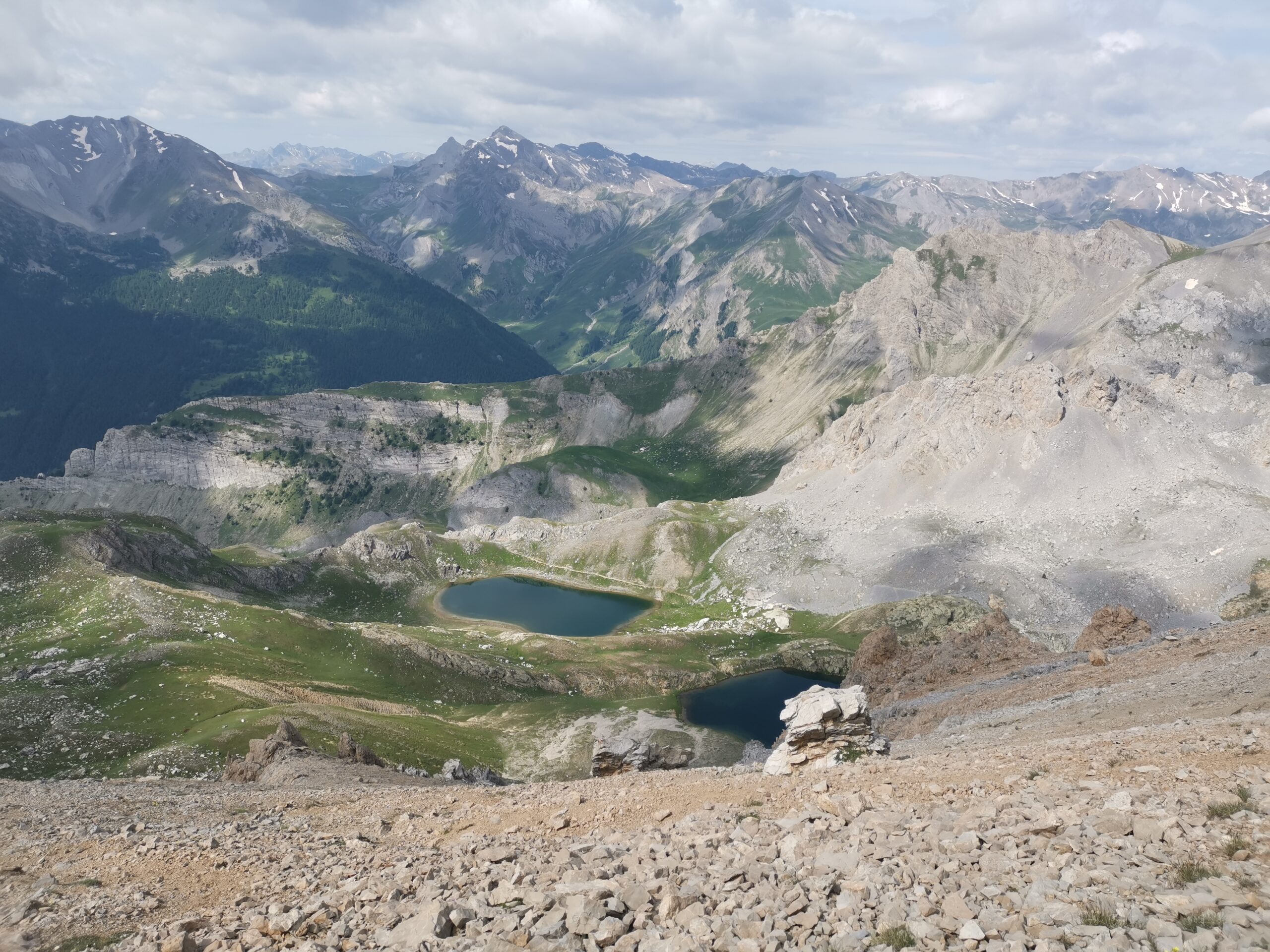
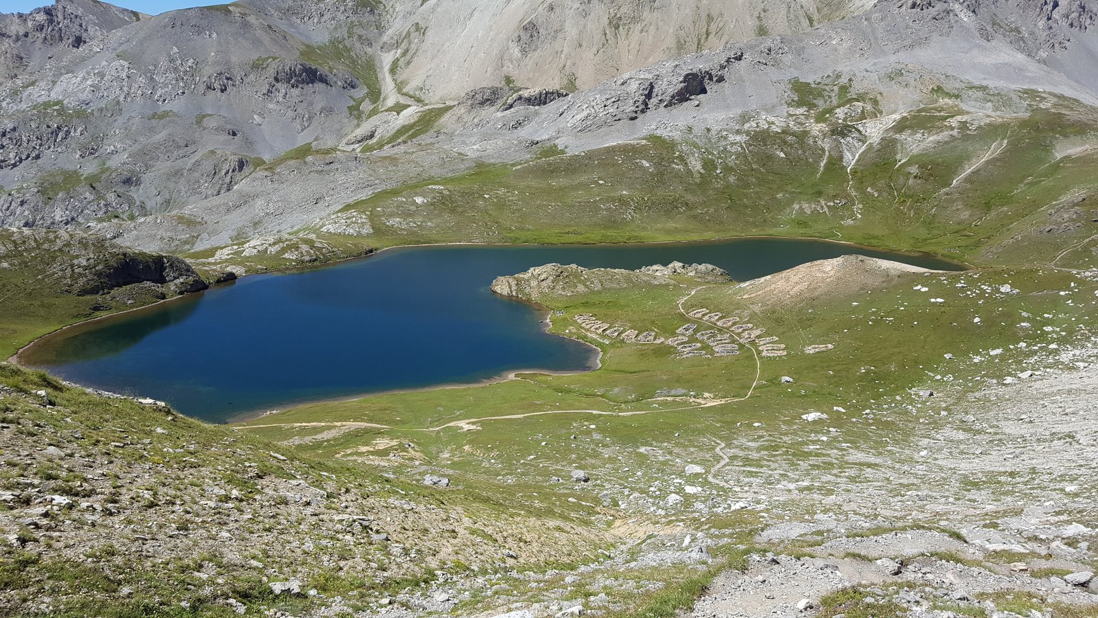
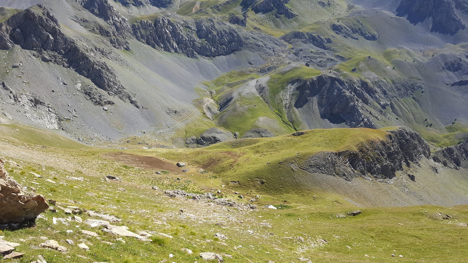
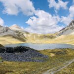
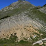
Seguendo l’evidente sentiero, segnalato da segnavia giallo/rossi e frecce azzurre, si riprende a salire toccando una bella baita, dalla quale ci si abbassa perdendo qualche metro di dislivello fino ad attraversare il rio, per poi riprendere la salita con pendenza regolare. In breve si giunge ai due laghi inferiori di Roburent, che si lasciano in basso a destra e dopo non molto appare davanti il Colle Roburent e il grosso Lago Superiore.
Qui è possibile sia raggiungere il lago (meritevole) contornandolo sul bordo destro e successivamente reperire il sentiero che a mezza costa da sinistra verso destra taglia le pendici sud del monte Vanclava diretto al Passo Scaletta, sia usufruire direttamente di una evidente traccia sulla destra, che in ascesa va a collegarsi al sentiero principale sotto il Monte Vanclava.
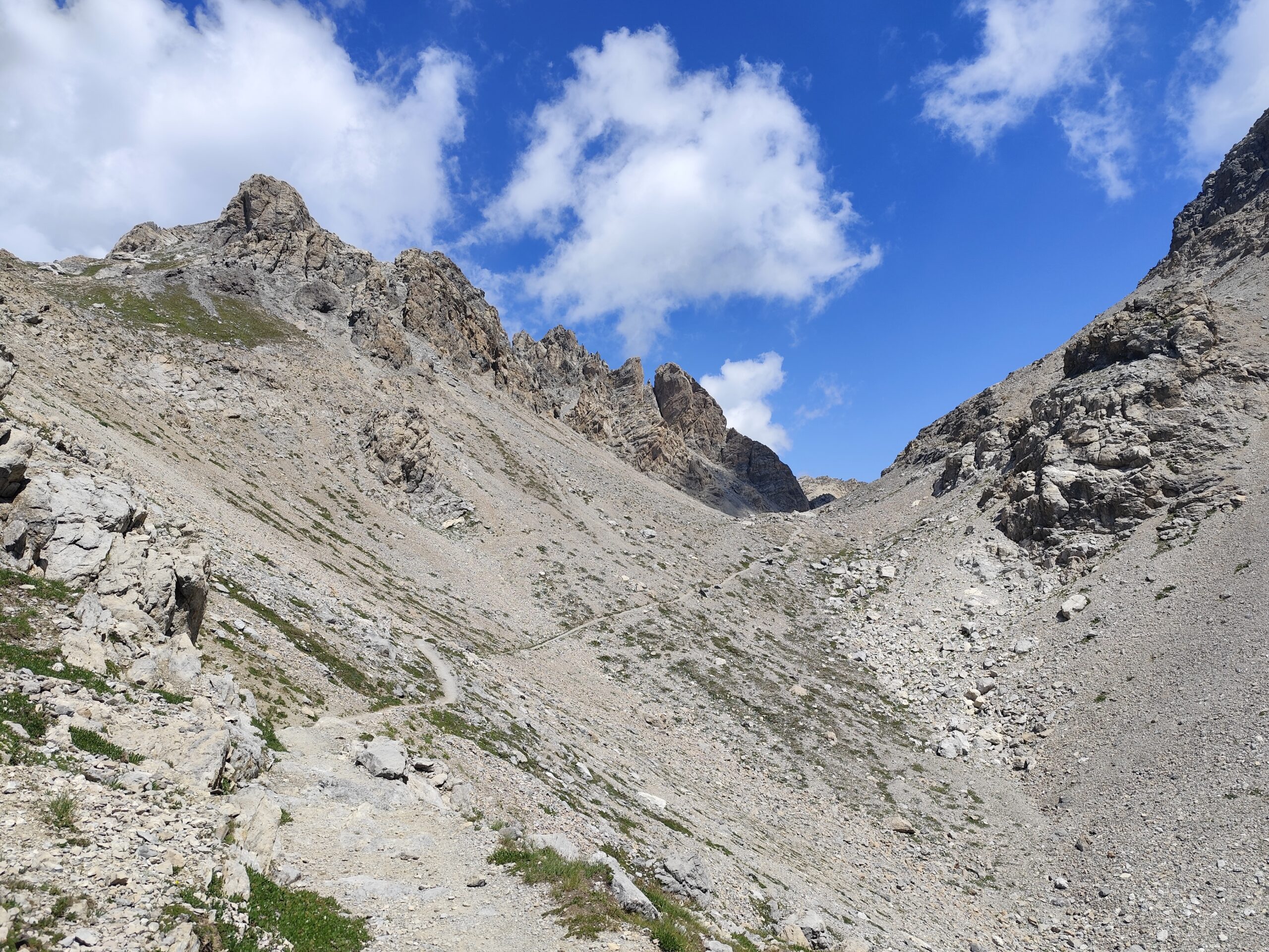
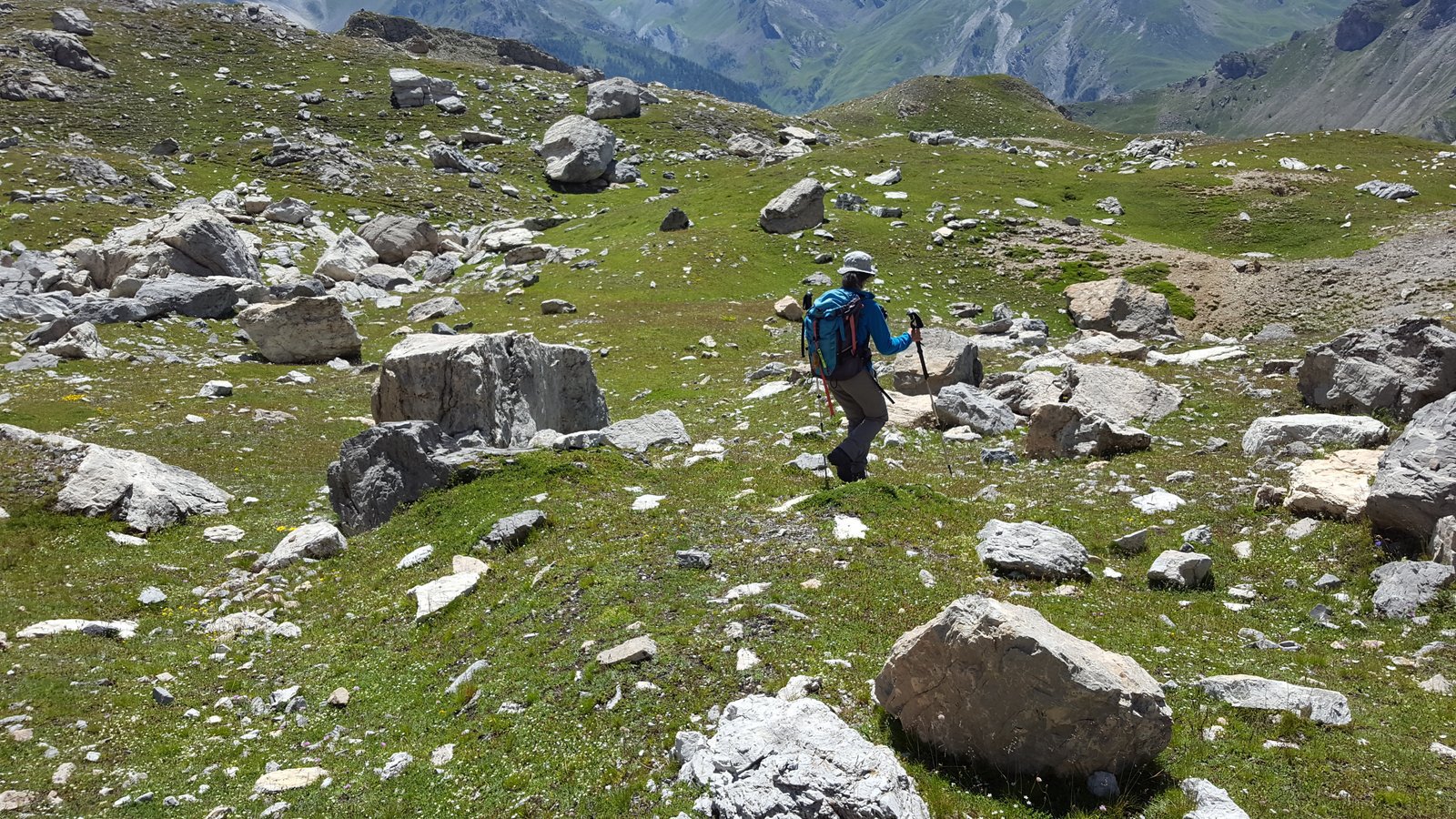
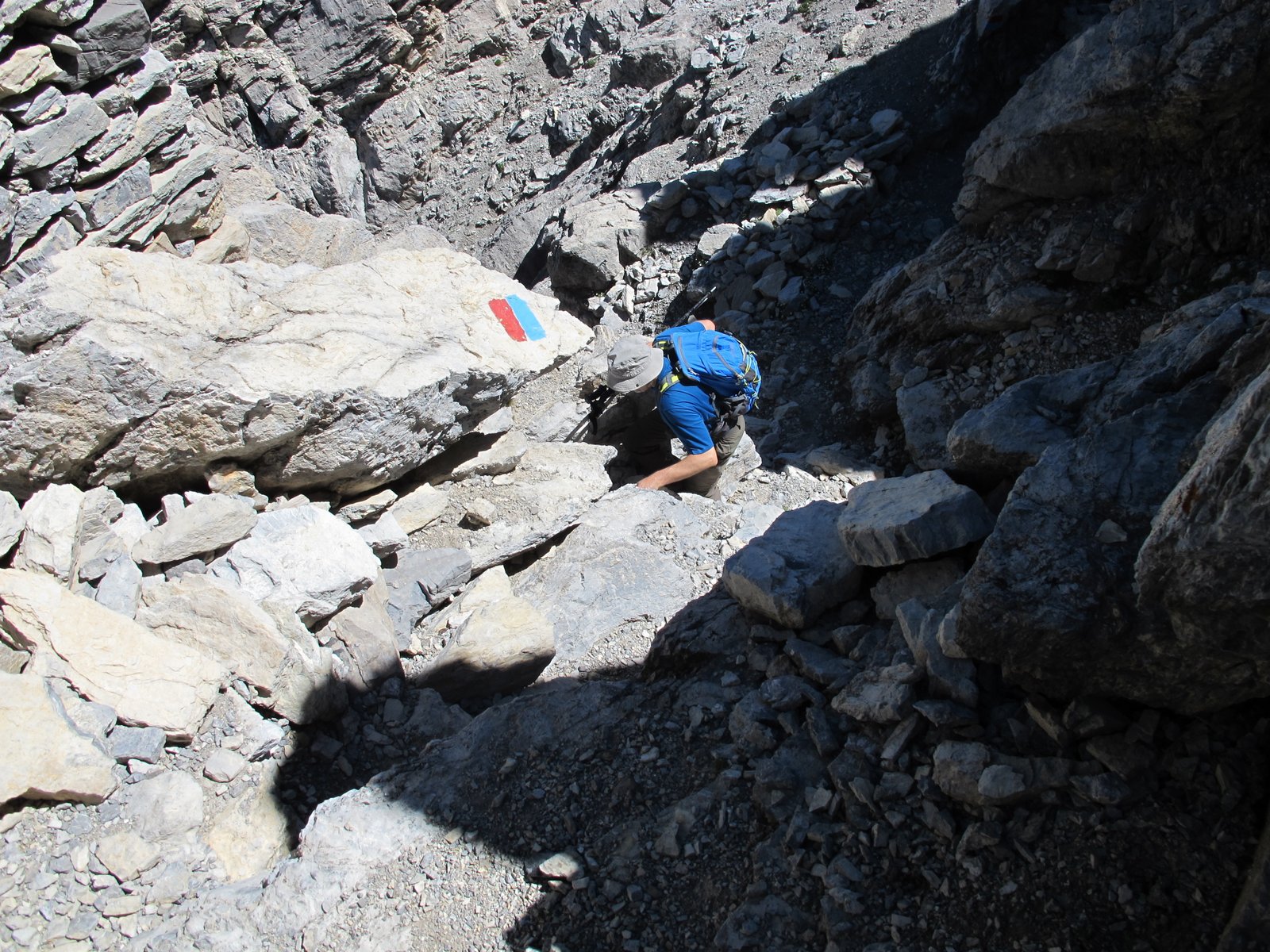
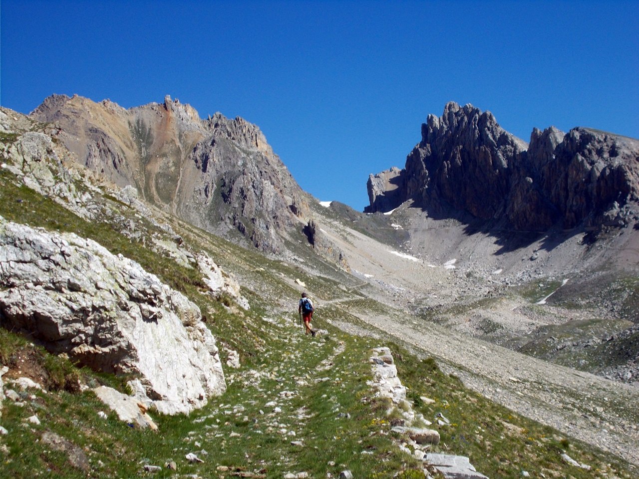
Raggiunto un dosso erboso, si entra in una stretta valletta che in poca pendenza conduce al Passo Scaletta 2614 m, dove si trovano le tacche rosso/blu del Sentiero Cavallero
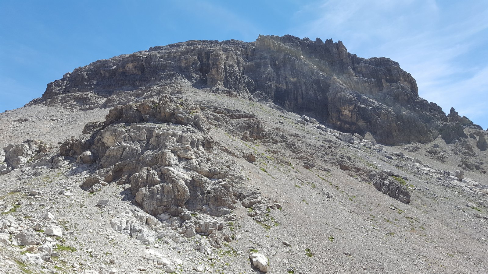
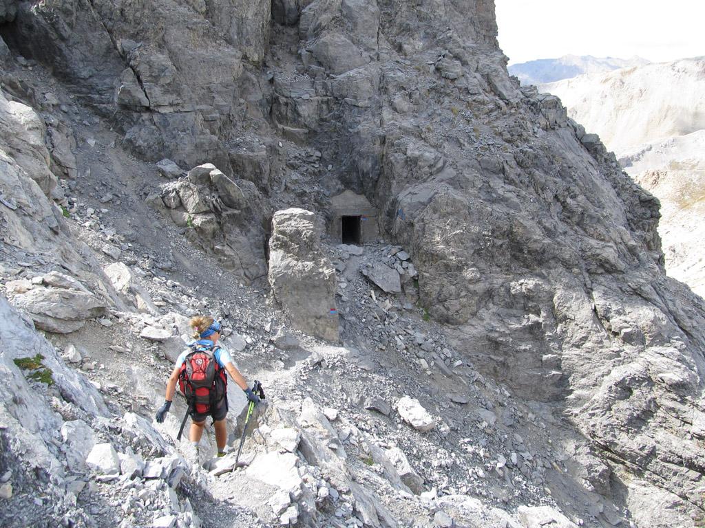
Dal passo si sale a destra con qualche serpentina tra i detriti, giungendo rapidamente contro una paretina rocciosa, dove si trova l’imbocco di una stretta galleria scavata dai militari il cui attraversamento richiede la pila, essendo curva a 90° (quindi cieca)/blu; attenzione comunque alla volta a tratti pericolante.
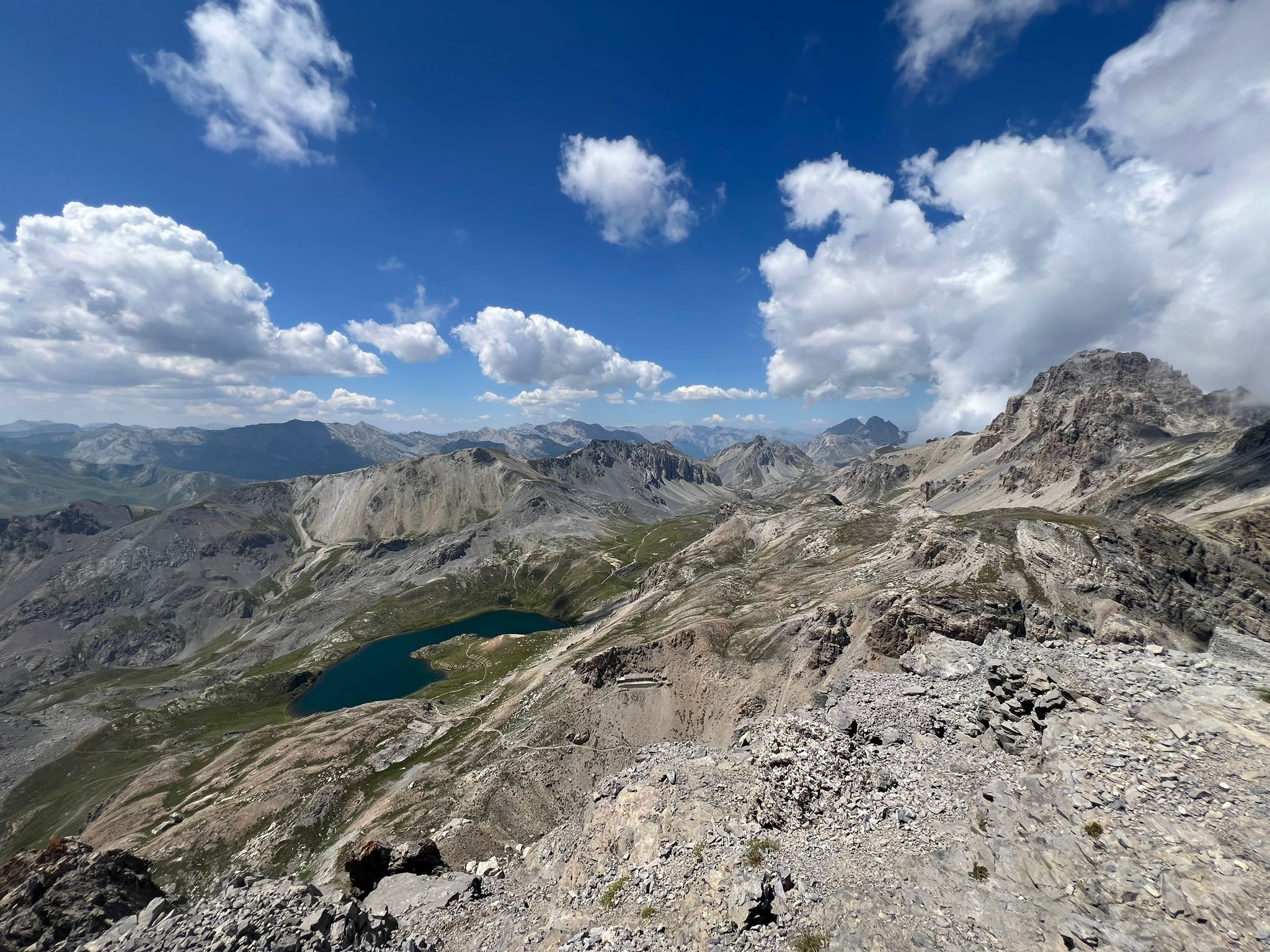
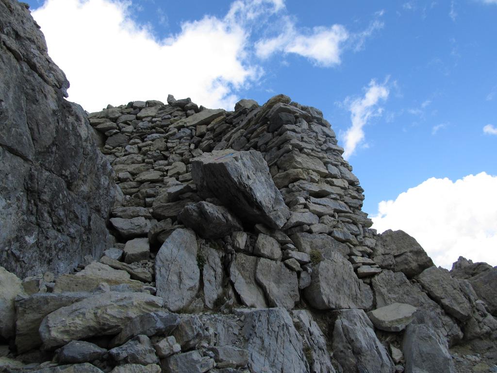
Usciti dalla galleria riprende il sentiero, tra roccette e detriti (attenzione al fondo un po’ scivoloso) e superati alcuni tratti con muretti e trincee si perviene all’ampia cima con la croce, sono presenti molte opere belliche, tra cui un’altra galleria che collega i versanti nord-sud della montagna.
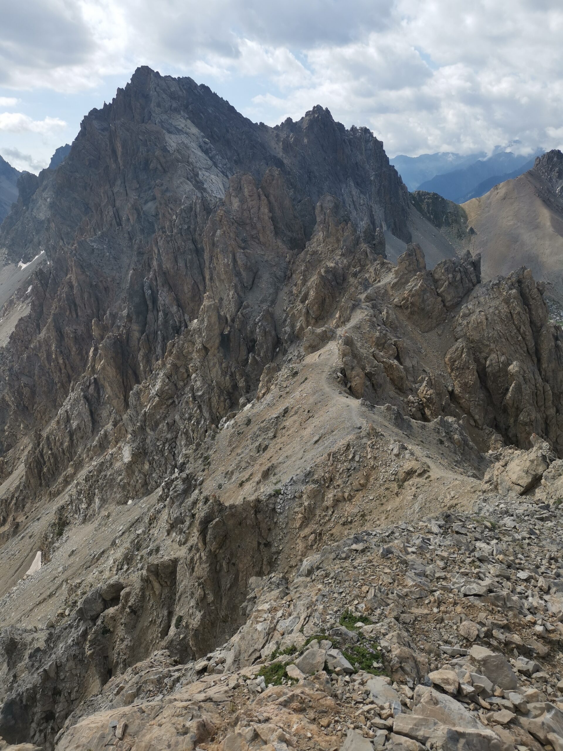
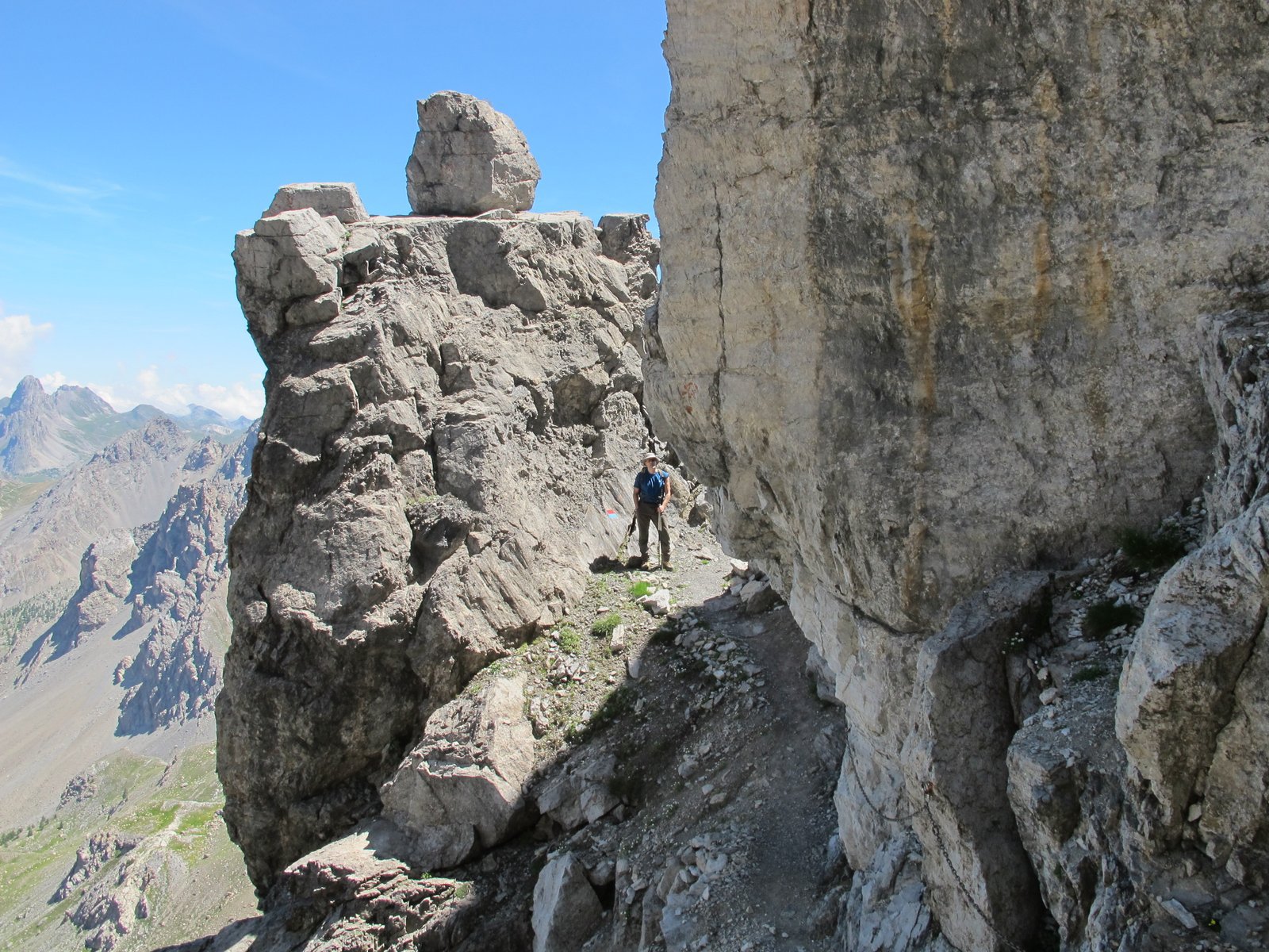
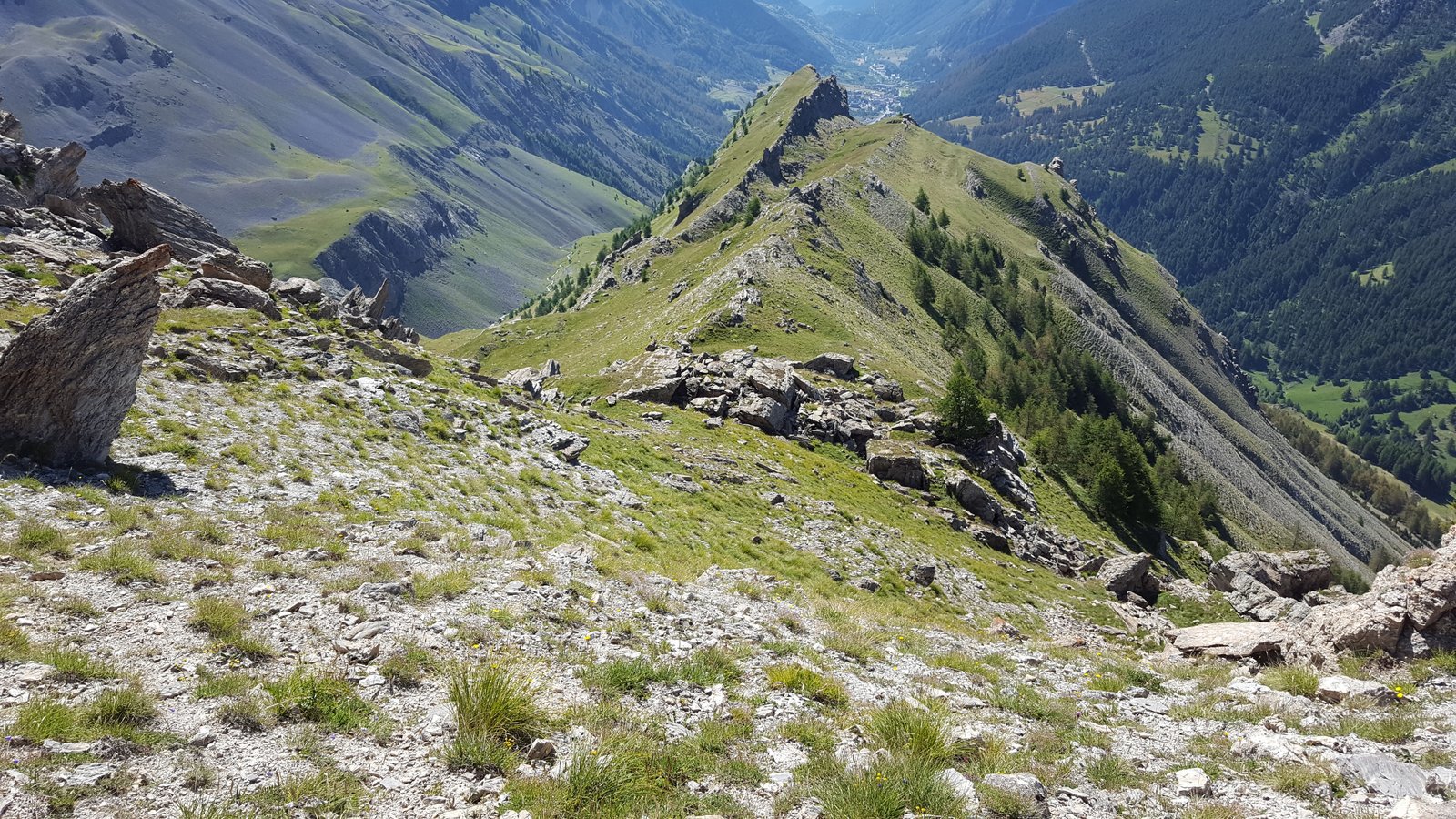
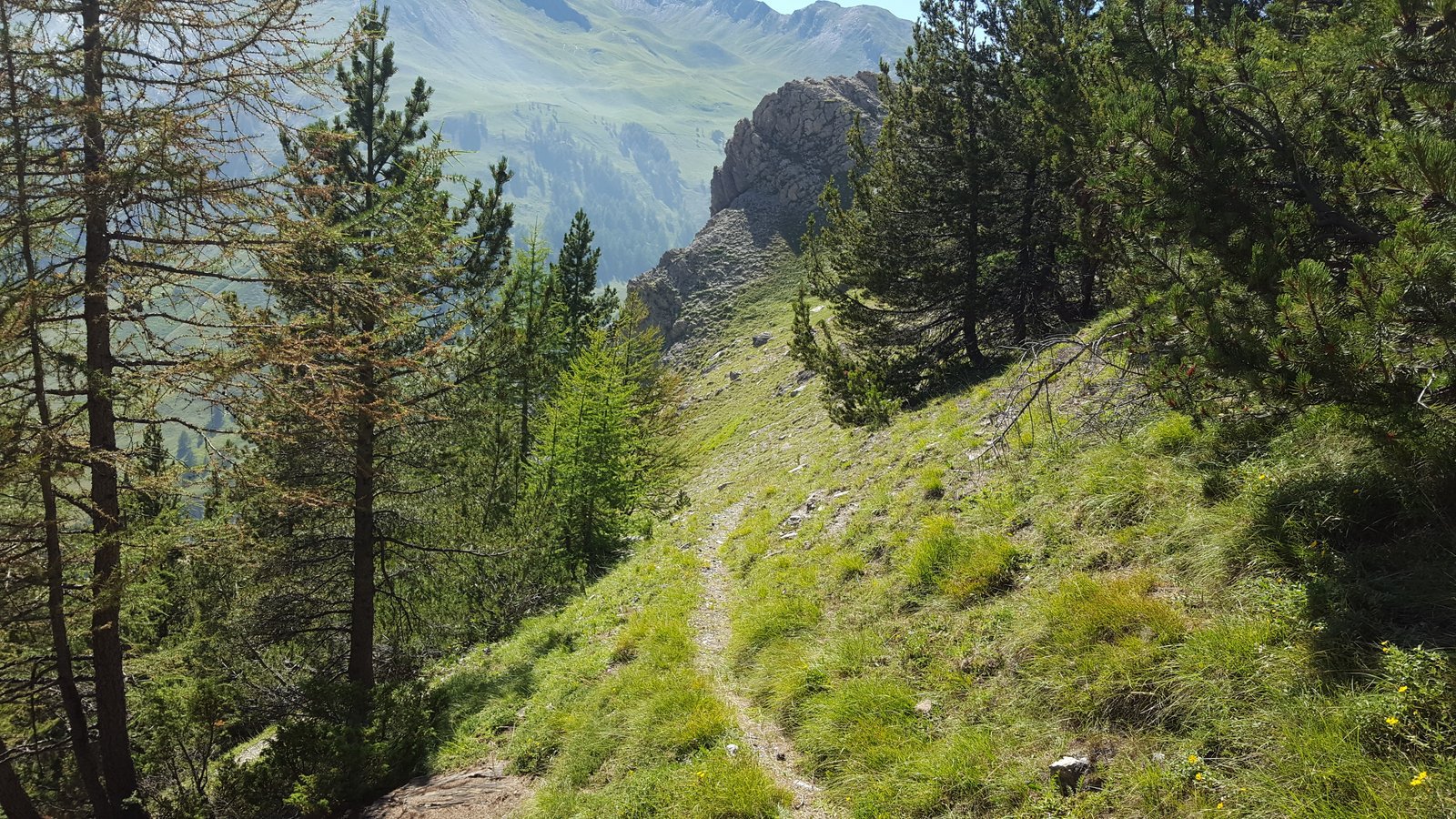
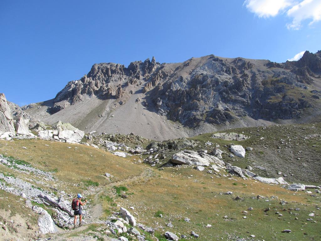
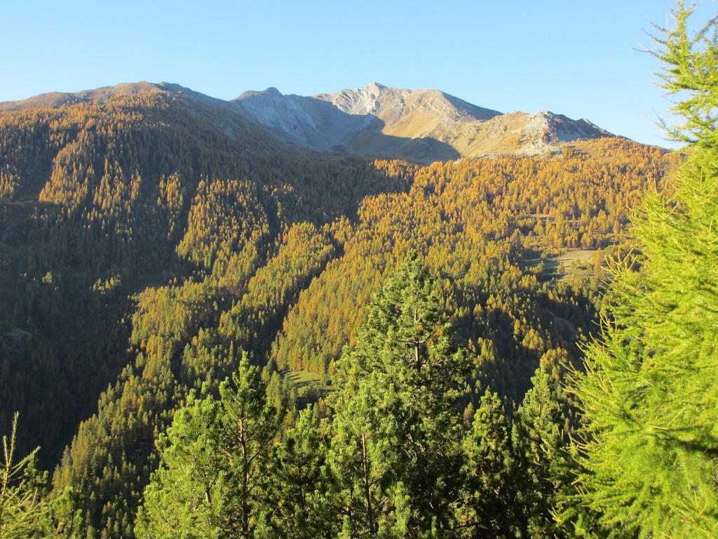
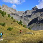
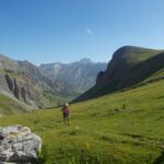
La discesa può avvenire per il percorso di salita, ma molto più consigliabile (in assenza di neve e con terreno asciutto) è percorrere verso est il Sentiero Cavallero, che dopo una prima agevole discesa sul crinale detritico, inizia un percorso suggestivo che si snoda tra torrioni, guglie e pinnacoli di grande varietà di colori. Si trova qualche passaggio su cenge rocciose sempre ampie ma con delle catene utilizzabili come corrimano. Solo un breve passo di disarrampicata (non esposto) richiede un po’ di cautela. Terminata la prima parte della cresta il terreno diventa detritico e scorrevole, scende più ripidamente su un pendio rossastro, quindi si perviene ad una sella ricca di guglie giallastre, che precedono un lungo traverso a mezza costa sul versante sud, ora ben sotto il filo della cresta sotto la Rocca Peroni.
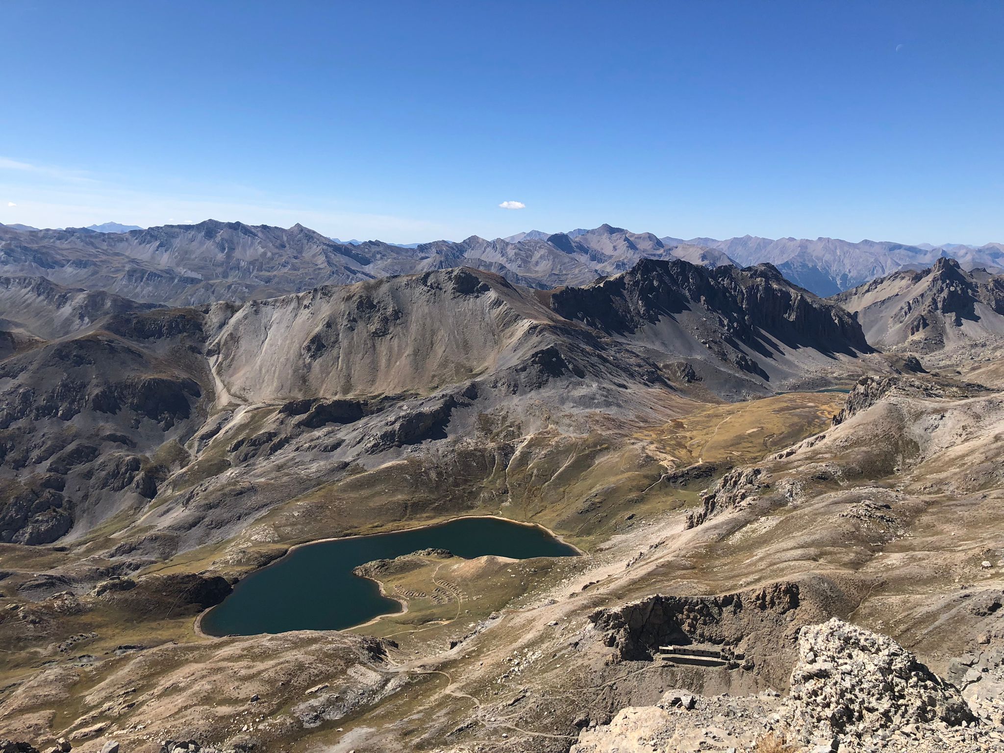
In vista del Passo Peroni, si trova sulla destra evidente ma non segnalato un sentiero che torna indietro in discesa erso ovest, e che condurrà ai due laghi Mediano e Inferiore di Roburent, toccandoli entrambi. Da questo ci si ricollegherà al sentiero già salito in andata, ritornando poi ad Argentera per la Tinetta.
Se si vuol raggiungere invece brevemente il Passo Peroni 2578 m, risalita di 50 m un po’ faticosa per il terreno friabile, è possibile o continuare ancora su comodo sentiero in piano fino al Bivacco Due Valli, già ben visibile su un dosso erboso, oppure salire sulla destra alla sommità del Bric 2658 m, raggiungibile dalla casermetta poco sotto sul versante est tramite una traccia un po’ friabile ma non difficile. Da qui occorre tornare indietro fino al bivio per i laghi Mediano e Inferiore di Roburent
Variante dal passo Pra di Bals
In alternativa alla partenza da Argentera è possibile salire dai pressi del Colle della Maddalena di fronte all’ex casa cantoniera (q. 1850 circa), appena dopo la lunga serie di tornanti della SS21(palina). Il percorso inizialmente non è molto evidente e di sicuro non è molto frequentato (estate 2016).
Si segue per qualche metro una sterrata che presto termina, si risale quindi a sx (direzione NE) il breve pendio di terriccio franoso sino ad un piccolo ripiano erboso in cui si trova una sbiadita tacca giallo-rossa su pietra.
Sulla sx ci si trova un ripidissimo pendio di erba e terra in cui sono sistemati dei paravalanghe, si prosegue dritto e si attraversa alla meglio un canalone di sfasciume fine, la traccia continua sul lato opposto inoltrandosi poi nel bosco di conifere e divenendo via via più visibile e omettato.
Dopo una lunga serie di tornanti il tracciato obliqua verso dx raggiungendo il grosso ometto posto su una pietra del Passo Pra di Bals (q. 2258)
Qui la dorsale erbosa proveniente dal Bric della Sabbiera si biforca e la traccia si perde nell’erba: occorre attraversare la bifida dorsale per ritrovare il sentierino che scende in direzione di una malga e della larga mulattiera (P41) che sale da Argentera.
Nelle vicinanze Mappa
Itinerari
02/07/2020 CN, Bersezio/Argentera D+ 980 m EE Nord
Bric (il) da Argentera per il Passo Peroni
 50m
50m
23/06/2024 CN, Bersezio/Argentera D+ 812 m E Sud-Est
Roburent (Colle e Laghi di) da Argentera
 50m
50m
25/10/2020 CN, Bersezio/Argentera D+ 1174 m EE Varie
Vanclava (Monte) o Tète de Vauclave da Argentera per i Laghi di Roburent
 50m
50m
27/06/2021 CN, Bersezio/Argentera D+ 1200 m EE Tutte
Pierassin (Monte) e Punta di Roburent da Argentera per i Laghi e Colle di Roburent
 50m
50m
07/09/2025 CN, Bersezio/Argentera D+ 1350 m EE Varie
Enchastraye (Monte) e Rocca Tre Vescovi da Argentera per il vallone del Puriac
 1.2Km
1.2Km
19/10/2025 CN, Bersezio/Argentera D+ 1189 m EE Varie
Lose (Cima delle), Punta del Briccas e Punta Incianao da Bersezio, anello
 3.8Km
3.8Km
18/06/2023 CN, Bersezio/Argentera D+ 1157 m EE Sud
Oserot (Monte) quota 2781 m o falso Oserot da Bersezio
 3.8Km
3.8Km
02/11/2014 CN, Pietraporzio D+ 1189 m EE Varie
Lose (Cima delle) da Bersezio, anello valloni Puriac-Ferrere
 3.8Km
3.8Km
09/10/2014 CN, Bersezio/Argentera D+ 1357 m EE Varie
Servagno (Monte) da Bersezio per la Bassa di Terra Rossa e il Colle Bernoir
3.8Km
30/09/2025 CN, Bersezio/Argentera D+ 1237 m EE Varie
Oserot (Monte) da Bersezio
 3.8Km
3.8Km
Servizi
200m
4.1Km
da Mo Ristorante
Bersezio/Argentera
4.2Km
Bruno Ristorante
Bersezio/Argentera
5.1Km
Della Pace Rifugio
Bersezio/Argentera
5.9Km
B&b del Villaggio B&B
Bersezio/Argentera
7Km
Viviere Rifugio
Acceglio
8.9Km
Gardetta Rifugio
Canosio
9.1Km
La Tavernetta Ristorante
Acceglio
9.1Km
Chialvetta Rifugio
Acceglio
9.2Km