1.4Km
1.4Km
Note
 1.2Km
1.4Km
1.4Km
4.3Km
4.4Km
6.9Km
6.9Km
6.9Km
7.8Km
8.7Km
1.2Km
1.4Km
1.4Km
4.3Km
4.4Km
6.9Km
6.9Km
6.9Km
7.8Km
8.7Km
1.4Km
1.9Km
2.7Km
4Km
7.2Km
7.4Km
7.5Km
8.2Km
8.8Km
8.9Km
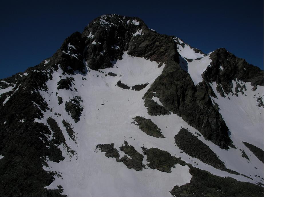
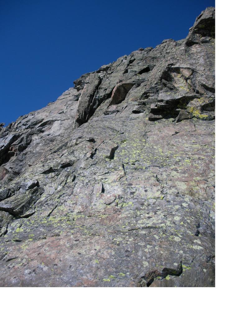
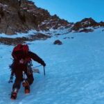
Itinerario da svolgersi preferibilmente a inizio stagione quando la neve copre ancora le immense e mobili pietraie del ripido versante NE si salita. In questo caso piccozza e ramponi sono indispensabili. In estate, senza neve, le difficoltà sono più contenute (F/F+) ma la salita è molto più penosa e pericolosa per il rischio di scariche di pietre quasi inevitabili.
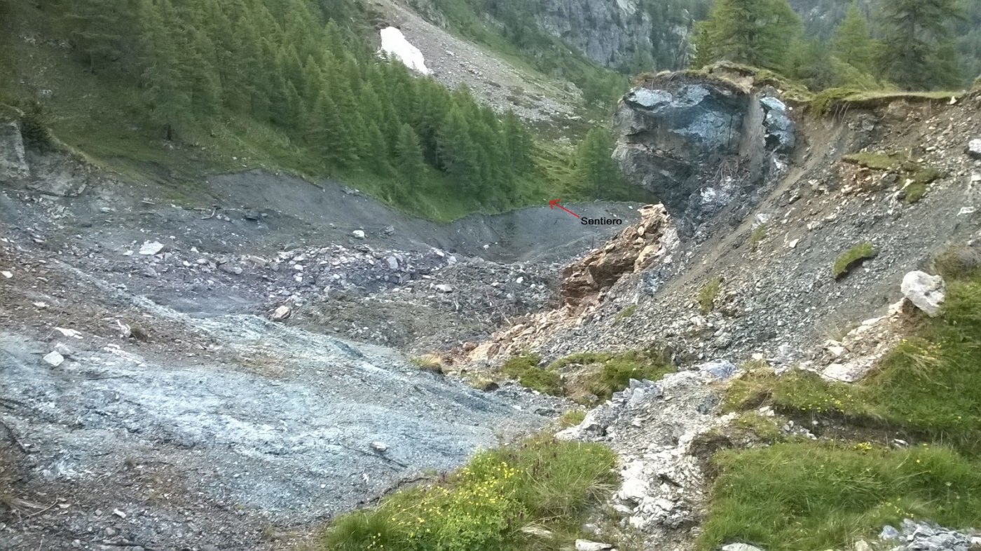
Il sentiero dai laghi di Fraudiere richiede molta attenzione perchè assai esposto ed ostico in discesa (per chi non facesse la traversata).
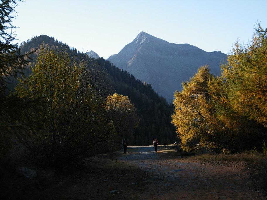
Avvicinamento
Il sentiero dai laghi di Fraudiere richiede molta attenzione perchè assai esposto ed ostico in discesa (per chi non facesse la traversata).
.
Descrizione
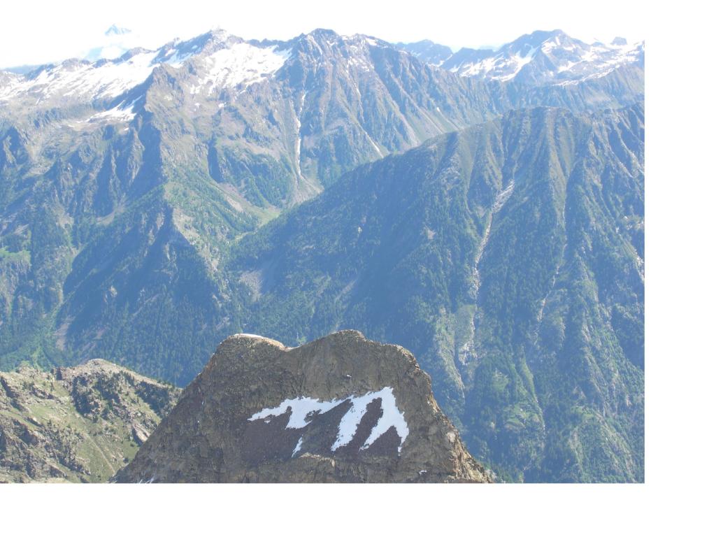
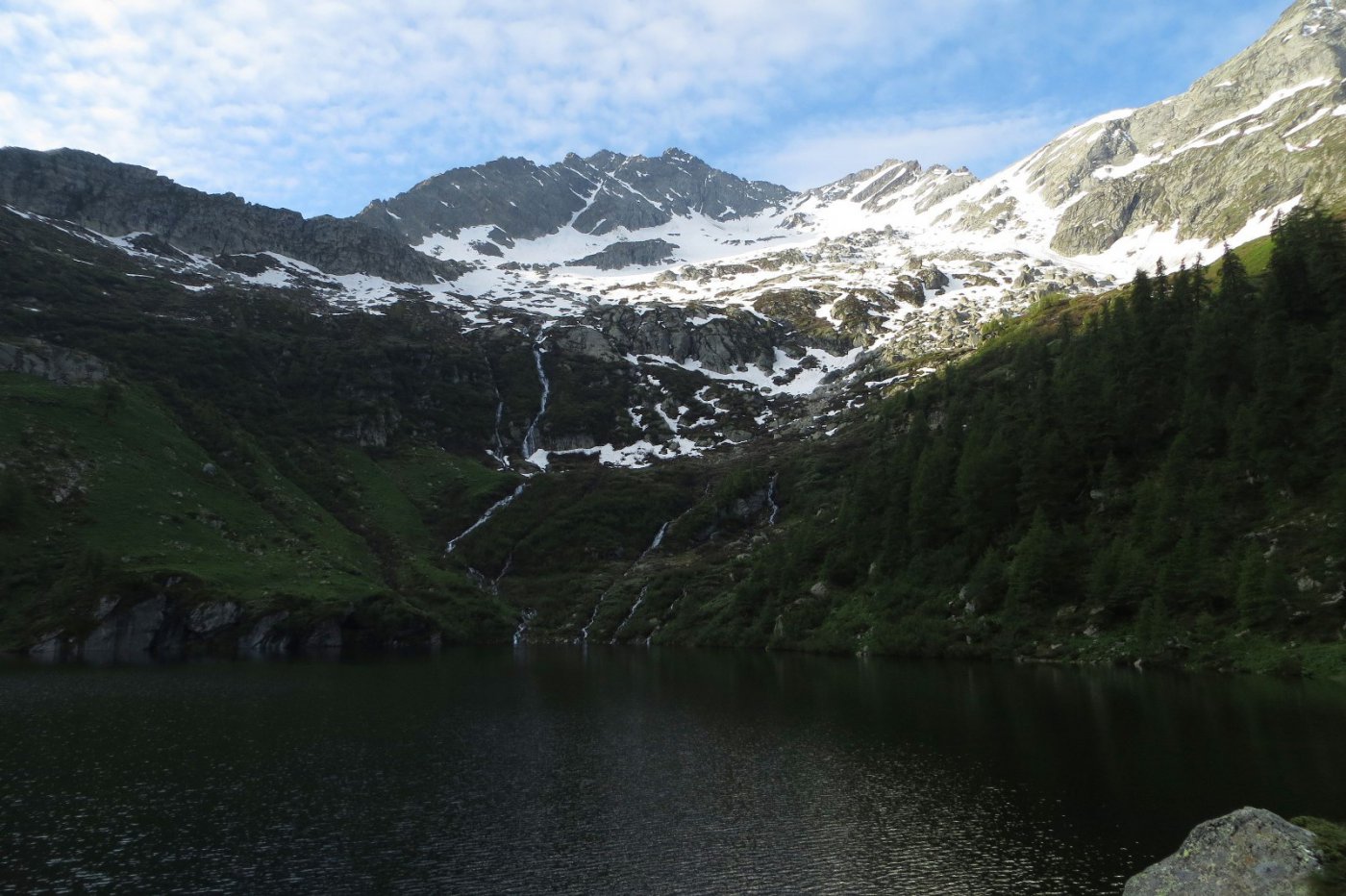
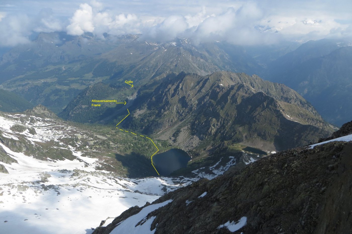
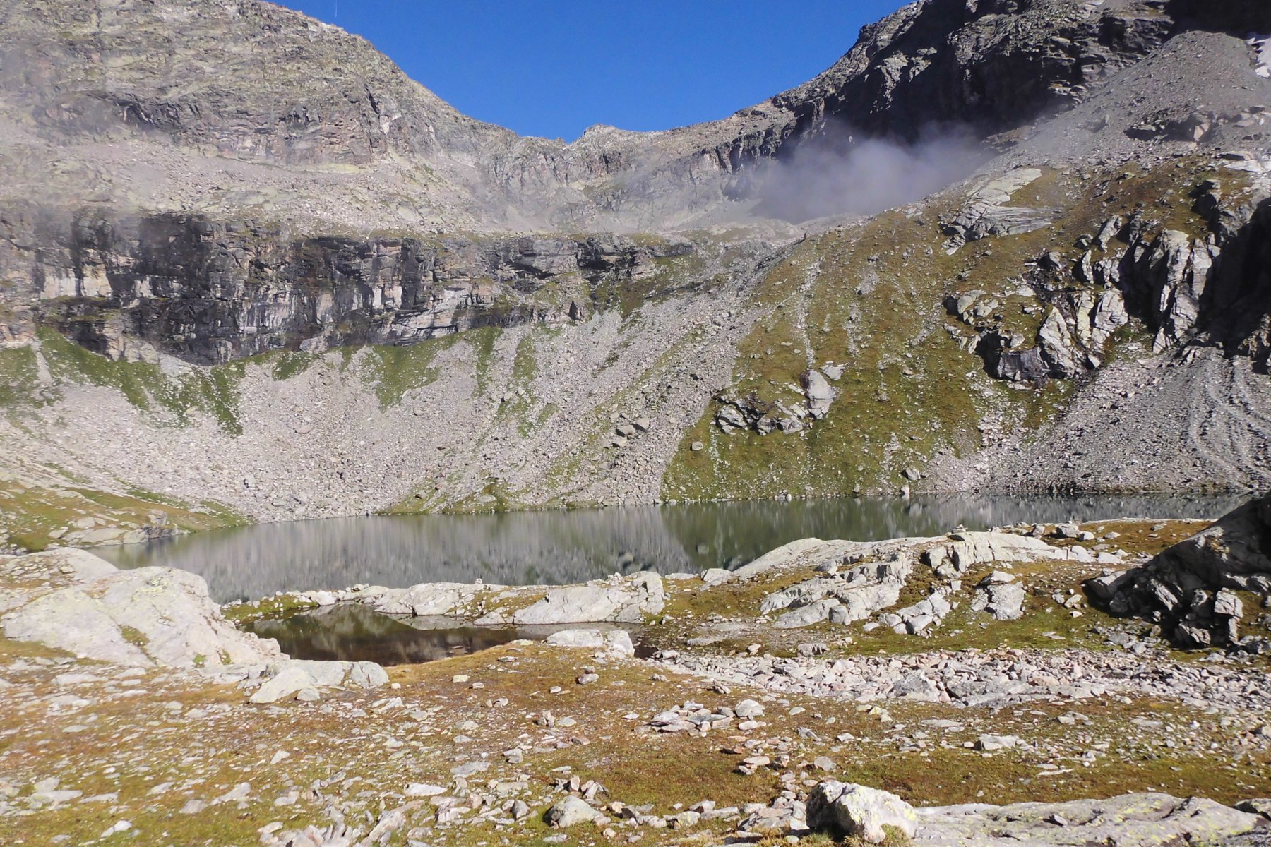
Da Gressoney Saint Jean prendere la seggiovia Weissmatten. Dall’arrivo della seggiovia seguire il sentiero per il colle e i laghi di Frudiere, (1,30-2 ore).
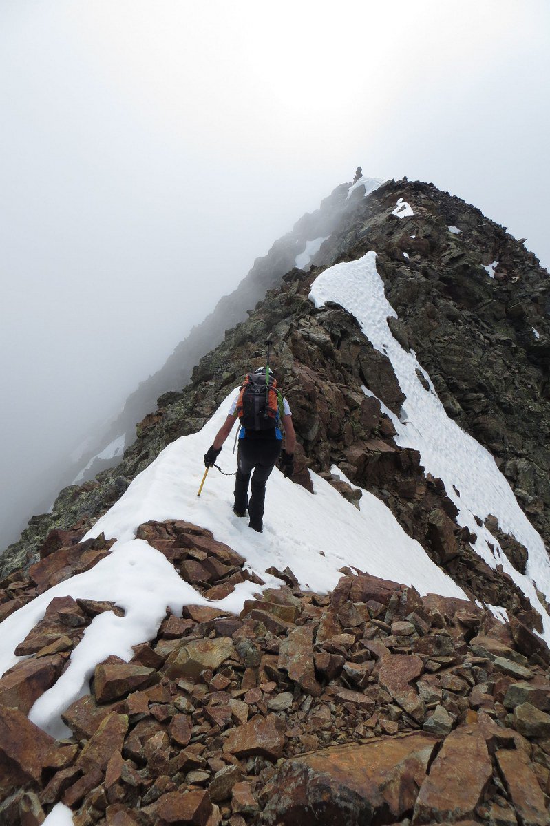
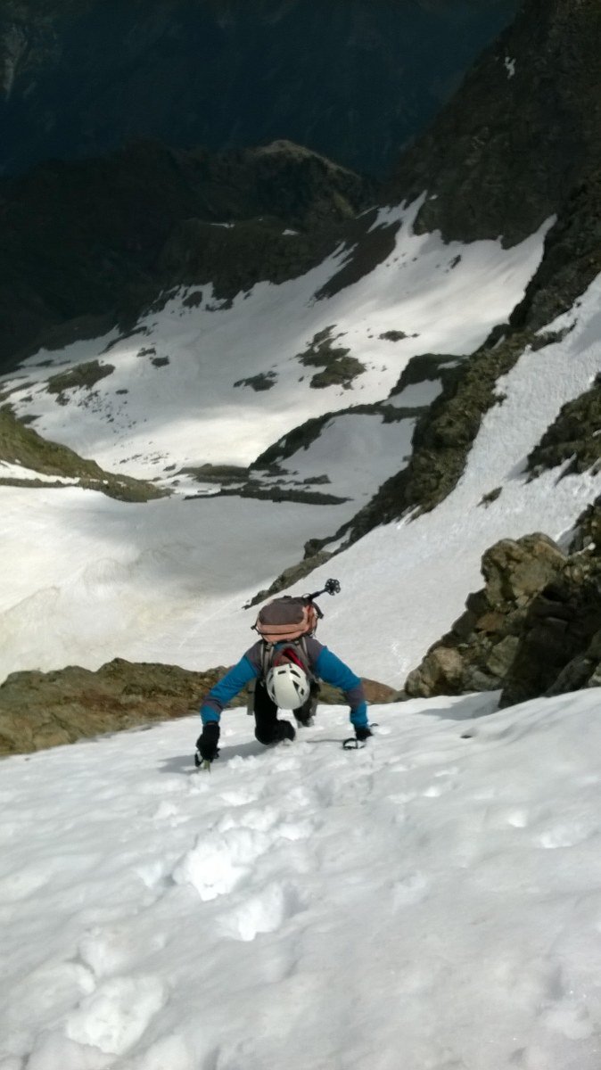
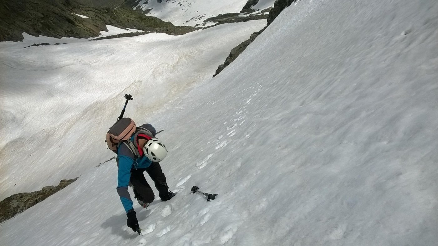
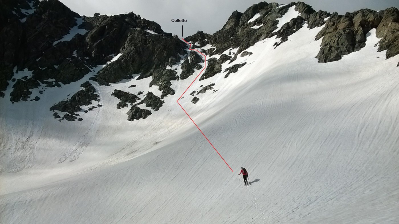
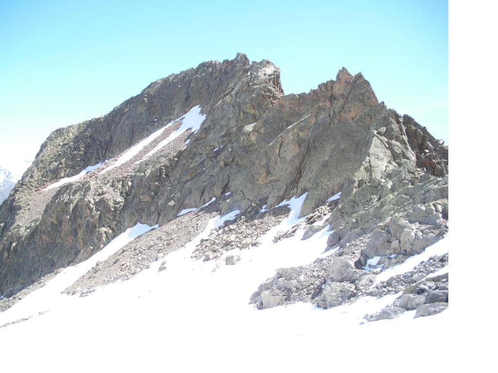
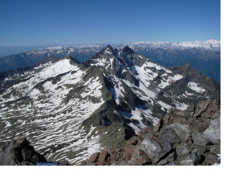
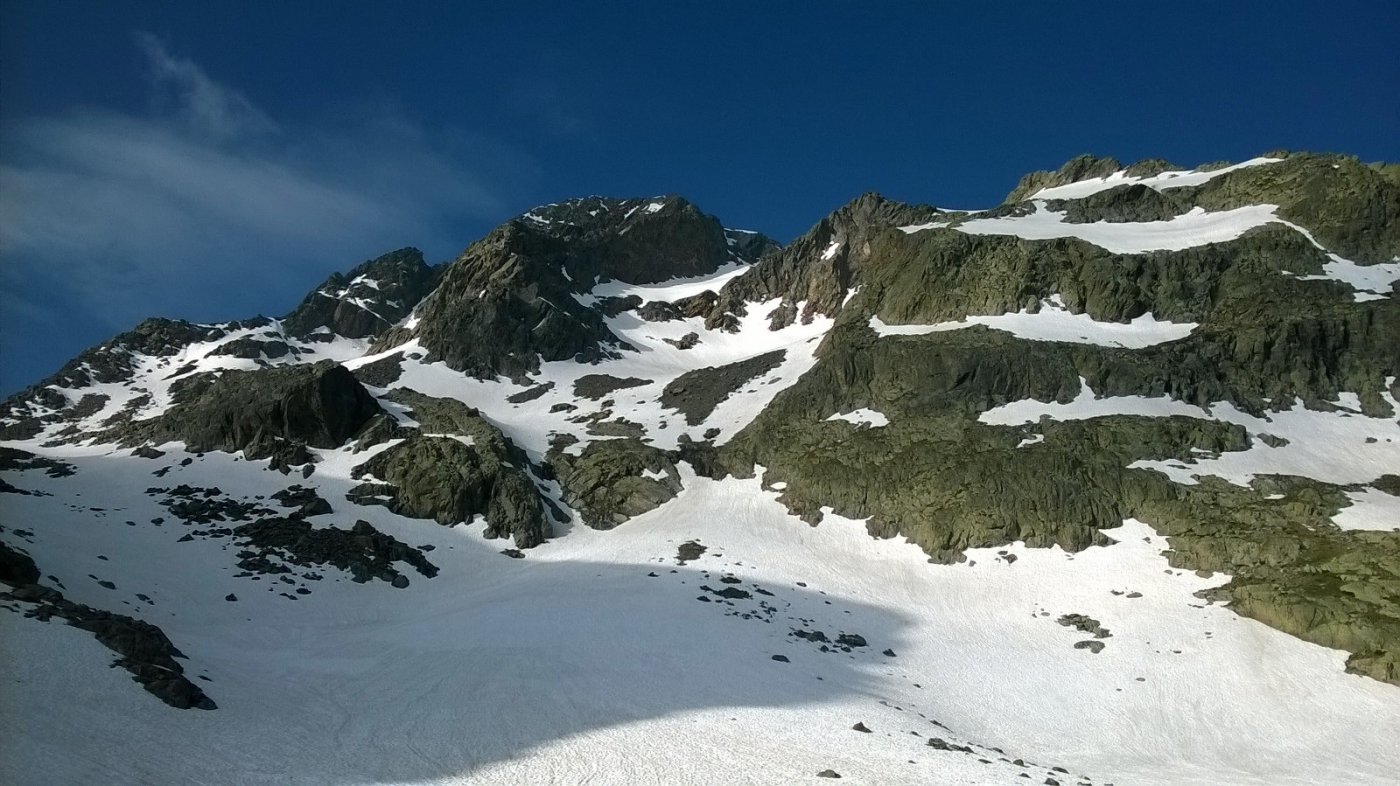
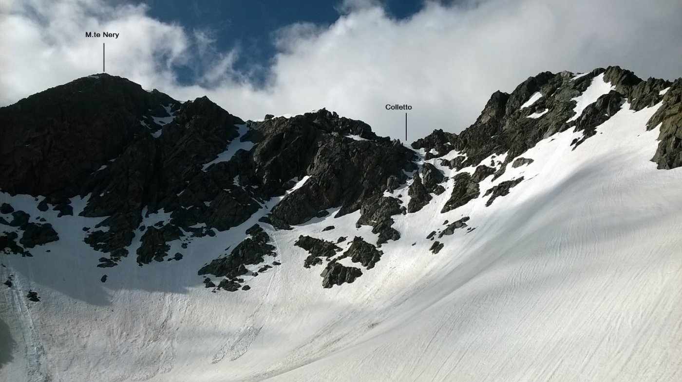
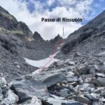
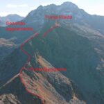
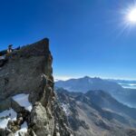
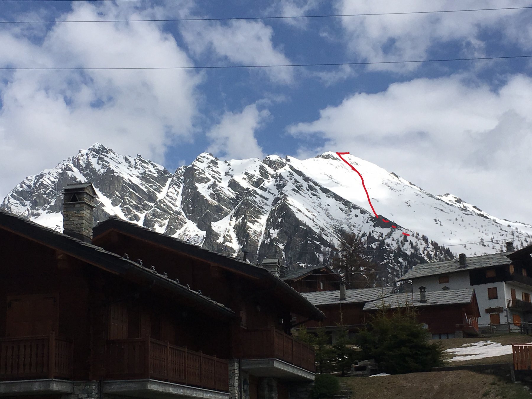
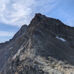
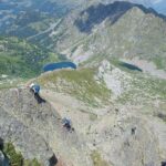
Dal colle salire verso sud sulla pietraia e imboccare il canalone di dx del versante NE del M. Nery, risalirlo alla meglio su tracce inesistenti, sino alla conca sottostante la vetta dove vi è ancora qualche residuo di neve. In estate il versante è una pietraia che mette in difficoltà l’esperto escursionista. Importantissimo controllare che non stiano salendo altri direttamente sopra se stessi. Puntare ad un colletto della cresta ovest da cui si perviene alla vetta seguendo la cresta o una traccia di sentiero poco distante sul lato meridionale.
Con neve il versante alterna una serie di falsi piani a tratti meno ripidi a alcuni tratti decisamente ripidi (45° gradi e oltre per alcune decine di metri per superare alcune balze rocciose), in particolare un primo salto verso 2550 m di quota, una rampa verso 2800 m e il pendio/canale finale che conduce dalla conca finale al colletto sulla cresta.
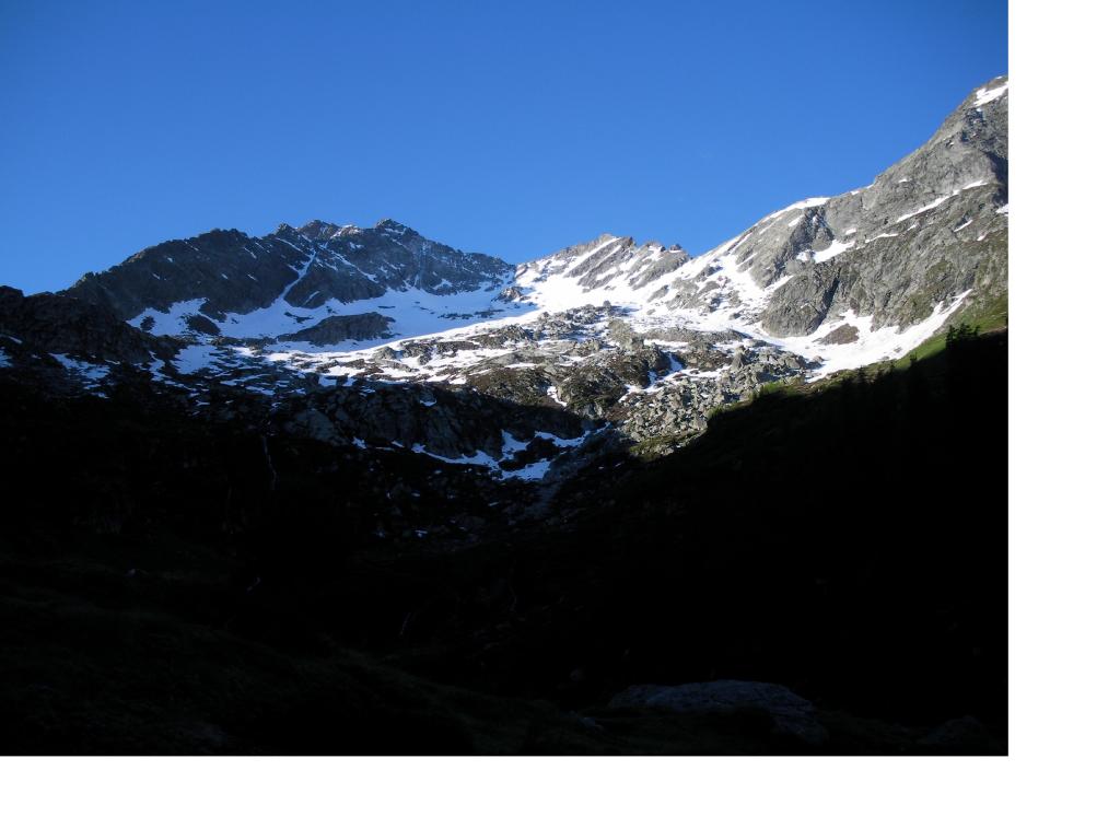
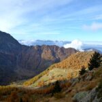
Discesa: ritornare all’intaglio e seguire gli ometti sulla sx con qualche passaggio facile, perdere quota sulla dorsale e scendere nel vallone di Chasten puntando alle ultime baite dove si trova il sentiero che porta ad Issime (in discesa circa 2100 m di dislivello).
Itinerari alternativi di salita che conducono sempre ai laghi e al colle di Fruderia salgono da Graines (1700 m di dislivello in salita), oppure dal divieto di transito oltre Estoul (1400 m circa di salita); un itinerario alternativo di discesa è il Vallone di Chasten fino a Tollegnaz (2050 m di dislivello in discesa).
Nelle vicinanze Mappa
Itinerari
30/01/2022 AO, Gressoney-Saint-Jean D+ 1200 m AD Nord
Taille (Monte) Parete Nord – Via Valy-Sandrone
 1.2Km
1.2Km
03/07/2026 AO, Gressoney-Saint-Jean D+ 1650 m F Varie
Rossa (Cresta) Via Normale da Valdobbia
 1.4Km
1.4Km
27/10/2021 AO, Gressoney-Saint-Jean D+ 1311 m F Nord-Ovest
Plaida (Punta) da Valdobbia
 1.4Km
1.4Km
21/08/2017 AO, Gressoney-Saint-Jean D+ 2100 m F Sud-Ovest
Bianco (Corno) da Chemonal per il Passo dell’Alpetto e il Lago Nero
 4.3Km
4.3Km
12/10/2025 AO, Gressoney-Saint-Jean D+ 1600 m PD Varie
Rissuolo (Punta di) Cresta Sud dal Passo dell’Alpetto
 4.4Km
4.4Km
23/10/2024 AO, Brusson D+ 1000 m F Varie
Taf (Monte) e Monte Taille da Estoul, anello di cresta per Weissmatten e Monte Rena
 6.9Km
6.9Km
05/05/2018 AO, Brusson D+ 795 m F+ Sud-Ovest
Ciosé (Monte) Canale SO e Versante S
 6.9Km
6.9Km
02/06/2023 AO, Brusson D+ 720 m F Sud
Ciosé (Monte) da Estoul per il Colle Ranzola
 6.9Km
6.9Km
06/09/2025 AO, Gressoney-la-Trinitè D+ 2000 m AD- Varie
Bianco (Corno) Cresta NO o dell’Uomo Storto da Gressoney la Trinitè
 7.8Km
7.8Km
12/07/2026 AO, Brusson D+ 1700 m PD+ Nord
Nery (Mont) Cresta Nord
 8.7Km
8.7Km
Servizi
1.4Km
1.9Km
Flying brasserie (Paul Verlaine) Ristorante
Gressoney-Saint-Jean
2.7Km
Bìerfall Ristorante
Gressoney-Saint-Jean
4Km
Kleine bar Ristorante
Gressoney-Saint-Jean
7.2Km
Mologna Albergo
Gaby
7.4Km
Hirsch stube Ristorante
Gressoney-la-Trinitè
7.5Km
Des Alpes Bar
Gaby
8.2Km
A Barma Drola B&B
Brusson
8.8Km
Punta jolanda Ristorante
Gressoney-la-Trinitè
8.9Km