1Km
1Km

Note
Storico
 50m
2.1Km
2.1Km
2.1Km
2.1Km
2.1Km
2.1Km
2.1Km
5.9Km
5.9Km
50m
2.1Km
2.1Km
2.1Km
2.1Km
2.1Km
2.1Km
2.1Km
5.9Km
5.9Km
1Km
1Km
1Km
1.1Km
1.2Km
1.8Km
2.8Km
3.1Km
4.1Km
7.1Km
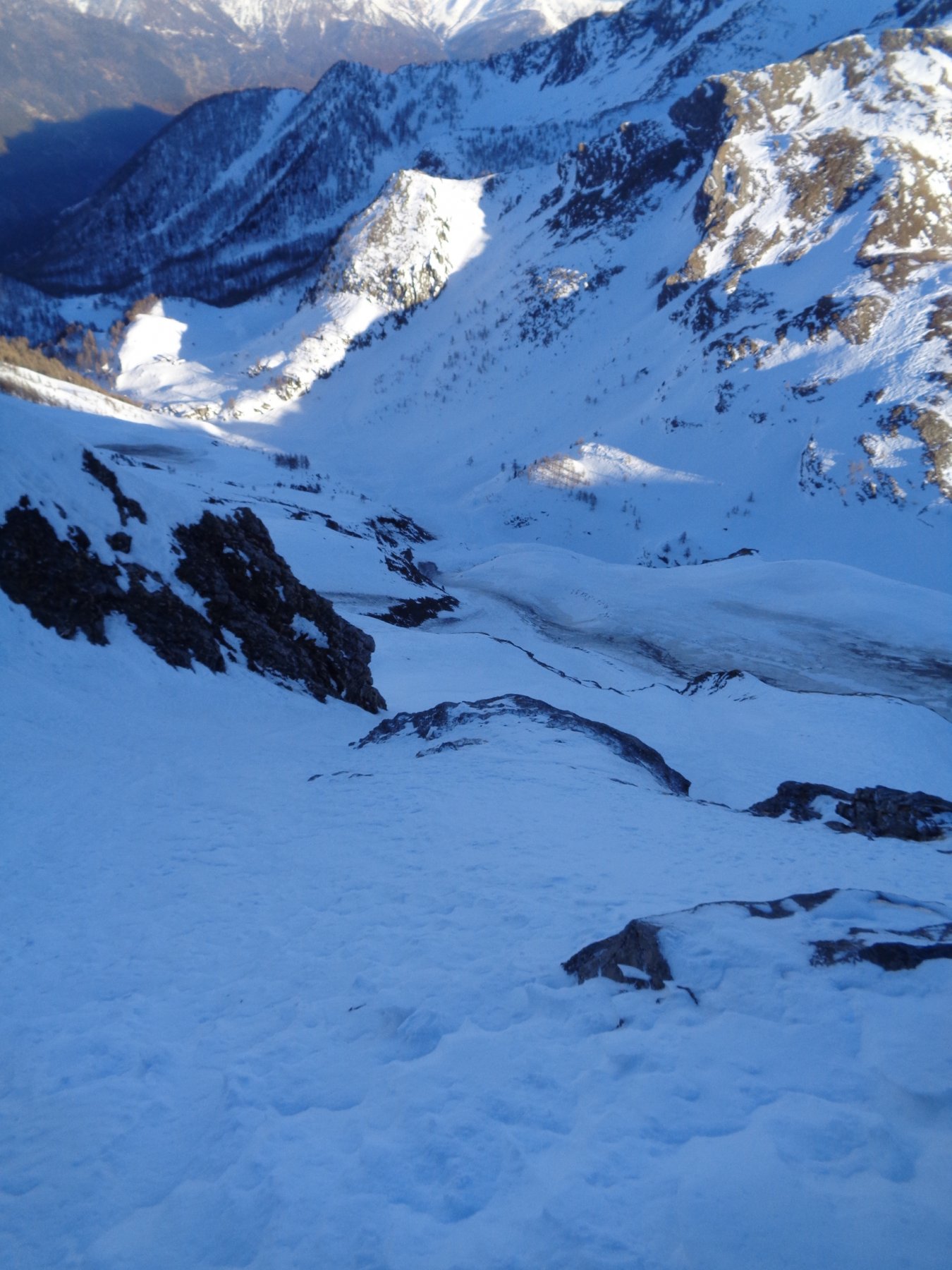
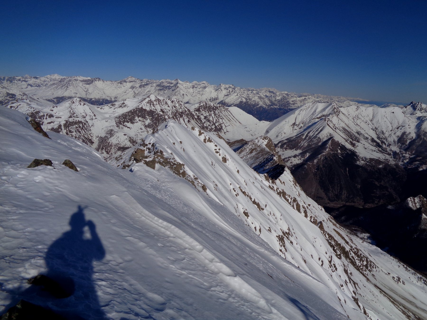
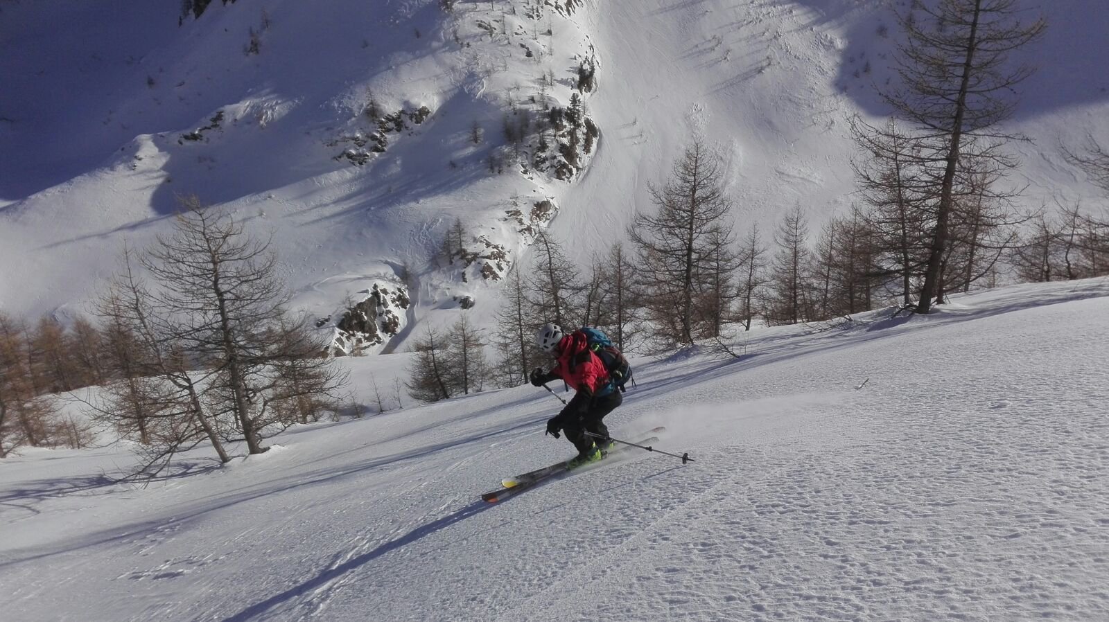
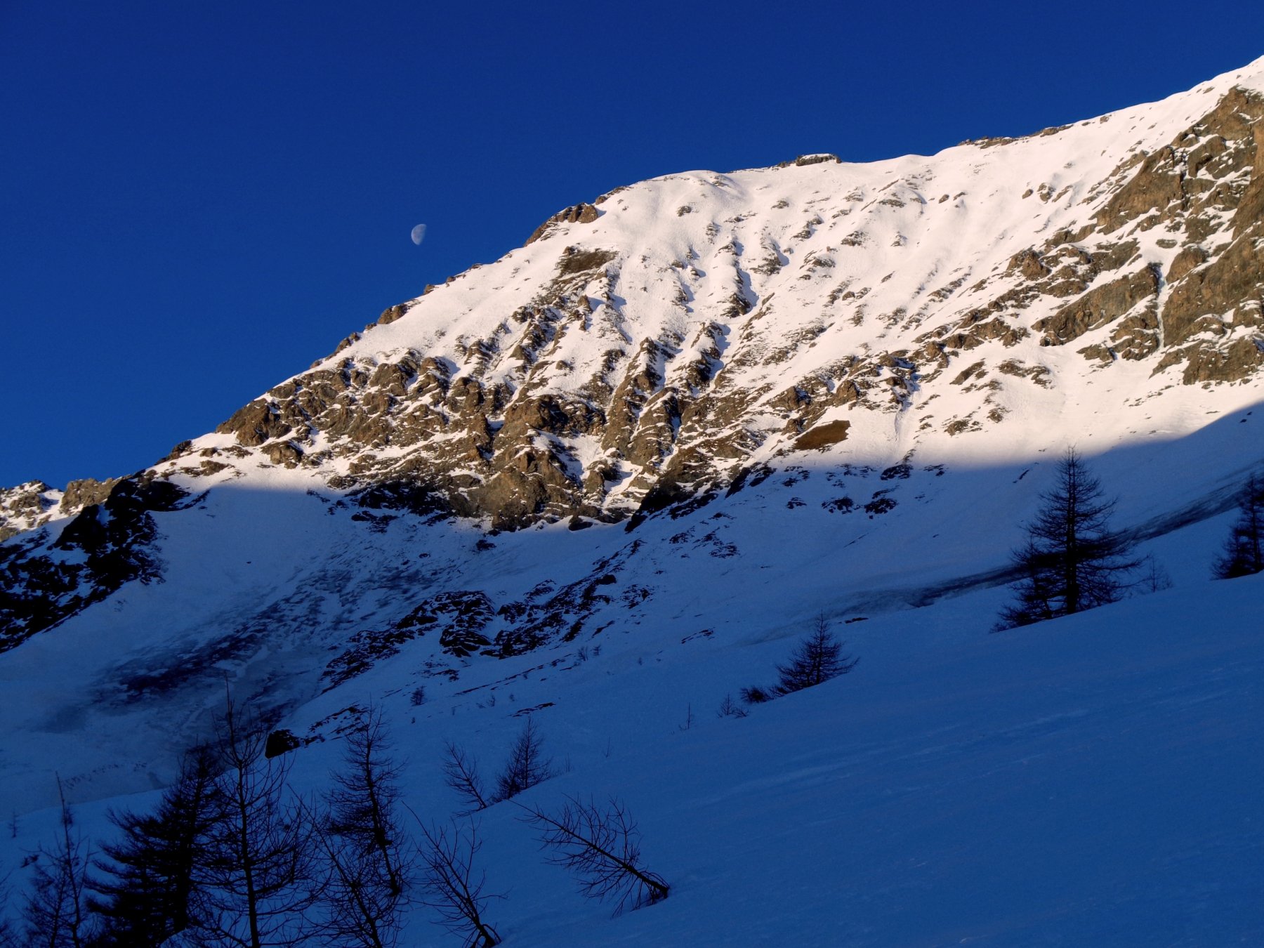
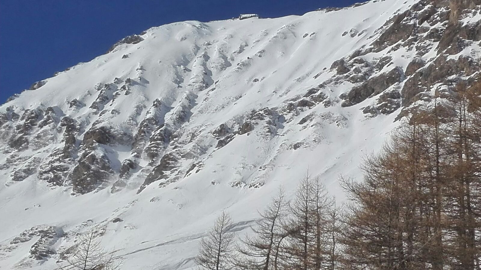
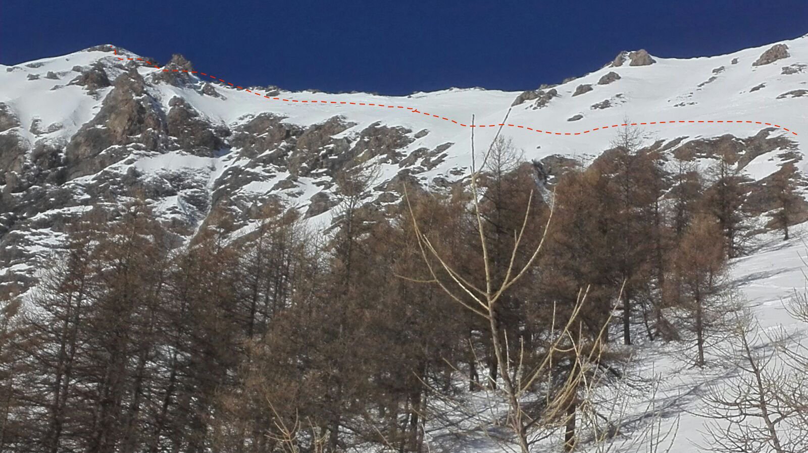
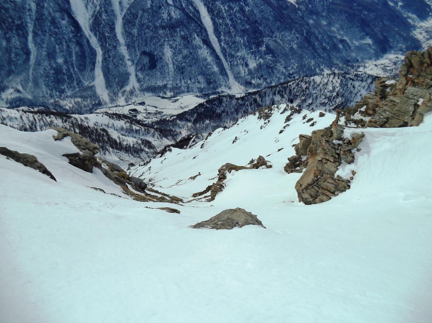
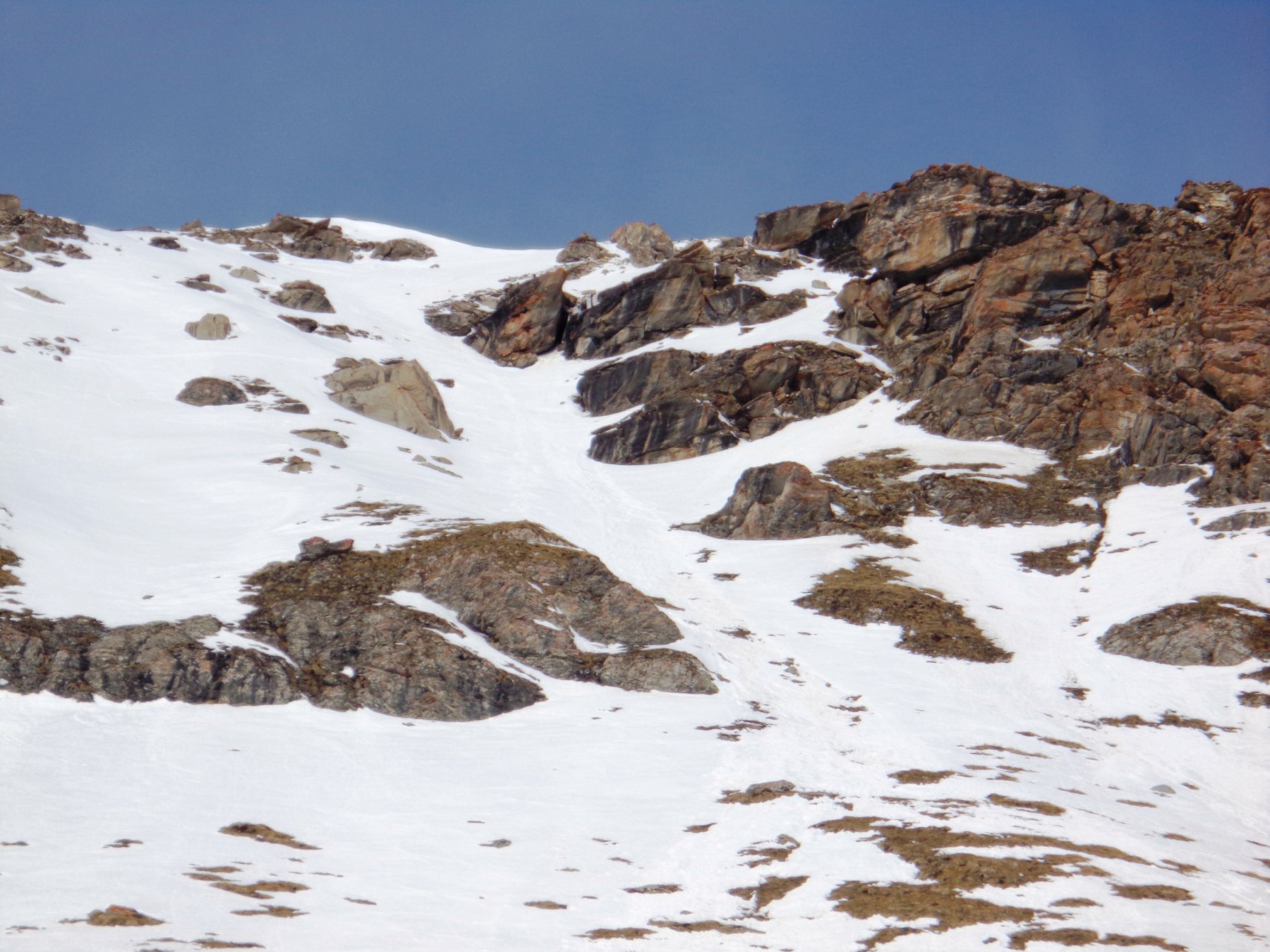
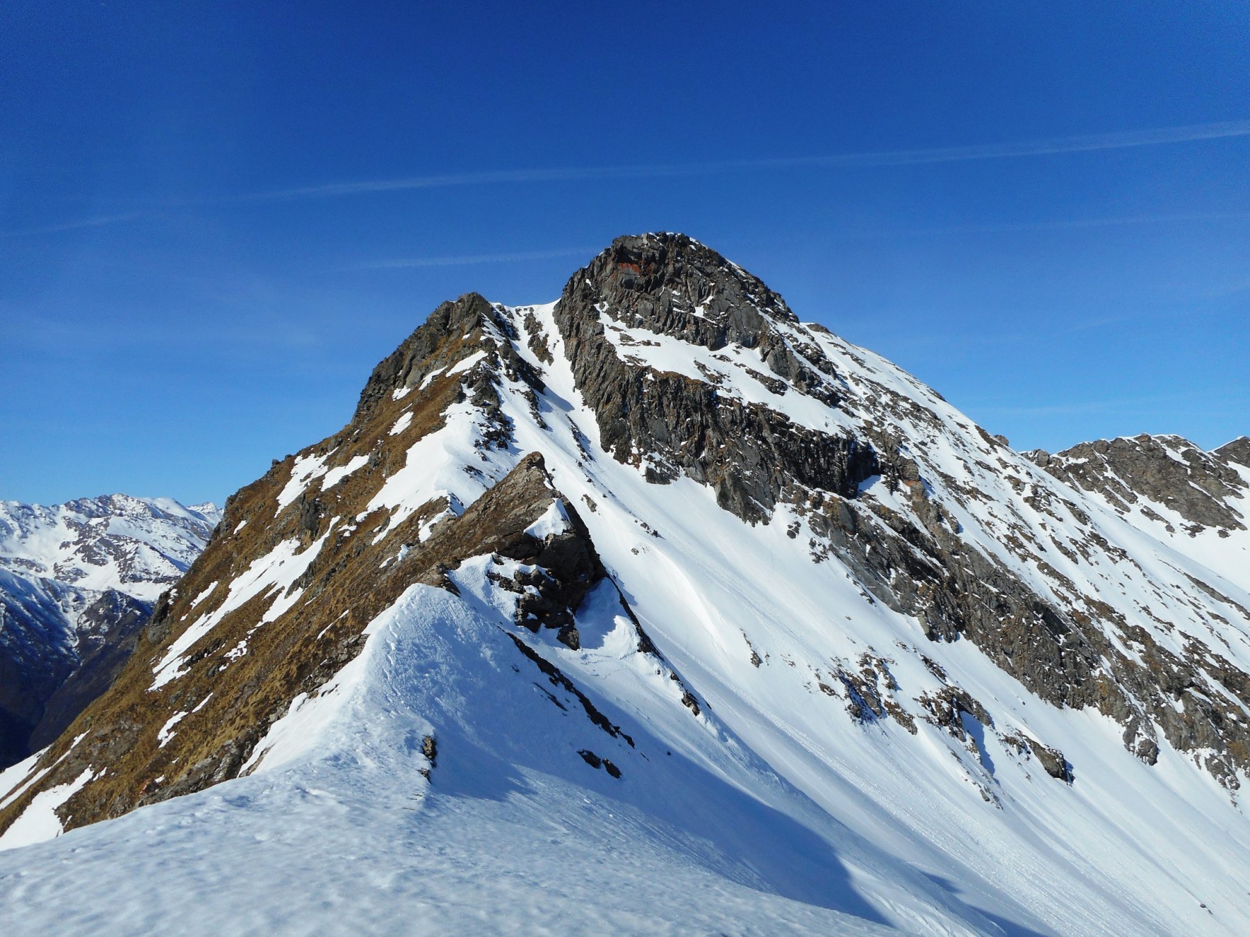
Parete vasta e scenografica, in un luogo remoto e poco frequentato in inverno. Si tratta di un itinerario serio e sostenuto: la parte bassa è costituita da un canalino che taglia un'alta fascia rocciosa di 200m, nella parte alta il canale si dirama in numerose canne d'organo.
45° su 500m
A causa dell'esposizione e lunghezza dell'itinerario valutare bene l'orario di partenza e di discesa.
Avvicinamento
45° su 500m
A causa dell'esposizione e lunghezza dell'itinerario valutare bene l'orario di partenza e di discesa.
Dalla strada Statale 23 del Sestriere deviare per Laux (cartello indicatore dopo il bivio per Usseaux). Percorrere il breve tratto fino al piccolo agglomerato di case di Laux parcheggiare l'auto nei pressi.
Descrizione
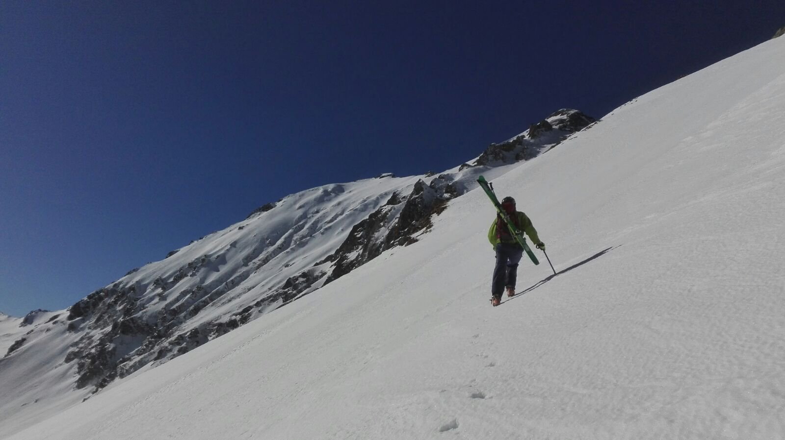
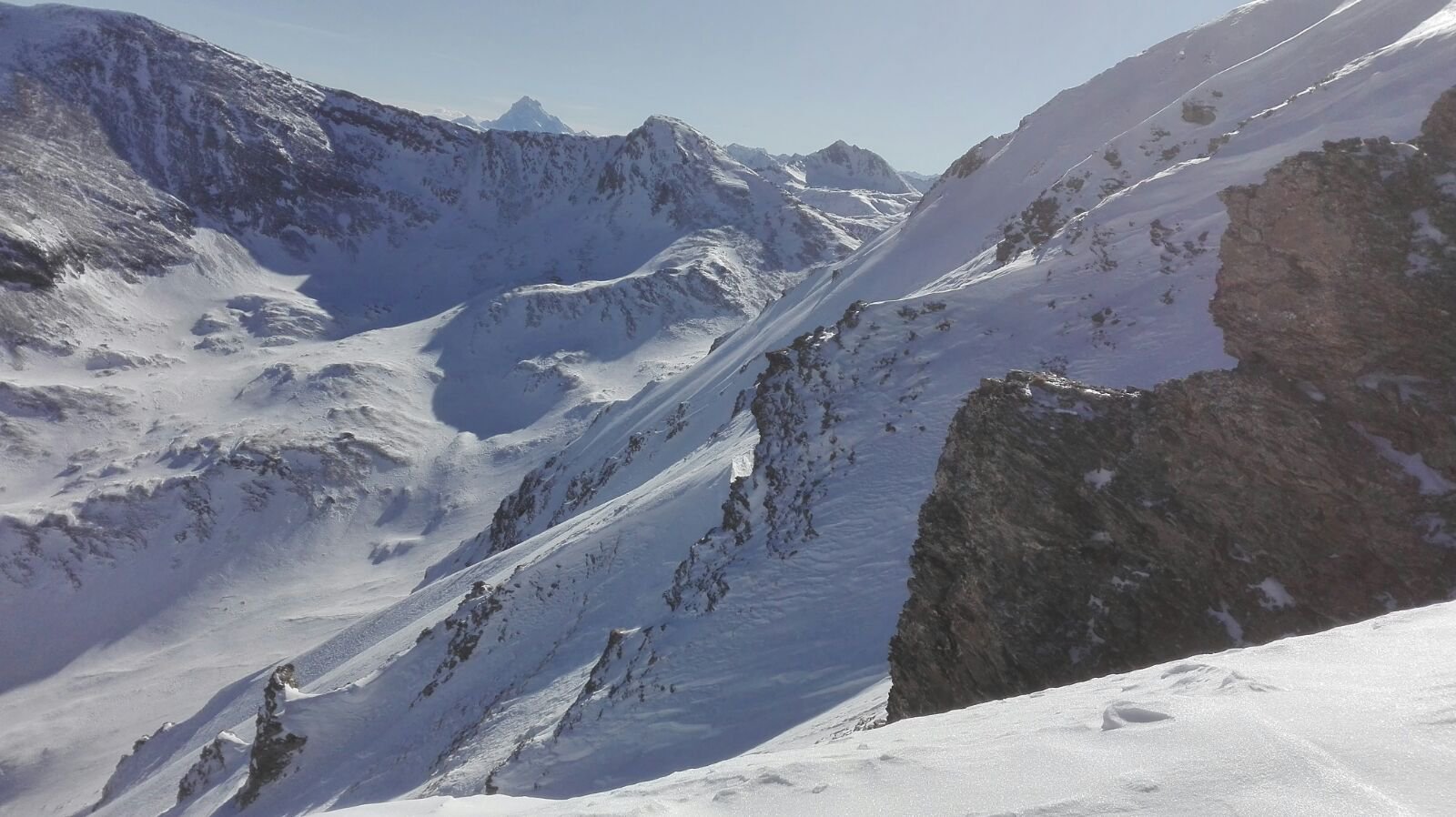
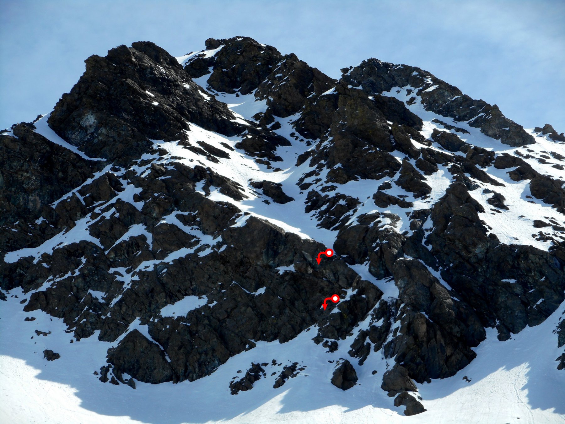
Da Laux seguire i cartelli indicatori “GTA” che conducono nel Vallone dell’Albergian. Seguire la strada sterrata (generalmente innevata e tracciata) fino alle berg. del Laux, proseguire quindi alla meglio lungo il sentiero estivo fino al bivio delle berg. di Pra del Funs. Con innevamento stabile (necessario comunque per affrontare le parete in sicurezza) è consigliabile proseguire lungo il sentiero estivo rimanendo in sx idrografica. Una volta fuori dal bosco il sentiero prosegue a mezzacosta e attraversa diversi canaloni, fino a raggiungere la grande valletta che si origina dal versante est dell’Albergian. Risalire la valletta (35°) fino alla base dell’evidente canale sulla destra del versante, che non esce in vetta ma a metà strada tra anticima e cima dell’Albergian. Risalire il canale dapprima incassato tra le pareti di roccia della fascia rocciosa basale della parete (pendenze di 40-45° su 200m), passare una strettoia ripida (qualche metro a 50°, possibile ghiaccio con scarso innevamento) e quindi proseguire nel canale ora meno definito. Continuare a salire sempre con forte esposizione e pendenze importanti (45°) cercando di obliquare via via verso sx fino ad entrare nel canale parallelo a sx . Si prosegue così fino a raggiungere la cresta d’uscita. Per raggiungere la cima dell’Albergian è anche possibile deviare via via verso sx passando al di sotto di una fascia rocciosa in cresta e arrivando a pochi metri dal castelletto sommitale (che si vince per un pendio ripido sulla dx).
Discesa dall’itinerario di salita, facendo attenzione a seguire fedelmente il percorso di salita e non sbagliare il canale basso.
In alternativa con 2 auto a disposizione è anche possibile percorrere la parete in boucle (magari con una buona foto di dettaglio dei canalini bassi) salendo dalla normale di Pragelato.
Nelle vicinanze Mappa
Itinerari
04/04/2024 TO, Usseaux D+ 1730 m III, 4.3, E2 Nord
Politri (Monte) o Bric Rosso Canale Nord-Est
 50m
50m
19/01/2020 TO, Usseaux D+ 1300 m II, 4.2, E3 Sud-Ovest
Pelvo di Fenestrelle (Monte) Versante SO
 2.1Km
2.1Km
02/02/2020 TO, Usseaux D+ 1186 m II, 4.2, E3 Sud
Vallette (Cima delle) Parete Sud
 2.1Km
2.1Km
27/12/2018 TO, Usseaux D+ 1150 m II, 4.1, E2 Nord
Français Pelouxe (Monte) Canale Sud
 2.1Km
2.1Km
16/03/2024 TO, Usseaux D+ 1290 m II, 4.3, E2 Sud-Est
Ciantiplagna (Cima) Versante SE
 2.1Km
2.1Km
22/03/2024 TO, Usseaux D+ 1165 m I, 4.1, E1 Est
Vallette (Cima delle) Parete Est
 2.1Km
2.1Km
02/01/2020 TO, Usseaux D+ 1160 m II, 4.3, E4 Sud
Fattière (Monte) Canale diretto Sud
 2.1Km
2.1Km
25/02/2014 TO, Usseaux D+ 1290 m II, 4.2, E4 Sud-Est
Ciantiplagna (Cima) Parete SE – Canale Sud
 2.1Km
2.1Km
13/04/2017 TO, Fenestrelle D+ 1050 m 4.2, E1 Nord-Est
Ciardonet (Roc) Canalino NE
 5.9Km
5.9Km
13/04/2017 TO, Fenestrelle D+ 1190 m II, 4.2, E4 Ovest
Orsiera (Monte, Punta Sud) Canale Sospeso O
 5.9Km
5.9Km
Servizi
1Km
1Km
Cheese Bar Ristorante
Usseaux
1Km
La Placette Ristorante
Usseaux
1.1Km
Souvenir Rifugio
Usseaux
1.2Km
Edelweiss Ristorante
Usseaux
1.8Km
Il Nido dell’Aquila Ristorante
Usseaux
2.8Km
Lago delle Rane Rifugio
Usseaux
3.1Km
Meizon Blanco Ristorante
Fenestrelle
4.1Km
Alpe Pintas Ristorante
Usseaux
7.1Km