7.1Km
7.1Km
Note
Storico
 50m
2.4Km
7Km
7Km
7.2Km
7.2Km
8.8Km
9.2Km
9.2Km
9.2Km
50m
2.4Km
7Km
7Km
7.2Km
7.2Km
8.8Km
9.2Km
9.2Km
9.2Km
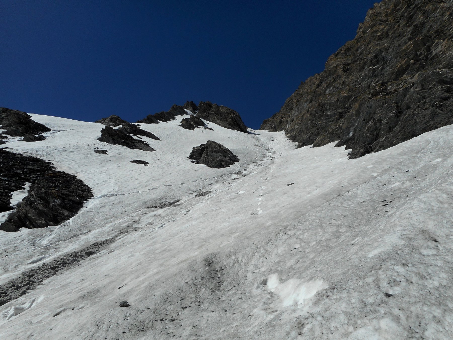
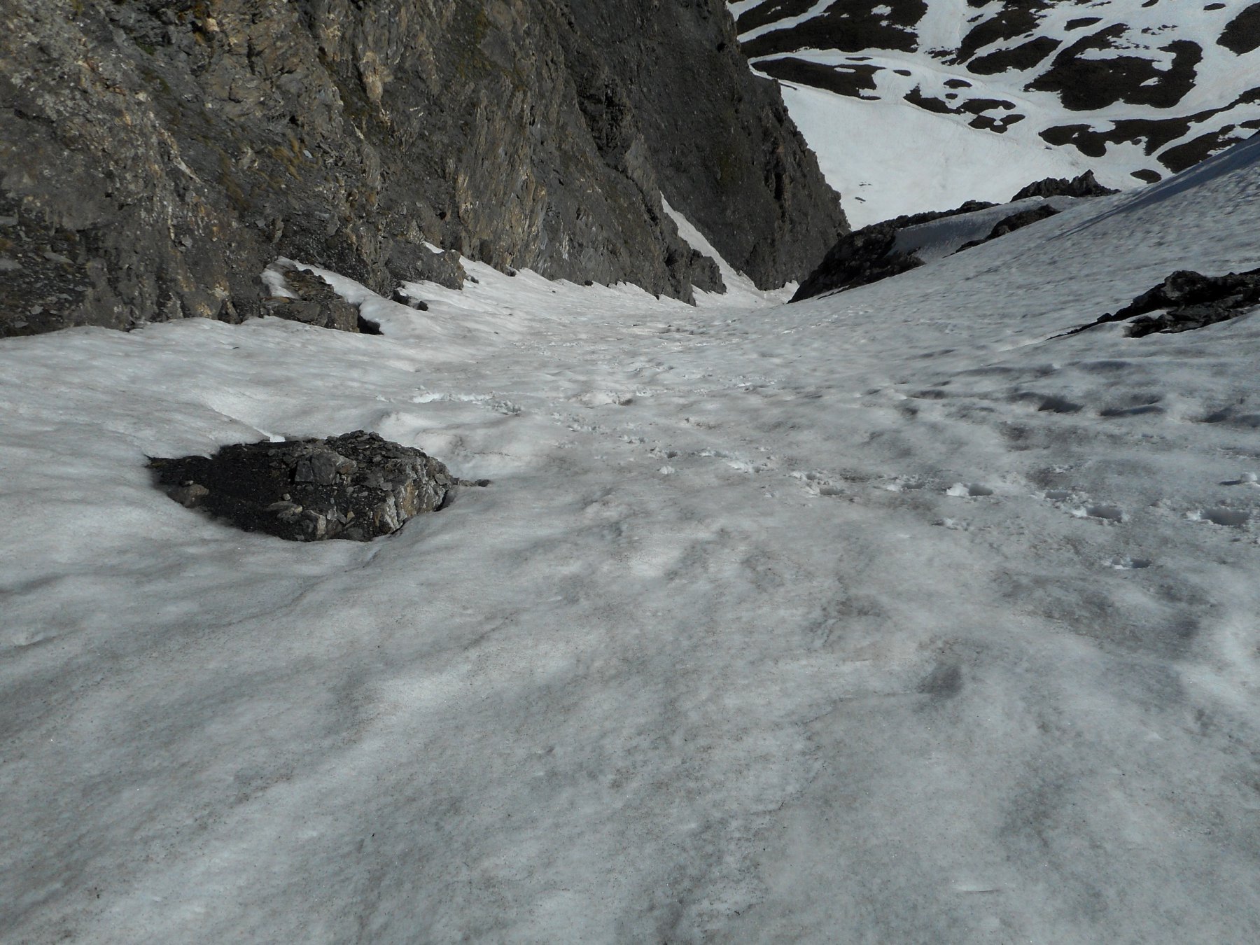
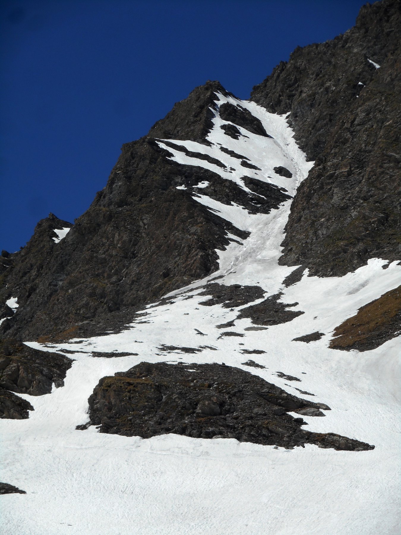
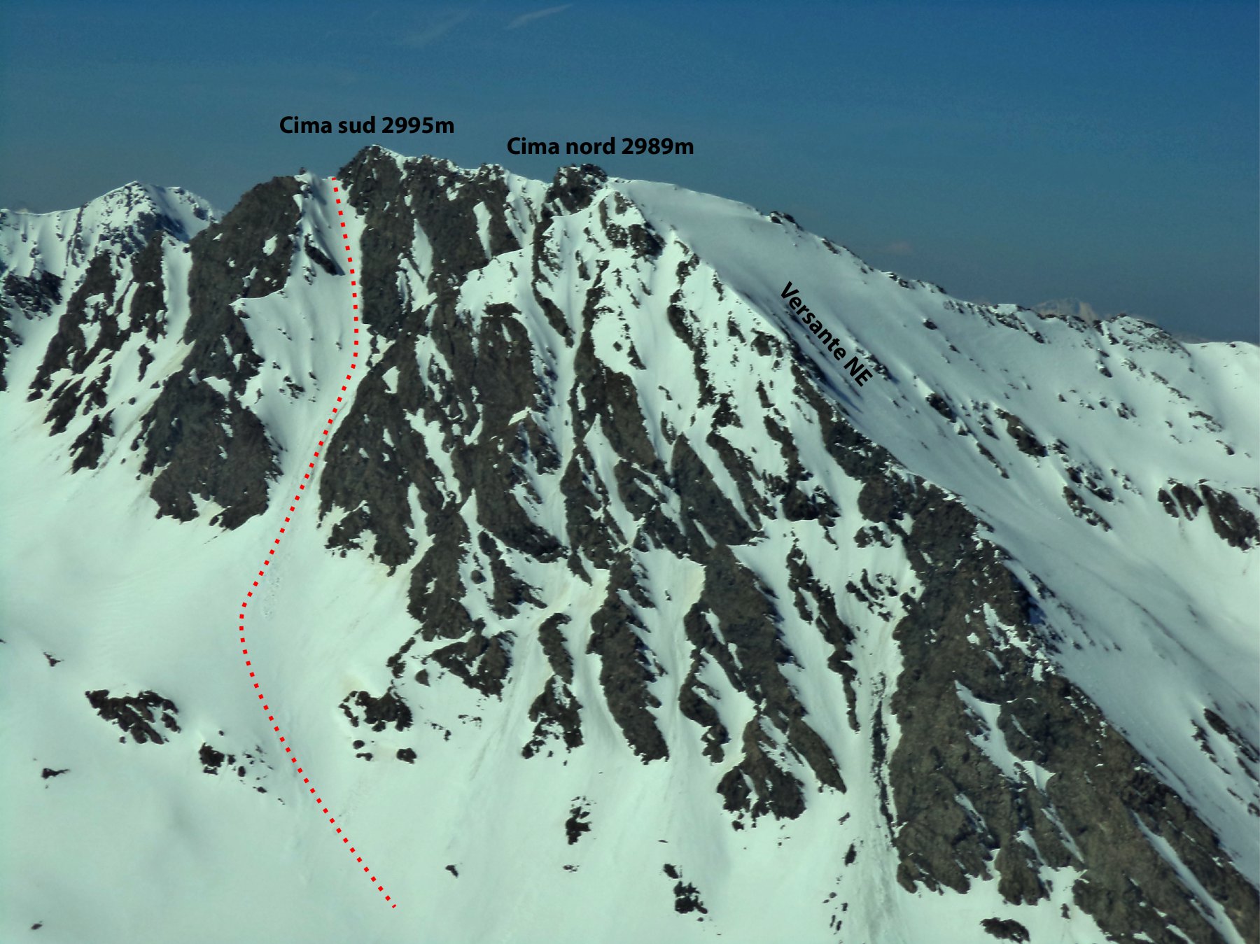
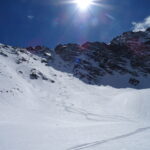
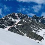
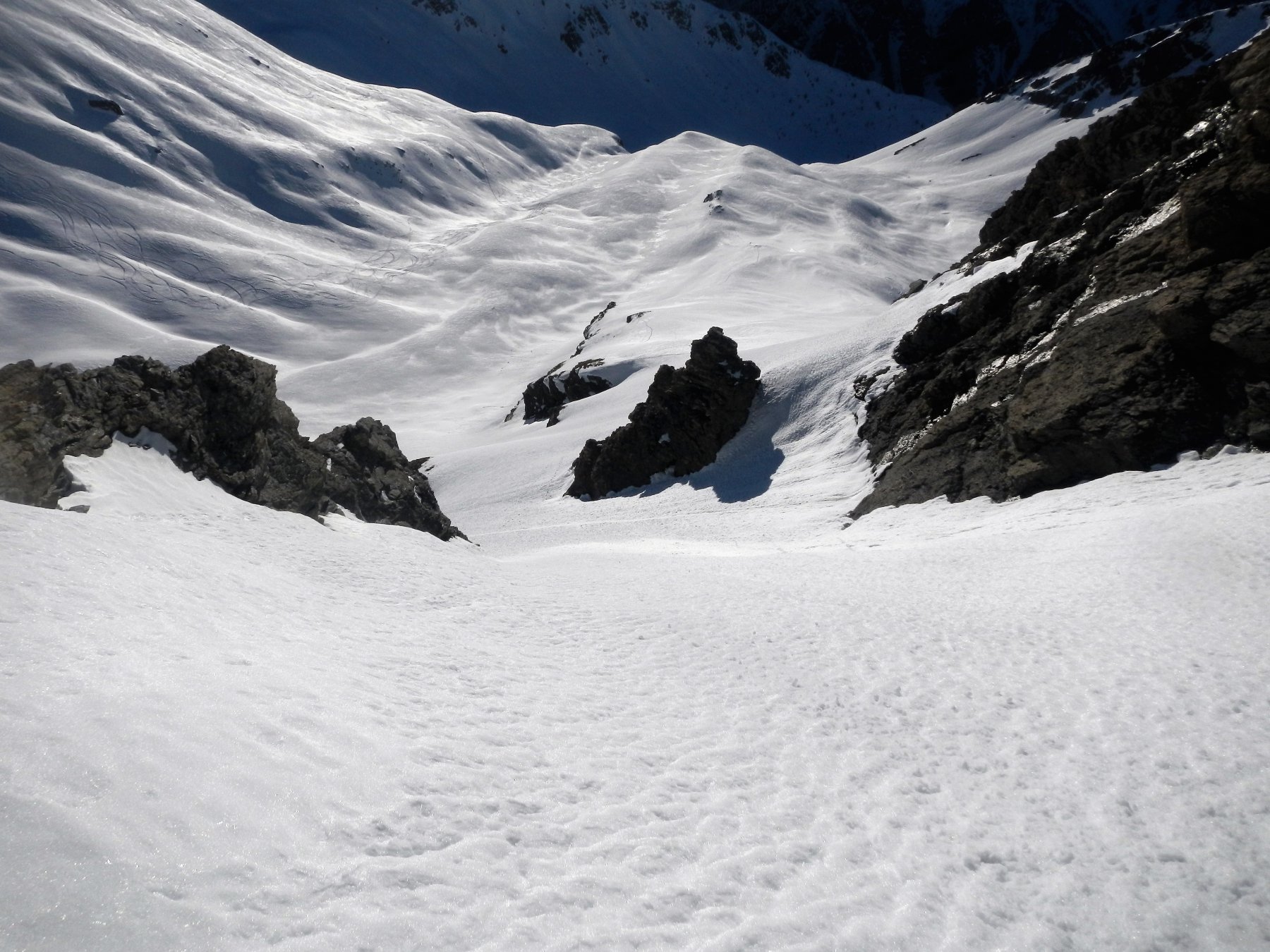
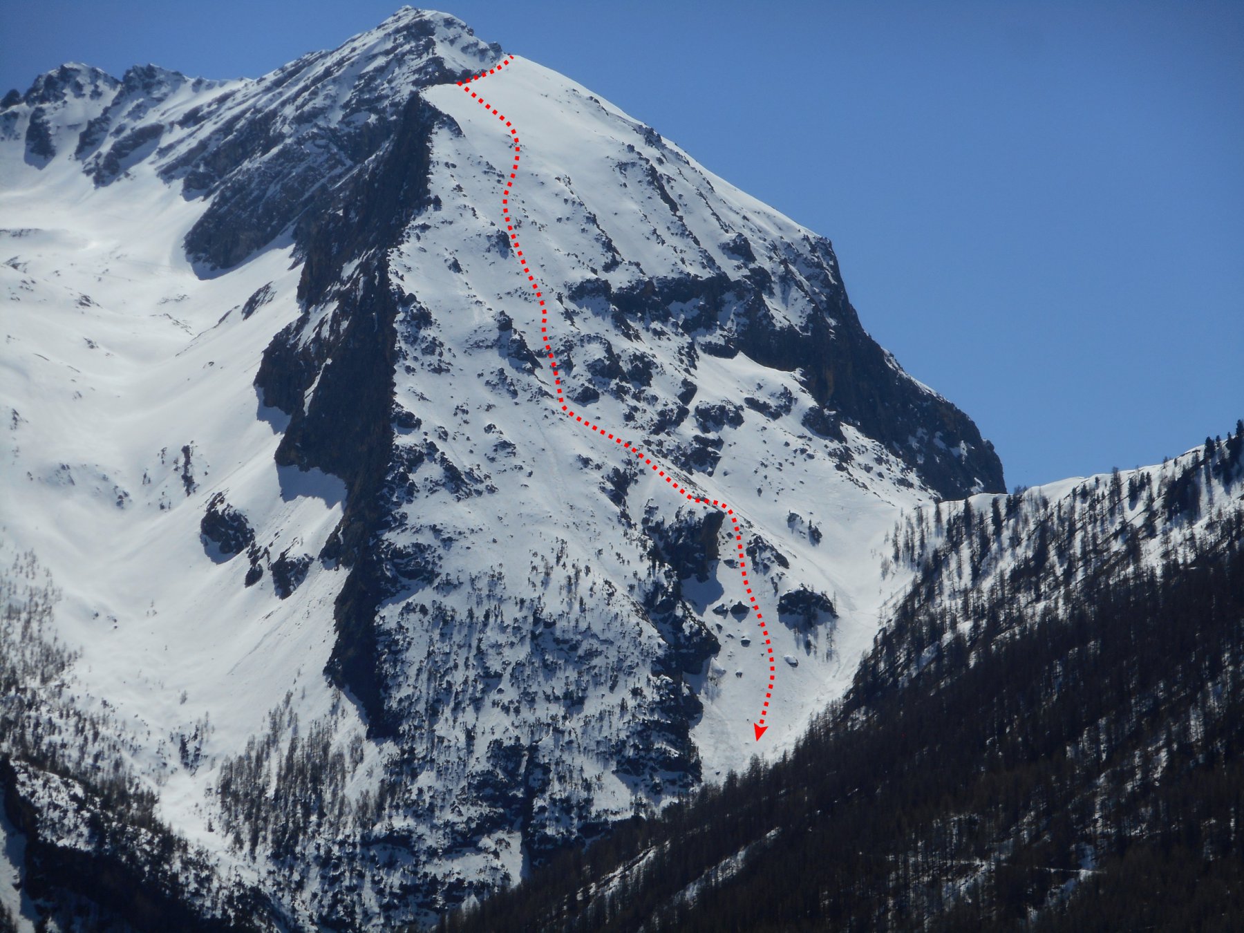
Breve canale intorno ai 200m con pendenze intorno ai 40° (possibili brevi tratti a 45°), la parte bassa della "Y" è esposta a E mentre la parte alta dopo la biforcazione è NE.
Difficoltà proposta 4.1 E2.
Avvicinamento
Difficoltà proposta 4.1 E2.
Itinerario consigliabile qualora si riesca a salire in auto fino al park Montenero (1912m).
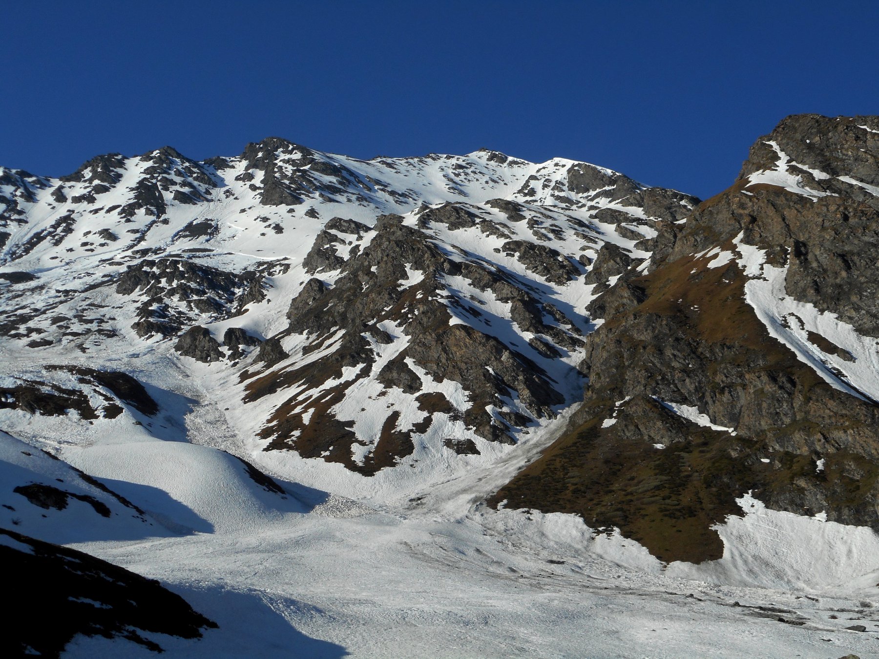
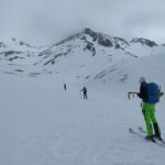
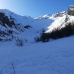
Dal parcheggio seguire la mulattiera che porta al rif. Alpe Plane, da lì proseguire nella valle Lunga lungo il sentiero prima in sx orografica e poi in dx (ad inizio stagione il torrente ricoperto di neve permette di salire più velocemente direttamente lungo il fondo valle).
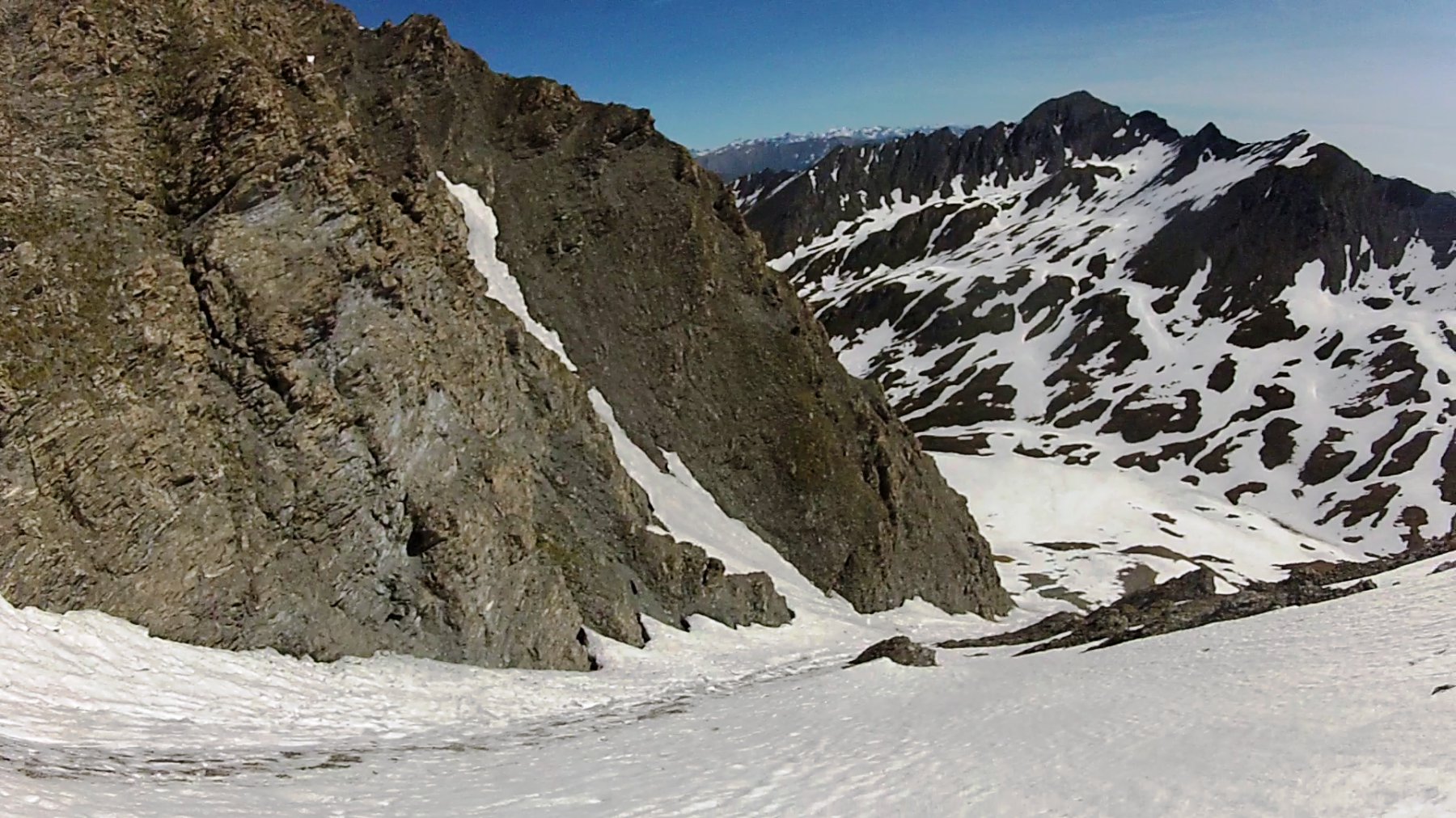
Dopo aver passato il versante NE del Gran Miol si arriva al pianoro a q. 2550m da cui si intravede il canale.
Descrizione
Dal parcheggio seguire la mulattiera che porta al rif. Alpe Plane, da lì proseguire nella valle Lunga lungo il sentiero prima in sx orografica e poi in dx (ad inizio stagione il torrente ricoperto di neve permette di salire più velocemente direttamente lungo il fondo valle).
Dopo aver passato il versante NE del Gran Miol si arriva al pianoro a q. 2550m da cui si intravede il canale.
Dal pianoro q. 2550m risalire i pendii che portano alla conoide e da questa, seguendo il canale, fino al colletto q. 2960m circa.
Dal colletto è possibile raggiungere la cima S del Gran Miol percorrendone la cresta SE (esposta e di roccia delicata, I/II), altrimenti ci si può accontentare dello sperone roccioso sulla sx del colletto (~2970m).
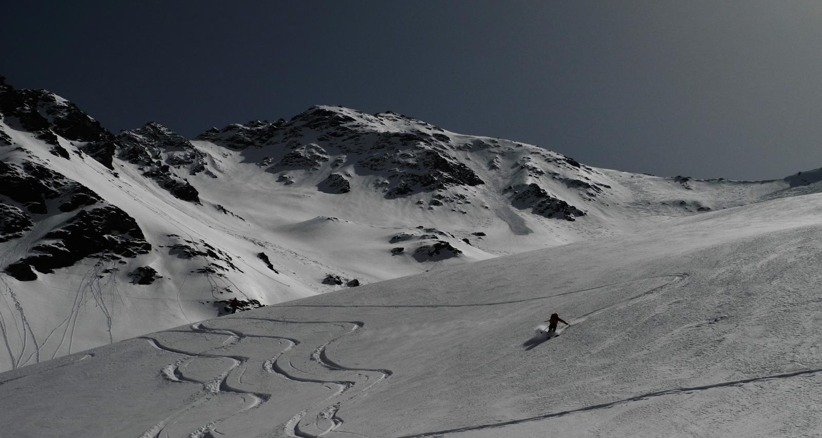
Discesa dall’itinerario di salita.
Prima discesa nota: A. Corno 10/6/17.
Nelle vicinanze Mappa
Itinerari
31/05/2025 TO, Sauze di Cesana D+ 1400 m I, 4.1, E1 Nord
Ramière (Punta) o Bric Froid diretta Versante Nord
 50m
50m
26/11/2011 TO, Sauze di Cesana D+ 1150 m II, 4.3, E3 Sud-Ovest
Barifreddo (Monte) diretta Versante O/SO
 2.4Km
2.4Km
08/04/2023 TO, Sauze di Cesana D+ 1625 m III, 5.1, E2 Nord-Est
Serpentiera (Punta) Canale NE
 7Km
7Km
23/05/2025 TO, Sauze di Cesana D+ 1620 m II, 4.2, E2 Nord-Est
Pelvo (Cima del) Canale Morandini
 7Km
7Km
03/01/2022 TO, Sauze di Cesana D+ 1179 m II, 3.3, E2 Sud-Ovest
Platasse (Monte) da Bessen Haut per la Paretina Sud
 7.2Km
7.2Km
08/03/2026 TO, Sestriere D+ 1170 m I, 3.3, E2 Sud-Ovest
Rouit (Rocce del) Paretina Sud
 7.2Km
7.2Km
16/04/2017 TO, Sauze di Cesana D+ 1230 m 4.3, E3 Nord-Ovest
Furgon (Monte) Parete NO
 8.8Km
8.8Km
24/05/2026 TO, Sestriere D+ 1235 m I, 4.1, E2 Nord-Ovest
Rognosa del Sestriere (Punta) Canale e Parete NO
 9.2Km
9.2Km
01/05/2022 TO, Sestriere D+ 800 m II, 3.3, E1 Nord-Est
San Giacomo (Rocce di) da Sestriere per il vallone del Chisonetto
 9.2Km
9.2Km
23/02/2025 TO, Sestriere D+ 620 m I, 4.1, E1 Nord-Est
Querellet (Monte) – Monte Sises, itinerari vari della dorsale
 9.2Km
9.2Km