3Km
3Km

Note
 50m
50m
50m
50m
50m
50m
50m
50m
50m
50m
50m
50m
50m
50m
50m
50m
50m
50m
50m
50m
3Km
3.1Km
3.2Km
4.5Km
5.2Km
7.2Km
8.7Km
8.8Km
9.1Km
9.2Km
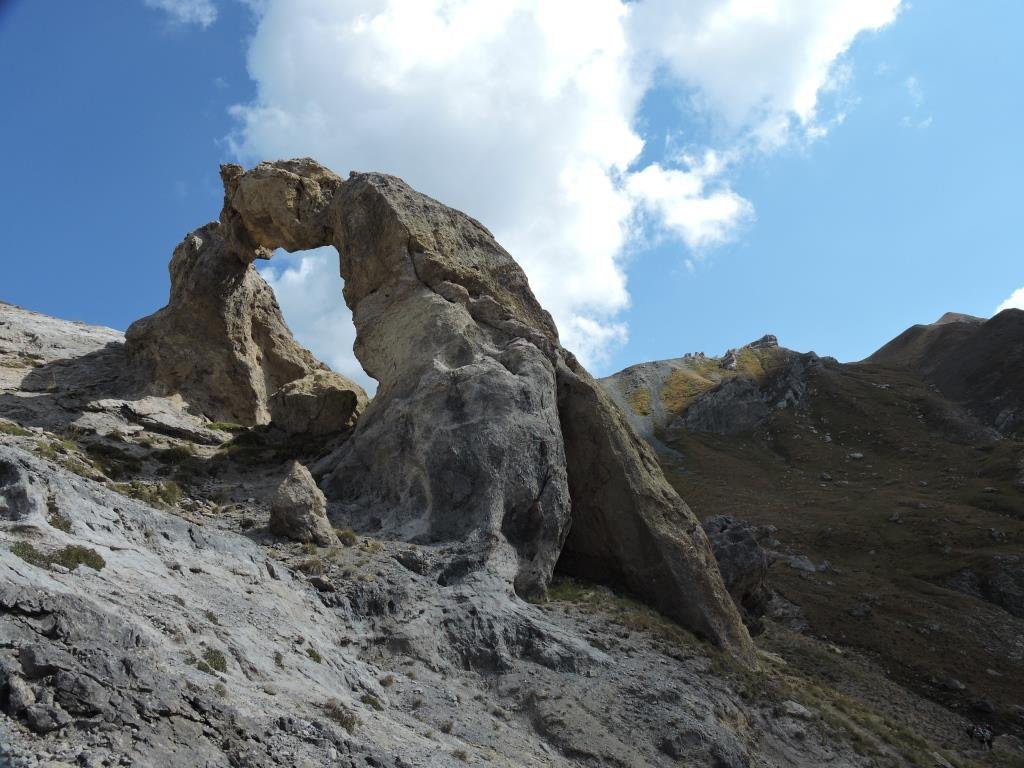
Bel giro che compie un piccolo anello sullo spartiacque Italia/Francia con splendida vista sui meravigliosi Laghi di Vens e sulla zona calcarea di Tortisse con lo splendido arco naturale di Tortisse.
Consigliata una visita al Museo La Mizoun Dal Coutrabandier a Ferrere e al vecchio grande forno del pane del paese.
Avvicinamento
Consigliata una visita al Museo La Mizoun Dal Coutrabandier a Ferrere e al vecchio grande forno del pane del paese.
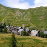
In Valle Stura, a Bersezio prendere il bivio per Ferrere. Attenzione alla strada che è stretta e spesso senza protezioni a valle, ampio posteggio prima di entrare in Ferrere.
Descrizione
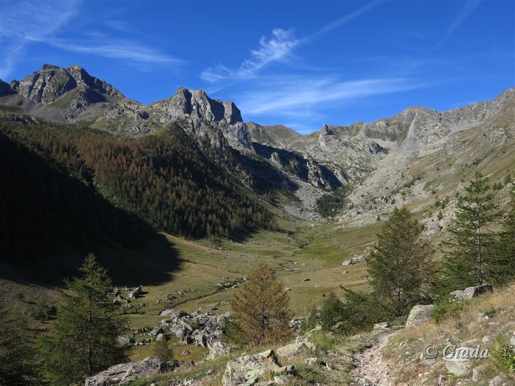
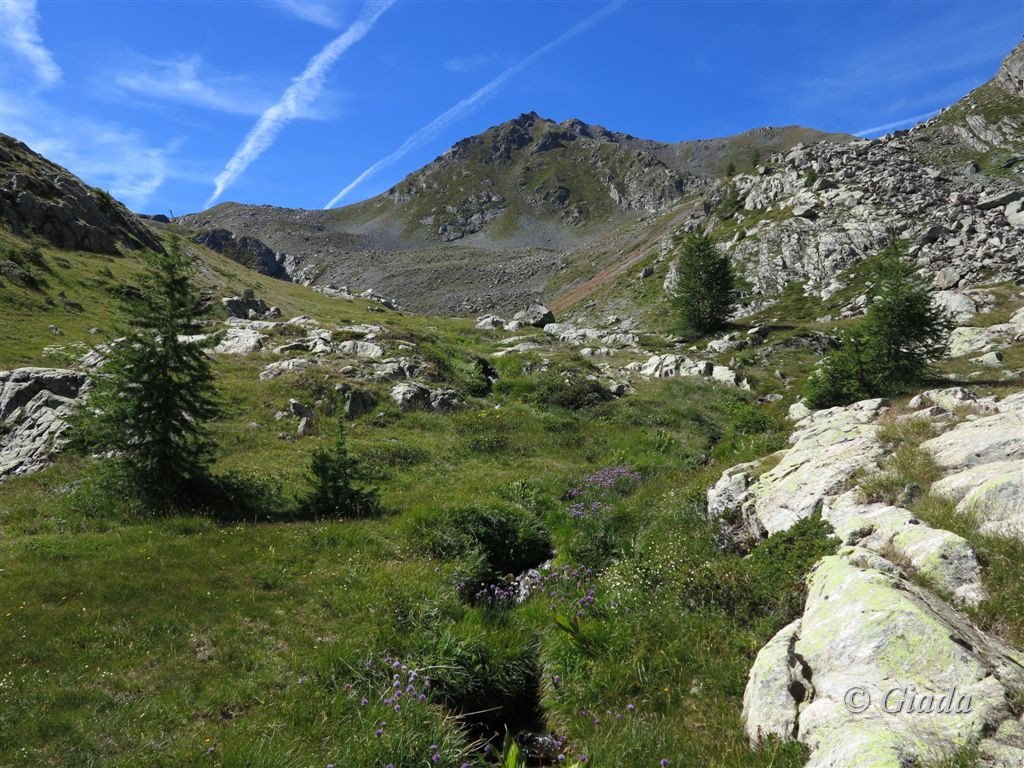
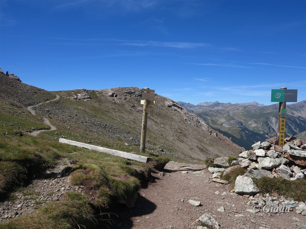
Da Ferrere seguire le indicazioni per il Colle del Ferro, lasciare i bivi per la Bassa di Colombart e il Colle del Puriac prima e di Stau, Gta dopo.
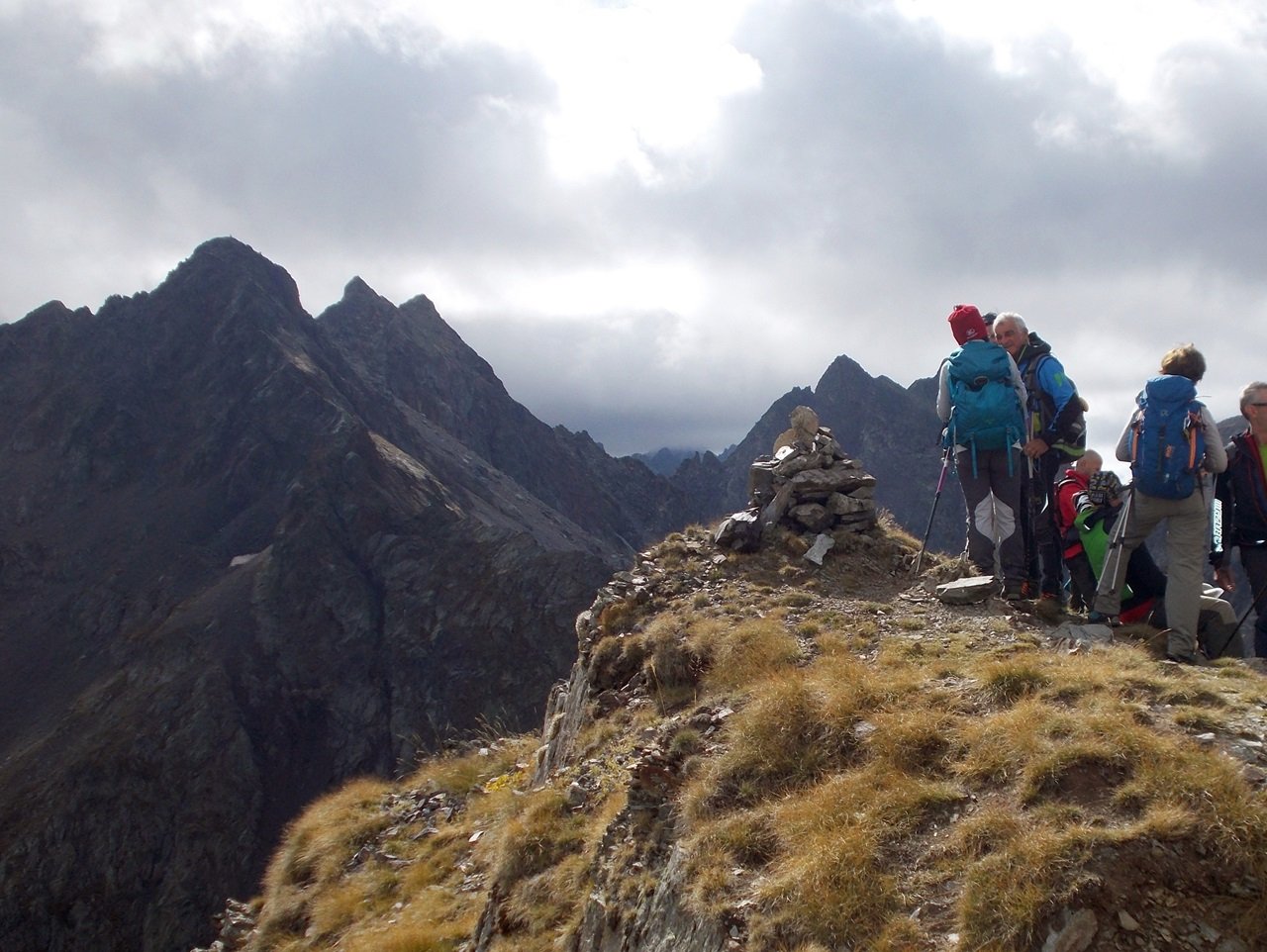
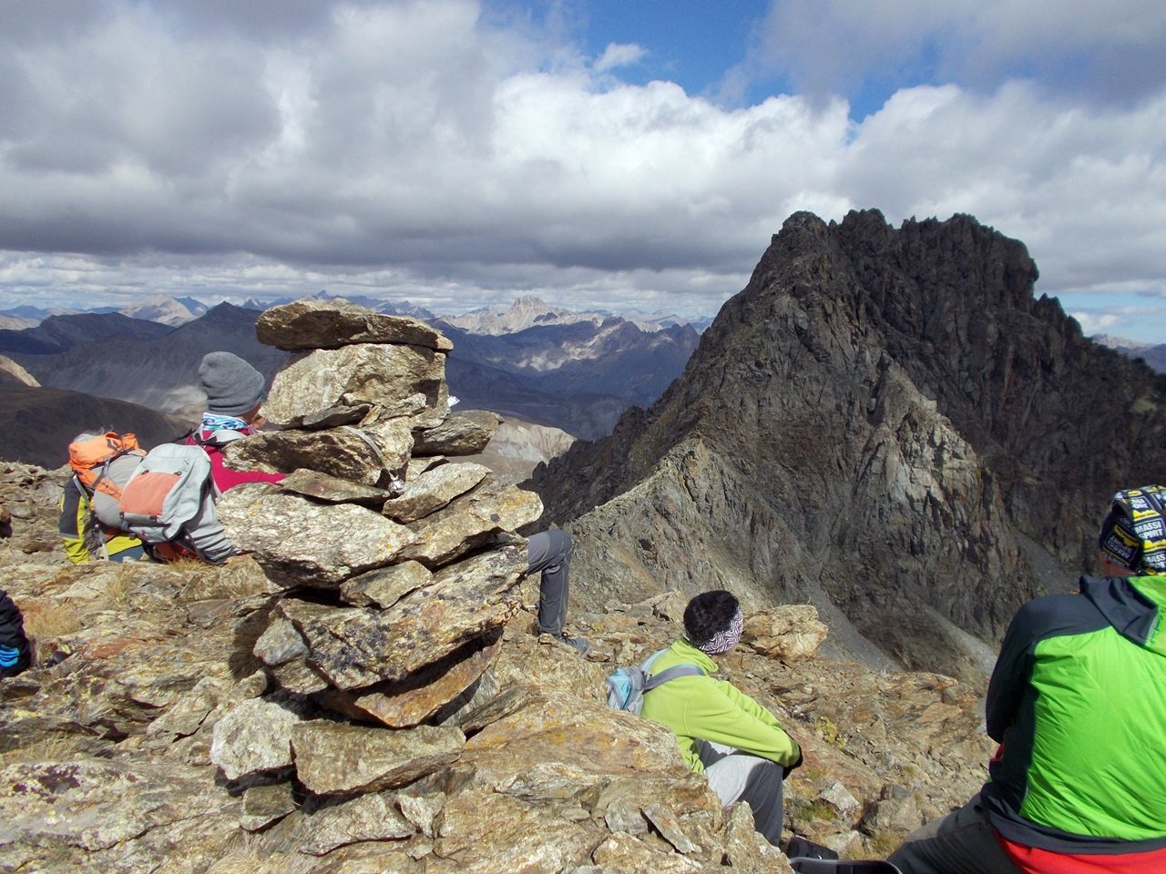
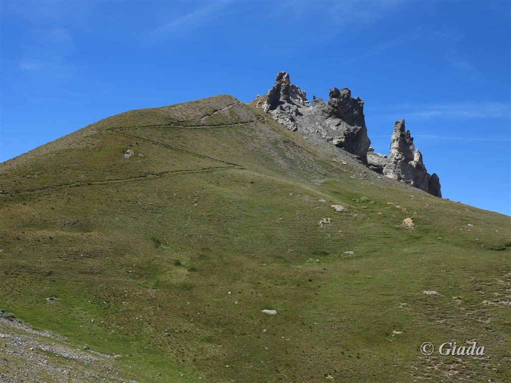
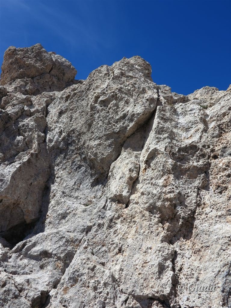
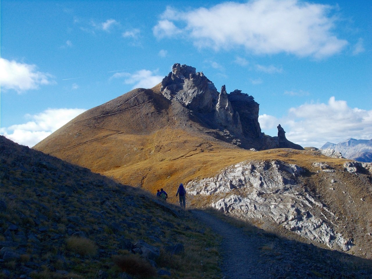
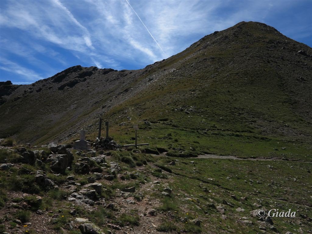
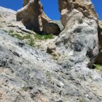
Salire il bel vallone fino al Colle del Ferro m.2584 (palina 35 e bacheca del parco del Mercantour), proseguire sul lato Francia verso sinistra, si entra nel Parco del Mercantour, giunti al Collet de Tortisse m.2591 (palina 35a) svoltare a destra su sentiero e salire alla Aiguilles de Tortisse m.2672, per la cima ultimi tre metri da arrampicare su taglienti rocce, II-.
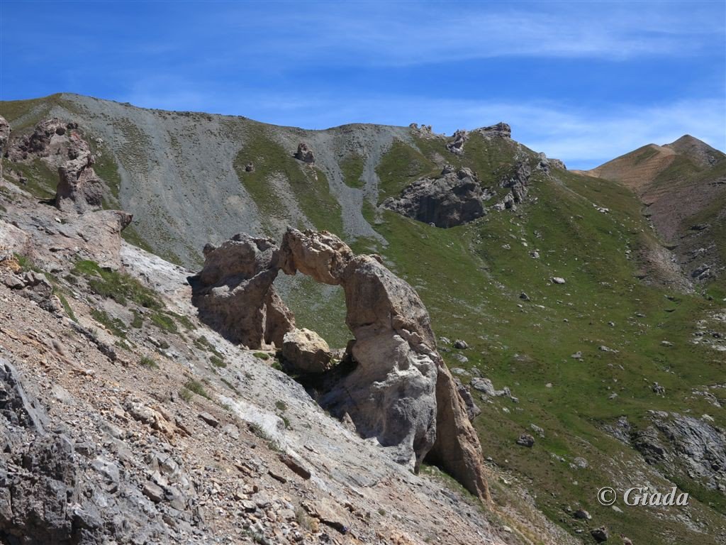
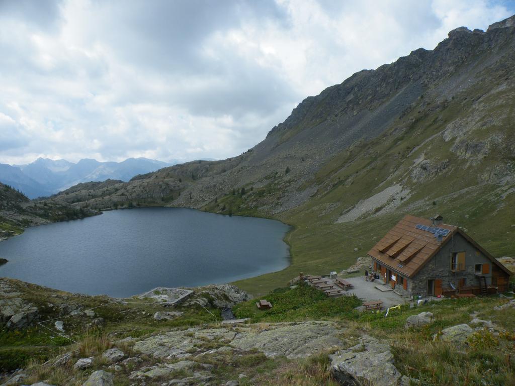
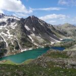
Bellissimo ambiente con contorte guglie calcaree e panorama sui laghi di Vens e dintorni.
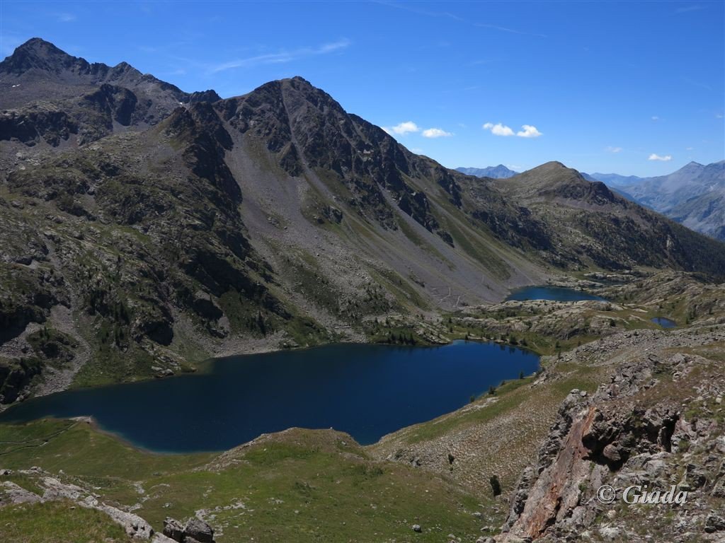
Si ritorna al Collet de Tortisse, consiglio una breve deviazione verso i Laghi di Vens per ammirarli dal, e assieme, allo splendido Arco de Tortisse, un bellissimo arco naturale nato dall’erosione dovuta alla particolare qualità della roccia.
Visto l’arco, si ritorna al Collet de Tortisse e si devia a destra per il Colle del Ferro Sud/Pas des Blanches m.2660.
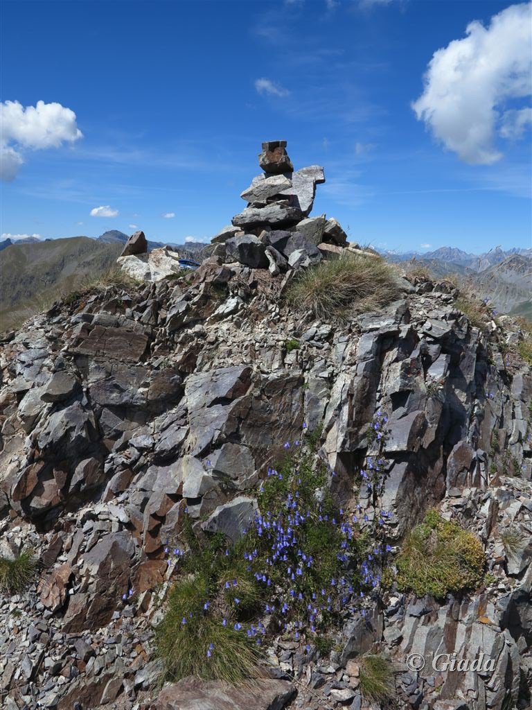
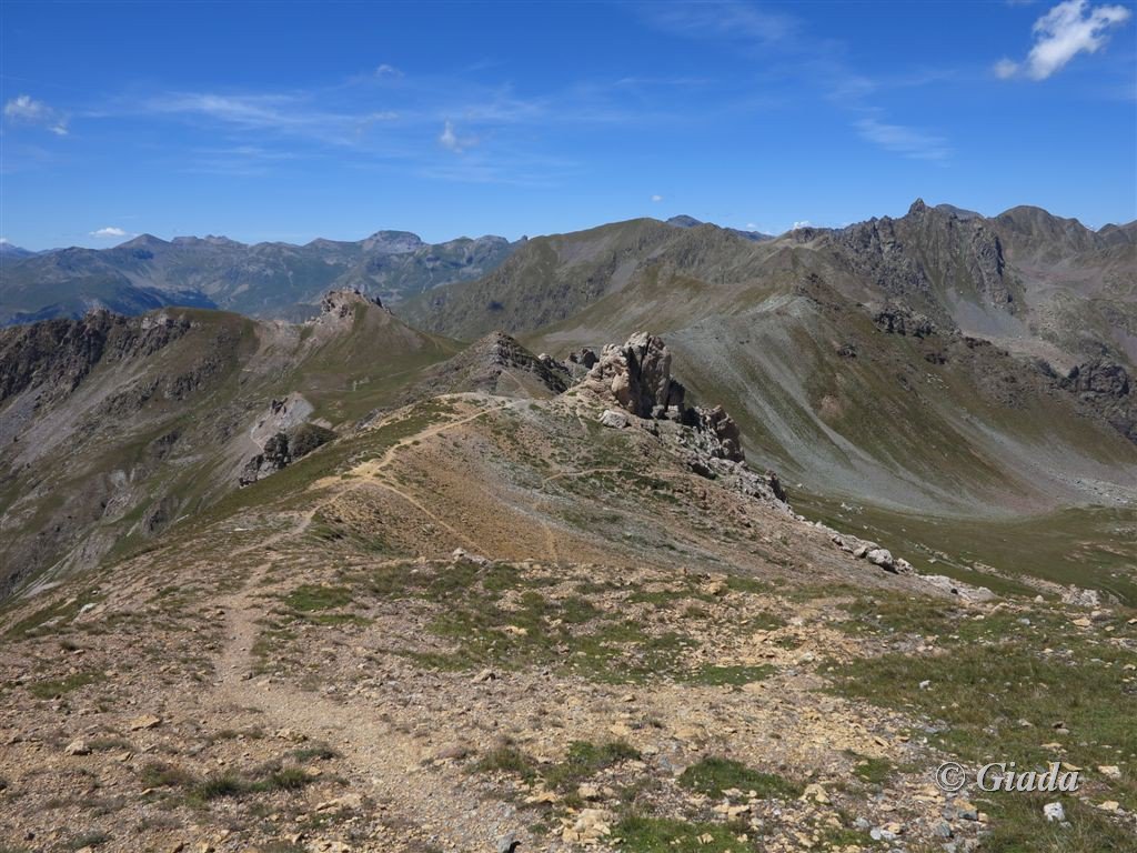
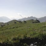
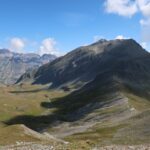
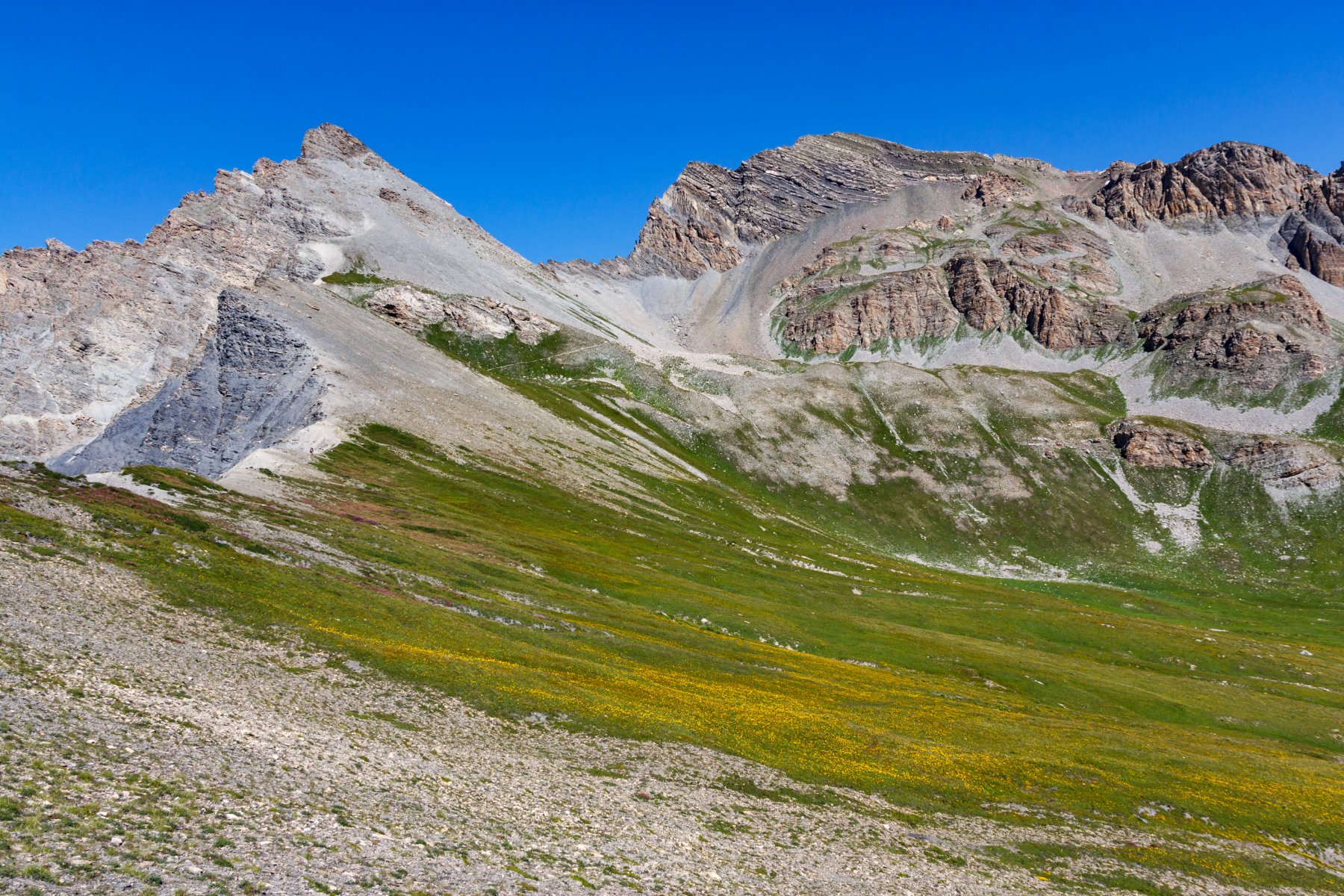
Si prosegue seguendo il sentiero per poi salire direttamente alla Testa del Ferro con la traccia che tiene il crinale, bellissimi colori ocra in tutta la zona. Dalla vetta della Testa del Ferro m.2765, ometto, bellissimo panorama sulle Cima Las Blancias, Monte Vallonetto, Cime di Vens, Cima Borgonio, Clai Superiore, laghi di Vens e tanti altri laghetti lato Francia, sul colle di Panieris e sul Monte Peiron lato Italia per citare i più vicini.
Dalla Testa del Ferro si scende a nord sul Colle di Panieris, o a vista sul pendio terroso/erboso, o con la vecchia mulattiera che saliva in vetta sulla destra.
Attenzione ai fili spinati che erano a difesa dell’imponente opera del Vallo Alpino posta sopra al Colle di Panieris, fatta saltare in base al trattato di pace dopo la seconda guerra mondiale.
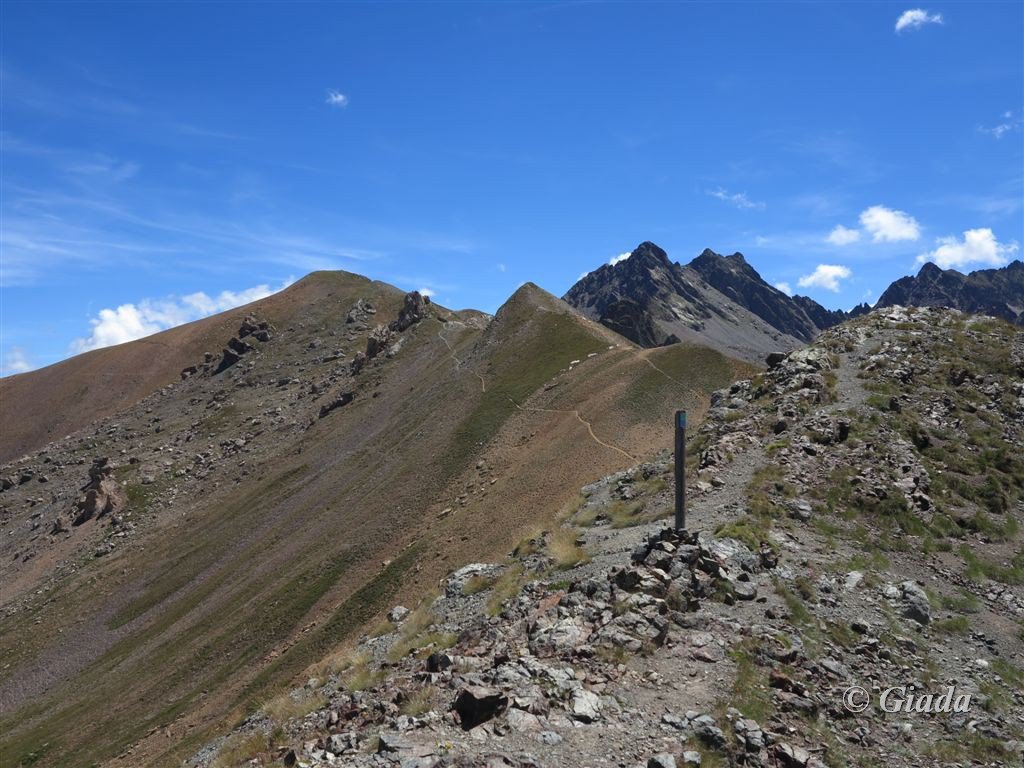
Dal Colle di Panieris m.2683, bellissimi colori ocra, si va sul sentiero a sinistra per il Pas des Blanches, dai colori invece bianchi.
Dal passo invece di scendere al Collet de Tortisse, si procede dritti sul crinale verso la Cima Fer m.2700, seguendo una traccia, dalla cima si scende direttamente sul colle del Ferro e da li con il sentiero percorso all’andata si ritorna a Ferrere.
- Cartografia:
- Fraternali 1:25000 n.13 Alta Valle Stura di Demonte
Nelle vicinanze Mappa
Itinerari
24/09/2017 CN, Bersezio/Argentera D+ 1000 m E Varie
Vens (Laghi di) da Ferrere
 50m
50m
30/08/2009 CN, Bersezio/Argentera D+ 1900 m EE Tutte
Vens (Cime di) da Ferrere, anello per Col del Ferro, Passo des Blanches, Passo di Vens, Colle di Stau
 50m
50m
22/07/2025 CN, Bersezio/Argentera D+ 800 m E Varie
Tortisse (Aiguille de) da Ferrere per il Colle del Ferro
 50m
50m
06/07/2025 CN, Bersezio/Argentera D+ 1250 m E Tutte
Ferro (Testa del) da Ferrere, anello per Col de Tortisse e Passo di Stau
 50m
50m
19/06/2022 CN, Bersezio/Argentera D+ 900 m EE Varie
Lose (Cima delle) e Punta del Briccas da Ferrere, anello
 50m
50m
14/09/2025 CN, Bersezio/Argentera D+ 850 m EE Sud-Est
Pebrun (Monte) o Pel Brun da Ferrere per il Colle del Puriac
 50m
50m
14/06/2026 CN, Bersezio/Argentera D+ 1227 m EE/F Varie
Aiga (Monte) e Monte Pebrun da Ferrere, anello per la Bassa di Colombart e la Rocca Reis
 50m
50m
30/06/2024 CN, Bersezio/Argentera D+ 1600 m EE Varie
Babarottes (Cime des) e Cime de Fourchas da Ferrere per i Laghi di Vens
 50m
50m
07/07/2025 CN, Bersezio/Argentera D+ 1000 m EE Sud-Est
Enchastraye (Monte) o Enchastraia da Ferrere per Bassa di Colombart e Colle del Puriac
 50m
50m
05/07/2020 CN, Bersezio/Argentera D+ 900 m EE Sud-Est
Tre Vescovi (Rocca) da Ferrere per il Colle del Puriac
 50m
50m
Servizi
3Km
3.1Km
da Mo Ristorante
Bersezio/Argentera
3.2Km
B&b del Villaggio B&B
Bersezio/Argentera
4.5Km
Archibus Pub Ristorante
Bersezio/Argentera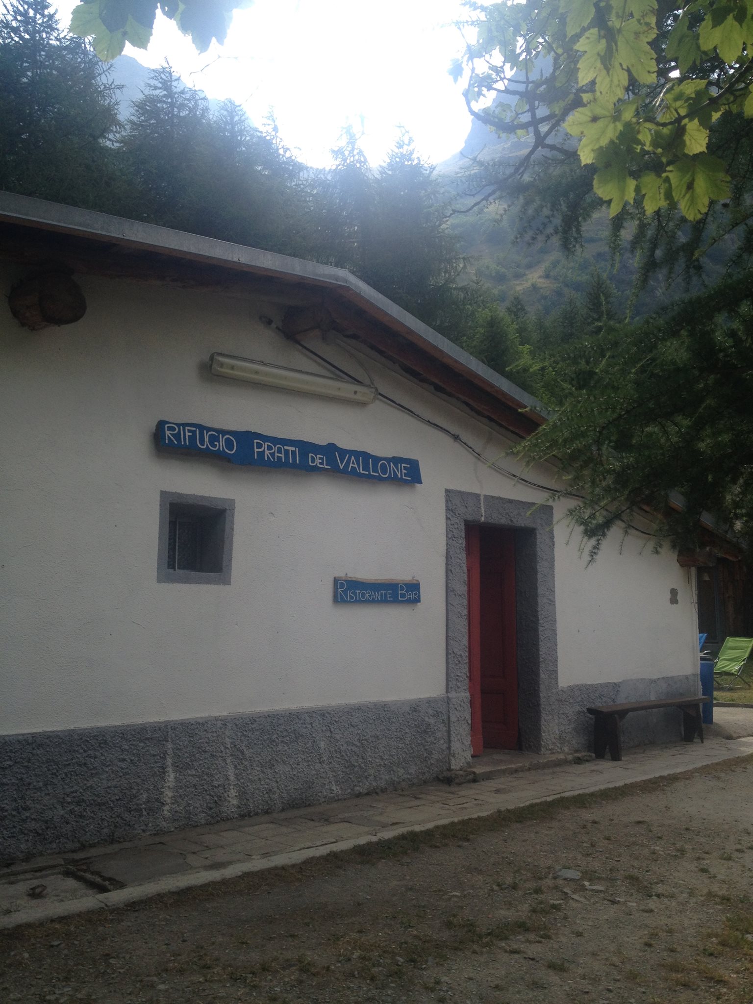 5.2Km
5.2Km
Rifugio Prati del Vallone Rifugio
Pietraporzio
7.2Km
Agri Bistrot Pecora Nera Ristorante
Pietraporzio
8.7Km
Gardetta Rifugio
Canosio
8.8Km
L’Oste d’oc Ristorante
Pietraporzio
9.1Km
Ostello Centosentieri Albergo
Pietraporzio
9.2Km