3.9Km
3.9Km

Note
 50m
50m
50m
50m
2.5Km
2.5Km
2.5Km
2.5Km
2.5Km
2.5Km
50m
50m
50m
50m
2.5Km
2.5Km
2.5Km
2.5Km
2.5Km
2.5Km
La cresta integrale di Peuterey rappresenta un’ascensione unica nelle Alpi: un totale di 4500 metri di dislivello, di scalata su roccia come su ghiaccio, di difficoltà, di discese in doppia. Questa combinazione stupenda è senza dubbio il modo più bello di percorrere la cresta di Peuterey: ad una magnifica arrampicata su roccia, seguono un’audace discesa in doppia e il percorso estremamente vario di una cresta senza rivali nelle Alpi (guida Vallot).
Ascensione lunga e impegnativa, anche se mai tecnicamente difficile, rappresenta un vero viaggio alpinistico, con alcuni reali pericoli oggettivi. Questi sono rappresentati dalla discesa in doppia sul versante nord (se si incastrano, molto difficile se non impossibile risalire in molti tratti), pericolo di caduta sassi sulle doppie (soprattutto con altre cordate presenti), nell’attraversamento delle Dames Anglaises e sul Grand Pilier d’Angle, attraversamento di affilate creste nevose, possibile presenza di ghiaccio nel tratto finale.
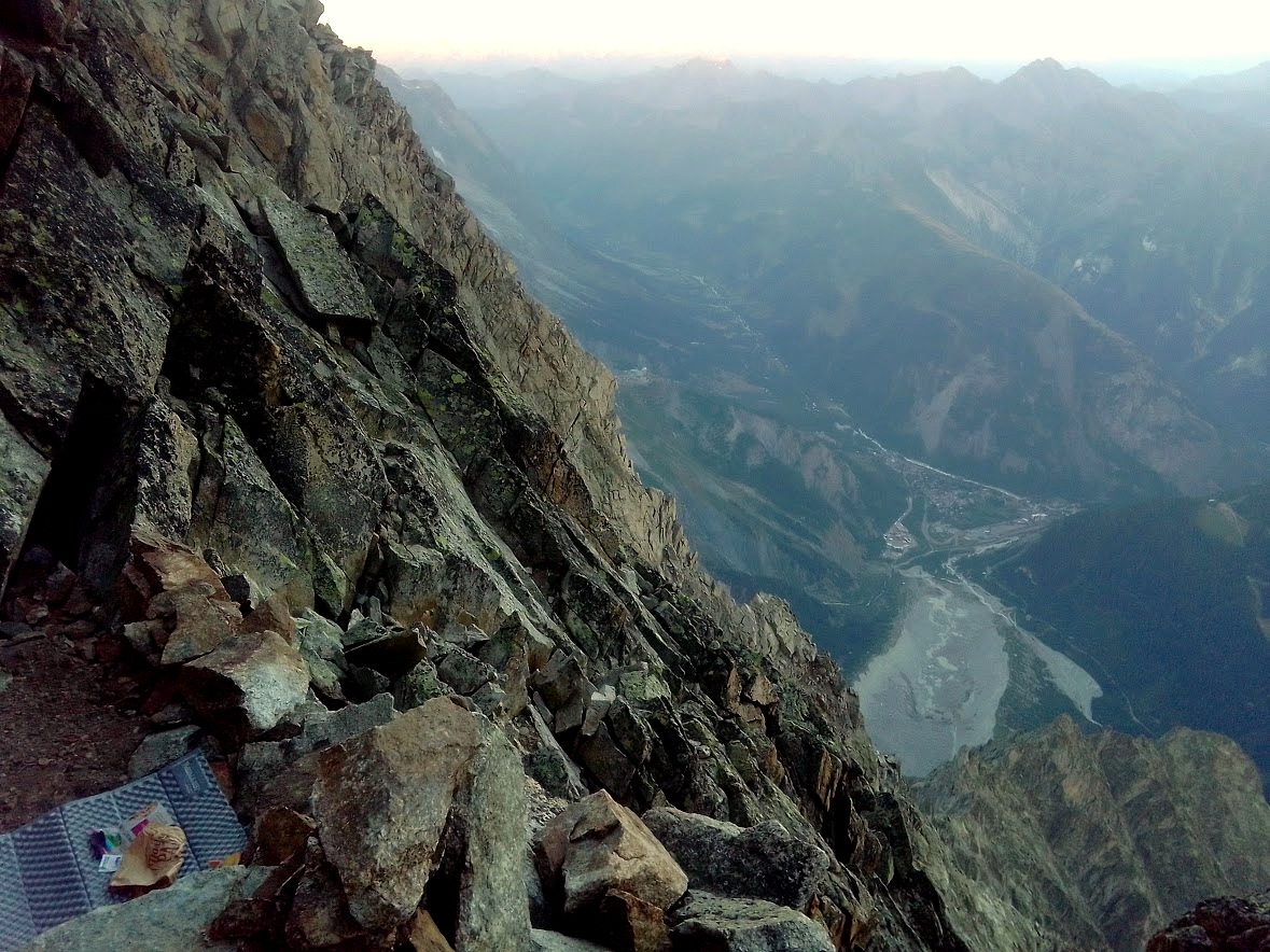
Arrivare in giornata al Craveri è difficile, prevedere dunque un paio di bivacchi (partendo dal Borelli).
L’acqua si trova molto difficilmente e dipende molto dalla stagione e quindi dalla presenza di neve. In genere si trova alla Breche Centrale, difficilmente al Craveri (senza coperte e materassi), e poi verso la calotta della Blanche. Tenere in considerazione l’aspetto acqua.
Fondamentale il tempo ultra stabile per tutti i giorni dell’ascensione.
Le scappatoie, scesi dalla Noire, sono poche, difficili, e pericolose.
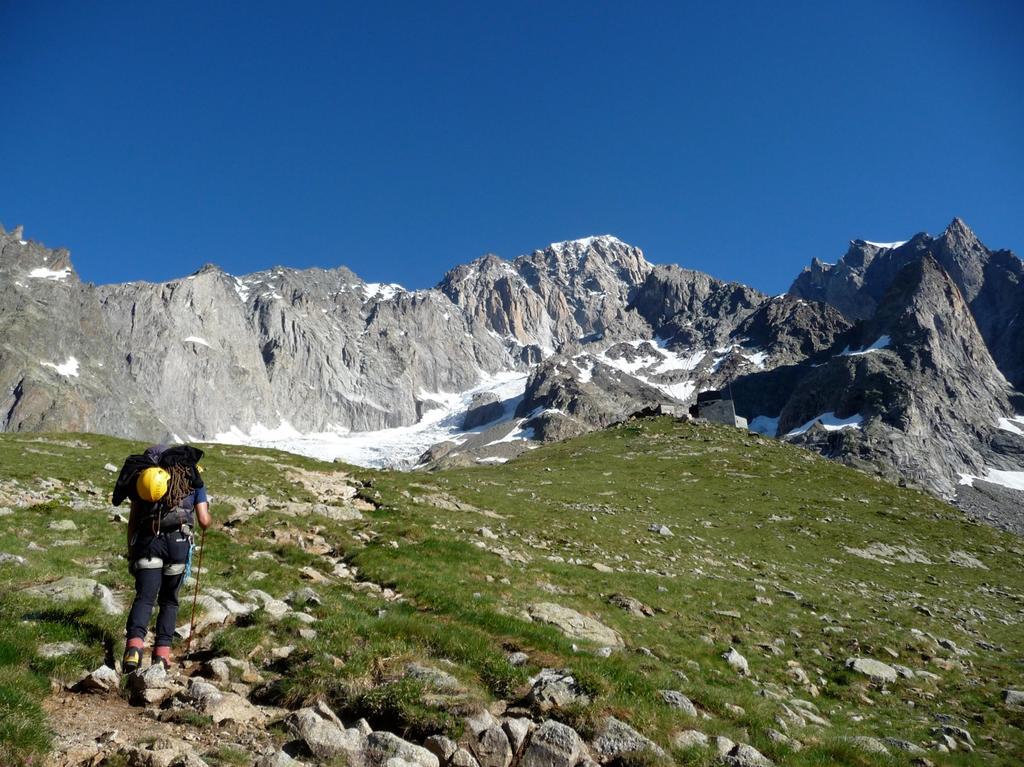
Avvicinamento
Ascensione lunga e impegnativa, anche se mai tecnicamente difficile, rappresenta un vero viaggio alpinistico, con alcuni reali pericoli oggettivi. Questi sono rappresentati dalla discesa in doppia sul versante nord (se si incastrano, molto difficile se non impossibile risalire in molti tratti), pericolo di caduta sassi sulle doppie (soprattutto con altre cordate presenti), nell’attraversamento delle Dames Anglaises e sul Grand Pilier d’Angle, attraversamento di affilate creste nevose, possibile presenza di ghiaccio nel tratto finale.
Arrivare in giornata al Craveri è difficile, prevedere dunque un paio di bivacchi (partendo dal Borelli).
L’acqua si trova molto difficilmente e dipende molto dalla stagione e quindi dalla presenza di neve. In genere si trova alla Breche Centrale, difficilmente al Craveri (senza coperte e materassi), e poi verso la calotta della Blanche. Tenere in considerazione l’aspetto acqua.
Fondamentale il tempo ultra stabile per tutti i giorni dell’ascensione.
Le scappatoie, scesi dalla Noire, sono poche, difficili, e pericolose.
Courmayeur, Val Veny, Portud
Descrizione
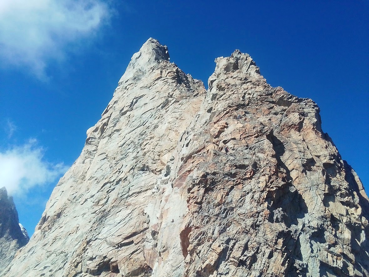
L’ascensione comprende la scalata della cresta sud dell’Aiguille Noire du Peuterey, la discesa in doppia dal versante nord, l’attraversamento delle Dames Anglaises, la risalita verso le Aiguille Blanche du Peuterey passando sotto il Pic Gugliermina, la risalita al Grand Pilier d’Angle e la risalita fino in vetta al Monte Bianco di Courmayeur e quindi alla vetta principale.
Percorrere tutta la cresta sud dell’Aiguille Noire du Peuterey (vedi itinerario Cresta Sud su Gulliver).
Appena sotto la madonnina di vetta (circa 5-10 m), reperire il primo ancoraggio delle doppie del versante nord (chiodi). Attenzione a non prendere le doppie della forcelletta prima della vetta (quelle sono le calate della Ovest). Effettuare sempre doppie corte, reperendo (attualmente) quelle dotate di moschettone. Scendere, dopo circa tre doppie, un po’ a sx (faccia a monte), per reperire profondo camino che porta alle cenge sottostanti la Breche delle Dames Anglaises. Circa 12 doppie.
Risalire il canalone (non andare alla Breche Sud), spostandosi progressivamente a sx, fino a giungere sotto il profondo camino della Punta Casati. Noi siamo saliti per circa 100/150 metri, poi, dove è presente una fettuccia, ci siamo spostati per una cengetta che taglia la parete da dx vs sx (non continuare nel camino!), effettuato un paio di tiri e quindi reperito la prima delle due doppie che portano alla Breche Centrale (si può anche giungere più facilmente, probabilmente, dallo speroncino di sx senza fare camino più cengetta).
Dalla Breche Centrale risalire con 2-3 tiri di corda l’Isolee, quindi con 2-3 doppie giungere al bivacco Craveri.
Spostarsi a sx per delle cenge, quindi andare verso le cenge Schneider e risalire il terreno fino sotto il Pic Gugliermina (stare a dx, non percorrere il canalone sotto la breche della punta).
Risalire in cresta, fare una breve doppia e quindi risalire vs dx per circa 100 m (versante Brenva) e quindi piegare a sx per andare in cresta (versante Freney), fino a raggiungere la neve dell’Aiguille Blanche di Peuterey.
Raggiungere la Punta Centrale, e, per una cresta molto aerea, raggiungere la punta NW. Calarsi con 4 doppie, saltando la terminale, e raggiungere il Col du Peuterey.
Da qui, superare la terminale del Grand Pilier d’Angle, a volte molto difficile, per risalire tutto il versante di questo (più o meno al centro), puntando al Grand Gendarme.
Si può evitare il Grand Pilier d’Angle per il couloir Eccles (se in condizioni), ma così facendo si svicolerà parte dell’integrale. Aggirare il Grand Gendarme sulla dx (passando dietro), e quindi, raggiungere la cresta nevosa. Percorrerla tutta, non stare mai nel canale pendio in alto (pericolo reale di caduta sassi, visti di persona), ma stare sempre sulla cresta.
A 4500 circa, in prossimità di rocce affioranti, andare a sx, breve passaggio su roccia, e quindi ancora cresta nevosa fino a bucare la cornice terminale (che può opporre ancora problemi) del Monte Bianco di Courmayeur. Quindi in vetta al Bianco.
- Bibliografia:
- Guida Vallot - Neige, glace e mixte di F. Damilano
Nelle vicinanze Mappa
Itinerari
18/08/2023 AO, Courmayeur D+ 300 m TD- Sud
Gamba (Pic) Cresta Sud – Via Plat
 50m
50m
29/01/2022 AO, Courmayeur D+ 1470 m ED Nord-Ovest
Peuterey (Aiguille Noire de) – Supercouloir de Peuterey
 50m
50m
22/08/2024 AO, Courmayeur D+ 2200 m TD Sud
Peuterey (Aiguille Noire de) – Cresta Sud
 50m
50m
26/07/2020 AO, Courmayeur D+ 1600 m TD+ Ovest
Peuterey (Aiguille Noire de) – Via Ratti-Vitali
 50m
50m
28/06/2026 AO, Courmayeur D+ 1600 m AD+ Sud-Ovest
Croux (Aiguille) – Via Cheney alla Cresta SO
 2.5Km
2.5Km
19/07/2010 AO, Courmayeur D+ 3400 m TD+ Sud-Est
Bianco (Monte) Pilier nord de Freney – Via Gervasutti
 2.5Km
2.5Km
12/08/2021 AO, Courmayeur D+ 2600 m AD Est
Bionnassay (Aiguille de) Cresta Est
 2.5Km
2.5Km
10/07/2023 AO, Courmayeur D+ 3250 m D Sud
Bianco (Monte) Cresta del Brouillard integrale
 2.5Km
2.5Km
02/07/2021 AO, Courmayeur D+ 400 m TD+ Sud-Est
Brouillard (Pilastro Rosso del) – Via Bonatti-Oggioni
 2.5Km
2.5Km
09/08/2024 AO, Courmayeur D+ 3400 m ED- Sud-Est
Bianco (Monte) Pilone Centrale Freney – Via classica
 2.5Km
2.5Km