 2.1Km
2.1Km
Note
 1.6Km
2Km
5.4Km
5.9Km
6.4Km
6.4Km
6.4Km
1.6Km
2Km
5.4Km
5.9Km
6.4Km
6.4Km
6.4Km
2.1Km
2.1Km
2.2Km
4.5Km
5.9Km
5.9Km
6.3Km
6.6Km
6.9Km
7.5Km
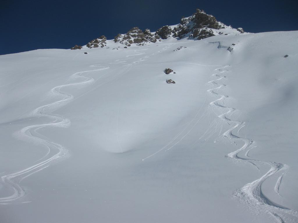
Il fuoripista si svolge a sinistra della seggiovia Sauze-Sportinia, risulta a mio parere più tecnico ed interessante del Barracano. Itinerairo stranamente poco battuto nonostante la vicinanza alla seggiovia di Sportina, probabilemnte a causa del cucuzzolo da aggirare, eh sembra sbarrarne l'accesso.
Avvicinamento
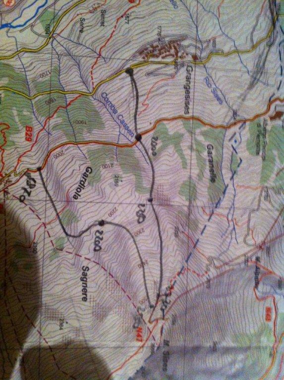
Si parte da Sportinia (2140 m) raggiungile con le Seggiovie Sauze-Sportinia e Jovenceaux-Sarnas-Sportinia, nonché scendendo da Rocce Nere o da Capanna Mollino (Seggiovia da "Lago Nero" da Clotes alta).
Descrizione
Da Sportinia (2140 m), scendere a lato del campo scuola per uscire sui bei pendii di moderata pendenza fino alla stradina di collegamento fra la 11 e la pista 12 che scende a Sarnas. Superata questa aggirare un cucuzzolo (2050 m) e affacciarsi su un pendio molto ripido con qualche piccola balza rocciosa, ben visibile anche dalla seggiovia.
Qui si ha il tratto molto tecnico e molto bello. Tenedosi a destra risulta molto ripido ma più breve; a destra é inizialmente meno ripido, poi con un tratto assai ripido e complessivamente più lungo; al centro l’ ingresso é su un meraviglioso canalino. Il pendio termina a 1920 m sulla stradina che collega Sarnas con Pian della Rocca.
Si prosegue quindi per bei pendii traversando a destra, fino a raggiungere la seggiovia intorno a quota 1780 m. Da qui si può scendere a piacimento a destra o a sinistra per boscaglie fitte e bei prati finali, fino alla partenza della seggiovia (1560 m), da cui si riparte per il secondo giro.
Da quota 1920 é anche possiible scendere a sinistra fino a Jovenceuax (1392 m), si incontrano bei prati in basso ma occorre fare attenzione a boscglie e tratti ripidi privi di neve. Tenersi tutto a sinistra.
- Cartografia:
- Fraternali N°2, IGC N°1 -Valli di Susa, Chisone e Germanasca
Nelle vicinanze Mappa
Itinerari
22/12/2012 TO, Sauze D'oulx D+ 1110 m 3.2, E1 Nord-Ovest
Rio Nero
 1.6Km
1.6Km
15/12/2012 TO, Sauze D'oulx D+ 1029 m 3.2, E2 Nord
Barracano
 2Km
2Km
24/12/2025 TO, Sestriere D+ 1000 m 3.1, E1 Nord
Sestriere Boschi
 5.4Km
5.4Km
23/12/2016 TO, Pragelato D+ 1000 m 3.1, E1 Nord
Pragelato Fuoripista Vari
 5.9Km
5.9Km
12/03/2013 TO, Sestriere D+ 595 m 3.1, E1 Sud-Est
Basset (Col) dal Fraiteve
6.4Km
22/12/2012 TO, Sestriere D+ 580 m 3.2, E1 Sud-Ovest
Sises (Monte) discesa a Bessen Haut
 6.4Km
6.4Km
14/02/2018 TO, Sestriere D+ 720 m 3.2, E1 Ovest
Grangesises dal Sises
 6.4Km
6.4Km
23/01/2015 TO, Sestriere 3.1, E1 Varie
Sestriere Pali della luce, Sotto Rognosa, Colombiere
 6.4Km
6.4Km
10/03/2013 TO, Cesana Torinese D+ 1720 m 3.1, E1 Sud
Alpes (Granges des) da San Sicario
7.8Km
01/12/2012 TO, Sestriere D+ 540 m 1.1, E1 Sud
Chalmettes – Rollieres da San Sicario
7.9Km
Servizi
2.1Km
2.1Km
paddy mc ginty Ristorante
Sauze d'Oulx
2.2Km
L’Cantun B&B
Sauze D'oulx
4.5Km
La Moretta Ristorante
Oulx
5.9Km
La capanna del sole Ristorante
Pragelato
5.9Km
Al Mulino Ristorante
Pragelato
6.3Km
La Chardouse Rifugio
Oulx
6.6Km
Arlaud Rifugio
Salbertrand
6.9Km
Il Covo di nord ovest Ristorante
Salbertrand
7.5Km


