 2.6Km
2.6Km
Note
 50m
50m
50m
2.5Km
2.5Km
3.4Km
3.4Km
4.2Km
5.6Km
5.6Km
50m
50m
50m
2.5Km
2.5Km
3.4Km
3.4Km
4.2Km
5.6Km
5.6Km
2.6Km
6Km
6Km
6.2Km
6.9Km
7.3Km
7.6Km
7.6Km
7.6Km
8.2Km
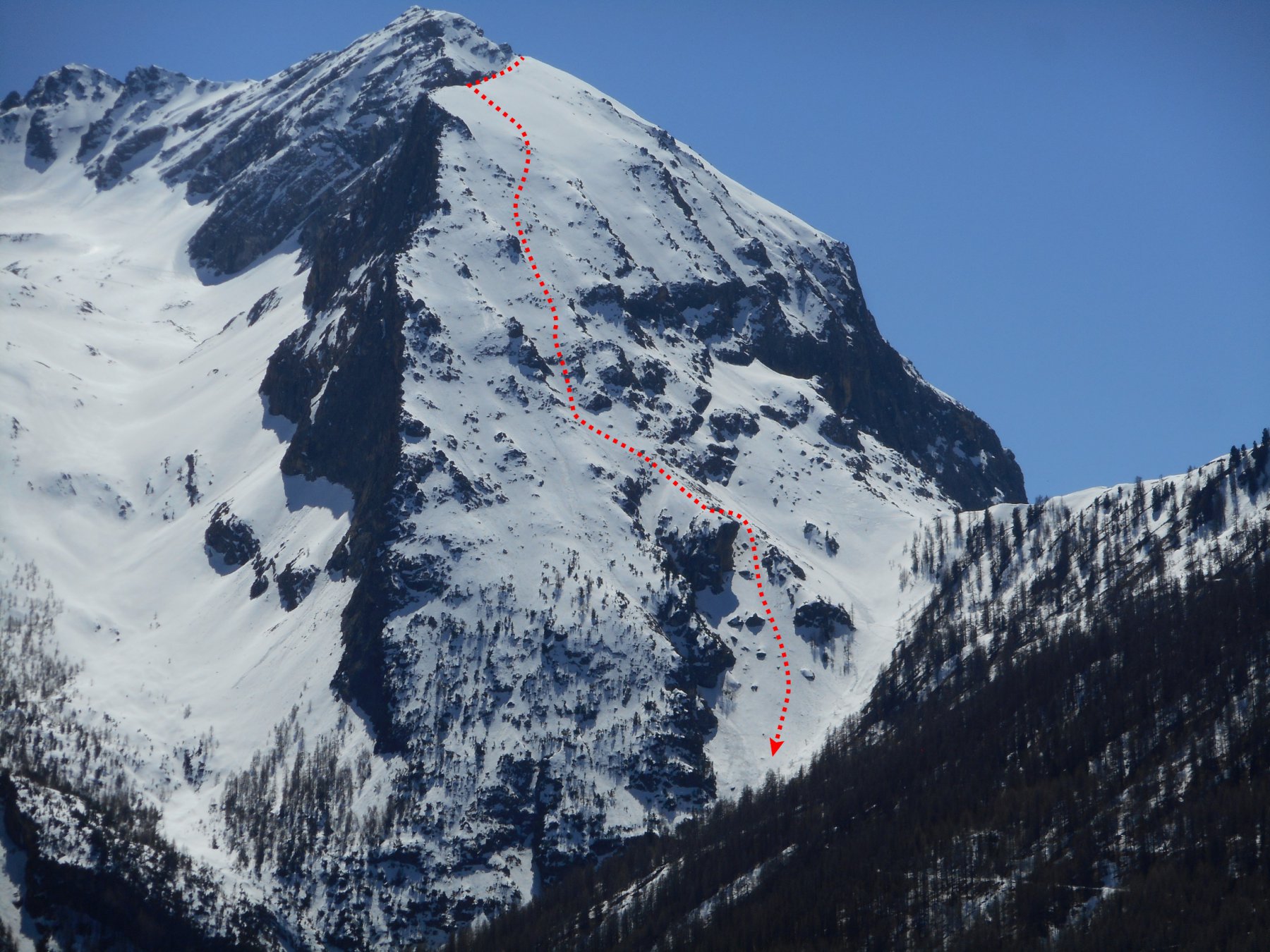
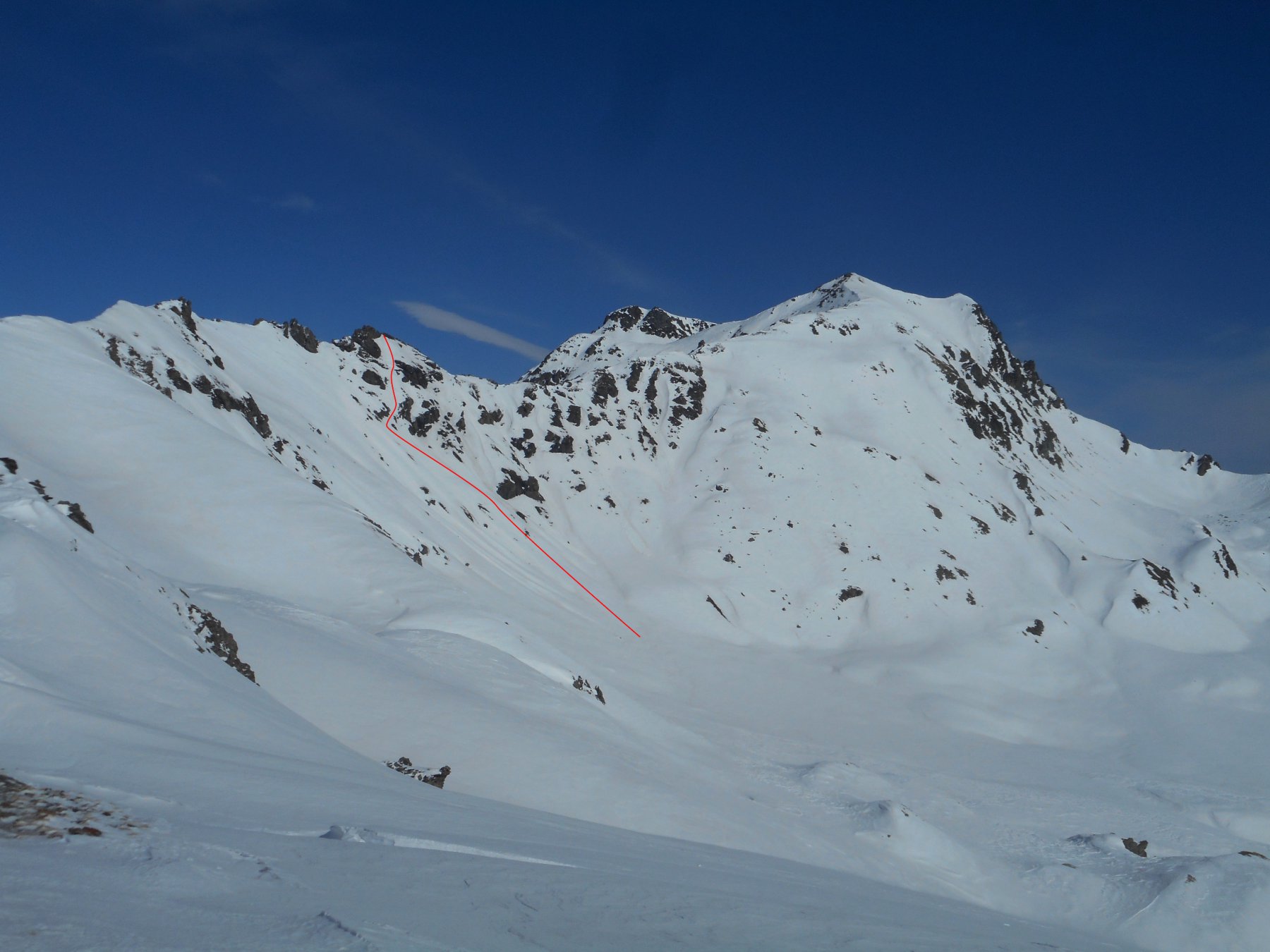
5.1/E3 su 400 m. - max. 50°/55°
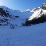
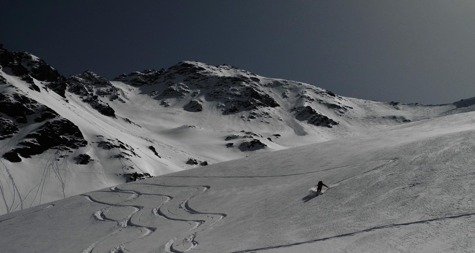
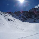
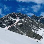
Itinerario in traversata che risale il classico versante-canale NO e con discesa di una delle pareti più belle e complesse della val Chisone.
Avvicinamento
Itinerario in traversata che risale il classico versante-canale NO e con discesa di una delle pareti più belle e complesse della val Chisone.
.
Descrizione
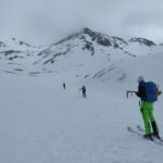
Da Sestriere risalire il vallone del Chisonetto fino in punta alla Rognosa.
Dalla punta scendere pochi metri sul versante-canale NO affacciandosi ad una forcella a ridosso dell’antecima settentrionale.
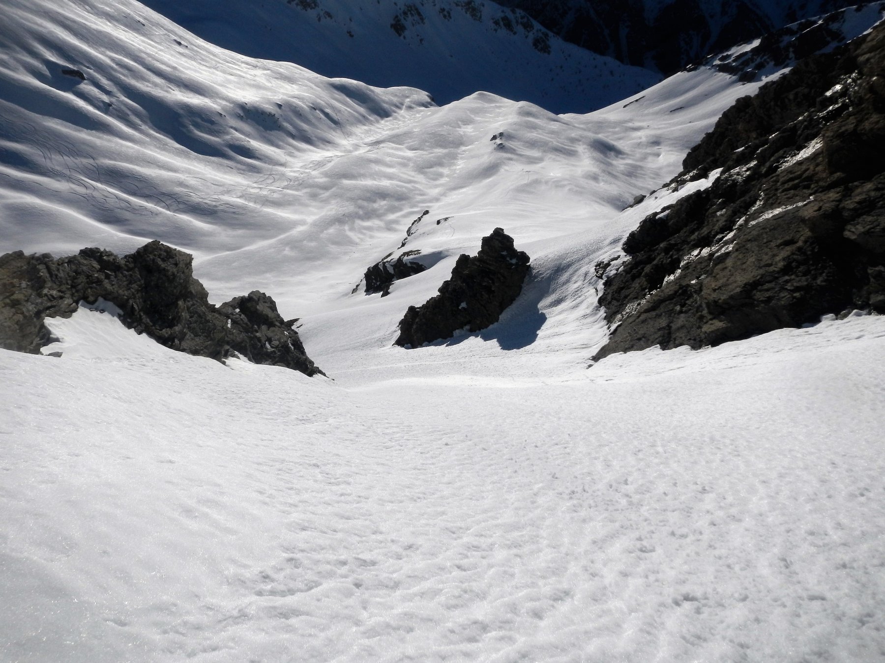
Da qui ci si immette in un canale in ambiente dolomitici (45° max) che termina su un salto.
Poco sopra il salto piegare a dx e superare una marcata cornice (50°-55°) scendendo la rampa esposta che segue.
A metà rampa immettersi in pieno pendio (45°) e seguirlo fin sopra la bastionata basale, che si aggira con qualche attenzione nella ricerca dei passaggi nel settore meridionale della parete (40°, tratti più ripidi).
Nelle vicinanze Mappa
Itinerari
23/02/2025 TO, Sestriere D+ 620 m I, 4.1, E1 Nord-Est
Querellet (Monte) – Monte Sises, itinerari vari della dorsale
 50m
50m
01/05/2022 TO, Sestriere D+ 800 m II, 3.3, E1 Nord-Est
San Giacomo (Rocce di) da Sestriere per il vallone del Chisonetto
 50m
50m
24/05/2026 TO, Sestriere D+ 1235 m I, 4.1, E2 Nord-Ovest
Rognosa del Sestriere (Punta) Canale e Parete NO
 50m
50m
08/03/2026 TO, Sestriere D+ 1170 m I, 3.3, E2 Sud-Ovest
Rouit (Rocce del) Paretina Sud
 2.5Km
2.5Km
03/01/2022 TO, Sauze di Cesana D+ 1179 m II, 3.3, E2 Sud-Ovest
Platasse (Monte) da Bessen Haut per la Paretina Sud
 2.5Km
2.5Km
08/04/2023 TO, Sauze di Cesana D+ 1625 m III, 5.1, E2 Nord-Est
Serpentiera (Punta) Canale NE
 3.4Km
3.4Km
23/05/2025 TO, Sauze di Cesana D+ 1620 m II, 4.2, E2 Nord-Est
Pelvo (Cima del) Canale Morandini
 3.4Km
3.4Km
16/04/2017 TO, Sauze di Cesana D+ 1230 m 4.3, E3 Nord-Ovest
Furgon (Monte) Parete NO
 4.2Km
4.2Km
24/02/2017 TO, Pragelato D+ 1430 m II, 4.2, E2 Sud
Vallonetto (Punta) Pendio Sud
 5.6Km
5.6Km
15/02/2025 TO, Pragelato D+ 1580 m III, 4.3, E4 Est
Pignerol (Monte) Canalino SE (l’Eiclapeuiro) dalla Val Troncea
 5.6Km
5.6Km
Servizi
2.6Km
6Km
Al Mulino Ristorante
Pragelato
6Km
La capanna del sole Ristorante
Pragelato
6.2Km
Mulino di Laval Rifugio
Pragelato
6.9Km
Centro Ristorante
Cesana Torinese
7.3Km
La Fontana del Thures Rifugio
Cesana Torinese
7.6Km
da Carlo Rifugio
Cesana Torinese
7.6Km
La Tana degli Orsi B&B
Cesana Torinese
7.6Km
La Crota B&B
Cesana Torinese
8.2Km


