6Km
6Km

Note
 650m
2.8Km
2.8Km
3Km
5Km
6.1Km
6.2Km
6.2Km
650m
2.8Km
2.8Km
3Km
5Km
6.1Km
6.2Km
6.2Km
6Km
7.2Km
7.2Km
7.3Km
8.4Km
8.6Km
8.7Km
8.7Km
8.7Km
8.8Km
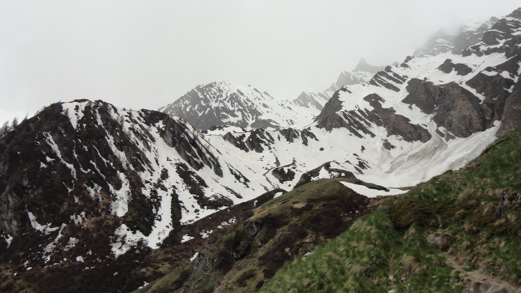
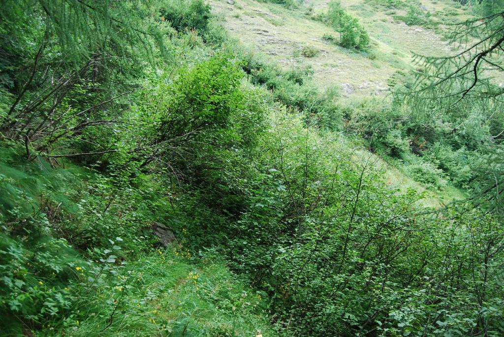
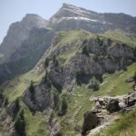
Sarebbe una bella traversata sul sentiero n. 17, che corre in costa ed è una splendida balconata sulla media Val di Rhemes. Purtroppo però il sentiero oggi versa in stato di totale abbandono. Da Plampra fino all’Alpe di Zette si riesce a salire, su percorso abbastanza visibile; dopo però il sentiero si interrompe, franato in più punti ed invaso dalla più fitta della vegetazione. TRAVERSATA QUINDI DA NON INTRAPRENDERE !! in attesa che, se mai sarà, venga ripristinato il sentiero.
Avvicinamento
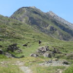
Risalire la Val di Rhemes, passare l'abitato di Rhemes St. Georges, dopo la galleria di Proussaz voltare a destra e risalire fino ai ruderi di Plampra.
Descrizione
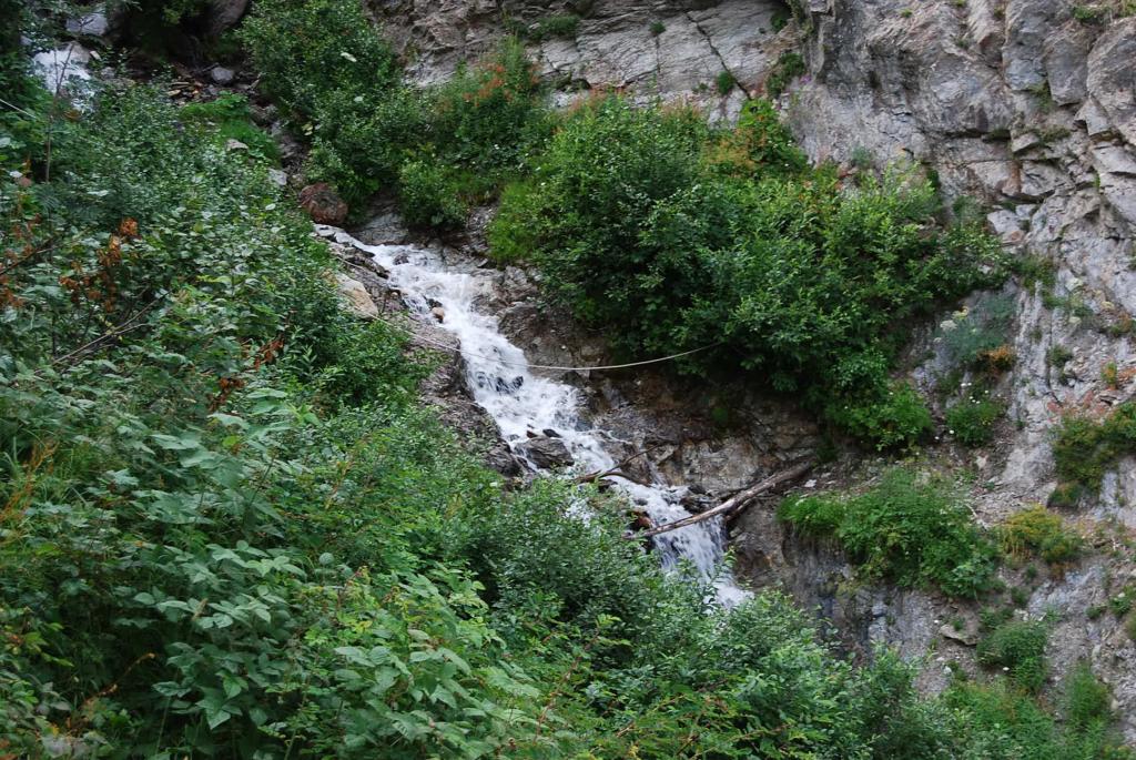
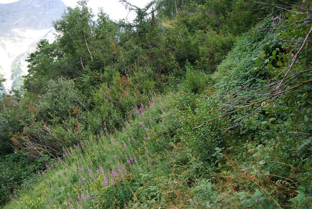
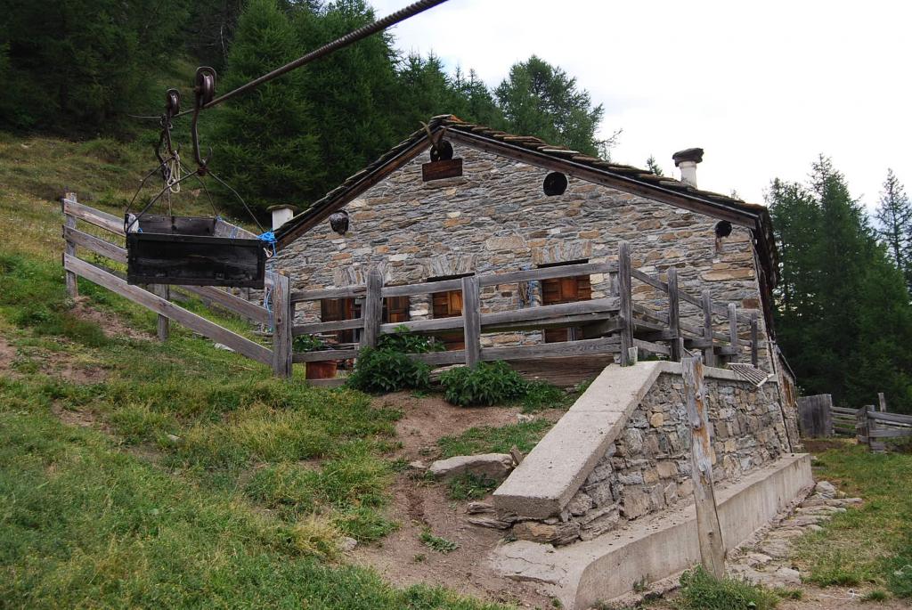
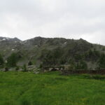
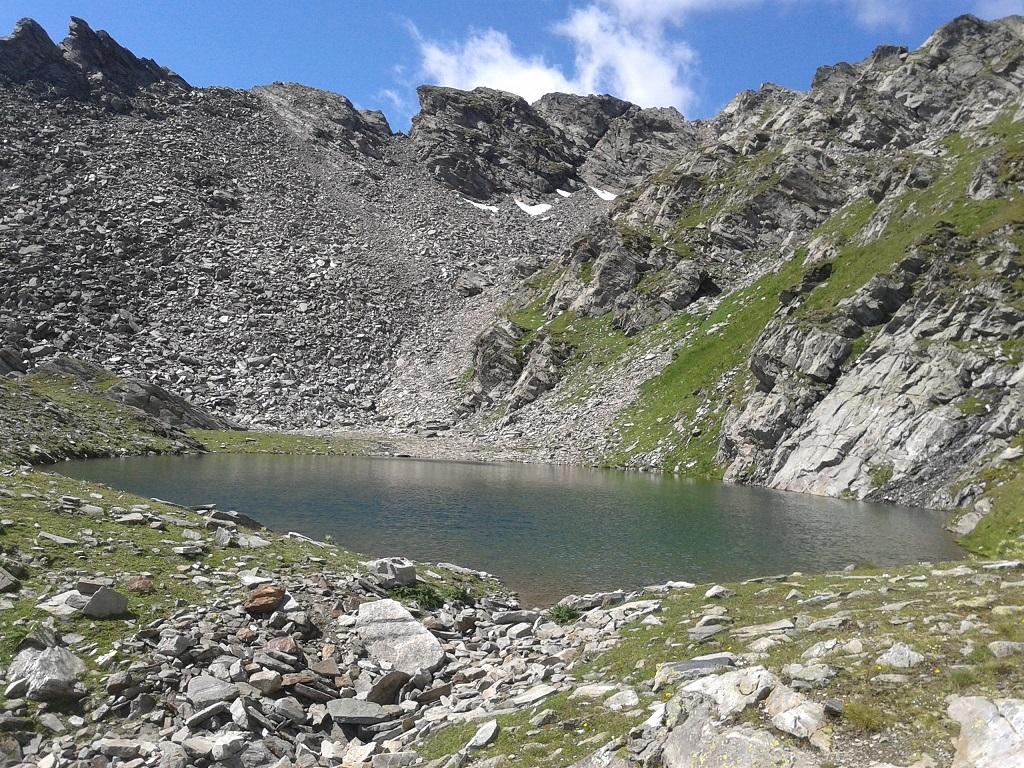
Passato l’abitato di Mugnoz e lasciati a sinistra i ruderi di Plampra si arriva alla curva dove parte – a destra salendo, palina con indicazione – il sentiero n. 17C per Balme. Si sale prima lungo una pista inerbita; questa poi diventa sentiero e, attraversando tratti erbosi, arriva al torrente di Prochetty: ignorare il ramo che scende (destra) al corso d’acqua, proseguire invece rimanendo sulla riva destra. Si arriva al bivio con il sentiero n. 17, si prende il ramo di destra, si costeggia un rudere e si ritorna in breve al torrente Prochetty che va ora attraversato; una fune aiuta il passaggio. Proseguendo in costa si arriva ad un secondo torrente, per l’attraversamento si consiglia di risalirlo per un tratto arrivando ad un guado agevole; passato il torrente ci si ritrova all’Alpe di Zette, con la sua caratteristica teleferica che scende a Plampra. Conviene interrompere qui l’escursione. Volendo invece proseguire, si segue ancora il sentiero costeggiando il caseggiato, si attraversa un primo torrente e si arriva a un tratto franato ed invaso dagli arbusti, dove non conviene andare oltre.
Difficoltà. Almeno per il tratto percorribile il sentiero è abbastanza visibile, e dopo la partenza vi sono anche alcuni sbiaditi segni gialli che guidano fino all’Alpe di Zette. Attenzione però ai tratti esposti ed all’attraversamento dei torrenti.
Dislivello. Il dislivello totale sarebbe negativo: si parte dai 1610 m ca. di Plampra per arrivare ai 1184 di Voix; quello positivo, qui citato, è pari a 316 m (differenza tra i 1926 m dell’alpe Zette ed i 1610 m di Plampra).
- Cartografia:
- Carta L’Escursionista, Fg. 3 (Valgrisenche-Val di Rhemes), Scala 1:25000
Nelle vicinanze Mappa
Itinerari
15/08/2023 AO, Rhemes-Saint-Georges D+ 900 m EE Sud
Lor (Mont de) da Corthoud, anello
 650m
650m
03/07/2011 AO, Rhemes-Saint-Georges D+ 1493 m EE Nord
Nequedè (Passo) da Creton
1Km
11/07/2023 AO, Rhemes-Saint-Georges D+ 1063 m EE Sud-Ovest
Changier (Laghi di) da Melignon
 2.8Km
2.8Km
02/09/2025 AO, Rhemes-Saint-Georges D+ 1152 m EE/F Nord
Changier (Becca di) da Melignon
 2.8Km
2.8Km
04/07/2025 AO, Rhemes-Saint-Georges D+ 1200 m E Ovest
Paillasse (Mont) e Mont Blanc da Coveyrand
 3Km
3Km
30/06/2024 AO, Rhêmes-Notre-Dame D+ 650 m T Nord-Est
Pechoud (Casotto del PNGP) da Carrè, anello per Alpe Chaussettaz e Chanavey
 5Km
5Km
30/07/2023 AO, Rhêmes-Notre-Dame D+ 1000 m EE Sud
Changier (Laghi di) da Chanavey, giro dei Valloni di Cussuna e Feluma
 6.1Km
6.1Km
26/09/2014 AO, Rhêmes-Notre-Dame D+ 1189 m EE Sud
Cussunaz o Cussuna (Colle di) da Chanavey
6.1Km
11/10/2025 AO, Arvier D+ 420 m E Varie
Bouque (Croux de) da Les Combes
 6.2Km
6.2Km
20/06/2026 AO, Introd D+ 1661 m EE Nord-Est
Merlo (Becca del) o di Chamin da les Combes per la cresta est
 6.2Km
6.2Km
Servizi
6Km
7.2Km
Tanini Ristorante
Rhemes-Notre-Dame
7.2Km
Lo Sabot Albergo
Rhemes-Notre-Dame
7.3Km
Galisia Albergo
Rhemes-Notre-Dame
8.4Km
Paramont Albergo
Arvier
8.6Km
La Tana delle Volpi Ristorante
Valgrisenche
8.7Km
Atanor Ristorante
Arvier
8.7Km
Lo Fourquin Bar
Valsavarenche
8.7Km
Abro de la Leunna Ristorante
Valsavarenche
8.8Km