1.9Km
1.9Km


Note
 1.7Km
1.7Km
1.7Km
1.7Km
1.7Km
2.2Km
2.2Km
3Km
1.7Km
1.7Km
1.7Km
1.7Km
1.7Km
2.2Km
2.2Km
3Km
1.9Km
2.3Km
3.6Km
3.6Km
3.6Km
3.6Km
3.6Km
3.6Km
3.7Km
3.7Km
bella escursione in ambiente selvaggio e poco frequentato. Il sentiero non è sempre ben evidente e questo potrebbe essere un problema con scarsa visibilità. L’anello proposto completa una escursione già di per se interessante ma offre la possibilità di vedere l’alpe Balma e la parte terminale della Valle di Rodoretto.
Avvicinamento
Da Pinerolo, SS23 del Sestriere fino a Perosa Argentina, quindi si devia a sinistra per la Val Germanasca direzione Prali.
Poco di prima di Prali si stacca una strada sulla destra per Rodoretto. Alle prime case proseguire dritti (non salire nel centro abitato) proseguendo per una stretta stradina che diventa sterrata, in buone condizioni fino alla piana di Rimas, qualche posteggio in spiazzi erbosi.
Descrizione
Poco di prima di Prali si stacca una strada sulla destra per Rodoretto. Alle prime case proseguire dritti (non salire nel centro abitato) proseguendo per una stretta stradina che diventa sterrata, in buone condizioni fino alla piana di Rimas, qualche posteggio in spiazzi erbosi.
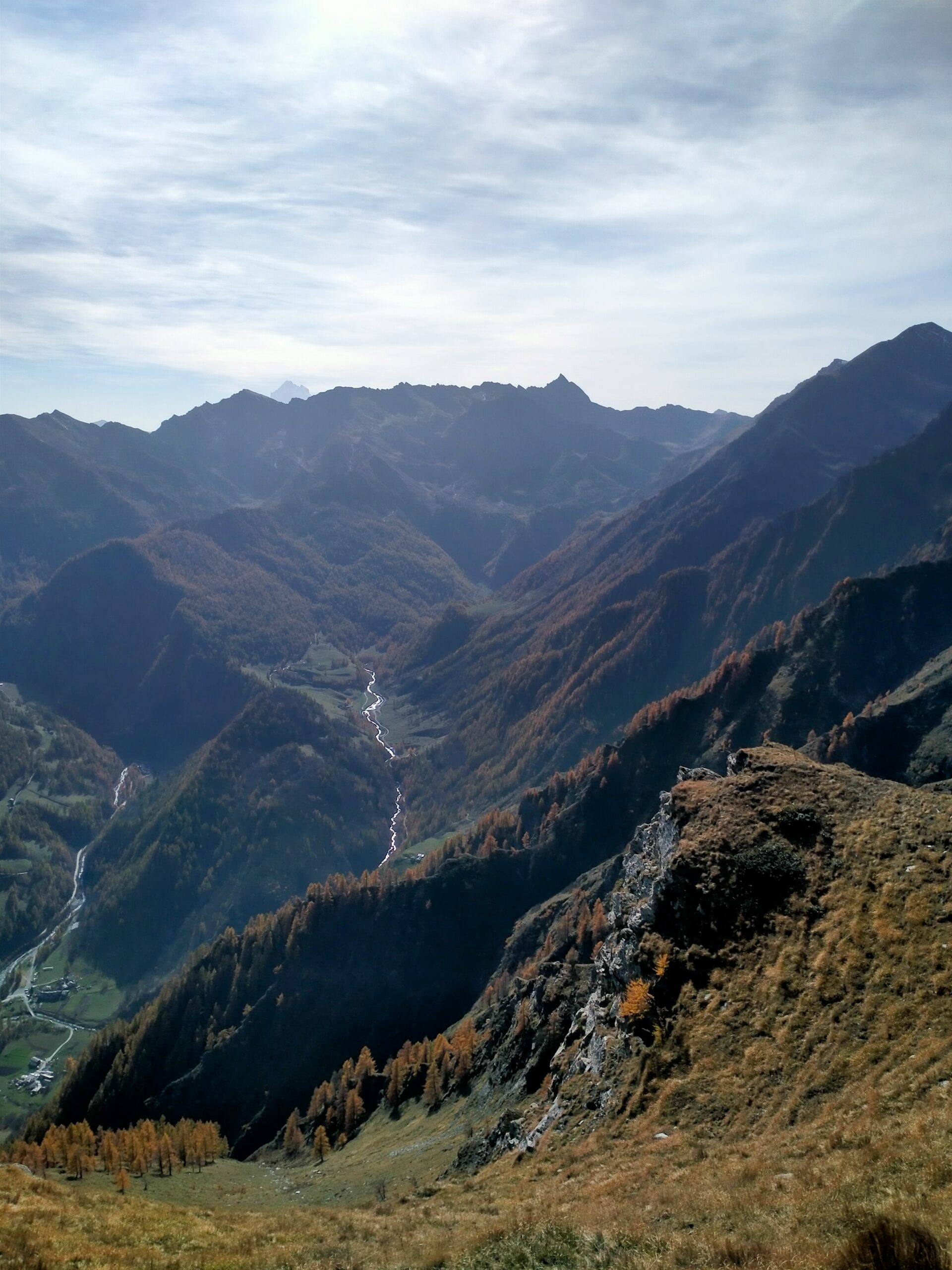
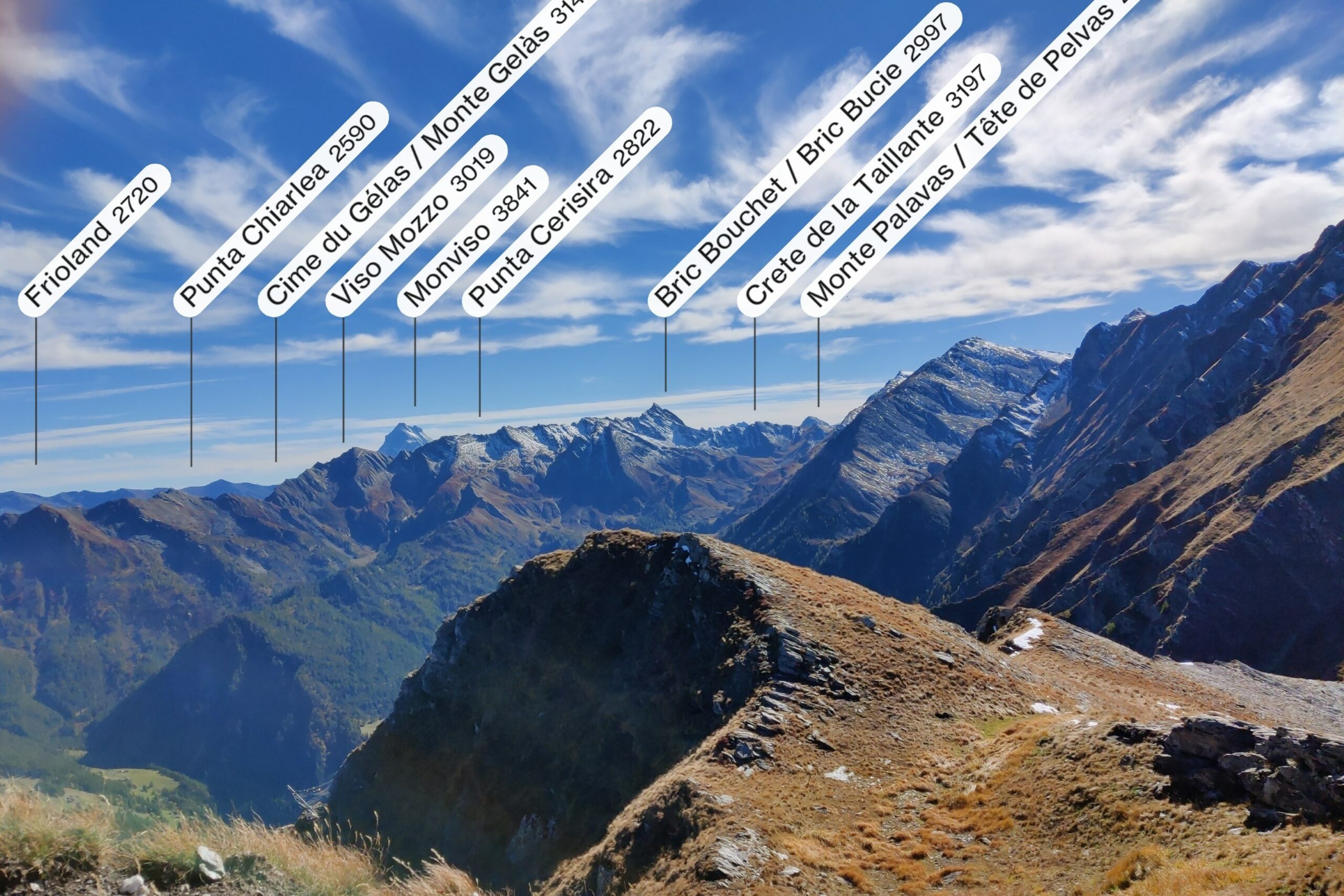
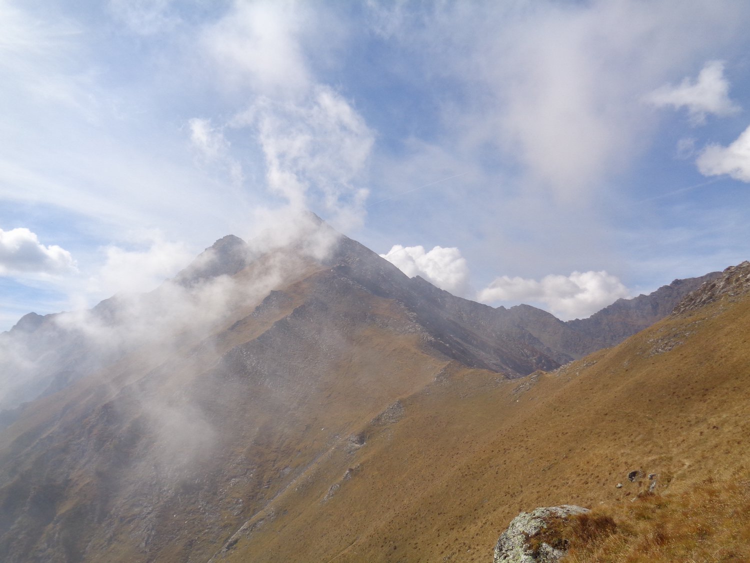
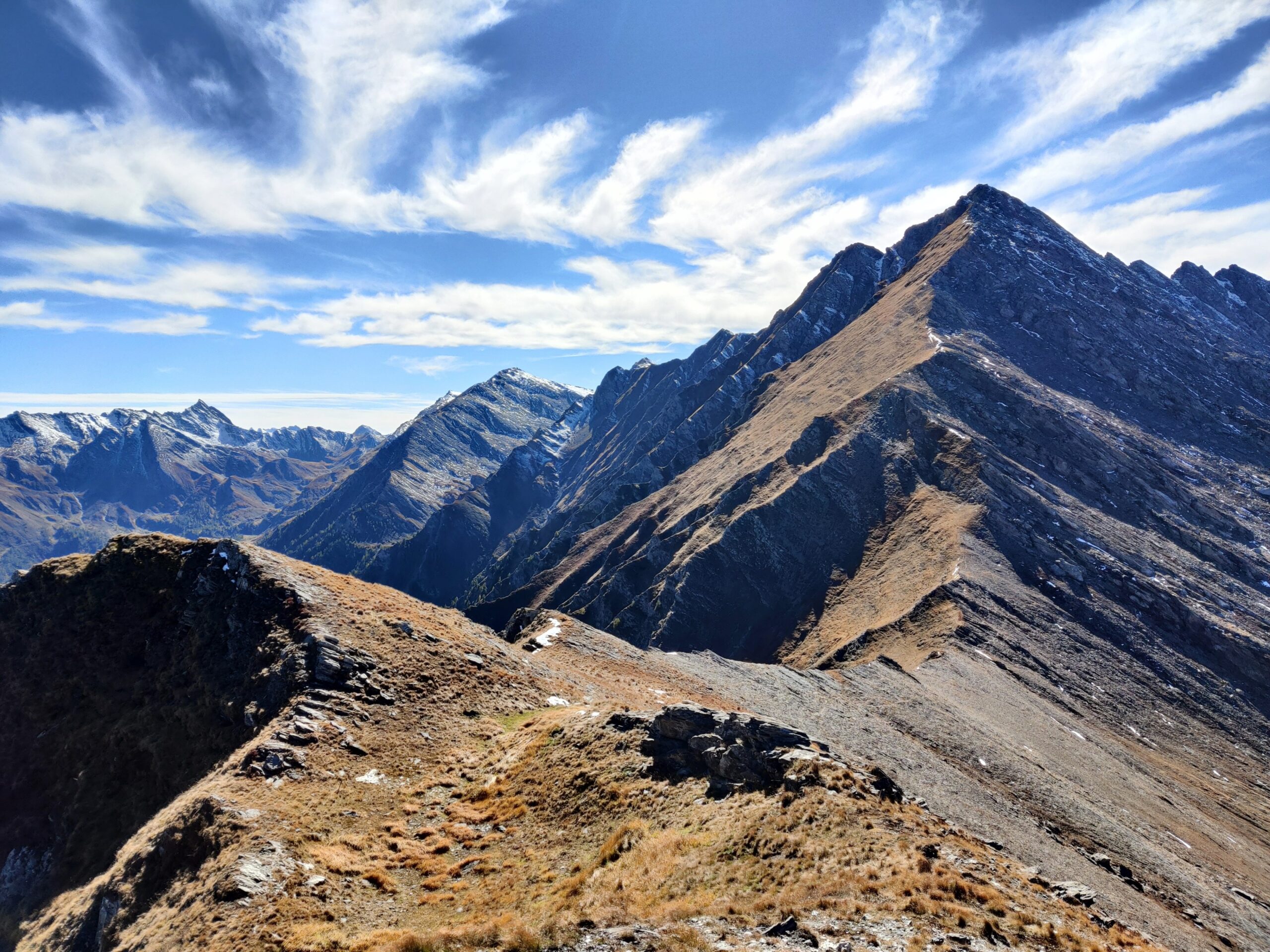
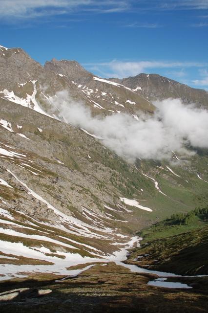
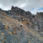
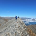
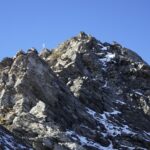
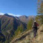
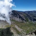
Da Rimas attraversare il torrente (ponte di legno) e seguendo il sentiero nella pineta si raggiunge prima i resti dell’alpe Prati dell’Orso poi attraversando un paio di ruscelli l’alpe Clot della Rama dove si trova un bel pianoro. Seguendo le tracce del sentiero raggiungiamo le grange La Miando 1874 m. Dopo l’alpe incrociamo il sentiero GTA per il Colle della Fontana (tacche sbiadite blu e rosse) si trova un colletto dove è presente una abbeveratoio. Qui il sentiero segue lo spartiacque con bella vista sulle cime della valle Germanasca e superate alcune strutture metalliche con lo scopo di paravalanghe raggiungiamo il Colle delle Fontane 2503 m. Voltando a destra per l’evidente e facile cresta si raggiunge la cima dove è presente un ometto.
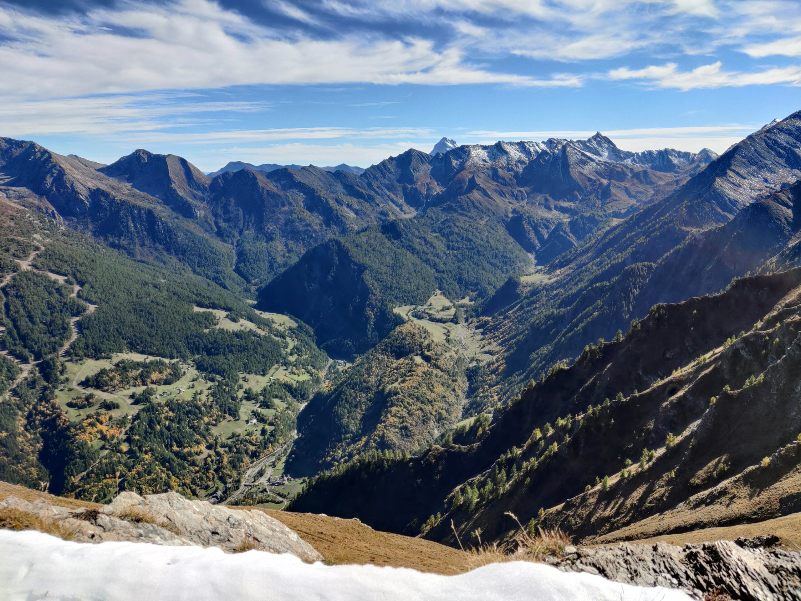
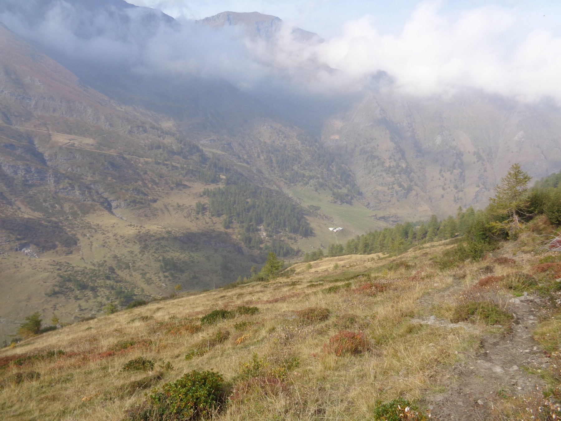
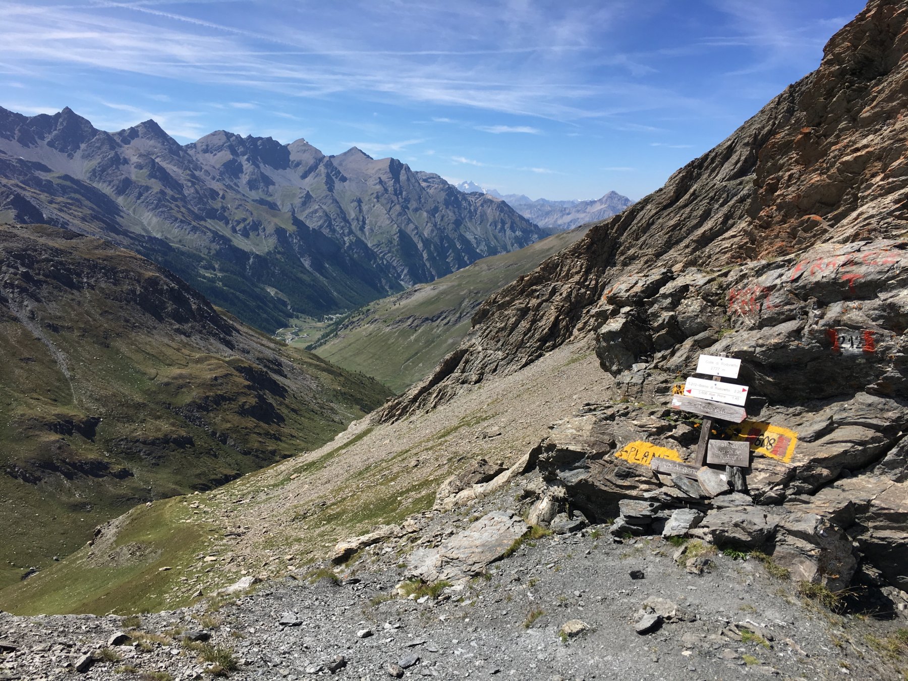
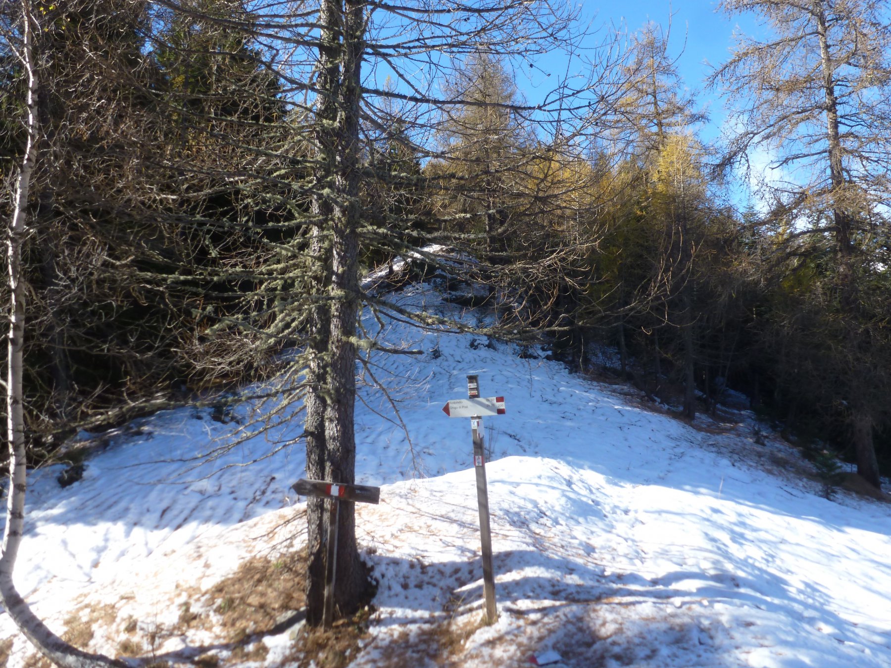
Per il ritorno, non volendo ripetere l’itinerario di salita, è possibile scendere dal Colle delle Fontane per il vallone del Rio Escafe seguendo tracce di sentiero che dovrebbe essere la continuazione del sentiero GTA, che si mantengono abbastanza evidenti sul lato destro del vallone.
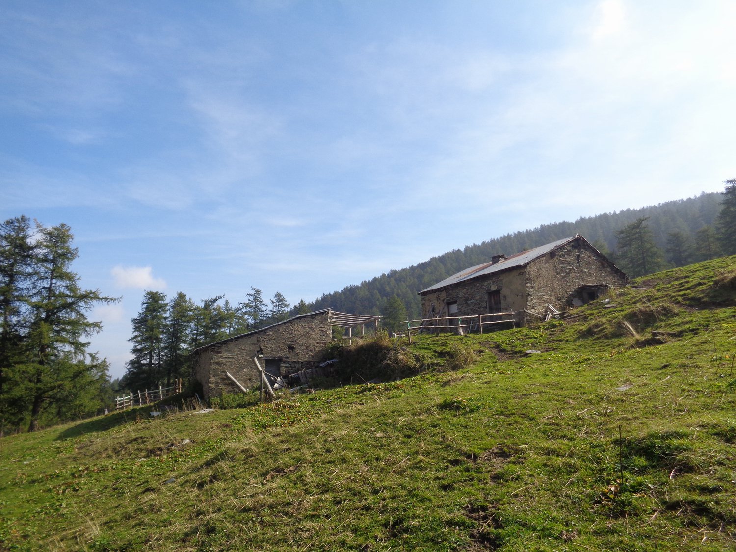
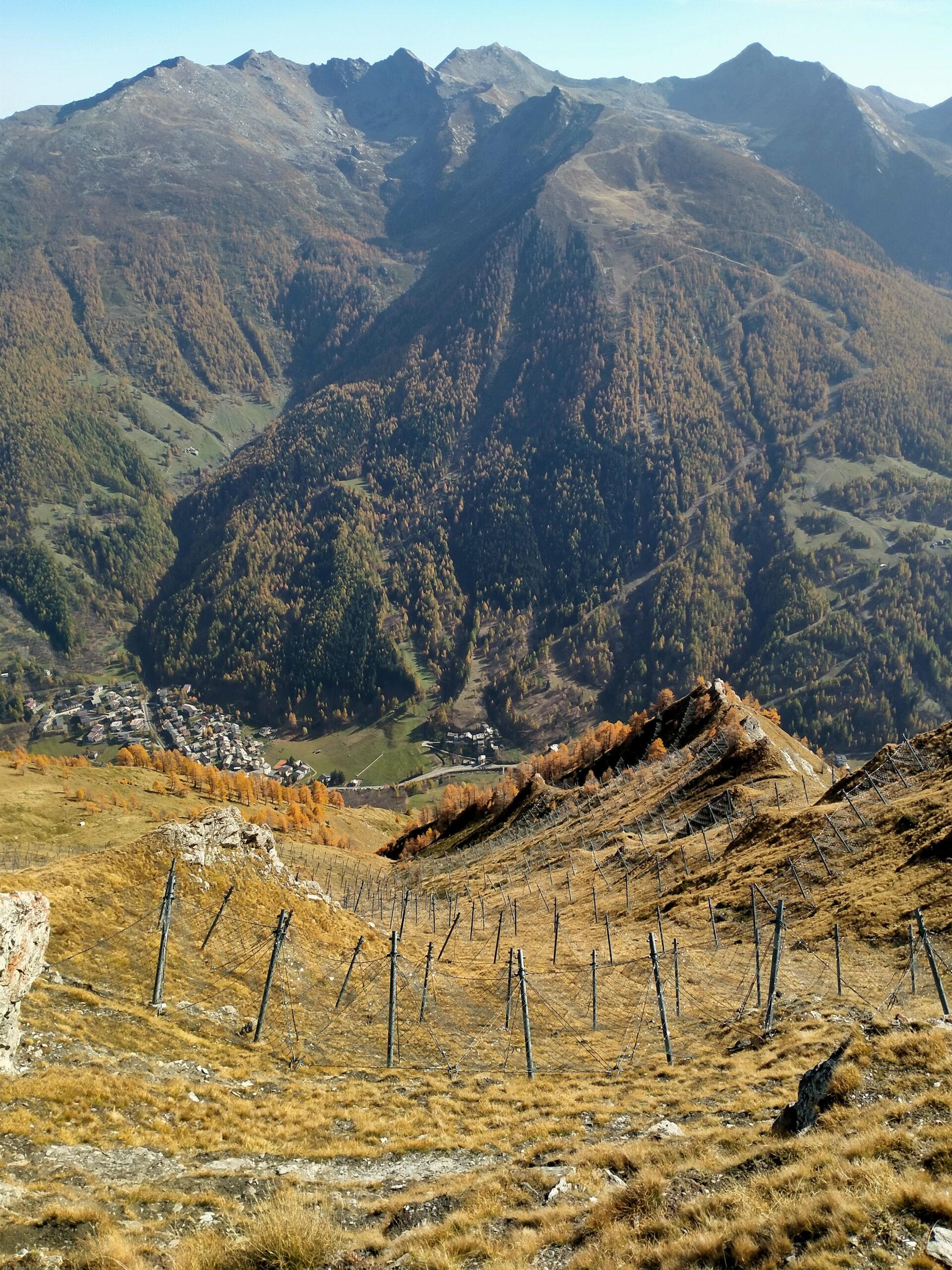
Si raggiunge una radura ai margini del lariceto con delle vasche abbeveratoio e quindi si scende a centro del vallonce che proviene dal Colle di Rodoretto, e seguendolo in discesa si incontra la strada sterrata nei pressi della Bergeria Balma a 1900 m.
Si segue la bella sterrata che in meno di 2 km porta alla frazione Balma 1713 m, e quindi ancora a Rimas per un altro km abbondante.
- Cartografia:
- IGC carta n°1 Valli di Susa Chisone e Germanasca
Nelle vicinanze Mappa
Itinerari
22/10/2022 TO, Prali D+ 1100 m EE Nord-Est
Acuta (Punta) da Balma per il Colle di Rodoretto
 1.7Km
1.7Km
20/07/2023 TO, Prali D+ 1064 m E Nord-Est
Rodoretto (Colle di) da Balma
 1.7Km
1.7Km
19/10/2025 TO, Prali D+ 1226 m EE Varie
Pignerol (Monte) da Balma per il Colle della Balma e Colle della Valletta
 1.7Km
1.7Km
19/10/2025 TO, Prali D+ 1200 m EE Varie
Lungin (Monte) da Balma per il Colle della Valletta
 1.7Km
1.7Km
02/06/2023 TO, Prali D+ 1099 m EE/F Varie
Vergia (Punta) e Monte Selletta da Balma per il Colletto delle Fontane
 1.7Km
1.7Km
14/09/2025 TO, Prali D+ 900 m E Sud
Mouton (Clot di) e Monte Truscera da Rodoretto
 2.2Km
2.2Km
12/11/2016 TO, Prali D+ 430 m E Varie
Serrevecchio (Colle di) da Rodoretto, anello per Fontane e Serrevecchio
 2.2Km
2.2Km
24/02/2007 TO, Prali D+ 1250 m EE Nord-Ovest
Rond (Bric) da Prali per la Rocca Bianca
3Km
28/06/2025 TO, Prali D+ 1667 m EE/F Sud-Est
Vergia (Punta) e Monte Selletta da Prali per il Colletto Galmont e Colletto delle Fontane
 3Km
3Km
11/08/2015 TO, Salza di Pinerolo D+ 1900 m EE Tutte
Lungin (Monte) e Monte Pignerol da Coppi per il Vallone di Salza e il Colle della Valletta
3.2Km
Servizi
1.9Km
2.3Km
Da Mafalda Ristorante
Prali
3.6Km
Nido dell’orso Ristorante
Prali
3.6Km
Del minatore Ristorante
Prali
3.6Km
Lago Verde Rifugio
Prali
3.6Km
La Brasserie Ristorante
Prali
3.6Km
Miandette di Grill B&B
Prali
3.6Km
Delle Alpi Albergo
Prali
3.7Km
Agape Rifugio
Prali
3.7Km