3.3Km
3.3Km

Note
 50m
50m
50m
50m
1.7Km
3.8Km
3.9Km
4.4Km
50m
50m
50m
50m
1.7Km
3.8Km
3.9Km
4.4Km
3.3Km
3.9Km
4.6Km
4.6Km
4.6Km
4.6Km
4.6Km
4.6Km
4.7Km
4.7Km
La difficoltà viventa un alpinistico F se si mantiene rigorosamente il "filo" di cresta
Vallone selvaggio e solitario, itinerario assai poco frequentato, panorama interessante e “insolito”.
Avvicinamento
Vallone selvaggio e solitario, itinerario assai poco frequentato, panorama interessante e “insolito”.
Da Pinerolo, SS23 del Sestriere fino a Perosa Argentina, quindi si devia a sinistra per la Val Germanasca direzione Prali.
Poco di prima di Prali si stacca una strada sulla destra per Rodoretto. Alle prime case proseguire dritti (non salire nel centro abitato) proseguendo per una stretta stradina che diventa sterrata, in ottime condizioni fino ad un pianoro (alcuni posteggi in uno spiazzo erboso) dopo Rimas a circa 1600 m (primo punto di partenza). E' presente un cartello di divieto di proseguire oltre ma è fittizio.
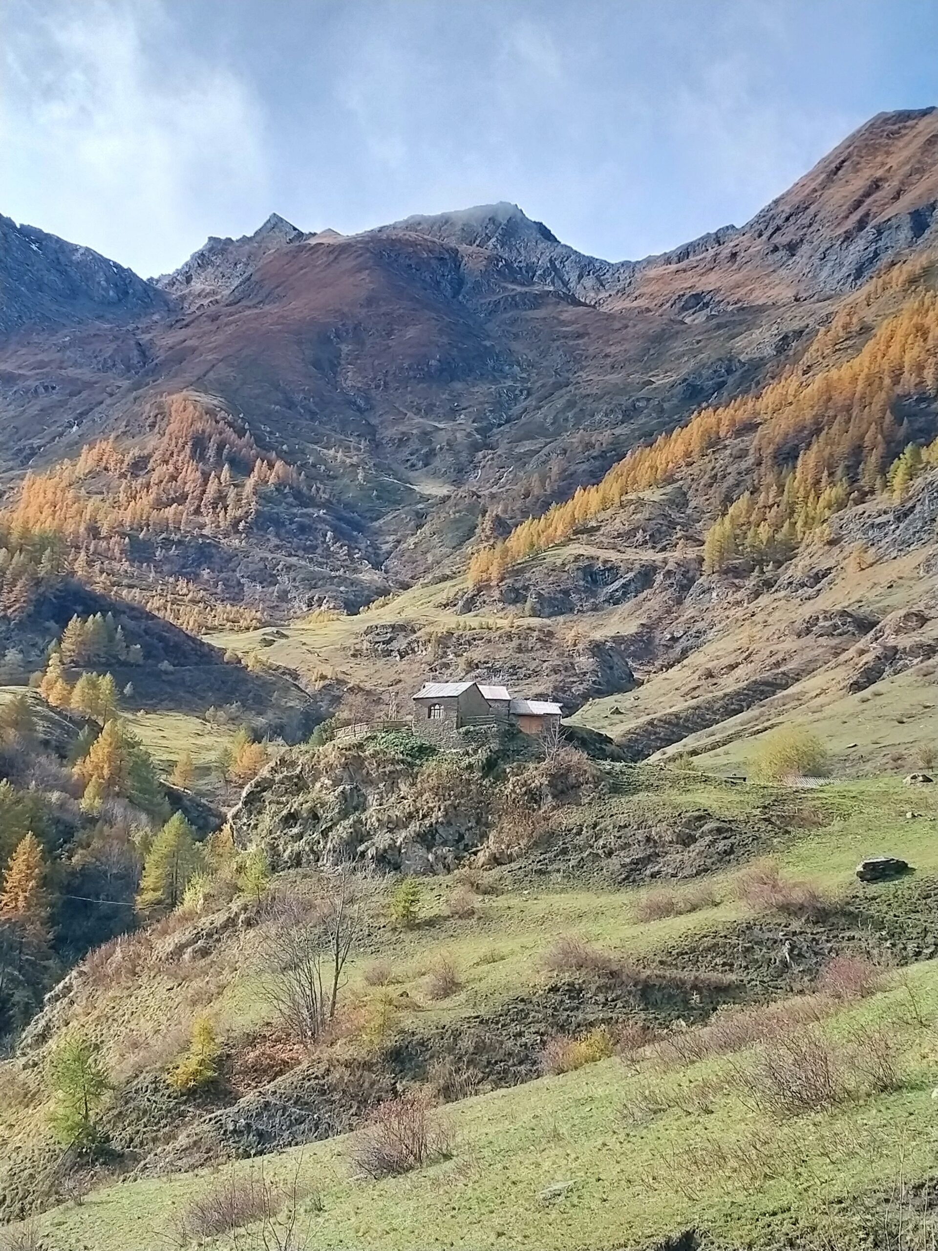
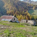
Si può quindi raggiungere il bel borgo di Balma 1713 m su un tratto di sterrata fattibile ma più sconnesso, e proseguire ancora fino alla Bergeria Balma a quasi 1900 m su una sterrata più ripida ma risistemata nel 2022.
Descrizione
Poco di prima di Prali si stacca una strada sulla destra per Rodoretto. Alle prime case proseguire dritti (non salire nel centro abitato) proseguendo per una stretta stradina che diventa sterrata, in ottime condizioni fino ad un pianoro (alcuni posteggi in uno spiazzo erboso) dopo Rimas a circa 1600 m (primo punto di partenza). E' presente un cartello di divieto di proseguire oltre ma è fittizio.
Si può quindi raggiungere il bel borgo di Balma 1713 m su un tratto di sterrata fattibile ma più sconnesso, e proseguire ancora fino alla Bergeria Balma a quasi 1900 m su una sterrata più ripida ma risistemata nel 2022.
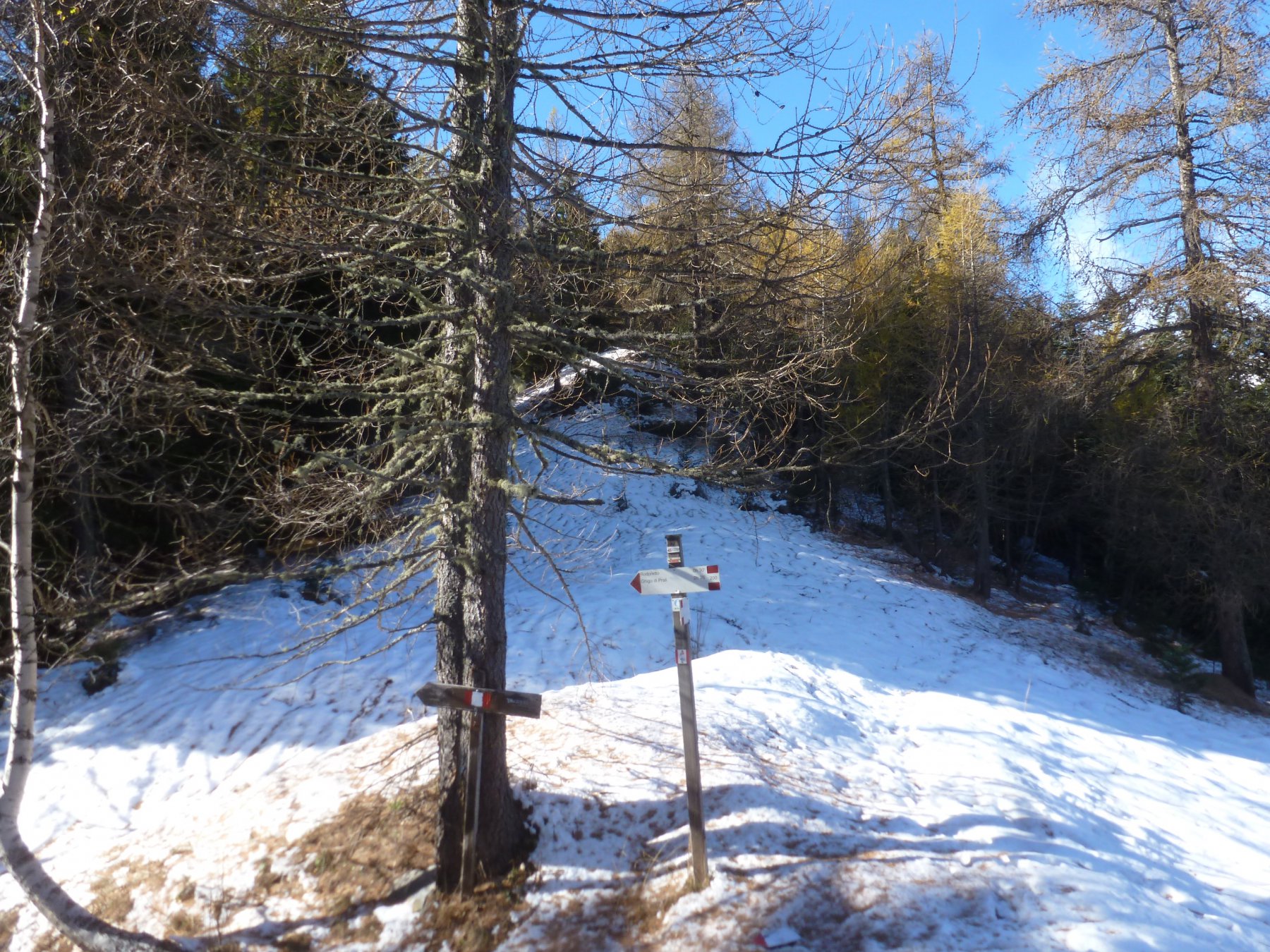
Si prosegue a piedi sulla sterrata attraversando il bell’abitato della Balma, si attraversa un ponte, e si arriva alle Bergerie della Balma 1883 m.
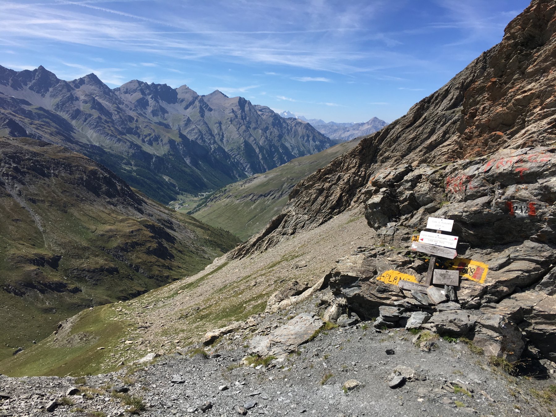
Alla fine della strada, attraversato un altro ponte, si incontra un palina lignea, indicante l’itinerario 212 “Col di Rodoretto – Lou di Rodoretto” e “Il Colle della Valletta – Lou della Valletta”. Voi dovete prendere il sentiero 212 per il Colle di Rodoretto. Ma state attenti!
I bolli successivi, che reperirete alla vostra sx, sono scorretti e tendenziosi…; per evitare di perdervi in un successivo dedalo di “sentierini dei pascoli”, “date le spalle” alla palina e al ponte e guardate in direzione Ovest sul pendio erboso dinanzi voi, in prossimità di due larici e un roccone, potete vedere un bollo, e soprattutto, la traccia di un sentiero che taglia in diagonale in direzione Nord, quindi trascurate l’abbondante segnaletica, che porta in direzione Sud verso il torrente e proseguite per reperire il sentiero, ben presto troverete un bollo e la successiva segnaletica.
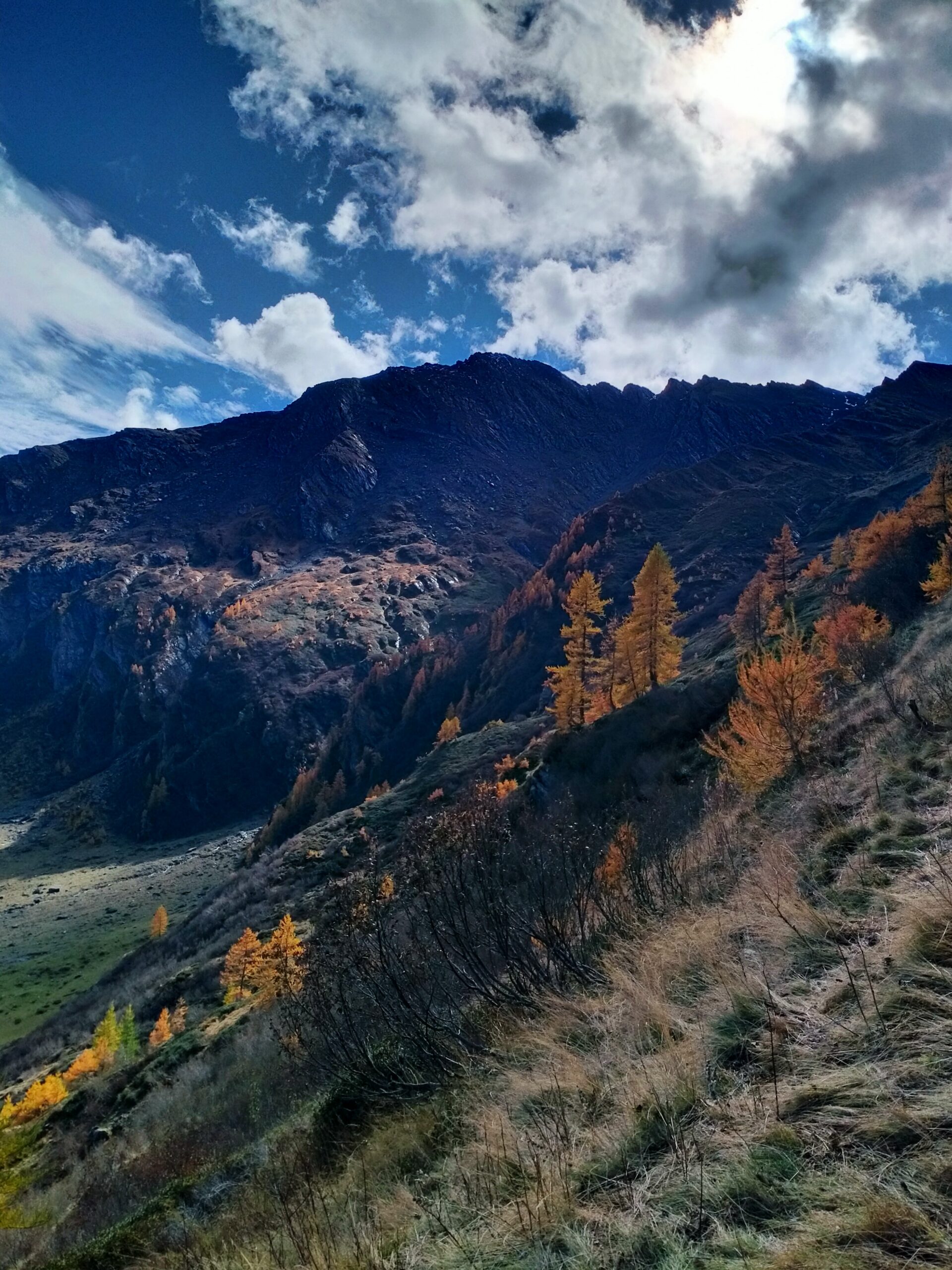
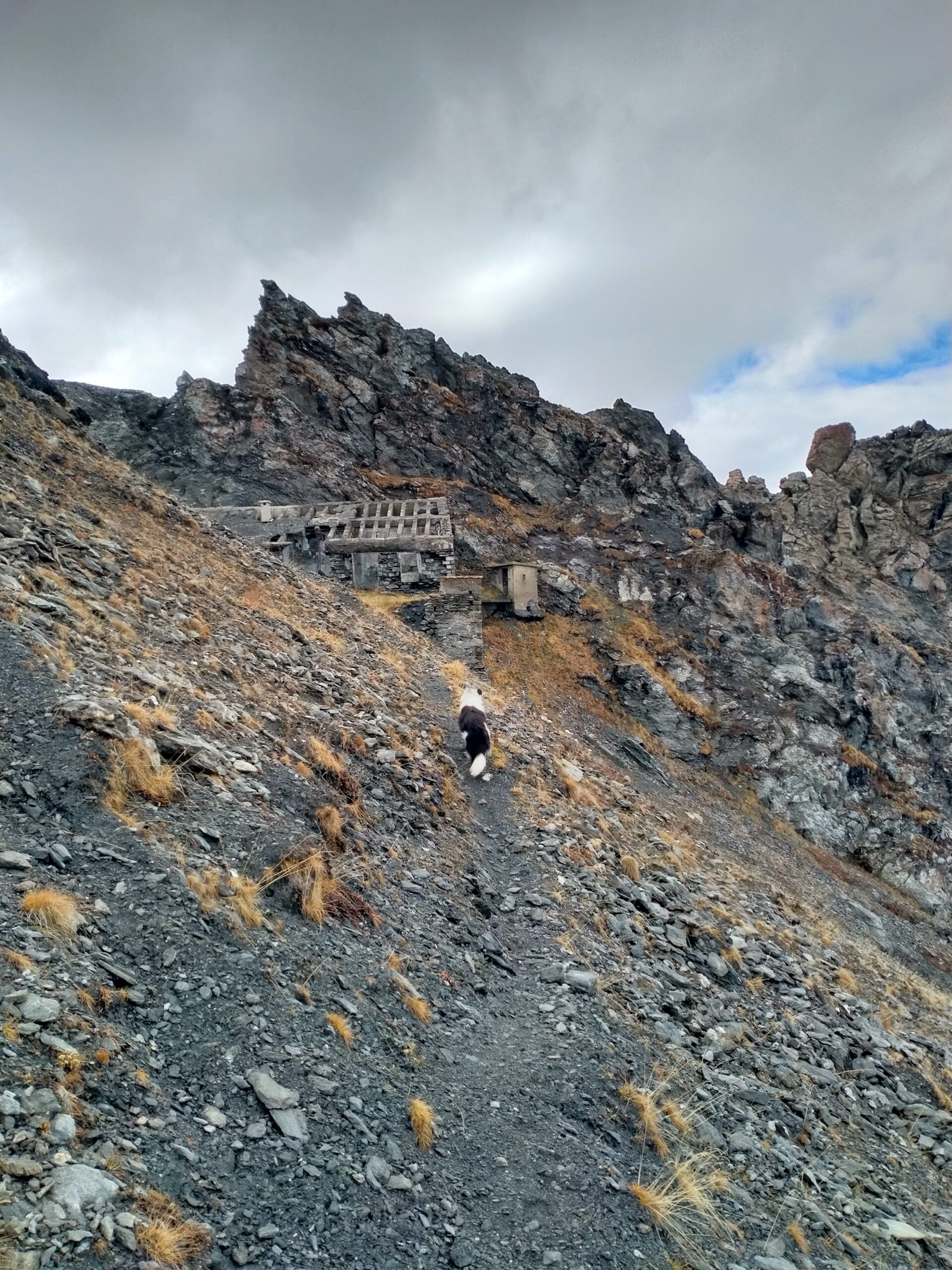
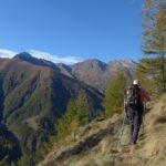
Il sentiero, inizialmente va in direzione Nord, ma poi piega verso Sud Ovest in direzione del Colle all’interno del bosco di conifere. Ben presto con regolari e ampie svolte si esce dal bosco, guadagnando con lunghi traversi, i costoloni erbosi di Punta della Capra, Poi con un ennesimo lungo traverso si entra nella conca finale-pietrosa, che scende dal Colle di Rodoretto, segnalato dal ben visibile, ricovero sottostante, abbarbicato a un roccone.
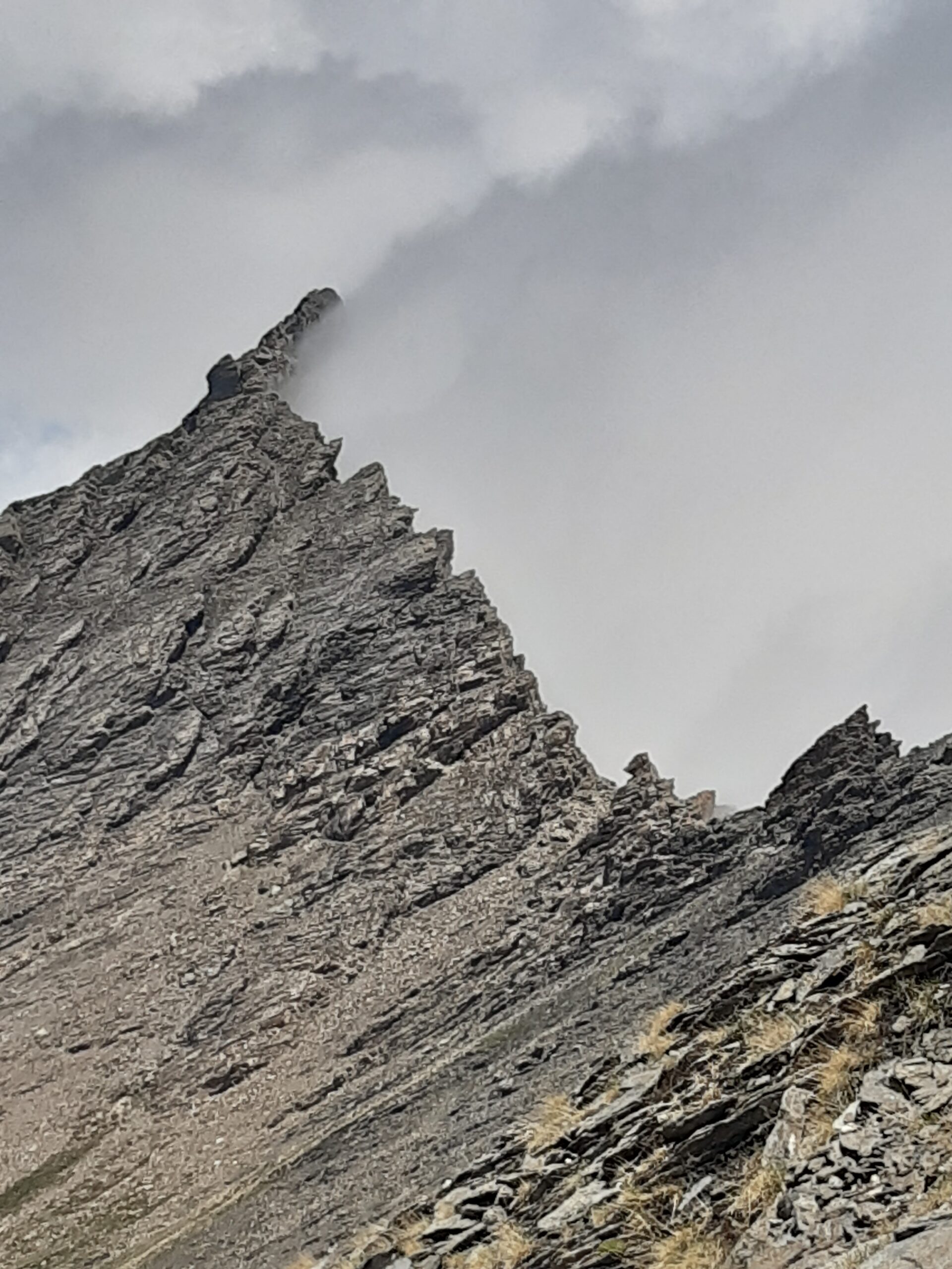
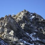
Ben presto il sentiero diventa sfasciume-pietraia, ma sale abbastanza dolcemente e con ampie svolte (segnaletica e traccia ben visibile). In breve con ultimo “strappo” si incontra il ricovero e si arriva al colle di Rodoretto (2829 mt).
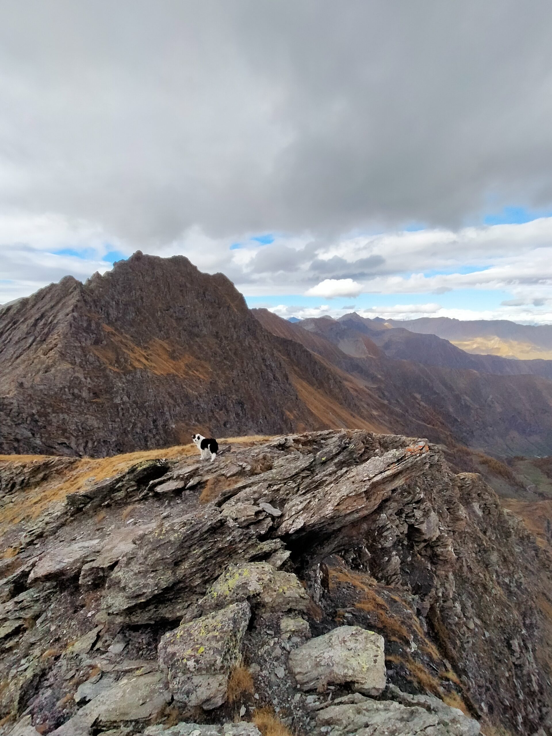
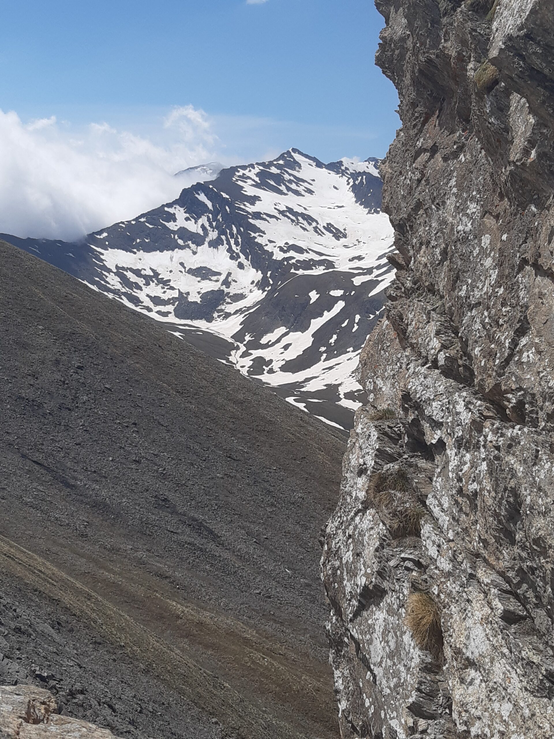
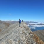
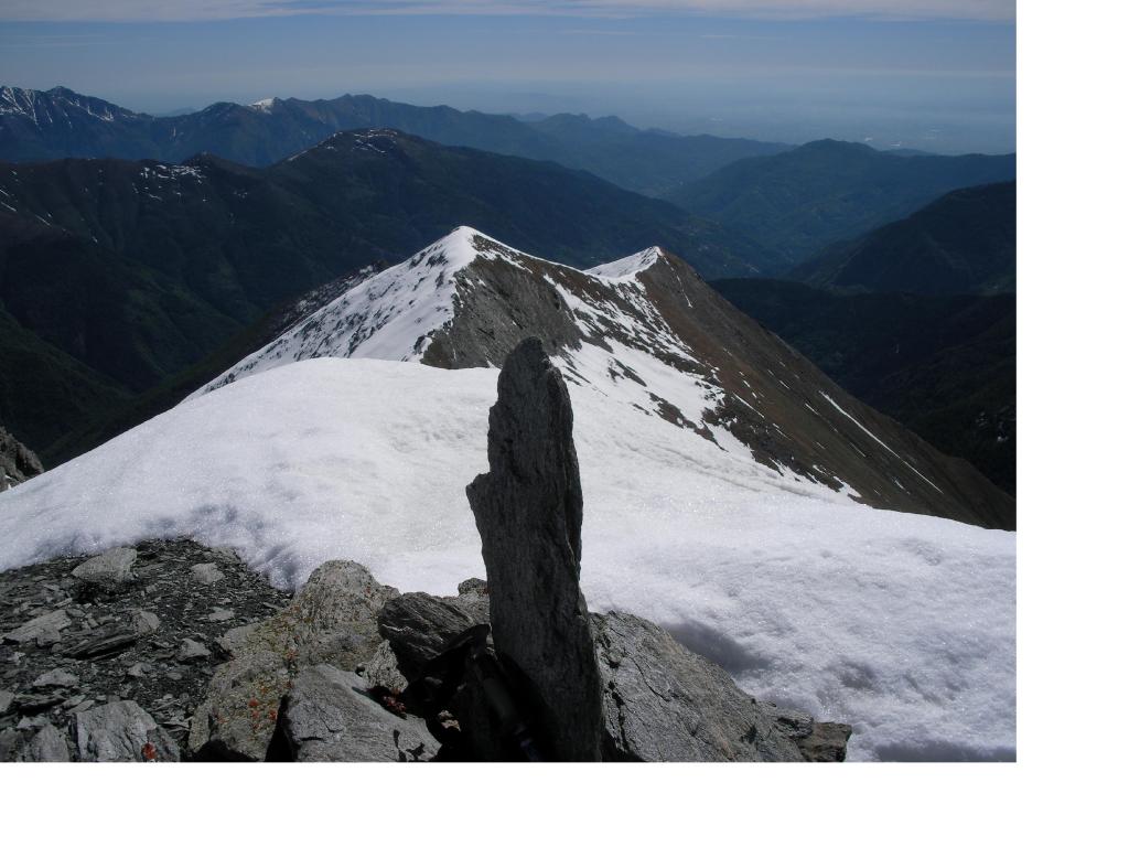
Dal colle si piega in direzione sud-est, lasciando alle spalle il crocevia del colle e per facili tracce di sentiero (no segnaletica) si perviene, brevemente, alla vetta della Punta Acuta (2880 mt). Bel panorama sulla Punta Vergia, Ramiere, Boucìe, Vallone dell’Argentera, si vedono anche l’Ecrins e lo Chaberton.
- Cartografia:
- I.G.C. n. 1 da 1:50.000 e n. 105 da 1:25.000
Nelle vicinanze Mappa
Itinerari
20/07/2023 TO, Prali D+ 1064 m E Nord-Est
Rodoretto (Colle di) da Balma
 50m
50m
19/10/2025 TO, Prali D+ 1226 m EE Varie
Pignerol (Monte) da Balma per il Colle della Balma e Colle della Valletta
 50m
50m
02/06/2023 TO, Prali D+ 1099 m EE/F Varie
Vergia (Punta) e Monte Selletta da Balma per il Colletto delle Fontane
 50m
50m
19/10/2025 TO, Prali D+ 1200 m EE Varie
Lungin (Monte) da Balma per il Colle della Valletta
 50m
50m
29/10/2022 TO, Prali D+ 1000 m E Varie
Selletta (Monte) da Rimas, anello per Balma
 1.7Km
1.7Km
14/09/2025 TO, Prali D+ 900 m E Sud
Mouton (Clot di) e Monte Truscera da Rodoretto
 3.8Km
3.8Km
12/11/2016 TO, Prali D+ 430 m E Varie
Serrevecchio (Colle di) da Rodoretto, anello per Fontane e Serrevecchio
 3.9Km
3.9Km
11/08/2015 TO, Salza di Pinerolo D+ 1900 m EE Tutte
Lungin (Monte) e Monte Pignerol da Coppi per il Vallone di Salza e il Colle della Valletta
4.4Km
27/09/2020 TO, Salza di Pinerolo D+ 1900 m EE Est
Peolioso (Monte) e Monte Laparè da Coppi, anello per il Passo della Pennazza
 4.4Km
4.4Km
24/02/2007 TO, Prali D+ 1250 m EE Nord-Ovest
Rond (Bric) da Prali per la Rocca Bianca
4.5Km
Servizi
3.3Km
3.9Km
Da Mafalda Ristorante
Prali
4.6Km
Delle Alpi Ristorante
Prali
4.6Km
Del minatore Ristorante
Prali
4.6Km
Lago Verde Rifugio
Prali
4.6Km
La Brasserie Ristorante
Prali
4.6Km
Miandette di Grill B&B
Prali
4.6Km
Delle Alpi Albergo
Prali
4.7Km
Nido dell’orso Ristorante
Prali
4.7Km