200m
200m
Note
 3.8Km
3.8Km
3.8Km
5.2Km
6Km
9.2Km
9.2Km
9.2Km
9.3Km
3.8Km
3.8Km
3.8Km
5.2Km
6Km
9.2Km
9.2Km
9.2Km
9.3Km
200m
4.1Km
4.2Km
5.1Km
5.9Km
7Km
8.9Km
9.1Km
9.1Km
9.2Km
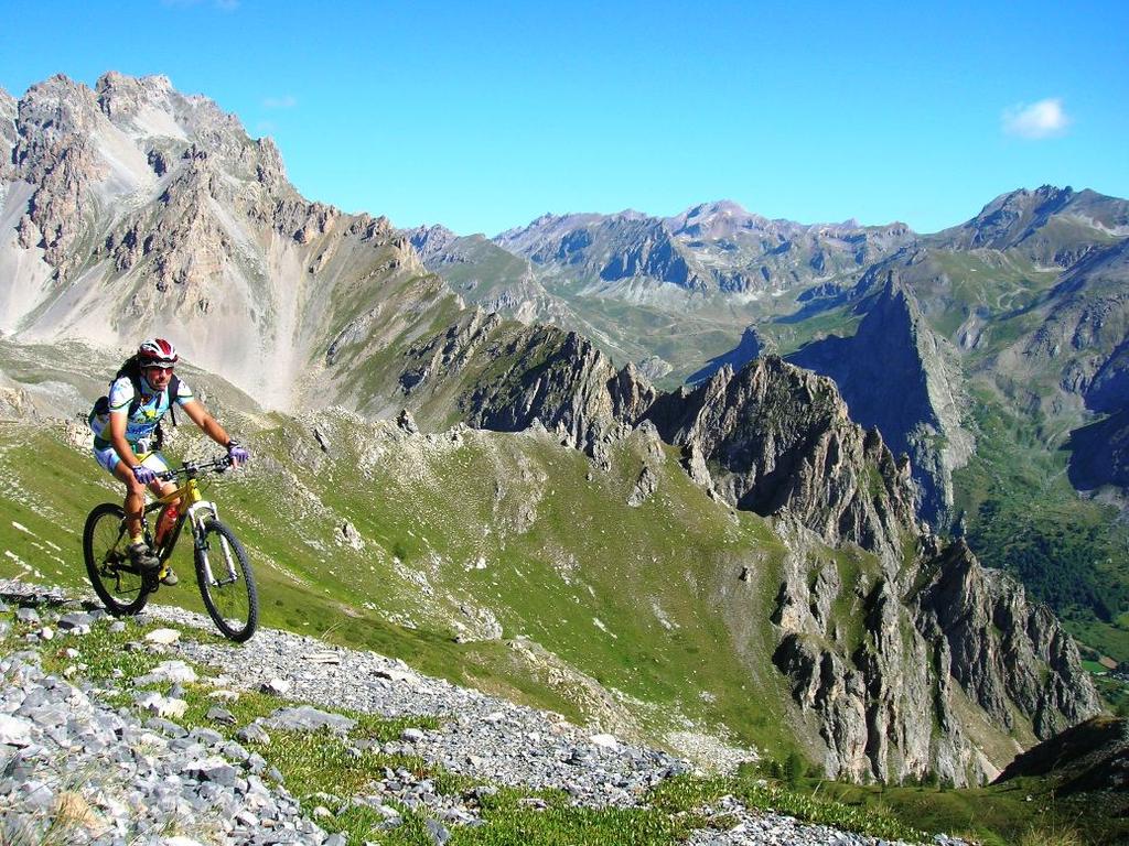
Bell'anello di alta montagna.
Purtroppo di recente la bellissima discesa dal colle Roburent è stata allargata con una ruspa, perdendo parte del divertimento e del fascino che solo il vecchio sentiero sapeva regalare.
Per di più, avendo fatto i lavori senza perizia, la stradella si è presto rovinata e ridoatta, in alcuni punti, a pietraia.
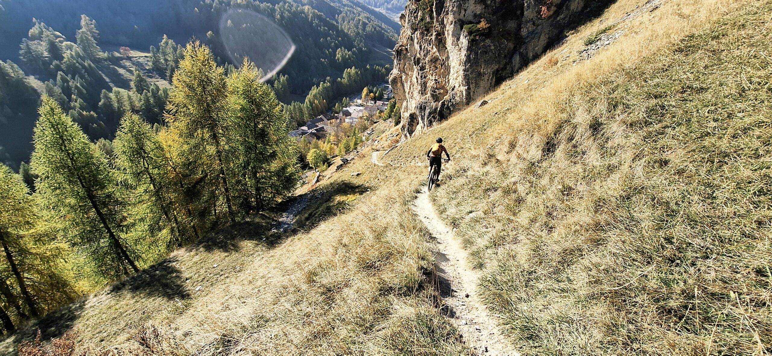
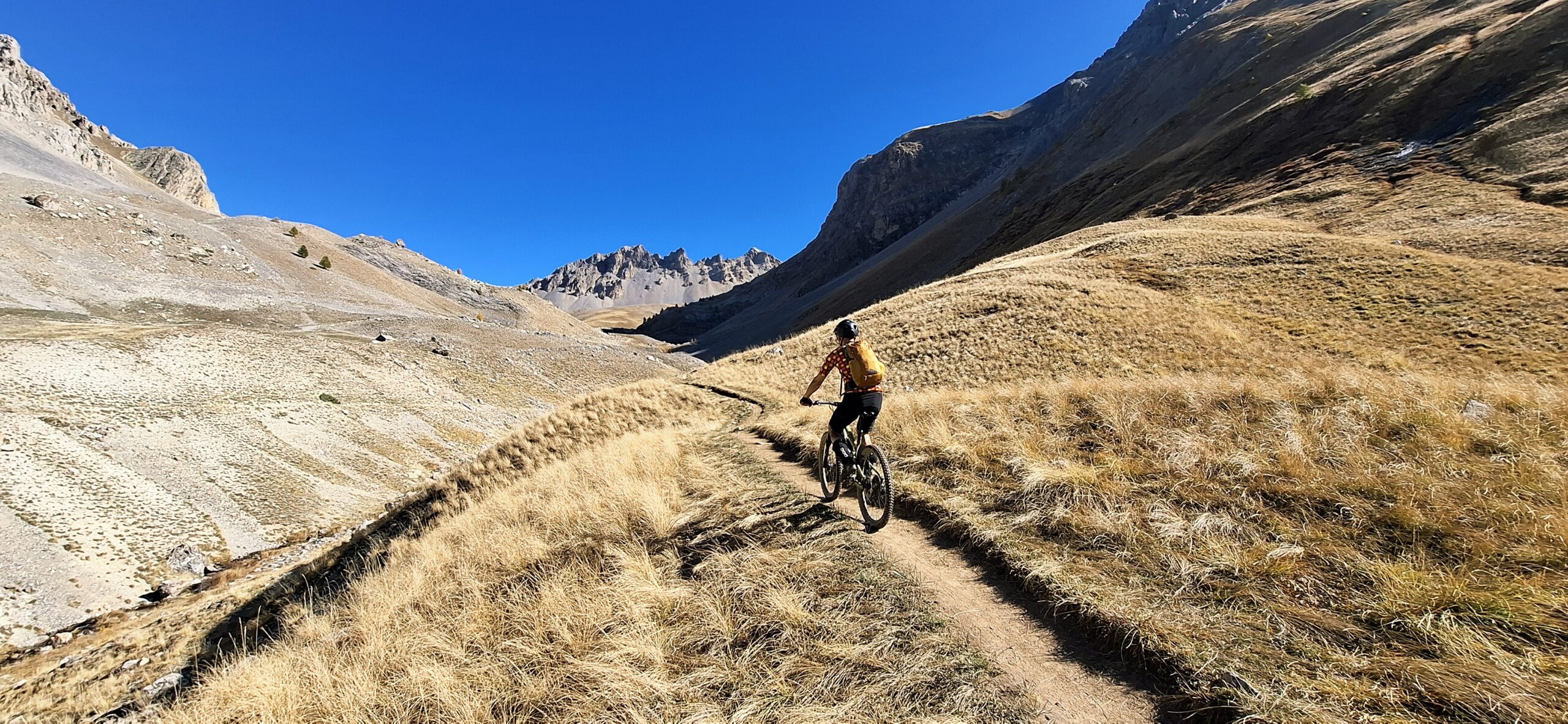
Resta invece sempre superbo il tratto finale di discesa dalla Tinetta, con passaggi molto impegnativi in corrispondenza di alcuni tornanti dalla marcata esposizione, ciclabili solo con ottima tecnica e con sicurezza.
Avvicinamento
Purtroppo di recente la bellissima discesa dal colle Roburent è stata allargata con una ruspa, perdendo parte del divertimento e del fascino che solo il vecchio sentiero sapeva regalare.
Per di più, avendo fatto i lavori senza perizia, la stradella si è presto rovinata e ridoatta, in alcuni punti, a pietraia.
Resta invece sempre superbo il tratto finale di discesa dalla Tinetta, con passaggi molto impegnativi in corrispondenza di alcuni tornanti dalla marcata esposizione, ciclabili solo con ottima tecnica e con sicurezza.
.
Descrizione
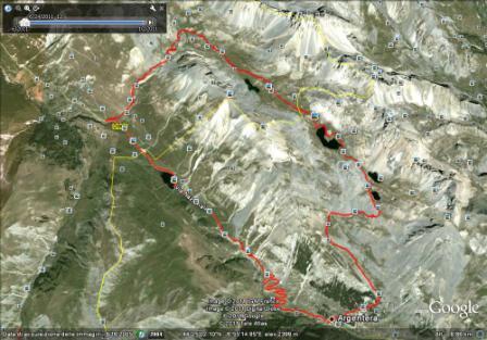
Da Argentera salire il Colle della Maddalena poi discesa verso Larche .
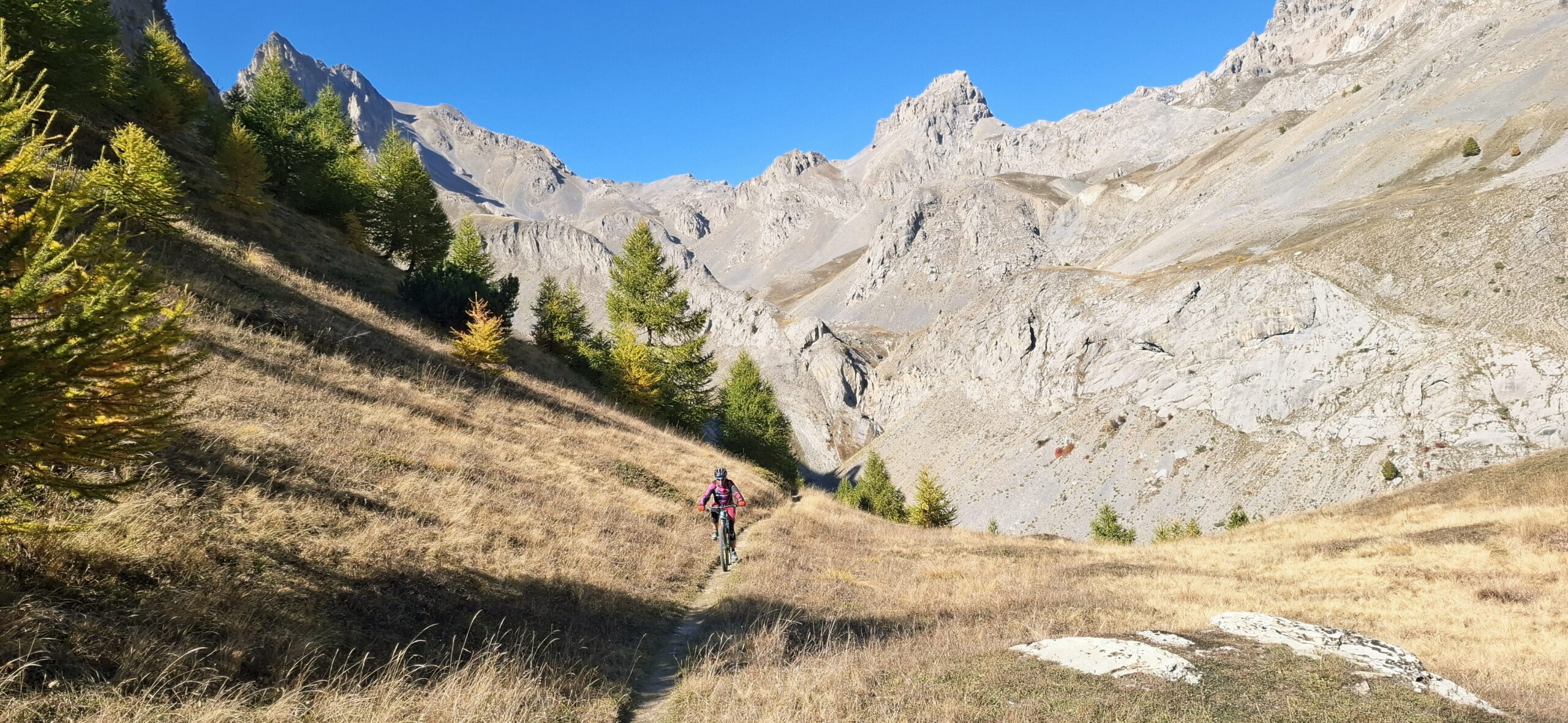
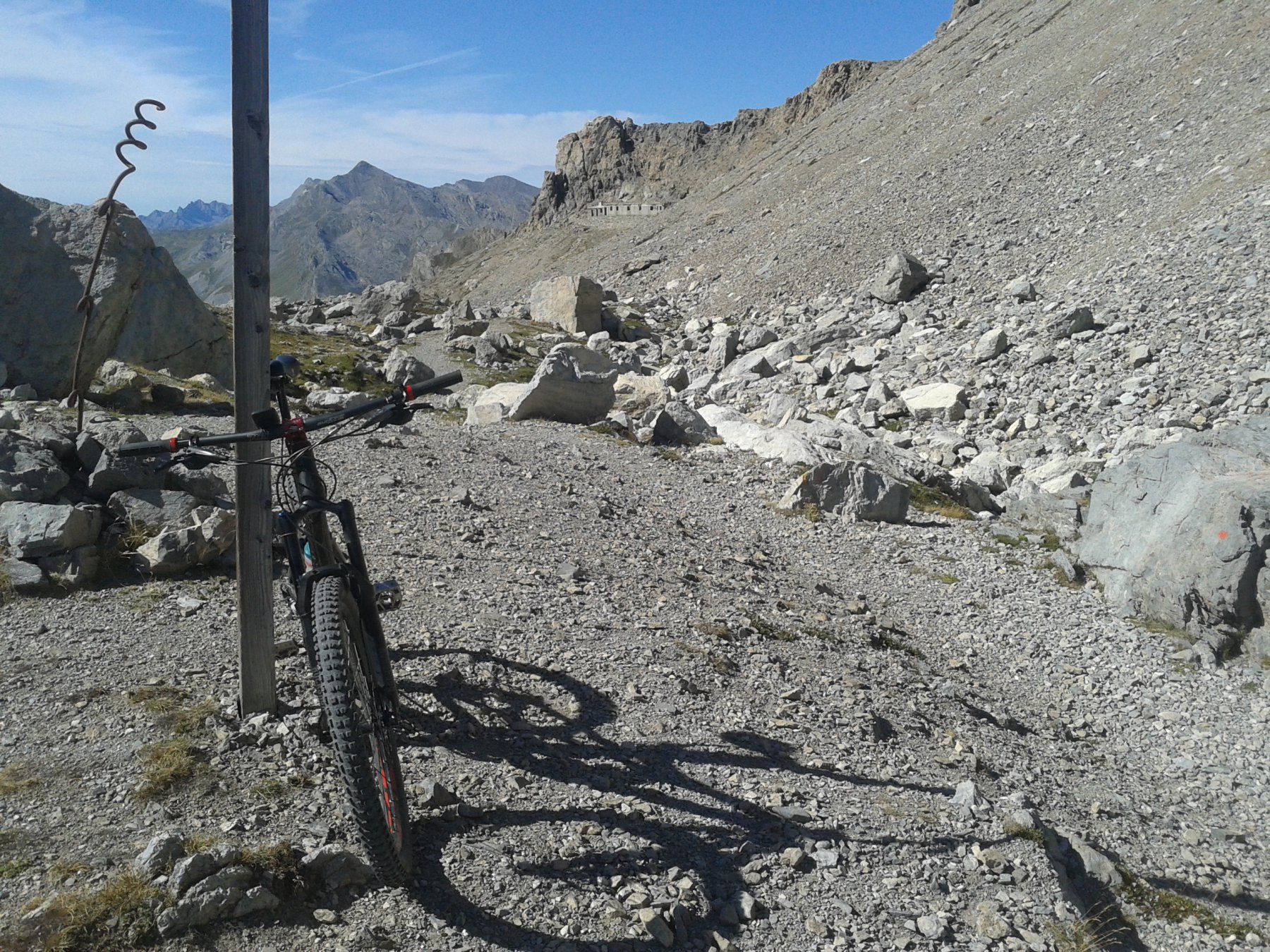
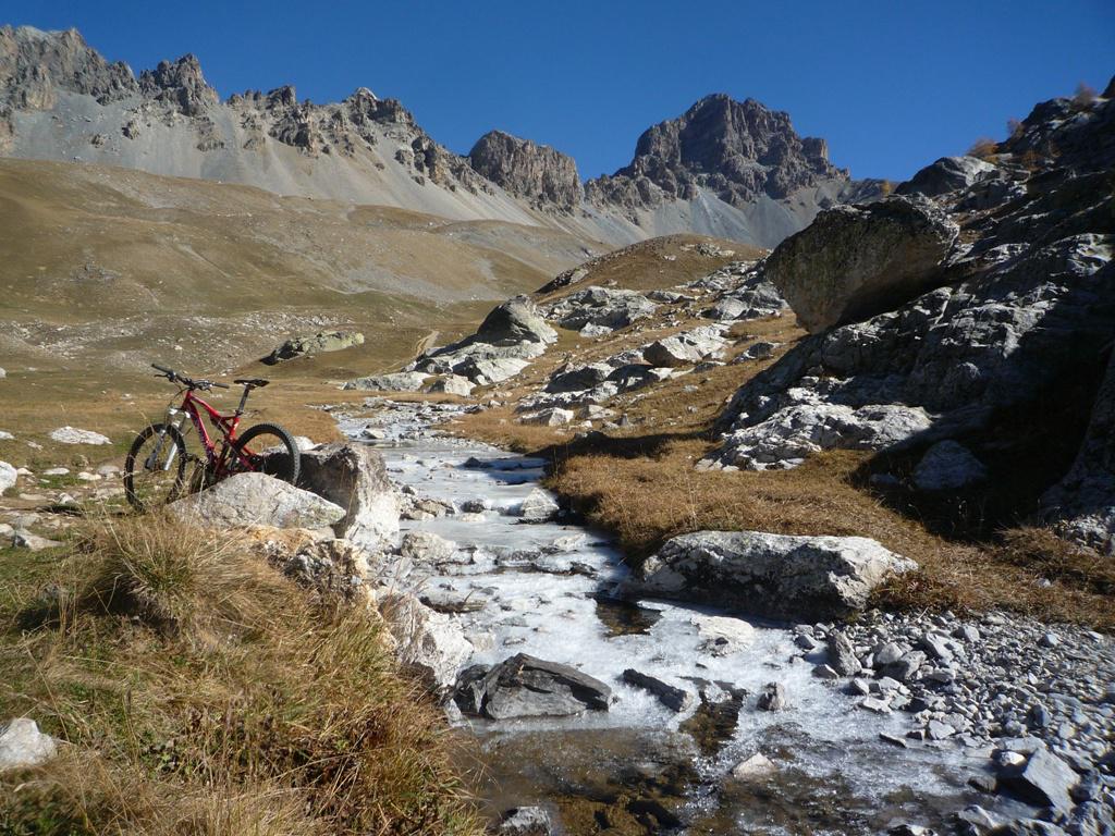
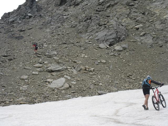
Da Argentera si sale su strada statale al Colle della Maddalena, da cui si scende per brevissimo tratto in territorio franese per imboccare, in prossimità di un parcheggio, la strada sterrata che sale verso il col Remy (volendo si può salire sino alla Tete Dure e raggiungere su tecnico sentiero il col Remy); l’ultimo tratto è su sentiero e costringe a spingere la bici.
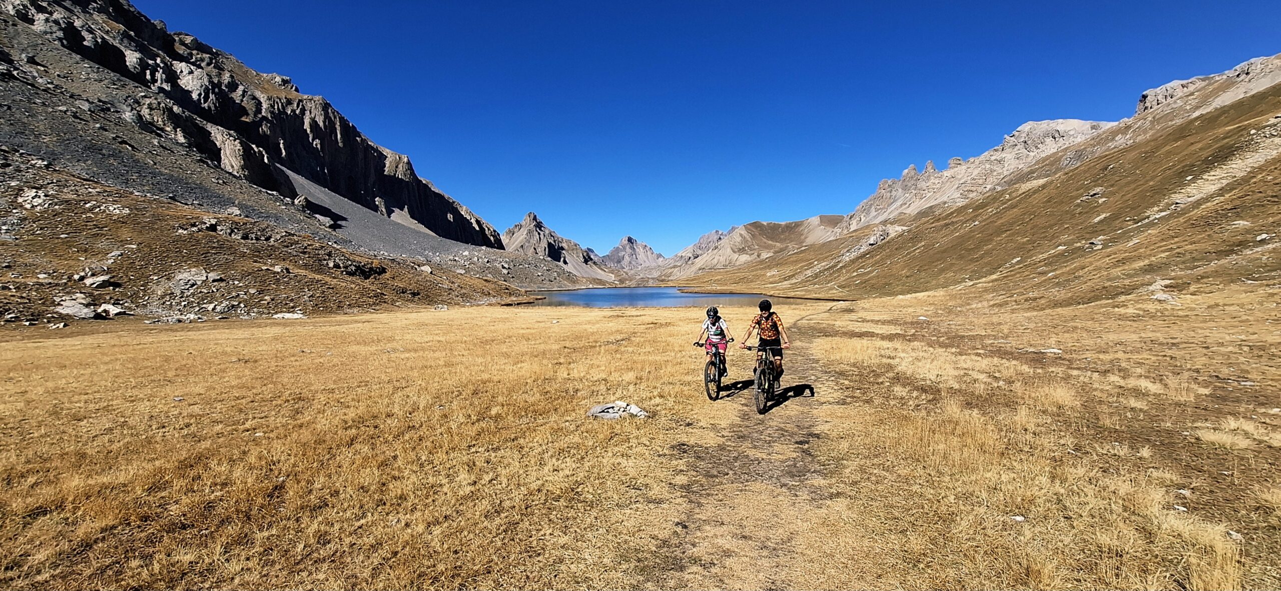
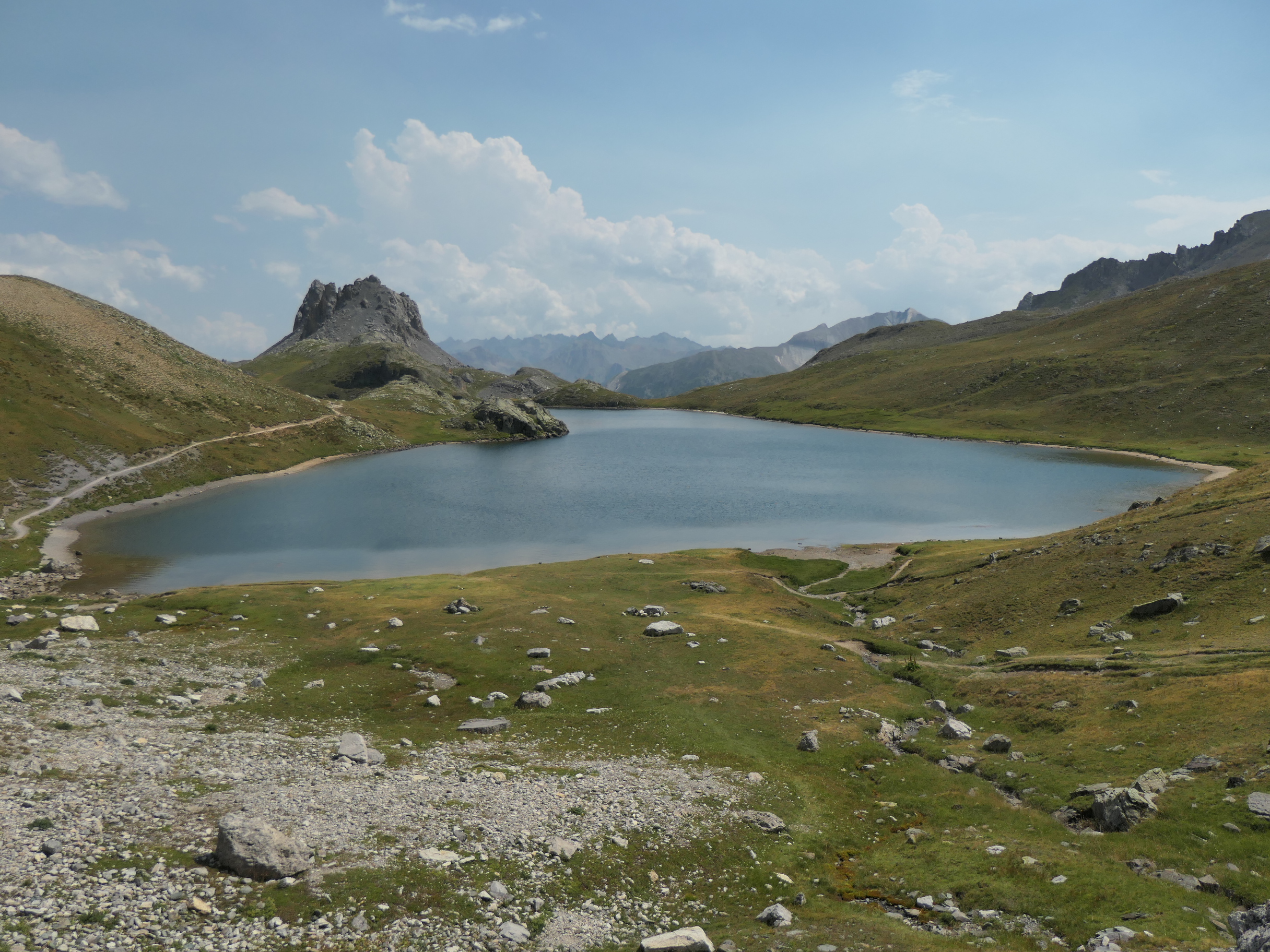
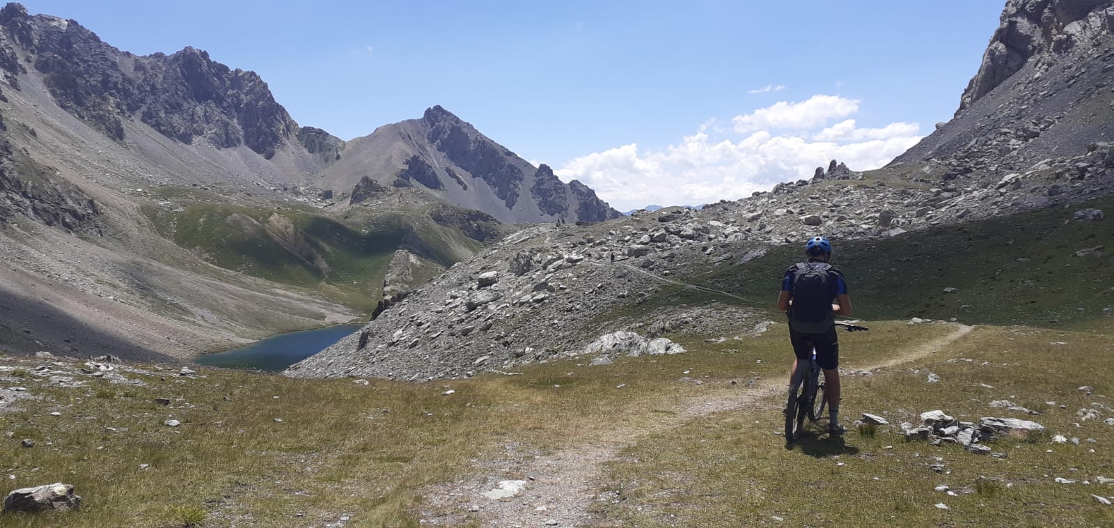
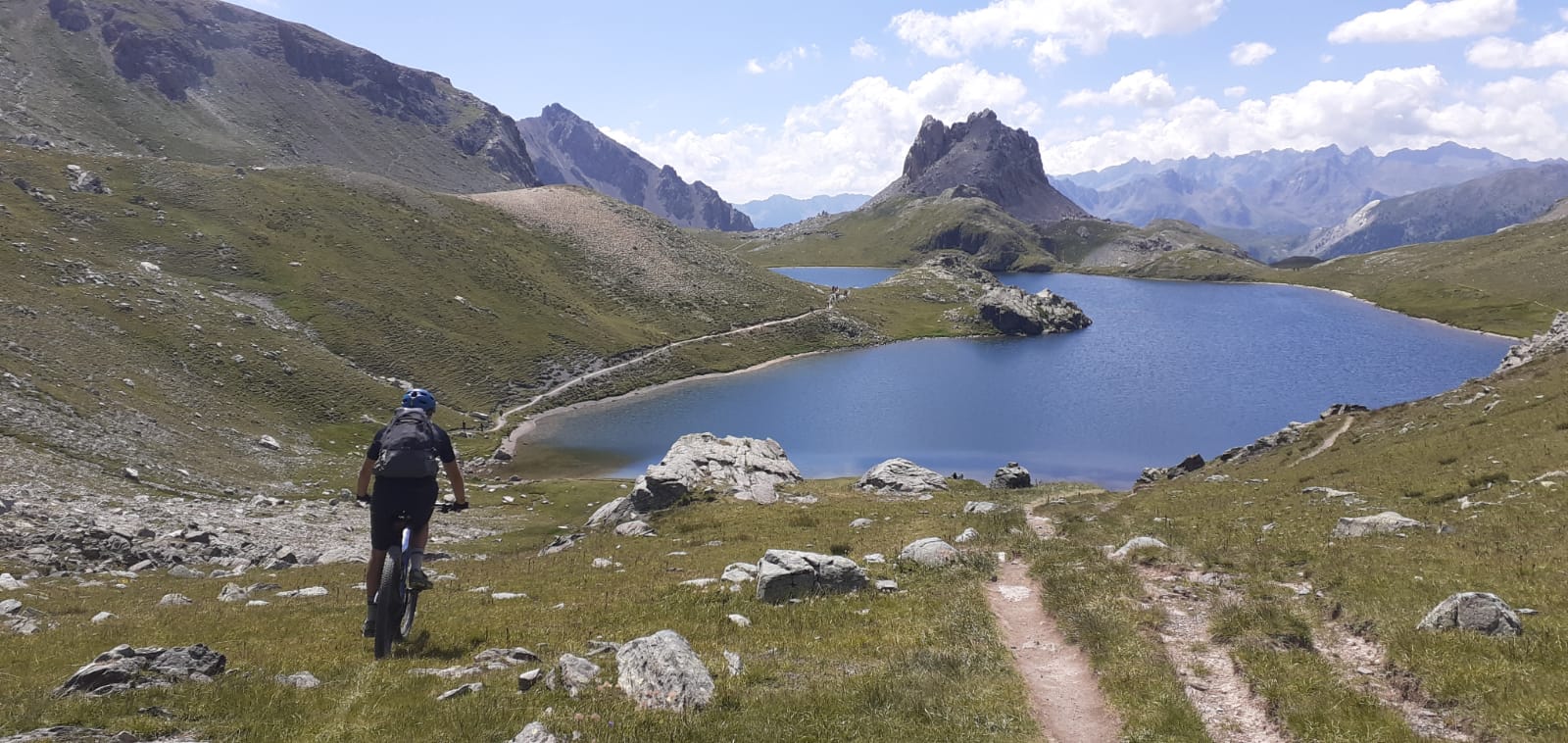
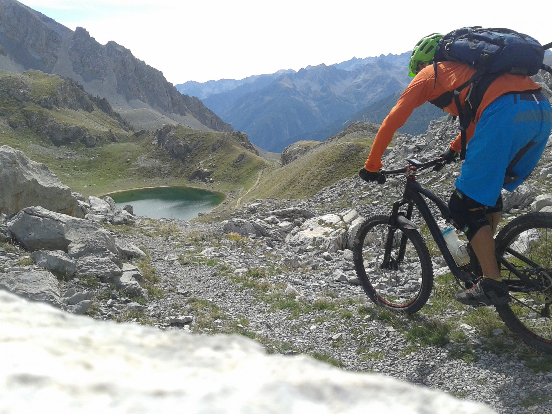
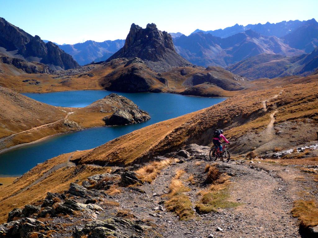
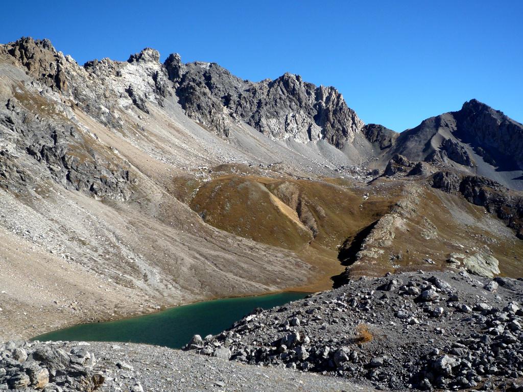
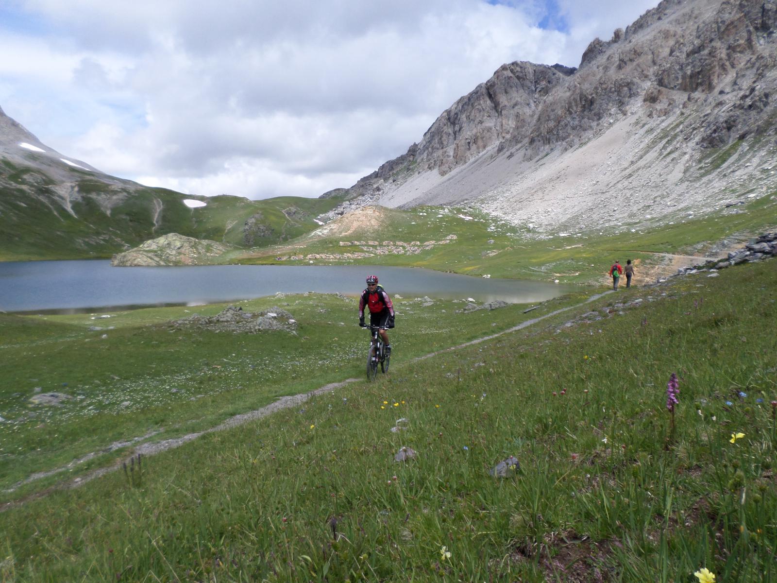
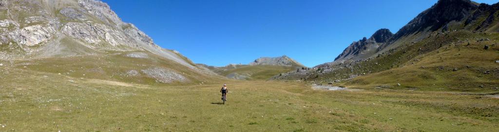
Dal col Remy la discesa è più semplice e veloce sino al fondo del vallone dove si intercetta il facile sentiero che porta al col de la Gipyerre de L’Oronaye, da cui in discesa su percorso facile si giunge ad un alpeggio con baita aperta dove si può fare una sosta sul bel pianoro.
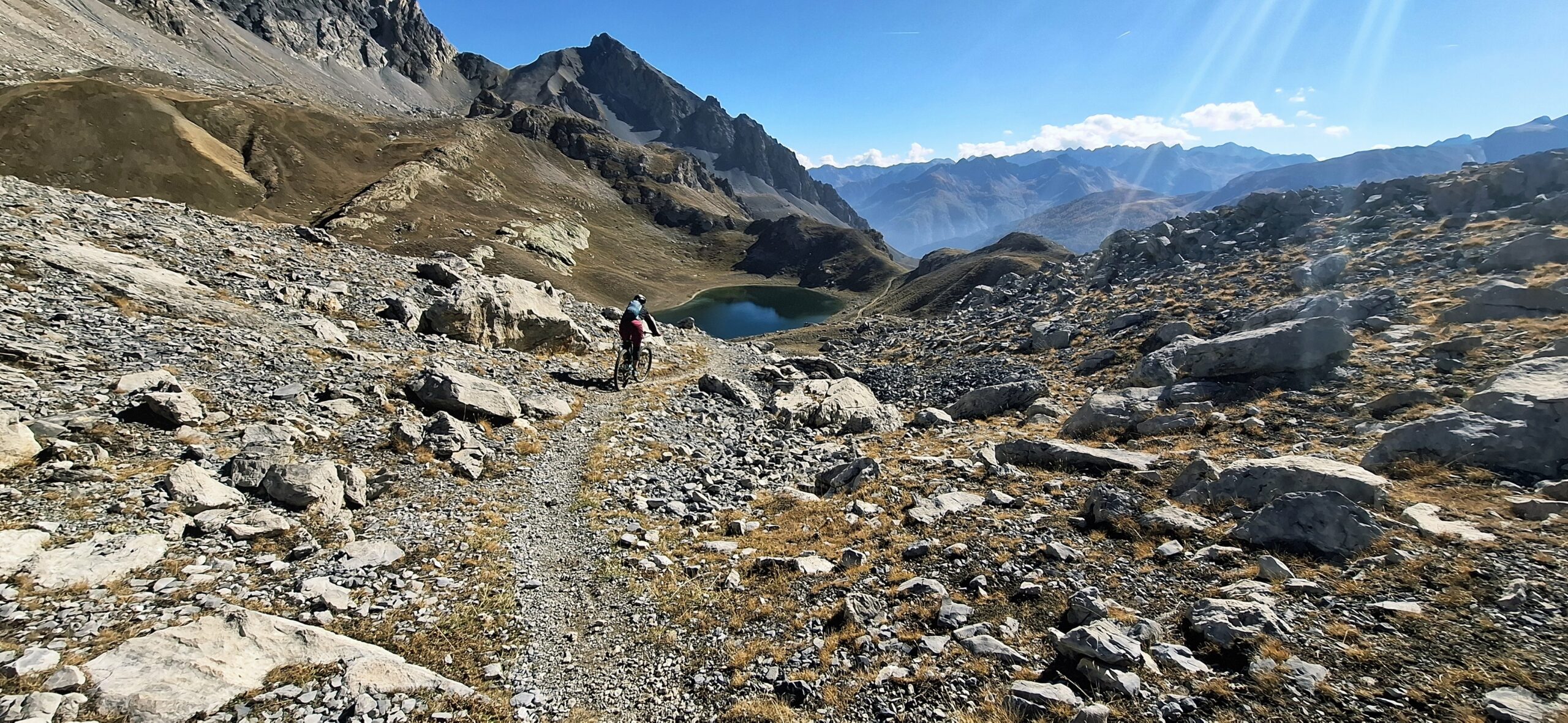
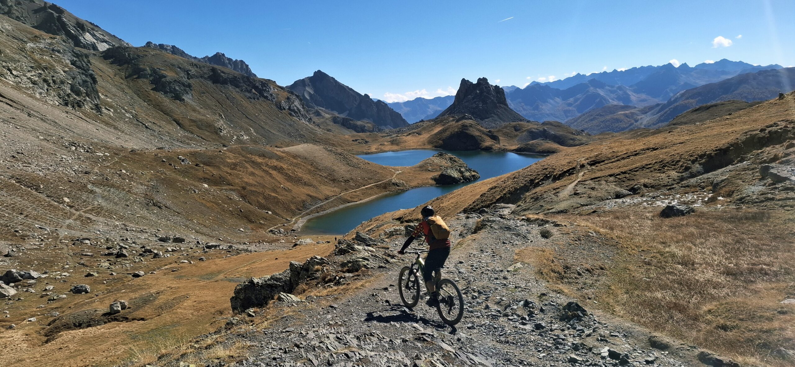
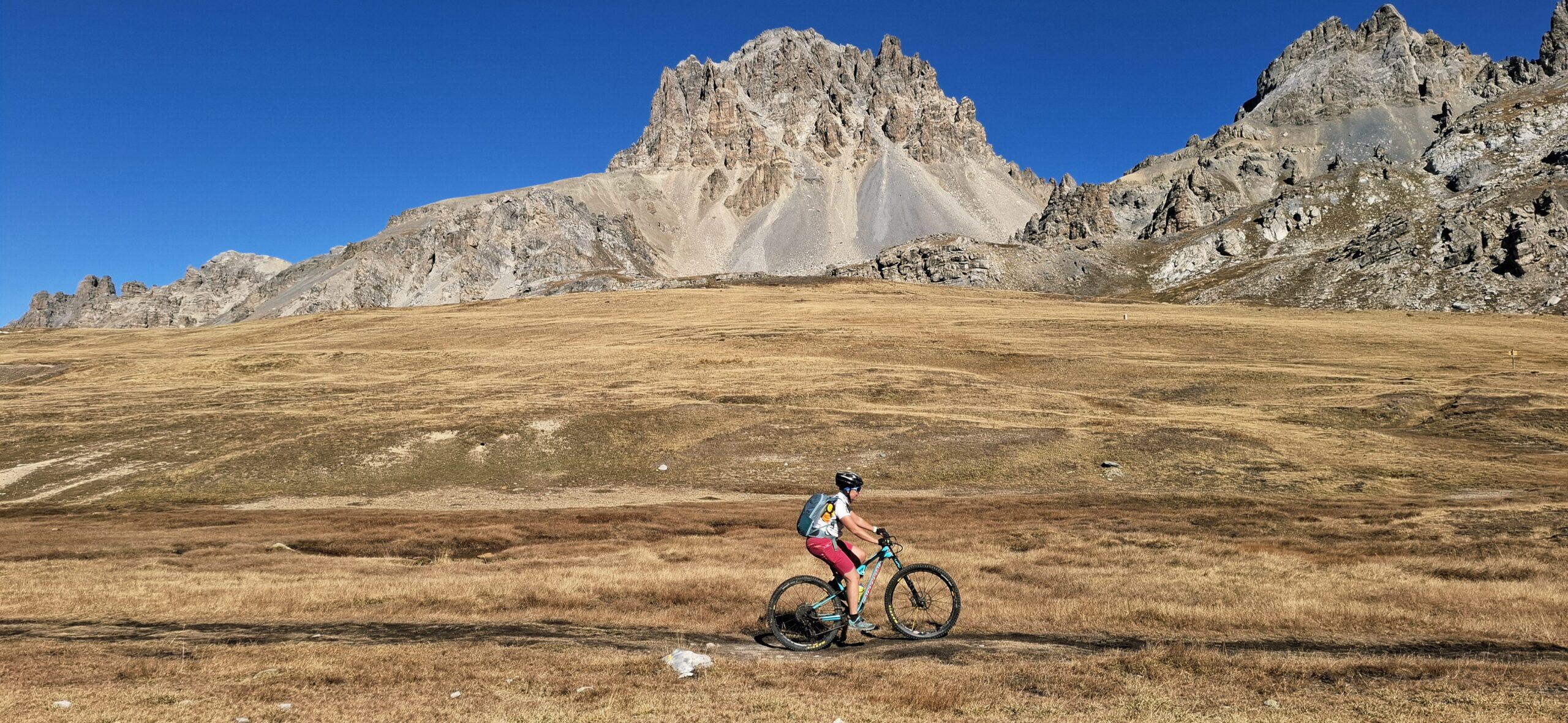
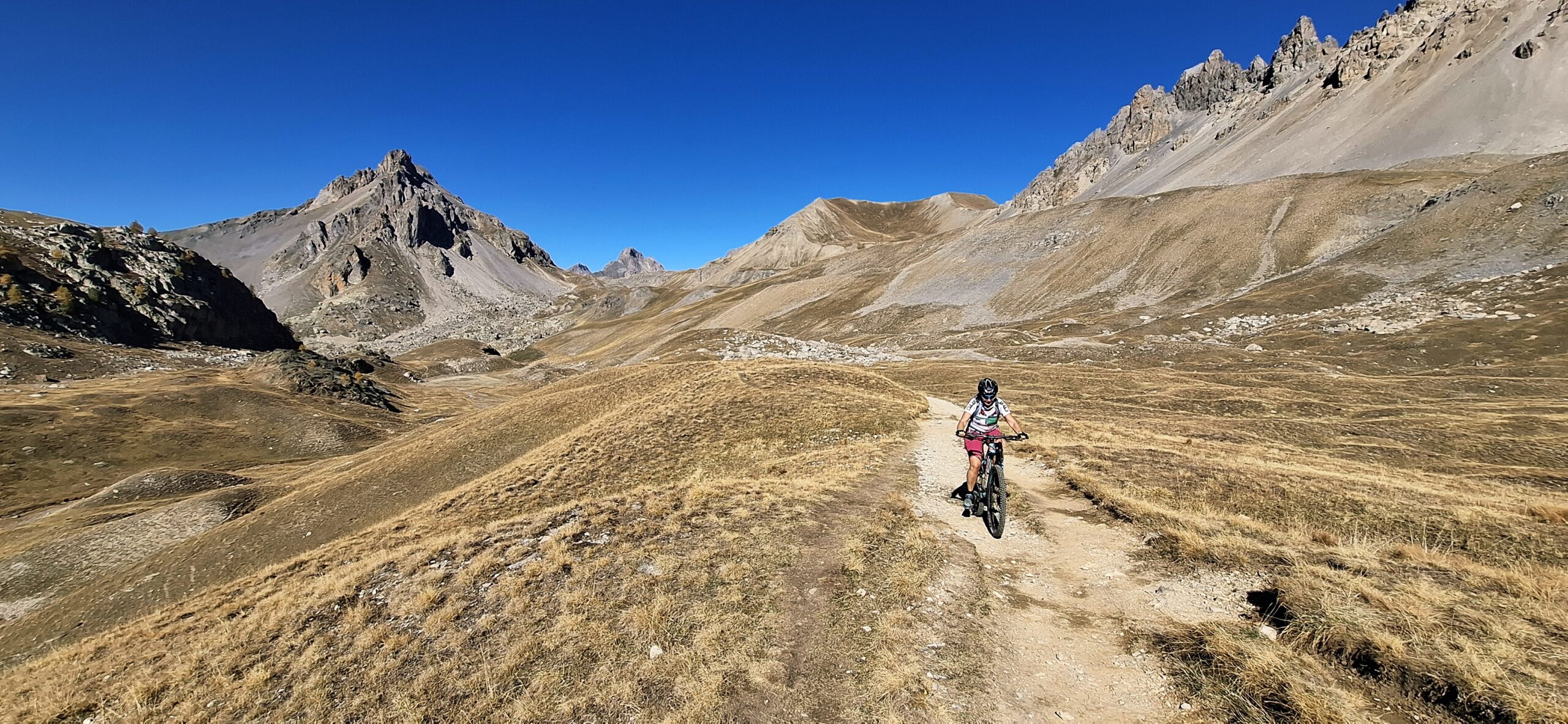
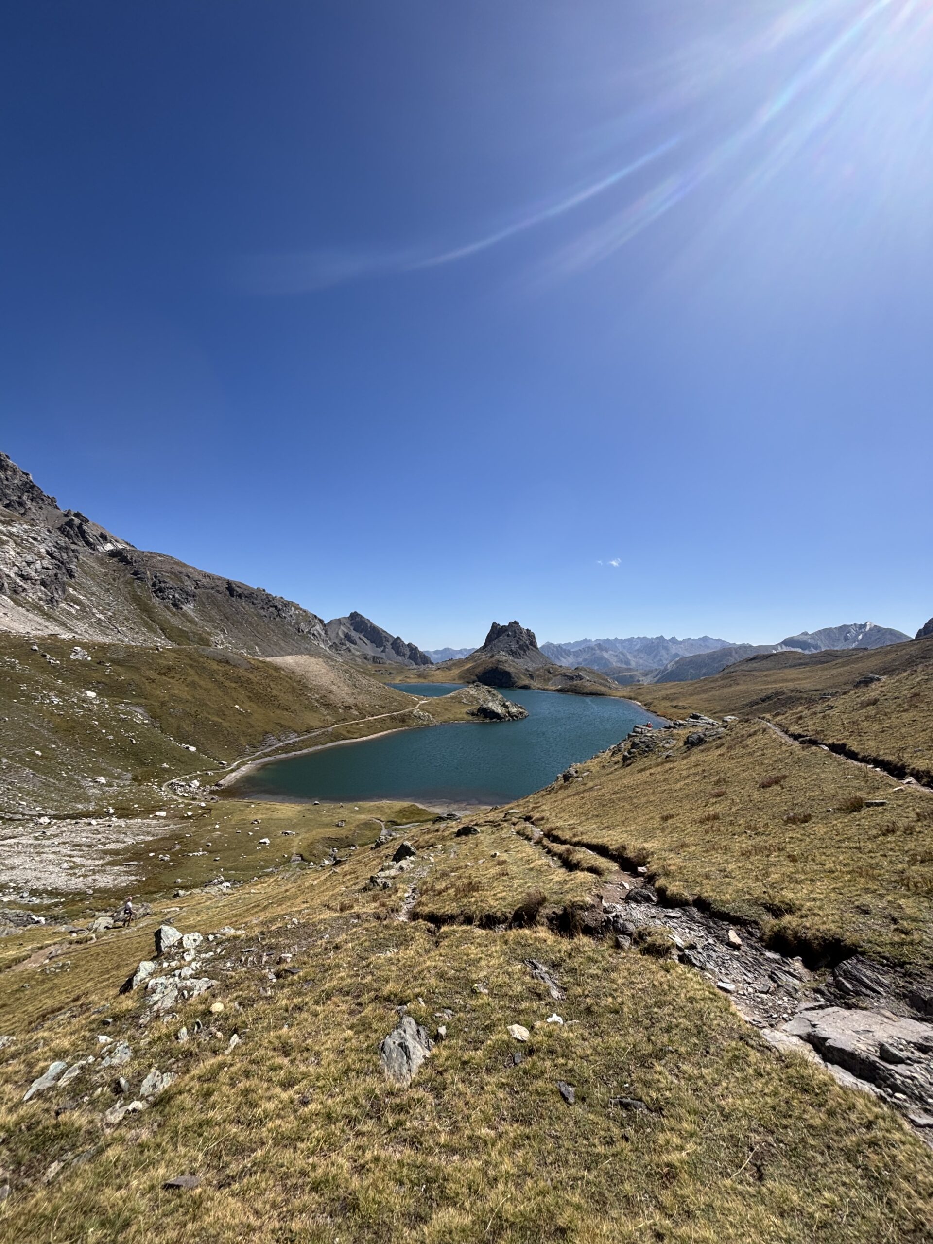
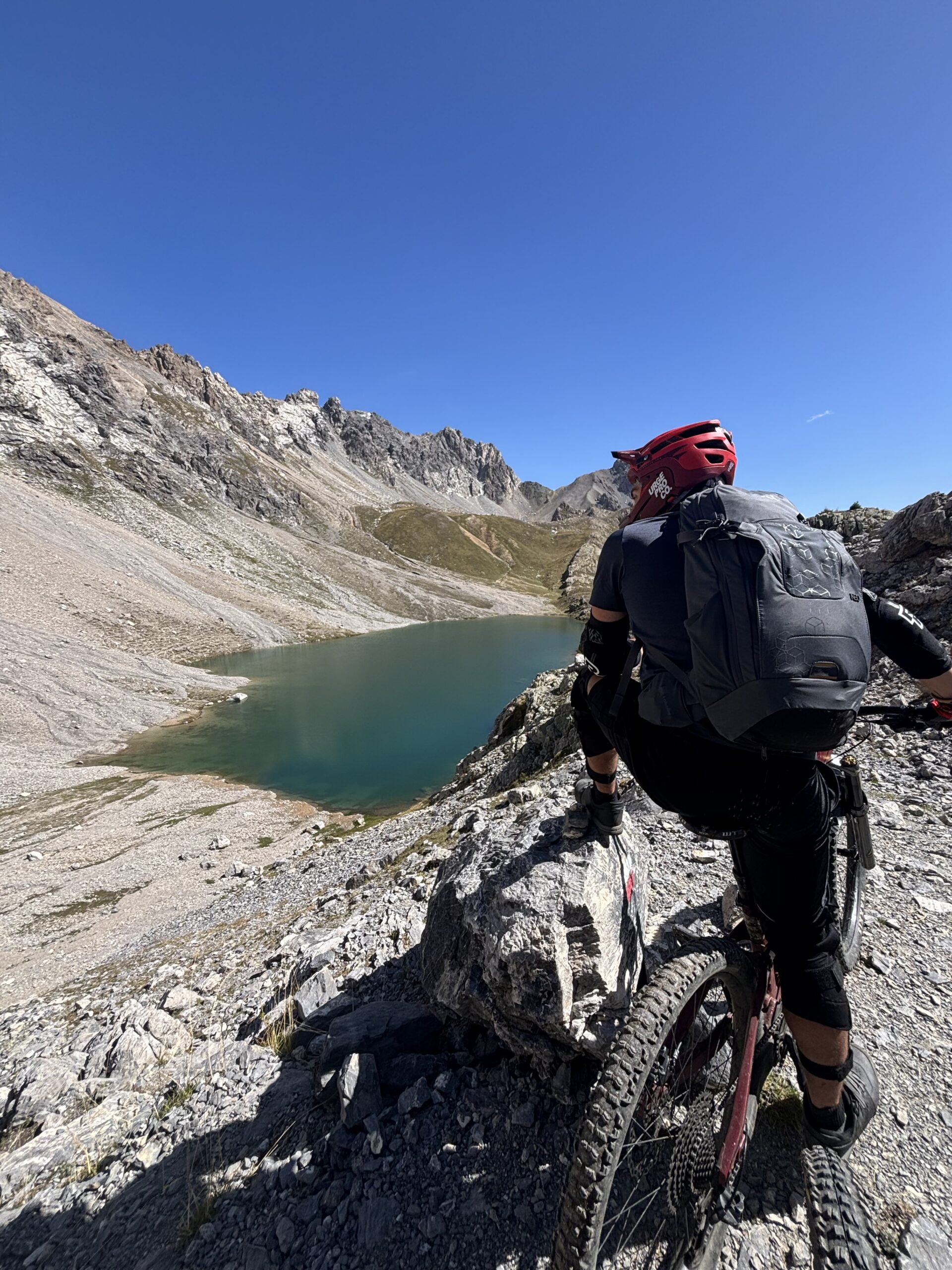
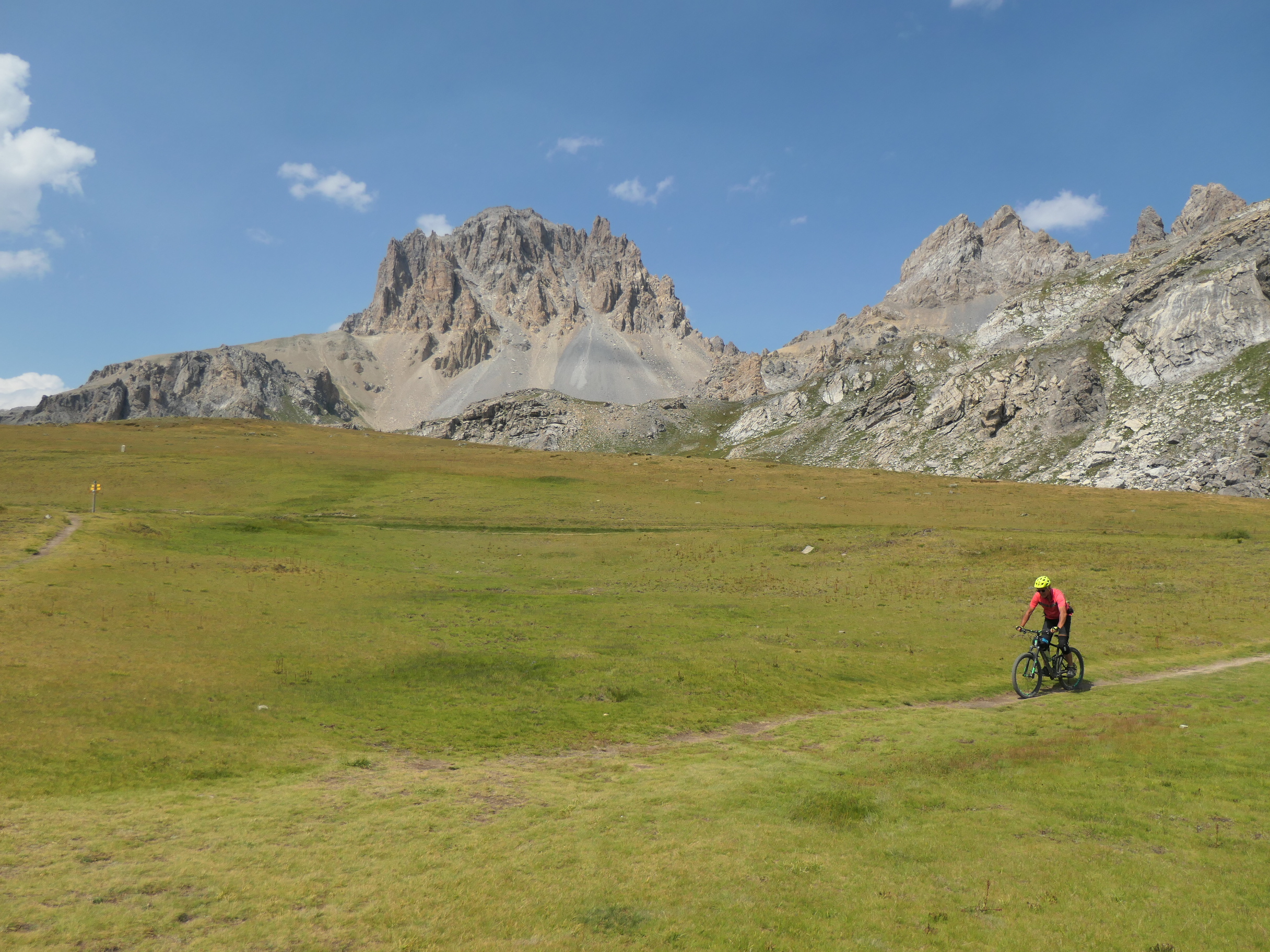
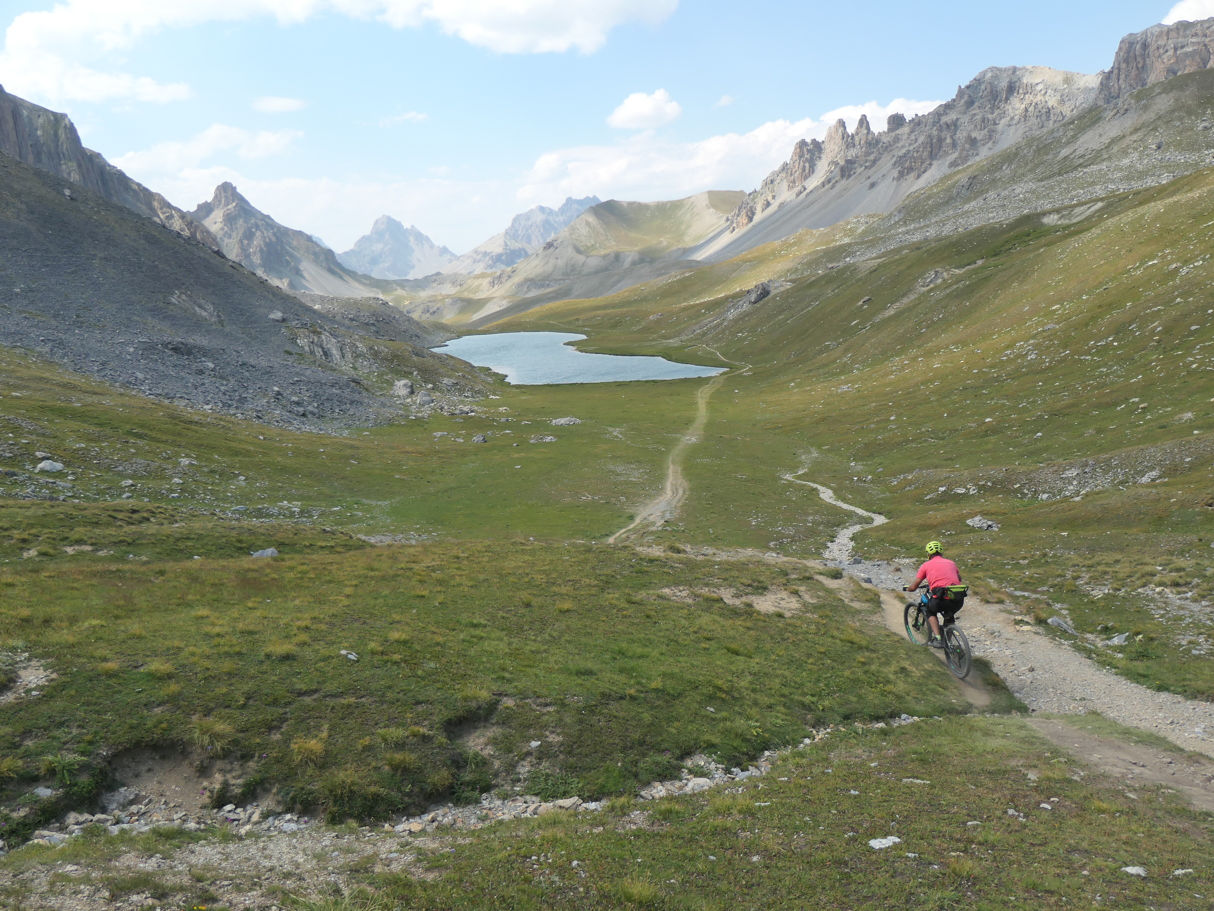
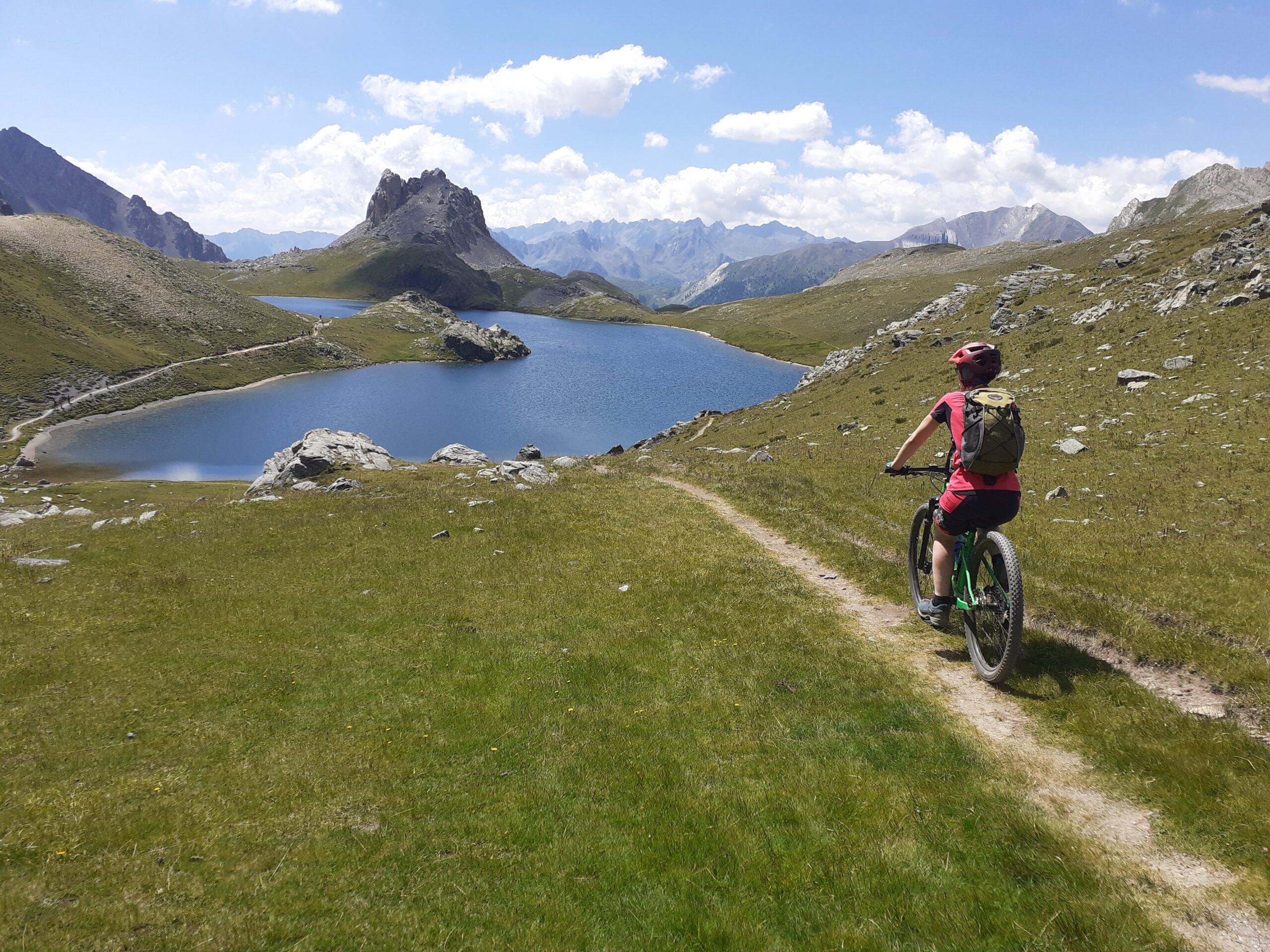
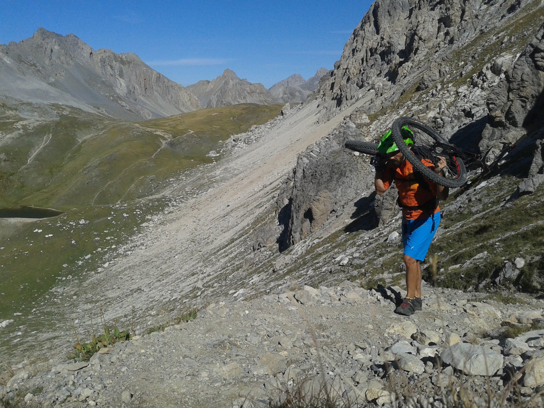
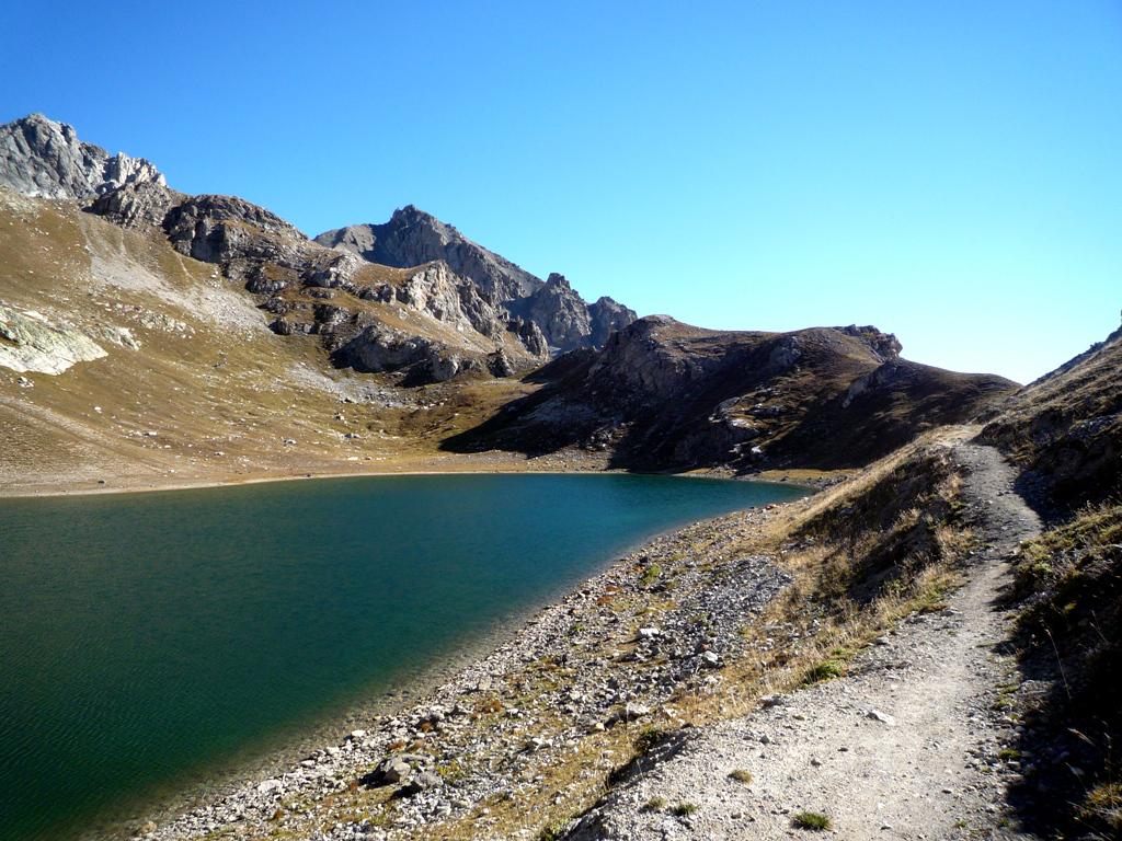
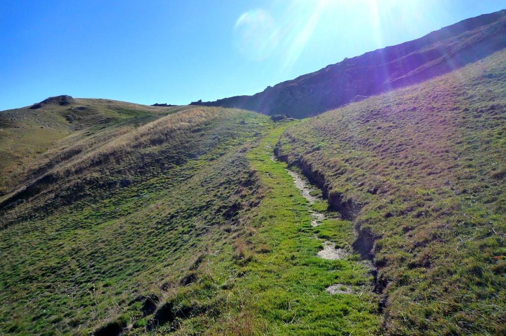
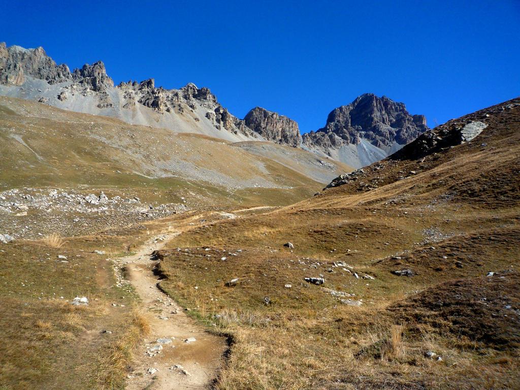
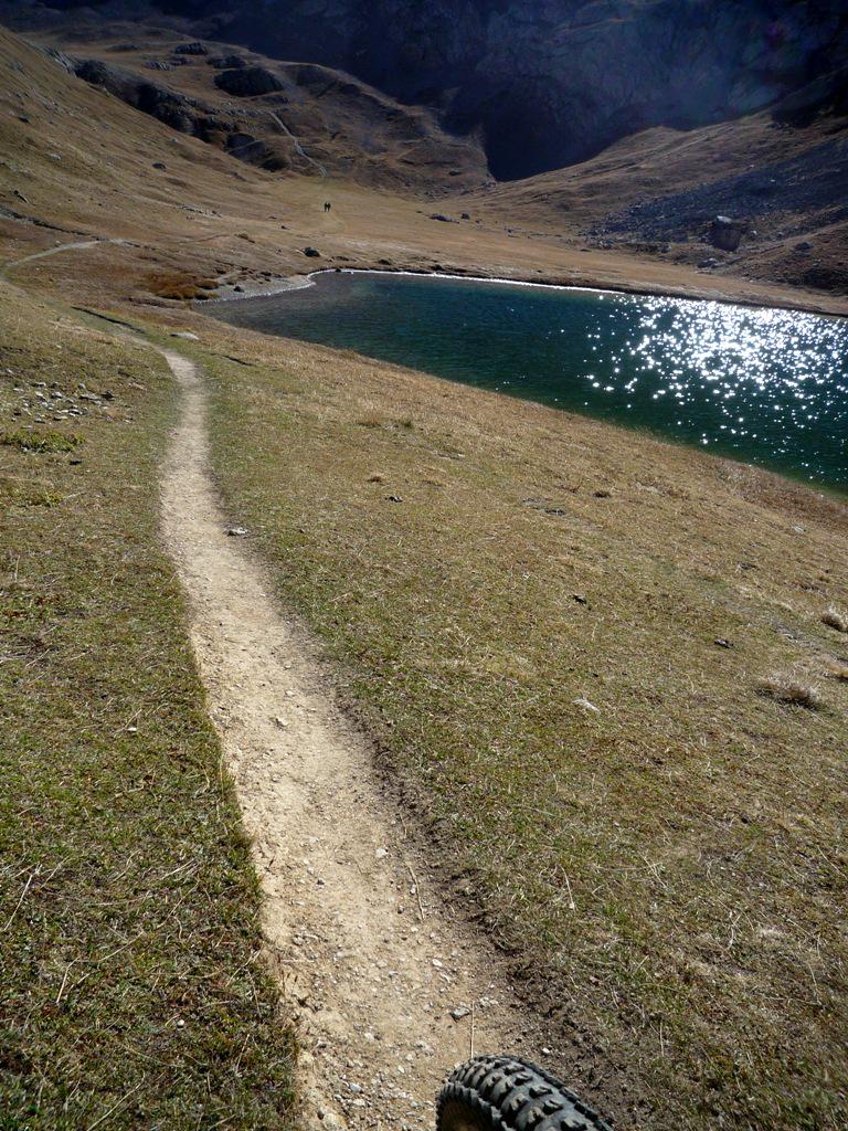
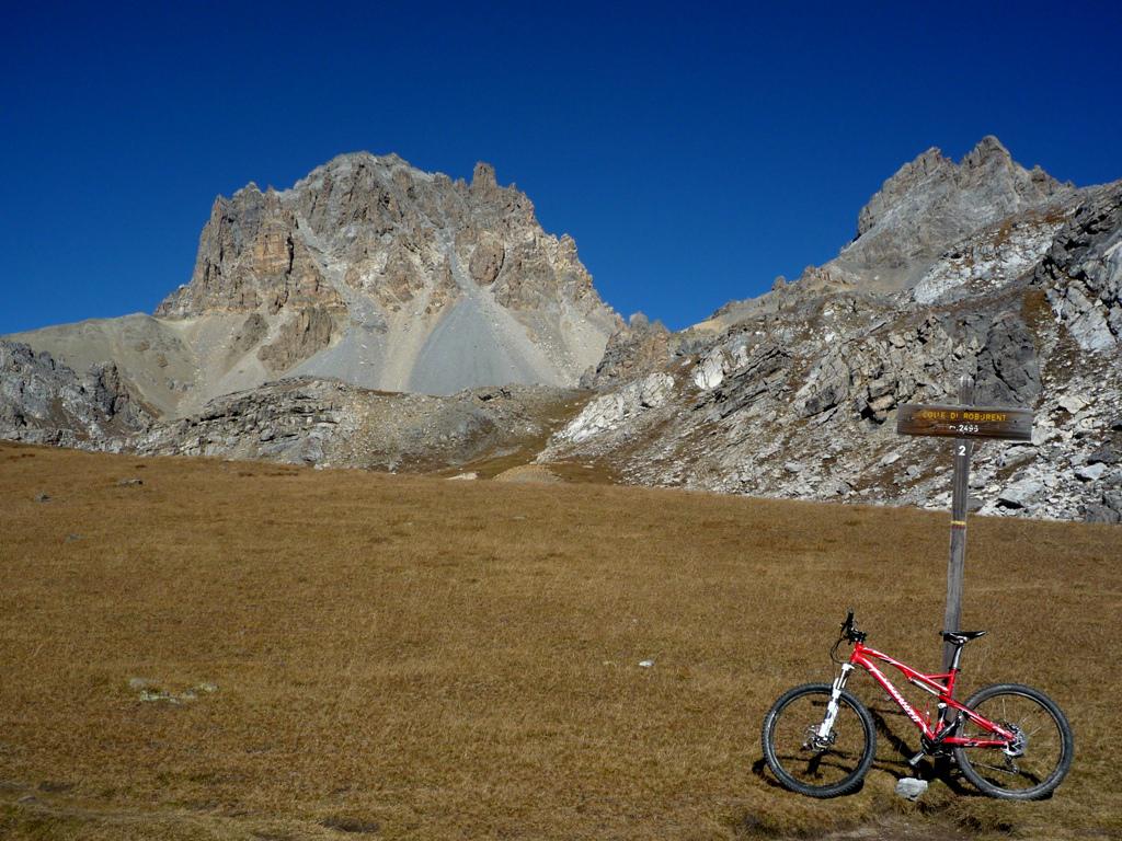
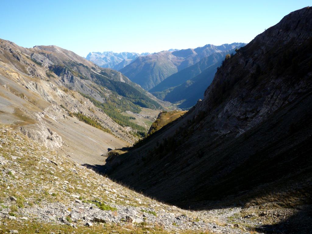
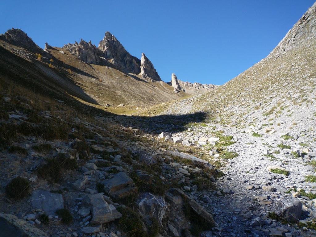
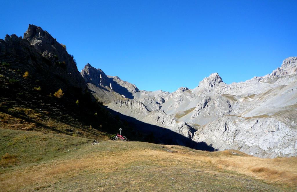
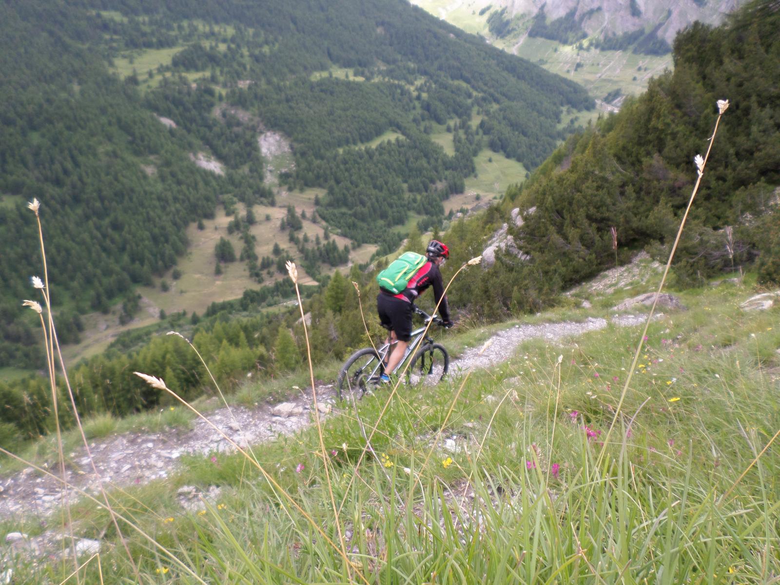
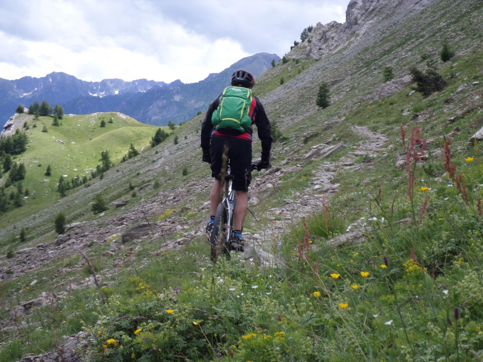
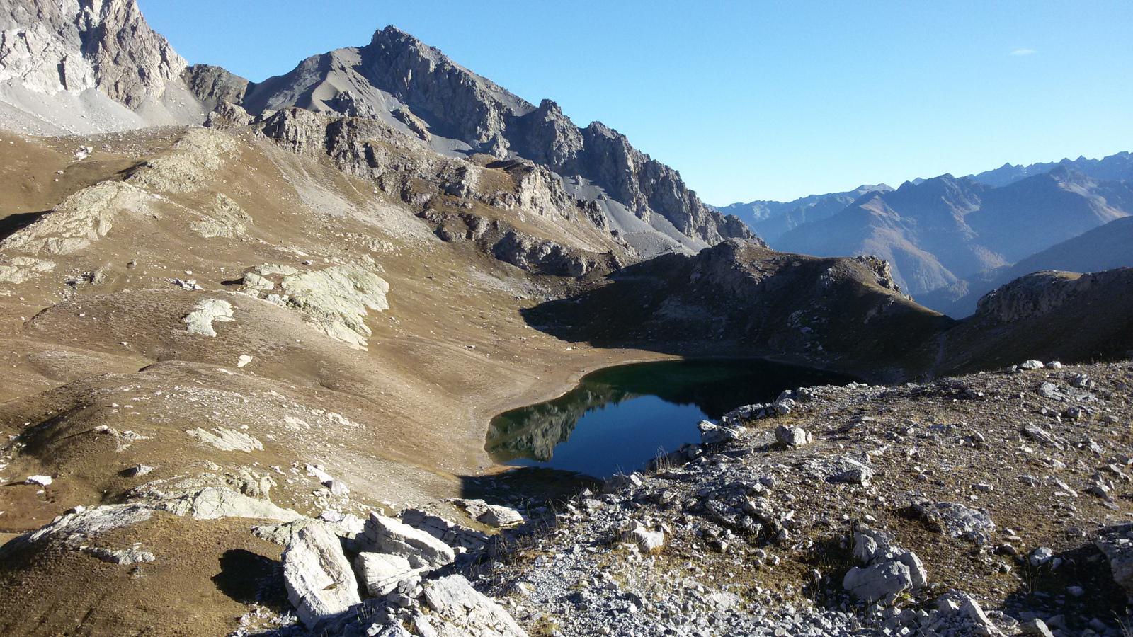
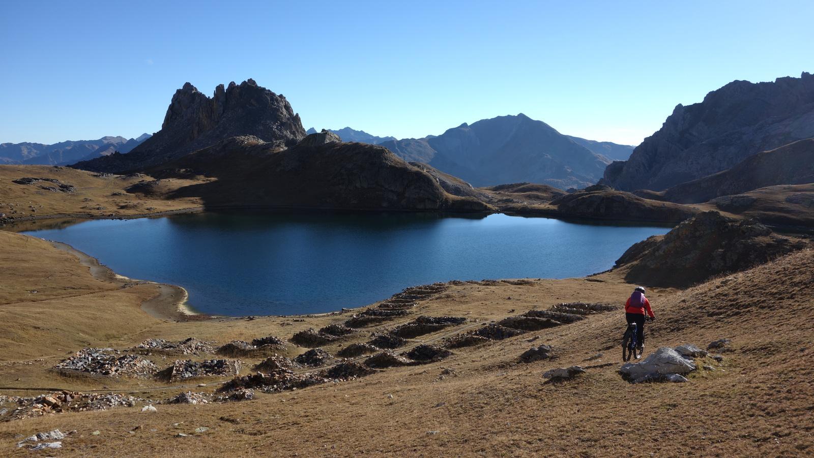
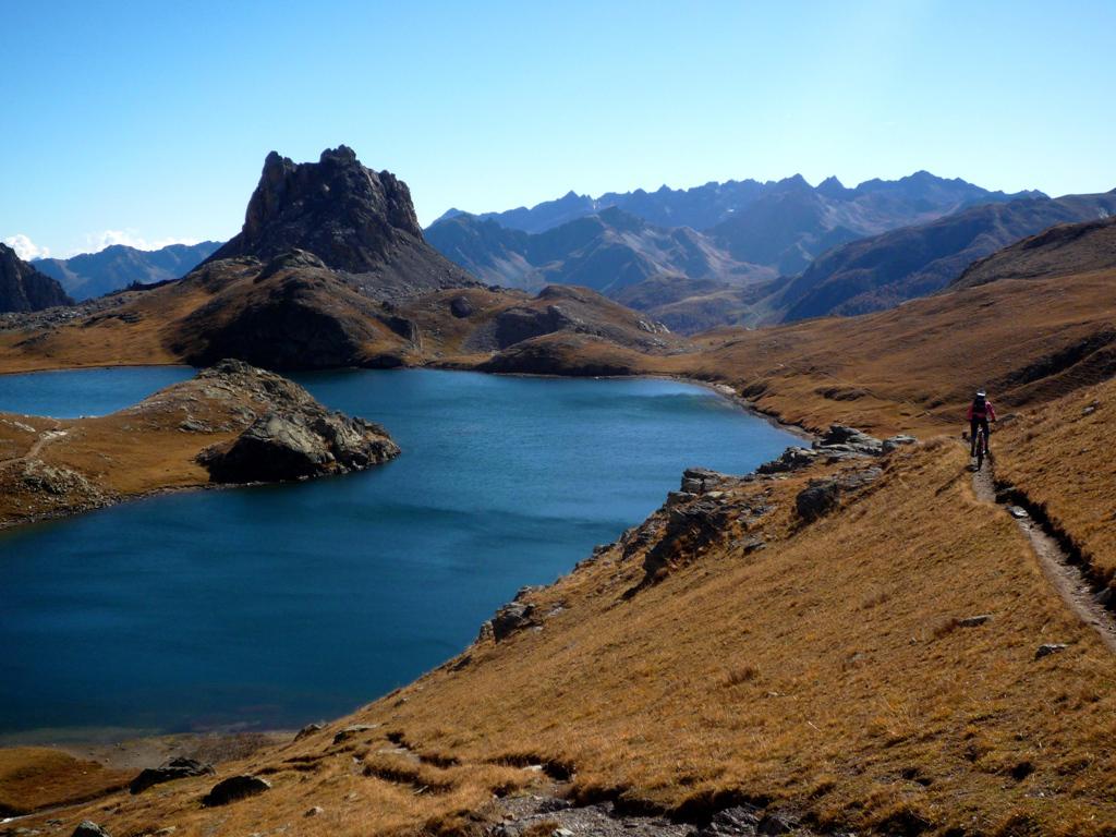
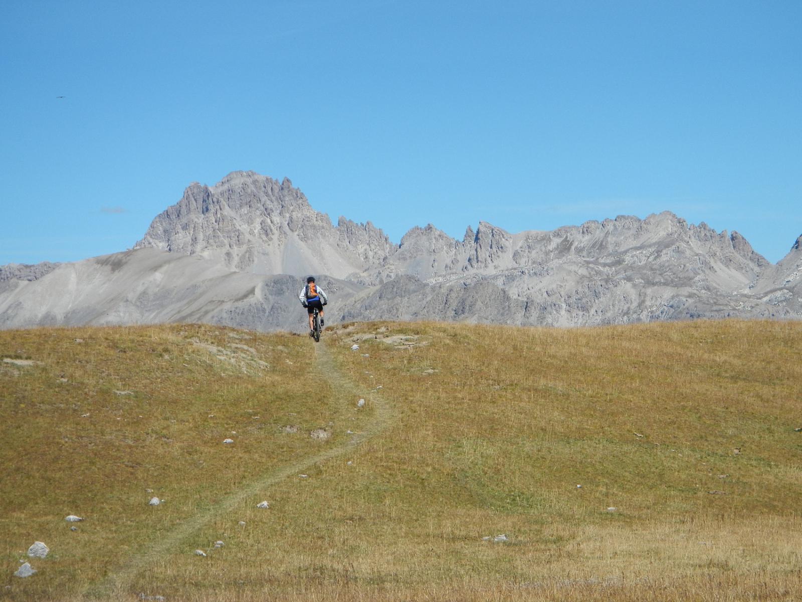
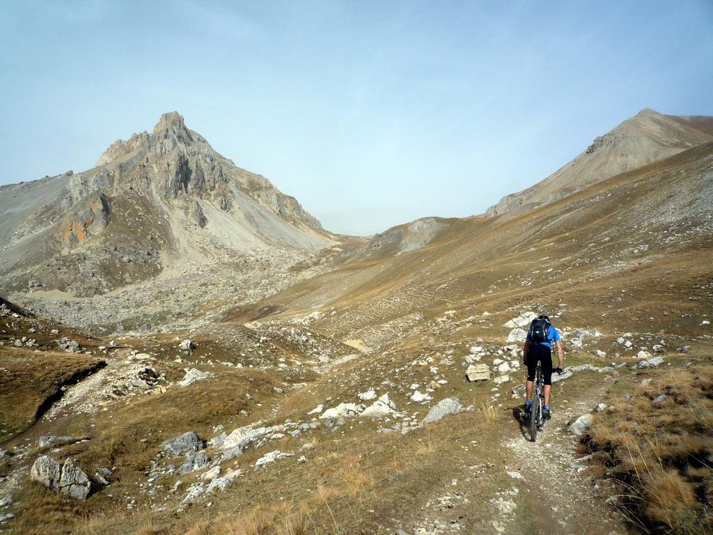
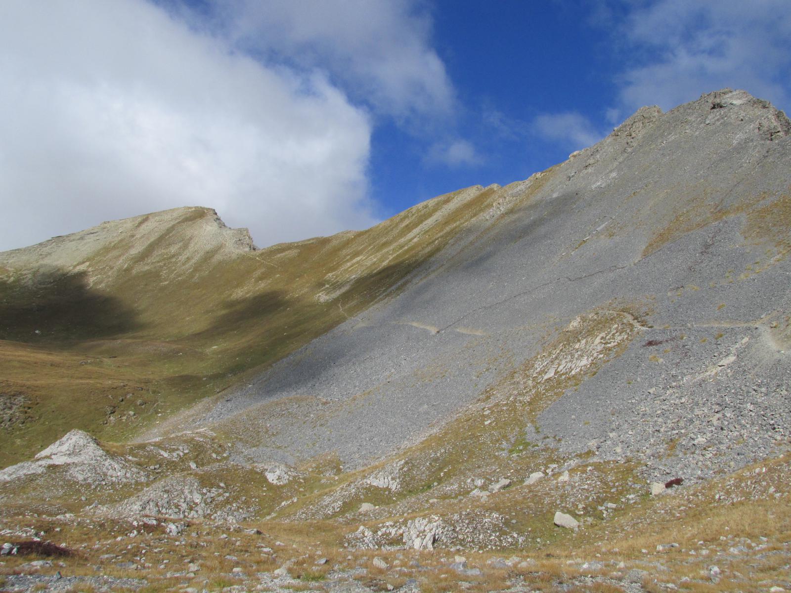
Si prosegue poi su bel sentiero puntanto in salita il colle Roburent che si vede sullo sfondo, superando a destra il lago Oronaye e, sempre su sentiero dal fondo compatto e stupendo da ciclare, si raggiunge il colle.
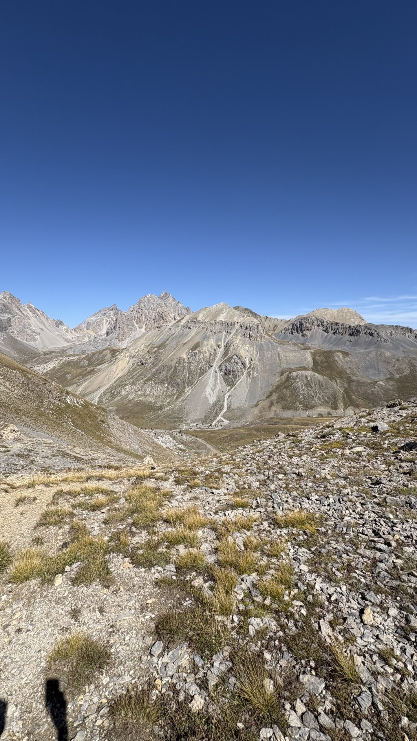
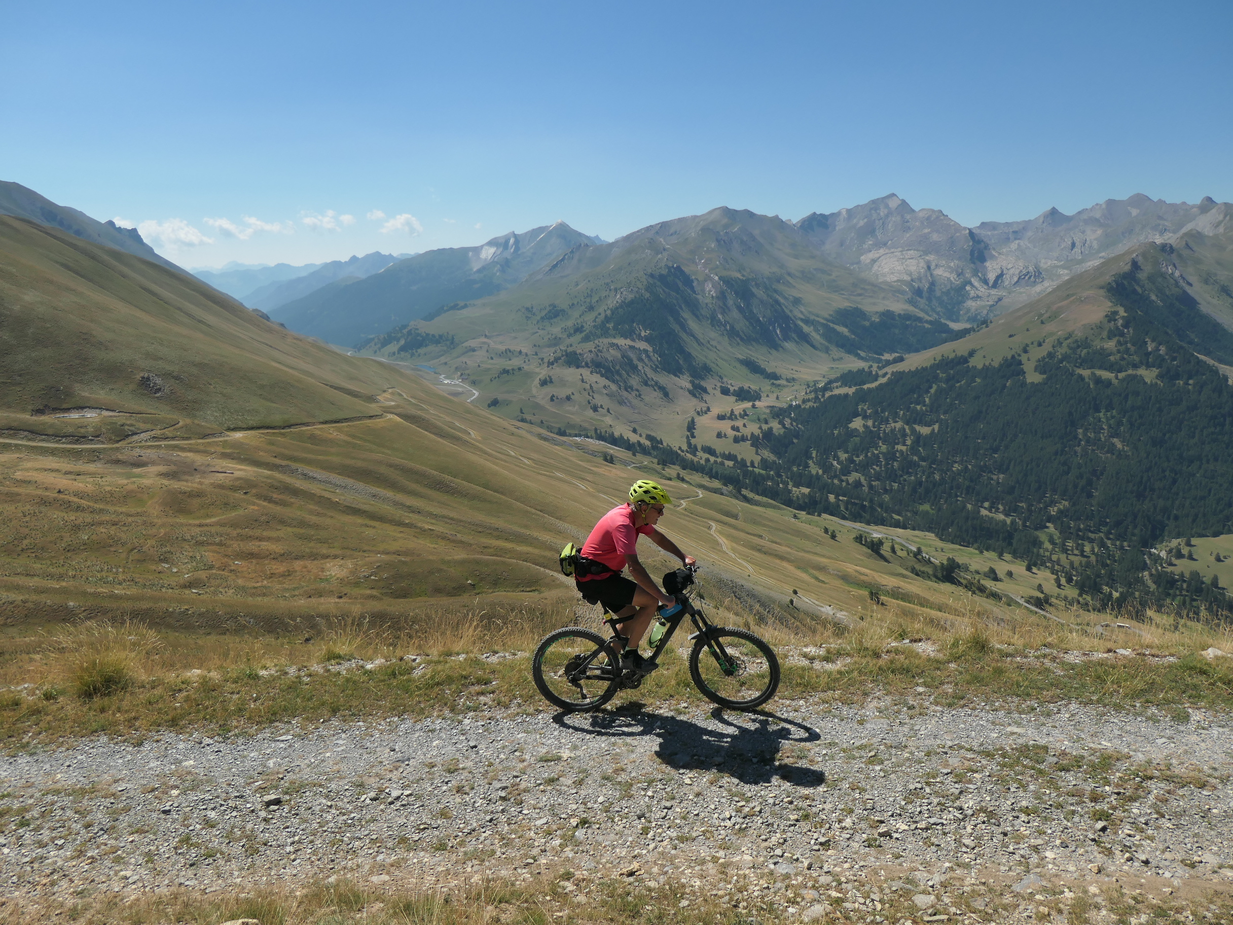
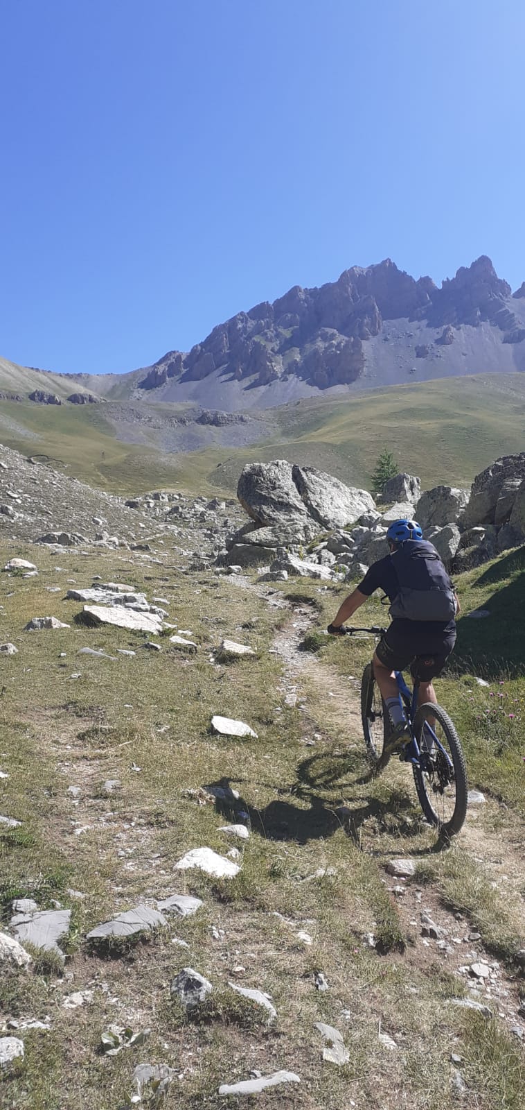
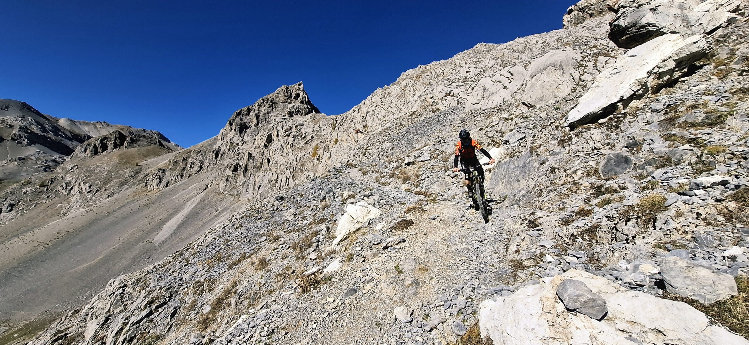
La discesa su Argentera è impegnativa anche se non estrema, e tocca in serie i vari laghi di Roburent e le belle trune.
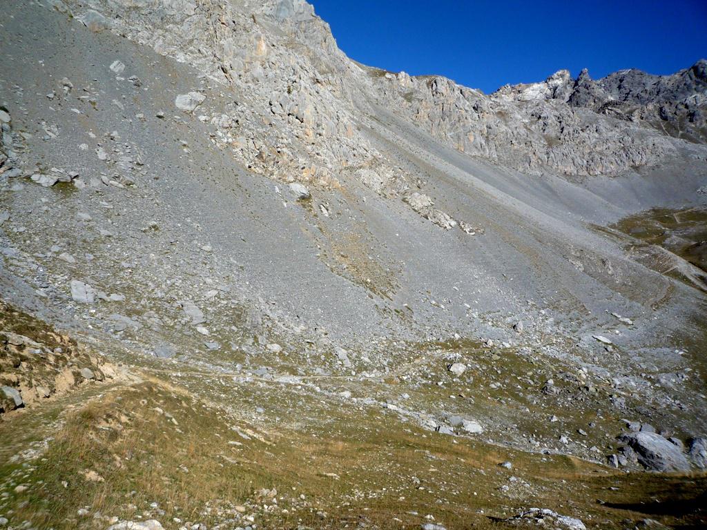
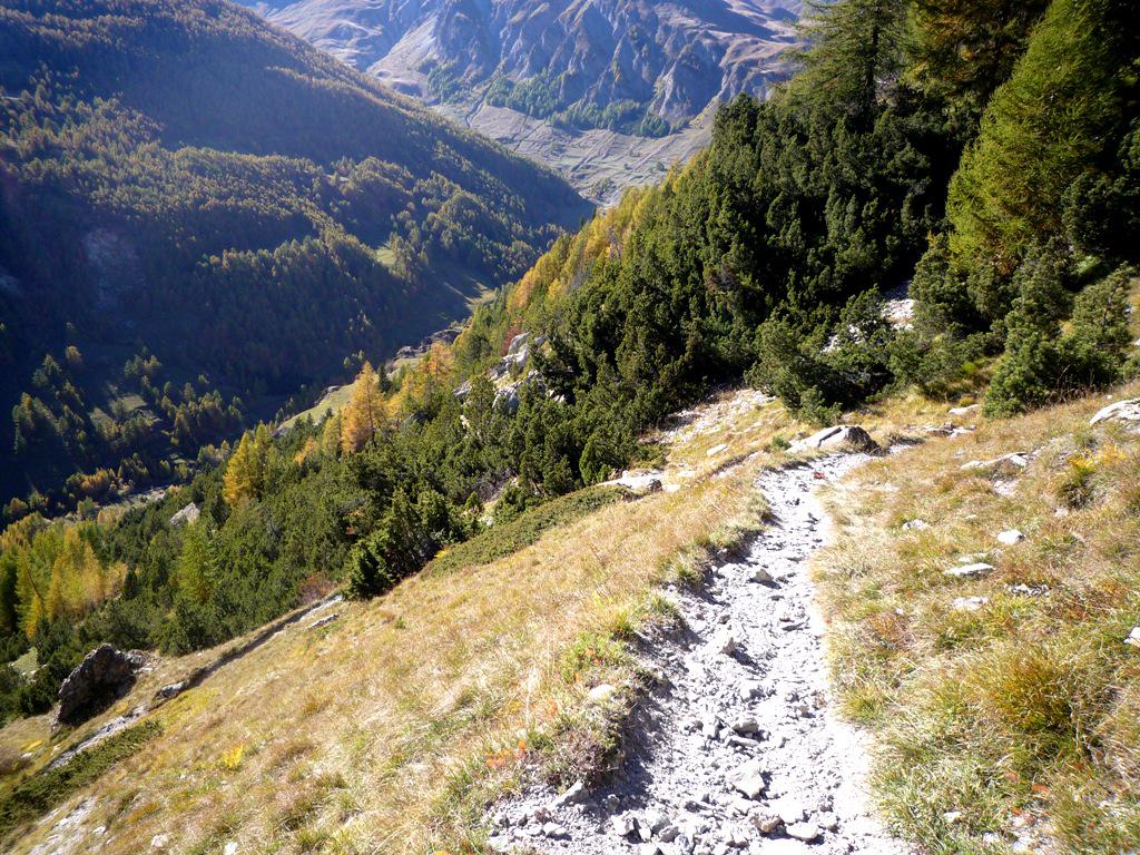
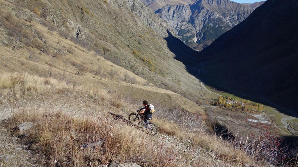
In questo tratto la stradella creata di recente rovina la poesia del giro ma, prima di un lungo traverso in leggera salita, il sentiero torna ad essere stretto e tecnico e, nell’ultimo tratto dalla Tinetta, doventa impegnativo da percorrere in sella solo se in possesso di ottima tecnica (passi S3). In breve con una serie di tornantini si ‘atterra’ su Argentera.
- Cartografia:
- igc 1.50000 n7 valle maira grana e stura
Nelle vicinanze Mappa
Itinerari
28/08/2011 CN, Bersezio/Argentera D+ 1538 m BC, OC, S3 Tutte
Viraysse (Tete de) da Bersezio, giro per i colli della Maddalena e de la Gipiere d’Oronaye
 3.8Km
3.8Km
14/06/2026 CN, Bersezio/Argentera D+ 1000 m BC, BC, S2 Tutte
Colombart (Bassa di) da Bersezio per l’Andelplan
 3.8Km
3.8Km
03/08/2024 CN, Bersezio/Argentera D+ 1000 m BC, BC, S2 Tutte
Puriac (Colle del) da Bersezio, giro
 3.8Km
3.8Km
08/10/2010 Alpes-de-Haute-Provence, Val-d'Oronaye D+ 1300 m BC, BC+, S2 Varie
Soubeyran (Monte) o Tete de l’Alp da le Pontet per il Col de la Gypière e il Colle delle Munie
 5.2Km
5.2Km
31/08/2022 CN, Bersezio/Argentera D+ 1130 m OC+, OC+, S3 Sud
Stau (Colle di) da Villaggio Primavera
 6Km
6Km
19/09/2021 CN, Acceglio D+ 1850 m BC, OC, S3 Tutte
Sautron, Portiola (Colli) da Saretto, giro per il Rifugio Stroppia
 9.2Km
9.2Km
15/07/2024 CN, Acceglio D+ 1400 m OC, BC+, S3 Varie
Viraysse (Monte) o Cime de la Coste du Col da Saretto anello per i colli della Cavalla, Munie, Sautron
9.2Km
07/08/2017 CN, Acceglio D+ 1280 m BC+, OC+, S3 Varie
Soubeyran (Monte) o Tete de l’Alp da Saretto, giro per i Passi della Cavalla e Munie e Lago Visaisa
 9.2Km
9.2Km
05/07/2015 CN, Acceglio D+ 3250 m OC, OC, S2 Tutte
Sautron, Portiolette, Vallonet, Maurin (Colli) da Saretto, giro (2 gg)
 9.2Km
9.2Km
02/09/2017 CN, Acceglio D+ 1917 m BC, BC+, S3 Tutte
Enchiausa (Colle d’) da Chialvetta, giro dell’Auto Vallonasso e Mont Freid per il Colle Ciarbonet
 9.3Km
9.3Km
Servizi
200m
4.1Km
da Mo Ristorante
Bersezio/Argentera
4.2Km
Bruno Ristorante
Bersezio/Argentera
5.1Km
Della Pace Rifugio
Bersezio/Argentera
5.9Km
B&b del Villaggio B&B
Bersezio/Argentera
7Km
Viviere Rifugio
Acceglio
8.9Km
Gardetta Rifugio
Canosio
9.1Km
La Tavernetta Ristorante
Acceglio
9.1Km
Chialvetta Rifugio
Acceglio
9.2Km