 200m
200m


Note
Storico
 0m
0m
0m
0m
50m
50m
50m
50m
50m
50m
0m
0m
0m
0m
50m
50m
50m
50m
50m
50m
200m
 5Km
5Km
5.1Km
6Km
6.3Km
6.6Km
6.7Km
9.5Km
9.9Km
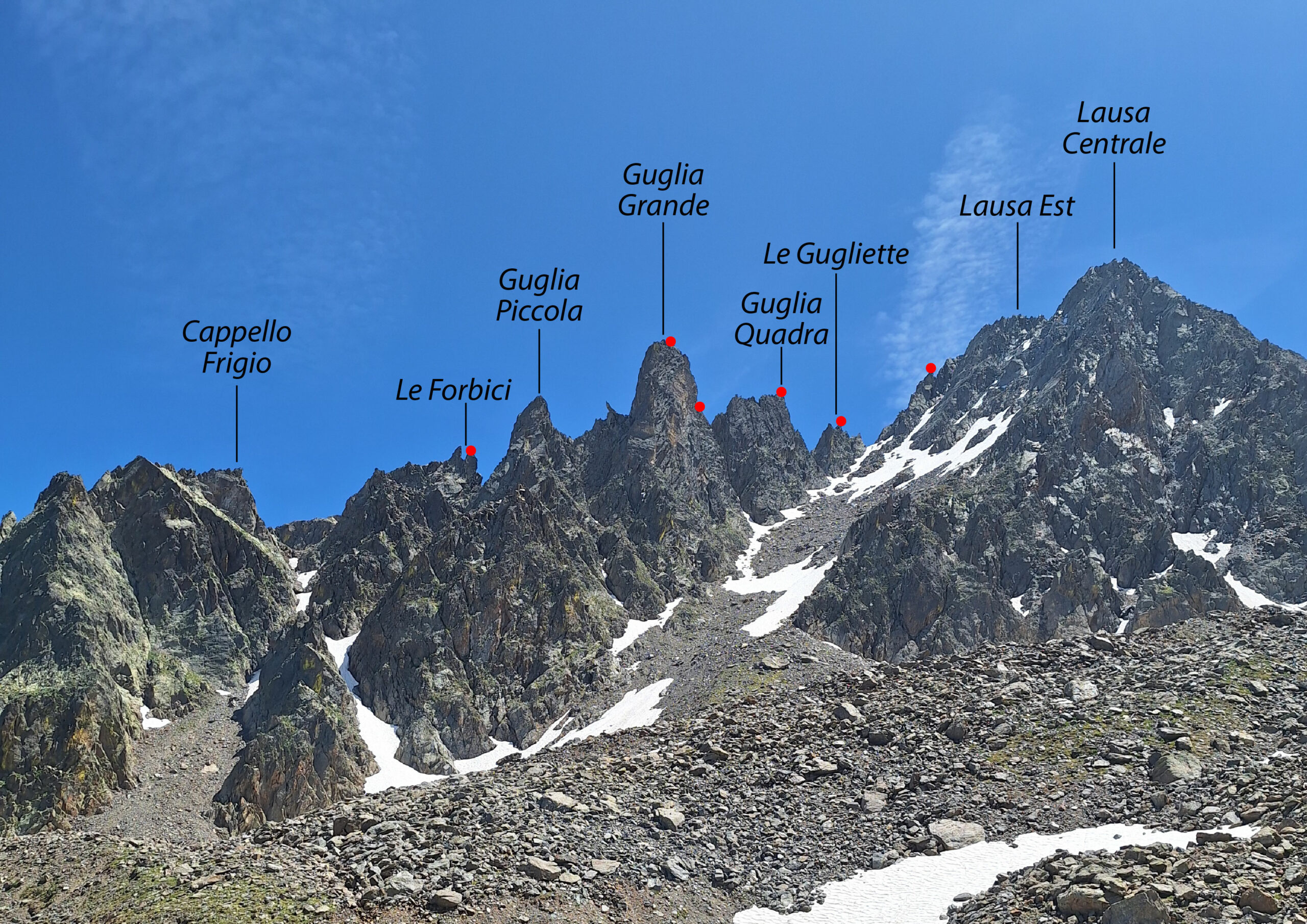
Traversata tra le più lunghe varie e interessanti della zona, su roccia in prevalenza buona. La traversata delle Guglie della Lausa prevede il superamento di 6 punte: 1. il cappello Frigio, 2. le Forbici, 3. la Guglia Piccola, 4. la Guglia Grande, 5. la Guglia Quadra, 6. le Gugliette. Dal suo termine la scelta più conveniente è senza dubbio quella di proseguire lungo la cresta Nord fino alla Cima della Lausa Est e da lì, su terreno nettamente più facile, proseguire alla cima Centrale e poi alla Ovest, da cui in breve si intercetta il sentiero del Colle della Lausa. In alternativa, al termine delle Guglie è possibile scendere sul bacino dell'ex ghiacciaio dell'Ubac evitando la salita delle Lause.
Avvicinamento
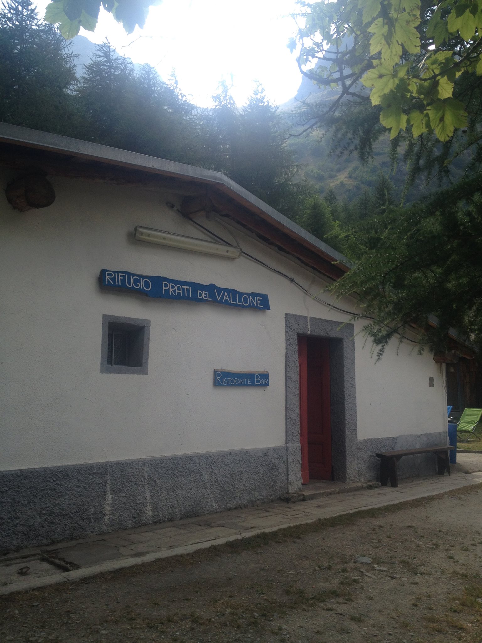
Da Cuneo risalire La Val Stura di Demonte fino a Pontebernardo. Svoltare a sx prima del paese. Risalire su strada stretta ma asfaltata il vallone di Pontebernardo fin dove la strada termina nei pressi del rifugio Talarico. Parcheggiare nell'ampio ampio spazio sulla destra dopo gli ultimi 500m di strada sterrata.
Descrizione
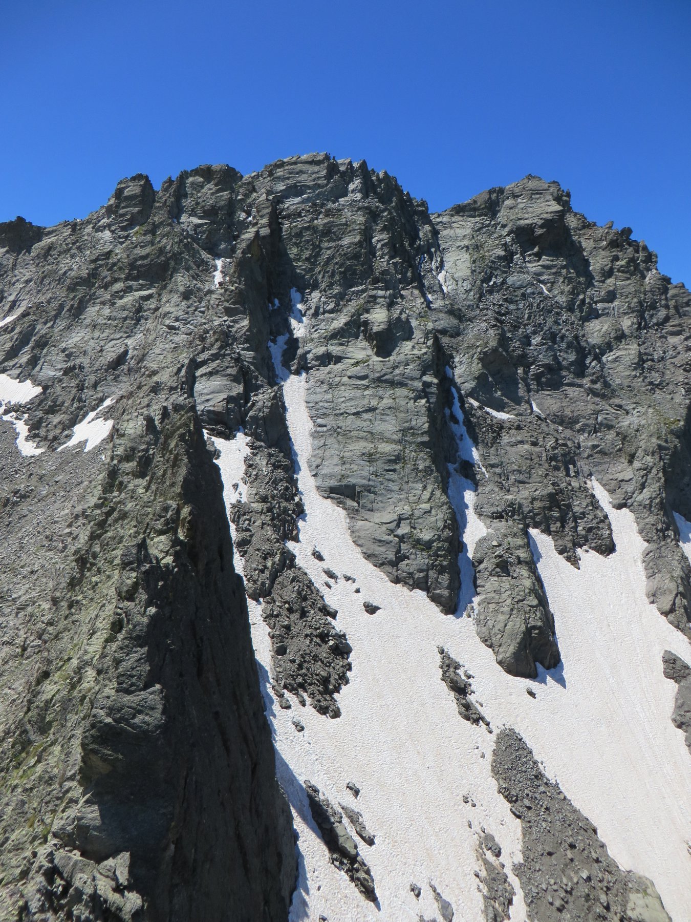
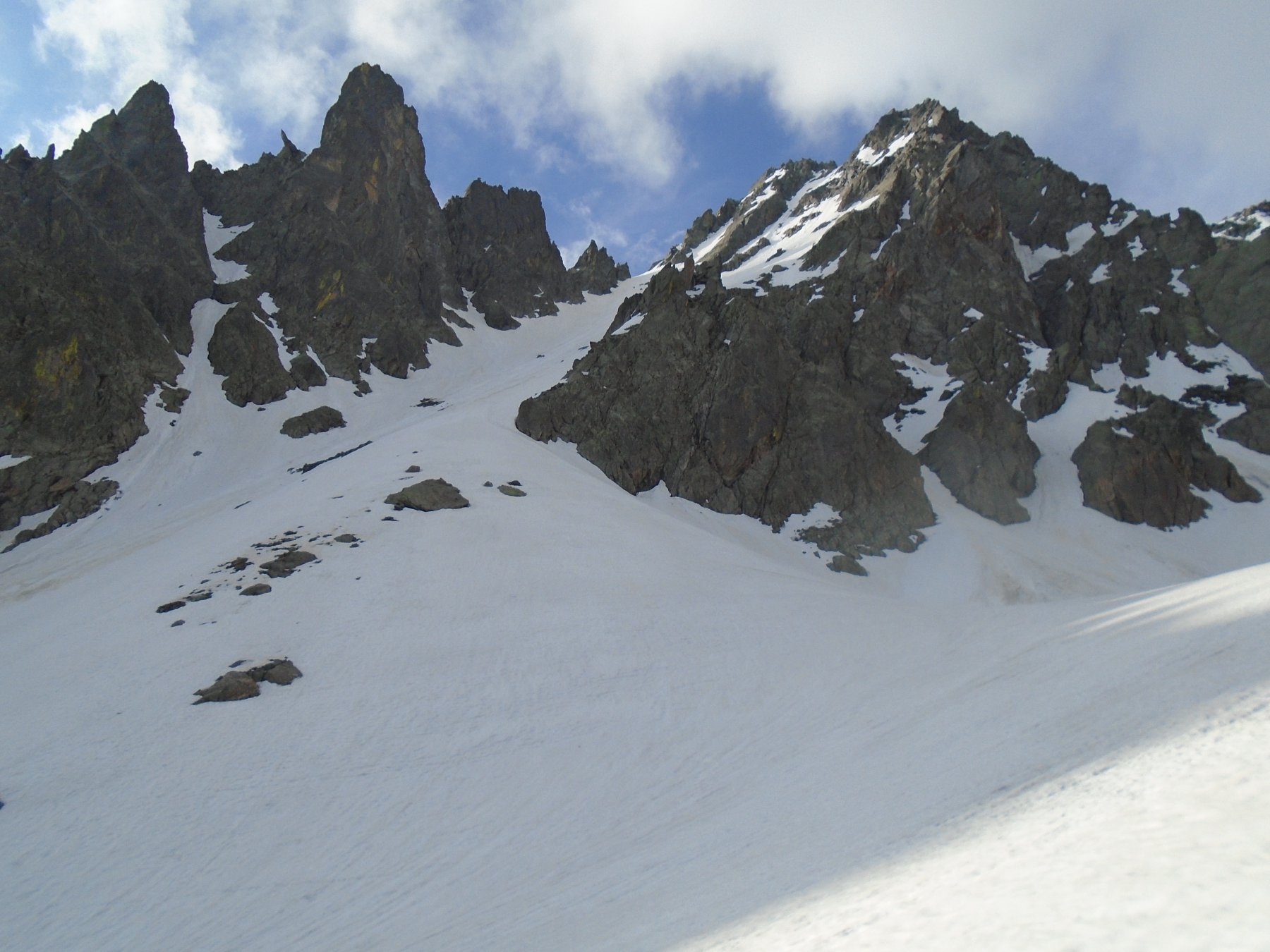
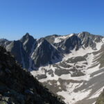
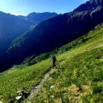
Dai prati del Vallone seguire le indicazioni per il Passo della Lausa. Salire fino alla morena a 2500m e quindi appena il sentiero spiana (dopo aver lasciato sulla dx il ricovero della Lausa), tagliare verso Est (sx) per pietraie, passare sotto una parete rocciosa e quindi salire verso l’ex ghiacciaio dell’Ubac (canalino di sfasciumi o ripida china erbosa a sx). Dal bacino salire verso dx (Sud) per un pendio di erba e roccette fino alla base della cresta.
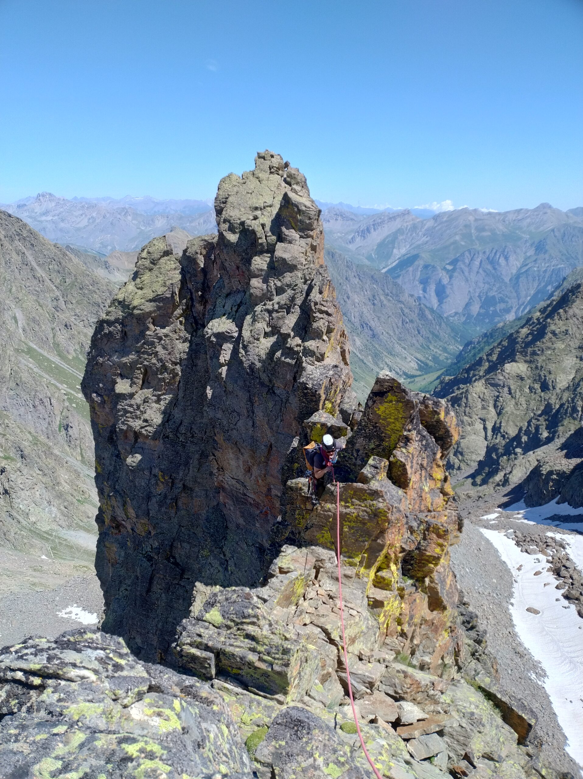
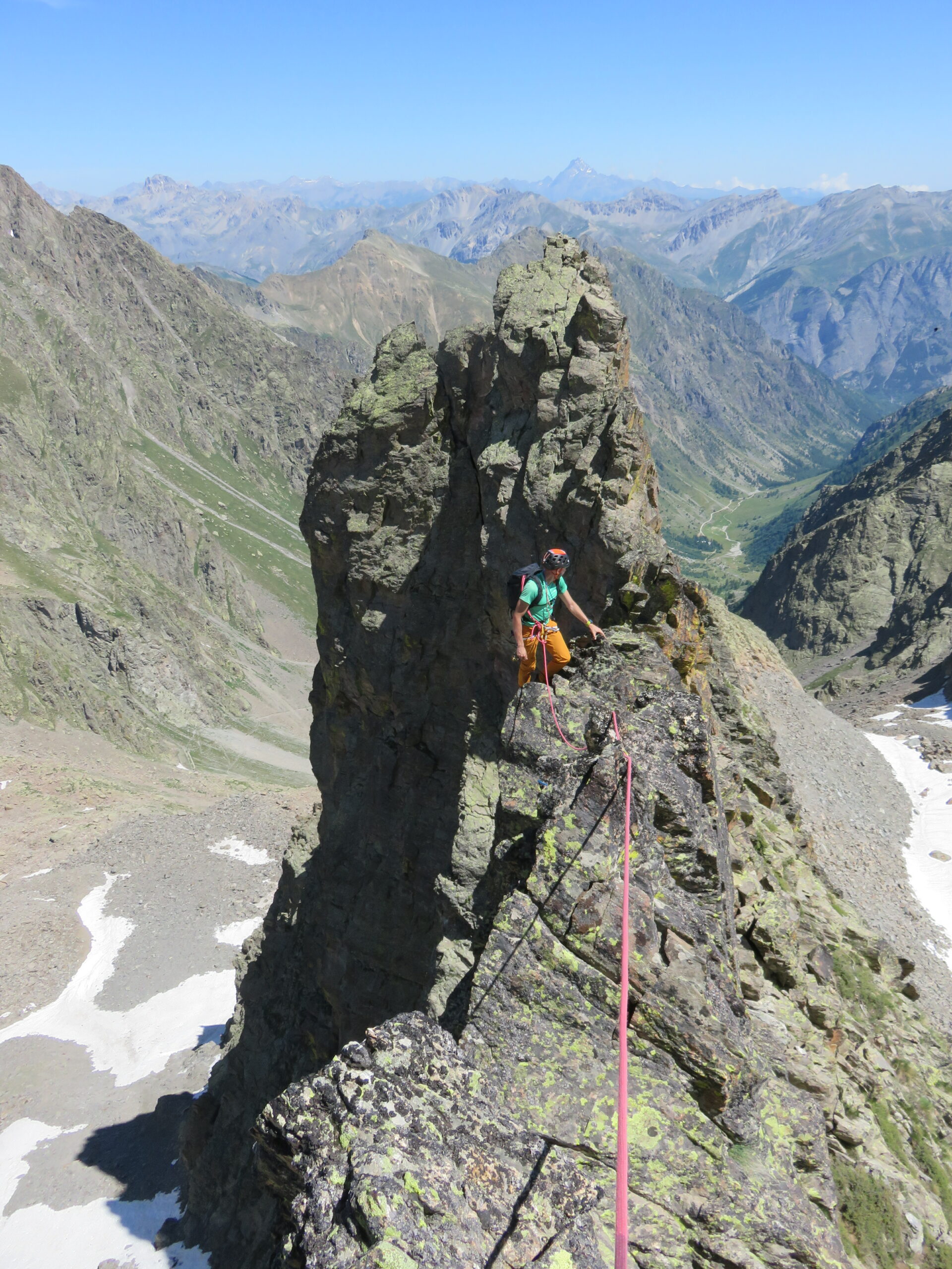
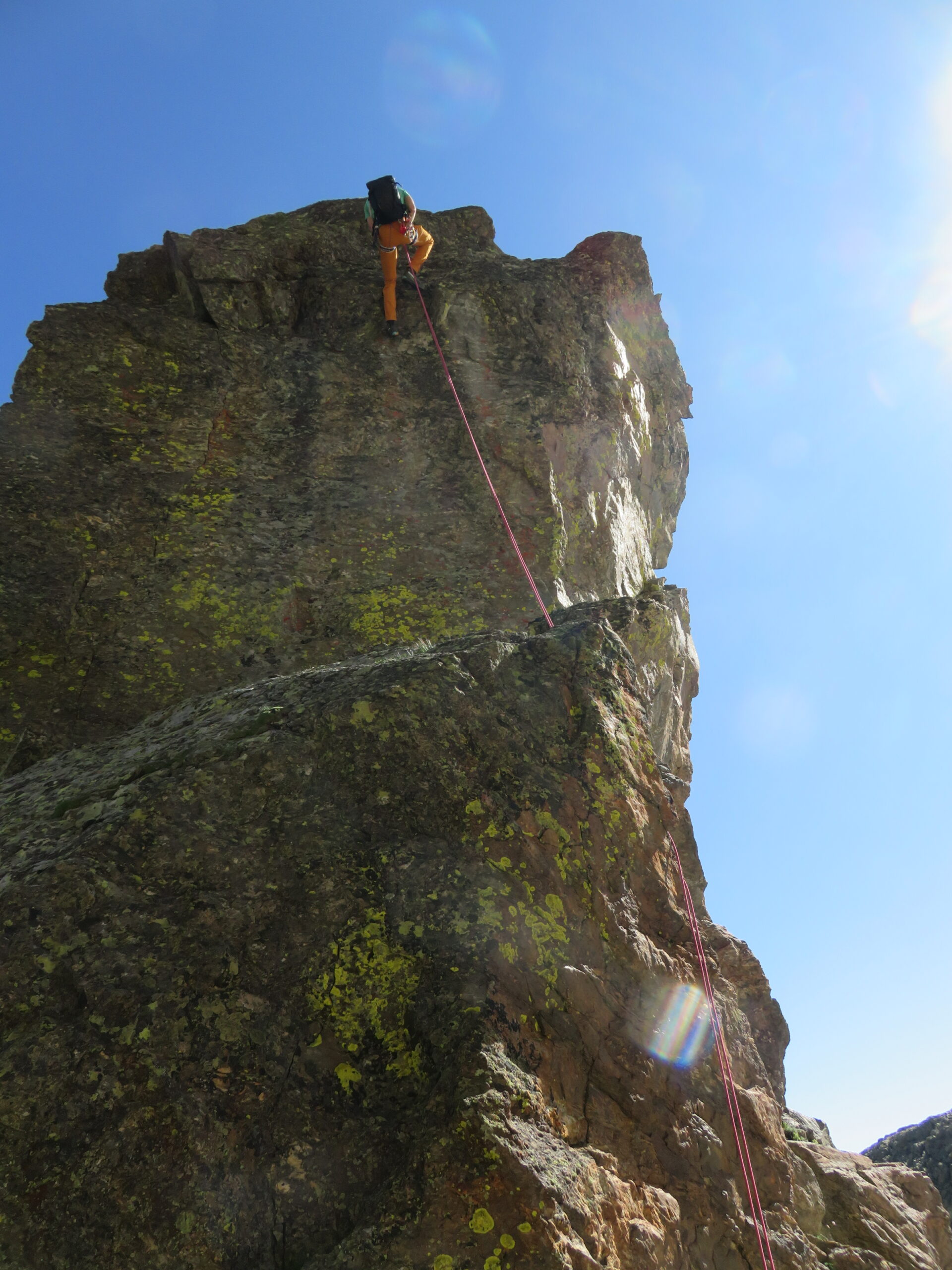
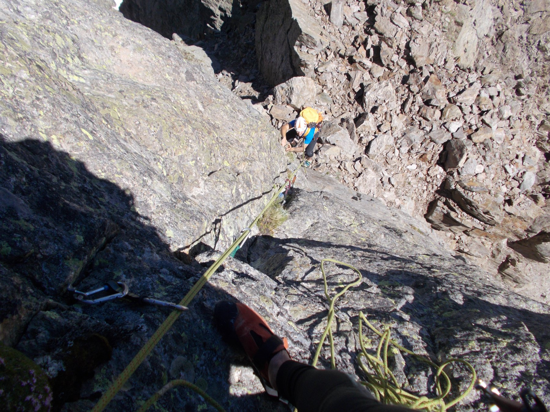
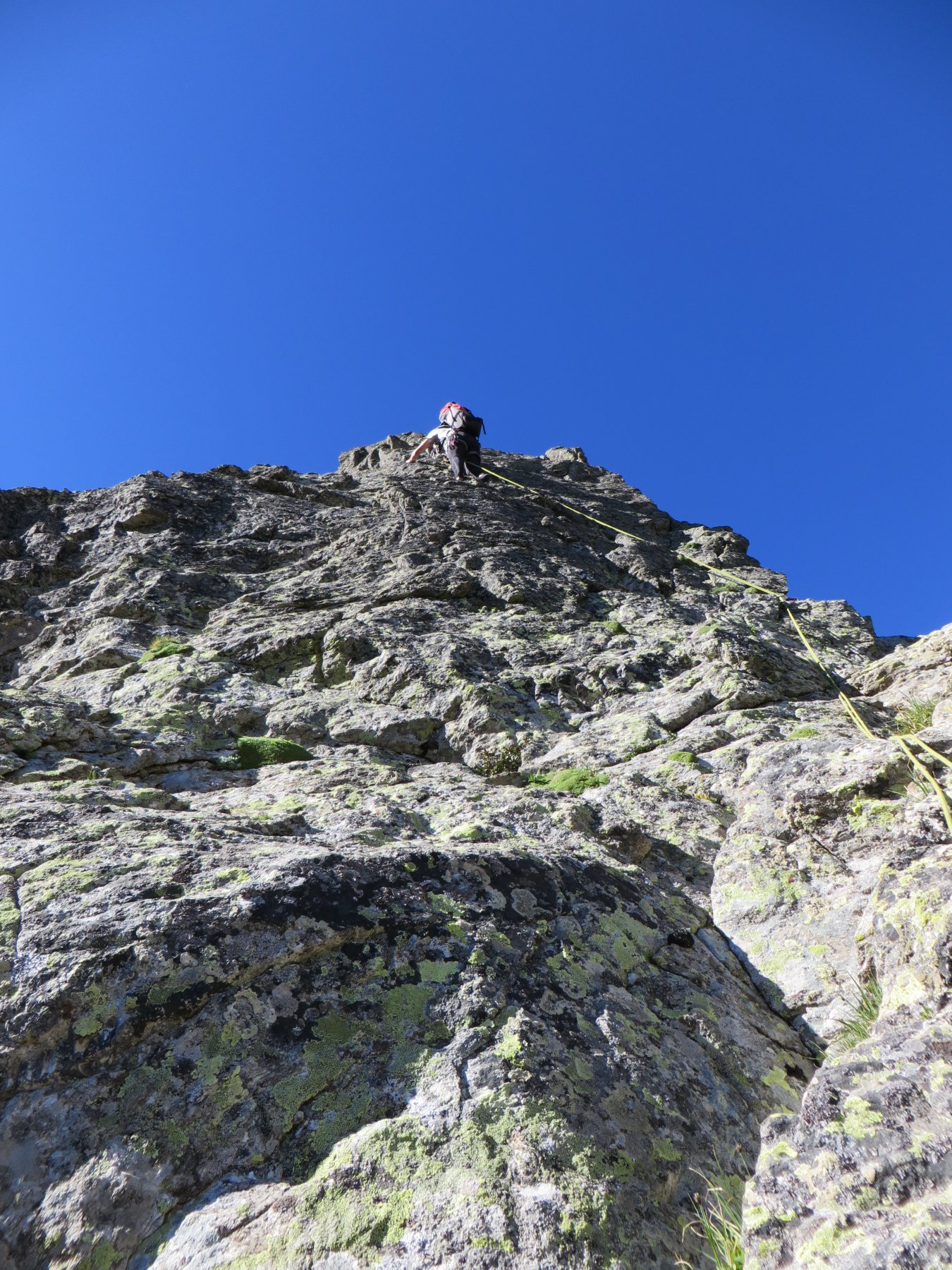
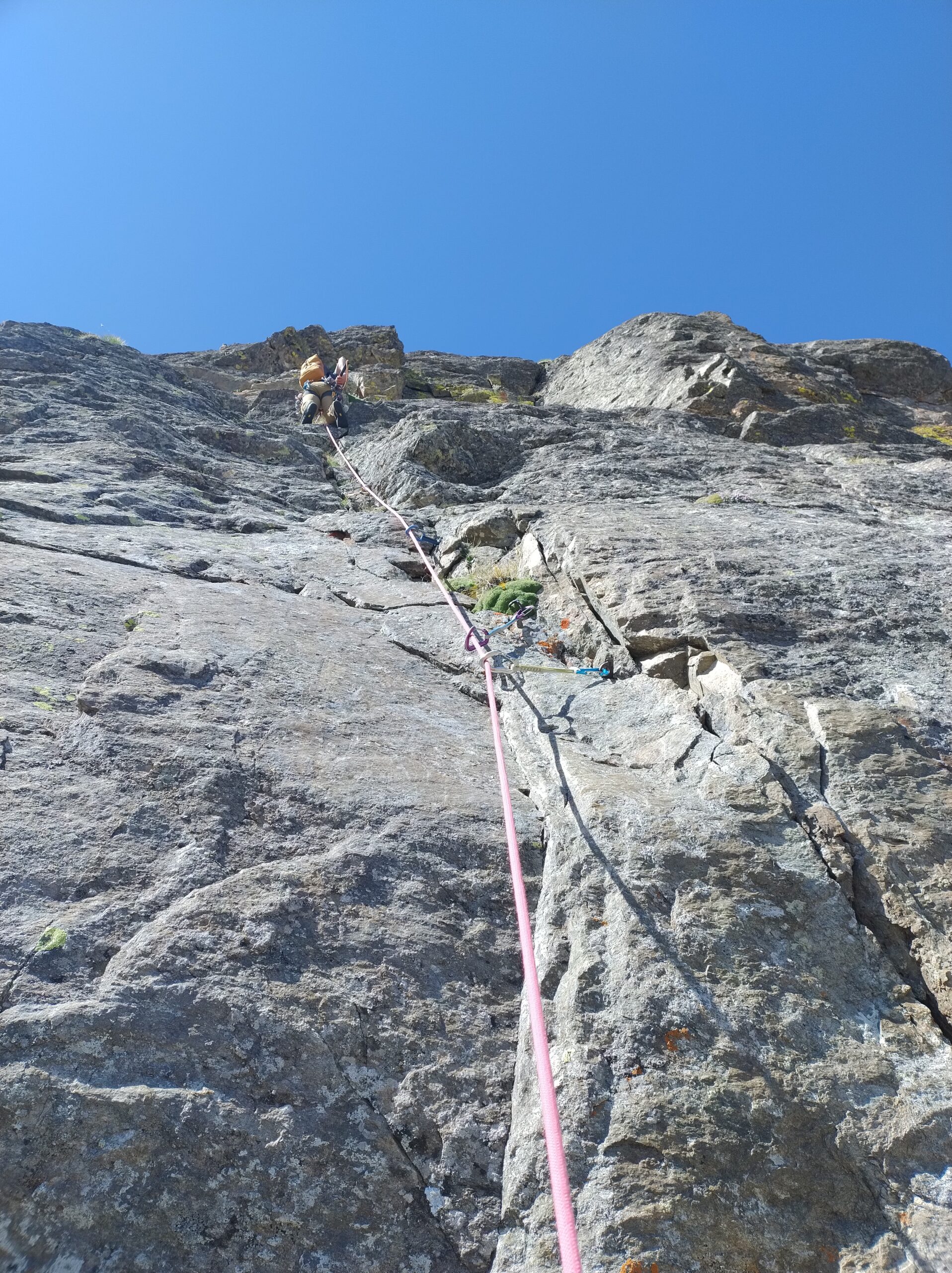
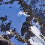
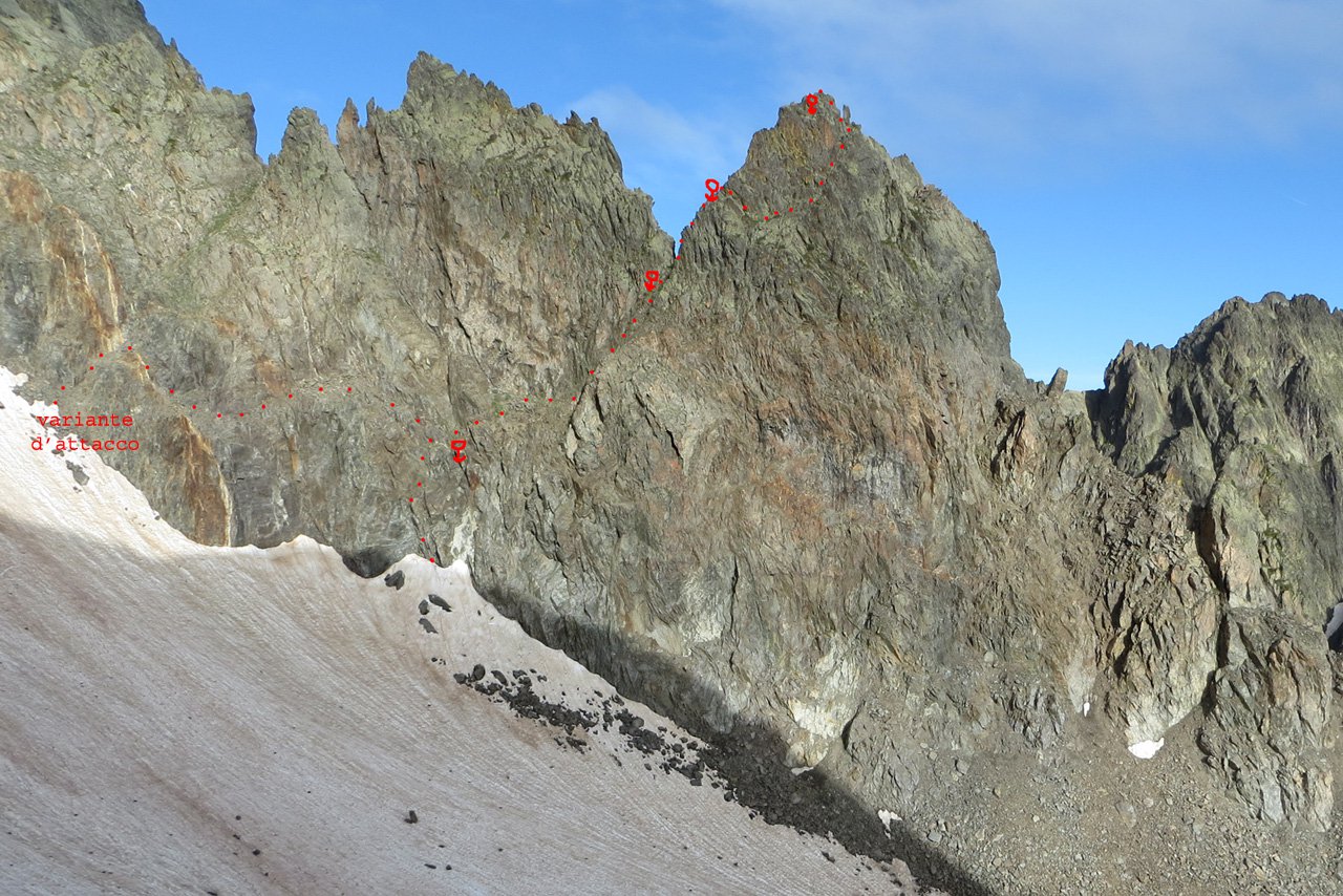
Risalire la prima guglia (Cappello Frigio) sul suo spigolo SE, con divertenti passaggi (max III). Dalla cima spostarsi verso sx e ridiscendere verso il bacino dell’Ubac fino ad un profondo colletto. Proseguire la salita delle “Forbici” lungo una fessura (III), quindi spostarsi a sx e proseguire sul filo fino ad un salto verticale, da cui si scende con una doppia verticale di 20m (cordone con maillon) fino ad un colletto.
Risalire la parete successiva sulla sx, per delle belle placche compatte (III/+), cercando il percorso migliore fino all’ultimo risalto ripido che porta in cima alla Guglia Piccola.
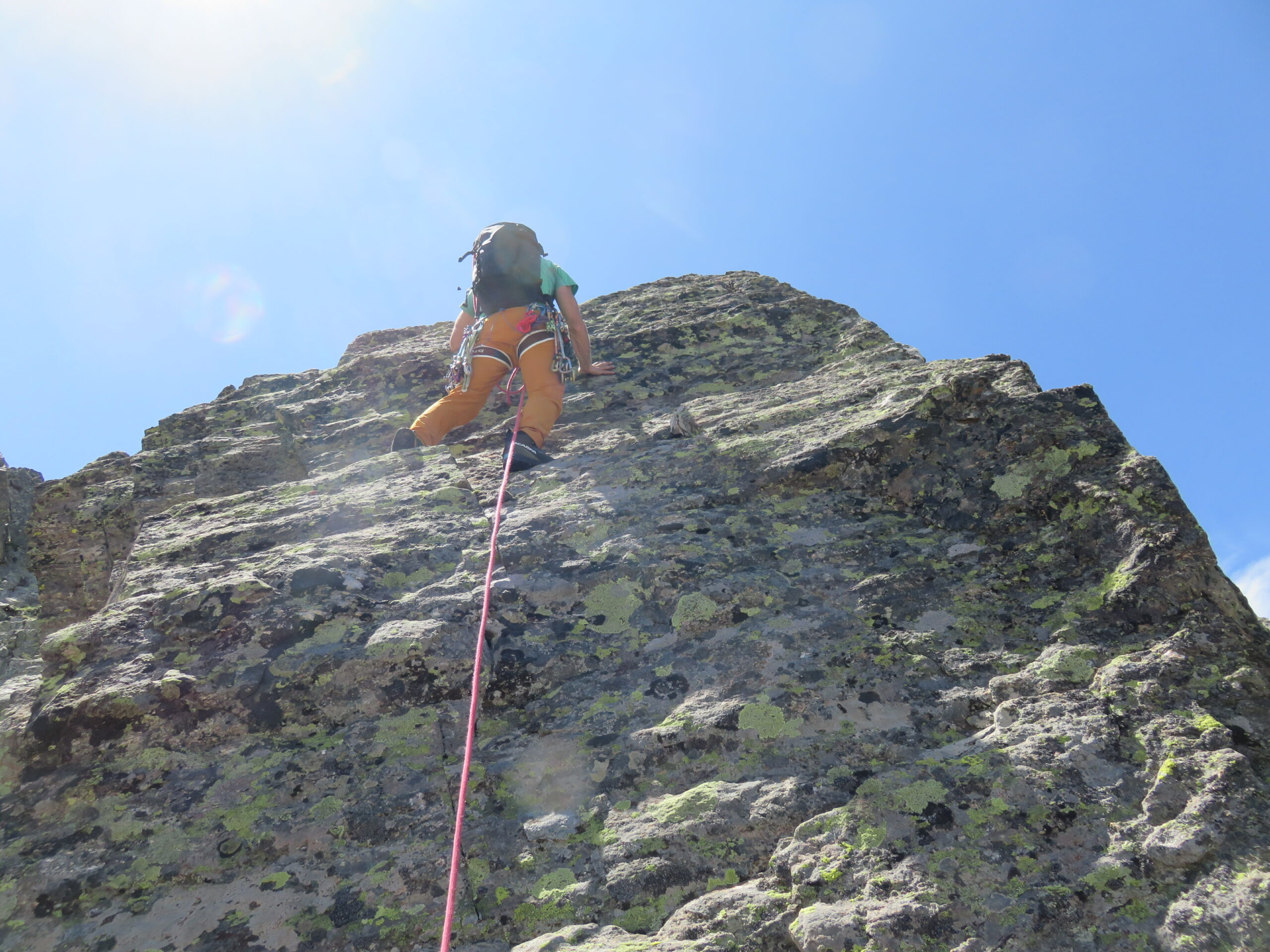
Ridiscendere dal suo spigolo Sud piegando prima a dx e poi a sx, quindi disarrampicare un caminetto e proseguire su una breve placca verticale improteggibile (III+), scontornare sulla sx (Est) un gendarme squadrato e quindi raggiungere il colletto alla base della Guglia Grande.
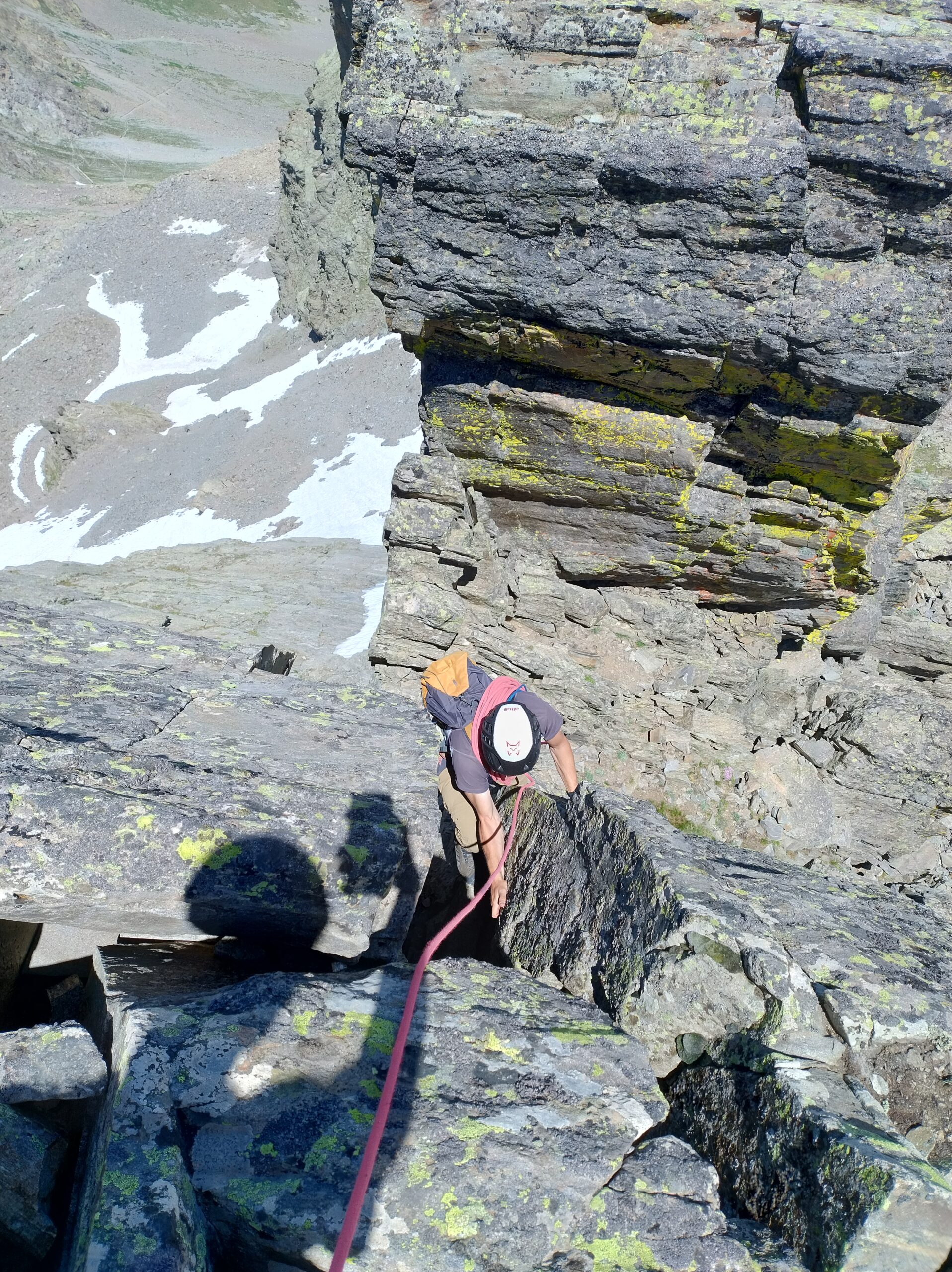
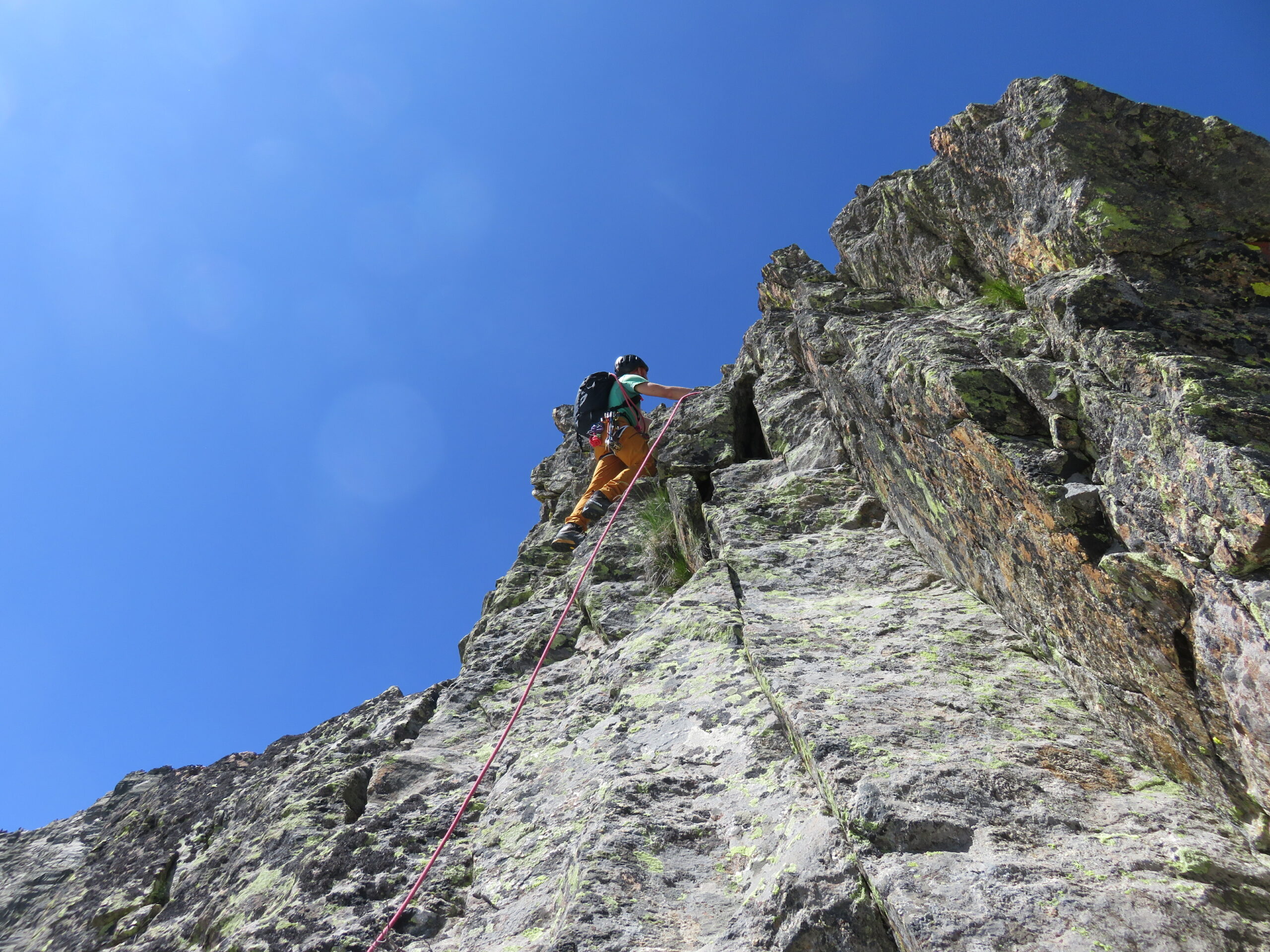
Risalire l’evidente fessura, liscia e improteggibile in partenza e poi attrezzata con 5 chiodi nei primi 15m, ripida e sostenuta (IV+ e A0). Sotto uno strapiombino si traversa a sx su un cengetta esposta e quindi si riprende a salire tramite una fessura via via meno ripida, proseguendo su placche abbattute ma di roccia non salda fino ad un comodo terrazzo di sosta (da allestire sui numerosi blocchi presenti).
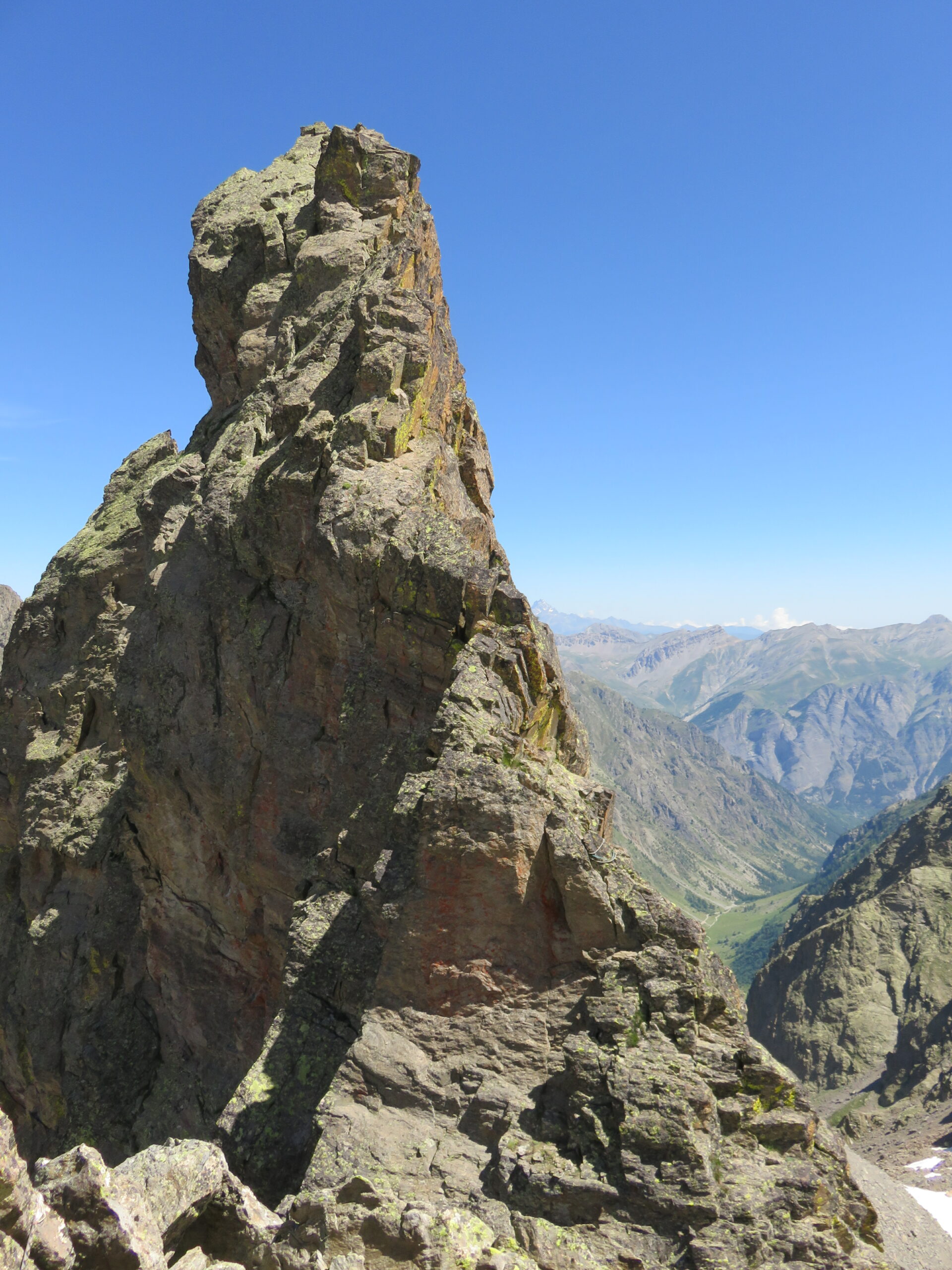
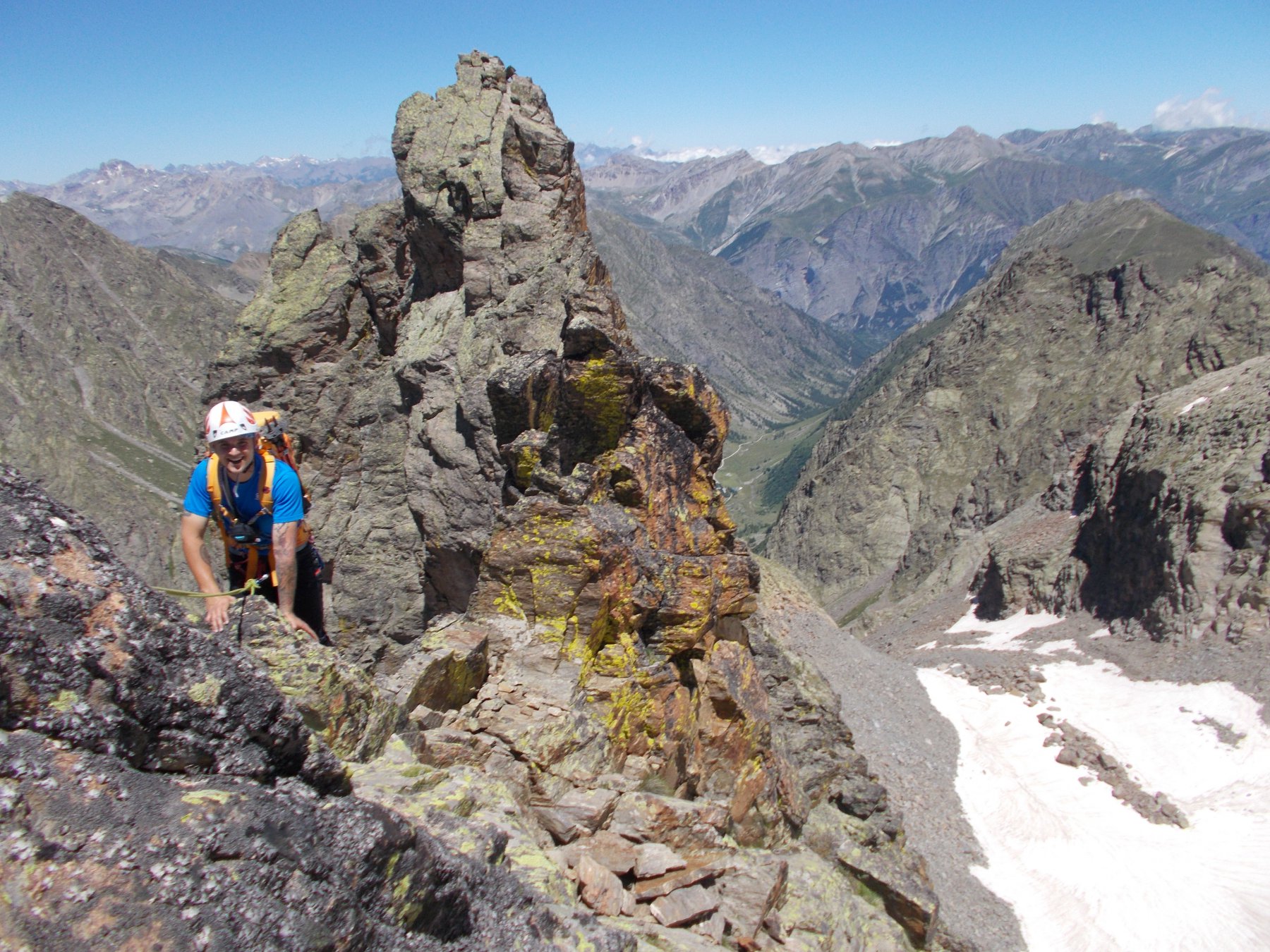
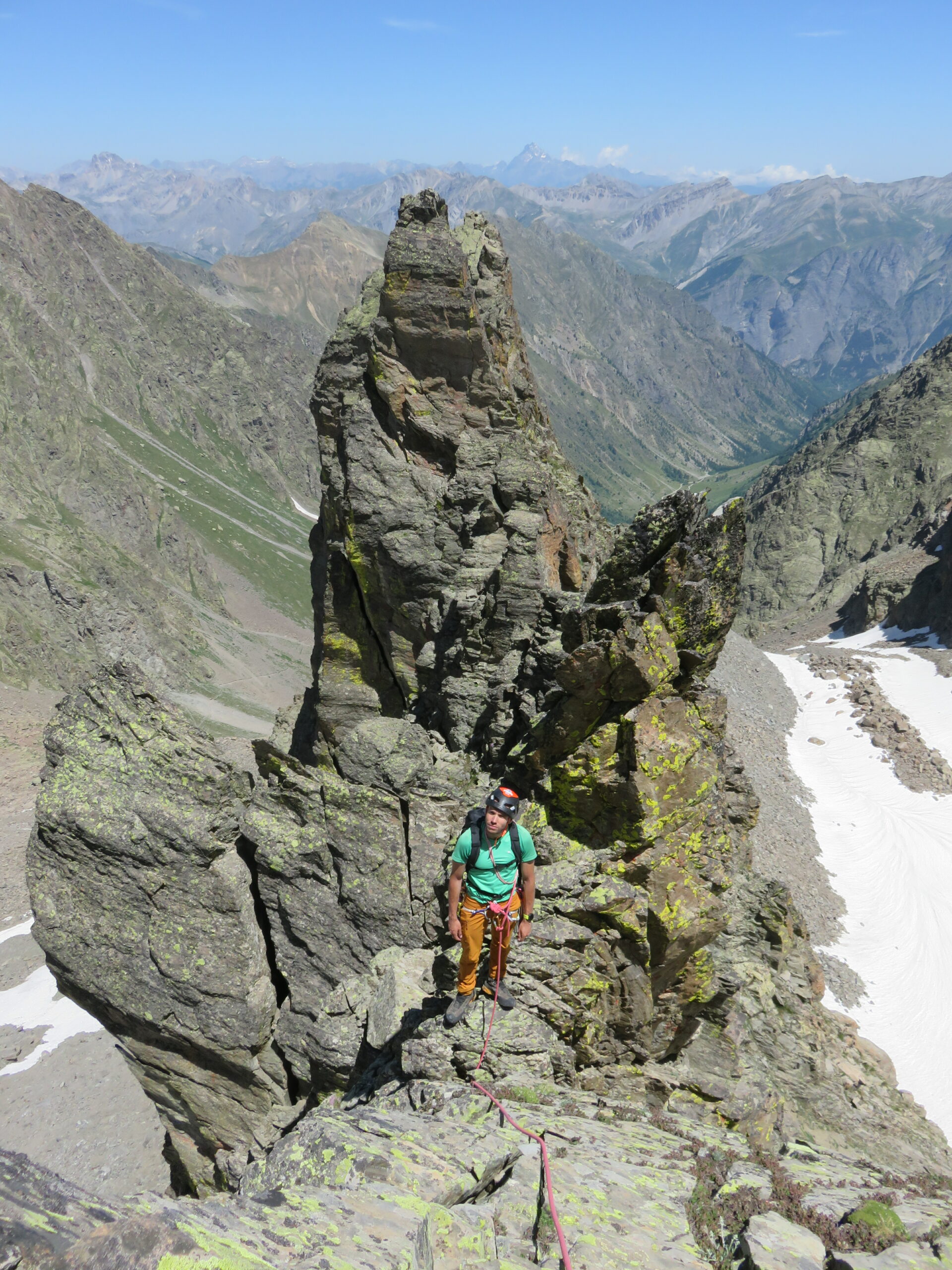
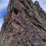
Si prosegue per una placchetta da affrontare da dx a sx (III) fino a raggiungere (piegando brevemente sul lato Ovest) l’ometto di vetta della Guglia Grande. Proseguire per 5m fino ad una sosta con 2ch.+cordoni, quindi calarsi per 25m verso Sud, traversare 4-5m verso dx (faccia a valle) e quindi con una seconda calata da 20m raggiungere la base della Guglia Quadra.
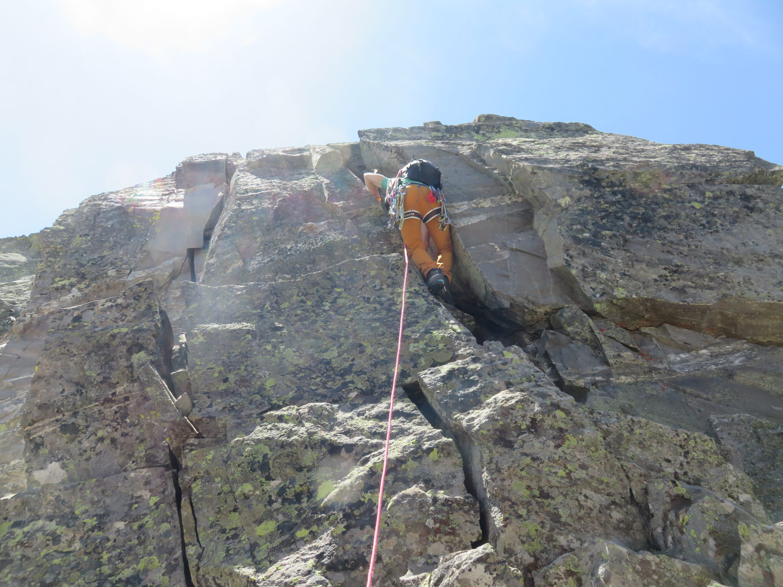
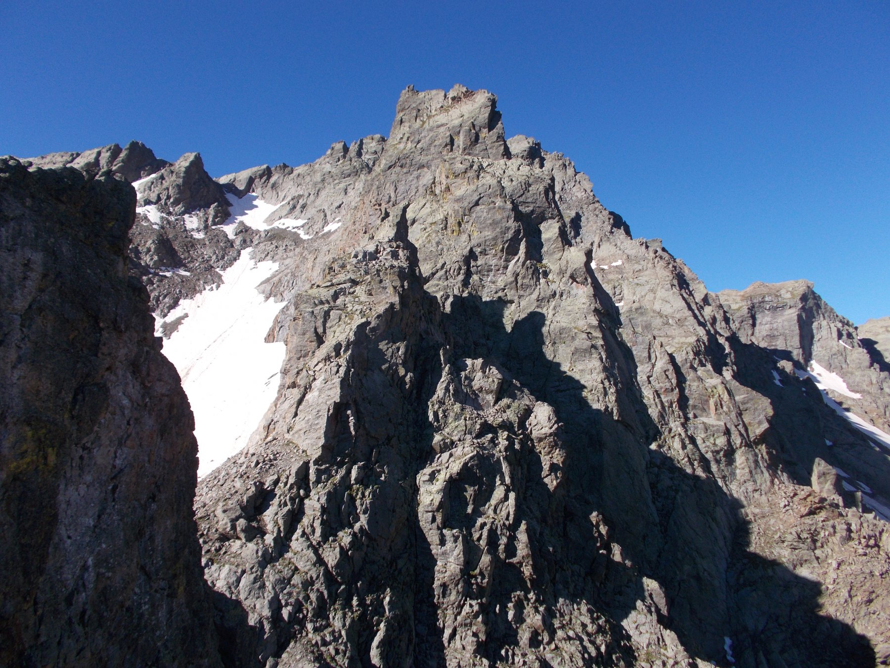
Risalire le belle placche ripide sulla sx, quindi ridiscendere brevemente fino alla base di un tratto di cresta ripido e molto stretto, che seguito integralmente (passo iniziale di III+ non proteggibile, quindi più facile ma molto esposto) porta in cima alla Guglia Quadra. Calarsi verso Sud fino all’altezza di un intaglio, quindi spostarsi a dx (O) e con alcuni saliscendi superare alcuni gendarmi di roccia marcia, fino a raggiungere la prima delle “Gugliette”.
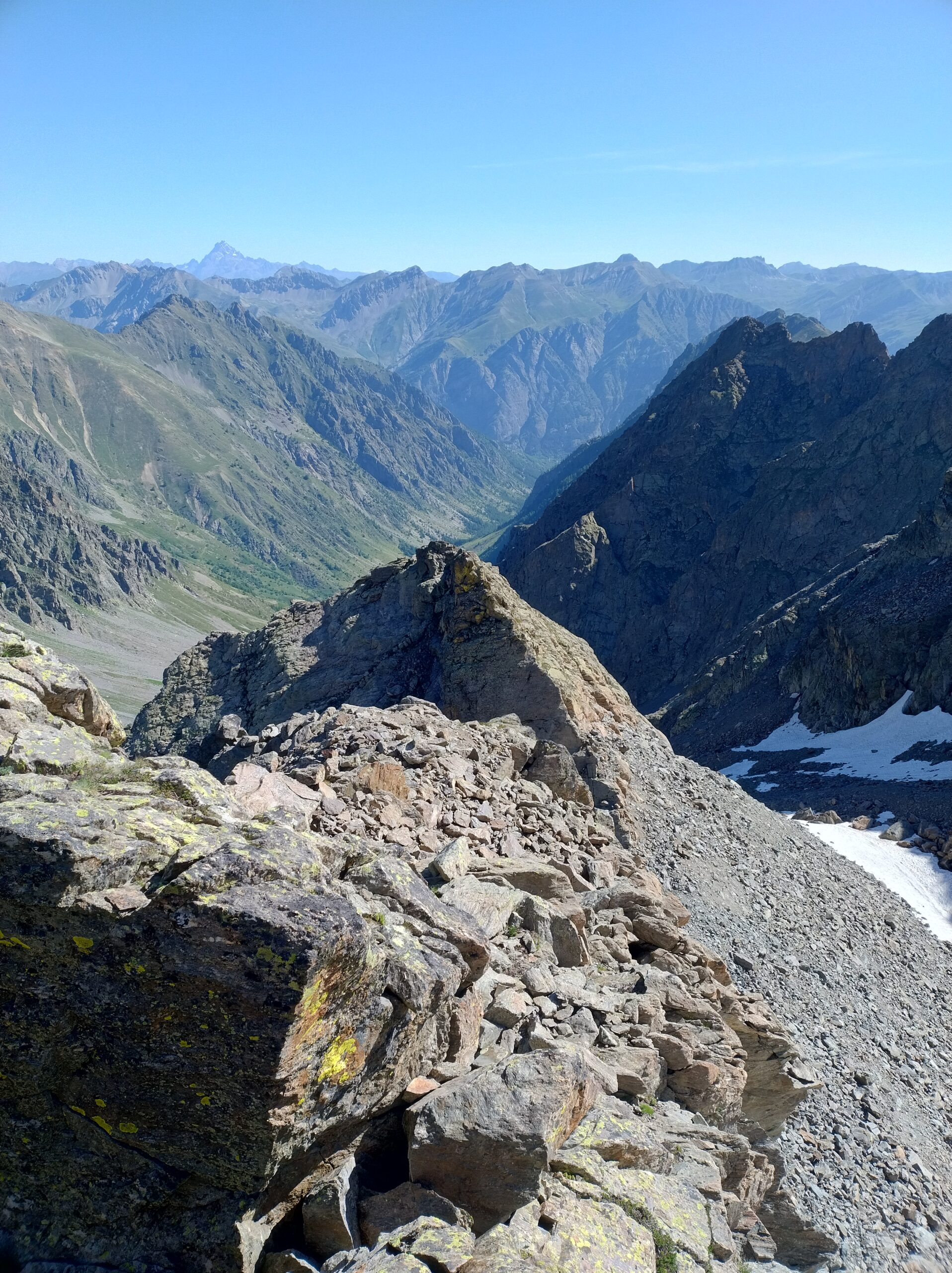
Calarsi per pochi metri (cordino) fino ad un colletto e quindi proseguire fino alla seconda Guglietta, proseguire in cresta con minori difficoltà e alcuni saliscendi fino a raggiungere il termine della cresta, alla base della cresta Nord della Lausa.
[Qui eventualmente è possibile abbandonare la traversate piegando a sx (SE) su sfasciumi e/o nevai tornando nel bacino dell’ex ghiacciaio, percorrendolo verso Nord si ritorna all’attacco della cresta da cui si può tornare all’auto tramite il percorso fatto all’andata]
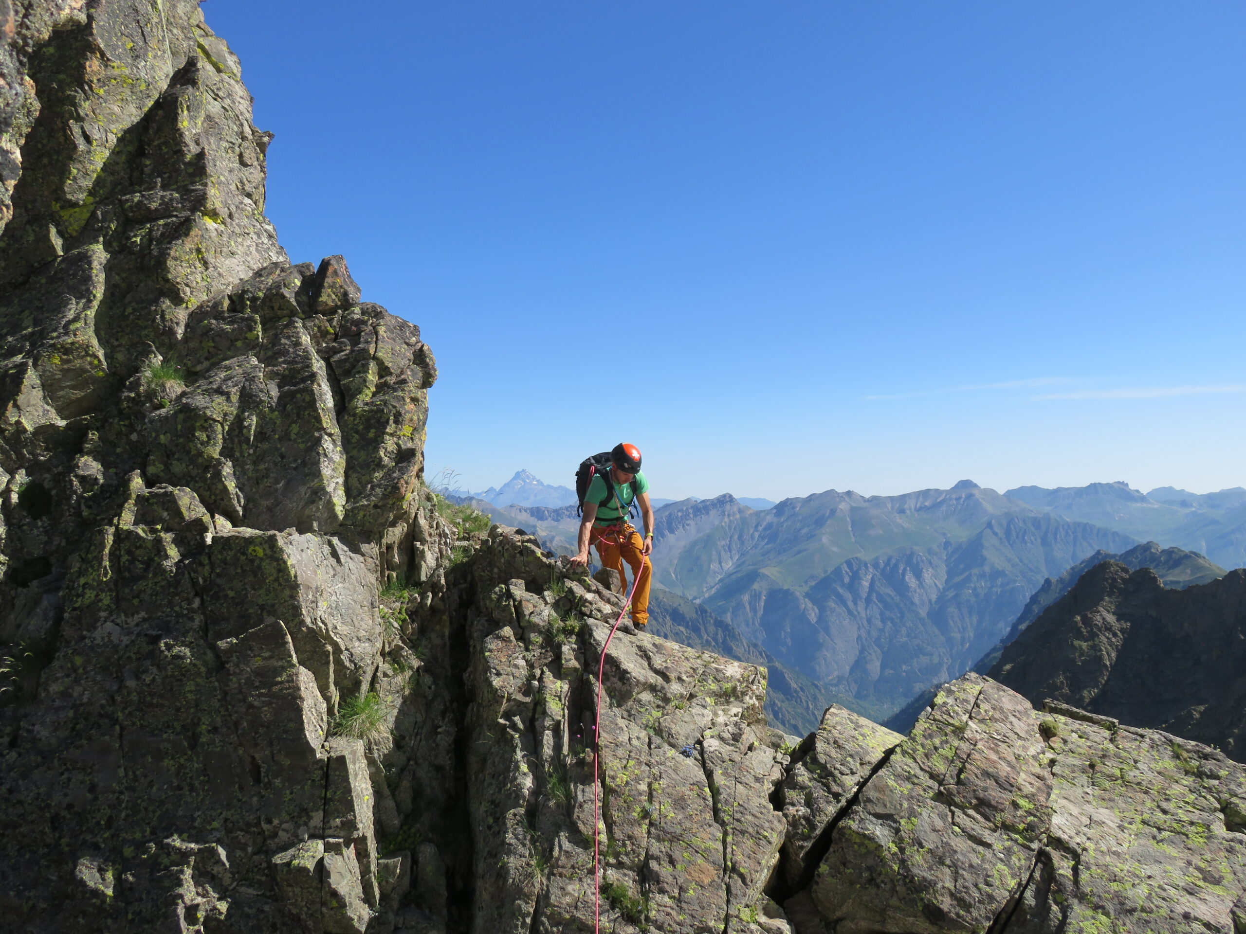
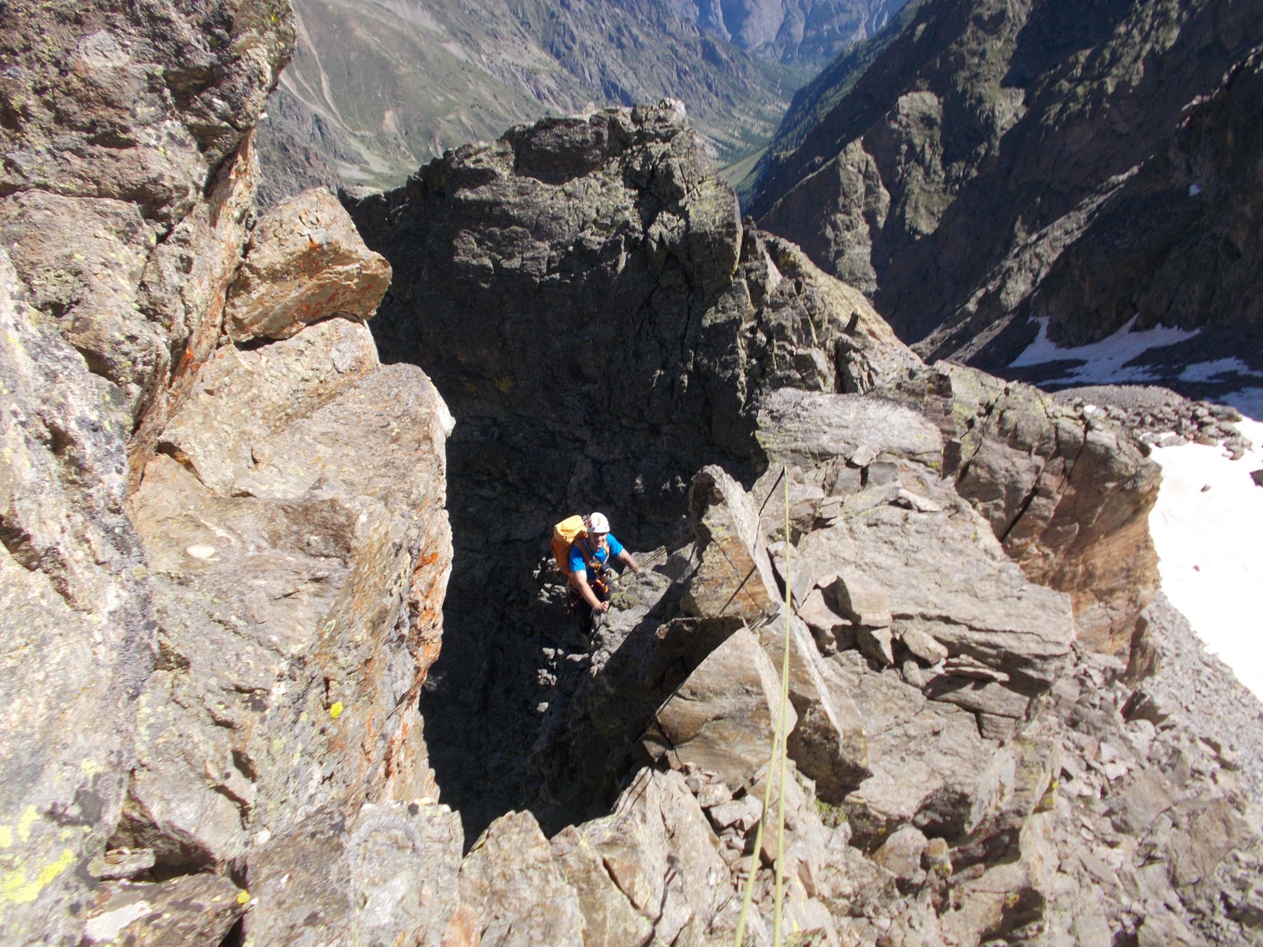
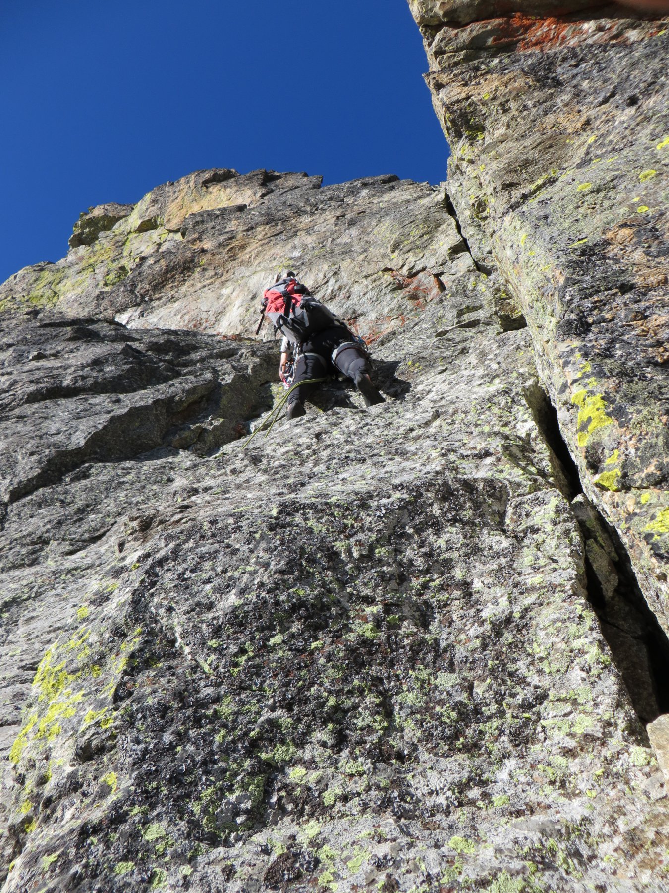
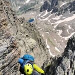
Attaccare la cresta a sx di una evidente vena di quarzo verticale, in una bella fessura verticale (III+), quindi proseguire su belle placche compatte (III) poco proteggibili. Raggiungere quindi il sommo di un breve salto, che si scende con una doppia di 5m (ch. con cordino). Risalire l’evidente camino che si ha di fronte (III+) e quindi proseguire su placche di roccia compatta fino all’ultimo muro della cresta, liscio e verticale. Abbassarsi di un metro verso sx su roccia marcia, quindi proseguire su paretine facili ma di roccia delicata fino ad uscire in cresta, a pochi metri dalla cima Est della Lausa.
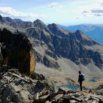
Proseguire senza difficoltà alla cima Centrale (grosso ometto), scendere dalla sua cresta Ovest (blocconi) e quindi risalire per paretine facili (max II) fino in vetta alla cima Ovest. Ridiscendere brevemente per facili blocchi fino al Colle della Lausa, da cui si imbocca il sentiero di ritorno fino ai Prati del Vallone.
Primi ad effettuare la traversata completa di tutte e sei le guglie, P.Abbiati e G.Gauderzo il 10 ottobre 1948.
- Cartografia:
- IGN 1:25:000 Valle Stura Vinadio Argentera n.112
- Bibliografia:
- Guida dei Monti d'Italia Alpi Marittime vol.II
Nelle vicinanze Mappa
Itinerari
20/07/2025 CN, Pietraporzio D+ 1150 m F+ Sud-Ovest
Peiron (Monte) Cresta Sud dal Colle Panieris
 0m
0m
06/10/2022 CN, Pietraporzio D+ 1006 m AD+ Varie
Scolettas (Becchi delle) Cresta Sud
 0m
0m
31/05/2017 CN, Pietraporzio D+ 1279 m PD+ Varie
Ubac (Testa dell’) Canale delle Guglie della Lausa
 0m
0m
14/07/2024 CN, Pietraporzio D+ 1250 m D- Varie
Vallone (Dente del) Cresta NE da Prati del Vallone
 0m
0m
14/07/2025 CN, Pietraporzio D+ 1350 m F Tutte
Piz (Becco Alto del) da Prati del Vallone per il Passo del Vallone, anello per il Passo Sottano delle Scolettas
 50m
50m
25/02/2022 CN, Pietraporzio D+ 1530 m PD+ Varie
Vallonetto (Monte del) traversata per Canale SE e Monte Las Blancias
 50m
50m
25/06/2022 CN, Pietraporzio D+ 1202 m PD- Varie
Vens (Cima Sud di) da Prati del Vallone
 50m
50m
19/06/2015 CN, Pietraporzio D+ 1142 m AD Varie
Lausa (Guglia Grande della) Via Normale dal Ghiacciaio dell’Ubac
 50m
50m
15/08/2025 CN, Pietraporzio D+ 1290 m F+ Sud-Est
Clai Superieur da Prati del Vallone
 50m
50m
12/06/2022 CN, Pietraporzio D+ 1200 m F Varie
Vallonetto (Monte del) cime nord e sud da Prati del Vallone e Monte Las Blancias
 50m
50m
Servizi
200m
5Km
Agri Bistrot Pecora Nera Ristorante
Pietraporzio
5.1Km
B&b del Villaggio B&B
Bersezio/Argentera
6Km
L’Oste d’oc Ristorante
Pietraporzio
6.3Km
Ostello Centosentieri Albergo
Pietraporzio
6.6Km
Bruno Ristorante
Bersezio/Argentera
6.7Km
da Mo Ristorante
Bersezio/Argentera
9.5Km
Archibus Pub Ristorante
Bersezio/Argentera
9.9Km