100m
100m

Note
Storico
 8.7Km
10.1Km
10.6Km
22Km
24.2Km
24.2Km
28.2Km
8.7Km
10.1Km
10.6Km
22Km
24.2Km
24.2Km
28.2Km
100m
1.2Km
1.2Km
1.2Km
4.7Km
6.8Km
8.8Km
9.6Km
9.7Km
9.8Km
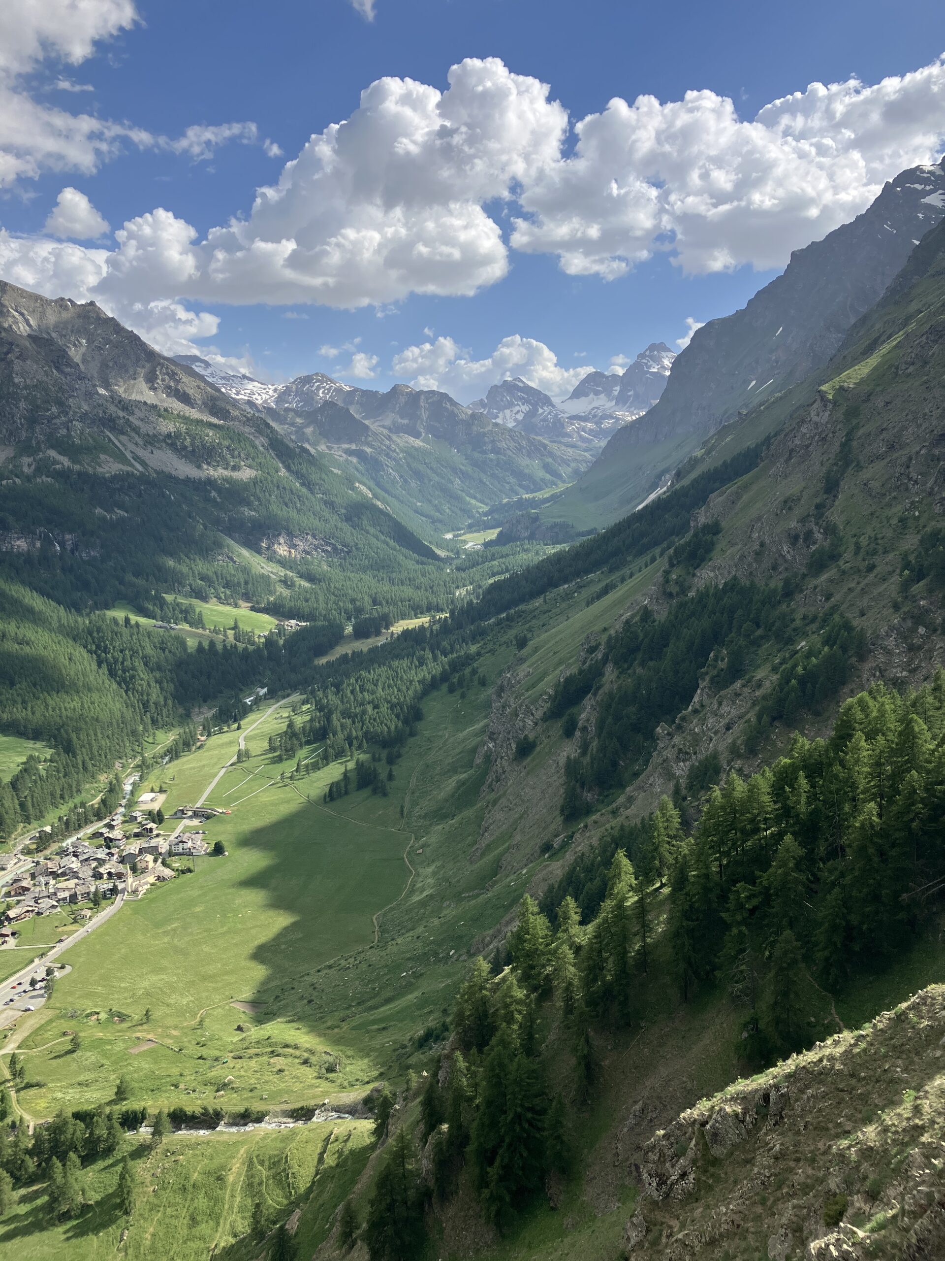
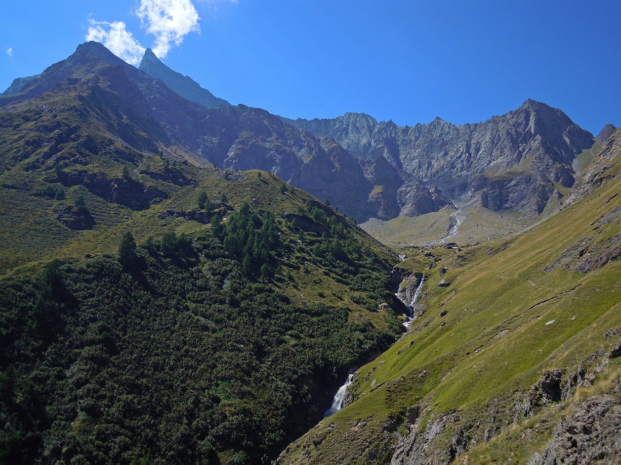
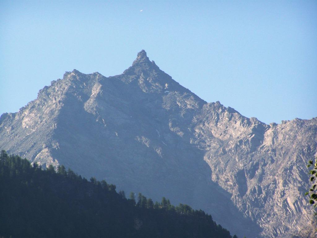
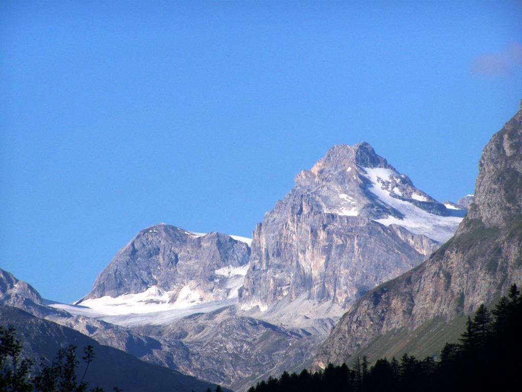
Situata nel settore sud-occidentale della Valle d'Aosta, fra la Valsavarenche e la Valgrisenche, la Val di Rhêmes si snoda ai piedi del suggestivo massiccio della Granta Parey (3.387 m), che domina il paesaggio circostante con il suo profilo inconfondibile.
Al centro della valle, in una conca soleggiata, circondata da pascoli e boschi, si trova Rhêmes-Notre-Dame (1.723 m), una piccola ed incantevole stazione turistica alpina dall'atmosfera rustica ed accogliente, dotata di alberghi e ristoranti capaci di offrire una calda accoglienza e di strutture sportive moderne ed efficienti che permettono di praticare le più svariate attività. Trascorrere una vacanza a Rhêmes-Notre-Dame e nella sua vallata significa quindi vivere un periodo di totale relax con un ritmo di vita sano e naturale e soprattutto essere sempre a contatto con il mondo suggestivo e ancora puro dell'alta montagna.
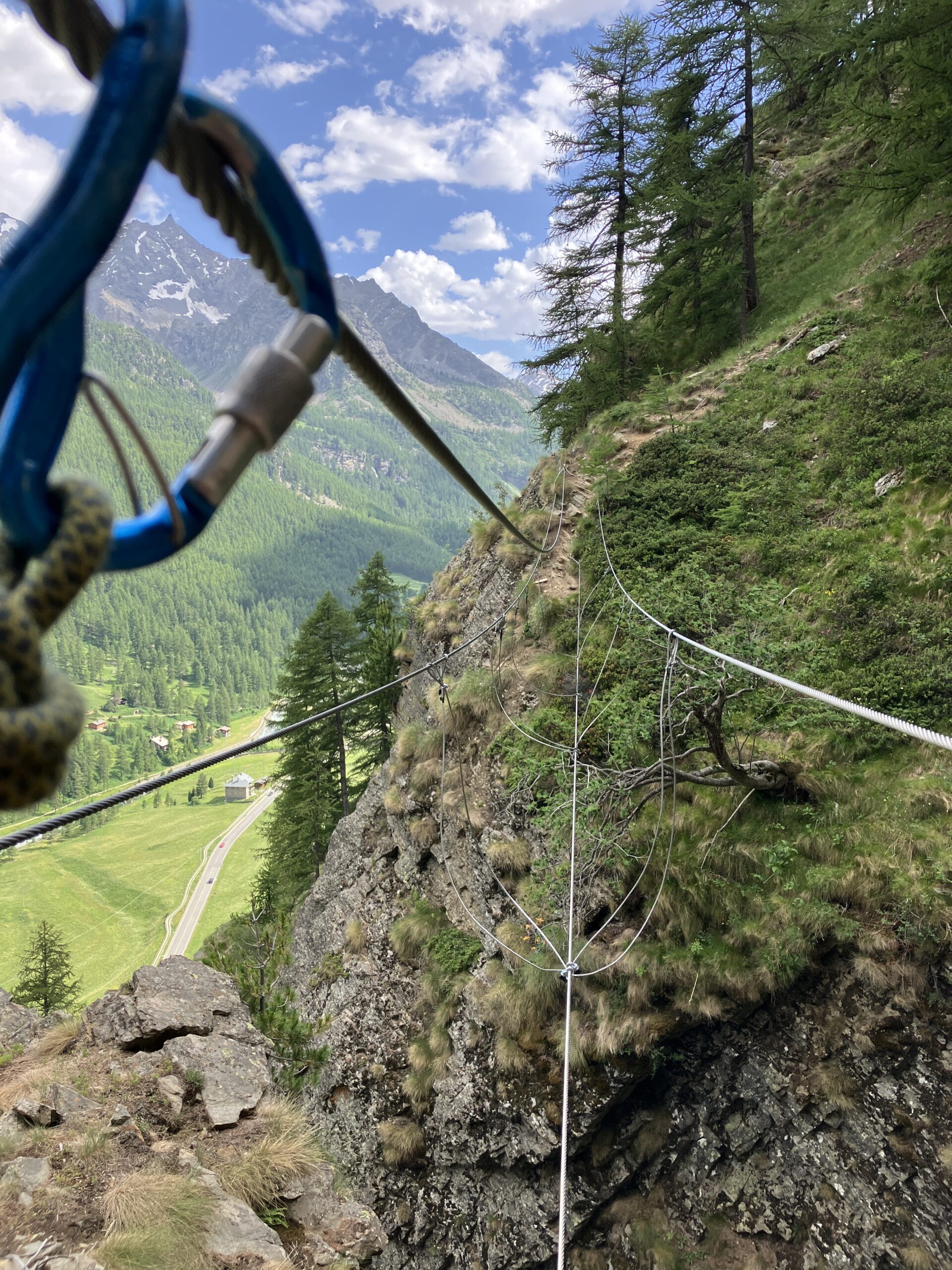
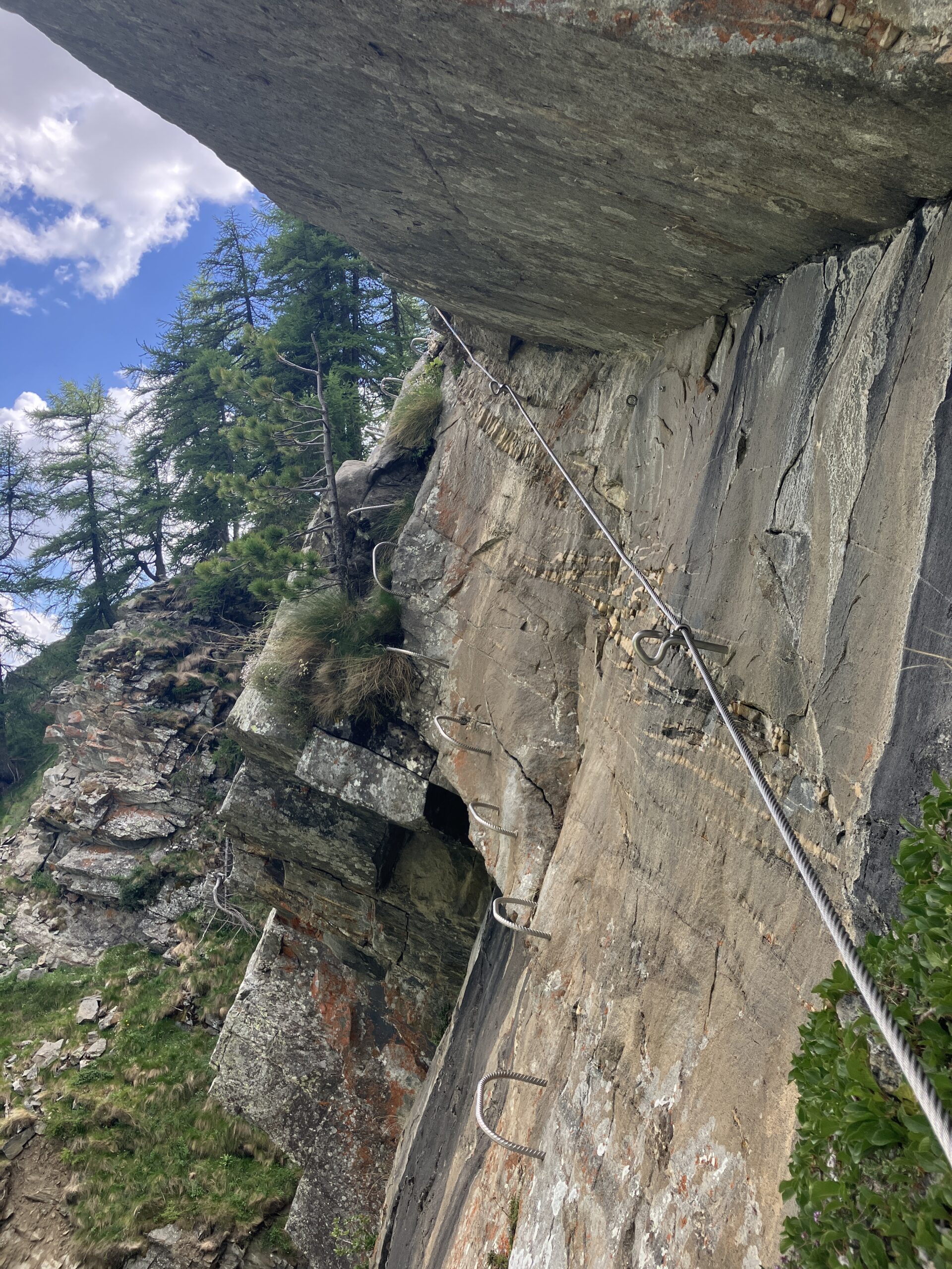
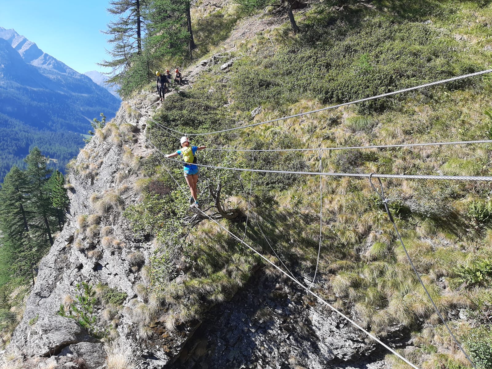
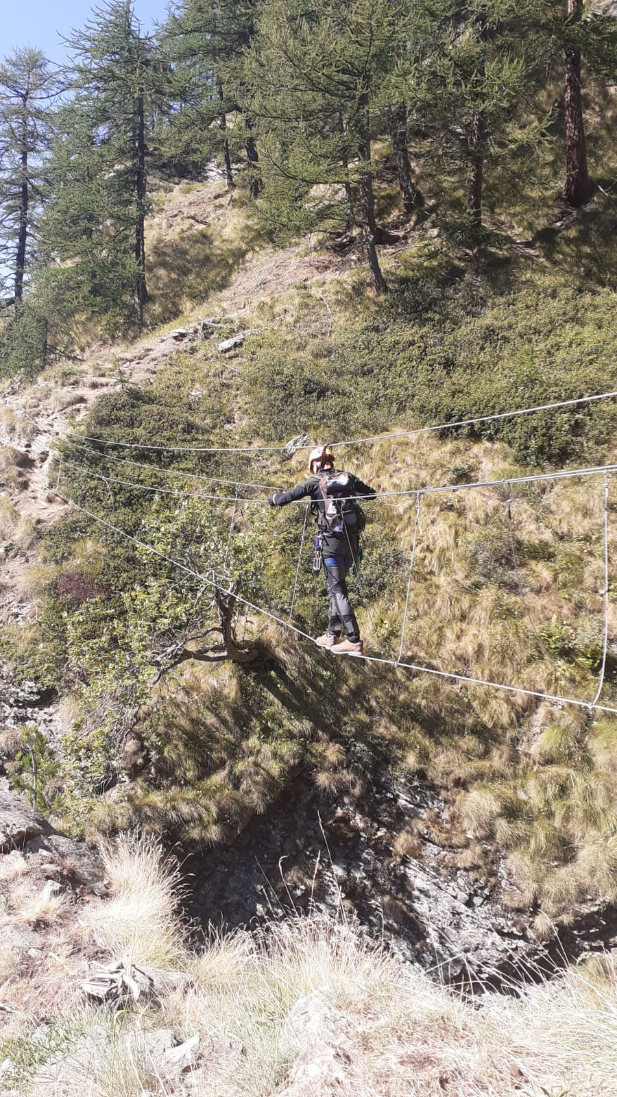
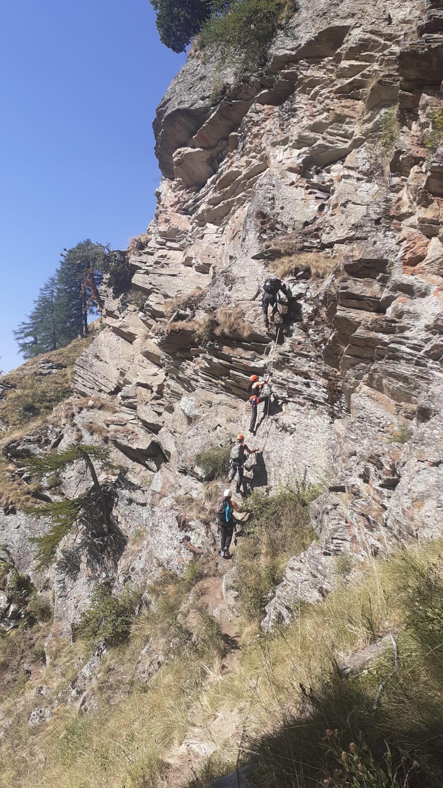
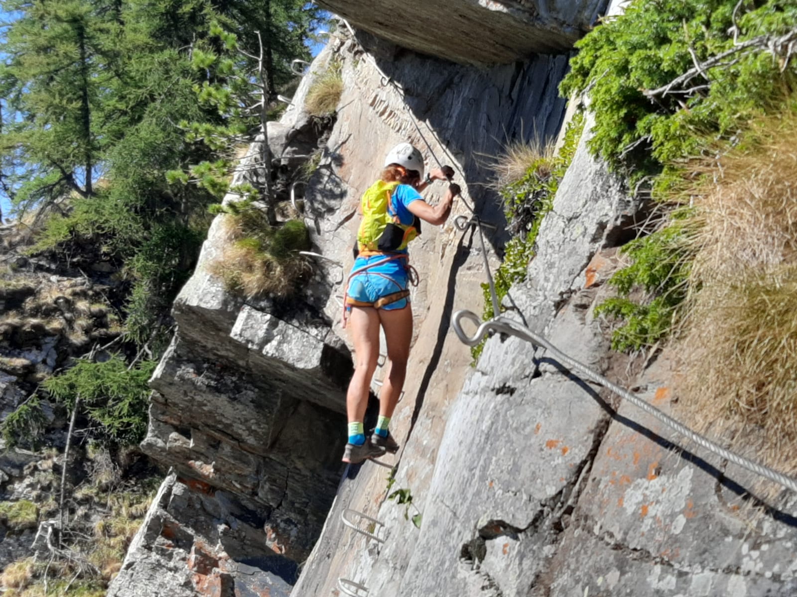
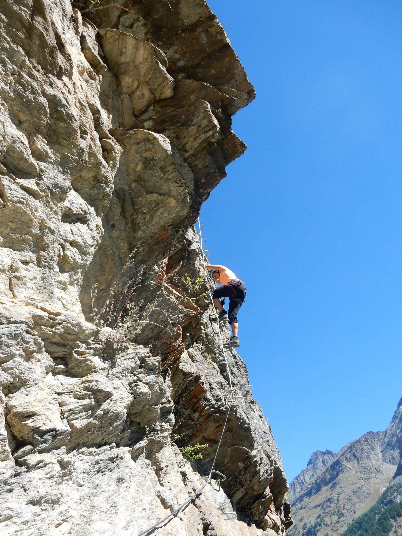
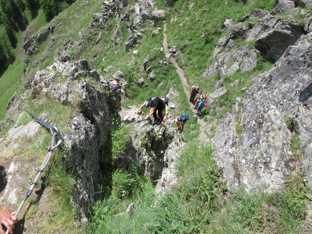
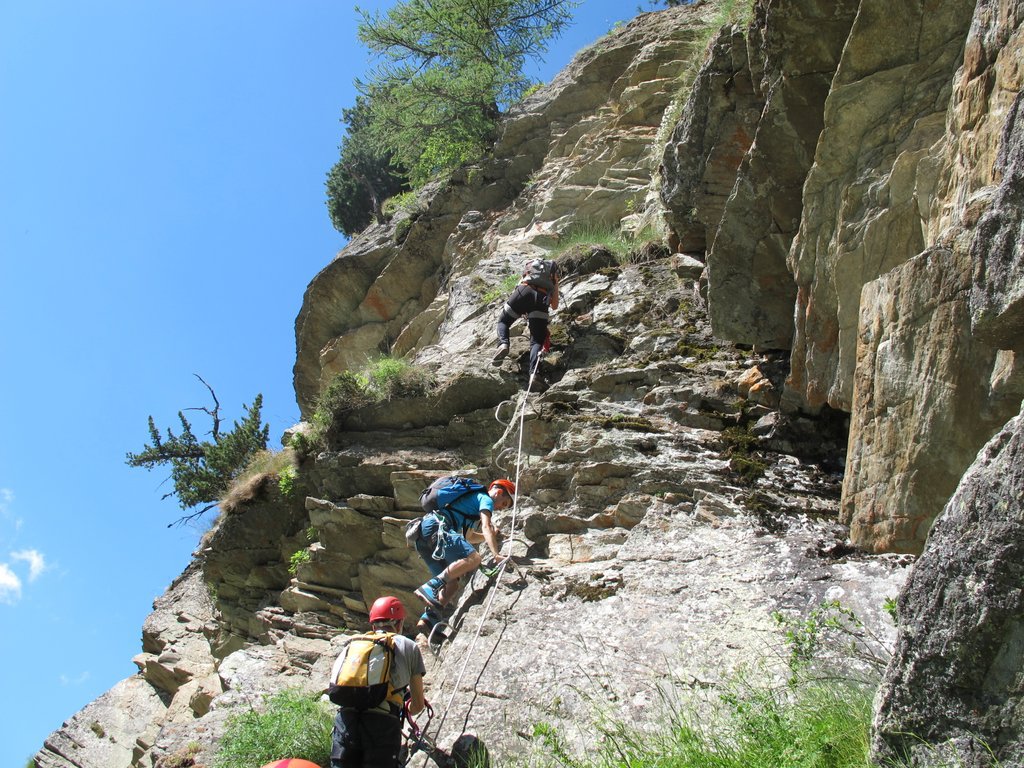
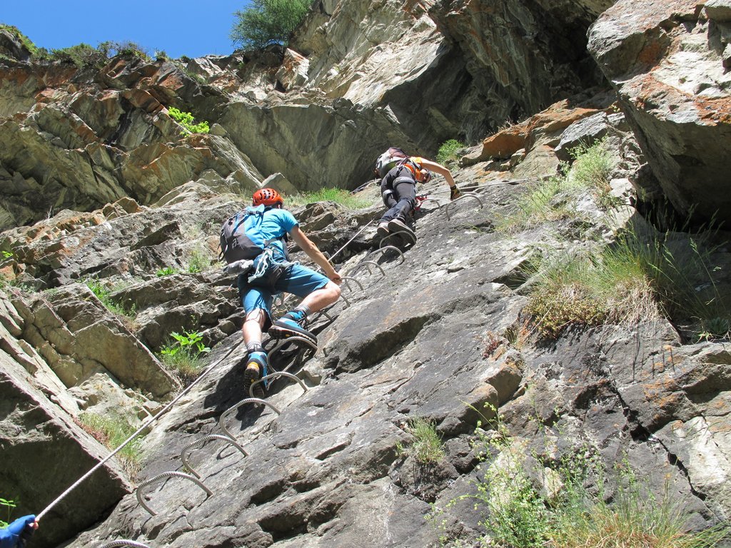
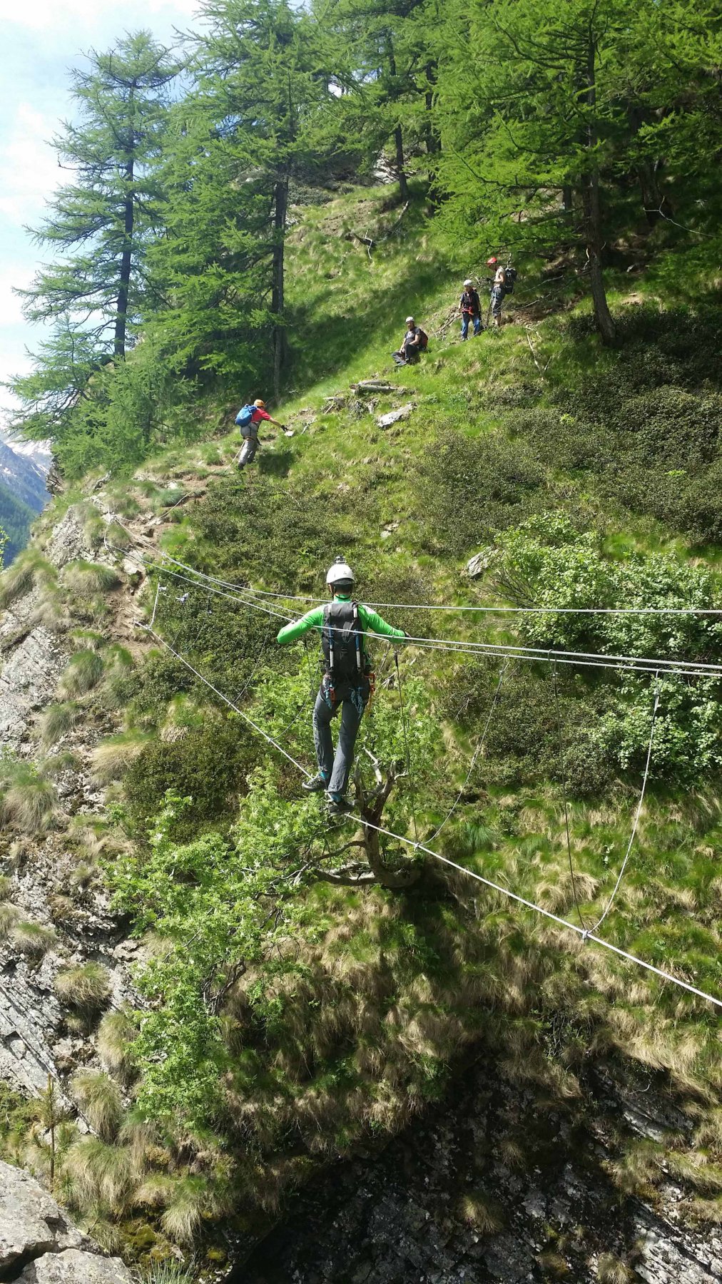
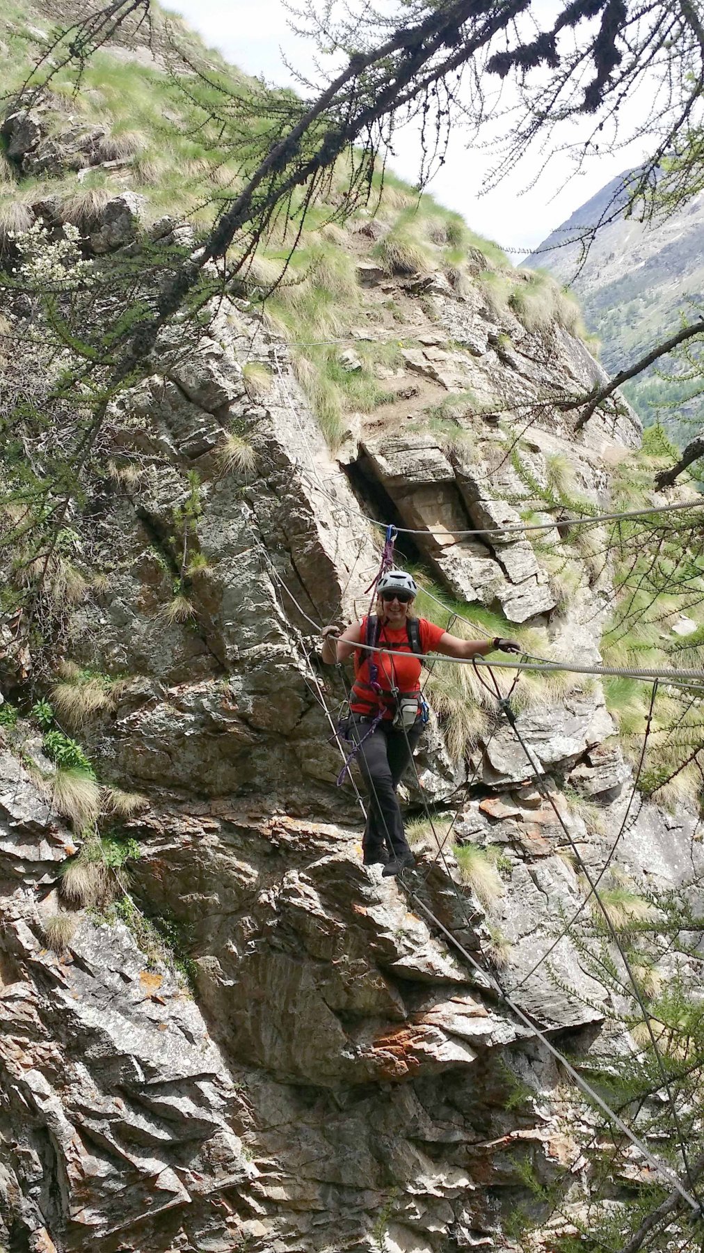
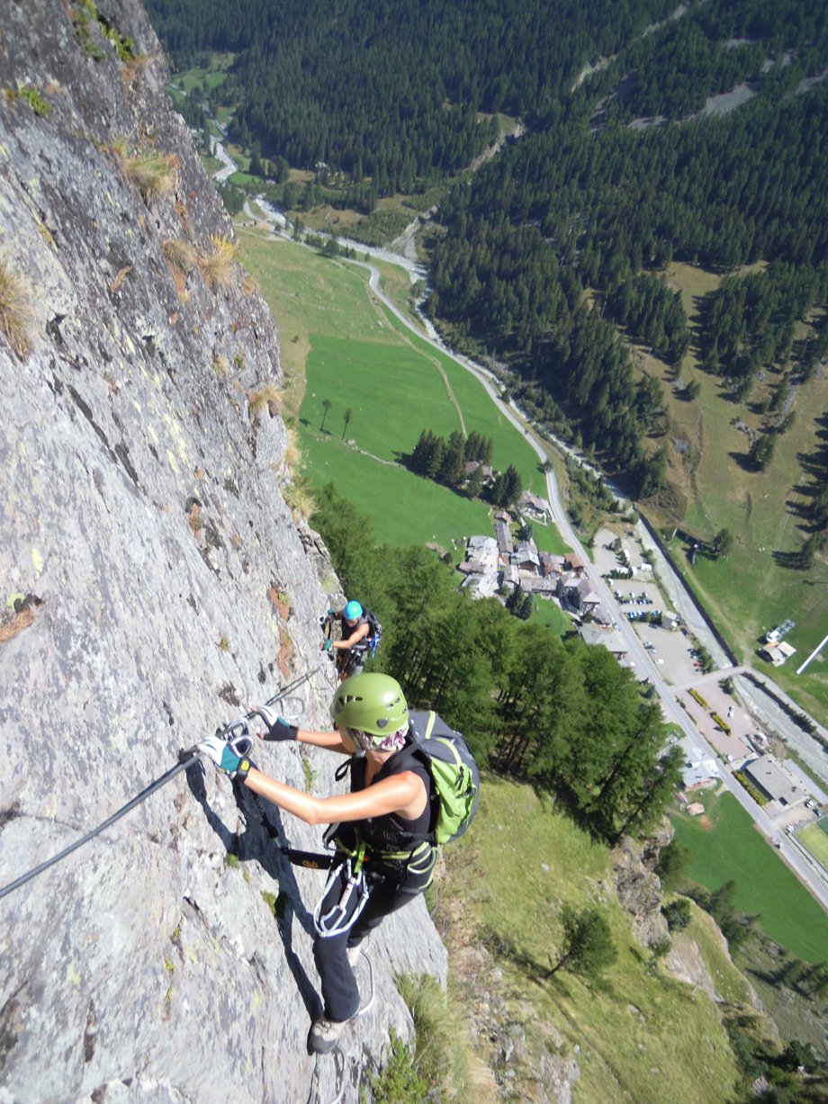
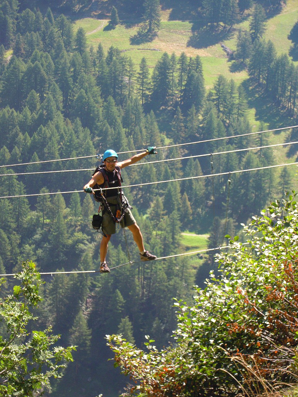
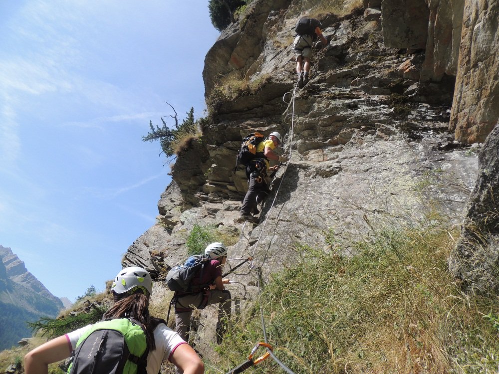
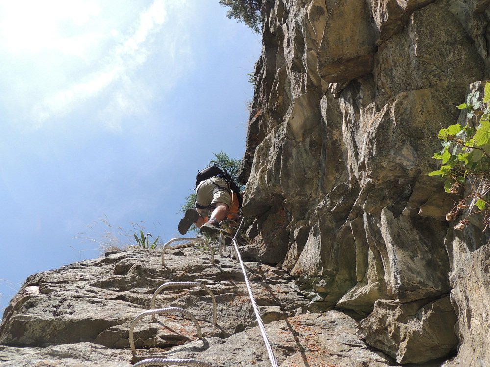
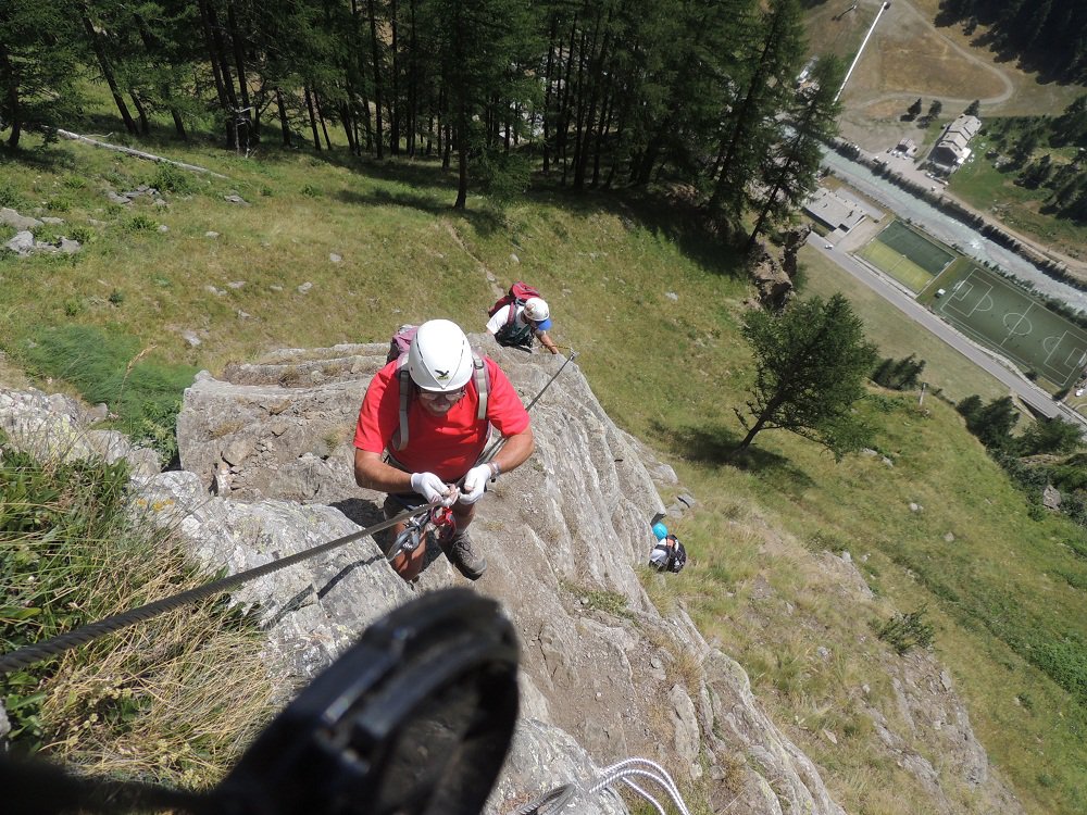
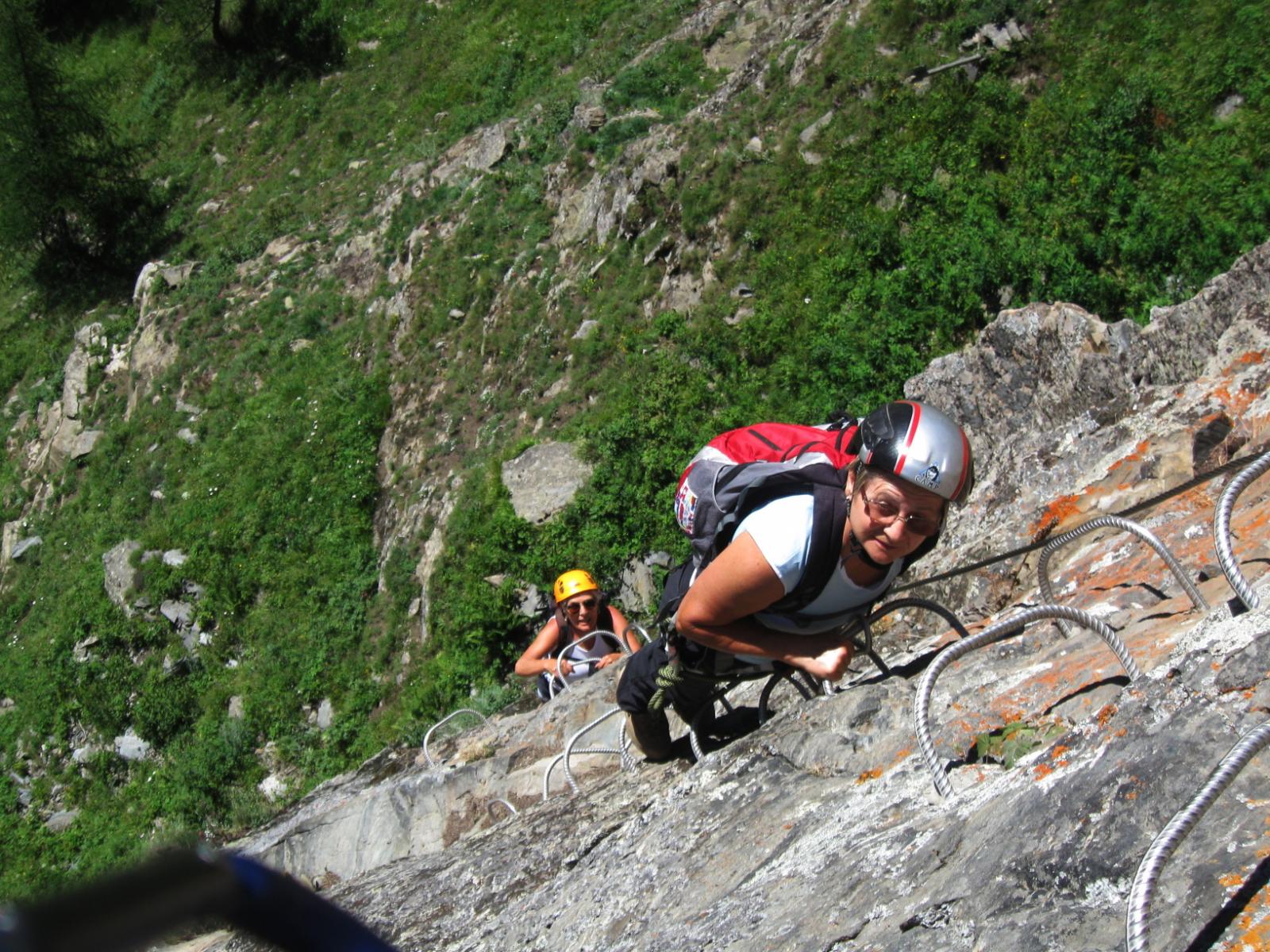
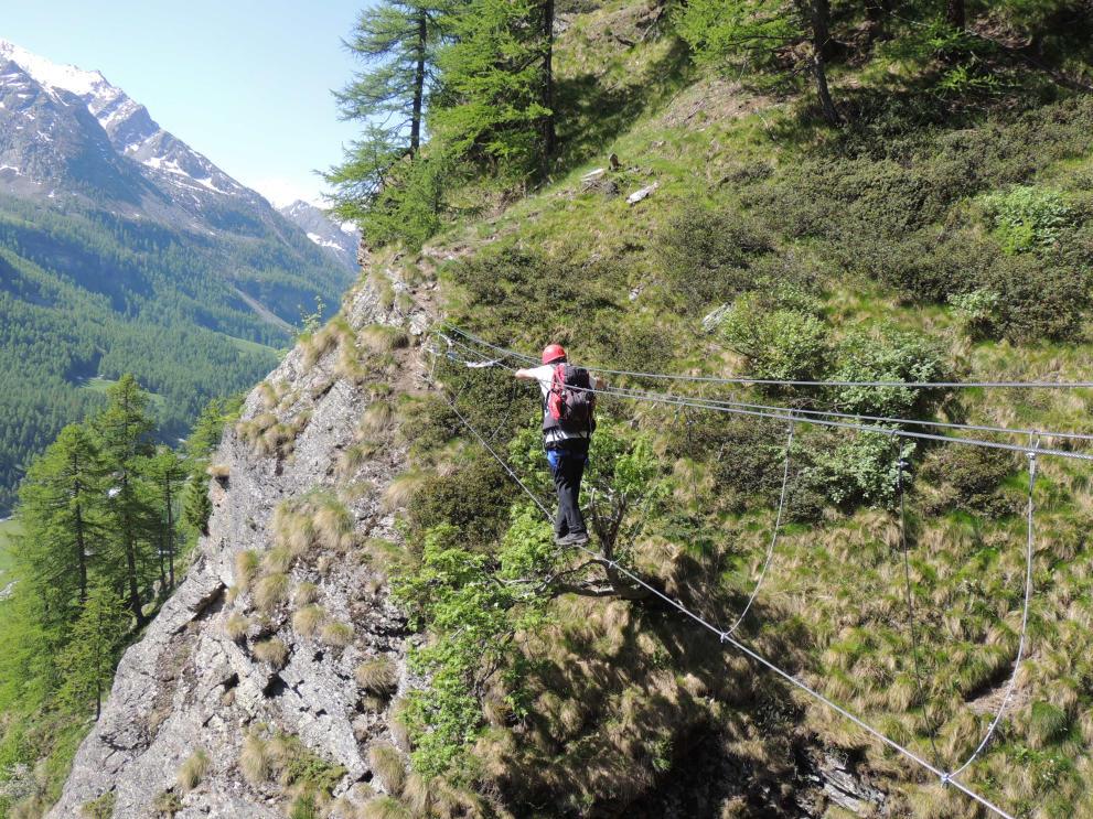
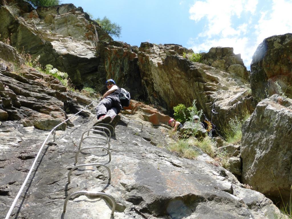
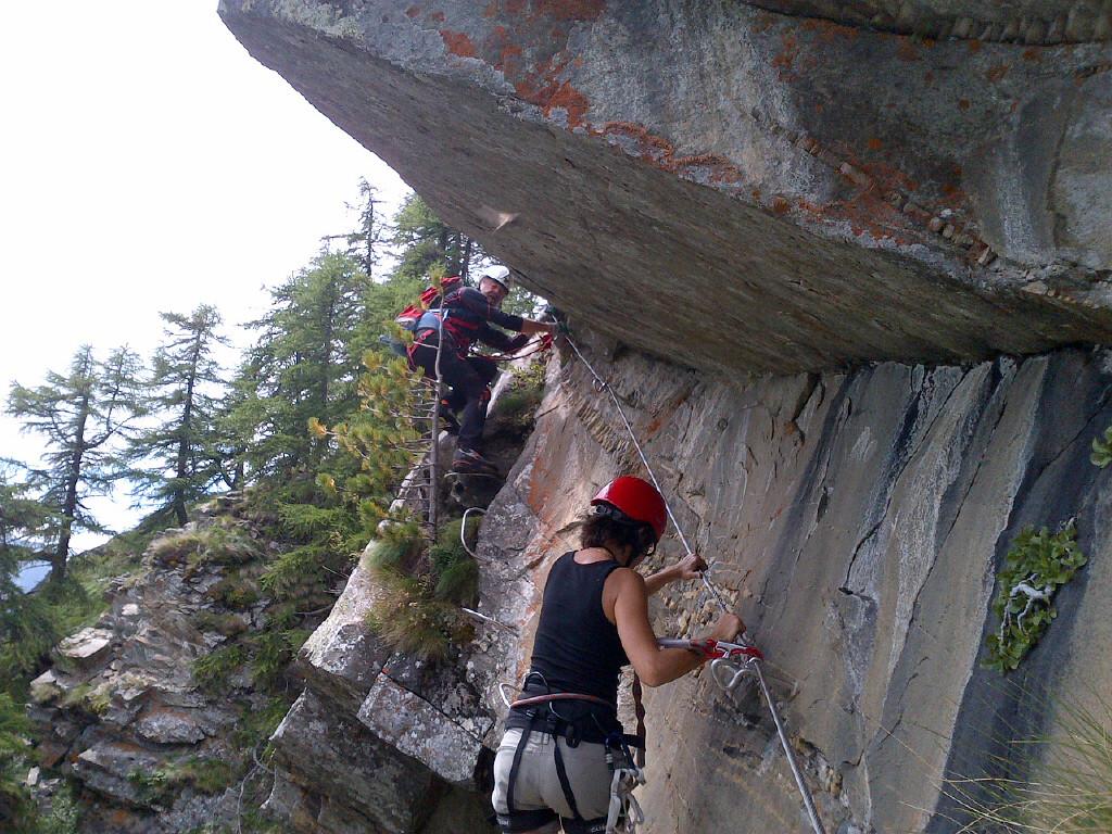
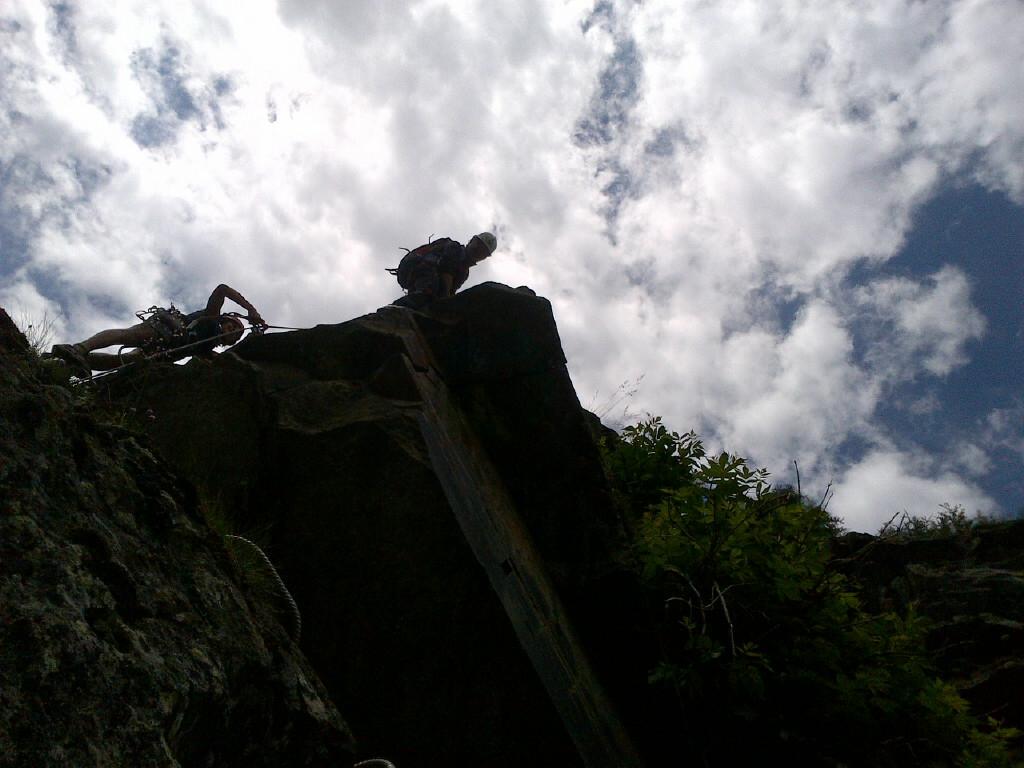
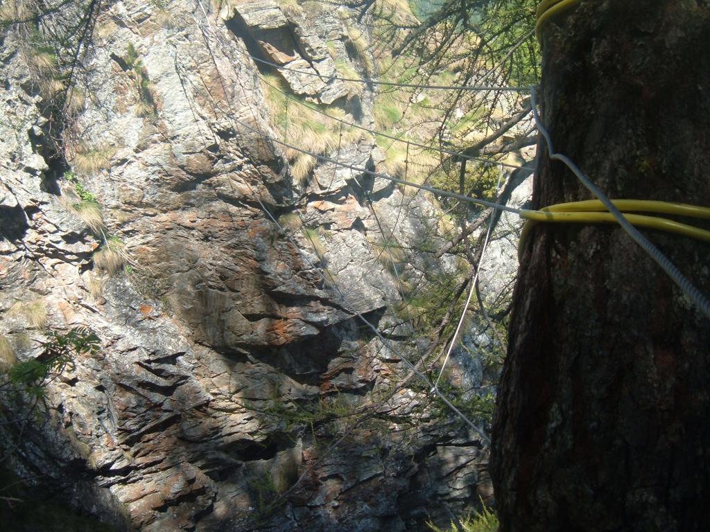
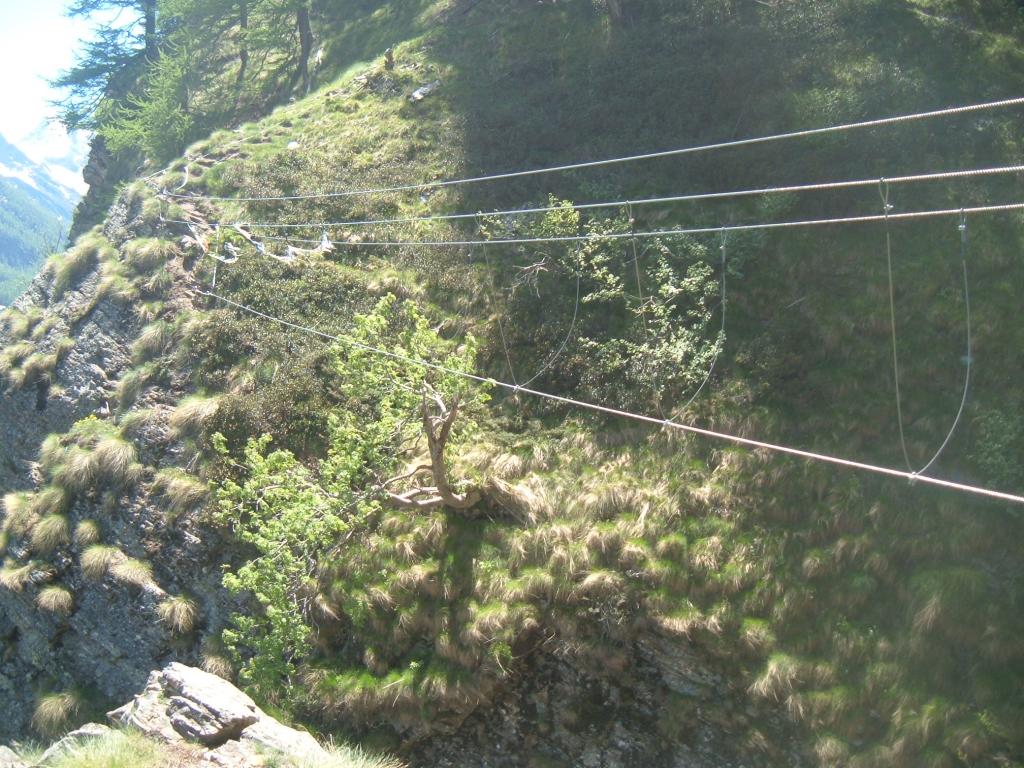
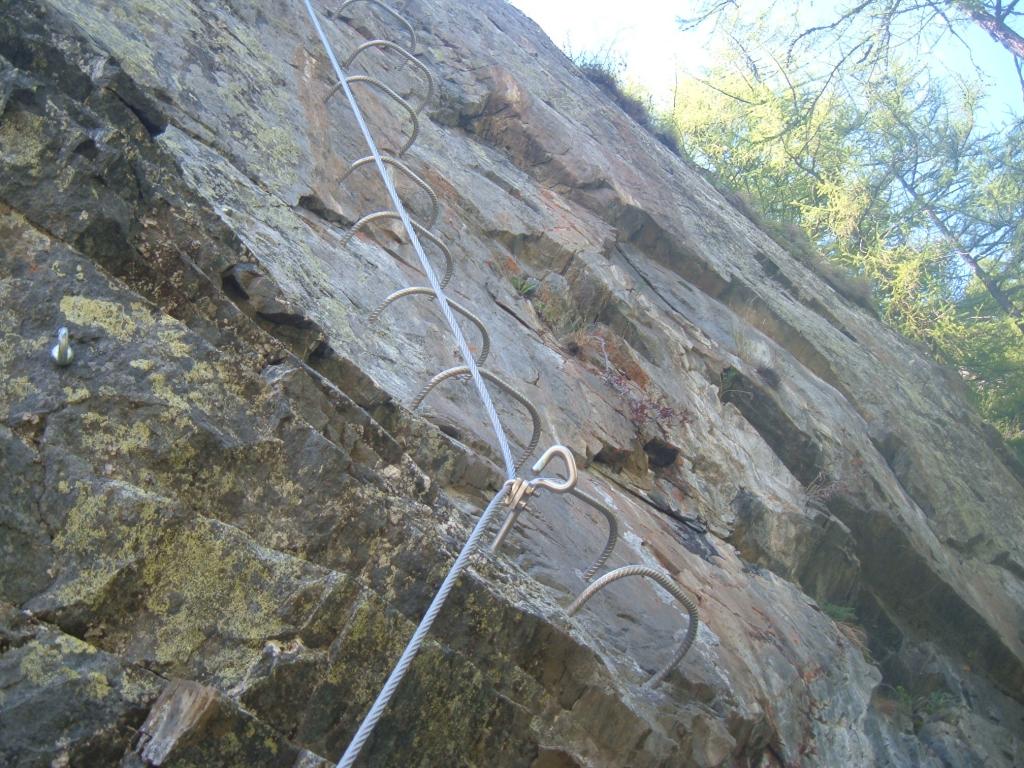
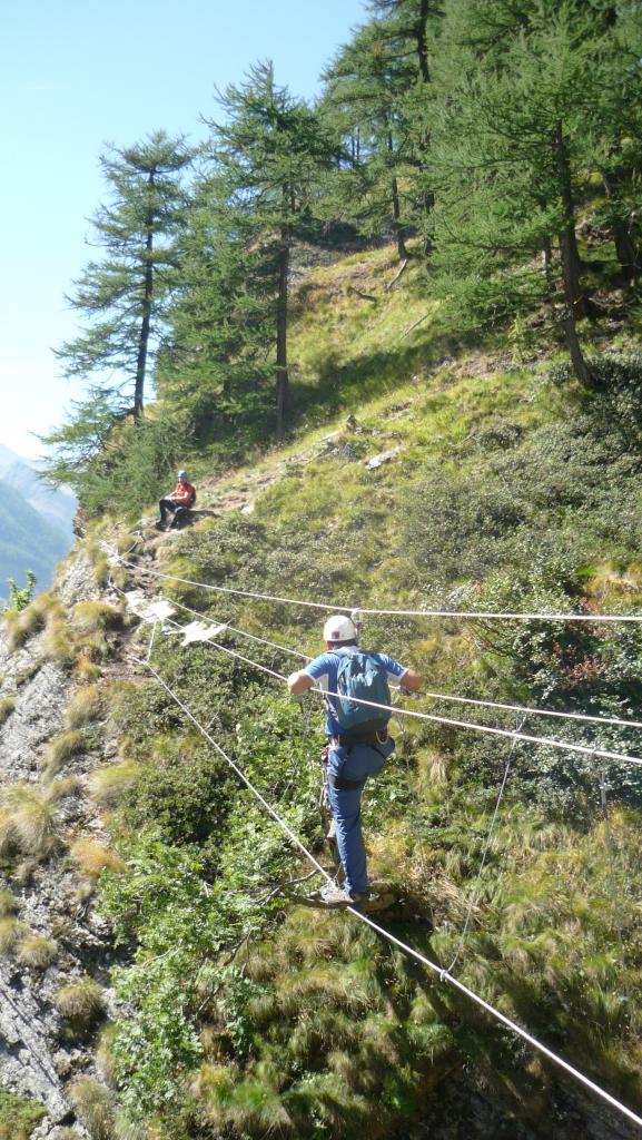
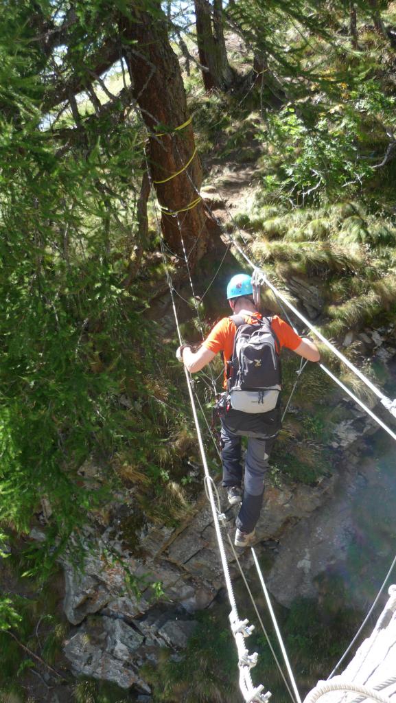
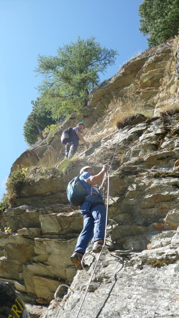
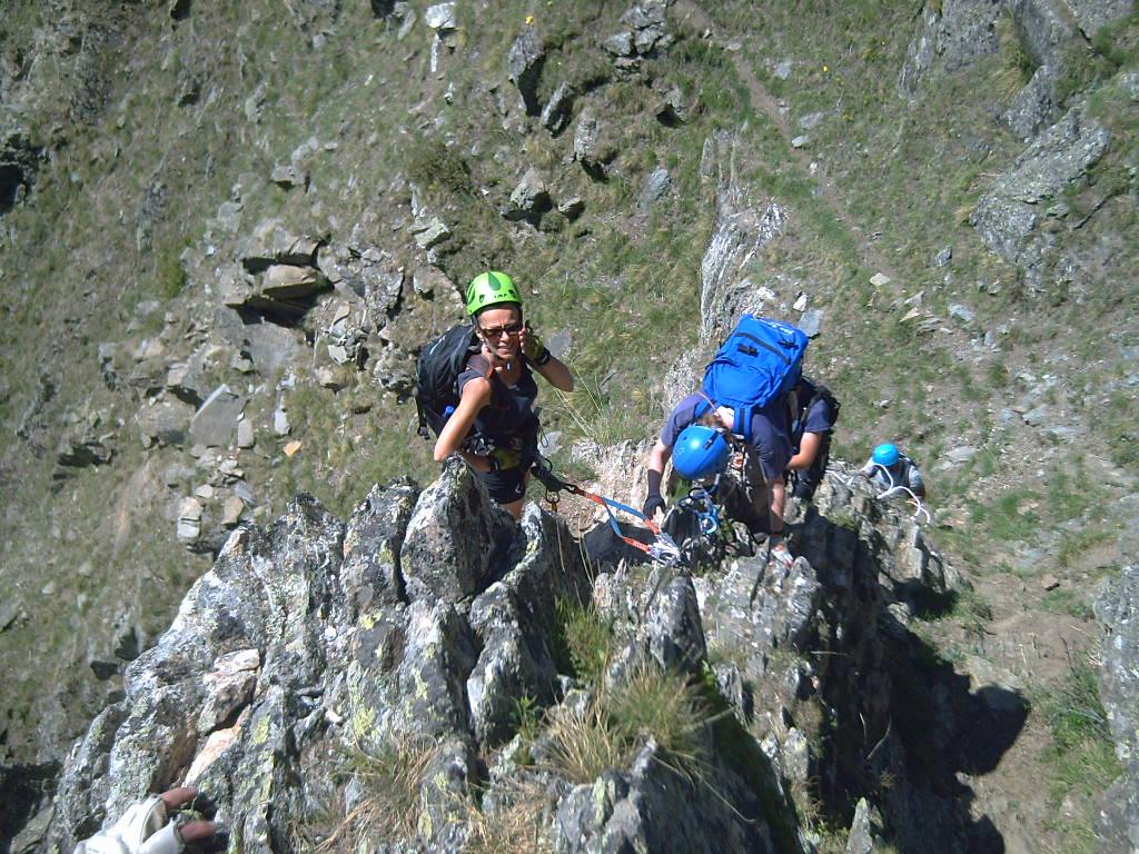
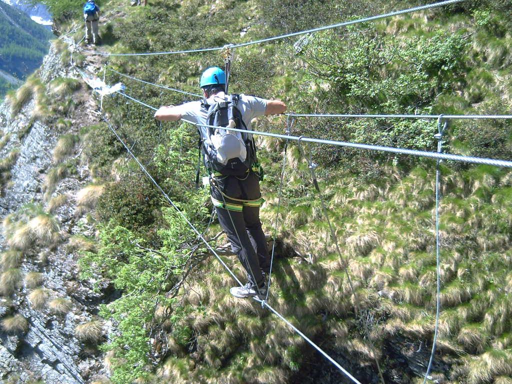
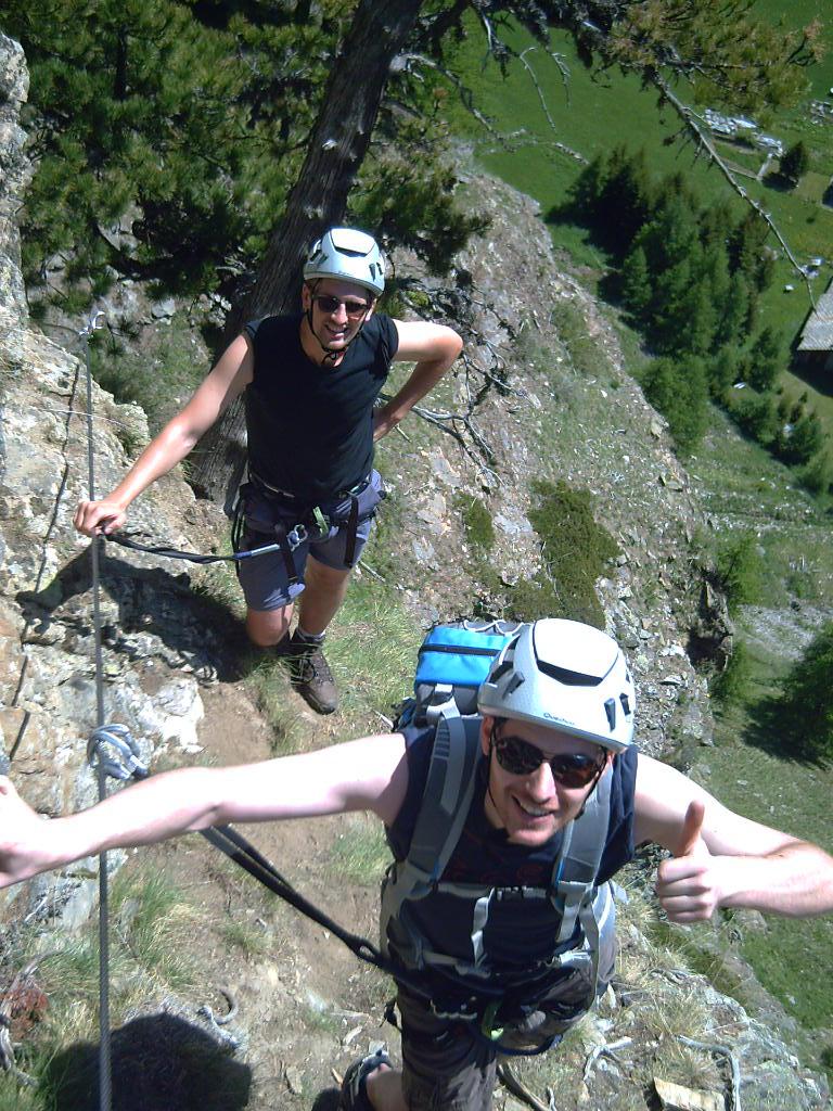
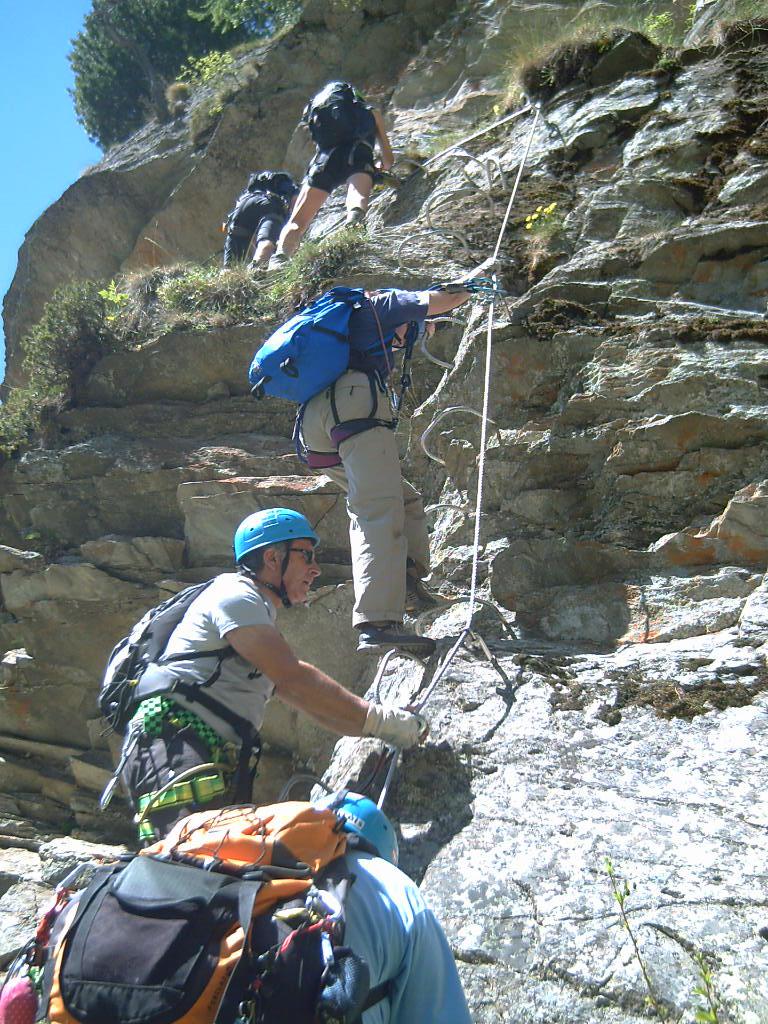
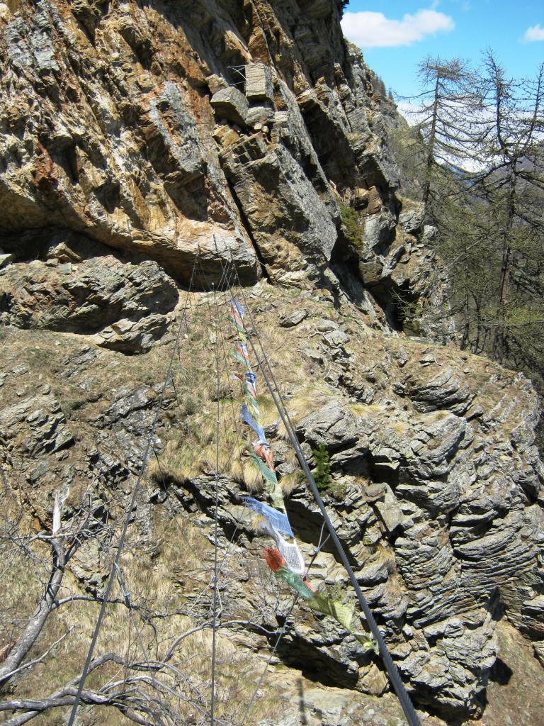
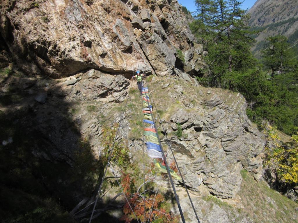
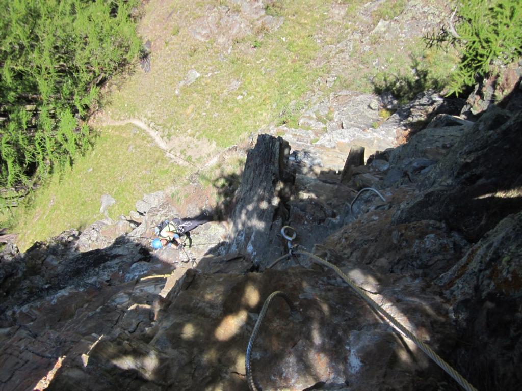
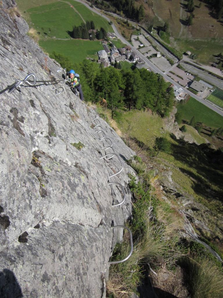
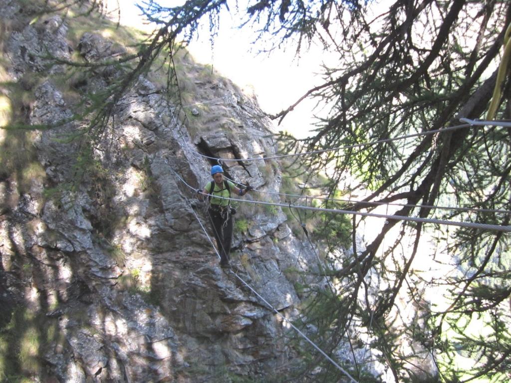
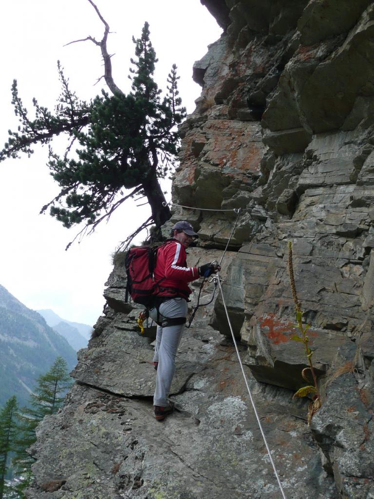
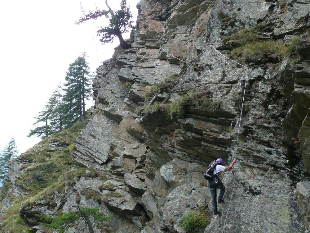
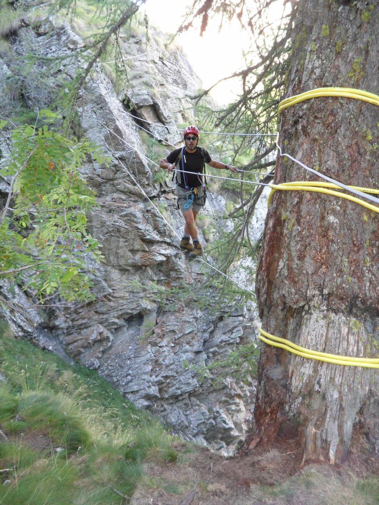
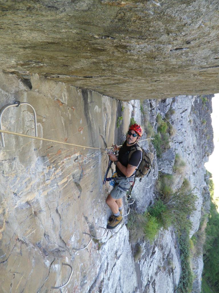
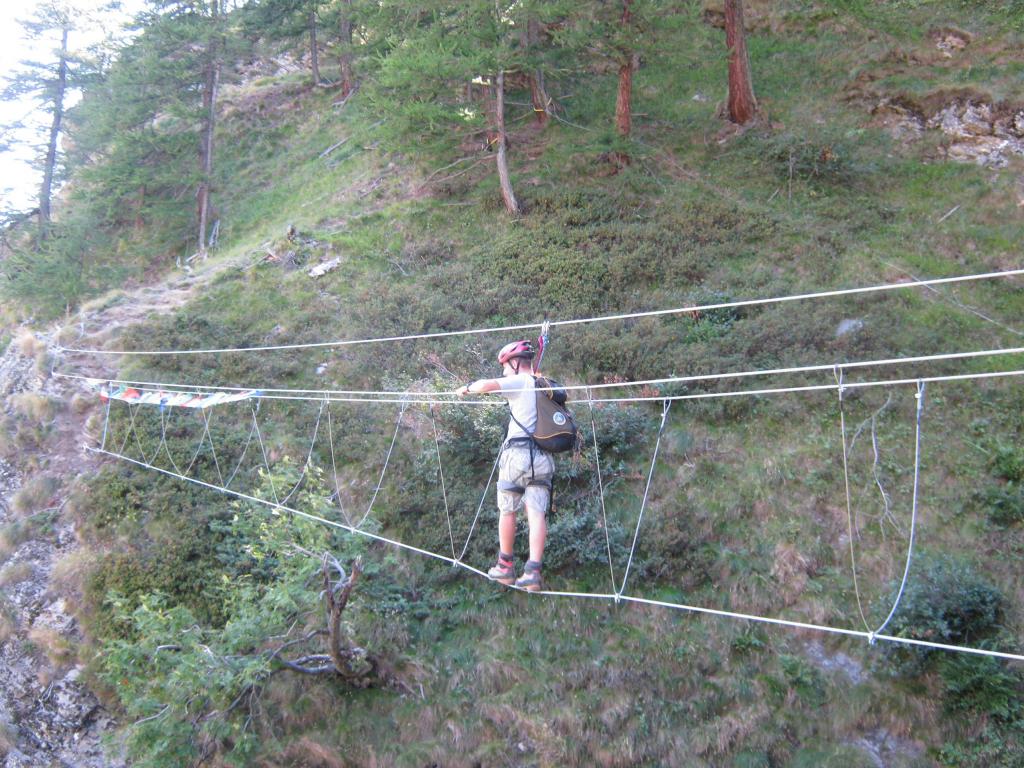
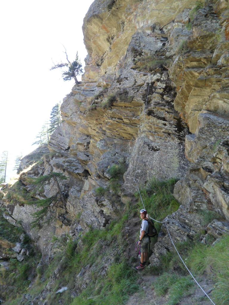
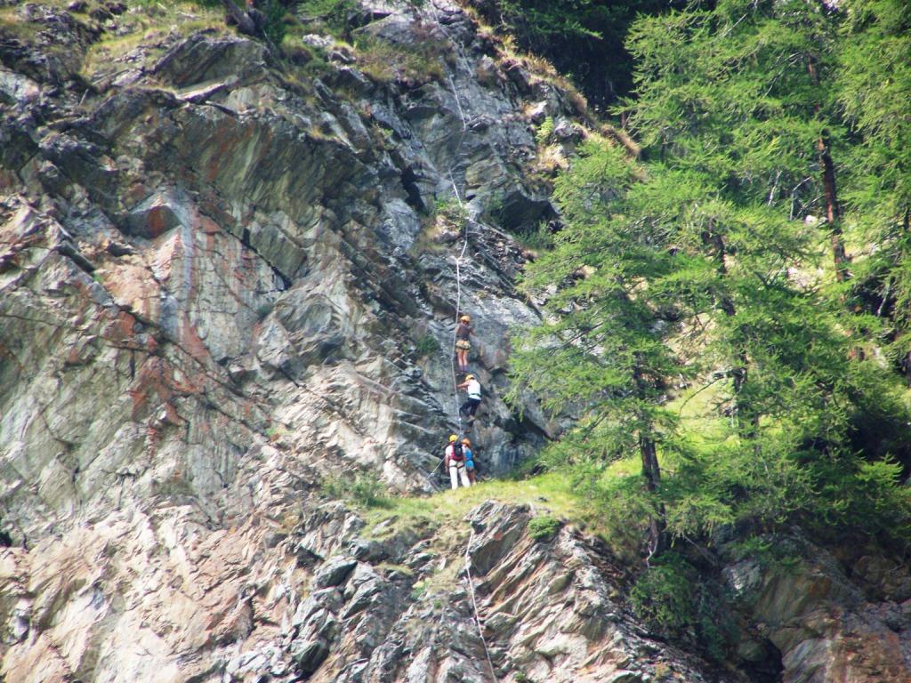
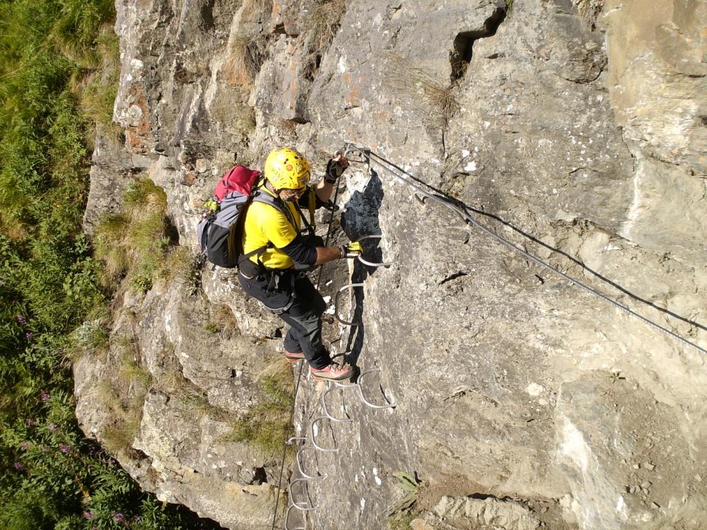
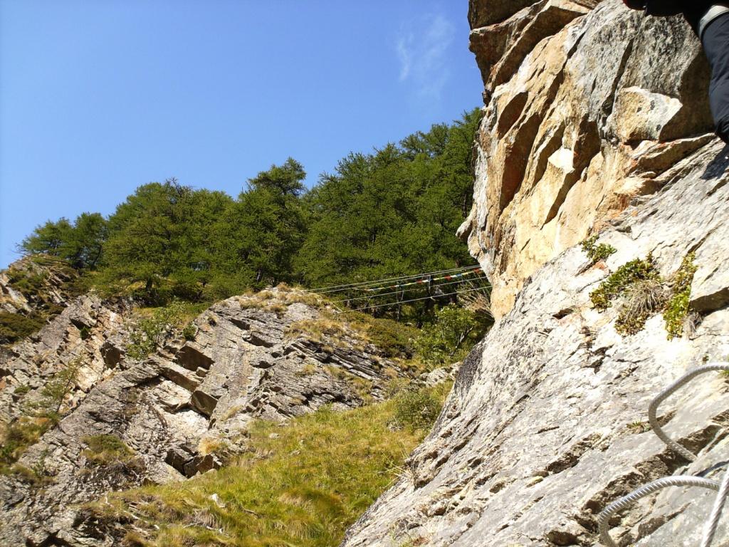
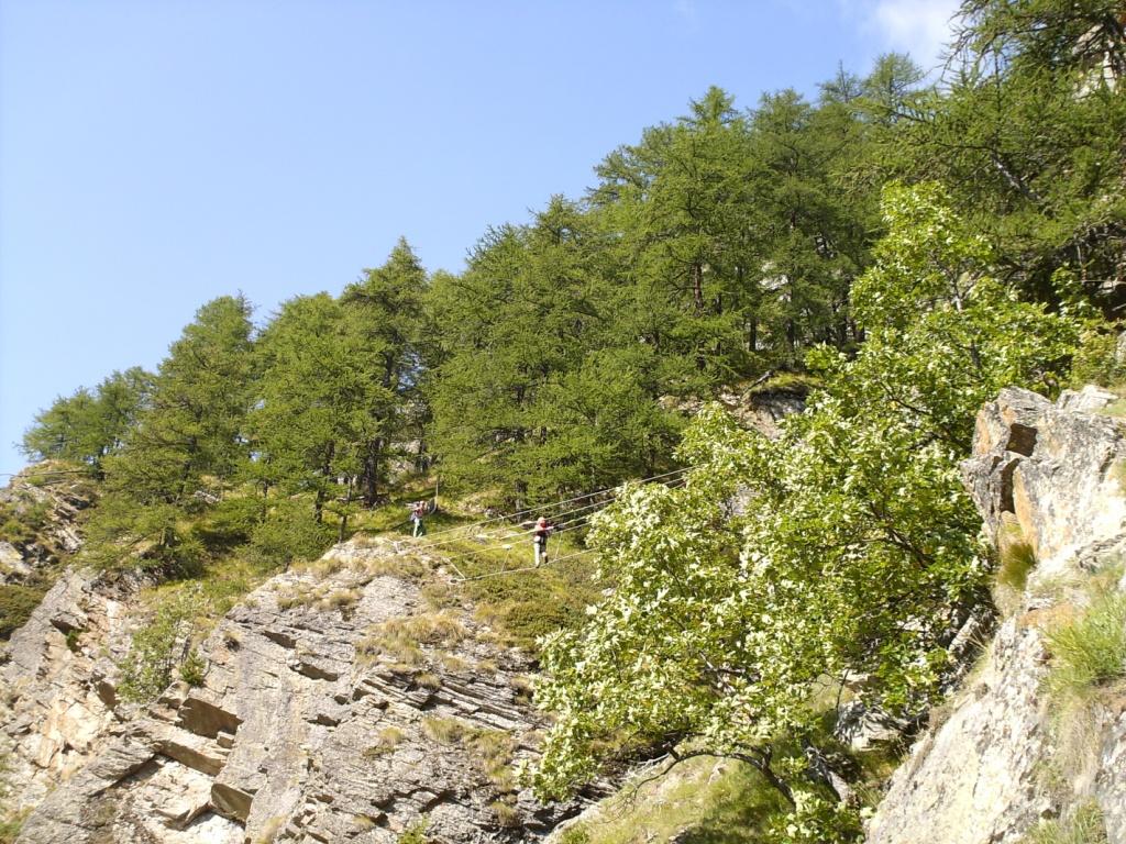
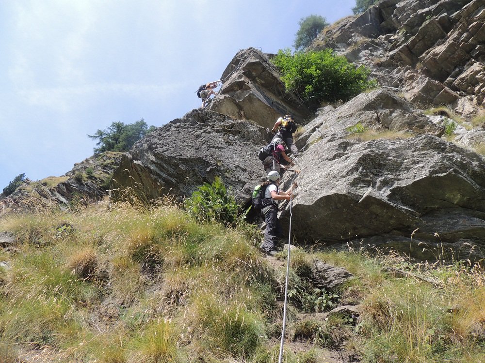
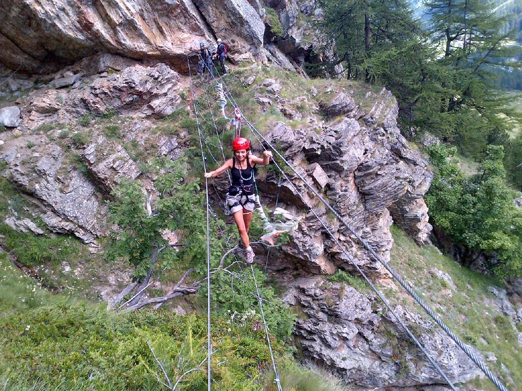
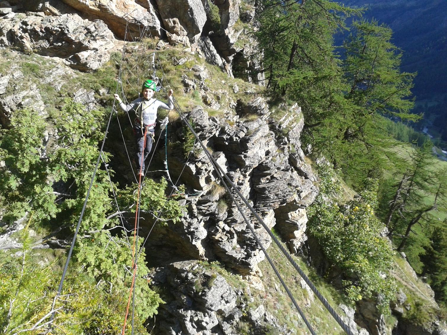
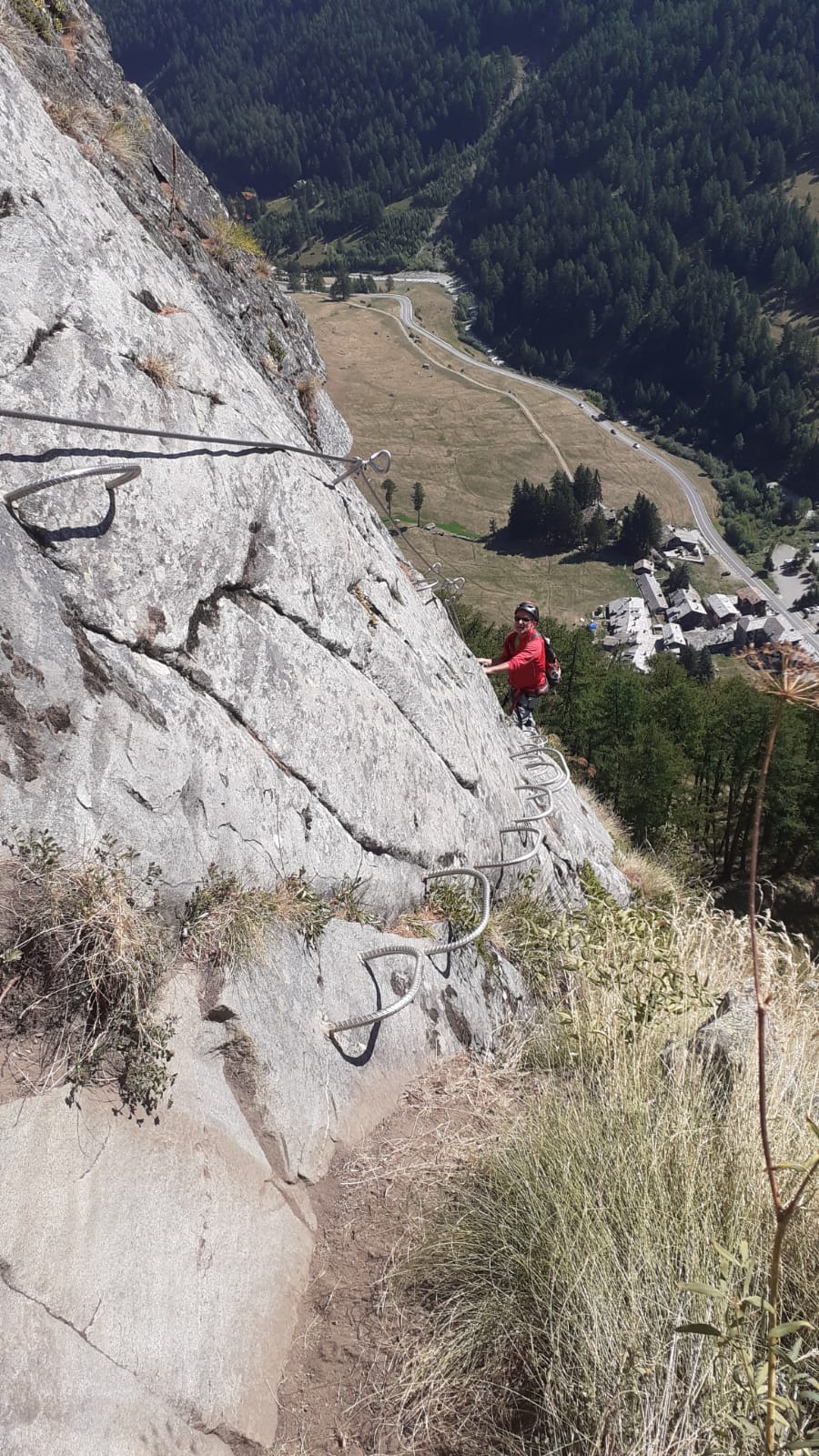
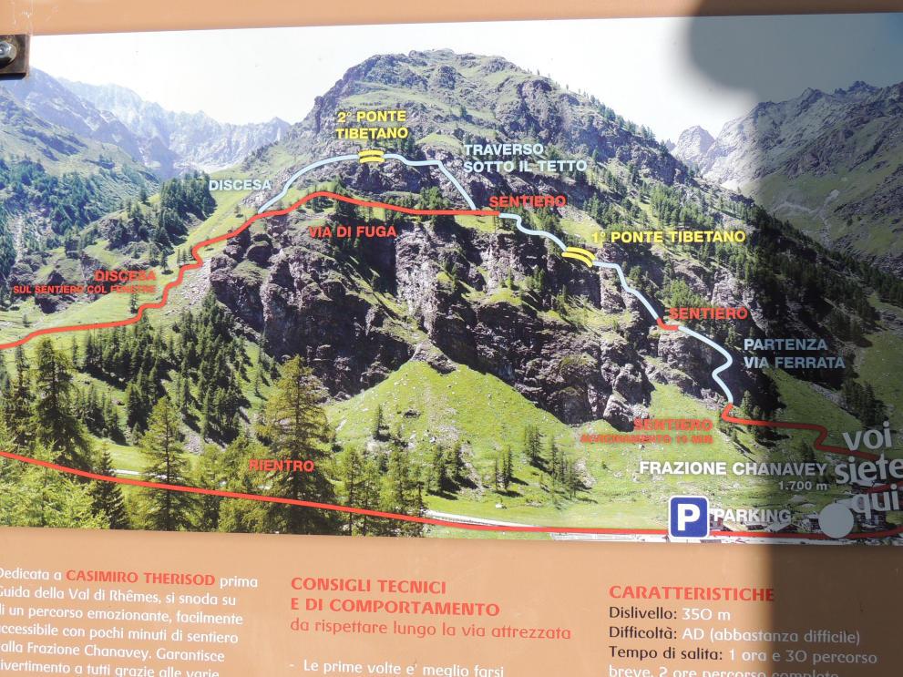
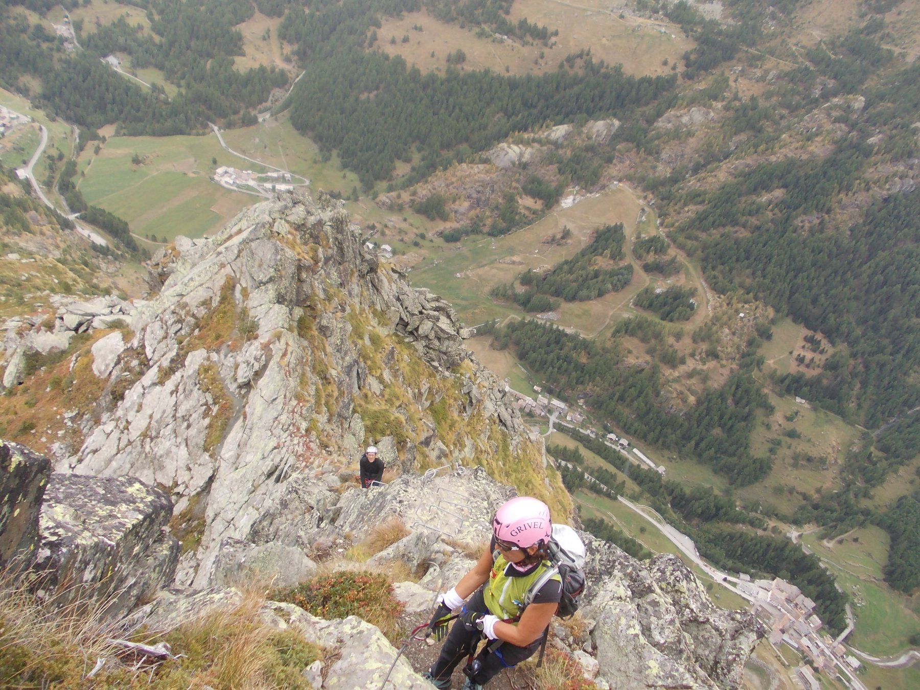
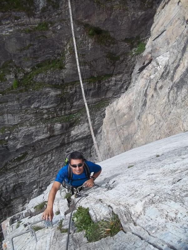
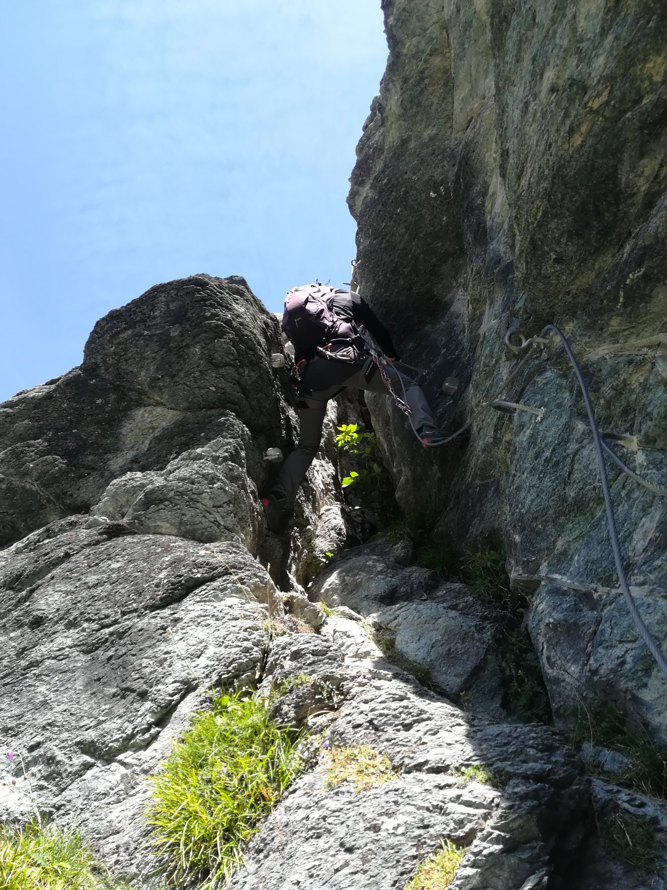
Si snoda su di un percorso emozionante, facilmente accessibile con pochi minuti di sentiero dalla Frazione Chanavey. Garantisce divertimento a tutti grazie alle varie combinazioni possibili, i ponti tibetani, lo spigolo, il sentiero dei camosci; sono alcuni dei passaggi più caratteristici ed emozionanti di questo itinerario con una suggestiva vista panoramica.
Tempo di salita:
1 ora e 3O percorso breve, 2 ore percorso completo
Tempo di discesa:
4O min percorso breve, 1 ora percorso completo
Periodo consigliato: giugno-ottobre
Avvicinamento
Al centro della valle, in una conca soleggiata, circondata da pascoli e boschi, si trova Rhêmes-Notre-Dame (1.723 m), una piccola ed incantevole stazione turistica alpina dall'atmosfera rustica ed accogliente, dotata di alberghi e ristoranti capaci di offrire una calda accoglienza e di strutture sportive moderne ed efficienti che permettono di praticare le più svariate attività. Trascorrere una vacanza a Rhêmes-Notre-Dame e nella sua vallata significa quindi vivere un periodo di totale relax con un ritmo di vita sano e naturale e soprattutto essere sempre a contatto con il mondo suggestivo e ancora puro dell'alta montagna.
Si snoda su di un percorso emozionante, facilmente accessibile con pochi minuti di sentiero dalla Frazione Chanavey. Garantisce divertimento a tutti grazie alle varie combinazioni possibili, i ponti tibetani, lo spigolo, il sentiero dei camosci; sono alcuni dei passaggi più caratteristici ed emozionanti di questo itinerario con una suggestiva vista panoramica.
Tempo di salita:
1 ora e 3O percorso breve, 2 ore percorso completo
Tempo di discesa:
4O min percorso breve, 1 ora percorso completo
Periodo consigliato: giugno-ottobre
Percorrere l'autostrada A5 To-Ao fino all'uscita Saint-Pierre (Aosta Ovest), quindi proseguire sulla s.s. 26 in direzione Courmayeur, all'altezza di Villeneuve lasciare la statale e seguire le indicazioni per Rhêmes-Notre-Dame.
Descrizione
Percorso di rientro
Si percorre il sentiero (alta via n.2 che proviene dal col Fenêtre) e poi la passeggiata Bruil-Chanavey.
Dedicata a Casimiro Therisod prima guida della Val di Rhêmes.
Ultima revisione 22/10/2025
Nelle vicinanze Mappa
Itinerari
19/08/2025 AO, Valgrisenche 1300 m PD Varie
Aouille (Becca dell’) Via Ferrata Bethaz-Bovard
 8.7Km
8.7Km
24/06/2026 AO, Valsavarenche 280 m F Est
Valsavarenche – La Voie du Paradis (Ferrata)
 10.1Km
10/07/2022 AO, Valsavarenche 400 m F Ovest
Gran Paradiso Ferrata al Gran Paradiso
 10.6Km
23/06/2016 Savoie, Val-d'Isère 421 m TD Est
Toviere (Le Roc de la)
 22Km
22Km
18/07/2026 AO, Gressan 280 m F Varie
Valletta (Punta della) da Pila per sentiero attrezzato Panorama
 24.2Km
12/07/2026 AO, Gressan 1500 m D Ovest
Emilius (Monte) Via Ferrata
 24.2Km
26/08/2018 Savoie, Bessans 500 m D Nord
Bessans, Andagne – Via Ferrata Guy Favre
 28.2Km
Servizi
100m
1.2Km
Tanini Ristorante
Rhemes-Notre-Dame
1.2Km
Lo Sabot Albergo
Rhemes-Notre-Dame
1.2Km
Galisia Albergo
Rhemes-Notre-Dame
4.7Km
Benevolo Rifugio
Rhêmes-Notre-Dame
6.8Km
Chalet de L’Epée Rifugio
Valgrisenche
8.8Km
La Tana delle Volpi Ristorante
Valgrisenche
9.6Km
Du paradis Rifugio
Valsavarenche
9.7Km
Lo Fourquin Bar
Valsavarenche
9.8Km