3.1Km
3.1Km


Avvicinamento
 50m
50m
850m
850m
850m
850m
1.4Km
1.8Km
1.9Km
1.9Km
50m
50m
850m
850m
850m
850m
1.4Km
1.8Km
1.9Km
1.9Km
3.1Km
3.7Km
4.6Km
5.7Km
5.8Km
6Km
7.7Km
8.7Km
9.3Km
Entrati in Gressoney si svolta a sinistra per Castel Savoia, lo si supera e si prosegue lungo la strada.
Superati alcuni tornanti, intorno a quota 1740 si trova uno spiazzo erboso verso valle dove parcheggiare l'auto. Al termine della strada asfaltata c’è un cartello di divieto di sosta.
Descrizione
Superati alcuni tornanti, intorno a quota 1740 si trova uno spiazzo erboso verso valle dove parcheggiare l'auto. Al termine della strada asfaltata c’è un cartello di divieto di sosta.
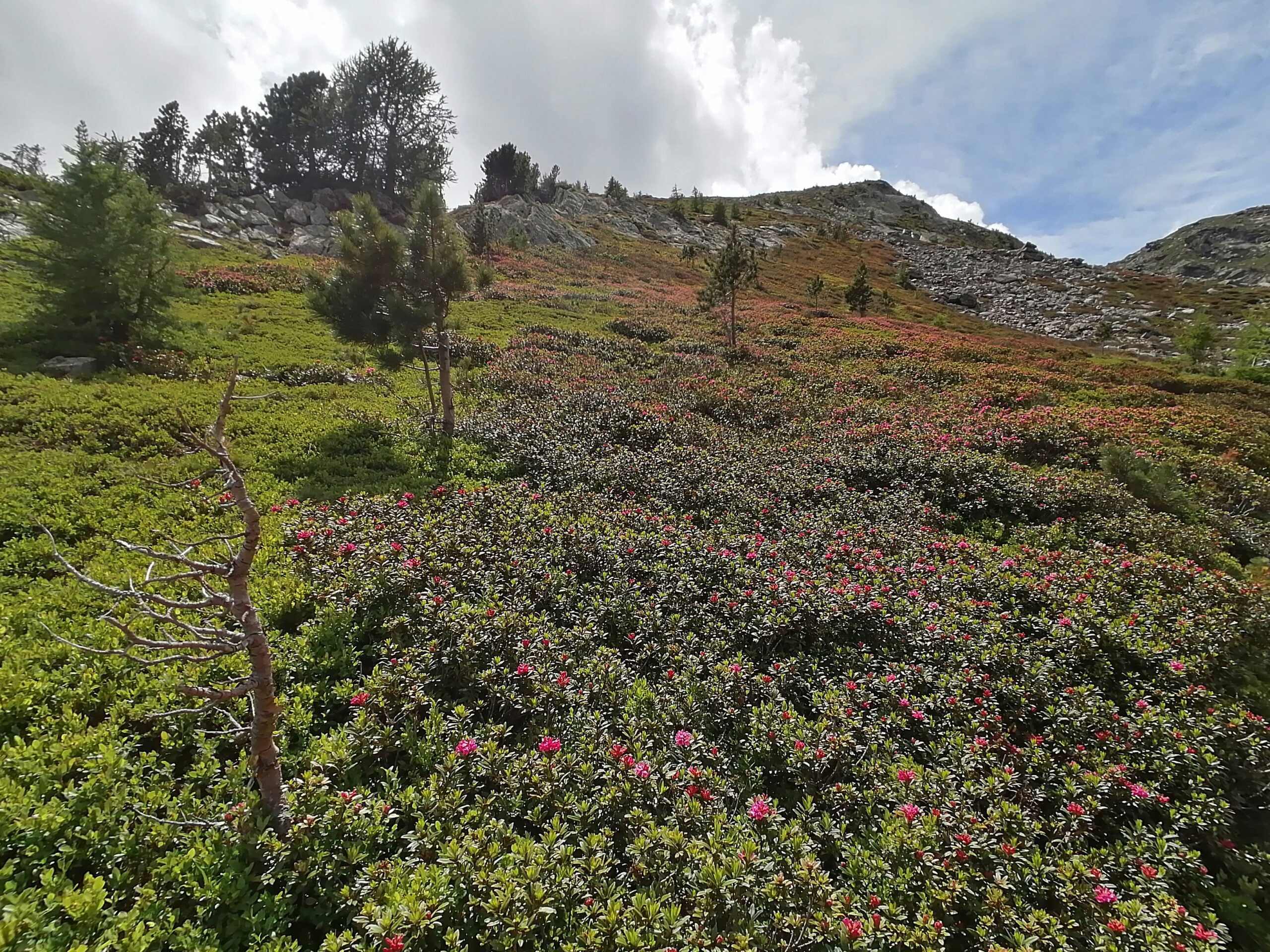
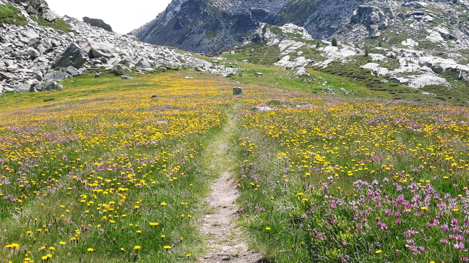
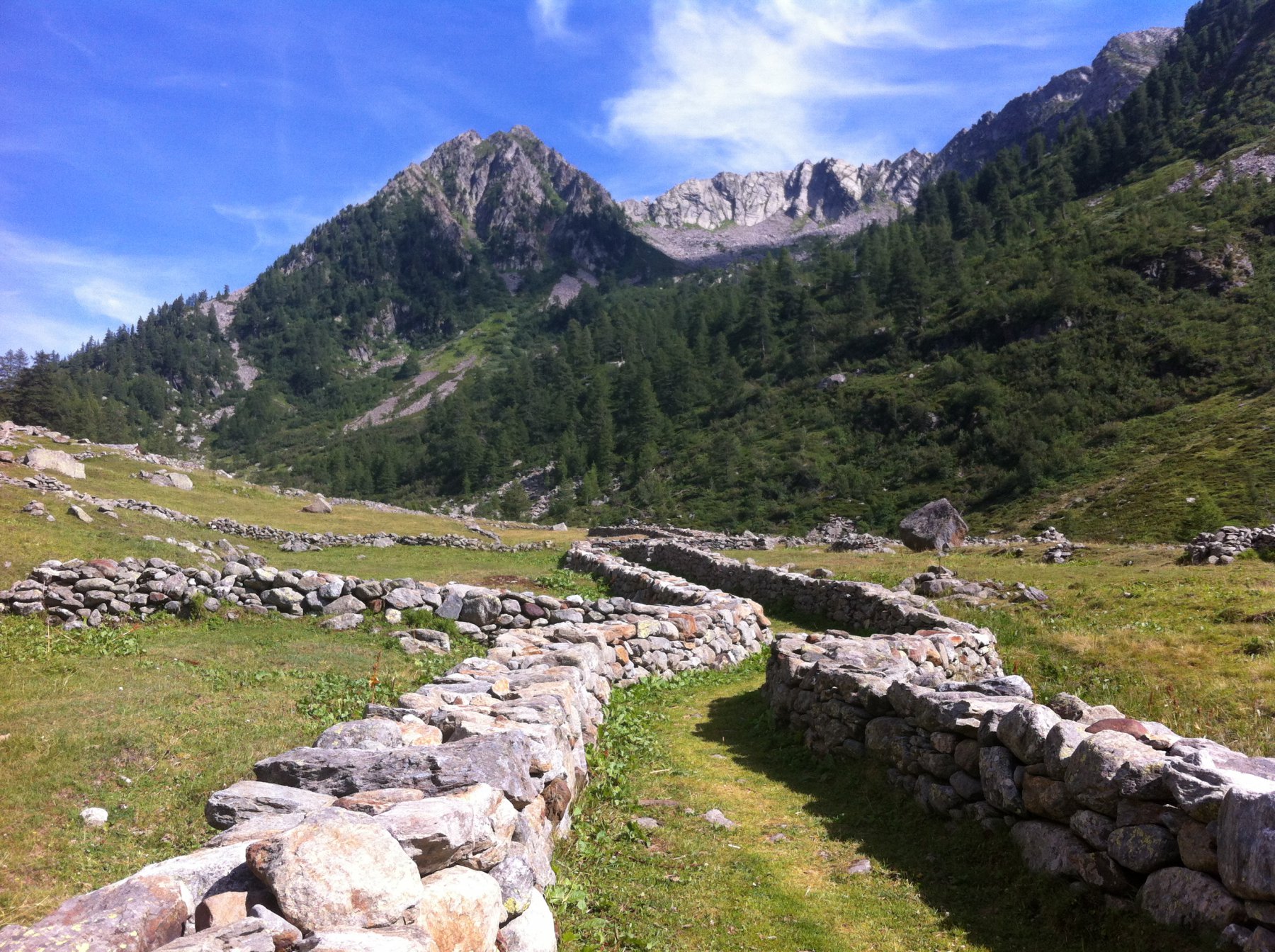
Lasciata l’auto si percorre la strada per 350 m fino al termine dell’asfalto in corrispondenza di un tornante. Da qui parte il percorso 1F, su strada verso sud. Dopo 200 m si incontra un alpeggio e si prosegue sempre sulla strada che diventa sempre più erbosa. In seguito oltre quota 1800 la strada diventa sentiero e verso quota 1850 m volge a ovest sempre nel bosco. Si passa presso alcune baite diroccate fino a giungere ad un bivio posto sulla dorsale fuori dal bosco. Di qui si seguono i bolli per il sentiero 1A verso sud ovest che continua a salire fino a quota 2400 m dove si trova l’indicazione per il sentiero 1B verso nord. I bolli non sono molto evidenti ma brevemente si guadagna la dorsale che porta al Monte Taf ove si giunge, seguendo gli ometti.
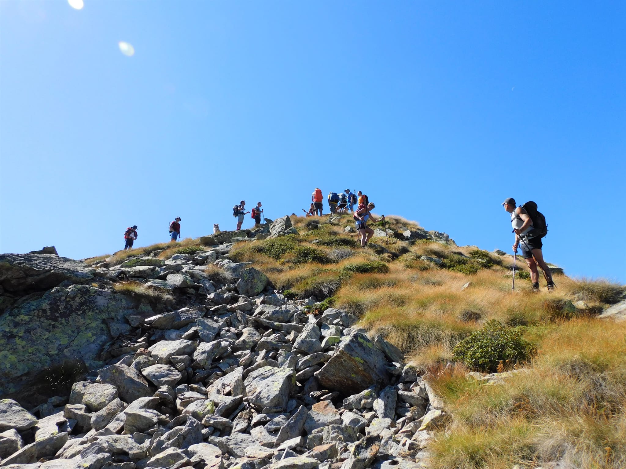
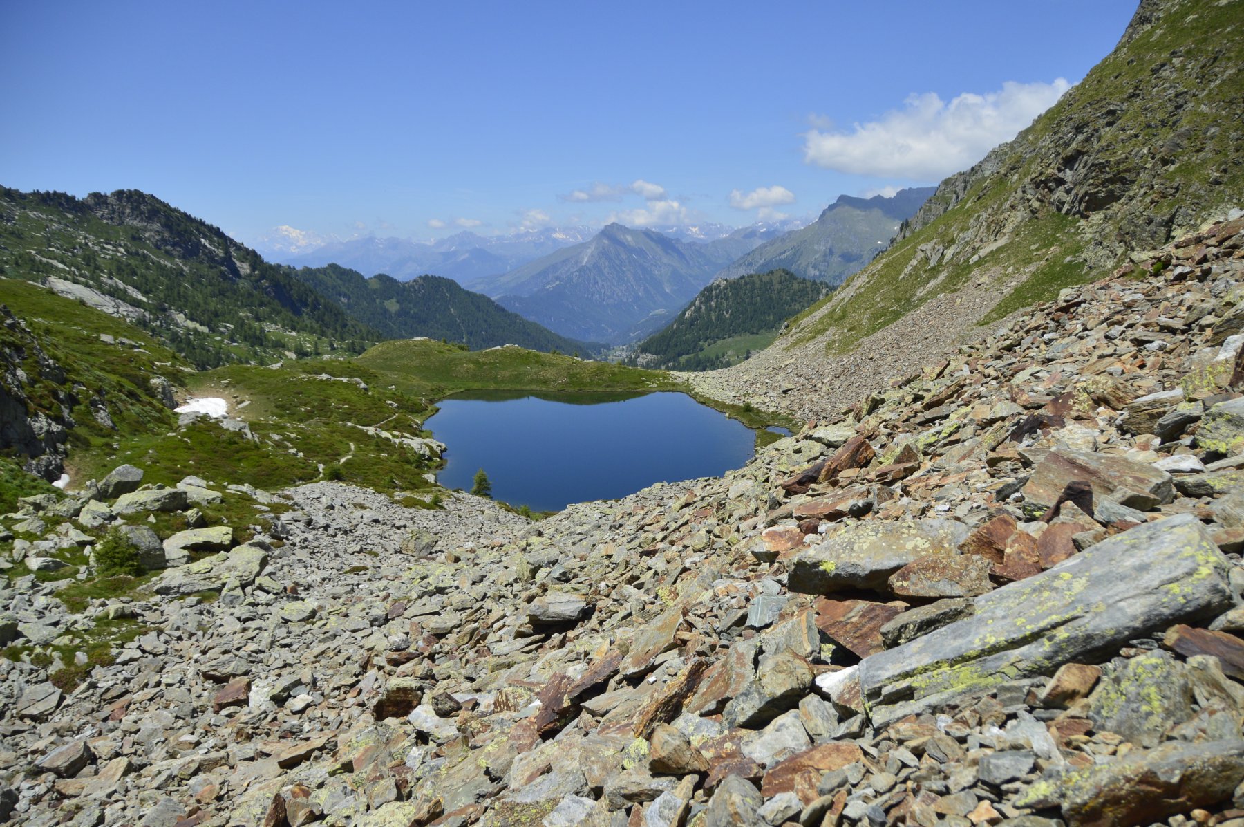
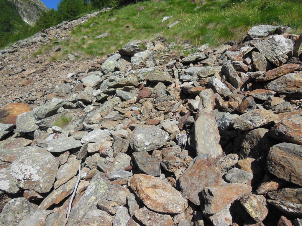
Discesi dal Taf fino a quota 2460 m si ritrova il sentiero 1B che prosegue verso nord ovest sul versante del lago di Frudiere con alcuni sali e scendi. Si superano molte selle erbose con percorso sempre esposto, fino a giungere all’ennesima sella alla base della cresta sud-ovest del Mont Taille dove una traccia pressoché invisibile punta verso la cima in direzione nord-est (consigliabile seguire direttamente la cresta). Ultimi 60 m di dislivello e si perviene alla vetta tra massi e sfasciumi.
Discesa per l’itinerario di salita.
- Cartografia:
- https://mappe.regione.vda.it/pub/geosentieri
Nelle vicinanze Mappa
Itinerari
08/07/2018 AO, Gressoney-Saint-Jean D+ 1100 m E Sud-Est
Frudiere (Colle e Laghi) dalla strada per Weissmatten
 50m
50m
29/10/2021 AO, Gressoney-saint-jean D+ 815 m EE Varie
Rena (Monte) dalla strada per Wiessmatten
 50m
50m
21/07/2021 AO, Gressoney-Saint-Jean D+ 1110 m E Sud-Ovest
Loo (Colle di) da Loomatten
 850m
850m
08/12/2025 AO, Gressoney-Saint-Jean D+ 973 m E Ovest
Kick (Monte) da Loomatten per il Vallone di Loo
 850m
850m
20/06/2022 AO, Gressoney-Saint-Jean D+ 1240 m EE Nord-Ovest
Lazoney o Lazouney (Punta) da Loomatten
 850m
850m
17/07/2017 AO, Gressoney-Saint-Jean D+ 1062 m EE/F Varie
Eby (Monte) da Loomatten
 850m
850m
10/09/2020 AO, Gressoney-saint-jean D+ 250 m T Varie
Mollino Carlo (Rifugio) da Woald
 1.4Km
1.4Km
23/06/2012 AO, Gressoney-Saint-Jean D+ 1012 m EE Est
Frudiere (Colle) da Zer Trino
 1.8Km
1.8Km
31/08/2022 AO, Gressoney-Saint-Jean D+ 1016 m EE Est
Frudiere (Colle) da Trinò
 1.9Km
1.9Km
02/09/2023 AO, Gressoney-Saint-Jean D+ 1400 m EE Varie
Valnera (Punta) da Gressoney Saint Jean, anello
 1.9Km
1.9Km
Servizi
3.1Km
3.7Km
Flying brasserie (Paul Verlaine) Ristorante
Gressoney-Saint-Jean
4.6Km
Bìerfall Ristorante
Gressoney-Saint-Jean
5.7Km
Mologna Albergo
Gaby
5.8Km
Kleine bar Ristorante
Gressoney-Saint-Jean
6Km
Des Alpes Bar
Gaby
7.7Km
La Gruba B&B
Gaby
8.7Km
A Barma Drola B&B
Brusson
9.3Km