3.9Km
3.9Km
Note
Storico
 1.1Km
1.1Km
1.2Km
1.9Km
2.3Km
3.1Km
3.2Km
4Km
1.1Km
1.1Km
1.2Km
1.9Km
2.3Km
3.1Km
3.2Km
4Km
3.9Km
3.9Km
5.1Km
5.1Km
5.3Km
5.6Km
6.5Km
6.6Km
7Km
7.6Km
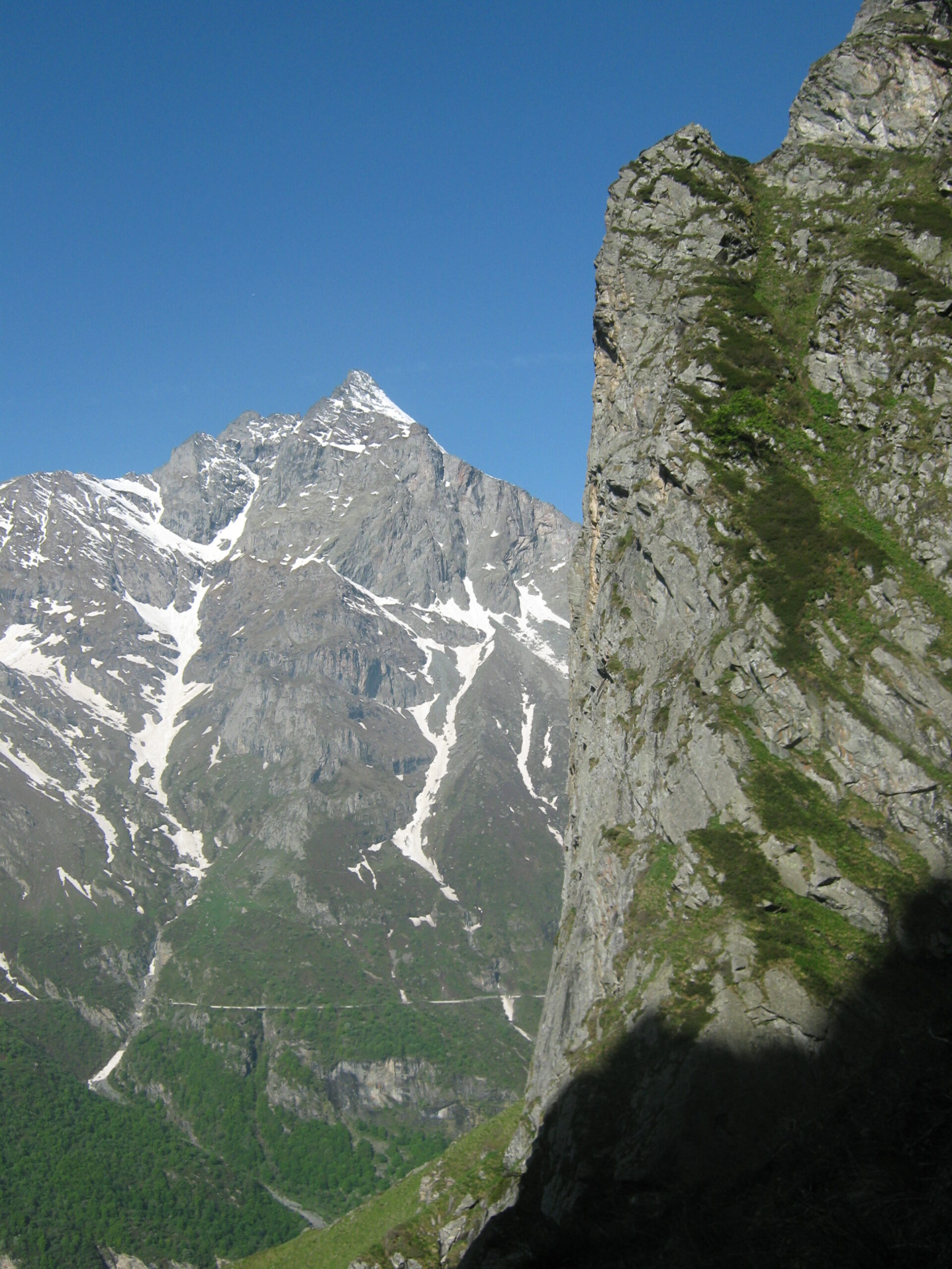
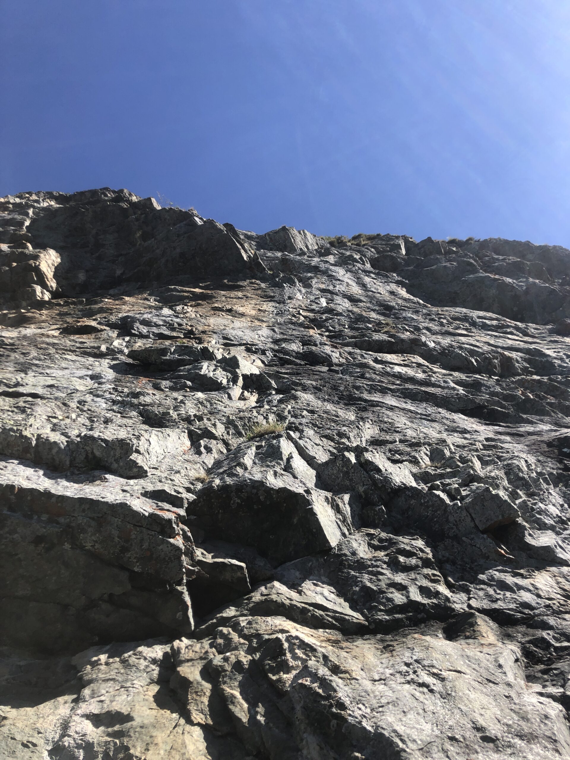
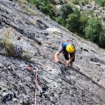
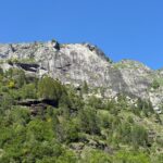
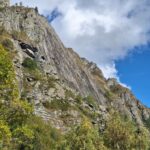
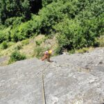
La torre rocciosa è imponente, la via percorre il lato destro della struttura. Sempre verticale propone un’arrampicata atletica. La via la si può percorrere con una corda singola da 70 metri e una decina di rinvii.
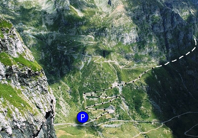
Avvicinamento
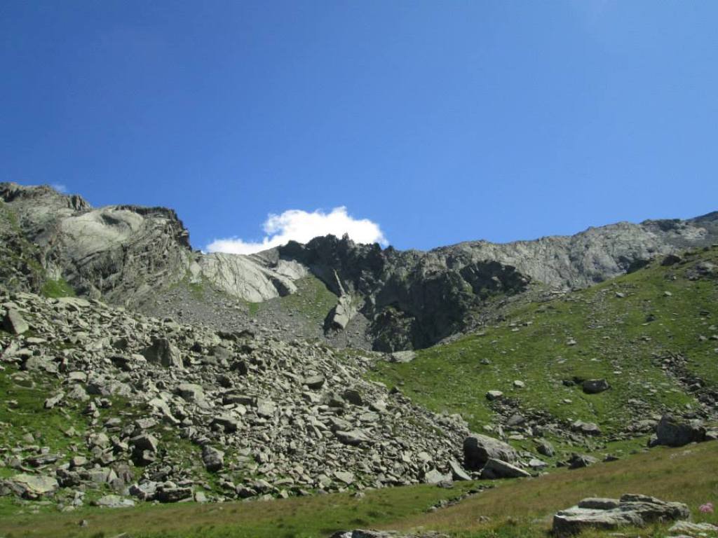
Dalla sbarra a Pian Sulè, al fondo del Vallone d'Arnas, si prosegue per la strada fino al quinto tornante.
In piano si attraversa la pietraia fino al primo canalone che si attraversa e per tracce di sentiero (traccia ben marcata dalle greggi), in leggera salita, si attraversano i radi pascoli in direzione della imponente struttura rocciosa, posta in corrispondenza di un canalone [1 ora].
Attenzione all'attraversamento dei prati terminali molto ripidi, utili i bastoncini.
Descrizione
In piano si attraversa la pietraia fino al primo canalone che si attraversa e per tracce di sentiero (traccia ben marcata dalle greggi), in leggera salita, si attraversano i radi pascoli in direzione della imponente struttura rocciosa, posta in corrispondenza di un canalone [1 ora].
Attenzione all'attraversamento dei prati terminali molto ripidi, utili i bastoncini.
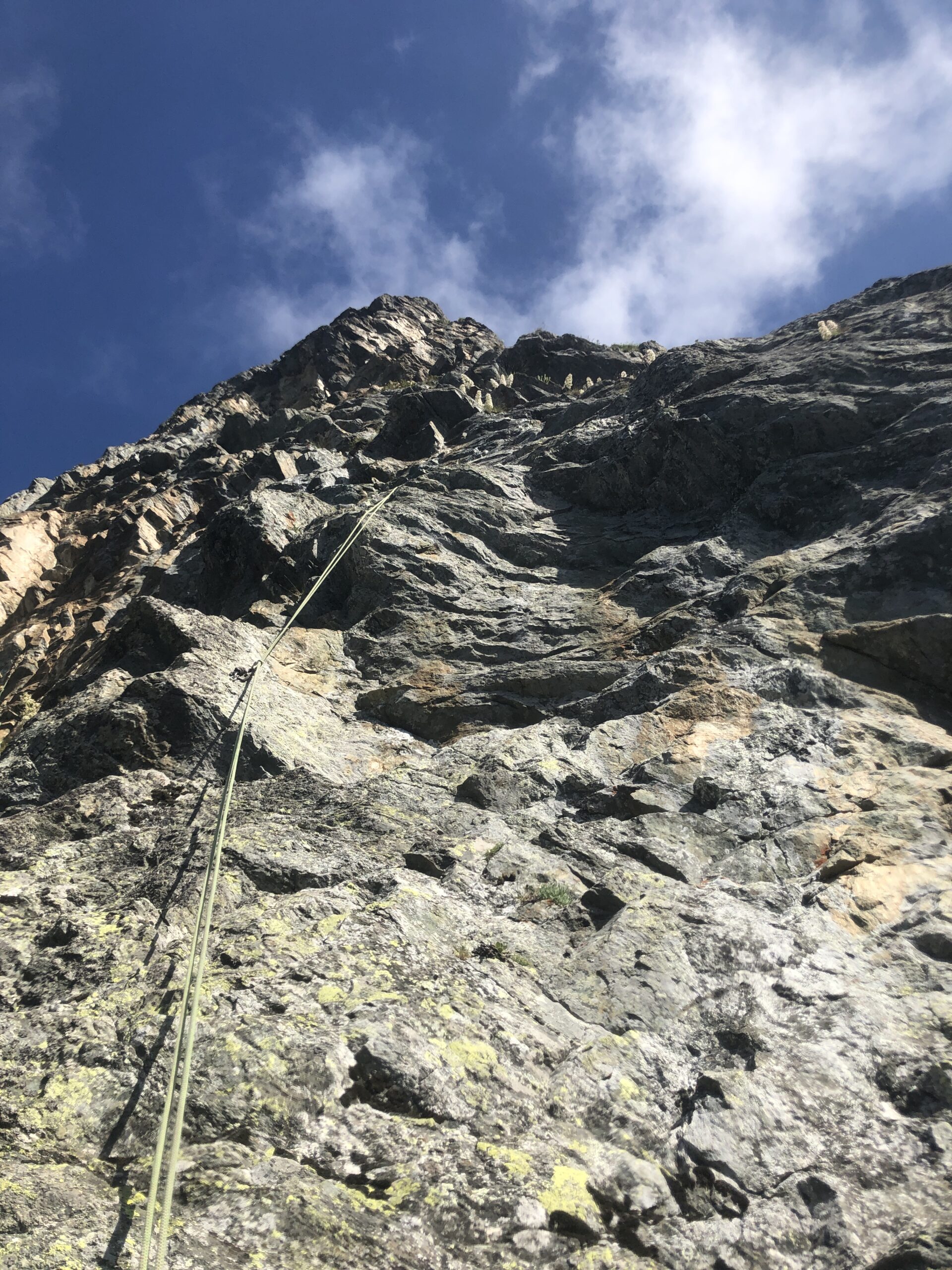
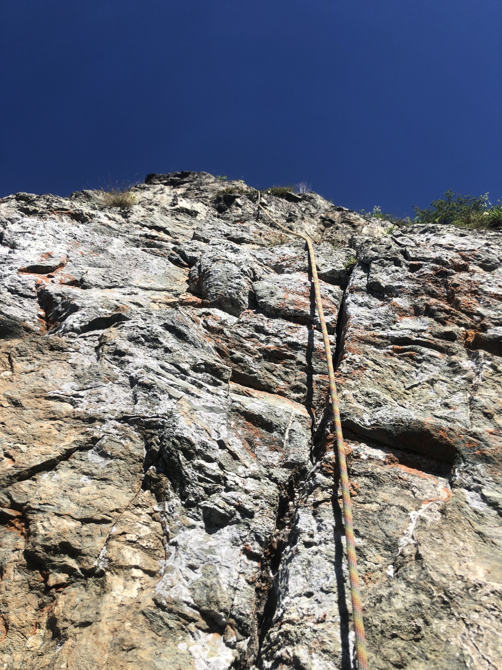
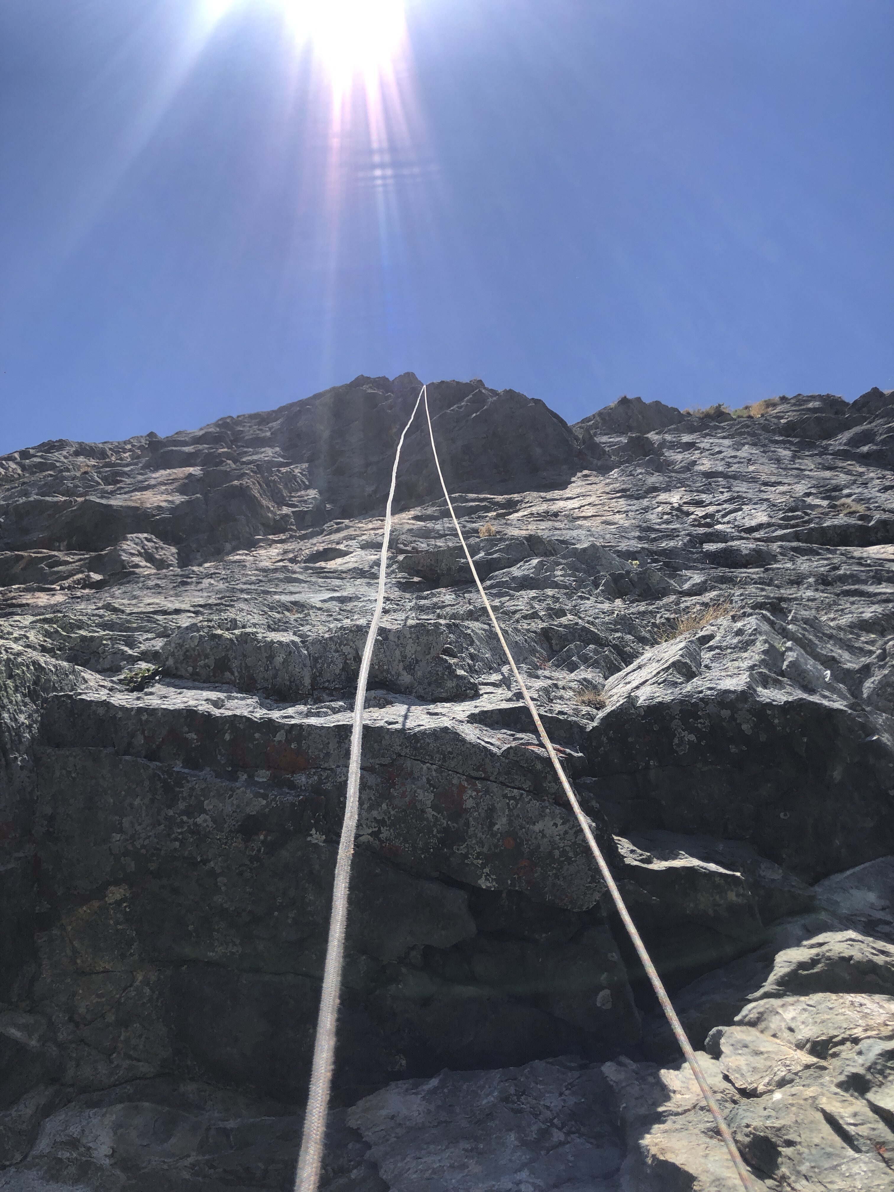
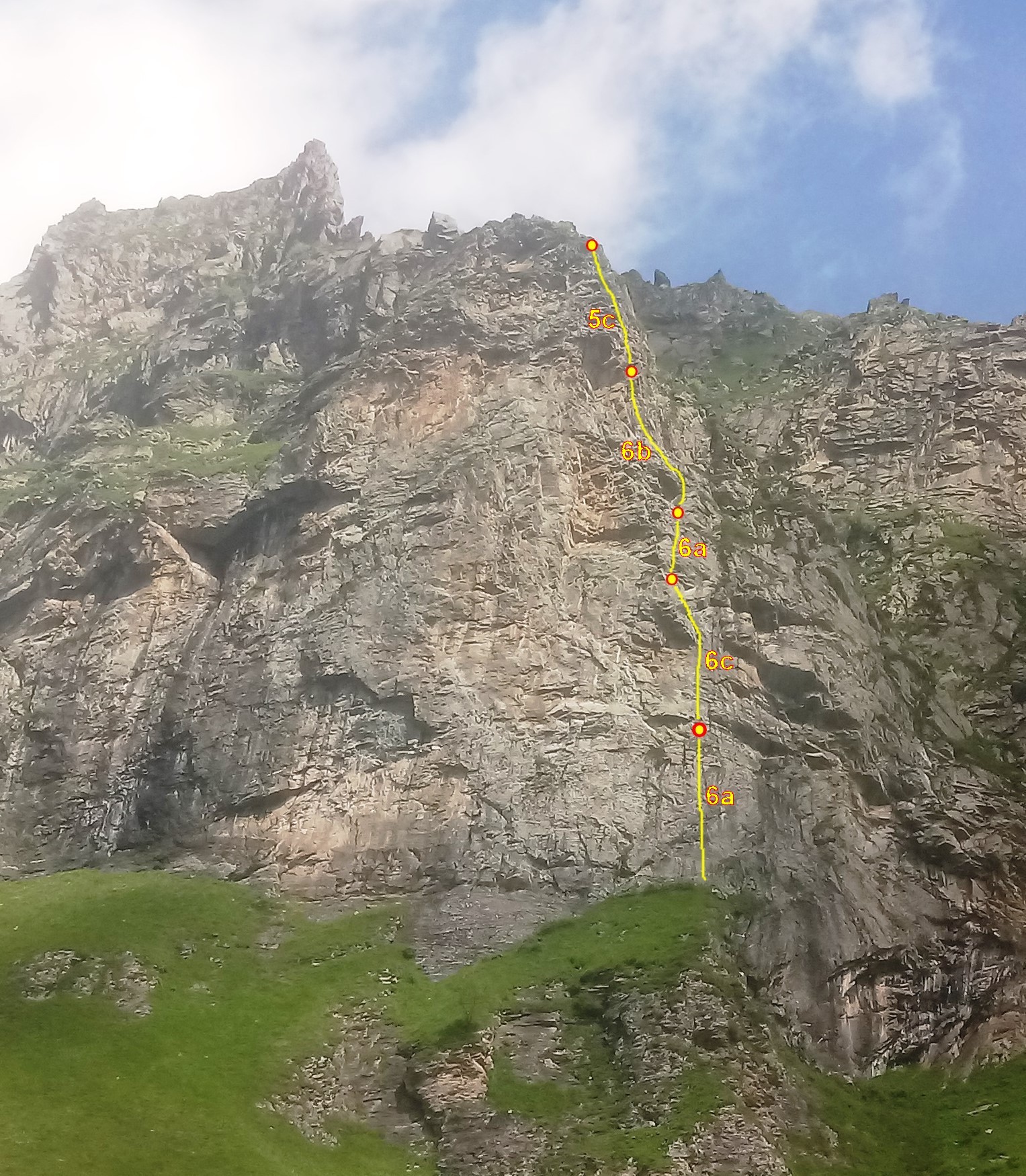
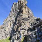
- L1: 6a affronta alcune sezioni verticali a buone prese a metà lunghezza si supera un piccolo strapiombo.
- L2: 6c un lungo muro verticale a piccole prese, la difficoltà sta nel finale per uscire su un pulpito poco prima della sosta
- L3: 6a inizialmente appoggiato supera uno sperone e poi traversa a destra verso la sosta
- L4: 6b si sale un muro liscio a liste fin sotto un piccolo diedro strapiombante da affrontare con decisione poi dritti in sosta per muretti
- L5: 5c si affronta il muro verso destra (vietato aiutarsi con la pianta) e da li per una serie di corti muretti al termine delle difficoltà alla sosta posta pochi metri sotto la sommità della torre in una nicchia
La discesa in doppia è veloce e alcuna calate sono interamente nel vuoto. Consigliabile dall’ultima sosta, salire in cima alla strutta, a piedi brevemente, per tracce di sentiero.
La via venne aperta il 13/06/1998 da Bosticco Andrea e Molino Fabio. Inizialmente attrezzata con tasselli M8 e placchette in acciaio zincato presentava lunghi tratti sprotetti. Richiodata interamente con materiale inox nel mese di luglio 2022 da Bosticco Andrea. Interamente ripulita e disgaggiata.
- Cartografia:
- Valli di Lanzo 1:25000
- Bibliografia:
- Toccata e Fuga sulle rocce della Valle di Viù di Andrea Bosticco
Nelle vicinanze Mappa
Itinerari
05/08/2017 TO, Usseglio 6a+, 6a+ obbl. Nord-Est
Lera (Monte) – Prigioni Via Manera
350m
19/10/2025 TO, Usseglio 6a, 5c obbl. Sud-Ovest
Vallone d’Arnas, Losa d’Alais – Primi Passi nella Follia
 1.1Km
1.1Km
12/06/2026 TO, Usseglio 6a, 5a obbl. Sud
Vallone d’Arnas, Losa d’Alais – Yaya
 1.1Km
1.1Km
04/11/2025 TO, Usseglio 6a+, 6a obbl. Sud-Ovest
Vallone d’Arnas, Losa d’Alais – Favola Semplice
 1.2Km
1.2Km
04/10/2019 TO, Usseglio 5c, 5a obbl. Sud-Ovest
Vallone d’Arnas, Losa d’Alais – Via dei Gargoille
1.2Km
08/07/2018 TO, Usseglio 6b, 6a obbl. Est
Cugnì (Cresta de) quota 3006 m – Anime Ribelli
 1.9Km
1.9Km
06/06/2026 TO, Usseglio 6a+, 5c obbl. Sud-Ovest
Vallone d’Arnas, Losa d’Alais – For Mina
 2.3Km
2.3Km
29/07/2025 TO, Usseglio 6a+, 6a obbl. Sud-Est
Corna (Punta) cima sud – Don Camillo
 3.1Km
3.1Km
04/10/2025 TO, Usseglio 6a, 6a obbl. Sud
Crot, Parete Centrale – Cani e Porci
 3.2Km
3.2Km
09/08/2025 TO, Balme 5b, 5a obbl. Nord-Ovest
Serene (Punta delle) contrafforte sud 2600 m – Prima che il Gallo Canti
 4Km
4Km
Servizi
3.9Km
3.9Km
Il Caminetto Ristorante
Usseglio
5.1Km
Luigi Cibrario Rifugio
Usseglio
5.1Km
Grand’Usselio Albergo
Usseglio
5.3Km
Il bivacco Ristorante
Usseglio
5.6Km
Vulpot Rifugio
Usseglio
6.5Km
Gastaldi Rifugio
Balme
6.6Km
Ciriè Rifugio
Balme
7Km
Nej e Solei Ristorante
Usseglio
7.6Km