3Km
3Km

Note
Storico
 1.8Km
2.5Km
2.5Km
2.5Km
3.1Km
3.1Km
3.3Km
3.4Km
1.8Km
2.5Km
2.5Km
2.5Km
3.1Km
3.1Km
3.3Km
3.4Km
3Km
3.4Km
3.4Km
3.6Km
4.9Km
5.2Km
5.3Km
5.3Km
5.3Km
5.3Km
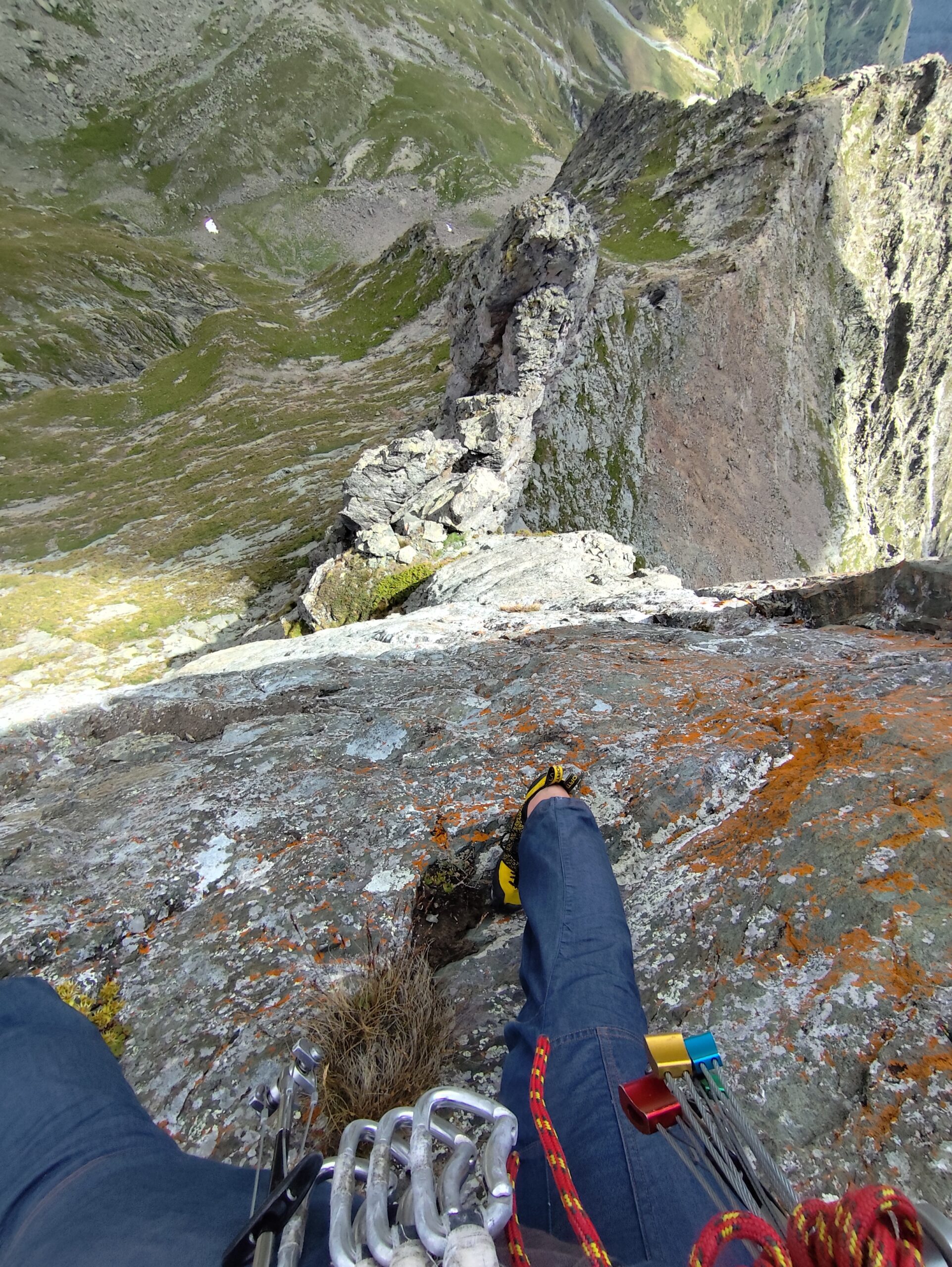
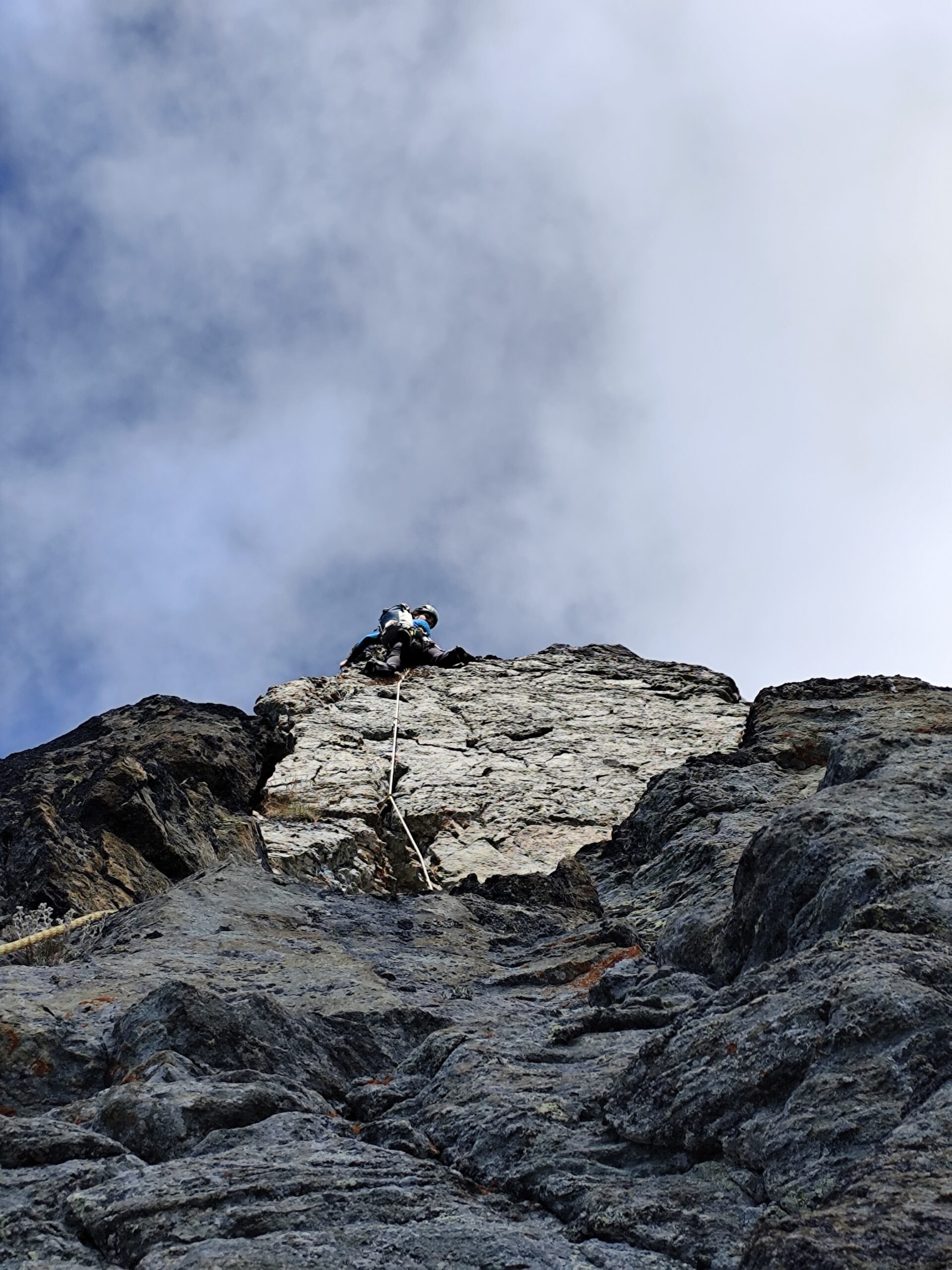
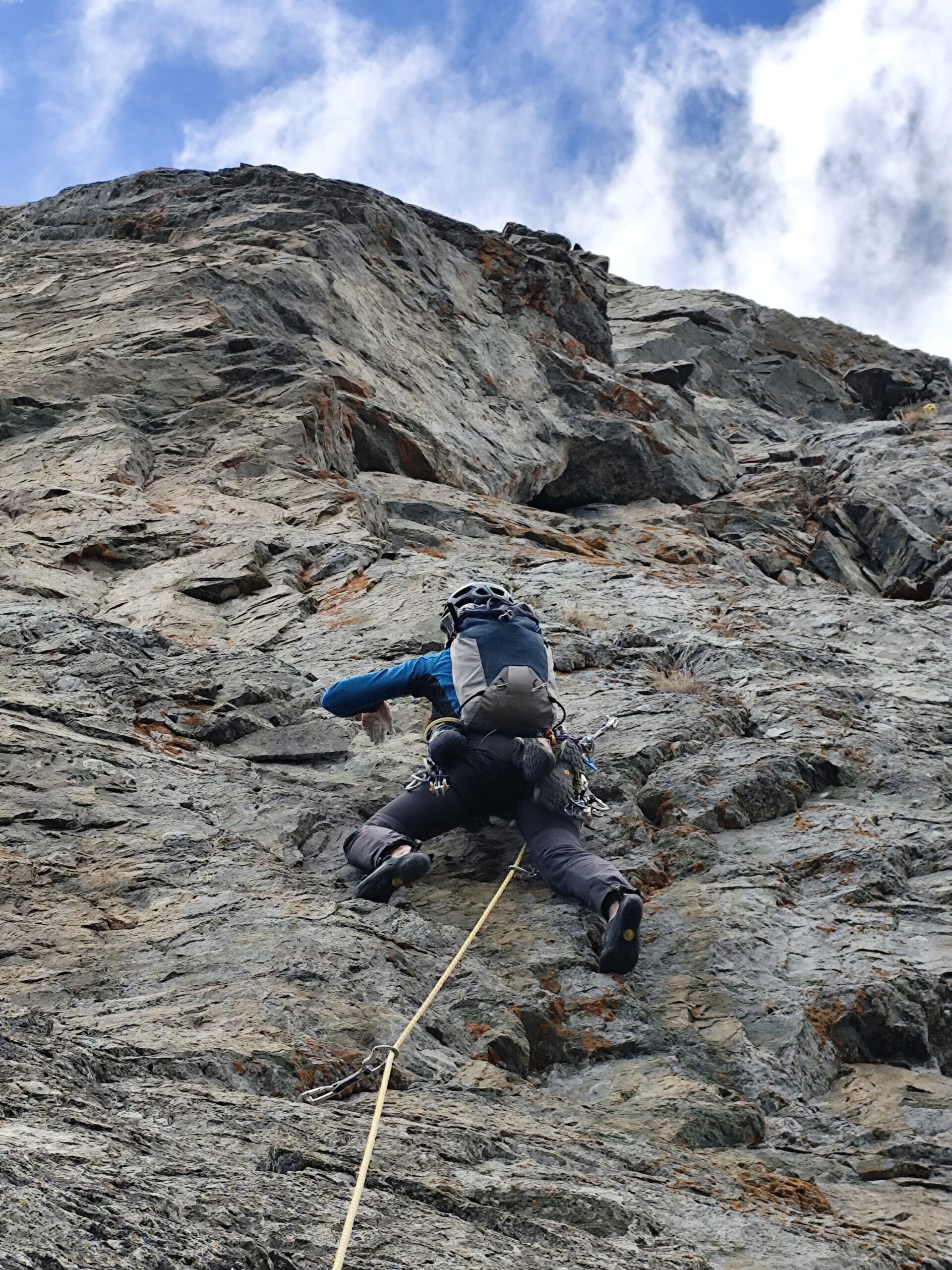
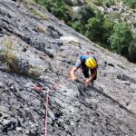
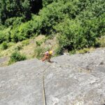
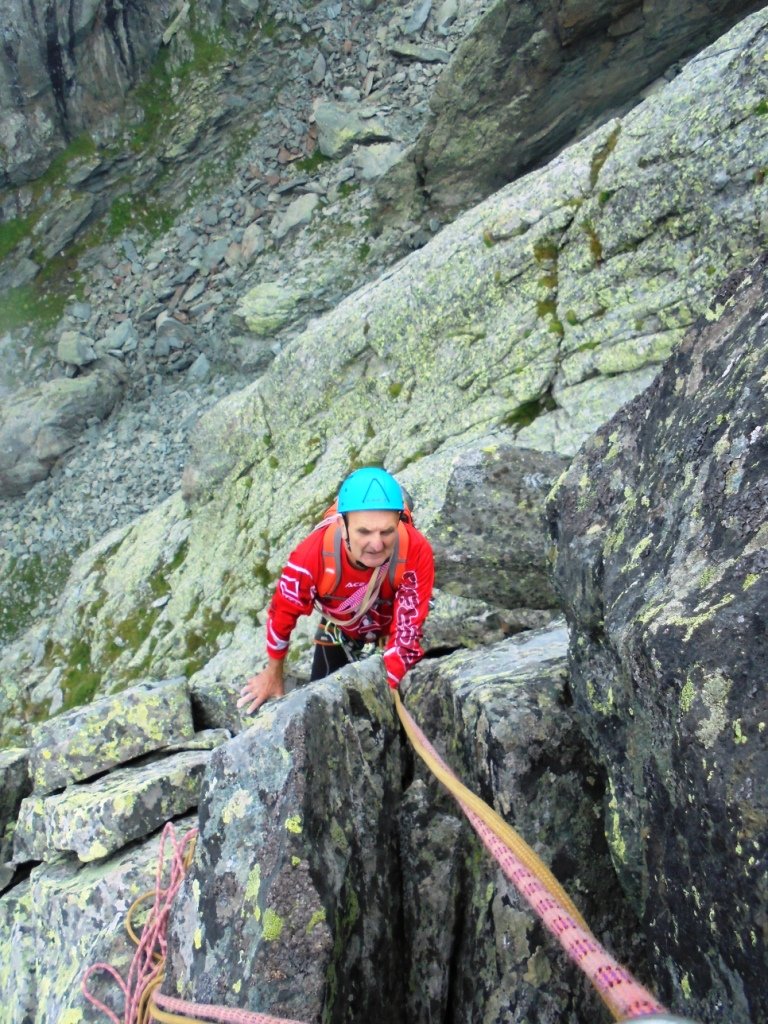
Via parzialmente attrezzata, dove risulta difficoltoso proteggersi con nuts e friends.
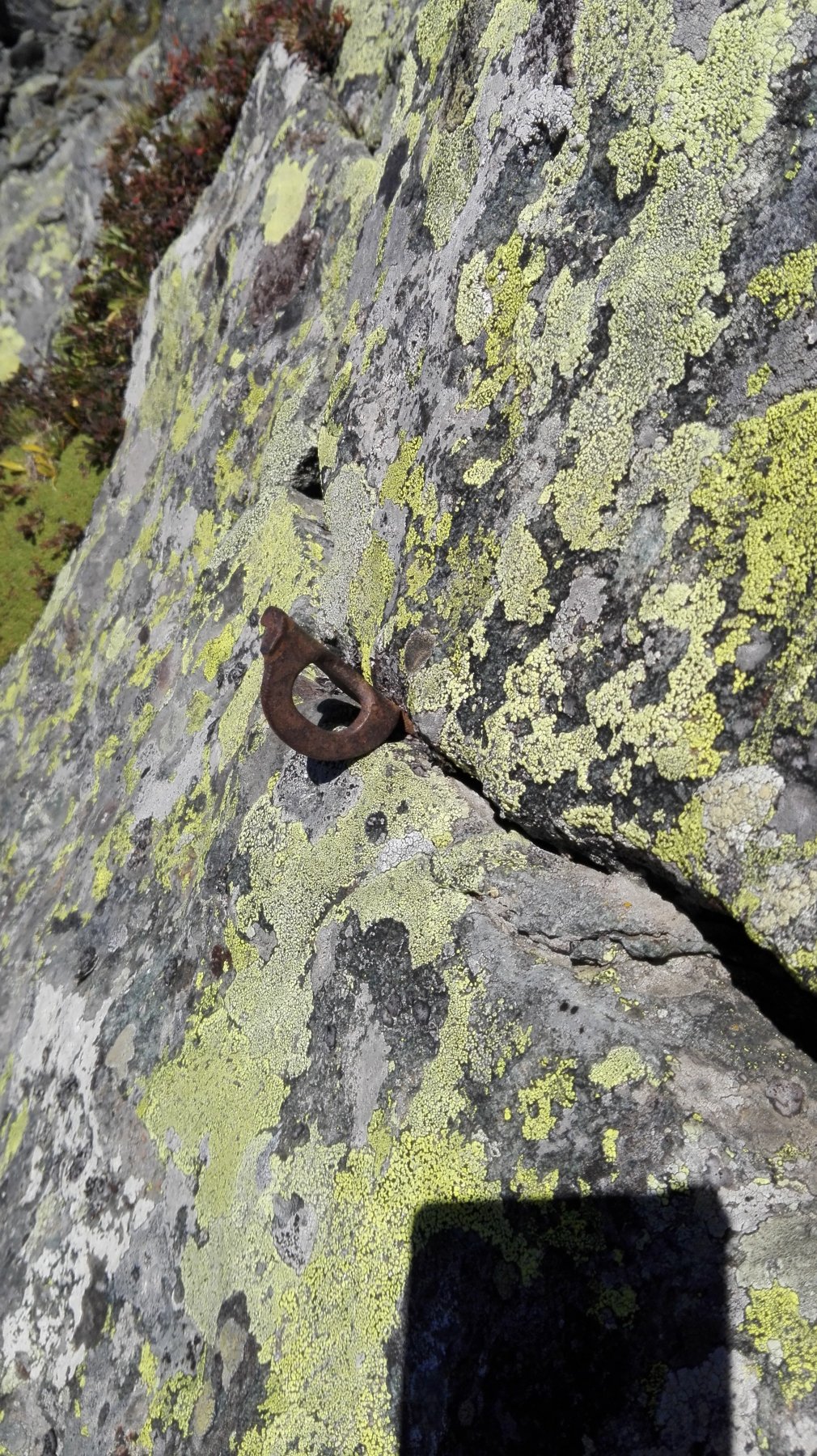
Soste attrezzate con due spits e cordone (non per la discesa in doppia).
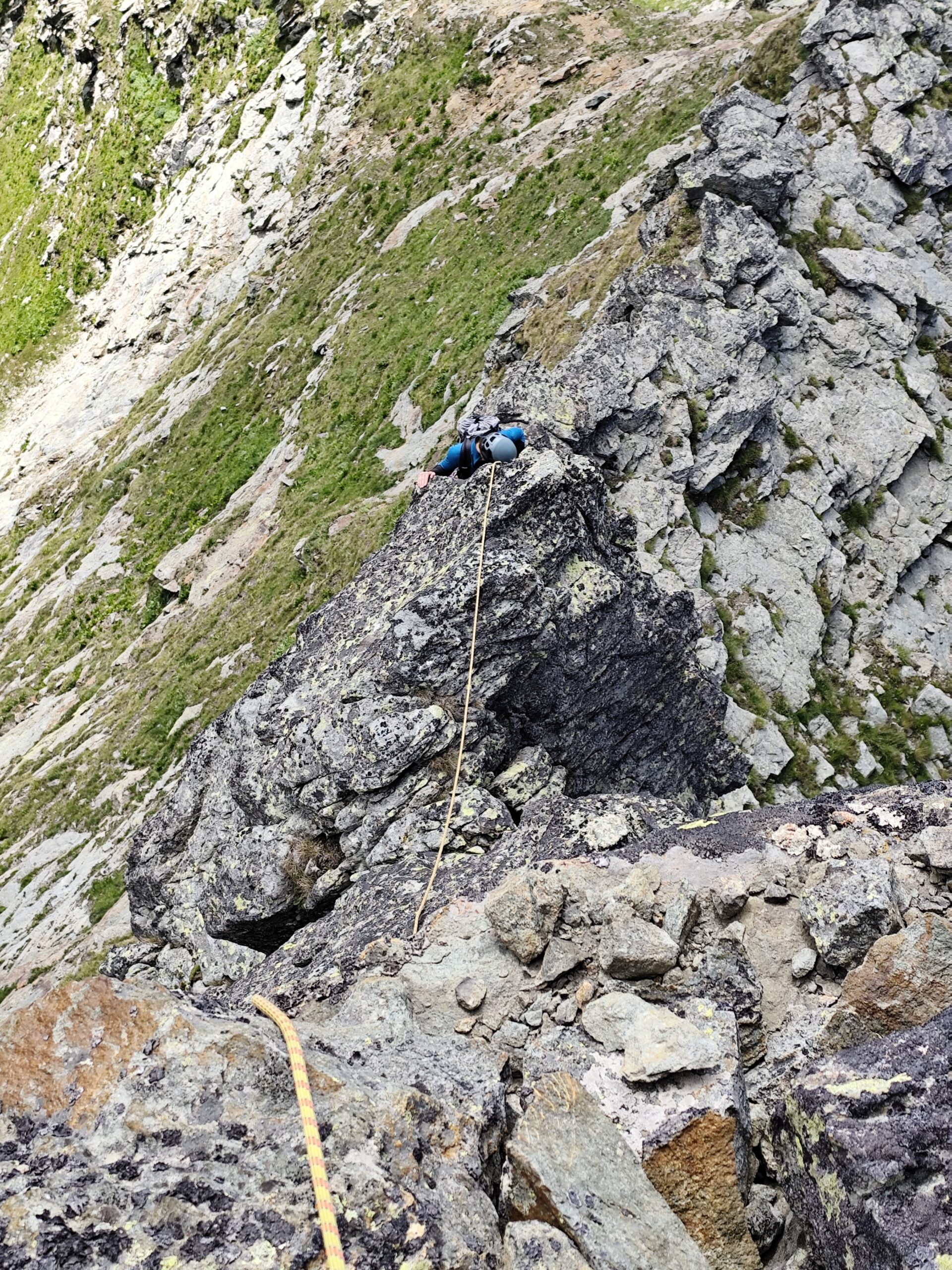
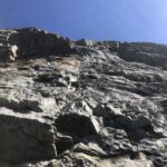
La linea di salita segue fedelmente il filo di spigolo.
Materiale: portare una serie di friends medio piccoli.
Sotto la croce di vetta è presente il diario delle salite.
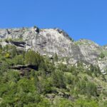
Avvicinamento
Soste attrezzate con due spits e cordone (non per la discesa in doppia).
La linea di salita segue fedelmente il filo di spigolo.
Materiale: portare una serie di friends medio piccoli.
Sotto la croce di vetta è presente il diario delle salite.
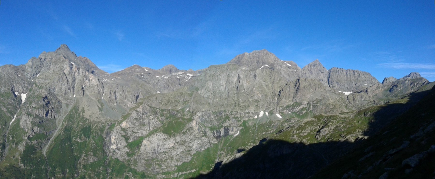
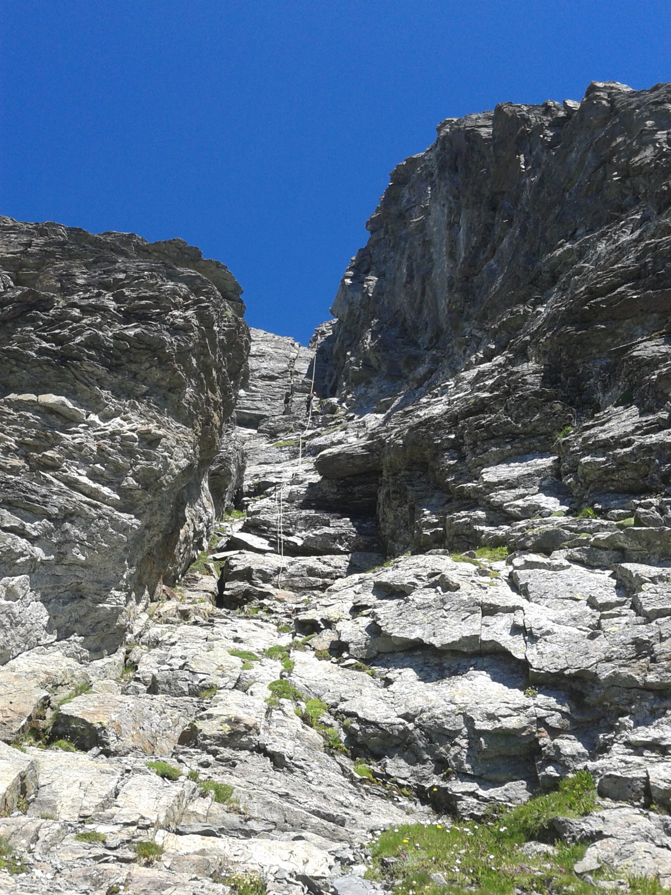
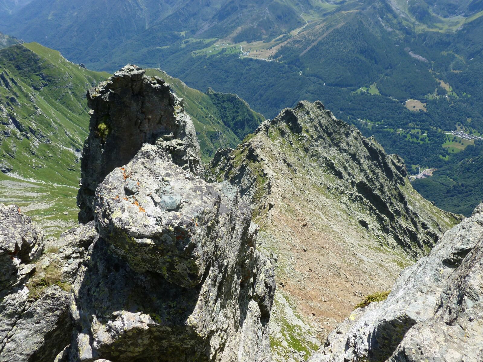
Dalla sbarra, al termine del tratto transitabile, nel Vallone d'Arnas, si prosegue fino a quando diventa sterrata. Giunti al primo tornante, dove sorgeva l'alpe di Bessanetto, si lascia la strada per salire i pendii meridionali che si addentrano nel Vallone del Veil.
Dopo pochi minuti si punta decisamente a destra in direzione della dorsale che scende direttamente dalla cresta Sud-Ovest della Punta Corna Meridionale.
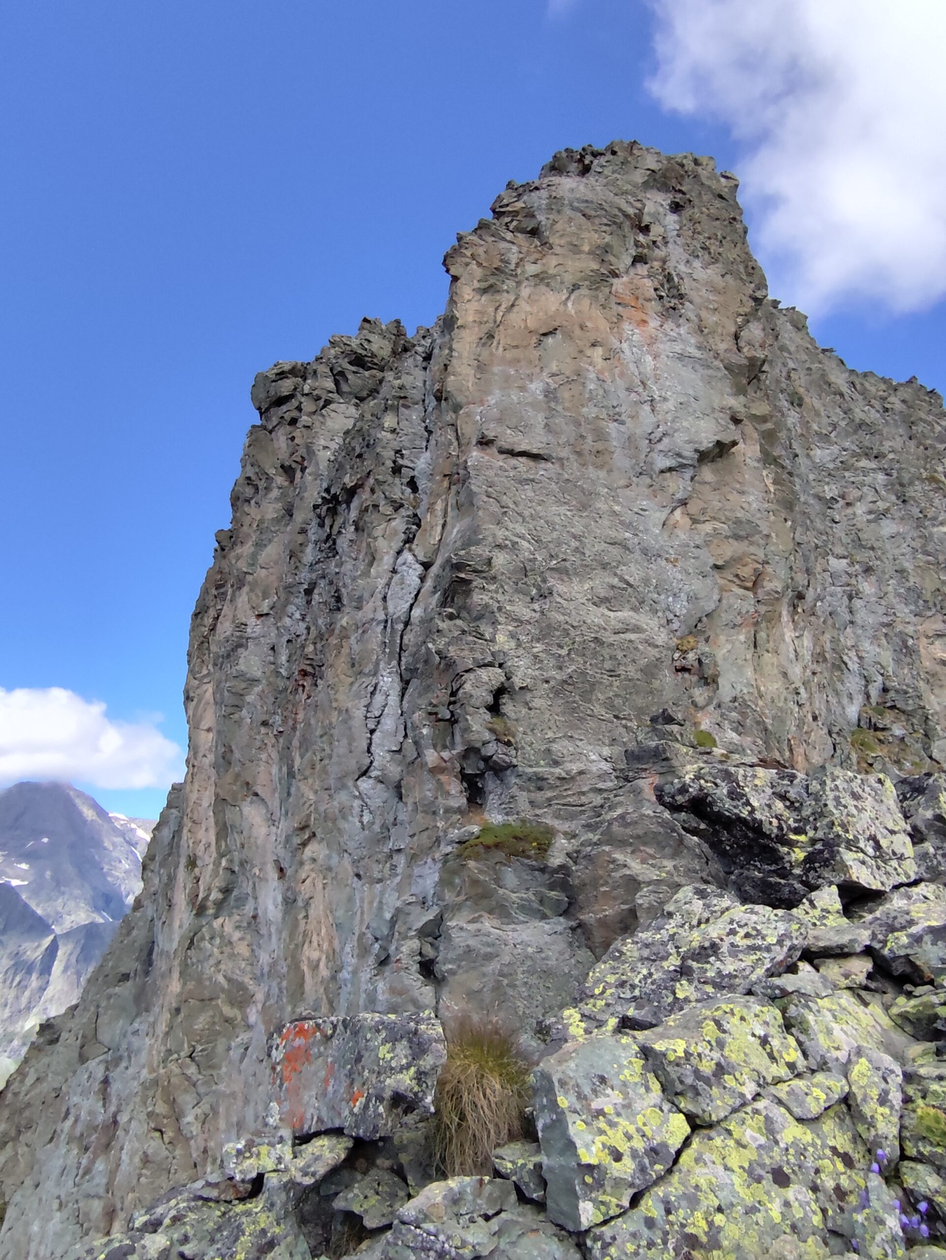
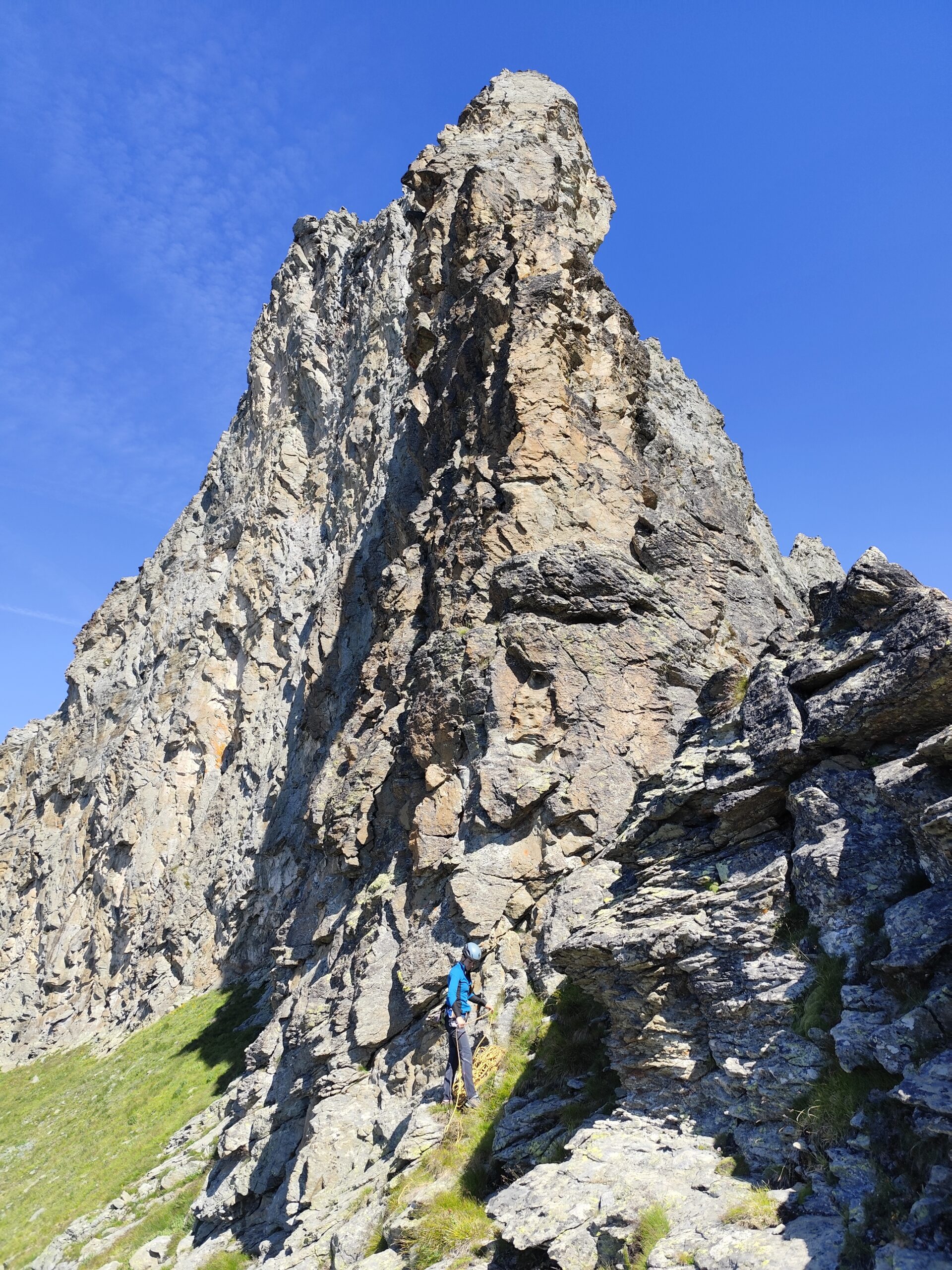
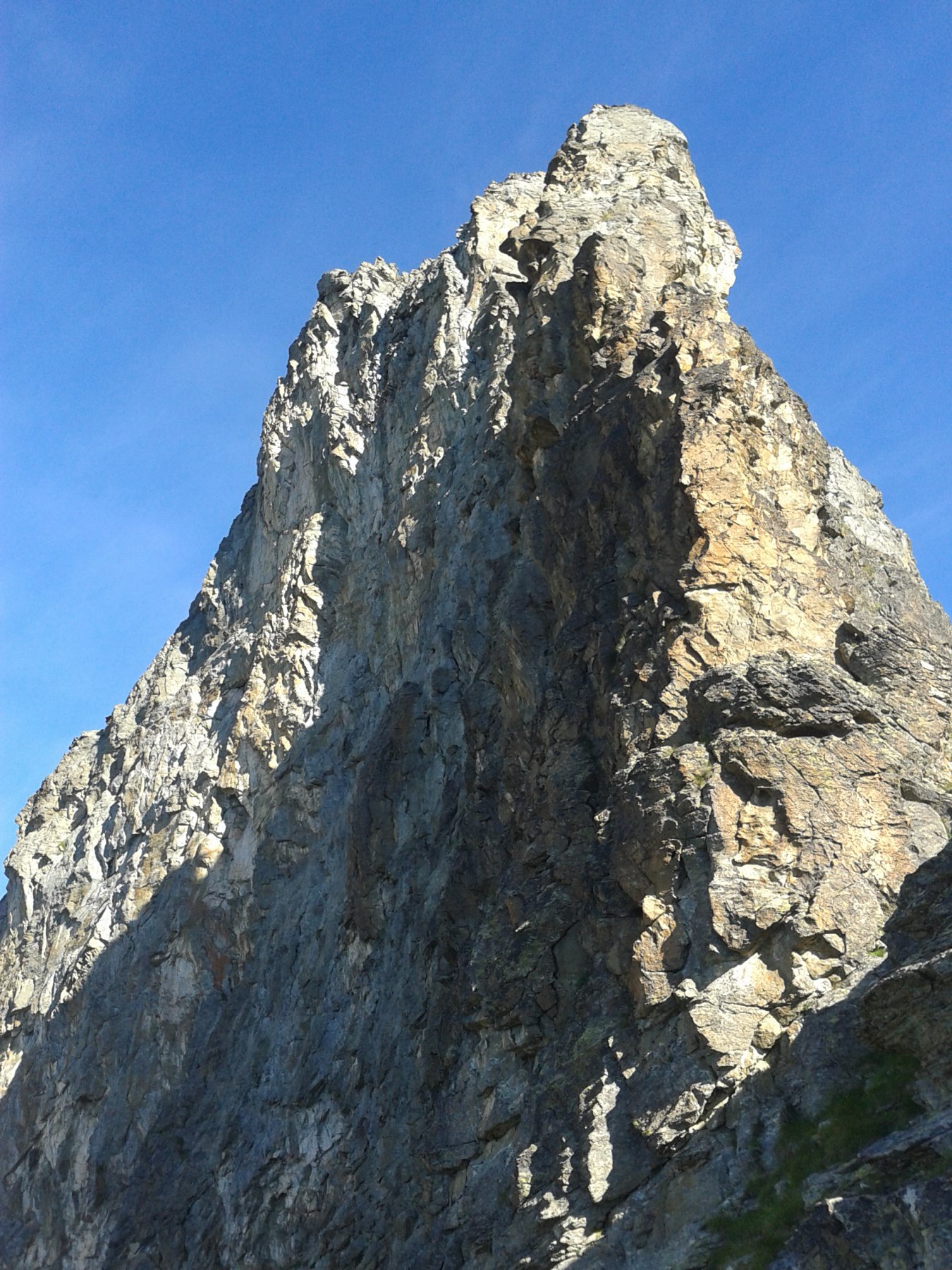
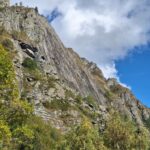
Si segue la dorsale fino a raggiungere la base della parete Sud. Giunti in prossimità, attraversale tutto a destra fino sul filo di cresta, che separa dal Vallone del rio Servin. Dove la cresta si raddrizza a formare il primo torrione parte la via (scritta alla base e spit visibile). Contare 3 ore dalla sbarra.
Descrizione
Dopo pochi minuti si punta decisamente a destra in direzione della dorsale che scende direttamente dalla cresta Sud-Ovest della Punta Corna Meridionale.
Si segue la dorsale fino a raggiungere la base della parete Sud. Giunti in prossimità, attraversale tutto a destra fino sul filo di cresta, che separa dal Vallone del rio Servin. Dove la cresta si raddrizza a formare il primo torrione parte la via (scritta alla base e spit visibile). Contare 3 ore dalla sbarra.
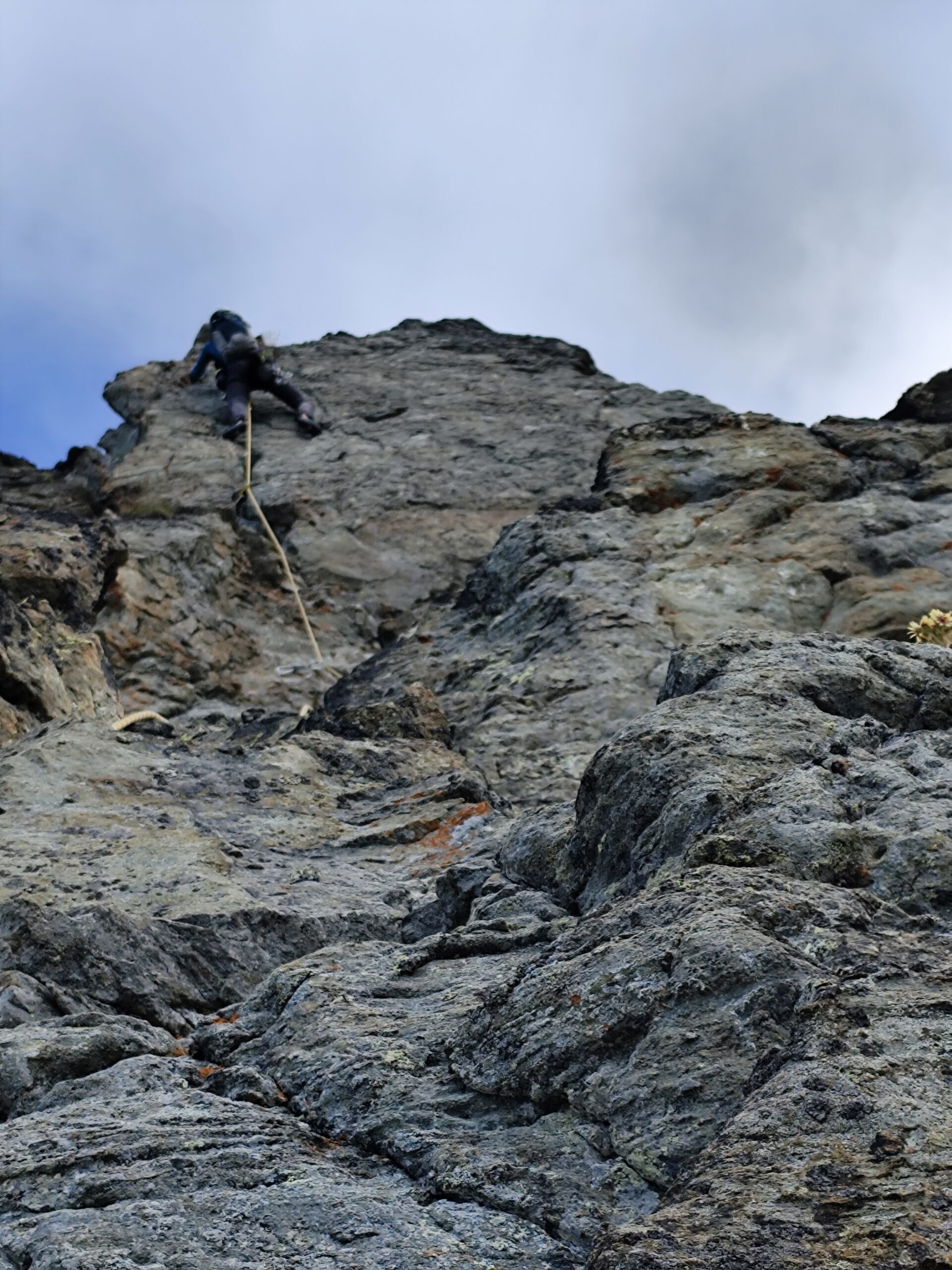
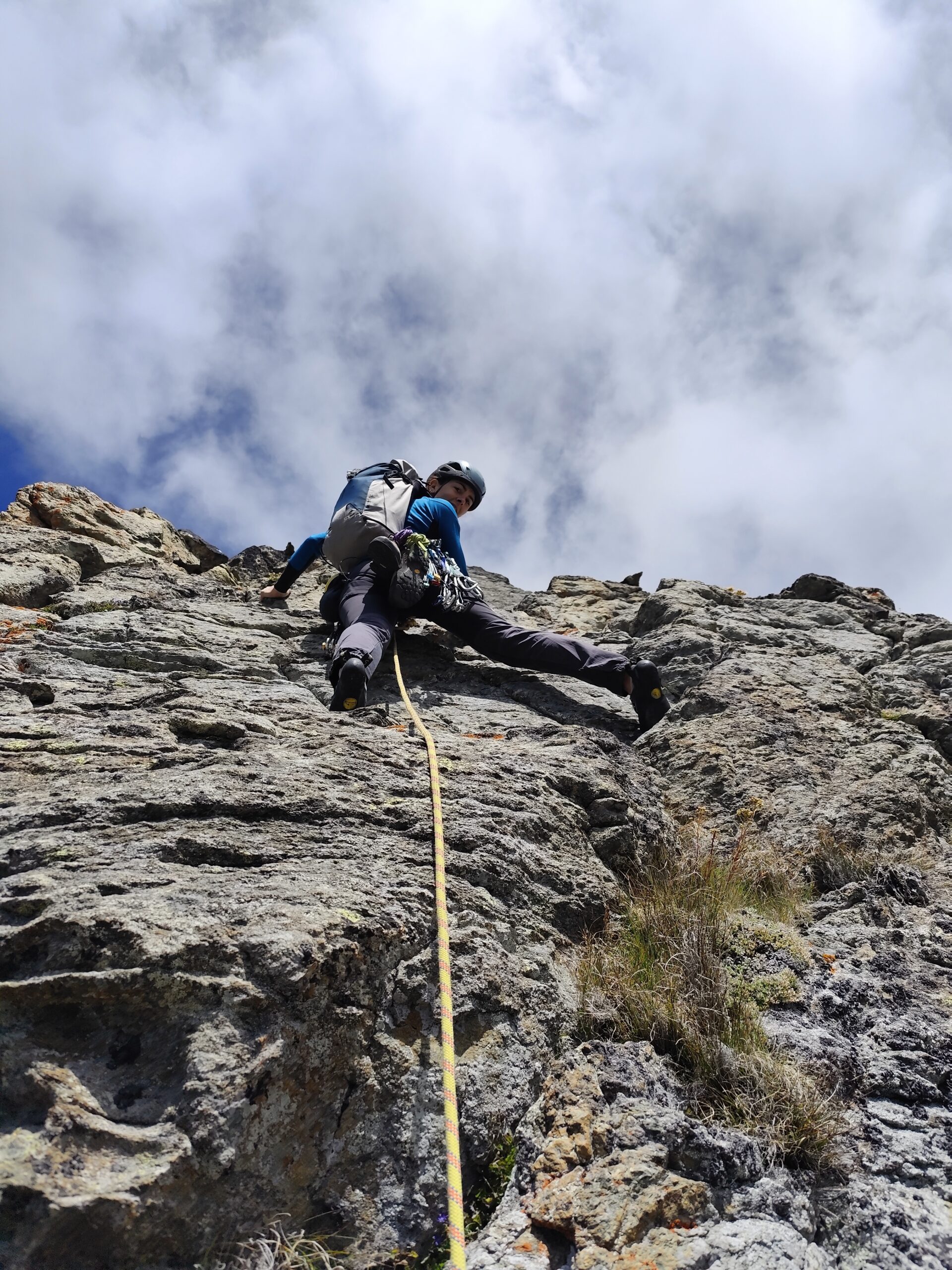
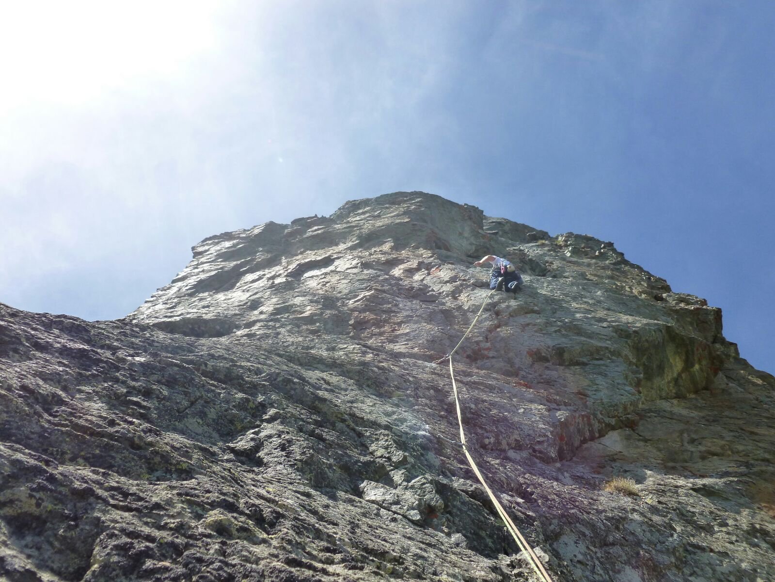
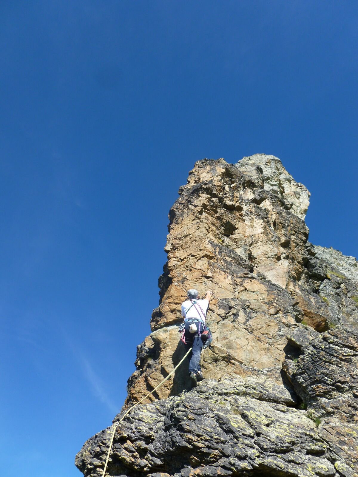
- L1: 5c
- L2: 5a
- L3: 4a (tiro di trasferimento delicato ed esposto)
- L4: 6a+ (al termine del tiro prestare attenzione ad un blocco instabile prima di arrivare alla sosta)
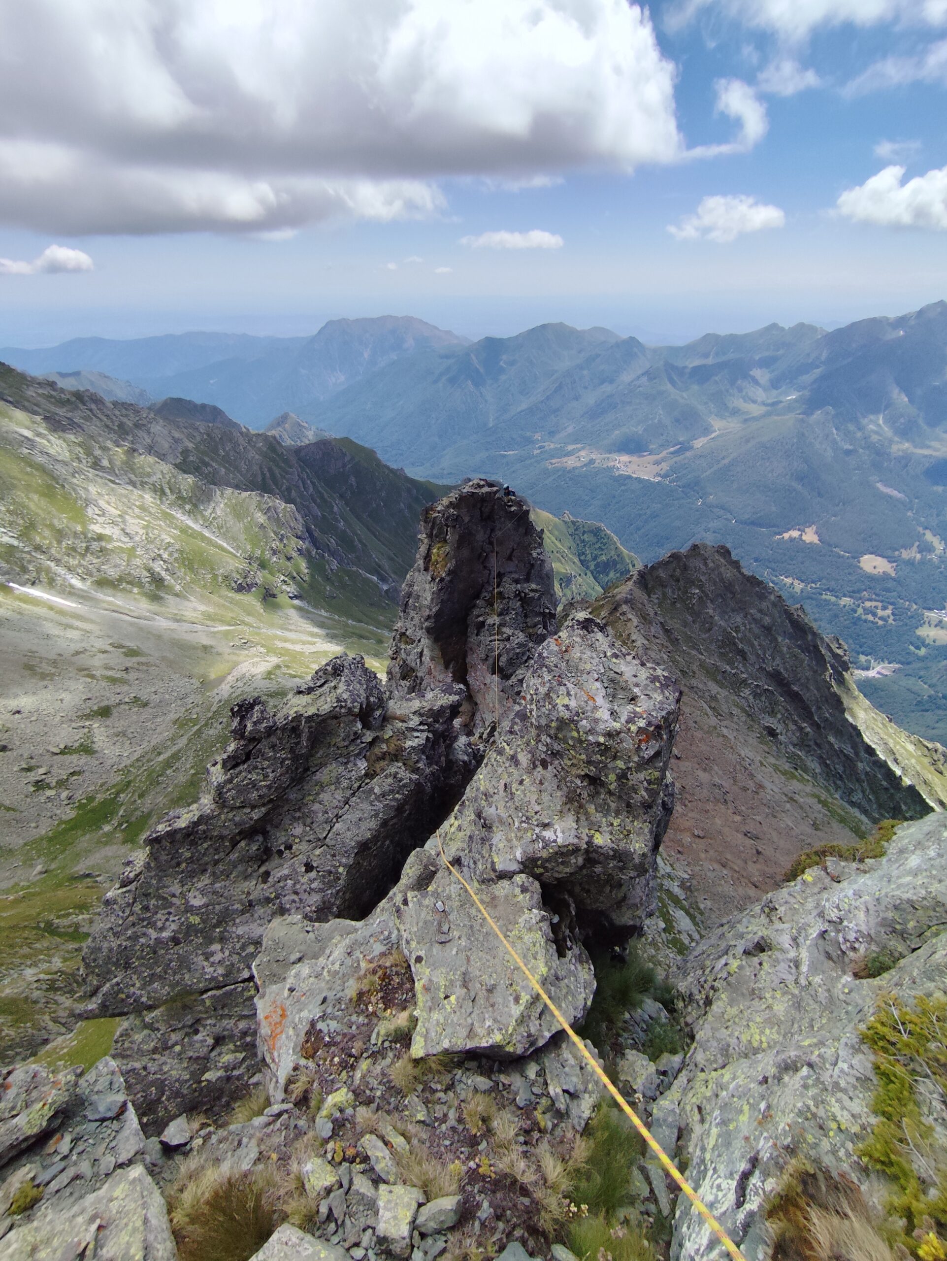
Discesa: dalla vetta, si reperisce la calata della via normale, sul lato nord (spits con catena visibili pochi metri più in basso). Effettuata una doppia di 60 metri che porta ad un terrazzino in prossimità della cresta sud-ovest (a sinistra faccia a valle).
Percorrerla brevemente in discesa, fino in corrispondenza di un risalto, alla base del quale si reperisce una fettuccia incastrata, da cui con una breve doppia di 20 metri si ritorna alla base della parete sud.
La verticale parete Sud, presenta un tentativo di salita, da parte di Claudio Balagna che, a causa della cattiva qualità della roccia, uscì verso destra nella parte terminale. Lo spigolo/cresta sud-est ad oggi non risultava ancora percorso.
Il nome dato alla via è in onore della festa al bivacco San Camillo al Lago della Rossa.
Via aperta il 6 agosto 2016 da Alessandro Pavan, Davide Fissolo e Andrea Bosticco
Il nome dato alla via è in onore della festa al bivacco San Camillo al Lago della Rossa.
Via aperta il 6 agosto 2016 da Alessandro Pavan, Davide Fissolo e Andrea Bosticco
- Cartografia:
- IGC 1:25.000 Alte Valli di Lanzo
- Bibliografia:
- Guida dei Monti d'Italia - Alpi Graie Meridionali (Berutto-Fornelli)
Nelle vicinanze Mappa
Itinerari
06/06/2026 TO, Usseglio 6a+, 5c obbl. Sud-Ovest
Vallone d’Arnas, Losa d’Alais – For Mina
 1.8Km
1.8Km
04/10/2019 TO, Usseglio 5c, 5a obbl. Sud-Ovest
Vallone d’Arnas, Losa d’Alais – Via dei Gargoille
2.5Km
12/06/2026 TO, Usseglio 6a, 5a obbl. Sud
Vallone d’Arnas, Losa d’Alais – Yaya
 2.5Km
2.5Km
04/11/2025 TO, Usseglio 6a+, 6a obbl. Sud-Ovest
Vallone d’Arnas, Losa d’Alais – Favola Semplice
 2.5Km
2.5Km
19/10/2025 TO, Usseglio 6a, 5c obbl. Sud-Ovest
Vallone d’Arnas, Losa d’Alais – Primi Passi nella Follia
 2.5Km
2.5Km
05/07/2026 TO, Usseglio 6c, 6a obbl. Sud
Arnas (Torre Inferiore d’) – Sole che Nasce Sole che Muore
 3.1Km
3.1Km
04/10/2025 TO, Usseglio 6a, 6a obbl. Sud
Crot, Parete Centrale – Cani e Porci
 3.1Km
3.1Km
05/08/2017 TO, Usseglio 6a+, 6a+ obbl. Nord-Est
Lera (Monte) – Prigioni Via Manera
3.3Km
27/08/2020 TO, Balme 5b, 4 obbl. Nord-Ovest
Pariate (Contrafforti delle) – Attraverso il Pollo
 3.3Km
3.3Km
27/08/2020 TO, Balme 5c, 5b obbl. Nord-Ovest
Pariate (Contrafforti delle) – Ciao Friend
 3.4Km
3.4Km
Servizi
3Km
3.4Km
Luigi Cibrario Rifugio
Usseglio
3.4Km
Grand’Usselio Albergo
Usseglio
3.6Km
Il bivacco Ristorante
Usseglio
4.9Km
Il Caminetto Ristorante
Usseglio
5.2Km
Val Servin Ristorante
Balme
5.3Km
Stella Alpina Ristorante
Balme
5.3Km
Masinà B&B
Balme
5.3Km
Nej e Solei Ristorante
Usseglio
5.3Km