600m
600m

Note
 50m
50m
50m
50m
2.8Km
2.8Km
2.8Km
2.8Km
2.8Km
2.8Km
50m
50m
50m
50m
2.8Km
2.8Km
2.8Km
2.8Km
2.8Km
2.8Km
600m
2.7Km
2.7Km
2.7Km
2.8Km
4.2Km
4.3Km
4.7Km
4.7Km
4.8Km
Il dislivello tiene conto delle varie discese e risalite.
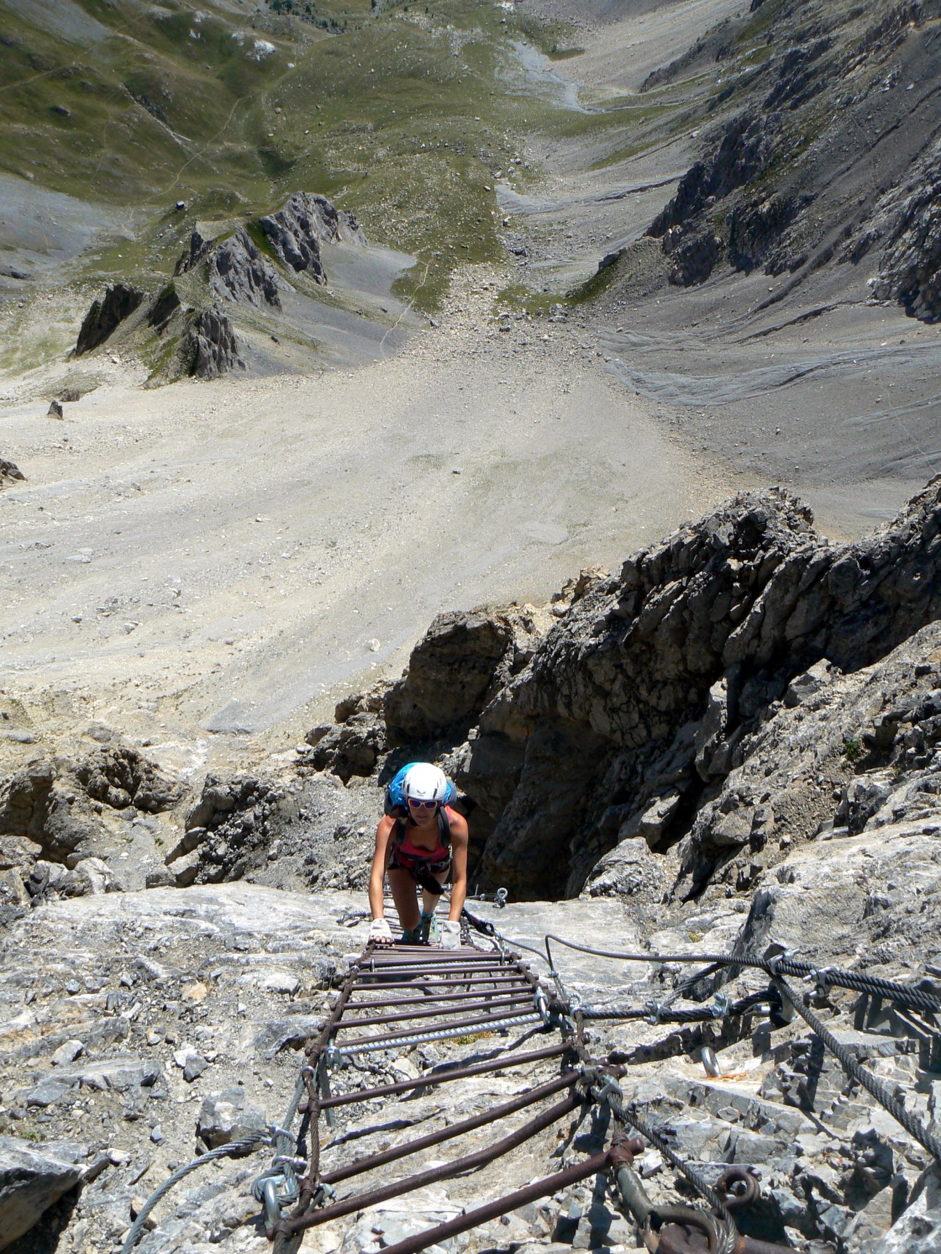
Materiale necessario: corda da almeno 40m, 8 rinvii, cordini, moschettoni. Il percorso è attrezzato con fix, golfari e moschettoni.
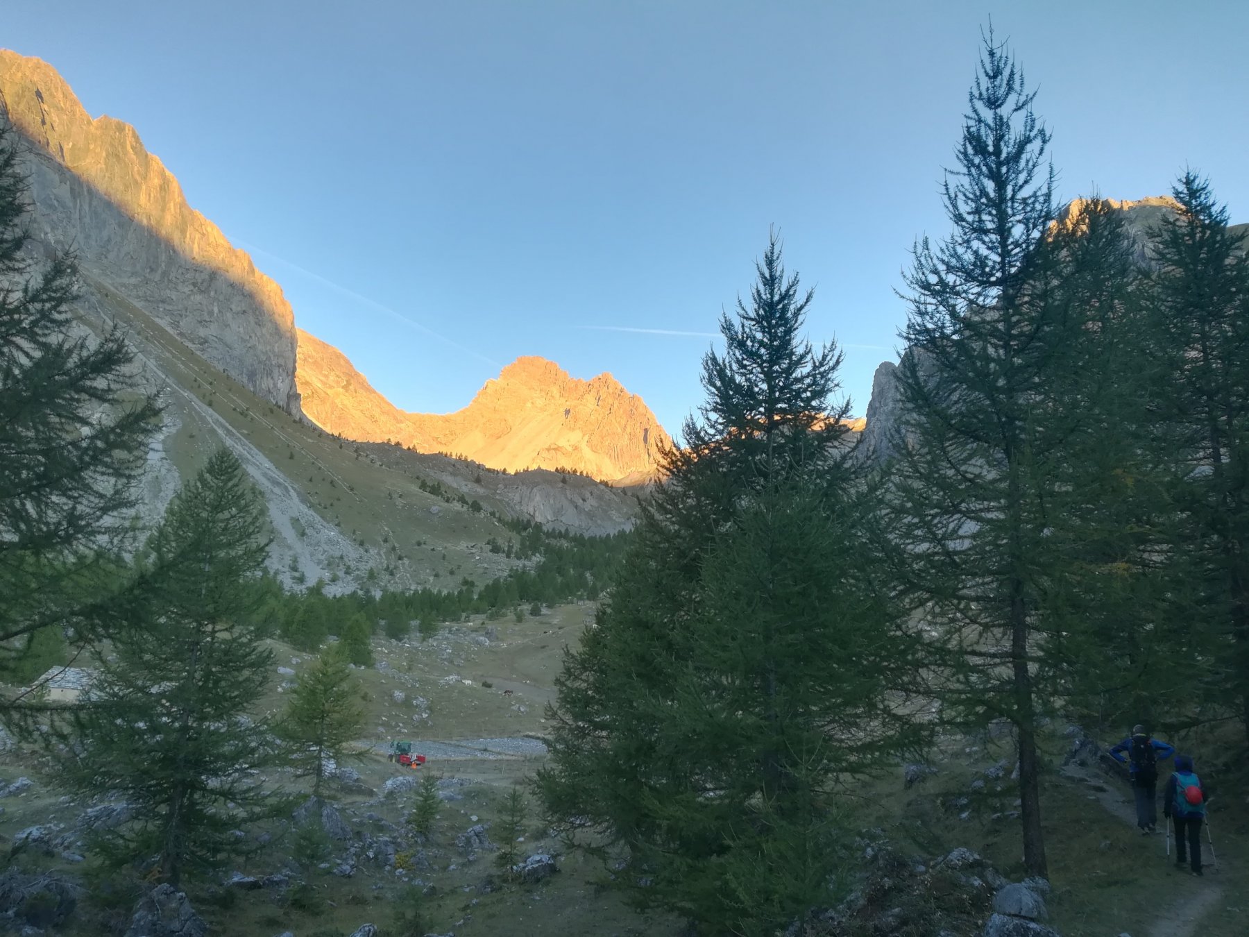
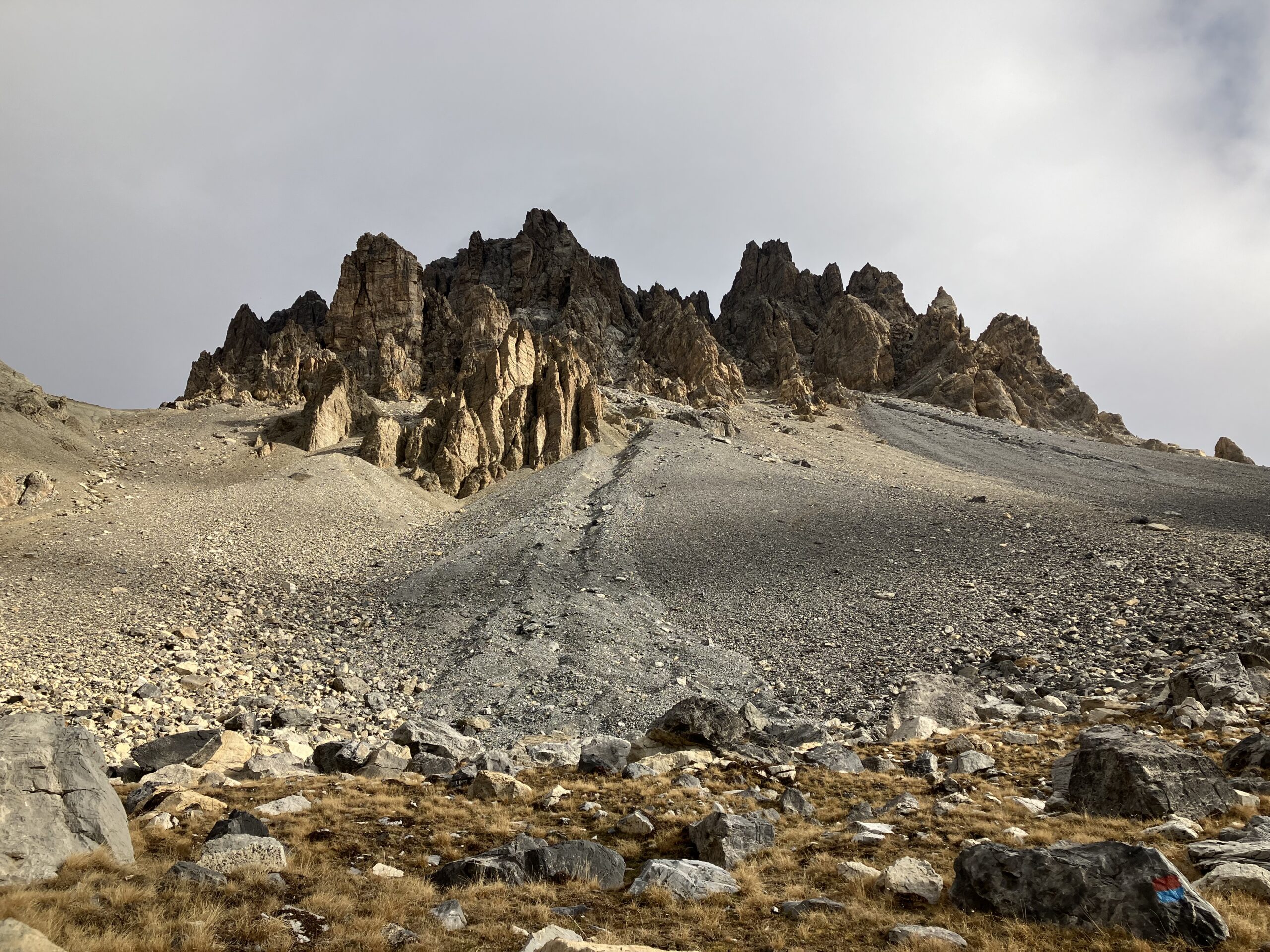
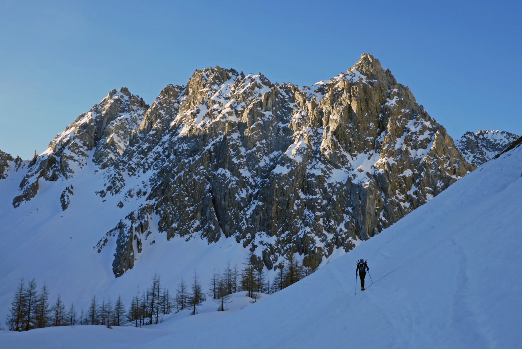
Avvicinamento
Materiale necessario: corda da almeno 40m, 8 rinvii, cordini, moschettoni. Il percorso è attrezzato con fix, golfari e moschettoni.
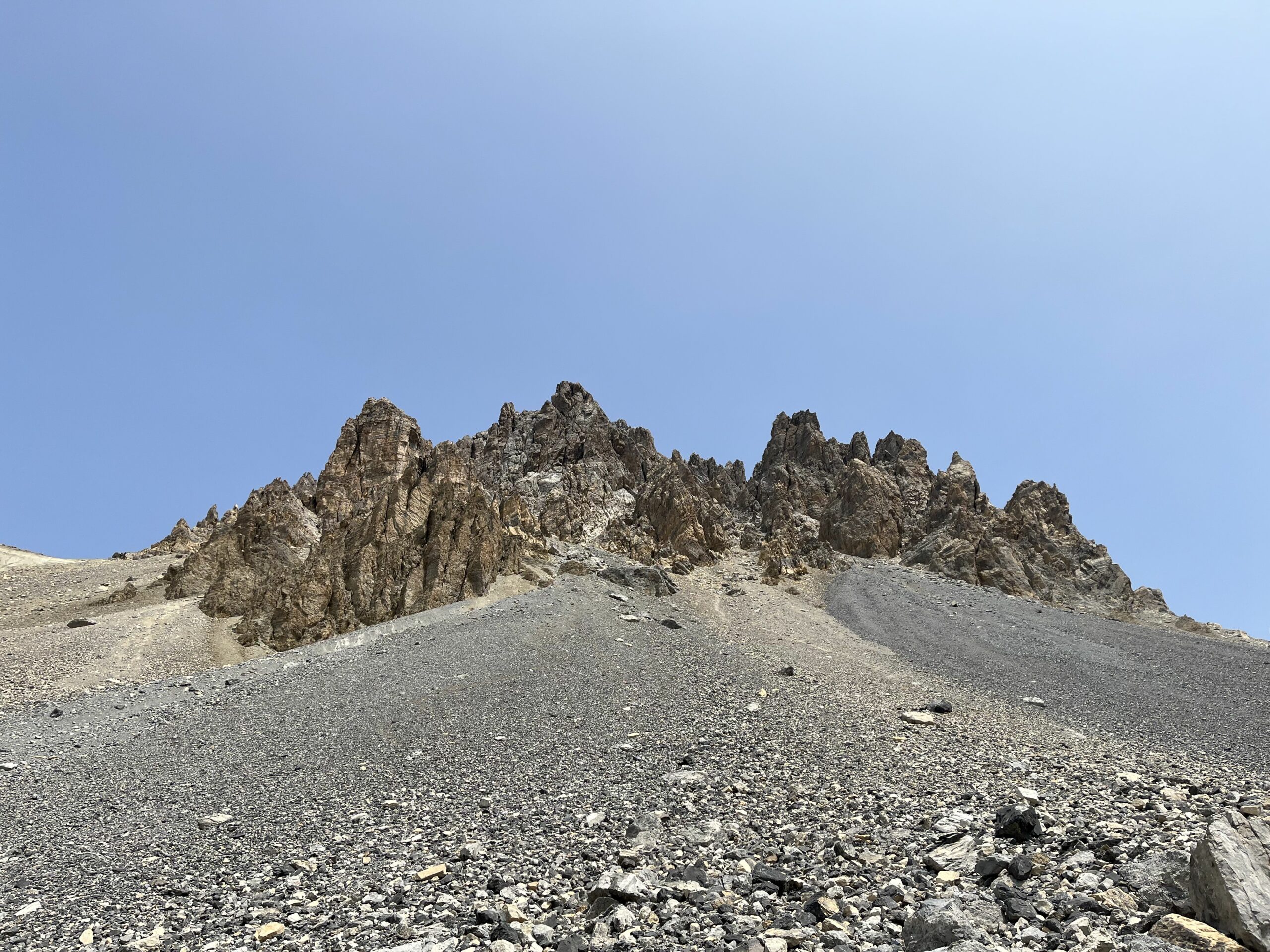
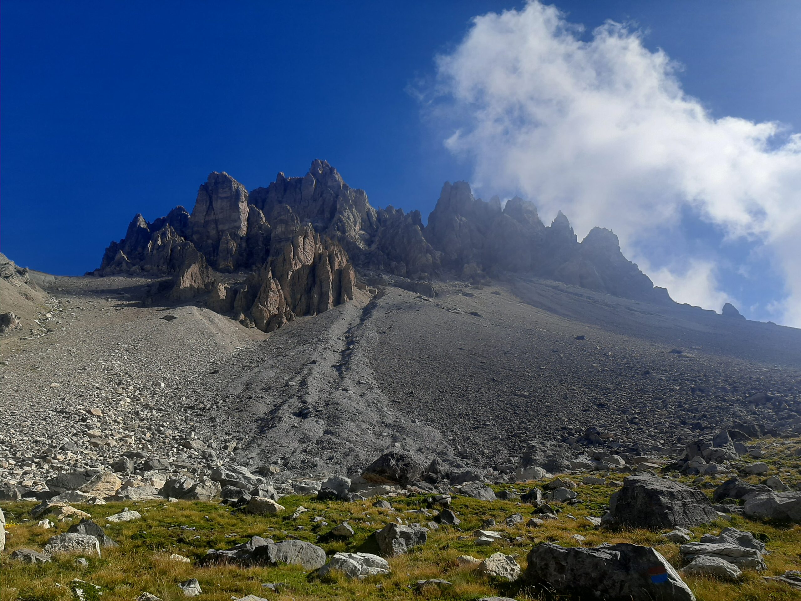
Dronero-Val Maira-Acceglio-Chialvetta-Viviere-strada per Prato Ciorliero. Lasciare l'auto al termine dell'asfalto al bivio per il Colle Ciarbonet, oppure poco oltre all'inizio del sentiero (pochi posti auto).
Descrizione
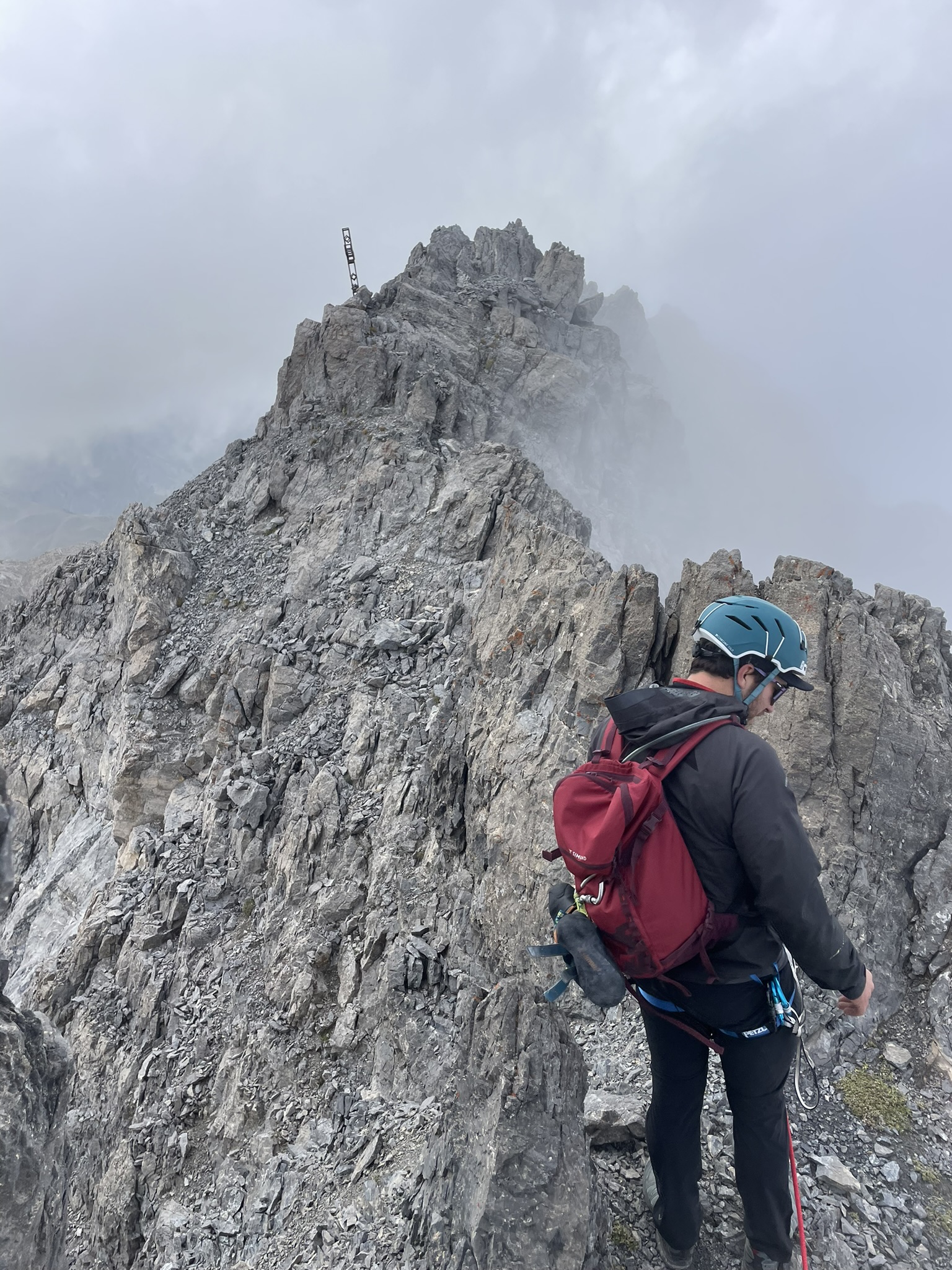
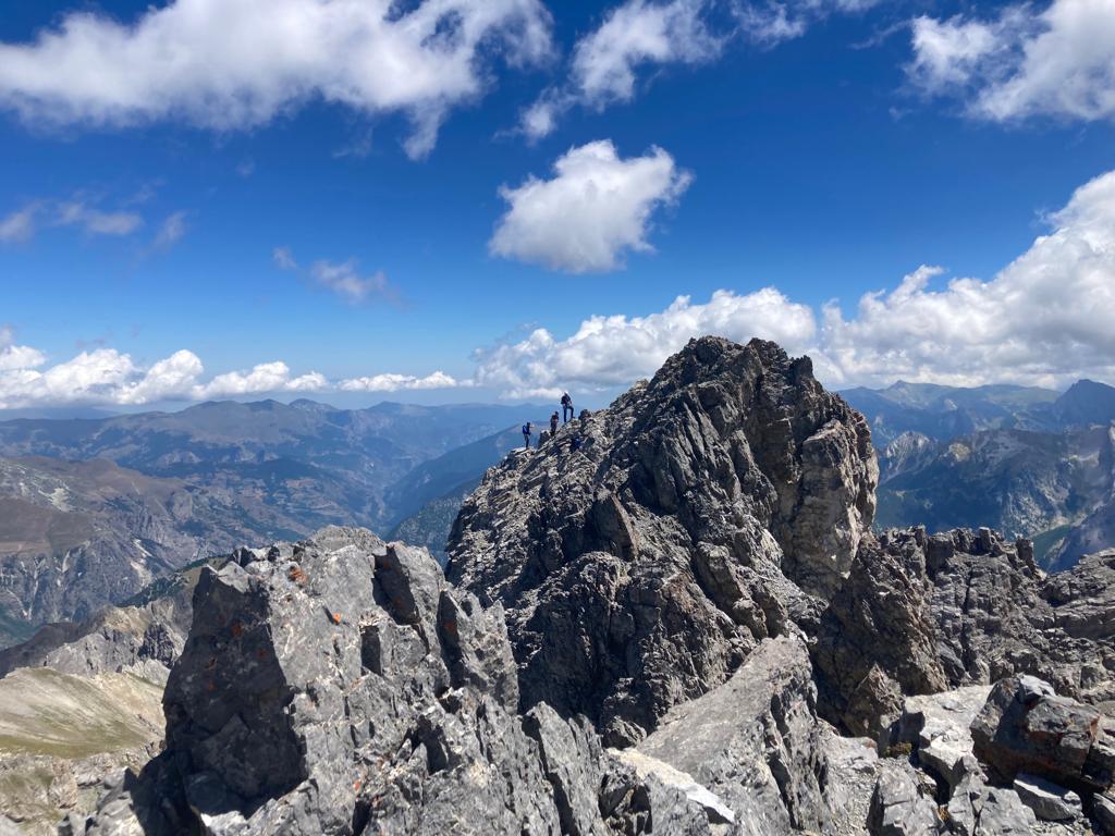
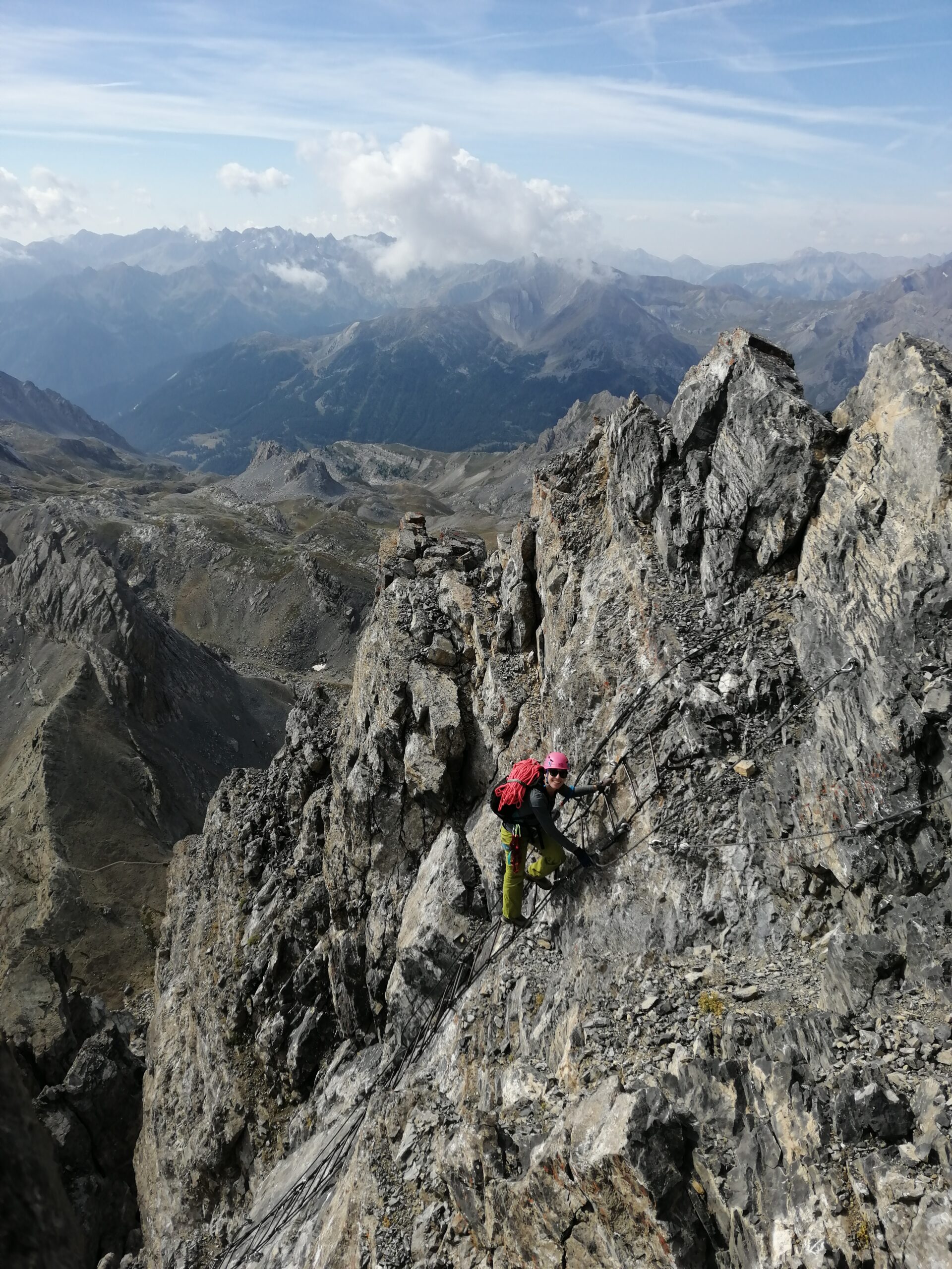
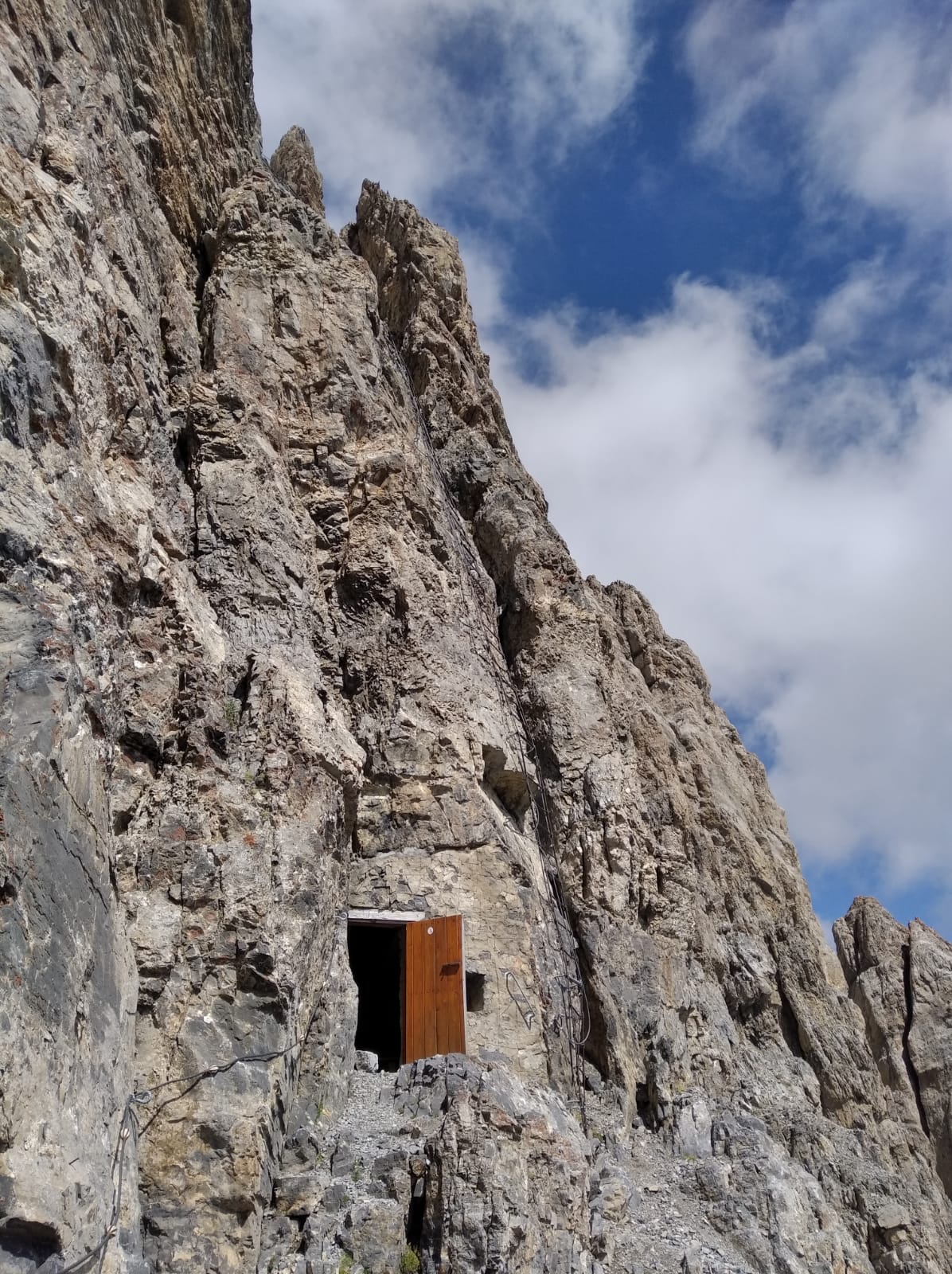
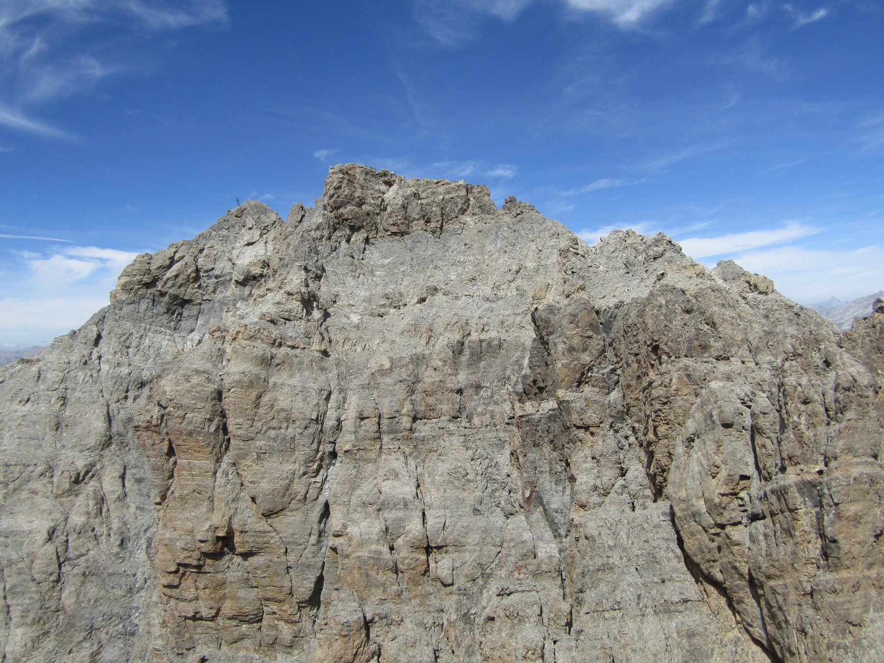
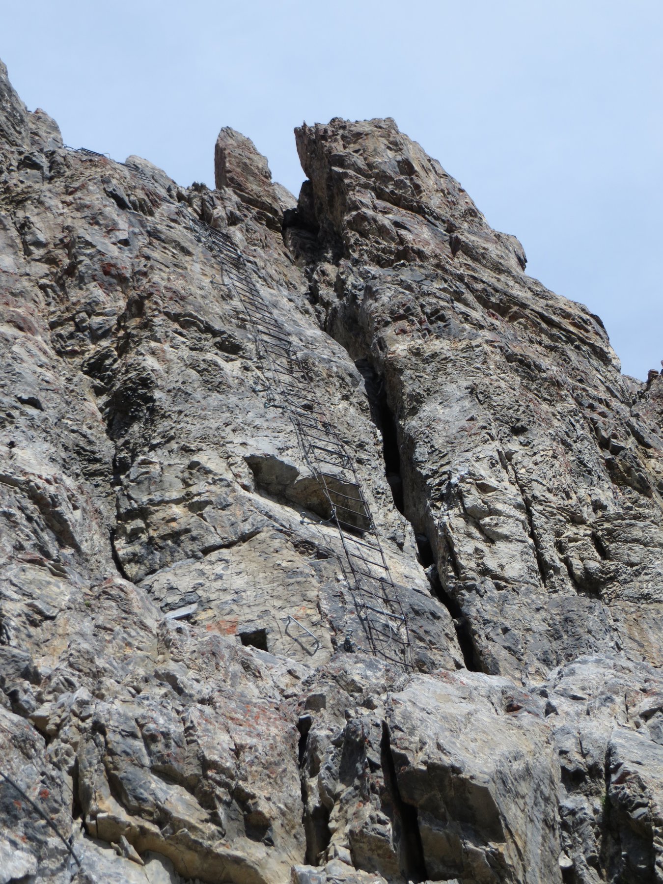
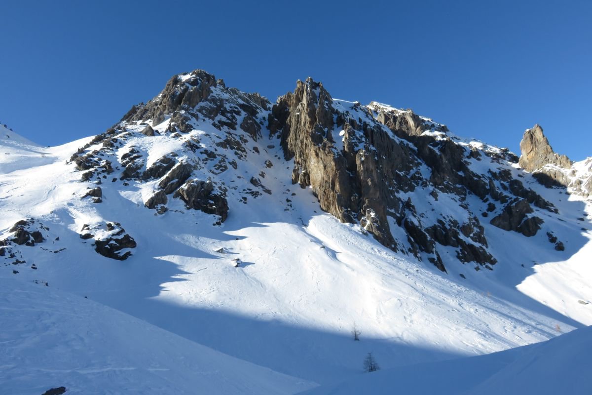
Salire alla Cima Dronero con il sentiero attrezzato degli Alpini.
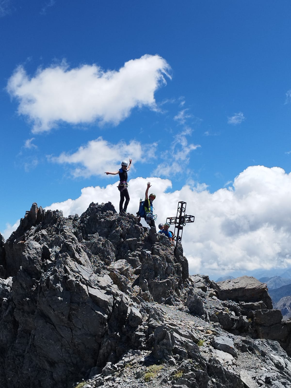
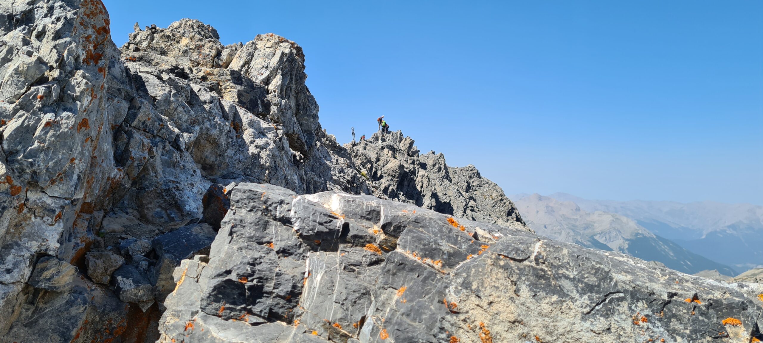
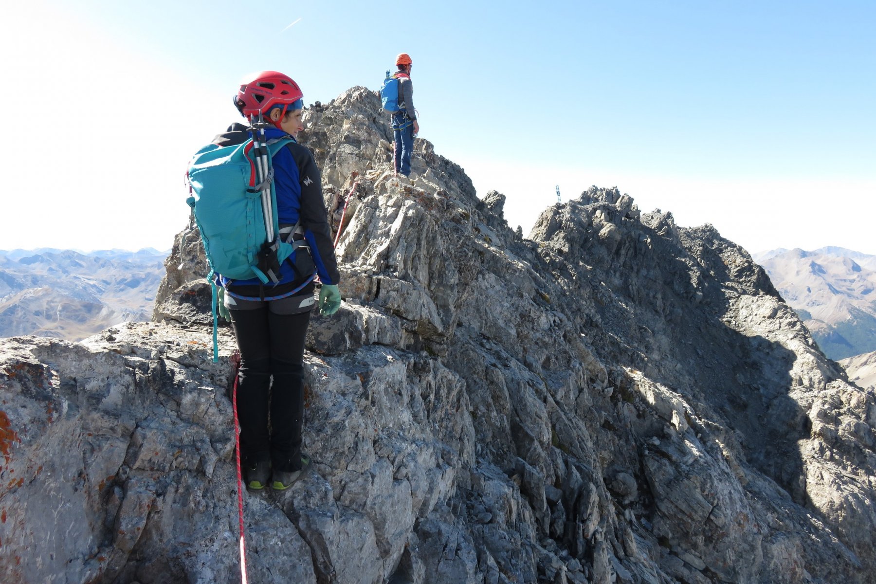
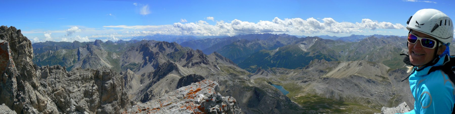
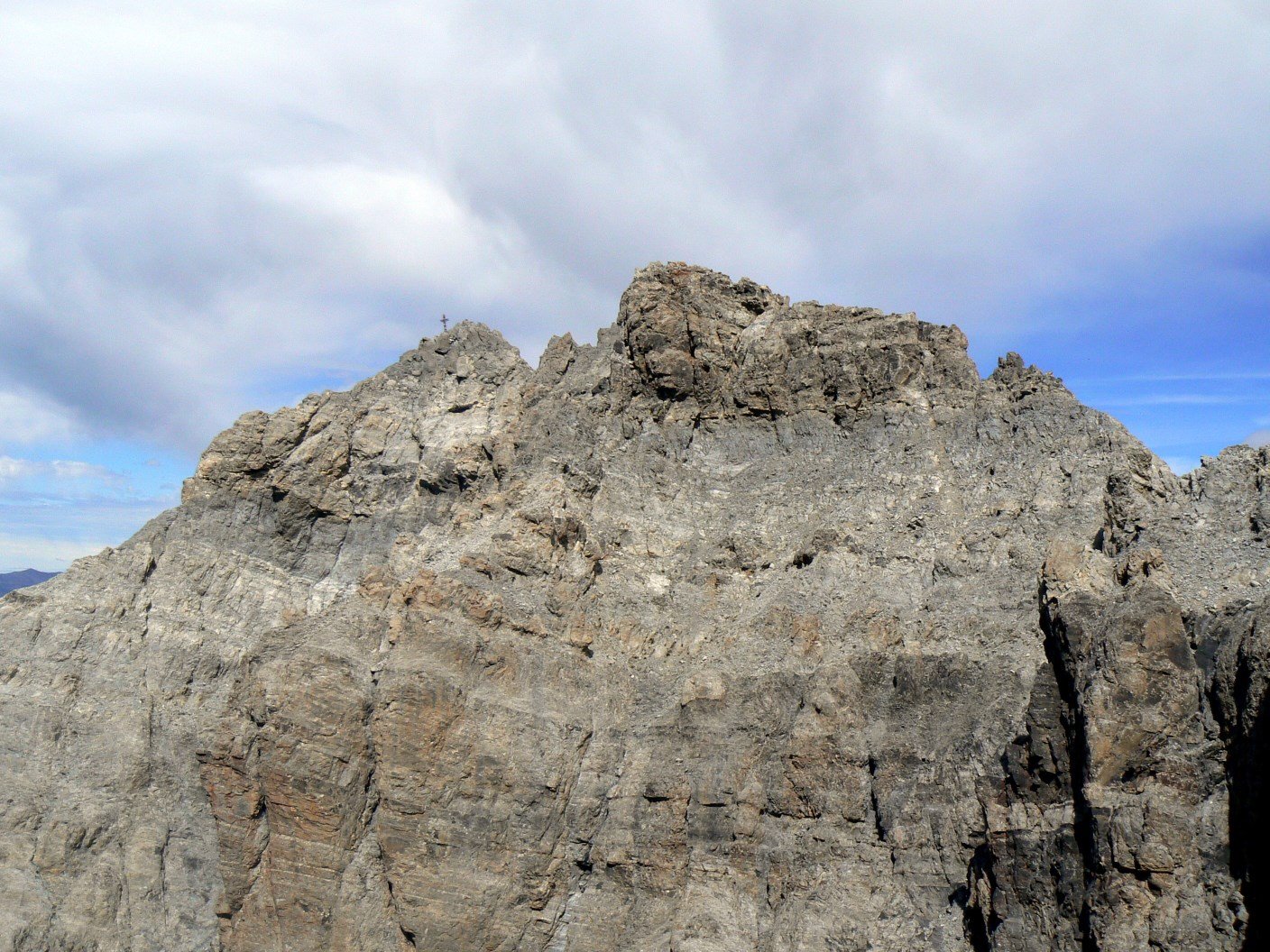
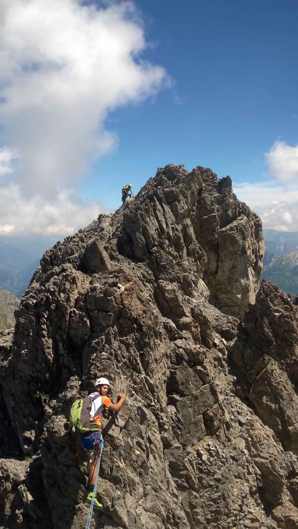
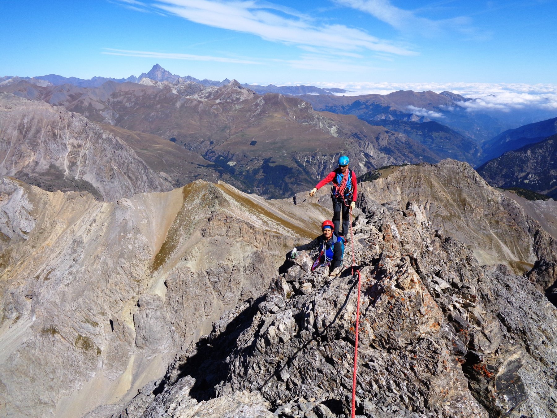
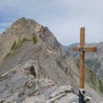
Dalla fine della “ferrata” proseguire verso la cima vera dell’Oronaye (croce) lungo la cresta Est.
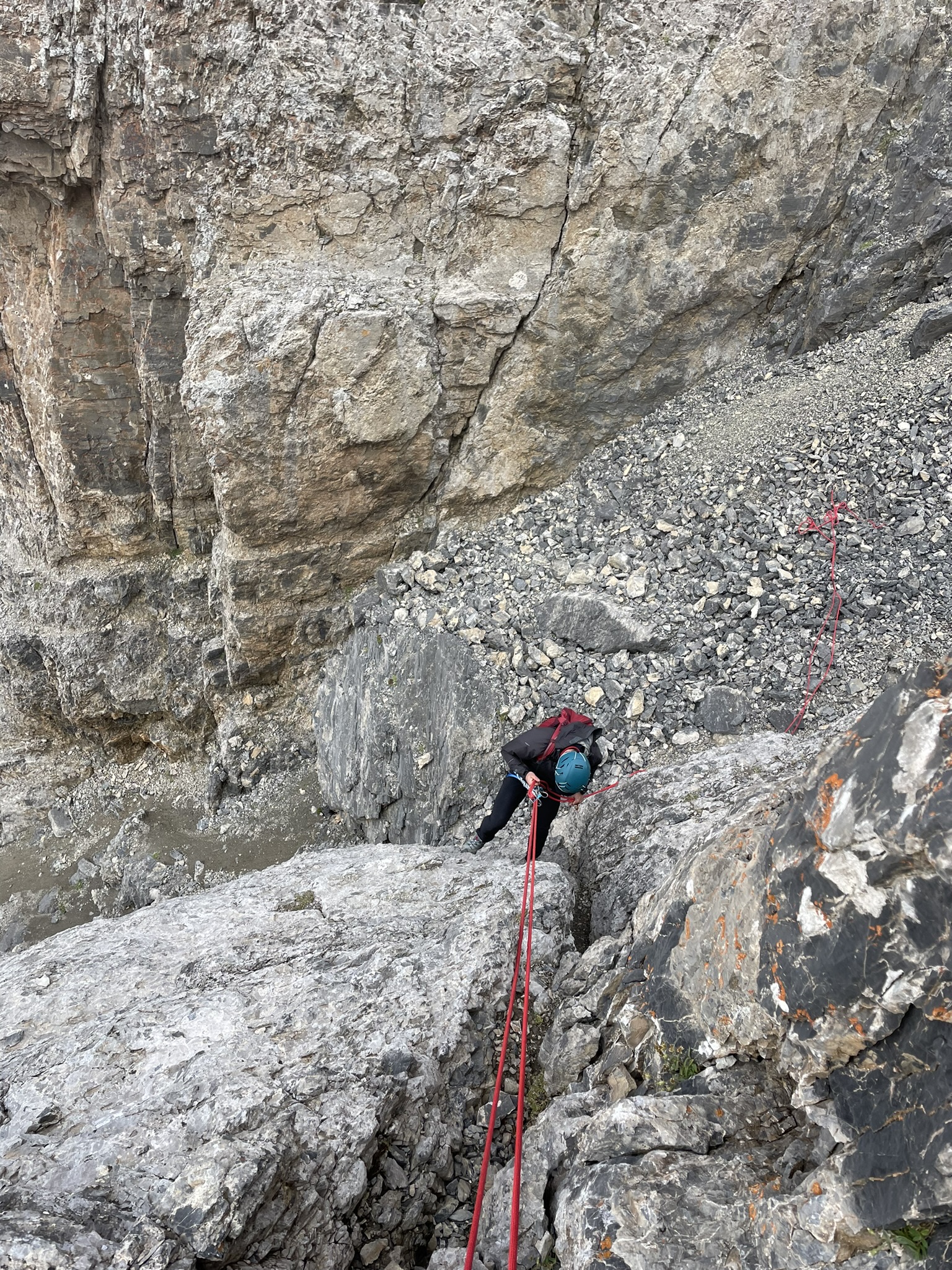
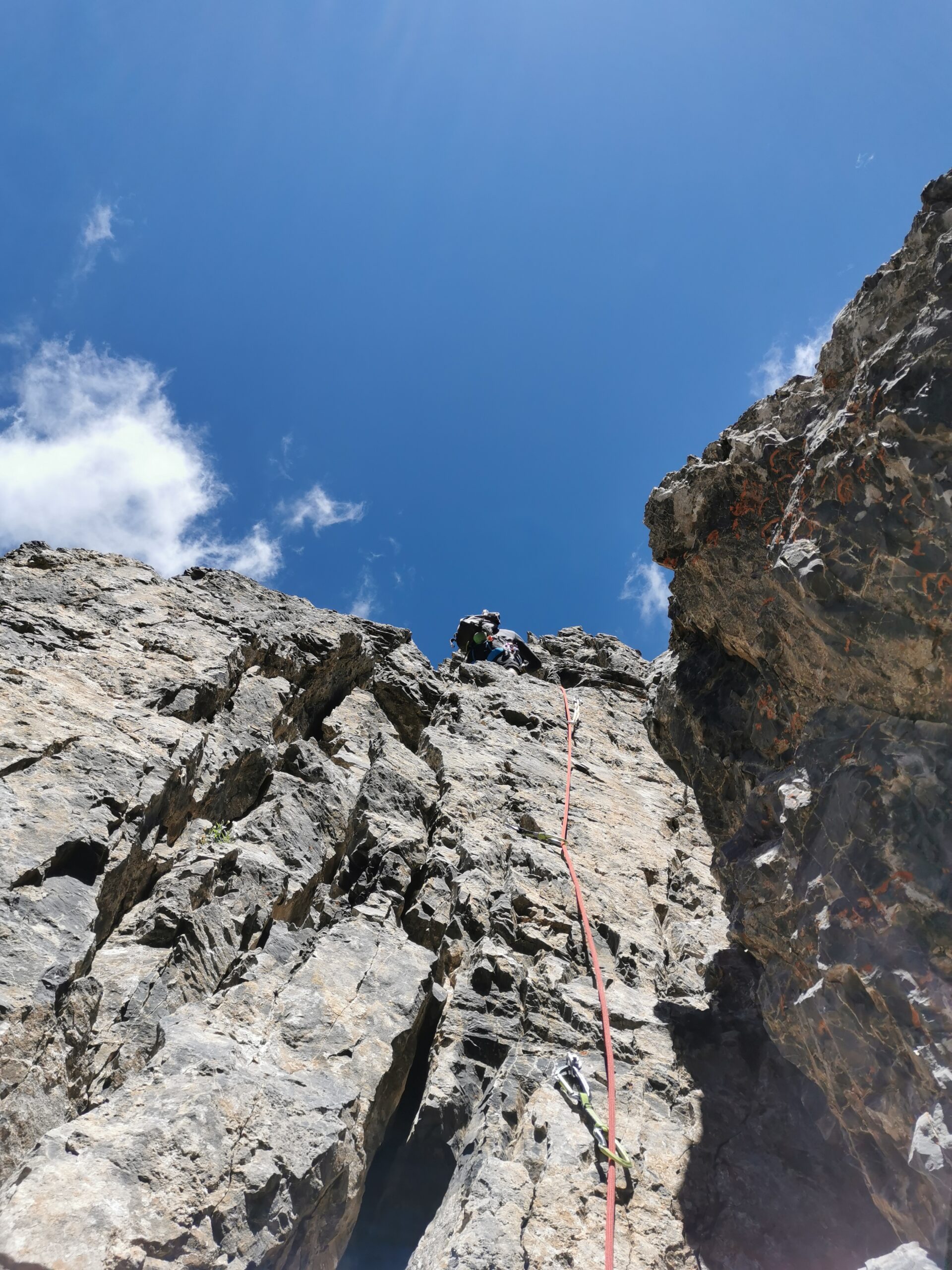
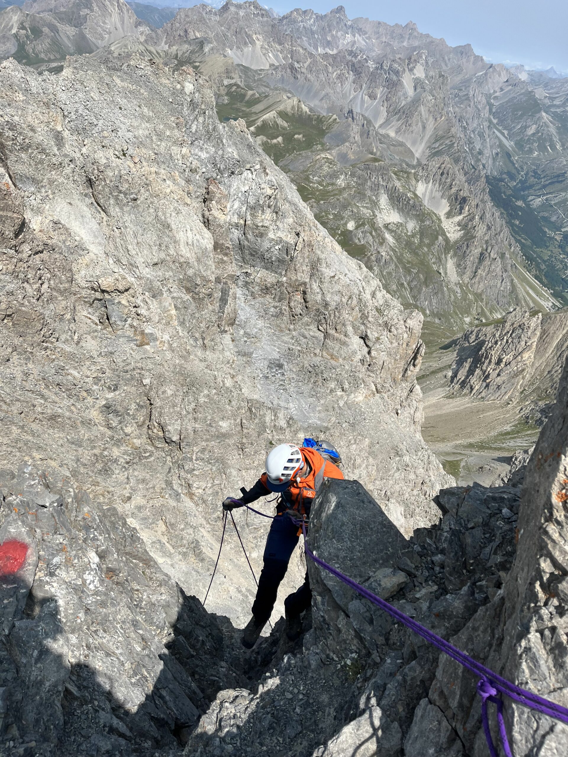
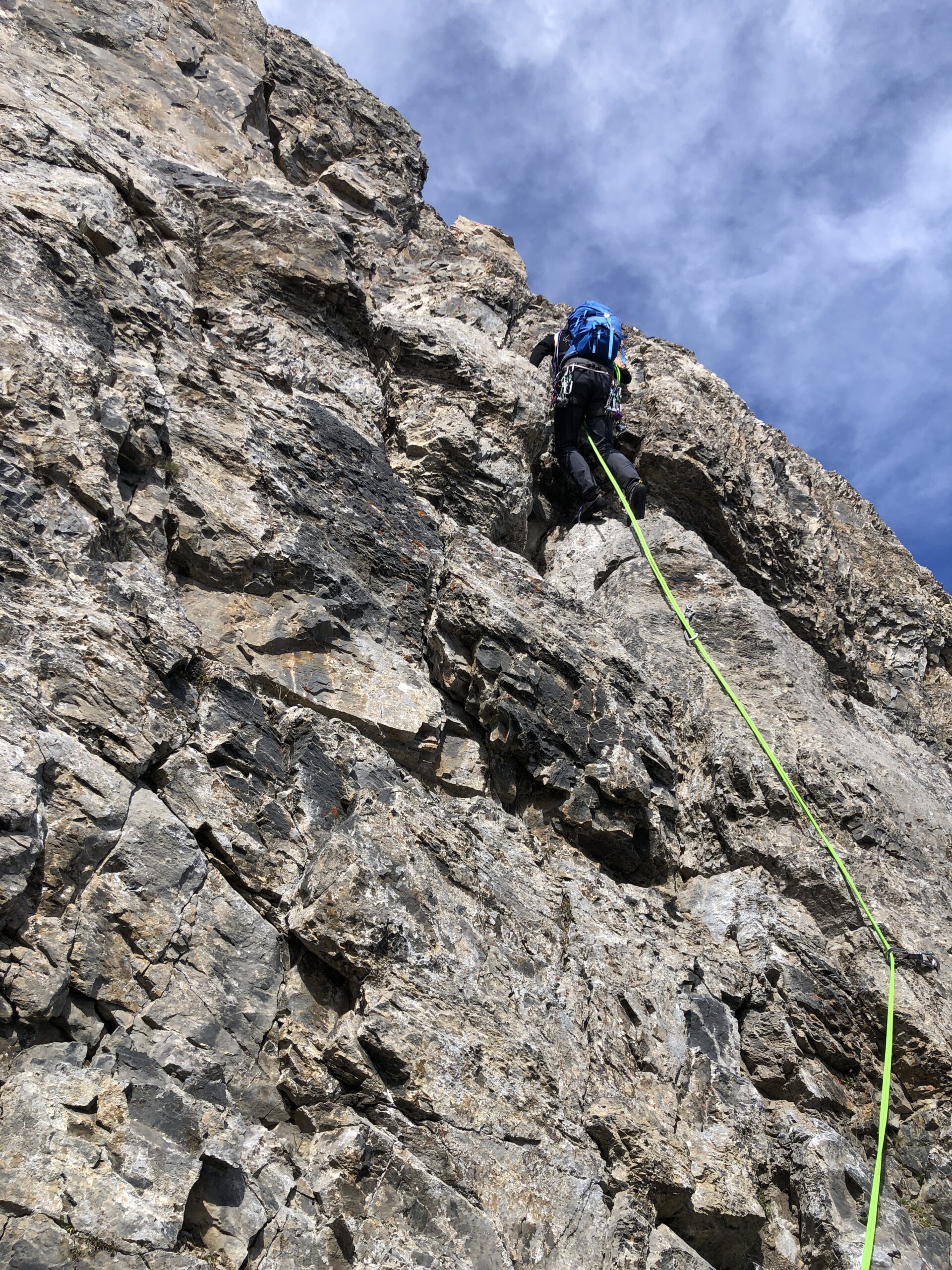
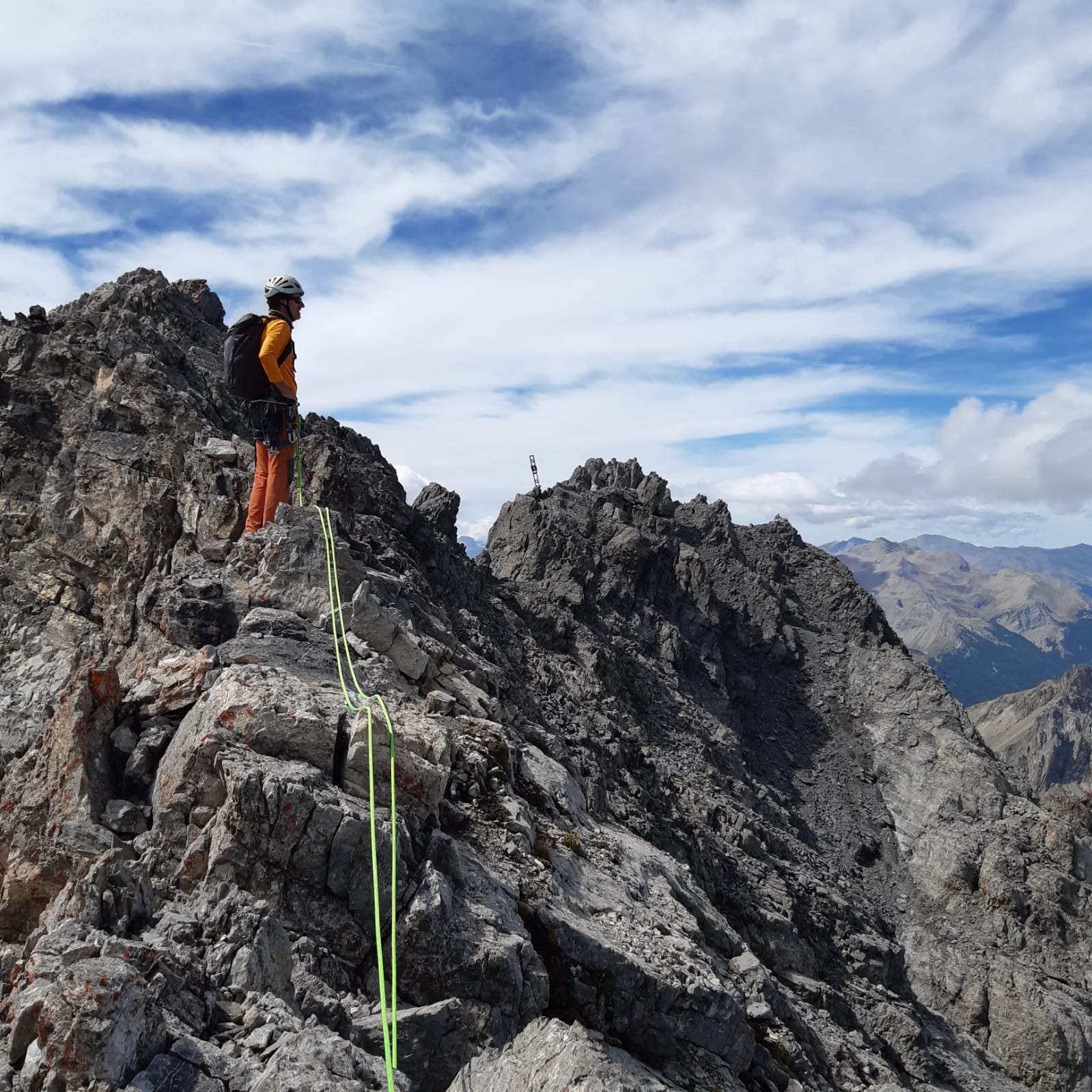
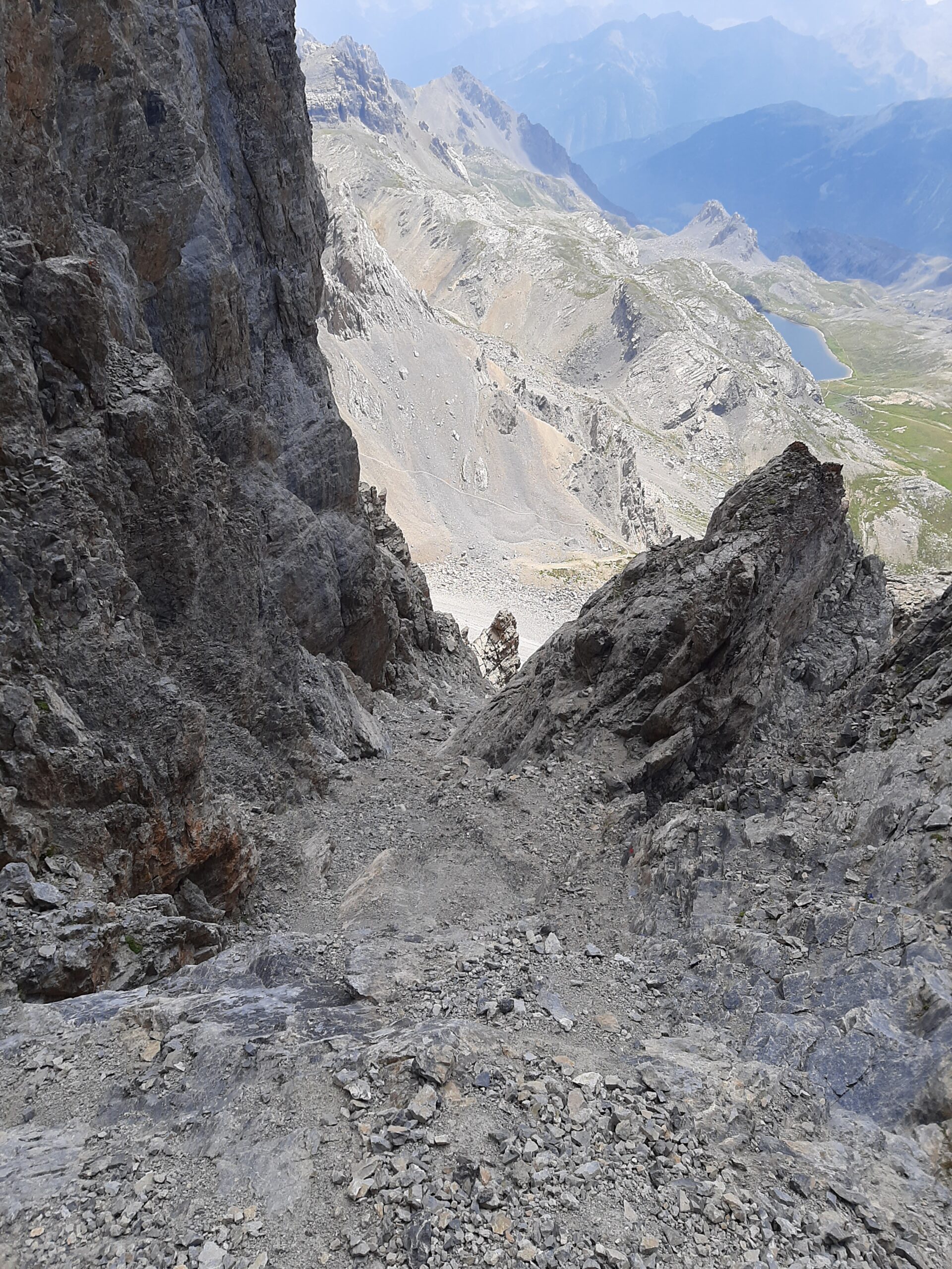
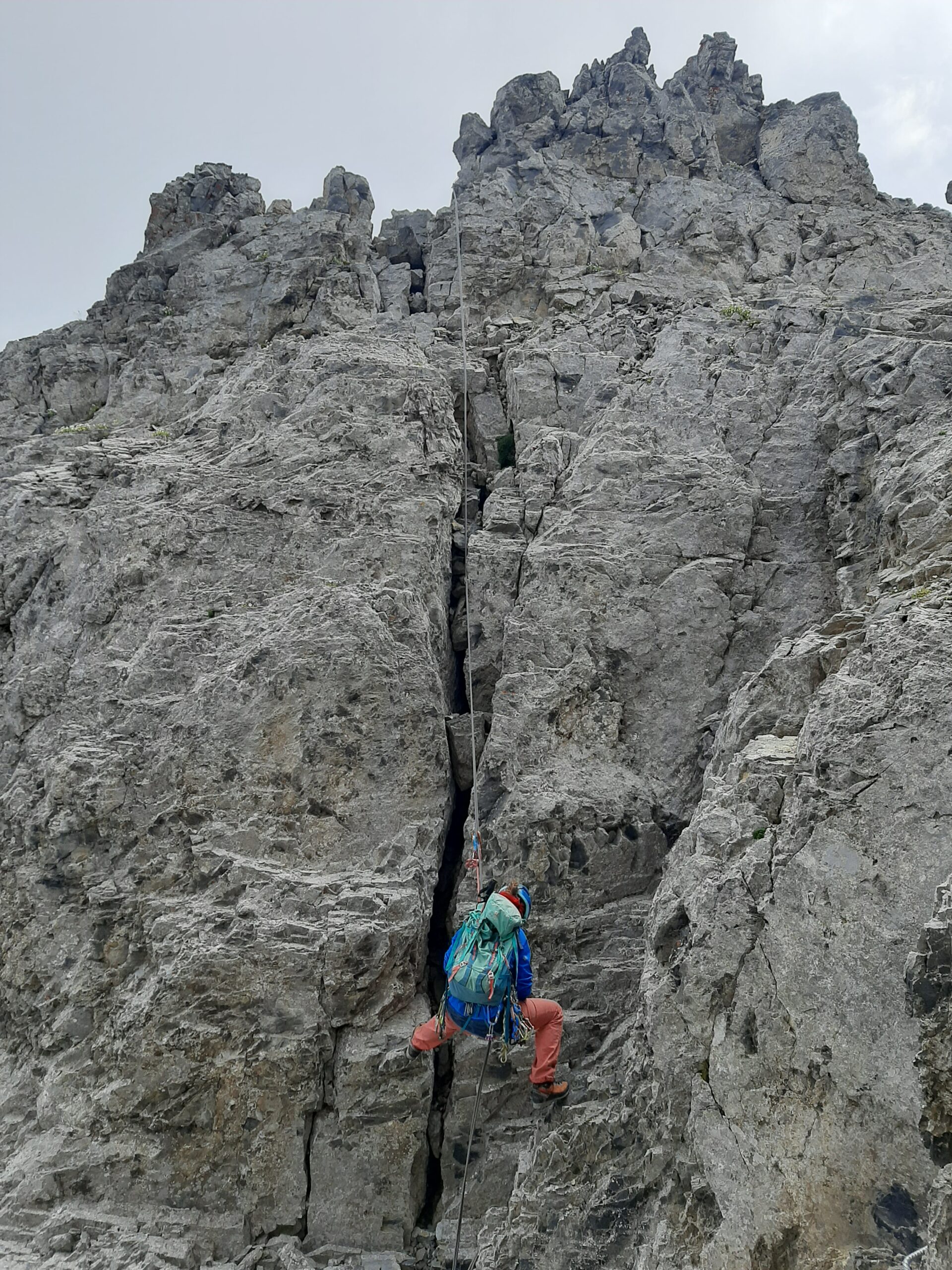
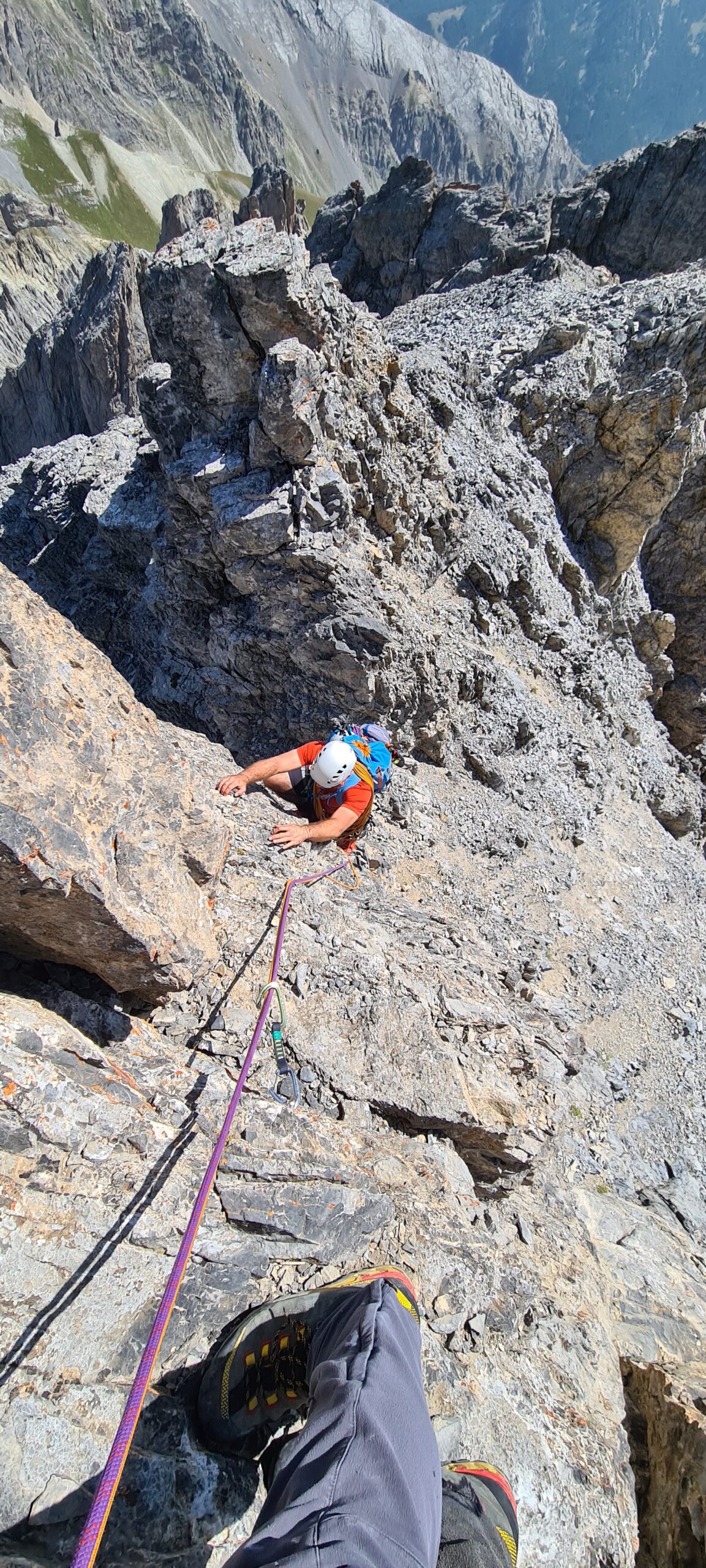
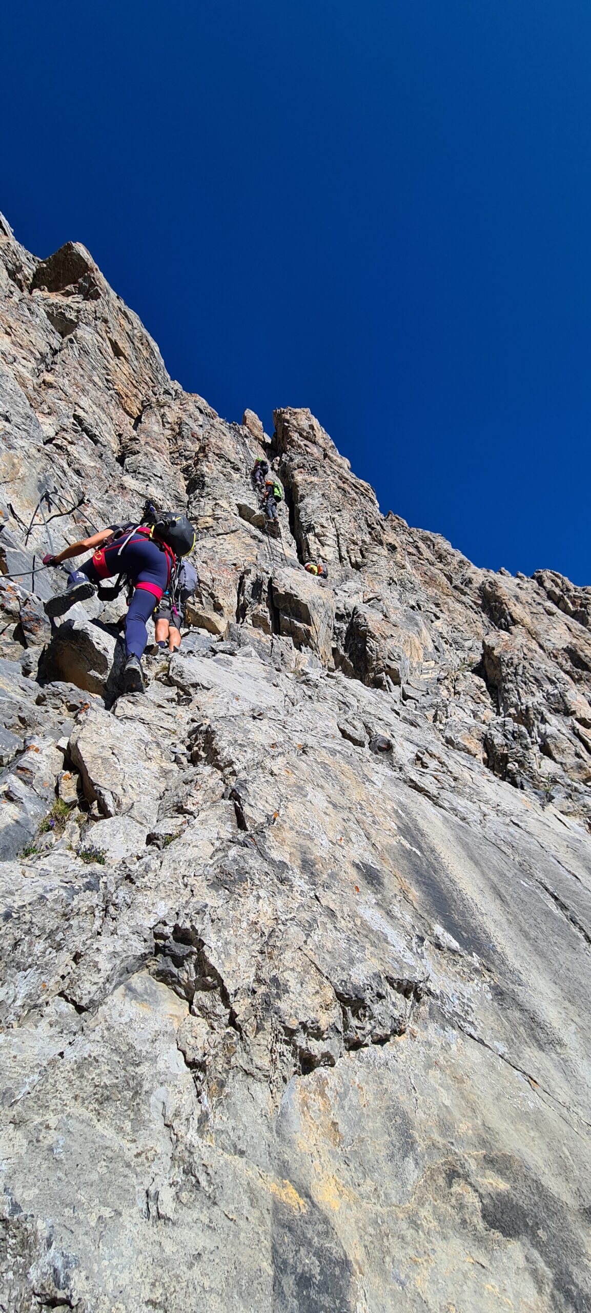
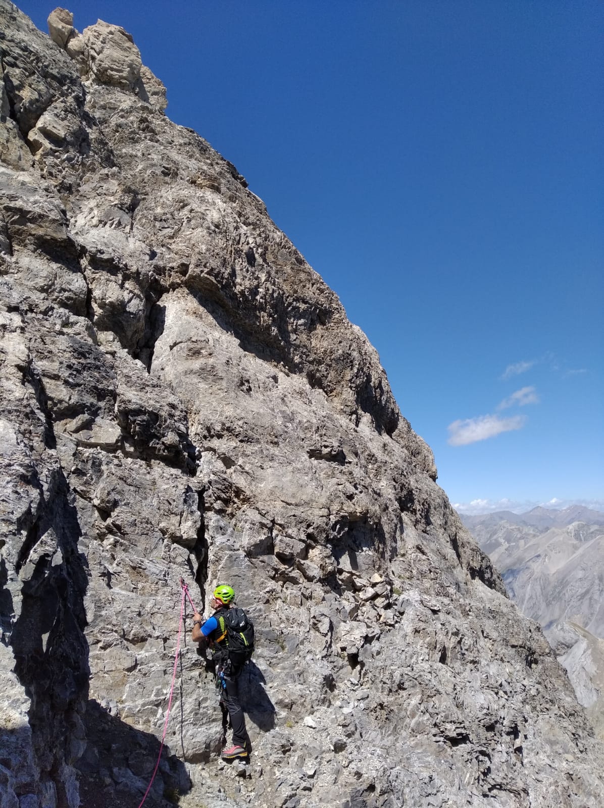
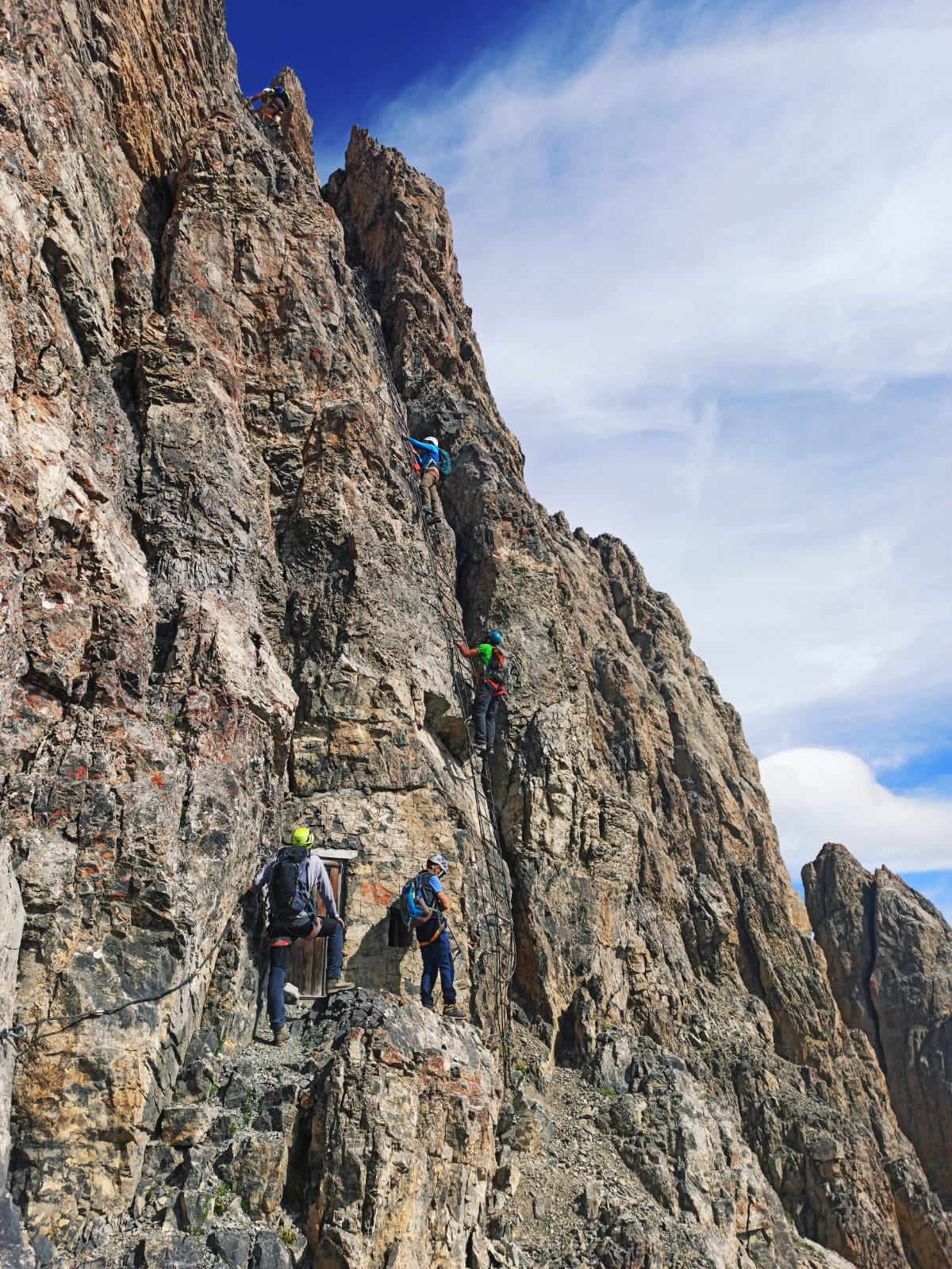
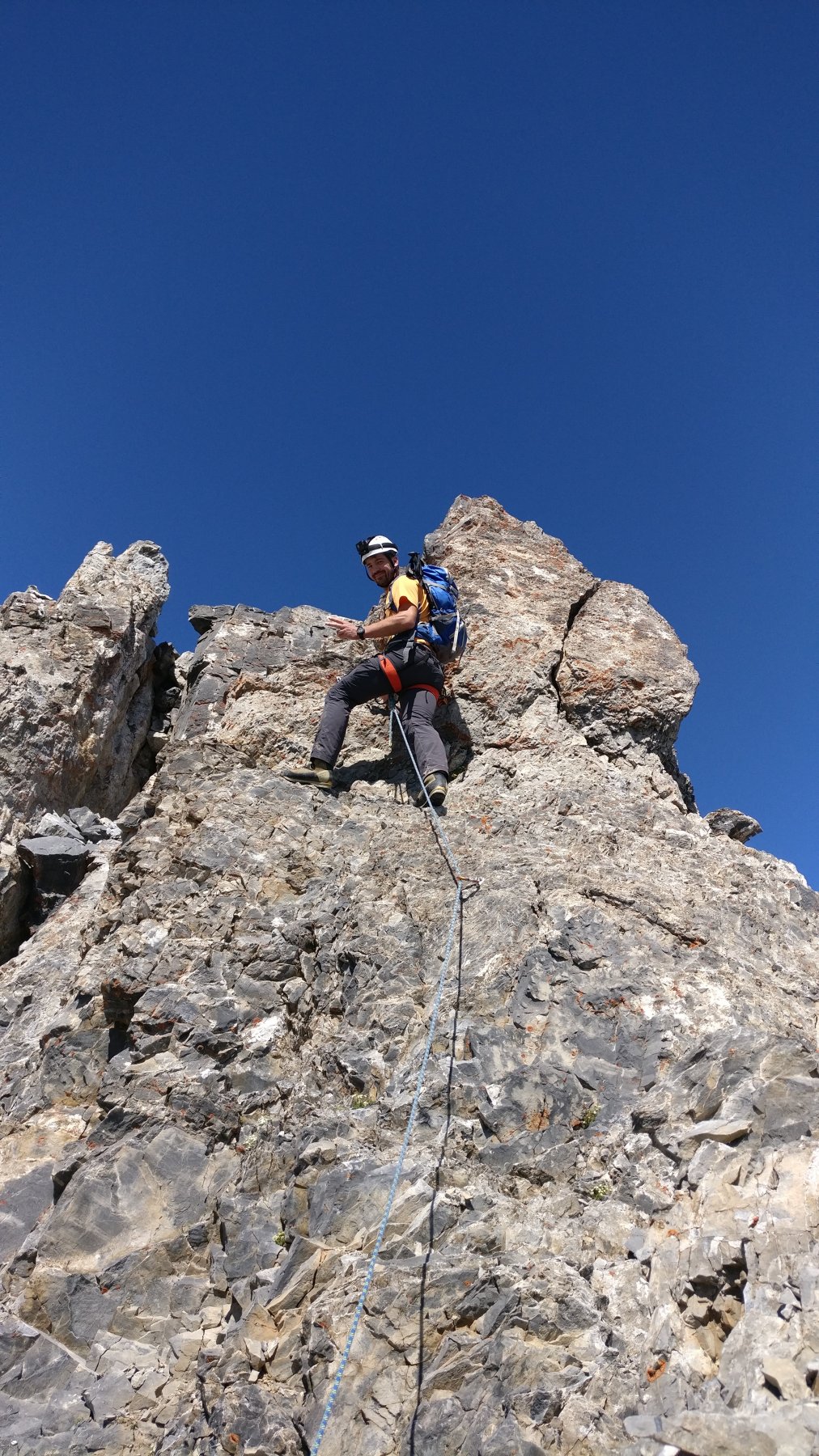
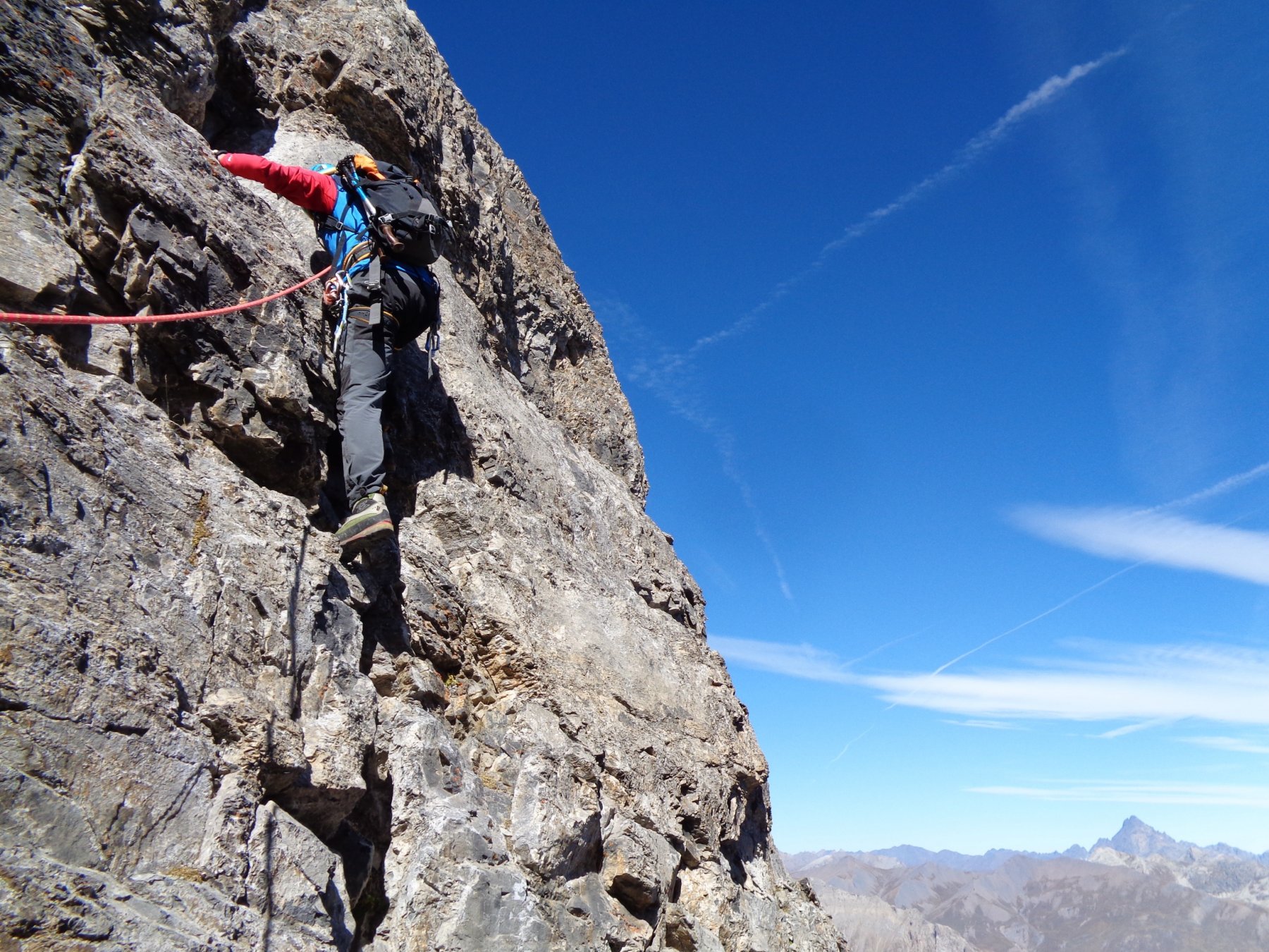
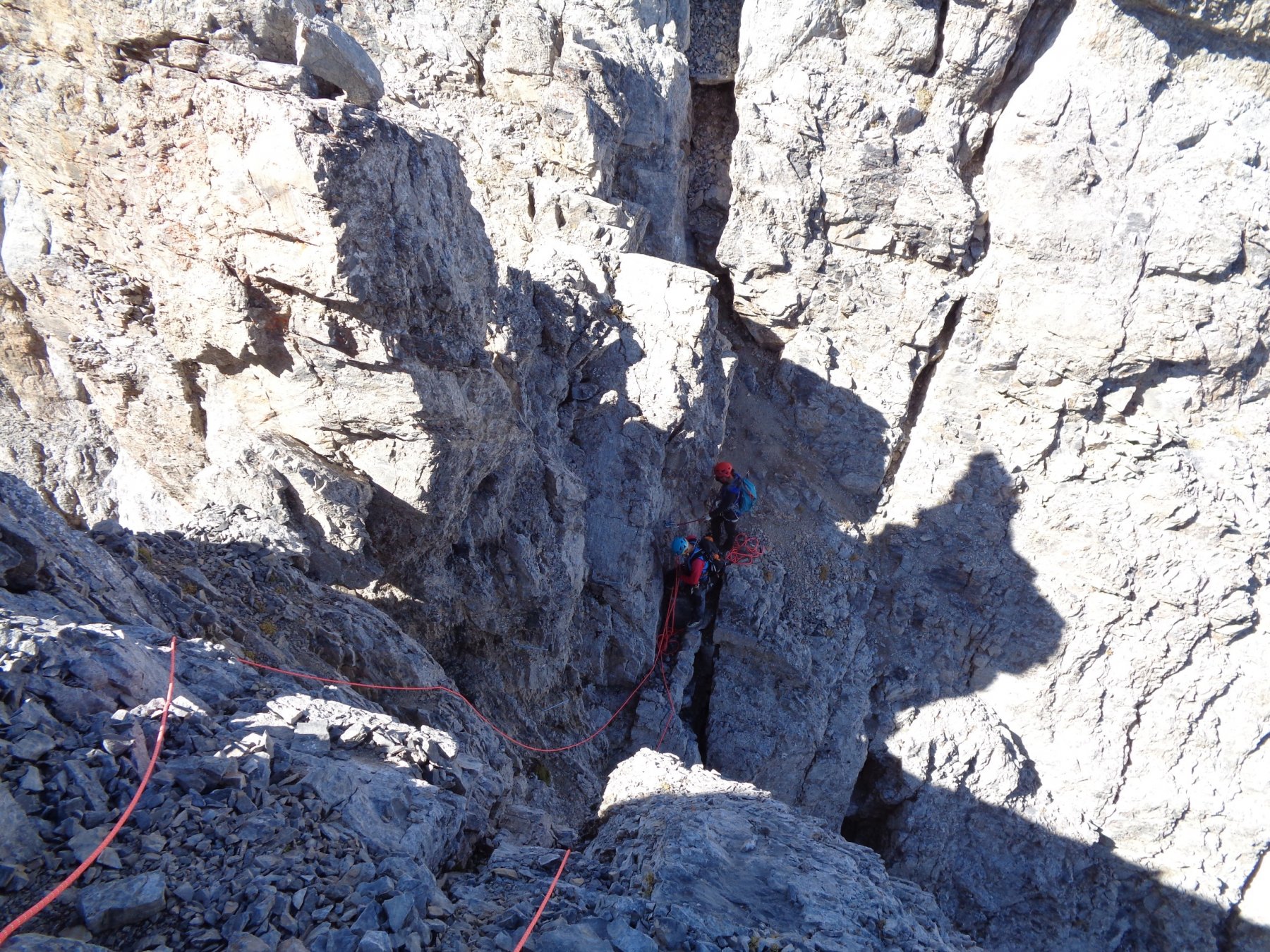
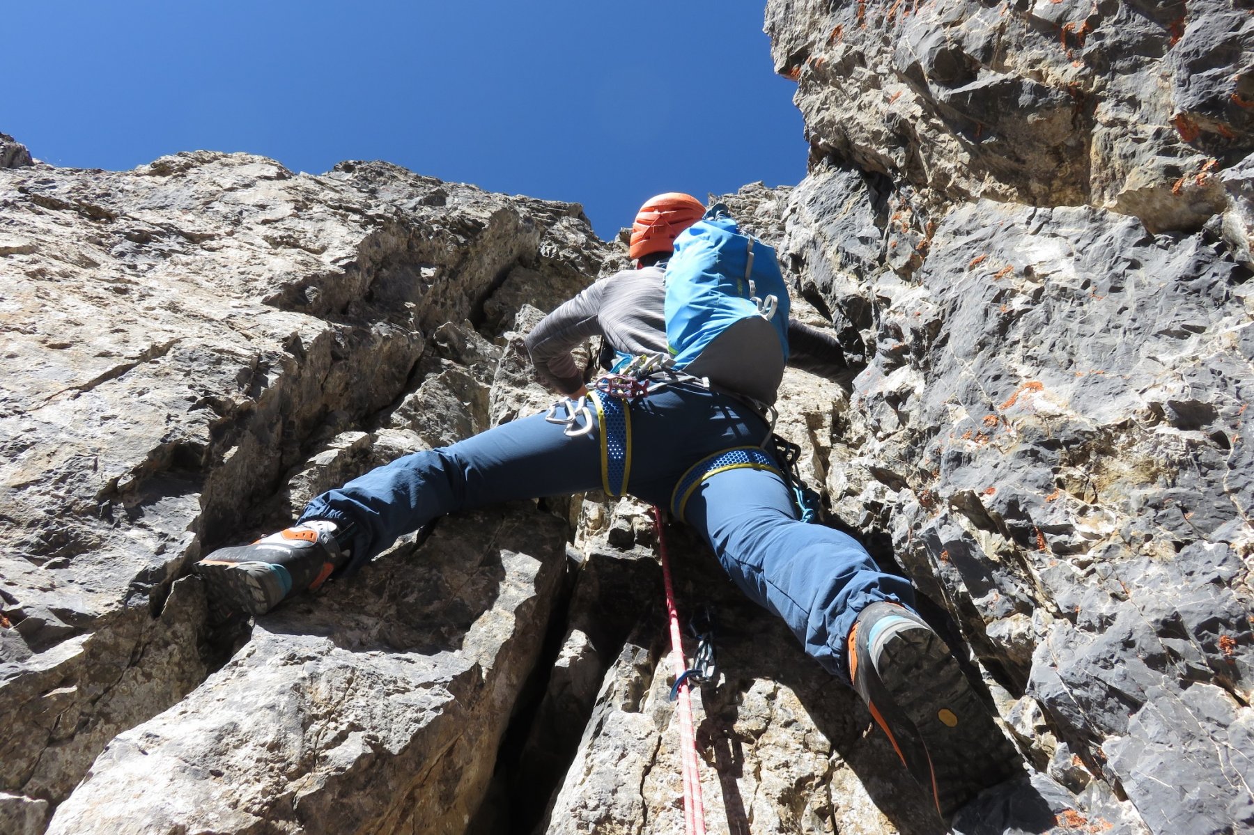
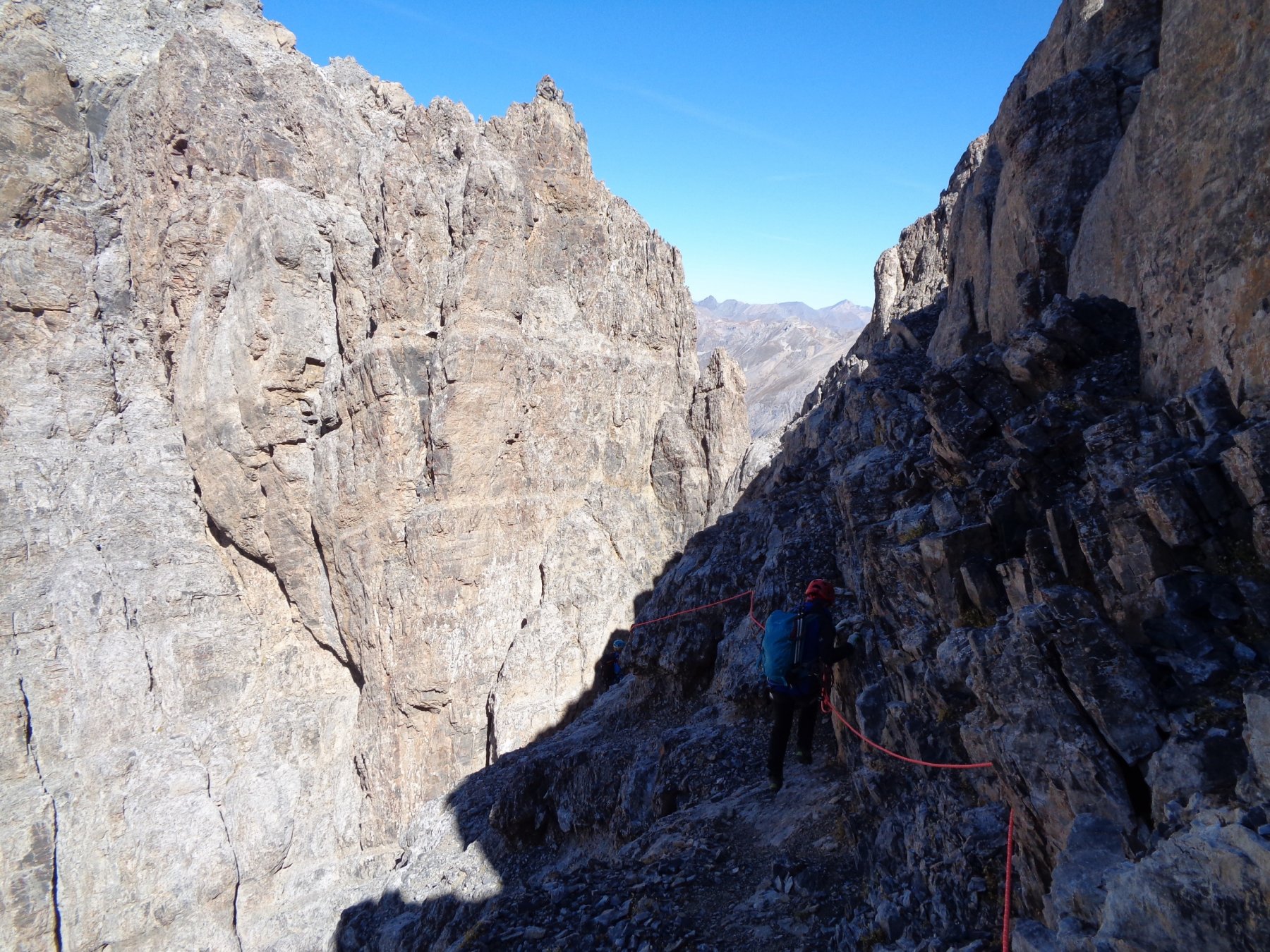
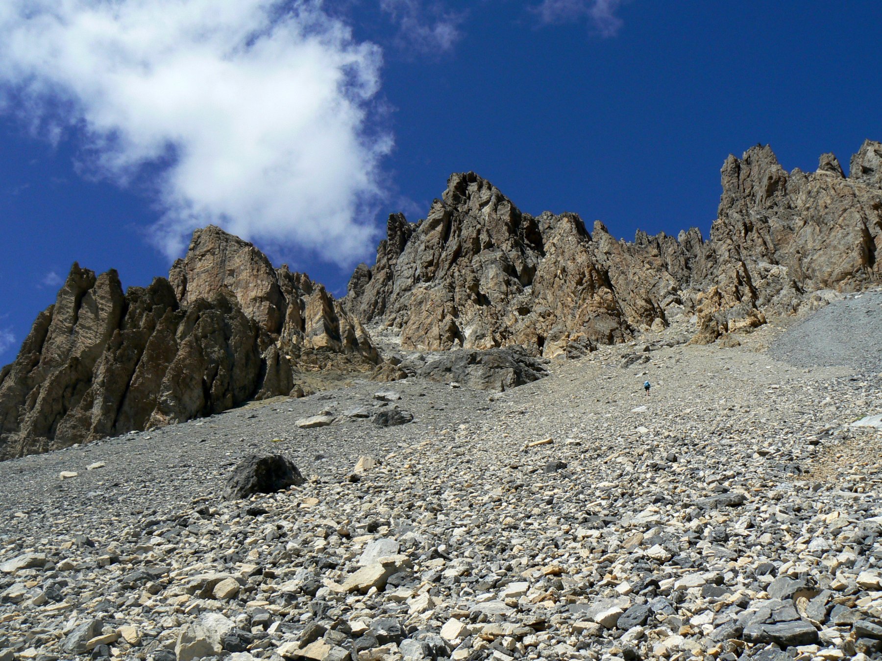
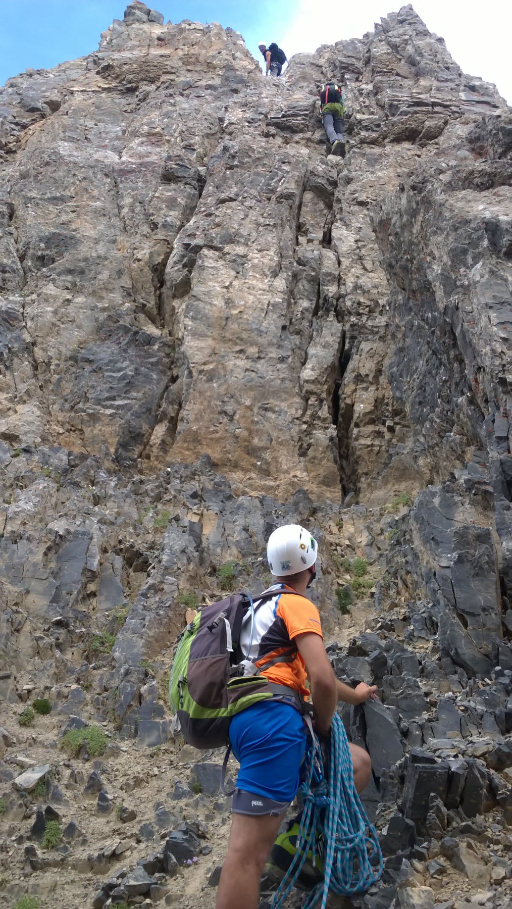
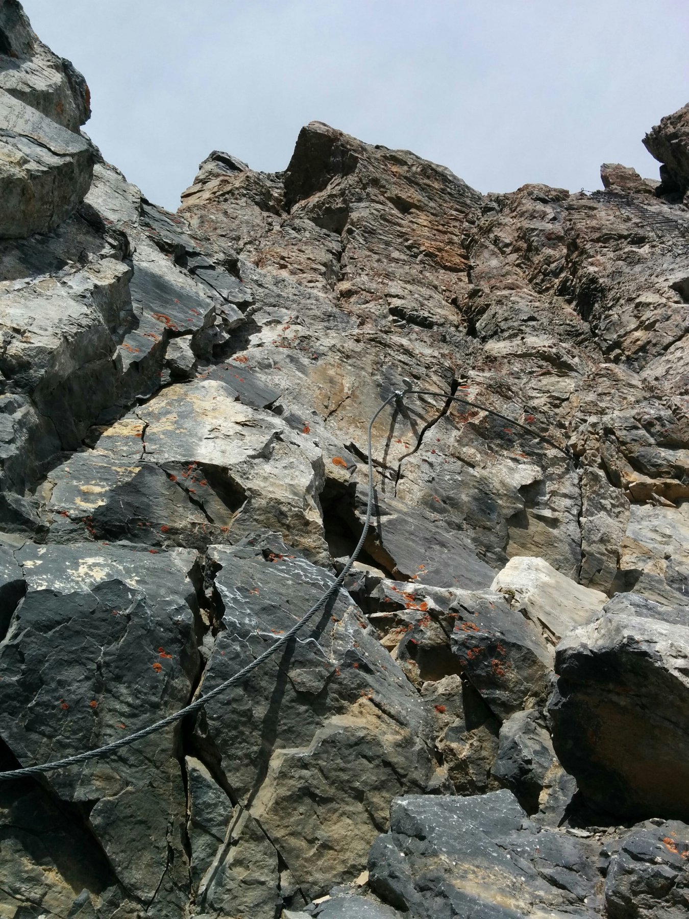
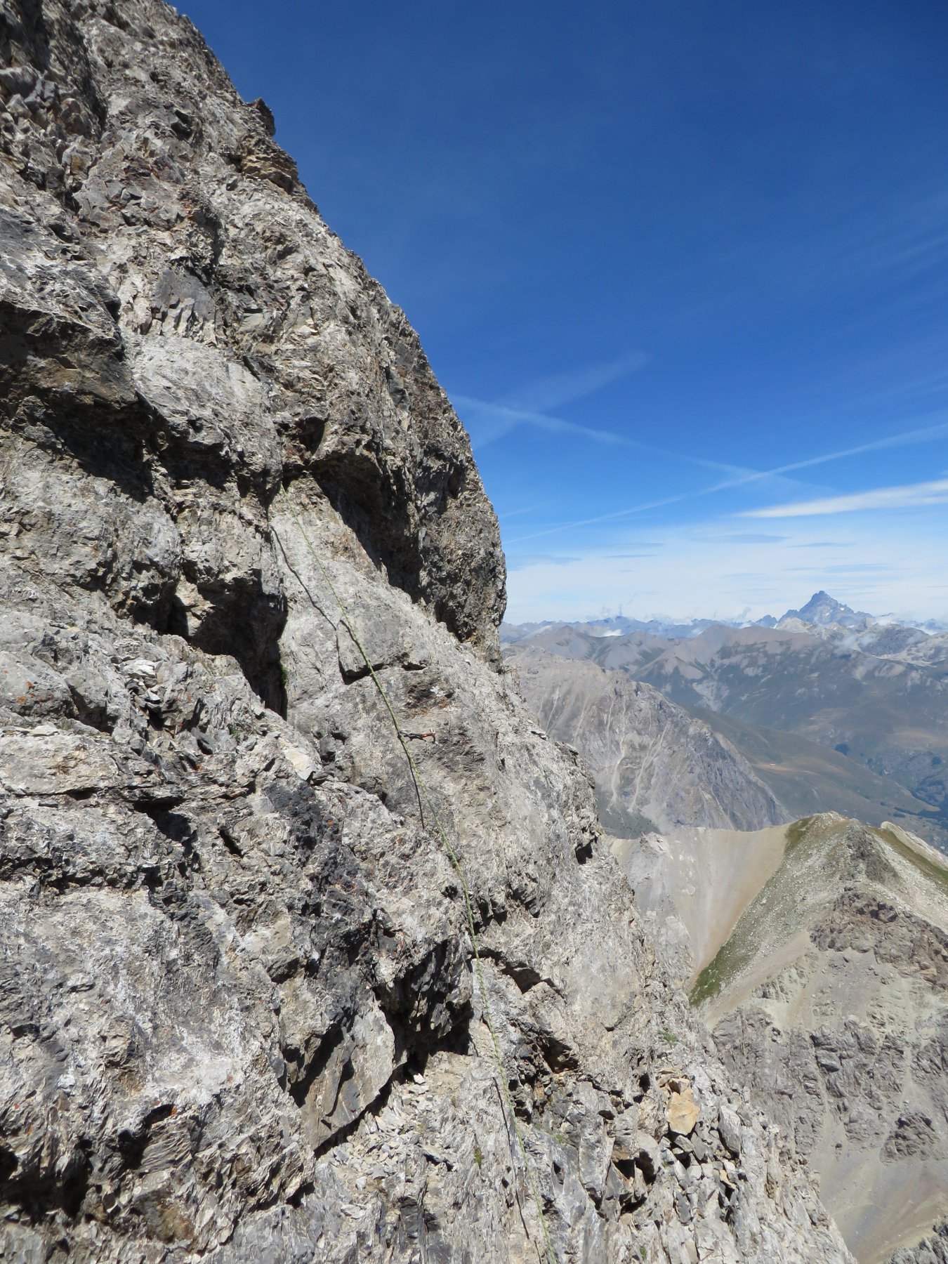
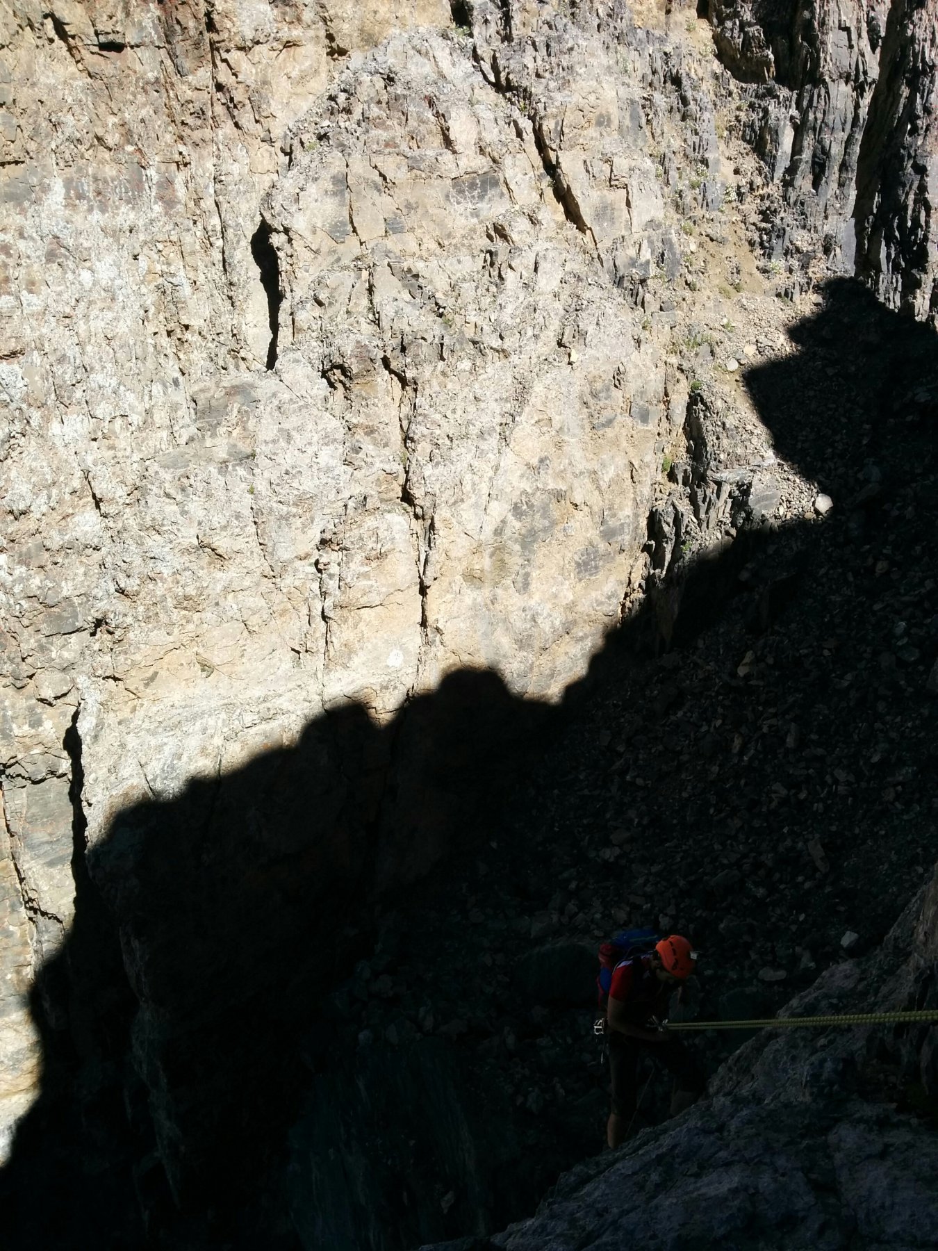
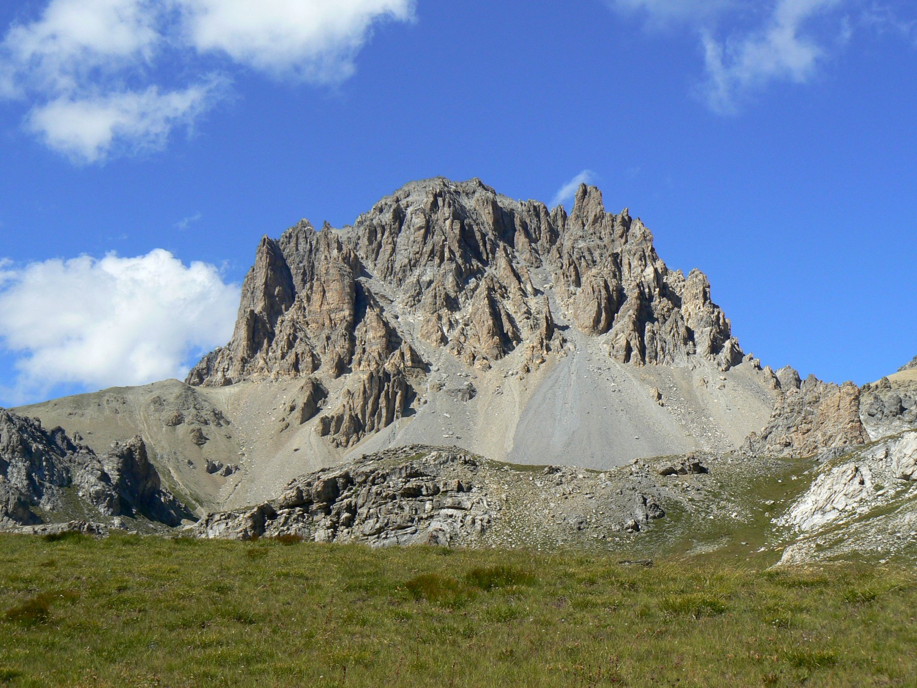
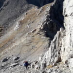
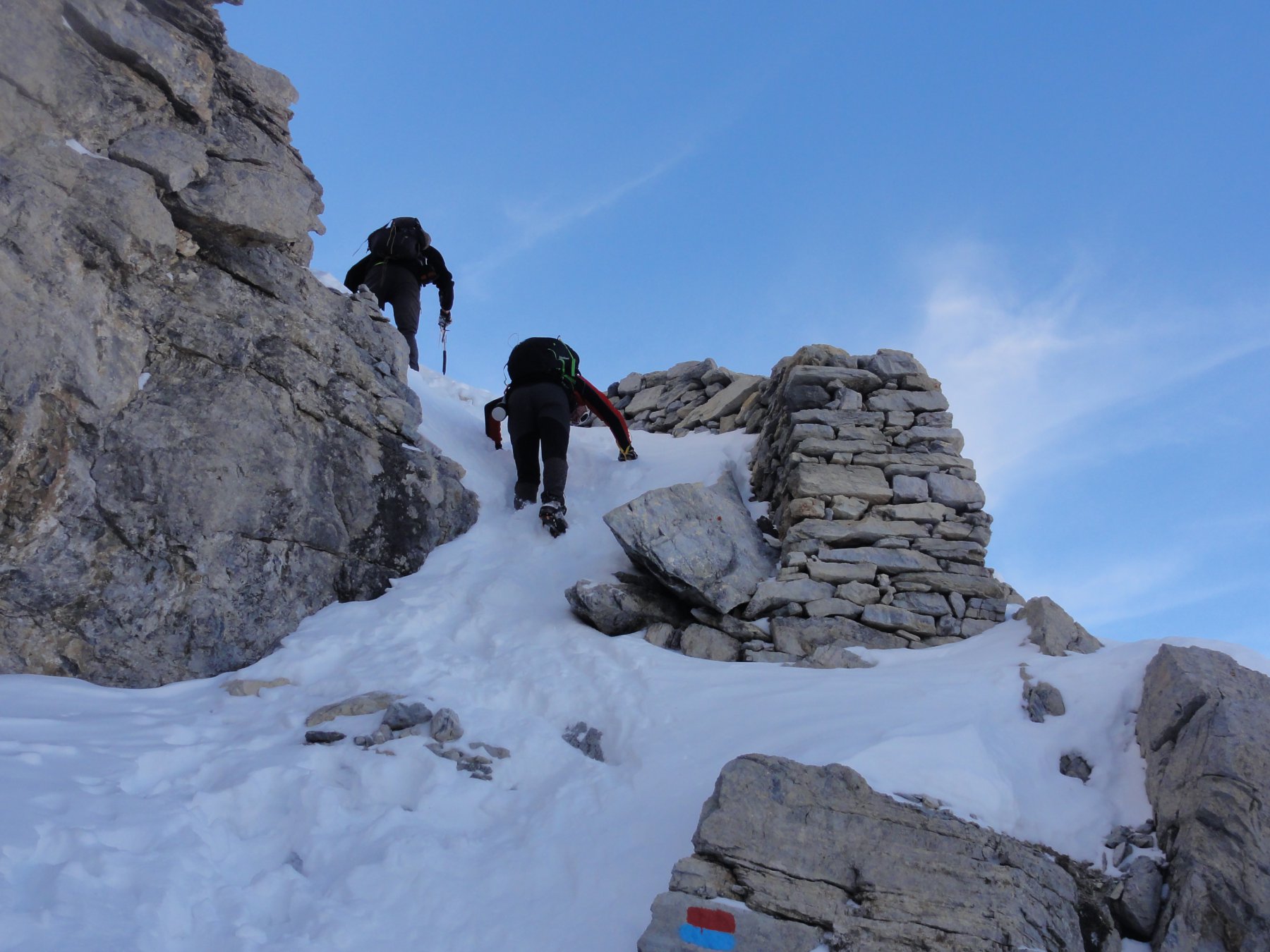
Scendere in traverso lungo il versante ovest della cima Dronero (numerosi moschettoni per assicurarsi) e calarsi alla prima forcella lungo una paretina (doppia da 7-8m). Salire il torrione successivo per un camino verticale, cui segue una paretina liscia e una fessura (25m, IV, poi III, numerosi fix).
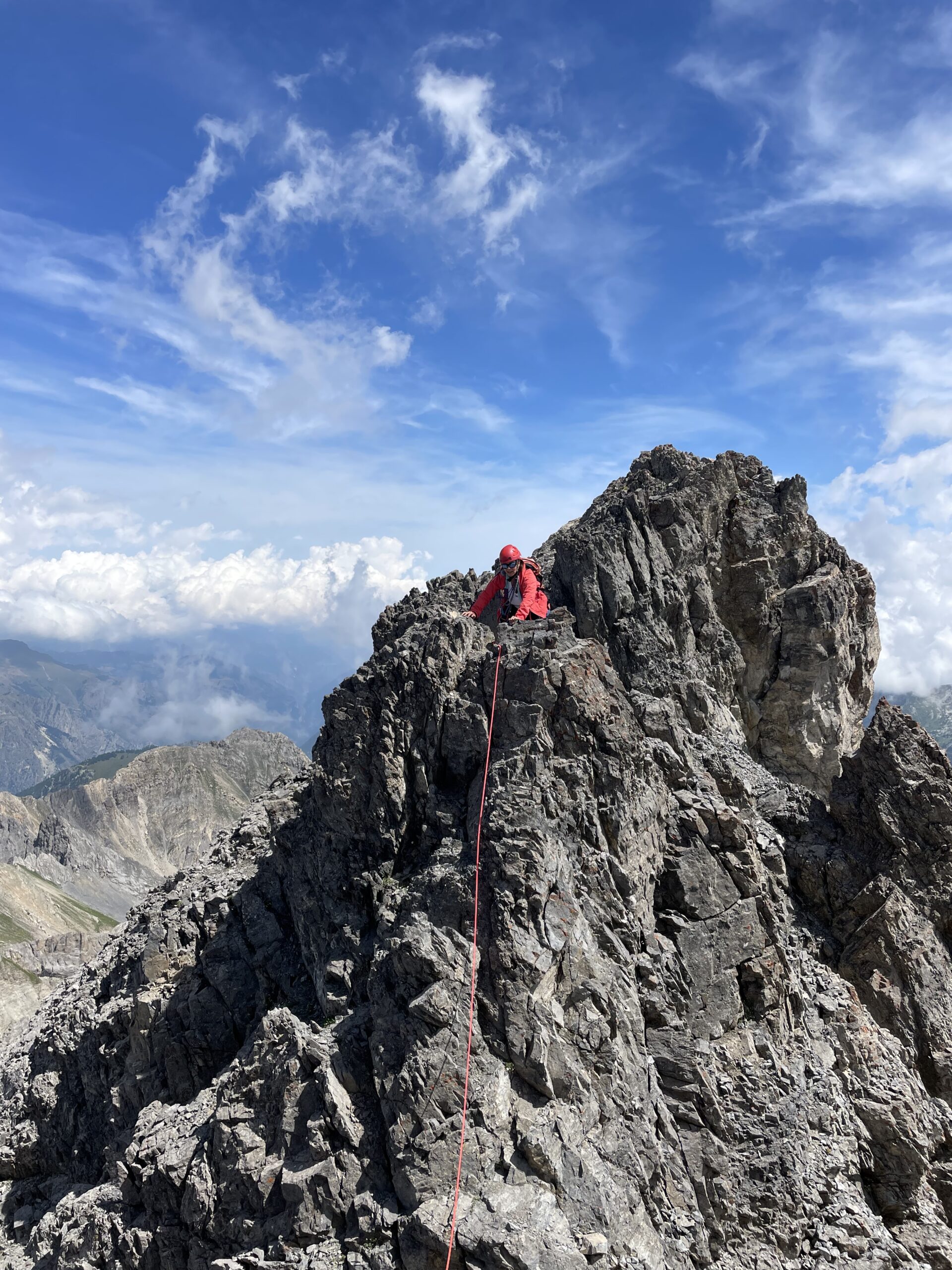
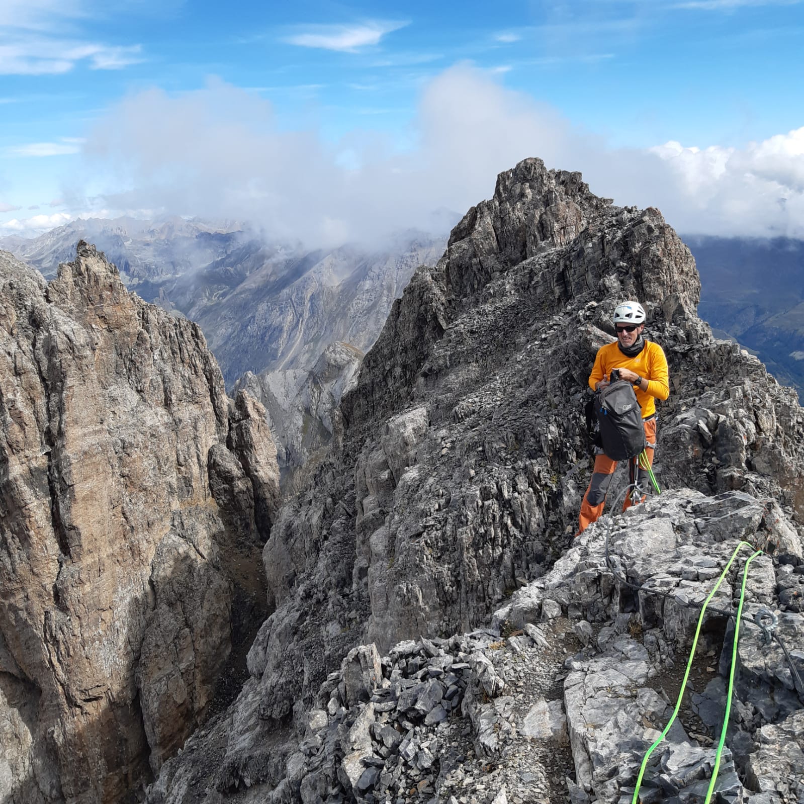
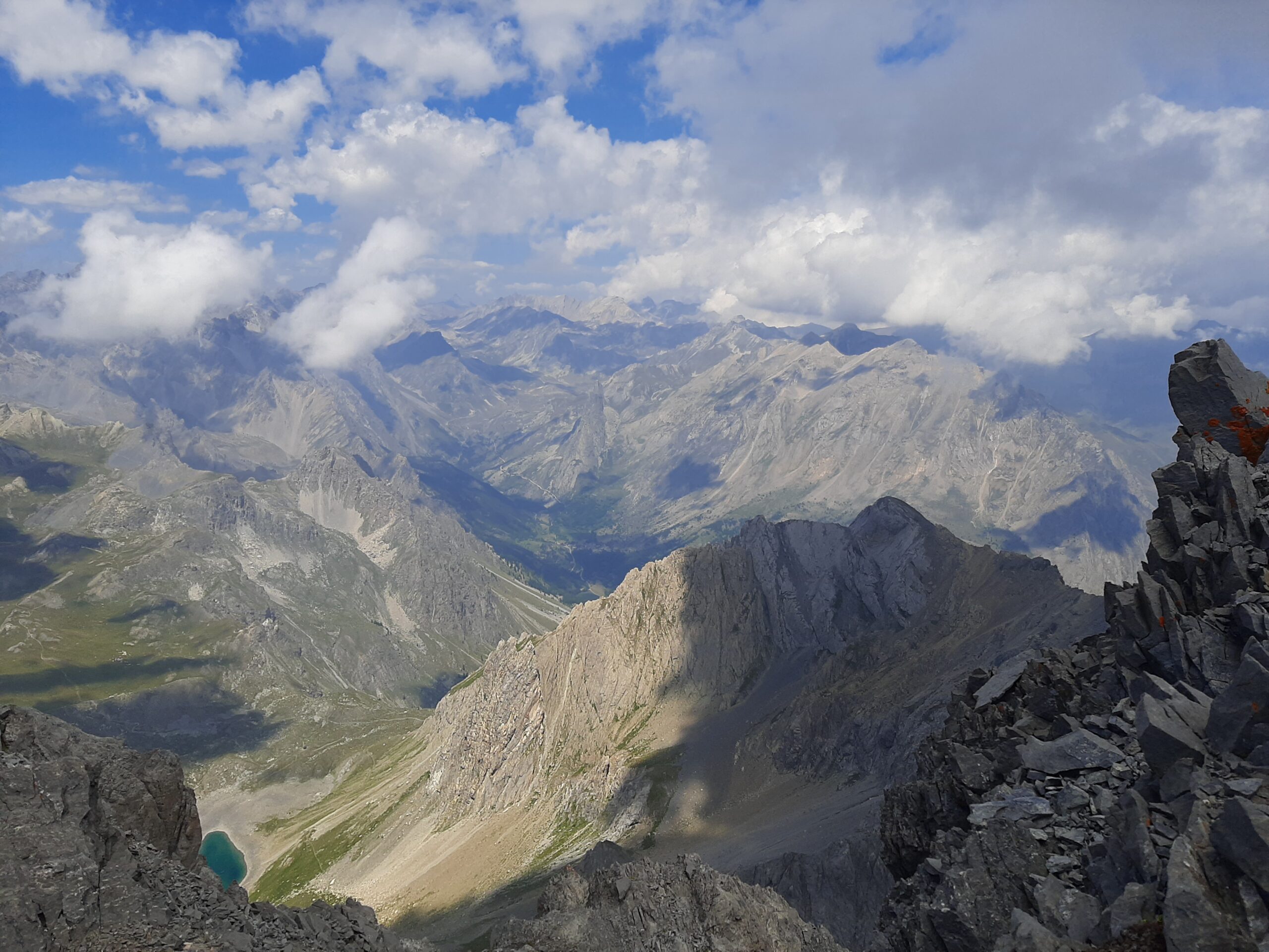
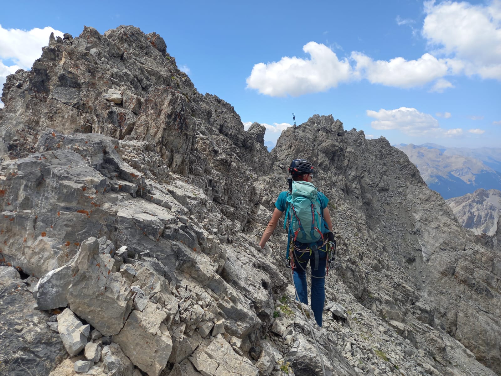
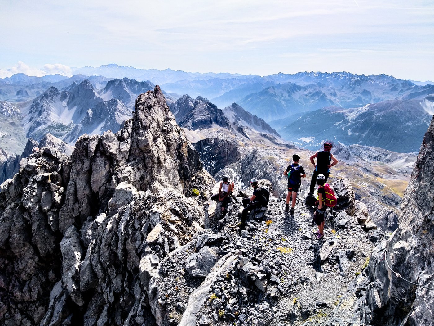
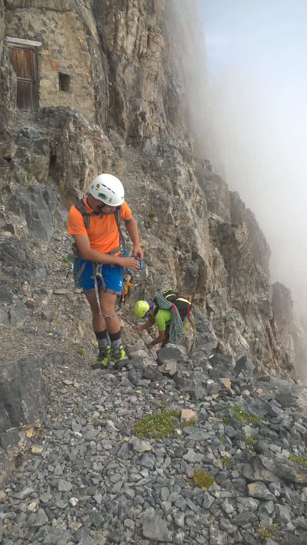
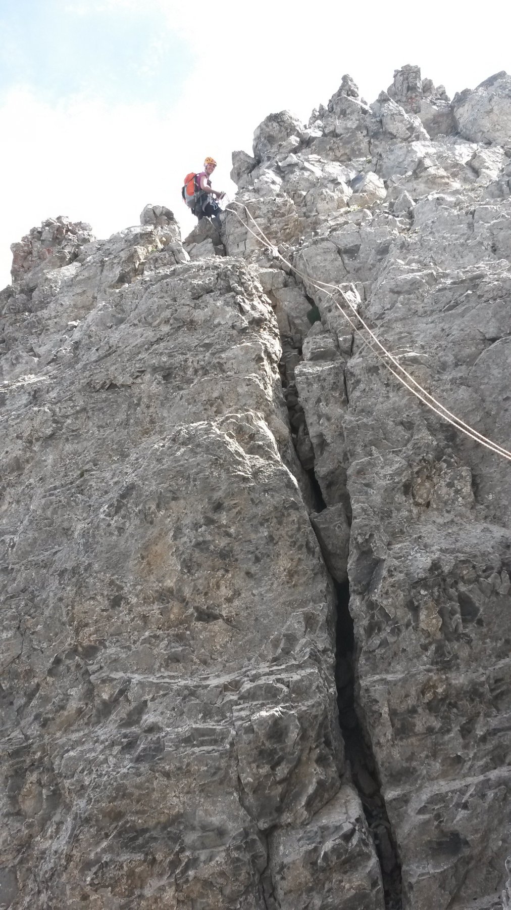
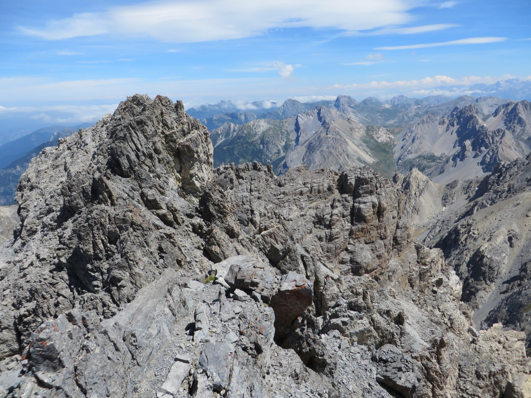
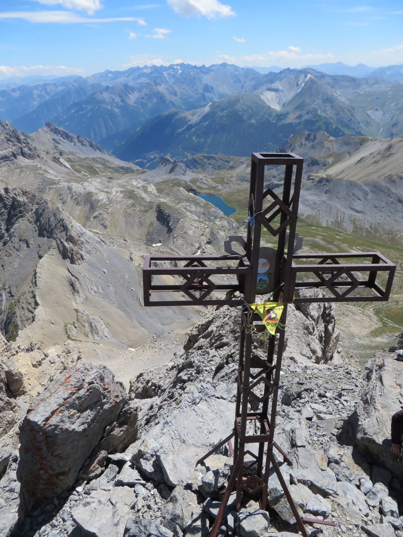
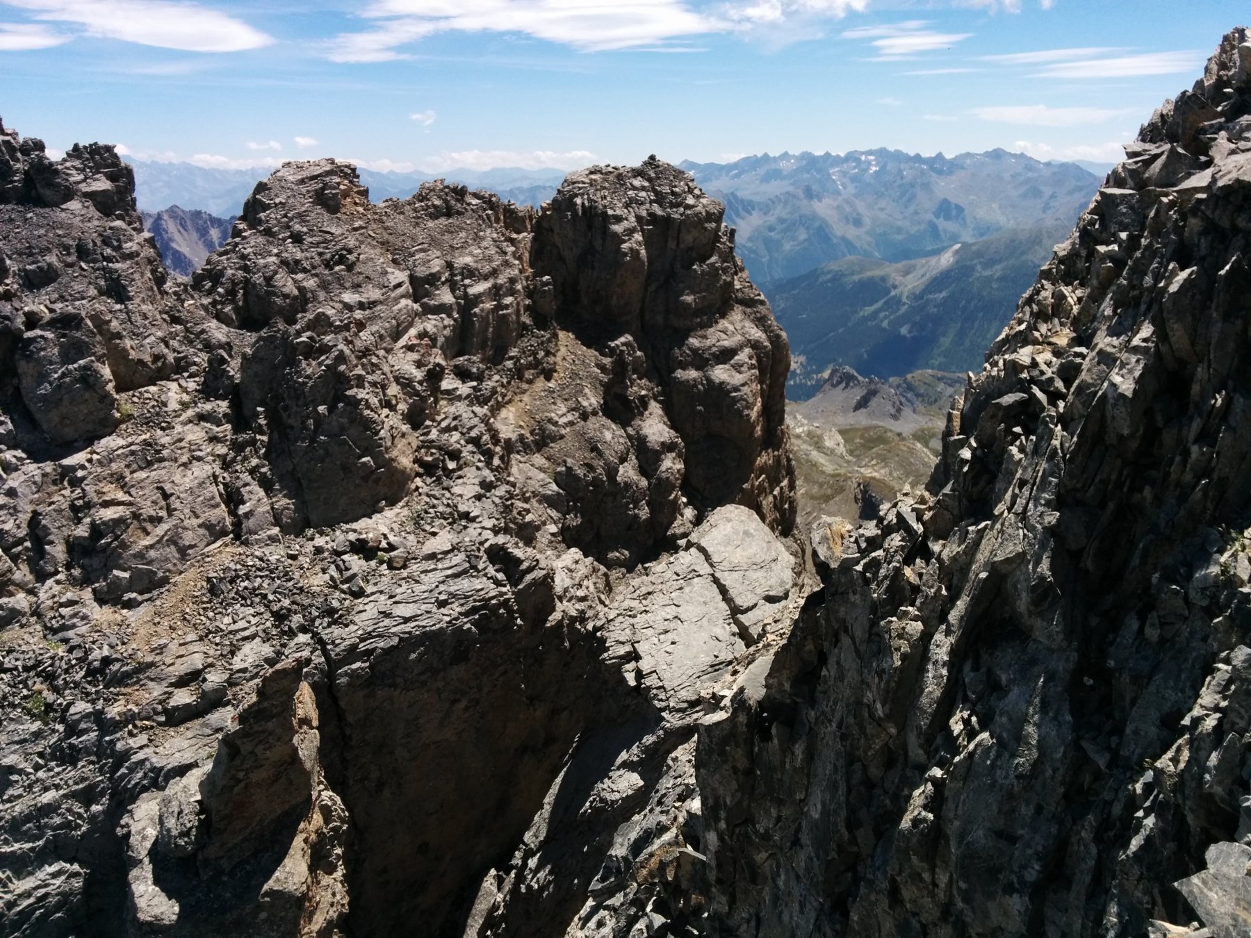
Scendere all’intaglio successivo con una calata di una ventina di metri, traversare sul versante nord della cresta (roccia molto instabile, tre gradini metallici), e risalire la paretina successiva fino in cima ad un altro torrione torrione (25m, III, fix). Ora la traversata diventa più facile, ma sempre su terreno delicato, fino alla croce di vetta, protetta nei punti più affilati e ripidi con qualche fix.
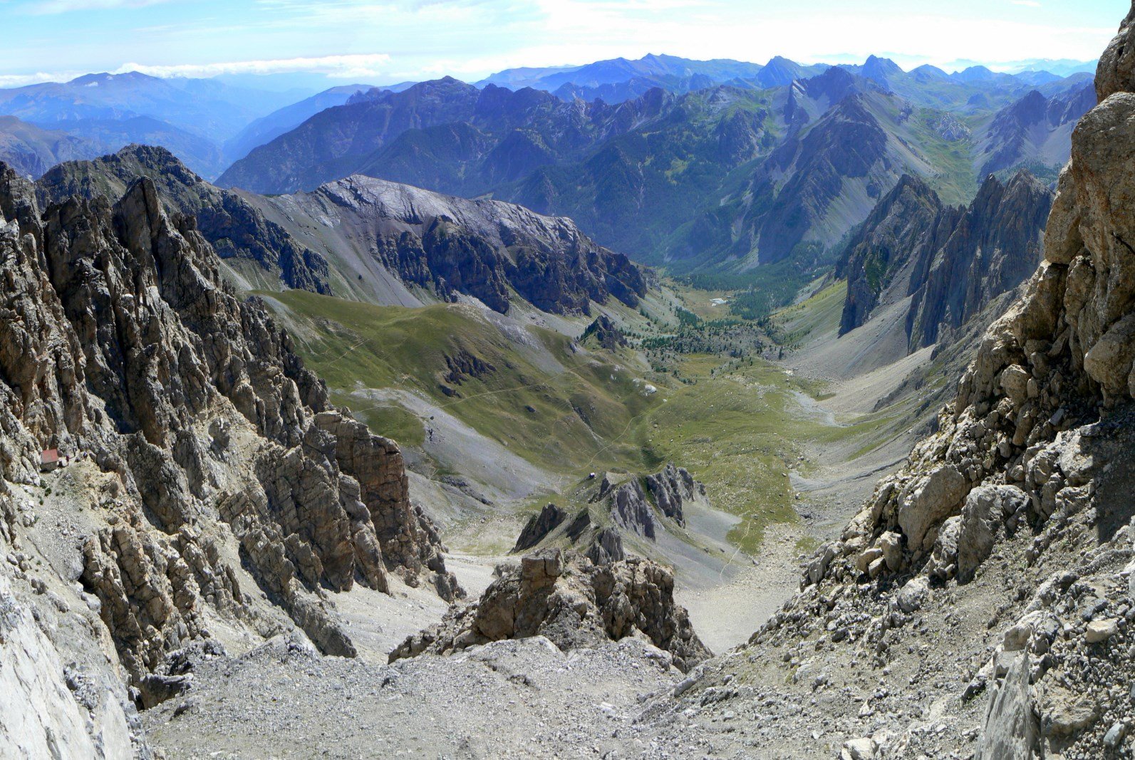
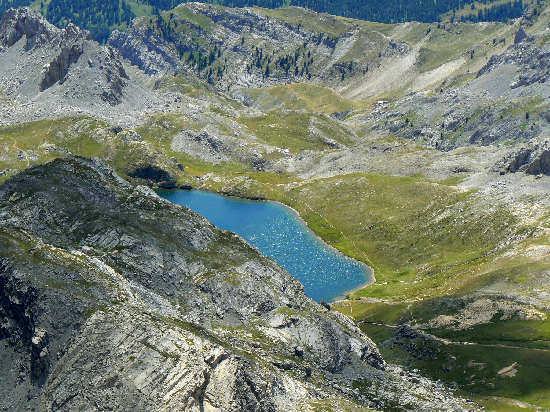
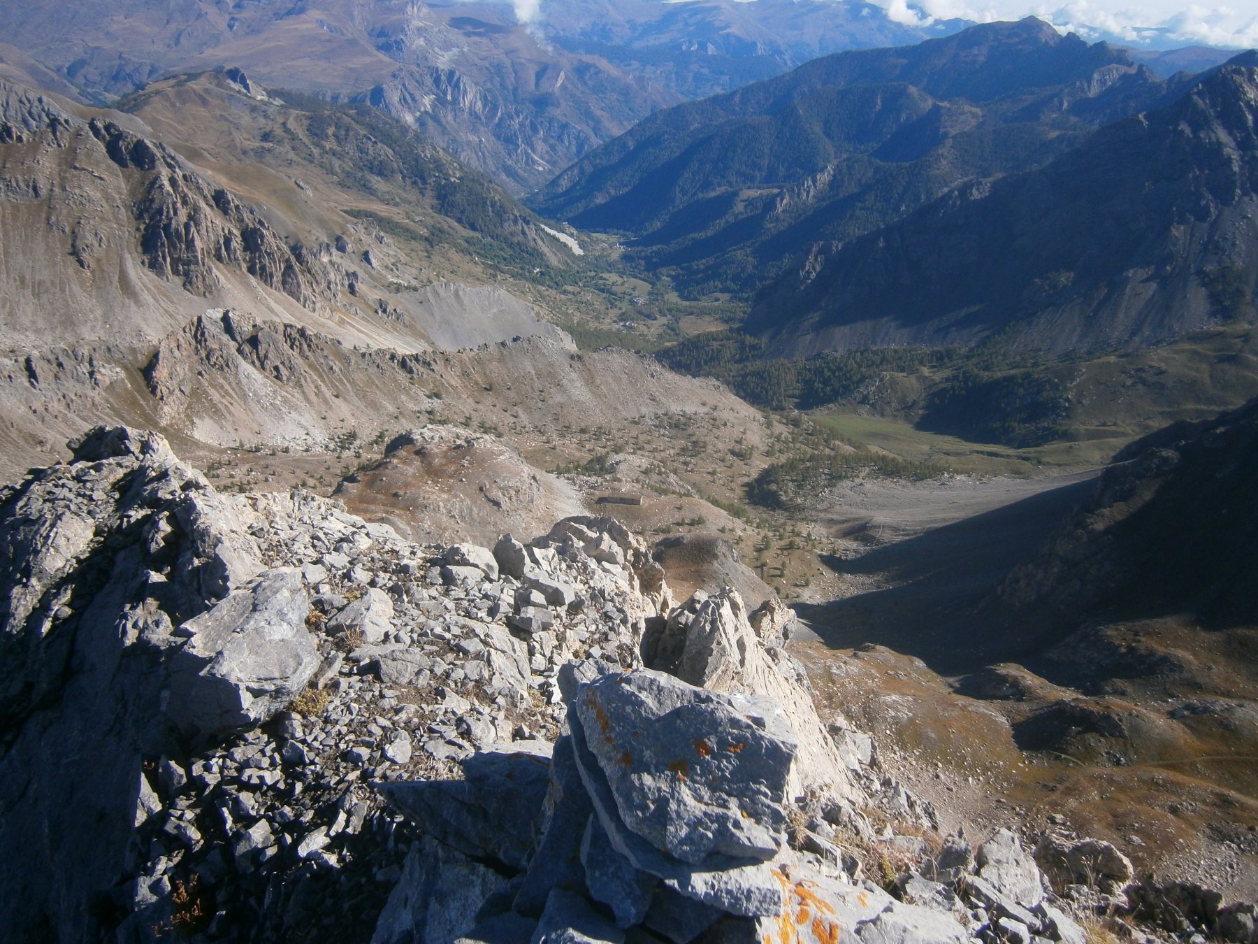
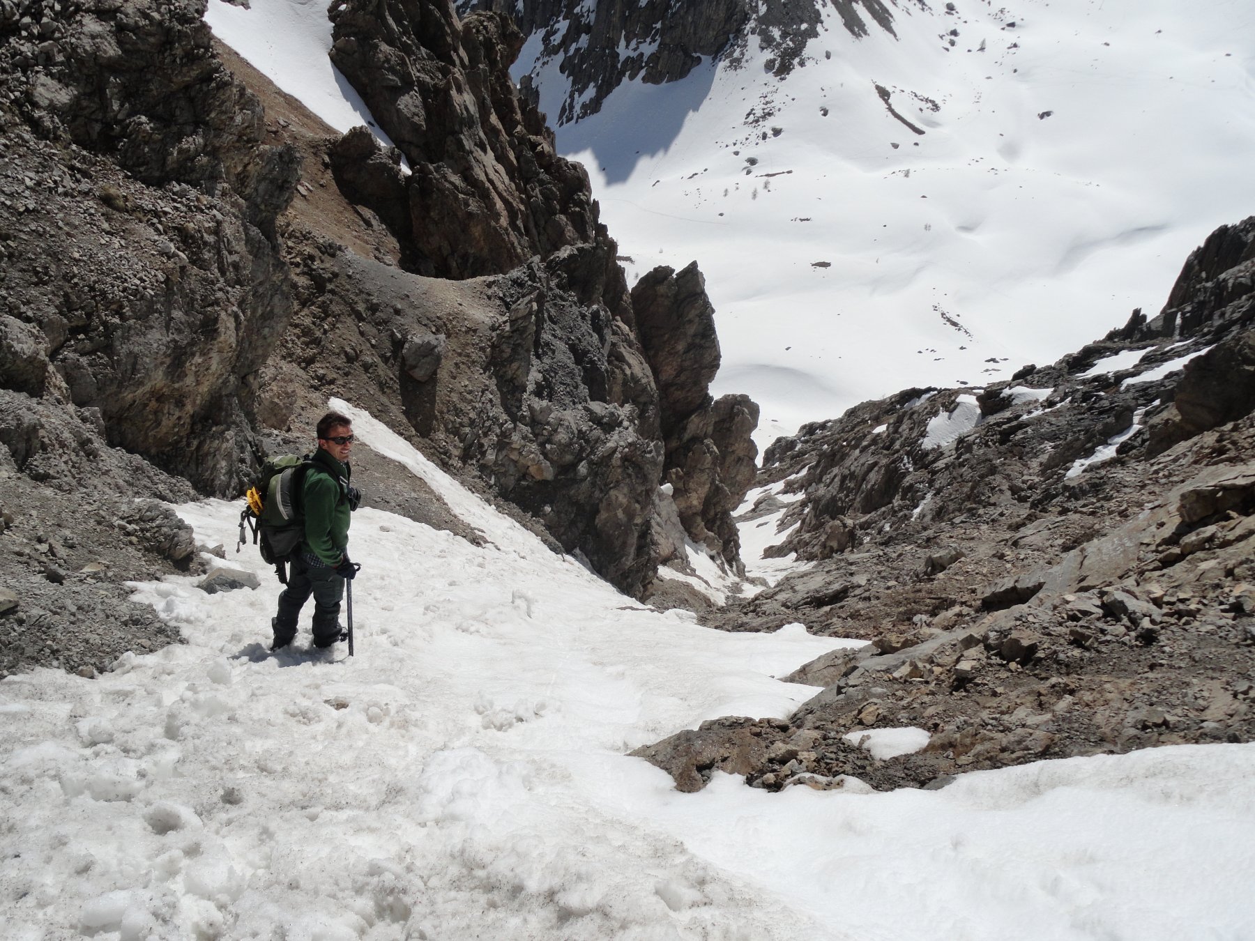
Discesa: dalla via normale del canale sud di sinistra. Giunti fuori dal canale, sulla grande conoide a 2700 m circa, tagliare verso sud-est in direzione del Col Feuillas, raggiungere il passo e scendere in Italia. In pochi minuti si torna al Bivacco Enrico e Mario dove si ritrova il percorso seguito in salita.
- Cartografia:
- Fraternali 1:25.000
Ultima revisione 12/12/2025
Nelle vicinanze Mappa
Itinerari
25/10/2022 CN, Acceglio D+ 1150 m PD Varie
Auto Vallonasso diretta dal Colle d’Enchiausa
 50m
50m
14/07/2024 CN, Acceglio D+ 1300 m F Tutte
Freid (Monte) e Cima Ciarbonet da Viviere, anello
 50m
50m
22/09/2016 CN, Acceglio D+ 1062 m F Varie
Peroni (Rocca) Canale Ovest
 50m
50m
10/06/2018 CN, Acceglio TD Est
Denti (Costa) – Anche gli Angeli Mangiano Ortiche
 50m
50m
16/02/2025 CN, Acceglio D+ 1250 m PD+ Varie
Content (Bric) Canale SE
 2.8Km
2.8Km
24/03/2014 CN, Acceglio D+ 1261 m PD+ Varie
Freid (Monte) Canale Est
 2.8Km
2.8Km
30/11/2015 CN, Acceglio D+ 1346 m PD- Varie
Scaletta (Monte) Cresta SE
 2.8Km
2.8Km
12/05/2024 CN, Acceglio D+ 1367 m PD Nord-Ovest
Oserot (Monte) Canali NO
 2.8Km
2.8Km
21/05/2025 CN, Acceglio D+ 1200 m PD Nord
Cobre, cima nord Canale Nord
 2.8Km
2.8Km
04/02/2018 CN, Acceglio D+ 1200 m PD Varie
Cobre, cima Nord Canale SE
 2.8Km
2.8Km
Servizi
600m
2.7Km
Chialvetta Rifugio
Acceglio
2.7Km
La Gardetta Rifugio
Acceglio
2.7Km
Rolando Ristorante
Acceglio
2.8Km
Della Gardetta Rifugio
Acceglio
4.2Km
La Barmo Ristorante
Acceglio
4.3Km
Il portichetto Ristorante
Acceglio
4.7Km
Londra Albergo
Acceglio
4.7Km
Alpi Cozie Albergo
Acceglio
4.8Km