2.6Km
2.6Km
Note
Storico
 0m
50m
50m
13.2Km
15.4Km
16.2Km
16.2Km
22.5Km
26Km
0m
50m
50m
13.2Km
15.4Km
16.2Km
16.2Km
22.5Km
26Km
2.6Km
4.3Km
4.3Km
4.3Km
4.3Km
7Km
7.4Km
8Km
8.9Km
9.3Km
INFO maggio 2025: la ferrata è attualmente chiusa per manutenzione
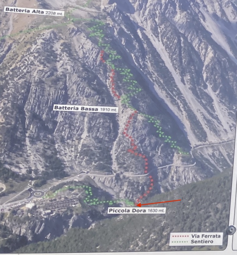
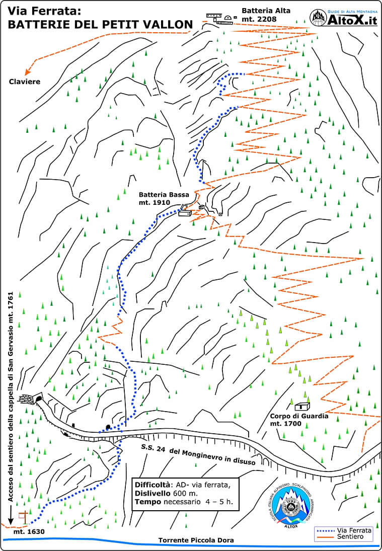
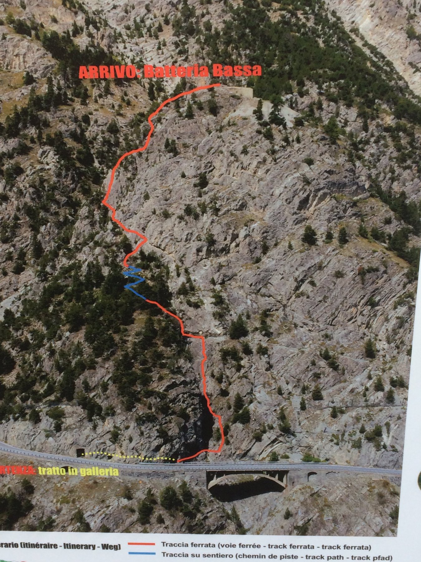
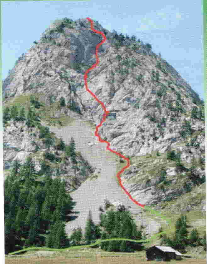
Avvicinamento
da Cesana proseguire per Claviere. Alla rotonda dove inizia il tunnel di by-pass di Claviere proseguire su via Torino e dopo qualche decina di metri raggiungere il piazzale del Ponte Tibetano sulle Gorge di S. Gervasio dove si trova un ampio parcheggio.
Descrizione
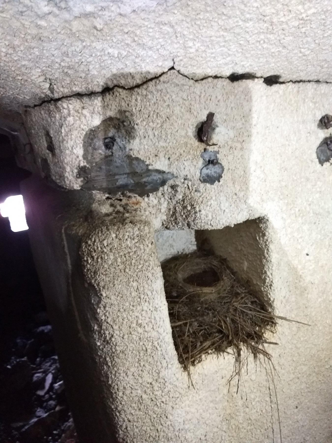
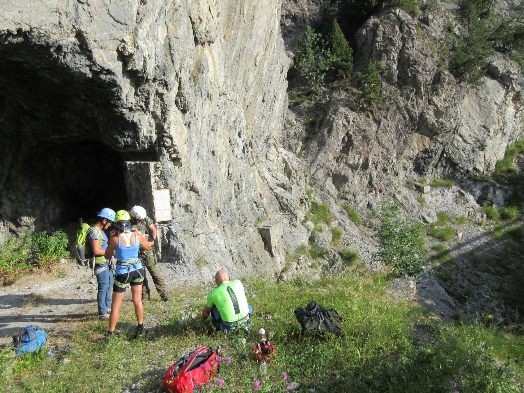
Incamminarsi a ritroso lungo la statale in direzione Cesana per circa 200 metri e poco prima della galleria prendere sulla destra la vecchia statale in discesa. In prossimità di una ampia curva a sinistra, sempre sulla sinistra si nota l’imbocco di una piccola galleria. Vi sono anche apposti i cartelloni con le indicazioni delle ferrate Batteria Bassa e Batteria Alta. Imboccare la galleria e percorrerla tutta ( circa 30 metri). Non servono torce in quanto è illuminata ed in ogni caso si vede bene l’uscita. Dal parcheggio calcolare 10/15 minuti.
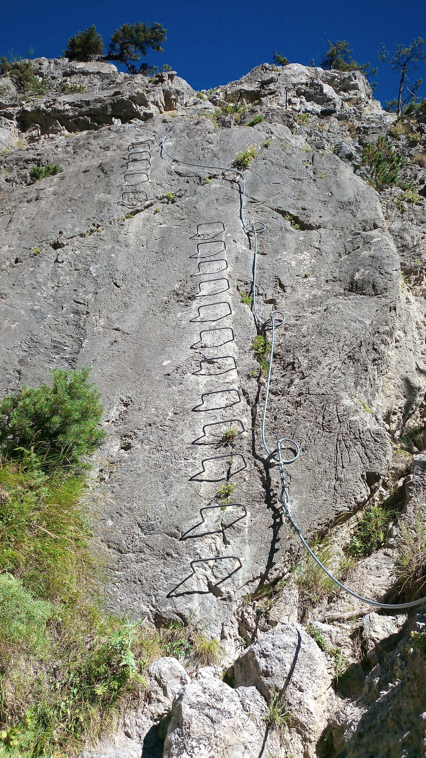
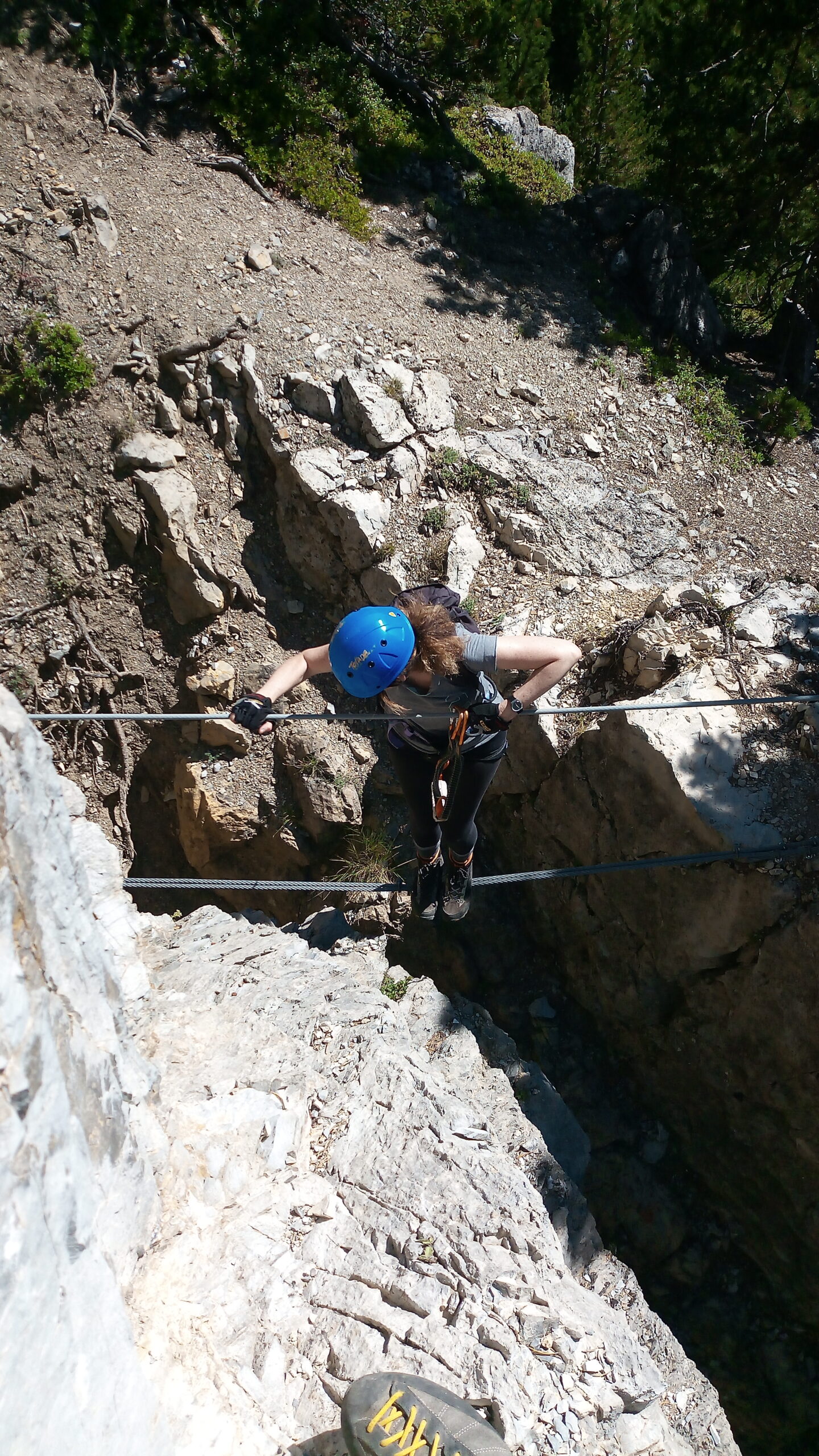
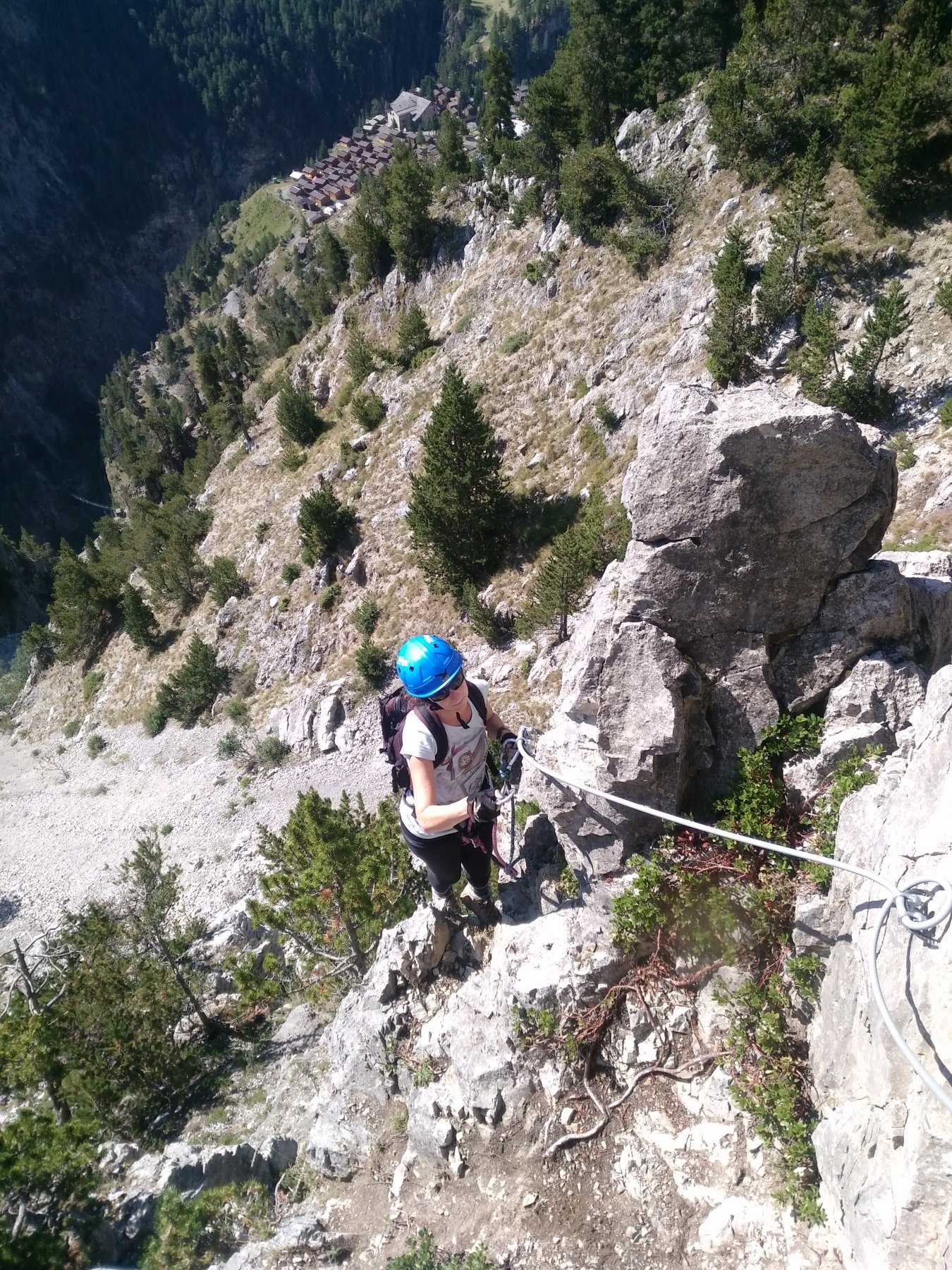
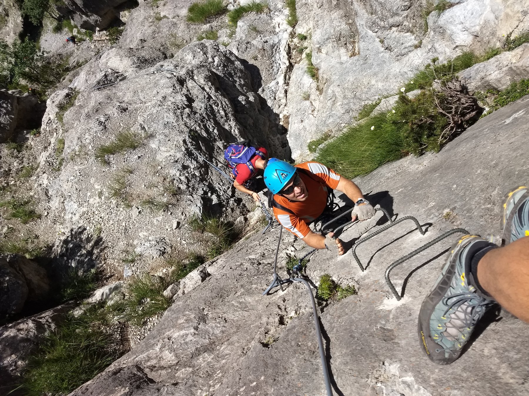
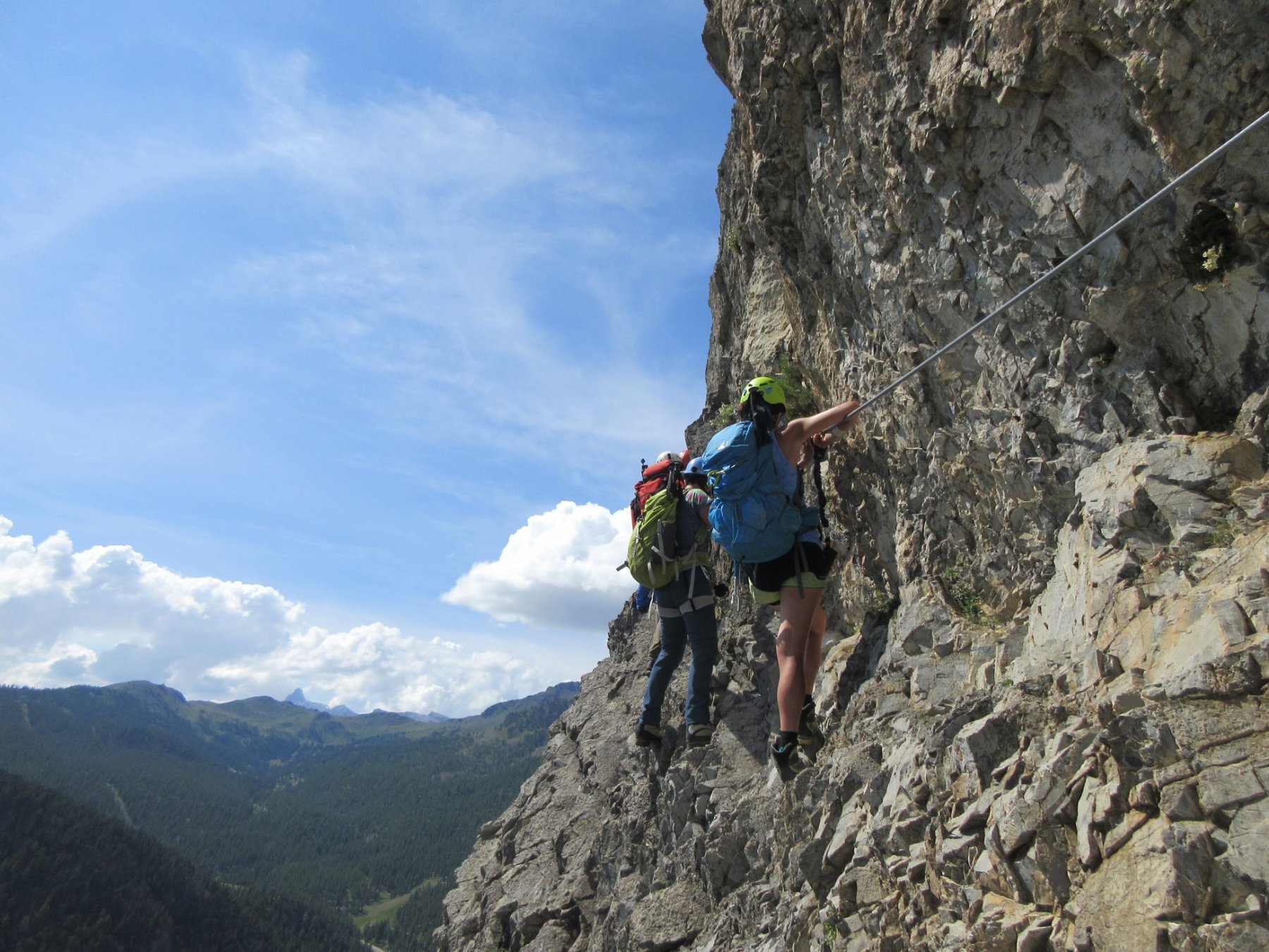
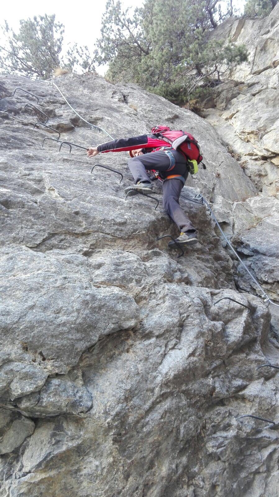
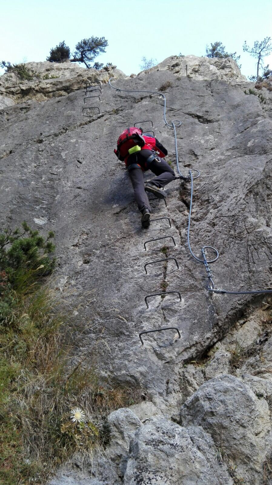
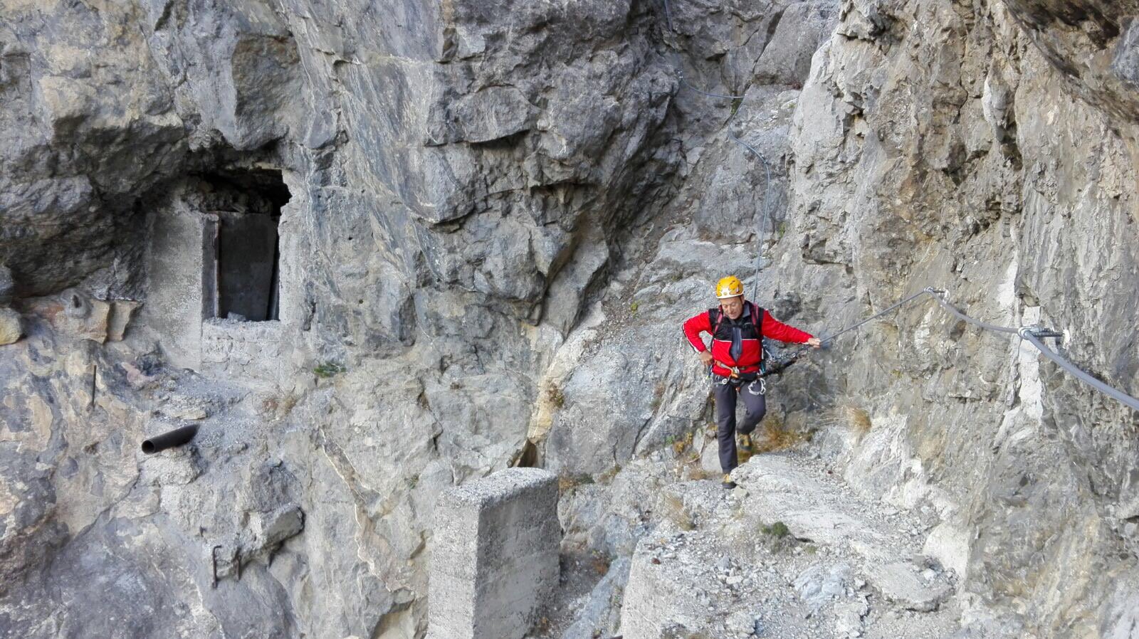
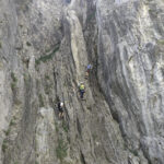
Primo tratto : Ferrata Batteria Bassa con possibile via di fuga e ritorno a Claviere.
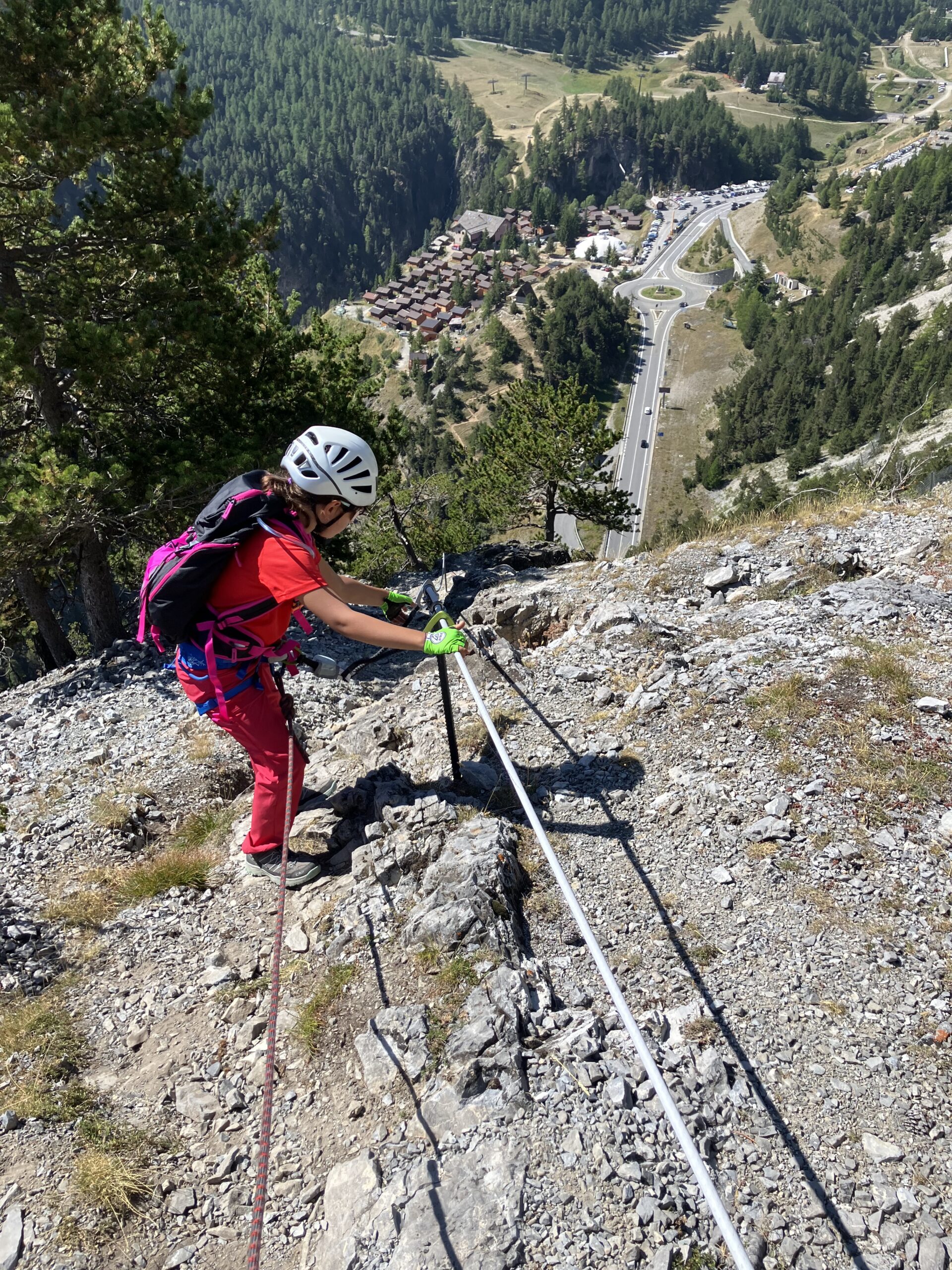
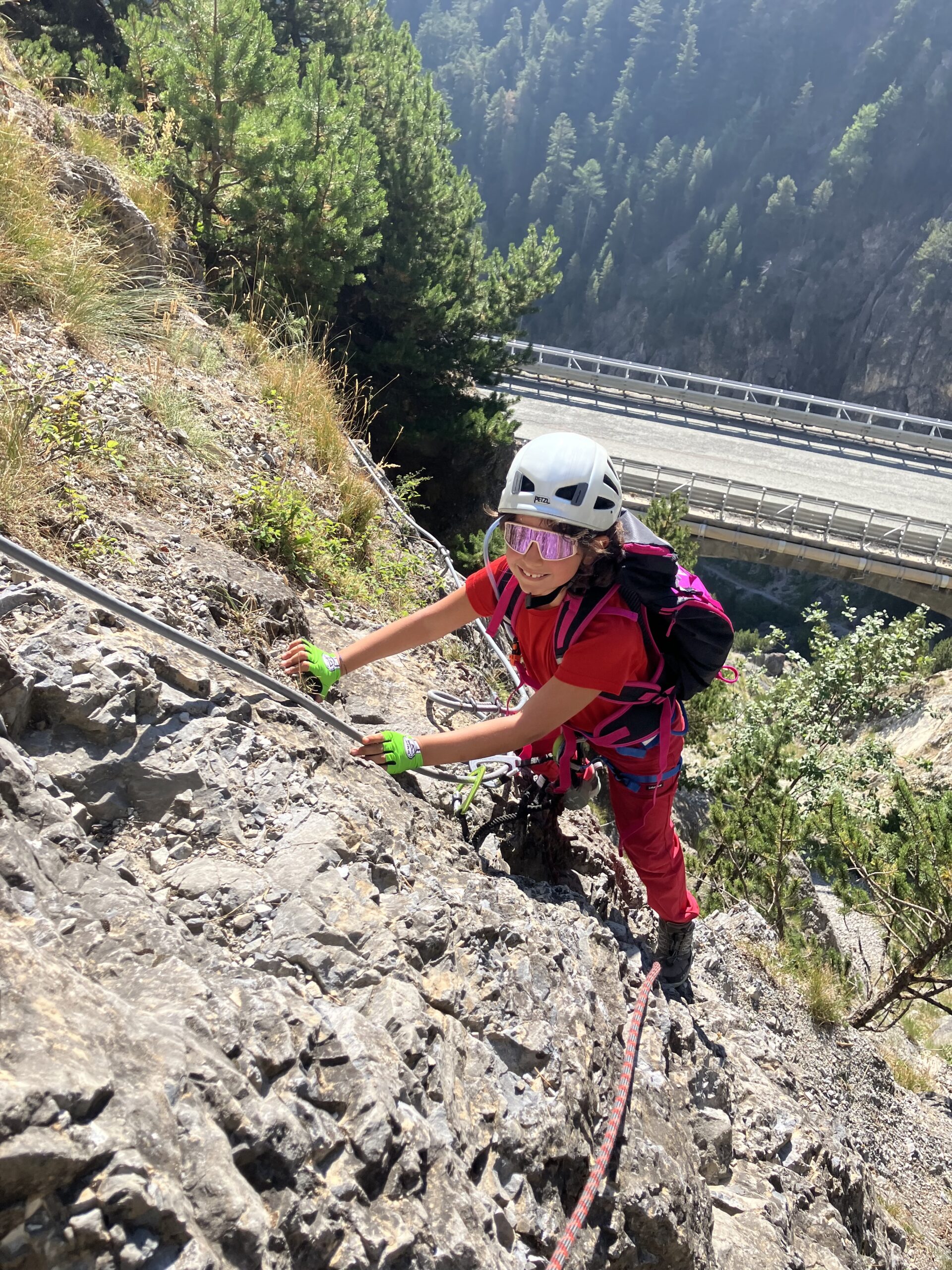
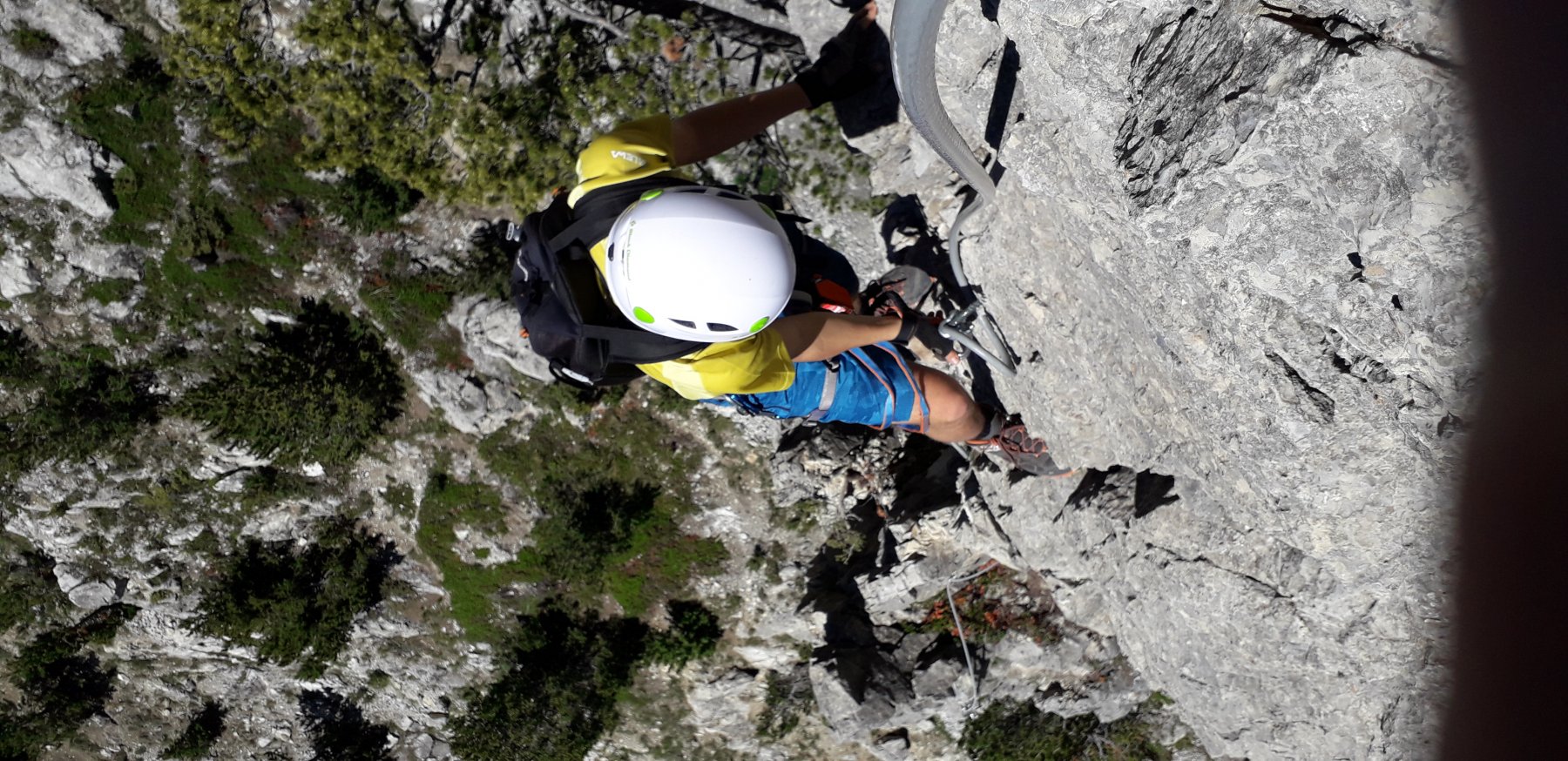
All’uscita della galleria la ferrata inizia con un traverso per poi verticalizzarsi immediatamente. Ferrata divertente , di media difficoltà, con arrampicata per roccette e placche che porta ai resti della Batteria Bassa ( 45/50 minuti di ferrata – da m. 1.700 a m. 1.900). Da questo punto è possibile ritornare a Claviere mediante il ripido sentiero che scende a destra ( faccia a monte) e che incontra la vecchia statale leggermente più a valle della galleria da cui siamo partiti .
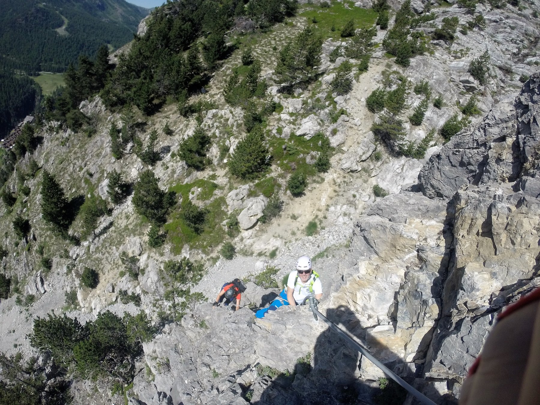
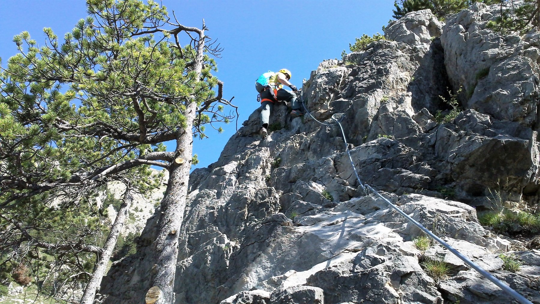
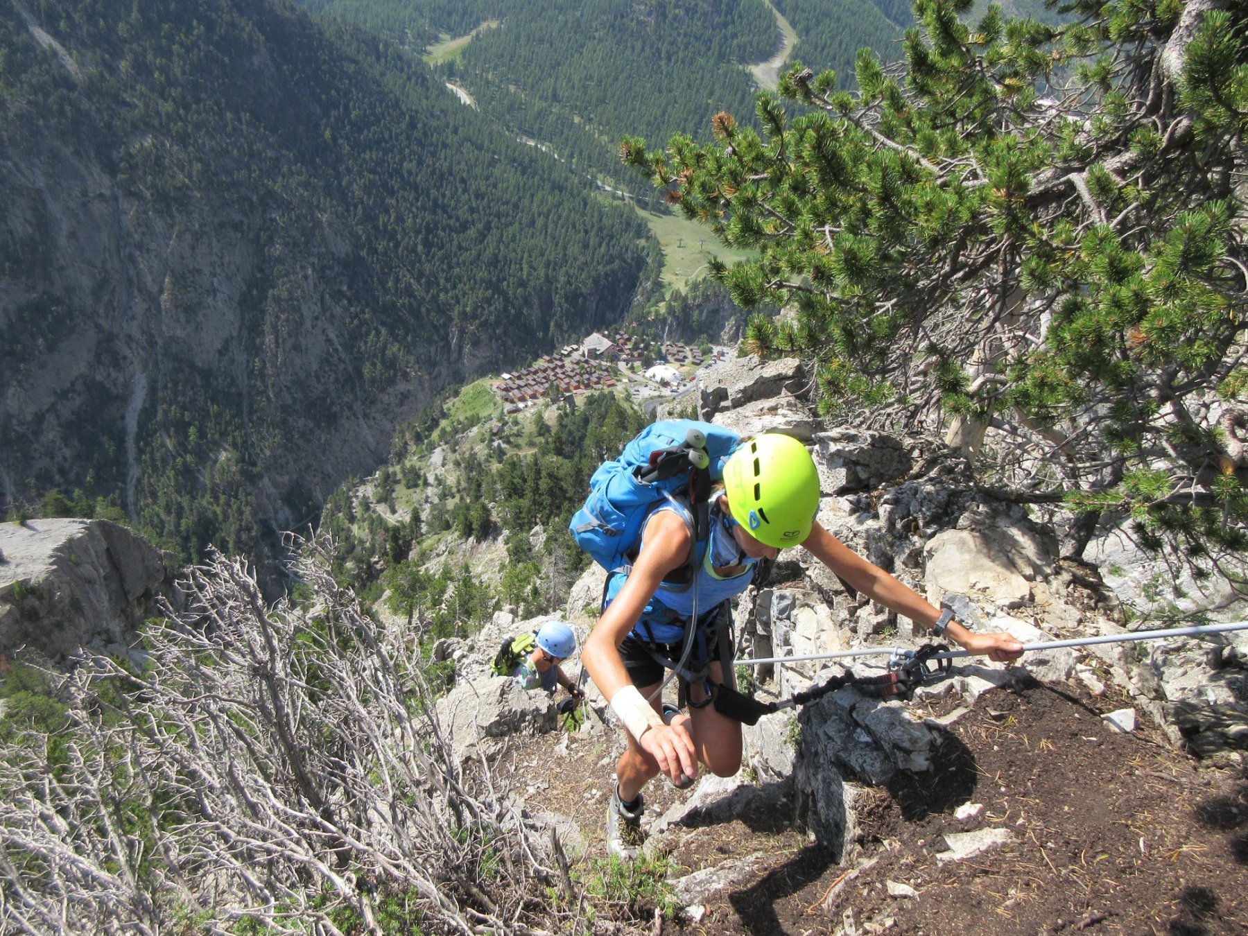
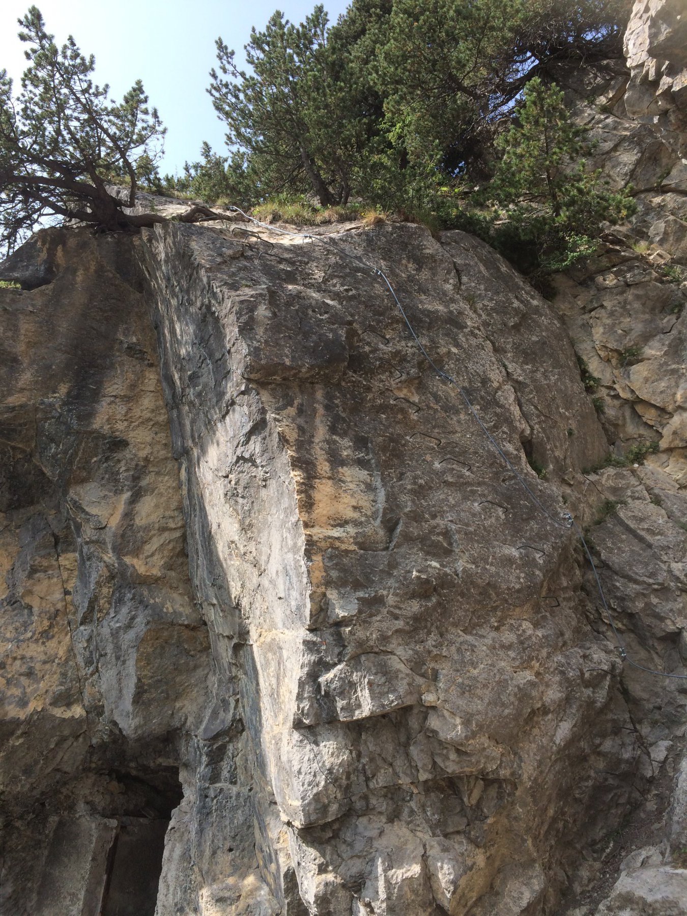
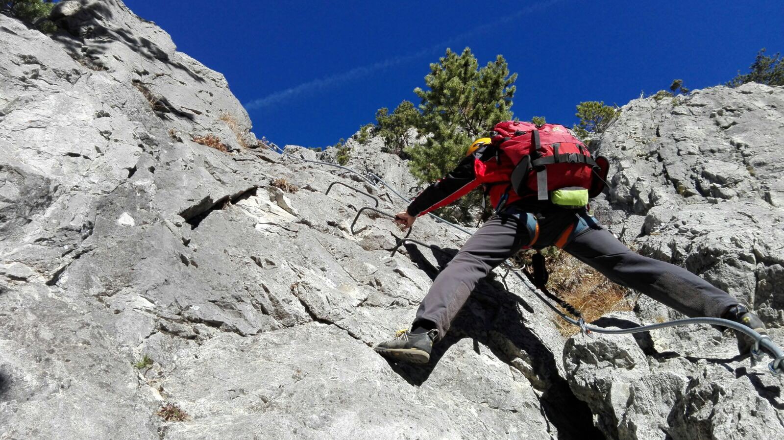
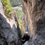
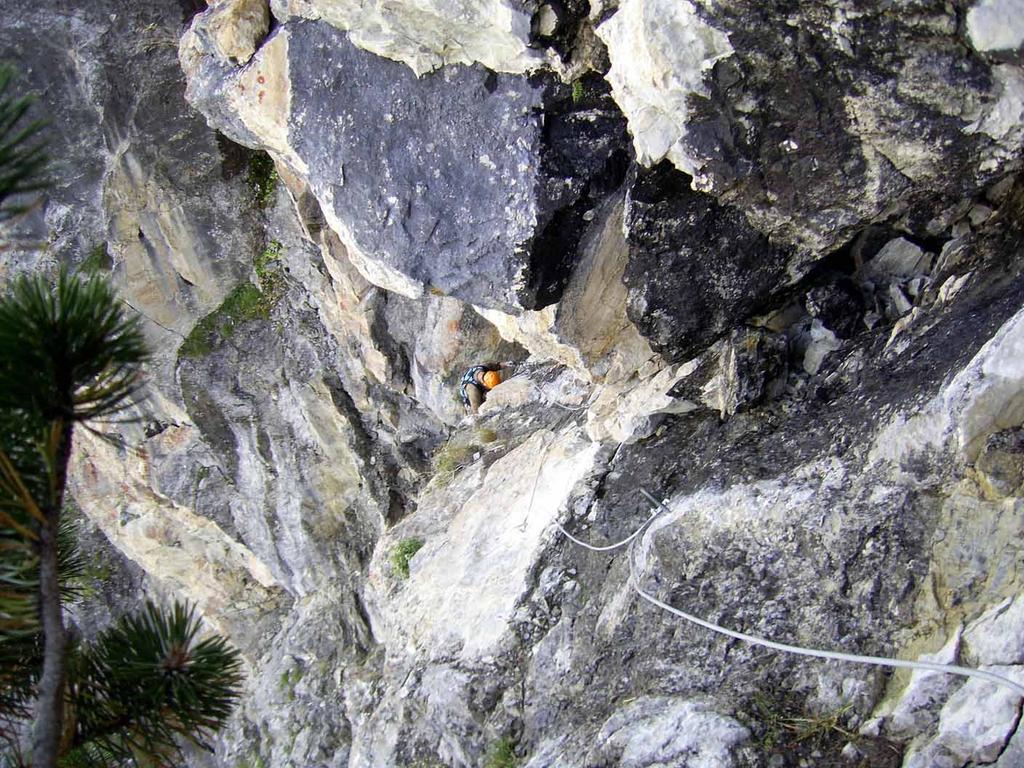
Secondo tratto : Ferrata Batteria Alta con possibile via di fuga e ritorno a Claviere.
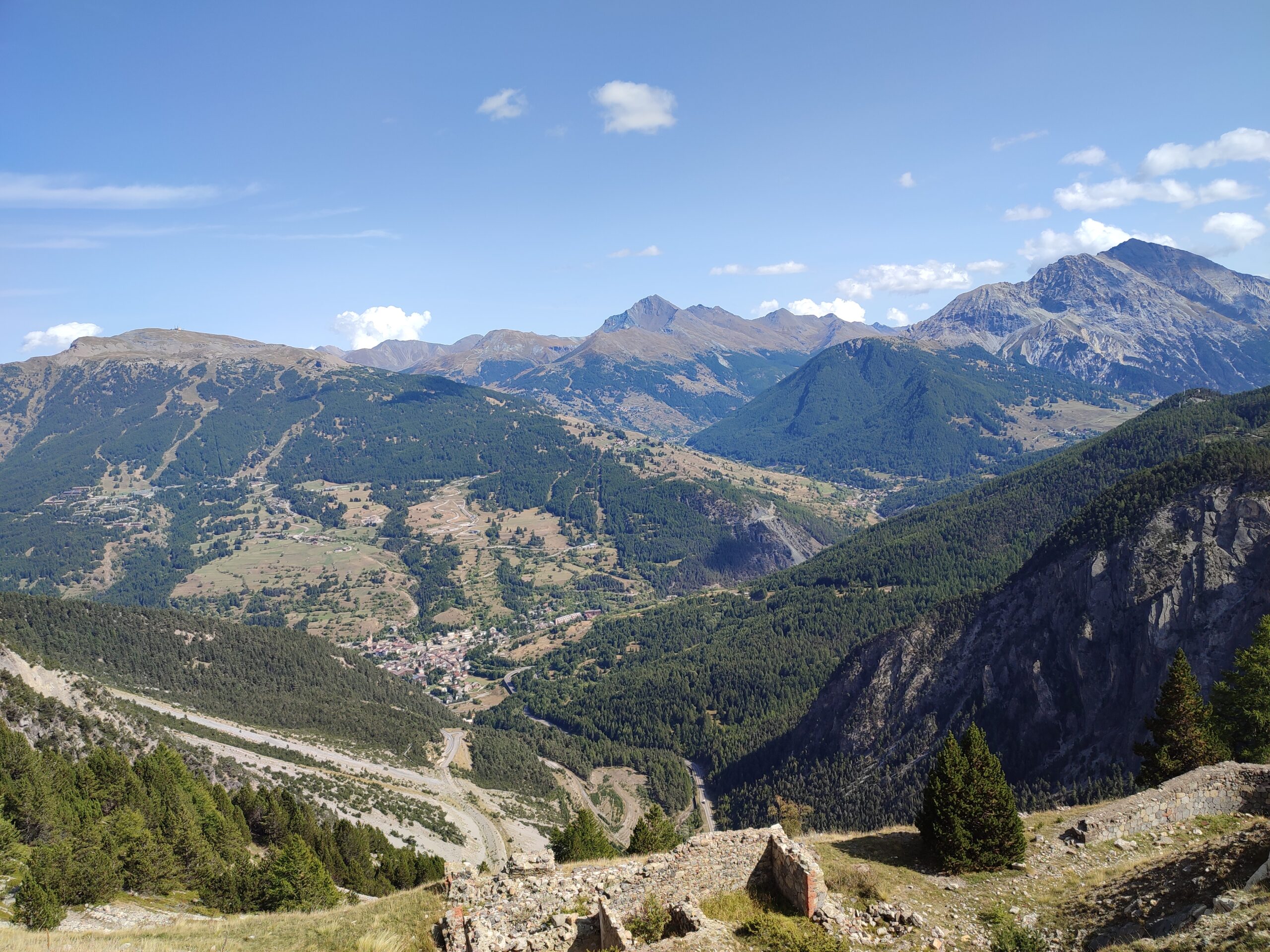
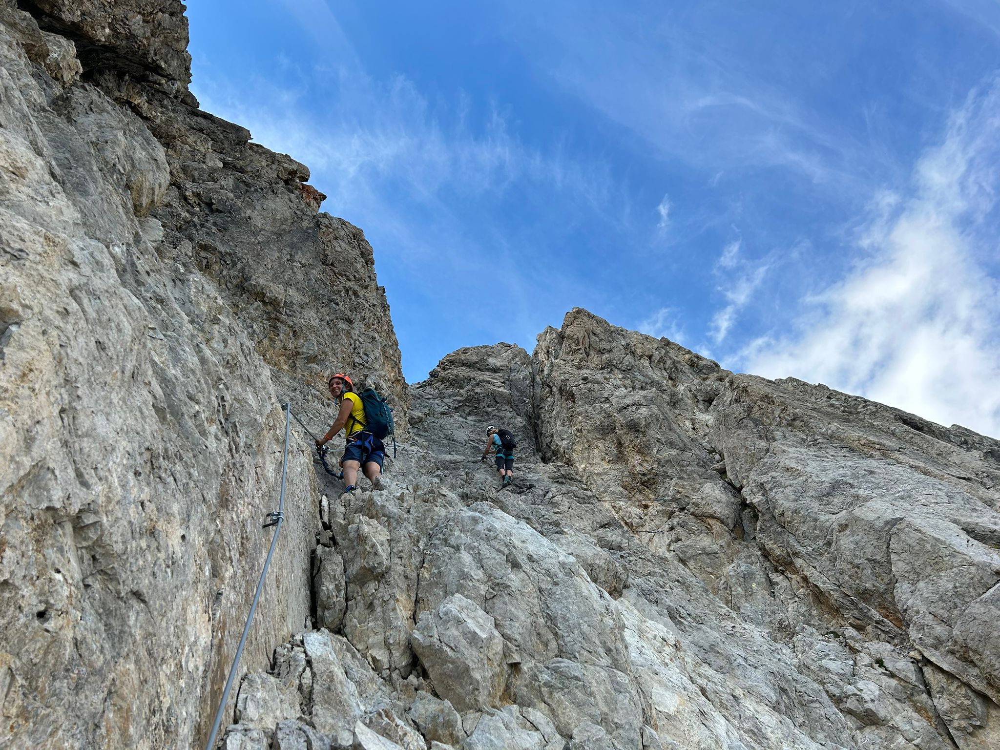
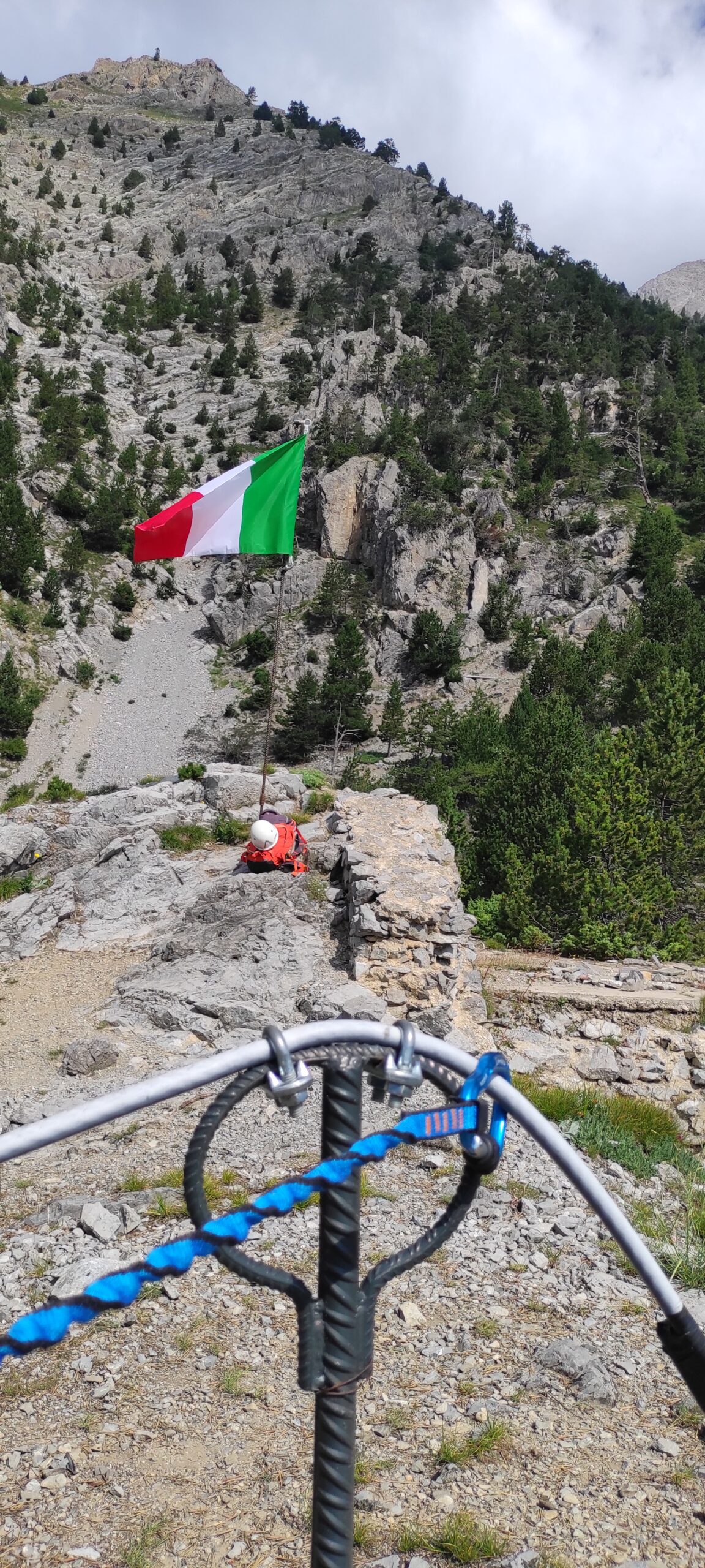
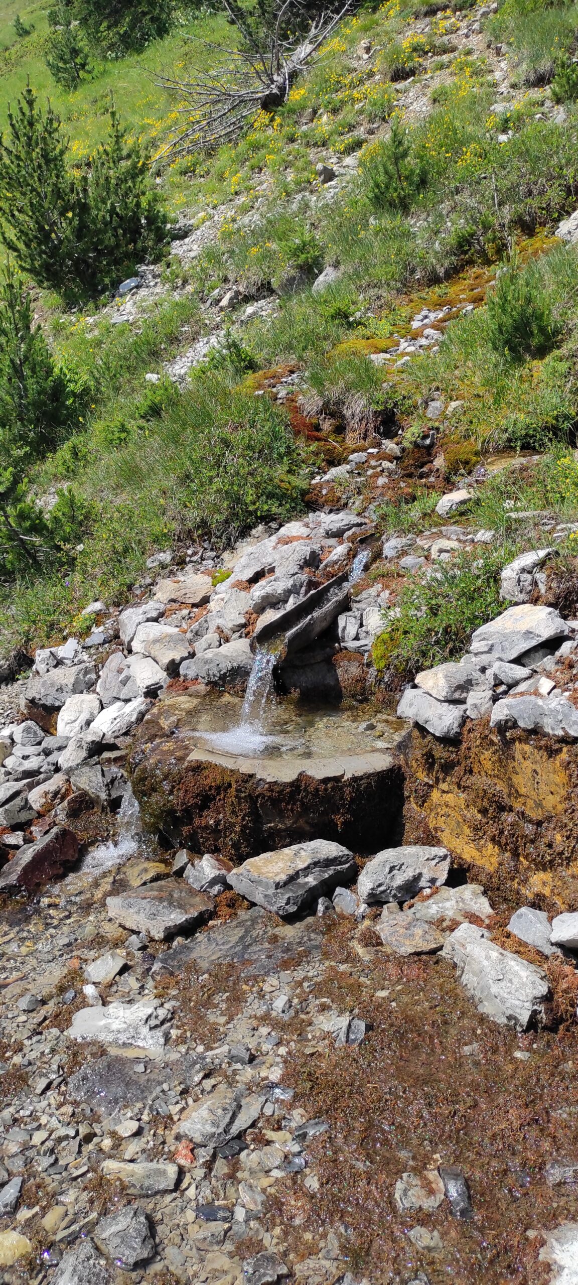
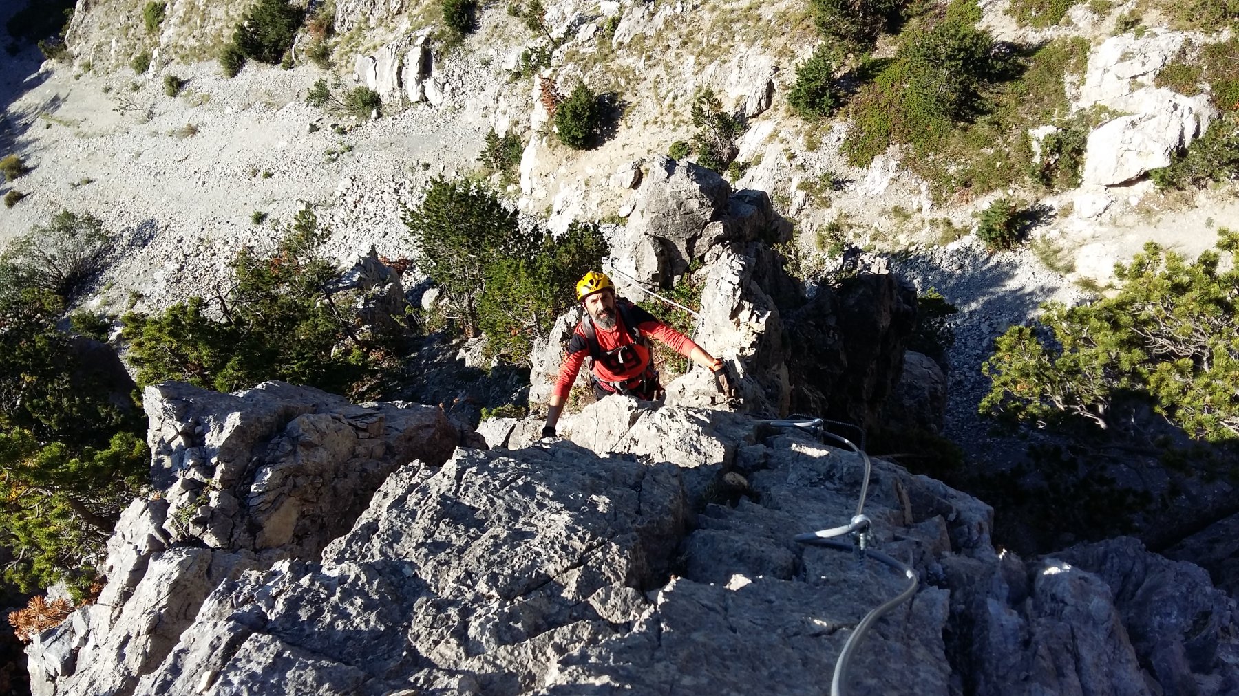
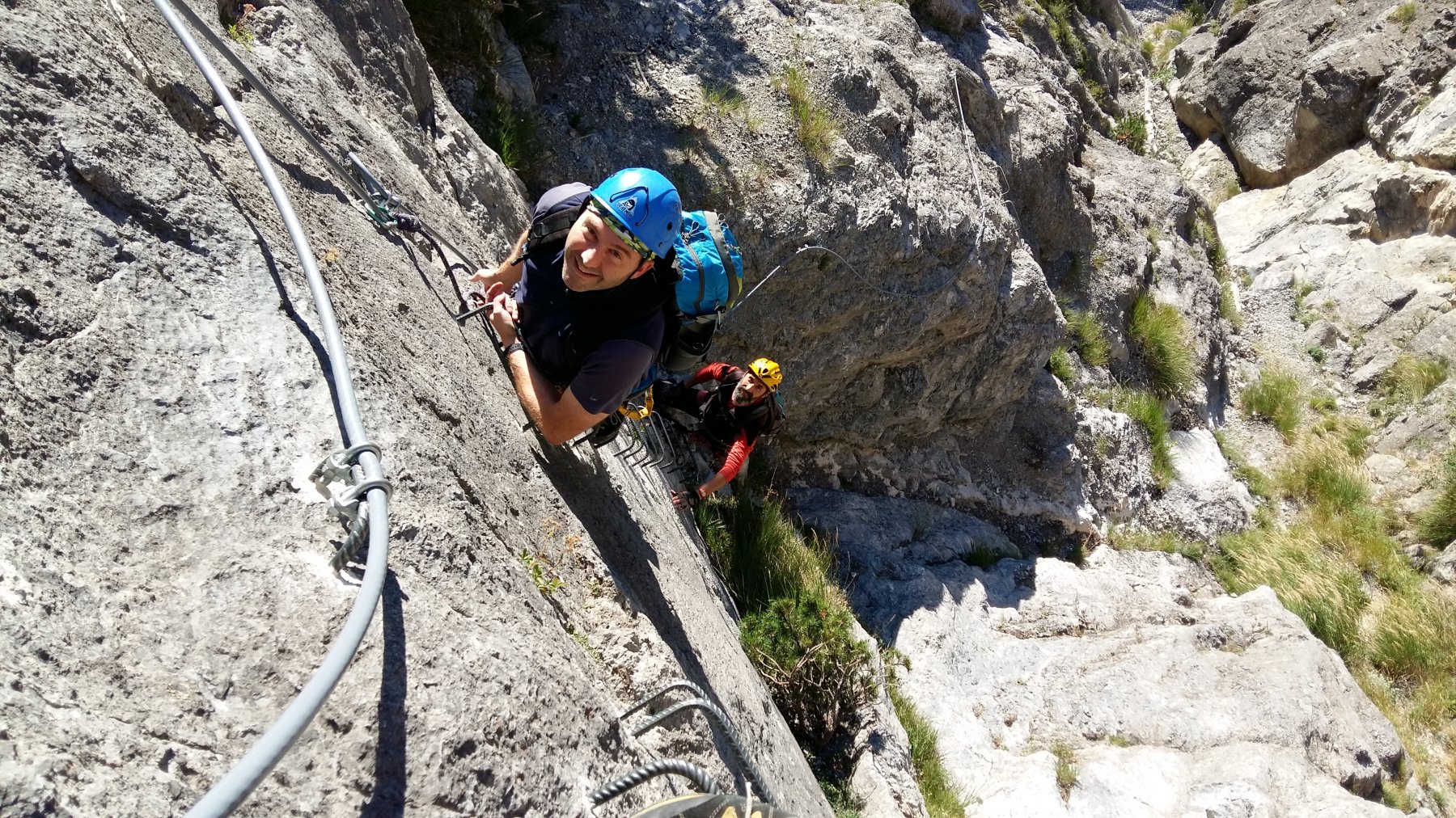
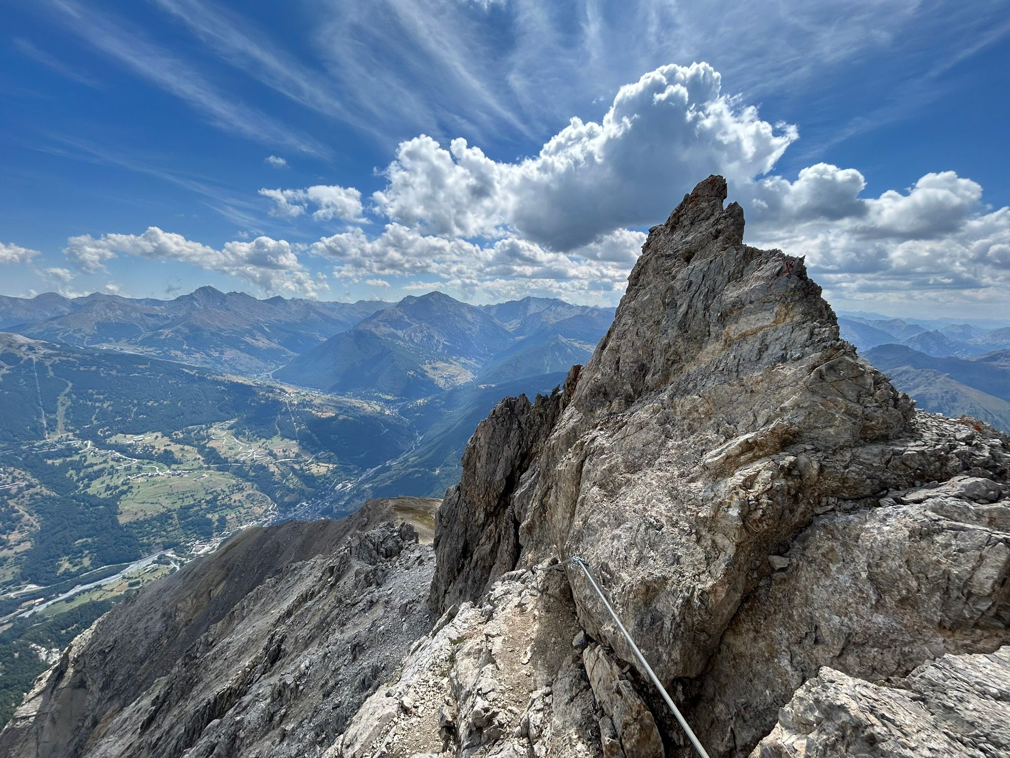
Dalla Batteria Bassa si prosegue per un breve tratto lungo il sentiero militare fino ad incontrare sulla sinistra l’attacco della ferrata . Sempre divertente come la precedente , di media difficoltà, la ferrata ad un certo punto si interrompe e si riprende il sentiero militare per un breve tratto. Poi sulla sinistra si individua un altro tratto di ferrata che supera una bastionata calcarea. La ferrata si interrompe nuovamente per riprendere il sentiero militare che , attraversando il confine franco-italiano, porta alla Batteria Alta. Prima della Batteria Alta lungo il sentiero si nota una splendida sorgente perenne e abbondante. ( 45/50 minuti di ferrata – da m. 1.900 a 2.200 ). Da questo punto è possibile ritornare a Claviere mediante il sentiero che scende a sinistra della caserma ( faccia a monte).
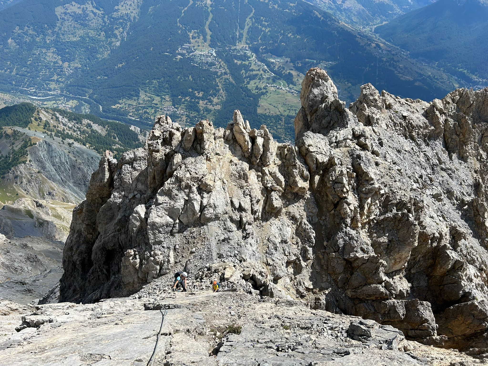
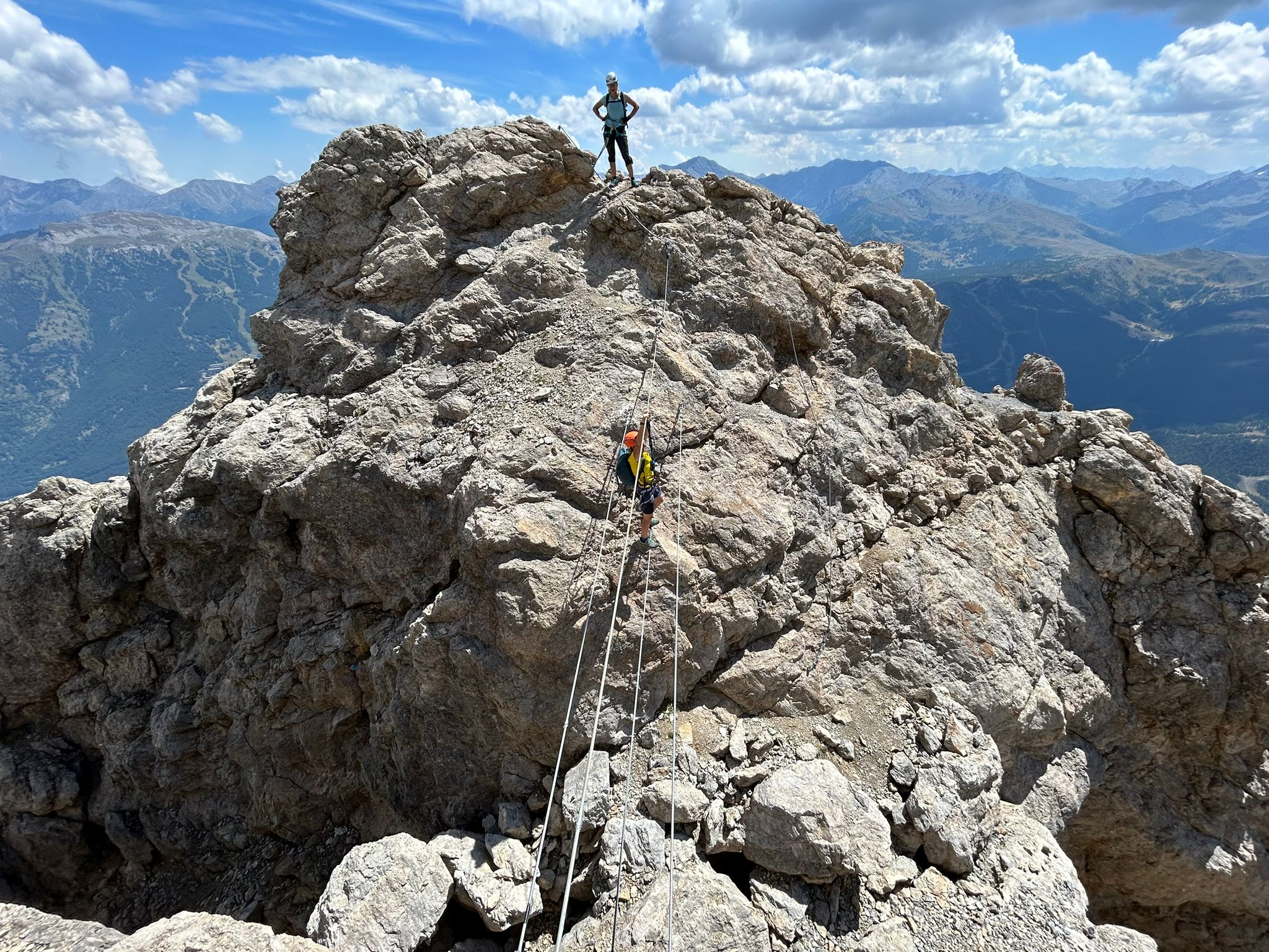
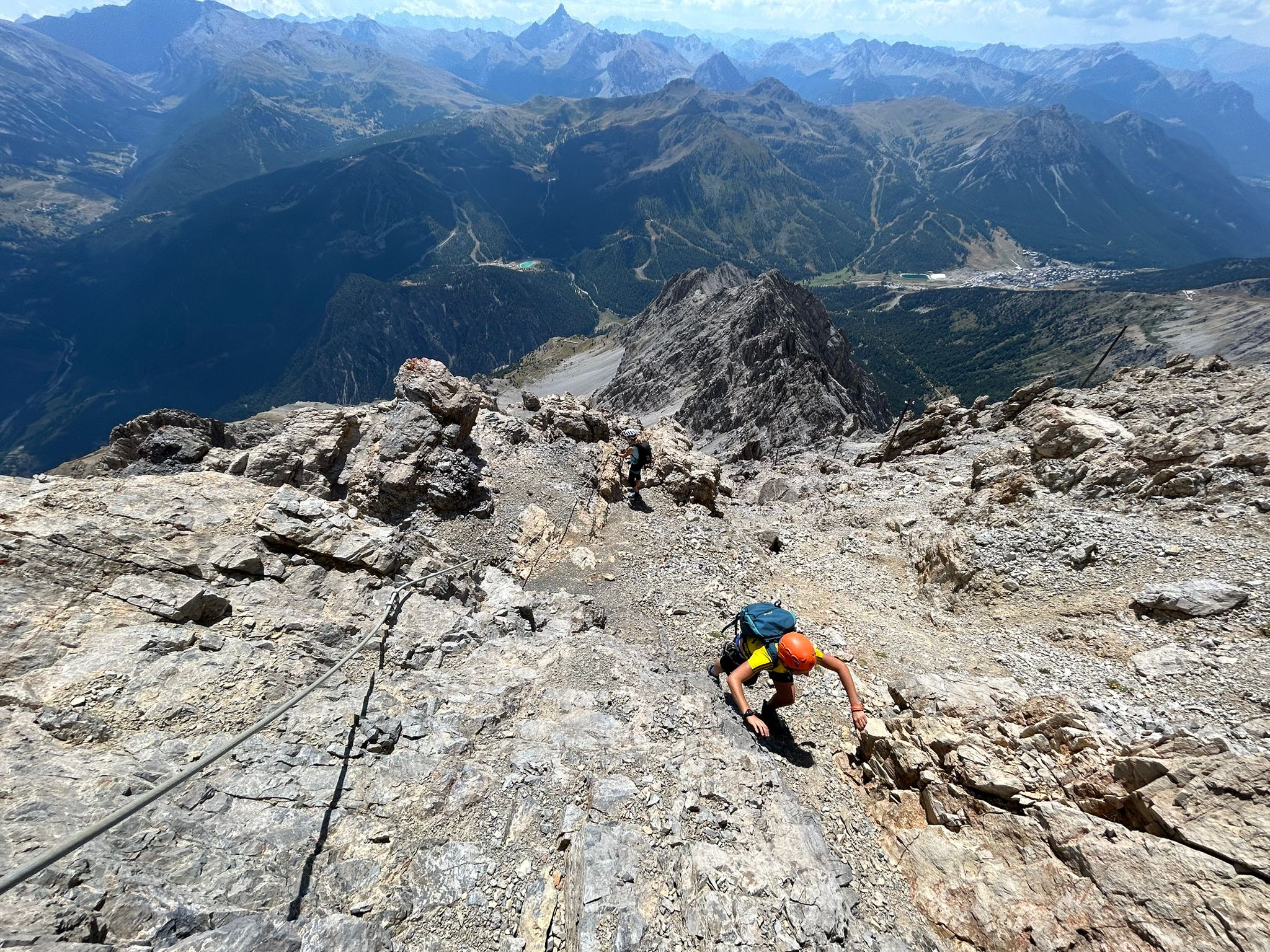
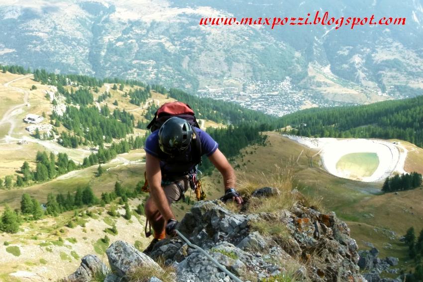
Da qui volendo è possibile proseguire fino alla sommità dello Chaberton tramite la recente Via Ferrata Mario Perona.
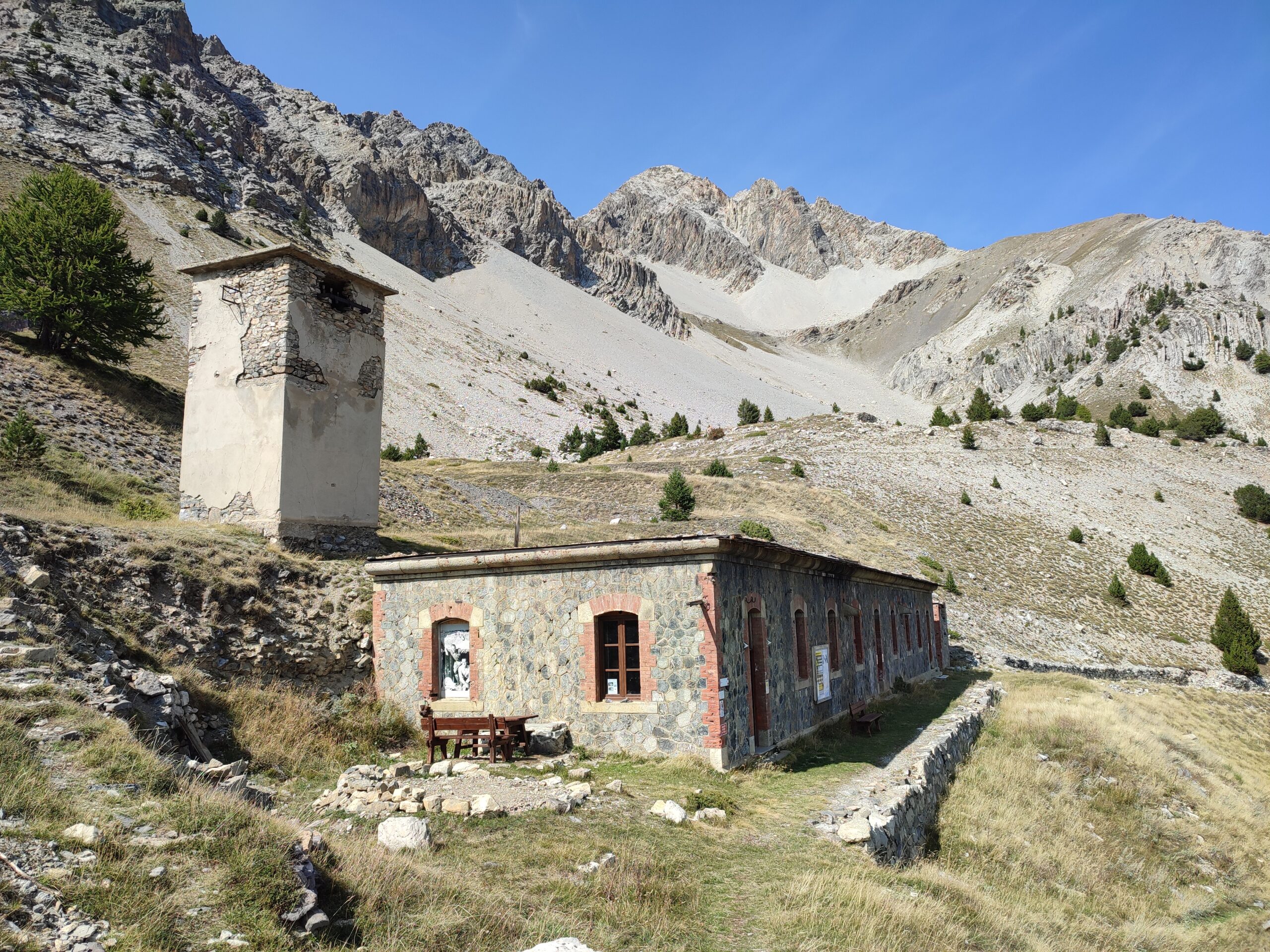
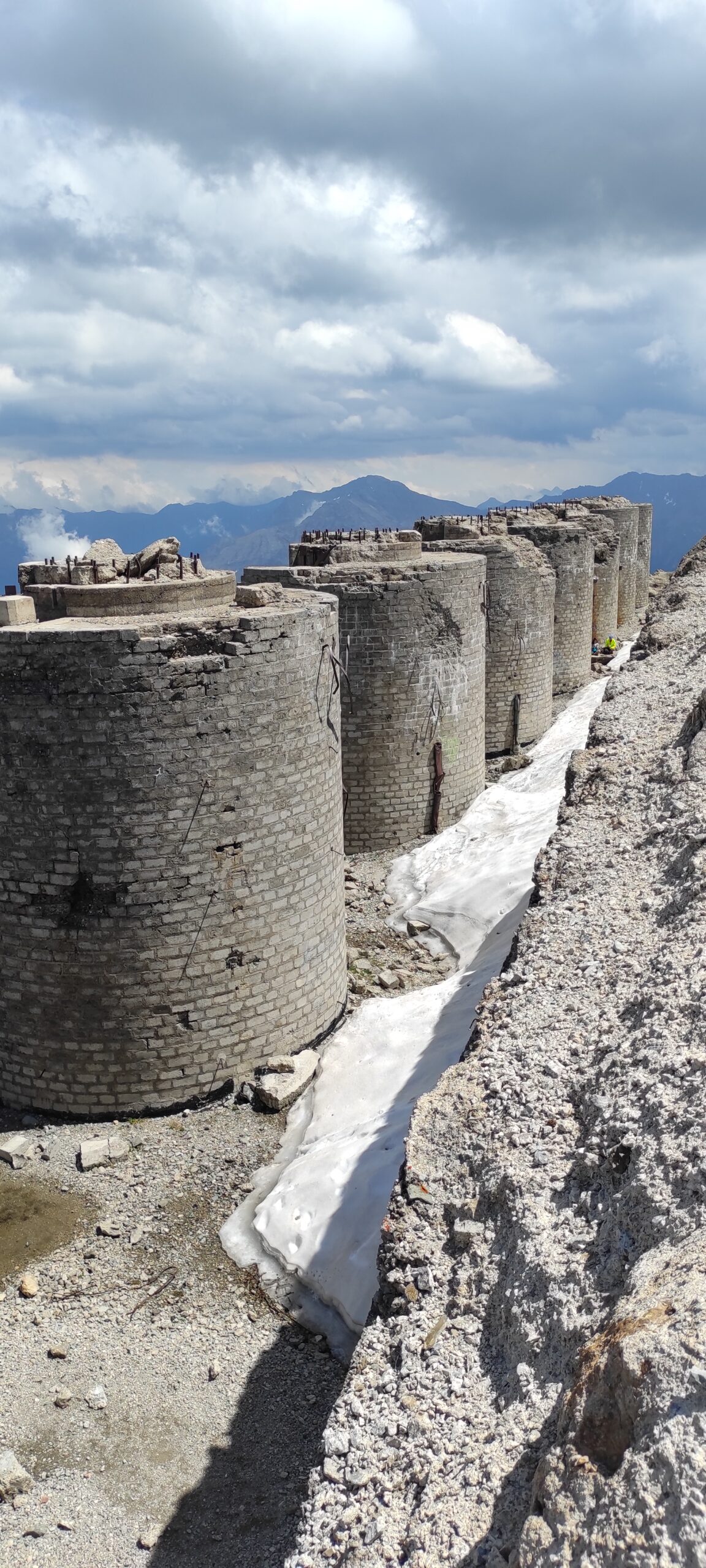
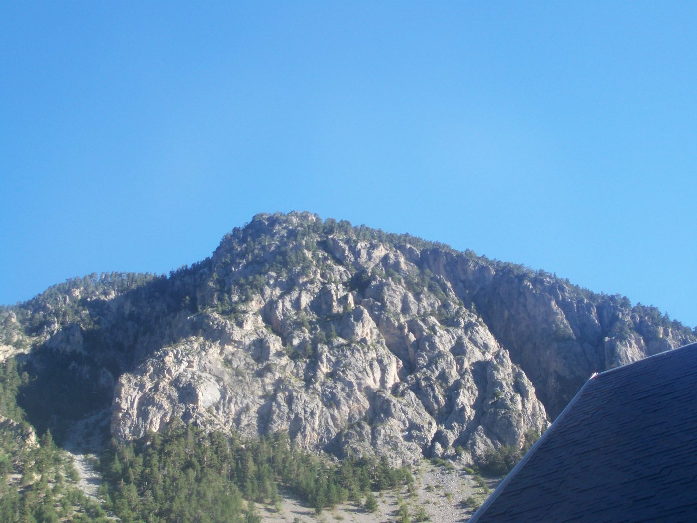
Sulla cima del Monte Chaberton a 3130 mt, si trova la cosiddetta Batteria dello Chaberton costruito tra il 1898 e il 1910 per migliorare l' apparato di fortificazioni sul confine con la Francia. Venne bombardato dai Francesi il 21 giugno 1940 e abbandonato definitivamente dopo la seconda guerra mondiale.
- Cartografia:
- IGC n 1 Valli di Susa Chisone e Germanasca
Nelle vicinanze Mappa
Itinerari
12/10/2025 TO, Claviere 900 m AD Est
Chaberton (Monte) Via Ferrata Mario Perona e Batterie del Petit Vallon ** CHIUSA PER MANUTENZIONE (luglio 2025) **
 0m
0m
07/06/2026 TO, Claviere 700 m D Nord
Clarì (Rocca) Via Ferrata Mario Perona – Aldo Saglia
 50m
50m
16/07/2023 TO, Claviere 465 m AD Varie
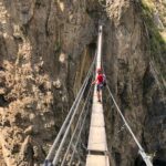
Claviere, Via Ferrata del Bunker e Ponte Tibetano
 50m
50m
17/08/2023 Hautes-Alpes, Briançon 400 m AD Sud
Toulouse (Croix de) Ferrata della Croix de Toulouse
 13.2Km
07/06/2026 TO, Bardonecchia 1000 m D Sud-Est
Colle (Pian del) – Via Ferrata del Rouas
 15.4Km
05/07/2014 Hautes-Alpes, Arvieux TD Varie
Combe La Roche (Crètes de) Via Ferrata
 16.2Km
05/07/2014 Hautes-Alpes, Arvieux 200 m D Varie
Pra Premier Via Ferrata
 16.2Km
21/09/2014 Hautes-Alpes, Château-Ville-Vieille 1400 m AD Sud-Ovest
Chateau Queyras – Via Ferrata delle Gorges du Guil
20.9Km
22/08/2012 Hautes-Alpes, La Salle-les-Alpes 100 m D Est
Rocher Blanc (le) Via Ferrata
 22.5Km
06/08/2022 Hautes-Alpes, Les Vigneaux 1000 m TD Varie
Gorges de la Durance (Ferrata delle)
 26Km
26Km
Servizi
2.6Km
4.3Km
Casa Cesana Bar
Cesana Torinese
4.3Km
L’Ibarus Rifugio
Cesana Torinese
4.3Km
Piergiorgio Frassati B&B
Cesana Torinese
4.3Km
Ottima Scelta Ristorante
Cesana Torinese
7Km
La vachette Bar
Montgenèvre
7.4Km
Centro Ristorante
Cesana Torinese
8Km
La Fontana del Thures Rifugio
Cesana Torinese
8.9Km
Terre Rouge Rifugio
Cervières
9.3Km